Tel Rekhesh (Rechesh) is the largest Biblical mound in the lower Galilee, with remains of multi-period Canaanite and Israelite cities, Assyrian citadel and an Early Roman farmstead.
Home > Sites > Yizreel Valley > Tel Rekhesh
Contents:
Background
Location
History
Identification
Photos
* Aerial Views
* Ground Views
* East side
* Southern summit
* Synagogue
* Western Foothills
* West
* Water Mill
* Flight Over
Links
Etymology
Background:
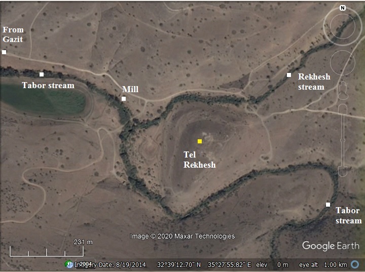
Tel Rekhesh, the largest Biblical mound in the lower Galilee, is situated in the deep gorge of Nahal Tabor, at the confluence of two streams. On top of the 55m high oval shaped hill are remains of multi-period Canaanite and Israelite cities, covering an area of 45 dunam. It was suggested as the Biblical city of Anaharath (Joshua 19:17,19): “And the fourth lot came out to Issachar… and Anaharath”.
An Assyrian citadel was built over the ruins of the Israelite city.
An Early Roman synagogue was unearthed on top, part of a farmstead established on the ruins of the Iron Age city.
Location:
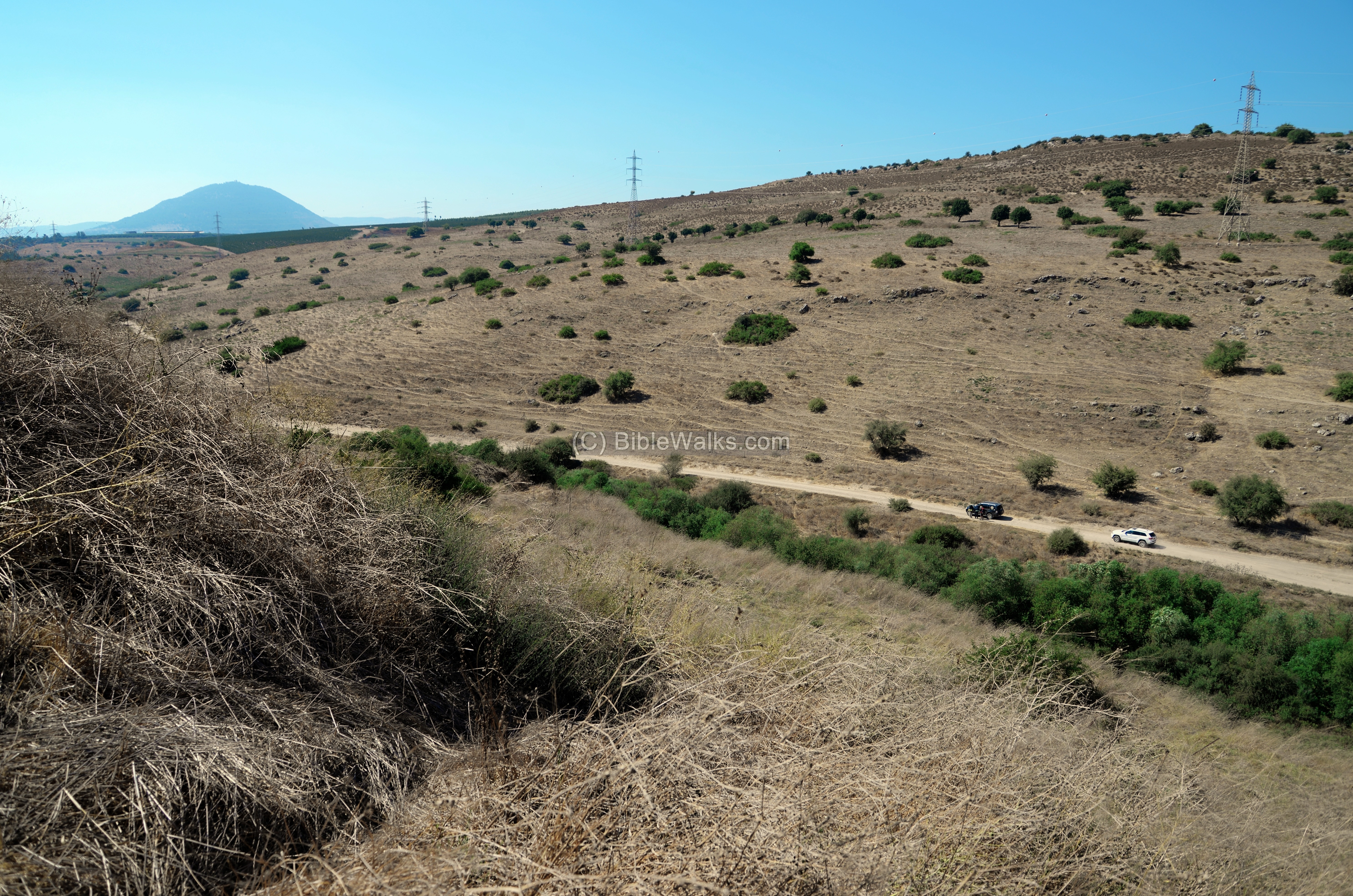
An aerial map of the site is shown here. Water flows around the hill from two streams that meet on its western foothills – Tabor and Rekhesh. This gave the ancient city its water supply and natural defense.
The Tabor stream starts from the eastern foothills of Mt. Tabor on the west, joins Rechesh stream, then flows 11km southeast to the Jordan river.
History:
- Bronze period (3150-1200BC)
The site, located on the north east edge of the Jezreel valley, was occupied since the Early Bronze period (3150-2200 BC). The well protected hilltop, defended by water on all sides, and a fertile valley on its west side, all these factors compensated on it being remote and away from major trade routes. The city flourished during the Middle Bronze II to the end of the Late Bronze II period. The archaeologists unearthed Late Bronze defense walls along the north eastern side of the top of the mound.
- Canaanite Anaharath
Tel Rekhesh was suggested by Y. Aharoni as the location of the Canaanite city of Anaharath (‘ana-charath), which fell to the tribe of Issachar in the division of the land (Joshua 19:17,19):
“And the fourth lot came out to Issachar, for the children of Issachar according to their families. …And Hapharaim, and Shion, and Anaharath“.
Anharath has been listed in the Egyptian campaign accords of Thutmose III (1481-1425 BC). Canaanite princes are depicted with hands tied behind their backs, and the city name appears in Egyptian hieroglyphics. Anharath appears as city number 52 out of his 199 conquests during the first excursion of Canaan (1468).

Thutmose III smiting his enemies (7th pylon in Karnak). Photo by Markh; public domain.
It was also listed in the second campaign of Amenhotep II (reigned 1426-1400), son of Thutmose III. It was conducted against the rebelling cities in Jezreel valley. The pharaoh lists the people and booty that he took after the city was plundered.
According to Aharoni, Rekhesh was a strong city during the 15th century and the only place in the area that fits the Egyptian sources.
Some of the 14th century Tell Amarna letters (EA 238–242, out of 382 tablets), written from various Canaanite cities in Akkadian cuneiform letters to their Egyptian masters, may have been written from the region of Anaharath.
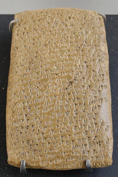
One of Tell Amarna letters (Louvre Museum, Public domain CC 2.5)
Cuneiform writing on a clay tablet.
A Biblical map shows the location of Anaharath, between Mt. Tabor to the west and the Jordan river to the east.
According to D. Dorsey (The Roads and Highways of ancient Israel”), a Bronze/Iron Age highway (“T3”) passed at Rekhesh, connecting Mt. Tabor, via Sirin, to the Jordan valley. This advantage of this route was that it was opened year round, while the highway connecting Afula to Megiddo would have been closed due to winter rains.
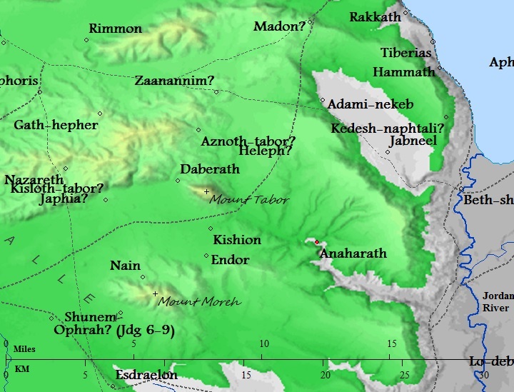
Map of the area around the site – from Canaanite/ Israelite to Roman period (based on Bible Mapper 3.0)
Note that there are other places that were suggested as the location of Anaharath, such as Tel el-‘Ajjul near Mount Moreh (suggested my Mazar), or on the eastern foothills of modern Arabic village of Na’ura. Those sites were not supported by archaeological evidence – a Bronze Age mound with strong fortifications.
- Iron Age (1200-586 BC)
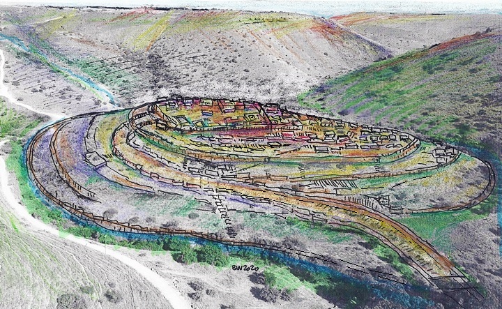
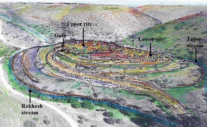
The city covered a total area of 45 dunam (45,000 square meters) on the upper side of the oval shaped hill, oriented along an axis from north-north-east to south-south-west. The mound is divided in 3 terraces, sloping north to south. A wall surrounded the city along its edges, at a total length of ~600m. The city gate was located on the northern foothill. From the gate was a road that descended along the western side of the hill.
An illustration of the Iron Age city is shown below, with a view from the west.
- Late Iron Age
The Assyrian empire conquered the North Kingdom of Israel in 732 BC, destroying most of the cities and villages in the land. They exiled some of the population and introduced harsh taxation. (2 Kings 15: 29):
“In the days of Pekah king of Israel came Tiglathpileser king of Assyria, and took Ijon, and Abelbethmaachah, and Janoah, and Kedesh, and Hazor, and Gilead, and Galilee, all the land of Naphtali, and carried them captive to Assyria”.

Fragmentary relief slab from Tiglath-Pileser III palace in Nimrud (744-727BC)
[Istanbul Archaeological museum]
Excavations identified structures of the Iron Age IIc (7-6th century BC), such as a large administrative complex on the eastern side of the acropolis. The rectangular complex (35 x 60m) included large reception halls, and covered about a half of the top terrace. It was built over the ruins of the earlier Iron Age IIa-IIb structures. The archaeologists suggest it is a Assyrian citadel, however its function is still unknown. The Assyrians held the city until the end of the Iron Age.
- Early Roman period (1st-2nd century AD)
An Early Roman period farming estate was unearthed on its summit, centered on the western side of the acropolis. The settlement included a public structure and several modest houses. This was a Jewish estate, based on the lack of pig bones.
The archaeologist unearthed a first of a kind rural synagogue, predating the destruction of the Temple.
Another finding of this period was a 3-step plastered installation north of the Late Iron age citadel, and suggest it might be a ritual bath (miqveh), or a ceremonial bathroom of the earlier occupation phase.
- PEF Survey:
Conder and Kitchener surveyed this area during the Survey of Western Palestine (SWP), commissioned by the Palestine Exploration Fund (PEF) in 1873. A section of their map is seen here. Tel Rekhesh is named here as “Tell el Mekurkush”. It was not reported in their survey.
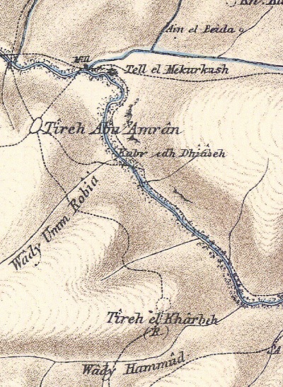
Part of maps Sheet 9 of Survey of Western Palestine,
by Conder and Kitchener, 1872-1877.
(Published 1880, reprinted by LifeintheHolyLand.com)
South west of the site is a fort named Tireh (Arabic for fort) Abu ‘Amran, suggested as another Roman/Byzantine Jewish village although not yet excavated.
Another multi-period site is 2.5km south, named Tireh el Kharbeh (the ‘ruined’ fort), Horvat Riv in Hebrew, where a seven branched menorah was found engraved above a cave opening.
- Modern period
Tel Rekhesh was excavated so far during 12 seasons: 2006-2010, 2013-2017 and 2019 by Japanese teams and local archaeologist Y. Paz ( Ben Gurion university/IAA).
The site is an open public area. However, it has not yet undergo conservation works to make it accessible and safe. Nevertheless, the beauty of the area is worth while a visit.
Photos:
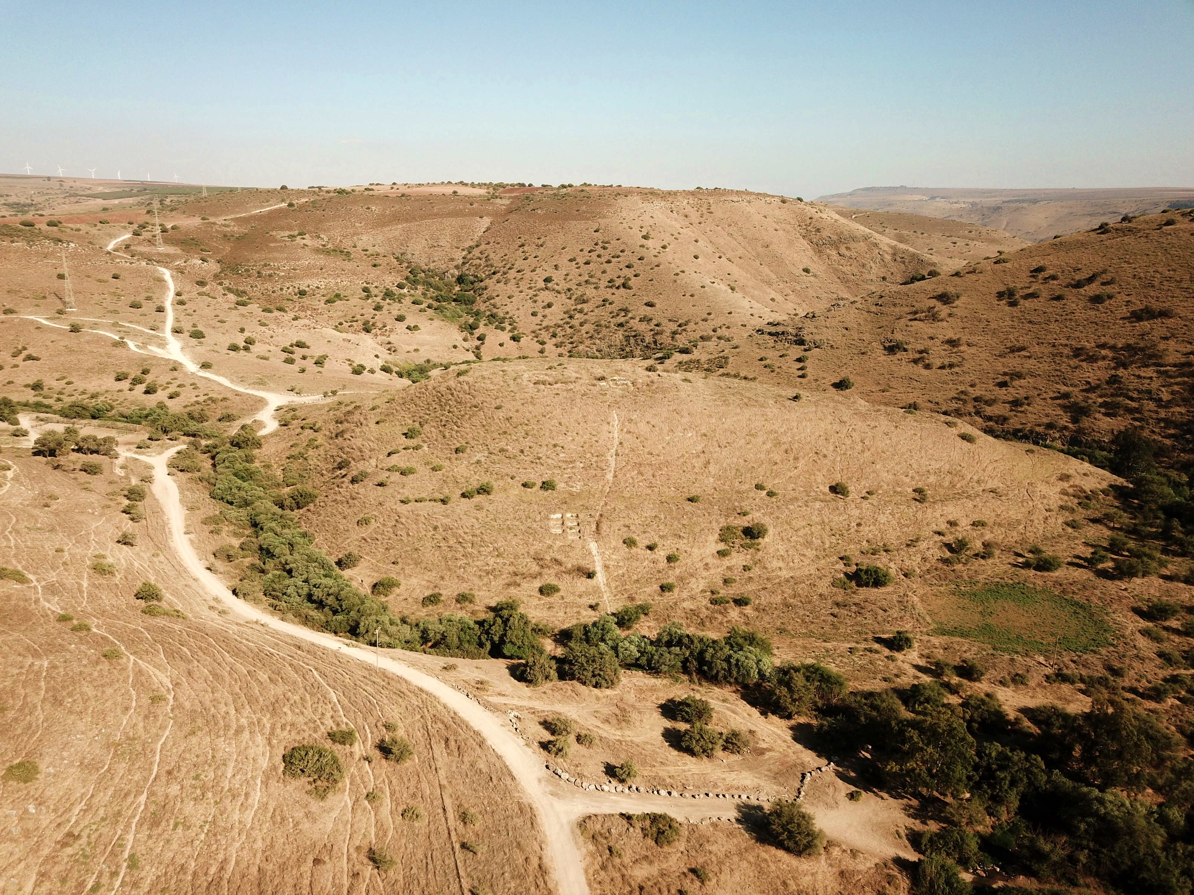
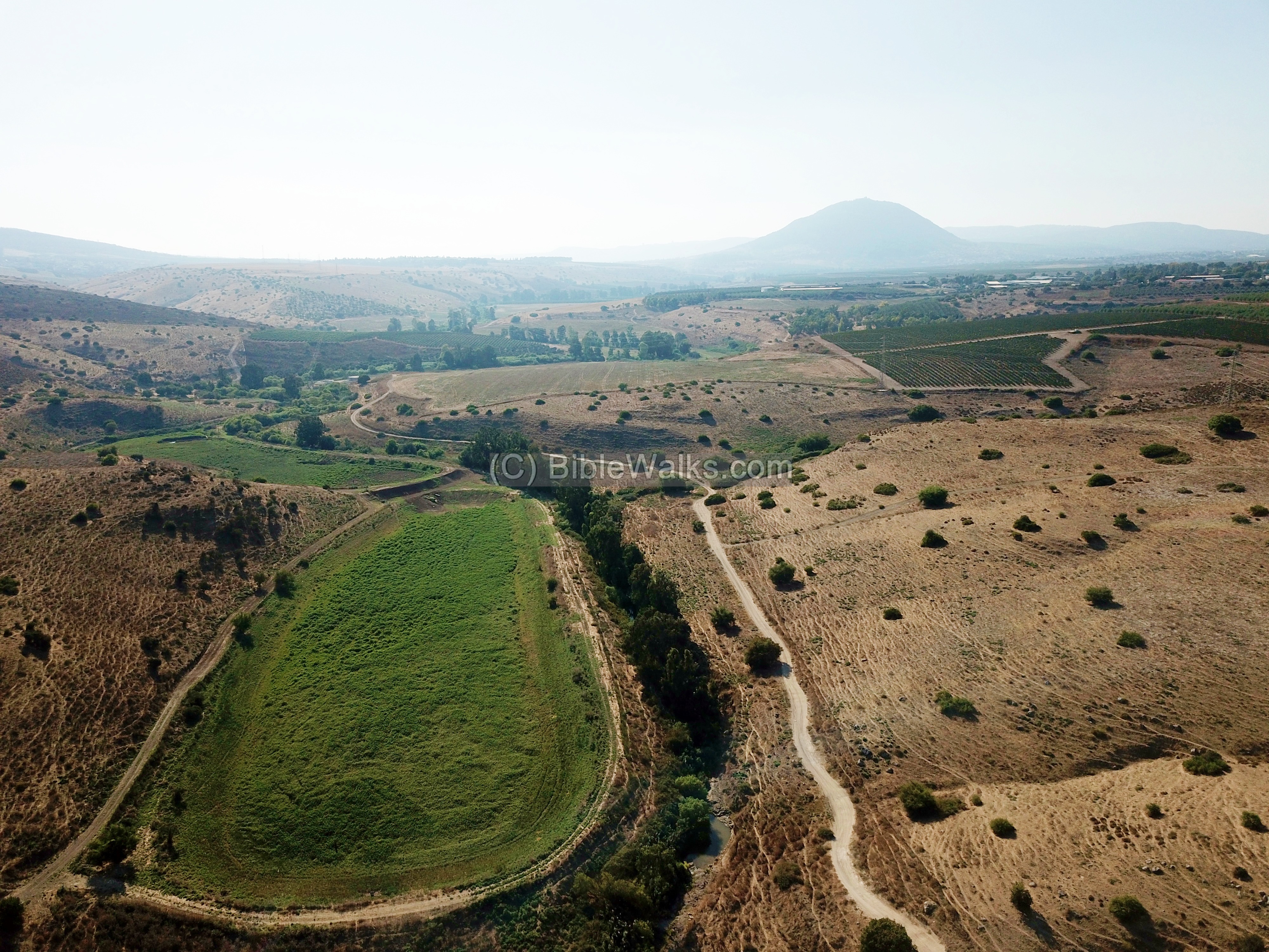
(a) Aerial view
An aerial view of Tel Rekhesh was captured by the drone from the west side. The ancient site is located on the upper section of the hill. The hill is located inside a deep depression, flanked by higher hills on both north and south sides.
The hill is surrounded by two flowing streams which join on its western side, then flow towards the Jordan valley through a gorge seen in the far right background.
The top of the hill is seen next, as filmed on August 2020. It is mostly covered by dry weed, obscuring the excavated areas.
On the northern side of the summit is a bright square clearing, where the early synagogue was exposed. It was part of a farmstead which was built over the Iron Age ruins and occupied the flat top on the north side.
(b) Access
A dirt road provides access from Kibbutz Gazit which is located 2KM south west of the site. The road follows the route of the fertile Tabor stream. In the far background of this photo is the tip of Mt. Tabor, located 9km north west.
The road approaches the western side of the hill of Tel Rechesh, where the car can be parked among the trees on the right. It continues east and around the eastern side of the hill.
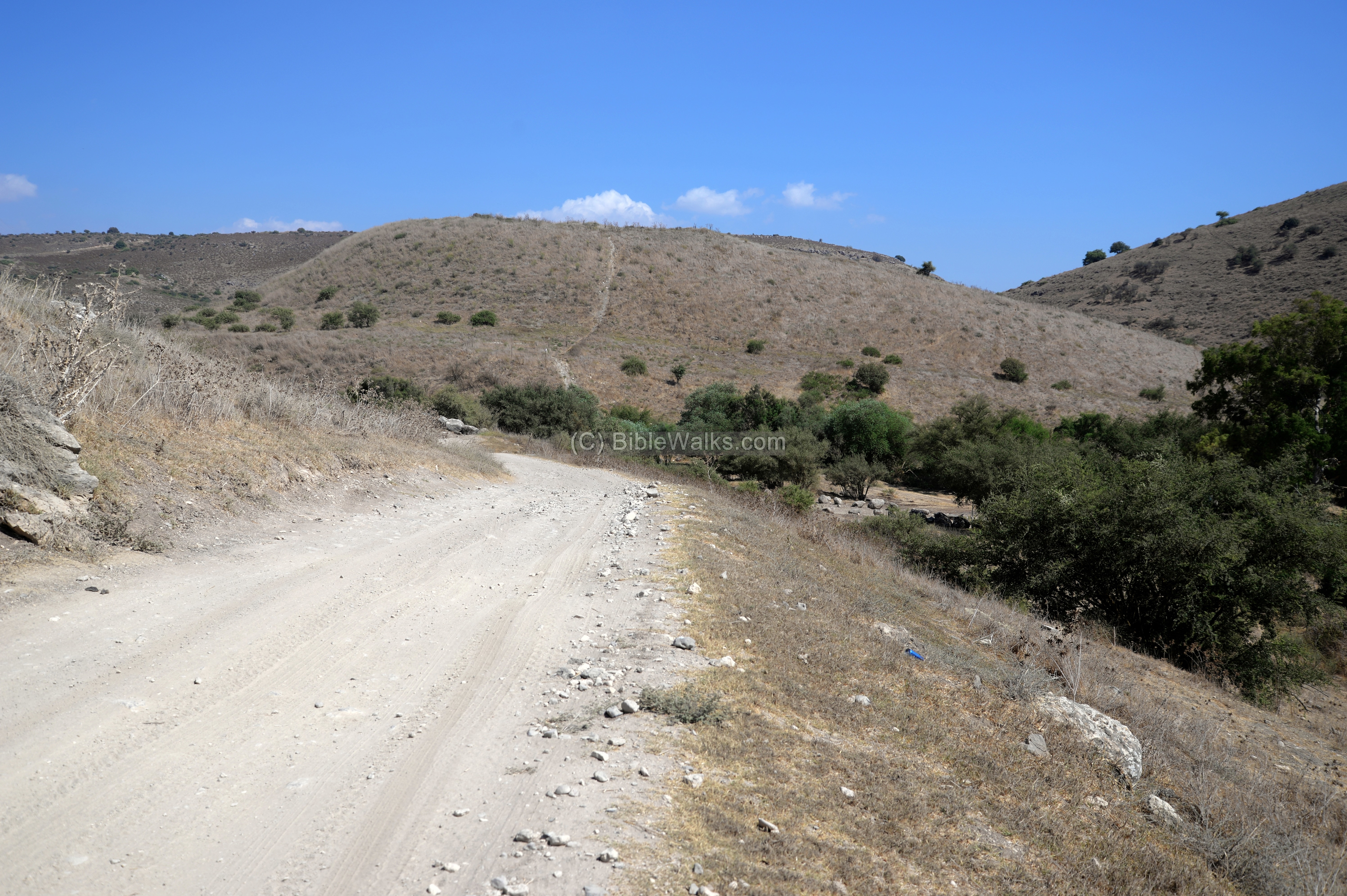
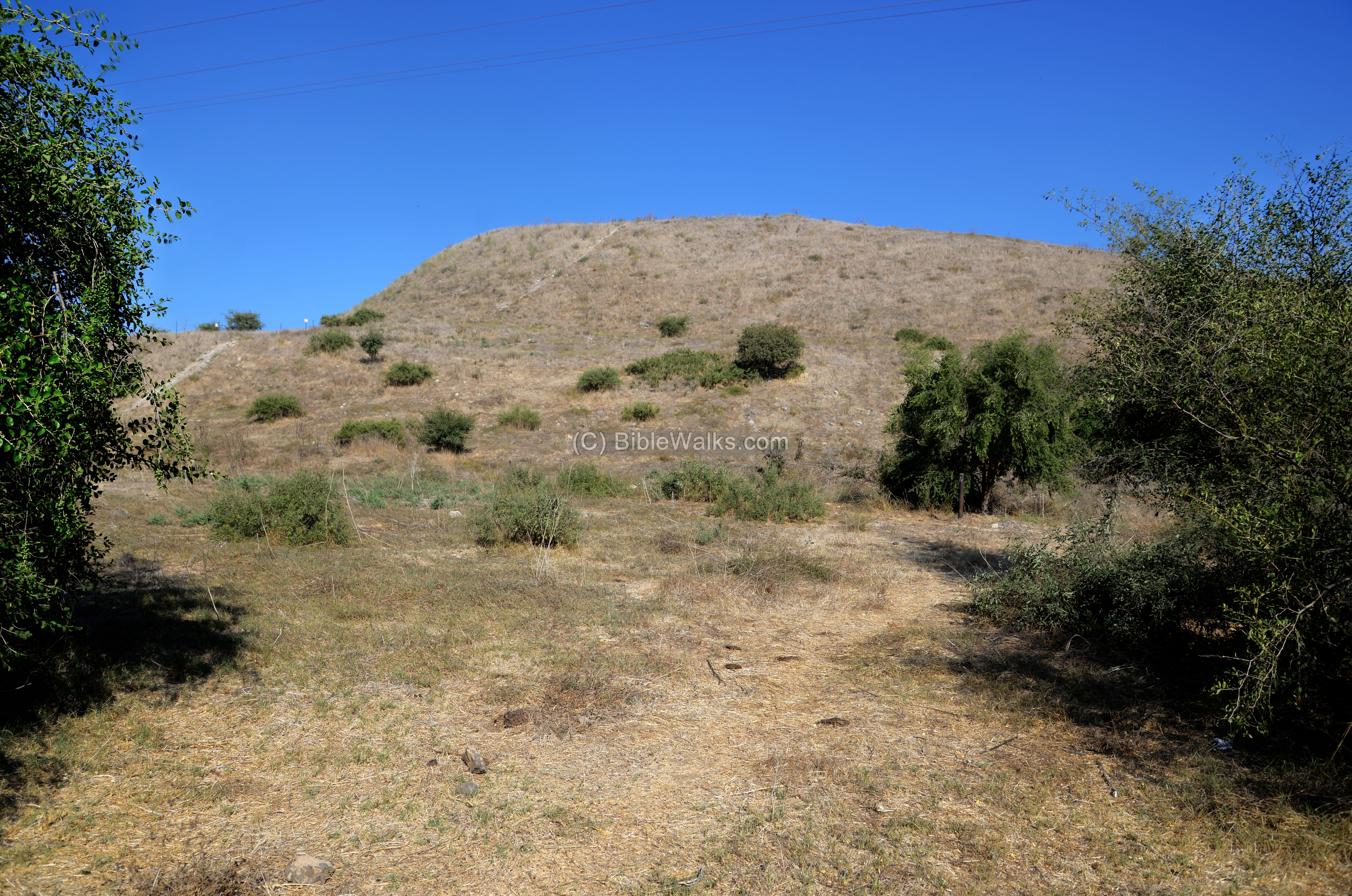
(c) Eastern side
We started to climb the hill from its east side. This was a mistake, as the easier ascent is from the western side.
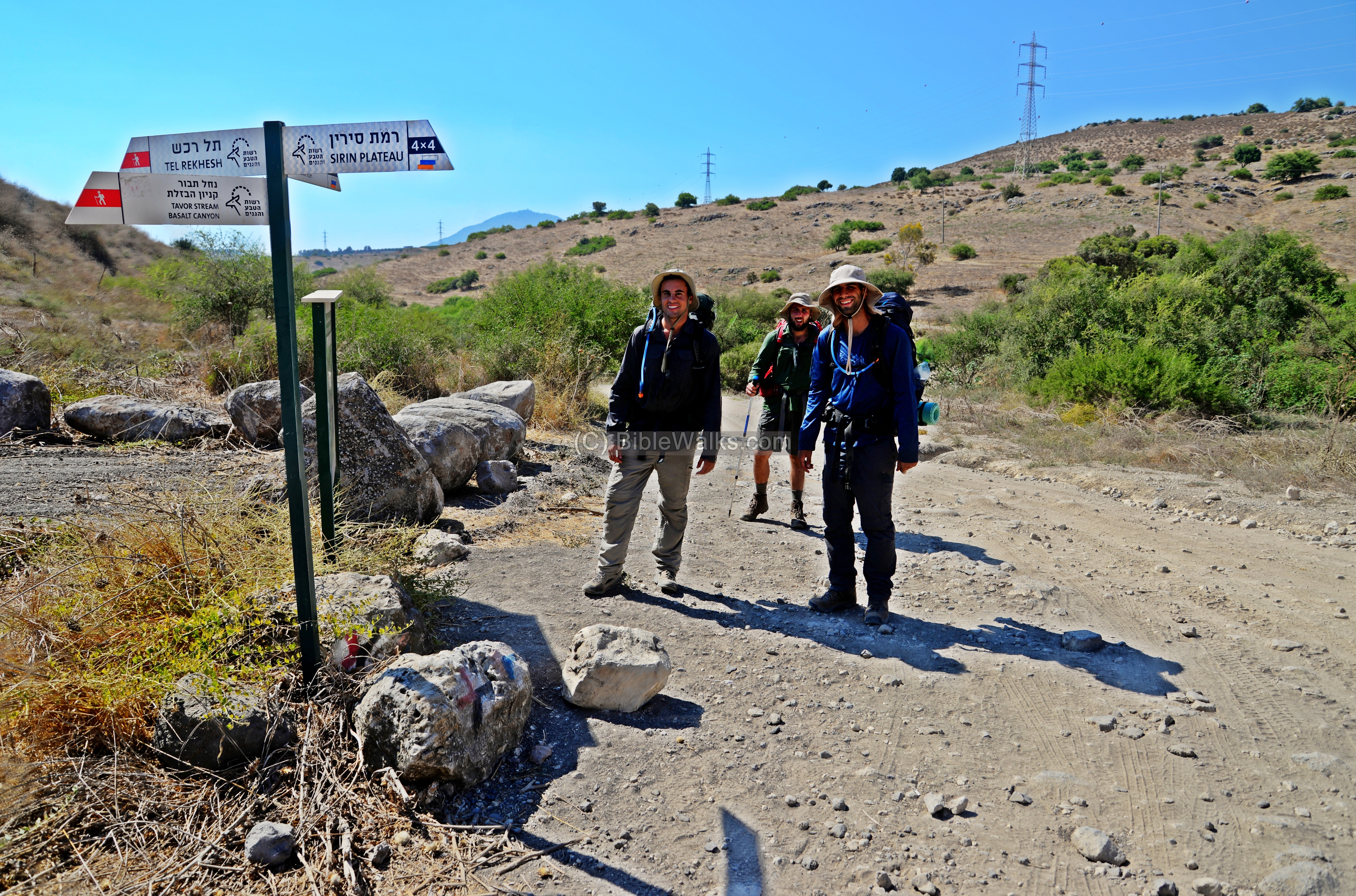
Just before ascending the hill, we crossed a group of young hikers. They were walking along the Israel National trail which passes at the site. The trail’s total length is 1,025 kilometers (636.9 mi), connecting the northern and southern tips with a route that maximizes the number of historic and Biblical sites along its path. It is marked with 3 colored strips – orange, blue and white – as seen on the right sign. The full length of the trail can be completed in about 6-8 weeks, but many take it slice by slice on weekends.
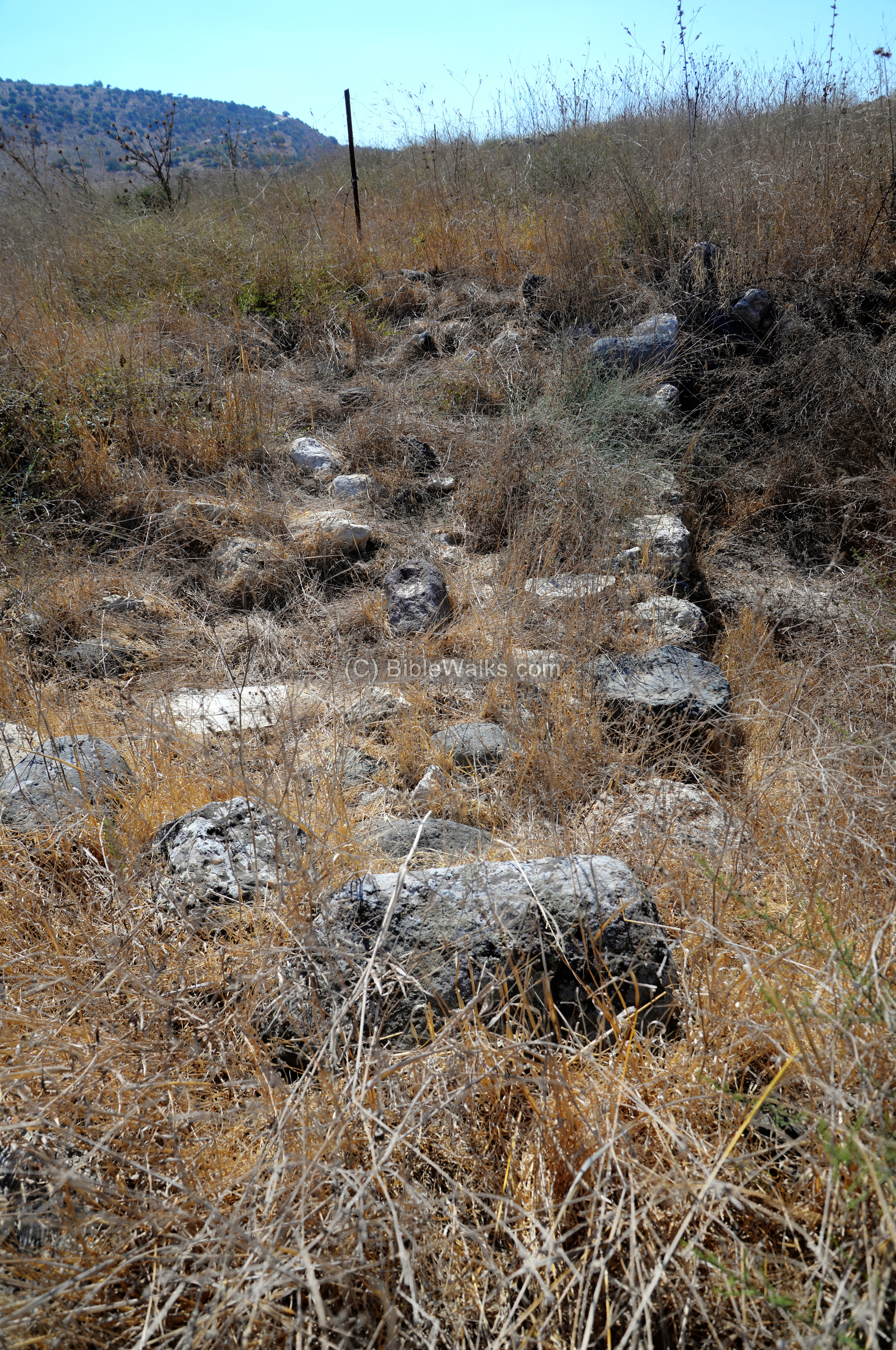
The hill is extremely steep, and was covered by weed and thorns. Along our brave ascent we crossed several areas of walls and archaeological trenches, and fortunately no snakes.
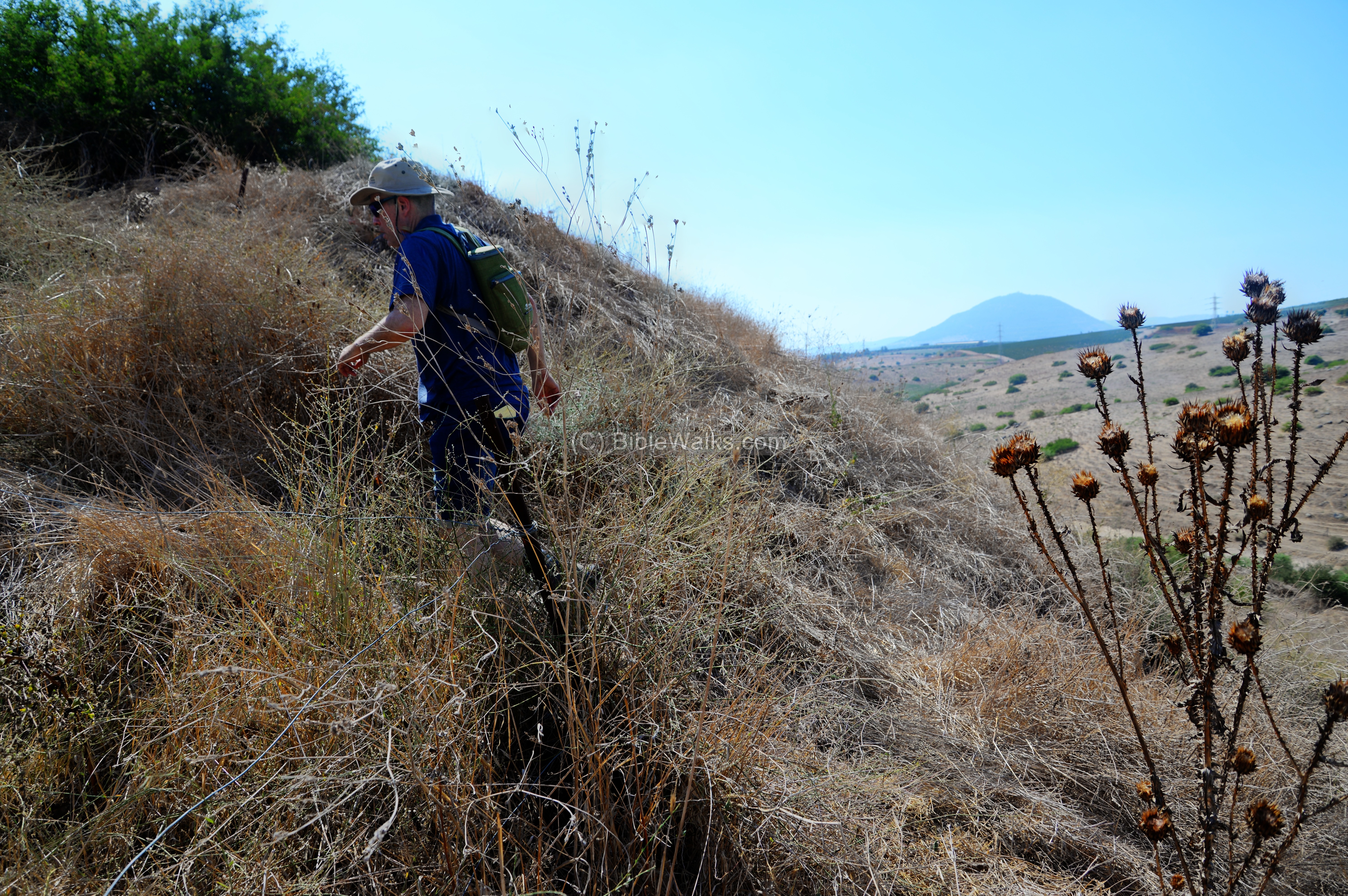
Walking up the hill, one needs to catch the breath and use the view as an excuse for stopping frequently to take photos…
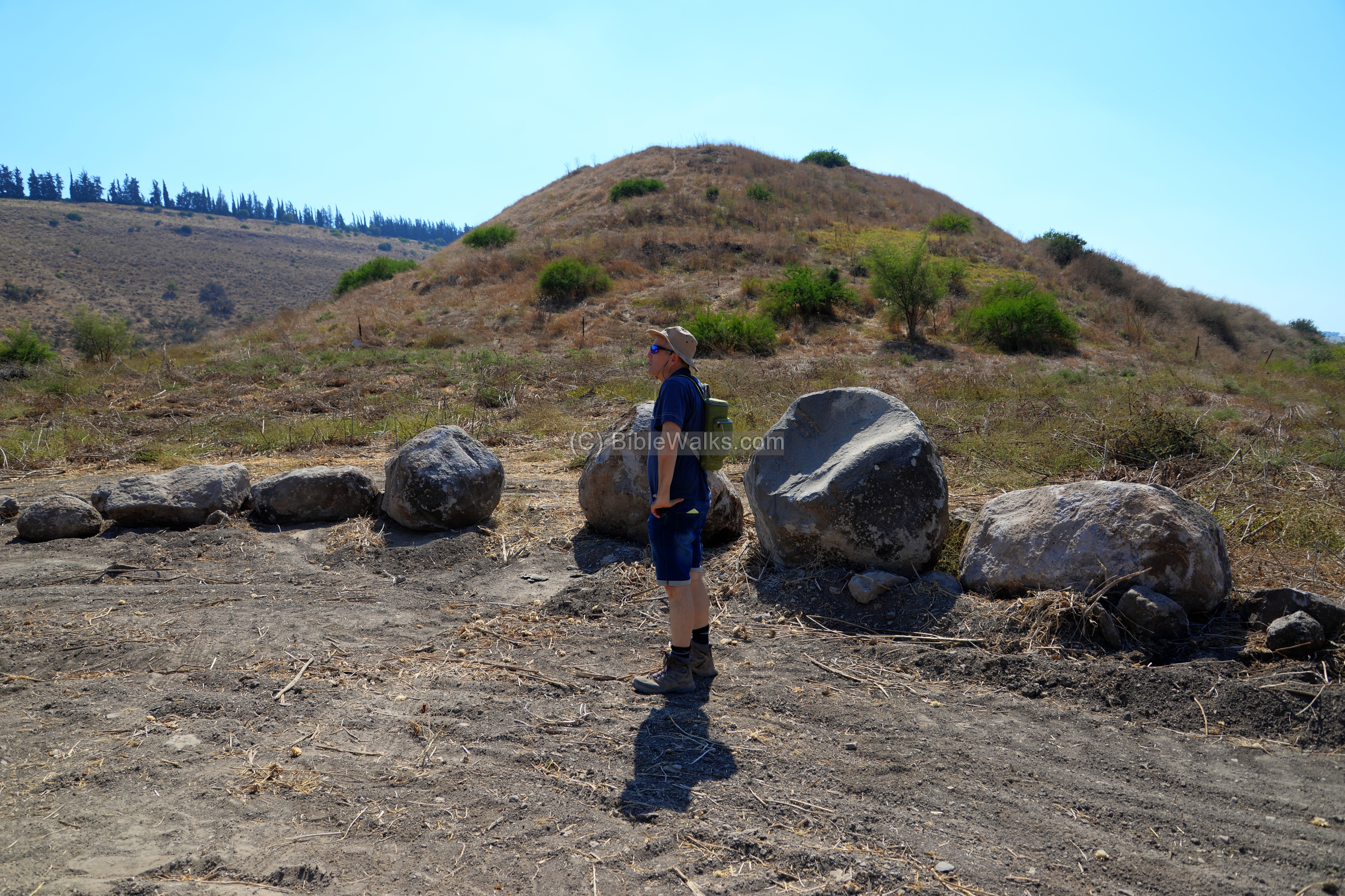
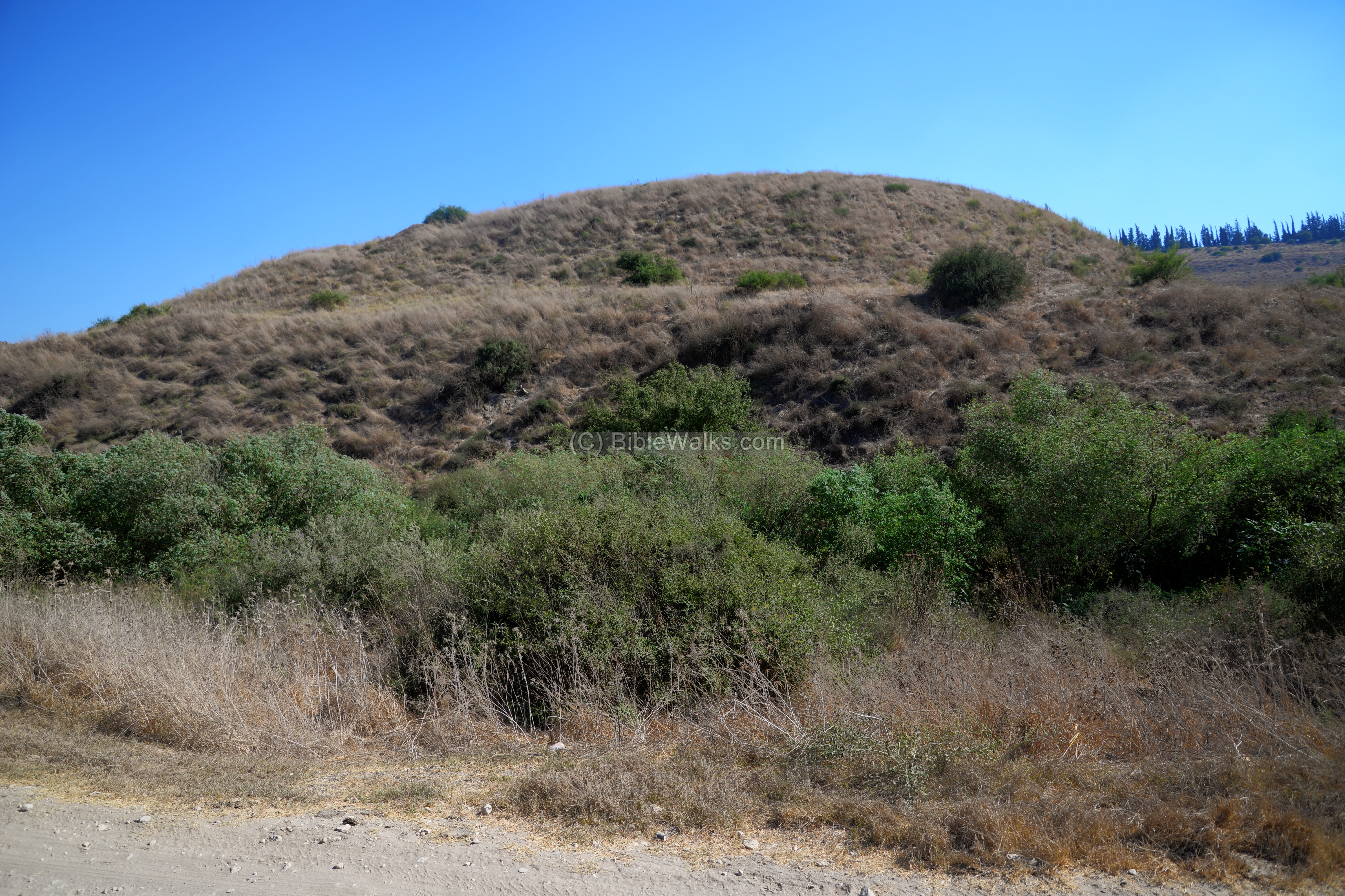
(d) Southern side of the hill
The ancient Iron Age city was composed of two sections on the top of the hill – a southern side along the southern foothills, and a flat top of the hill (‘acropolis’) on the north side of the mound.
We first started from the south side. On this side of the summit are traces of walls and structures of a condensed residential area.

The archaeologists opened many tranches on the hill, but the weeds made it almost impossible to see what they cover.
The southern side of the hill overlooks to the basalt gorge of the Tabor stream, flowing down to the Jordan river. The height of the hill is 34m above sea level, while the Jordan valley (11km south east) is 263m below the sea level.

Among the covered antiquities we noticed an oil press stone.

To the east of the hill is a parking area where hikers leave their car and walk down the basalt gorge. It seems like a popular hike, and we should try it next time we visit Tel Rekhesh.

(e) Early Roman Synagogue
On the northern side of the hill is a flat area, covering ~4,600 square meters. On the southwestern edge of the flat area (the ‘Acropolis’) the archaeologist uncovered a unique structure just below the surface, cut into the earlier Iron Age city walls. The large room, 9m long and 8m wide, has a 1m wide entrance on the north side. Limestone ashlar blocks, 40cm wide, were arranged as benches arranged its walls.
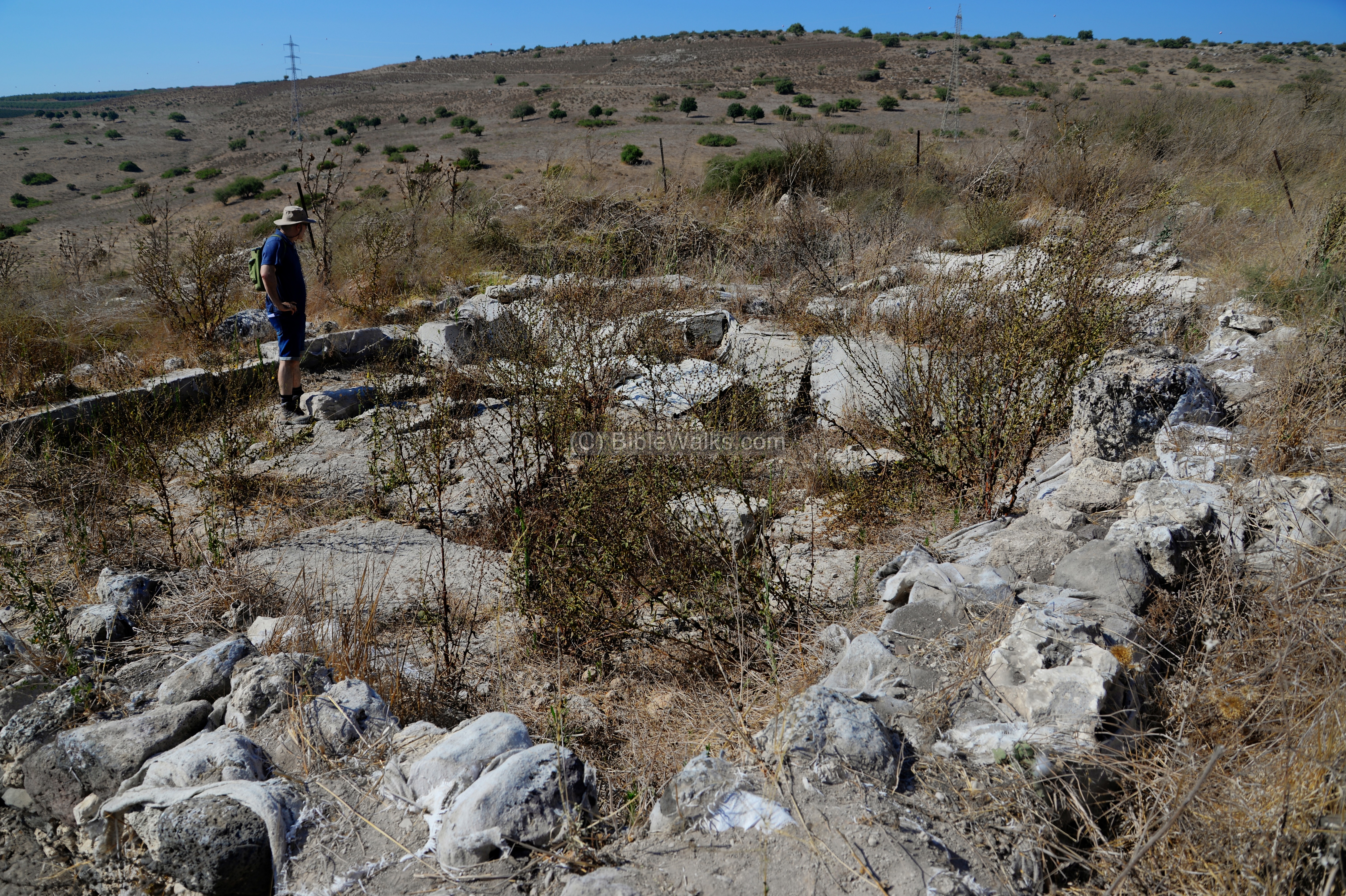
These are the remains of a public assembly room, probably a rural synagogue. Based on its features, pottery and coins, it was dated to the Early Roman period. The structure was in use since the establishment of the farmstead during the 1st century AD, until the site was abandoned following the second revolt (Bar Kokhbah) in the 2nd century.
According to Prof. Moti Aviam of the Kinneret Institute for Galilean Archaeology, who headed excavations together with archaeologists from a Japanese university, this early synagogue is unique as it predated the destruction of the second temple. It is not oriented towards Jerusalem, a common feature in synagogues that were constructed from the second century.
The public structure provided services to a small number of Jewish residents, substituting the need to travel to the nearest synagogue which was 4kM away. The main service was the public reading of the Torah in front of the sitting attendees.
The floor was made of packed soil.
The archaeologists unearthed, near the center of the floor, a rectangular pillar base of one of the two pillars that supported the flat roof. The size of the western stylobate, seen here, is 2m square, and a limestone block (1.1 x 0.8m) was inserted into the cut frame. The eastern pillar was a large (0.5m square) limestone block.
A rounded depression was also found adjacent to the northern wall.
This may have been one of the Galilee synagogues that were described in the New Testament as the villages visited by Jesus. (Mark 1:39): “So he traveled throughout Galilee, preaching in their synagogues…”. The site is only 16km south east of Nazareth. Prof. Moti Aviam hopes that the synagogue is preserved and become an attraction to Christians who search for Jesus’ footsteps.
Adjacent to the structure are agriculture installations.
From this place are great views of the valley of Tabor stream and the round hill of mount Tabor. The fertile valley below was used in antiquity to grow crops, which was one of the reasons the city thrived.
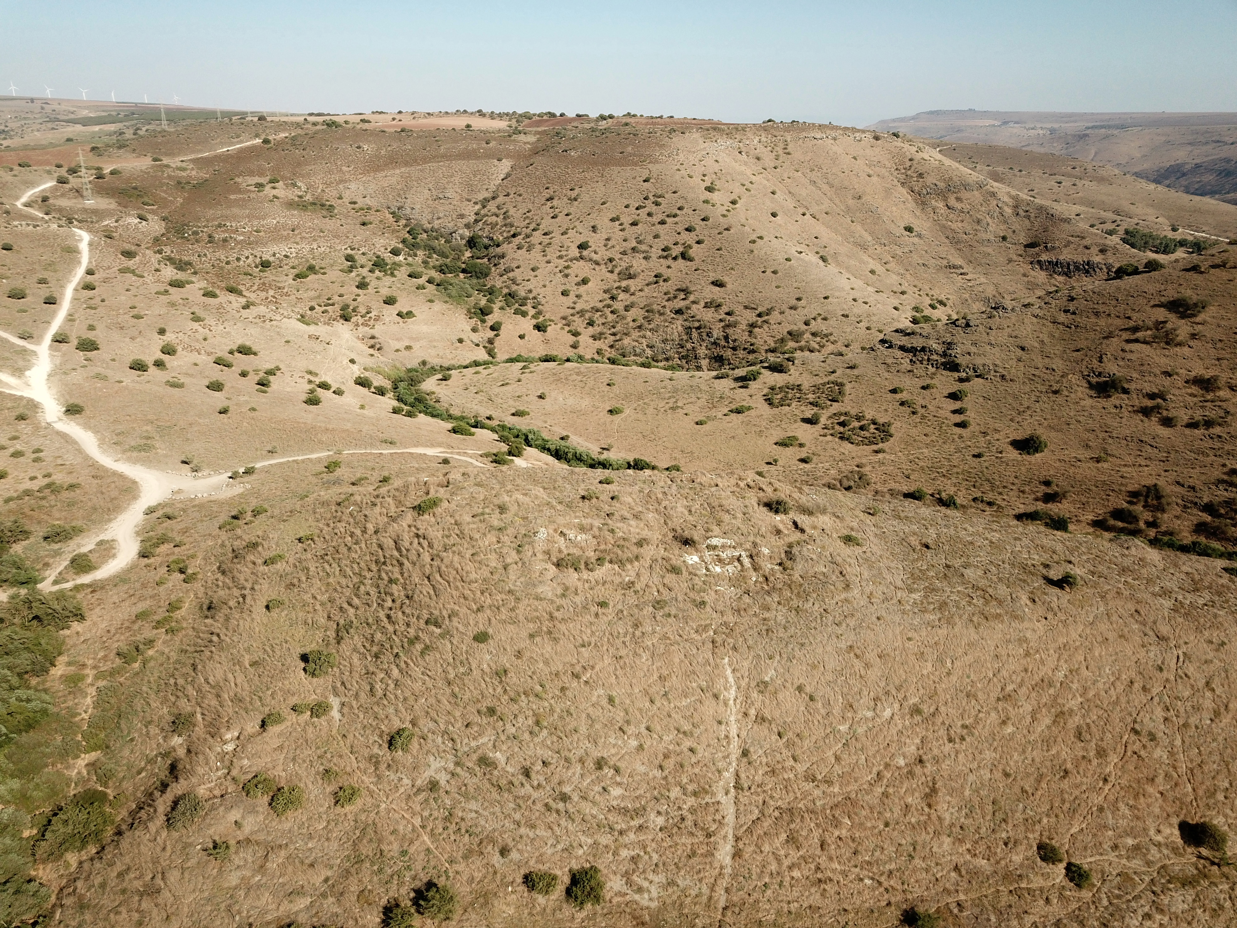
(f) Western foothills
A more convenient ascent to the hill is from the western side.
A closer view of the western foothills is next. Notice the shelf on a lower level of the mound, that may have been the entrance road to the city.
(f) Area West of the hill
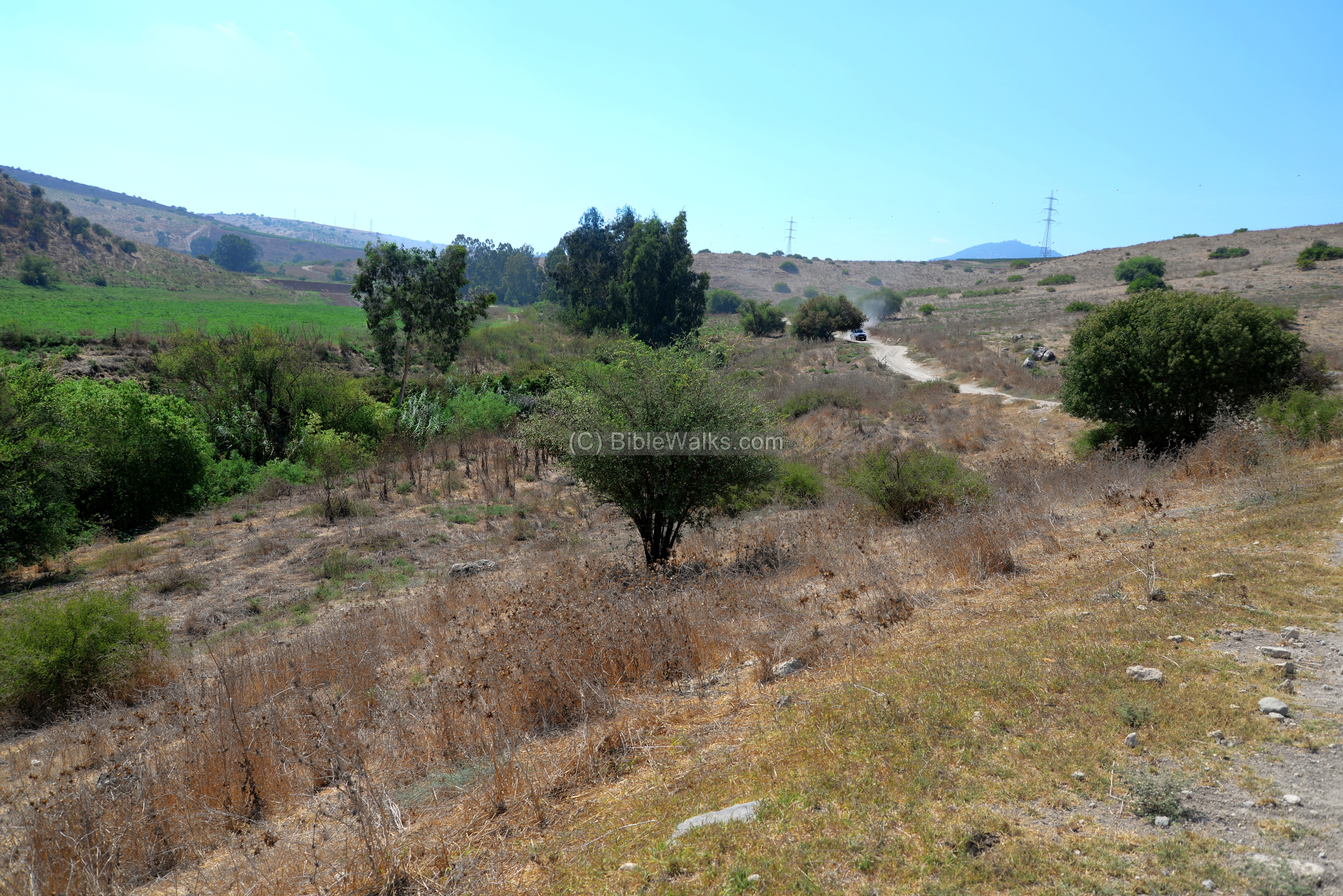
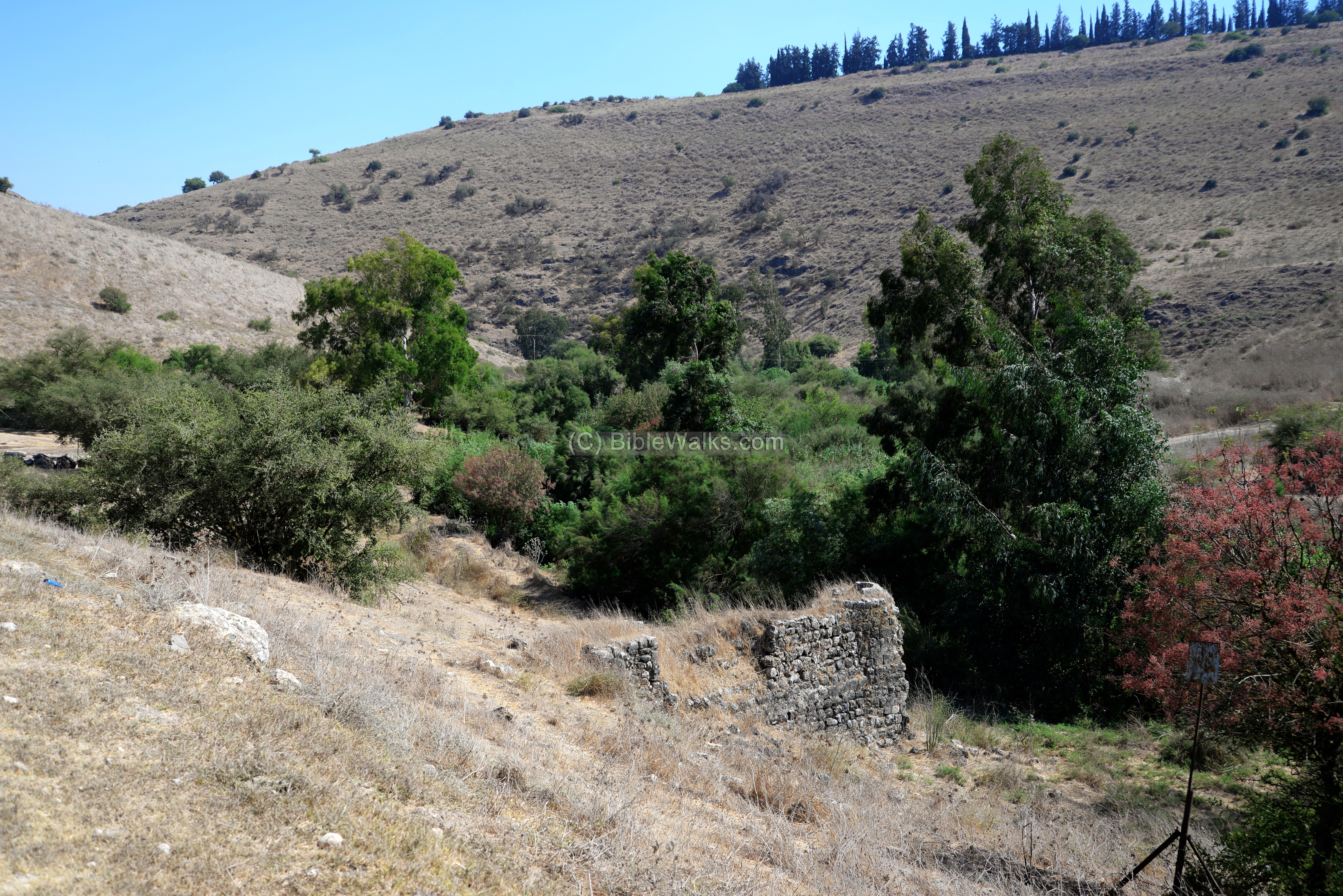
The Tabor stream flows from the foothills of Mount Tabor, here in the background, and turns south east at the western and southern foothills. In the area west of the hill are twin lakes, which dry out during the summer time but leave a green footprint.
The photo below shows a section of the Nahal Tabor stream near the parking area west of the hill.
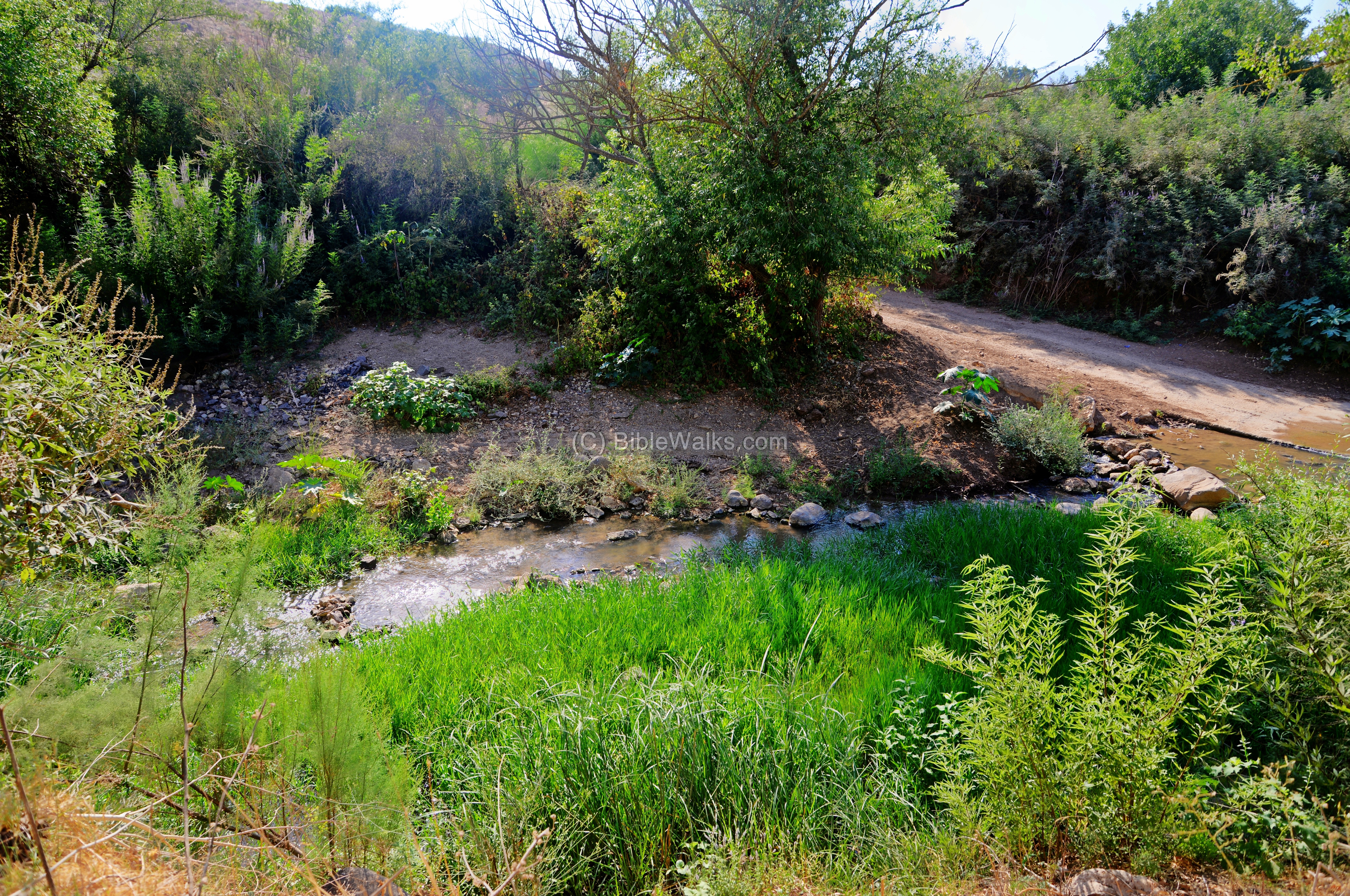
Another stream – Nahal Rekhesh – joins the Nahal Tabor stream. The confluence of the streams is on the west side of the hill.
Although this photo was taken at the end of the summer, the flow was quite extensive. At ancient times the flow was considerably higher as there were no pumping stations along the valley as there are today.
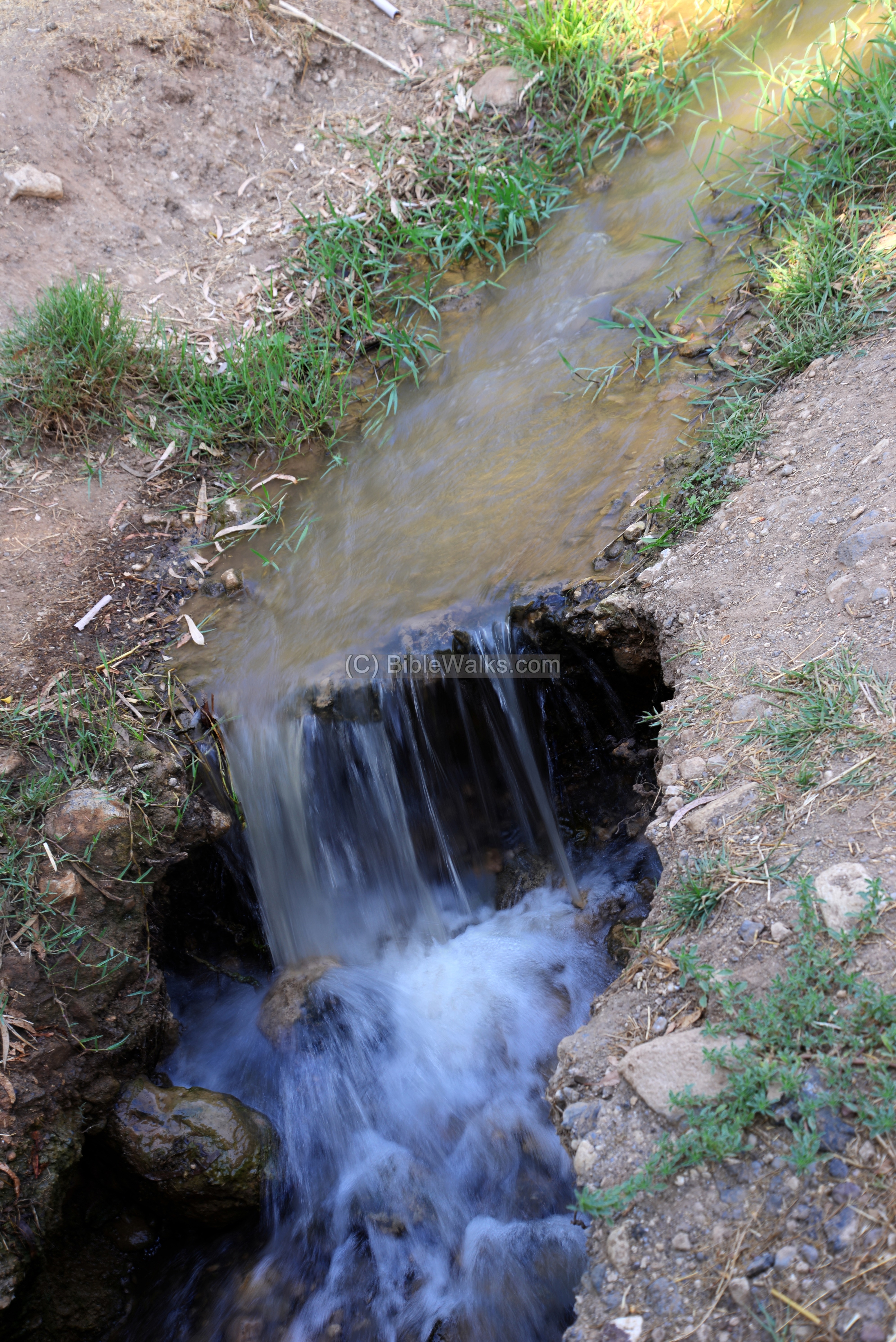
(g) Water operated Mill
The waters of the Rekhesh stream were used to power an Ottoman period flour mill. This is one of at least 5 mills are marked on the PEF map from Mt. Tabor to the Jordan valley.
Remains of the mill’s chimney are located to the west of the hill, above the valley of the Tabor stream. An aqueduct conveyed the water from a higher altitude into the chimney.
Falling water turned the water wheel, spinning a vertical shaft attached to a grinding stone. Wheat grains were introduced into the wooden box, and the grains fell unto the grinding stone where they would be crushed, creating powder – flour. Flour was then collected and packed into sacks, and the owner kept one tenth of the yield as the fee.

(h) Flight Over
![]() A drone video of the site is seen here. The drone starts from the west side of the hill, then ascends along the steep foothills to the summit. Ruins of the synagogue are clearly visible as a square opening on the summit.
A drone video of the site is seen here. The drone starts from the west side of the hill, then ascends along the steep foothills to the summit. Ruins of the synagogue are clearly visible as a square opening on the summit.
Links and references:
* References:
-
Excavation project website: www.Rekhesh.com
- 2016 preliminary report – Hadashot Arkheologiyot V131 (2019)
- Second temple synagogue on Tel Rechesh (Ynet, 2016; Hebrew) – Dr. Moti Aviam describes this rare finding
- Anaharath identification – Y. Aharoni (link: https://www.jstor.org/stable/543080)
- Who built Tel Rekhesh? BAR Fall 2020; Shuichi Hasegawa, Hisao Kuwabara, and Yitzhak Paz
* Internal:
- Nahal Tabor Delta – Jordan river crossing
- Drone Aerial views – collection of Biblical sites from the air
- BibleWalks YouTube channel
- Flour Mills of the Holy Land
Etymology (behind the name):
- Tell el Makurkush – Arabic name of the site; Tell – mound. Makurkash -a private name meaning any hard food
- Tel Rekhesh – Hebrew name, based on the Arabic name
- Wadi el Bireh – Arabic name of the lower section of Tabor stream (from Rekesh downstream)
- Wadi esh Sherrar – Arabic name of the upper section of Tabor stream (from Mt. Tabor to Rekhesh)
BibleWalks.com – exploring the ancient sites of Israel
Horvat Qisi <<<—previous site—<<< All Sites>>>—next site—>>>Tel Ein Haddah
This page was last updated on Sep 19, 2020
Sponsored links: