Biblical sites near an ancient crossing point of the Jordan river at the delta of Nahal Tabor.
Home > Sites > Jordan Valley > Jordan River crossing at Nahal Tabor delta
Contents:
Background
Location
History
The Sites
Photos
* Tel Yakush
* Tel Shamat
* Tel Zan
* Tel Shoshan
* Tel Kittan
* Horvat Minha
* Preh. Gesher
* Railway Bridge
Etymology
Links
Background:
During the Bronze and Iron Ages the Jordan River was crossed at selected fords rather than bridges. Ancient sites surround one of the major crossing point in the northern Beit Shean valley – the fords near the estuary of Nahal Tabor (Tavor). This page reviews 8 ancient sites both sides of Nahal Tabor.
(Joshua 2:7): “And the men pursued after them the way to Jordan unto the fords…”.
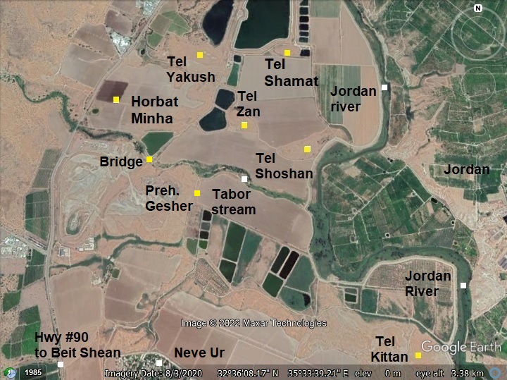
Location:
This map shows the area where Nahal Tabor (Tavor) flows into the Jordan river. Around the river delta are a number of ancient sites that guarded the passage across the fords at this area. The sites that are detailed in this page include Tel Yakush, Tel Shamat, Tel Zan, Tel Shoshan, Horvat Minha, Tel Shamat and Tel Kittan.
History:
The multi-period sites were inhabited since the stone age until the Middle Ages. They commanded the river crossings that supported the trade routes connecting the land of Israel to the Trans Jordan mountains and beyond.
-
Biblical map
The cities and roads during the Canaanite and Israelite periods are indicated on the Biblical Map below, with the crossing point marked by a yellow circle on the west bank of the Jordan river.
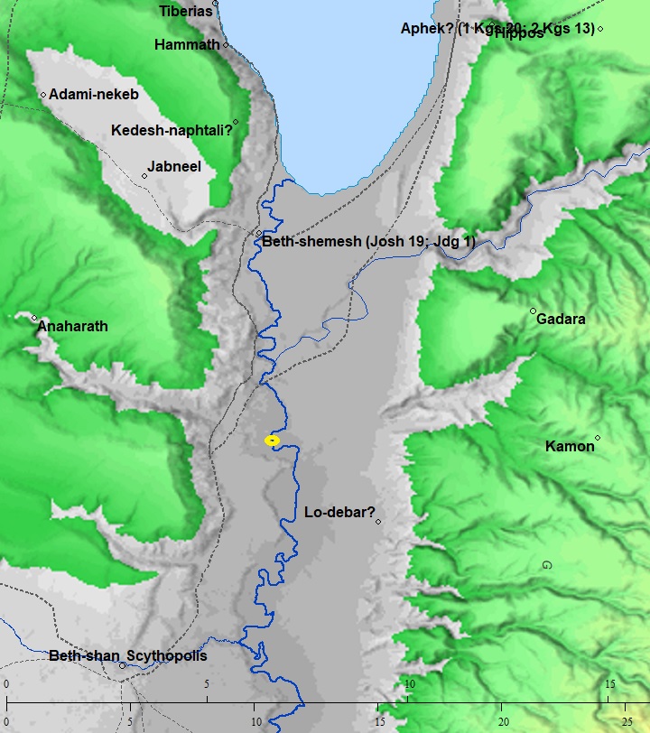
Map of the area of Jordan valley around Nahal Tabor- during the Canaanite and Israelite periods (based on Bible Mapper 3.0)
The location near the crossing was strategically important during the ages. Throughout the Biblical times, several cities and villages were erected near the river crossing, on both north and south sides of the Tabor stream.
These major routes passed near or through the river crossing area:
- A major North-South highway along the Jordan valley passed below the site. David Dorsey (“The roads and Highways of Ancient Israel”, 2018) marked it as Bronze/Iron age ‘A3’.
- Another major route, ‘T5’, was a west route along the valley of the Tabor River (‘T5’), connecting to Tel Rekhesh and beyond. Its steep descent was guarded by Horvat Ziwan and the nearby Horvat Zavon (850m south).
- Towards east, a river crossing passed thru a ford on the Jordan river near Tel Kittan.
- River crossing in antiquity
See Kfar Ruppin sites – another major river crossing.
- Late Roman/Byzantine period
An ancient Roman highway used the same North/South route connecting Beit She’an to the Sea of Galilee. Many Roman milestones were found along the route. For example, the milestones found near Tel Issachar.
The Peutinger Map (Tabula Peutingeriana) is a medieval map which was based on a 4th century AD Roman military road map. The map was made in the 13th century, and copied from an older map. The map shows the major roads, with indication of the cities, and geographic highlights (lakes, rivers, mountains, seas). Along the links are stations and distance in Roman miles (about 1.5KM per mile).
In the section shown below is the area of the Jordan valley, drawn in a rotated direction (south is left, north is right). The major cities appear on this section are: Beit Shean as Scytopoli, Acre as Ptolomaide, Tyre as Tyro, Sidon as Sydone, Tiberias as Tyberias (including the Sea of Galilee as La(cus) tyberias). The roads are shown as brown lines between the cities and stations. The location of the river crossing is marked with a yellow circle on the side of the Roman road between Beit Shean and Tiberias – which is XXIII (23) Roman Miles (34 km).
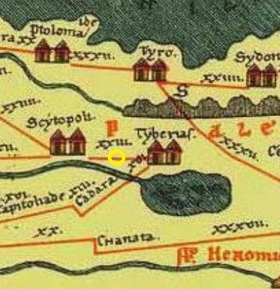
A section of the Peutinger map – yellow circle marks the site
- Crusaders period
A large Crusaders fortress, Belvoir, was constructed west of the crossing point, on the high mountain (400m above the height of Ziwan). The Crusaders valued the location of this place: the proximity to major roads and to river crossing points, and the heights that provided both a natural protection and great visibility of the area around it.
-
Later periods
The site was examined in the PEF survey (1866-1877) by Wilson, Conder and Kitchener.
A section of their map is shown here. The river crossings (marked as Mak.t – short for Makhadet – Arabic for ‘ford’) appear as a short lines north and south of the connection of Nahal Tabor to the Jordan River (Wady el Bireh). Another river crossing in marked at Jisr el Mujamia (modern Gesher) – a Roman period bridge.
Part of Map sheet 9 of Survey of Western Palestine,
by Conder and Kitchener, 1872-1877.
(Published 1880, reprinted by LifeintheHolyLand.com)
- British Mandate
A 1940s British map shows the area around the site with more details. The Jordan river passes on the right (eastern) side of the map. Nahal Tabor (Wadi el Bira) flows left to right into the Jordan river, at a location of a great bend in the river (that was probably caused by the delta).
The major ancient large mounds include the following sites, on the north or south of the Nahal Tabor stream:
- North Crossing: Tell esh Shamdin (Tel Shamat), Tell es Sanbaqiya el Gharbi (Tel Zan), Tell es Sanbaqiya el Sherqi (Tel Shoshan), Munhata (Tel Minha).
- South Crossing: Tell Musa (Tel Kittan).
British survey map 1942-1948 – https://palopenmaps.org topo maps
License: public domain under the UK Copyright, Designs and Patent Act 1998
-
Modern Times
A new project, based on pumped storage hydropower method, is being built on the south side of Nahal Tabor, using the 400m height difference between the heights and the valley to generate electrical power. Water is raised from a lower to an upper reservoir, and released down to generate electrical power.
The area of the delta of Nahal Tabor is near the border with Jordan. The sites that appear in this page are accessible from Israel.
Sites:
A summary of the ancient sites that are reviewed in this page are shown in this table, with indication of the periods that were dated there.
| # | Site name | Neo- lithic |
Chal- colithic |
Early Bronze |
Middle Bronze |
Iron Age I |
Iron Age II |
Persian, Hellen. |
Roman, Byzantine |
Early Muslim |
|
| 1 | Tel Yakush | + | |||||||||
| 2 | Tel Shamat | + | + | + | + | + | + | + | |||
| 3 | Tel Zan | + | + | + | + | + | + | ||||
| 4 | Tel Shoshan | + | + | + | + | ||||||
| 5 | Tel Kittan | + | + | + | + | + | + | ||||
| 6 | Neve Ur East | + | |||||||||
| 7 | Horvat Minha | + | + | + | |||||||
| 8 | Gesher | + | + | + |
Photos:
The sites covered in this section are arranged from north to south.
(a) Tel Yakush
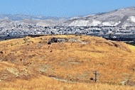
On Tel Yakush are ruins of a large Early Bronze Age village, located on the north side of Nahal Tabor. This view of Tel Yakush, on a elongated ridge seen after the fish pond and the grey field, was captured from Tel Zan – south east of the site. In the background, north west of the site, is Kibbutz Gesher – named after the bridge (Hebrew for Gesher) 1km north of the location.
Click on the photos to view in higher resolution…
The site covered an area of 25 dunams (2.5 hectares).
We first ascended from the eastern foothills – a difficult task due to the soft soil on this steep side. These ramparts once protected the ancient village.
The hill is covered by new excavations, headed by a team of the Tel Yaqush Research and Excavation Project. The project was launched in 2018 by Prof. Mitchell Rothman, Dr. Yael Rotem and Dr. Mark Iserlis.
The excavations revealed structures and artifacts dated to the Early Bronze period (3700-2500 BC). The village existed for 1,000 years. The fact the community existed for such long time, although great changes in the region, makes it a special early urbanization and social study project.
Another view of the excavated areas. In the far left background is the course of the Jordan River, with the Gilead mountains behind it. On the right background are two additional mounds – Tel Zan and Tel Shoshan.
Numerous Early Bronze period pottery fragments are scattered on the mound and unearthed by the excavations.
(b) Tel Shamat
Tel Shamat (Tell esh Shamdin, Shemdin) is a large elongated mound, located in the area of Nahal Tabor’s flood plain, 700m east of Tel Yakush. It is lower and flat on the west side, and rises towards the Jordan river on its east side. The mound is at altitude -248.5m, rising 12m above the area.
This is a view towards the north east, with father Yoram standing in the field on the south side of the mound. In the right background is the valley of the Jordan river, and beyond are the Jordanian mountains.
Remains of fortifications were seen on the south east side – perhaps a wall or glacis. Foundations of structures are seen on the south side. A stream cuts along the southern side. The 1882 PEF report (Vol 2, p. 128) reported that there was a stream on either side, suggesting that the ancient city was naturally protected by streams on its sides.
This west looking view was captured on the south east side of the mound. The hills of the heights of Ramot Issachar are seen on the left background, while the valley of Nahal Tabor is on the right background, hidden behind the Tel.
The next photo was captured on the east side of the mound with a view towards the Jordan river. Its course is just 700m east of the mound, seen here along the green area.
Modern fish ponds are located on the north and east of the site. Notice the flock of birds resting just behind the fish pond. They were on the way to winter in Africa, but enjoy a short stay accompanied with a meal of fresh fish. The farmers attempt to prevent them from feeding on their fish, stretching nets across the pond, but it seems like a futile struggle against the 500 million birds that pass here yearly.
Ceramics collected on the mound and on its foothills were dated by previous surveys to the Chalcolithic period, Early Bronze age (few found on the west side), Middle Bronze age (many found on the northern, eastern and southern foothills) , Iron Age I, Persian, Byzantine, and Early Muslim (many on top of the hill).
The following are few samples of interesting findings found during our short survey across the site. We collected a few sherds of these periods. All items were left on the hill.
A closer look on a handle of a vessel dated to the Bronze/Iron age:
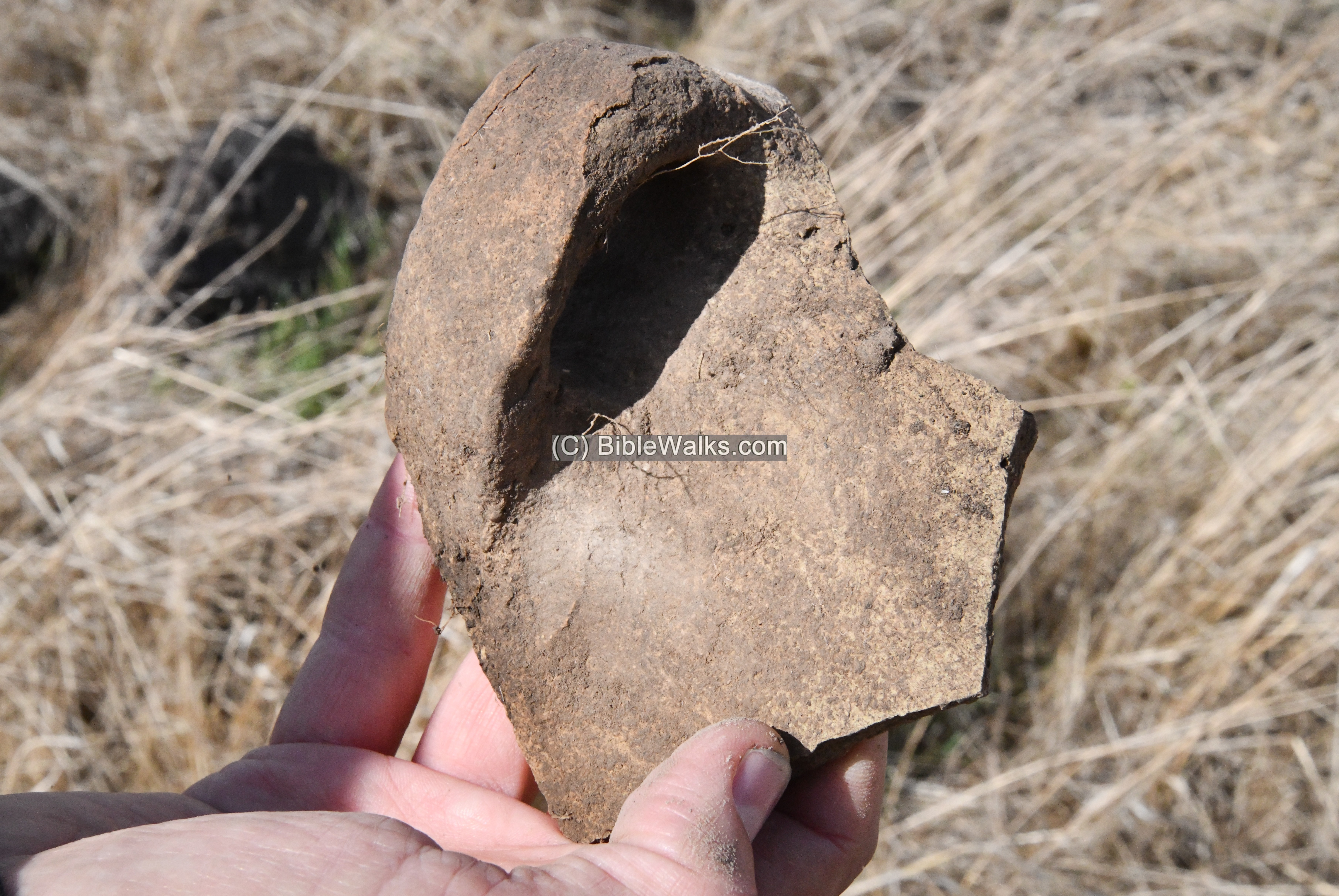
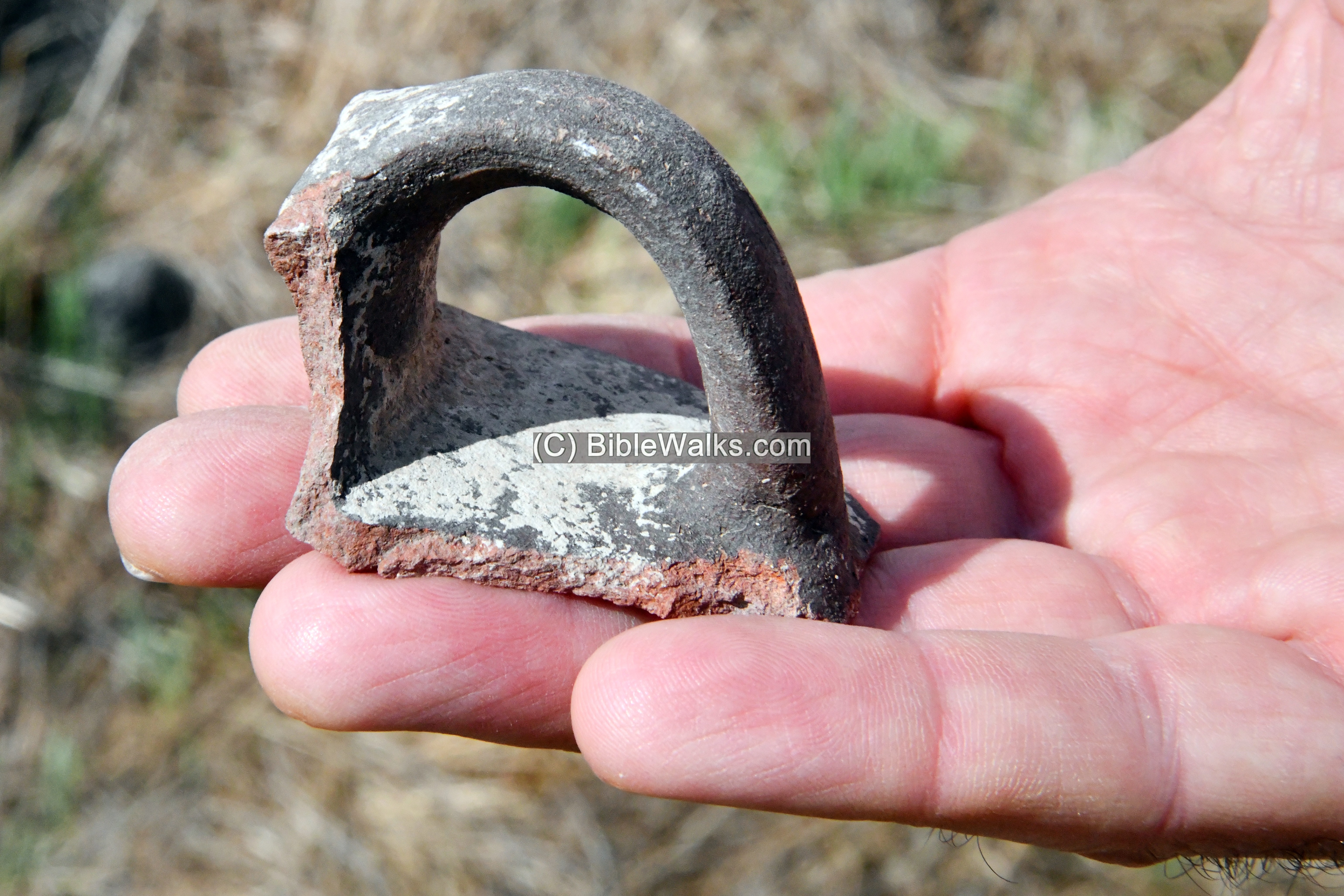
Another closer view of a handle of a Byzantine period vessel:
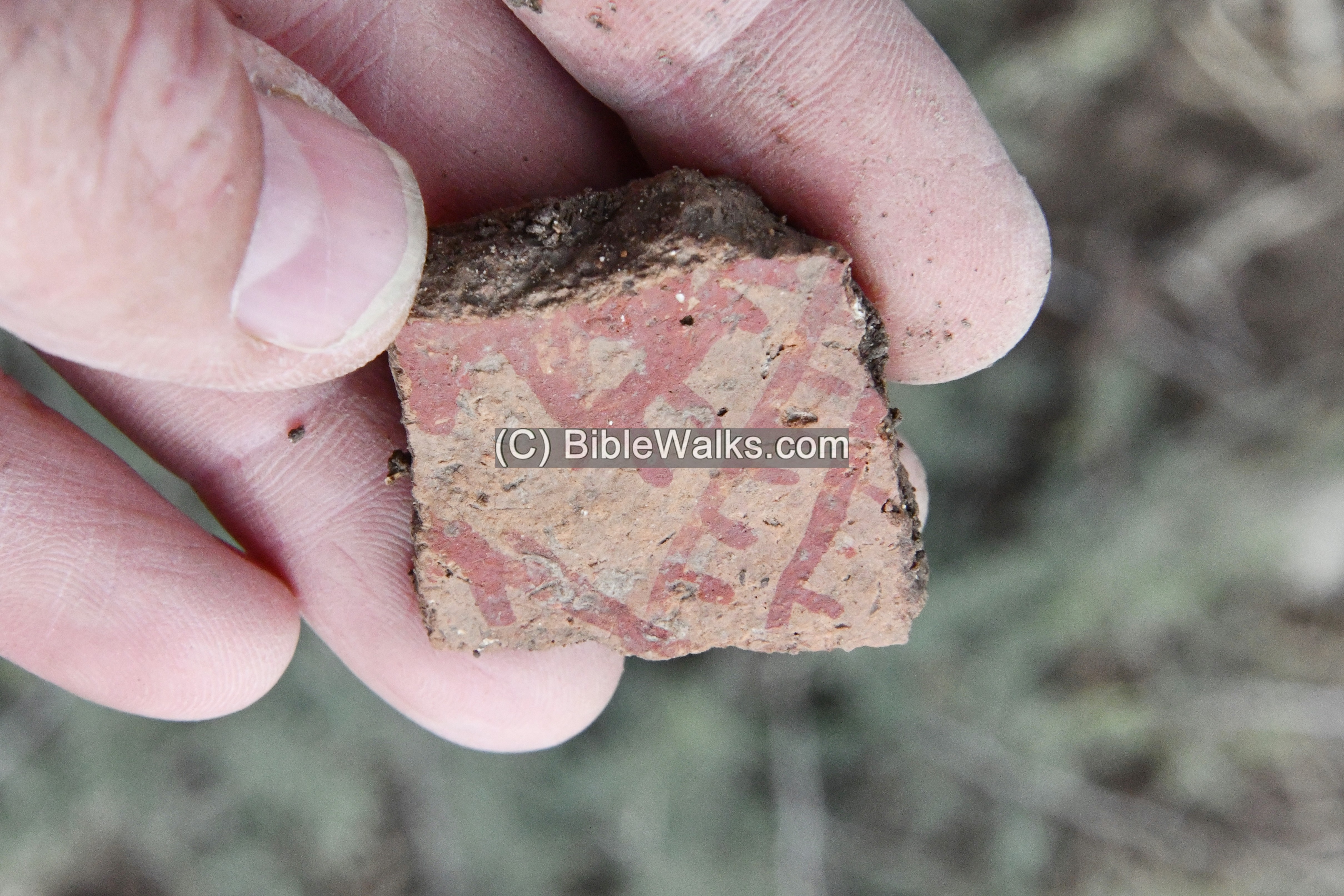
An additional pottery fragment was of a colorful Late Bronze vessel, with red geometric patterns. The figure above the line may possibly be an illustration of a horse.
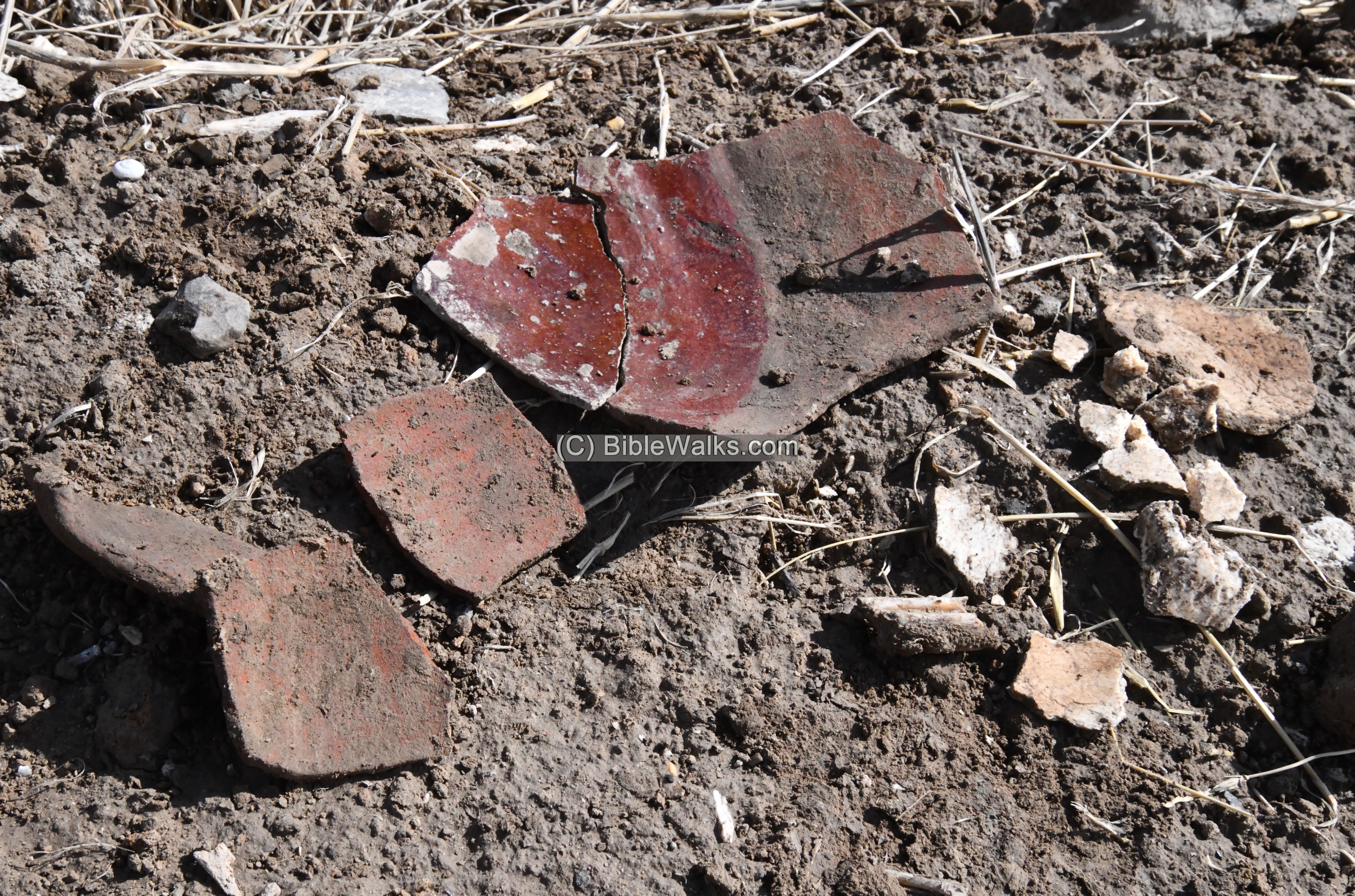
Pieces of a broken cooking pot, with a smooth red surface on the base, were found on the southern foothill. It was dated to the Middle ages.
Fragmented bones and teeth, seen on the right side, were also found near it.
Most of the sherds were found on the side of several porcupine holes across the mound. These mammals dig into the ground, pulling out dirt and pottery fragments, making it easy to sift thru the soil and pick up the ceramics.
Identification of Tel Shamat? Albright identified the site as the Biblical city of Beit Shemesh (of the Galilee), but later changed his mind as he reconsidered the mound to be natural. The IAA survey (Zori, BIES 1954p. 83) also does not agree with this identification, based on the archaeological findings. Biblical Beit Shemesh was one of Issachar’s cities (Joshua 19:17,22):
“And the fourth lot came out to Issachar… And the coast reacheth to Tabor, and Shahazimah, and Bethshemesh; and the outgoings of their border were at Jordan: sixteen cities with their villages”.
(c) Tel Zan
Tel Zan (Zanbaqiya west, Tell esh-Shauk) is a large mound, aligned east to west. It is also located on the north side of Nahal Tabor stream. The summit of this mound covers an area of 4 dunams.
The PEF survey of 1880 merely wrote (Volume 2, p. 128): “Tell ez Zanbakiyeh -An artificial mound near Jordan; a spring exists about 1 mile to the west”.
This photo is from the north side.
Access to the summit is best from the south and west sides.
A challenging path (named the “path of the braves”) is from the north side, starting from the relaxation place (“zula”) at the foothill.
The relaxation place (“zula”) is a great rest stop before or after the climb. It was constructed by members of Kibbutz Gesher.
We did not dare to climb up the path of the braves. Rather, a convenient ascent is from the south side. On the top is a memorial observation place overlooking the area. It is in memory of Amishua Zait who managed the farming of the cotton fields that were planted in the grounds around the area.
This view is towards the north.
An ancient crushing basin of an oil press (R. Frankel’s type 7.3.2) was added here, probably found in the fields around here. This basin was part of one of the typical oil press types during the Roman/Byzantine period.
Another view towards west is next. In the background is the valley of Nahal Tabor (right side) and the Naftali heights (left side).
A closer view of the west side is in the following photo. Notice the Ottoman period railway bridge in the center of the view, built over the stream.
On the north west side of the summit is a raised extension, with a walkway (modern?) paved with basalt stones.
Descending from Tel Zan was from a walkway arranged along the steep foothill. The few basalt stones help to take a grip while stepping down. Here Uncle Ronnie uses a pair of Ski sticks to control his balance.
A view from the bottom of the descending path:
Ceramics collected on the mound and on its foothills were dated by previous surveys to the Early Bronze age, Iron Age I and II (primary), Hellenistic and Byzantine (few), and Early Muslim (many).
The findings in our short walk on the site included these pottery sherds, primary of the Iron Age.
Here is another pottery fragment we observed, painted with faint red stripes.
(d) Tel Shoshan
Tel Shoshan (Zanbaqiya East, Tell Abu el Jamal) is located on the bank of the Jordan river and close to the Nahal Tabor stream. It rises east to west, covering an area of 20 x 50m on the top. The foothills around the summit were paved by basalt stones, creating a glacis. Foundations of buildings were observed on the western side.
Here is a view from Tel Zan, viewing the mound from the north west side.
Ceramics collected on the mound and on its foothills were dated by previous surveys to the Early Bronze age IV, Mid Bronze II, Iron I and Byzantine.
Another view of Tel Shoshan from the south west side, captured during the winter:
(e) Tel Kittan
Tel Kittan (Tell Abu Musa, Tell Sheikh Qassim) is located to the south of Nahal Tabor stream. It is adjacent to the Jordan river, rising 40m above the river. The site is seen here in the left background, located at the edge of the Jordan river. These hills originated from the alluvial fan of Nahal Tabor (loose clay, silt, sand, or gravel that has been deposited by running water in a stream).
The ancient site covers an area of about 8 dunams, with additional ancient settlements around it.

Next is a view from the west side. Behind it is the green valley of the Jordan river, and farther in the background are the villages of Jordan, situated along the foothills of the Gilead (Gilad) mountains.
The PEF survey of 1880 merely stated (Volume 2, Sheet IX, p. 128): “Tell esh .Sheikh Kasim – A very large artificial mound near Jordan”.
A closer view from the west side is below. The site was heavily damaged by a construction of military fortifications on parts of the hill, access road, trenches and structures. On the foothills are lines of military fortifications – barbed wire and possibly mines.
The military road inside the compound cut thru the ancient layers, revealing living floors and pottery fragments.
Modern excavations revealed 9 settlement layers. It was first settled during the Neolithic period, and reached a peak in the Early Bronze I period. After a time gap the site was resettled during the Middle Bronze IIa. and continued until the Late Bronze I.

The excavations unearthed remains of two temples dated to Middle Bronze period IIb (1750-1550 BC, layer V and IV) and another temple dated to the Late Bronze I (1550-1300 BC, layer III). Below are the remains of the first temple – external size 6.9m x 5.5m and internal size 4,6 x 4.3m. The foundations are made of stones, while the walls were made of sun-dried mud bricks. A bench made of bricks was built along the internal side, holding the offerings. The roof stood above 4 columns, held above flat bases located inside the temple. Two columns stood on both sides of the eastern entrance. To the east of the temple was an area with lines of tombstones, including a carved statue of a naked woman (perhaps the fertility goddess known as Ashtoret).

Additional residential structures were unearthed on the southern side. This side overlooks the Jordan valley on the east side, and a very large photovoltaic array floating above the fish pond.

Ceramics collected on the mound and on its foothills were dated by previous surveys to the Chalcolithic, Early Bronze age I, Mid Bronze II, Late Bronze, Iron II, Roman, Byzantine and Early Muslim. The findings included pottery sherds, basalt objects and Hellenistic thru Early Muslim coins.
In our brief stay on the hill, in the exposed layers next to the abandoned army outpost, we observed the following objects:
A closer view of some of these findings are shown here. All items were left on site.
- A section of a large storage container (pithos) dated to the Chalcolithic period. From 5000-4500 BC Chalcolithic villages developed in the Jordan valley. The villagers grew cereals, vegetables, fruits and olives, and stored them in these jars. A complete similar jar was found in Abu Hamid. Another sample is seen in the Jerusalem museum.
2. A ceramic bead, probably of the Chalcolithic period. Beads were used as Jewelry, and later evolved into finer objects using various materials.
3. A section of a sun dried mud brick. Mud bricks were used to build walls, laid over a stone base.
4. Another mud brick:

5. A piece of a ceramic handle, probably of the Bronze Age.
6. A rim of an Iron Age vessel.

7. A section of a basalt Quern-stone (hand grinding stone), probably of the Biblical age (Bronze/Iron age). It was part of a pair, used to hand grind cereal grains into flour. This type of tool was first used in the Neolithic period.
8. A large stone weight (or stone anchor), probably dated to the Chalcolithic period. The limestone is 45cm long and 31cm wide with 9cm wide hole. A groove on the side of the hole, seen on the reverse side, imply that a rope was tied to it.

A 3D model of this stone was scanned using the Scaniverseapp. Pressing on the following photo will open a mp4 video player with a 3d model of this tool, revolving around its axis.
(f) Neve Ur East – Large Chalcolithic settlement
Another Chalcolithic settlement was excavated in an emergency excavation 400m west of Tell Kittan, in an agriculture field of Neve Ur, located along the Kirkuk-Haifa IPC pipeline. The four opened squares in areas A and B revealed structures and objects dated to the Late Chalcolithic period (5800 BC), which was part of a large settlement of the Late Chalcolithic Ghassulian culture.
(g) Horvat Minha (Munhata)
On Horvat Minha (Munhata) are ruins of a large Neolithic (New stone Age) period settlement. The site is located on a high terrace, situated above the north bank of Nahal Tabor stream.
Horvat Minha was excavated in 1962-1967 by J. Perrot and N. Zori, covering a large area (20 dunams), out of the 100 dunams estimated size of this large early settlement. This was the largest Neolithic excavation in Israel, and one of the largest in the Levant.
This view, towards the south, shows a section of the excavation area. Most of the site is covered under the farming fields around.
The archaeologists dated 6 layers:
- Levels 6 to 3 are of the Neolithic II period (Middle and Late PPNB: Pre Pottery Neolithic B – 8000 BC to 7210 BC). A C-14 dating in a sample extracted from these levels gave approximate date of 7210 BC.
- Level 2 is of the Late Neolithic Pottery period (6400-4500 BC), following a gap in the occupation of the village. A C-14 dating of a sample gave approximate date of 5420 BC. Level 2a had a “Yarmukian” material culture (reflected in pottery, figurines and flint) similar to the Neolithic village in Sha’ar Hagolan, while Level 2b has a material culture parallel to the Wadi Rabah (mid 5th Millennium BC).
- Level 1 is of the Chalcolithic period (4500-3150 BC) up to Early Bronze 1A.
The earliest layer (6) was founded on the natural subsoil, while other layers accumulated to 3m high deposits. The early settlement included fragments of several rectangular buildings with plastered floors, and remains of a large round building with rooms around a central courtyard.
Some remains of the site are scattered above the soil, including flint tools, ground stone tools, and human and animal figurines scratched on pebbles or made of clay. Here are some fragments we collected. The items were left on the site.
- A collection of flint stone items and a rolling stone:

The following items are shown from a closer view:
2. Stone vessels:
Pottery was first introduced only in the Late Neolithic period (7000-5000 BC). Therefore, most of the vessels that were used here were made of stone.
2a: Stone vessel:
2b: Part of a stone bowl:
2c: Part of a smaller stone bowl: Notice the carved lines on the base of this vessel.
This limestone pebble was found in the field on the east side of the excavated area. Its core stone is 7cm in diameter and 2.5cm thick. Then, it was flaked on one side, thus creating a cutting edge. It is similar to the scrapper found 1km east of the site near Tel Zan.

3. Carved animals and Humans –
Carvings and clay figurines were a very common find on Horvat Minha. During the 1960s excavations many such objects were unearthed. During our short survey of the site we found two such samples.
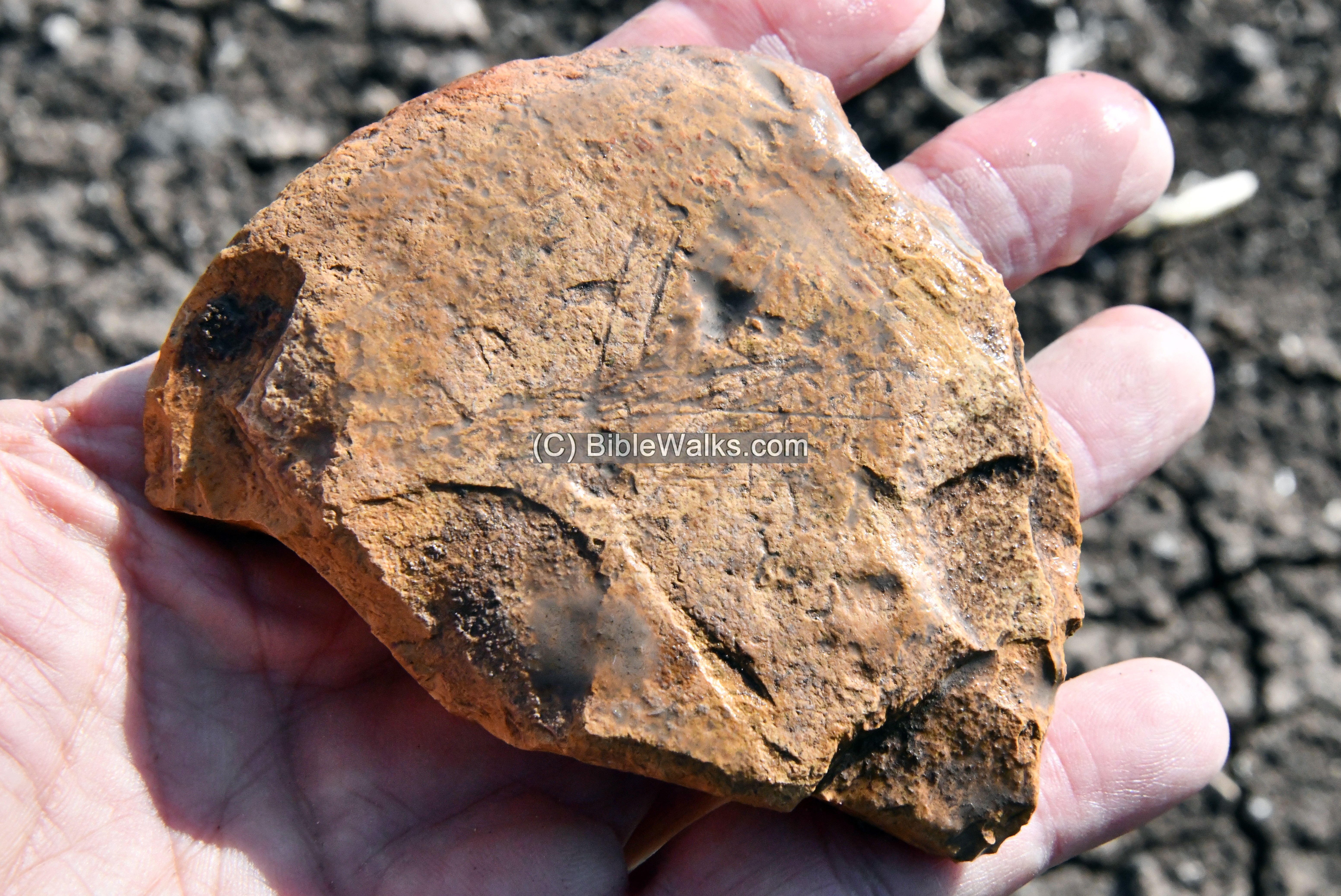
3a: Carved animal: A Neolithic carved figurine of a gazelle:
3b: Carved geometric form on a stone:
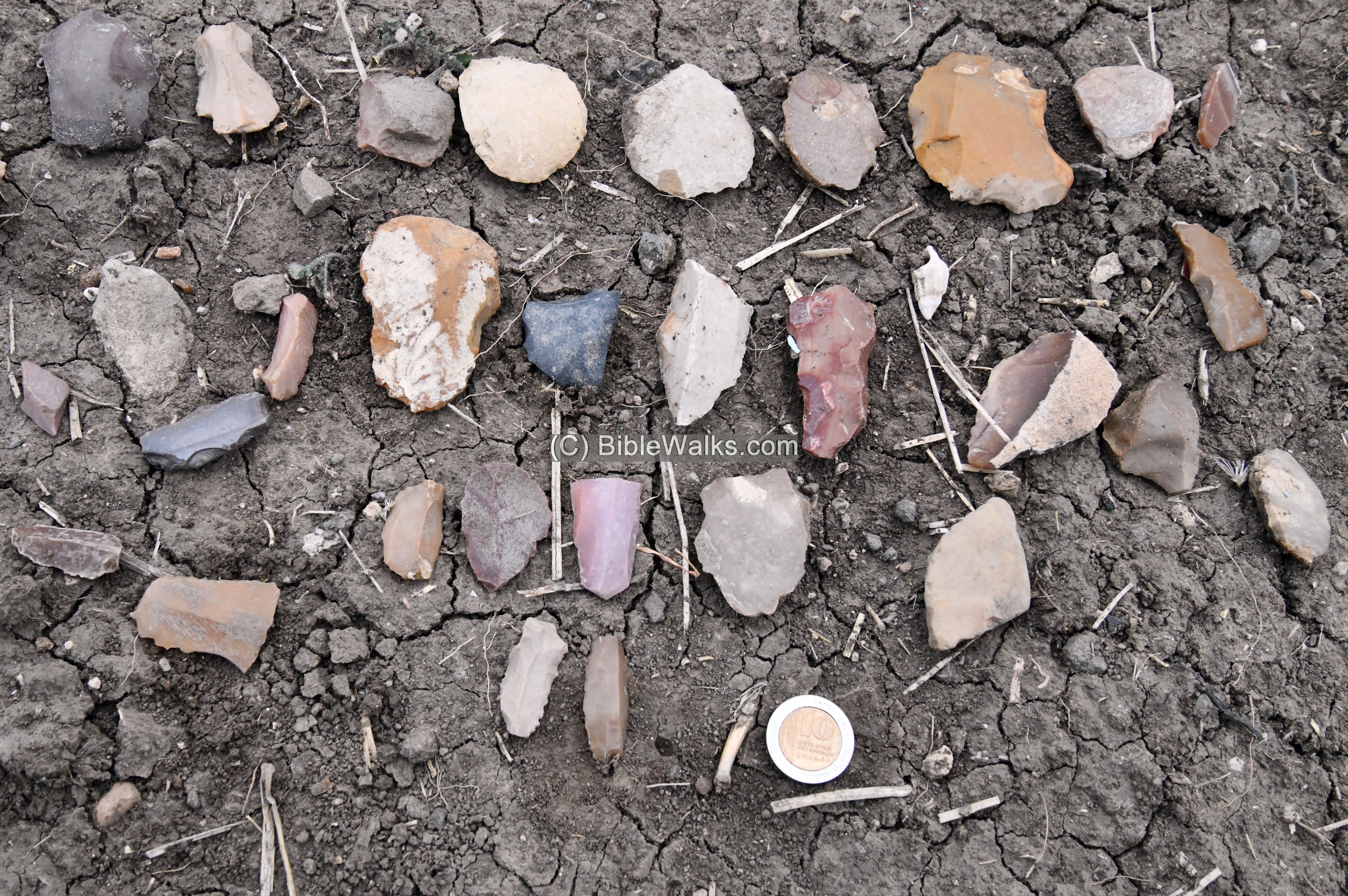
4. Flint stones
Flint was used to manufacture tools during the stone age, such as knives and arrow heads. It is hard and splits into thin, sharp splinters.
A collection of flint stones we saw around the excavation area:
A closer view of some of the flint stones:
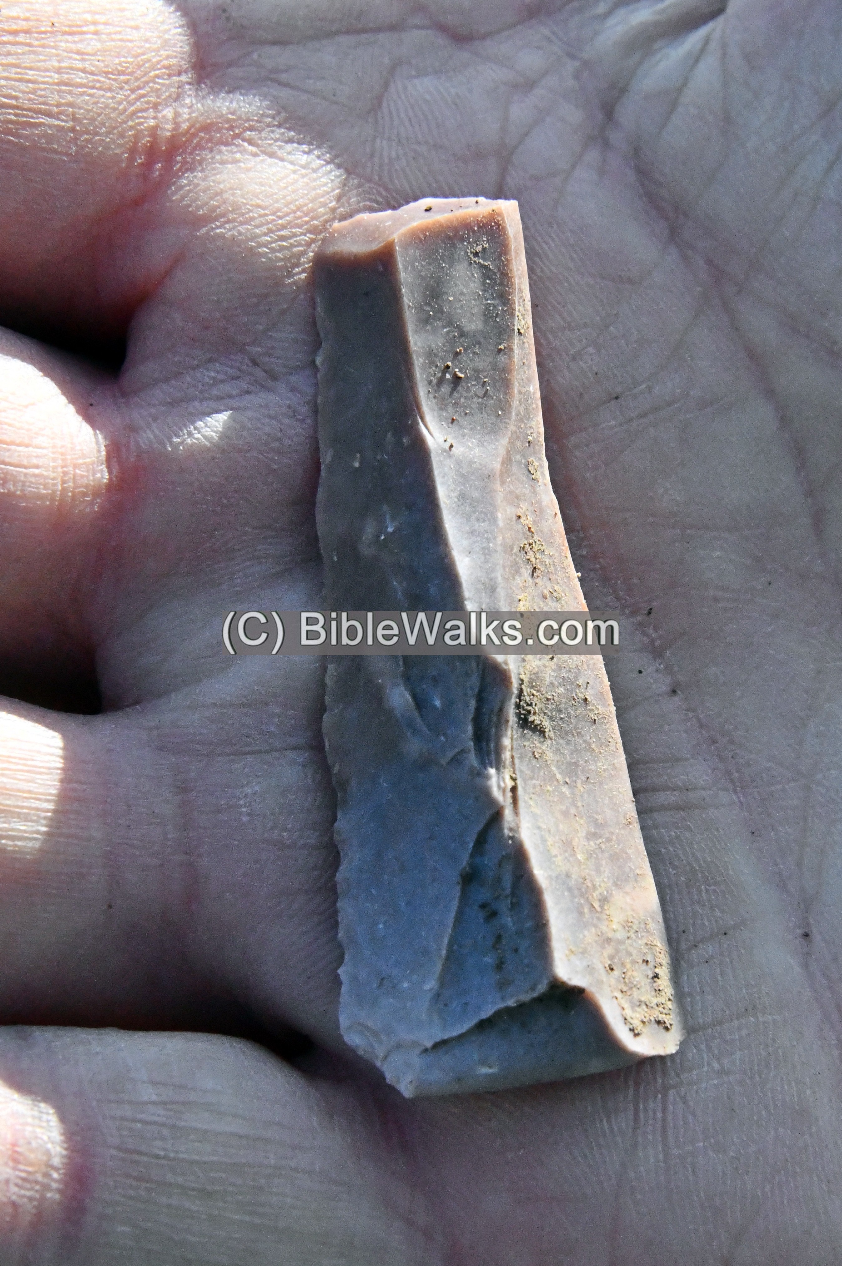
4a: Flint blade – used as a sickle blade, or knife, or arrow head:
4b: Another Flint blade:
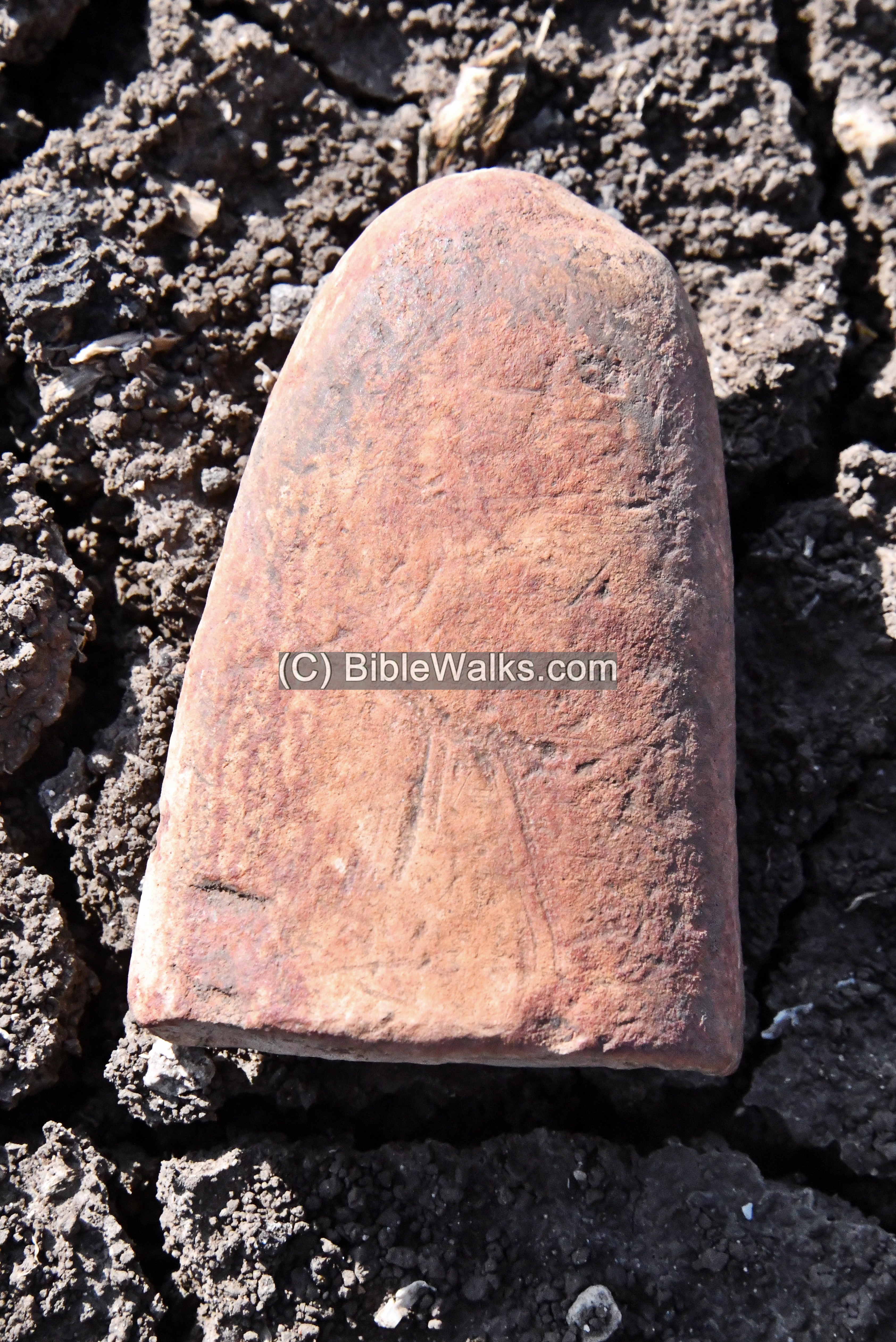
4c: A small, fine made, red flint arrowhead:
This type is known as the Jericho arrowhead, dated Pre-Pottery Neolithic period.

5. Basalt vessels
5a: A section of a large basalt grinding base, found in the excavation area:
5b: Another large basalt grinding base, with 2 concave sections, also found in the excavation area:
![]() A short video of our survey (captured June 2025):
A short video of our survey (captured June 2025):
(h) Prehistoric Gesher
Another Neolithic village was exposed on the south bank of Nahal Tabor, 500m south east of Railway bridge and west of the fish pond. The site, prehistoric Gesher, was an earlier settlement of the Pre-Pottery Neolithic A (PPNA, 10,000–8,800 BC). The excavations (1986-7, 2002, 2004) were headed by Y. Garfinkel and S. Cohen. Four C-14 dating samples gave an average of an approximate date of 8000 BC.
During the Middle Bronze IIa the site served as a cemetery, with 20 graves uncovered.
(i) Railway bridge
During the Bronze and Iron Ages the Jordan river crossings used the fords of the Tabor delta to cross to the east. Later, during the Roman period, a stone bridge was constructed in nearby Gesher.
In 1905 the Ottomans linked the railway from Haifa, via Beit Shean, to eastern Jordan unto Damascus. It crossed Nahal Tabor above this beautiful bridge, in a location not far from the ancient sites described above. The railway continued 2km kilometers to the north, where it crossed the Jordan river near Gesher.
Etymology (behind the name):
- Tel (Tell) – mound (See more on the story of a Tel).
- Makhadet – Arabic: Ford
Links:
* External, archaeological links:
- Crossing the Jordan river during the Biblical period – north versus south – David Moster, Aram 29 (2017), pdf
- Late Bronze Survey in Jordan valley – James Mark Schaaf (545 pages, 2012, thesis, Univ S. Africa); great resource!
- Bergman & Brandsteter Arch. surveys in Beit She’an valley (1940-1941:86-90, Hebrew)
- IAA survey:
- Horvat Minha Map 47 Site 10 – a Neolithic thru Chalcolithic periods site (area 100 dunams), near highway #90
- Tel Shamat (Tell esh Shamdin) Map 47 site 15
- Tel Yakush (Giv’at Ha-Mokshaim) Map 47 Site 14
- Tel Zan (Zanbaqiya West) Map 47 site 18
- Tel Shoshan (Zanbaqiya West, Tell Abu el Jamal) Map 47 site 19
- Khirbet Zar (Kh. Mazar) Map 47 site 24 – abandoned Bedouin village
- Tel Kitan (Tell Musa) Map 47 site 28
- Study of bead materials and production
- Tel Kitan – The Early Bronze Age IB Pottery Assemblage from Tel Kitan, Central Jordan Valley. Emanuel Eisenberg and Yael Rotem (Israel Exploration Journal, Vol. 66, No. 1 (2016), pp. 1-33 )
- The Middle Bronze Age Temples at Tel Kittan – E. Eisenberg, Qadmoniot 36, 1976, pp. 105-109
- Newe Ur (East) – HASI 134 2022 Yoav Zur
- Tel Yakush – Penn Museum project; Facebook page
- Highlighing the PPNB in the Southern Levant
- The Neolithic period: Triumphs of Architecture, Agriculture, and Art
* Other Jordan river crossings:
* Internal links:
- Mount Tabor – source of Nahal Tabor
- Tel Rekhesh – Major city upstream
- Horvat Ziwan – Iron Age site, protected the crossing
- Prehistoric Tools – info page on early man tools
- Tel – Ancient mounds
BibleWalks.com – exploring the ancient sites of Israel
Horvat Ziwan<<<—previous Jordan Valley site—<<< All Sites>>> — Next site—>>>
This page was last updated on Dec 25, 2024 (add arrowhead)
Sponsored links: