A Benedictine monastery in Abu Ghosh, with a 12th century Crusaders church, near the ancient road to Jerusalem.
Home > Sites > Judea > Abu Ghosh > Crusader Church
Contents:
Overview
Location
History
Photos
* Aerial Views
* Spring
* Exterior
* Interior
* Crypt
* Garden
Etymology
Biblical
Links
Overview:
A Benedictine monastery in Abu Ghosh, adjacent to Tel Kir’yat Ye’arim, on the side of the strategic ancient road to Jerusalem. This 12th century church is one of the most beautiful and interesting Crusaders structures in the Holy Land. It was built on the ruins of a Roman period water reservoir, and an Abbasid caravansarai.
Location:
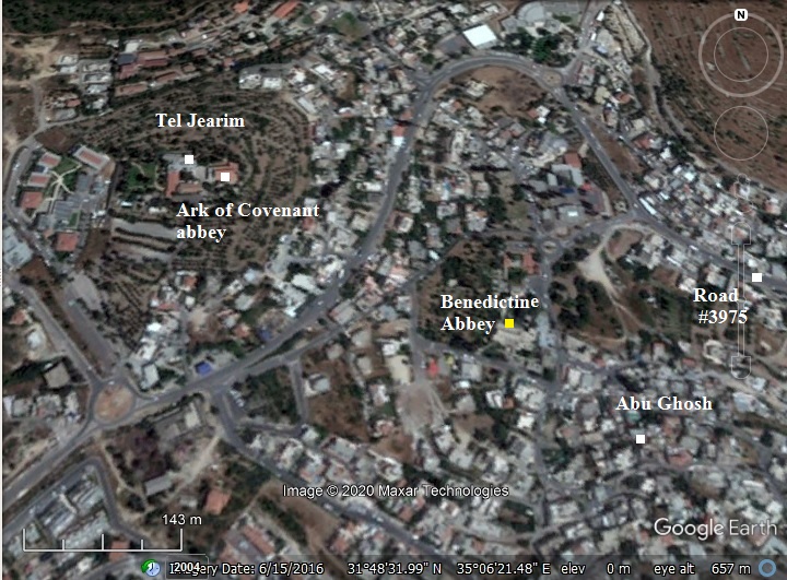
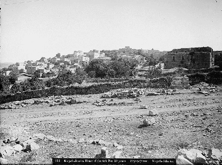
The following aerial view shows the area around the abbey, within the village of Abu Ghosh. Adjacent to the site is the spring (‘Ain el ‘Azir). North west of the site (alt. 680m), situated on a high hill (alt. 758m), is the archaeological mound of Kiriath Jearim (Kir’yat Ye’arim) and the Abbey of the ark of Covenant.
History:
- Biblical periods
Ruins of the Israelite city of Kiriath Jearim are located on a hill to the west of the Benedictine monastery. Kiriath Jearim (Hebrew: Kir’yat Ye’arim – House of woods”) is the place where the ark of Covenant was stationed after the Philistines returned it to the Israelites. Later, King David moved it to the temple in Jerusalem.
- Roman period
A Roman legion, Legio X Fretensis, had a station house and guard post in Abu Ghosh until the end of the 3rd century AD. An inscription of this legion on a stone is displayed on the wall of the church. Their post was adjacent to the Abu Ghosh spring.
During this time a large pool was built to store the waters of the spring. The pool’s estimated size is 16.25 x 20.70. It was later incorporated into the crypt of the Crusader Church. Two staircases were cut into the rock, descending down to the pool. These stairs were also incorporated into the crypt.
In 1923 Benedict archaeologists unearthed two tombs with rolling stones near the Church. They were dated to the Second Temple period.
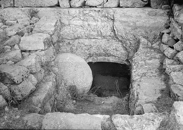
Abu Ghosh – Jewish Tombs with Rolling stones – Matson collection 1940-1946; Photos of the Library of Congress
- Early Arab period
An inn was constructed near the Abu Ghosh spring in the 9th century (Abbasid Caliphate), servicing the pilgrims to Jerusalem. Its rooms, surrounding a courtyard, were built on the western side of the Roman pool. An inner pool in the center of the courtyard was fed from the Roman pool. The entrance to the inn was on the north side, opened to the main road to Jerusalem.
- Crusaders period
A Church and a monastery was built here in ~1140 by the order of the Hospitallers. The eastern side of the church was built over the Roman pool, while the western side was built over bedrock.
The Knights named their order after John, and were called the “Knights Hospitallers of St. John”, or commonly known as the Hospitallers. They became one of the important military orders defending the Holy Land, and established other structures and installations such as the knights halls in Acre (1104).
The church was named “Church of the Resurrection“, as the Crusaders associated the place to Emmaus, which is referred in the Gospel of Luke. This Gospel tells about the meeting between Jesus, after his resurrection, and the two companions, on the road to Emmaus (Luke 24: 13-35):
“And, behold, two of them went that same day to a village called Emmaus, which was from Jerusalem about threescore furlongs….”.
There are different Biblical versions of the location of Emmaus; some indicate sixty stadia (about 10KM) or hundred and sixty stadia (about 32KM). The former range fits this location, while the latter range fits the ruins near Latrun.
- Saladin and Mameluke period (1187-1516)
The area was lost to the forces of Saladin in 1187, and the church was abandoned.
The Mamelukes built a new caravansarai (inn) and stables in 1350-1400. The western wall of the caravansarai was joined to the eastern wall of the Crusader church. A mosque was added on the eastern side. The inn continued to serve the caravans passing thru Abu Ghosh until the 16th century. The mosque is still standing and functioning to date.
- Ottoman period (19th Century AD)
In the 16th century an Arab family, named Abu Ghosh, settled here. According to a tradition, they were of Chechen descent, and fought with the Ottoman Sultan Selim I. From the beginning of the 16th century until 1834 the family controlled the pilgrimage route from Jaffa to Jerusalem, imposing tolls on the pilgrims.
The French obtained the property in 1873. Its ruins were cleared out on 1894 and the finished abbey was handed to the Benedictine order in 1901. Most of the original Crusader church remained, and the original frescoes were preserved.
- PEF survey:
The area around the site was examined in the Palestine Exploration Foundation (PEF) survey (1866-1877) by Wilson, Conder and Kitchener. A section of their map is shown below, with the site appearing here as “Kuryet el Enab”. A major Roman road passed nearby, indicated by double dashed lines.
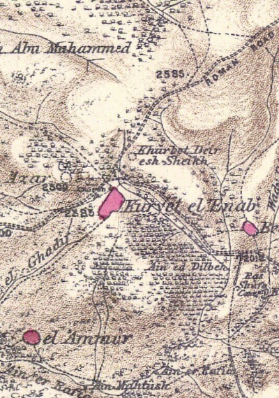
Part of Map Sheet 17 of Survey of Western Palestine,
by Conder and Kitchener, 1872-1877.
(Published 1880, reprinted by LifeintheHolyLand.com)
The ruined Church was illustrated in the PEF survey (Sheet XVII, Volume 3, pp. 132-143). This view is from the north east side, viewing the entrance to the church. They named it as the Church of St. Jeremiah, based on their apparently mistaken identification of the village as Anathoth – the birthplace of prophet Jeremiah.
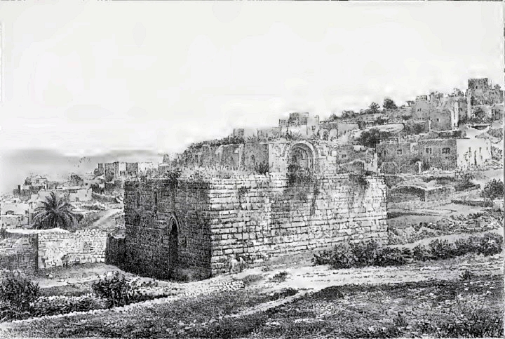
Their description in 1875 provides a valuable description of the state of the Crusader church, 2 years after the ruin was purchased and before it was cleaned.
“The ruined Church of St. Jeremiah, in the valley, is one of the best preserved specimens of Crusading work in the country. The building is remarkable from its unsymmetrical plan—the east wall is 2 1/2 feet longer than the west. The length of the building outside is 90 feet ; the breadth on the west, outside, is 68 feet. The side walls are 8 feet thick ; the west wall is set back twice in its height, the base measure being 12 feet. The nave apse is 13 1/2 feet diameter, the side apses 11 1/2 feet. The church consists of four bays, with heavy square piers, 31/2 feet side.
The church has a crypt beneath, occupying the two eastern bays, and having also three apses. There are two galleries under the aisles, 20 feet long, 3 feet broad, running west from the crypt. They seem to have formed a communication between the crypt and the church above, but they are now much choked up with earth. The entrance to the crypt is now on the north, by a side door, with steps within. In the crypt is a spring, with steps leading down to it from the floor. The nave of the church has a clerestory with windows ; the total height to the roof from the church floor is about 50 feet ; the crypt is 17 feet high, in addition to the 50 feet”.
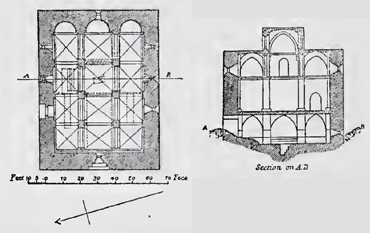
The plan of the church is illustrated here; on the left is a top view, while on the right is a cross section along the line A-B.
Their report provided details on the interior:
“The finest feature of the church is the west window of the clerestory, which is pointed so slightly as to appear almost semicircular. The arches of the door and remaining windows are of the same character. The vaults are all groined; those of the nave roof are supported on dwarf columns, or brackets, with capitals of Gothic design, like those of the church of Samaria.
The masonry of the outer walls is extremely irregular, the courses not being continuous horizontally. Small and large stones are used indiscriminately, and the dressing is very rough. Many of the stones are drafted, especially the corner stones. Well-dressed stones of good size, not drafted, are also used at the corners, and the general appearance is that of a building reconstructed from older material. The masonry of the clerestory is, however, well dressed throughout. There are buttresses between the windows outside on this story, supporting the thrust of the roof, but this arrangement is not continued on the lower part of the building.The joints of the masonry are very broad, and are patched with chips of stone ; the vertical joints are not always properly broken ; the drafted stones have rustic bosses with a considerable projection. Three or four kinds of dressing are observable. 1st. The undrafted corner-stones have a diagonal dressing with a sharp pointed instrument ; in some cases the instrument was used in two directions, giving a criss-cross pattern. 2nd. The smaller masonry in the apse interiors has lines all vertical, cut with a toothed instrument. 3rd. The piers of the crypt are dressed with a blunt instrument, used at right angles to the face of the stone. 4th. Hammer-dressed stones occur on the exterior.
The north door has an arch more decidedly pointed than the windows. The foregoing list gives an idea of the comparative frequency with which the various signs occur. The Maltese cross is twice repeated on the north-west corner of the outer wall. In the crypt are found other marks. The only mark used on the piers is the hour-glass, or two triangles with apexes joined. Of these masons’ marks a majority occur in the Muristan at Jerusalem, at Kaukab el Hawa, and at Beit Jibrin—all places dating about 1140 a.d. This would agree with the arches of the building, which are just of the transition period, between the round and pointed arch. The building is not mentioned in any Crusading Chronicle, so that its date is unknown historically.
Visited 12th February, 1875”.
A view of the area, with the ruined church, is here on a photo from the end of the 19th century. The photo was captured from the main road to Jerusalem.
Abu Ghosh – View of the church from the north east side – American Colony 1898-1914; Photos of the Library of Congress
Another photo shows the church from the south.
Abu Ghosh – View of the church from the south – American Colony 1900-1920; Photos of the Library of Congress
-
Modern Period
A view of the north west corner of the church is seen here, captured on 1941.
Abu Ghosh – View of the church from the NW – Matson collection 1941; Photos of the Library of Congress
Excavations of the area, immediately east and south of the church, were conducted in 1944. The archaeologists unearthed remains of the Abbasid caravansarai and Roman structures.
The monastery is opened to the public, and is a recommended stop on the way to Jerusalem. Standard visiting hours, except Sundays and feast days, are 8:30-11:00 and 14:30-17:30.
Photos
(a) Aerial Views
A drone view from the north side shows the area of the Benedictine monastery. The Church is seen in the center, behind the buildings of the monastery. To its left is the minaret of the old mosque. In the top far right background is Tel Kiriath Jearim.
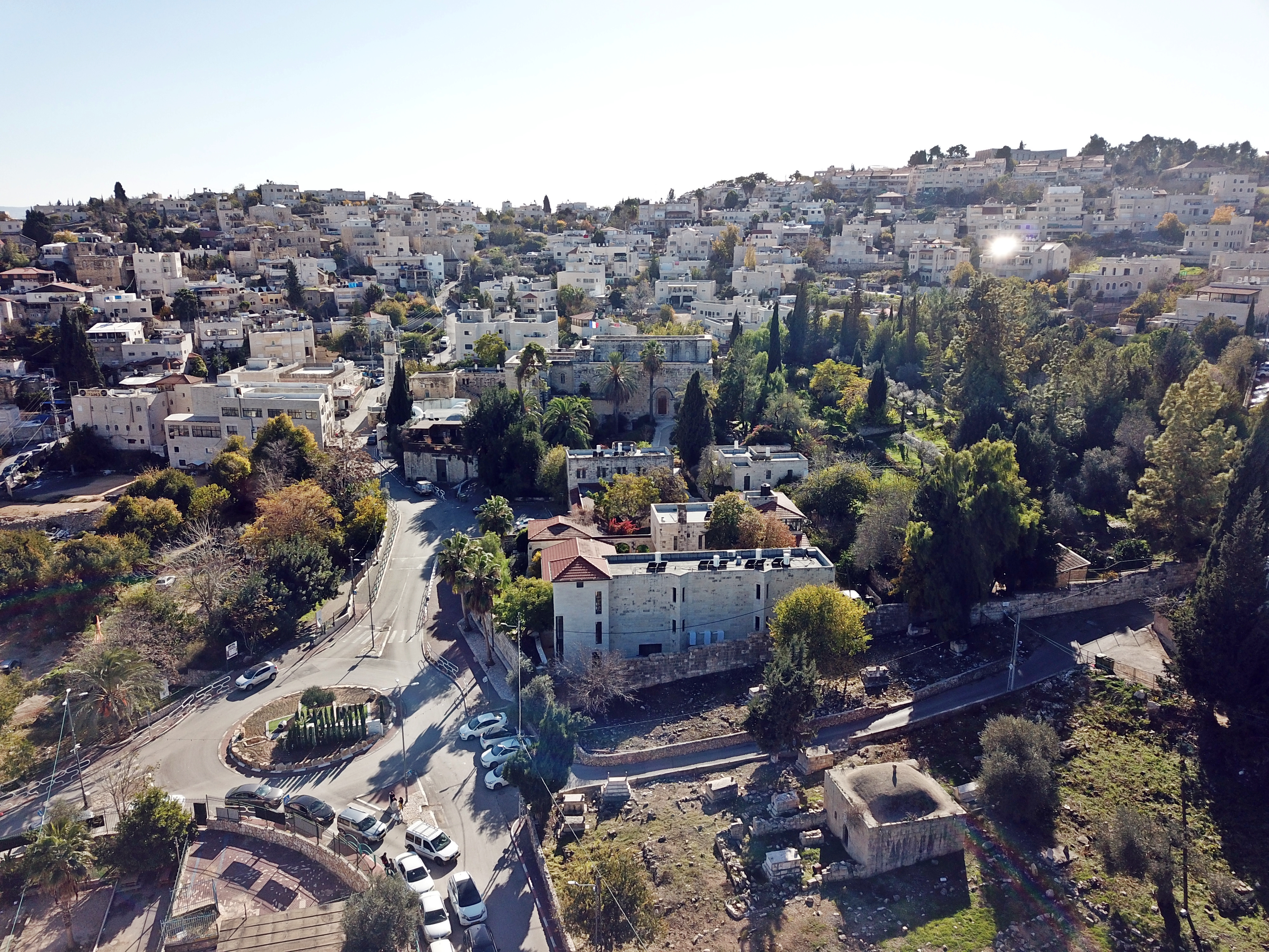
![]() The drone captured a video of the monastery, approaching from its north side, then scanning around the area.
The drone captured a video of the monastery, approaching from its north side, then scanning around the area.
In this cover image of the video: the Crusaders church is in the right side, and the old mosque is on the left.
Captured on December 2020
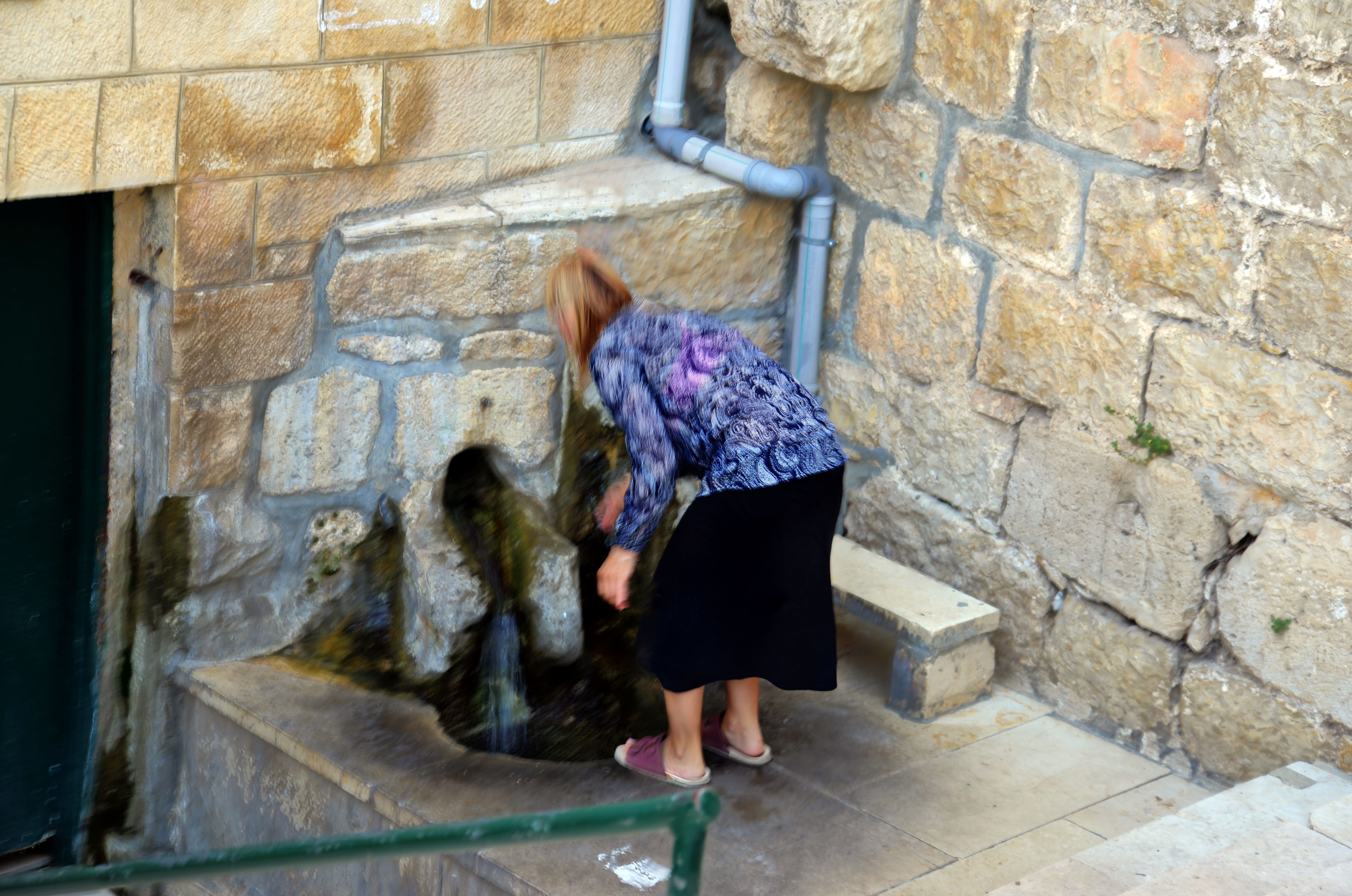
(b) Spring outlet
A mosque is adjacent to the walls of the monastery, which was built by in 1350-1400.
On the north east side of the mosque, and east of the monastery, is an outlet of the spring of Abu Ghosh. Its waters come from the spring located in the crypt of the church. The water flows thru a hole in the wall, filling a small pool that the worshipers cleansed their feet prior to entering the mosque.
Click on the photos to view in higher resolution…
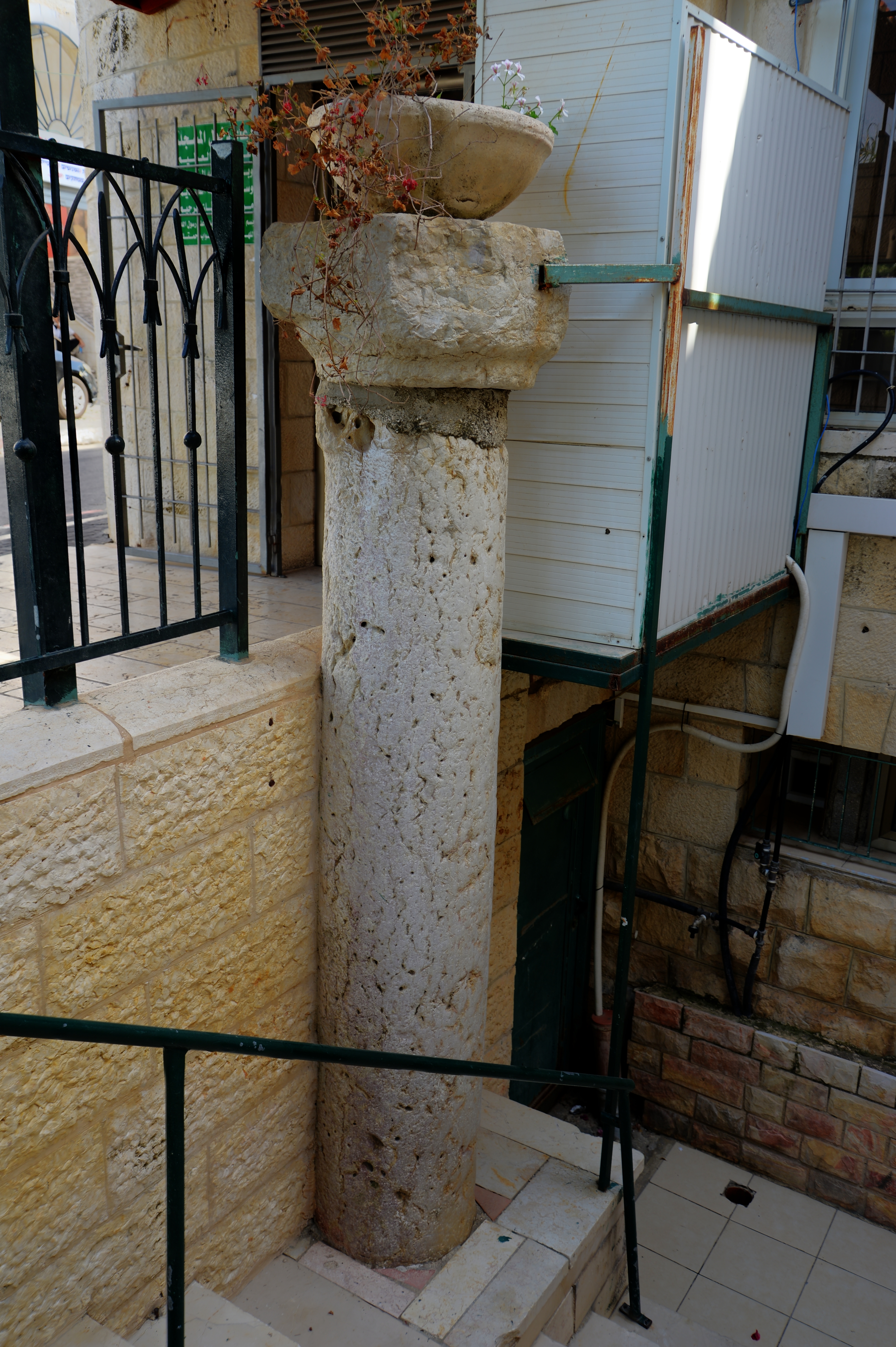
A marble column stands near the spring, once taken from the ruins in the vicinity.
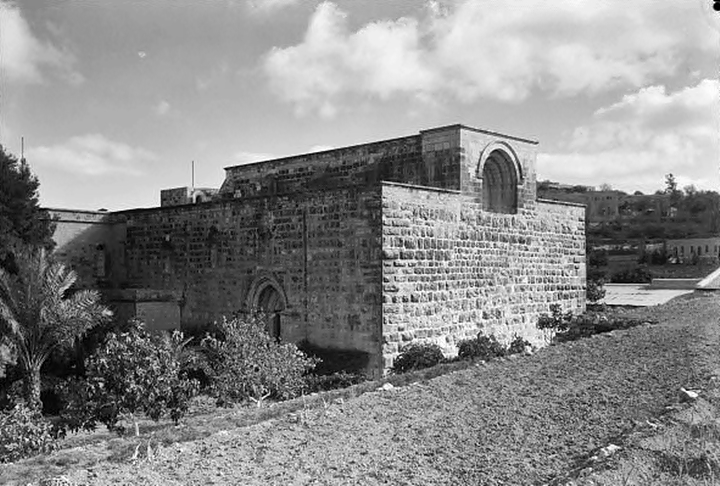
(c) Exterior
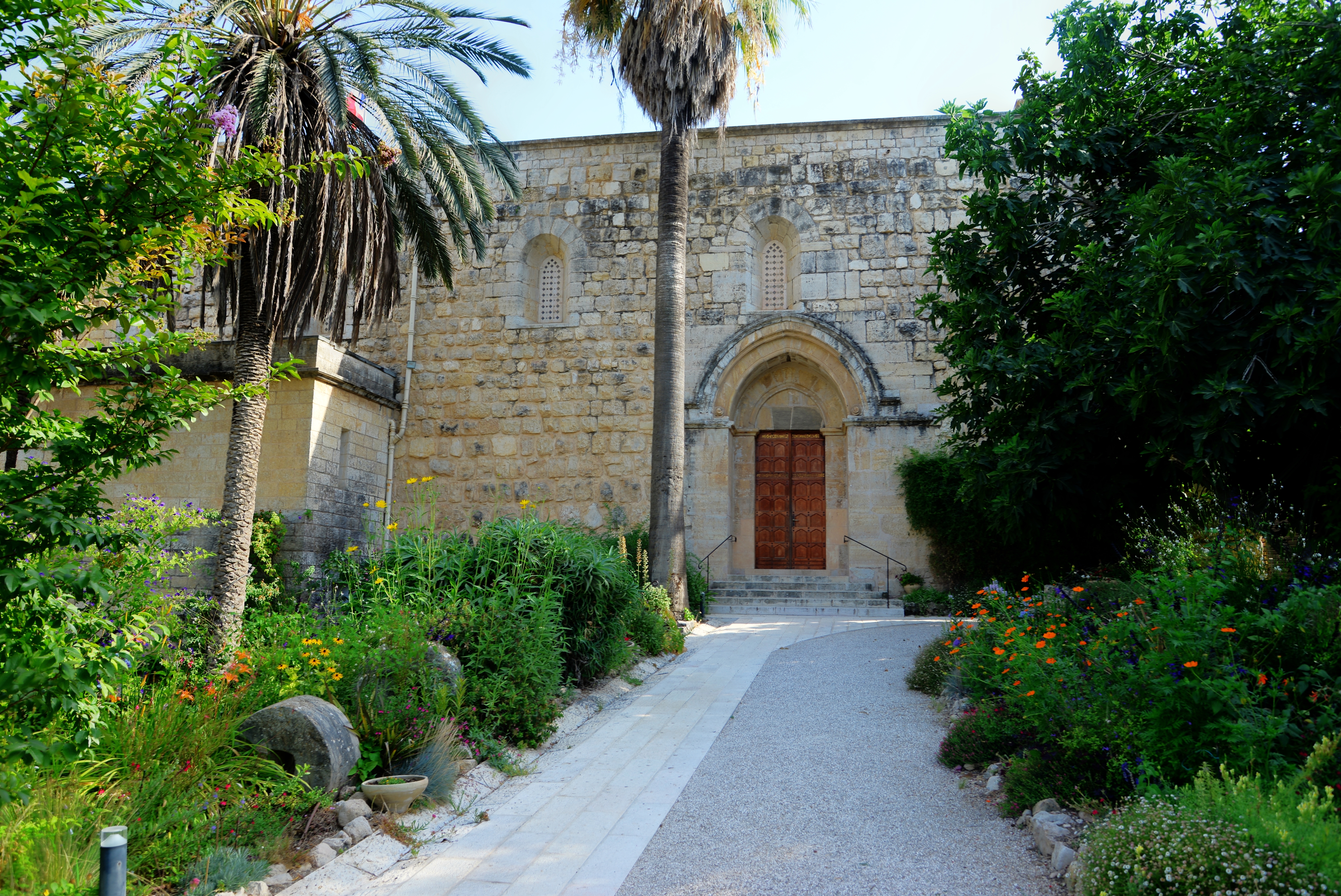
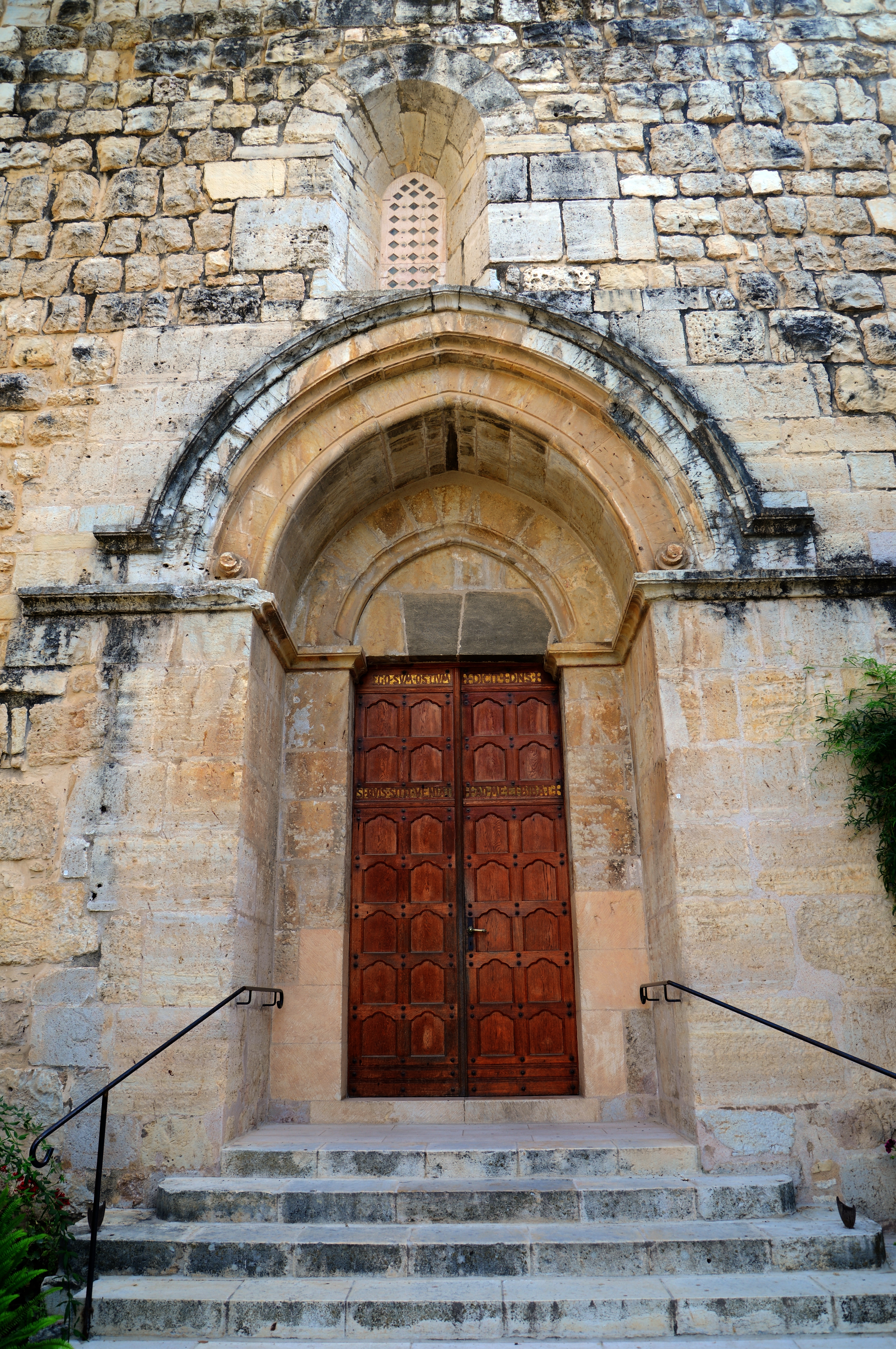
Public entry to the monastery is from the eastern gate. After entering into the courtyard of the compound, a view of the building is seen on its south side.
The public entrance into the church is from the north side of the building.
A closer view of the entrance door to the church:
(d) Interior – Ground level
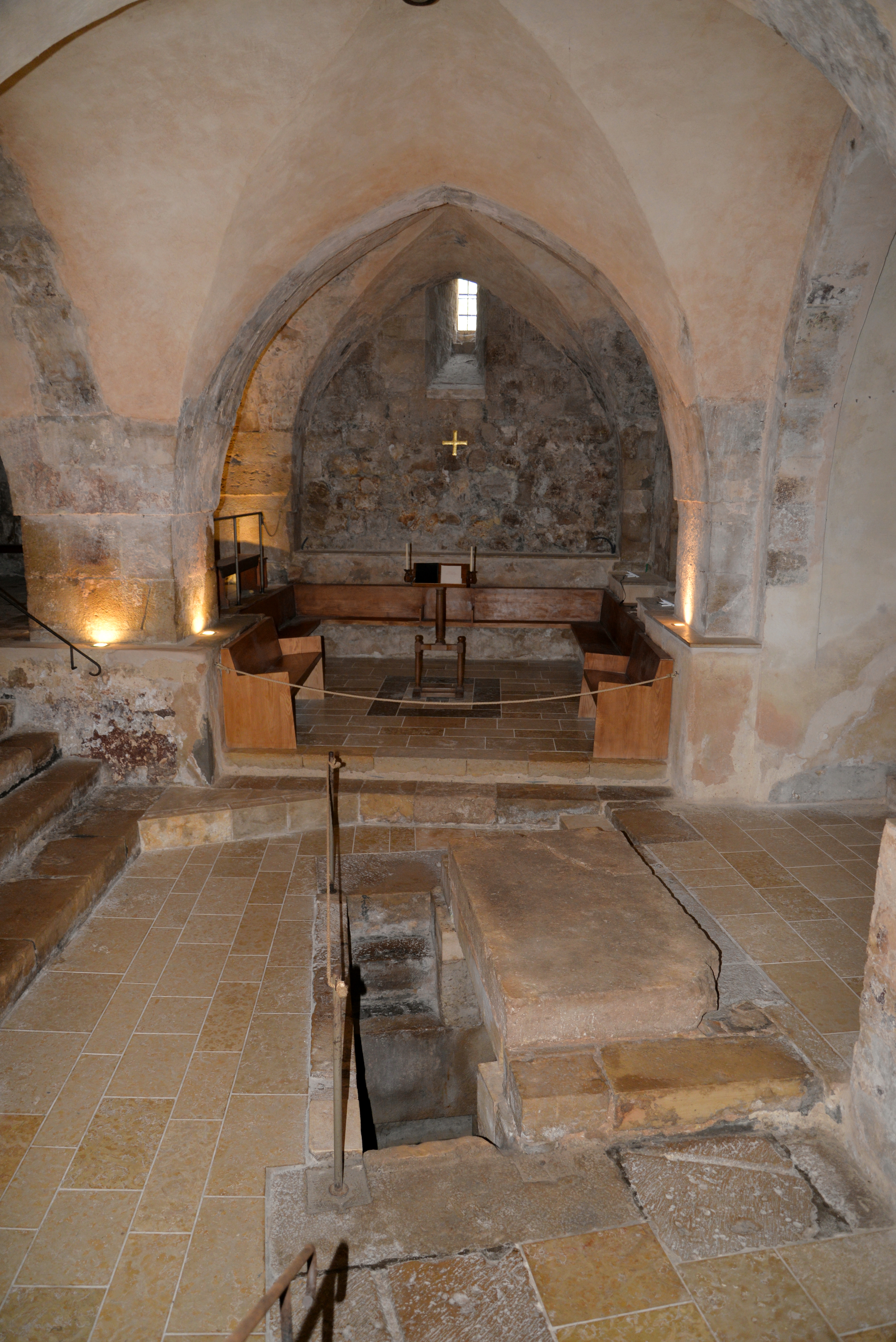
The plan of the ground level of the church consists of a central nave, seen here below, and two naves on both sides.
Each aisle terminates on the eastern side in a semi-circular apse, with a pointed semi-dome embedded on top. The central aisle is unique, having a east facing window, set just above the lower cornice.
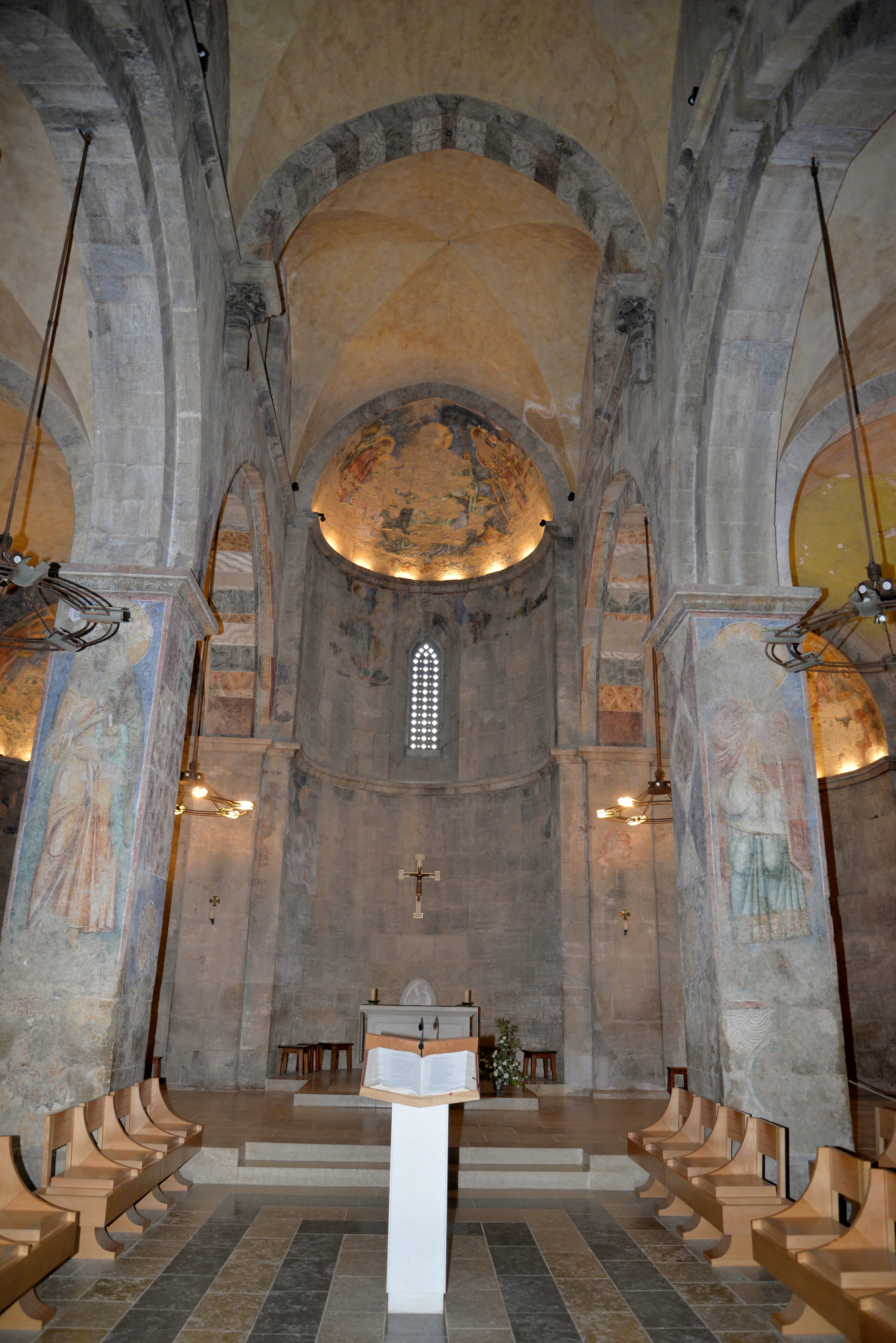
The size of the Church is 27.5m x 20.6/21.3, with 2.5m wide walls.
The following photo shows a closer view of the main altar in the eastern edge of the central nave. It is taken from the southern aisle.
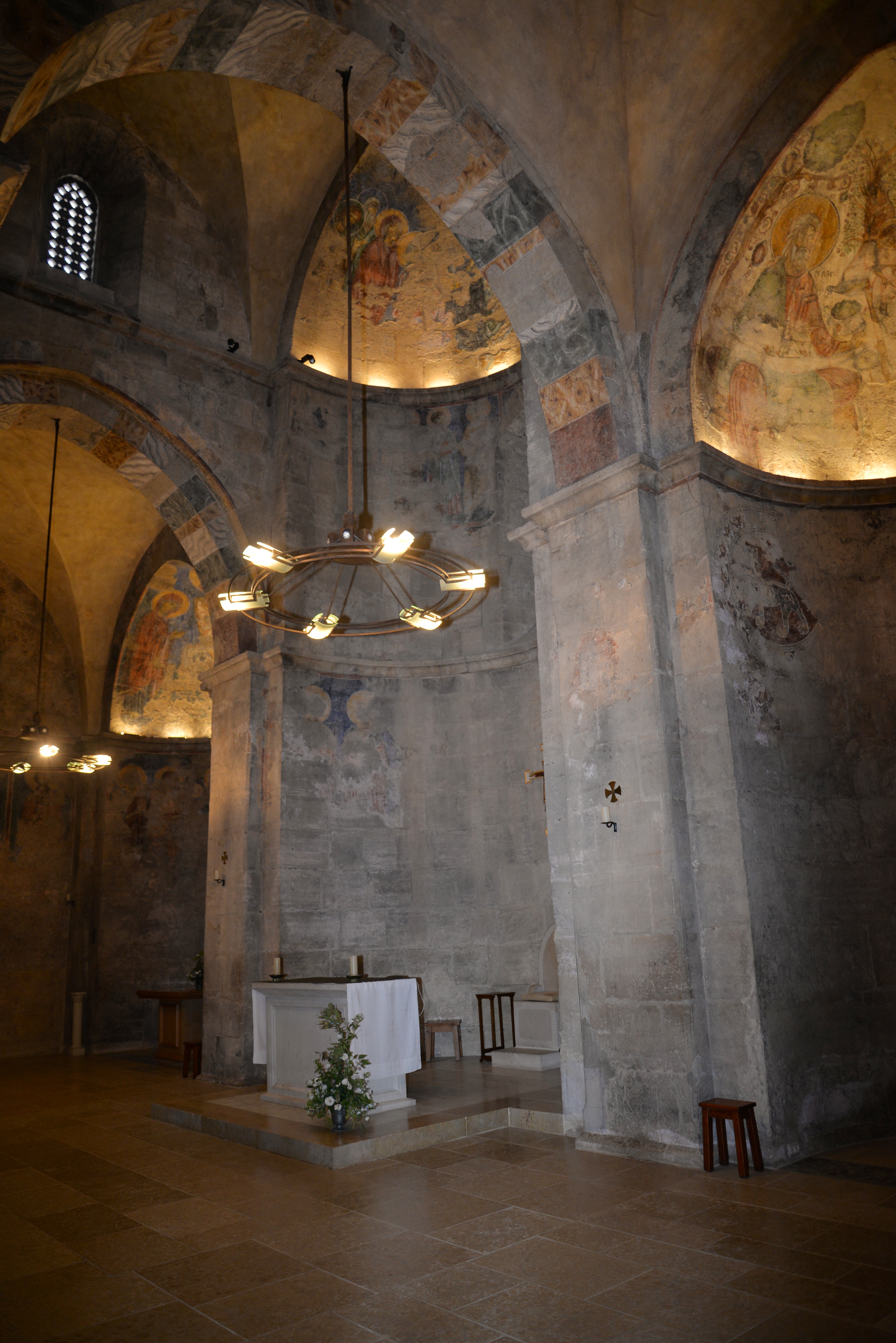
The following photo is of the northern aisle.
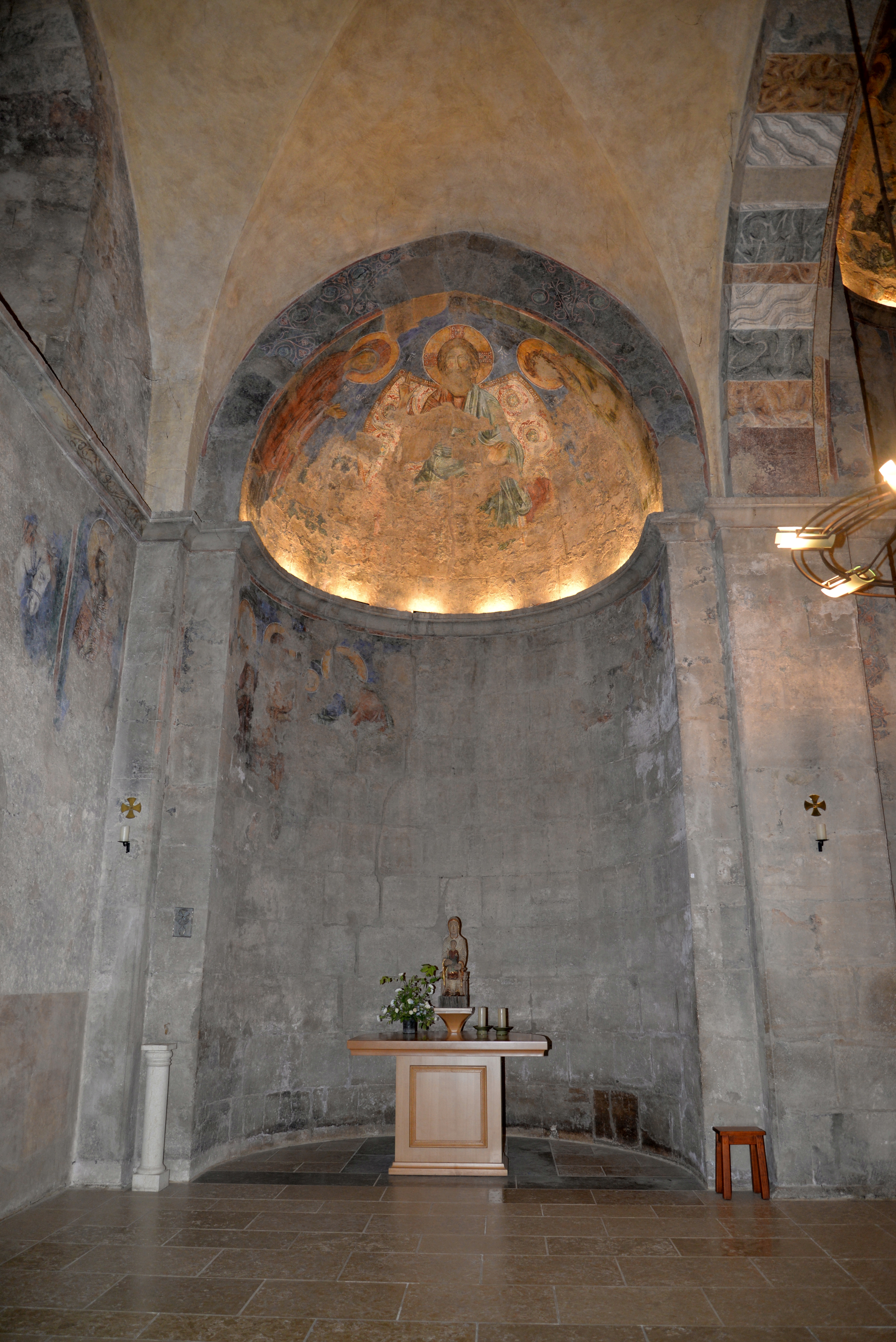
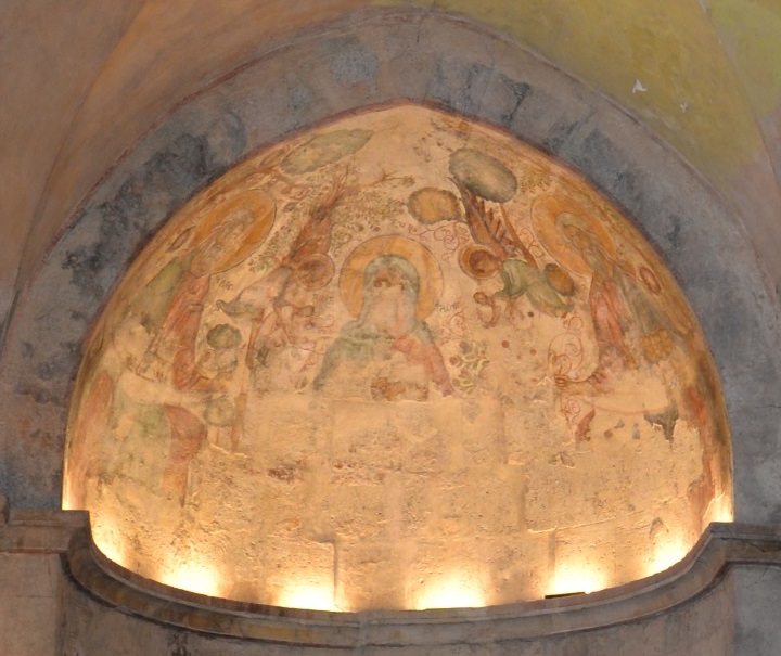
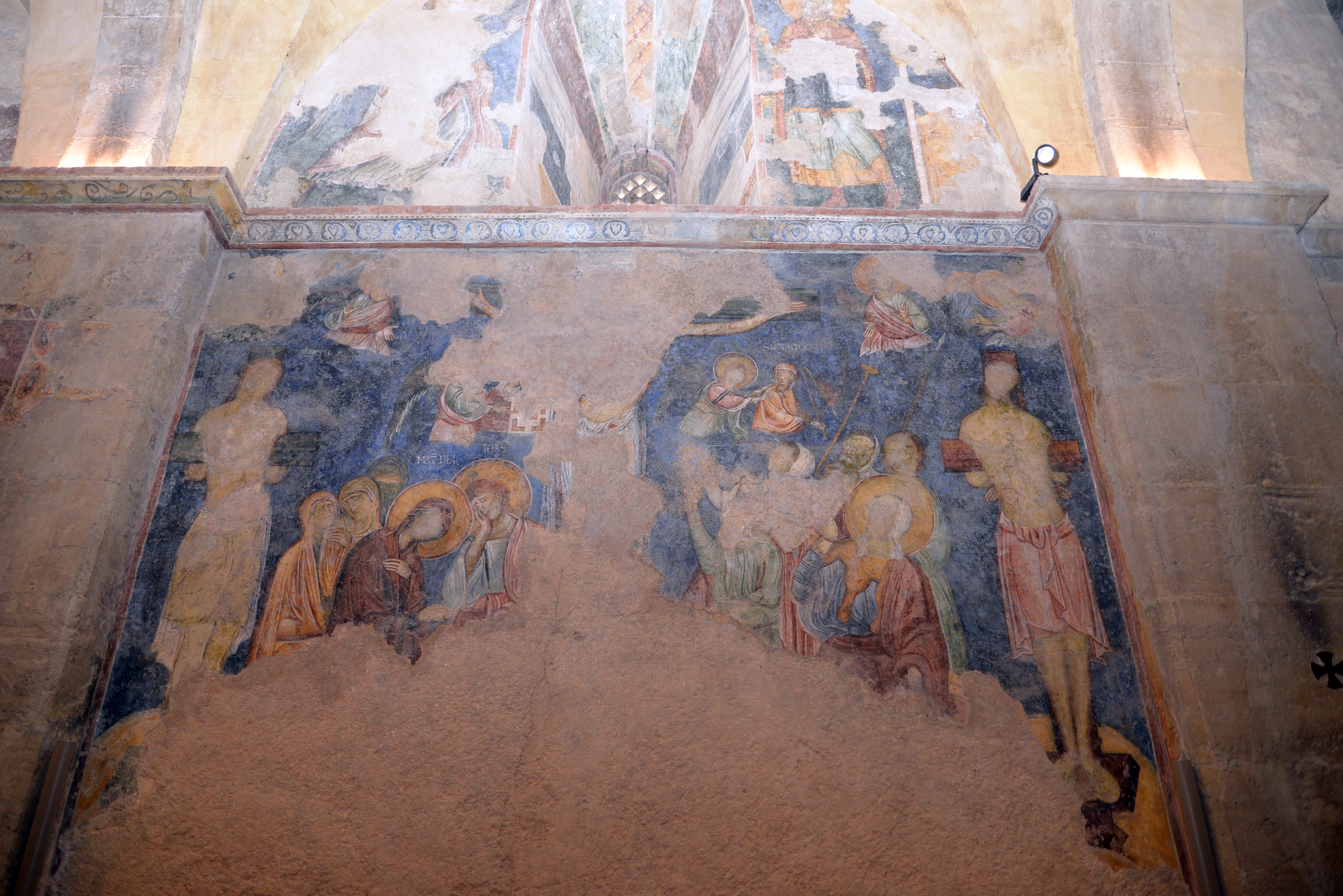
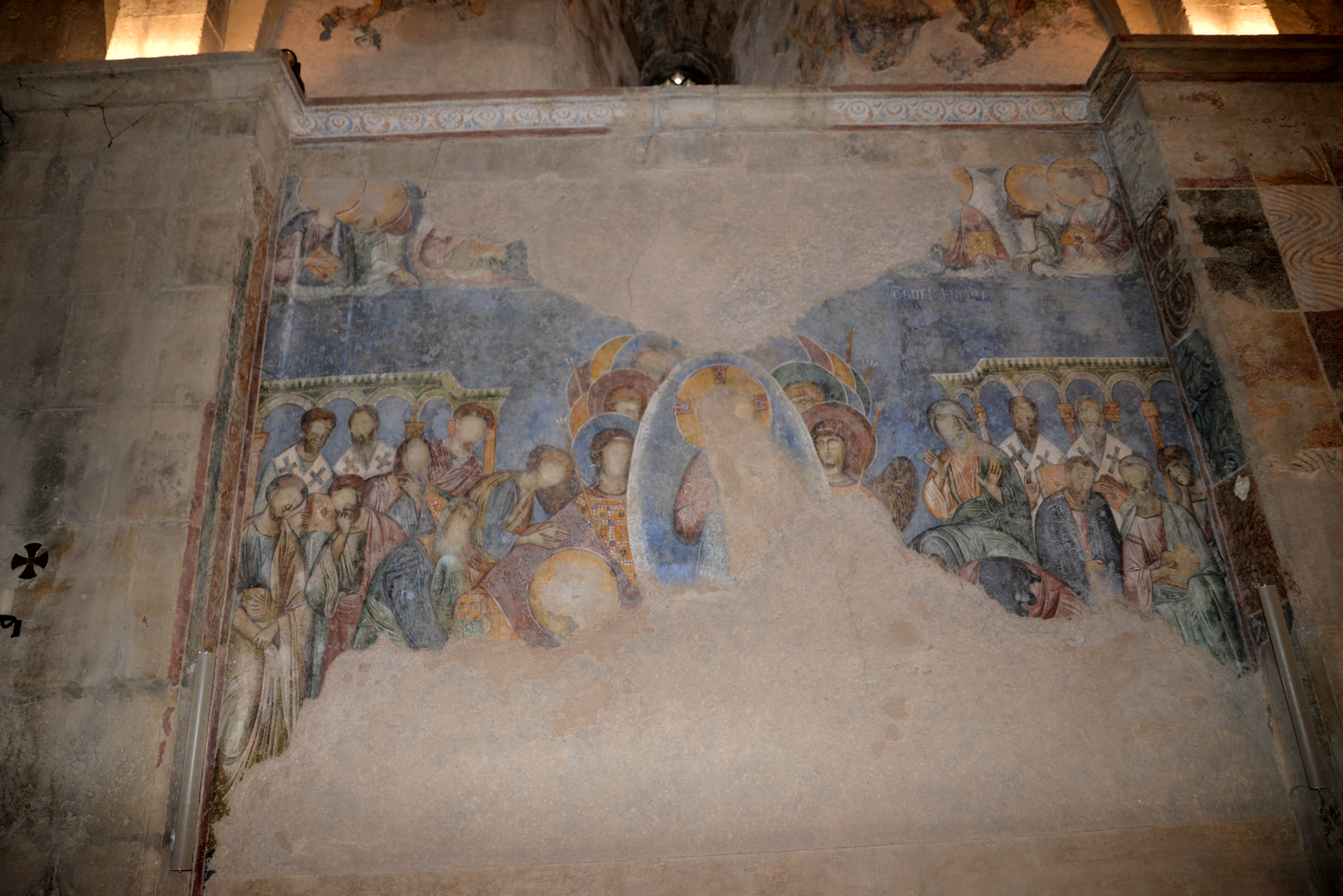
On the walls and ceilings are old paintings (frescoes), remaining from the Crusader church. They were painted on the walls in 1171, but were damaged over the years due to neglect and intentional sabotage.
The painting above the altar depicts the 3 patriarchs – Abraham, Isaac and Jacob. Angels deliver babies (souls) for their blessings, a symbol of resurrection.
The PEF reported in 1875 on the frescoes (Volume III, p. 134):
“The interior of the church is cemented, and was once painted in fresco on the cement. There are traces of the nimbi of saints on the apse-walls, and on the north walls various figures : a bishop In a pallium of Byzantine appearance, and architectural and geometrical designs are dimly visible. There are numerous graffiti on the walls, scratched on the paintings. The place was used at one time as a stable, but has been lately cleared out by the French Consulate.”.
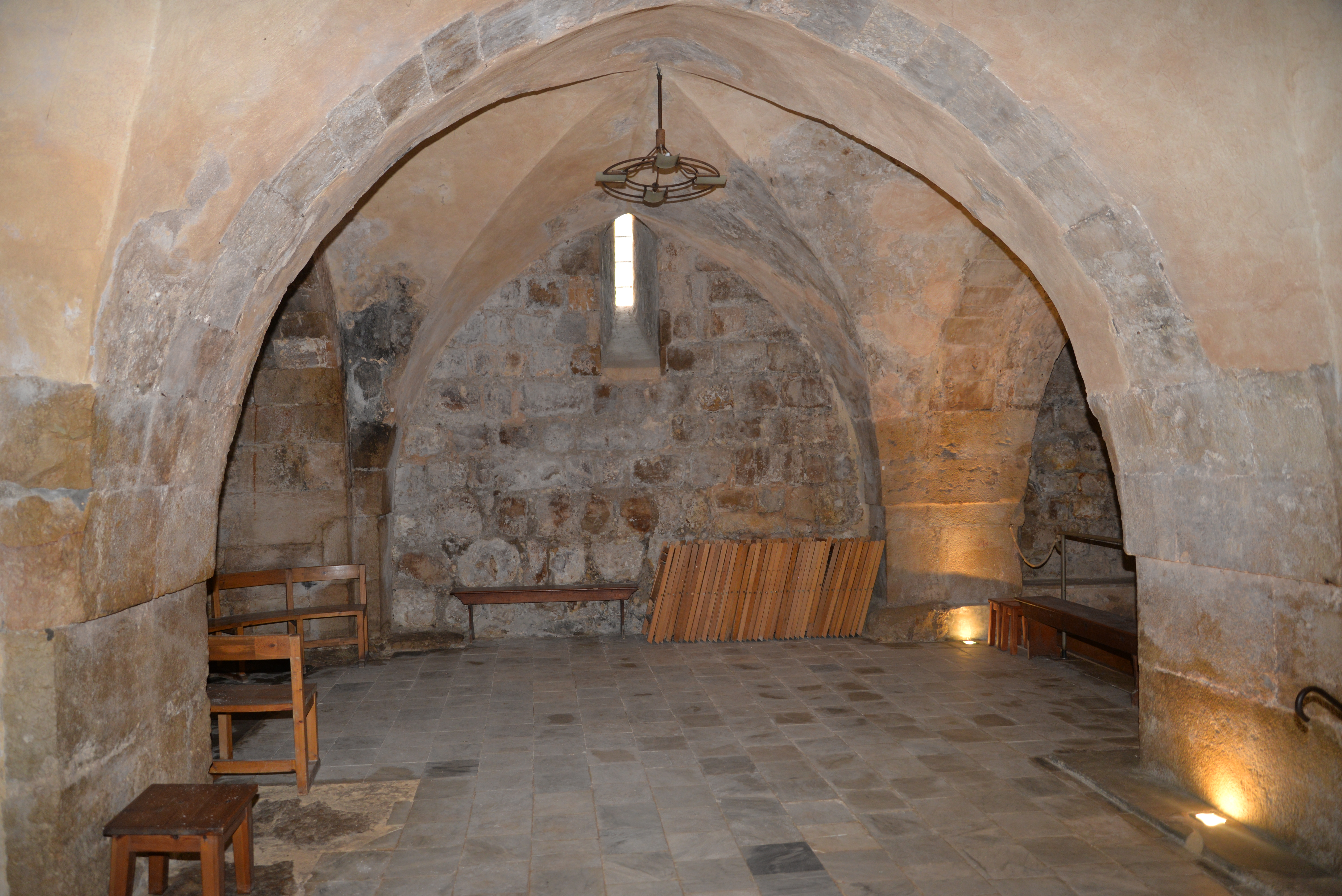
(e) Crypt
The eastern side of the Crusader church was built over the Roman cistern, which provided water for the garrison. The western side of the Church was built over bedrock.
A staircase on the western side of the church leads down to the crypt, where the original area of the pool is located. Its size is 16.25m by 20.70m – the size of the Roman pool.
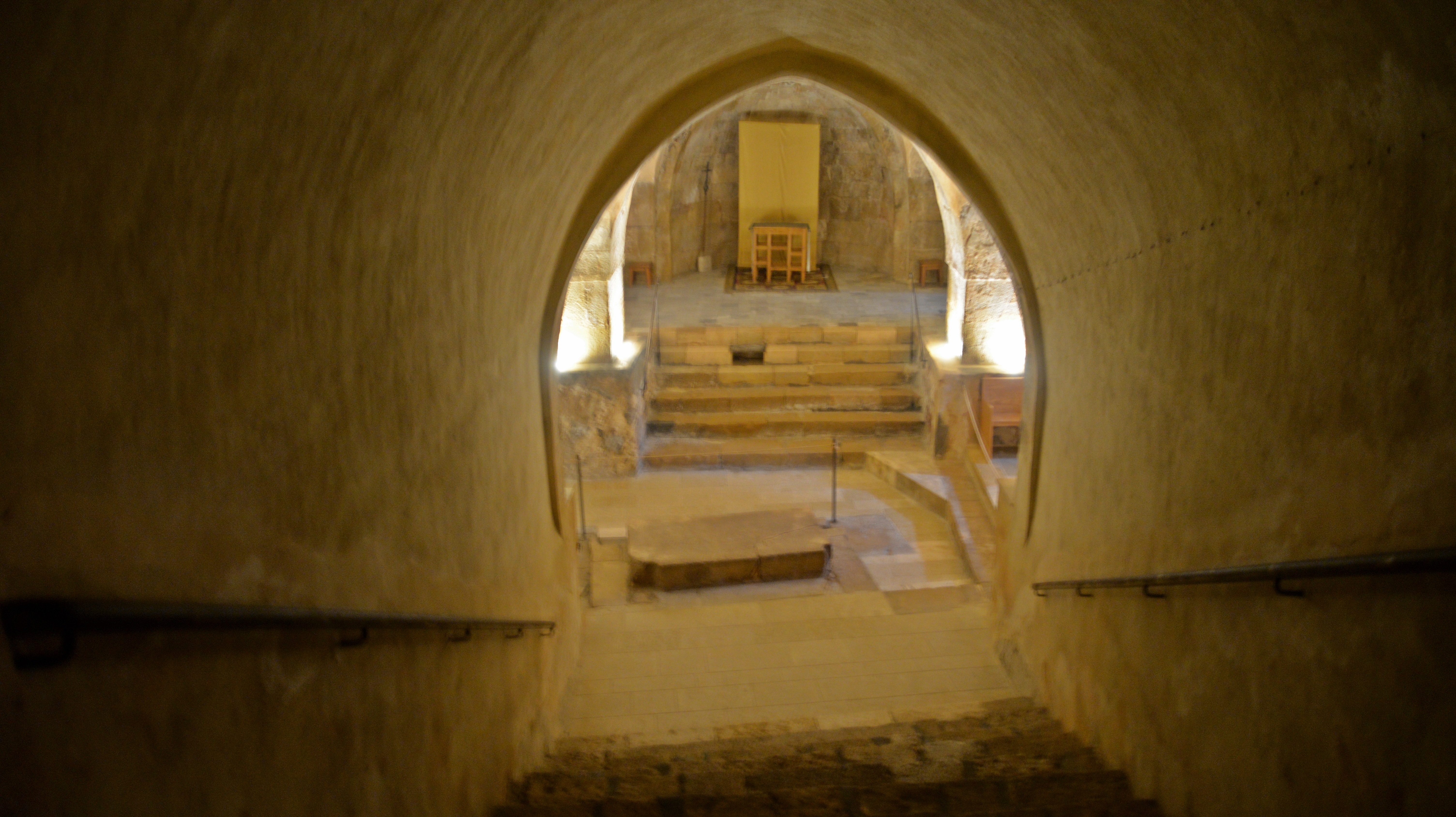
Next photo: A view of the staircase, looking up from the crypt.
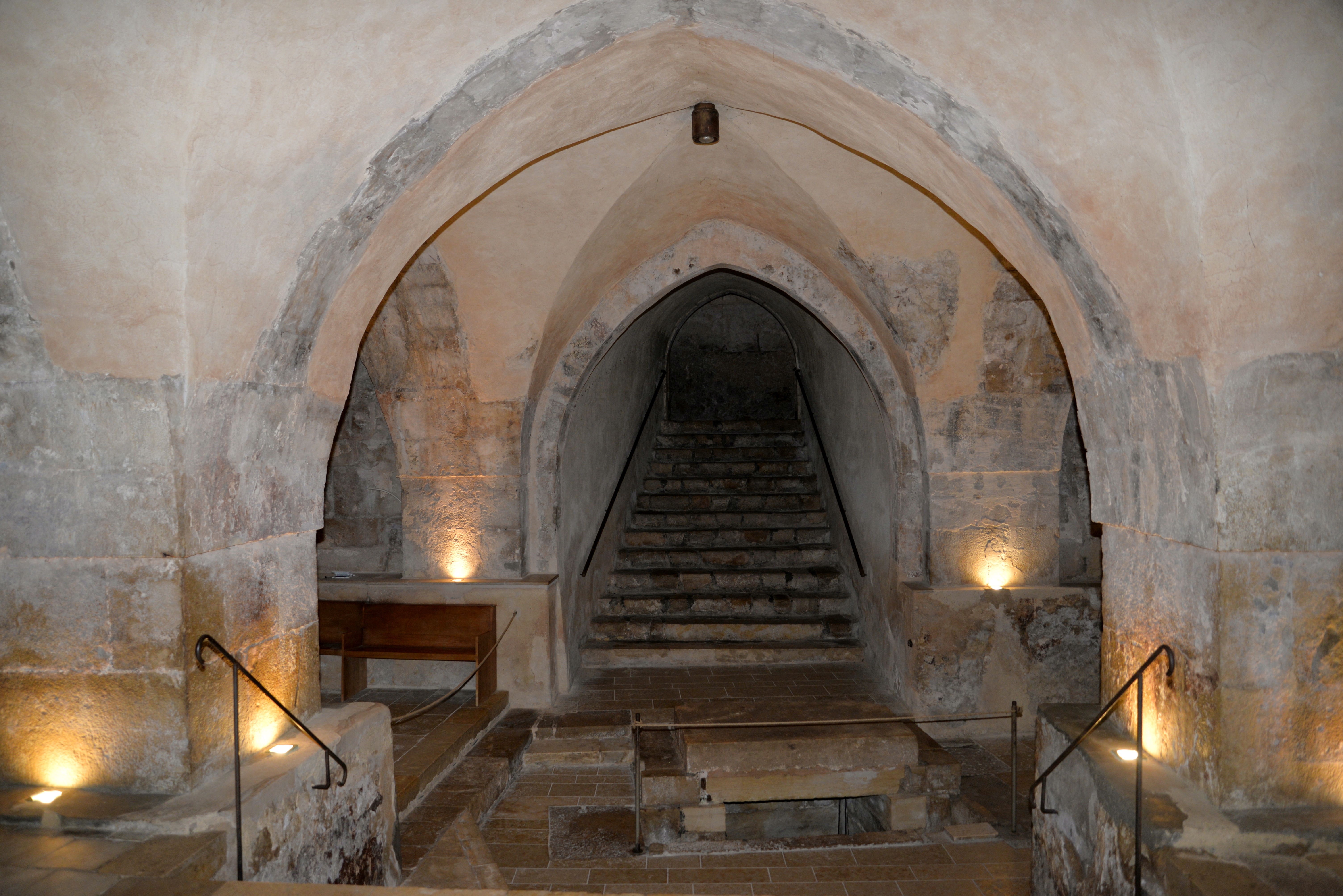
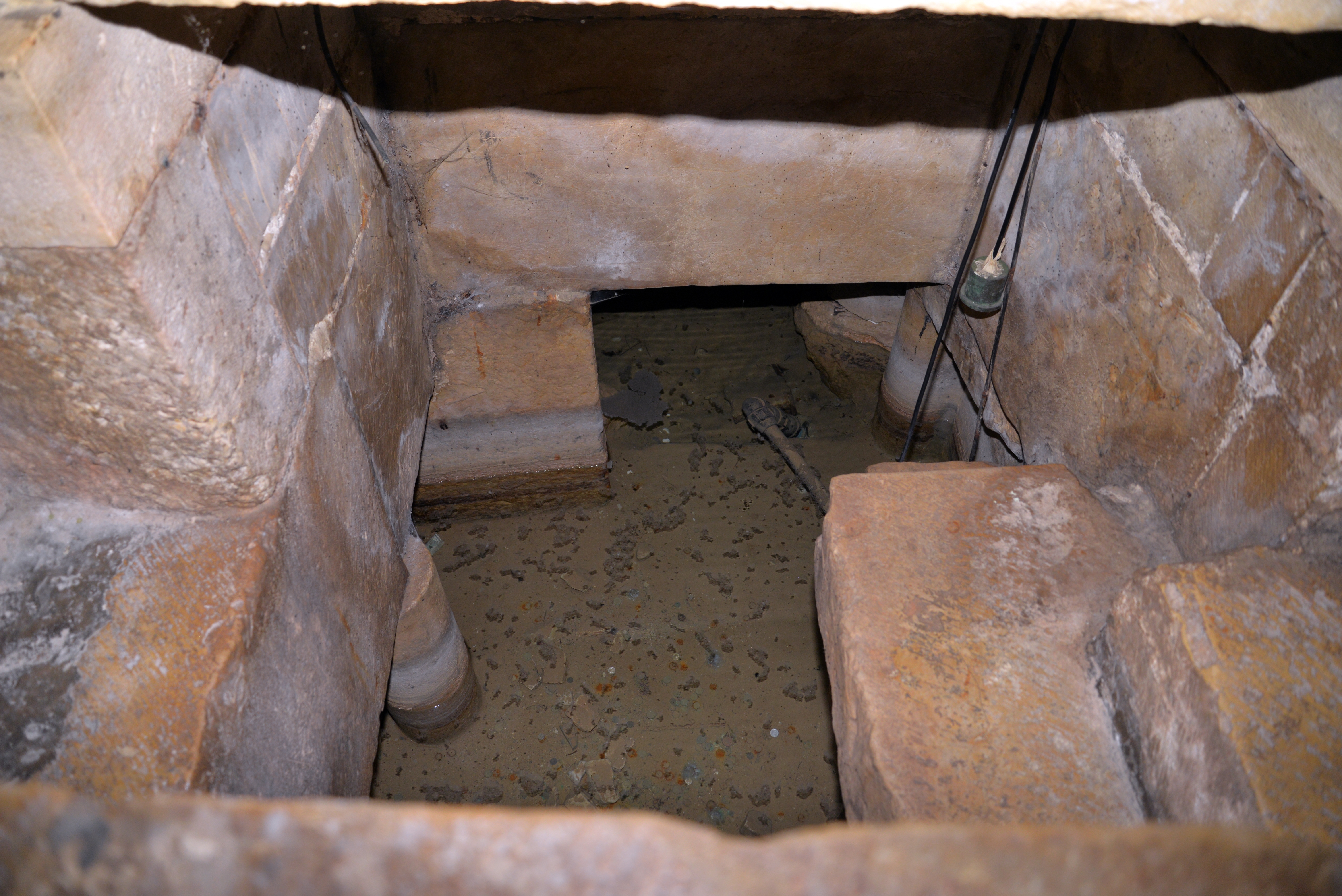
In the center of the floor is a rectangular tank, which receives the water from the spring. The spring is located under the edge of the staircase.
The large slab behind the rope was the base of the altar which was erected over the spring.
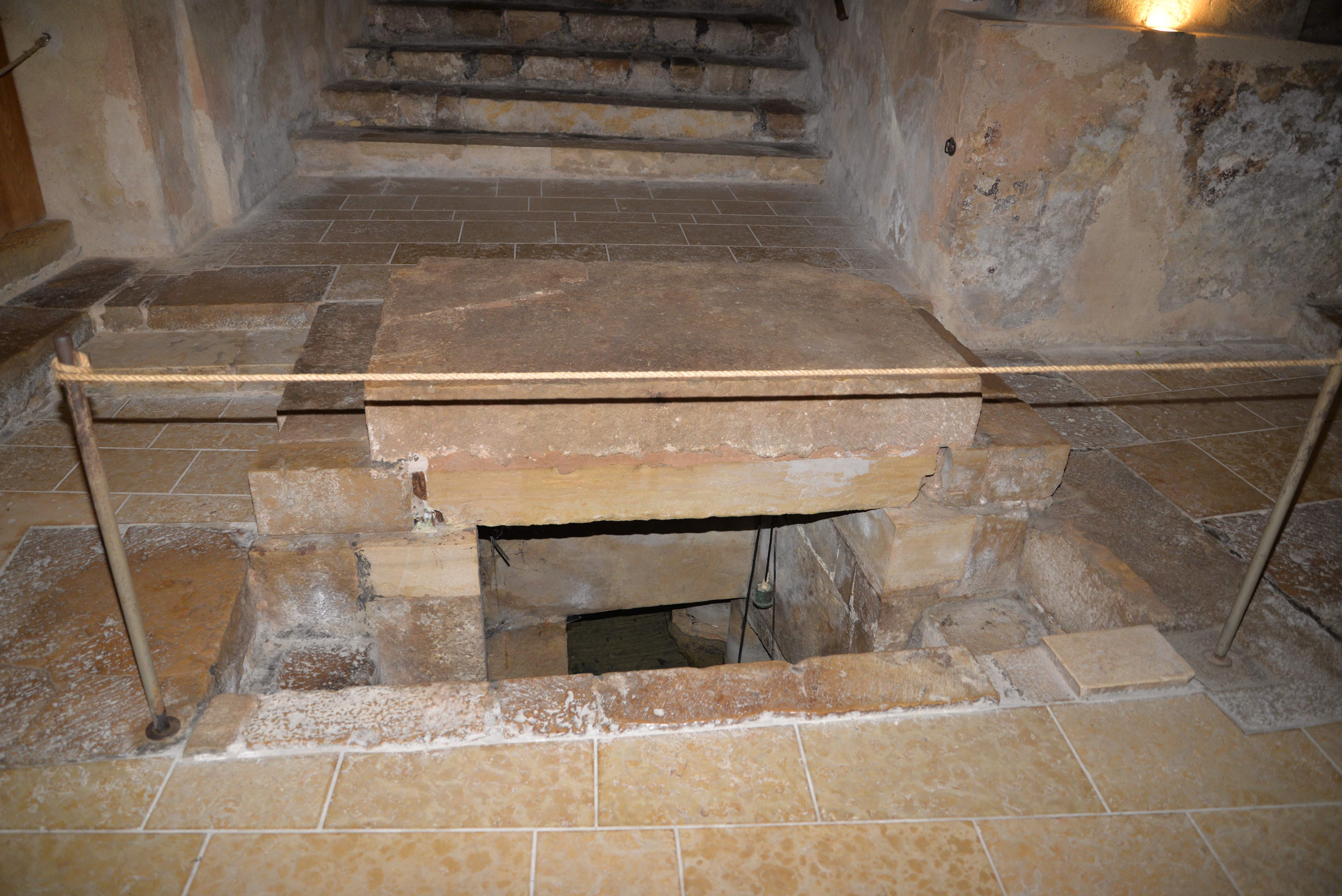
A closer view of the rectangular rock-cut tank. The spring water enters from the western side, and drains thru a channel out to the eastern walls.
The south east vault has a narrow window, letting in some light.
Both north and south walls of the crypt were those of the Roman pool, though masked by pilasters supporting the vault.
The next photo shows the south eastern vault, also with a narrow window in the wall.
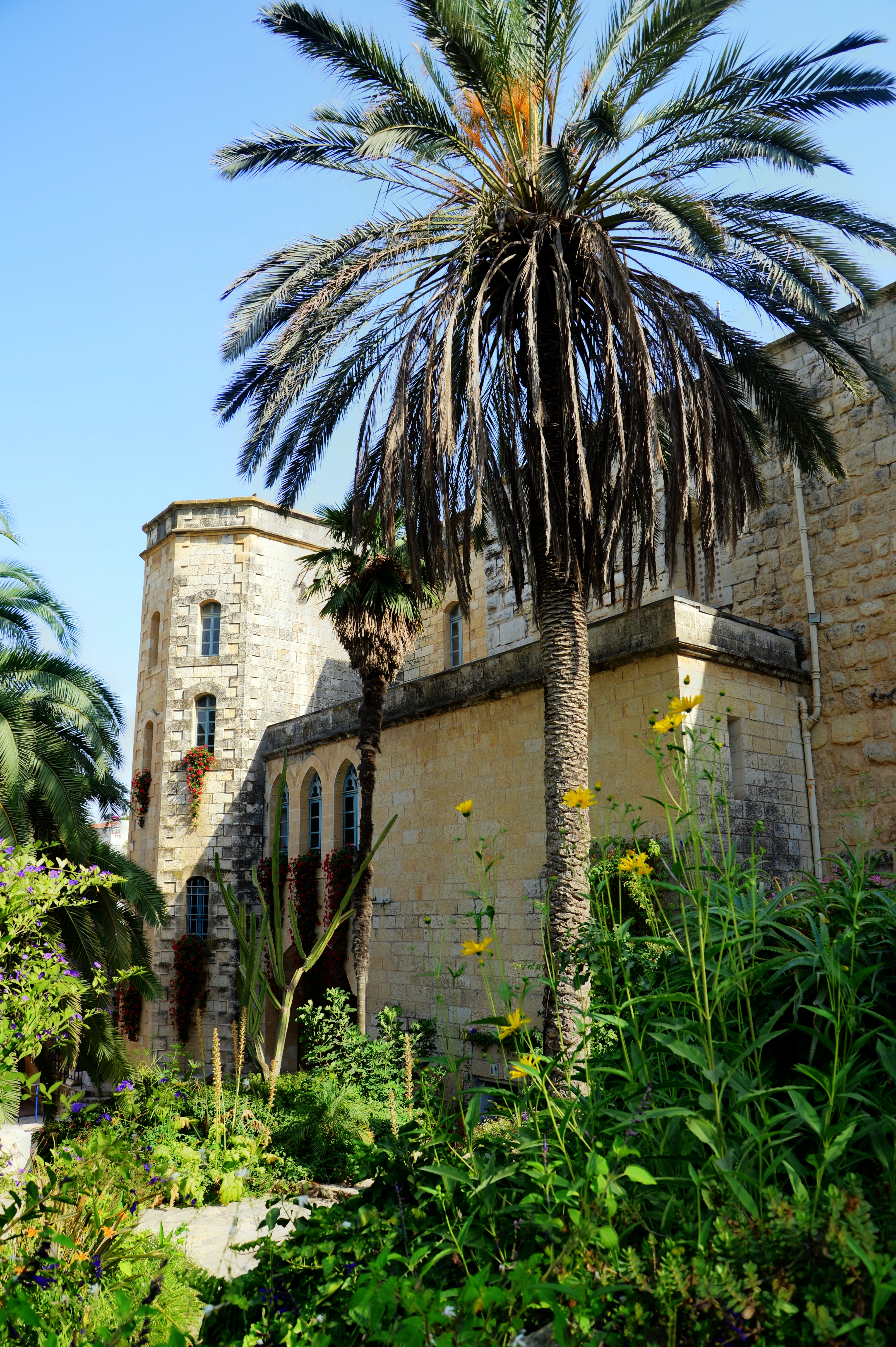
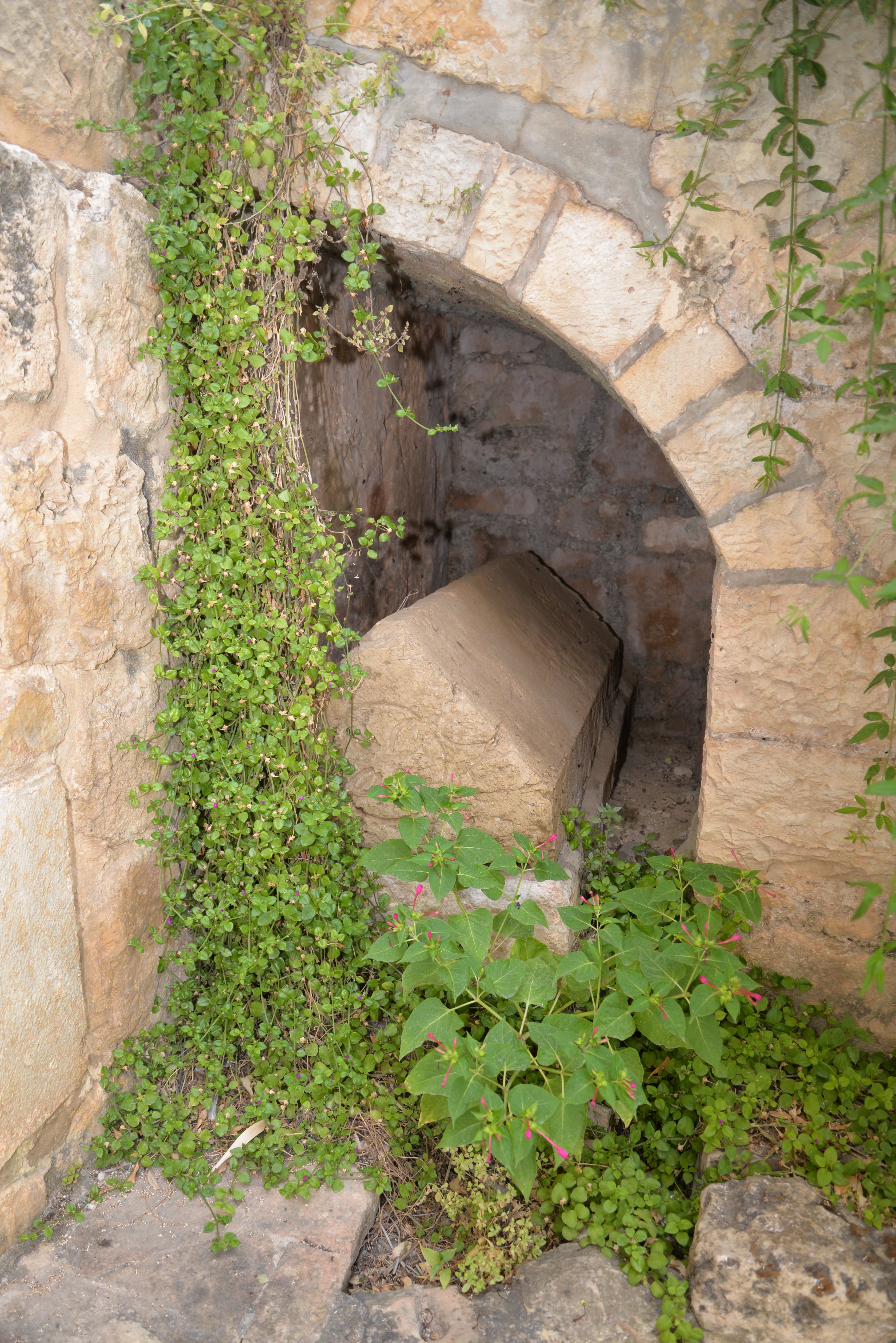
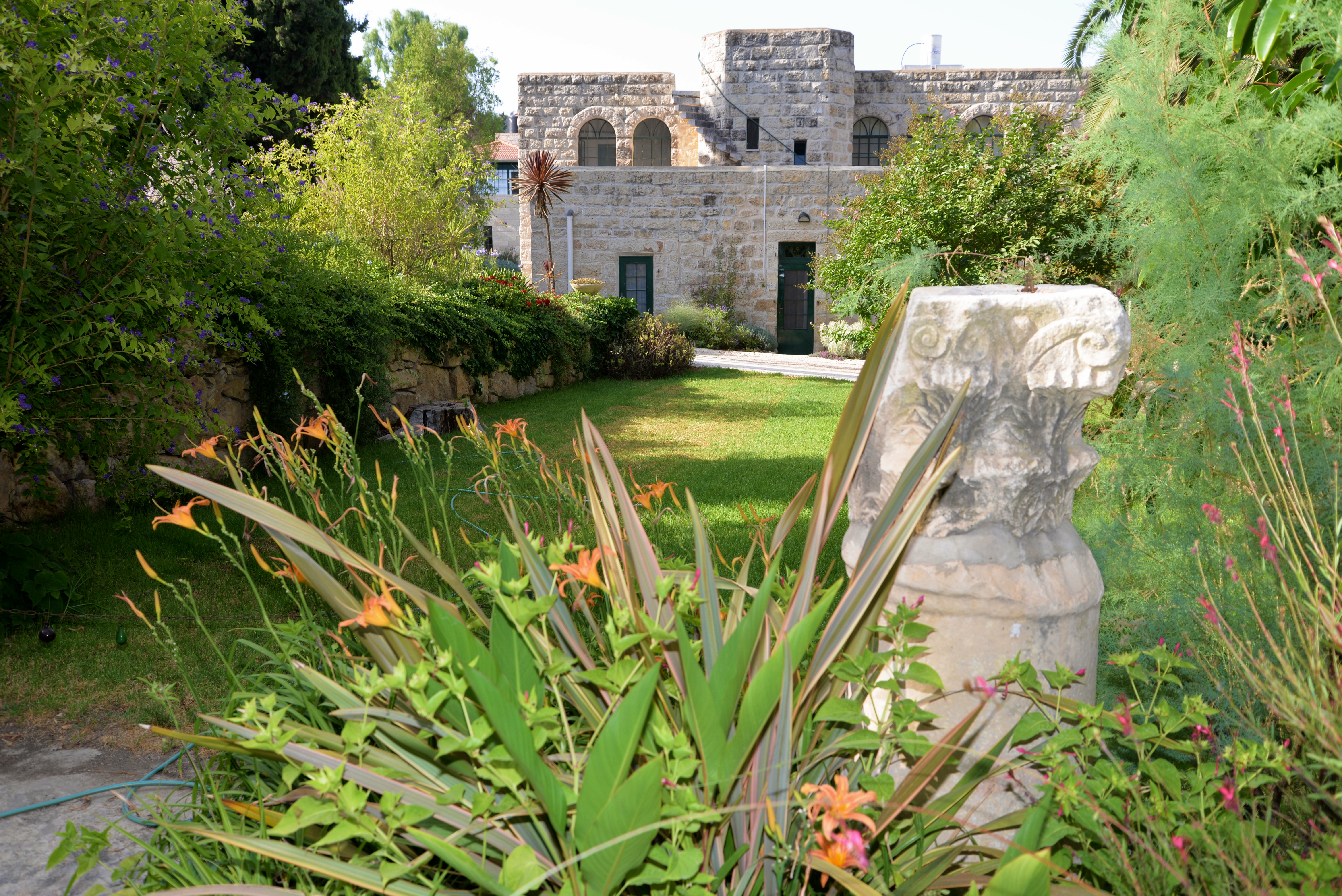
(f) Archeological Garden
The garden of the monastery has a number of interesting archaeological artifacts that were collected in the area.
On the lintel is an engraved double cross that was partially erased by the Muslims.
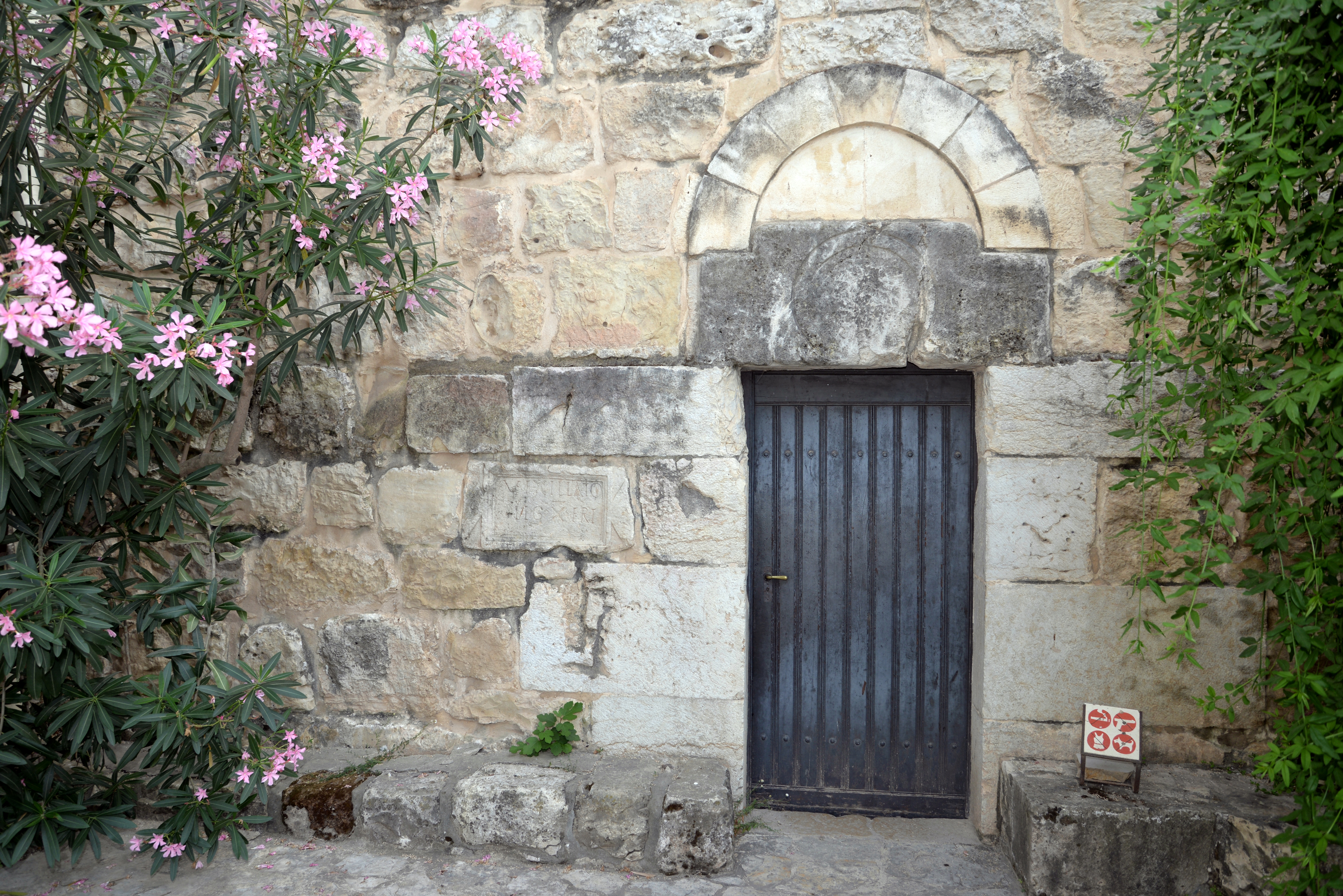
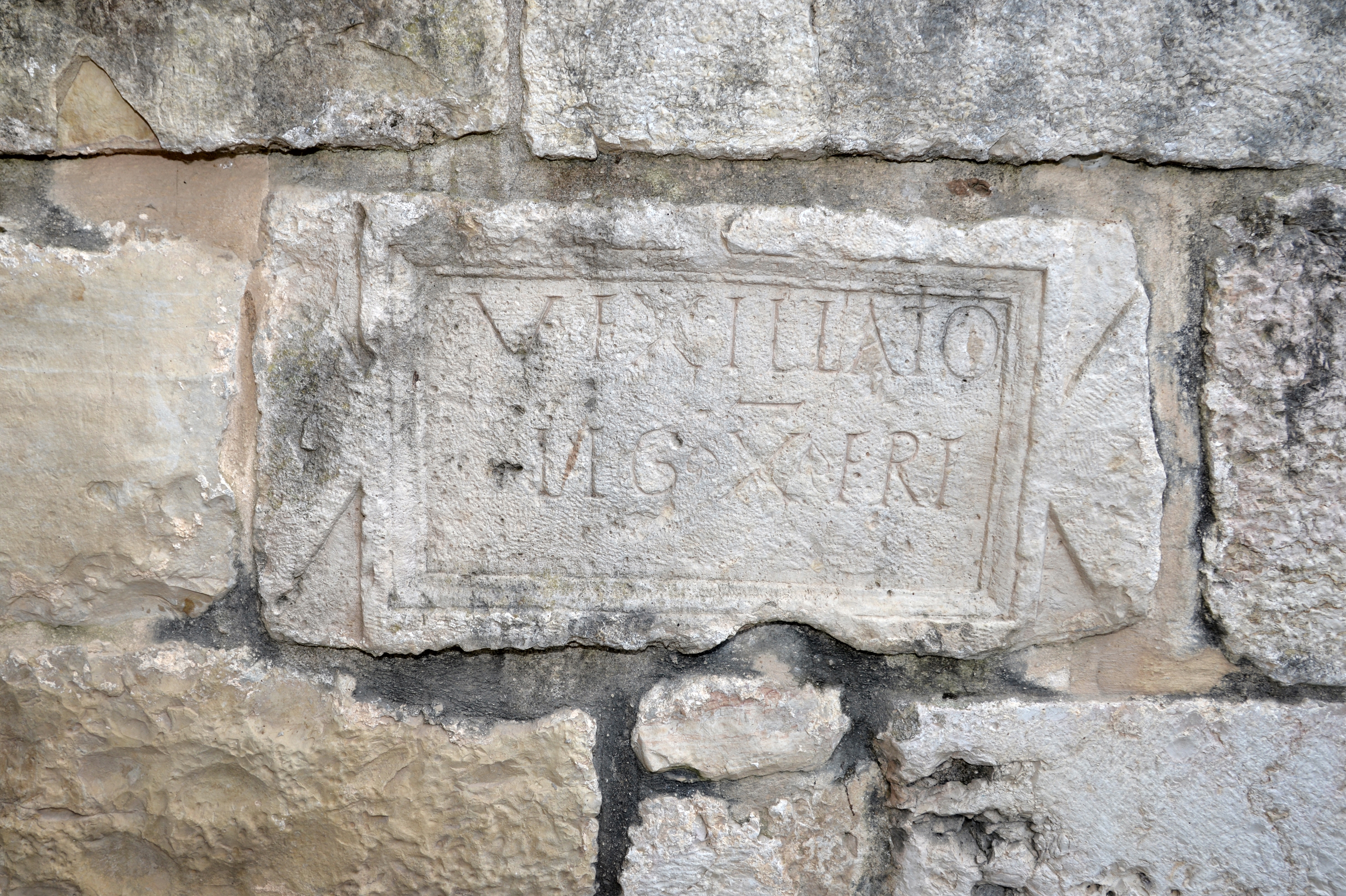
To the left of the entrance is a slab embedded into the wall, with an inscription. The Latin lines are:
“VEXILLAT(i)O LEG(ionis) X FRE(Tensis)”.
It mentions a vexillatio (a detachment of a Roman legion, formed as a temporary task force) of the 10th Legion (“LEG”) Ferentesis (“FRT”). This Legion was deployed in 66AD to quell the Great Revolt. The legion had a station house and guard post in Abu Ghosh until the end of the 3rd century AD.
Another similar inscribed slab is located inside the nearby Church of the Ark on Tel Kiriath Jearim.
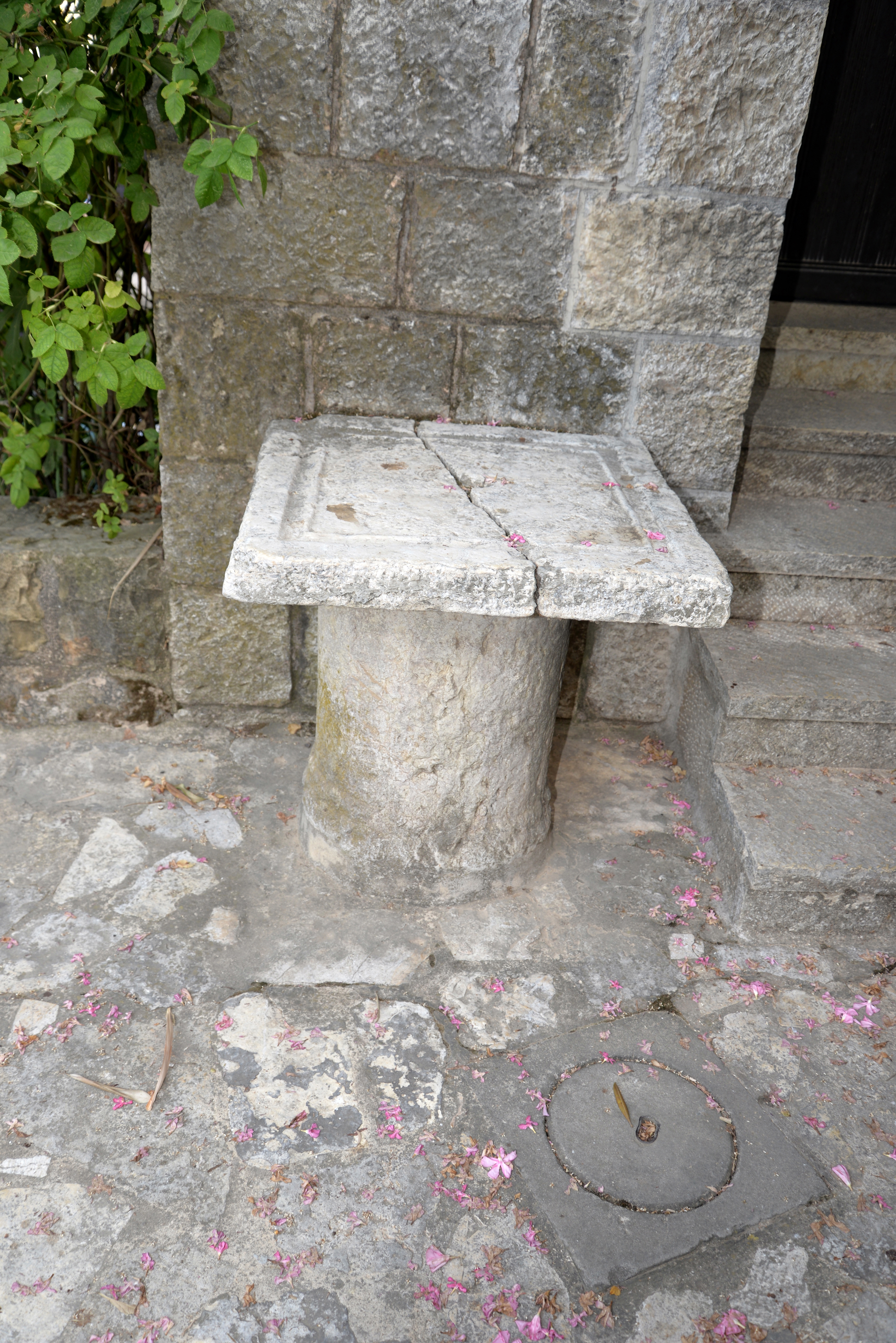
A stone coffin is located nearby.
Another artifact is laid over a section of a column:
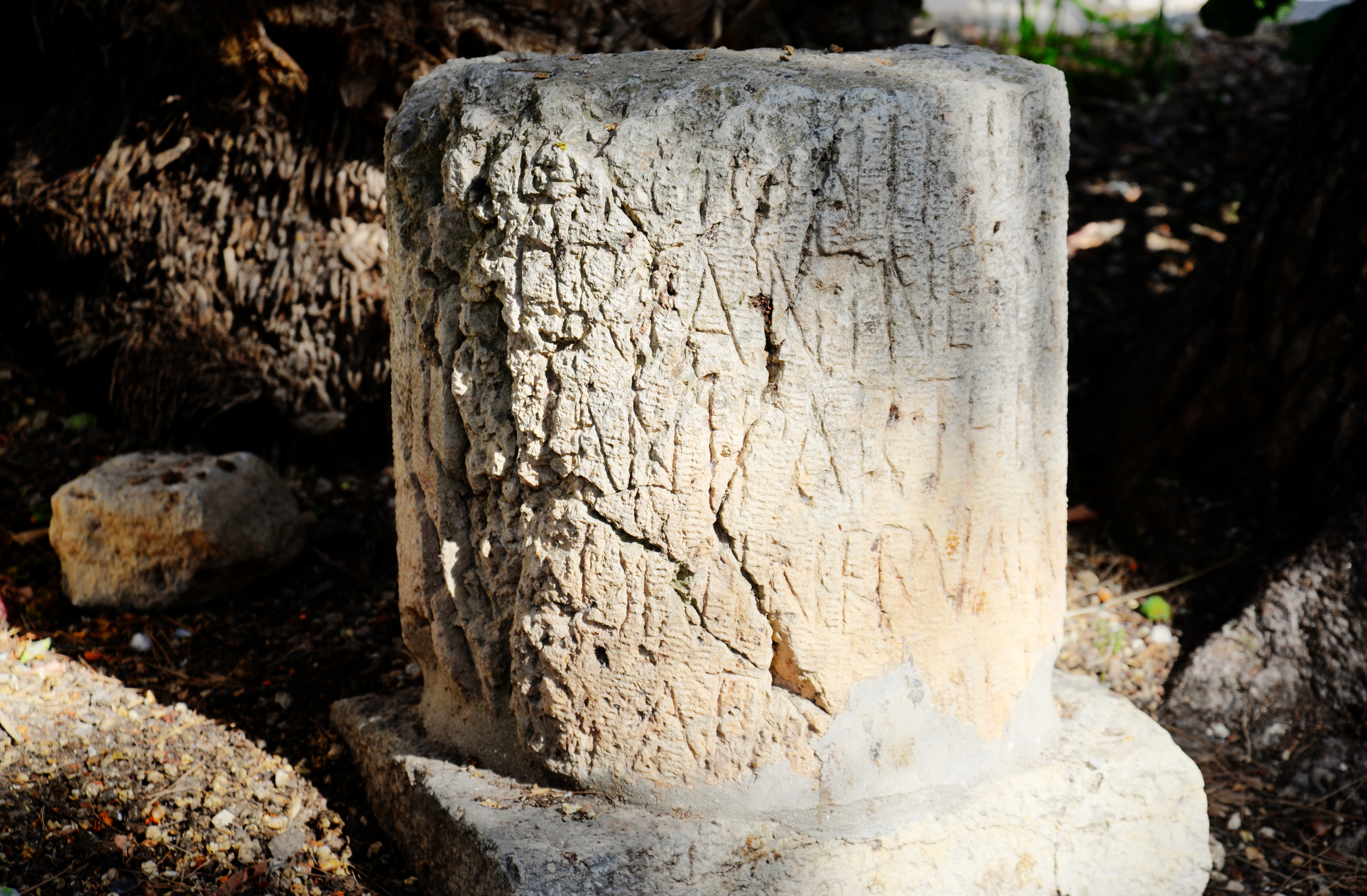
An oil press rolling stone and a milestone is located near the eastern entrance.
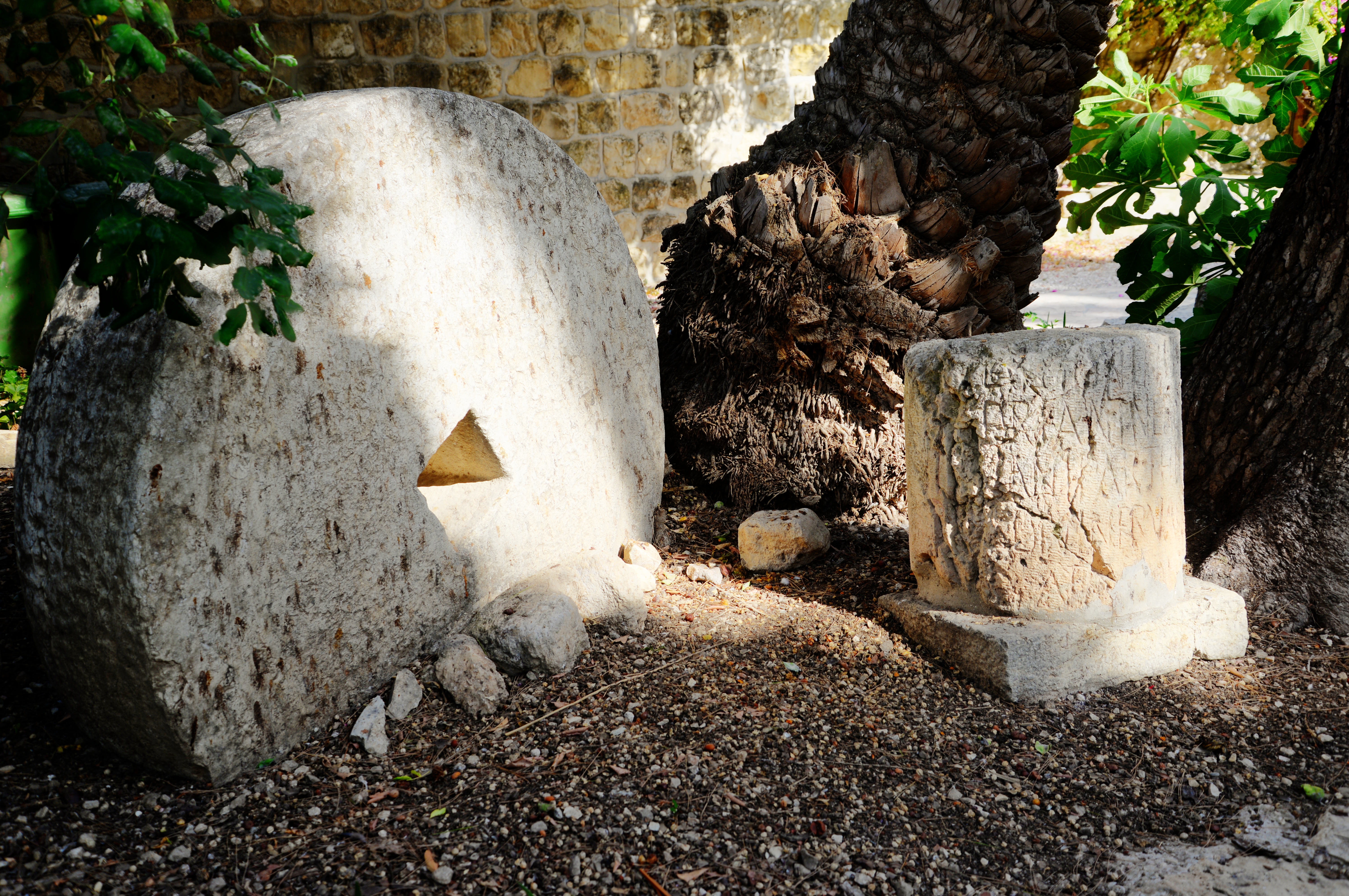
The Roman milestone is dated 162 AD. It bears the name of Caesar Marcus Aerelius, indicating the distance to Jerusalem.
The following photo shows a view of the northern buildings of the monastery.
Etymology:
Names of the site:
- Kuryet al Enab – Arabic name the place, meaning: “Town of grapes”.
- el Kuryeh – another Arabic name, based on its identification with Kiryath of Benjamin (Joshua 18:28).
- Kiriath Jearim (Kir’yat Ye’arim) – nearby Biblical site, mentioned as a station along the route of the Ark of Covenant’s return from the Philistines. Hebrew meaning: “Village of woods”.
- Abu Ghosh – modern Arabic name of the village around the site, based on the native family who lived here from the 16th century.
- Benedictine – St. Benedict was the father of Western monasticism (5th century in Italy), who wrote rules for monasticism life in the community (prayer, work and study). See also: Byzantine monks
Biblical References
After the resurrection, on the road to Emmaus (Luke 24: 13-35):
“And, behold, two of them went that same day to a village called Emmaus, which was from Jerusalem about threescore furlongs. And they talked together of all these things which had happened. And it came to pass, that, while they communed together and reasoned, Jesus himself drew near, and went with them. But their eyes were holden that they should not know him. And he said unto them, What manner of communications are these that ye have one to another, as ye walk, and are sad? And the one of them, whose name was Cleopas, answering said unto him, Art thou only a stranger in Jerusalem, and hast not known the things which are come to pass there in these days?
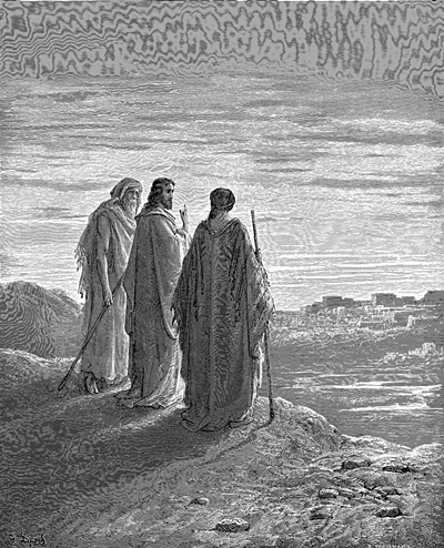
Walk to Emmaus – Drawing by Gustav Dore (French artist, 1832-1883)
And he said unto them, What things? And they said unto him, Concerning Jesus of Nazareth, which was a prophet mighty in deed and word before God and all the people: And how the chief priests and our rulers delivered him to be condemned to death, and have crucified him. But we trusted that it had been he which should have redeemed Israel: and beside all this, to day is the third day since these things were done. Yea, and certain women also of our company made us astonished, which were early at the sepulchre; And when they found not his body, they came, saying, that they had also seen a vision of angels, which said that he was alive. And certain of them which were with us went to the sepulchre, and found it even so as the women had said: but him they saw not. Then he said unto them, O fools, and slow of heart to believe all that the prophets have spoken: Ought not Christ to have suffered these things, and to enter into his glory? And beginning at Moses and all the prophets, he expounded unto them in all the scriptures the things concerning himself. And they drew nigh unto the village, whither they went: and he made as though he would have gone further. But they constrained him, saying, Abide with us: for it is toward evening, and the day is far spent. And he went in to tarry with them. And it came to pass, as he sat at meat with them, he took bread, and blessed it, and brake, and gave to them. And their eyes were opened, and they knew him; and he vanished out of their sight. And they said one to another, Did not our heart burn within us, while he talked with us by the way, and while he opened to us the scriptures? And they rose up the same hour, and returned to Jerusalem, and found the eleven gathered together, and them that were with them, Saying, The Lord is risen indeed, and hath appeared to Simon. And they told what things were done in the way, and how he was known of them in breaking of bread”.
Links:
* Archaeology:
- Churches of the Crusader Kingdom of Jerusalem – Abu Ghosh – D. Pringle 1993
* Other:
* Other BibleWalks pages:
- Drone Aerial views – collection of Biblical sites from the air
- BibleWalks Youtube channel
BibleWalks.com – travel with the Bible in hand
Horvat Midras<<<—previous site–<<< All Sites >>>—>>>—next Judea site—>>>Kiriath Jearim
This page was last updated on Dec 11, 2020 (added aerial views)