The Biblical place of Tel Kir’yat Ye’arim in Abu Ghosh, and the Monastery of the Ark of Covenant on top of the hill.

Home > Sites > Judea > Abu Ghosh > Kiritah Jearim (Kir’yat Ye’arim)
Contents:
Overview
Location
History
Photos
* Aerial Views
* Church
* Archaeological
* Vocal Music
* Monastery
* The Mound
Etymology
Links
Overview:
Kiryat Ye’arim, also known as Kiriath-Jearim, is a suburban neighborhood in the Jerusalem district of Israel. The area is believed to be the location of the biblical town of Kiryat Ye’arim, which was a major center of Jewish life during the time of the Judges and the First Temple period.
According to the Bible, the Ark of the Covenant, which contained the tablets inscribed with the Ten Commandments, was brought to Kiryat Ye’arim after being captured by the Philistines. The Ark remained in Kiryat Ye’arim for 20 years before being returned to Jerusalem.
Today, visitors to Kiryat Ye’arim can explore the site of the ancient town, which includes the remains of a fortress, a water cistern, and a necropolis. The site also offers panoramic views of the surrounding hills and valleys.
Kiryat Ye’arim is also home to a number of religious institutions, including a yeshiva (a Jewish religious school), a seminary, and a women’s college. The area is considered to be a center of Jewish learning and culture, and hosts a number of events and festivals throughout the year.
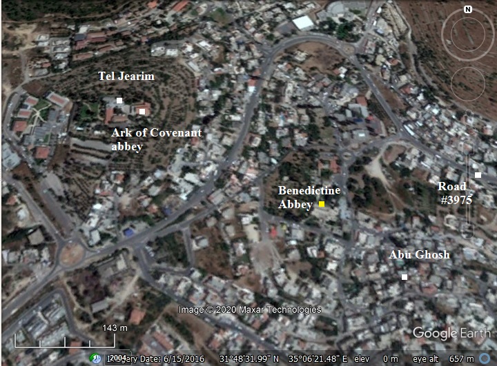
Location:
The following aerial view shows the area in the west side of Abu Ghosh. On a high hill (alt. 758m), is the archaeological mound of Kiriath Jearim (Kir’yat Ye’arim) and the Abbey of the ark of Covenant.
On the foothills is the spring of Abu Ghosh and the Benedictine Abbey near it – a Crusaders Church.
History:
- Biblical period
Ba’alah – City of Ba’al:
Kiriath Jearim was previously a Canaanite place of sanctuary – Ba’alah. It was named after Ba’al the storm and fertility god (also known as Hadad). Baalah was a Hivite city linked to the Gibeonites who had a peace treaty with Joshua (Joshua 9:15-17):
“And Joshua made peace with them, and made a league with them, to let them live: and the princes of the congregation sware unto them. And it came to pass at the end of three days after they had made a league with them, that they heard that they were their neighbours, and that they dwelt among them. And the children of Israel journeyed, and came unto their cities on the third day. Now their cities were Gibeon, and Chephirah, and Beeroth, and Kirjathjearim“.
The city was on the border between the tribes of Judah and Benjamin (Joshua 15:9):
“And the border was drawn from the top of the hill unto the fountain of the water of Nephtoah, and went out to the cities of mount Ephron; and the border was drawn to Baalah, which is Kirjathjearim“.
The city was also mentioned as the border of Benjamin, here as Kirjath in short (Joshua 18: 21, 28):
“Now the cities of the tribe of the children of Benjamin… Gibeath, and Kirjath; fourteen cities with their villages. This is the inheritance of the children of Benjamin according to their families”.
Another name of the place was Kirjath Baal – the Town of Ba’al (Joshua 15: 60): “Kirjathbaal, which is Kirjathjearim…”. The name of the place changed to Kiriath Jearim – Hebrew for the Town of Forests. (Joshua 15: 60):
“Kirjathbaal, which is Kirjathjearim, and Rabbah; two cities with their villages”.
Ark of Covenant:
The hill continued to be sacred after the conquest of the Land of Israel. It is common that early religious centers continued to be sacred for the Israelites, such as in Jerusalem and Shiloh which were also previously Canaanite worship sites.
Kiriath Jeraim was mentioned in connection with the return of the Ark of the Covenant by the Philistines in the 10th century BC. The ark was captured seven months earlier, but the Philistines decided to return it to Israel after it caused them plagues. Its first station was in Beth Shemesh (1 Samuel 6 10,12):
“And see, if it goeth up by the way of his own coast to Bethshemesh”…”And the kine took the straight way to the way of Bethshemesh, and went along the highway…”.
Return of the Ark – at Beth Shemesh; drawing by Gustav Dore (French artist, 1832-1883)
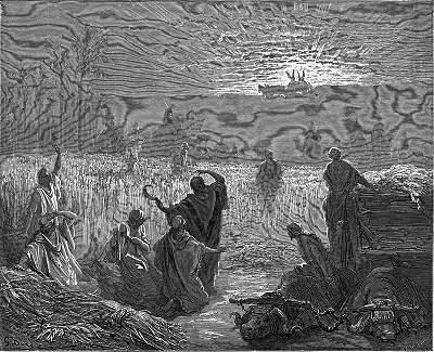
Some of the people of Beth Shemesh peeked into the ark and God killed them, and so the Ark was sent to the nearby city of Kiryat Ye’arim (1 Samuel 6:19-21):
“And he smote the men of Bethshemesh, because they had looked into the ark of the LORD, even he smote of the people fifty thousand and threescore and ten men: and the people lamented, because the LORD had smitten many of the people with a great slaughter. And the men of Bethshemesh said, Who is able to stand before this holy LORD God? and to whom shall he go up from us? And they sent messengers to the inhabitants of Kirjathjearim, saying, The Philistines have brought again the ark of the LORD; come ye down, and fetch it up to you”.
The ark was then brought to Kiriath Jearmin, to the house of Abinadab (1 Samuel 7: 1-2):
“And the men of Kirjathjearim came, and fetched up the ark of the LORD, and brought it into the house of Abinadab in the hill, and sanctified Eleazar his son to keep the ark of the LORD. And it came to pass, while the ark abode in Kirjathjearim, that the time was long; for it was twenty years: and all the house of Israel lamented after the LORD”.
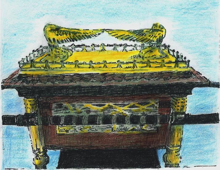
Ark of Covenant Drawing by grandma Rina
After about 60 years, when David became king, he brought the ark to Jerusalem (2 Samuel 6):
“Again, David gathered together all the chosen men of Israel, thirty thousand. And David arose, and went with all the people that were with him from Baale of Judah, to bring up from thence the ark of God, whose name is called by the name of the LORD of hosts that dwelleth between the cherubims. And they set the ark of God upon a new cart, and brought it out of the house of Abinadab that was in Gibeah: and Uzzah and Ahio, the sons of Abinadab, drave the new cart. And they brought it out of the house of Abinadab which was at Gibeah, accompanying the ark of God: and Ahio went before the ark. And David and all the house of Israel played before the LORD on all manner of instruments made of fir wood, even on harps, and on psalteries, and on timbrels, and on cornets, and on cymbals”.
The ark of covenant – from the synagogue at Capernaum.
The ark was temporarily stationed at the house of Obededom the Gittite for 3 months, then brought into the City of David in Jerusalem with a parade led by David (2 Samuel 6: 14-16):
“And David danced before the LORD with all his might; and David was girded with a linen ephod. So David and all the house of Israel brought up the ark of the LORD with shouting, and with the sound of the trumpet. And as the ark of the LORD came into the city of David…”.
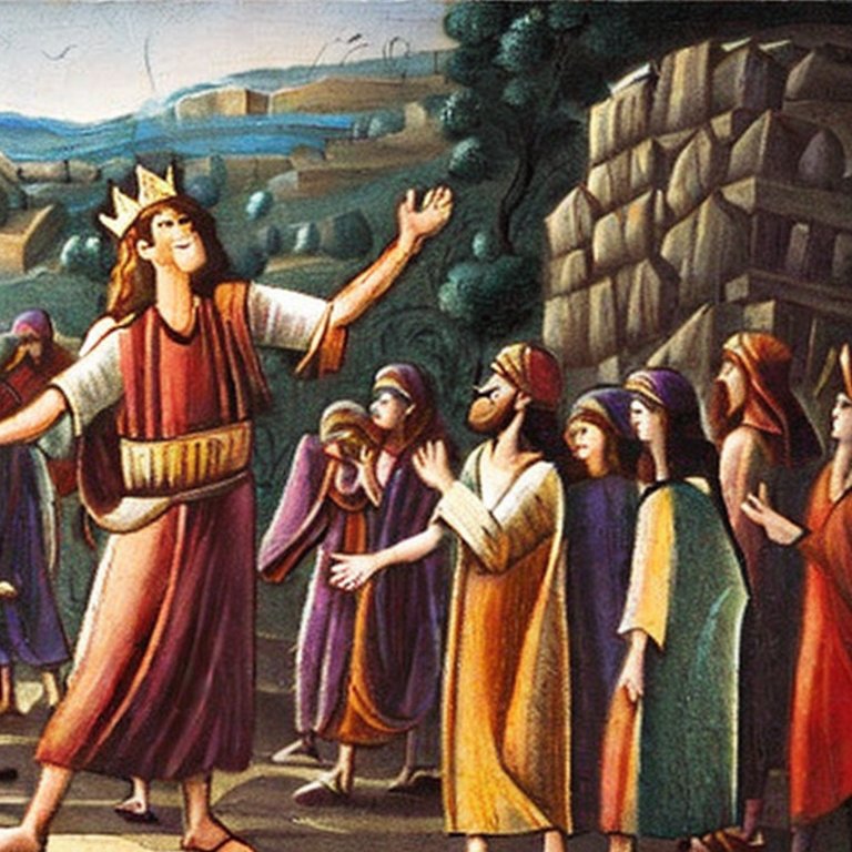
King David parades the ark to Jerusalem– AI generated by Stable Diffusion
- Byzantine period (5th-7th century AD)
A Basilica was constructed on top of the hill in the 5th century AD. It was destroyed during the Persian conquest of 614 AD, and rebuilt several centuries later.
The Church was demolished in the 11th century by the Egyptian Caliph Hakim.
- Ottoman period (19th Century AD)
In the 16th century an Arab family, named Abu Ghosh, settled in this area. According to a tradition, they were of Chechen descent, and fought with the Ottoman Sultan Selim I. From the beginning of the 16th century until 1834 the family controlled the pilgrimage route from Jaffa to Jerusalem, imposing tolls on the pilgrims.
- PEF survey:
The area around the site was examined in the Palestine Exploration Foundation (PEF) survey (1866-1877) by Wilson, Conder and Kitchener. A section of their map is shown below, with the site appearing here as “Deir el ‘Azar”. A major Roman road passed nearby, indicated by double dashed lines.
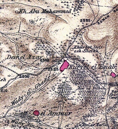
Part of Map Sheet 17 of Survey of Western Palestine,
by Conder and Kitchener, 1872-1877.
(Published 1880, reprinted by LifeintheHolyLand.com)
At the time of the survey the ruins covered the hill, as the abbey was not yet constructed.
The PEF surveyors (1866-1877) attempted to identify the site. Their description of the history of the site and their suggested non-conventional location is one of the most detailed in their entire survey of the Holy Land (10 pages long!). They explained why: “The exact position of Kirjath Jearim is of great importance for the right understanding of several Biblical narratives”.
They first described the Biblical history of Kiriath Jearim (Volume 3, Sheet XVII, pp. 43-52):
“Kirjath Jearim is first mentioned in the Book of Joshua as identical with Kirjath Baal, a town of Judah (Joshua xv. 60). It was on the boundary between the tribes of Judah and Benjamin (verse 9), and from the peculiar expressions used in the descriptions of the border line (Joshua xviii. 15, XV. 10), it appears that the town must have stood at an angle, from which the line ran in two directions, one being eastwards towards Nephtoah, the other northwards towards Kesla, which is Chesalon, on the north side.
The next appearance of the city is in the Book of Judges, when the men of Dan, who had no inheritance (Judges xviii. i), went up to the Mahaneh Dan, which was ‘ behind ‘ (or more correctly, west of) Kirjath Jearim. Of the position of this Mahaneh Dan, or ‘ Camp of Dan,’ we have a further indication in the history of Samson, in which it is mentioned as ‘between Zorah (Surah) and Eshtaol’ (Eshua) (Judges xiii. 25). The term Mahaneh is identical with Mukhnah, ‘camp,’ a title now applied to the plain east of Shechem, and it seems to be properly indicative of a plain fit for camping ground. We can therefore have little hesitation in placing the Mahaneh Dan in the broad Wady Surar, near the recognized sites of Zorah and Eshtaol ; and the site of Kirjath Jearim should thus apparently be sought east of this natural camping ground.
Kirjath Jearim is again mentioned as the place where the Ark remained for twenty years after the destruction of the men of Beth Shemesh (i Samuel vi. 19, vii. i). From this passage it appears that Kirjath Jearim was in the mountains above Beth Shemesh ; yet Josephus, who may be supposed to have known the real site, states that the two cities were near one another (Ant. vi. i, 4).At a late period David went down to Baalah (or Kirjath Jearim) to bring up the Ark to Jerusalem. It was found in the house of Abinadab ‘in Gibeah ‘ (the hill or knoll), but this place would appear to have been in or part of the city of Baalah. This is the last mention of the city except its enumeration in the lists of Ezra, where the name appears under the abbreviated form, Kirjath Arim (Ezra ii. 25)”.
They provided clues from the Bible:
“From these various notices we may sum up the apparent requisites which should be satisfied in any site proposed as identical with this important town.
1. The name Arim or Jearim (‘thickets’) should be recovered, and the site should present such thickets.
2. It must be east of the Mahaneh Dan, which lay between Zorah and Eshtaol.
3. It must be south of Chesalon, identified with the modern Kesla.4. It must be near Beth Shemesh (now ‘Ain Shems), which agrees with the second indication.
5. It must be in the mountains above the last-mentioned site.
6. It must be at the south-west angle of the border line of Benjamin.7. Its position must agree with that of Nephtoah and Rachel’s tomb (cf. Joshua XV. 9, and i Samuel x. 2), so as to allow of an intelligible line being drawn for the south border of Benjamin.
8. The name Baalah indicates either that a high place of Baal existed at the city, or else that the position was elevated (taking Baal in a wider geographical sense, as some authorities are inclined to do).
9. A rounded hillock or humped knoll of some kind seems indicated by the term Gibeah occurring in connection with the site of the city.
The usual site shown as representing Kirjath Jearim is the village of Kuryet el ‘Enab (‘ Town of Grapes ‘), better known as Abu Ghosh, on the road from Jaffa to Jerusalem. This town is called simply el Kiiryeh by the fellahin, and appears to be the ancient Kirjath of Benjamin (Joshua xviii. 28), a place apparently distinct from Kirjath Jearim, and situated in the Lot of Benjamin, whereas the latter belonged to Judah. There is no doubt that in the fifth century Abu Ghosh was believed to be Kirjath Jearim, and the only argument which Dr. Robinson has adduced in favour of this identification appears to be founded on the early Christian tradition, which he too often quotes in favour of his own views, even against his own canon of criticism condemning such traditions as of no value”.
The author then decided against the tradition:
“The site thus commonly pointed out to travelers does not, however, fulfill the requisites enumerated. The name of Arim is not found at Abu Ghosh, the site of which lies 9 miles north-west of ‘Ain Shems, and 3 1/2 miles north-west of Chesalon. The border line of Benjamin cannot be drawn through Abu Ghosh and also through Rachel’s tomb, without being so twisted as to be practically improbable, while no special features occur which would serve to explain the names Gibeah and Baalah, connected with that of Kirjath Jearim”.
The author suggested an alternative site, and gave a list of justifications. Here is the conclusion:
“The site which appears to me best to suit this important town is Khurbet ‘Erma”.
Note that Khirbet ‘Erma (Kh. er-Ras in the Sorek valley) is located south west of Abu Ghosh.
-
British Mandate
A photo of this period shows the area around the site, before the town expanded. The eastern foothills of the Tel are seen on the right side. The road to Jerusalem passes at the foothills. The large structure of the Crusaders Church stands in the center of the photo.
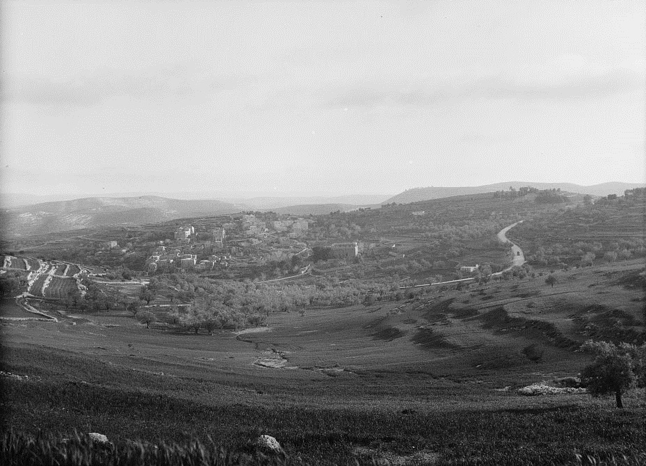
Abu Ghosh – View from the north – Matson collection 1920-33; Photos of the Library of Congress
Excavations of the Byzantine Church were conducted in 1923 by Benedictine archaeologists. The top of the hill was purchased by Sister Josephine Rumebe, on behalf of the Sisters of St. Joseph of the Apparition. The consecration took place on Aug 31, 1924. It was named “Our Lady Ark of the Covenant” – “Notre Dame de L’Arche d’Alliance”. It belongs to the Catholic church.
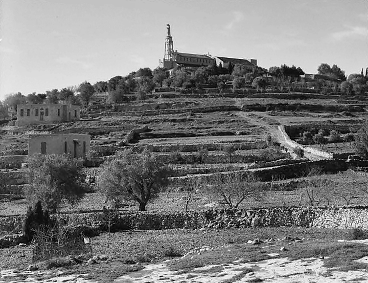
Abu Ghosh – View of the church from the north east side – Matson collection 1940-46; Photos of the Library of Congress
- Modern period
New excavations are being held since 2017 by Prof Finkelstein of the univ. of Tel Aviv, together with Thomas Römer and Christophe Nicolle of the Collège de France. This is a bi-National joint project sponsored by the Shmunis family.
The monastery is opened to the public, and is a recommended stop on the way to or from Jerusalem. Standard visiting hours, except Sundays and feast days, are 8:30-11:30 and 14:30-17:00.
Newly updated by Sister Valentina on Jan 18, 2022: “We hope to restore the Basilica as soon as possible, in order to start again to welcome people for concerts and liturgical celebrations. In fact, the church is now closed due to the dangerous condition of the roof”. They are also requesting donors to assist in the renovations.
Photos:
(a) Aerial Views
A view of the Tel and the monastery on its top is from this north west view. The town of Abu Ghosh is seen around it.
Click on the photos to view in higher resolution…
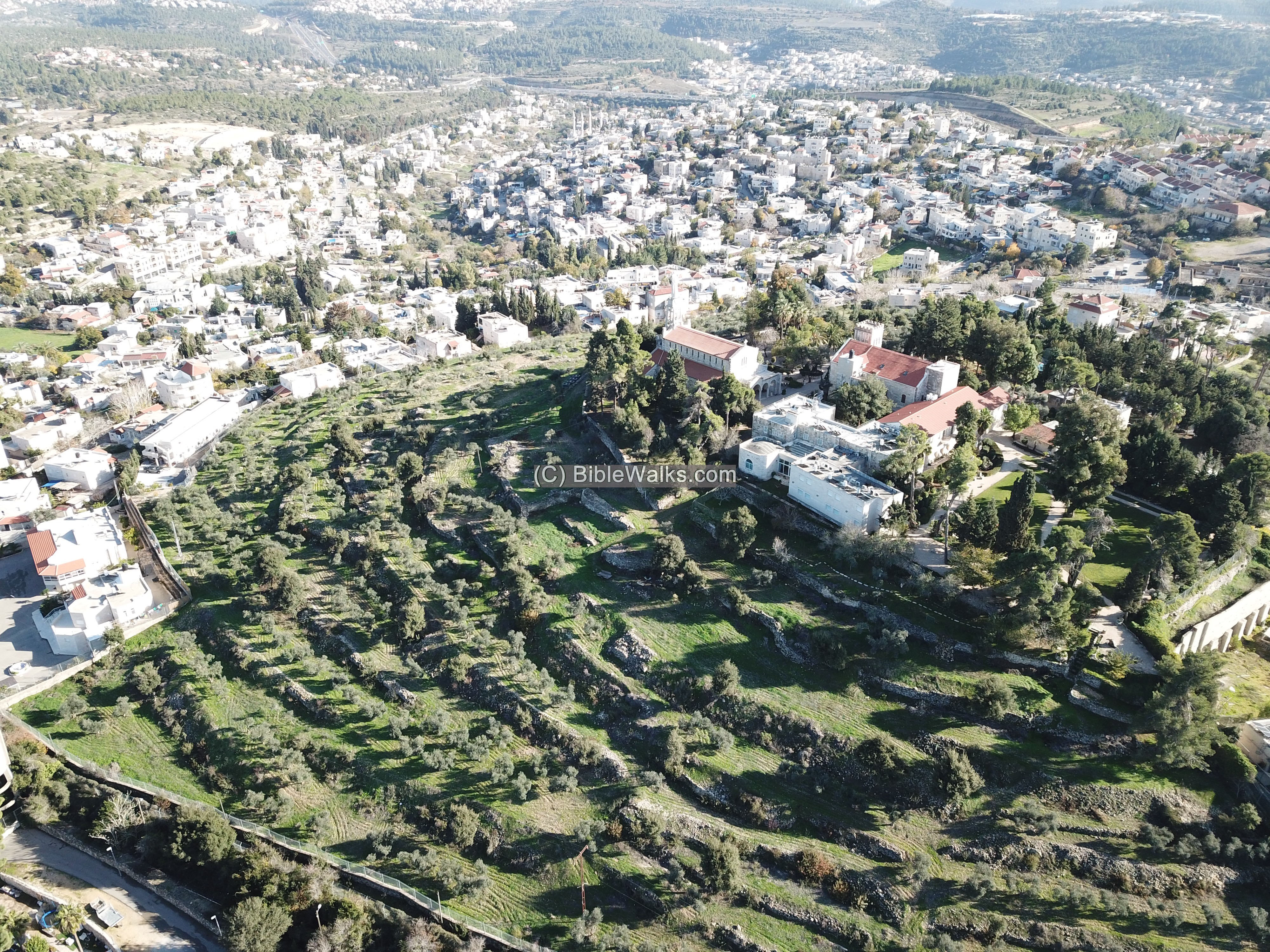
The major points of interest are indicated on this view – below. In the foreground, on top of the mound, is the Ark of Covenant Church and the monastery. On the terraced foothills, are remains of the Biblical site of Kiriath Jearim. On the northern foothills is Kir’yat Ye’arim youth village.
To the east of the hill is the Crusaders Church, the spring of Abu Ghosh and the old mosque. Farther east is the new AHK (Ahmad Haji Kadyrob) mosque, which is Israel’s second largest mosque (completed 2014) – second in size to Al-Aksa in Jerusalem. In the background are the villages of Ein Rafa and Ein Naqquba. In the far left background is the highway #1 to Jerusalem, that passes thru a tunnel near the Castel Crusaders/Ottoman fortress.
![]() A drone captured this video from the west side of the hill.
A drone captured this video from the west side of the hill.
Captured on December 2020
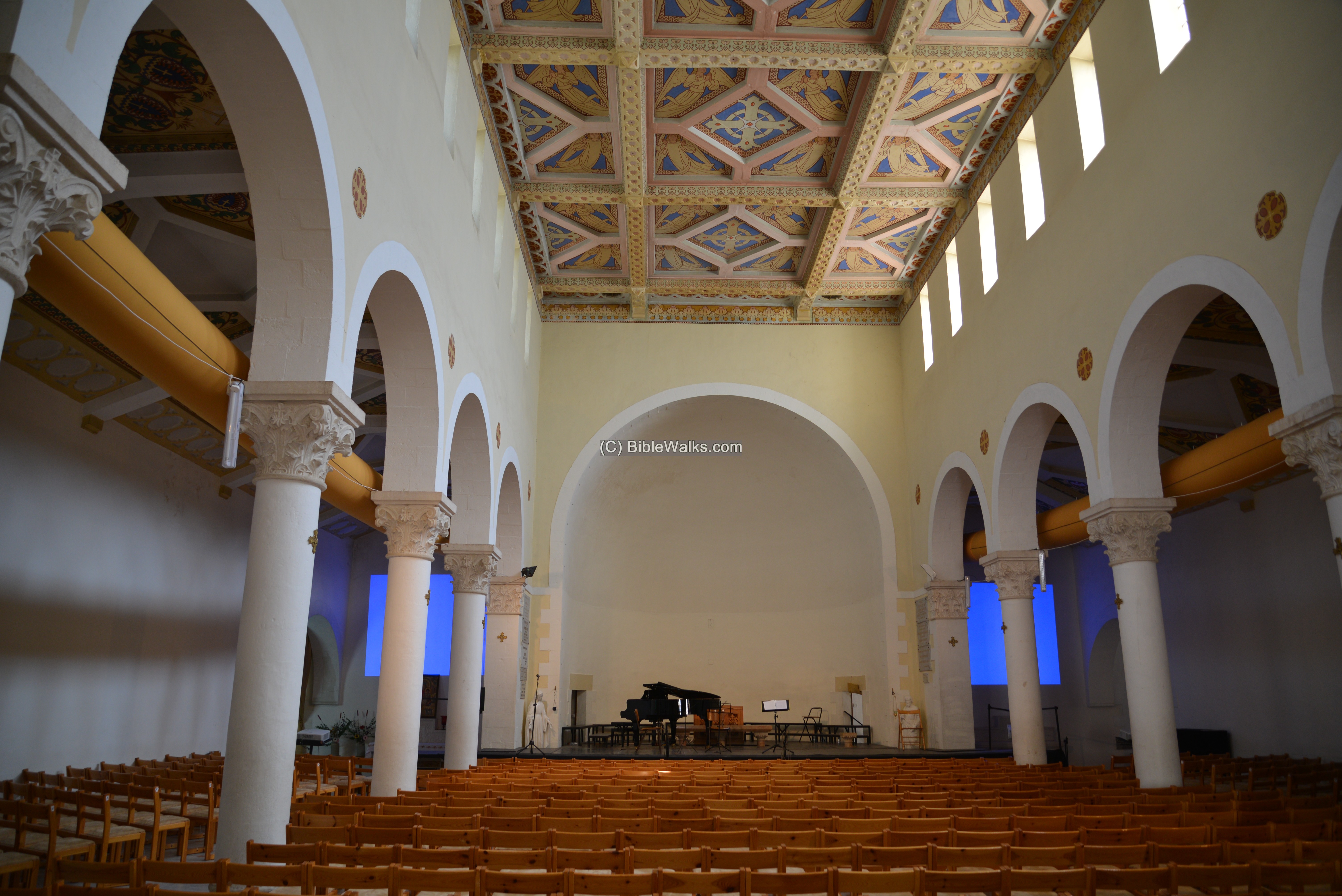
(b) The Church
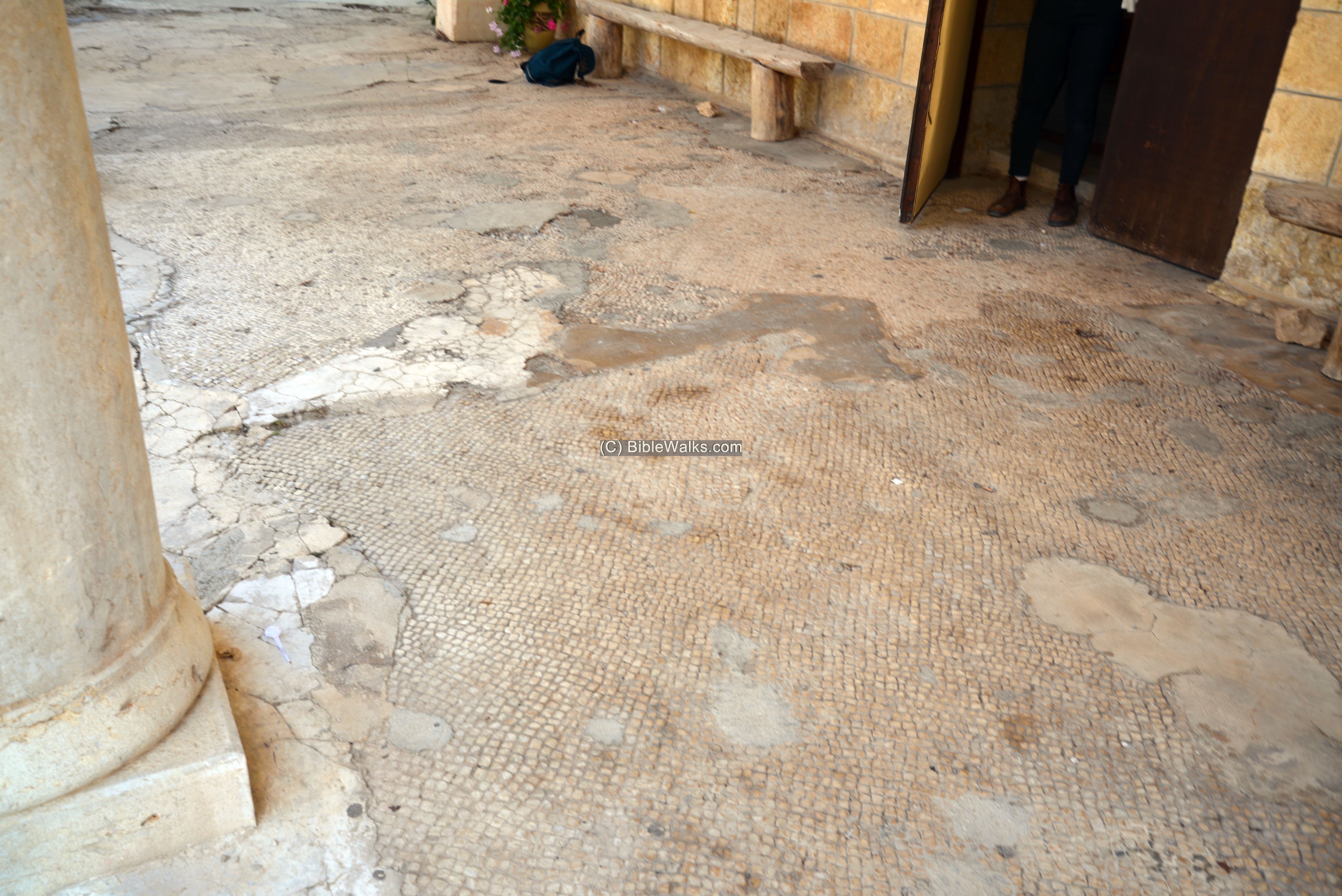
The Church of the Ark of the Covenant, dedicated to Mary, stands on top of the hill. It was built in the 1920s and officially ordained in 1924.
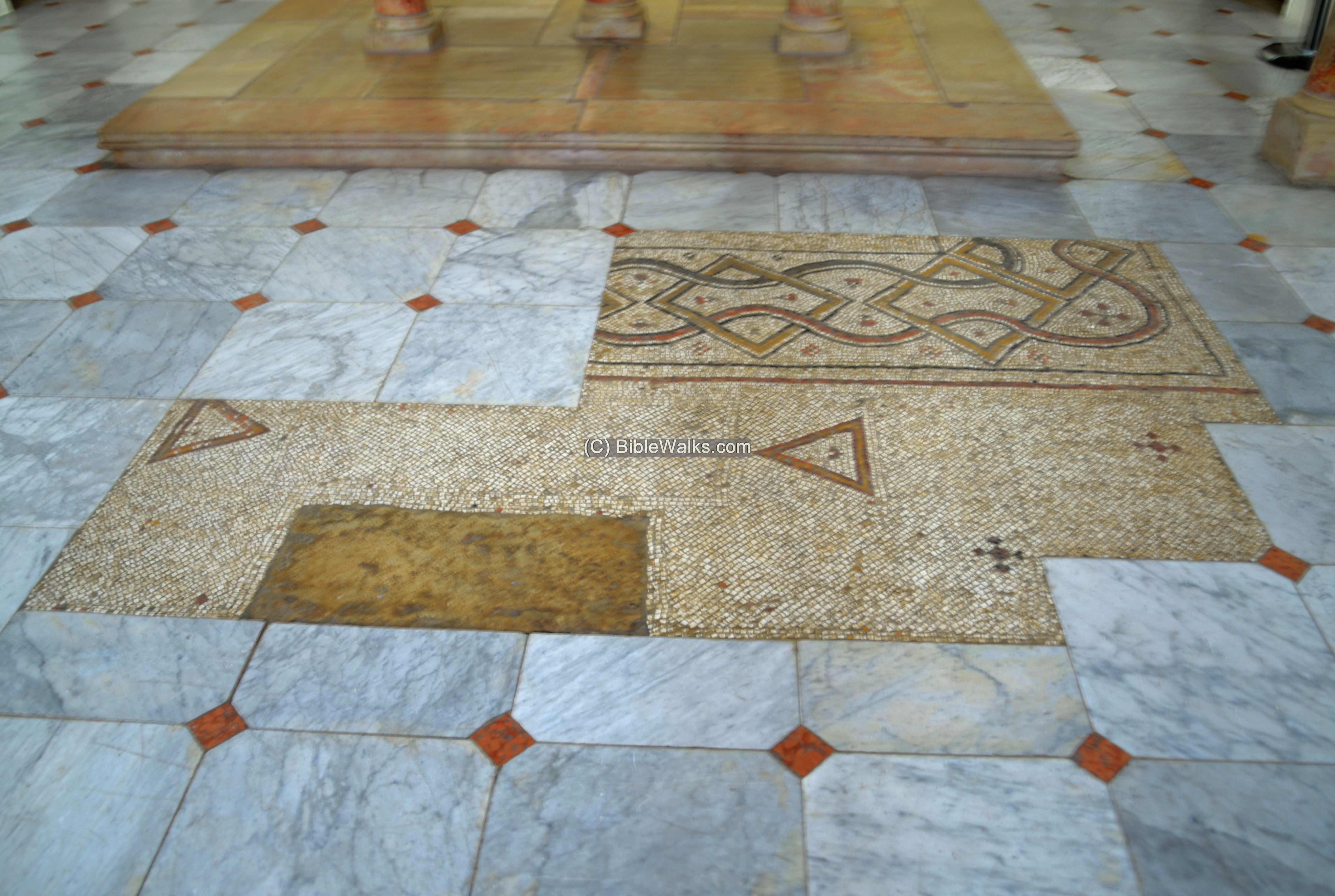
The Church was built over the ruins of a Byzantine Church, which was larger than the modern church.
Remains of the earlier church mosaic floor are seen here at the entrance to the modern church, and inside it.
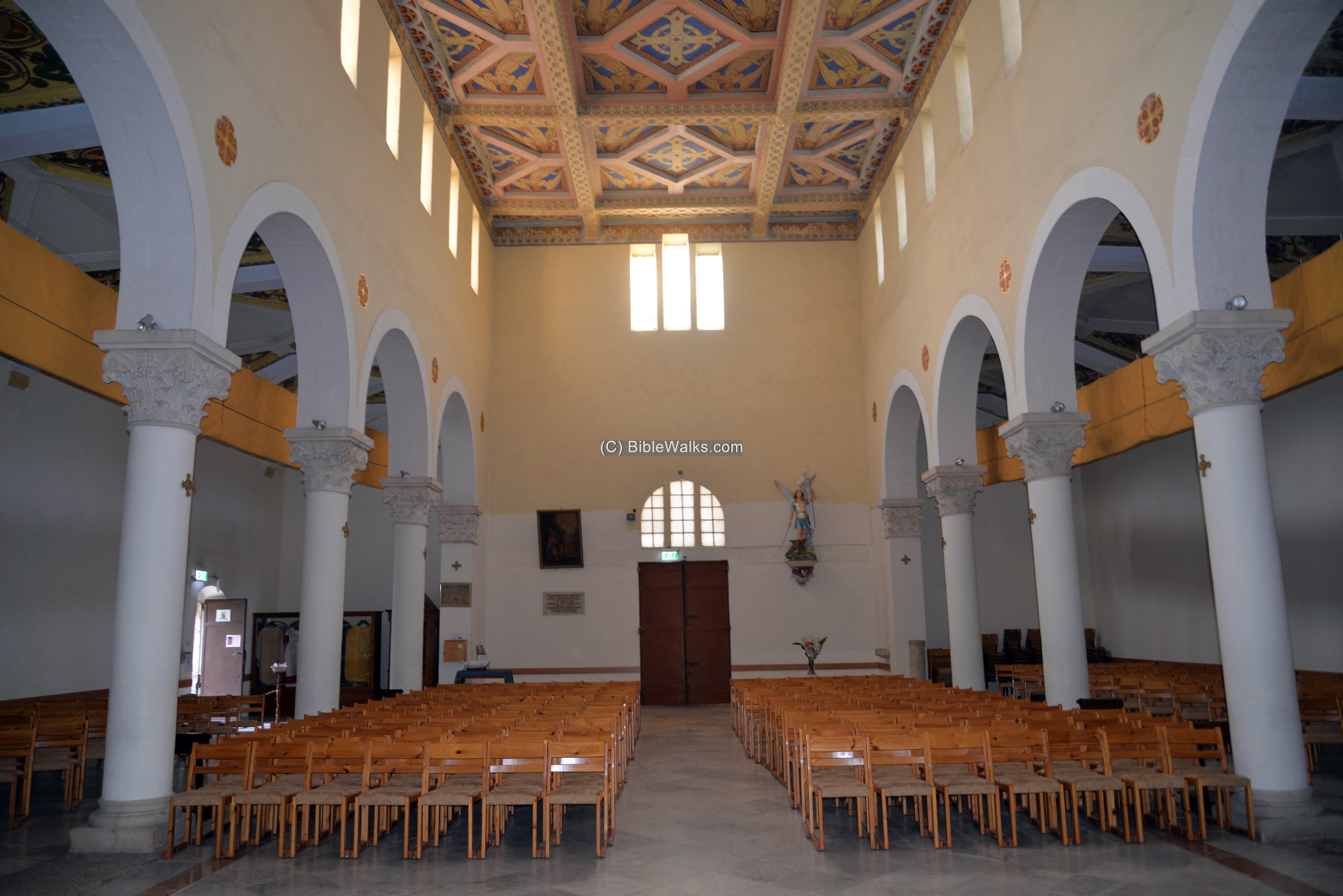
This is the interior of the church, with a view towards the entrance on its west side. It is decorated with simplicity.
On the floor before the altar are sections of a decorated mosaic floor – the remains of the Byzantine Church.
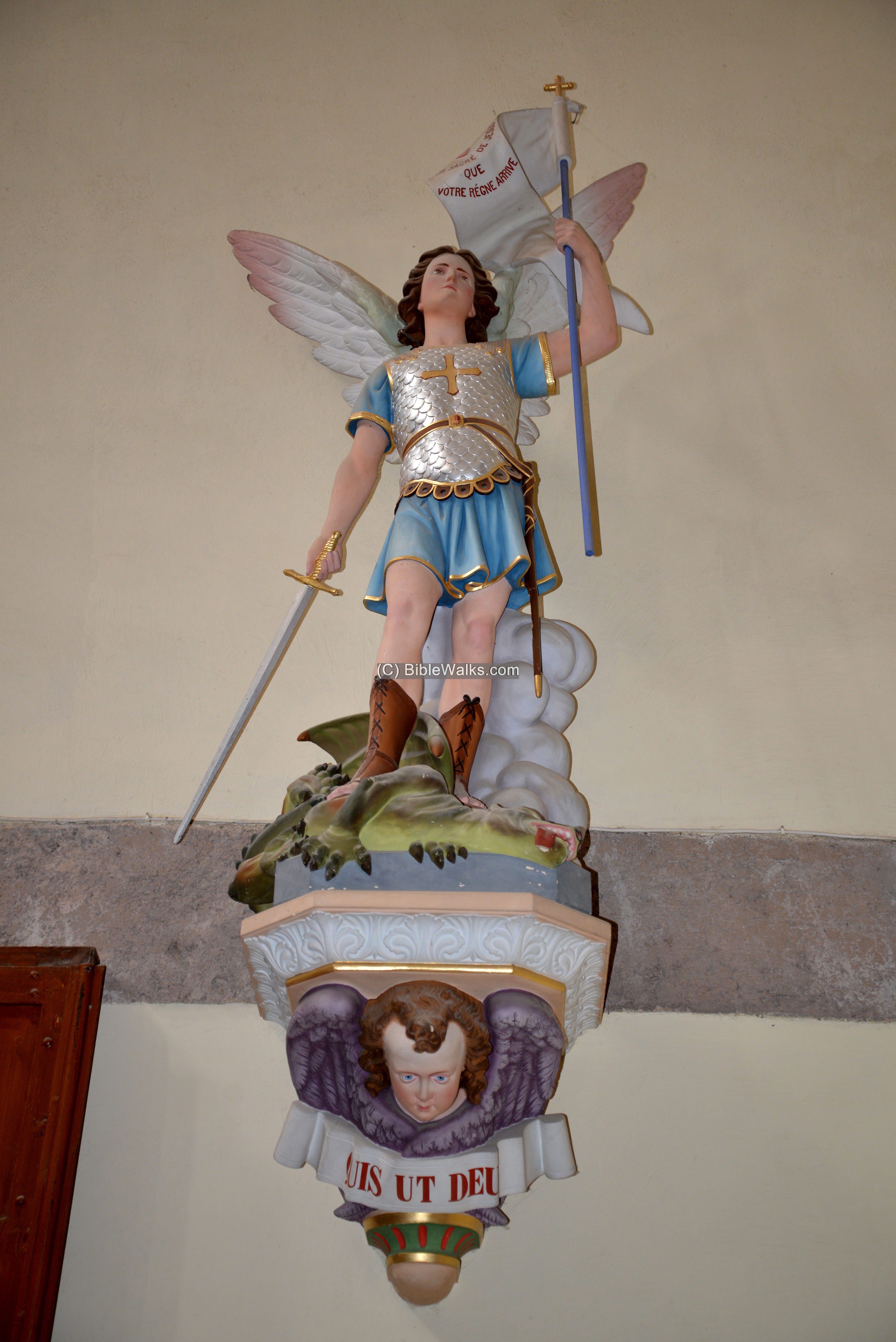
The figure of Saint Michael, represented as an angelic warrior, stands above the right side of the entrance.
The warrior is holding a sword and a flag, standing above a slayed dragon (representing Satan, as per Revelation 12:7-12:9). The inscription on the flag reads (French): “May your reign come”.
On the bottom of the stand, below yet another winged angel, is the sentence Quis ut Deus? – a Latin sentence meaning “Who [is] like God?”
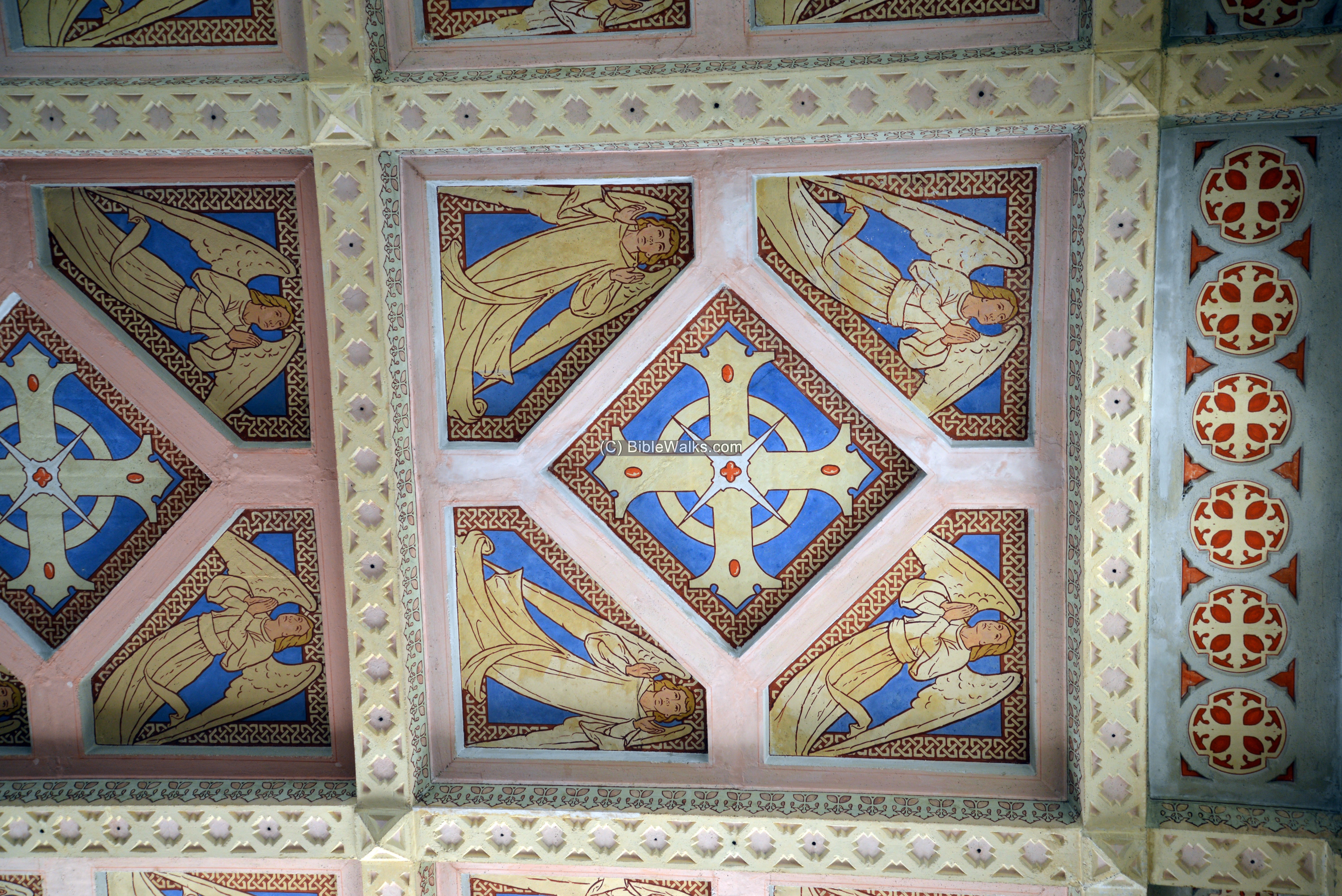
In the following photo is section of the decorated ceiling, depicting angels around a stylized cross.
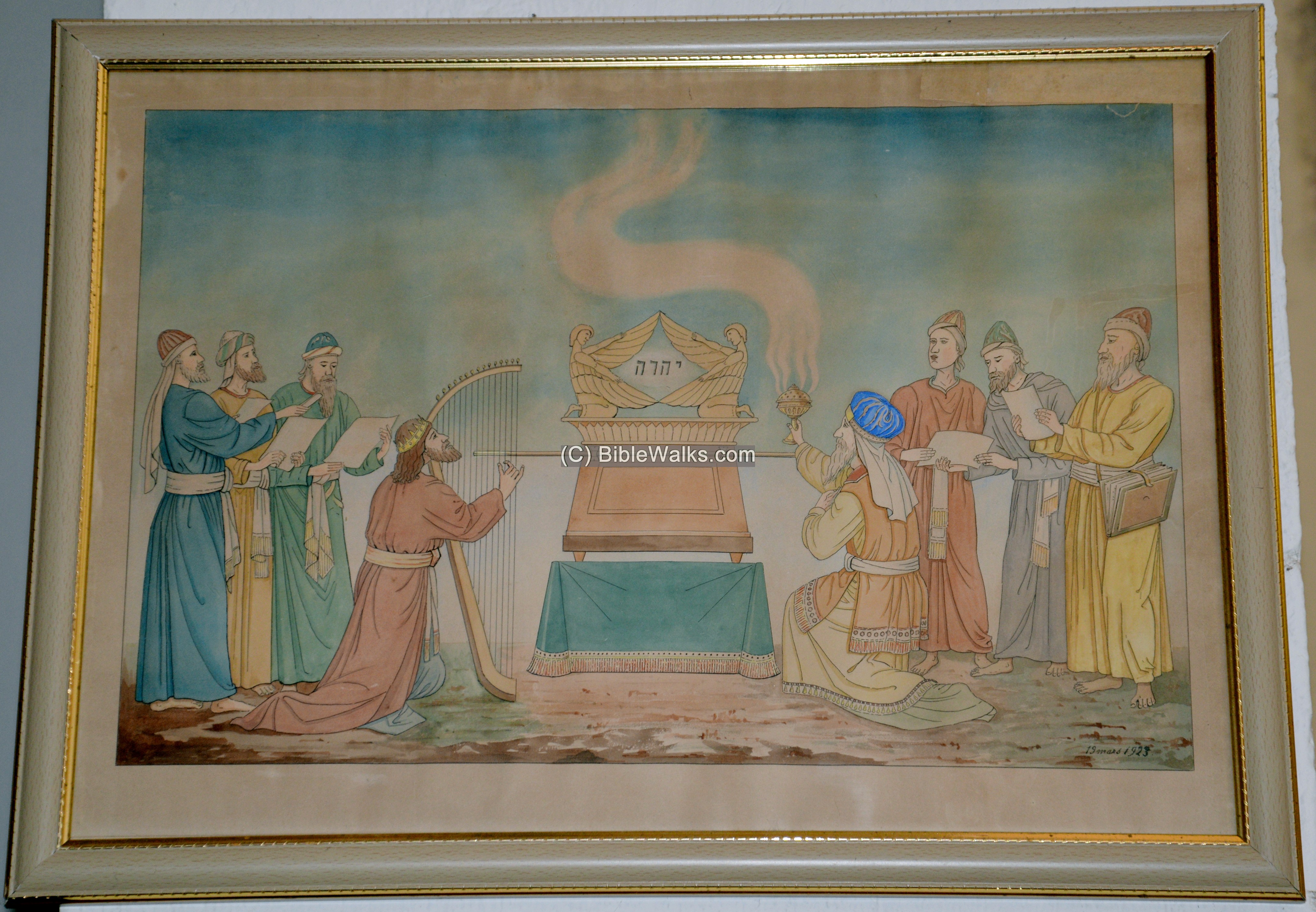
On the walls are several paintings. This one is of King David, the harp and the ark.
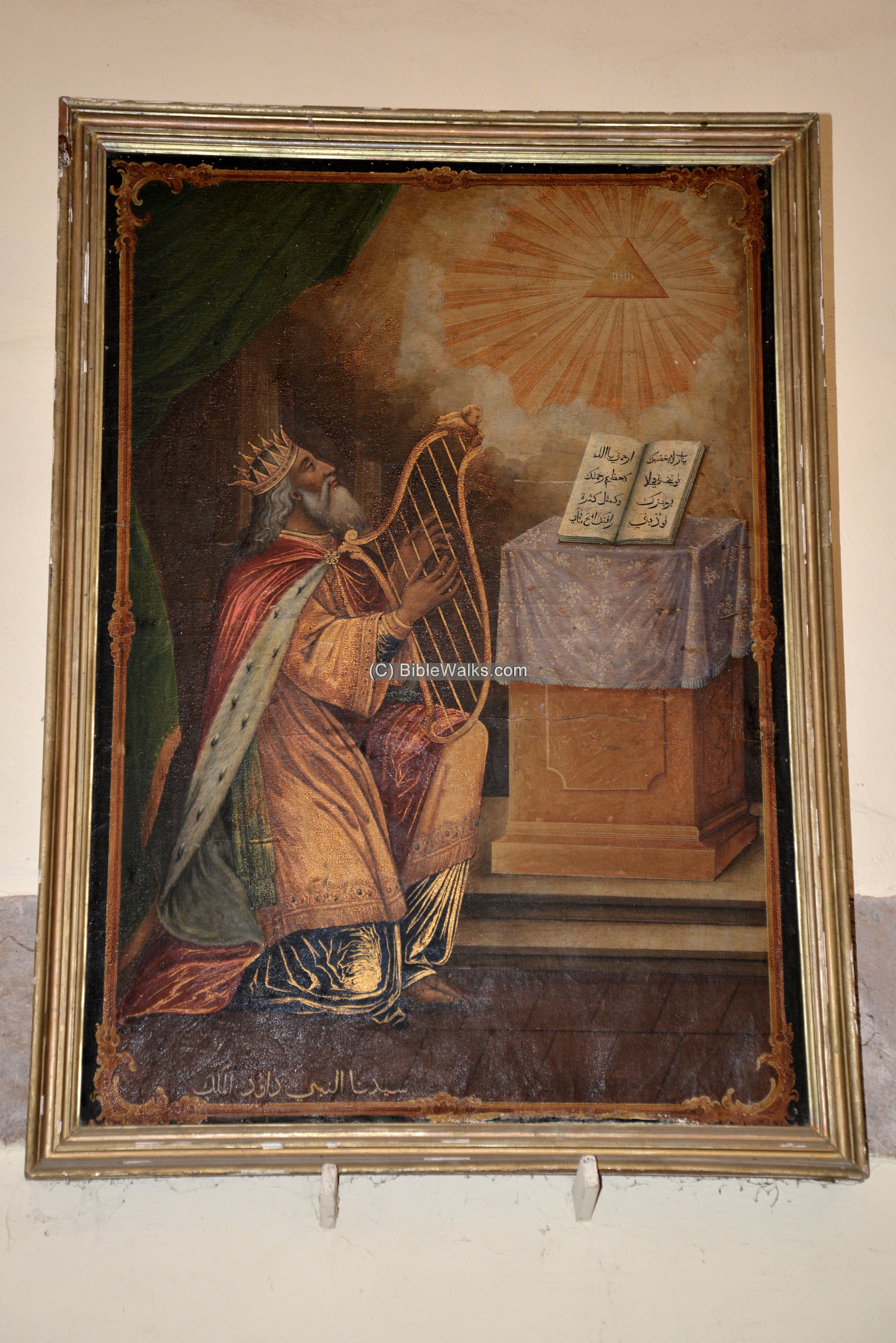
Yet another painting of King David and the ark:
(c) Archaeological Artifacts
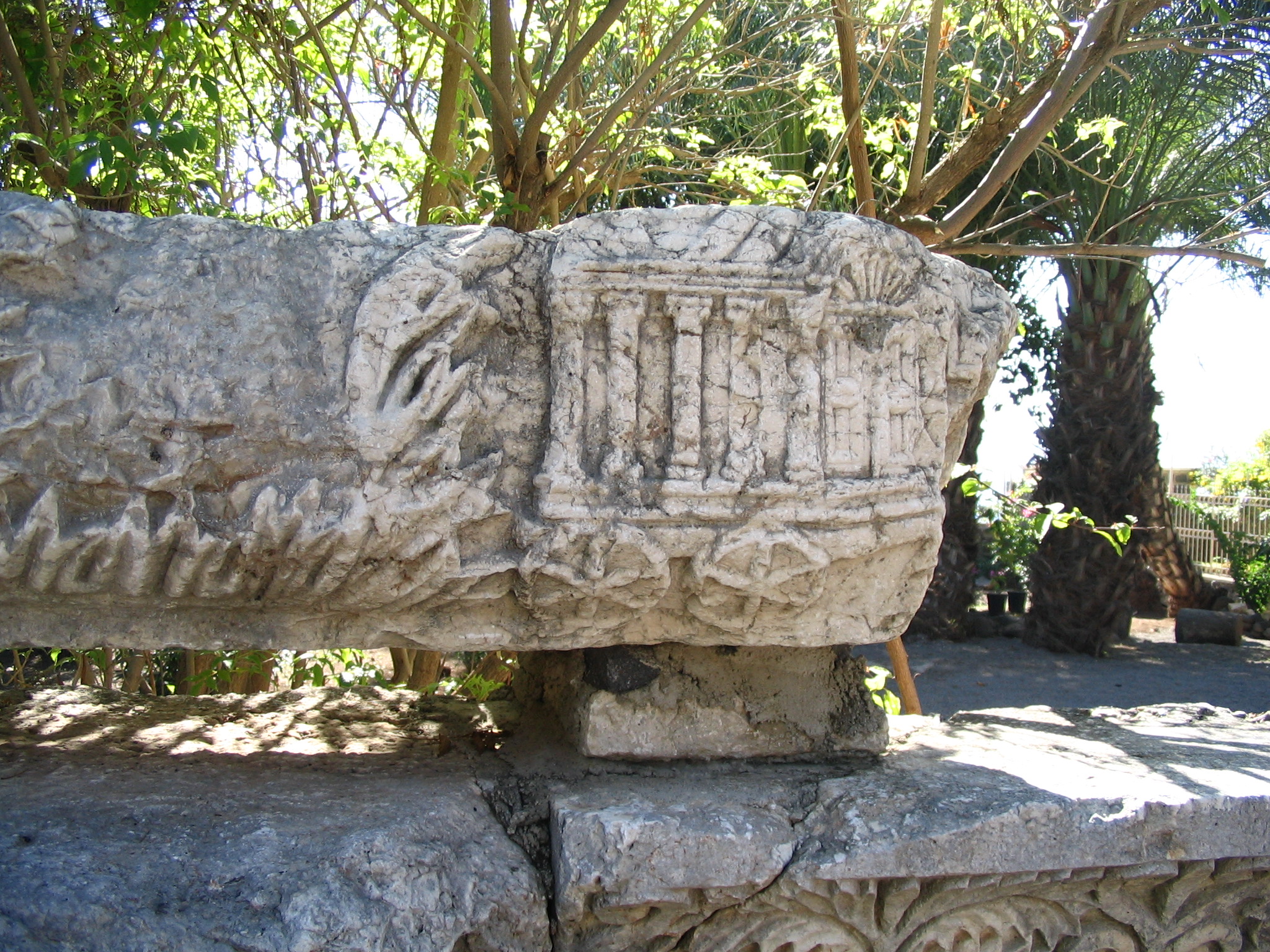
Inside the church are several extremely interesting archaeological pieces, dated to the Early Roman period, that were collected in the area.
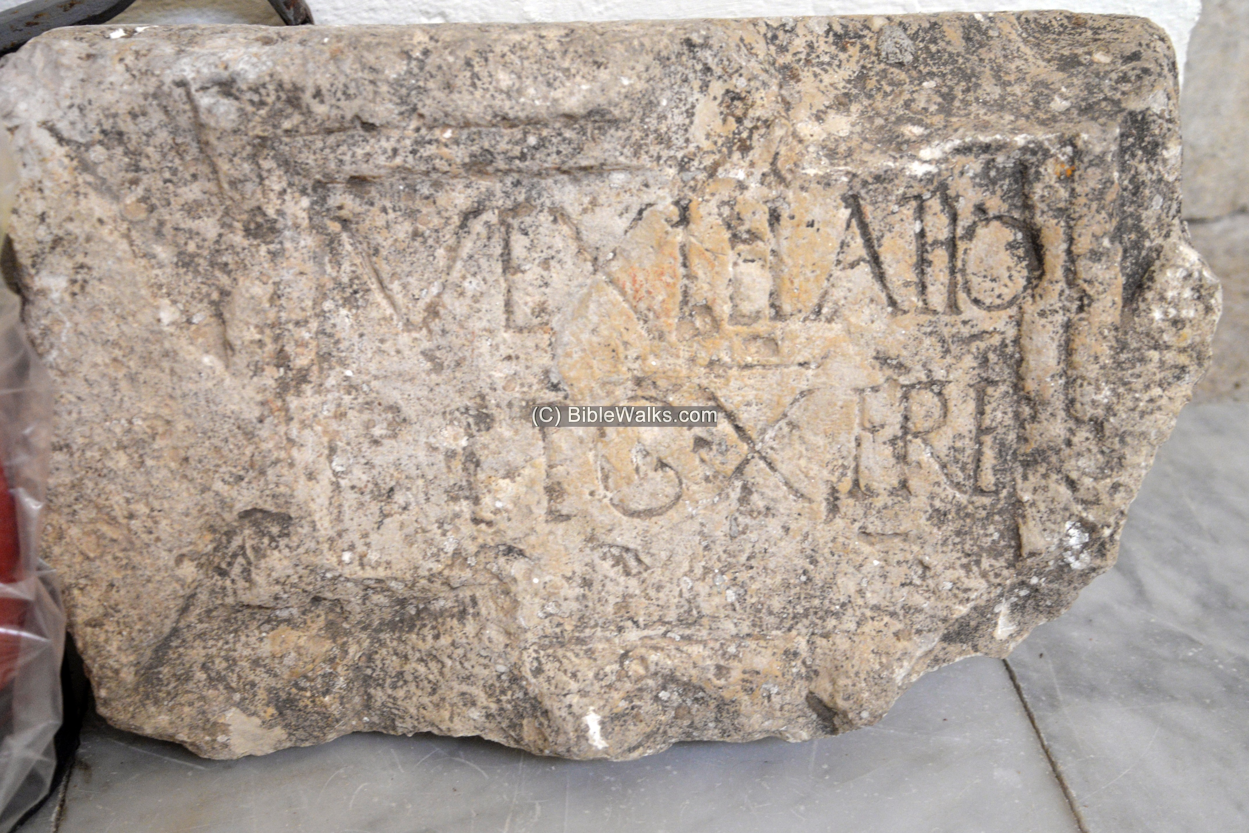
- 10th Legion inscription
A limestone slab with an inscription is dated to the Early Roman period. The Latin lines are:
“VEXILLAT(i)O LEG(ionis) X FRE(Tensis)”.
It mentions a vexillatio (a detachment of a Roman legion, formed as a temporary task force) of the 10th Legion (“LEG”) Ferentesis (“FRT”). This Legion was deployed in 66AD to quell the Great Revolt. The legion had a station house and guard post in Abu Ghosh until the end of the 3rd century AD.
Another similar slab is located in the nearby Benedictine Abbey.
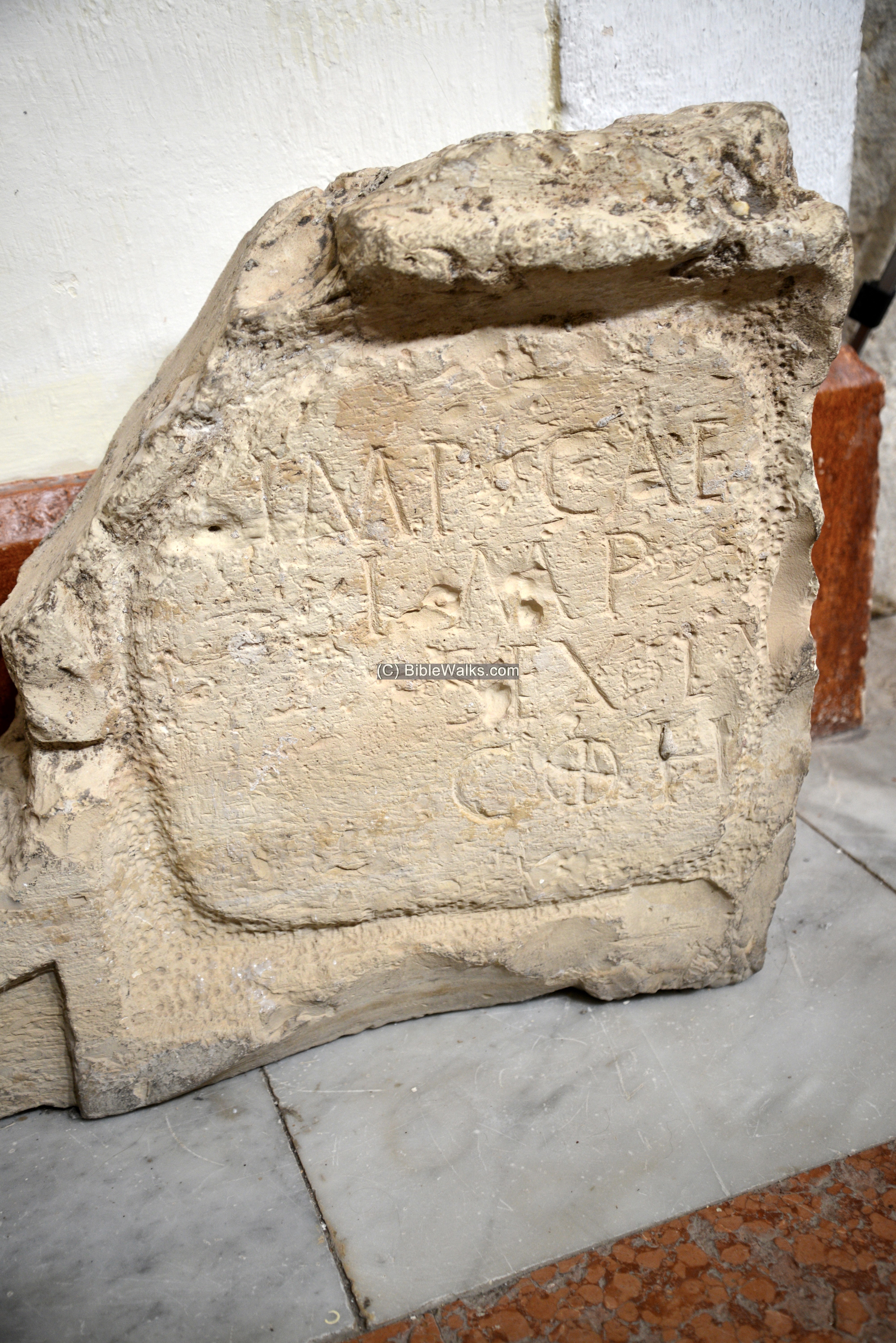
- Imperial building inscription
Another limestone slab probably attests the building of a camp for the cohors (military unit) of either the Legio X (as above), or for an auxiliary cohors, which were stationed in Abu Ghosh in 71 to 73 AD. It has the following letters inscribed on it:
IMP CAE IMP (T) SEX L(V) COH
This is an abbreviation of: Imp(erator) Cae[s(ar) Vespesianus Augustus] Imp(erator) T(itus) [Caesar Vesp(asiani) Aug(usti) fil(ius)][Sex(to) Lu[cilio Basso leg(ato) Aug(usti) pr(o) pr(aetore)][coh(orti) …]
Meaning: Imperator Caesar Vespasianus (and) Imperator Titus Caesar, son of Vespasianus Augustus, (have erected this building) under Sextus Lucilius Bassus, governor with praetorian rank, for the coros…
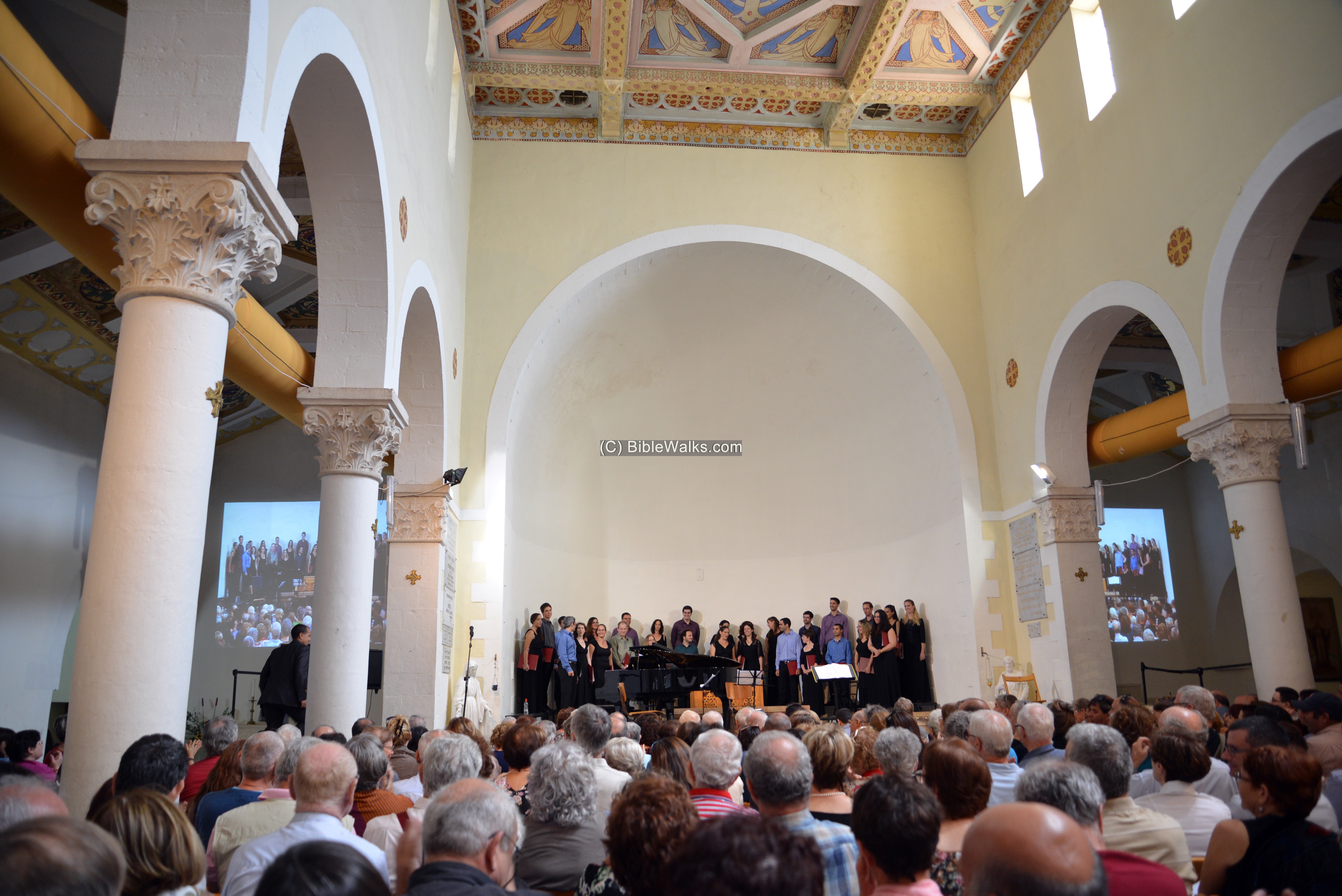
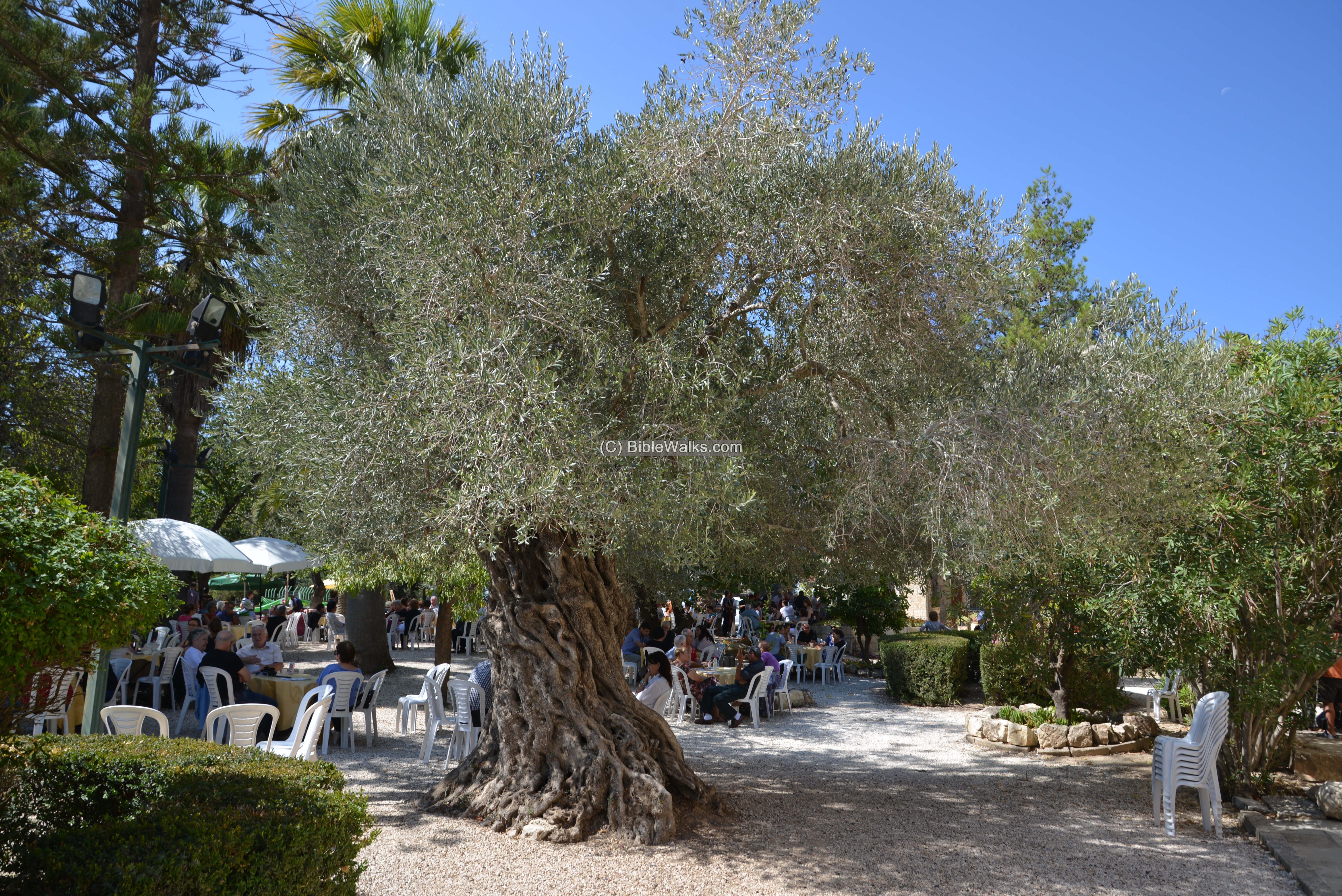
(c) Vocal Music festivals
Once a year the monastery hosts a festival. It is the famous Abu Ghosh vocal music festival. A platform is erected on the on the east side of the Church where the singers stand.
The great acoustics of the church reward the visitors with great vocal sounds.
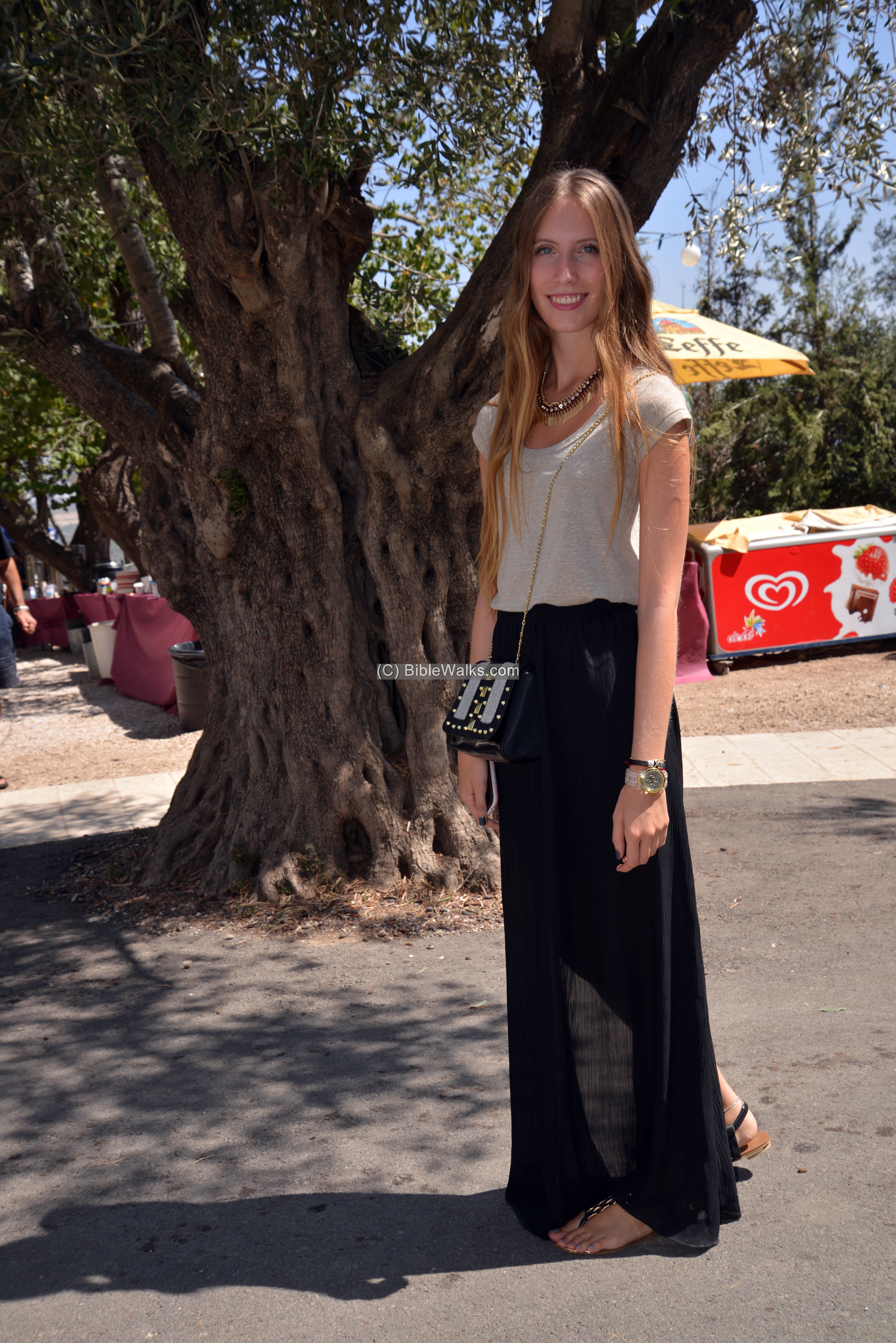
The visitors also enjoy sitting in the gardens around the church.
One of the young visitors is Amit – webmaster Rotem’s younger sister.
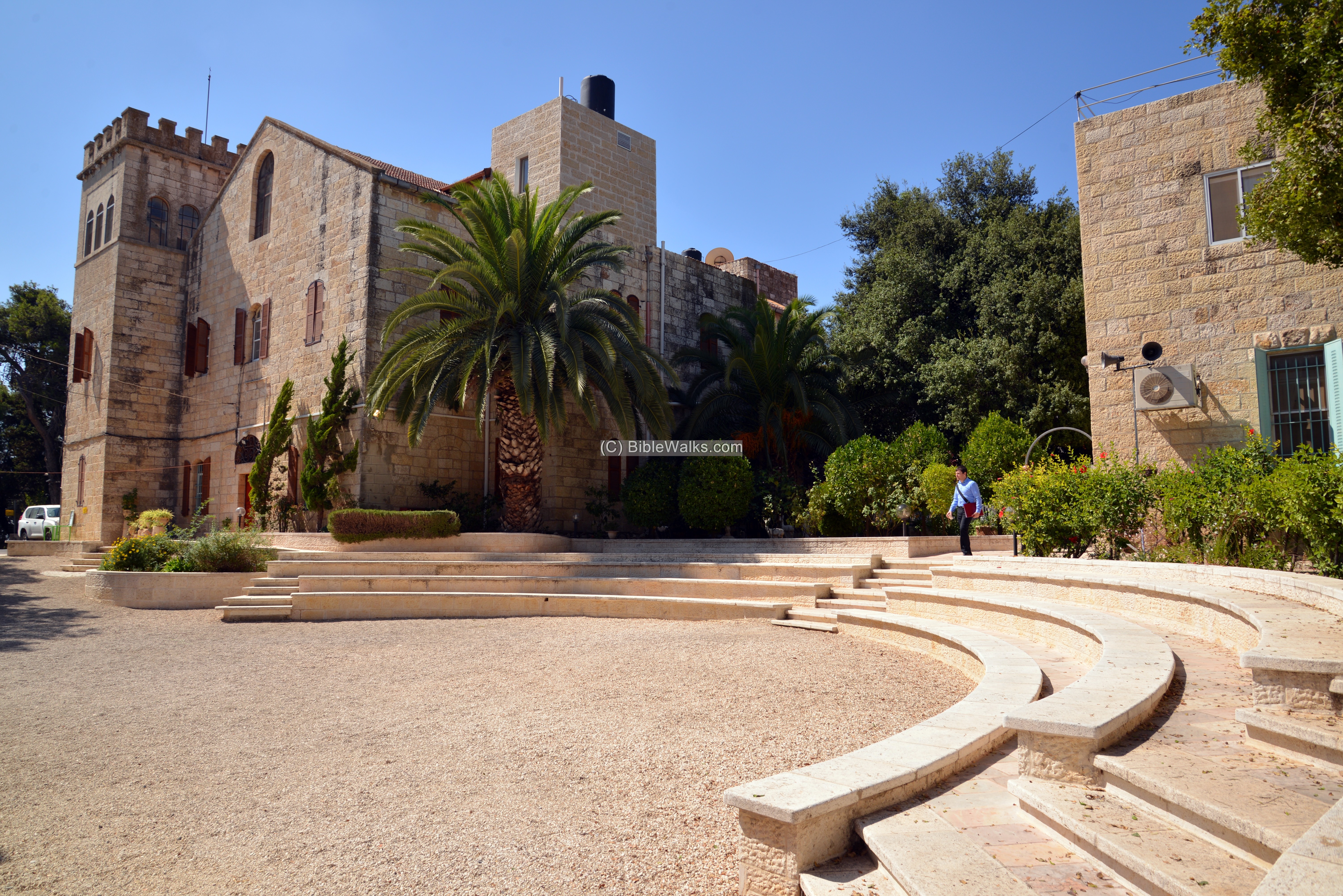
(d) The Monastery
On the west side of the church are buildings of the monastery, and an open courtyard between them.
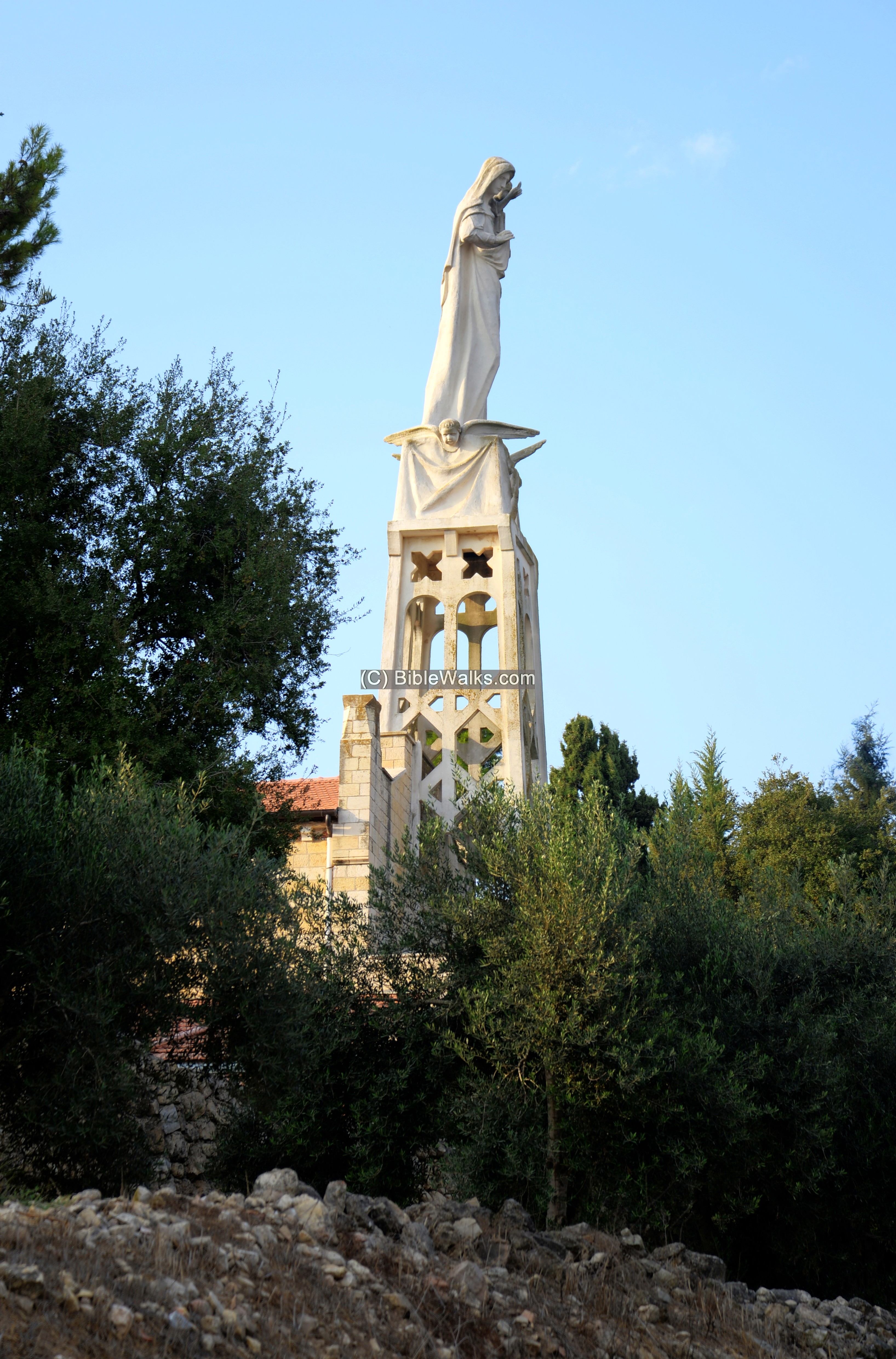
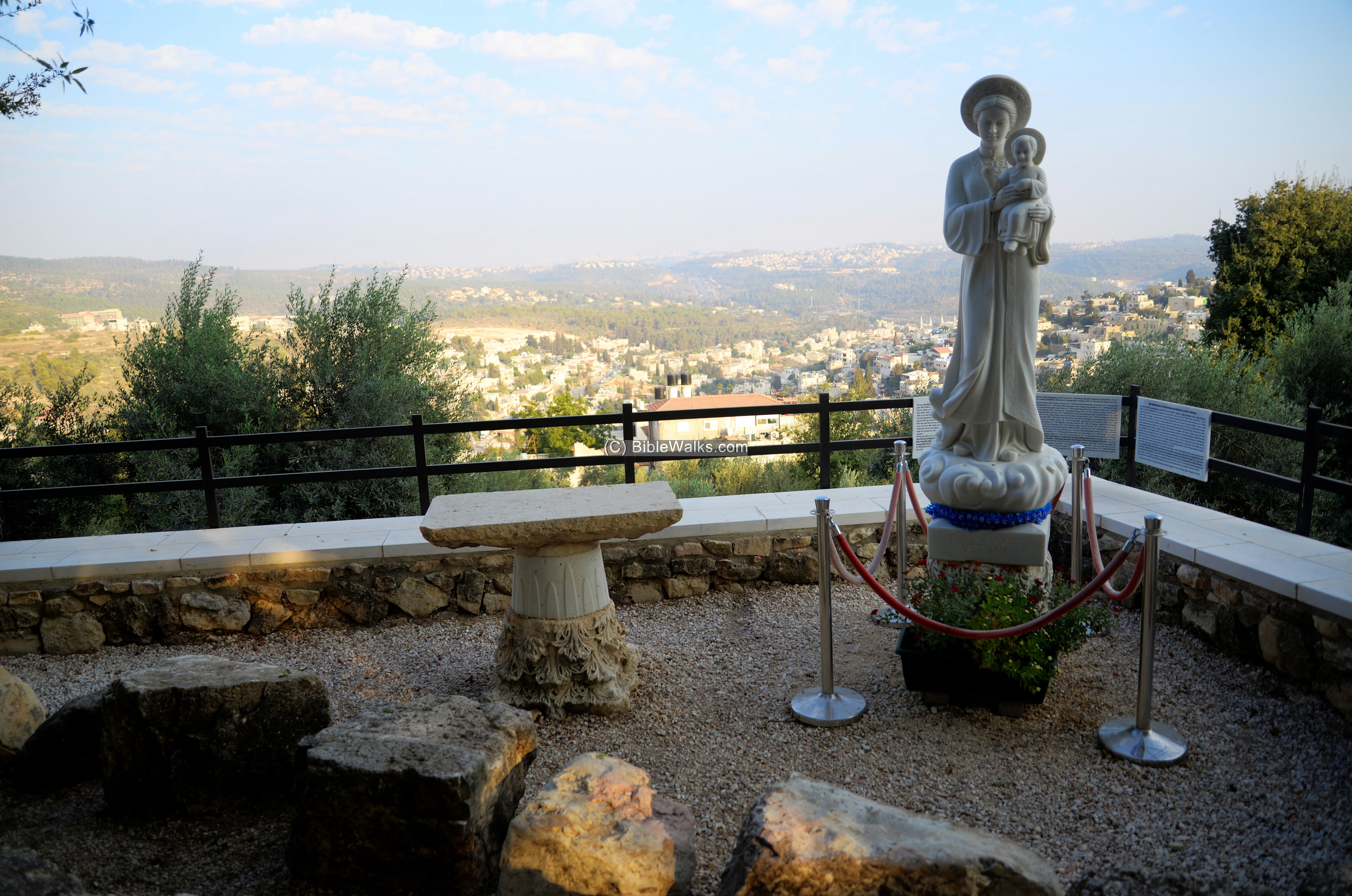
The Church is dedicated to Mary, Ark of Covenant. A statue of Mary and infant Jesus, located on a tower east of the Church, towers over the place.
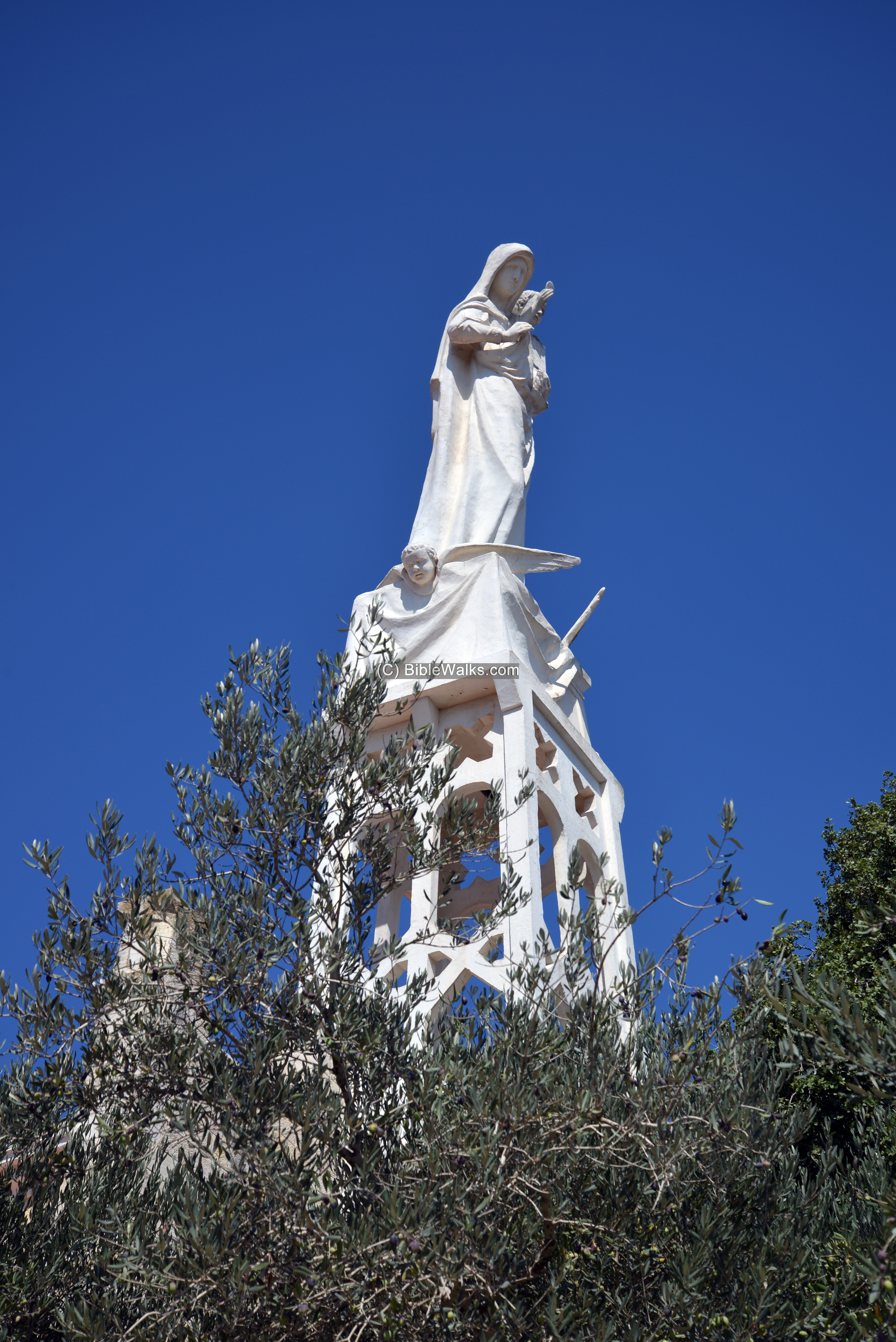
Another view of the statue:
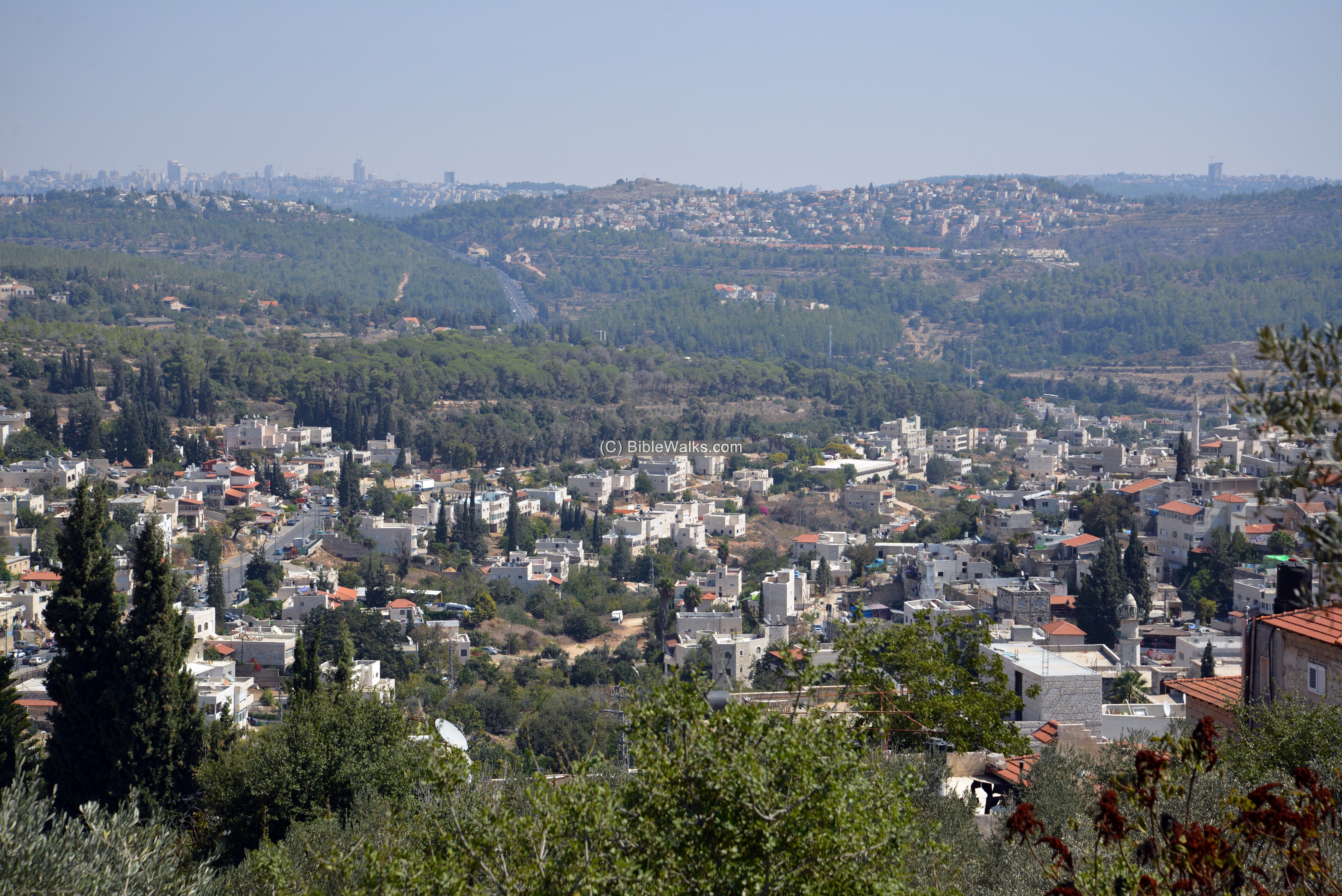
From the garden are great views of area – Abu Ghosh in the foreground and the outskirts of Jerusalem in the far background.
This statue – the Lady of La Vang – was added in 2018, commemorating the persecution of Christians in Vietnam. Since then the church has been a meeting place of the Vietnamese pilgrims.
The road to Jerusalem, seen here in the background ascending to the capital city, is the source of the history of the place – a major station along the ascent to Jerusalem.
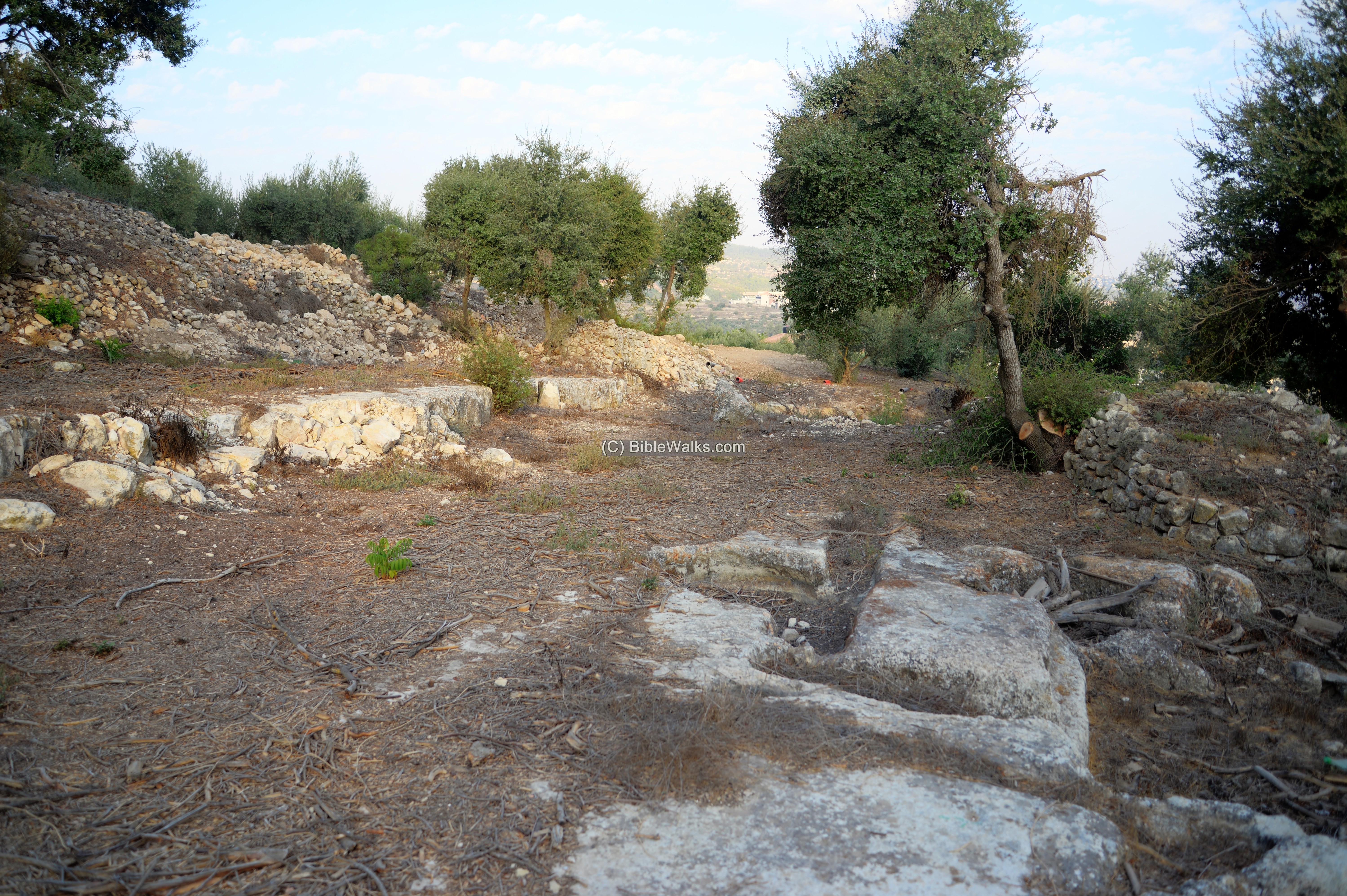
(d) The Mound
Along the foothills are terraces with traces of the early cities.
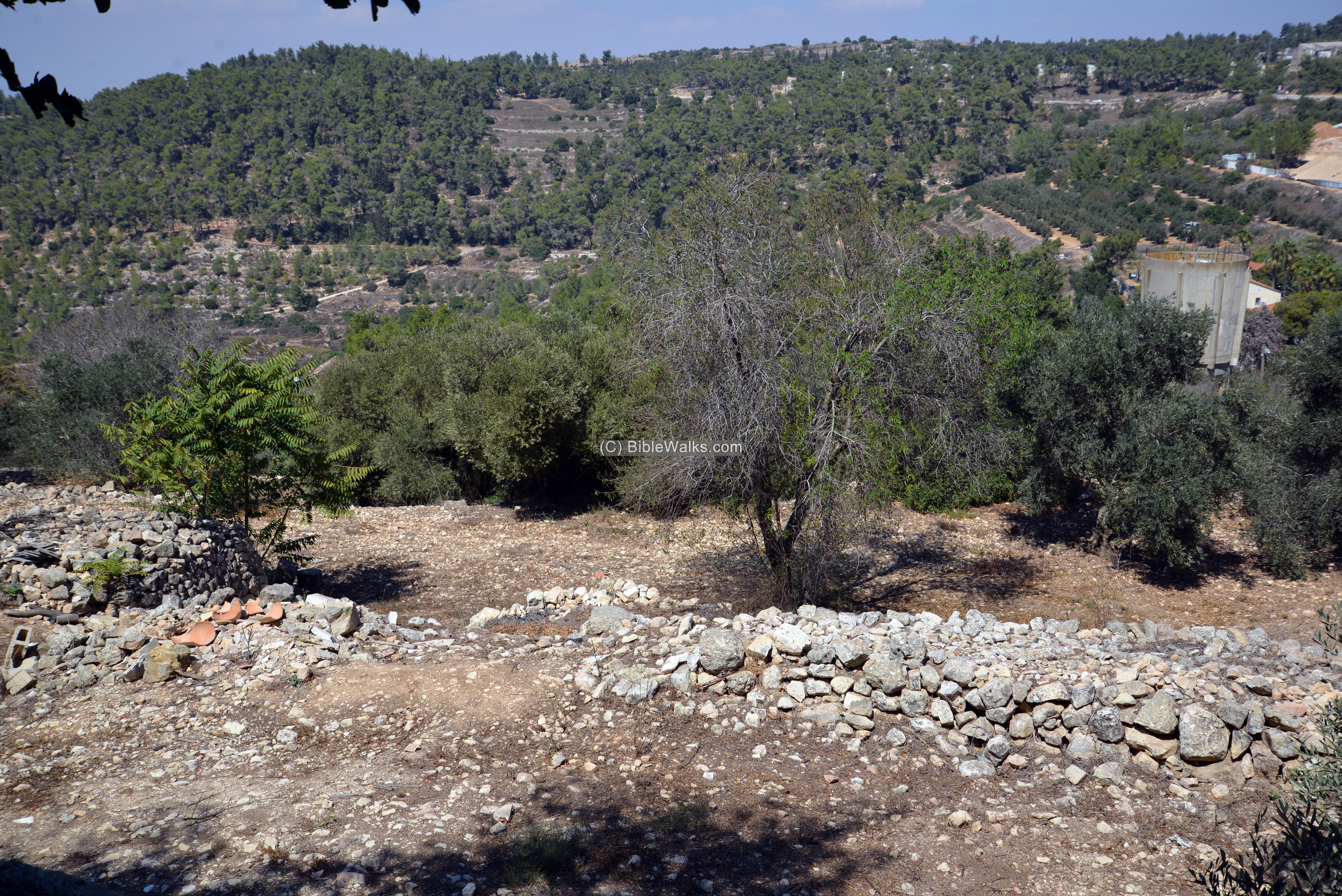
According to recent excavations, the majority of the settlement is of the 8th century BC. Sections of a wall had similar type of building blocks that were used by the Northern Kingdom in the 8th century BC.
Based on the initial research and the hypothesis of the excavators, a large temple was constructed in the 8th century by the great Israelite King Jeroboam II. It stood on a huge (150m x 100m) plateau on the top of the hill. It has a similar construction plan, and type of building blocks, as used in the city built by Jeroboam II in capital Samaria.
Due to the existing modern structures, the archaeologists have to work with care and in limited areas. The search for the lost temple will continue in future years.
Etymology:
Names of the site:
- Kuryet al Enab – Arabic name the place, meaning: “Town of grapes”.
- el Kuryeh – another Arabic name, based on its identification with Kiryath of Benjamin (Joshua 18:28).
- Kiriath Jearim (Kir’yat Ye’arim) – nearby Biblical site, mentioned as a station along the route of the Ark of Covenant’s return from the Philistines. Hebrew meaning: “Town of Forests”.
- Baalah – the Canaanite name of the place – City of Baal (Canaanite deity)
- Kiriath Baal – Hebrew for the city of Baal
- Deir el-Azar – Arabic name of the Byzantine ruins
- Abu Ghosh – modern Arabic name of the village around the site, based on the native family who lived here from the 16th century.
- “Our Lady Ark of the Covenant” – “Notre Dame de L’Arche d’Alliance” – name of the Church and Monastery.
Links:
* Archaeology:
- The secret of the Ark of Covenant (YouTube 7:47m, Hebrew)
- Jerusalem 705-1120 – edited by Hannah M. Cotton et al. (p. 11, for inscribed slab)
* Other BibleWalks pages:
- The ark of Covenant – Its Journeys
- Drone Aerial views – collection of Biblical sites from the air
- BibleWalks Youtube channel
BibleWalks.com – all roads lead to Jerusalem
Abu Ghosh Crusader Church<<<—previous site–<<< All Sites >>>—>>> —Next Judea site—>>> Castel
This page was last updated on Mar 16, 2023 (new illustration, new overview)
Sponsored links: