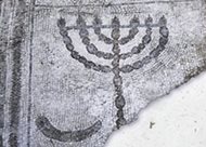
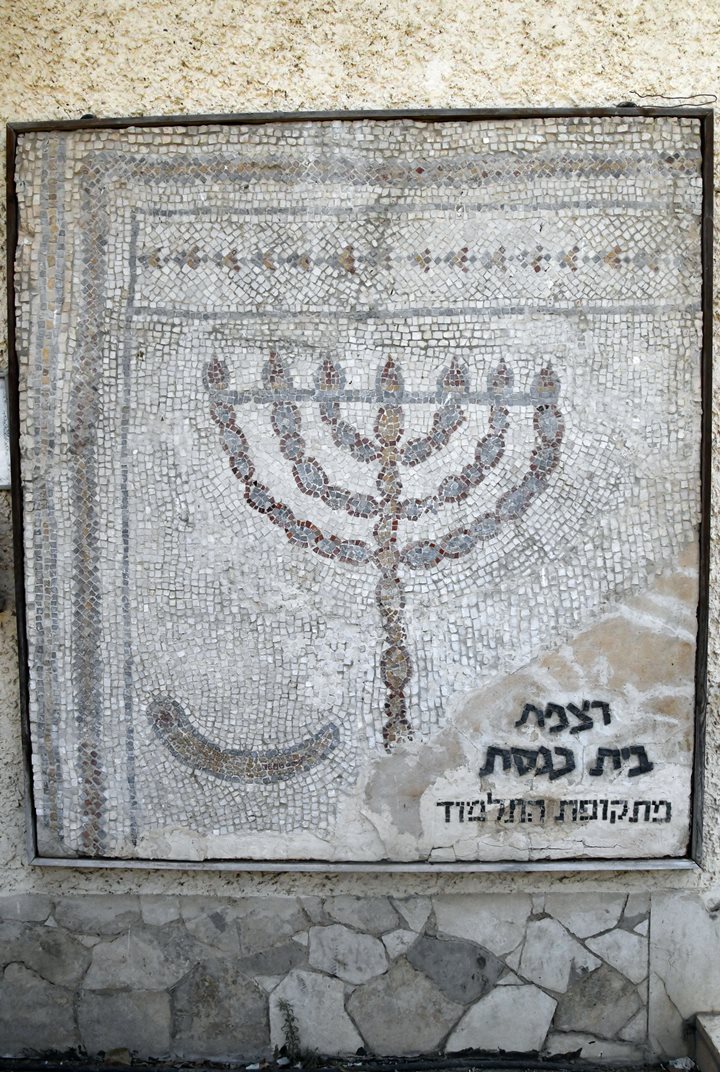
Ruins of a multi-period site north west of Tirat Zvi, with a mosaic floor decorated with a Menorah and Shofar. Nearby are additional sites – Tels Shkafim and Zofarim.
Home > Sites > Jordan Valley > Tel Menorah, Tirat Zvi (Kefar Qarnayim, Tell Abu Faraj)
Contents:
Background
Location
History
Photos
* Aerial views
* Ground views
* Findings
* Kfar Karnayim
* Open Museum
* Tel Zofarim
* Tel Shkafim
Etymology
Links
Background:
Tel Menorah (Tell Abu Faraj) is an archaeological ruin in Kibbutz Tirat Zvi, 2.5 km west of the Jordan river. Settlement on a mound during the Bronze and Iron age, with a substantial expansion during the Byzantine period.
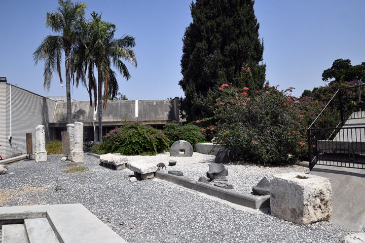
An open archaeological museum in Tirat Zvi has a collection of ancient artifacts, millstones and milestones that were found around the Kibbutz.
Nearby are additional sites – Tels Shkafim and Zofarim.
Location:
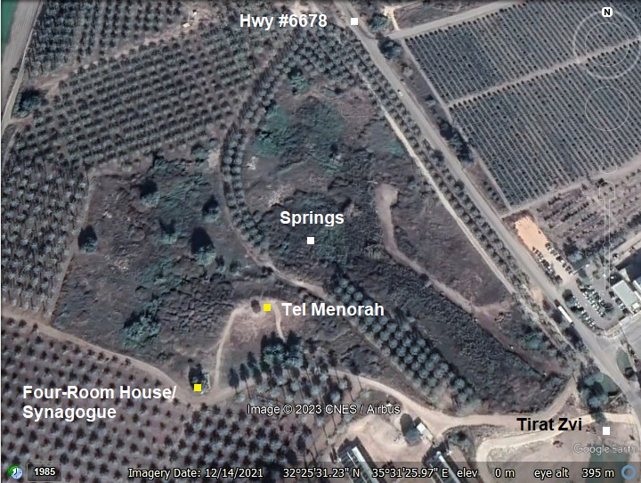
This map shows the area around the site. It is located north-west of Kibbutz Tirat Zvi, at an altitude of -200m (under sea level).
History:
- Bronze and Iron Age:
Ceramics on the mound of Tel Menorah were dated to the Early Bronze I, Intermediate Bronze, Middle Bronze II (few), Late Bronze, Iron I, Iron IIa, Iron II, Persian. Flint stones were dated to the Epi-palaeolithic period (20,000-10,000 years ago) and to the Early Bronze period. The settlement on the mound continued until the Iron Age II and Persian period.
-
Biblical map
The cities and roads during the Canaanite and Israelite periods are indicated on the Biblical Map below, with the site marked by a red circle.
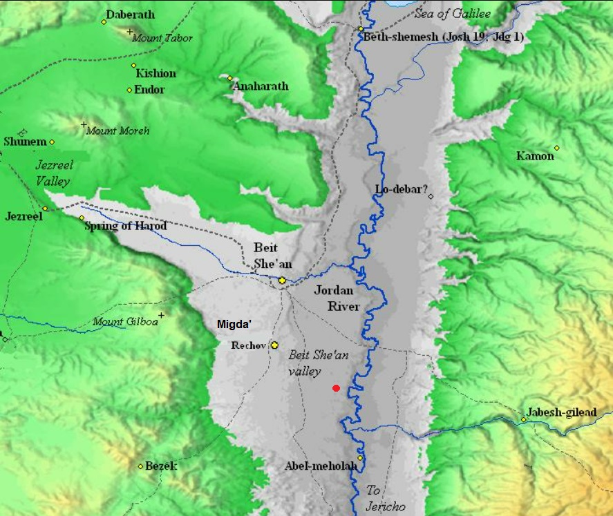
Map of the area of Jordan valley around the site (red circle)- during the Canaanite and Israelite periods (based on Bible Mapper 3.0)
David Dorsey (“The roads and Highways of Ancient Israel”, 2018, p. 104 and 114) marked the Bronze/Iron road connecting the main city Rehob to the river crossing Abu Naj (south east of the site) as “T9a”.
- Later periods
After the Biblical periods the settlement grew considerably around the mound, especially during the Byzantine period. Ruins of these periods cover a total area of 60 dunams. Ceramics were dated in the area around the mound to the following periods: Hellenistic, Roman and Byzantine (primary), Abbasid, Crusaders, mameluke and Ottoman periods.
During the Byzantine period the site was named Kfar Qarnayim (village of horns), based on the inscriptions on the mosaic floor of Rechov. A hoard of 300 coins were found nearby, dated to the 4th-5th century AD. A winepress was unearthed on the west side of Tel Menorah. The archaeologists found remains of a bathhouse near the spring.
- Crusaders/mamelukes
Remains of a Middle Ages sugar factory was also found north of the site. Dozen of sites in Israel and Jordan may have been sugar factories during the Crusaders/Mameluke periods. Sugar canes were grown along the river beds. (Reference: Katherine strange Burke, UoC, “A Note on Archaeological Evidence for Sugar Production in the
Middle Islamic Periods in Bila’d al-Sha’m”).
-
Ottoman period
A sheikh’s tomb gave the site its Arabic name – Abu Faraj.
The site was examined in the PEF survey (1866-1877) by Wilson, Conder and Kitchener. They merely wrote about the site (Volume 2, sheet IX, p.127):
“Tell Abu Faraj —A large mound, apparently artificial. Ruins of houses and of a small Mukam on the north-east, A stream of water from ‘Ain Malhah exists on the north, and another spring, giving a good supply of water. It will be noted that this is the case with all the true Tells on this sheet.”.
A section of their map is seen here, with the site marked as Tell Abu Faraj. It is located on the side of a major road from Beit Shean to Tel Shalem in the south (double dashed line), a road west to Samaria, and east to the Jordan river crossing fords (esh Saghaiyir, Zor es Simsim and abu Naj). The fords are marked as Mak.t – short for Makhadet – Arabic for ‘ford’.
On the side of the road, west to the site, were 5 Roman milestones of the 6th Roman mile from Scythopolis. They are on display in Tirat Zvi.
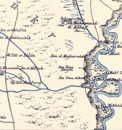
P/O Sheet 9 of SWP, by Conder and Kitchener, 1872-1877.
(Published 1880, reprinted by LifeintheHolyLand.com)
- British Mandate
A 1940s map shows the area around the site (Tell Abu Faraj). The springs are indicated as “Sp”, a dot with lines emitting from it, and within an area marked as ‘Uyun Abu Faraj (springs of Abu Faraj).
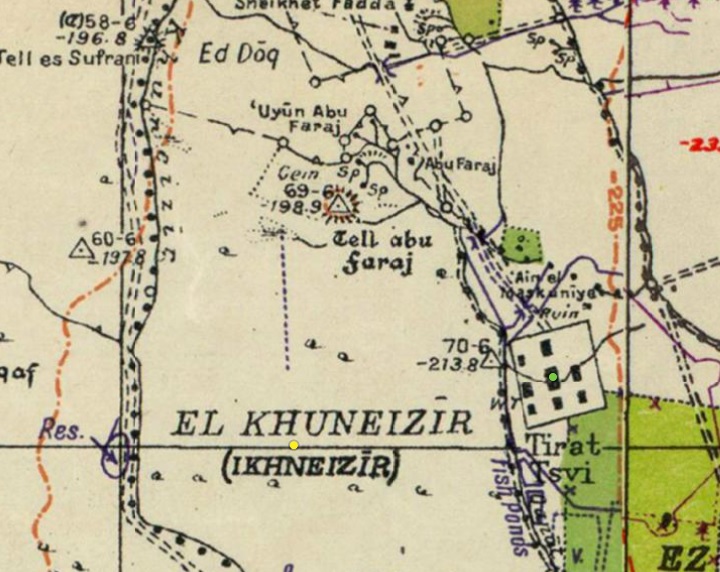
British survey map 1942-1948 – https://palopenmaps.org topo maps
License: public domain under the UK Copyright, Designs and Patent Act 1998
-
Modern Times
The ancient site of Tel Menorah is in an open place in the date palm orchard area on the north side of Kibbutz Tirat Zvi.
Tirat Zvi, a religious Kibbutz, was established in 1937 as a “Tower and Stockade” settlement along the eastern borders of Israel. It was named after Rabbi Zvi Hirsch Kalisher (1795-1874), an orthodox German Rabbi, who expressed views in favor of the Jewish re-settlement of the Land of Israel, predating the Zionist movement.
An open archaeological museum in Tirat Zvi has a collection of ancient artifacts, millstones and milestones that were found around the Kibbutz. On the wall of the synagogue is the original section of the mosaic floor with the menorah and shofar.
Photos:
(a) Aerial Views
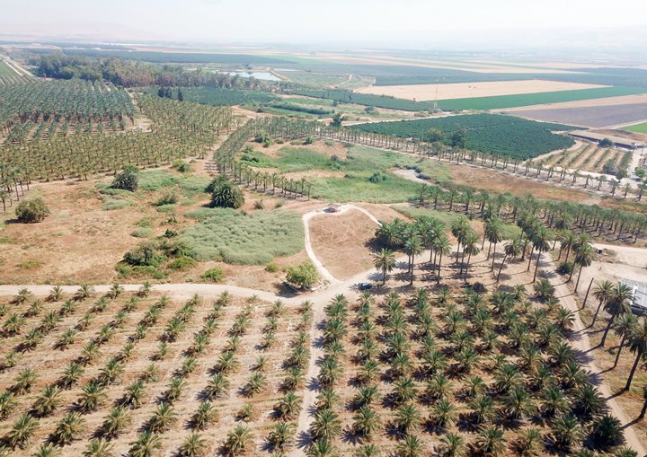
A drone captured this view towards the north. This flat area is known as the Al-Ghor (‘הע’ור’), the middle section of the Jordan valley. Also known as Kikar Hayarden, or the ‘depression’. This section is ~200m under sea level, 5km wide. The Jordan river is 2km to the east.
Click on the photos to view in higher resolution…
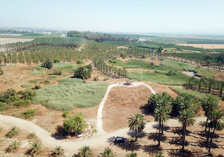
The center of the site is the mound – an accumulation of several cities since the Early Bronze period. The springs are just beyond the mound, as indicated by a green area on the right.
![]() A drone flew above the mound and captured this aerial video:
A drone flew above the mound and captured this aerial video:
(b) The Mound
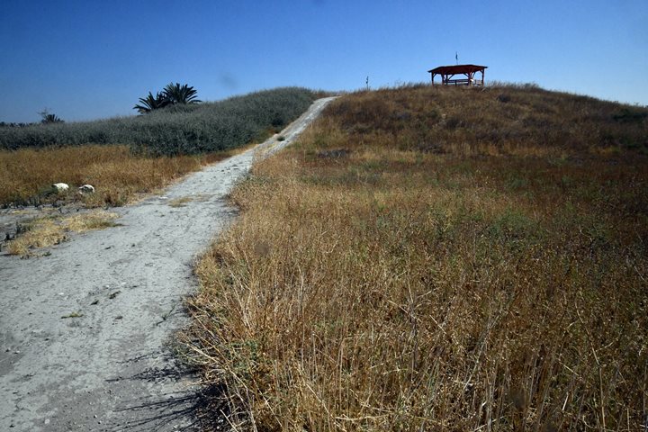
The artificial mound rises 10m above the area, with a low spur on its east side, covering an area of 5 dunam.
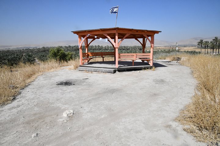
On the summit is an observation place where you can relax and hide from the scorching sun, and view the area.
From here are great views of the area around the site. In the fields around the mound are remains of the post-Biblical site.
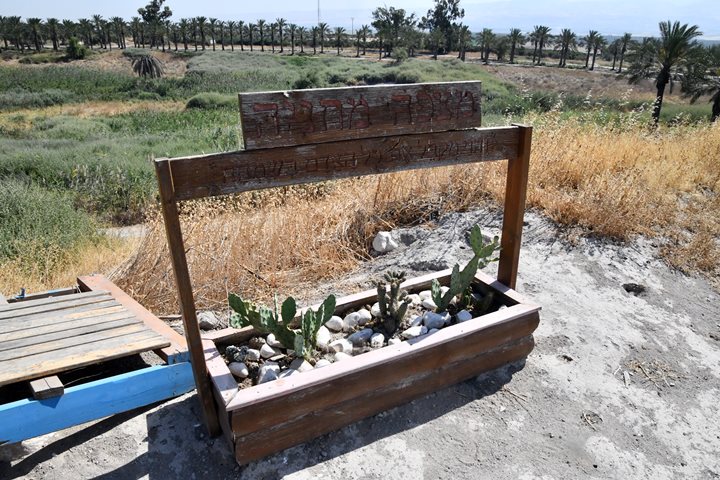
A memorial for Sgt. Metania Rabinsan was built on top of the hill. Metania, raised in the Kibbutz, was killed in action in 2002.
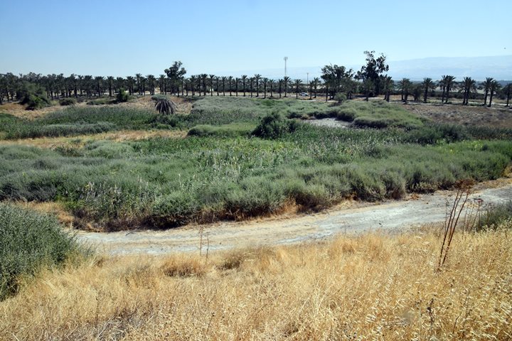
In the bush area ahead is a spring (named Ein Qarnayim – spring of the horns). The water supplied from the spring and the streams that crossed the area made it possible to live here, as this is one of the hottest places in the world. In June 21, 1942, the third hottest temperature in the world ever recorded was measured here in Tirat Zvi: 53.9 c (129 f)!
(c) Four Room House
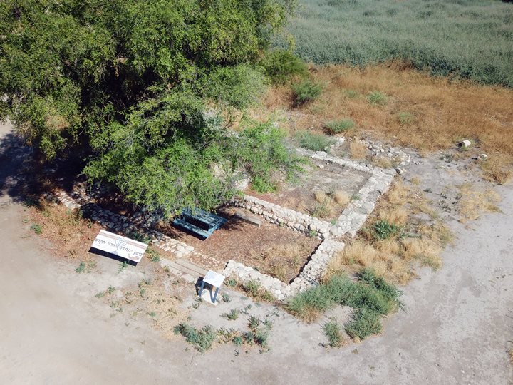
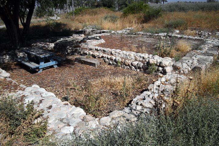
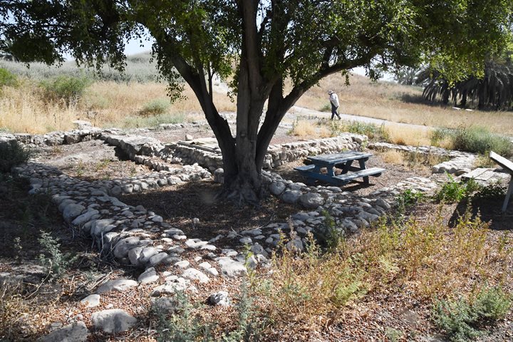
On the south side of the mound, under a tree, is the most important finding in Tel Menorah. The archaeologists unearthed an Iron age II four-room house, measuring 11.3m x 10.6m.
The largest room is on the north-east side, on the top right side of the photo below.
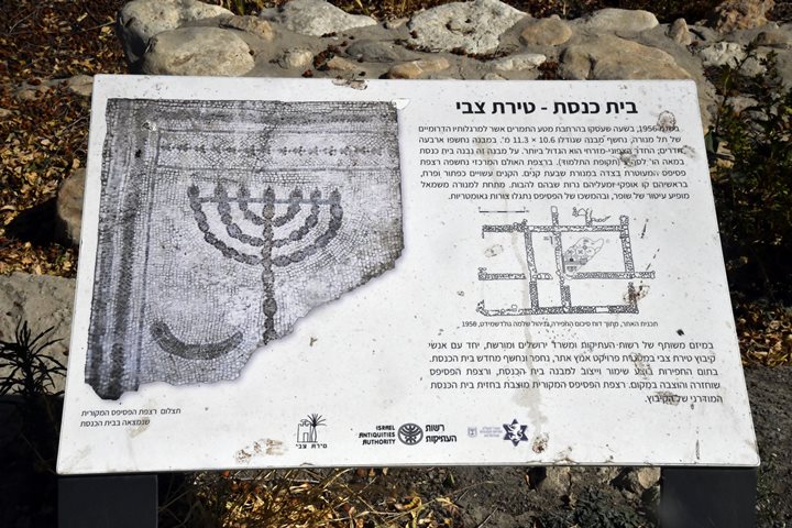
The four-room house was reused as a synagogue during the Byzantine period (6th century AD). A section of a mosaic floor was exposed on the largest room.
Its mosaic floor depicts a seven-branch Temple menorah, a shofar (Jewish ritual horn), and geometric forms.
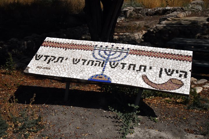
A sign with the menorah and shofar was posted in front of the ruin, with the words of Rabbi Kook: “The old will be made new, and the new made holy”. Meaning: new ideas help reinterpret the old, while old ideas provide meaningful contexts for the new.
(d) Findings
- Basalt tools
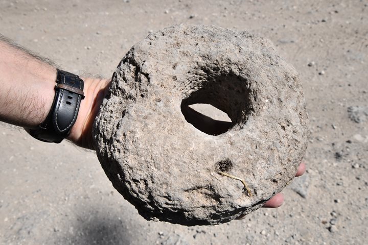
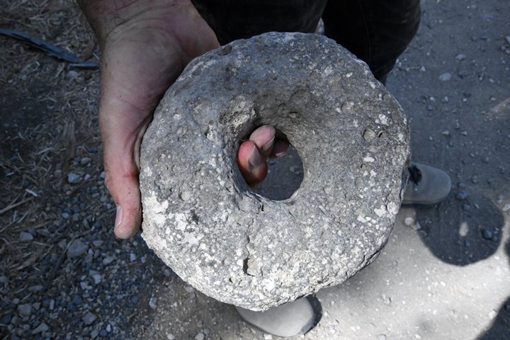
Basalt stone is the primary type of stone found on the mound. The strong Basalt stone was used as a building material and for installations due to it durability, strength, and resistance to weathering.
Basalt’s hardness and toughness made it suitable for crafting various tools and weapons. Ancient peoples shaped basalt into axes, hammers, grinding stones, and cutting tools. It was particularly valued for its ability to hold a sharp edge and its resistance to wear and abrasion.
The following basalt stones were found during our survey of the mound, probably dated to the during the Early Bronze period. They may have been used as weights for the textile industry, or for fishing in the ponds or in the river.
(e) Kfar Karnayim
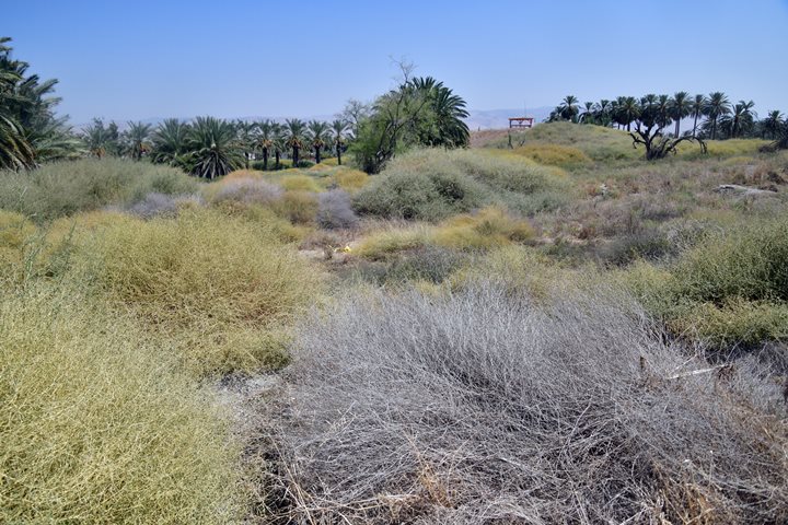
During the Byzantine period, a large village was built around the springs, probably named Kfar Karnayim (or Kefar Qarnayim, meaning: ‘village of horns’). Currently, its ruins are buried under the ground, spread around the springs and the ancient mound. This photo is a view of the area north side of the springs, with the mound on the background in the south. Most of the area is covered by bush and by palm trees.
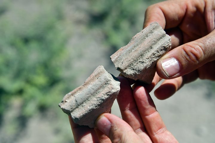
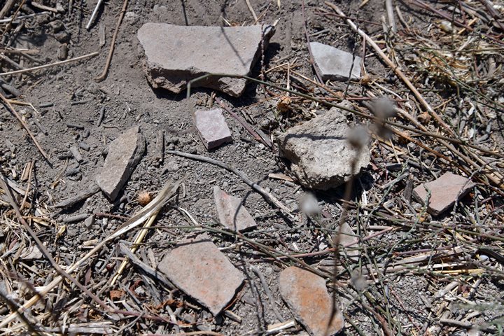
The ceramics we saw during our short survey were indeed from the Byzantine period, such as this broken piece that was identified by Ayelet as Kfar Hananiah pottery.
All the ceramics we found in this area north of the mound were Roman/Byzantine period.
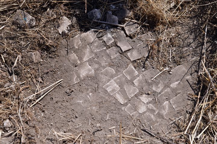
A section of a crude (industrial) mosaic floor was also visible in the area north of the springs.
(f) Tirat Zvi Museum
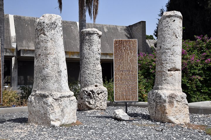
Inside Kibbutz Tirat Zvi is an open museum with architectural elements collected from the site and surrounding fields.
- Synagogue elements
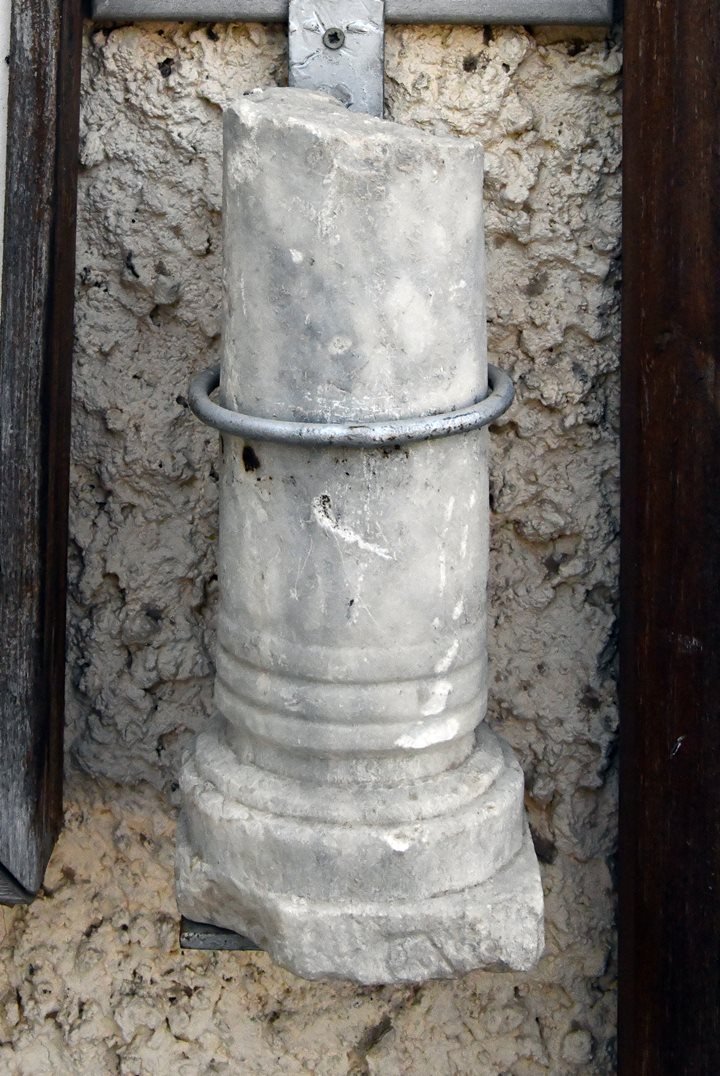
A marble column was found 60m from the synagogue after clearing a section of the palm orchard. It could have been part of the table or part of the screen of the synagogue.
Also on display is a section of the original mosaic floor with the menorah and shofar. The Hebrew title: “The floor of the synagogue of the Talmud period”.
- Basalt Millstones
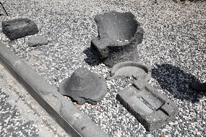
Basalt installations are also on display.
Below are two pieces of a millstone – a type called “Pompeian” (or: Donkey mill). The upper part of this installation (in the middle, with the cavity facing up) is broken and sits upside down. The lower part is the cone shaped stone. The process of the grinding was as follows: the wheat grain was placed into the top hole of the upper part, then the upper millstone was turned around, and the ground grains would fall to the bottom as flour.
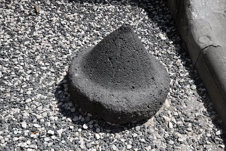
Another lower part of another millstone of the type “Pompeian” (Donkey mill) is also seen nearby:
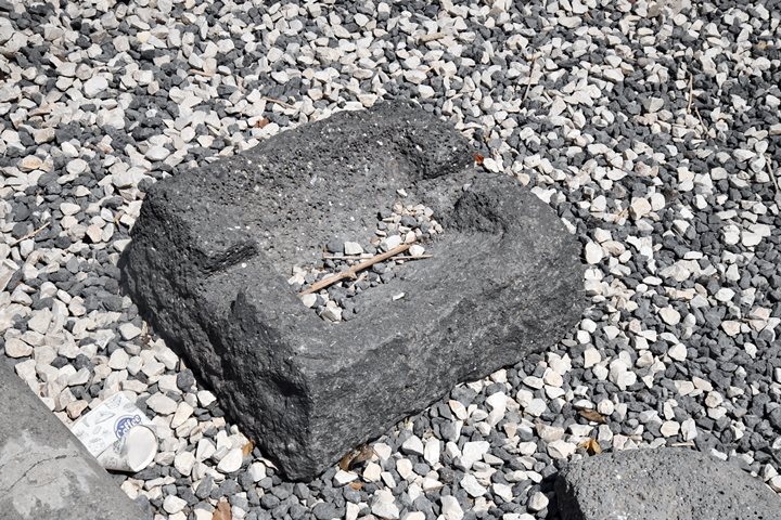
There is another common type of hand millstones – the “Olynthus”. The process of grinding is different, where the upper millstone with the grooves (seen below) is rubbed back and forth over a lower millstone, using a lever.
- Marble Sundial
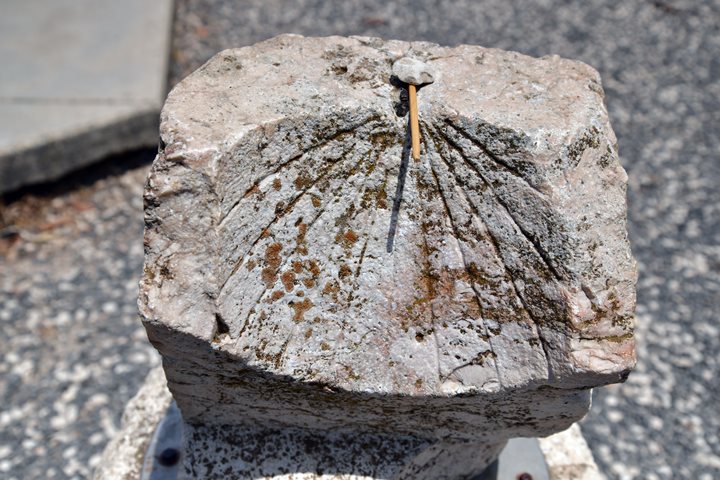
A marble sundial nesting on a pedestal is also on display. The Hemicyclium (concave hemisphere) has grooves showing the hour based on the shadow of a pin in the center. It is dated to the Byzantine period (5th-6th century AD).
- Milestones
An important imperial Roman road passed nearby, connecting Scythopolis to Jericho. And only 2km south of the Kibbutz is Tel Shalem – a major site and Roman camp.
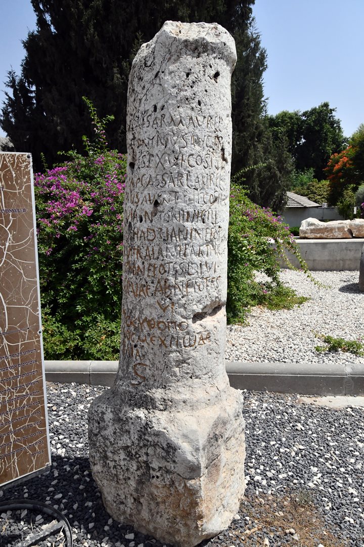
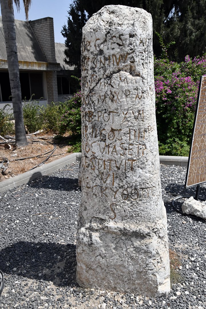
Several of the milestones along the road are on display in front of the Kibbutz dining hall. All 5 milestones stood on the 6th Roman mile (8.87 km) from Scythopolis (Beit Shean). According to the map this range is on the 1km north west side of Tirat Zvi, on the side of a small Byzantine period site named Tel Zofarim (Tell es Sufrani on the British map, Tell el Khaneizir on the PEF map). They were constructed during the reign of Marcus Aurelius and Adrian in the 2nd century AD.
The following milestone stood 6 Roman miles from Scythopolis, as written on the bottom of the milestone. It reads in 15 lines of Latin (first 11 lines) and Greek (last 4 lines) a praise to Roman emperor Marcus Aurelius (reigned 161-180 AD):
IMP(ERATOR) CAESAR M(ARCUS) AVREL(IUS) / ANTONINUS AVG(VSTVS) / TR(IBVNUCA)P(OT)EST(AS) XVI CO(N)S(VL) III ET / IMP(ERATOR) CAESAR L(VCIUS) AVREL(IVS) / VERVS AVG (VSTVS) T(RIBVNCIA) P(OTESTAS) C(ONSVL) II / DIVI ANTONINIOFILI /DIVI HADRIANI NEPOT(E) / DIVITRAIANUS PARTHI / CIPRONEPOTES DIVI/ NERVAE ABNEPOTES / VI / ΔHOCKYΘOΠO / ΛEWCMEXPIWΛE /MIΛIA / S
Another milestone dated to Marcus Aurelius, also stood on the 6th Roman mile from Scythopolis. The 6th mile is written on the bottom (VI in Latin, S[tigma] in Greek).
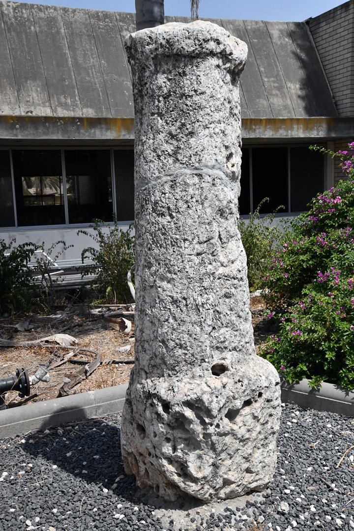
Another milestone stands behind, without a clear inscription:
In 2024 another group of milestones were moved here from their original location at the 7th mile. They were reported by Zori (1962, p. 182, site 118).
(g) Tel Zofarim
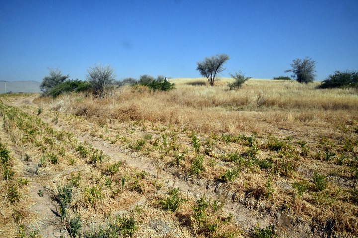
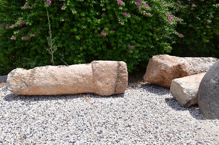
Another ancient site is located 1 km north west of Tirat Zvi. This was a small (0.5 dunam) Byzantine period site, named Tell es Sufrani (Britsh map) or Tell el Khaneizir (“the pigs hill”). It is today scattered in the field west of the palm trees. Near the site was the Roman imperial road where the milestones were found and are on display in Tirat Zvi.
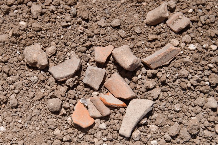
Indeed, the ceramics we saw on the hill and around it were Roman/Byzantine ceramics.
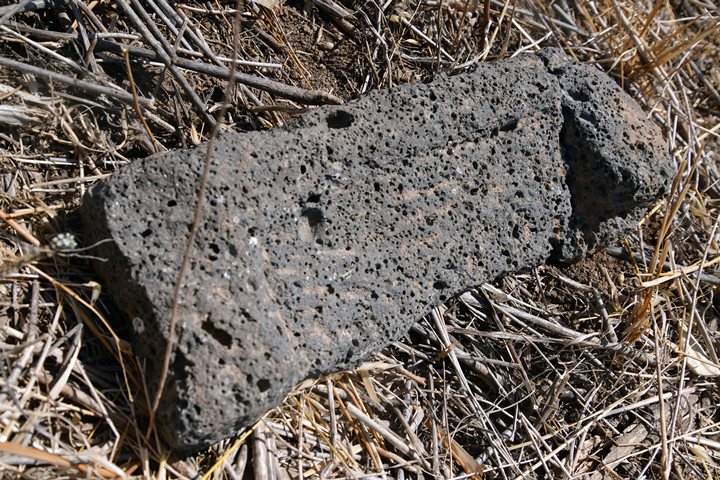
We also saw a basalt stone, probably used for grinding. It was broken in two pieces and we placed them together.
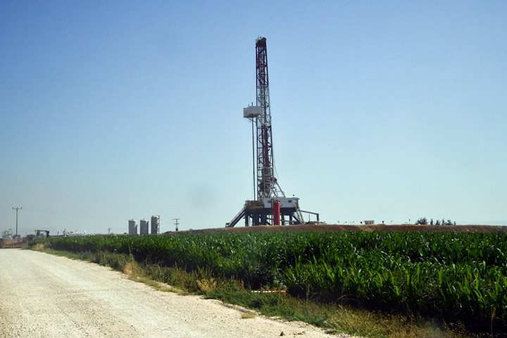
Nearby, within the corn field, is a modern oil drilling tower. The company (“Zion Oil and Gas Inc.”) have a drilling license in the area of Jezreel valley and Jordan valley. They based their digging and the prospect of finding oil on the Bible. Their website claims: “Inspired by Genesis 49:25-26 and Deuteronomy 33:13-16”. A true BibleWalker!…
(h) Tel Shkafim
Another ancient site is located 2 km west of Tirat Zvi. It appears on the PEF map as Tell es Shukf. This is a small hill, with ruins covering an area of 1 dunam. There are several Muslim tombs on the hill and many porcupine digging holes. Near the site passed the Roman imperial road. At the side of the road were 5 milestones without inscriptions, as reported by N. Zori (1962, site 112). Their current location is not known.
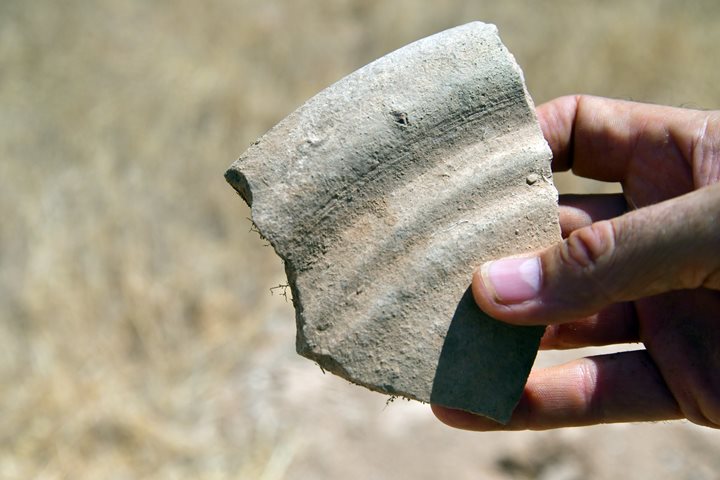
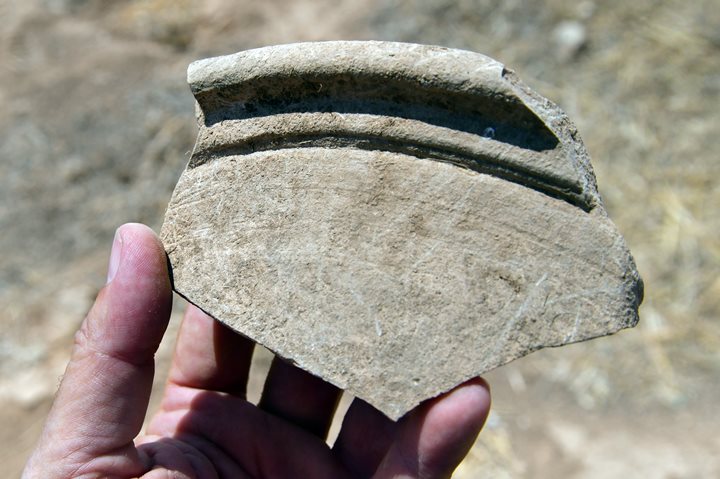
The ceramics were dated to the Persian and Hellenistic periods N. Zori (1962, site 69). Here is one of the Persian period pottery fragment that we found on the site, pushed out from the ground by one of the porcupines.
Another Hellenistic period vessel:
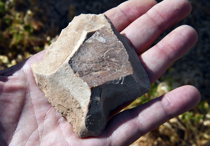
A flintstone was also found here, probably was used as a scrapper.
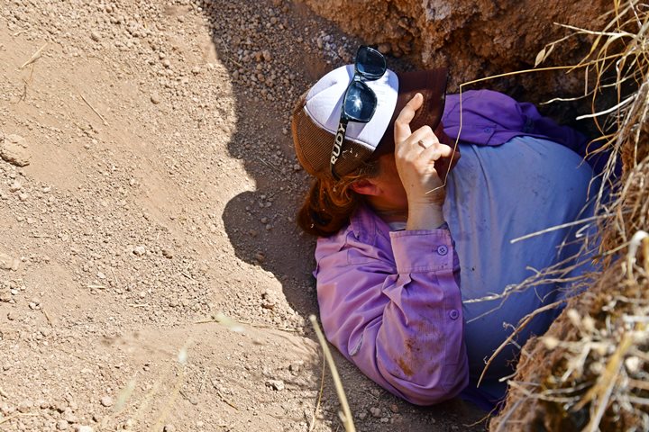
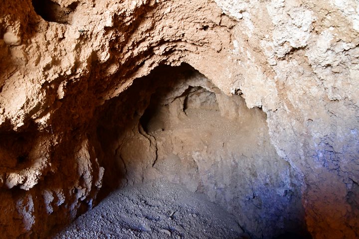
One of the porcupine holes was huge, cutting a small cave into the hill. Archaeologist Ayelet Keidar-Goldberg decided on exploring it.
There were no archaeological layers visible inside the hole. It seems like the majority of the hill is natural soil, while the archaeological layers are shallow on the surface.
Etymology (behind the name):
- Tirat Zvi – Hebrew: Zvi’s fort. Tirat Zvi, a religious Kibbutz established in 1937, was named after Rabbi Zvi Hirsch Kalisher – A religious Zionist forerunner.
- Kefar Qarnayim (village of horns) – Byzantine name of the village
- Horvat menorah – ruin of the seven-branch Temple menorah, named after the mosaic
- Tell Abu Faraj – Arabic name of the site, based on a sheikh’s shrine
Links:
* External, archaeological links:
- Survey of Western Palestine, Vol 2 Sheet XII
- Tel Menora, Salvage excavation – HA-ESI 134 2022
- Tel Qarnayim – IAA website
- Izkor – Sgt. Metania
- Ancient Sundials Including Tirat Zvi
- Survey of Tel Rechov area – Ahia Cohen-Tavor , 2010, Hebrew Univ. Site #55 (Tel Menorah), Site #56 (Tirat Zvi) and sites #57-58 (Tel Zofarim)
* Internal links:
-
Tel Rechov – The main Iron age city in the area
- Tel Shalem – nearby site
BibleWalks.com – unearthing the Bible lands
Archaeological survey<<<—previous Jordan Valley site—<<< All Sites>>> — Next site—>>>Tel Tsaf, Gamma
This page was last updated on July 27, 2024 (new milestone)
Sponsored links:
