Ruins of a village near Beit Shemesh – the home town of Samson.
Home > Sites > Judea > Beth Shemesh > Zorah
Contents:
Overview
Location
History
Photos
* Aerial Views
* Tel Zorah
* Summit
* Mukhtar’s house
* The Park
* Menoah’s altar
Etymology
Links
Overview:
Ruins of a village near Beit Shemesh, situated on a mound overlooking the area. This was the home town of Samson, the Israelite champion and last judge.
Location:
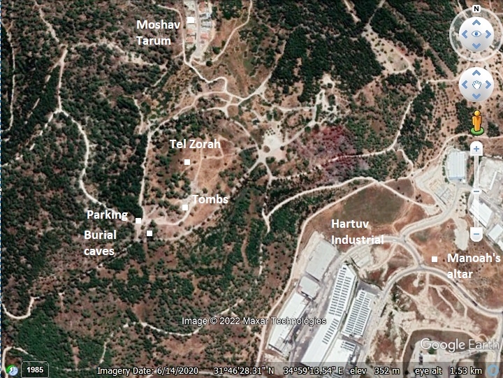
The following aerial view shows the points of interest. Tel Zorah (Tsor’ah) is located on a hill (alt. 375m) overlooking the area. Access to the Zorah park is from highway #44.
History:
- Bronze Age
Tribes of Israel: The area around Beth Shemesh was initially given to the tribe of Dan (Joshua 19 41): “And the coast of their inheritance was Zorah, and Eshtaol, and Irshemesh”.
Zorah was a Canaanite city during the Bronze Age.
Zorah is mentioned in one of the 14th century Tell Amarna letters. According to this letter, a Canaanite queen from one of the cities (perhaps the city-state of Beth-Shemesh) complained to Egypt’s pharaoh Amenhotep III the pharaoh that the two sons of Milkilu, king of Gezer, have been almost beaten to death by the Apiru [local bandits] while visiting Aijlon and Zorah.
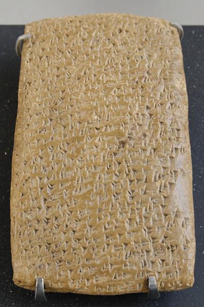
One of Tell Amarna letters (Louvre Museum, Public domain CC 2.5)
Cuneiform writing on a clay tablet.
The sites and roads during these periods are indicated on the Biblical Map below. Zorah is indicated in the center, north of Beth-Shemesh.
According to D. Dorsey (“Roads and Highways of ancient Israel”, p. 187), road “J5” from Jerusalem to the port city Yavne-Yam passed thru Nahal Kesalon (Chesalon), then westwards thru Eshtaol, passing thru Beth Shemesh west to Biblical Timnah along the valley of Sorek. A branch of the road, not indicated on the map, passed thru Zorah.
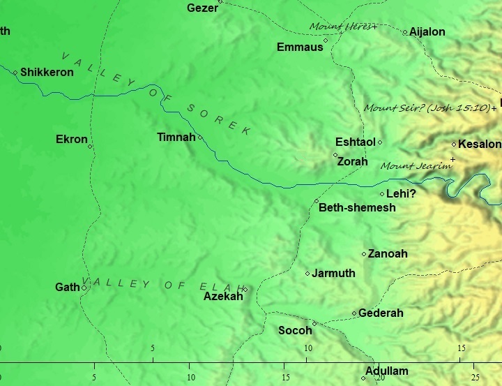
Area around Zorah – Biblical through Roman periods (based on Bible Mapper 3.0)
- Iron Age:
Judges period (12th-11th century BC): Recent excavations in the adjacent city of Beth Shemesh revealed Canaanite architecture and ceramics, but the study of the remains of animal bones indicated that the diet excluded pigs which imply an Israelite presence.
Samson:
During the 12th century the Philistines arrived to the cities along the shore. Beth Shemesh and the villages around the Sorek valley were located on the border with the Philistines, and were affected by their push from the shore eastwards into the land of Judah.
Their conflict with the Israelites started in the mid 11th century BC, and one of the stories associated with this conflict is the heroism of Samson of the tribe of Dan, who was born in Zorah. His father was Manoah – belonging to the tribe of Dan (Judges 13:1):
“And there was a certain man of Zorah, of the family of the Danites, whose name was Manoah”.
Although Manoah’s wife was barren, an angel instructed the parents to offer a sacrifice on an altar, then Samson was born (Judges 13:24):
“And the woman bare a son, and called his name Samson: and the child grew, and the LORD blessed him.”
The mighty Samson was a judge for 20 years. The name Samson means “man of the Sun”, so even his name is related to Beth Shemesh – the “house of the sun”.
Samson slaying the Lion –
drawing by Gustav Dore (French artist, 1832-1883)
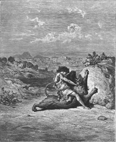
Samson caused much trouble to the Philistines through heroic acts against their cities.
In one instance, Samson attacked Gaza and tears down the doors of the city gate, as illustrated below (Judges 16: 1-3):
“Then went Samson to Gaza, and saw there an harlot, and went in unto her. And it was told the Gazites, saying, Samson is come hither. And they compassed him in, and laid wait for him all night in the gate of the city, and were quiet all the night, saying, In the morning, when it is day, we shall kill him. And Samson lay till midnight, and arose at midnight, and took the doors of the gate of the city, and the two posts, and went away with them, bar and all, and put them upon his shoulders, and carried them up to the top of an hill that is before Hebron”.
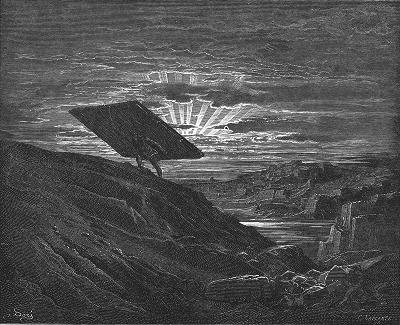
Samson carries the doors of the gate of Gaza – Drawing by Gustav Dore
After giving up their attempts to capture him, they bribed his 3rd wife Delilah to learn the secret of his strength.
Following several failed attempts to give up his secret to Delilah, Samson finally revealed it to Delilah: Samson kept a vow of growing his hair as a devotion to God (Judges 16: 17):
“That he told her all his heart, and said unto her, There hath not come a razor upon mine head; for I have been a Nazarite unto God from my mother’s womb: if I be shaven, then my strength will go from me, and I shall become weak, and be like any other man”.
After she cut his hair, the weakened hero was captured. The Philistines then blinded Samson, and carried away him to Gaza (Judges 16: 21-23):
“But the Philistines took him, and put out his eyes, and brought him down to Gaza, and bound him with fetters of brass; and he did grind in the prison house. Howbeit the hair of his head began to grow again after he was shaven. Then the lords of the Philistines gathered them together for to offer a great sacrifice unto Dagon their god, and to rejoice: for they said, Our god hath delivered Samson our enemy into our hand”.
Samson was then moved from the prison to the Philistine temple of Dagon in Gaza. Samson then knocks the temple down, uttering his famous last words (Judges 16: 29-20):
“And Samson took hold of the two middle pillars upon which the house stood, and on which it was borne up, of the one with his right hand, and of the other with his left. And Samson said, Let me die with the Philistines. And he bowed himself with all his might; and the house fell upon the lords, and upon all the people that were therein. So the dead which he slew at his death were more than they which he slew in his life”.
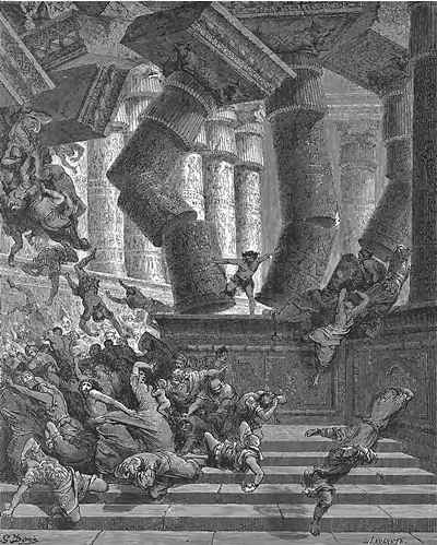
Death of Samson in Gaza – Drawing by Gustav Dore (French artist, 1832-1883)
Samson was the last judge of the ancient Israelites before the institution of the monarchy.
- Judean Kingdom
Rehoboam King of Judea fortified the city (2 Chron. 11:5-12):
“And Rehoboam dwelt in Jerusalem, and built cities for defence in Judah. He built Bethlehem, and Etam, and Tekoa, … and Zorah, and Aijalon, and Hebron, which are in Judah and in Benjamin fenced cities. And he fortified the strong holds, and put captains in them, and store of victual, and of oil and wine. And in every several city he put shields and spears, and made them exceeding strong, having Judah and Benjamin on his side”.
The city was destroyed by the Babylonians. The returnees from the exile built Zorah (here: Zareah) once again (Nehemiah 11: 25, 29):
“And for the villages, with their fields, some of the children of Judah dwelt at … Enrimmon, and at Zareah, and at Jarmuth”.
- Later periods
The village continued until the Roman and Byzantine periods.
Eusebius Pamphili (better known as Eusebius of Caesarea), a 4th Century Greek historian of the Church, wrote in his book “Onomasticon” about the village he knew at his times (translated):
“Saraa – Village in the boundary of Eleutheropolis, (about) ten miles north on the road to Nicopolis. (In) tribe of Dan or Juda.”.
- Ottoman period – PEF survey
The village was resettled in the 16th century, and named Sar’a/Surah. The name of the village preserved the ancient name and settled on top of it.
The area was examined in the Palestine Exploration Foundation (PEF) Survey of Western Palestine (SWP), conducted 1866-1877 by Wilson, Conder and Kitchener. A section of their map is shown here, with the Arab village of Surah located on the ruins of the ancient Zorah.
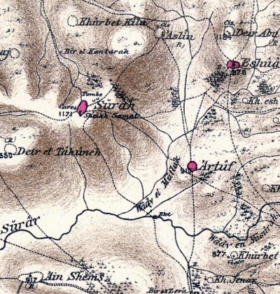
Part of Map Sheet 17 of Survey of Western Palestine, by Conder and Kitchener, 1872-1877.
(Published 1880, reprinted by LifeintheHolyLand.com)
The surveyors wrote about the site (SWP, Vol 3, p.26-27):
“Surah (J t).—A village of moderate size on a low hill. The hill is bare and white, but there are olives lower down the slopes to the north and east. On the north in a tributary valley is a well. On the south side of the village is a small Mukam, with a dome, standing in a conspicuous position above the broad Hat valley (Wady es Surar). It is dedicated to Neby Samat. There are rock-cut tombs to the north-east and south of the village. The village obtains its water supply from a spring called ‘Ain el Mardum, half a mile to the south, at the foot of the hill. Surah is the ancient Zorah (Joshua xv), the home of Samson. Traditions connect Neby Samat with Samson, and the tomb seems to be that shown to Isaac Chelo as Samson’s in 1334 A.D. Zorah is placed by the ‘ Onomasticon’ (s.v. Saara) about 10 Roman miles north of Eleutheropolis. Surah is about 12 English miles from Beit Jibrin (Eleutheropolis)”.
An old photo of the Neby Samat tomb (aka Samson’s tomb) was captured in the following photo, showing some of the women of Surah carrying water jugs on their heads. The structure is now gone.
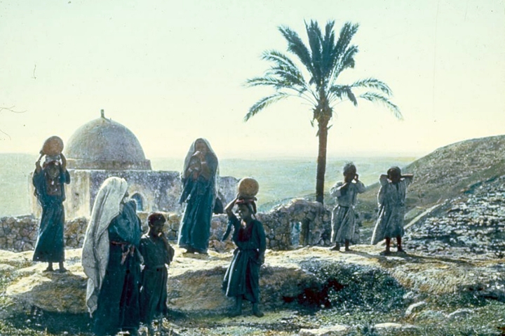
Neby Samat – 1900-1920 – Matson collection – Photos LOC
- British Mandate
A 1940s British map shows the area around the site, marked here as Sar’a. The major roads in and out of the village were added for clarification.
A east-west Biblical road (marked as dashed line) passed from Ishwa’ (Eshtaol) to Rafat.
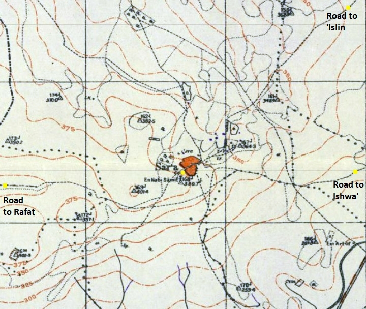
British survey map 1942-1948 – https://palopenmaps.org topo maps
License: public domain under the UK Copyright, Designs and Patent Act 1998
The Arab village was captured and destroyed during the independence war of 1948.
- Modern time
Zorah forest (Ya’ar Tsor’ah) is a large KKL park and welcomes visitors. You can drive up to Tel Zorah and walk up to visit the tombs of Samson and his father, and tour the ancient site.
Photos:
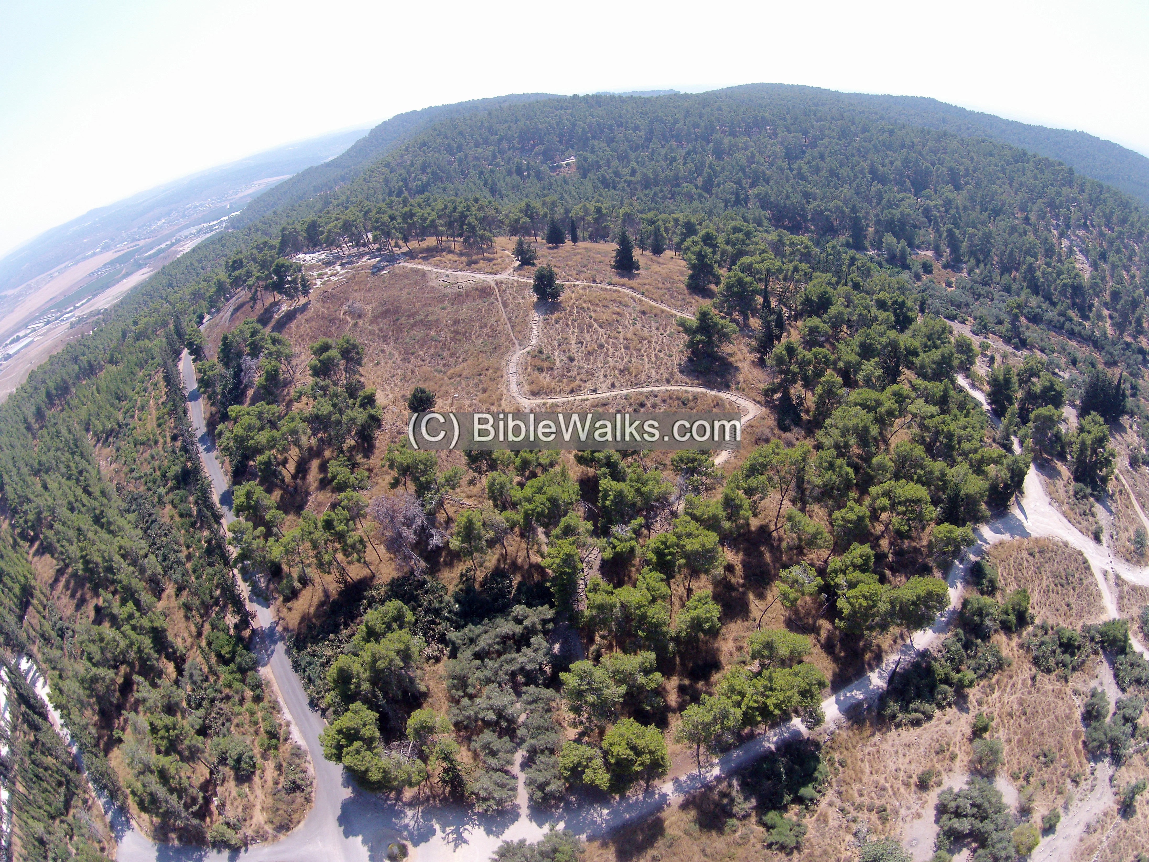
(a) Aerial Views
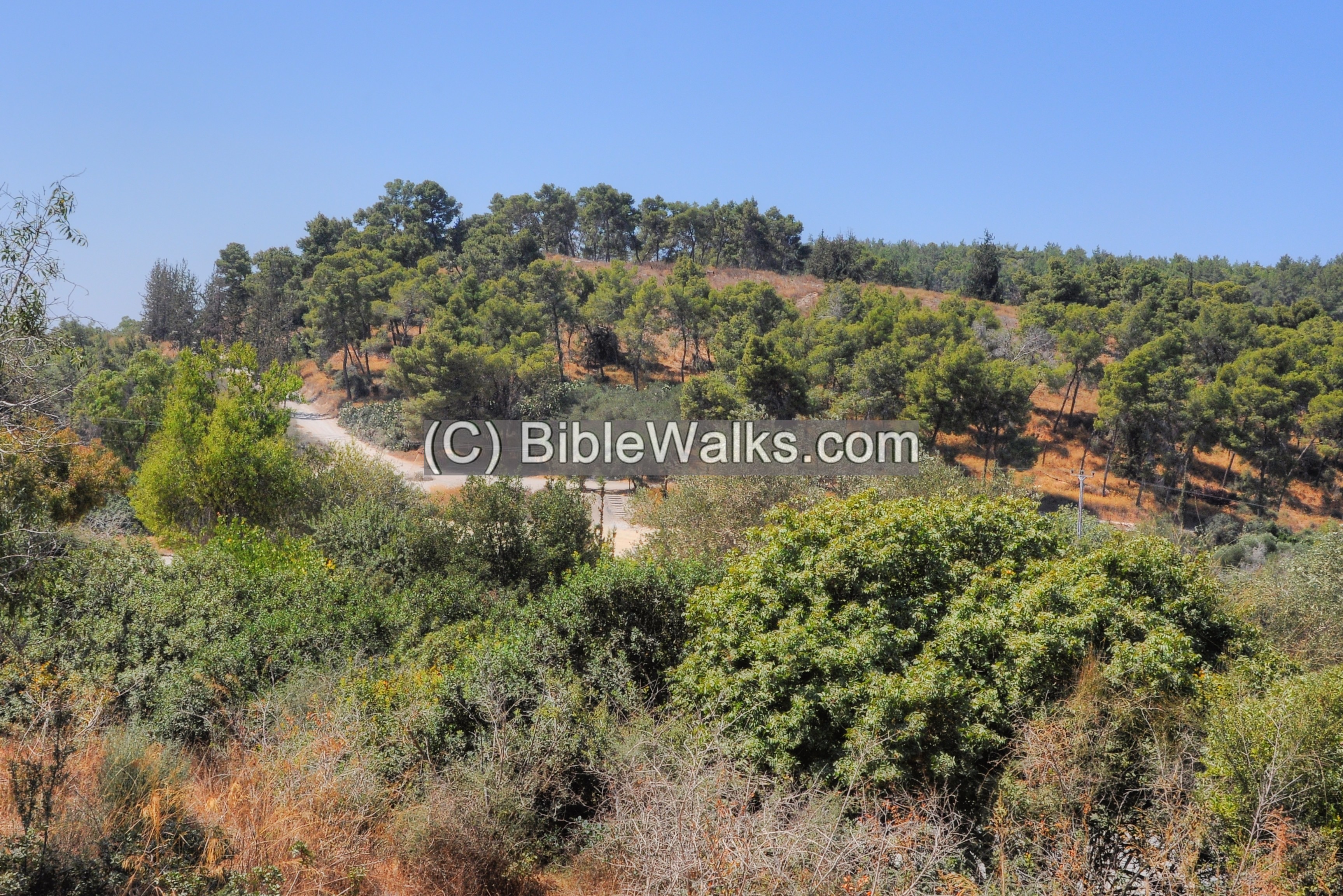
Tel Zovah is located on a hill. This view is from the north east side. A trail ascends the foothills to the summit.
The brown area between the trees is where the ancient Roman town was once located. This is also where the residential houses of the Arab village of Sara’a were once located.
A paved access road, seen on the left side, leads along the eastern foothills to the parking place on the south side.
Click on the photos to view in higher resolution…
Another view is from the south side of the hill, where the tombs of Samson and his father are located.
(b) Tel Zorah
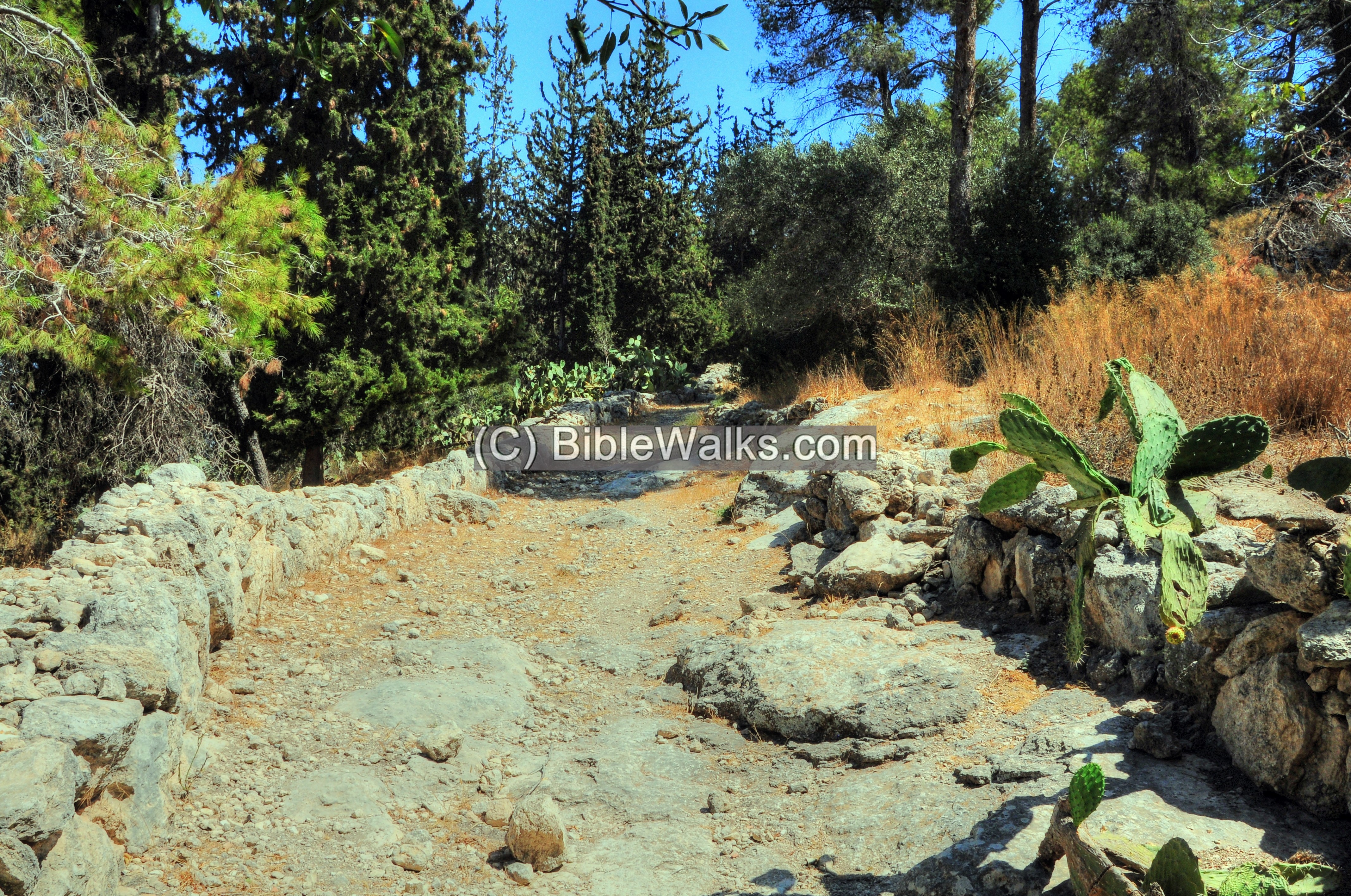
Ruins of the ancient city and the Arab village are located on the steep hill. It is best accessed from the southern parking area, accessible by a road on the eastern side of the hill.
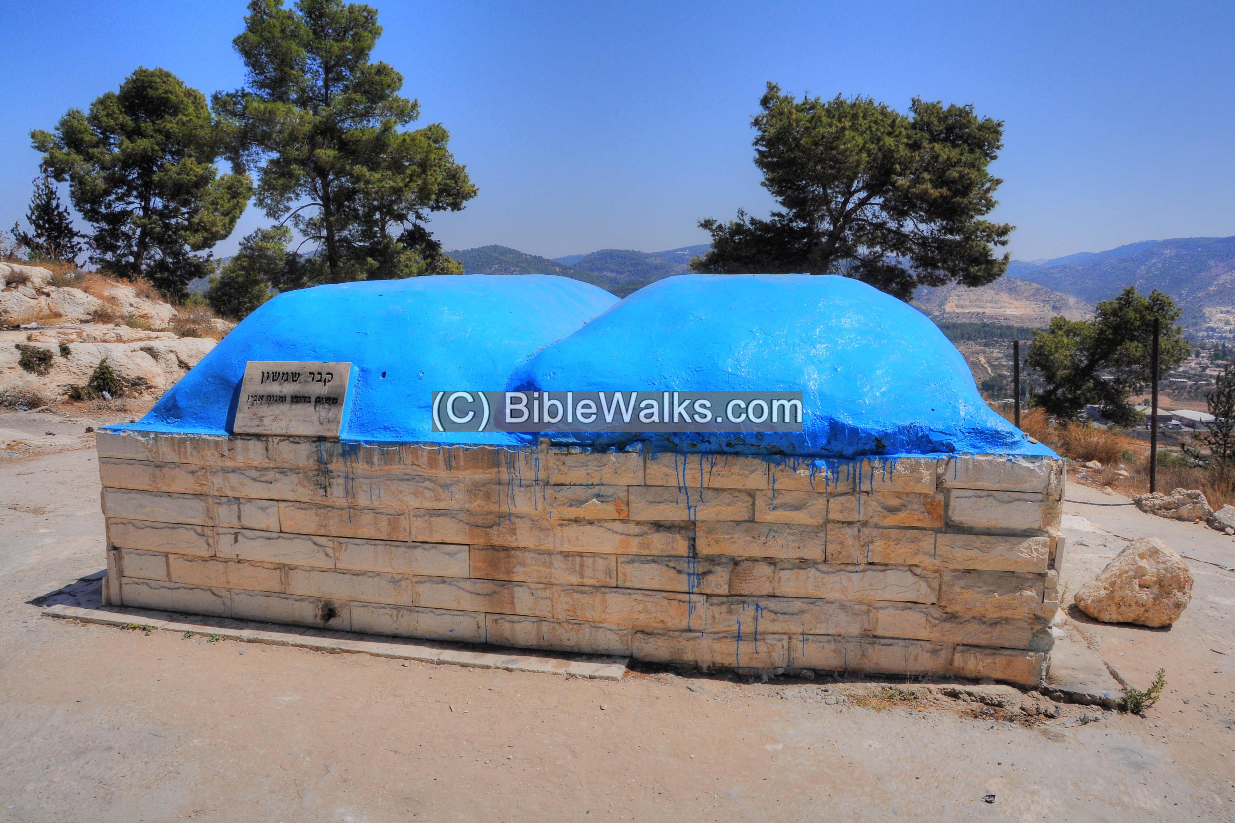
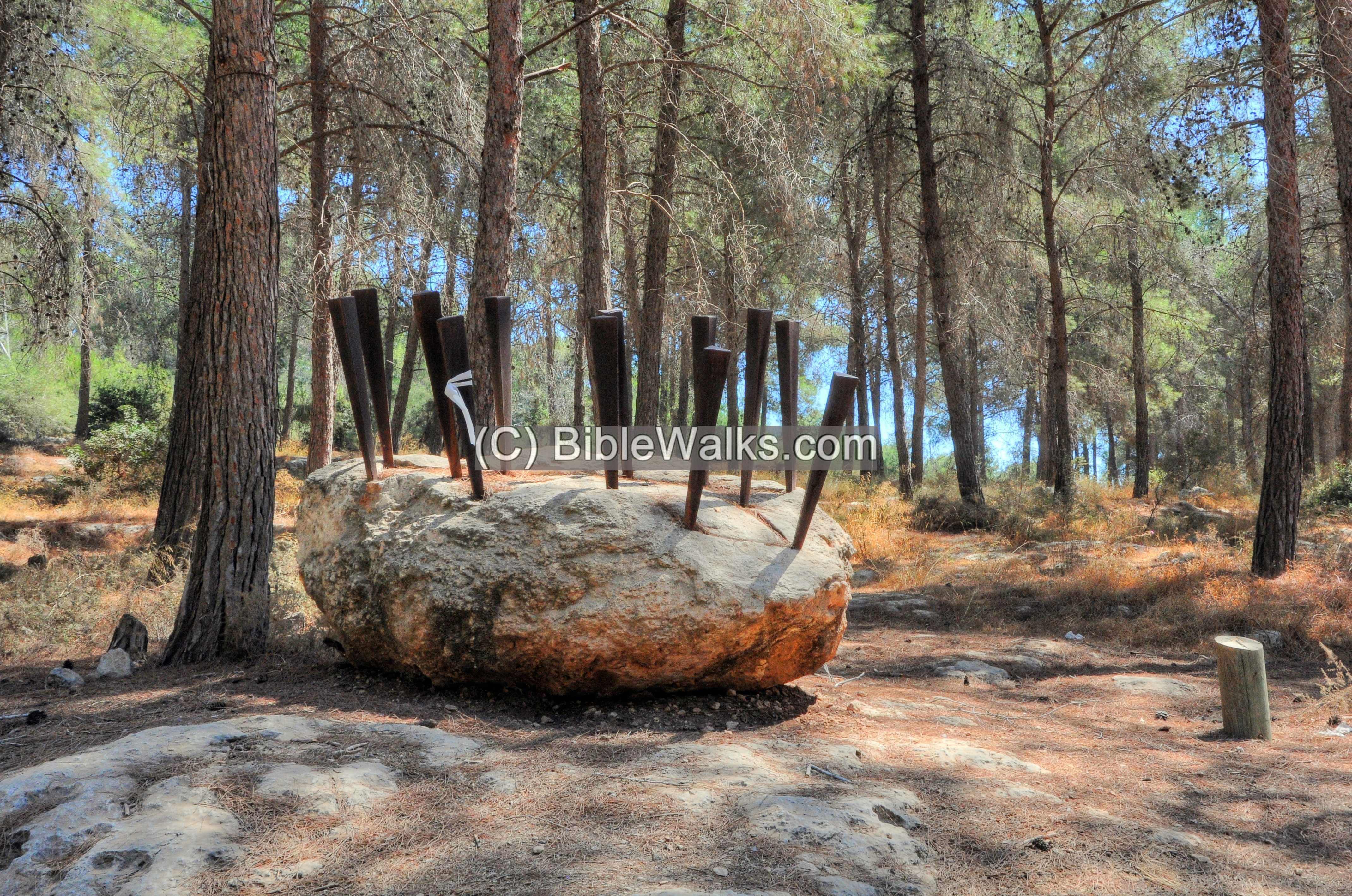
At the entrance to the trail is one of the sculptures that are on display in the park. An inscription in Hebrew points to Samson’s tomb (קבר שמששון).
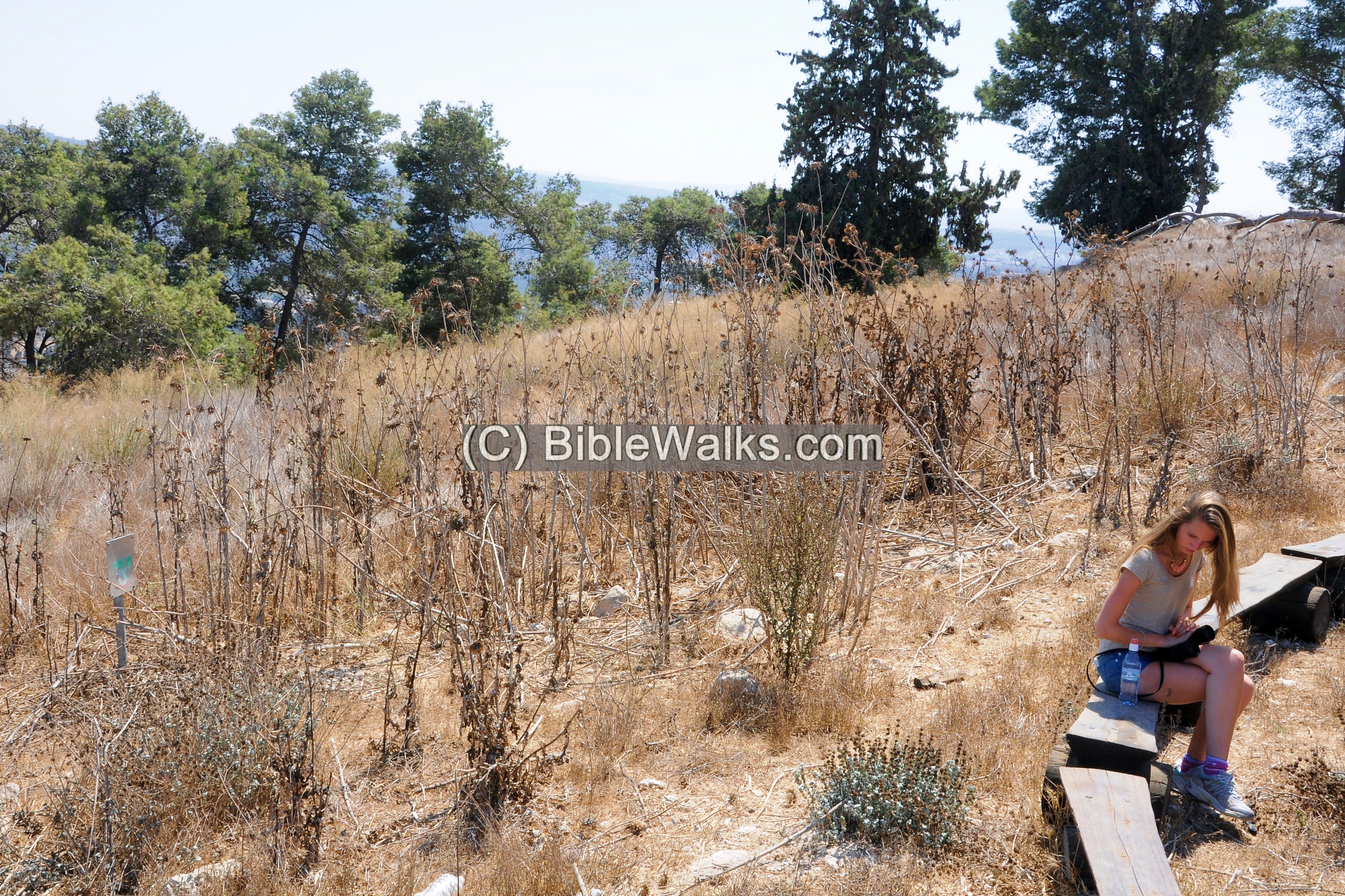
Along the foothills are many rock cut tombs.
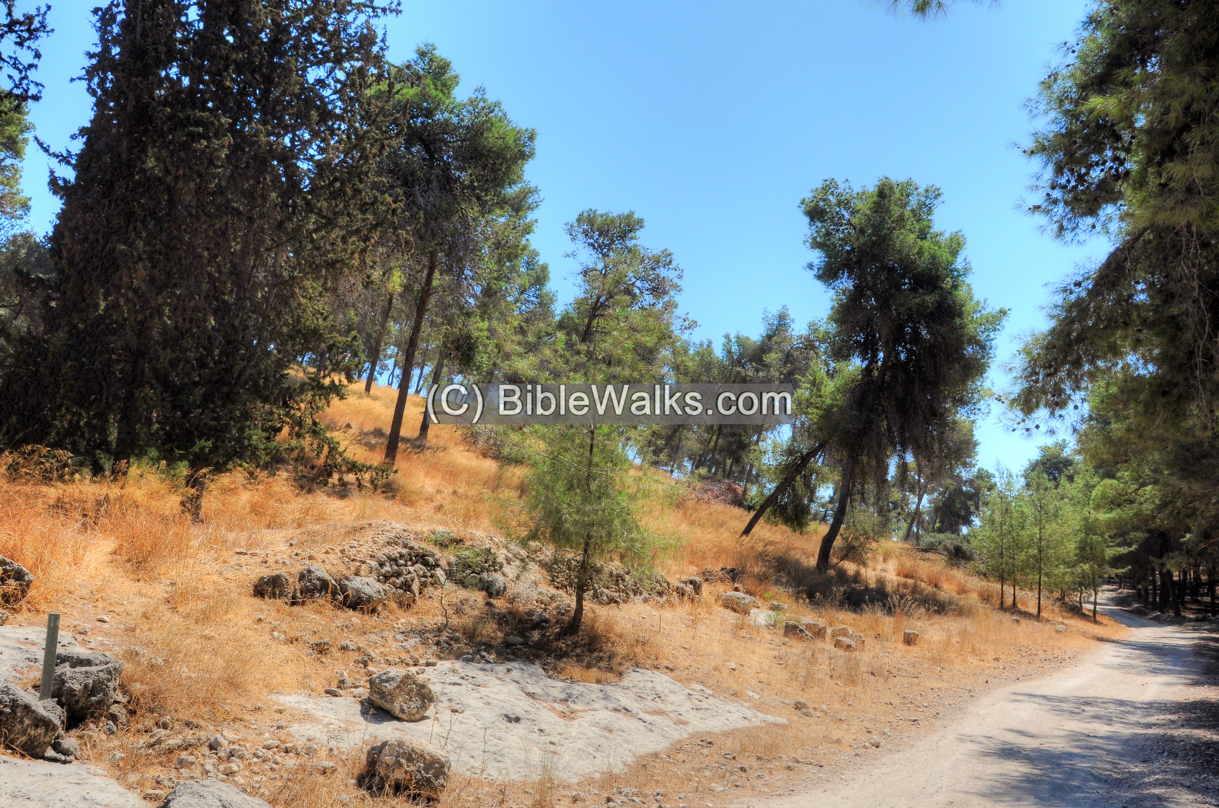
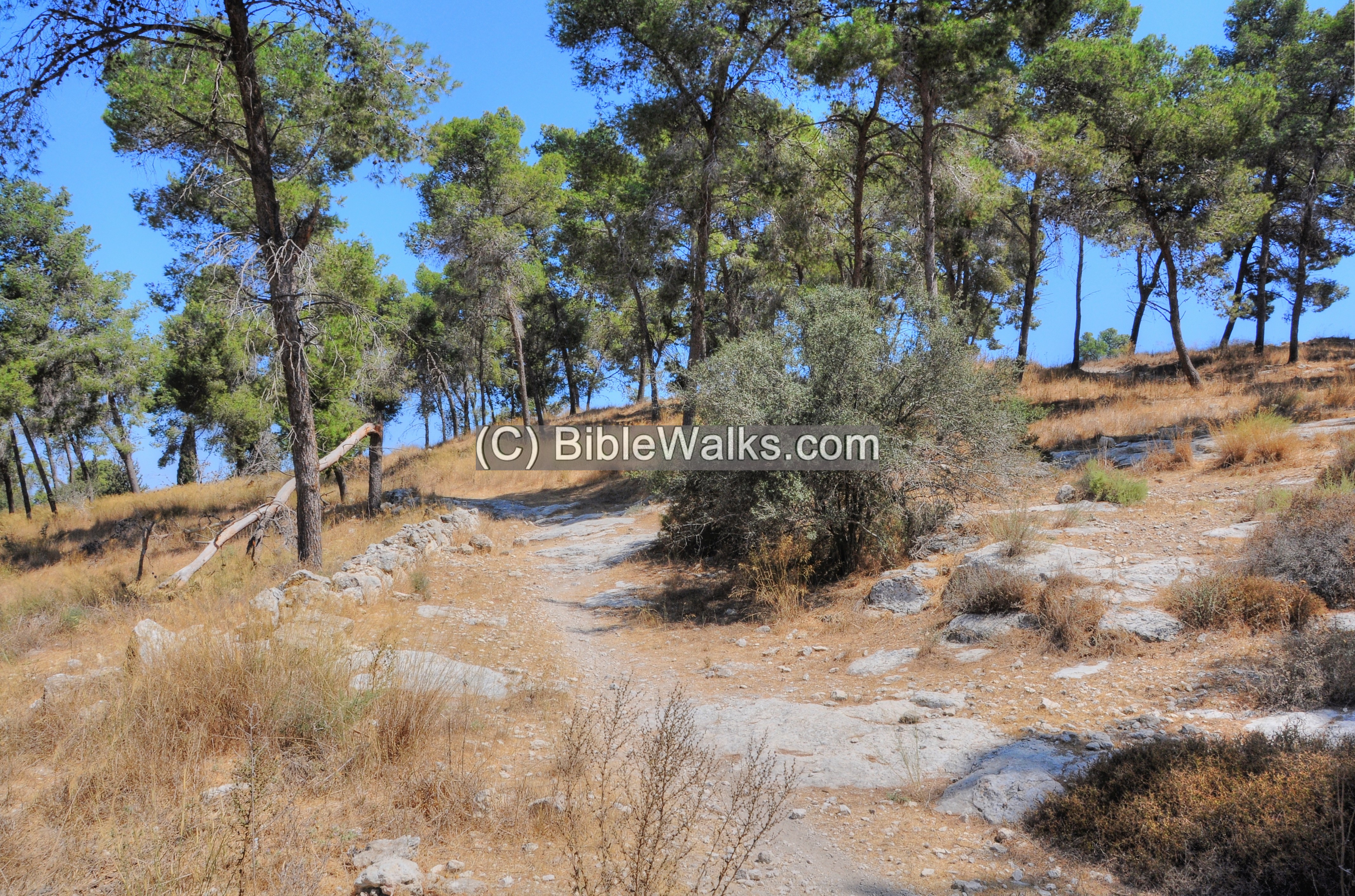
The access trail leads up to the summit.
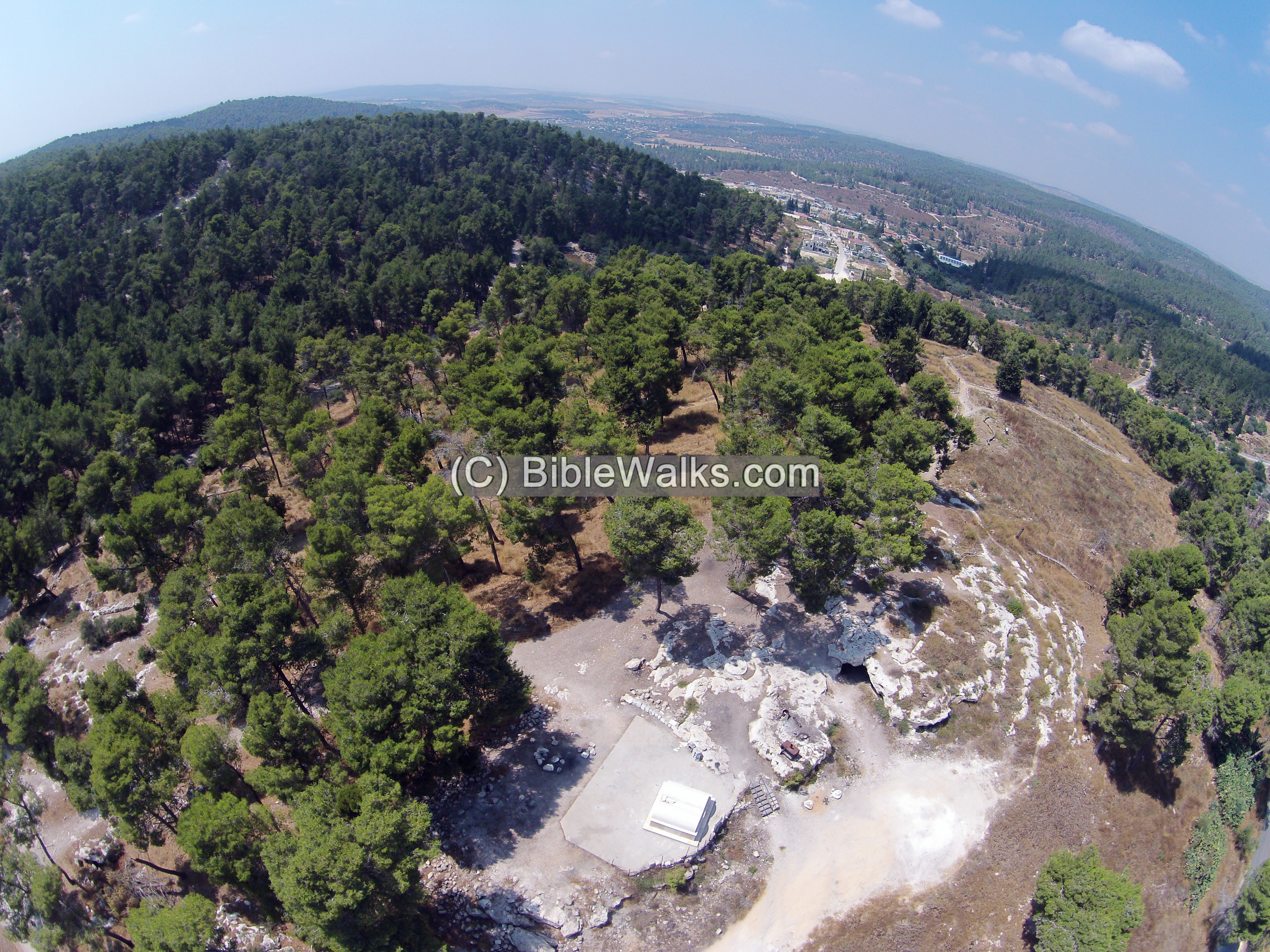
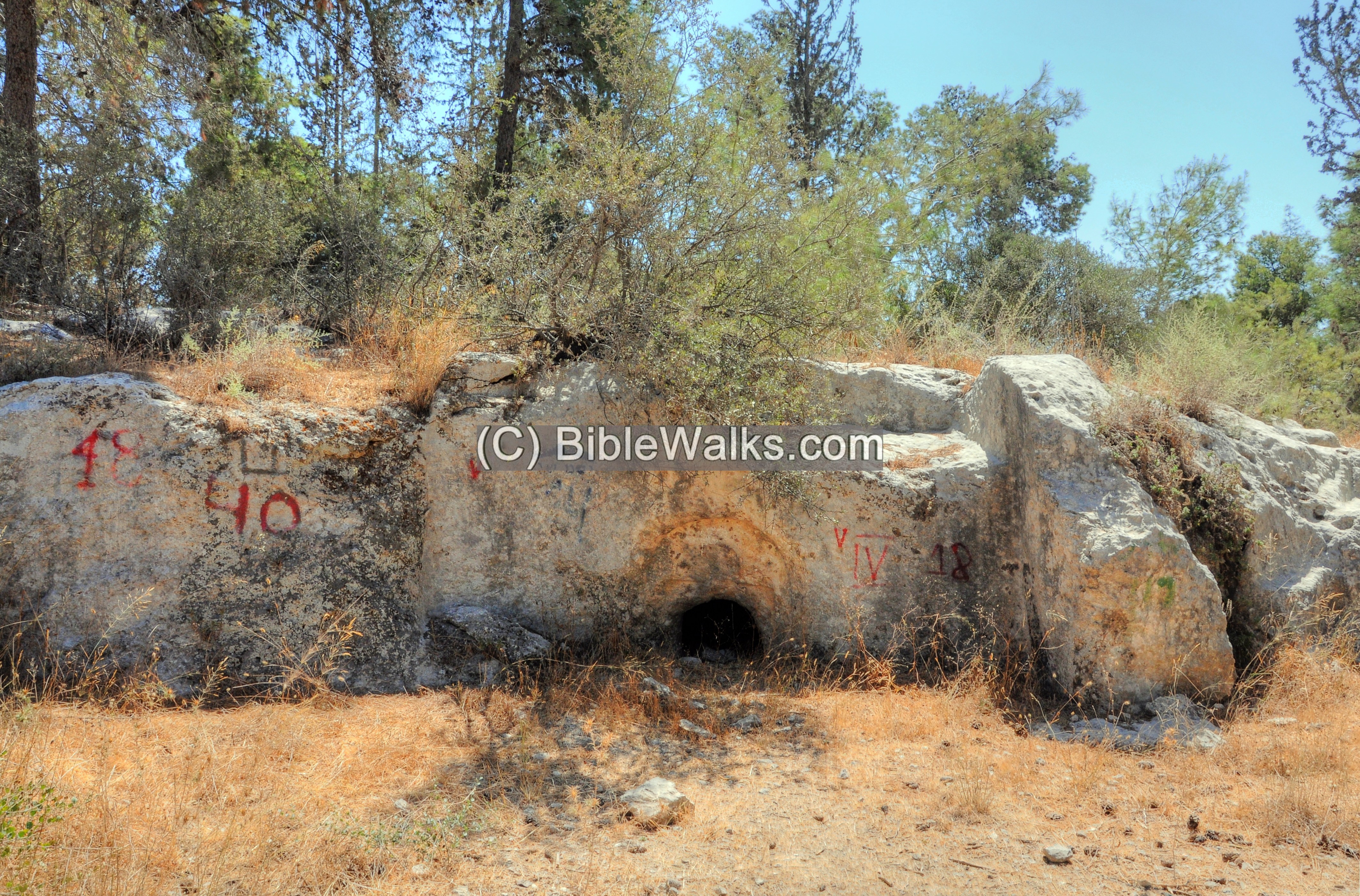
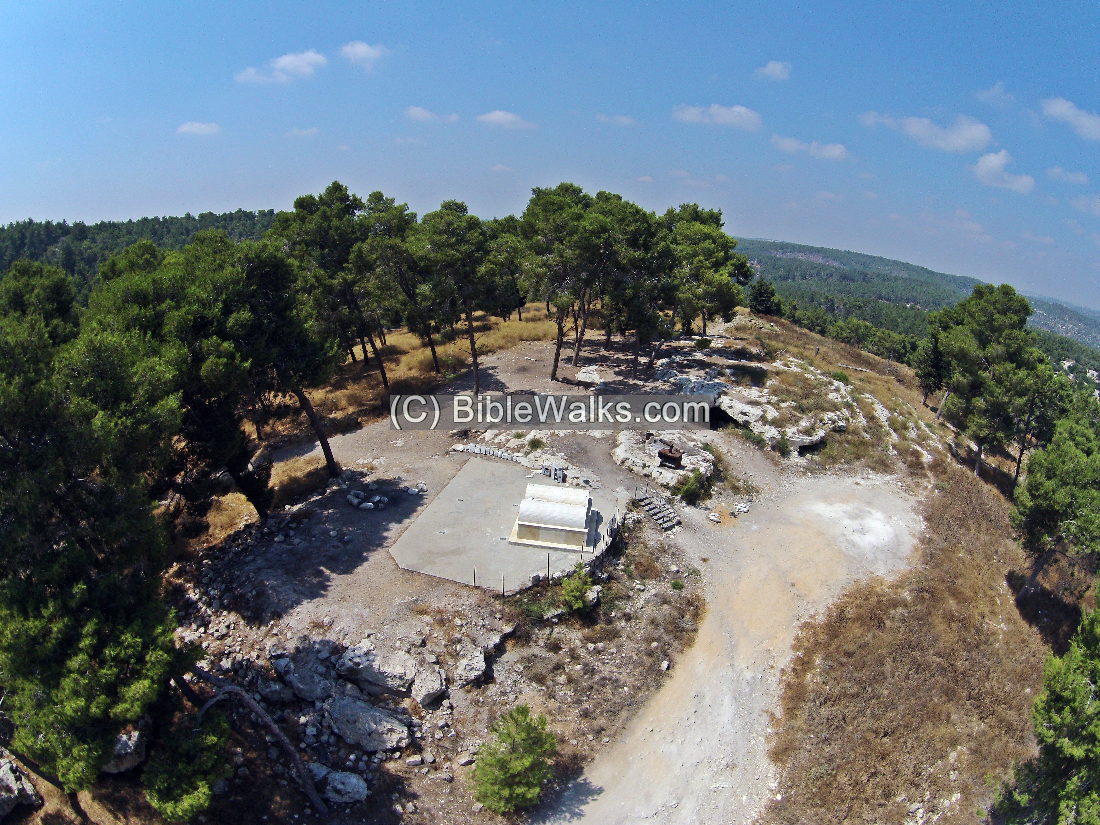
(c) Summit
An aerial view of the summit is in this drone view. The twin tombs are seen in the center. Caves and rock-cut installations are located around it.
The twin caves are now painted light blue. They are considered as the tombs of Samson and his father Menoah. According to the Bible, they are buried together (Judges 16:31):
“Then his brethren and all the house of his father came down, and took him, and brought him up, and buried him between Zorah and Eshtaol in the burying place of Manoah his father…”.
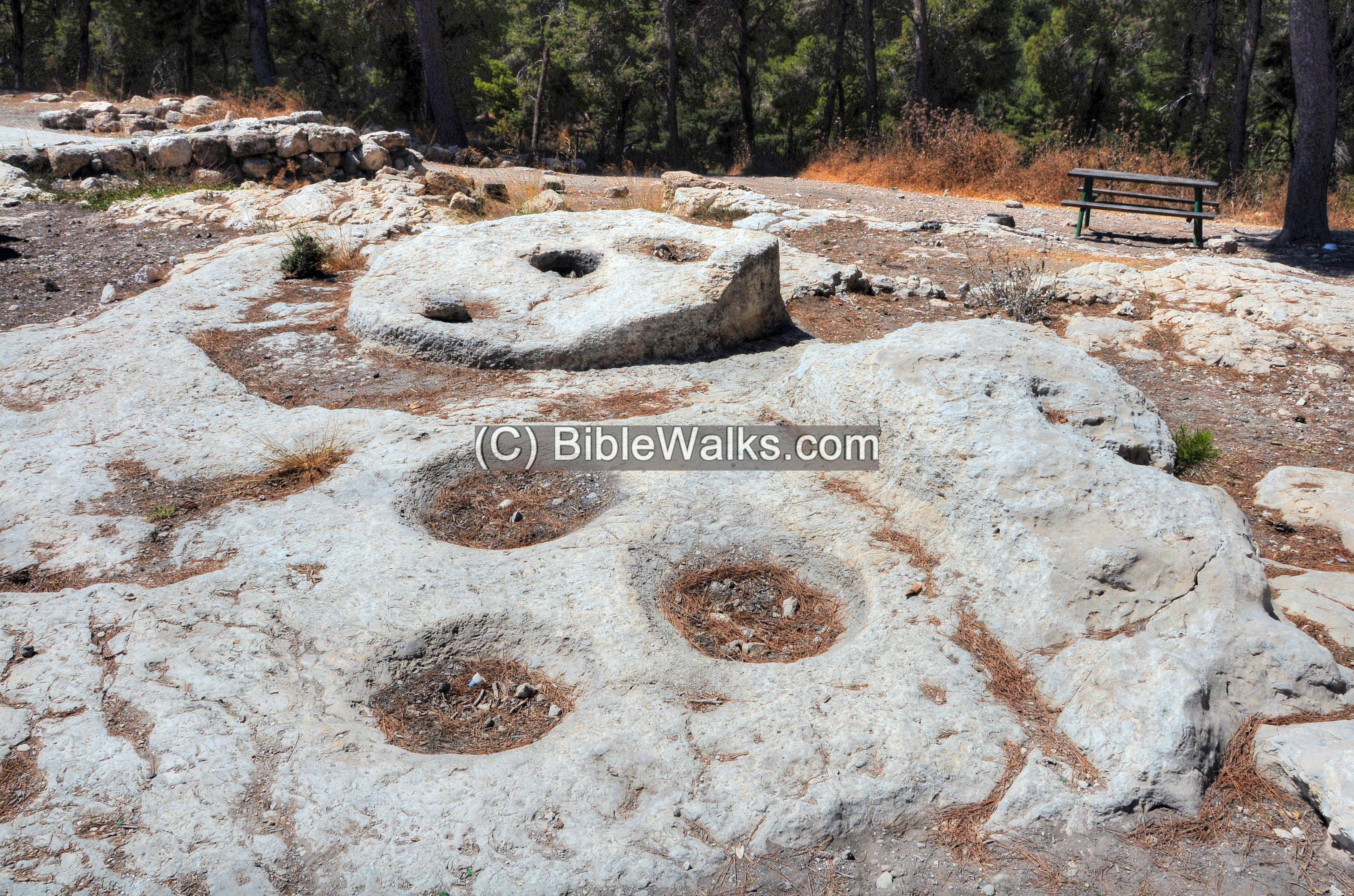
There are several caves here. One of them was used by the Arab villages for an oil press.
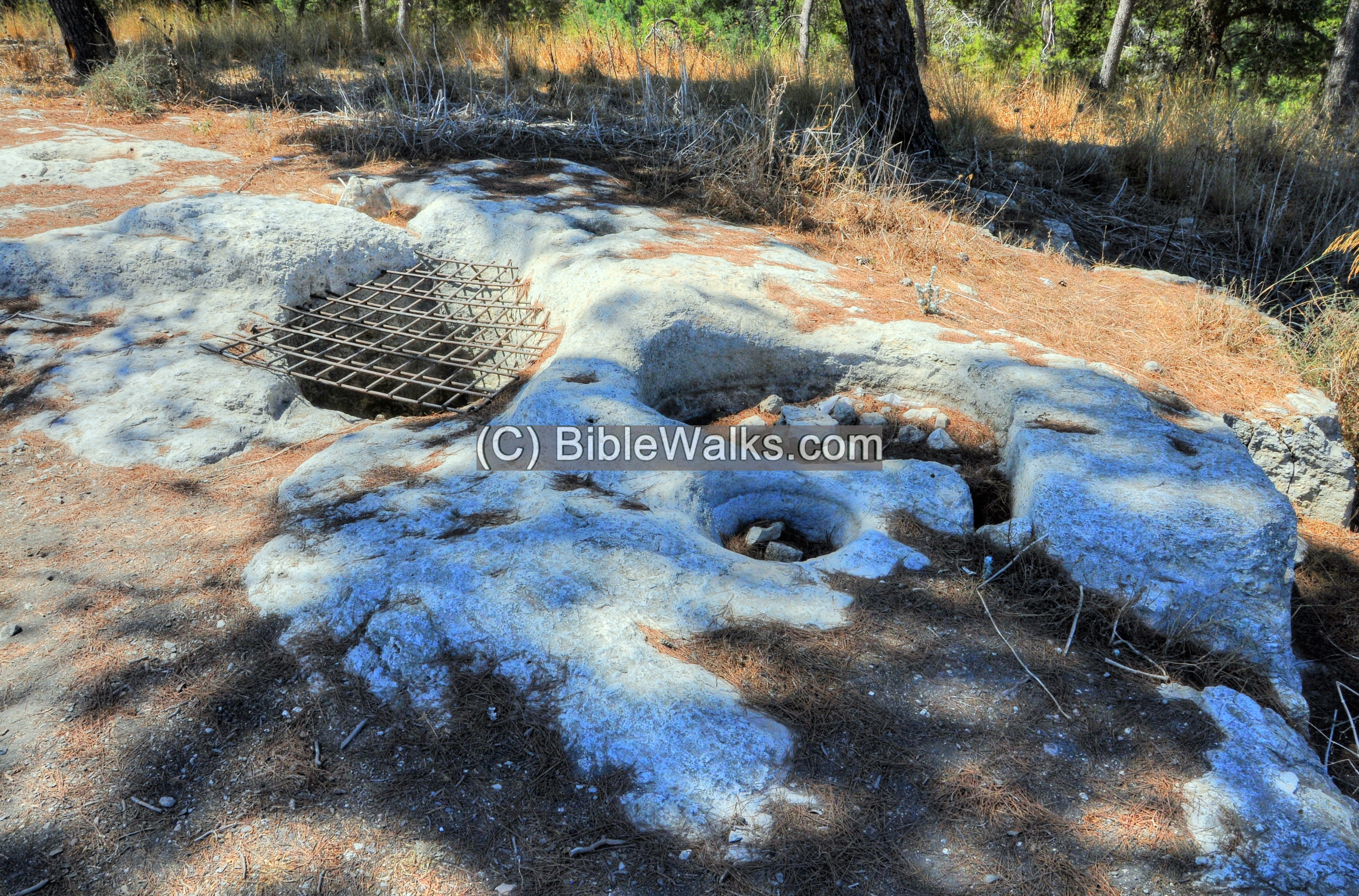
A winepress, with a mosaic floor, is also cut into the rock floor:
Other cup marks and cisterns are seen on the rock:
The ruins of the Arab village are scattered on the northern foothills.
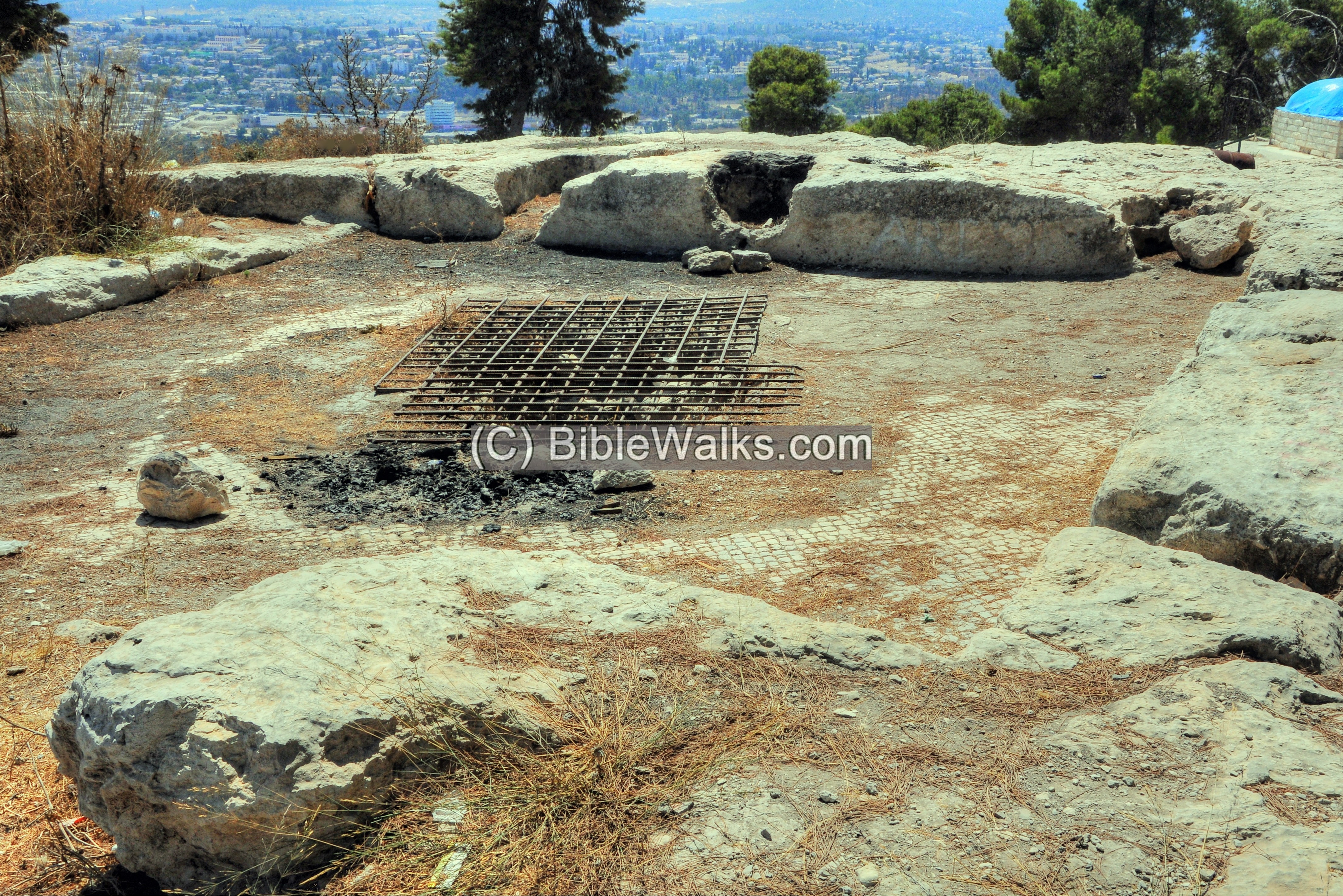
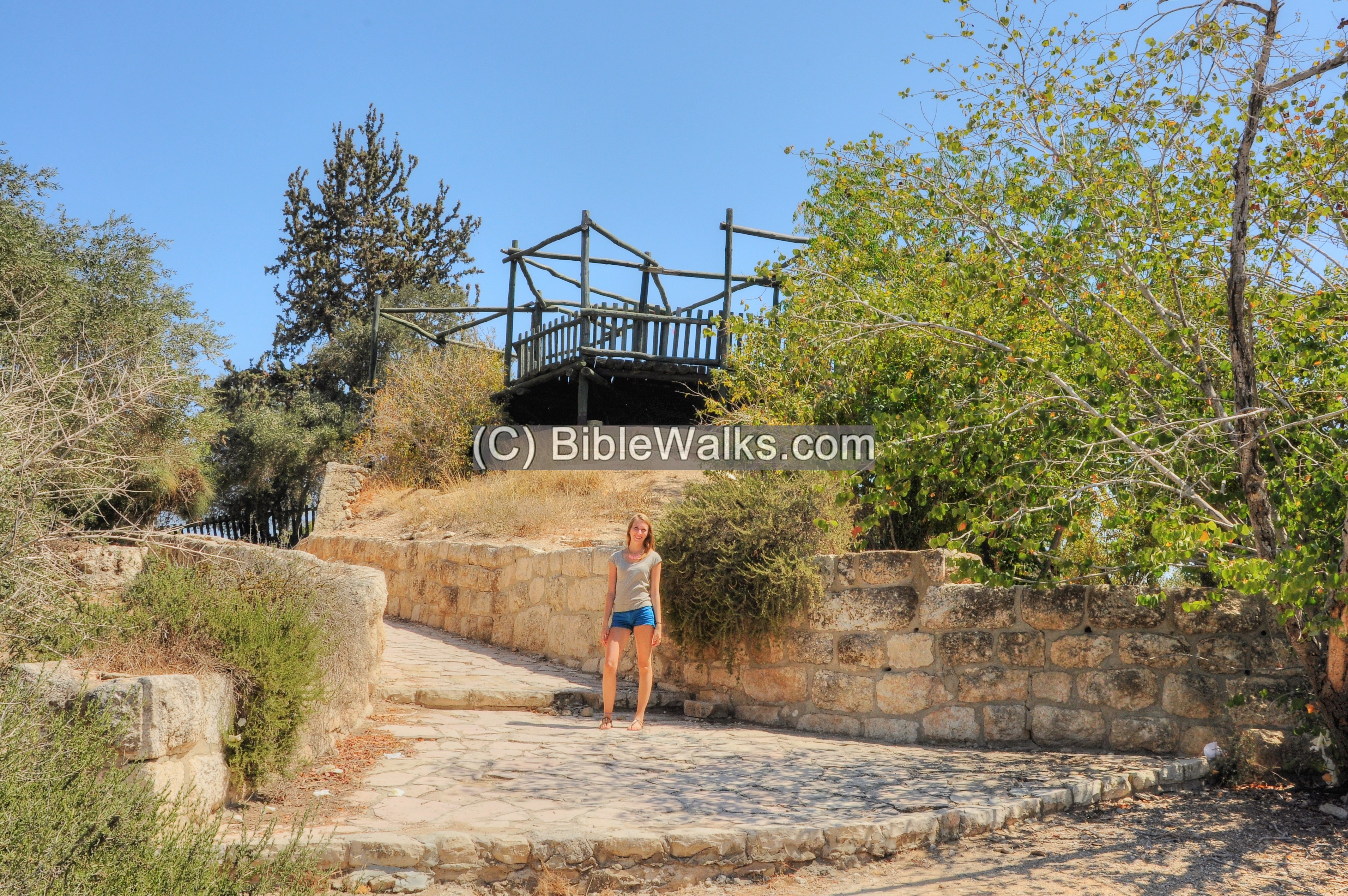
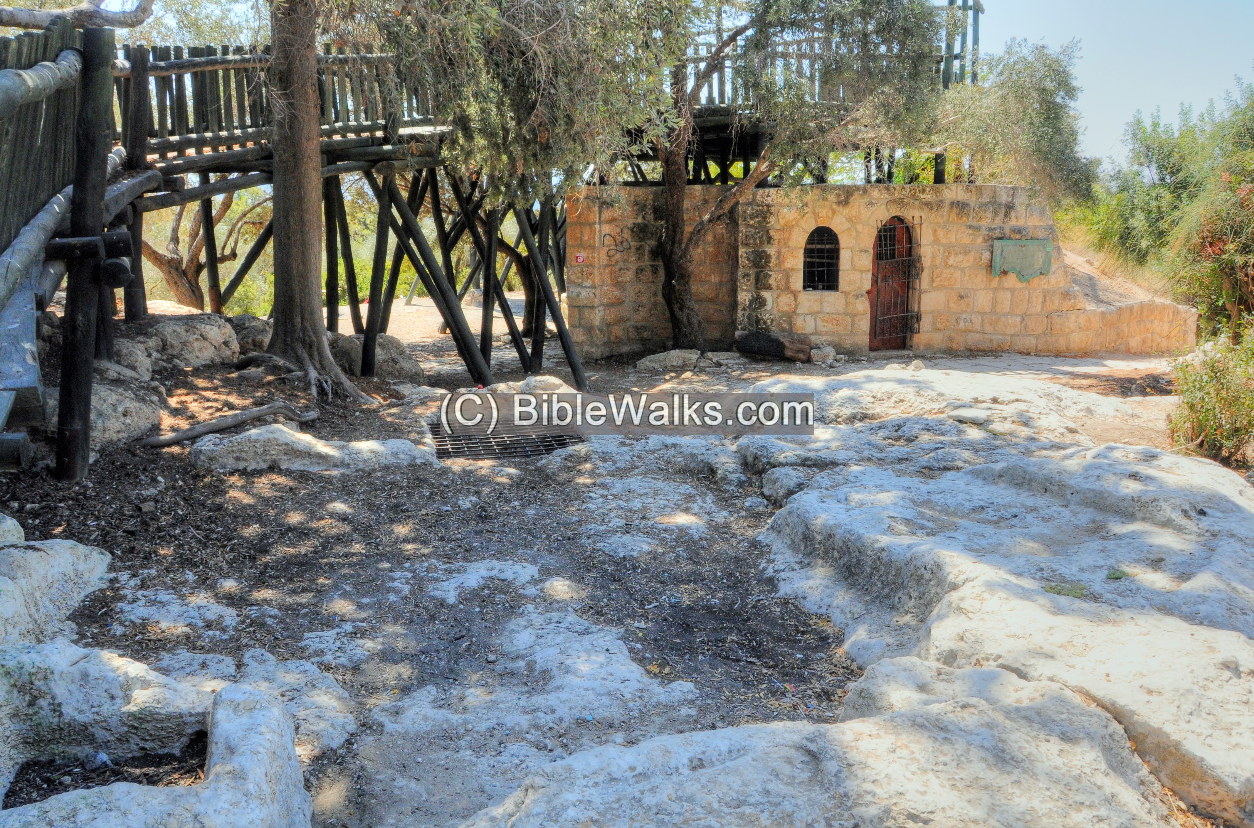
(d) The Mukhtar’s house
North of the hill are the remains of the Mukhtar’s two-levels house – the only remaining structure from the Arab village.
Two rock cut wine press installations and cisterns are found around the structure – remains of the Roman/Byzantine village.
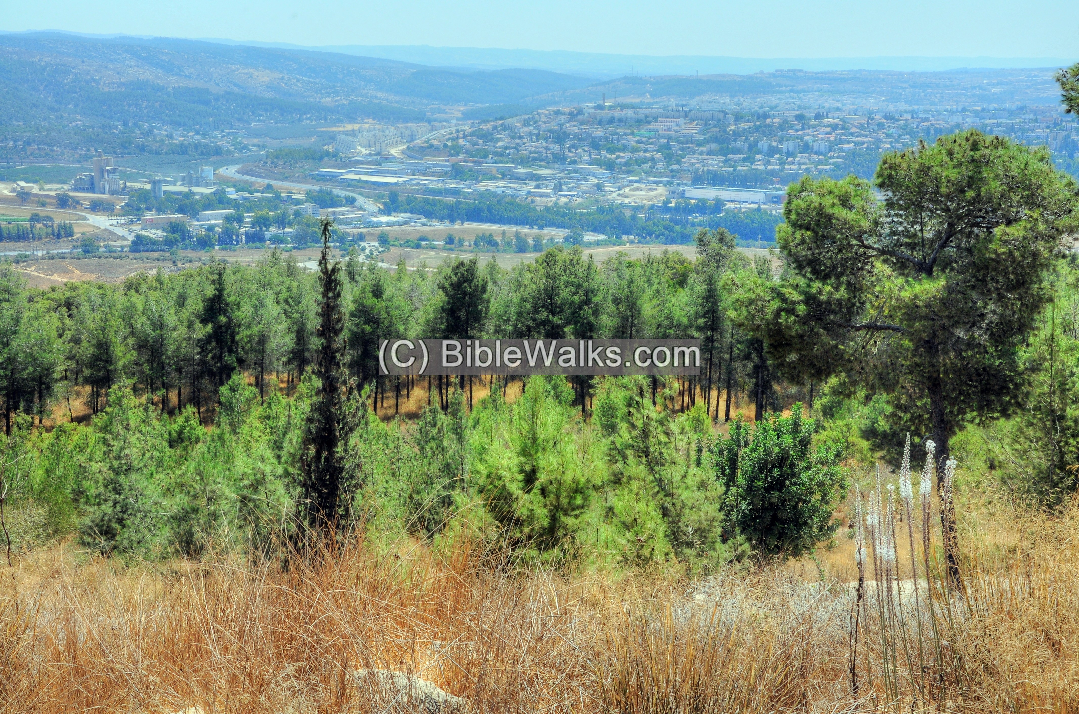
An observation terrace was constructed on top of the house. From there are great views of the area.
This is the view of north side of Tel Zorah.
Another view is towards the south east. In the far background is the modern city of Beit Shemesh.
(e) The Park
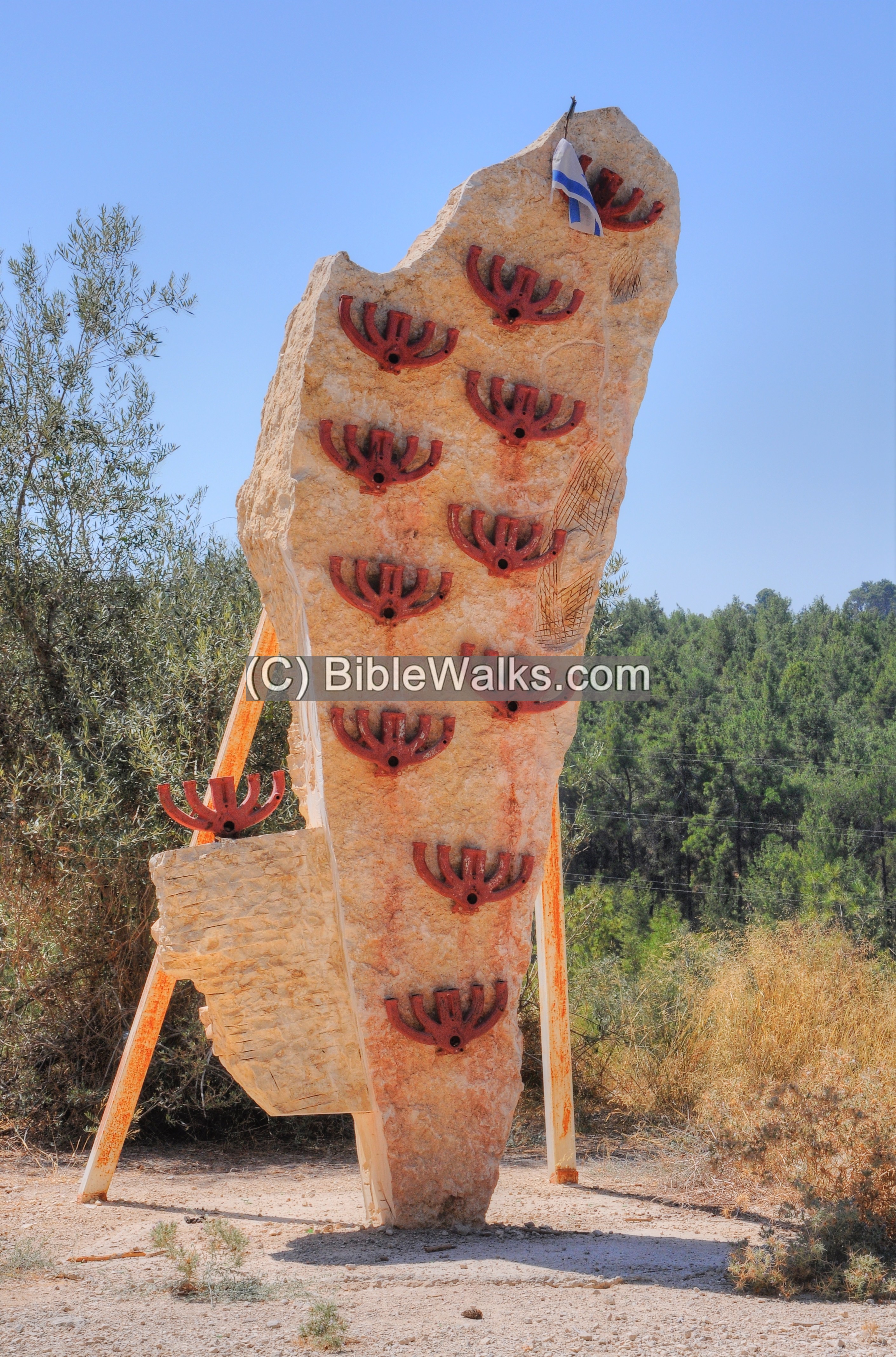
Along the park road that leads to the site are dozens of sculptures.
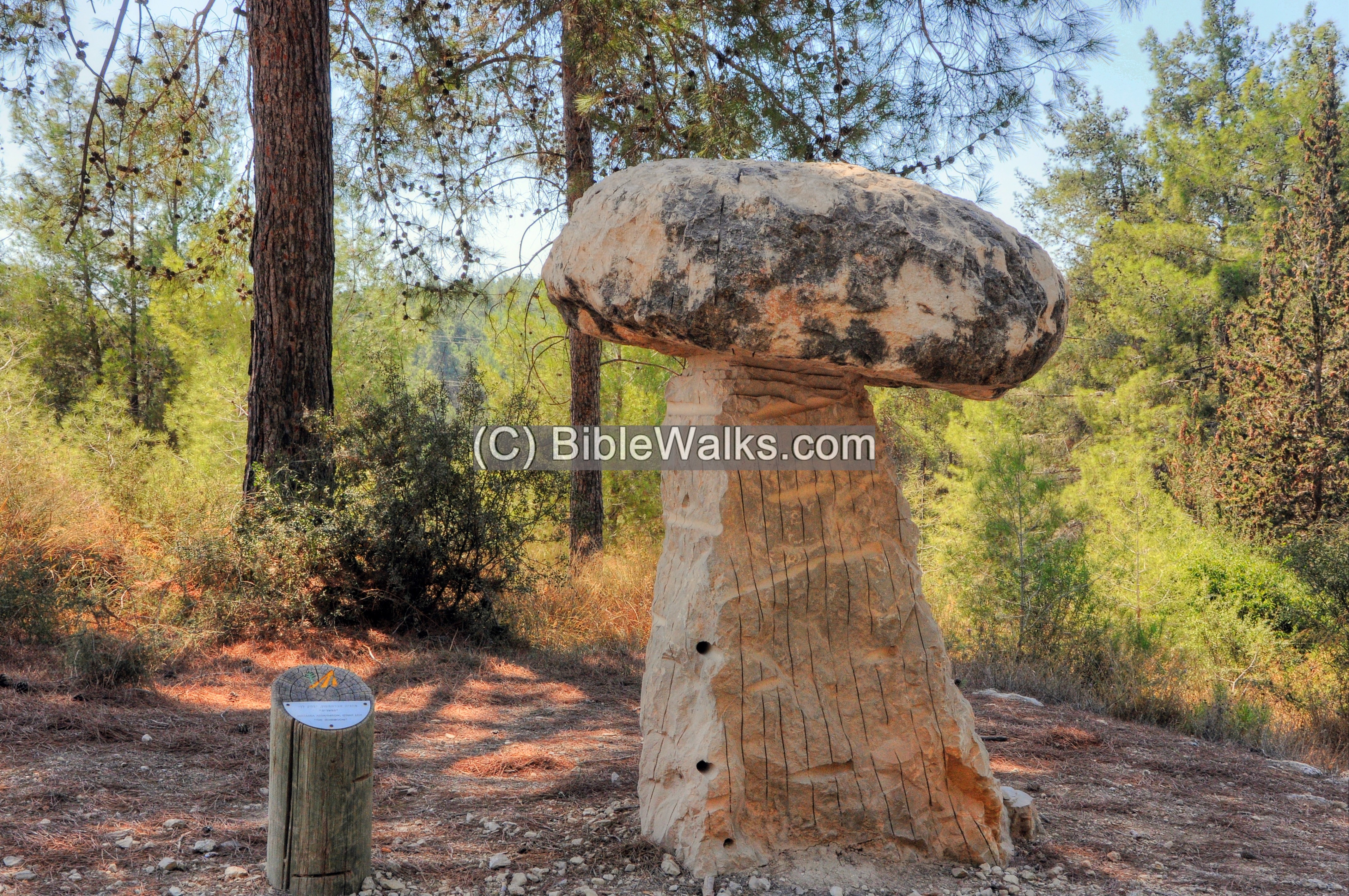
Another sculpture:
In addition to the sculptures are picnic tables and even a basketball court.
Walking trails crisscross the park.
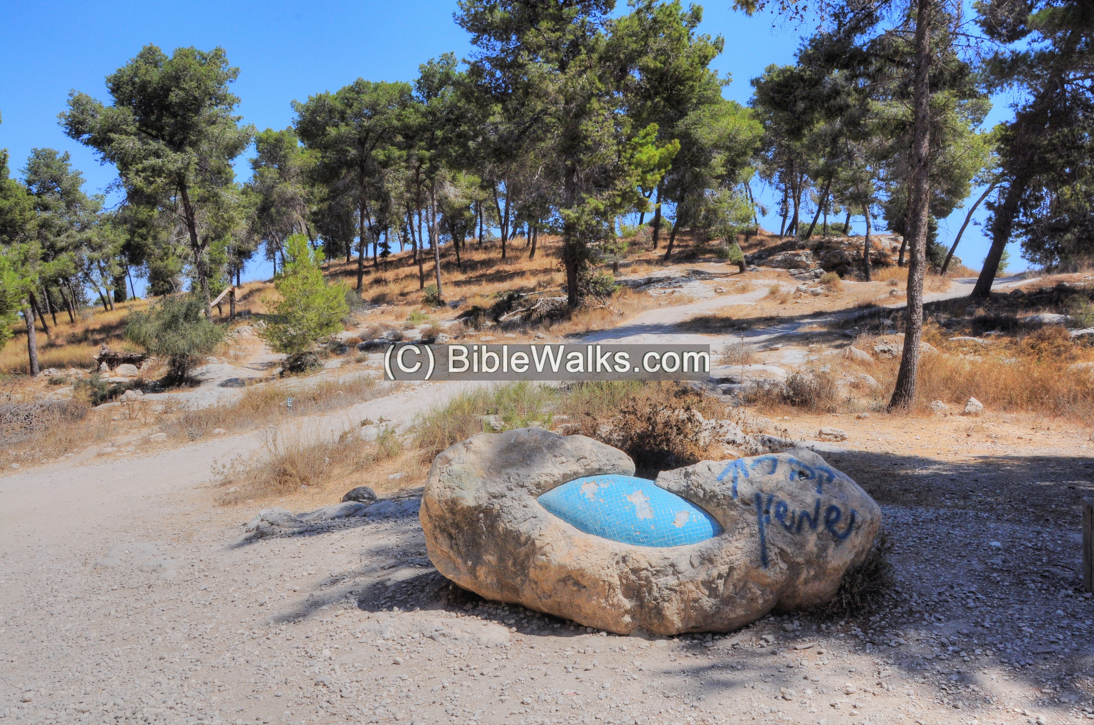
(f) Menoah’s altar
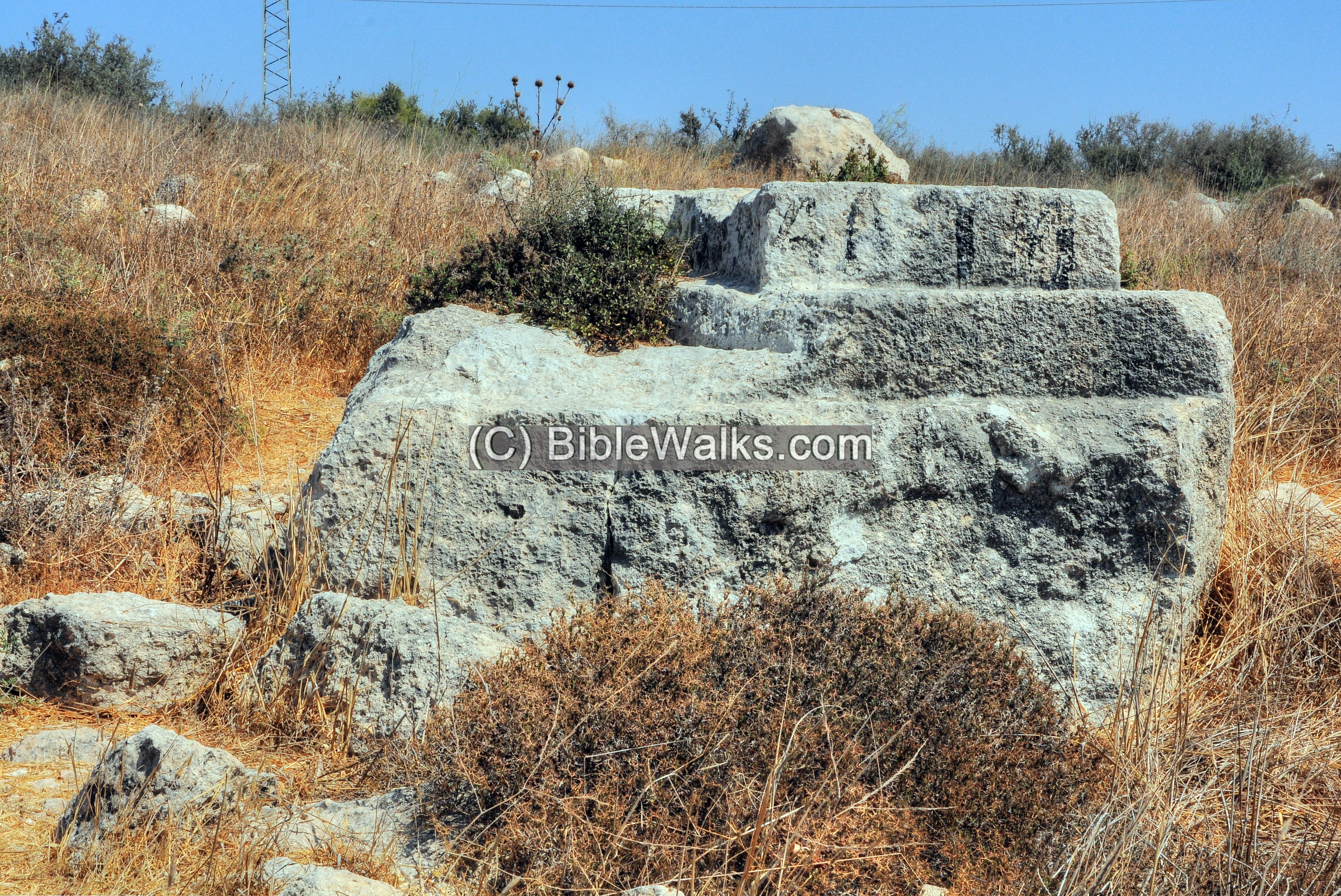
An ancient altar was found in the foothills of Zorah, at the edge of the industrial area. It is associated with the birth of Samson.
Samson’s mother was initially barren (Judges 13: 2):
“And there was a certain man of Zorah, of the family of the Danites, whose name was Manoah; and his wife was barren, and bare not”.
An angle told the wife that she will conceive a son (Samson) provided the parents and son will dedicate themselves (Judges 13: 5):
“For, lo, thou shalt conceive, and bear a son; and no razor shall come on his head: for the child shall be a Nazarite unto God from the womb: and he shall begin to deliver Israel out of the hand of the Philistines”.
Samson’s parents, Manoah and his barren wife, gave offering on an altar (Judges 13: 19-20)
“So Manoah took a kid with a meat offering, and offered it upon a rock unto the LORD: and the angel did wondrously; and Manoah and his wife looked on. For it came to pass, when the flame went up toward heaven from off the altar, that the angel of the LORD ascended in the flame of the altar. And Manoah and his wife looked on it, and fell on their faces to the ground”.
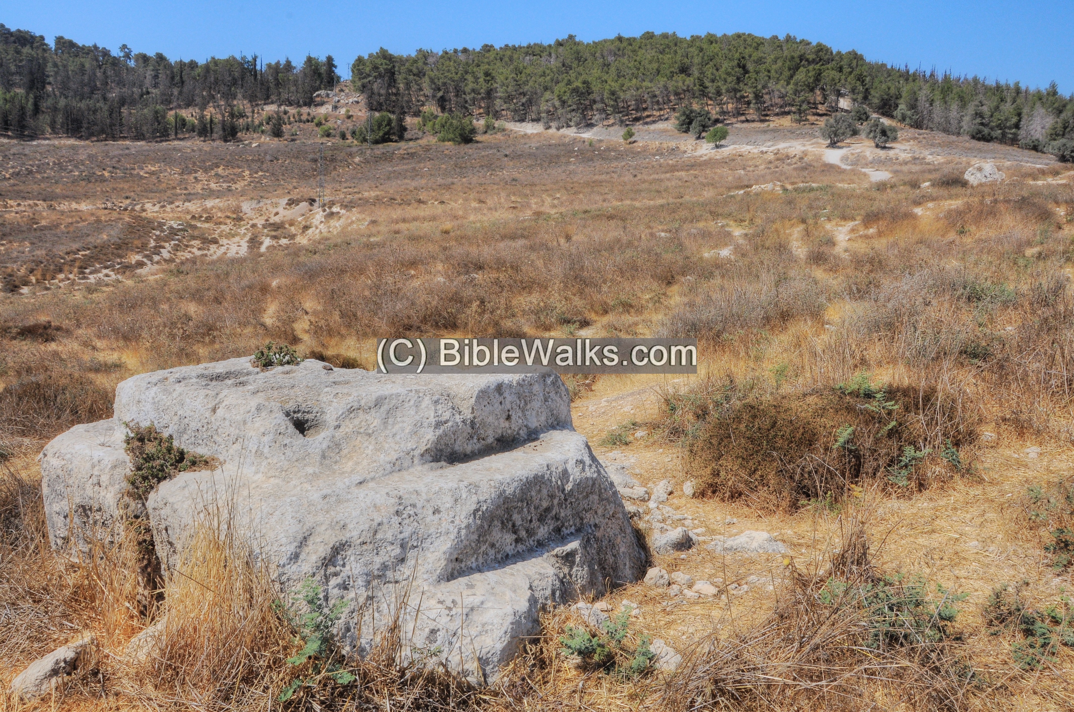
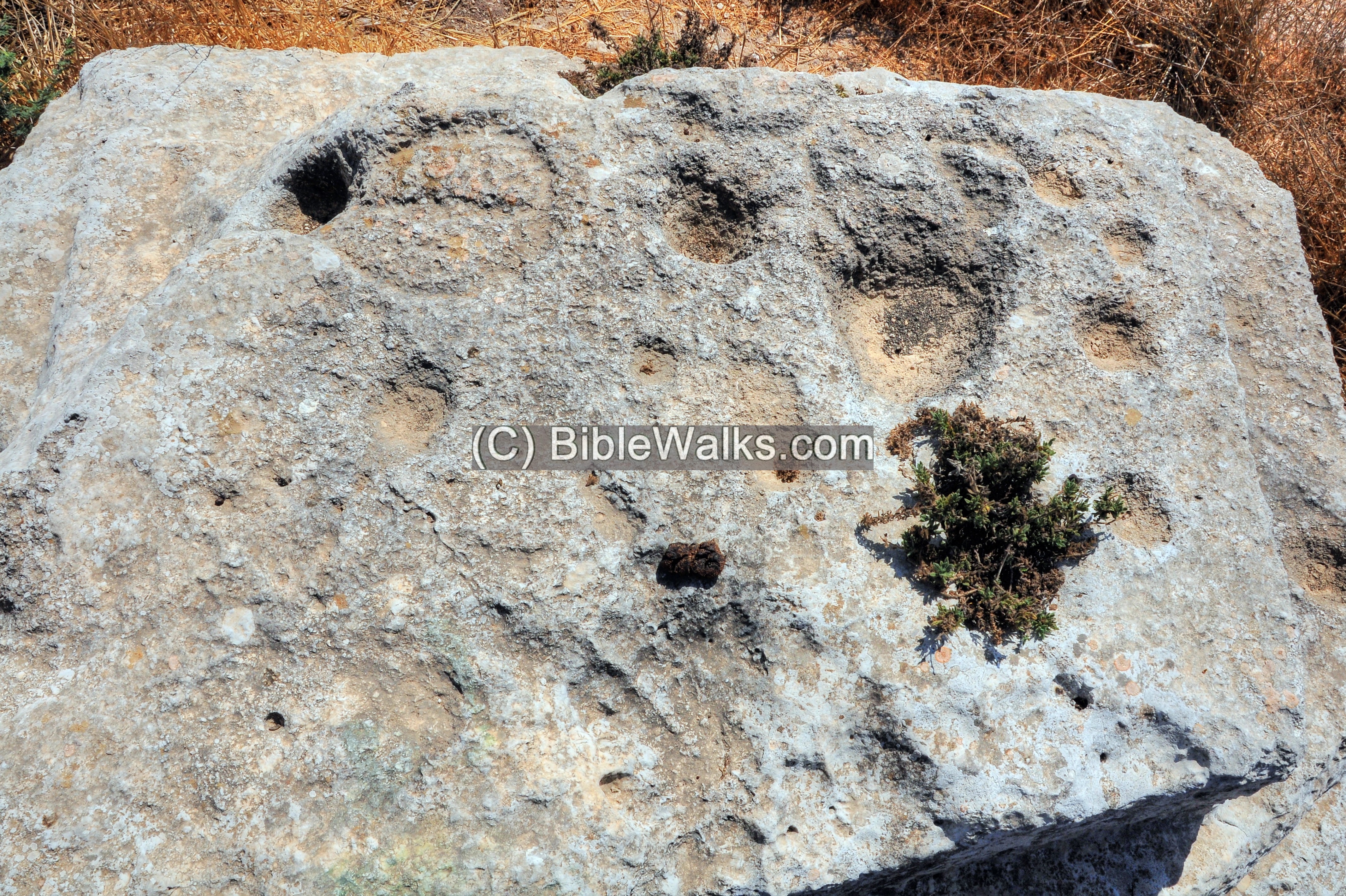
A closer view, from the south side, is below. The rock hewn altar dimensions are 3.00m x 2.50m and height is 1.5m.
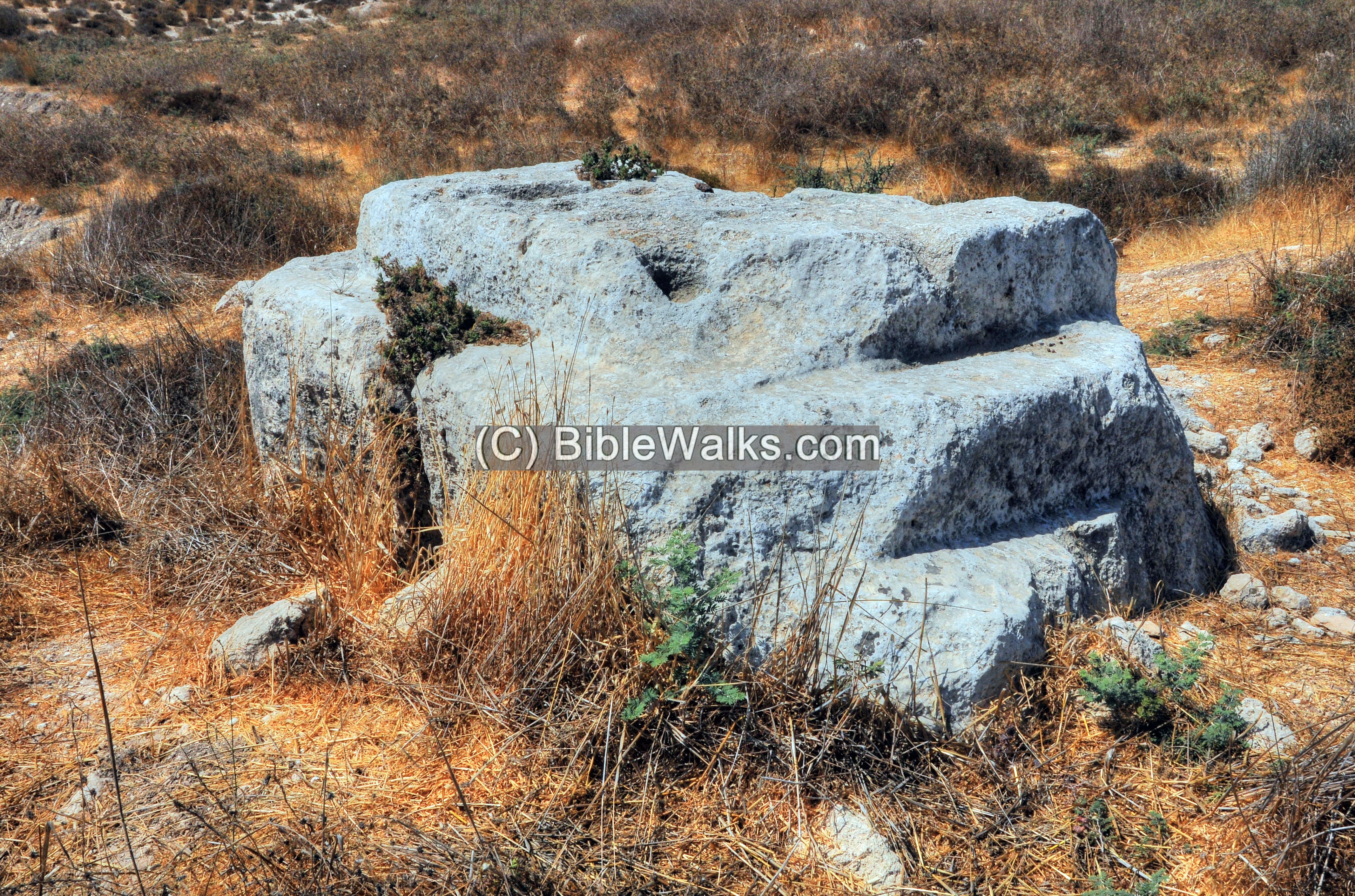
Another side of the altar – a view from the north west side:
The top side of the altar dimensions are 1.50m by 1.45m. There are about 10 cup marks of various sizes, some connected with grooves. These were used for draining the blood and oil of the sacrifice.
Etymology:
- Zorah, Tsor’ah – Hebrew name of the Biblical site
- Sar’a, Saraa, Surah – Name of the Arabic village, preserved the ancient name
Links and References:
* Archaeology:
- Zorah and Eshtaol identification – Prof. Yoel Elitzur (2015)
* Biblical:
* Internal – sites nearby:
- Tel Beth Shemesh
- Valley of Elah
- Beit Jamal
- Kh. el ‘Alya
- Tel Yarmut
- Gath – Philistine city, home of Goliath
* Other:
- Biblical pictures by Gustave Doré (1832-1883)
- Wild Flowers in the Holy Land
Kefar Sorek<<<—previous site–<<< All Sites >>>—next Judea site—>>> Kh. Alya
![]()
This page was last updated on Apr 28, 2022 (updated history)
Sponsored links: