Khirbet el-‘Alya is a multi-period site, towering over the west side of Ramat Beit-Shemesh Aleph.
Home > Sites > Judea > Beit Shemesh > Khirbet el-‘Alya
Contents:
Overview
Location
History
Photos
* Top of hill
* Miqveh
* Cisterns
* Cup-marks
* Columbarium
* Cave
* Neby Bulus
Etymology
Links
Overview:
Khirbet el-‘Alya is a multi-period site, towering over the west side of Ramat Beit-Shemesh Aleph. On the hill are cisterns, installations, miqveh, cave and a unique cluster of hundreds of ancient cup-marks. On the western foothills is a sheikh’s tomb – Neby Bulus – with remains of an Arab farming village around it.
The site may be identified as Biblical Ellon , a city in the area allotted to the tribe of Dan.(Joshua 19:40, 43): “And the seventh lot came out for the tribe of the children of Dan according to their families…… And Elon, and Thimnathah, and Ekron”.
Location:
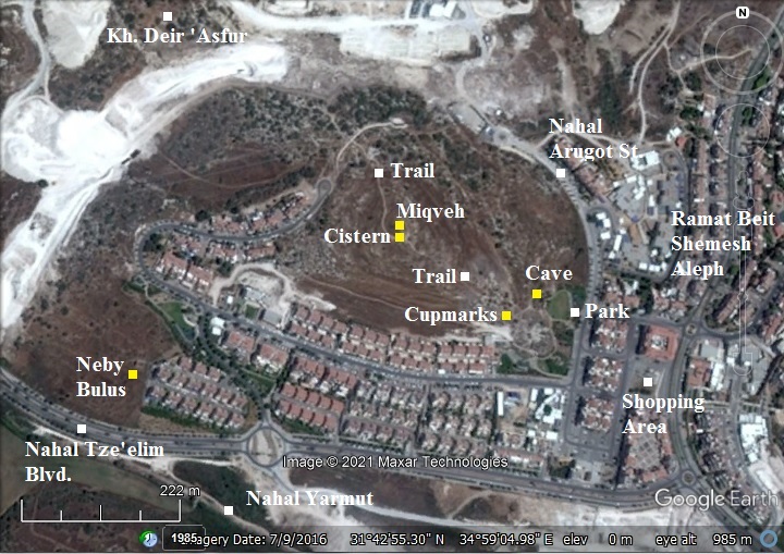
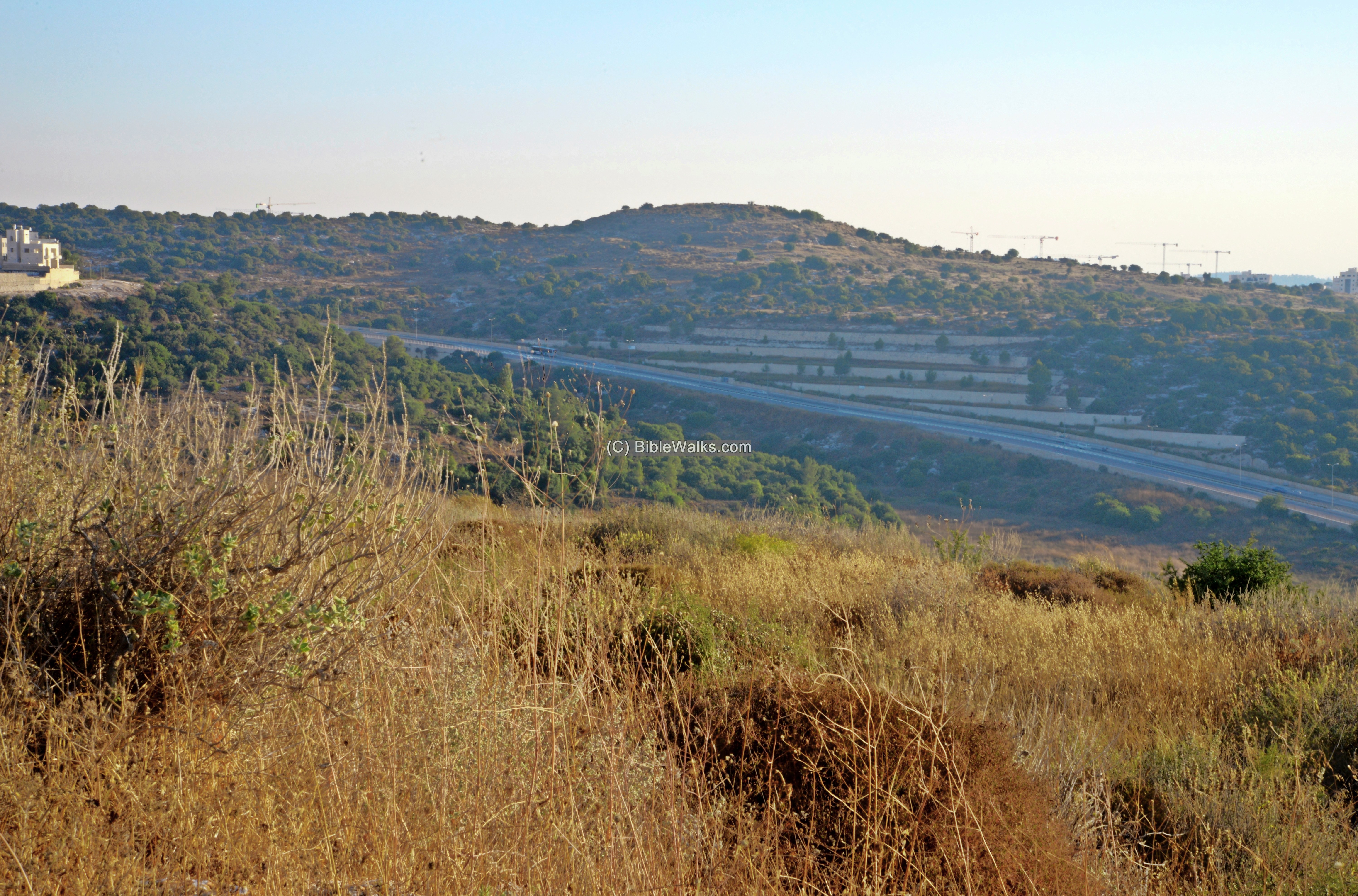
The following aerial view shows the area of Khirbat el-‘Alya. It is located on a hill (alt. 383m) towering over the west side of Ramat Beit Shemesh Aleph – a southern superb of Beth Shemesh. On its south is the valley of Nahal Yarmut, named after the nearby Tel Yarmut (Jarmuth). Another ruin, Kh. Deir ‘Asfur, is located north west of the site.
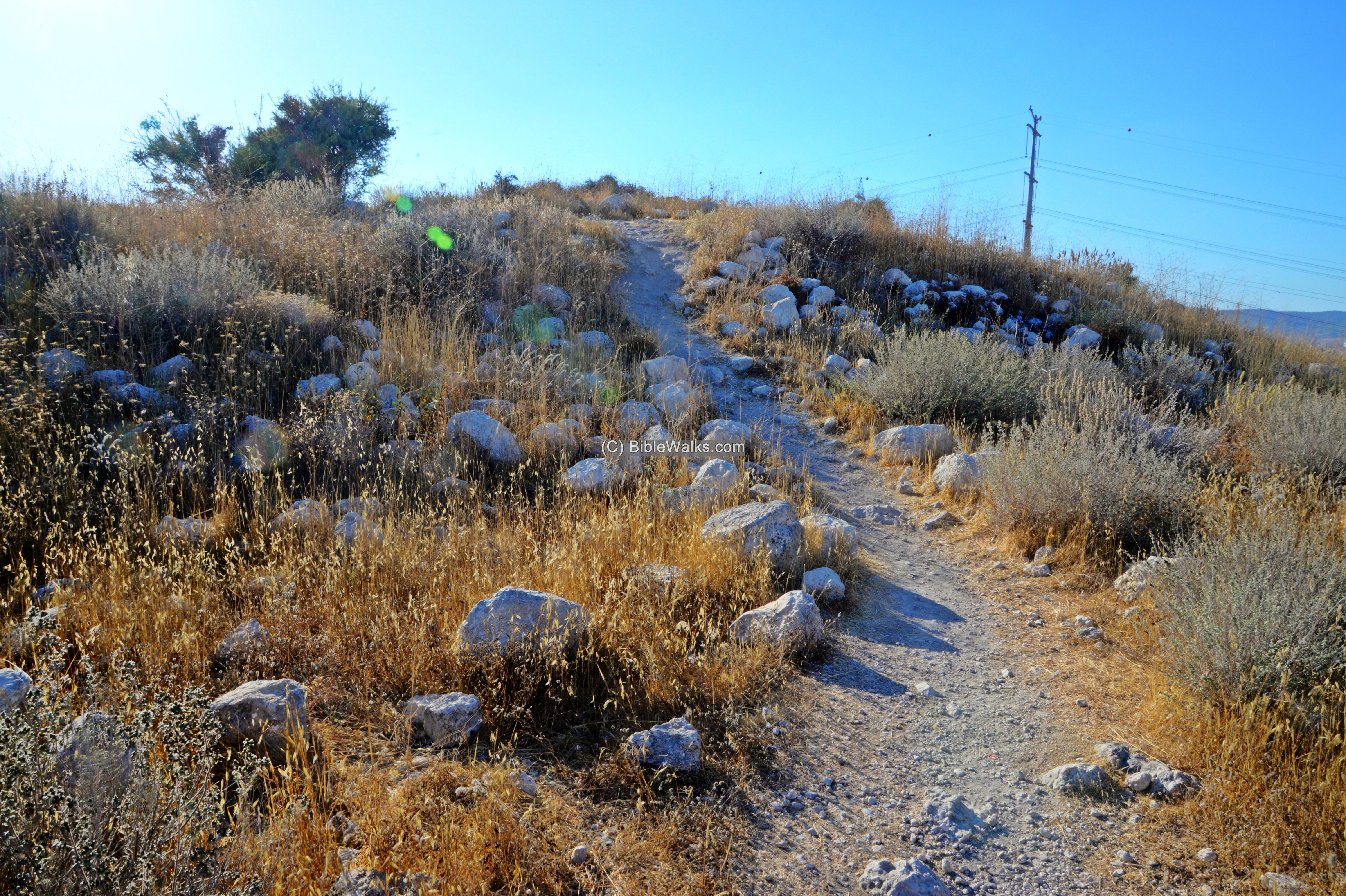
A visit to the site is by a trail that ascends from the park on its east side, adjacent to a shopping area.
History:
- Chalcolithic period (4,500 – 3,150BC)
A cluster of hundreds of rock-hewn cup-marks were surveyed on the south east foothill. The majority are round depressions. This unique concentration of cup-marks may have been a communal area used for food preparation – grinding and pounding.
In most of the ancient sites in Israel, only a small number of cup-marks are exposed on the surface. These small bedrock hewn cuttings are associated with Neolithic or Chalcolithic period settlements.
There are few exceptions with a high number of such micro-installations, such as the Nevallat site (north of Tel Hadid), and Modi’in Buchman-South. These sites were associated with nearby Chalcolithic settlements. In the Nevallat site the dating was based on C14 measurements of small olive stones found in the pits, yielding a range of 4002-3808 BC.
- Intermediate Bronze period (2400-2000 BC)
Other installations on and around the site were dated to the Intermediate Bronze period.
- Iron Age IIB (900-700 BC)
Excavations and surveys of the site dated the site as an fortified urban settlement from Iron Age IIB. Many agriculture installations on and around the site were dated to this period. This period witnessed great growth in the area of Ramat Beit Shemesh, including villages around the site (Beth Shemesh, Zanoach) and roads that interconnected them.
Based on the Arabic name and Geographic location, some scholars identify this ancient city with Ellon, a city in the area allotted to the tribe of Dan.(Joshua 19:40, 43):
“And the seventh lot came out for the tribe of the children of Dan according to their families…… And Elon, and Thimnathah, and Ekron”.
The cities and roads during these periods are indicated on the Biblical Map below. The site is indicated as a red point, and is positioned near the large Early Bronze city Jarmuth (Tel Yarmut). The site is near the main north-south road connecting Beit Shemesh to Lachish (now highway #38), and the west-east road along the valley of Elah ascending to Jerusalem.

Area around kh. el ‘Alya – Biblical through Roman periods (based on Bible Mapper 3.0)
- Other periods
The site was also inhabited during the Early Roman to the Byzantine periods.
Second temple burial caves were unearthed around the site.
- Ottoman period – PEF survey and excavations (19th Century AD)
The area around the site was examined in the Palestine Exploration Foundation (PEF) survey (1866-1877) by Wilson, Conder and Kitchener. A section of their map is shown below, with the site in the center.
They wrote about the site (SWP, Volume III, p. 167):
“Khurbet el ‘Aly —Ruined walls, foundations, rock-cut cisterns. In the valley to the south there are springs. An old road runs on the north-east side of the ridge”.
That old road connected Beit el Jemal and Beit Netif, as marked on the map.
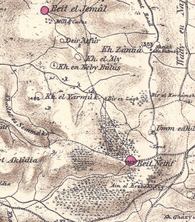
Part of Map Sheet 17 of Survey of Western Palestine,
by Conder and Kitchener, 1872-1877.
(Published 1880, reprinted by LifeintheHolyLand.com)
A small village was located on the south west foothills – Kh. en Neby Bulus. It is named after apostle Paul (Bulus in Arabic). The PEF survey wrote (V3, p. 123):
“Khurbet en Neby Bulus (J u).—Heaps of stones round a Kubbeh. The latter is modern, with a cenotaph and a vault below, which looks like Crusading work, and is entered by a door on the west having a lintel with an ornamented boss. North of this building is a fine birkeh. The site has evidently been that of a small village”.
-
Modern Period
The site is in a public area, nested between the residential areas of Ramat Beit-Shemesh.
Photos:
(a) Top of hill
A trail leads up from the park, on the east side of the hill, up to the summit.
On the higher foothills are traces of walls and ruins of houses.
The scattered building blocks are rough field stones, common in the Iron Age.
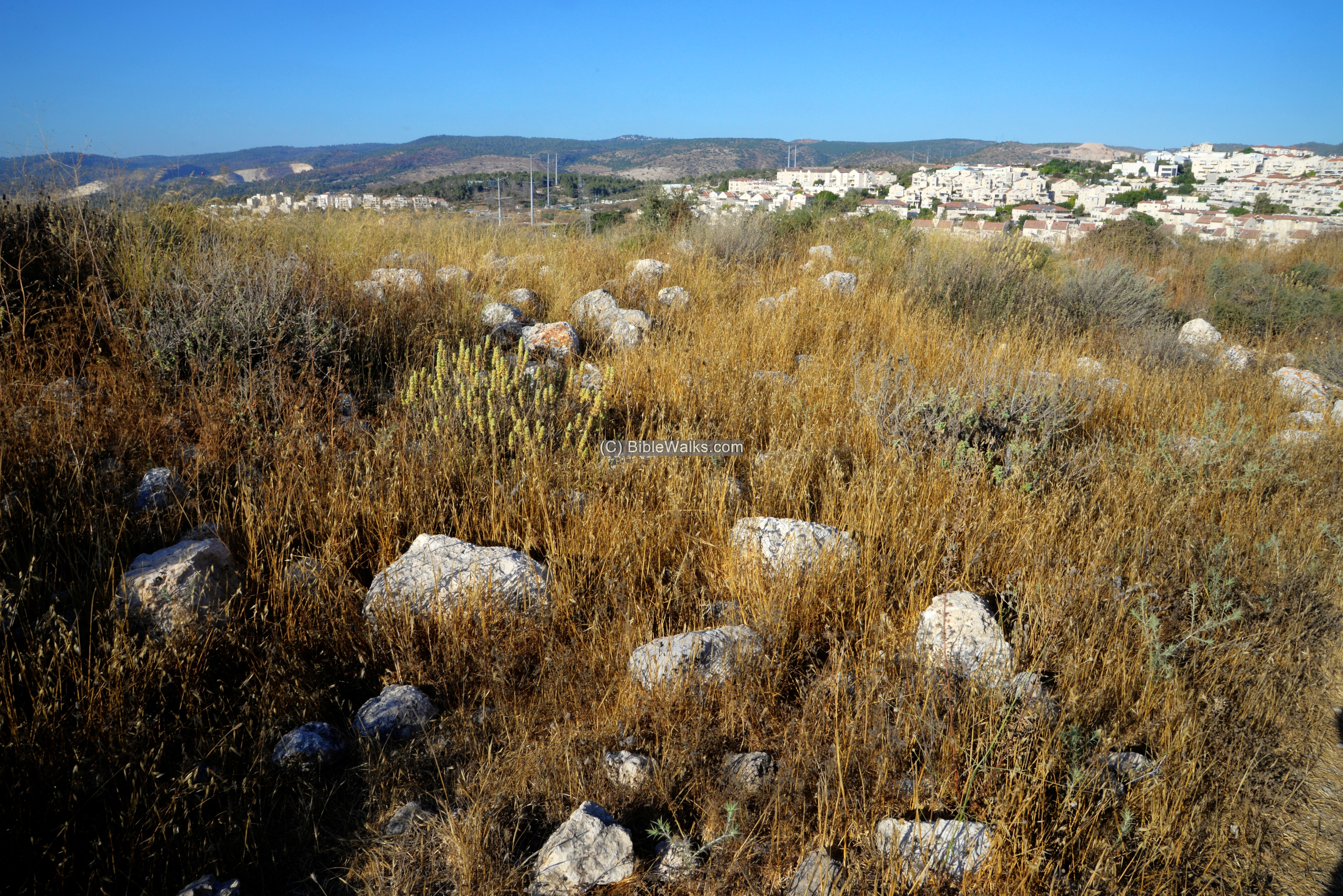
This view is towards the east – facing the residential houses of Beit-Shemesh (right) and Ramat Beit-Shemesh Aleph (left).
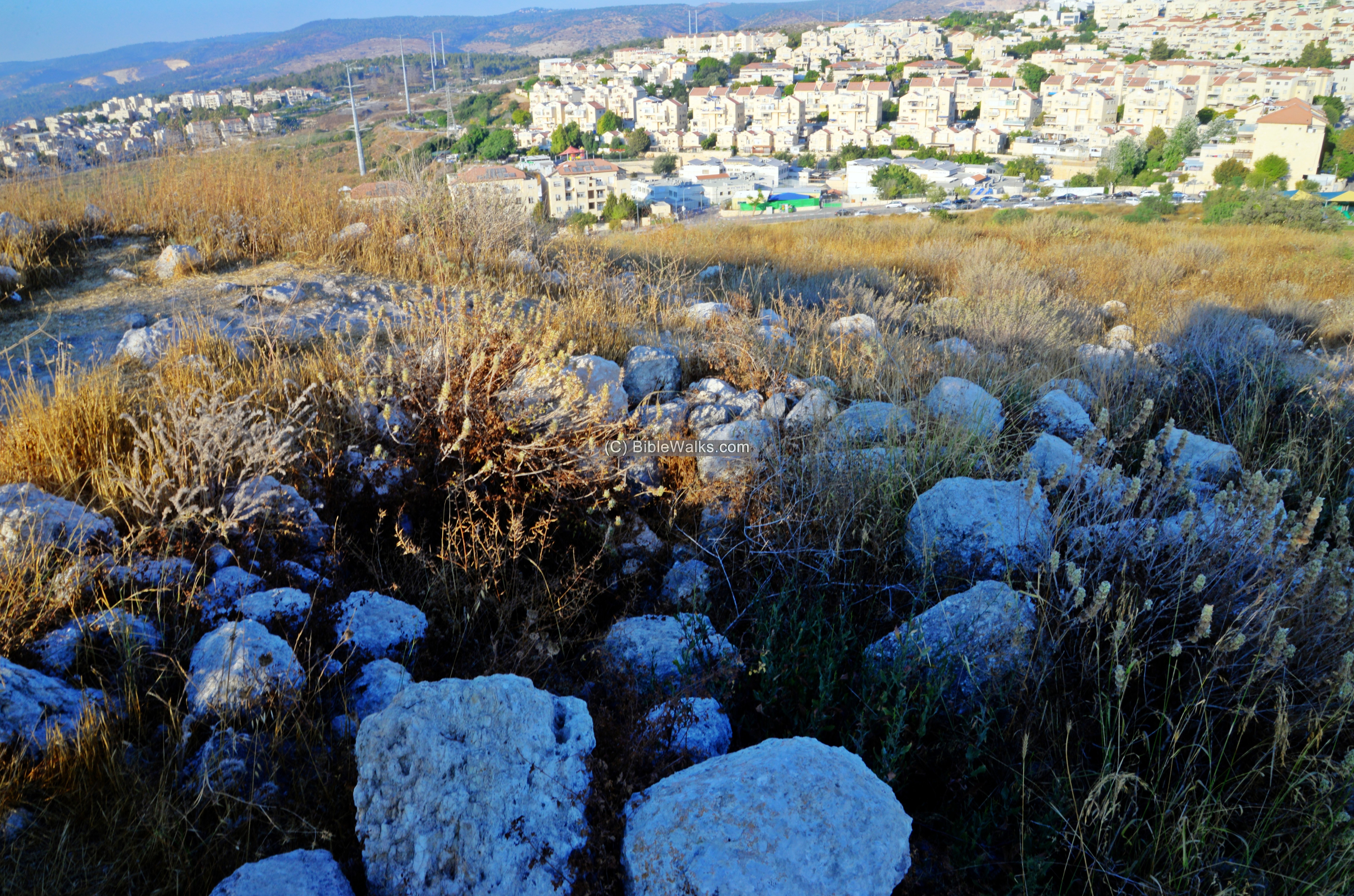
From the summit is a view of the summit of Tel Jarmuth (Yarmut) – a major Early Bronze II-III period city state. The “upper city” on and around the summit continued to be occupied until the 4th century AD, including the same period of the peak settlement activity during the Iron Age.
(b) Miqveh
On the summit are remains of ancient installations, including this stepped ritual bath.
According to Jewish tradition, the vine-dressers (workers responsible for producing the wine), and the workers of the olive oil, had to purify themselves in a ritual bath for producing Kosher wine or oil. Such ritual bath (Hebrew: Miqveh) was cut into the rock. These stepped pools had common features: cut into the bedrock, steps leading down to the bottom, deep enough allowing full immersion, and water supplied through channels from a spring or filled by rainwater.
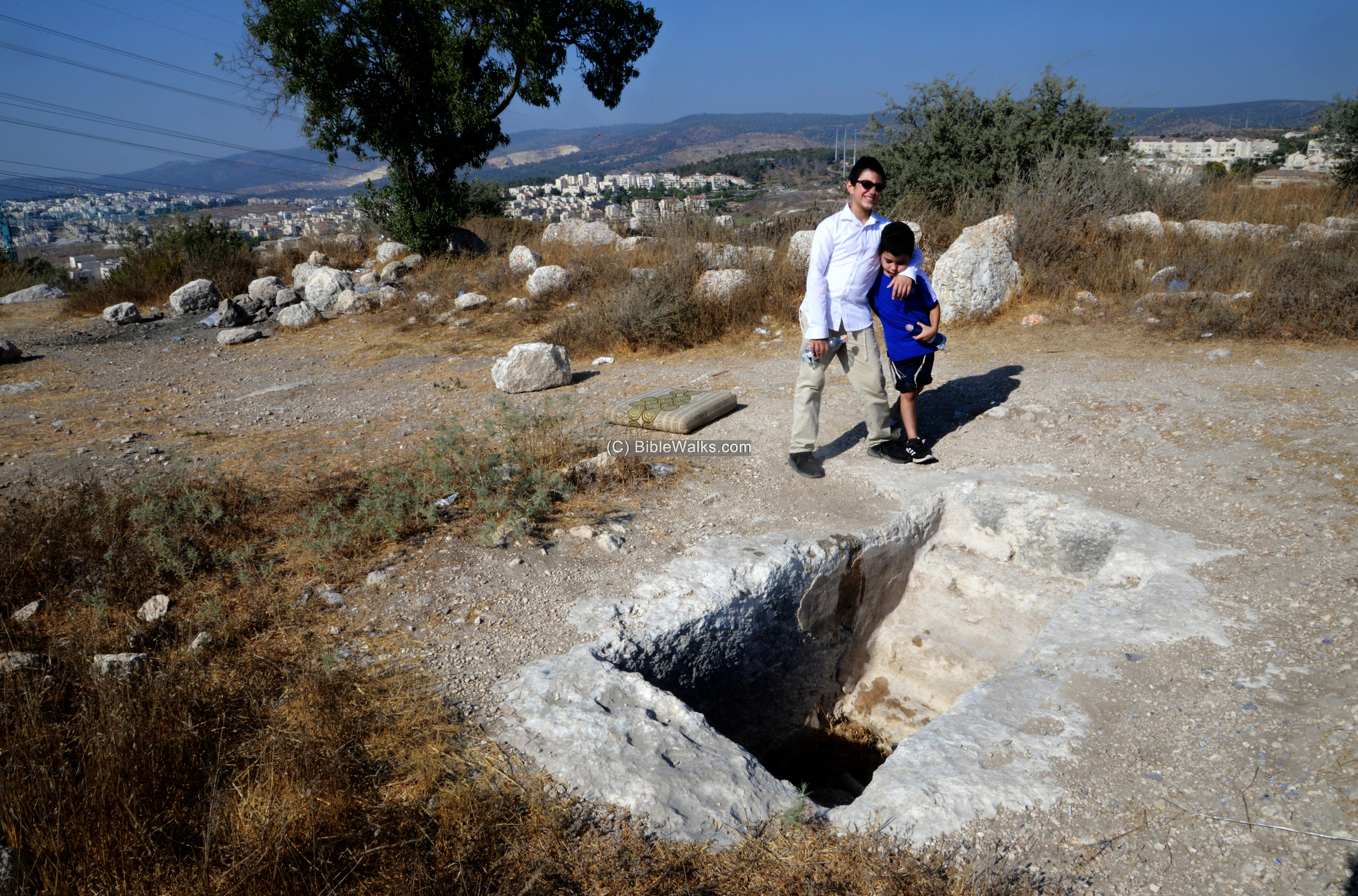
Ritual bathing pools are common in Judea, from the Hasmonean period (end of the 2nd century BC) up to the Bar Kokhba revolt (2nd century AD).
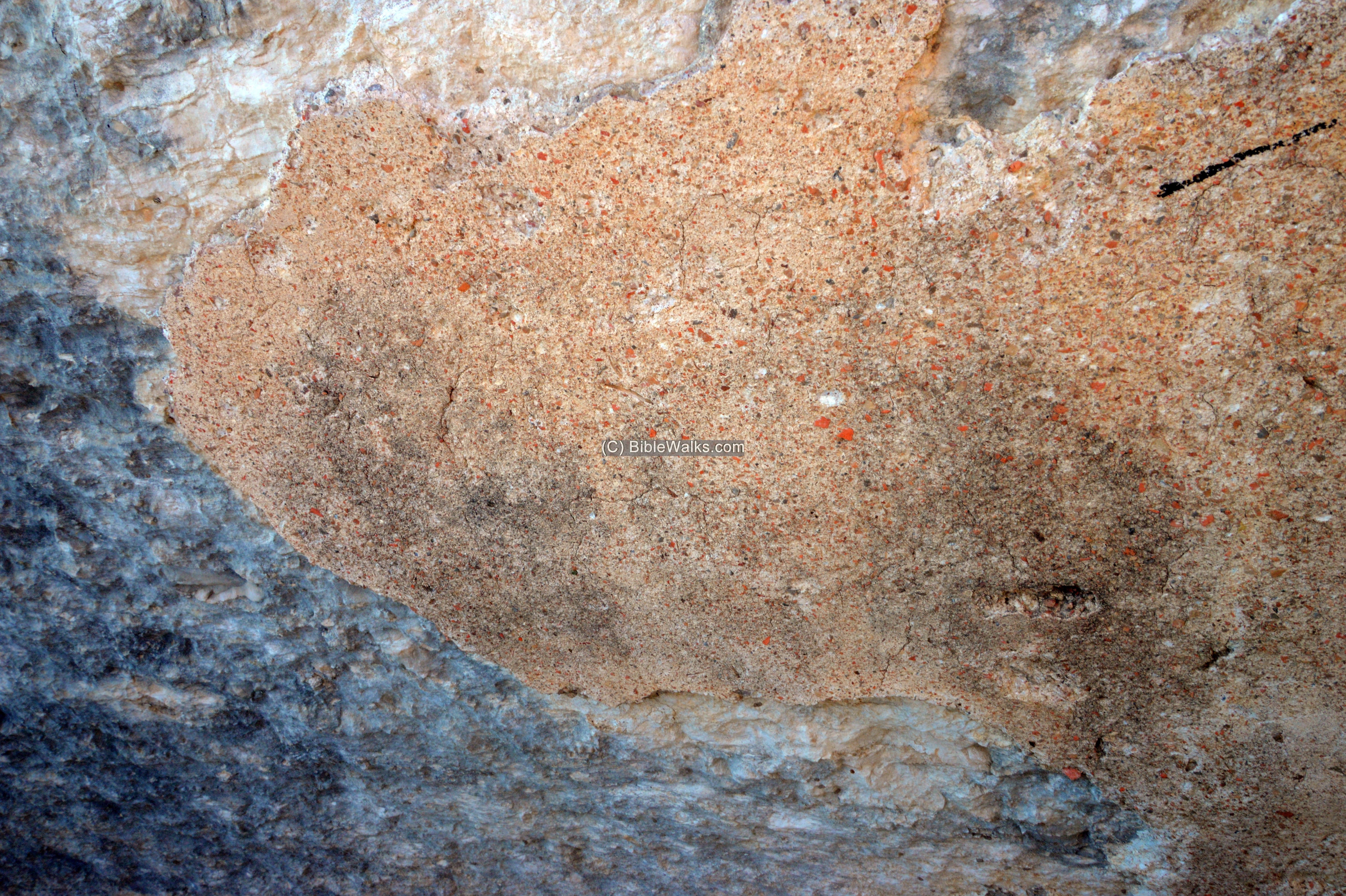
A layer of hydraulic plaster remains on sections of the ritual bath. The plaster prevented the water to seep into the earth. Notice the speckles of red ceramics embedded in the layer.
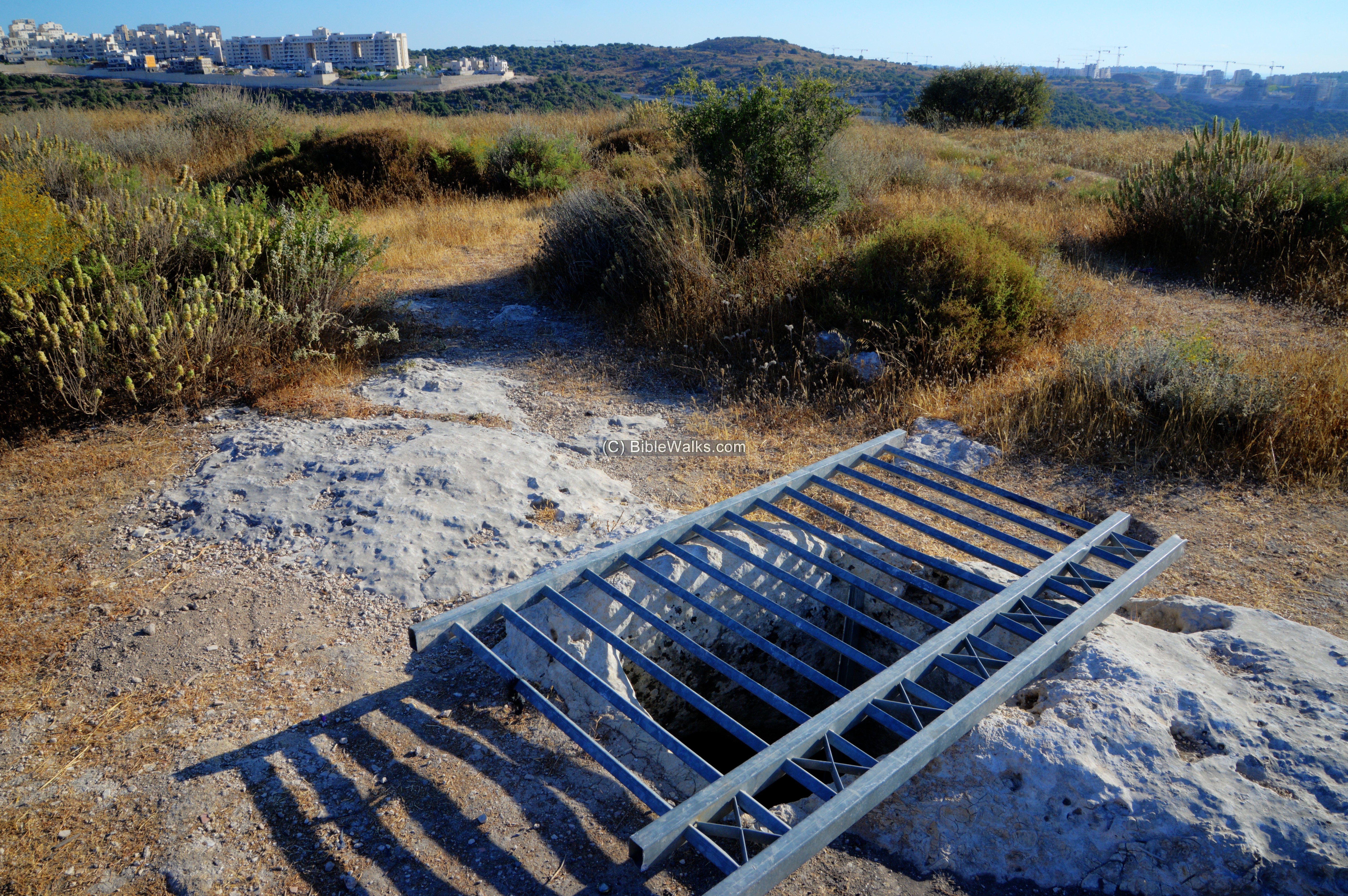
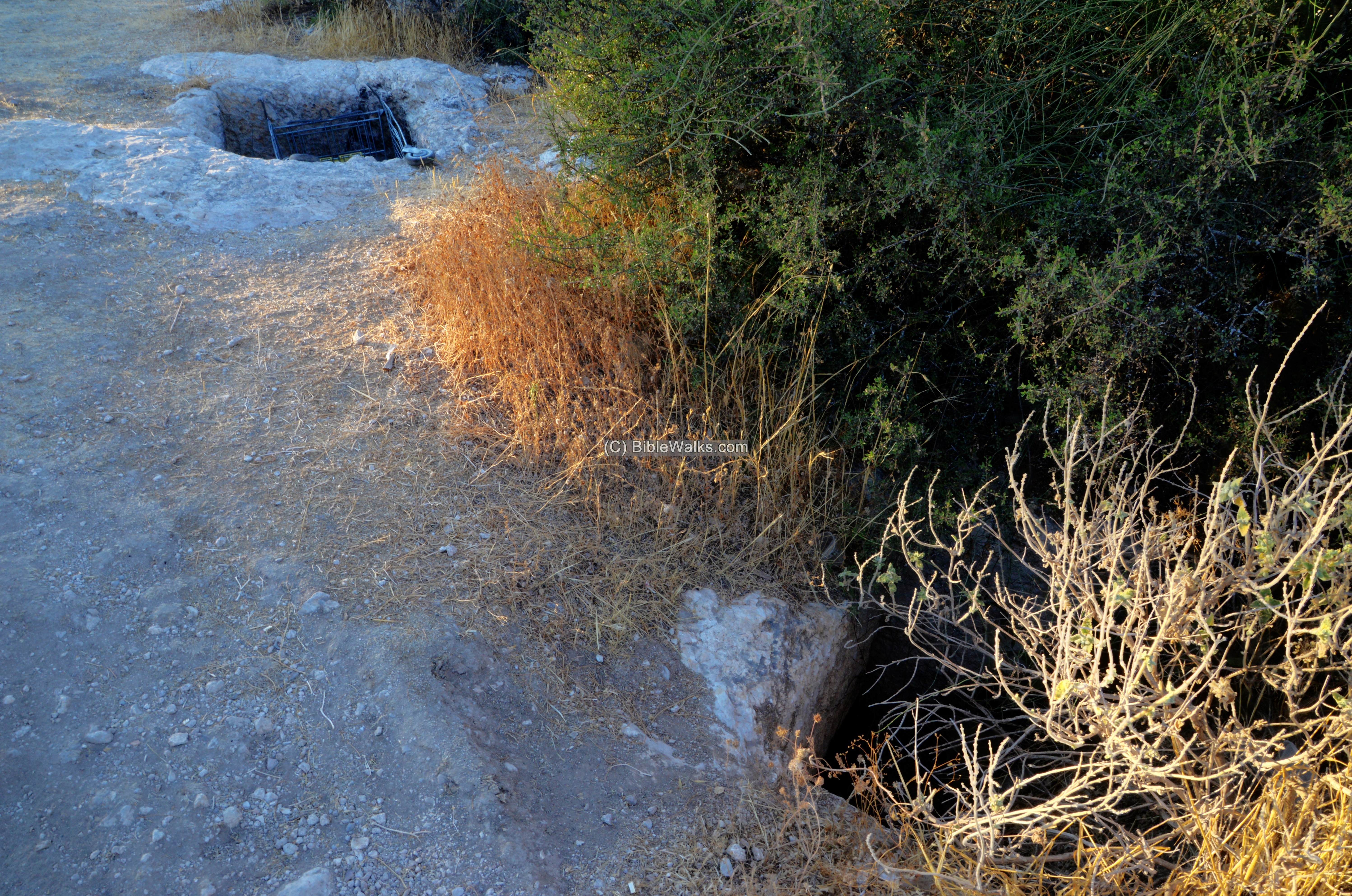
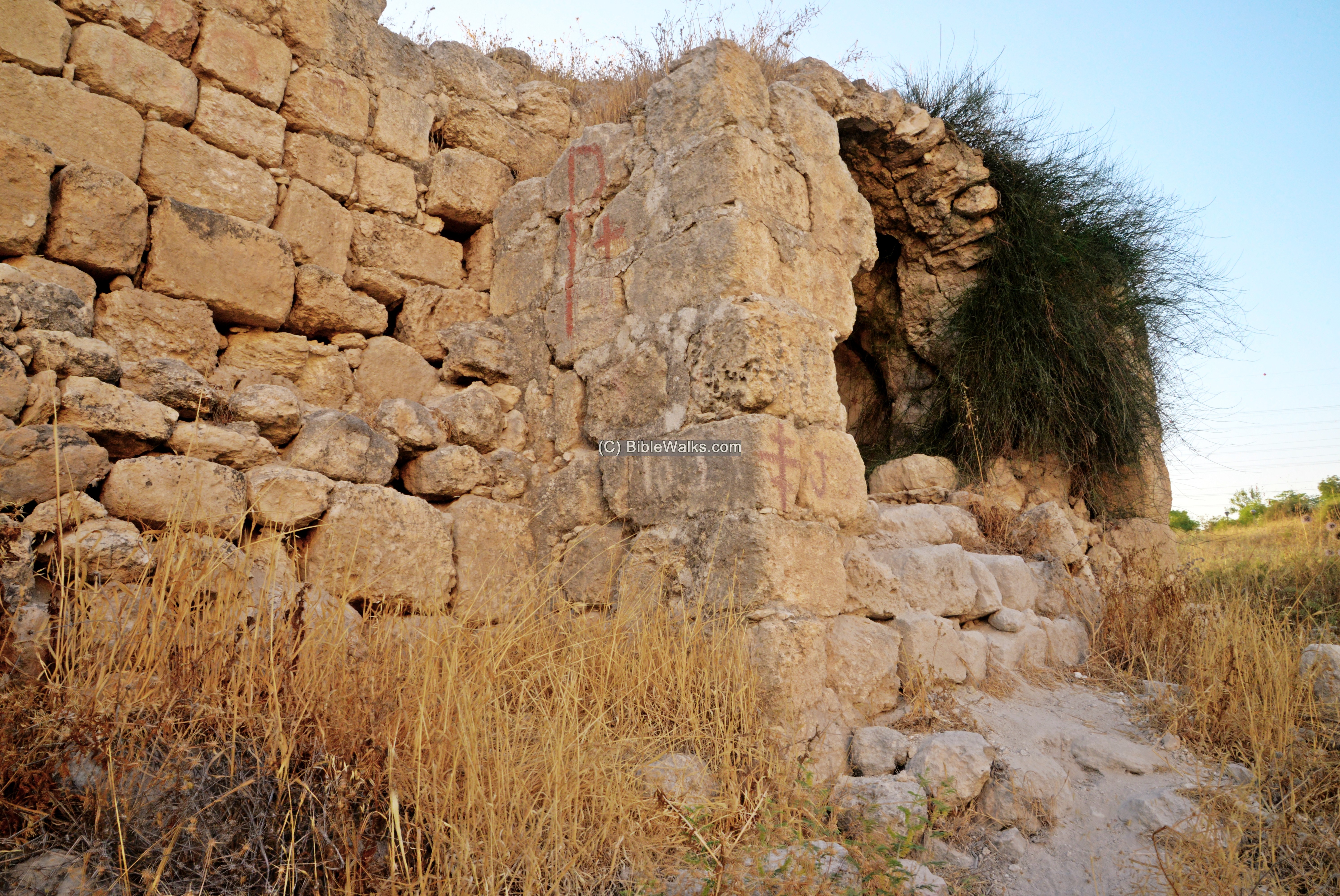
(c) Cisterns and installations
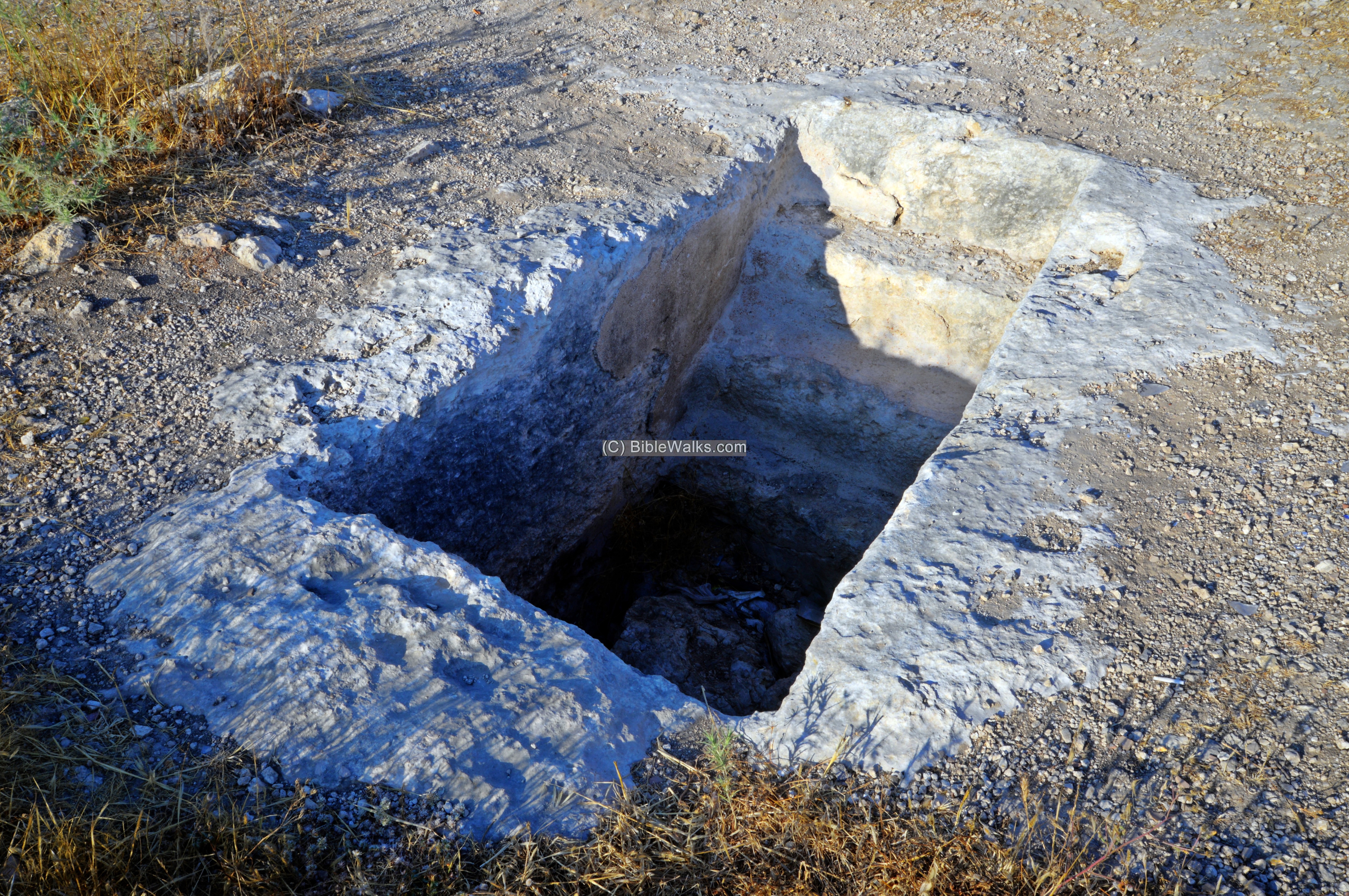
On the summit (below) and foothills are several types of cisterns and installations.
An opening to a cistern on the summit is covered for safety reasons.
The internal side of the cistern:
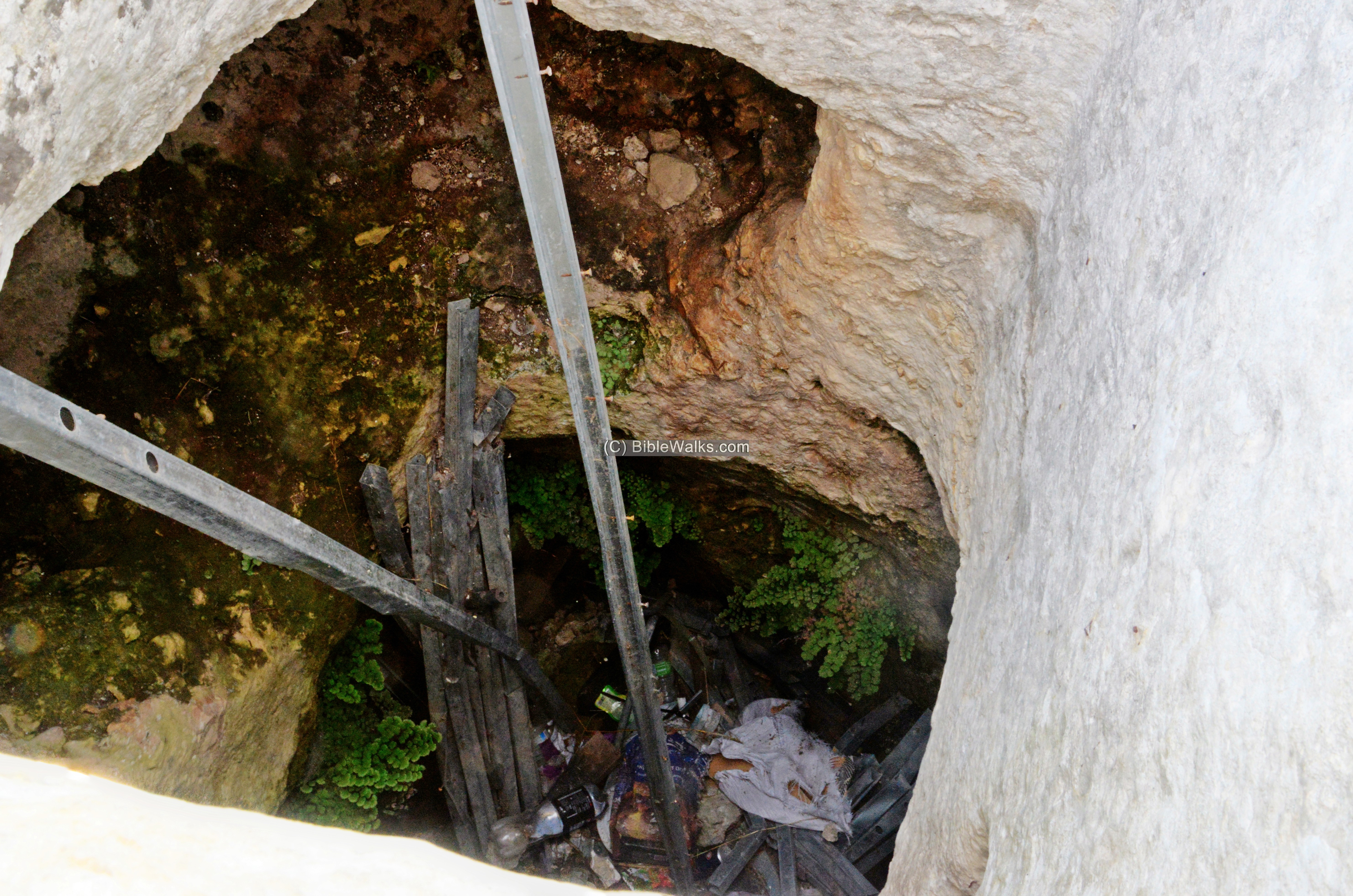
Another cistern is located at a lower section of the eastern side of the hill, adjacent to the ascent trail. This one is covered by a supermarket cart.
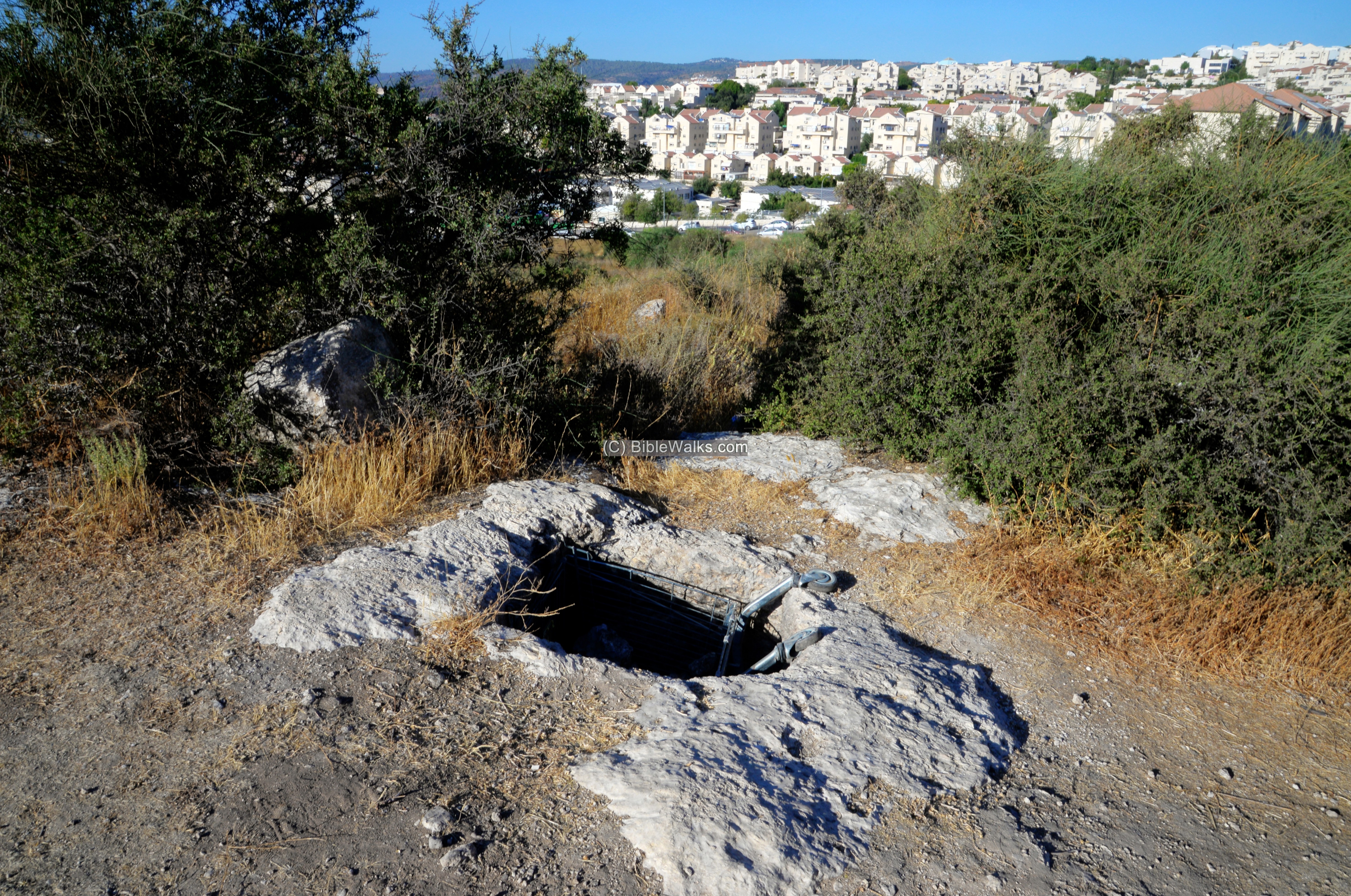
The cistern is part of an underground complex. Another opening is from the side. Perhaps, it served as a hiding place during the Bar Kokhba revolt.
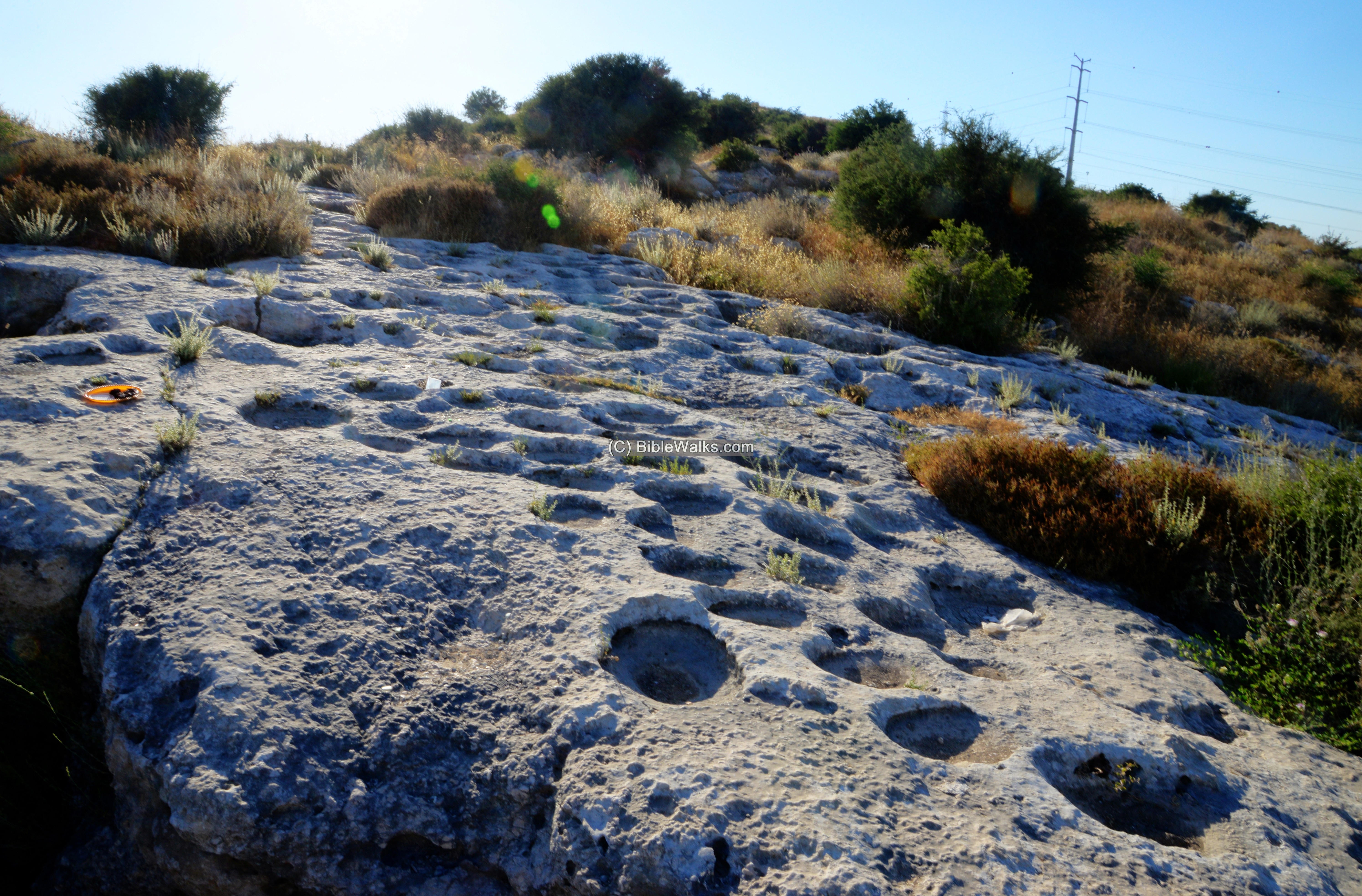
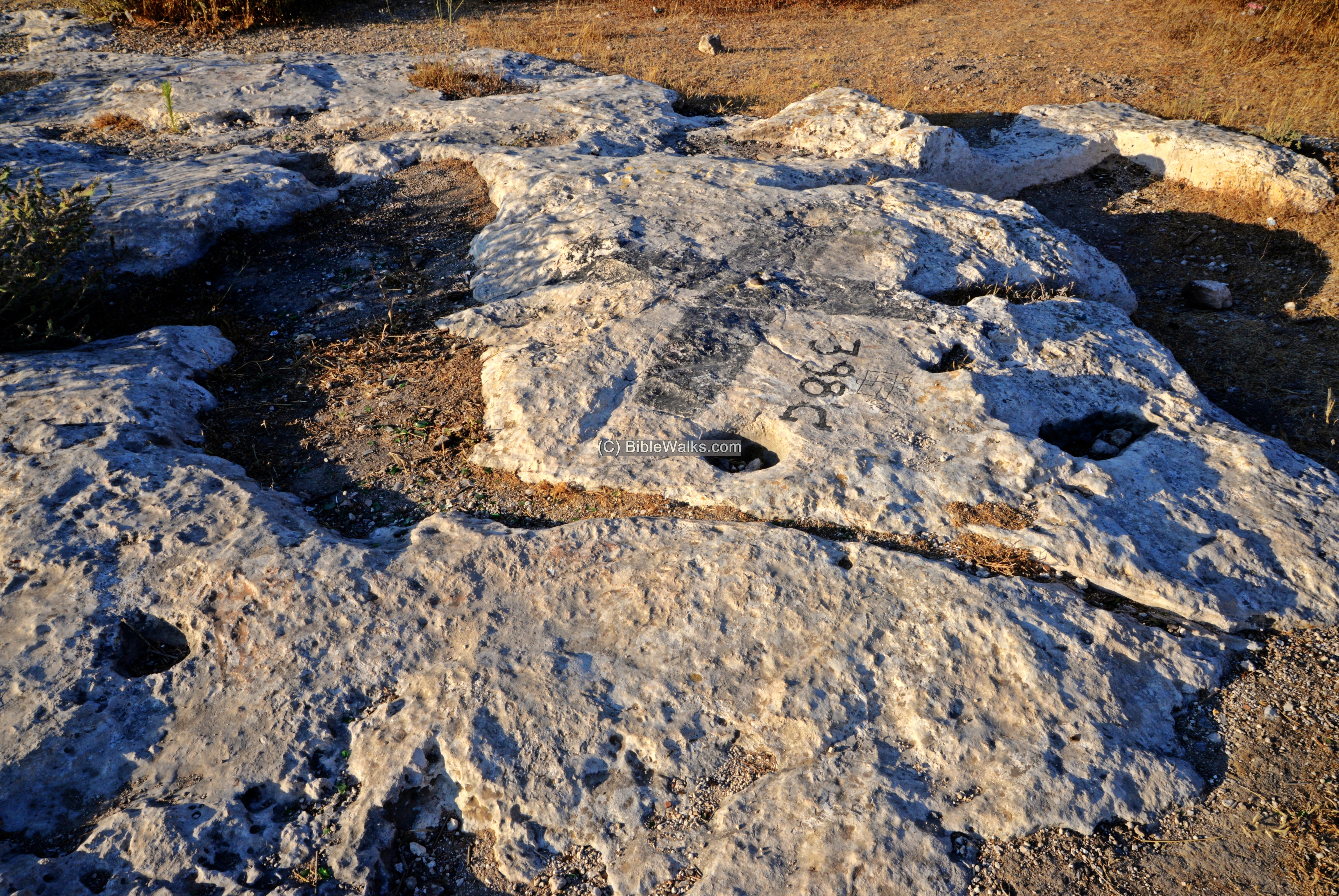
(d) Cup-marks
A cup-mark plateau, with hundred of installations, is located near the park on the south east side of the hill.
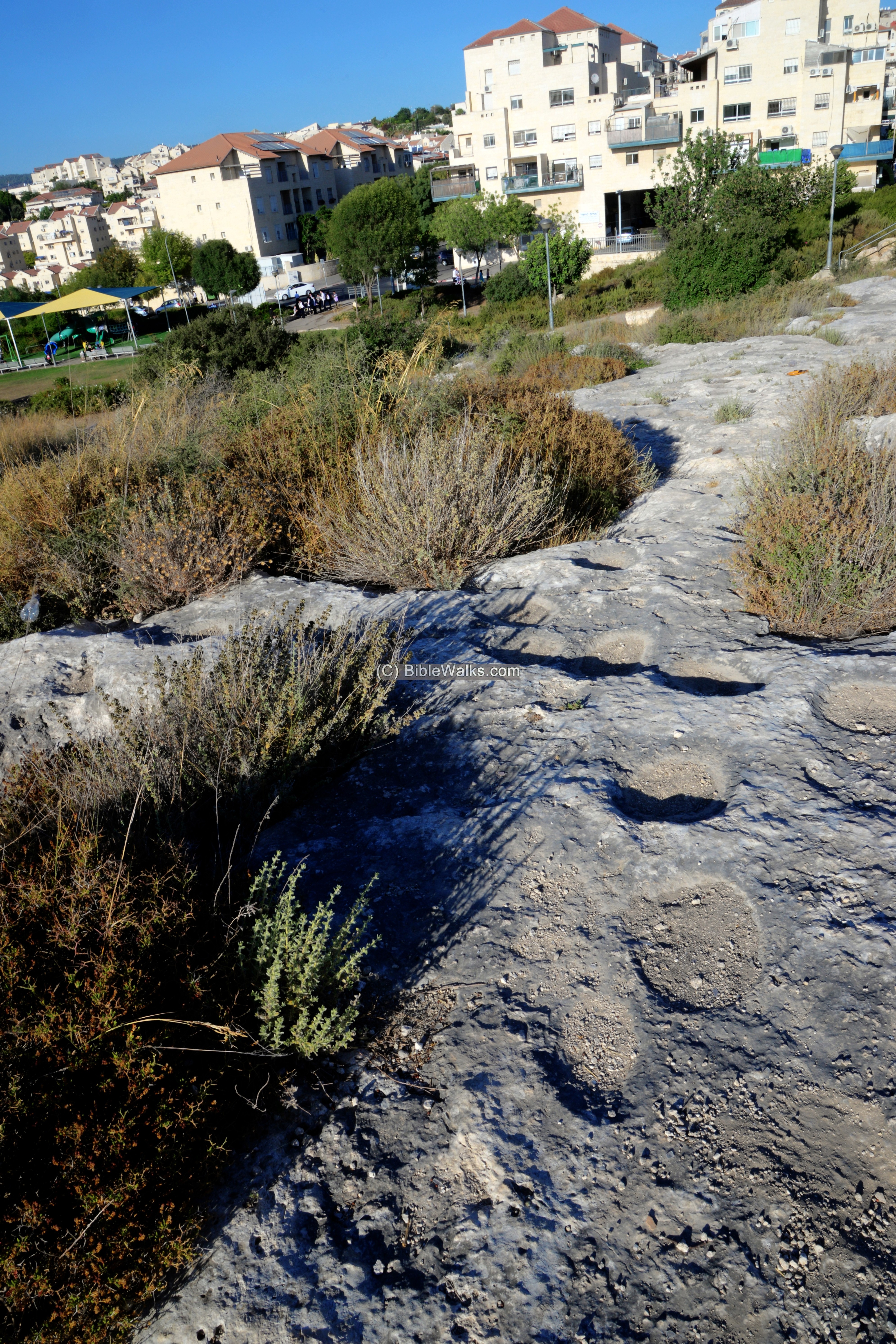
Hundreds of rock-hewn cup-marks are exposed. The majority are round depressions.
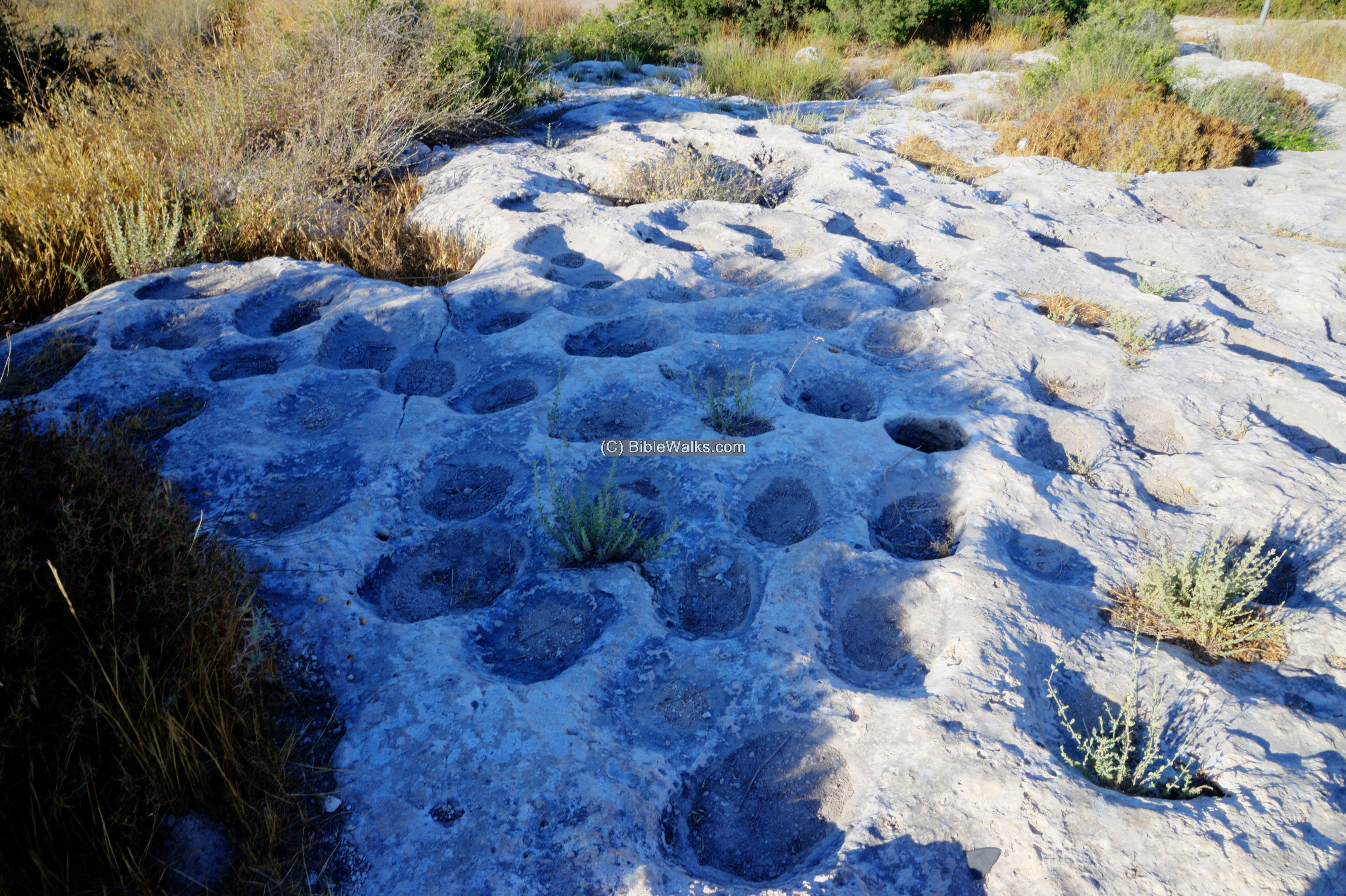
This unique concentration of cup-marks, dated to the Chalcolithic period, may have been a communal area used for food preparation – grinding and pounding.
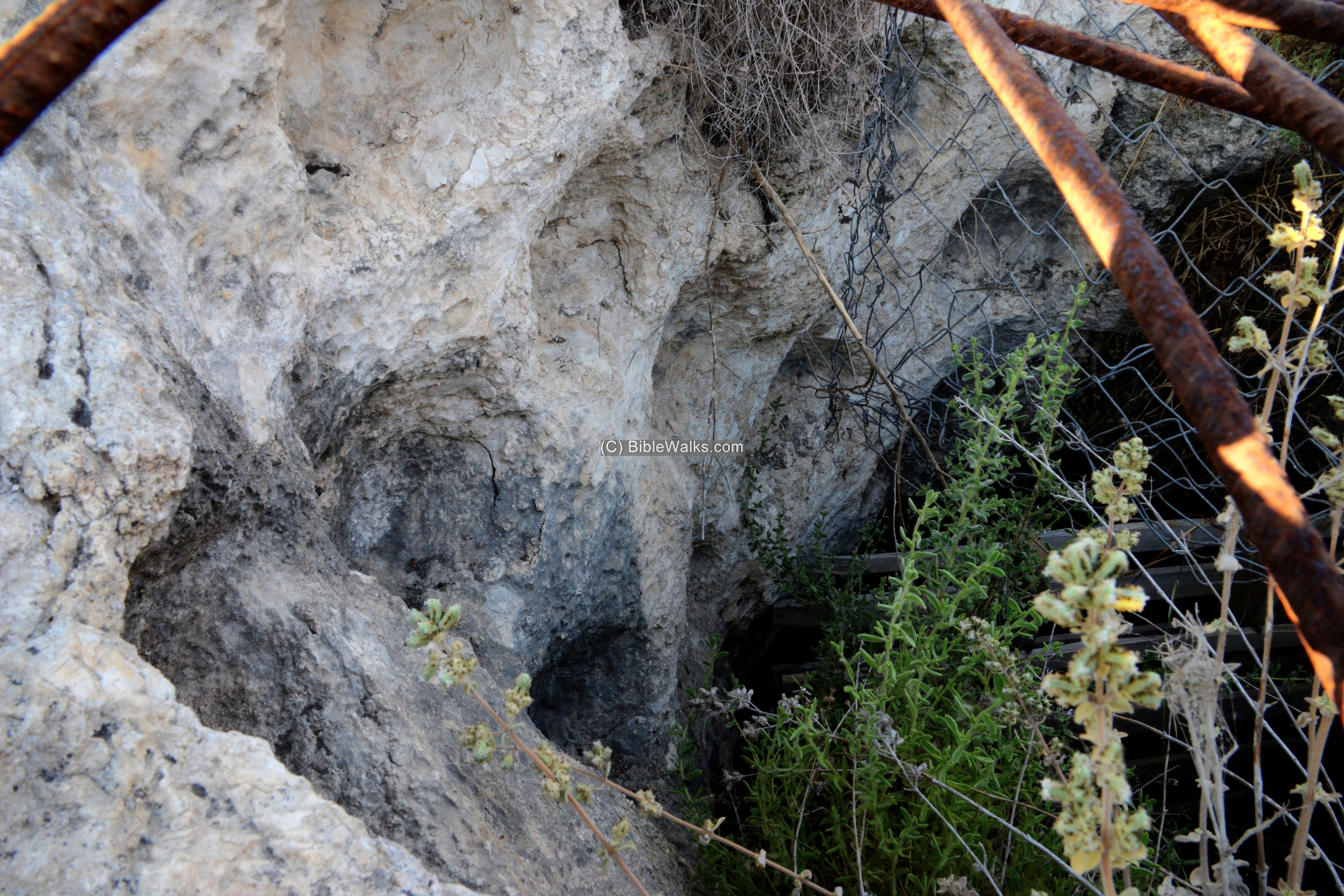
(e) Columbarium
In the cup-mark plateau, on the south east side, is a cavity with holes along the walls. This was a Columbarium cave, which is common in Judea. The installation was used to grow pigeons and doves for food and/or for fertilizer production.
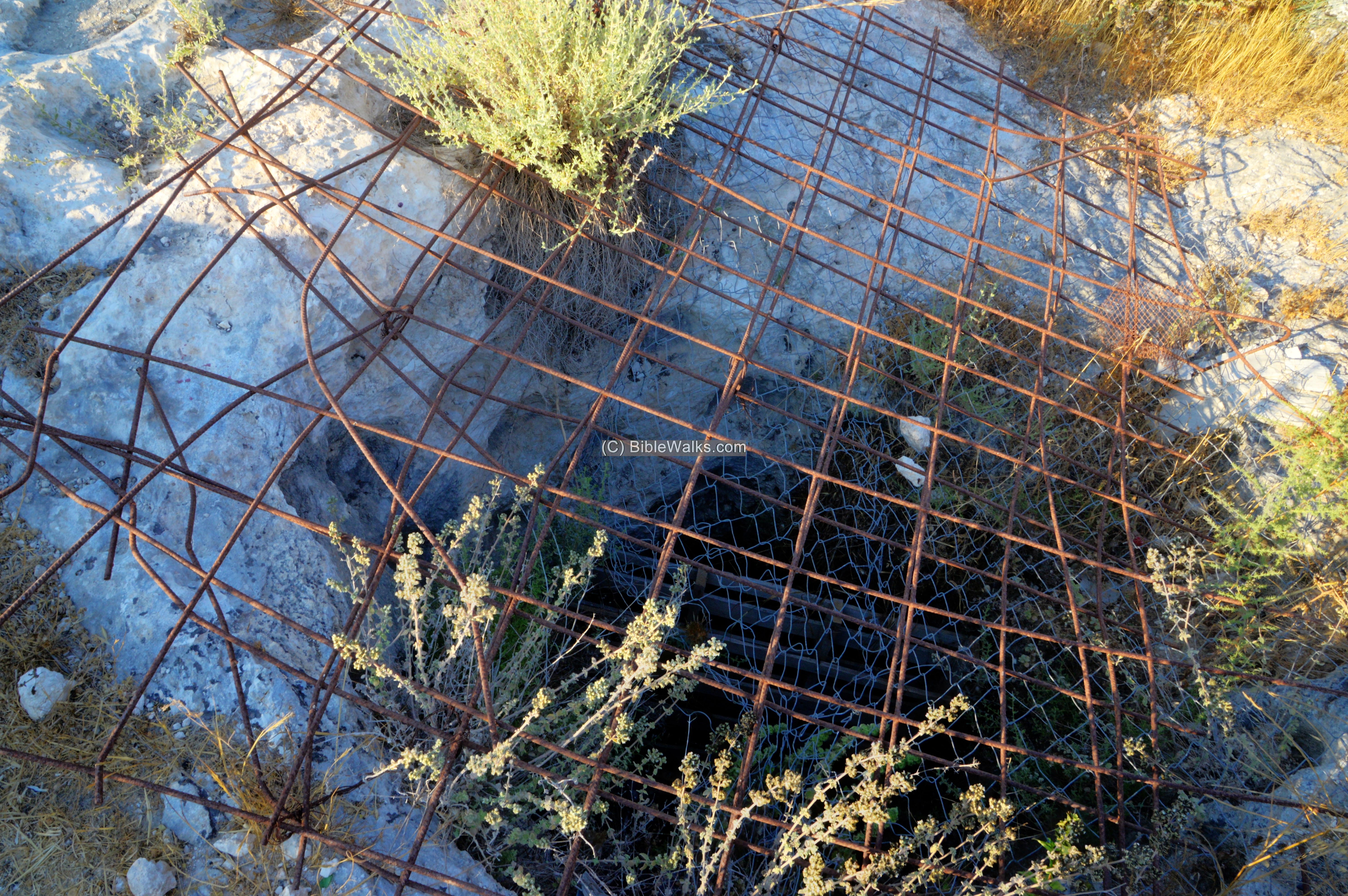
The word ‘columbarium’ is based on the Latin word columba (‘pigeon’), as it was originally used for a place to house doves and pigeons.
The entrance to the cave is sealed by a metal fence.
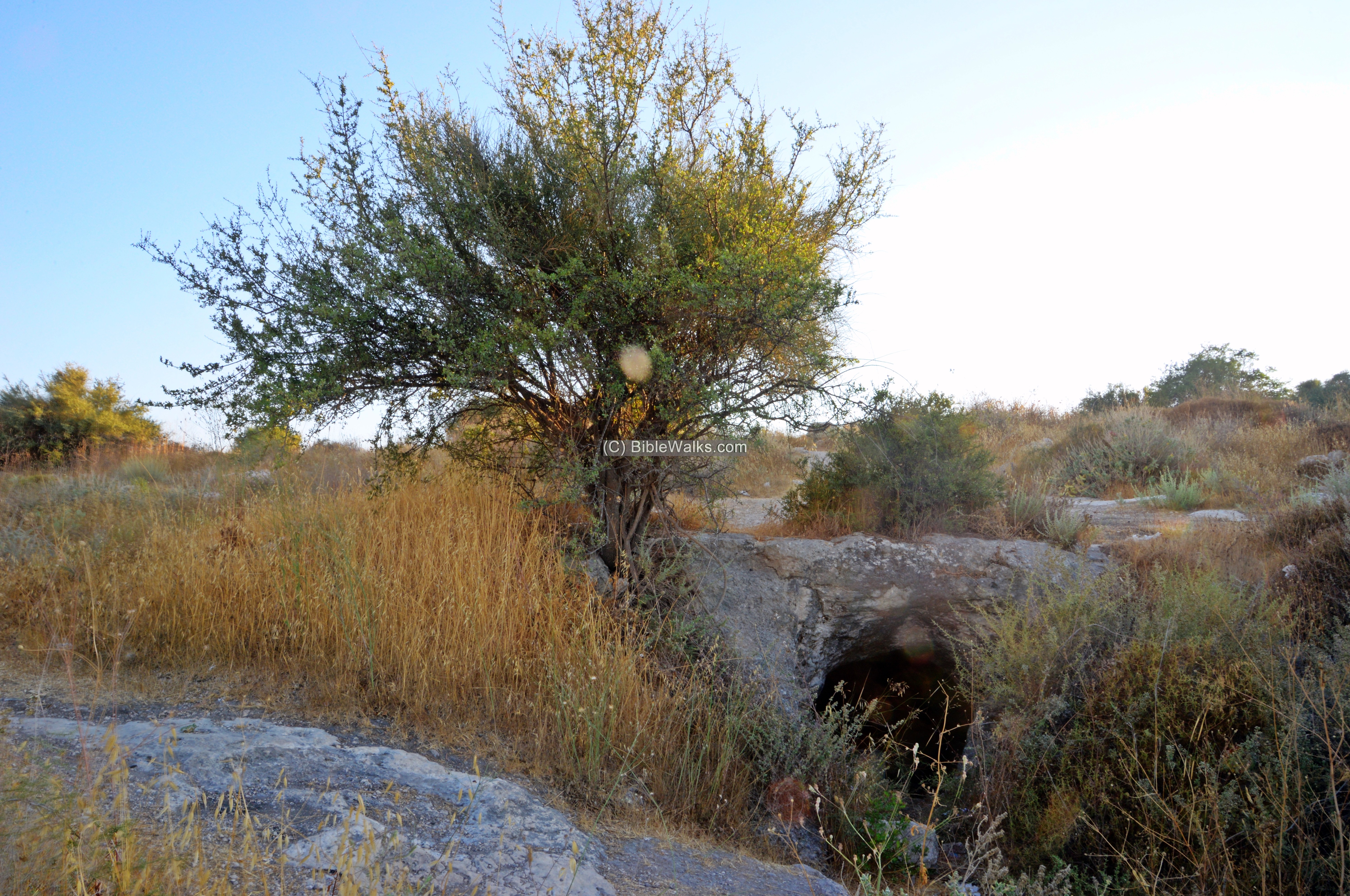
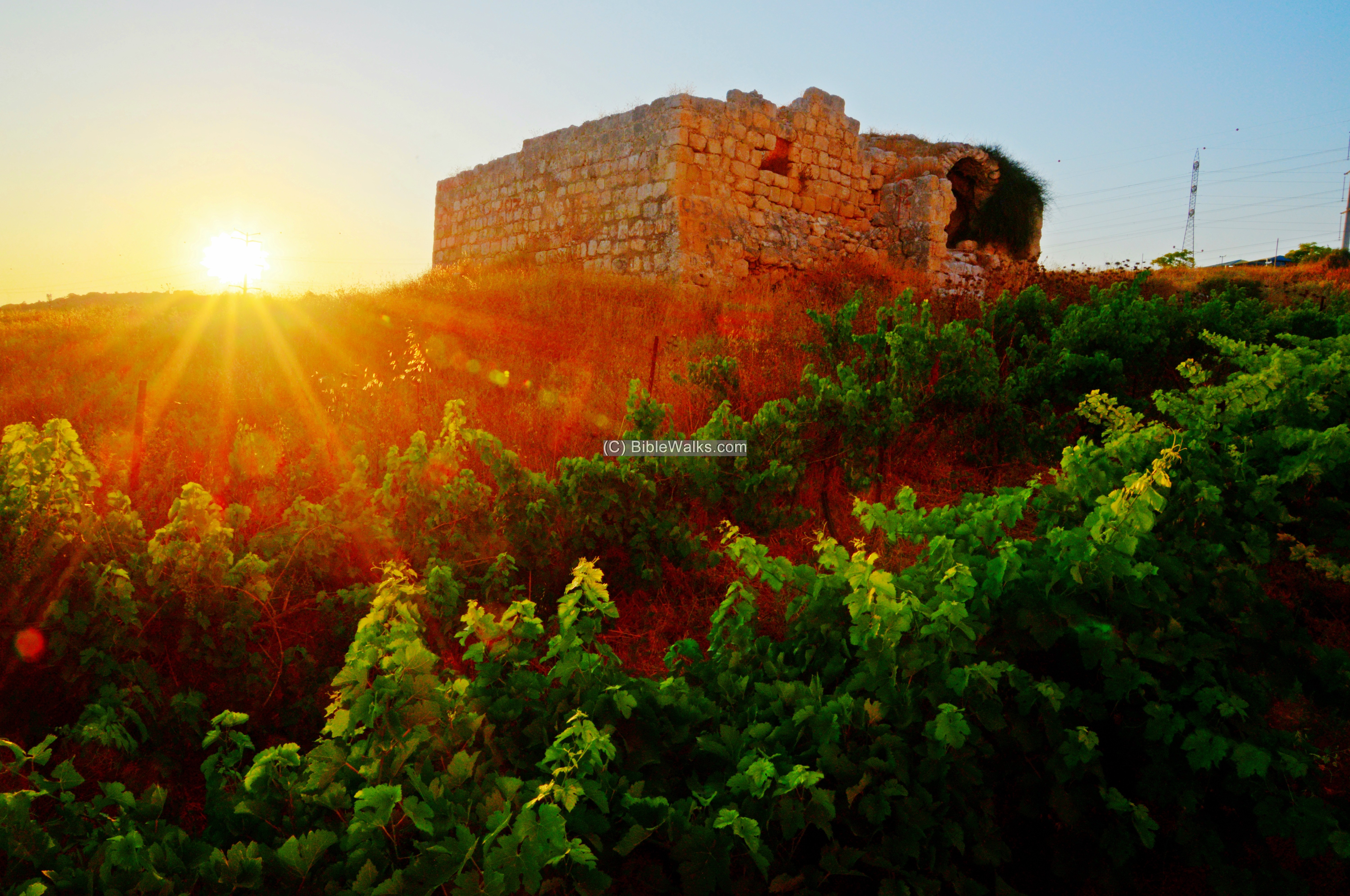
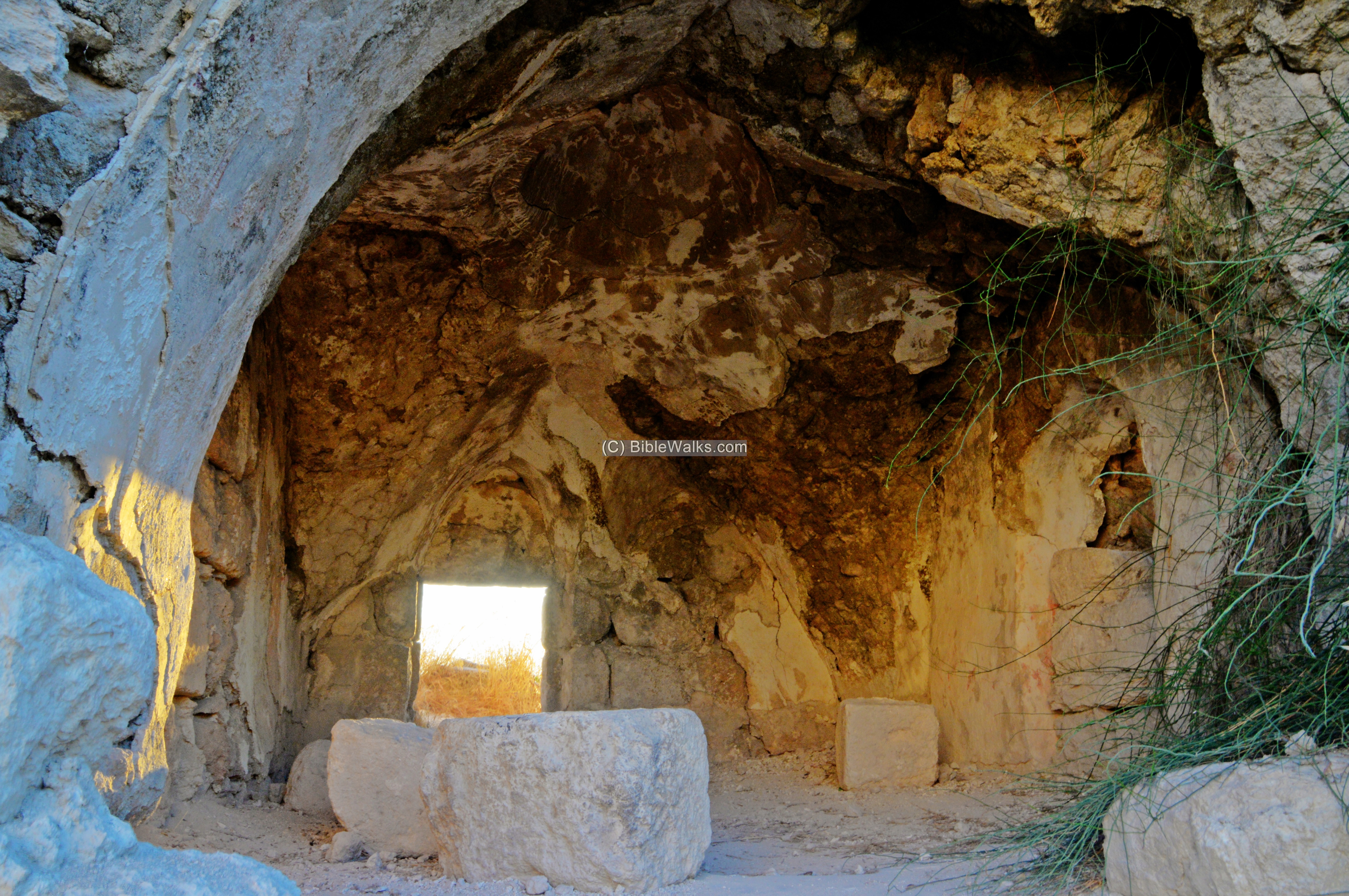
(f) Cave
On the eastern foothills, in the back of the park, is a small cave.
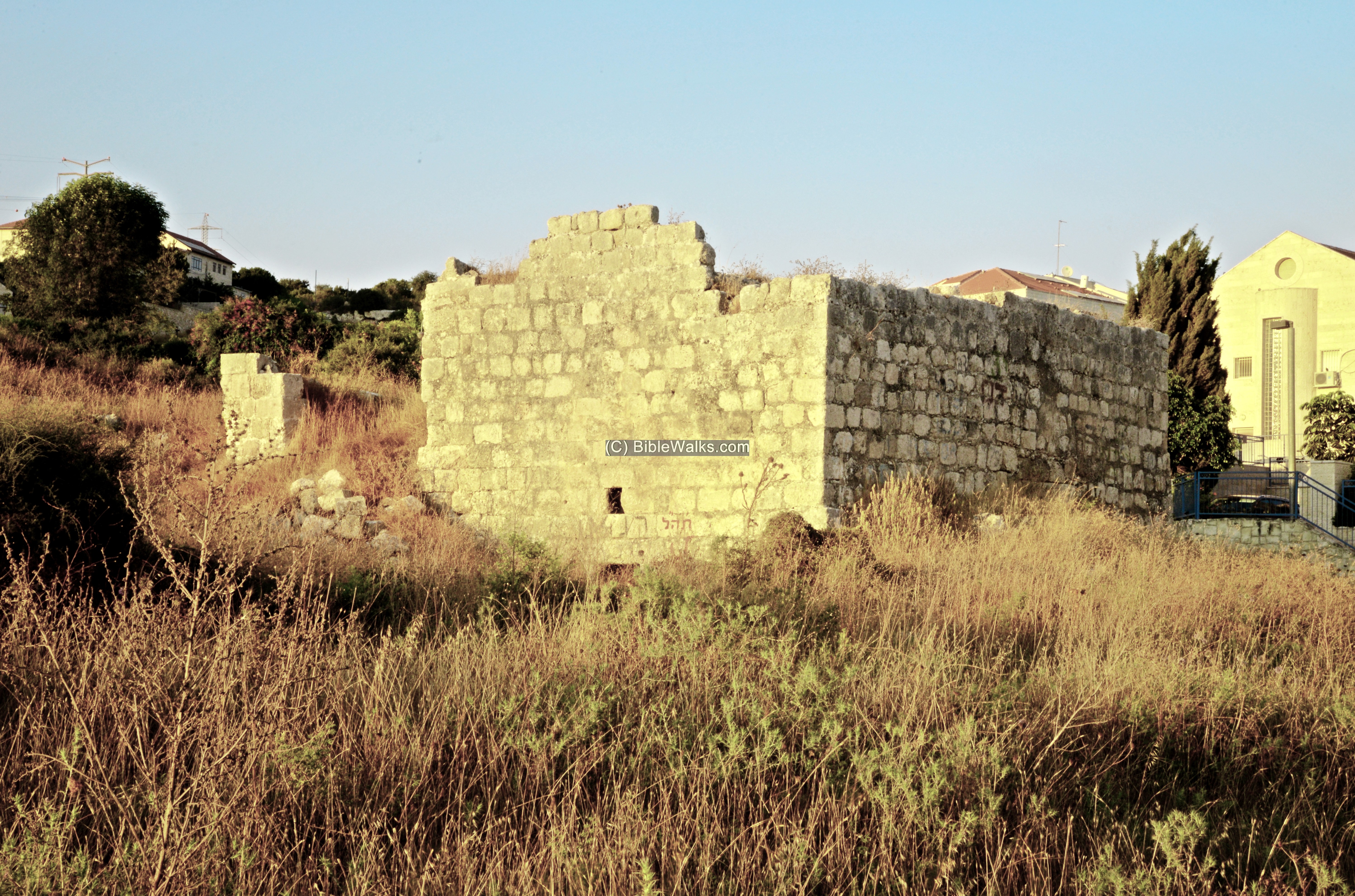
(g) Sheikh’s tomb
On the south west foothills, close to the edge of the modern residential buildings, are ruins of a multi-period farming village – Khirbet en Neby Bulus.
Excavations exposed remains of a settlement from the Late Hellenistic period until the Mameluke period. The peak of the settlement was during the Abbasid (750-1171) and Mameluke (1250-1517) periods.
The only visible standing structure is a sheikh’s tomb and pool. Ruins of the village, covering an area of ~200m square, are scattered to the north and west side of the standing structure.
The tomb (or shrine) is named after Neby Bulus – Apostle Paul of Tarsus. Paul died in about 65 AD and actually was buried in Rome.
Why would a Christian figure be cherished by Muslim Arabs? The Muslim Quran (36:14) refers to 3 messengers that were sent by Allah. Paulus (Bulus) is widely accepted as the 3rd messenger.
The 2 story structure was built over the foundations of an earlier structure. The following photo is from the rear, facing the east.
Its interior is seen in the following view.
The entrance was from the western side. It is seen here at the bottom of the structure. The PEF survey wrote about this:
“The latter is modern, with a cenotaph and a vault below, which looks like Crusading work, and is entered by a door on the west having a lintel with an ornamented boss. North of this building is a fine birkeh”.
Etymology:
Names of the site:
- Khirbet el ‘Aly, Khirbet ‘Ali – Arabic: Aly’s ruin (who is ‘Aly? perhaps Ali ibn Abi Talib – cousin, son-in-law and companion of the Islamic prophet Muhammad and the 4th Caliph)
- Ellon (Elon)- Based on the Arabic name and Geographic location, some scholars identify this ancient city with Ellon, a city in the area allotted to the tribe of Dan.(Joshua 19:40, 43): “And the seventh lot came out for the tribe of the children of Dan according to their families…… And Elon, and Thimnathah, and Ekron.
- Elah– perhaps the source of the name Ellon; Elah, is a Terebinth (Pistacia Palaestina) tree. The valley of Elah is 3km south of the site.
Links:
* Archaeology:
- Kh. en-Nabi Bulus – HA-ESI 117 2005, also: HA-ESI 122 2010
- Kh. el -Alya – HA-ESI 129 2017
- Batz, S. 2009. A Burial Cave at Khirbet ‘Alya. In: I. Yezerski (ed.), Excavations and Discoveries in Benjamin and Judea. Judea and Samaria Publications 10. Jerusalem: 273-275 (Hebrew; English summary).
- Peleg, Yehoshua, ”Second Temple Period Burial Caves in Khirbet ‘Alya”, Pages 205-214 in One Land – Many Cultures
* Cup mark sites:
- Modi’in Buchman south, near Horvat Hadat – HA-ESI 118 2006. Hundreds of rock-hewn cup marks in a Chalcolithic village. Two types: oval cup marks (20 cm by 35-40 cm, some of linked by channels), and circular cup marks (diam. 10–15 cm)
- Modi’in HA-ESI 117-2005 Buchman-Southeast
- Har Homa – HA_ESI 121 2009; Roman/Byzantine agriculture installations with dozens of cup marks
- Van den Brink, Edwin C.M., et al. “Chalcolithic Dwelling Remains, Cup Marks and Olive (Olea Europaea) Stones at Nevallat.” Israel Exploration Journal, vol. 51, no. 1, 2001, pp. 36–43. JSTOR, www.jstor.org/stable/27926953. – concentration of cup marks, at a site south of Shoham.
- Van den Brink, Edwin C. M. “A New Fossile Directeur of the Chalcolithic Landscape in the Shephelah and the Samarian and Judaean Hill Countries: Stationary Grinding Facilities in Bedrock.” Israel Exploration Journal, vol. 58, no. 1, Israel Exploration Society, 2008, pp. 1–23, http://www.jstor.org/stable/27927183.
* Internal – sites nearby:
* Other:
- Biblical pictures by Gustave Doré (1832-1883) – public domain
- Drone Aerial views – collection of Biblical sites from the air
- BibleWalks Youtube channel
BibleWalks.com – Have Bible – will travel
Zorah<<<—previous site–<<< All Sites >>>—>>> —Next Judea site—>>>Glorius Martyr
This page was last updated on Dec 11, 2021 (New link)