An artificial mound located in the Beit She’an valley, with remains from the Canaanite and Israelite periods.
Home > Sites > Jordan Valley > Tel Nissa
Contents:
Background
Location
History
Photos
* Aerial views
* Southern foothills
* Western foothills
* Findings
* Northern side
* Quarry
* Video
* Excavation
Links
Etymology
Background:
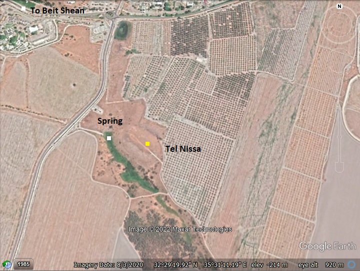
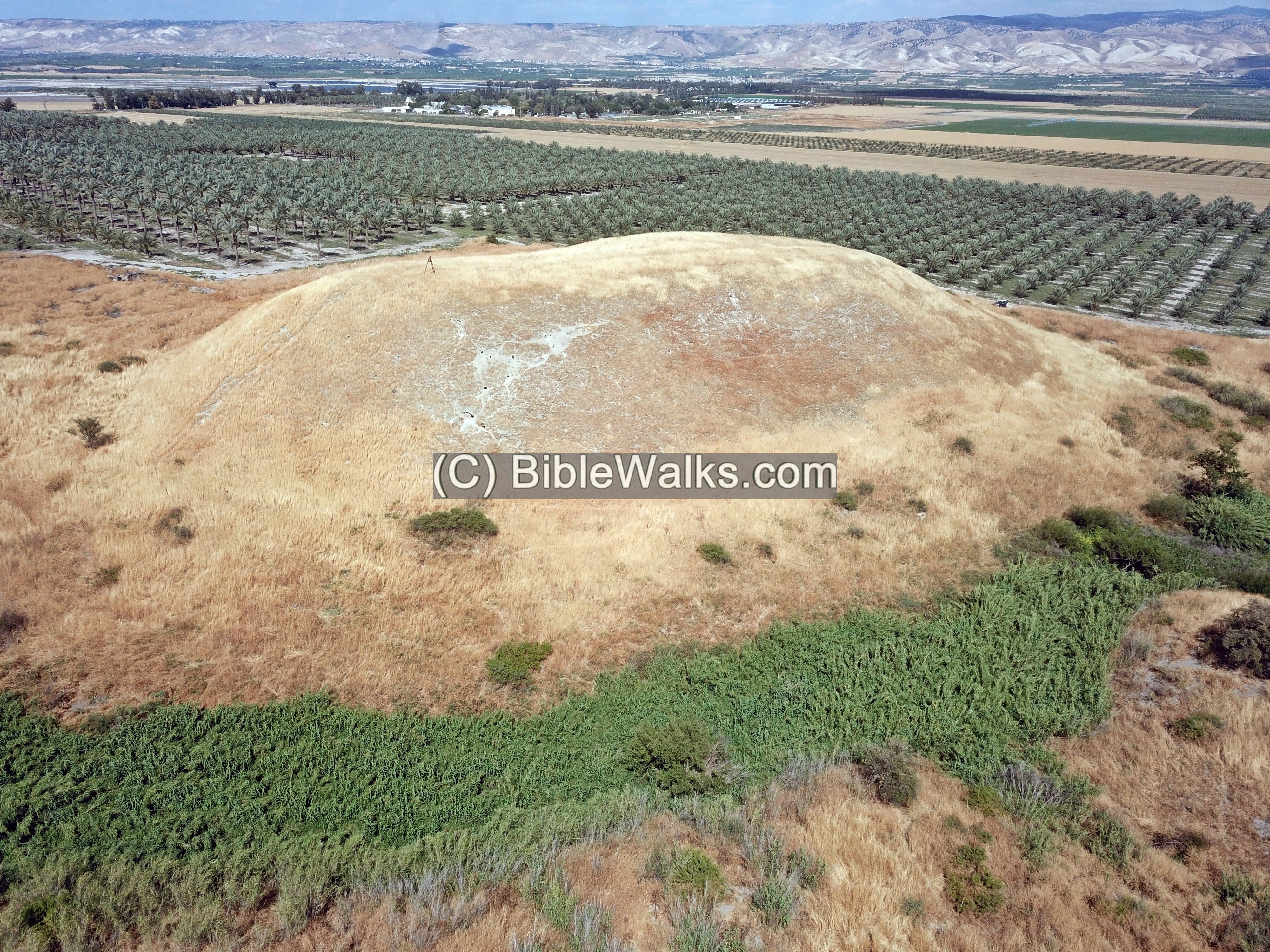
Tel Nissa (Tell el-Manshiya) is an artificial mound east of the city of Beit She’an, in the Jordan valley region. Its peak, 150m long and 75m wide, towers 15m above a spring that flows to the Jordan river.
On the hill is a multi-period Canaanite/Israelite city: starting from the Early Bronze Age I (3500-2900 BC), continuing thru the Late Bronze period (1550-1200 BC), and ending in the Iron Age I and II (1200-1000, 1000-586 BC).
As nearby Tel Rechov, it was probably destroyed by invading Egyptian Shishak (924 BC), followed by incursions by Hazael of Aram-Damascus (815-810 BC), and ending in the Assyrian destruction (732 BC). Prehistoric flintstones of the Paleolithic and Neolithic periods were found near the spring below the hill.
Location:
The site is located in the Beit She’an valley, 1KM east of Beit She’an. It is located in an open field – easily accessed by foot or car.
History:
- Prehistoric periods
Prehistoric flintstones of the Paleolithic and Neolithic periods were found near the spring below the hill.
-
Bronze Age
Tel Nissan was first settled in the Early Bronze period (early third millennium), at the same time when the nearby Tel Beit-Shean and Tel Rechov were established. Like other Bronze Age cities, the Canaanites moved enormous amount of earth to create the entire hill on which the city was located. The mound was built inside the valley of a spring, in order to provide water to the city, and also for protecting it by a wet moat.
A massive mud-brick wall was built around the top side of the mound.
-
Late Bronze age – Egyptian rulers
The nearby Tel Rechov (Rehob) was a central city-state in this region in the late Bronze age (1550-1200BC). Rechov was probably one of the cities conquered by Egyptian Pharaoh Thutmose III, just after the famous battle near Megiddo (1468 BC), which resulted in the Egyptian conquest of Canaan for 350 years.
Another evidence of the Egyptian conquest was found in the nearby Tel Beit Shean. An Egyptian basalt stele dated to 1318 BC was found on Tel Beit She’an, commemorating an Egyptian military victory. It was during the reign of Pharaoh Seti I (~1294-1279 BC) when a coalition of several rebelling cities attempted to seize the headquarters in Beit She’an, but were crushed by the Egyptians. The stele described the city-state Rechov as loyal to Egypt, and told how their enemies had the city under siege.
-
Biblical map
The ancient city on Tel Nissa was located in the path of major ancient crossroads, connecting to Beit She’an (north), the Jordan valley (south), Bezek (southwest), Jezreel (west), and Gilead (east). The cities and roads during the Canaanite and Israelite periods are indicated on the Biblical Map below, with Tel Nissa marked by a red dot.
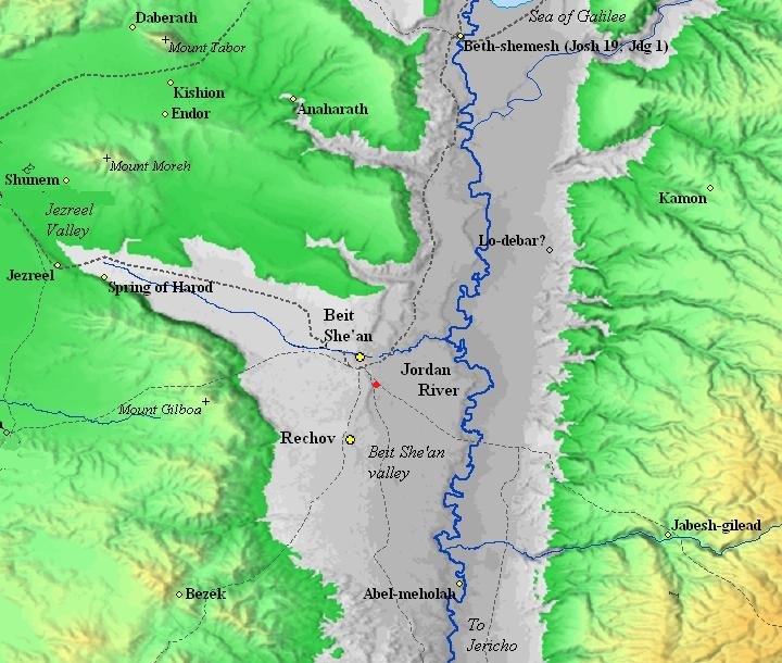
Map of the area around Tel Nissa – during the Canaanite and Israelite periods (based on Bible Mapper 3.0)
David Dorsey (“The roads and Highways of Ancient Israel”, 2018, p.111) suggested that a east going road, connecting Beit She’an thru Tel Nissa to one of the fords along the Jordan river, was used to cross the Jordan river. A chain of Iron Age sites are aligned along this route – from ‘Ein Umm el Filus (1km north west), thru Tel Nissa, then Tel Zemed (Tell esh Sheikh as Simad, 1km south east). This route is marked in the map as a dashed line that crosses the Jordan river. The river crossing, named Makhadet esh Sheikh Daud (ford of Sheikh David), was near the Bronze/Iron age sites of Tel ‘Artal, Tel Karpas, Tell el Qitaf (near Kibbutz Kfar Rupin). It connected to the city of Pehel (Pella) on the other side of the Jordan river, and was the main crossing point in this region.
According to Dorsey (p. 116), Rechov connected by a highway passing thru ‘Ein Hanaziv – half way the distance between the two cities. It is also indicated on the map as a dashed line.
-
Israelite period (the Judges)
The mighty Canaanite city was probably not conquered by the Israelites during their conquest of Canaan in the 12th century. Although the Bible does not name the city directly, it does tell us that the region of Beit She’an remain Canaanite (Judges 1: 27):
“Neither did Manasseh drive out the inhabitants of Bethshean and her towns“.
-
Israelite period (Saul and David)
Even the first Israelite King Saul did not manage to take this small Canaanite enclave around Rechov and Beit She’an. Only his successor, King David, managed to take it in approximately year 1000 BC, extending his empire to the upper Galilee (1 Chronicles 18 3):
“…And David smote Hadarezer king of Zobah unto Hamath”.
Since then, the city was under the control of the Israelites.
-
Israelite period (Northern Kingdom)
In 928 the Kingdom separated to the south (Judah) and the north (Israel), and Rechov and its towns (including this city) became part of the Northern Kingdom.
After Solomon’s death, Egypt’s Shishak invaded Israel in 924 BC (1 Kings 14: 25):
“In the fifth year of King Rehoboam, Shishak king of Egypt attacked Jerusalem”.
According to the Pharaoh’s hieroglyphic inscriptions, nearby Rechov is listed as one of the cities that he captured (#17 r-h-b). This destruction may be evident in Tel Rechov’s Stratum V, and perhaps will be found here as well.
- Plan of the city:
A figurative illustration of the city during the Israelite period is shown here. Although only a future excavation will provide solid inputs on the features of this site – dating the layers of settlements, location of the main structures, etc – some of the highlights are assumed and illustrated here.
The plan of this ancient city was based on a raised artificial mound. The slope on the outer face make the attackers’ ascent difficult. To make it even more difficult a glacis was formed along the slopes. Using a cover of fieldstones and sealing them with a smooth layer of rammed earth and plaster, the slope of the glacis became a smooth and slippery surface. These slopes made the ascent difficult for the assailants, kept them in an open area for the archers, while also strengthening the walls against undermining. A tall mud brick wall was built along the rim of the hill, from which the defenders would fire arrows and spears. On the south side was a tower or gate house. An access road ascended up to the summit. A spring on the north western side provided water supply and added an important defensive measure.
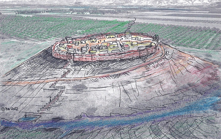
Tel Nissa – Biblical period – figurative illustration
The buildings in Rechov, and probably also in Tel Nissa, were constructed of mud bricks without stone foundations. Wood was used for some of the foundations of the walls and floors. This architecture is unusual for this period, which was based on unhewn stones.
-
Israelite period (House of Omri)
Omri was a general, who was made king (882BC) over the Northern Kingdom during the mutiny of Zimri (1 kings 16 16):
“And the people that were encamped heard say, Zimri hath conspired, and hath also slain the king: wherefore all Israel made Omri, the captain of the host, king over Israel that day in the camp.”.
After regaining the control of his Kingdom, Omri turned to defend his country against their arch-enemy – Aram-Damascus – and the rising empire of Assyria.
Ahab, his son, fought against Aram-Damascus in 3 battles, but was killed (850) in the 3rd battle. Ahab’s son Yoram continued to confront the Syrians, and was killed in Jezreel (842), thus ending the house of Omri. (1 kings 22:35):
“And the battle increased that day: and the king was stayed up in his chariot against the Syrians, and died at even: and the blood ran out of the wound into the midst of the chariot”.
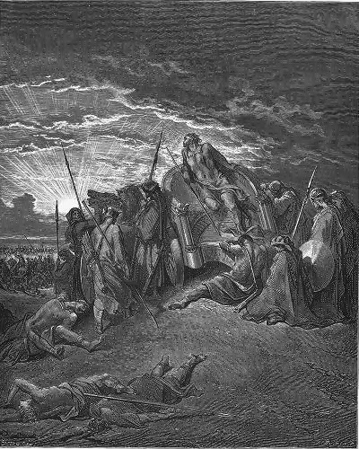
Fall of King Ahab in Ramoth Gilead
Drawing by Gustav Dore (French artist, 1832-1883)
The assaults continued from the north: the Assyrians forces – a rising force in the region- hit the Northern Kingdom in 841, and Aram-Damascus headed by Hazael invaded in 815-810, as per Biblical accounts (2 Kings 8:12, 12:18-19, 13:3+7; Amos 1:3) and (2 Kings 10 32):
“In those days the LORD began to cut Israel short: and Hazael smote them in all the coasts of Israel;”.
In one of these intrusions the city of Rechov (and probably the city here as well) was violently destroyed; the archaeologists dated this destruction in Rechov to an approximate date 840-830 BC (and marked it as layer called Stratum IV).
-
Assyrian conquest
In 732 BC was an intrusion to the North of Israel by the Assyrian King Tiglath-Pileser III, who annexed the area (as per 2 Kings 15: 29):
“In the days of Pekah king of Israel came Tiglathpileser king of Assyria, and took … Galilee…and carried them captive to Assyria”.
The Assyrians captured the cities in the region. This destruction is evident is evident in most of the Rechov excavation areas (Stratum III), and probably this was the case of Tel Nissa. The Assyrians occupied the ruined city for some time, but then made Megiddo the capital of the region and these cities were completely abandoned for the next 1,500 years.
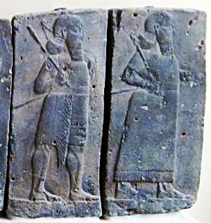
Orthostat relief – depicting soldiers from different orders of the Assyrian Army,
in procession; basalt; Hadatu Tiglath-Pileser III period (744-727BC)
[Istanbul Archaeological museum]
- Persian period
The Tel was also settled in the Persian period.
- Roman period
The site was not settled during this period. However, Byzantine and Early Muslim coins, glass and ceramics and remains of structures were found north east of Tel Nissa (as per N. Zori 1962, site 87 “Jaljil”).
An ancient Roman highway (from Scythopolis/BethShean to Neapolis/Shechem and Jericho) passed on the west side of Tel Nissa. A milestone from this road (#5) is on display in the nearby Kibbutz Sde Eliyahu (5 km south). This section appears in the 4th century Peutinger Map (marked by a yellow circle to the left of “Scytopoli”).
-
Later periods
The site was examined in the PEF survey (1866-1877) by Wilson, Conder and Kitchener. It appears as “Tell el Menshiyeh” in the center of the section of this map of 1878. It is situated near a road. The surveyors wrote about it (SWP, Vol 2, p. 127):
“Tell el Menshiyeh —An ancient artificial mound, with a spring on the south side”.
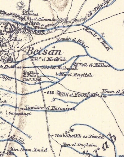 Part of Map sheet 9 of Survey of Western Palestine,
by Conder and Kitchener, 1872-1877.
(Published 1880, reprinted by LifeintheHolyLand.com)
- British Mandate
A 1940s British map shows the area around the site – that is marked as Tell el Menshiye. The spring is marked on the south side of the hill.
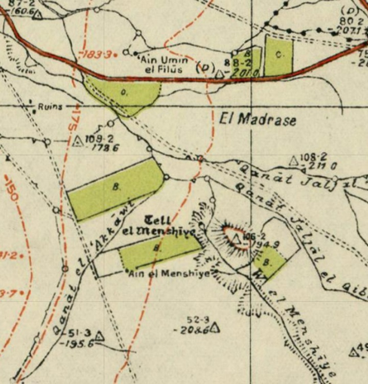
British survey map 1942-1948 – https://palopenmaps.org topo maps
License: public domain under the UK Copyright, Designs and Patent Act 1998
A 1932 archaeological survey reported:
“Fairly large tell on which some third Semitic pottery was seen. The top of the tell is cultivated. A small runlet of water enters the large natural basin which protects the site on the West and South, and there joins a spring which immediately becomes a considerable stream. It is possible that the sides of this basin may contain tombs”.
The surveyor Russ added:
“Three large and rough stones built in a wall were unearthed by the effect of heavy rain on N.E. corner of the top edge. Probably this is the outer wall of the old top settlement”.
The surveyors concluded: “Excavation recommended”. Perhaps after 90 years its about time to excavate.
-
Modern Times
Tel Nissa is accessible by a dirt road that branches off the road connecting ‘Ein Hanaziv to Tel Ashtori junction.
An archaeological excavation has been approved on the site. A pottery survey was conducted on November 2023.
An excavation will be held on April 2024.
Photos:
(a) Aerial Views
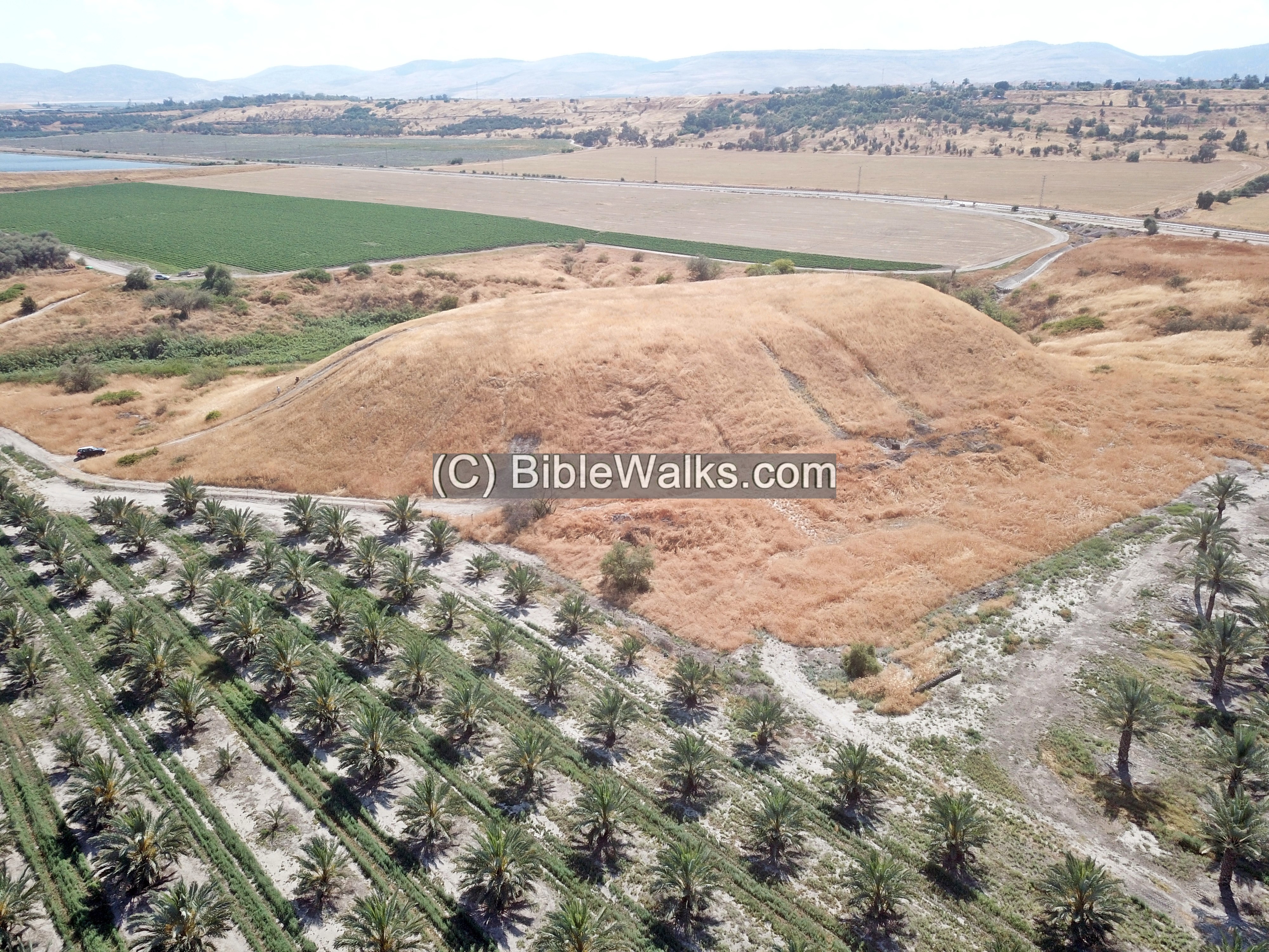
Our drone captured views of Tel Nissa from all sides. The first one is the view of the ancient Tel, as seen from the south. In the far background, less than 1km, are the houses of the city of Beit She’an.
Click on the photos to view in higher resolution…
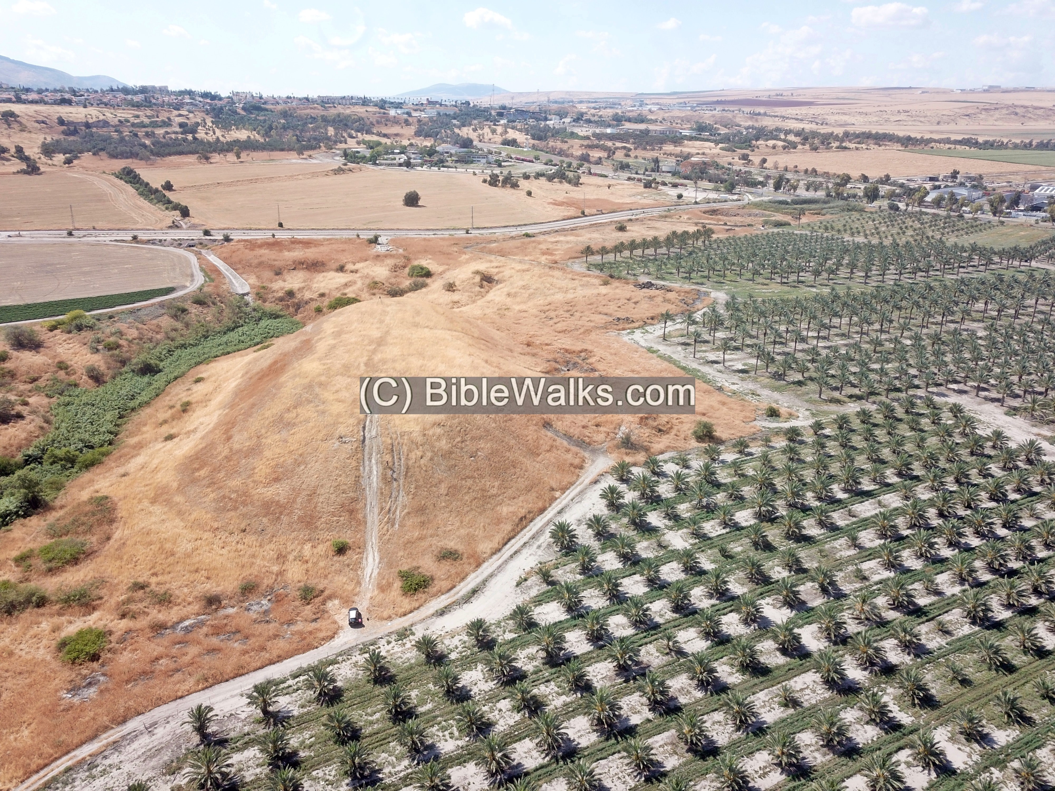
The next view is towards the west.
Closer to the site is the north-south road nicknamed ‘-200’, as its route is along the height of 200m below sea level. This was probably the same route as in the Bronze Age and Roman periods.
Next is a view towards the east. Behind, after the plantations, there are two communities – kibbutz Neve Eitan and kibbutz Maoz Haim. In the far background is the Jordan river, and behind it are the mountains of Jordan.
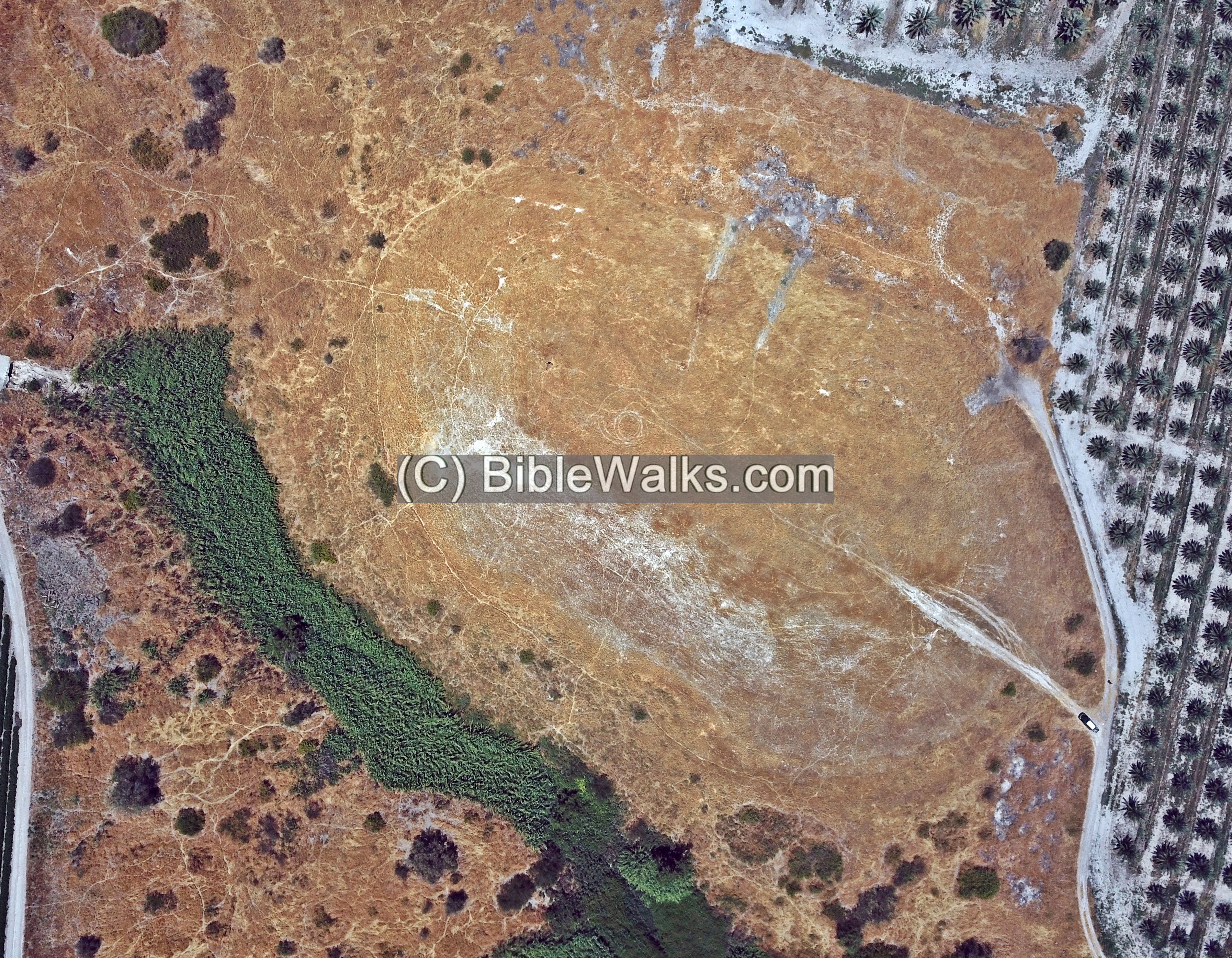
Finally, a top view of the site:
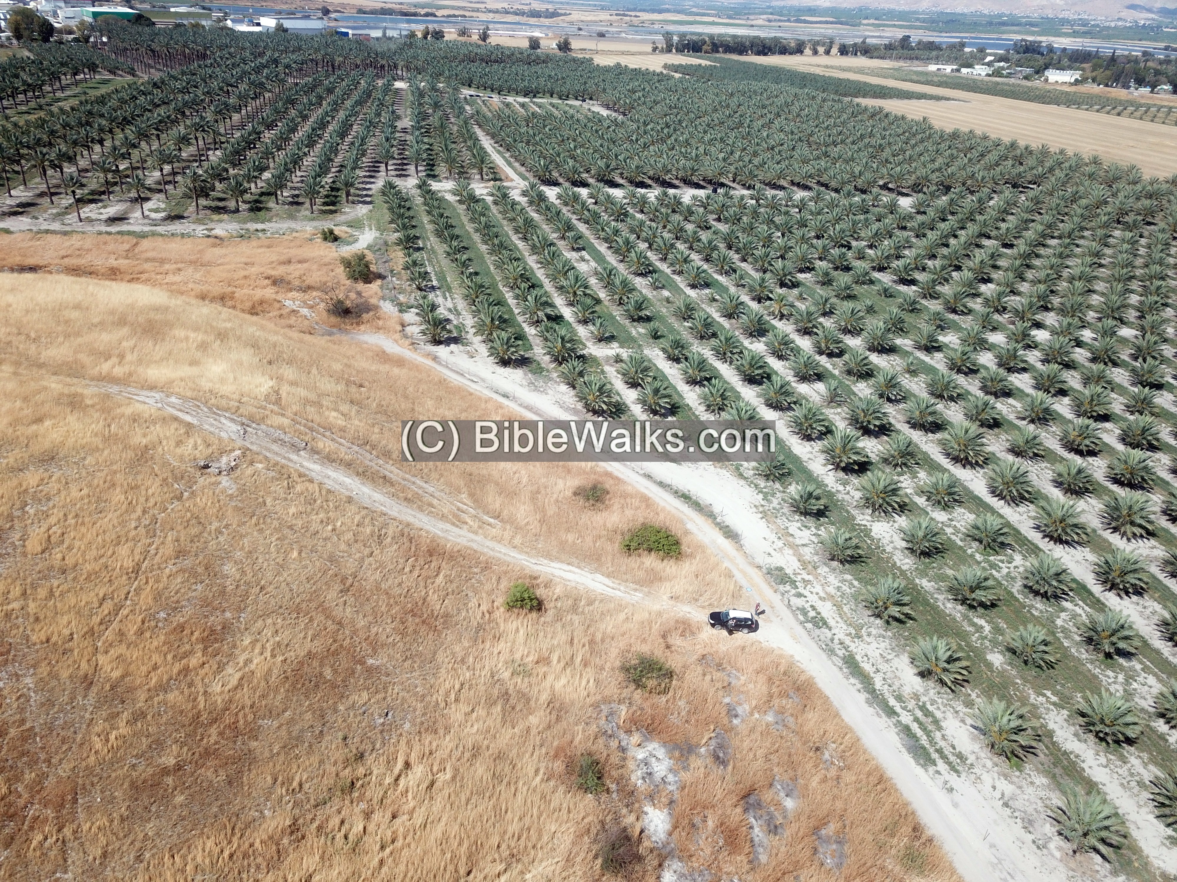
(b) Southern foothill
Access to the summit is on the east side. We left the jeep at the bottom of the hill.
This was a steep dusty ascent, with almost nothing to hold to. The artificial hill is composed of the soft marlstone, and the soil breaks into powder. Combined with the extreme heat in one of the hottest regions in Israel, with 40 degrees Celsius (100 Fahrenheit) on that day, the exploration was indeed difficult.
The name of the mound – Tel Nissa – means in Hebrew ‘elevated mound’, and the Arabic name Manshiyeh means ‘built’. Both are associated with the difficult climb.
Remains of a sun dried mud brick wall, built over a basalt stone foundation, are visible along the upper peripheral side of the summit. Archaeologist Ayelet Goldberg-Keidar examines this location, just a few meters from the summit, where the brick wall is seen. The sun dried mud bricks were actually fused by the heat of the fire during the destruction, preserving them for centuries.
The base of a large structure – a tower, gate house or public structure – is visible on the south eastern side.
Below is another visible section of the base of the wall.
According to Ayelet’s assumptions, and based on a previous survey conducted by Nehemia Zori, this was part of a formidable structure. It is dated to the Iron Age IIa, a time period parallel to the time of Tel Rechov.
The location of the structure (a tower or fortress?) is marked on the right side of the illustration (south east edge).
Tel Nissa – Biblical period – figurative illustration
The wide base of the structure suggests that the outside city walls, made of mud bricks laid over a base of basalt stones, can be up to 5m.
Remains of one of the mud bricks is shown here. Most of the bricks have since crumbled into dust, but some are still found along the slopes.
(c) Western foothills
A view towards the south and west is seen here from the summit.

The team searched the foothills for ceramic fragments and tracked the path of the wall.
(d) Findings
- Flint Stones:
N. Zori (1962, site 88) found many flint stones along the stream south of the mound. Their dating: Paleolithic period, Neolithic-Chalcolithic, Early Bronze and Iron Age.
The following flint stone was found on the mound during our first visit:
- This sharp flintstone is the blade of a sickle. It is dated from the Chalcolithic period up to the Iron Age. A similar item can be seen in the IAA archives, for example from Tel Arad (sickle).
- Ceramics:
Ceramics collected on the mound and on its foothills were dated by N. Zori (1962, site 88) to the Early Bronze I (few), Late Bronze, Iron I, and Iron II.
In our first visit to the site, we have collected the following samples (and leaving them on the site):
- A handle of a cooking pot, decorated with red stripes and paint. It was dated to the Iron Age II, 10th century BC.
- Next is a fragment of a cooking pot, dated to the Late Bronze Age.
- Yet another cooking pot, dated to the Iron Age II.
(e) North West side
The following photo is a view of the north west side of the mound.
On the north west side of Tell Nissa is the spring that was the source of the water supply, and the reason why the mound was erected on this spot.
The valley of Beit She’an is a semi-desert area due to its depression among the mountains around it. The average yearly rainfall is a mere 250 millimeters (10″). Life could be sustained only with a live perennial spring. In the valley of Beit She’an, kick named “the valley of springs”, are many springs and ancient sites that were built near them.
Prehistoric settlement predated the construction of the mound during the Bronze period. Flintstones of the Paleolithic and Neolithic periods were found along the path of the stream emerging from the spring.
(f) Quarry
A short distance north of the spring are remains of an ancient quarry. It was probably used to mass produce the mud bricks that were used to raise the walls. Mud bricks were made with the quarried soil, water and straw, and after casting them in wooden mold, they were left to dry in the sun for several days. The proximity to the spring and the quarry made the production of the bricks much easier.
A closer view of the quarry is next. Notice that a large wild beehive hangs inside one of the cavities,
A closer view of the honeycomb:
A large sun-dried mud brick was found in situ near the quarry. It also looks like there are ancient imprints of fingers casted in the brick.
Yet another large mud brick, seen below, was found at the western foothill.
The walls of the city required massive number of mud bricks. Assuming a height of 5m, a width of 1.8m, and length of 350m along the peripheral of the summit (covered within an area of 150m x 75m), this amounts to a volume of 3,150 cubic meters of bricks. Assuming a cubic volume of each mud brick of 0.007 m³ (35cm x 20cm x 10 cm), this wall required ~0.5 million bricks.
(g) Video
![]() Fly around the site with this YouTube video. The drone surrounds the Tel starting from the east side.
Fly around the site with this YouTube video. The drone surrounds the Tel starting from the east side.
Video and photos captured on Apr 2022
(h) Excavation
The first excavation of Tel Nissa (Tell el-Manshiya) has been approved, one of the outcomes of BibleWalks Jordan Valley survey. It is headed by the distinguished archaeologists Professor Emeritus Amihai Mazar (Hebrew University), Dr. Yoav Vaknin (Tel Aviv University) and Archaeologist Ayelet Goldberg -Keidar (Hebrew University). A preliminary phase of a polygon survey was conducted on Nov 24, 26, 27, 2023.
Prof. Mazar is one of the most senior experts on Biblical Archaeology, and among his major projects are the Beth Shean Valley Archaeological Project and the excavation and publications of Tel Beit Shean and Tel Rechov.
Doctor Yoav Vaknin specializes on archaeomagnetic dating of mud bricks, a new technology that will help to determine the destruction time of the site. This technique measures the direction of the earth’s magnetic field recorded in a burnt sun dried mud brick and compares it to the historic magnetic field variations.
Here are some of the survey’s photos.
In this photo: The team collects pottery and flint stones within one of the polygons designated for the survey. This section is on the east side. The foothills are very steep and there were hundreds of pottery segments to collect on the vast surface of the mound. The volunteers picked up ancient fragments into pails, and the collection was tagged then brought to the analysis team. Thanks for the dozens of the volunteers, combined with the preparations arranged before the survey by Ayelet and Yoav, this phase of the survey was completed in just a day and a half.
Below – The BibleWalks team who participated in the polygons field survey (left to right) – Hofman brothers Amnon, Ofer, Yoram and Ronnie. The turquoise shirts are of the Jordan Valley Archaeological Survey project operated by BibleWalks.
Amit, another BibleWalks member, helped brushing the dust off the pottery fragments prior to the dating process.
Archaeologists determine the date of the pottery sherds based on indicative features of the pottery sherds, as their forms shapes and styles changed over time.
The pottery dating analysis team examined the collected findings within each polygon, in order to create a ‘heat map’ of the various periods of the mound.
Around the table, from left to right: Dr. Nava Panitz-Cohen (Hebrew University, director of Abel Beth Maacah excavations); a young volunteer; Dr. Yoav Vaknin; Ayelet Goldberg -Keidar and Prof. Amihai Mazar. Both Nava and Amihai have dozens of years experience in pottery classification and dating.
Below – Prof. Mazar and Dr. Vaknin examine a section of the exposed eastern wall just below the summit.
The next phase of the excavation will be in April 2025, with several archaeological squares opened in areas that will be determined by these experts. One of the tasks will be to examine some of the mud bricks using archaeomagnetic technology, in order to retrieve the date of the destruction.
See details on the April 2024 excavation.
Links:
* External:
- British Mandate survey report, 1932
- IAA survey, map 63, site 77
- Eero Junkkaala – Three Conquests of Canaan (pdf)
- Cooking pot production in Judea during Iron Age II – D Ben-Shlomo, pdf, 2019
- Prof. Amihai Mazar – Hebrew Univeristy, The Institute of Archaeology
* Archaeomagnetic Dating of mud bricks:
- Archaeomagnetic Dating of mud bricks – TOI 2022
- Geomagnetic Field Data – Tau (Hebrew) – a scientific breakthrough dated 21 layers of destruction in 17 archaeological sites
- “Pre-Excavation Identification and Dating of Iron Age Destruction Events” – Yoav Vaknin, Roi Granot, Nitsan Shalom, Eldar Buzaglo-Yoresh, Ayelet Keidar-Goldberg, Stefan Münger; Aug 2025, Wiley online library. related to the work on Tel Nissa and nearby sites.
* Other:
- Biblical pictures by Gustave Doré (1832-1883) – public domain
* Internal:
- April 2024 excavation – come to dig
- Tel – Ancient mounds
- Tel Rechov
- Tel Beit Shean
- Drone Aerial views – collection of Biblical sites from the air
Etymology (behind the name):
- Tel (Tell) – mound (See more on the story of a Tel).
- Tell el-Manshiya (Menshiyeh) – Arabic: the mound of the growth, or: the built mound. The root name is ‘ansha’ meaning: to build.
- Tel Nissa – Hebrew: the elevated mound (תל נישא)
- Nahal Eitan – the modern name of Manshiya stream, based on the nearby Kibbutz Neve Eitan
- Neve Eitan – the Kibbutz is named after a Biblical verse related to the Jordan (Jeremiah 49:19): “Behold, he shall come up like a lion from the swelling of Jordan [גאון הירדן] against the habitation of the strong [נווה איתן]”.
BibleWalks.com – exploring the ancient sites of Israel
Tell Ubeidiya<<<—previous site—<<< All Sites>>> — Next site—>>>Tel Artal
This page was last updated on Aug 26, 2025 (article)
Sponsored links: