Yarmut (Jarmuth) was a major Early Bronze II-III period city state, located on a vast mound overlooking Ramat Beit Shemesh. A monumental Early Bronze III palace was exposed on the lower city. Occupation continued 1000 years later on the upper city during the Late Bronze and Iron Age periods, and was one of the Amorite cities that attempted to block Joshua and the Israelites.
Home > Sites > Judea > Tel Yarmut (Jarmuth)
Contents:
Overview
Location
History
Photos
* Aerial views
* Outer City Gate
* Palace
* Main Entrance
* Palace Rooms
* Water supply
* Upper City
Etymology
Links
Overview:
Yarmut (Jarmuth) one of the oldest and most important Canaanite cities. Ruins of the Early Bronze II-III period city is located on a vast mound overlooking Ramat Beit Shemesh Gimel. A monumental palace was exposed on the lower city.
Occupation continued 1000 years later on the upper city during the Late Bronze and Iron Age periods, and was one of the Amorite cities that attempted to block Joshua and the Israelites.
Location:
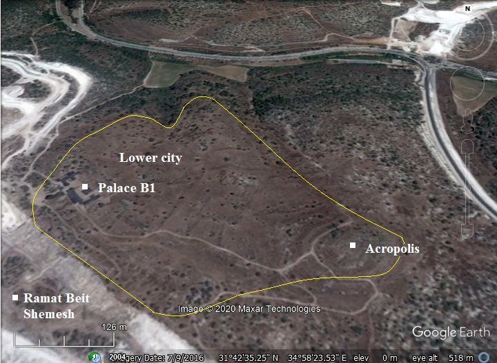
The following aerial view shows the area of the ruins of Tel Yarmut. Just south of it are the newly built neighborhoods of Ramat Beit Shemesh.
The mound is vast, covering an area of 180 dunam (40 acres) – 640 long and 420 wide. The small upper city (Acropolis), known as Khirbet Yarmuk, is located on a hill (altitude 405m) on the east side, covering a mere area of 15 dunam. The expansive lower city with its grand palace (B1) is on the west side of the hill. Remains of its walls are still visible in the slopes around the mound, with slopes of ~5m along the hillside. The plan of the city walls, reaching 1800m in length, is highlighted with a yellow line.
History:
Tel Yarmut is a multi period city. It had a first phase of a mega city during the Early Bronze II-III period, a long gap of occupation, then followed by a smaller city during the Late Bronze and Iron Ages.
- Early Bronze II-III (3050-2300 BC)
The city was established and occupied during the Early Bronze periods II-III. The mound covers an area of 180 dunam, and is composed of an acropolis on the east side and a large fan-shaped lower city sloping on the west side. A depression on the north west corner may have led to a large water reservoir that supplied water to the city.
The city walls, going thru several phases of construction, are enormous – reaching widths of 38m on the west side.
The phases of Early Bronze occupation are summarized here, with the major changes during each phase, listed from early to late:
Early Bronze 1B (3500-3150): Sherds, no fortifications; core of settlement is on the acropolis.
Early Bronze 1B (3150-3050): Domestic buildings, already a large settlement (100-150 dunam). Defense: Phase 0: first defense works.
Early Bronze 2 (3050-2650): Domestic and public buildings; defense: Phase A: city wall A, Phase B: city wall B, city gate E
Early Bronze 3A (2650-2500): Domestic and public buildings; “White building” temple
Early Bronze 3B (2500-2400): Building C; defense: Phase C: platforms
Early Bronze 3B (2400-2300): Palace B2; defense: dismantlement of platforms
Early Bronze 3C (2400-2300): Palace B1, Buildings J-K-M; defense: use of earlier fortifications
Early Bronze 4 (2300): Abandonment
The destruction levels of these occupation phases accumulated on the mound for a total height of 4m.
- Early Bronze IIIC (2400-2300 BC)
Based on the findings, Yarmut became a well organized city-state with a full fledged palatial economy and sophisticated urban planning.
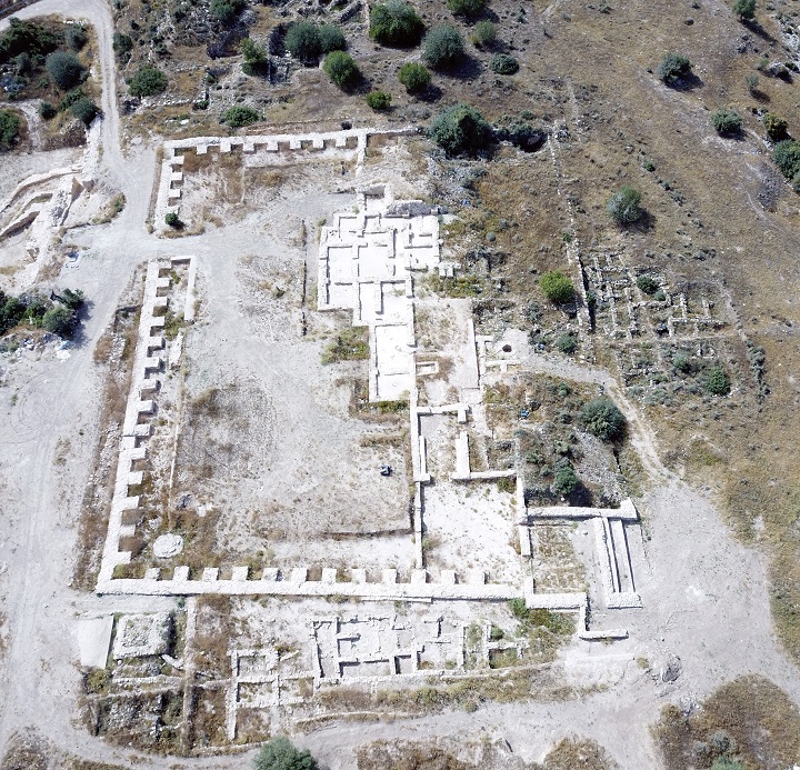
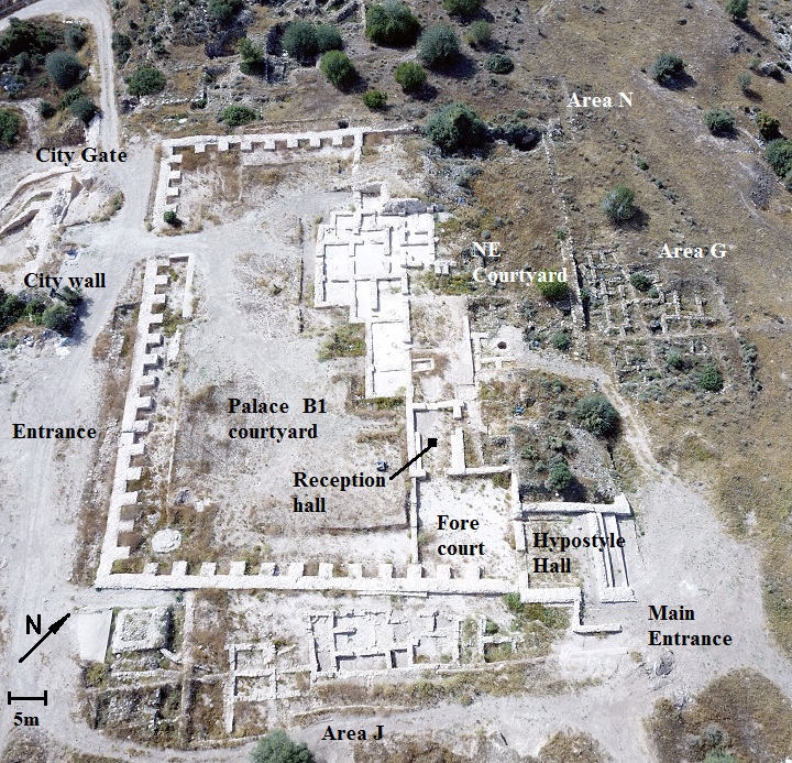
One of the remarkable remains of this period was a monumental palace. Remains of two phases of construction were exposed in the lower city, adjacent the city gate on the south west side of Tel Yarmut. A plan of Palace B1 is shown below. The outer dimensions of the palace are 71.m by 84.5m.
- Early Bronze IV (~2300BC): Abandonment
The city was suddenly abandoned at about 2300 BC. The residents took with them the precious goods, but left behind large or broken vessels.
This phenomenon is known from all Early Bronze IV cities of Canaan. Towards the end of the Early Bronze period most of the large fortified cities were depopulated in the Levant. Old empires collapsed, like the Old Kingdom in Egypt that witnessed turbulent times and chaos. It may have been a result of onset of drier climatic conditions, which resulted in insufficient resources to support the large cities. This was a dramatic social change – the shift from urban to non-urban life. The sources of income also changed to a pastoral and agricultural society, with emphasis on herding rather than farming. The population moved to smaller, seasonal and scattered camp sites that required less resources. None of these sites were fortified, as opposed to the formidable cities of the Early Bronze period. Settlements were mostly inhabited by nomads or semi-nomads, and built on summits or slopes of high hills.
- Late Bronze (1400-1300 BC)
After the site was unoccupied for a thousand years, a new settlement was established during the Late Bronze period. The new city occupied the area around the upper city (acropolis), one tenth of the entire mound. The majority of the lower city was never again occupied, and so the excavations on the lower side of the mound were just below the surface.
- Biblical references
Yarmut (Jarmuth) is mentioned 7 times in the Bible:
a. Coalition of the 5 Amorite kings
The King of Jarmuth was one of the five Amorite kings who fought against Joshua during the conquest of the land of Israel.
The Amorites were an ancient Semitic-speaking people who originated from Syria, and dominated the Levant from the 21st Century to the 17th Century BC. The Bible writes about their origin as forth son of Canaan (Genesis 10:15-16): “And Canaan begat …And the Jebusite, and the Amorite”). They are known to establish the city of Babylon, among other cities in Mesopotamia.
In Israel, they dwellt in the Judean desert and the Jordanian mountains between Jabbok and Arnon brooks (Numbers 13:29): “…And the Amorites, dwell in the mountains…”. Moses captured their country (Numbers 13:32): “And Moses … took the villages thereof, and drove out the Amorites that were there”. Their land was divided among the tribes of Judah (west of the Jordan) and Reuben and Gad (east of Jordan river).
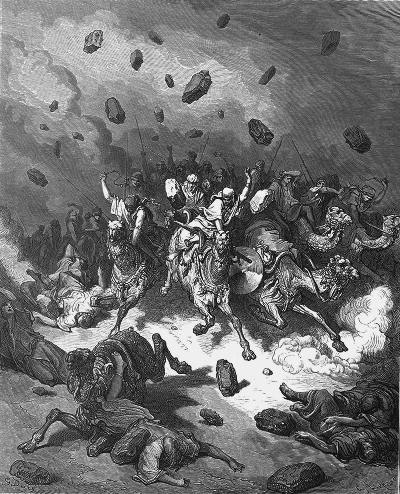
However, after the conquest of Israel, the Israelites encountered resistance from the remaining Amorites in Judea. In the campaign of the city of Gibeon, Joshua chased the 5 Amorite kings down to Azekah. The Israelites slew the Amorites, and God casted great hailstones which destroyed them.
Joshua 10:3-5:
“Now it came to pass, when Adonizedek king of Jerusalem had heard how Joshua had taken Ai, and had utterly destroyed it; as he had done to Jericho and her king, so he had done to Ai and her king; and how the inhabitants of Gibeon had made peace with Israel, and were among them; That they feared greatly, because Gibeon a great city, as one of the royal cities, and because it greater than Ai, and all the men thereof mighty. Wherefore Adonizedek king of Jerusalem sent unto Hoham king of Hebron, and unto Piram king of Jarmuth, and unto Japhia king of Lachish, and unto Debir king of Eglon, saying, Come up unto me, and help me, that we may smite Gibeon: for it hath made peace with Joshua and with the children of Israel”.
Joshua defeated them. Joshua 10 10-11:
“And the LORD discomfited them before Israel, and slew them with a great slaughter at Gibeon, and chased them along the way that goeth up to Bethhoron, and smote them to Azekah, and unto Makkedah”.
And it came to pass, as they fled from before Israel, and were in the going down to Bethhoron, that the LORD cast down great stones from heaven upon them unto Azekah, and they died: they were more which died with hailstones than they whom the children of Israel slew with the sword.”
Hailstones on Amorites- Drawing by Gustav Dore (French artist, 1832-1883)
b. Tribe of Judah
The city became one of the cities of the tribe of Judah (Joshua 15: 20, 35): “This is the inheritance of the tribe of the children of Judah according to their families…. Jarmuth, and Adullam, Socoh, and Azekah”.
c. Exile returnees
It was also mentioned as one of the cities resettled by Nehemiah in 435 BC (Nehemiah 11:29): “…And at Enrimmon, and at Zareah, and at Jarmuth,…”.
d. Northern Jarmuth
Another city named Jarmuth was a Levitical city in the north, within the tribe of Issachar (Joshua 21:29).
Yarmuth is also known from an Akkadian letter found in Tell el-Hesi.
The cities and roads during these periods are indicated on the Biblical Map below. Jarmuth is indicated as a red point, and is positioned near the main north-south road connecting Beit Shemesh to Lachish, and the west-east road along the valley of Elah.
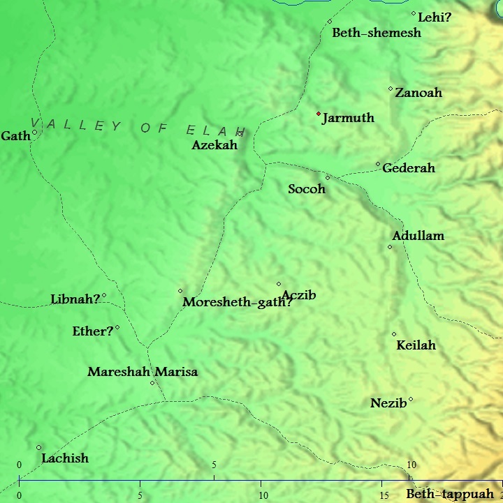
Area around Jarmuth – Biblical through Roman periods (based on Bible Mapper 3.0)
- Iron Age through Byzantine period
The upper city continued to be occupied until the 4th century AD, then was abandoned for good.
- Ottoman period – PEF survey and excavations (19th Century AD)
In 1863 Victor Guerin identified Khirbet Yarmuk as Biblical Jarmuth. The name Yarmuk was derived from the Byzantine village of Iermochus located on the site, which preserved the ancient name. Eusebius Pamphili (better known as Eusebius of Caesarea, a 4th century Greek historian of the Church), wrote in his book “Onomasticon” that Iermochus is Yarmuth.
The area around the site was examined in the Palestine Exploration Foundation (PEF) survey (1866-1877) by Wilson, Conder and Kitchener. A section of their map is shown below, with the site in the center. They also identified the site Khirbet el Yarmuk as Biblical Jarmuth, based on Geurin’s identification. Khirbet Karmuk was written in a short entry (Volume III, volume XVII, p. 128):
“Khurbet el Yarmuk (J u).—Heaps of stones, foundations and cisterns”.
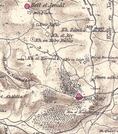
Part of Map Sheet 17 of Survey of Western Palestine,
by Conder and Kitchener, 1872-1877.
(Published 1880, reprinted by LifeintheHolyLand.com)
-
Modern Period
Tel Yarmut is today a national park and open to the public. Access to the site, which is not yet officially opened and prepared for convenient public access, is thru the newly built neighborhood of Ramat Beit Shemsh Gimel.
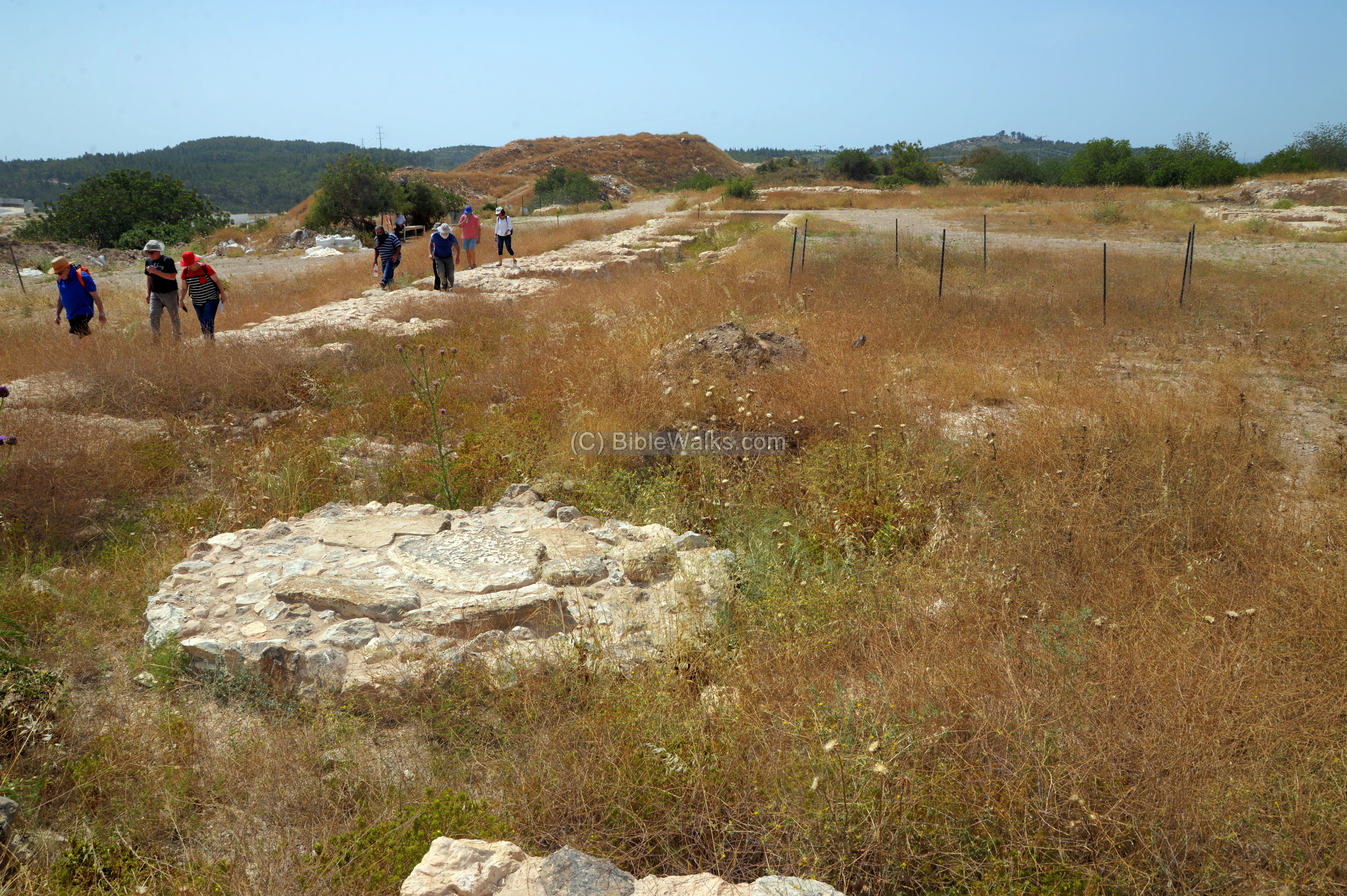
Modern excavations started in 1980 and continued for 30 years.
Photos:
(a) Aerial Views
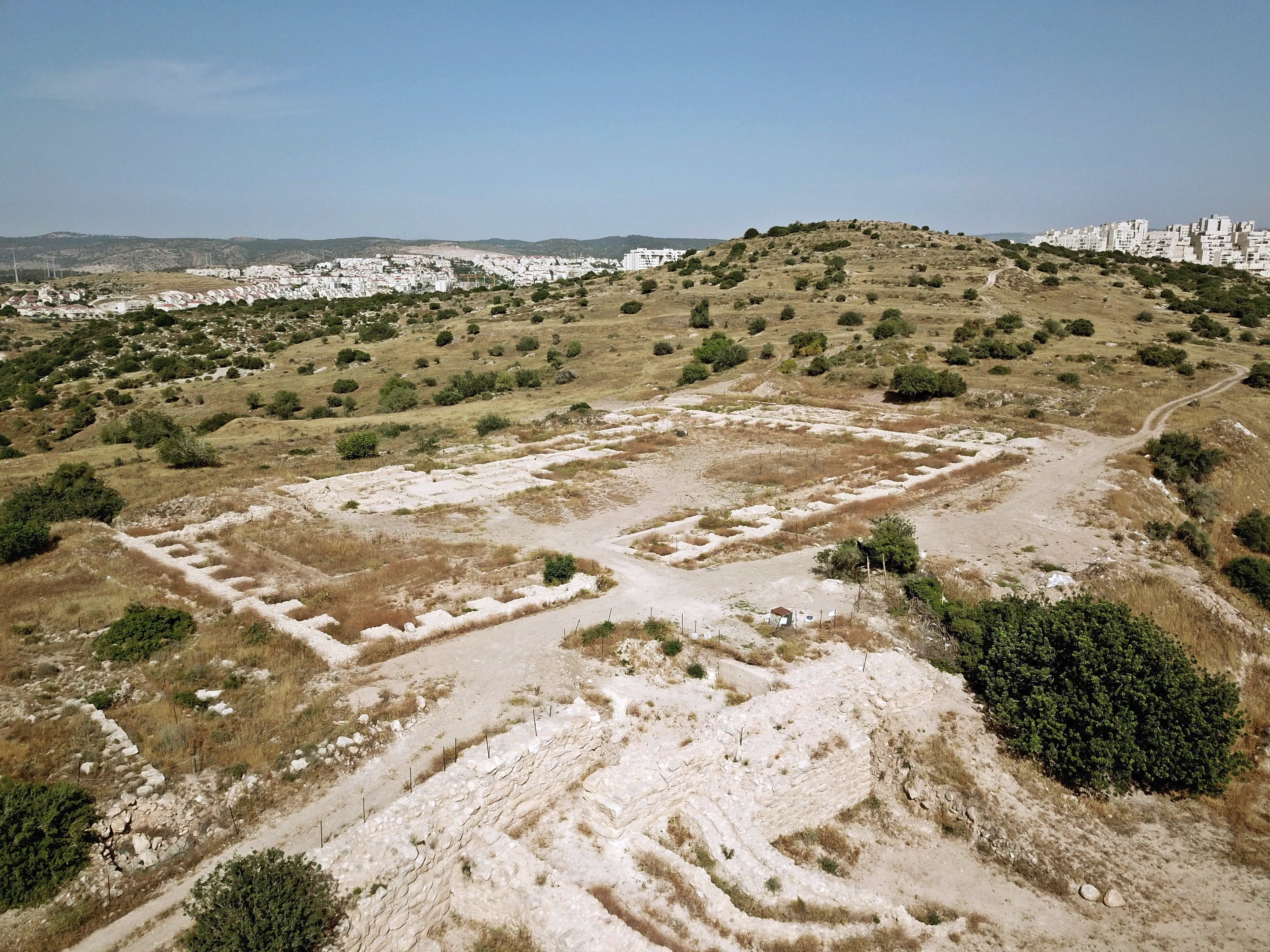
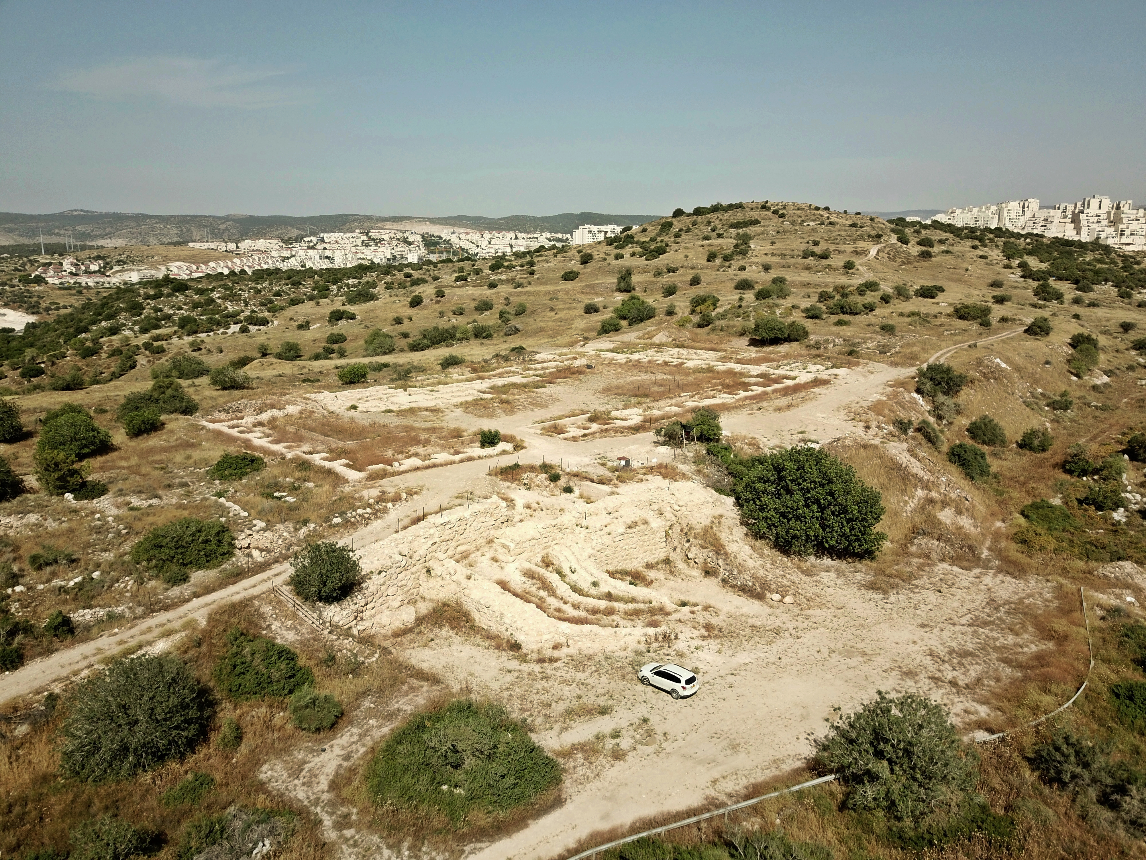
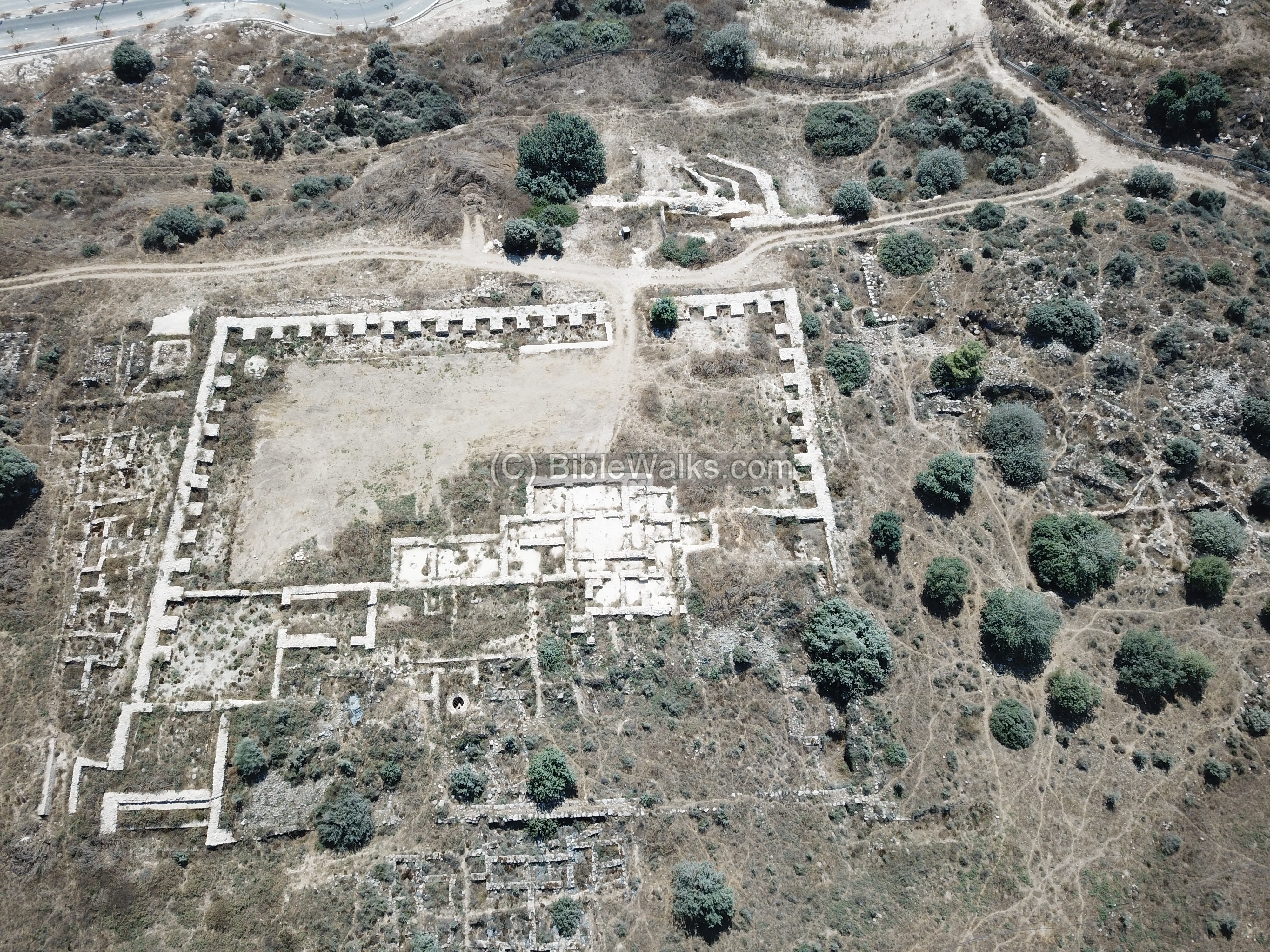
A view from the south west towards the east shows the lower city, with the city gate and Palace B1 behind it, and the upper city in the far background. The ancient Early Bronze period city occupied this entire area.
Around the site, now a declared national park, is surrounded by the ever growing residential neighborhoods of Ramat Beit Shemesh.
Click on the photos to view in higher resolution…
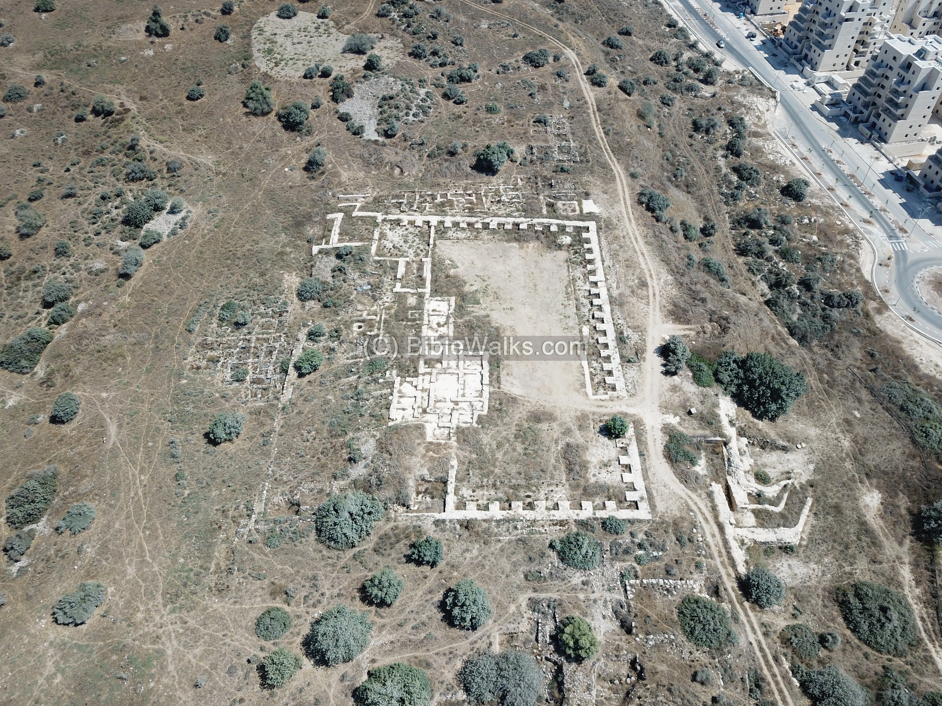
A drone view over the ruins of palace B1, and facing the east, is in the following photo.
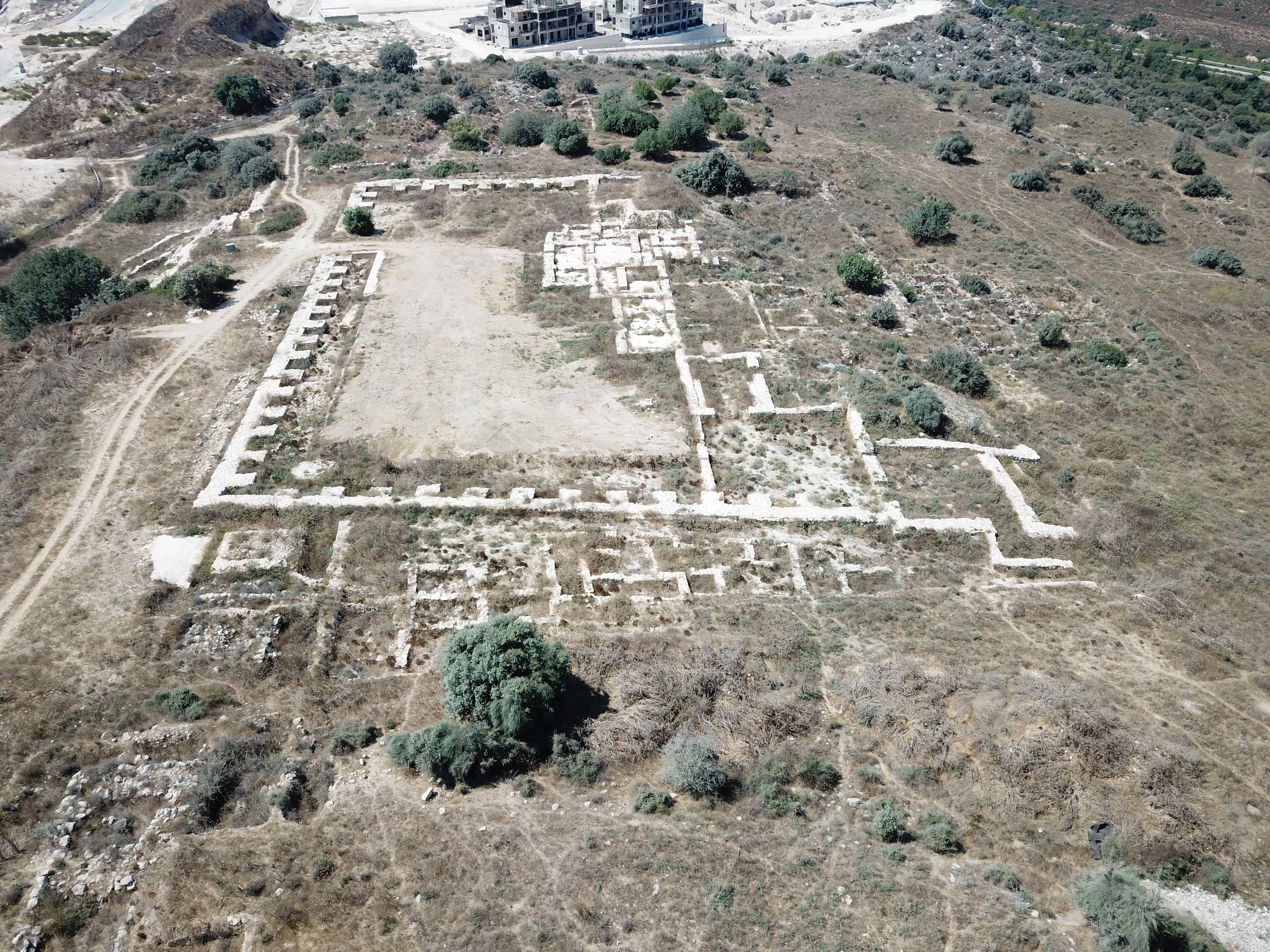
The next photo is a drone view facing the west side of the lower city.
(b) Outer City gate
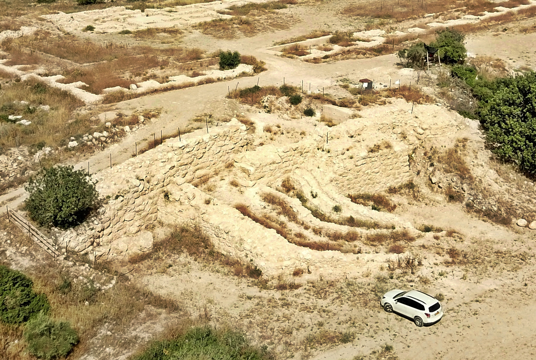
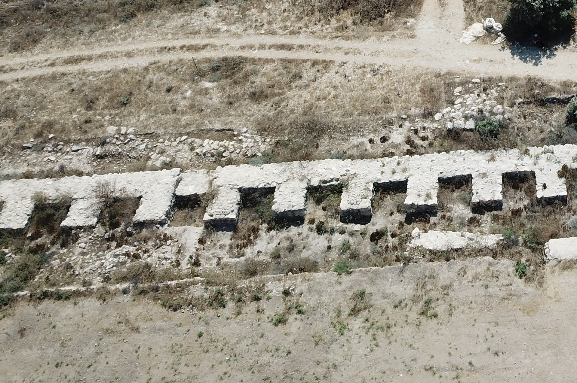
The outer city gate is seen here from the south side. It was built in the end of the Bronze II period, as part of the second line of defense (‘wall B’). The earlier (Early Bronze II) defense line (‘wall A’) was 20-30m behind, its walls passing under the southern wall of what was later built as the palace B1. The total width of these ramparts were a staggering 40m wide! Their remains are visible along the edges of the mount, with a height difference of ~5m.
A closer view of the reconstructed gate area is below. The access ramp follows a U-shaped course, flanked by a thick wall on the left and a modest wall on its right. The ramp climbed to a height of 7m above the bedrock.
A ground view of the ramp is below. The ramp served the city until the city was abandoned.

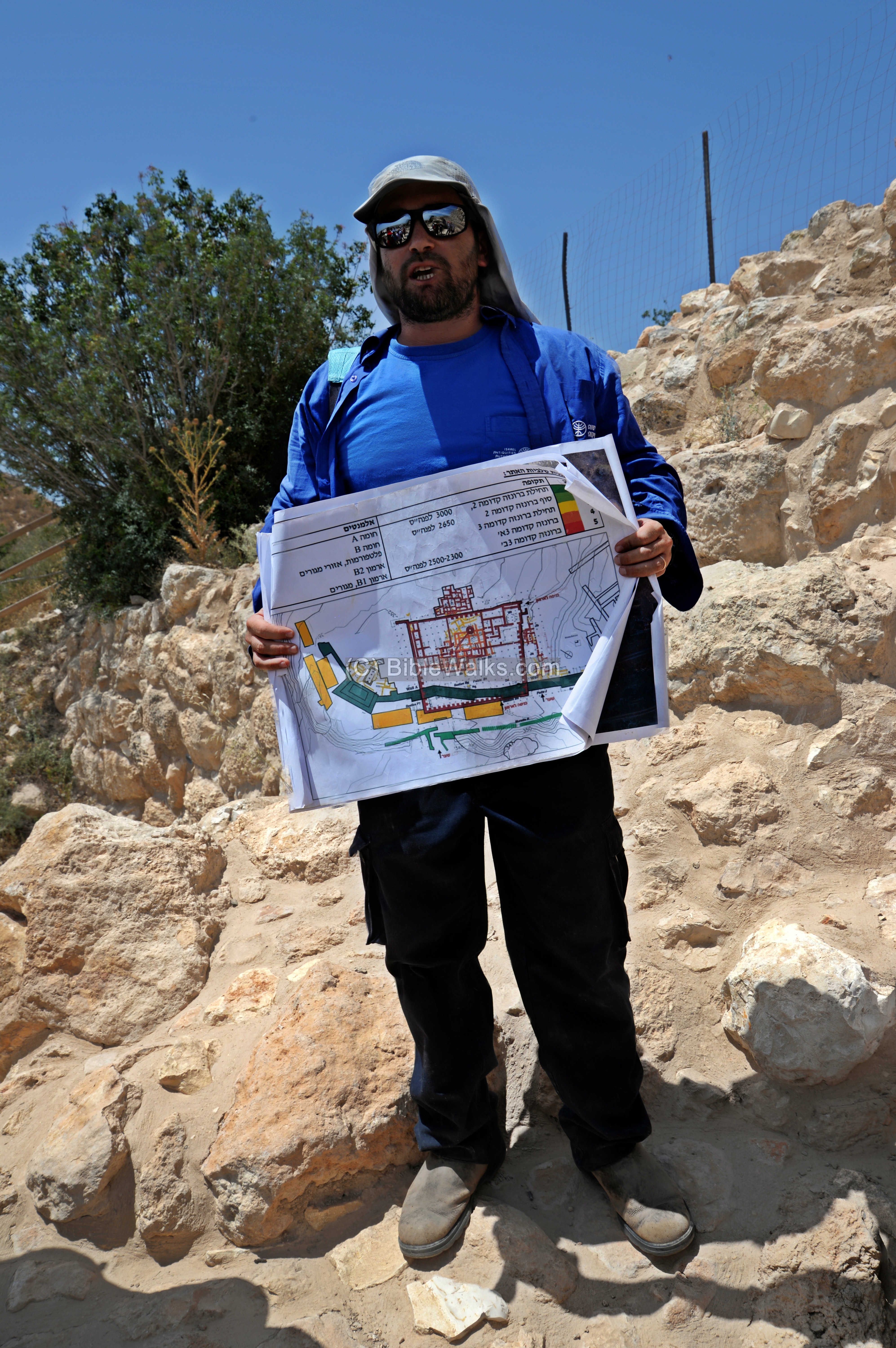
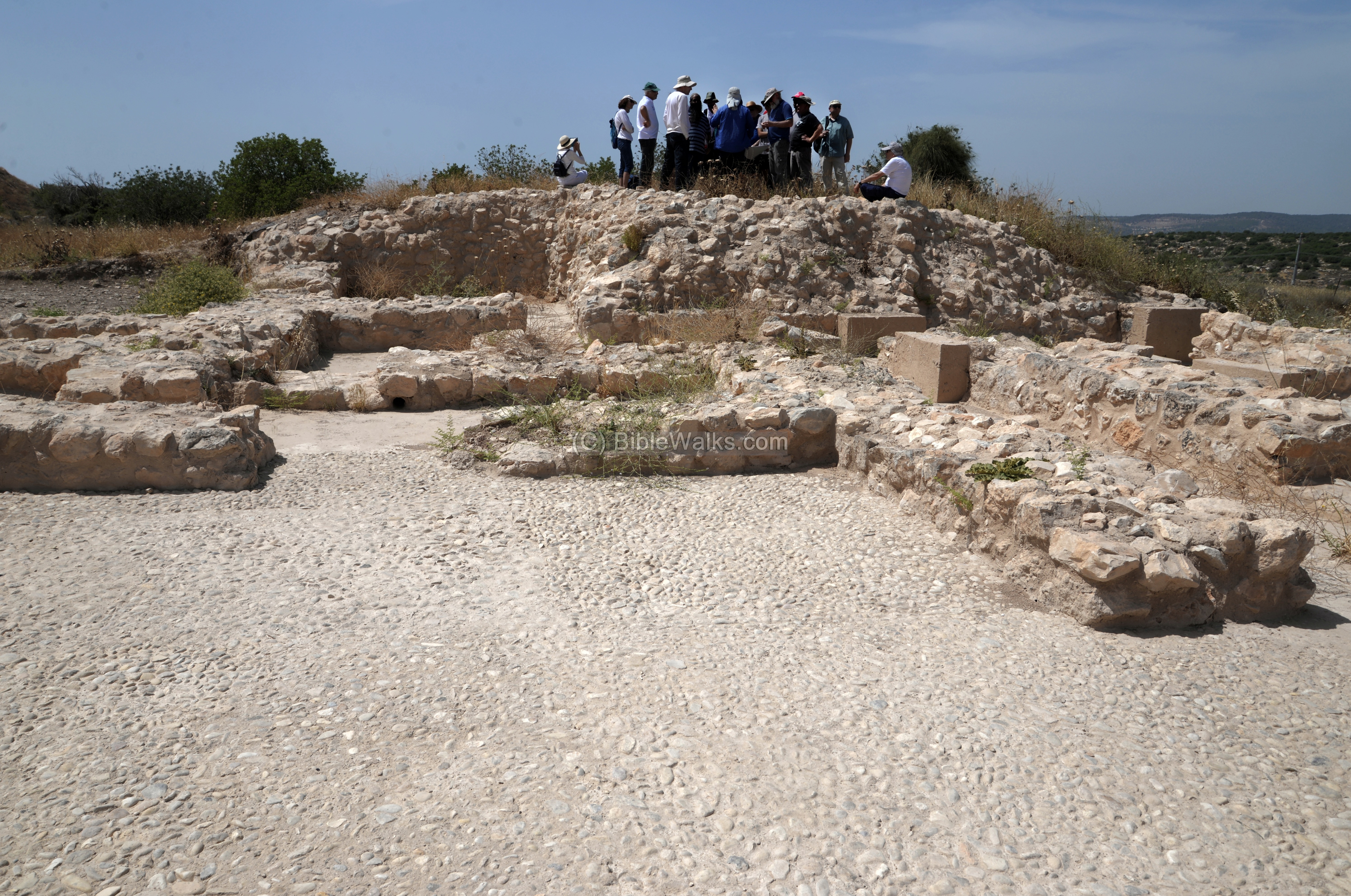
Dr. Omer Shalev, who guided this tour, explains the plan of the gate.
A section of the wall on the east side of the wall is seen here from the top of the hill. The stones that supported the new wall were of cyclopean masonry, with stones up to 2.5m long. The outer wall was 3-3.6m wide, and 7m high. Remarkably, the ramparts are still visible around the mound after 4,700 years.
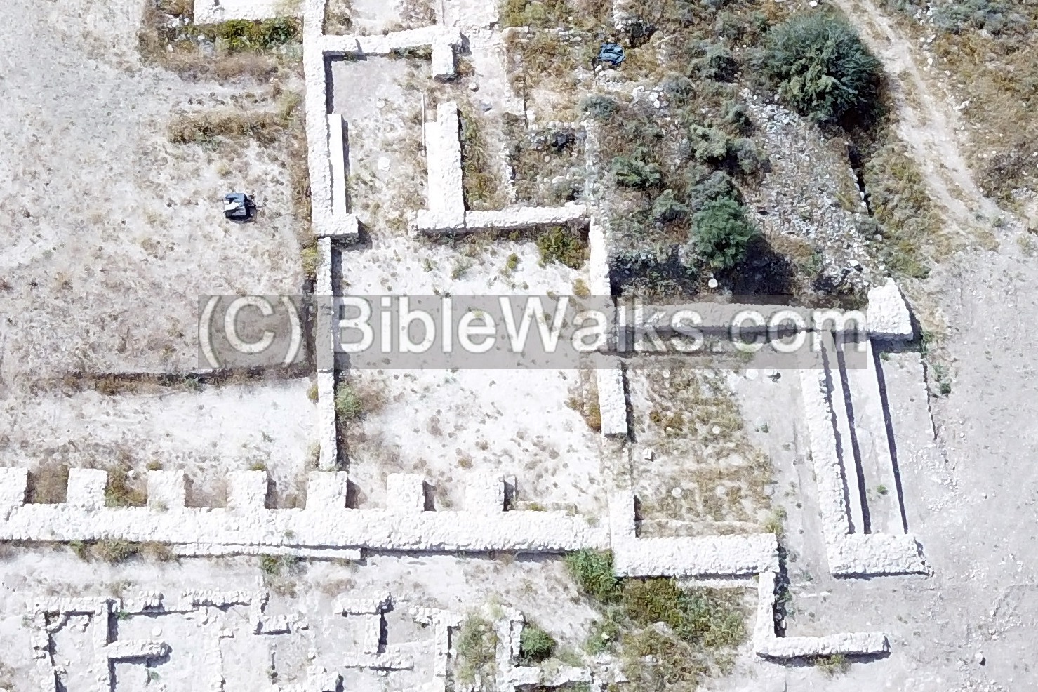
(c) Palace B1
A grand palace was built during the Early Bronze period IIIC (2400-2300 BC). An earlier smaller palace, B2, was replaced by palace B1 – the current visible base of the palace. Both palaces required the builders to erect an artificial flat and horizontal terrace over the natural slopes, constructing heavy retaining walls and filling up shallow areas with soil up to depths of 2m.
A plan of Palace B1 is shown below. The outer dimensions of the palace are 72.1m by 84.5m, covering 6,000 square meters.This is the largest building complex of this period in the Levant.
The main courtyard on its south side is 81m long by a width of 35-46.5m. The ceremonial entrance is from the east corner, which opens to a Hypostyle hall, then to a forecourt, followed by a reception hall.
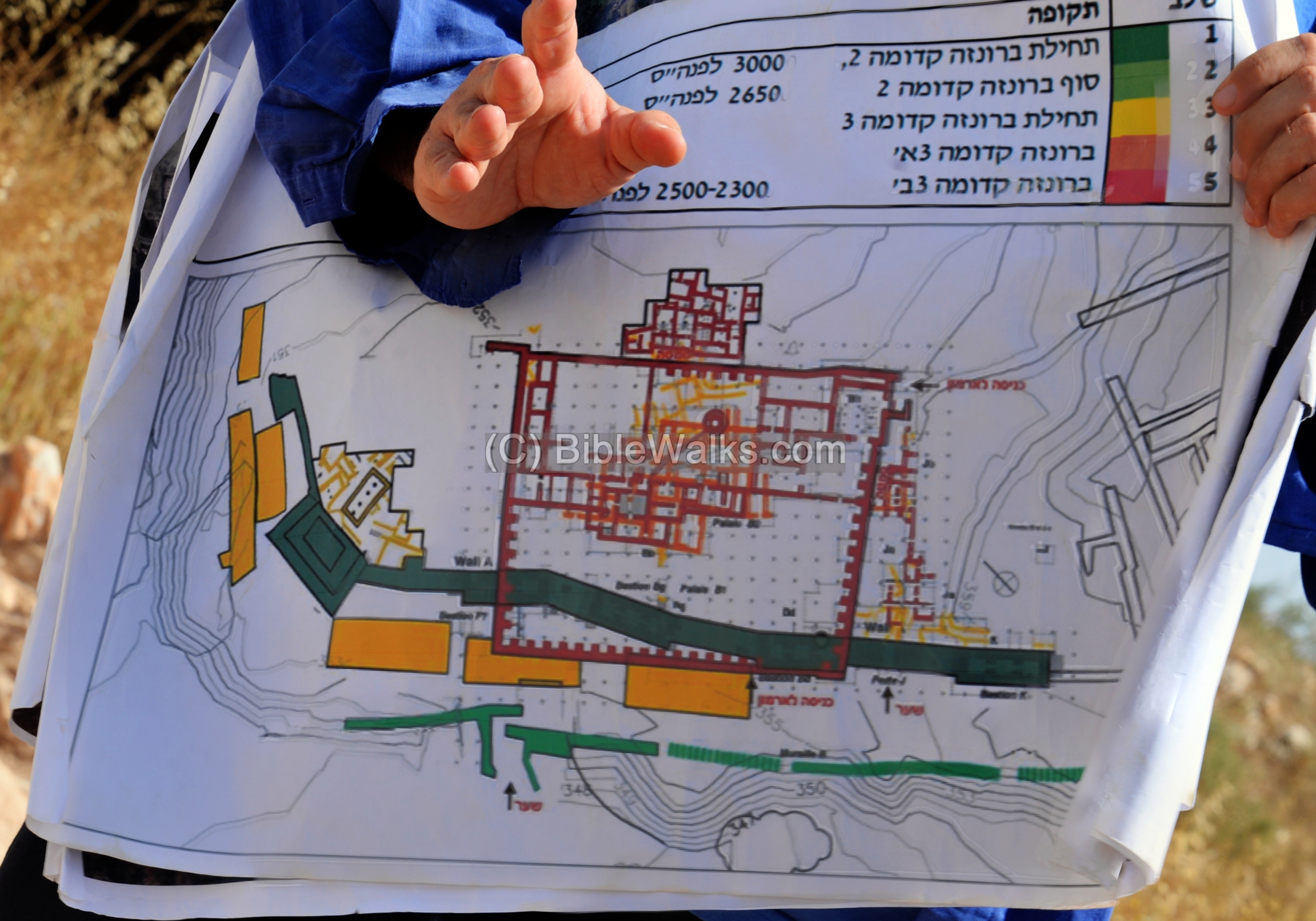
Dr. Omer Shalev showed us a plan of the palace, illuminating the various construction phases. Palace B1 (in brown color) was built over a previous palace B2.
Let’s take a tour of the palace…
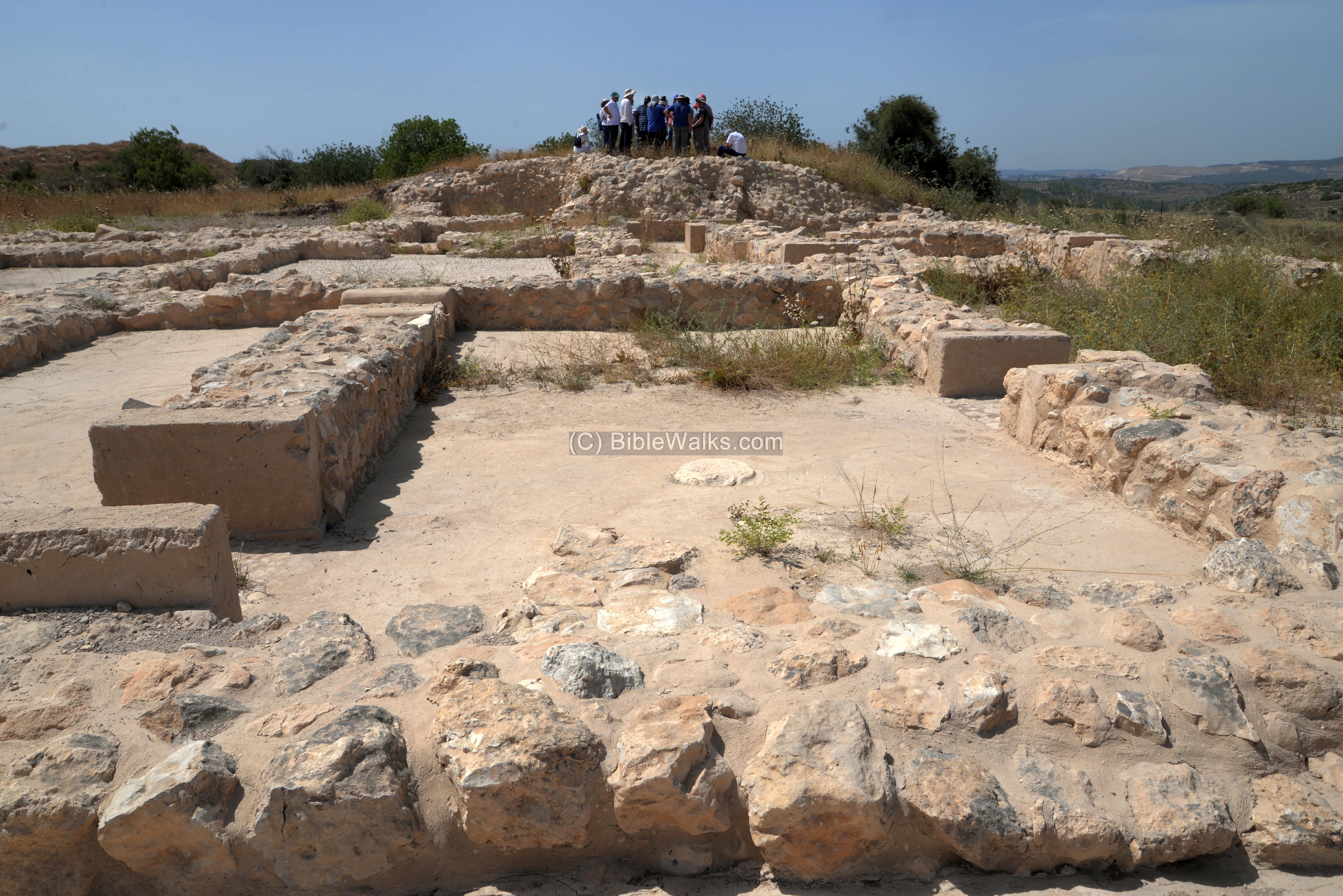
Starting from the outer city gate, walk along the southern wall to reach the eastern side of the palatial complex.
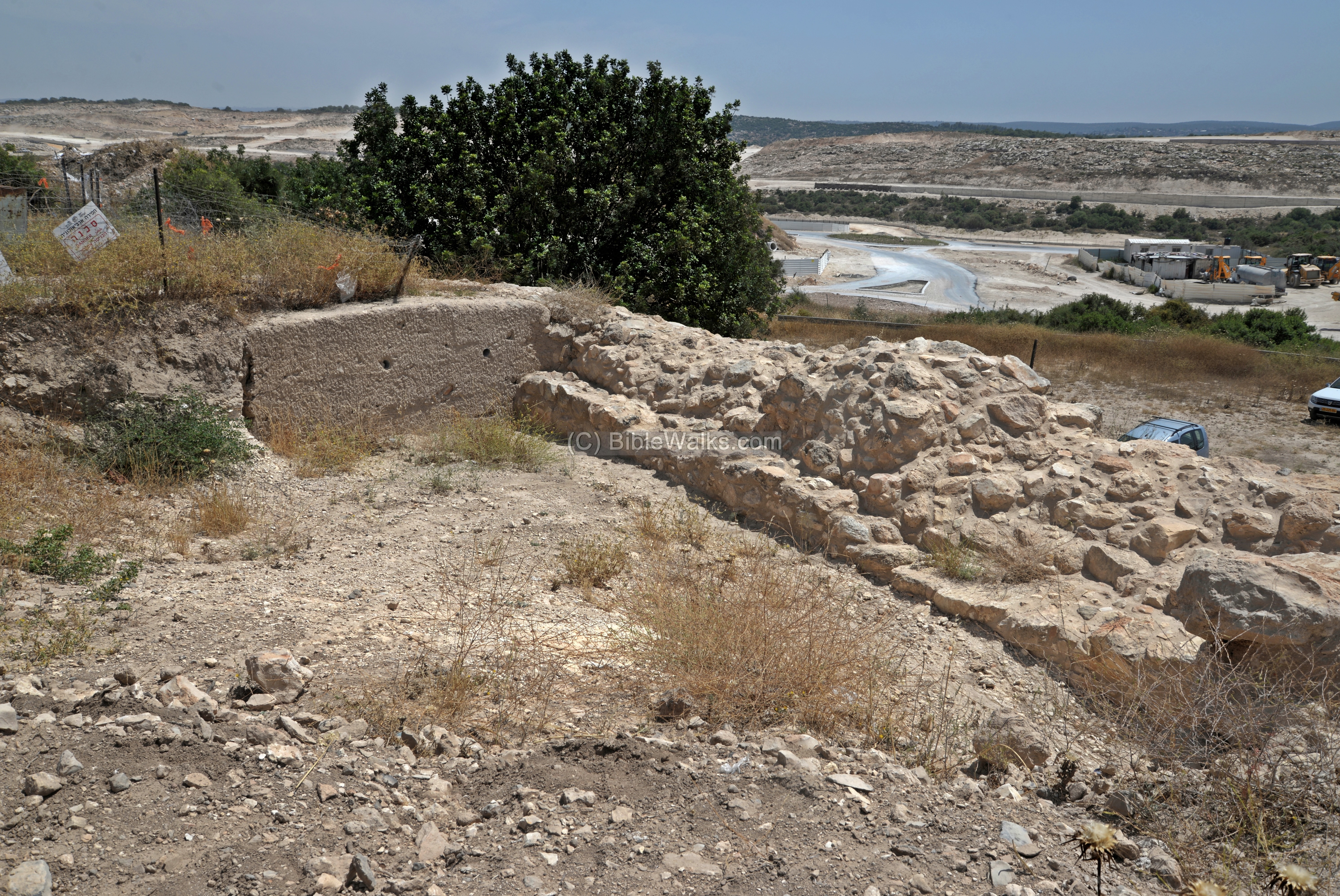
The peripheral wall of the palace is unique. It is 2m wide and has 3m deep foundations. The walls are made of square inner buttresses placed at regular intervals. This served for aesthetic function in addition to a structural function. A similar design was found in Byblos EBI-II sanctuary or the EBIII ramprt.
(d) Main entrance to the Palace
The ceremonial entrance to the palace is from the north eastern corner, its plan is seen here.
The entrance is thru a large hypostyle hall (interior space where the roof rests on pillars), with 4 rows of 3 columns resting on large stone bases. The hall is 17m long and 13.9m wide. Its floor was plastered, and on either side were mud brick benches lined by small stone slabs.
A close up of one of the bases is in the following photo.
The visitor then entered thru a wide (2.6m) entrance to the forecourt (see below).
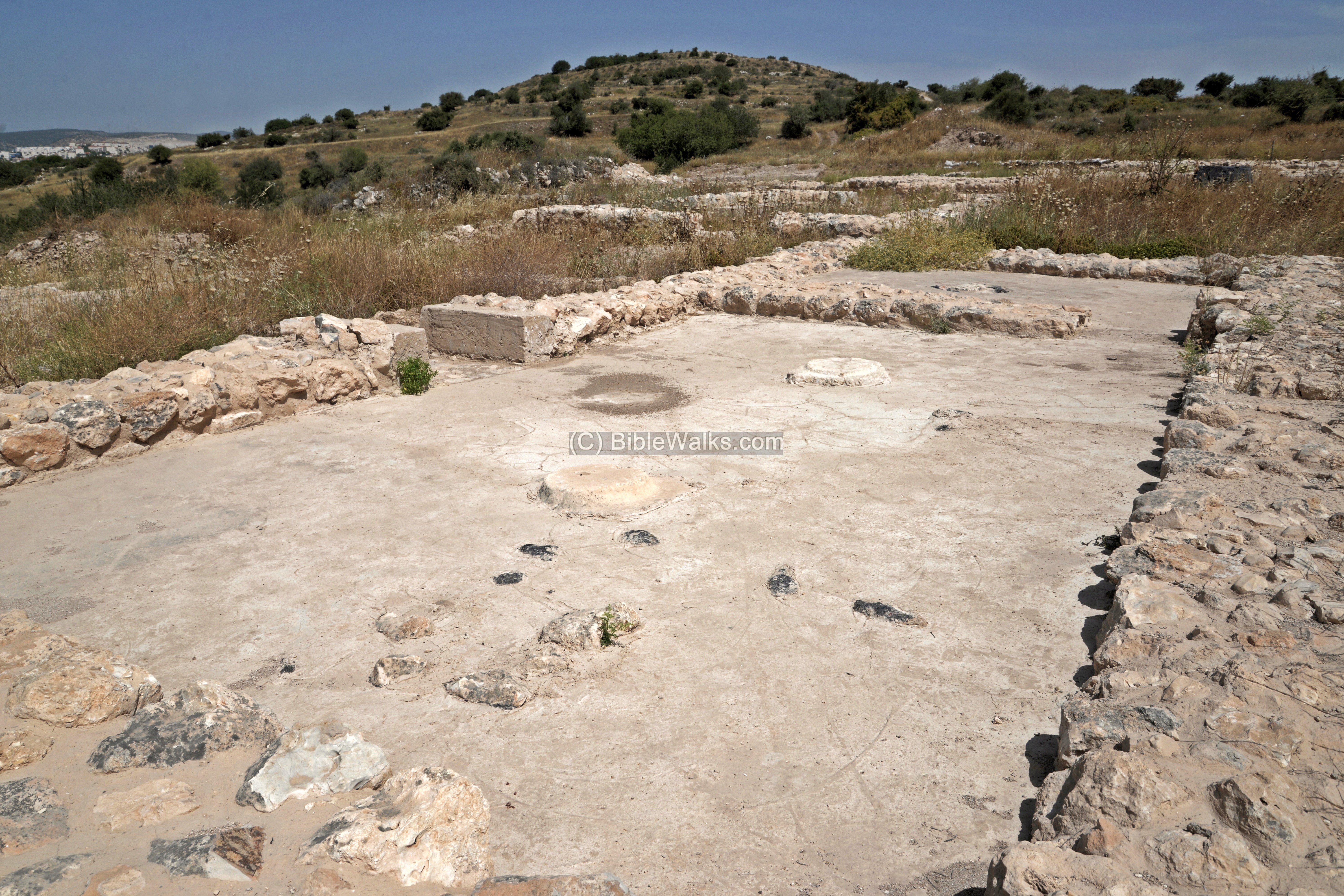
From the forecourt the visitor would either enter into the main courtyard, or turn right into a reception hall and continue into the interior rooms of the palace. The size of the reception room is 10.6m x 6m, and was used for meetings. Two side benches lined the walls.
(d) Palace rooms
To the north of the ceremonial entrance are the rooms of the palace. A section of the aerial view shows this area, with a view towards the north west.

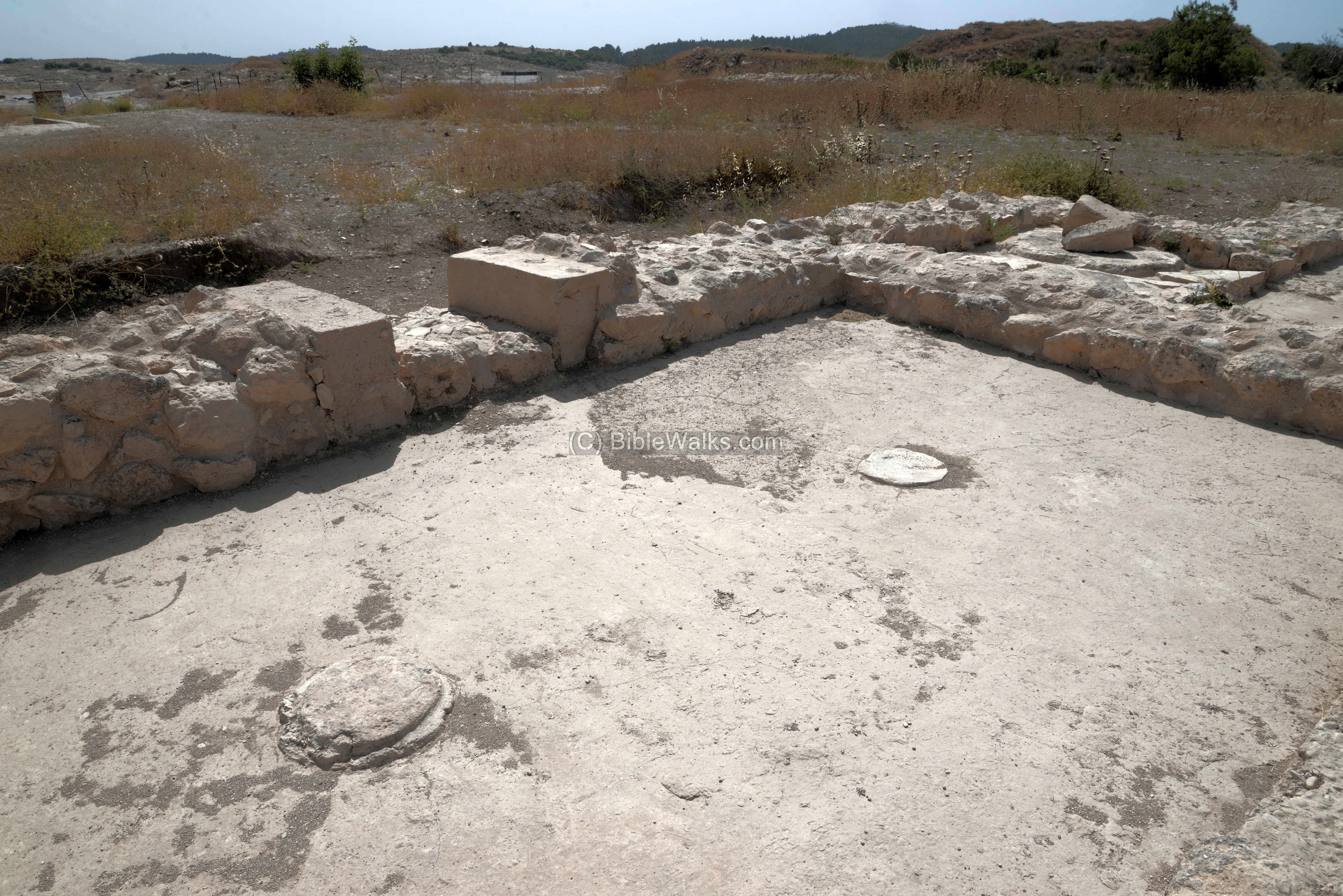
A view of the rooms is seen from the north west side. The rooms, doorways, and overall plan are advanced for this early period of urban planning, using regularity in size and angles. This was professionally planned and executed.
The base of the rooms consisted of field stones with dressed outer faces. Their foundations go deep 0.2-0.5m for the inner walls, and 1-2m for thick walls. Above the bases, resting over a layer of mortar, were baked mud bricks.

In the center of this cluster is an open courtyard. The floors of the rooms are either covered with river pebbles set in mortar (as in the following photo) or lime plastered.
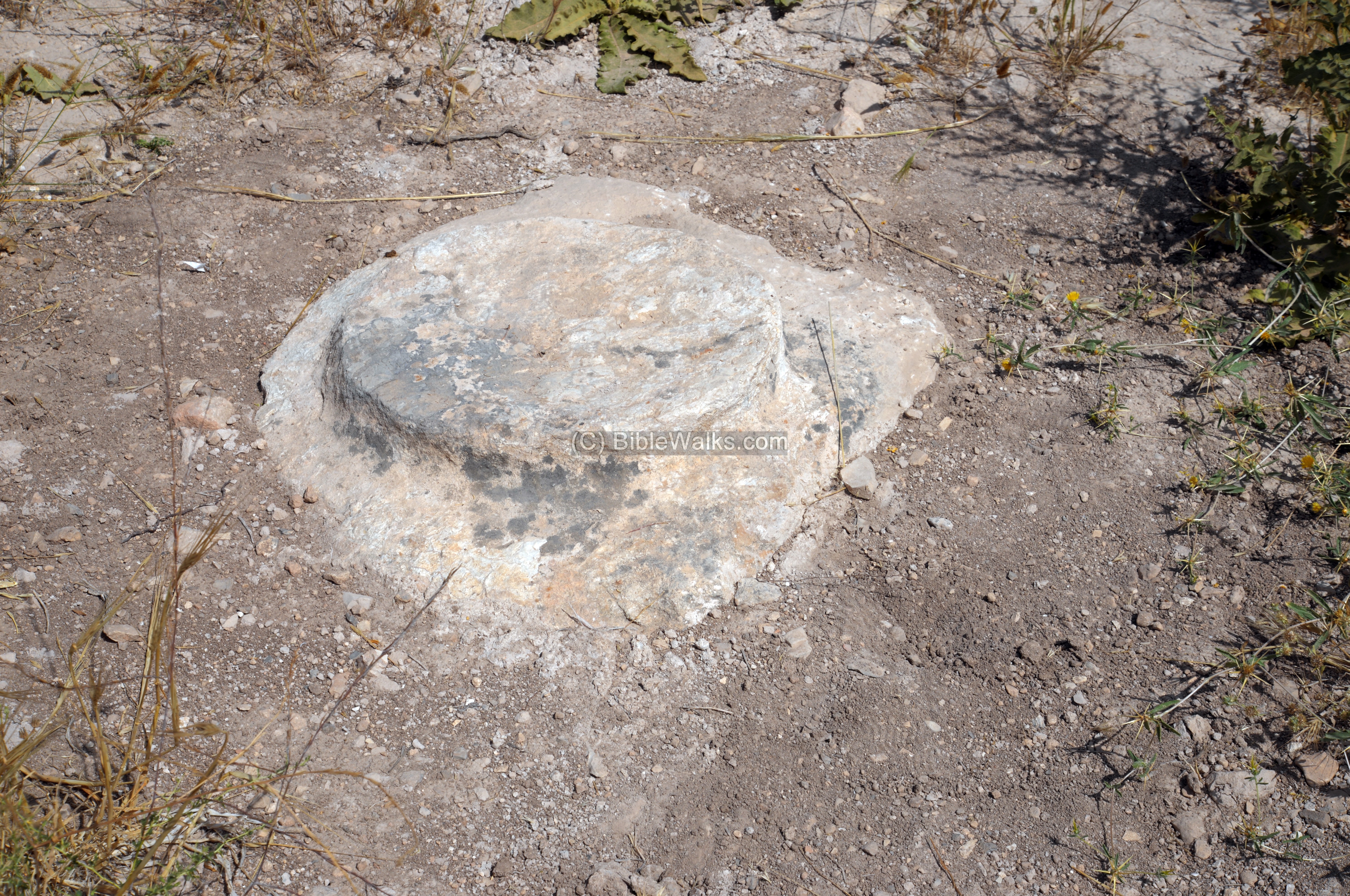
The courtyard was open without a roof, while the rooms around where covered by a roof supported by wooden pillars resting on stone bases, as seen below in the center of the room. Steps lead to the roof or second story.
Doorways contained mud bricks or baked brick doorjambs. The doors used wooden door frames with swivels. A total of 43 doorways have been located.
The door thresholds consisted of large slabs (below), or a pebbled surface lined on each side of a wooden plank.
(e) Water reservoirs
A large cistern collected the runoff rain water from the houses and structures, and was used to supply water.

Small water channels were used to convey the runoff water into the cistern, as seen on the bottom of the opening.

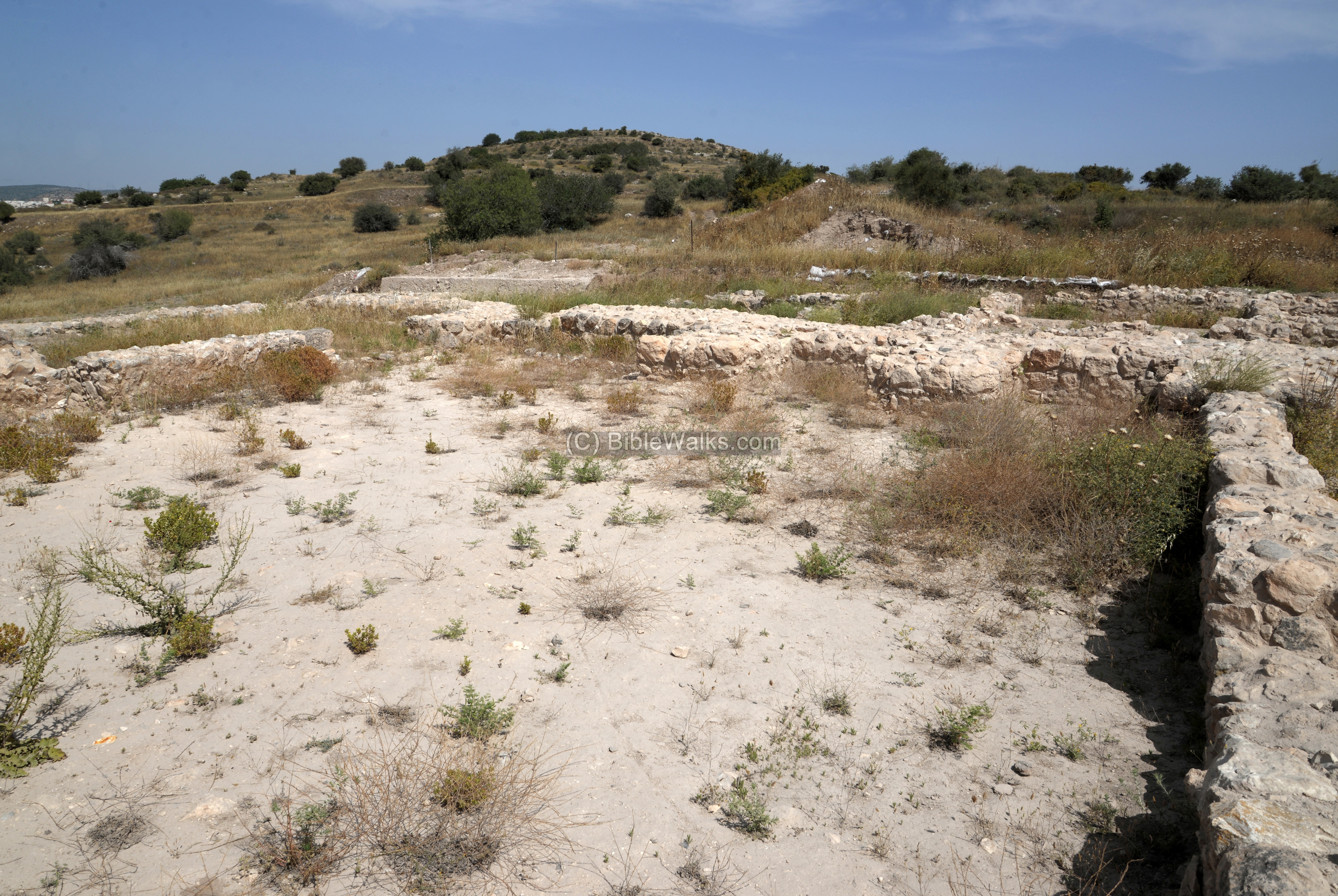
(m) Upper City
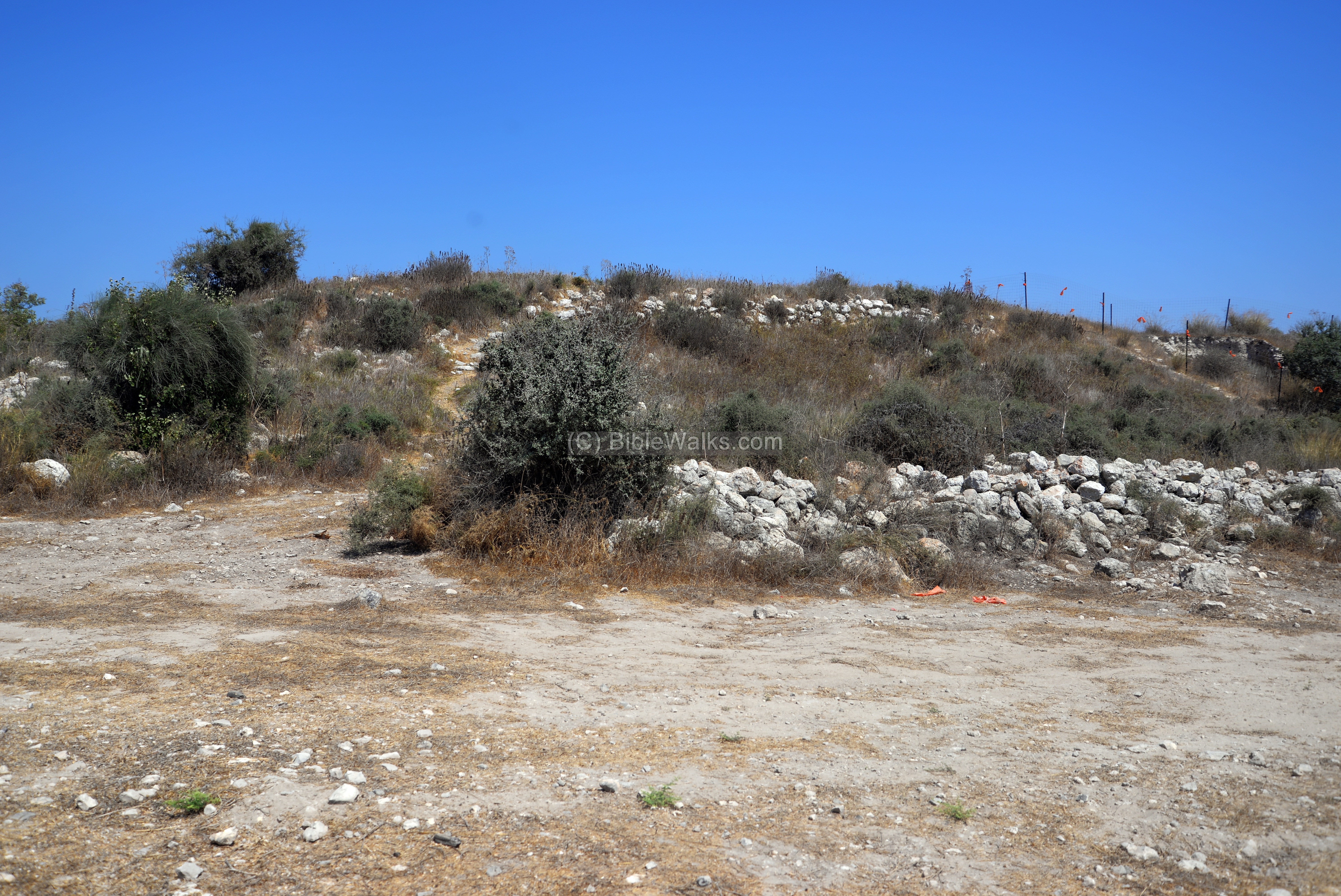
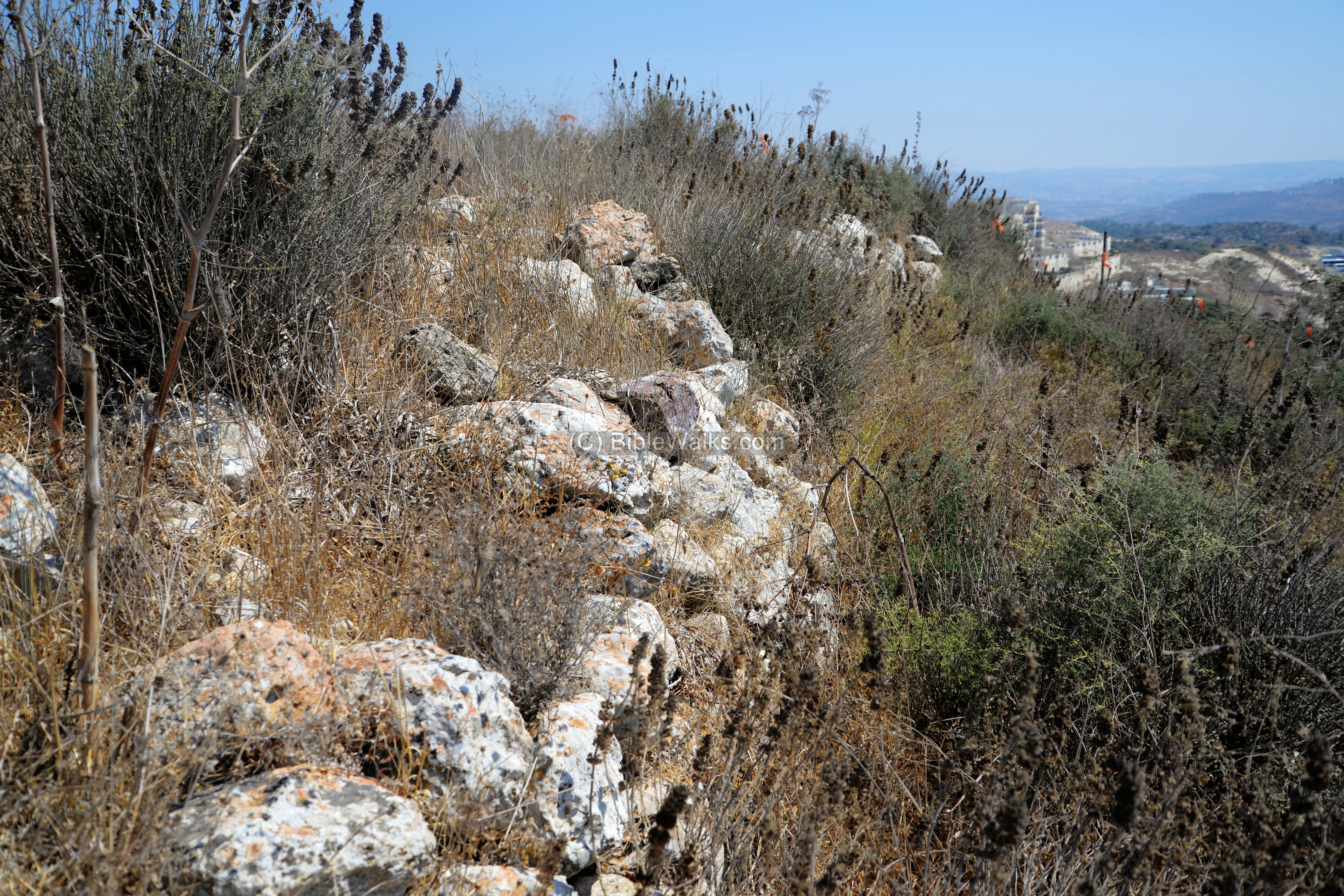
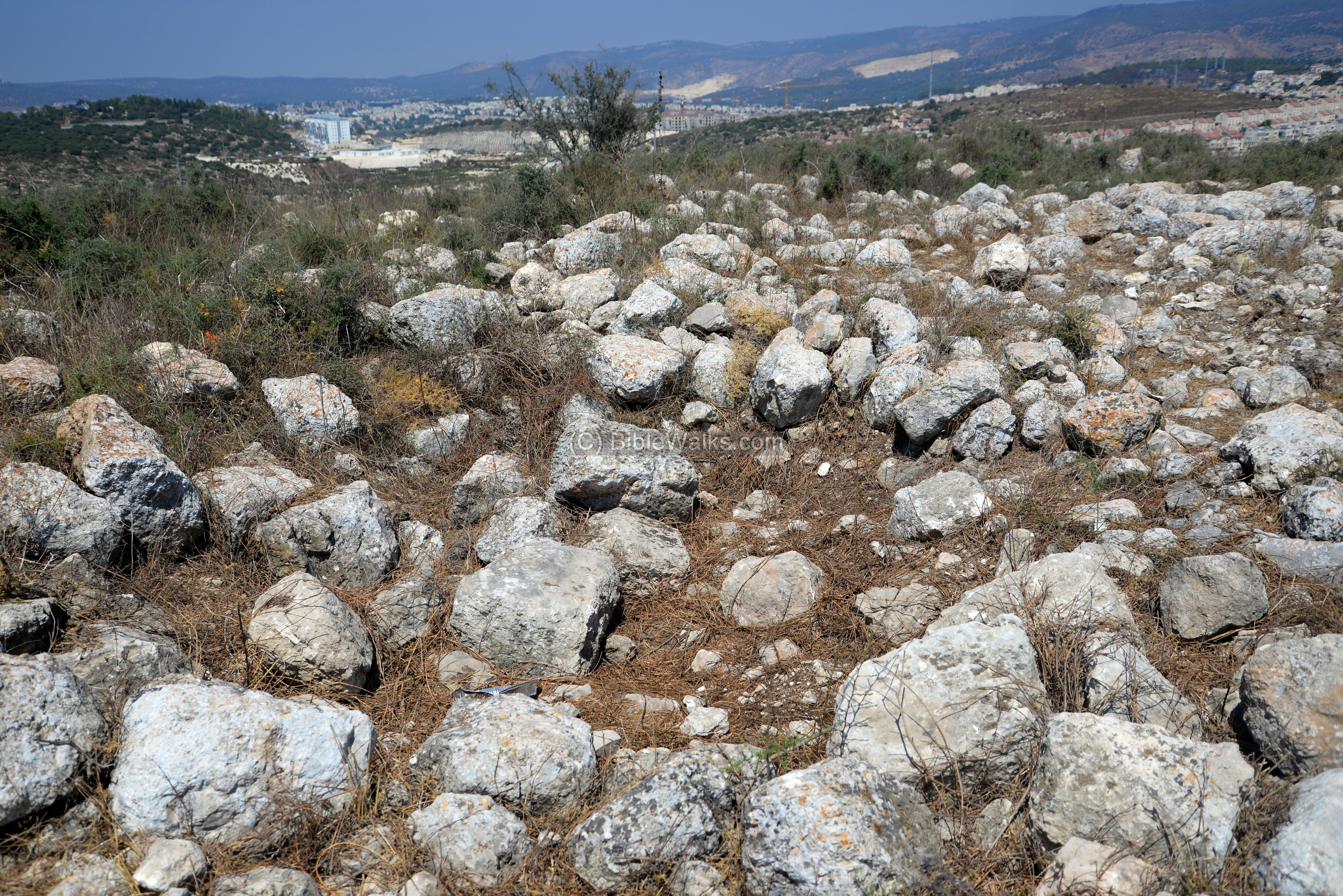
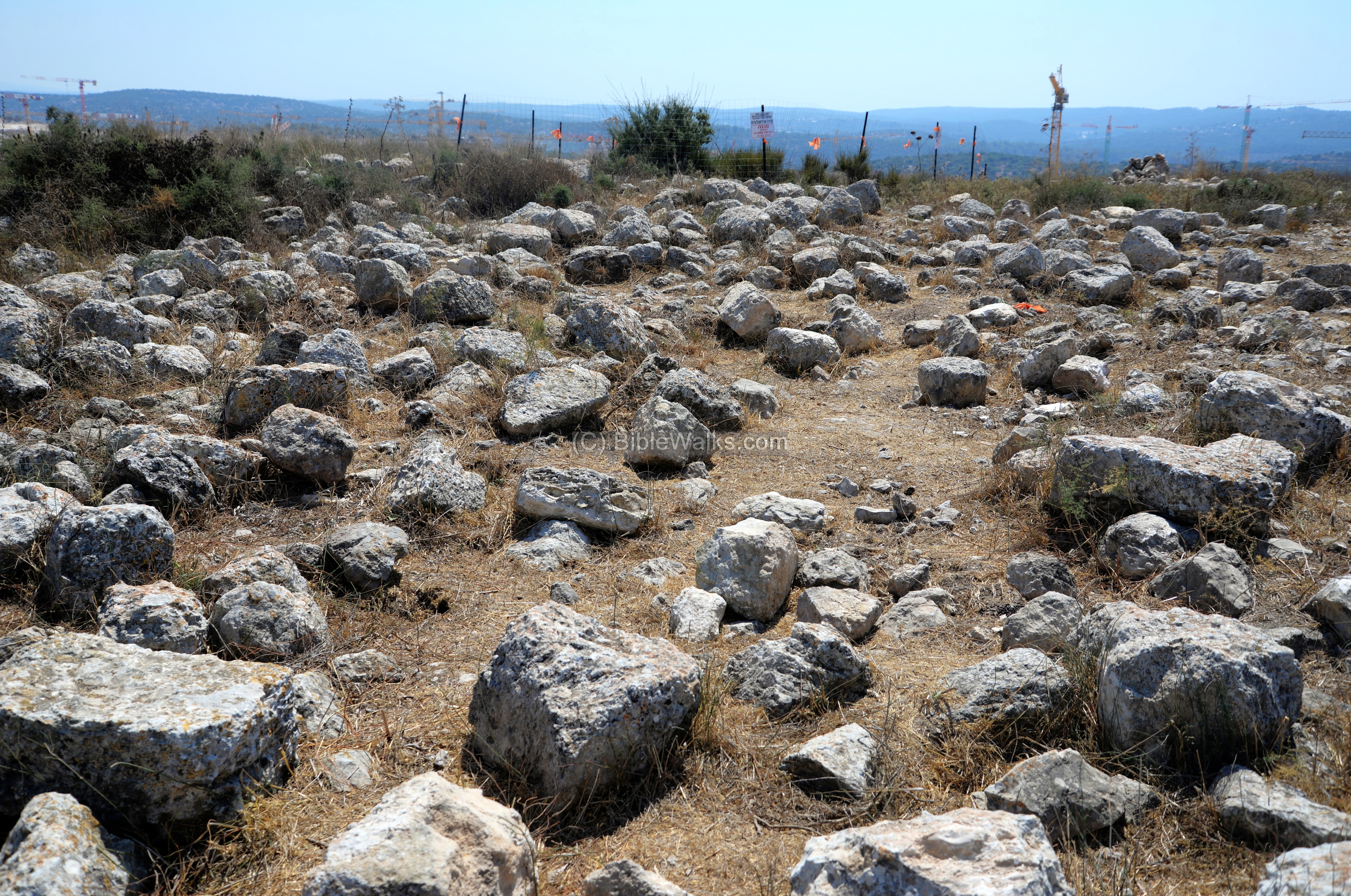
An aerial view of the acropolis is shown here, as captured from the east side (on May 2018). The upper city was occupied during the time of the Early Bronze II-III period, but then was abandoned for 1000 years. The hill was reoccupied from the Late Bronze II period until the Byzantine period. The archaeologist dated 7 layrs (Strata Acr-VII thru Acr-I, where Acr is short for Acropolis).
Ruins are scattered on the peak and foothills, with few excavation areas opened on the hill. At a lower level of the east side is a visible terrace and wall- the remains of the Early Bronze wall which circled the eastern side of the hill at the height of 395m (10 meters under the summit).

The fortifications are visible around the summit. The view below is from the south side (captured Summer 2020), where a flat terrace is in front of the summit.
A Hellenistic/Early Roman period house was exposed on the lower terrace (level Acr-II).
Along the southern edge of the summit are remains of a wall.
A long cut into the south-west side of the summit revealed Early Bronze levels. The ruins reached bedrock at depths of 6.35 to 7m below the surface.

The exposed levels on the acropolis were dated to the Early Bronze II-III period (level Acr-VII) just on top of bedrock, a Late Bronze II layer (VI), three layers of Iron Age (V-IIIB).
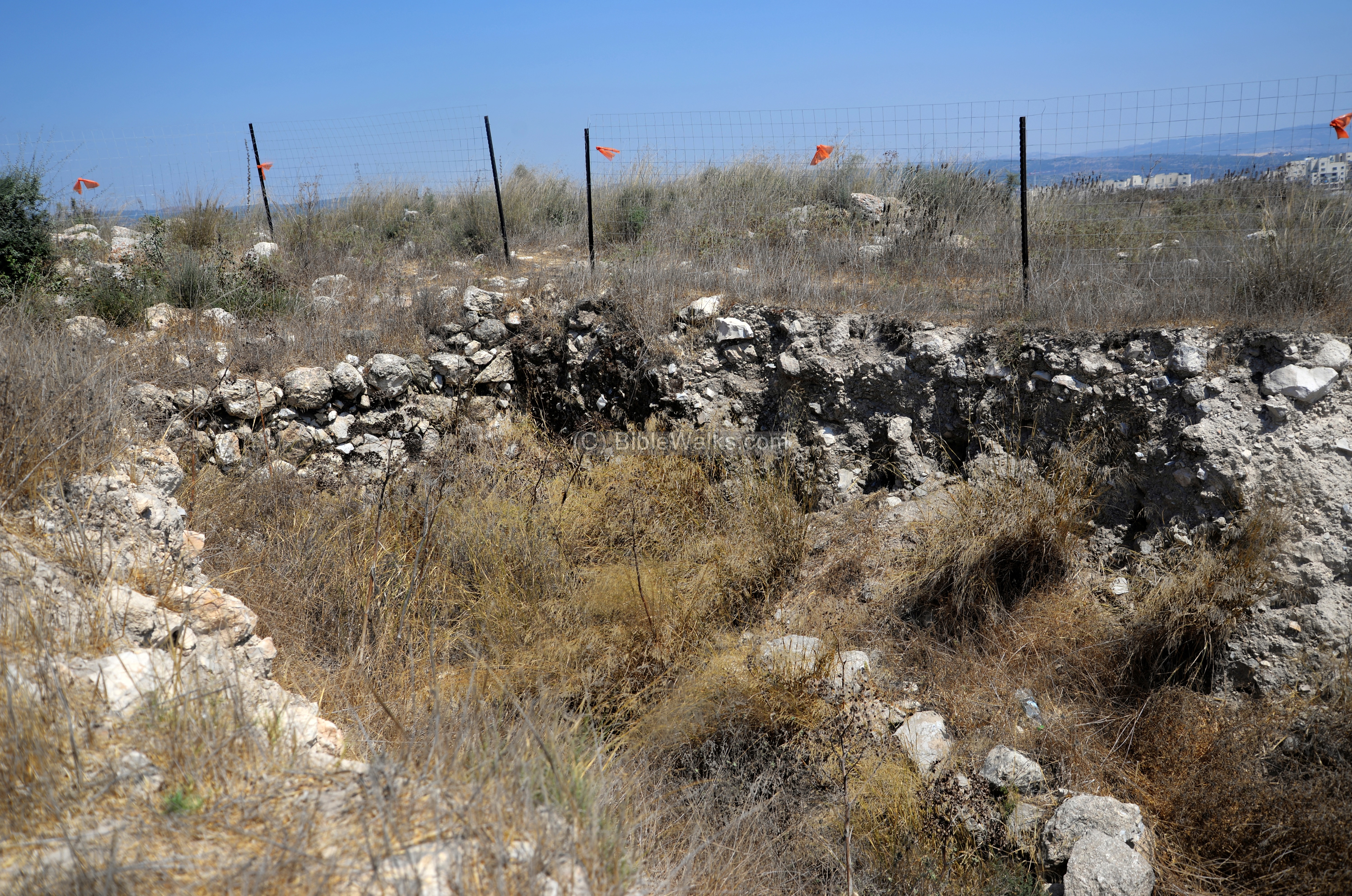
The findings suggested that Yarmut was just a village in the Late Bronze period (13th-14th century).
During the first phase of the Iron Age (layer V) there were 5 areas separated by walls, with central courtyards and an oven. The next level (IV) included a large industrial installation (kiln?). Level III (11th century, times of King Saul) revealed a burnt layer, together with Philistine pottery.
(k) Video
![]() Fly over the site with this YouTube video:
Fly over the site with this YouTube video:
Etymology:
Names of the site:
- Yarmut (Yarmuth, Jarmuth) – Canaanite/Biblical name of the city. Perhaps based on the root word ramah (height).
- Yarmuk – Arabic name of the ruins, derived from the ancient name.
- Iermochus – Byzantine name of the ruins, as appear in the “Onomasticon”
- Ramat Beit Shemesh Gimel – new neighborhood adjacent to the site (opens 2021)
Links:
* Archaeology:
- Tel Yarmuth Hadashot Archeologiot – Volume 130 2018
- IAA conservation of Tel Yarmut
-
The Late EB III Palace B1 at Tel Yarmuth: A DESCRIPTIVE SUMMARY – Pierre de Miroschedji (https://www.jstor.org/stable/23629866)
- Yarmuth -The dawn of city states in Southern Canaan – Pierre de Miroschedji (Near Eastern Archaeology 1999, https://www.academia.edu/1820541/Yarmuth_The_dawn_of_city_states_in_Southern_Canaan) – highly recommended resource
* Internal – sites nearby:
- Kh. ‘Alya
- Church of the Glorius Martyr
- Valley of Elah – overview
- Kh, Qeiyafa – Shaaraim
- Sochoh
- Adullam
* Other:
- Biblical pictures by Gustave Doré (1832-1883) – public domain
- Drone Aerial views – collection of Biblical sites from the air
- BibleWalks Youtube channel
BibleWalks.com – Have Bible – will travel
Horvat Geres<<<—previous site–<<< All Sites >>>—>>> —Next Judea site—>>>Adullam Park
This page was last updated on Sep 27, 2020 (New site)