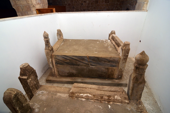
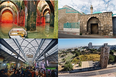
The city was founded in the 8th century as a new administration center. It is the only city in Israel that was established by the Muslim rulers.
Home > Sites > Shefela > Ramla (Overview)
Contents:
Background
Location
History
Photos
* Arches pool
* Aqueduct
* Armenian Monastery
* City Market
* Mameluke Khan
* White Mosque
* Great Mosque
* Abu Aloon mosque
* Conservations
Etymology
Links
Background:
The city of Ramla (“Sandy”) was founded in the 8th Century as a new administration center. It is the only city in Israel that was established by the Muslim rulers.
This page is an overview of the ancient city of Ramla (er Ramleh). It provides a history of the city and lists its major ancient sites.
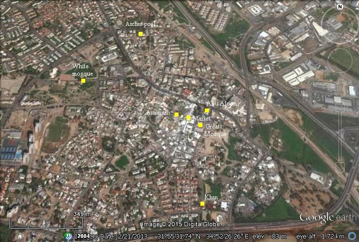
Aerial Map:
This aerial map shows the sites of Ramla in the area around the center of the city.
History:
-
Arab period – Umayyad Caliphate (661-750 A.D.)
The Umayyad Caliphate was the second of the four major Islamic caliphates, who ruled the Muslim empire in years 661-750. The Umayyad governor of the Palestine district, Sulayman ibn Abu al-Malik, selected a site in the sands west of Lod/Lydda to serve as the administration center of the Arab “Jund Filastin” (military district of Palestine), one of the five districts in the Syrian (Ash-Sham) province of the empire. It was strategically located along the major crossroads, and yet far enough from the Byzantine naval raids. The new city, established in ~715 AD, was named “Er Ramleh”, meaning: “Sandy”, as the city grew in the sands. Soon enough the new city was flourishing, replacing Lod as the commercial and administration center. Sulayman remained in the newly founded city even after he became the Caliph (ruled 715-717).
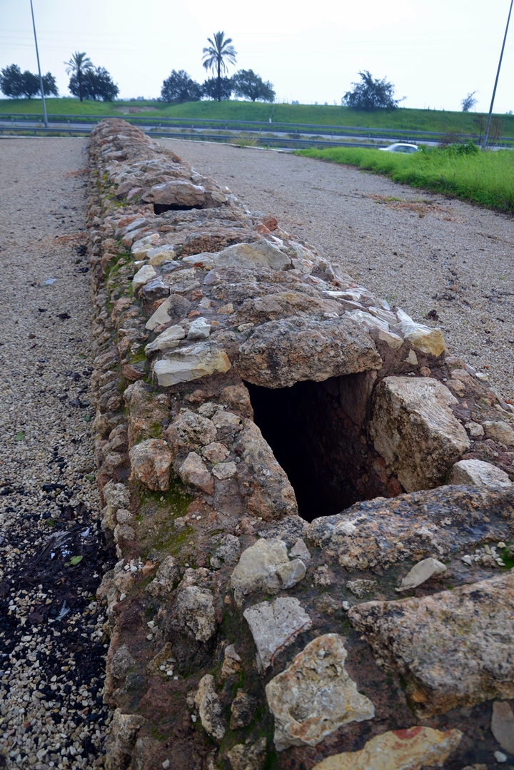
Grand engineering solutions were required in order to provide a sufficient water supply, at a place where there were few natural solutions. Initially, cisterns and deep wells were used. To fundamentally resolve the city’s water supply needs, Sulayman built a long aqueduct in order to bring the waters from a group of springs located 12 KM south east of the city. These springs are located near Tel Gezer and the Ottoman village of Abu-Shusheh.
-
Arab period – Abbasid Caliphate (750-1258, 1261-1517 A.D.)
The Abbasid Caliphate was the third of the four major Islamic caliphates, who ruled the Muslim empire in years 750-1258. and 1261-1517.
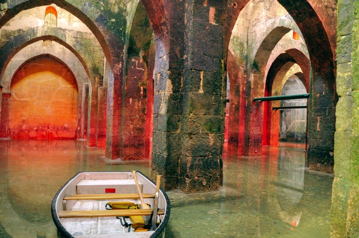
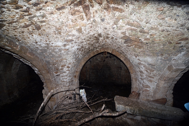
A large underground water reservoir, named today as the Arches Pool, was constructed and completed in the year 789. It received the waters of the aqueduct, as well as being fed from rainfall, serving the growing needs of the population in the new city. The aqueduct was in use for 150 years. After then, the major flow to the pool of arches was suspended, and it dried out. As a result of the great earthquake of 1068 in the southern part of Israel, the city was severely damaged and subsequently the city’s area has decreased in size.
-
Ottoman Period – (1516-1918 A.D.)
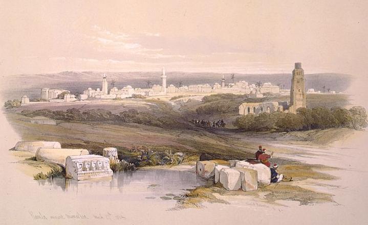
The famous painter of the Holy Land, David Roberts, visited Ramla in March 27, 1839 and illustrated this beautiful view of the city.
The area of Ramla was examined in the Palestine Exploration Foundation (PEF) survey (1866-1877) by Wilson, Conder and Kitchener. The map below is a section of their survey results. Two major roads are seen in the map as double dashed lines:
-
West to East- top left (from Jaffa) to bottom right (to Jerusalem);
-
North to South: top right (from Damascus) to lower left (to Cairo).
Part of map sheet 13 & 16 of Survey of Western Palestine,
by Conder and Kitchener, 1872-1877.
(Published 1880, reprinted by LifeintheHolyLand.com)
The sites of Ramla (Er Ramleh) are described in their report (Vol 2, Sheet XIII, pp269-275):
“Er Ramleh -Traces of the original extent of the town exist,as marked on the map, also two fine monuments, 1st. The church, now a mosque (Jamia el Kebir). 2nd. The White Mosque (Jamia el Arbain Meghazi)”.
The report details these 2 monuments, and adds a detailed history of Ramla by Robinson:
‘The name er Ramleh signifies “the Sandy” and the place is first mentioned under this name by the monk Bernard about 870 AD. Adamnanus, about 697 AD, makes no allusion to it, although he speaks of the memorials of St. George at Lydda. All this tallies well with the account of Abulfeda, drawn from earlier Arabian writers, that Ramleh is not an ancient city, but was founded by Suleiman, son of the Khalif ‘Abd el Melek, in the early part of the eighth century, after he had destroyed Ludd.
A palace of ‘Abd el Melek had already occupied the spot. William of Tyre and Marino Sanuto give the same testimony. The place soon became flourishing, and is celebrated by Arabian writers. Edrisi, about 1150 A.D., calls Ramleh and Jerusalem the two principal cities of Palestine, and describes the former as pleasant and well peopled, with markets and commerce and revenue. Before the time of the Crusades it was surrounded by a wall, with a castle and twelve gates ; and with each of the four principal gates, towards Yafa, Ascalon, Jerusalem, and Nablus, there were connected markets and a mosque.”.
The report of the history continues:
“‘The Crusaders in 1099 AD, on their march from Antioch to Jerusalem, having celebrated the Day of Pentecost at Caesarea, directed their course to Lydda, where they found the splendid tomb and church of St. George. Count Robert of Flanders, with five hundred knights, was sent forward to reconnoitre the neighbouring Ramleh, and found the gates open and the city deserted of inhabitants. The host of Crusaders followed, and took up their quarters in Ramleh for three days, recruiting themselves with the abundance of provisions which the inhabitants had left behind in their flight. Here they celebrated a festival to St.George, who had already aided them in the battle near Antioch, and with due formality installed him as their patron saint. His tomb at Lydda was made the scat of the first Latin bishopric in Palestine; and Robert, a priest from Rouen in Normandy, was on the spot appointed bishop, and received tithes from the pilgrims. The new see was endowed with the cities of Ramleh and Lydda and the lands belonging to them. On the fourth day the army proceeded towards Jerusalem.
‘From its position between Jerusalem and the coast, Ramleh formed an important post for the Crusaders, and continued generally in their hands while they held possession of the Holy City, and long afterwards. About 1177 AD the place was burned by the renegade Ivelin. In 1178 AD Saladin was totally defeated in the vicinity by the Christians under King Baldwin IV.; but in 1187, after the decisive battle of Hattin, the whole plain, with Yafa, Ascalon, and also Jerusalem, fell into his hands. On the approach of Richard of England in 1191 AD, Saladin caused the fortifications of Ascalon to be dismantled, and the fortress of Ramleh and the church of Lydda, as well as other castles in the plain, to be razed. In the truce made between Richard and Saladin in the following year, it was stipulated that the plain and coast from Tyre to Yafa, including the half of Ramleh and Lydda, should remain in the hands of the Christians. In 1204 a.d. Ramleh was wholly given up to them, and appears to have continued chiefly in their possession until 1266 AD, when it was finally taken from them by the Sultan Bibars. In the subsequent centuries it is often mentioned as the resting-place of pilgrims and travellers on their way between Ycifa and Jerusalem. About 1547 Belon found it almost deserted, scarcely twelve houses being inhabited, and the fields mostly untilled.
‘ With the history of Mohammedan Ramleh the tower on the west of the town stands in close connection. This structure has long been a stone of stumbling to travellers, who have mostly been content to follow in this case, as in so many others, an indefinite monastic tradition. In all Frank writers, down to the middle of the sixteenth century, I find no allusion to the spot. At that time, about 1555, Bonifacius of Ragusa speaks of it as the site of a former Christian church, dedicated to the Forty Martyrs of Sebaste in Armenia. This is repeated by Zuallardo and Cotovicus, cited with approbation by Quaresmius, and followed by most other travellers. In the beginning of the eighteenth century we begin to find it regarded as one of Helena’s churches. In the present century it has become fashionable to refer these ruins to the time of the Crusades, as having been a convent and church erected by the Knights Templars, and dedicated to the Forty Martyrs. The tower in question has usually been held to have belonged, as a belfry, to the ancient church”.
An old 19th century photo of Ramla is seen below, as viewed from the same west side, captured on top of the tower of 40 martyrs.
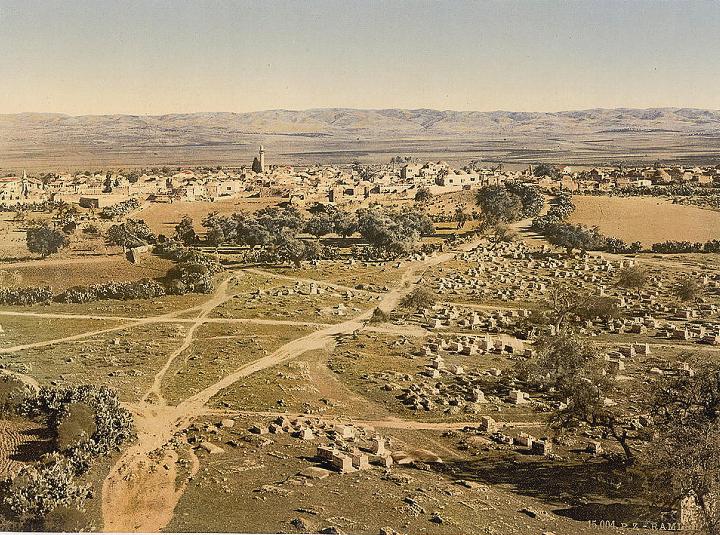
Ramla in 1890, as seen from the Tower of 40 martyrs – Library of Congress
-
Modern times
The city sustained heavy damages in the earthquake of July 1927. During the Arab revolt of 1936-1936, Ramla was a base of Arab gangs who attacked British forces and the Jewish community. This revolt was headed by its leader Hassan Salama who was stationed near Ramla. The battles of the independence war (1948) brought more damages, and its Arab residents left the city. The new city of Ramla was first established in 1949.
Most of the old structures of the old city of Ramla are gone, replaced by modern buildings. However, the remaining old structures are very interesting and worth a day tour.
Photos:
(a) The arches pool and Aqueduct
An impressive 8th Century underground water reservoir is located in Ramla. This is one of the exciting sites in the city, where you can tour the vaulted pools with row boats.
Click on the photos to view in higher resolution…
An aqueduct was constructed by the founder of Ramla, Sulyman ibn Abu al-Malik, in the 8th Century. It brought waters from a group of springs located 12 KM south east of the city, near Tel Gezer. The waters were conveyed by the aqueduct to reservoirs in the city, mainly in the vicinity of the white mosque, and also to the Arches pool, for a duration of 150 years. During the 10th Century the aqueduct went out of use, causing the Pool of Arches to dry out.
![]() Read more on the pools and aqueduct in the Arches pool web page.
Read more on the pools and aqueduct in the Arches pool web page.
(b) Armenian Monastery
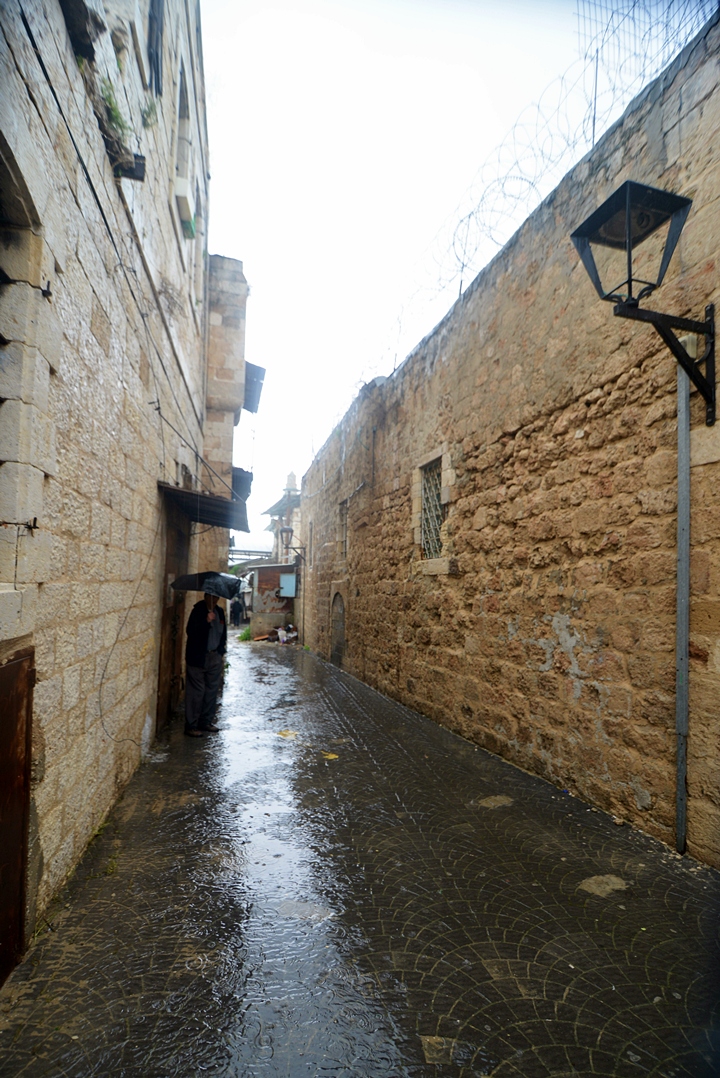
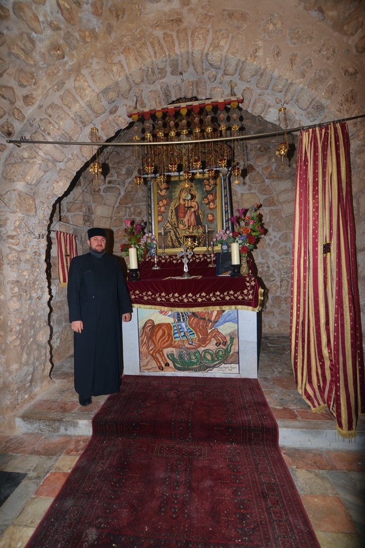
The Armenian monastery of St. George is located in the old city of Ramla. It was constructed in the 19th Century, on the ruins of an earlier Medieval structure. The monastery is located on the south (left) side of the alley, that is accessed from the city’s market. This paved alley was once the main north-south road that once passed through the city of Ramla.
The Armenian Church is an eastern Orthodox Church, and is based on a structure which is common in other Orthodox churches.
![]() Read more on this place in the Armenian Monastery web page.
Read more on this place in the Armenian Monastery web page.
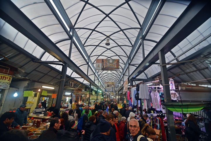
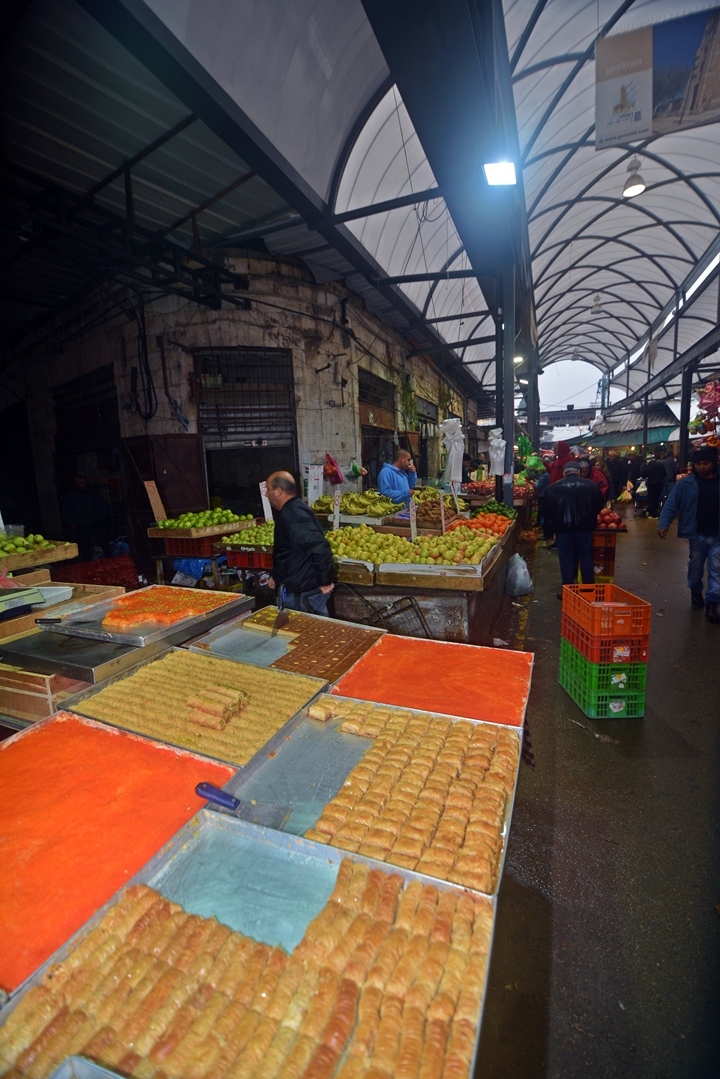
(c) City Market
The Armenian monastery is located near the Ramla city market. This covered street market is a great place to take a bite on the way to or back from the tour of the monastery.
You can find here tasty pastries, burek (burkeas), fruits, sweets, drinks, and more.
(d) Ramla Mameluke Khan
The ruins of a 13th Century Khan (inn) are located in the outskirts of Ramla. This Mameluke structure once served the caravans and travelers along the main roads of the central area of the Land, an important station along the Mamluke postal road.
![]() Read more on the place in the Mameluke Khan web page.
Read more on the place in the Mameluke Khan web page.
(d) White Mosque
The ruins of the White Mosque (Arabic: Jamia el Arbain Meghazi), also known as the mosque of the 40 Champions, are located in Dani Maas street. It was built in several phases, during the Umayyad, Ayyubid and Mameluke periods. The drone view shows the Minaret tower and ruins from the north side.
The PEF report wrote about it:
“The enclosure measures about 300 feet north and south, by 280 feet east and west. The fine minaret, commonly called ‘Tower of the Forty Martyrs’ by Christians, is in the centre of the north side ; along the south wall is a double colonnade with pointed arches. There is a Mihrab in the south wall. Beneath the surface are three vaults, running cast and west, with pointed arches. To one of these the title Arbain Meghazi, ‘Forty Champions ‘(companions of the Prophet), applies. This vault is full of Meshahed, or cairns, erected by pilgrims. A small ruined building or chapel stood in the centre of the court”.
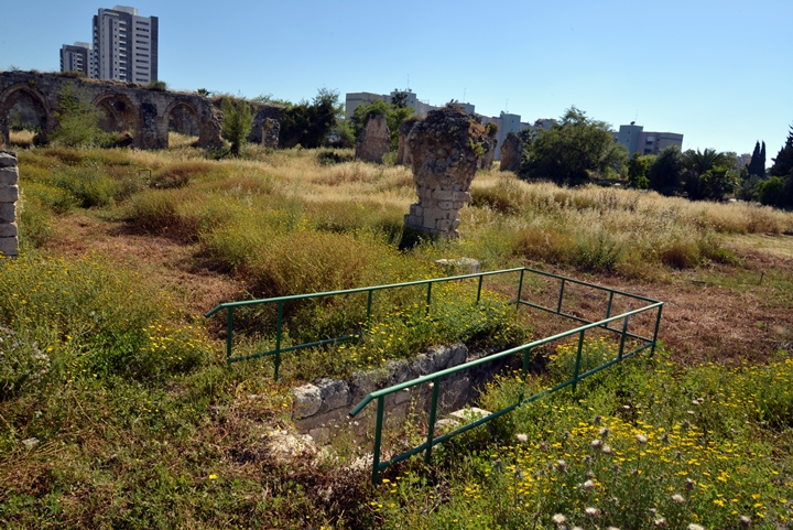
The mosque’s courtyard is almost square (94m x 93m). It has three underground water reservoirs, accessed by stairs as seen in the following photo. Each reservoir is based on arches, similar to the Arches pool, and was connected to the Ramla aqueduct.
The PEF report (1874) described the mosque:
“There are remains of chambers, probably occupied by the ministers of the mosque, along the west wall. All the arches are pointed, the roofs are groined, the masonry is small. In the centre of the area is a square building about 26 feet wide. In the north-west corner is the little kubbeh of Sheikh Silleh. There is a gate on the north and another on the east, also remains of a central colonnade running east and west”.
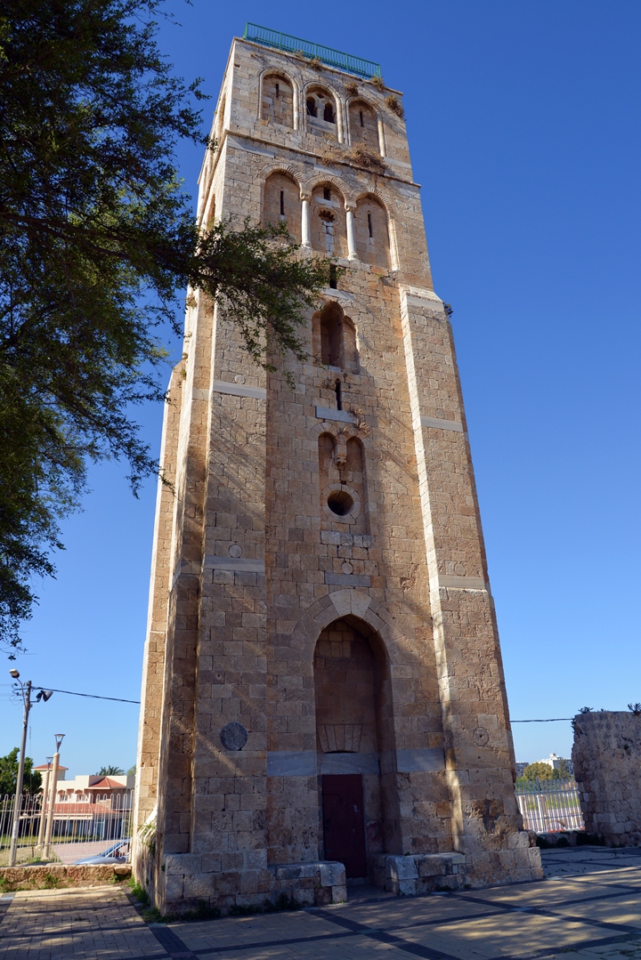
The mosque’s minaret tower, known as the “White Tower”, is 30m high. It is dated to the Mameluke period (construction on year 1318). The PEF report described it:
“The minaret has a winding staircase and solid core of masonry. Masons’ marks were observed on the slabs used for steps, which were probably taken from one of the tenth century churches, destroyed before the building of the mosque. The tower has been severely shaken by earthquake. The height is 120 feet, and the base is 26 feet square. The masonry is remarkably fine throughout”.
![]() You can also “fly” over the site with this drone video.
You can also “fly” over the site with this drone video.
(e) Great Mosque
The Great Mosque (Jamia el-Kabir) is a large structure, is actually a 12th Century Crusader Church. After the defeat of the Crusaders, the Arabs added a minaret tower and a Michrab (Islam prayer niche) on its south side.
The PEF report of 1874 writes about it:
“The church, now a mosque (Jamia el Kebir)… It consists of a nave and two aisles, with three apses at the end. The nave has a clerestory, as at Ludd [Lod]. The length is 150 feet, the breadth 75, almost the same as in the church at Ludd. The height of the centre of the nave roof is about 40 feet. There are seven bays of columns. The span of the arches is irregular, being from 12 to 14 feet. The interior has been plastered, and a Mihrab made in the south wall. The church has a bearing 104°. The roof appears to be the original one. No masons’ marks were found, as they have been plastered over. The piers are similar to those at Lud d, about 5 feet 8 inches square, including the attached semi-columns, 18 inches diameter. The arches are pointed, and the clerestory windows have also pointed arches. The capitals were sketched. One is peculiar as being unsymmetrical. They are much effaced by the whitewash. … The minaret probably was the belfry ; on the east side, above the staircase door, which leads out on to the roof, is a lintel, with a beautiful bas relief, representing two conventionally represented animals. This has been sketched by M. le Comte. This church is perhaps the finest and best preserved specimen of Crusading work in Palestine”.
An interesting element is the entrance, typical of Crusaders churches, with 3 columns on both sides: “The church is entered from the north, but had a fine west door, with moldings resembling those of the west door of the church at Gaza. This door is now blocked up”.
(f) Abu ‘Al’o0n mosque
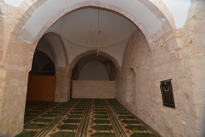
This mosque is located near the junction of Herzl and King Solomon streets. It is dedicated to Sheikh Abu ‘Al’oon, who was the spiritual leader of the order of Dervish monks – Sufi Muslims who live a life of extreme poverty, and are known for their frenzied, ecstatic, whirling dance.
In this mosque is the tomb of Sheikh Abu ‘Al’oon, who died in 1504. His wife is buried in the adjacent tomb.
(g) Conservations and the future
The IAA conservation teams are doing a great job in restoring the beauty of the old city. Slowly, the old city structures and streets, which were neglected for the past 60 years, are brought back to life. In this photo, taken in 2008, the scaffolding of the alley near the renewed market shows one of these projects which were completed and beautified the once neglected sections of the old city.
At this time (2015), many of the old structures in Ramla are still waiting for the conservation works. In future, the historic center could become a great tourist center.
Etymology (behind the name):
* Names of the site:
- Ramla (er Ramleh) – Arabic – “Sandy”.
Links and References:
* Archaeology and History:
- Community Based Archaeology at Khan el-Hilu, Lod, Israel – See more at: http://www.archaeological.org/news/currentprojects/9088#sthash.8CNJ2cQV.dpuf
- Go Ramla – information and sites of Ramla
- Tagliot – “Archaeology for All” (Hebrew site) – arranged the tour, which was guided by guided by Dr. Yigal Sitry, director of the Ramla museum.
- Library of Congress – photos of Ramla /Ramleh
- Excavations near the white mosque
- IAA conservation projects – Ramla
* Sites of Ramla:
* Other sites:
- Drone Aerial views – collection of Biblical sites from the air
BibleWalks.com – exploring the Biblical sites
Lod (Overview)<<–previous site—<<< All Sites>>>–next Shefela site–>>> Armenian Monastery
This page was last updated on May 23, 2015
Sponsored links:
