A Roman village, Crusader fortress and Ottoman period village on a hilltop near Kibbutz Tzova, west of Jerusalem.
Home > Sites > Judea >Tel Tzova
Contents:
Overview
Location
History
Photos
* Aerial views
* Hill
* Eastern wall
* South side
* Center
* North side
* Northern walls
* Nature
* Ein Tzova
* Aerial video
Etymology
Links
Overview:
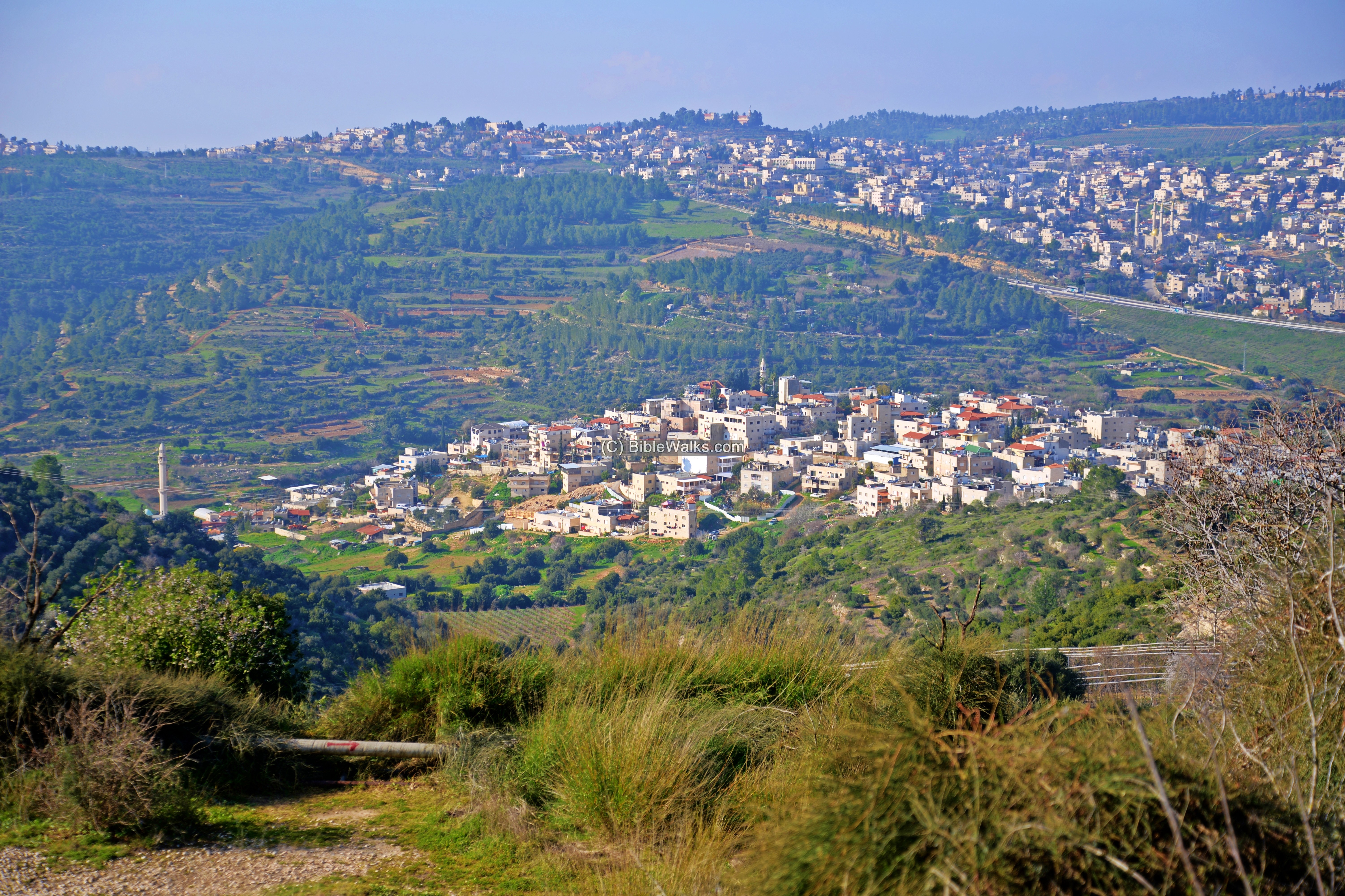
Tel Tzova is a multi-period settlement situated on a conical hill west of Jerusalem.
In 1169 the Crusaders built a castle named Belmont (‘beautiful mountain’). The castle was captured by Saladin in 1187, and demolished four years later. Sections of the castle walls are still visible, although they were assimilated into the Muslim village Suba that existed on the hill until 1948. Its name, Suba, preserved the Hebrew name.
Today Tel Tzova is a National park, open to the public, and accessible from nearby Kibbutz Tzova.
Location:
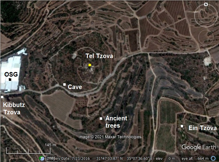
The following aerial view shows the area. Tel Tzova is located on a hill at an altitude of 769m above sea level, raising ~50m above the ridge. Deep valleys are on its north (Nahal Kesalon) and south side (Nahal Tzova).
The site is accessible by a road from the eastern side of Kibbutz Tzova, from a paved road that starts near the OSG glass factory.
History:
- Iron Age
The village started from the Iron Age, perhaps a Biblical farming village named Tzova (Zobah) – the home town of one of David’s friends (2 Samuel 23:36):
“Igal the son of Nathan of Zobah”.
- Roman/Byzantine period (1st century BC-7th century AD)
In Roman times it was a Jewish village named Seboim.
- Crusaders (12th-14th century)
The Crusaders arrived from Europe to the Holy Land in order to liberate the Holy Land and free Jerusalem. They accomplished the mission in 1099, and established the Crusader Kingdom. Then they began to construct fortresses along the borders, ports and main roads.
The Crusaders named the village Subahiet. In ~1169 they built a castle named Belmont (‘beautiful mountain’).
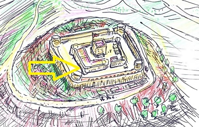
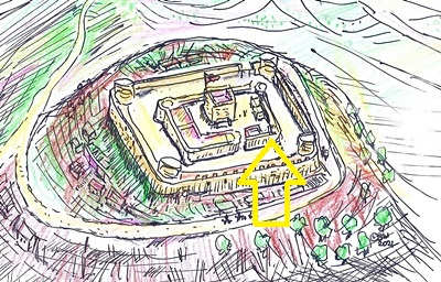
An illustration of the castle was drawn based on the excavations, with a view from the north side. The complex includes an outer wall (~64m x 72m) that is built along the a lower slope of the hill. The outer gate was located on the south west side. An inner wall (~38 x 42m) encloses the castle, with an inner gate on its north side. In the center is a ~15 x 15m square tower.
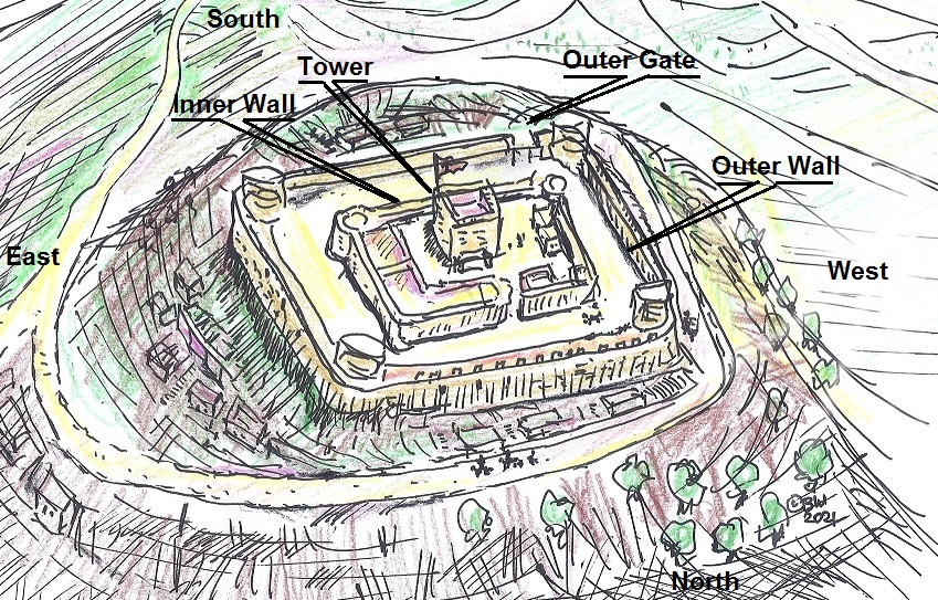
Illustration of Belmont castle on Tzova hill (figurative sketch)
The castle was captured by Saladin in 1187, and demolished four years later. Sections of the castle walls are still visible, although they were assimilated into the Muslim village Suba that existed on the hill until 1948.
- Ottoman period (19th Century AD)
The Arab name of the village, Suba, preserved the Hebrew name. It was resettled after the collapse of the Crusader kingdom.
In the mid 19th century the village was controlled by the Abu Ghosh clan, who re-fortified the castle. The Abu Ghoshes settled in the area starting in the 16th century. According to a tradition, they were Arabs of Chechen descent, and fought with the Ottoman Sultan Selim I. From the beginning of the 16th century until 1834 the family controlled the pilgrimage route from Jaffa to Jerusalem, imposing tolls on the pilgrims.
In 1834 the Ottoman rulers of Egypt imposed new taxes and rules, sparking the Peasants’ revolt of Palestine. Since the Abu Ghosh toll collection business was abolished by the new rules, they participated in the countrywide rebellion. This all ended after the Egyptian general Ibrahim Pasha, the eldest son of Ottoman ruler of Egypt Muhammad Ali , came to reimpose Ottoman authority in the land. He jailed the family leader and destroyed the fortress.
- PEF survey:
The area around the site was examined in the Palestine Exploration Foundation (PEF) survey (1866-1877) by Wilson, Conder and Kitchener. A section of their map is shown below, with the site appearing here as Soba.
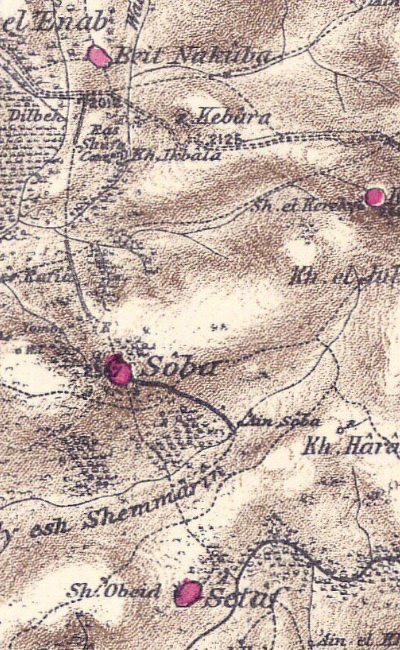
Part of Map Sheet 17 of Survey of Western Palestine,
by Conder and Kitchener, 1872-1877.
(Published 1880, reprinted by LifeintheHolyLand.com)
The survey reported (Volume III, p. 18-19):
“Soba—A stone village of moderate size, in a very conspicuous position on the top of a steep conical hill. It has a high central house. The knoll is surrounded with olive groves and vineyards. There arc rock-cut tombs both on the north and on the south. The hill stands up 700 or 800 feet above the valley on the north. There is a good spring in the valley on this side, and another (‘Ain Soba) in the valley to the south-west. There are remains of a Crusading fortress, which was destroyed by Ibrahim Pasha. The place was at one time a fortress of the Abu Ghosh family. Suba was considered at one time to be Modin. Brocardus (1283 a.d.) makes Modin 6 leagues east of Beth Shemesh (‘Ain Shems). The village or the district appears to have been called Belmont in the twelfth century ; and Soba was apparently a fief of the Holy Sepulchre (see Theodoricus 11 72, a.d., and the Cartulary of the Holy Sepulchre).”.
Page 45:
“Soba is the Bel-Mont of the Crusaders, and is undoubtedly an ancient Jewish site”.
Page 157-158:
“Soba —There are remains of a Crusading fortress at this place. Nearly at the top of the hill to the east is a rocky scarp, 20 feet high, sloping, and fitted with a sloping masonry revetement of good-sized drafted masonry. The draft has a diagonal dressing like that on twelfth century masonry. This fortress was destroyed by Muhammed Ali, and rebuilt by Abu Ghosh. It was again destroyed at a later period. There are remains of Crusading buildings in all parts of the village, and a stone altar, with steps, marks the probable position of the church. The central tower, which is very conspicuous, seems also Crusading work, and one of the streets has a wall of roughly-dressed large stones, with joints packed (as at Kuryet el ‘Enab) with small chips. A little to the west of the village is a large vaulted building, with drafted stones in the walls.
South of the village there are rock-cut tombs. One of these was newly opened in 1875. It had nine kokim, each of which had a slab closing the end, still in place, and 4 inches thick. The roofs of the kokim were arched. Near this was a fine rock-cut wine-press with several chambers. Vineyards still exist round the village. South of Soba are the ruins of a Khan”.
Visited 25th May, 1875.
- Independence war
In January 1948 the Arab forces launched attacks on Jewish conveys bringing supplies to besieged Jerusalem. Fierce battles occurred here in an effort of the Israeli forces to open the road to besieged Jerusalem. The village of Soba, a base of the Arab forces, was strategic as it protected their nearby stronghold Castel. Both first two attacks, on April 17-18, 1948 and April 19-20, failed. A third successful attempt occurred on July 12-13, 1948, fought by the 6th regiment of the Palmach Harel forces, as part of operation Danny, which resulted in opening a route to Jerusalem.
- Modern period
Today Tel Tzova is a National park, open to the public, and accessible from nearby Kibbutz Tzova.
Photos:
(a) Aerial views
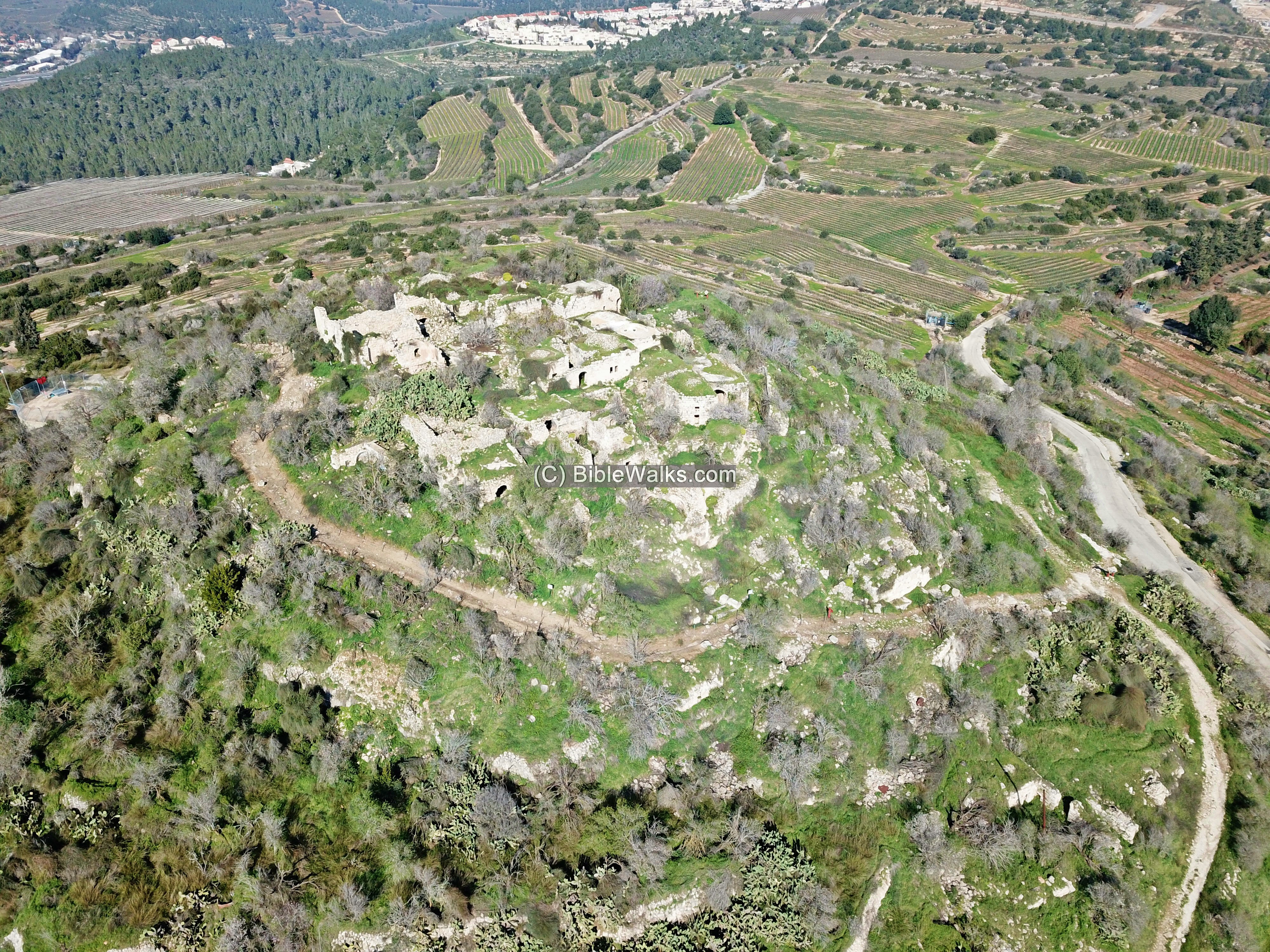
Ruins of the village and the Crusader castle are seen here in the drone view from the south side of the hill. In the far background is Jerusalem. On a closer hill, seen in the left background, is the Castel – ruins of another Crusader fortress.
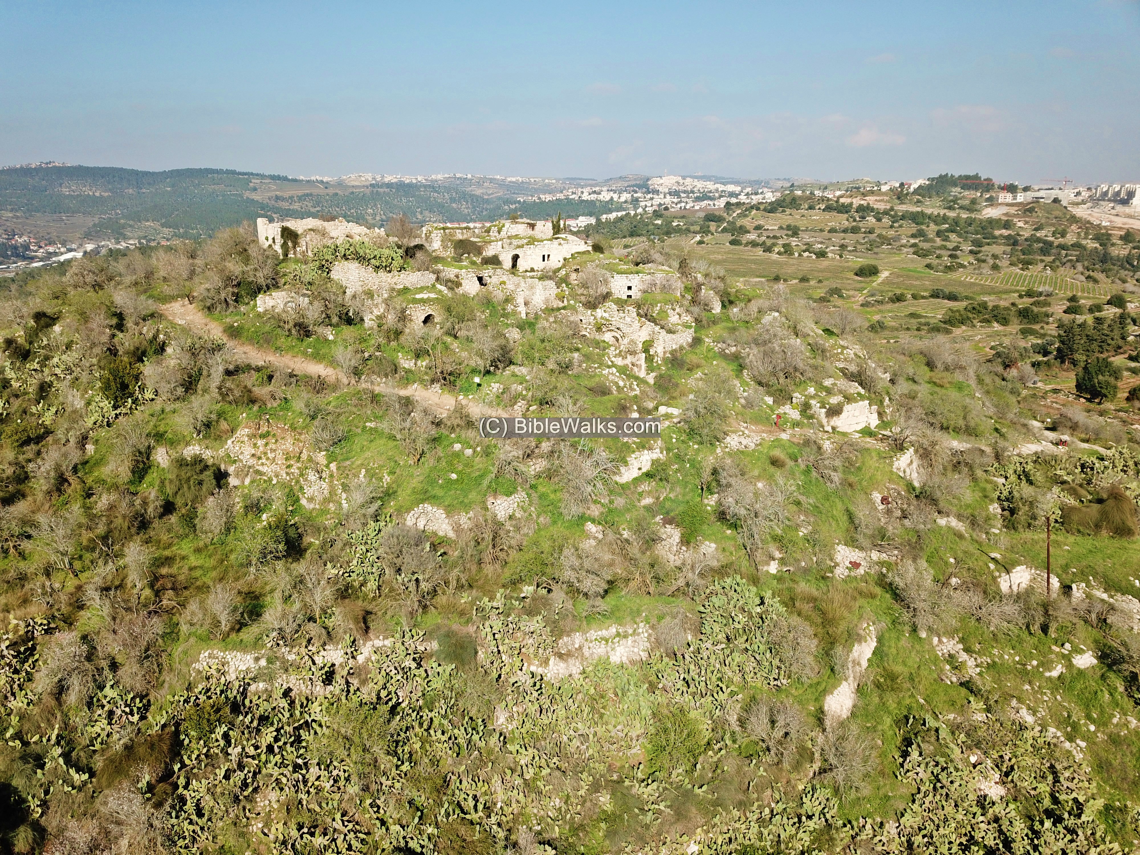
A higher view of the top of the hill:
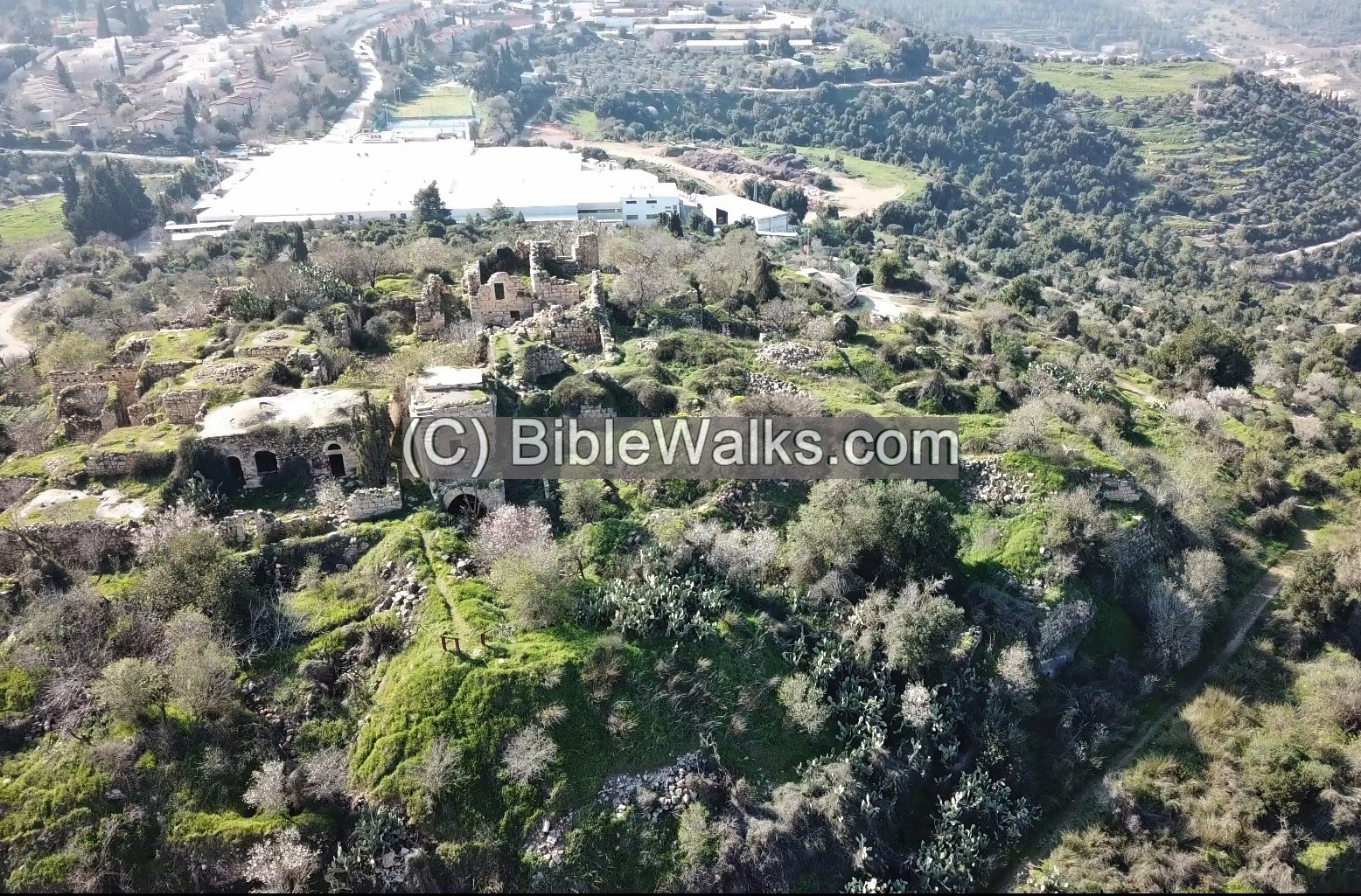
Another view from the north side is next. This is the location of the inner gate of the fortress. The north west corner of the outer wall is seen here on the bottom right side just above the trail.
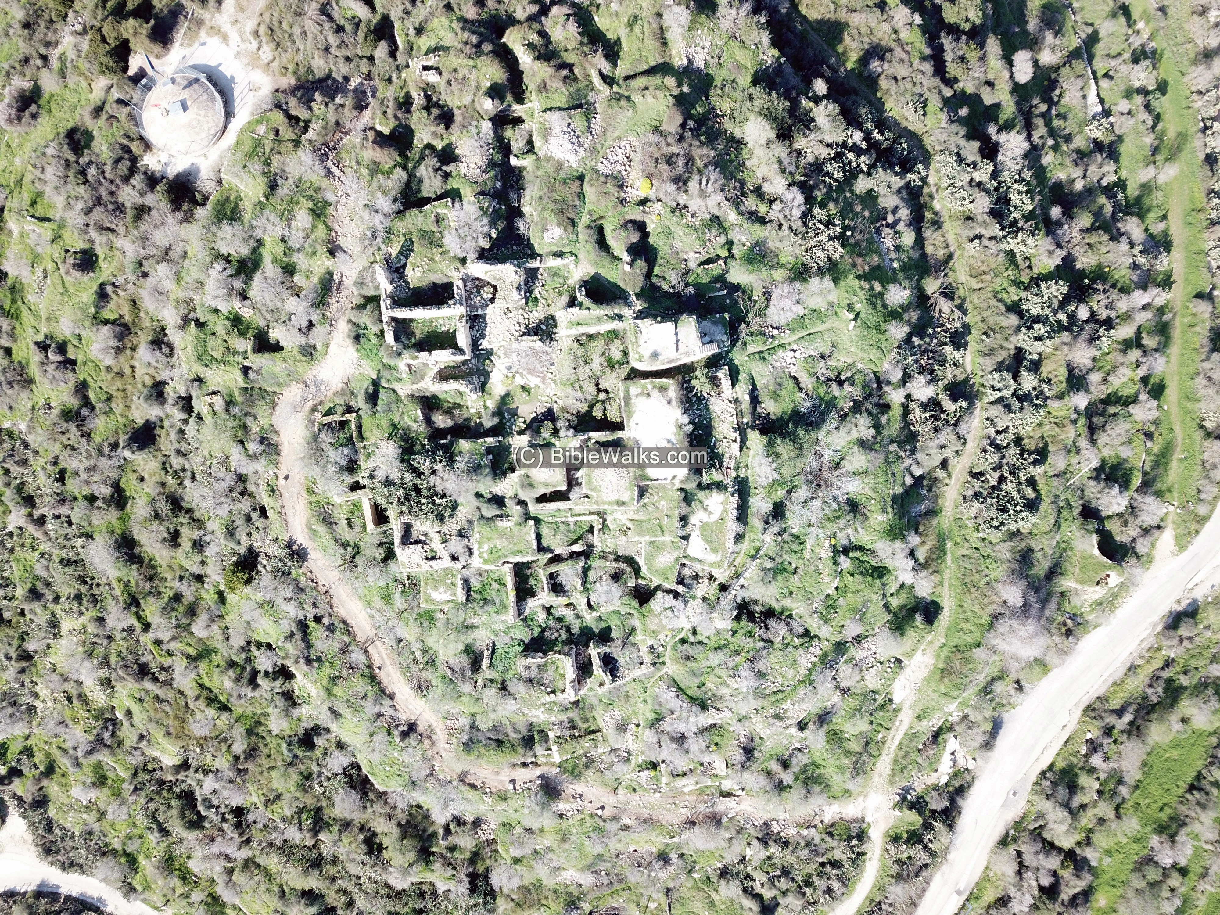
A top view over the ruins, with a view towards the west:
(b) Access to the site
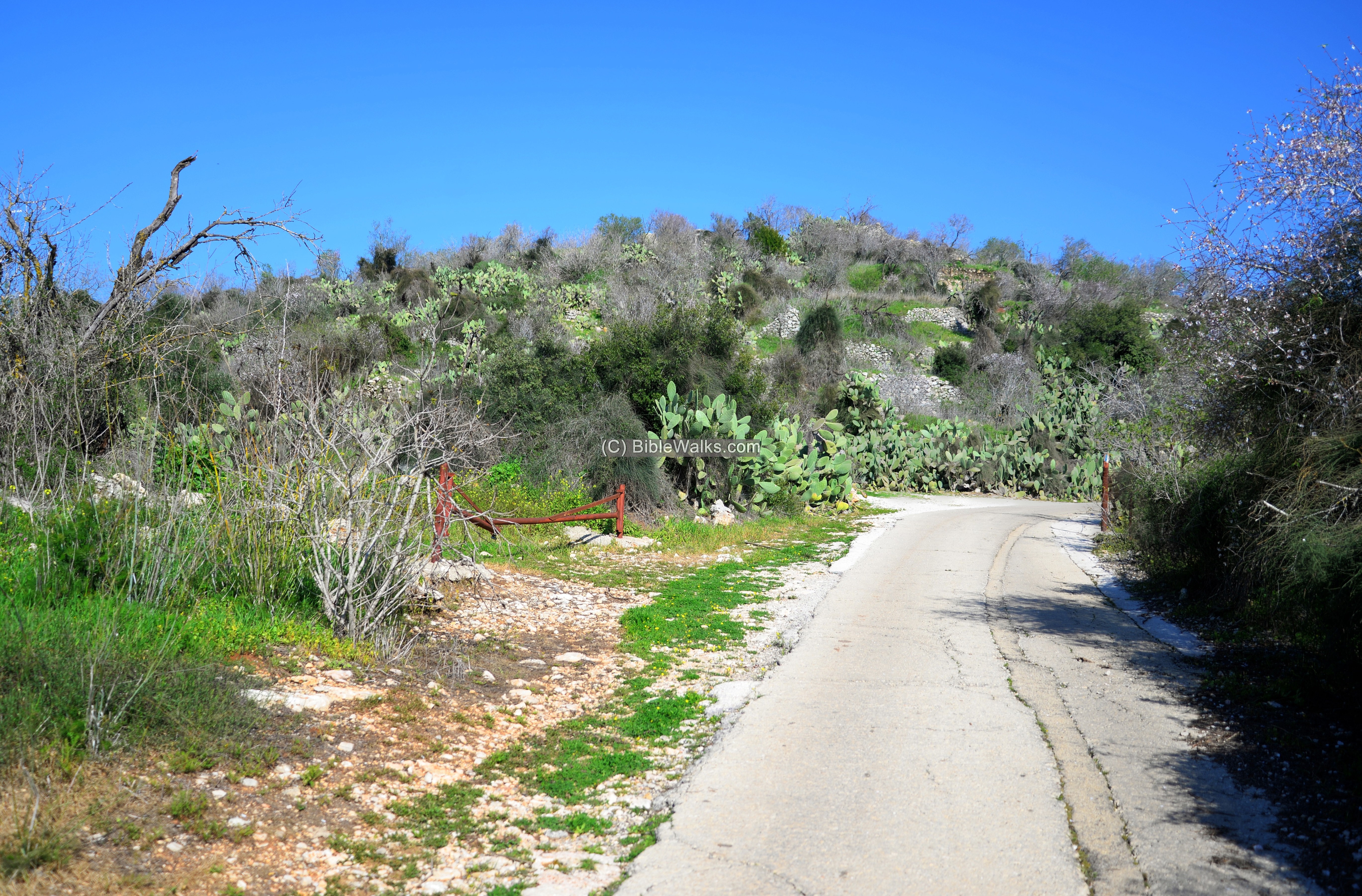
Access to the site is from Kibbutz Tzova. A paved road leads from the parking lot near the OSG factory to the site. A gate prevents driving along the road, so a short walk is required to reach the foothills of ancient Tzova. Its ruins are scattered on the top of the hill.
Click on the photos to view in higher resolution…
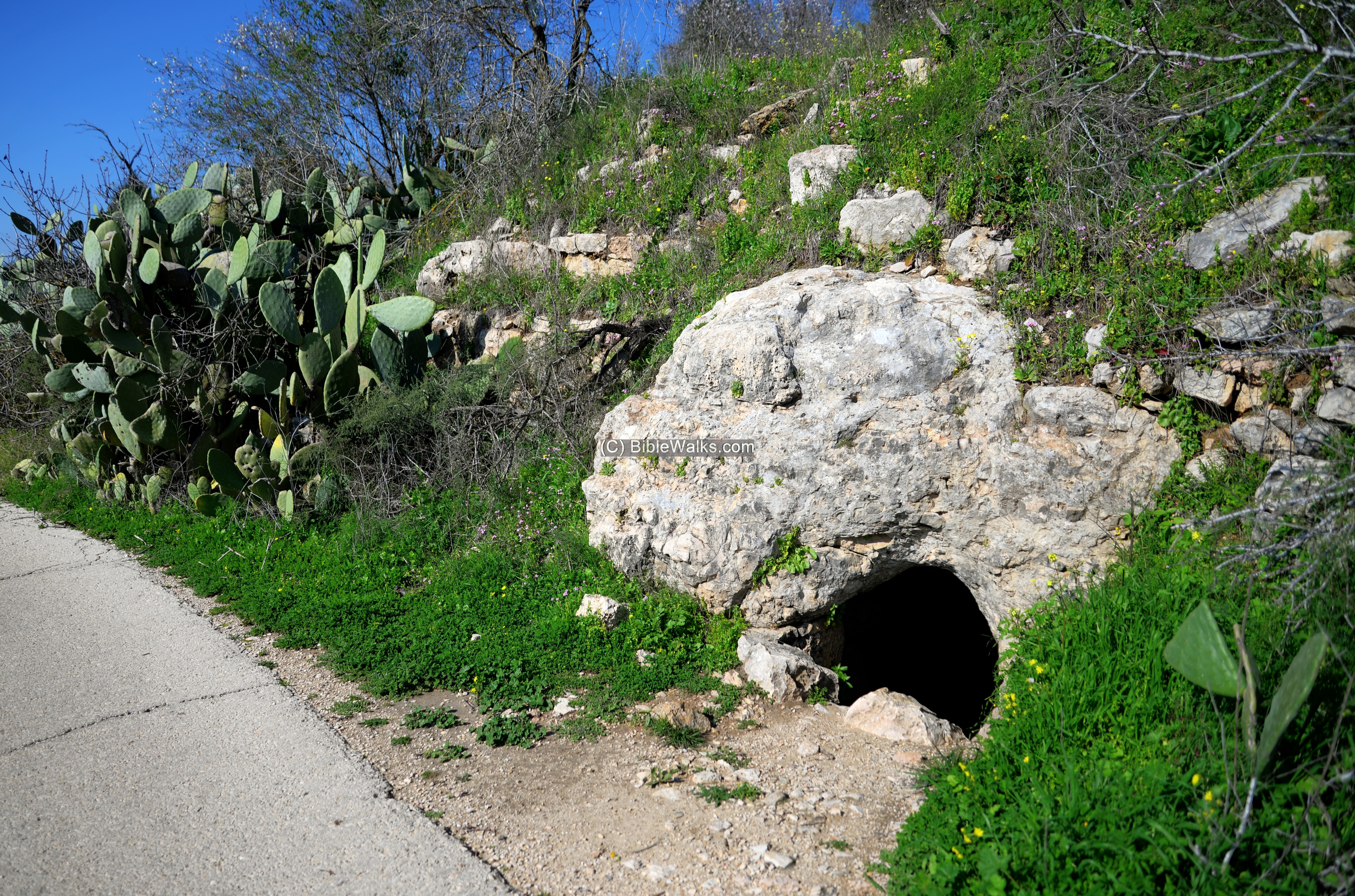
Along the foothills is a hewn burial cave.
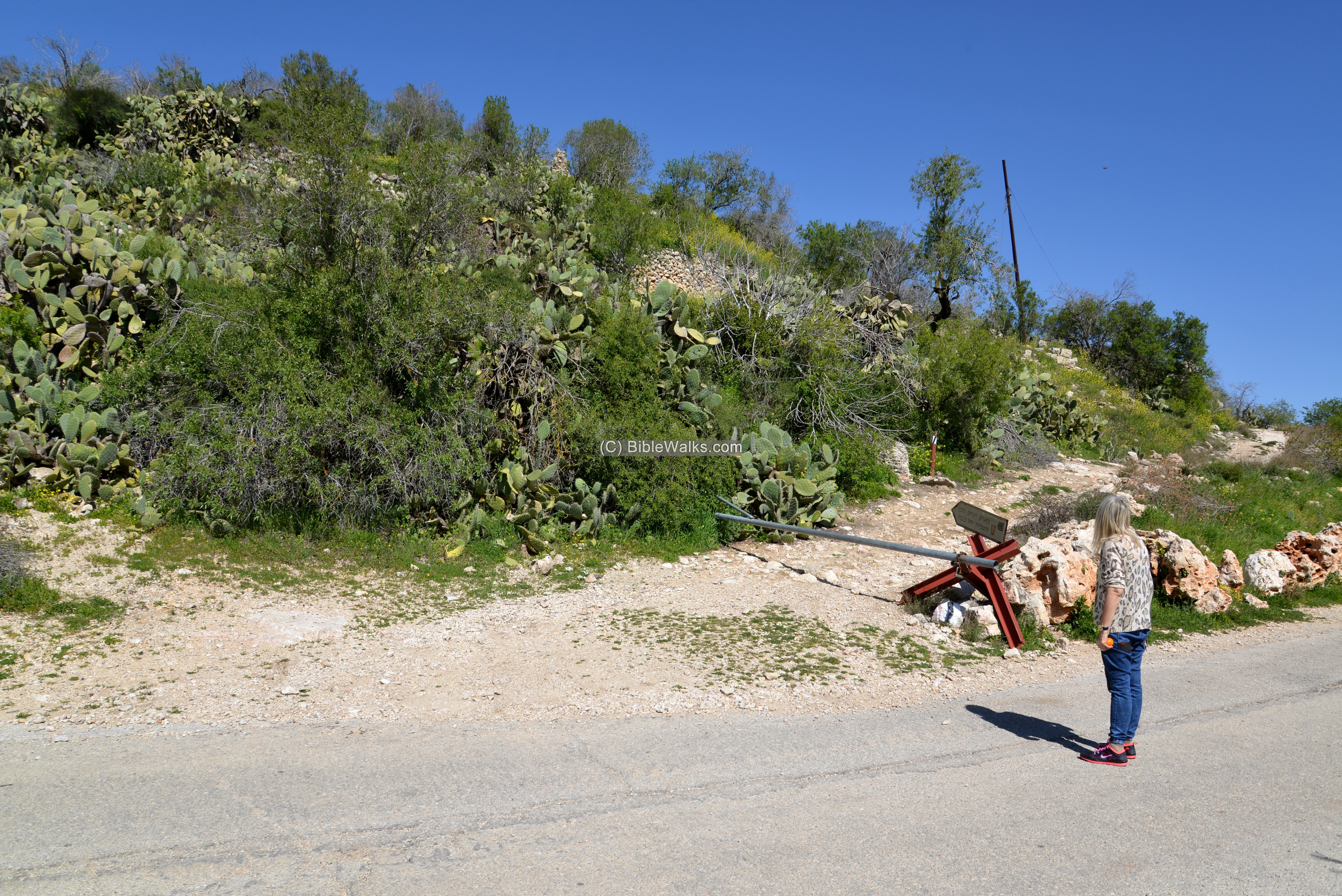
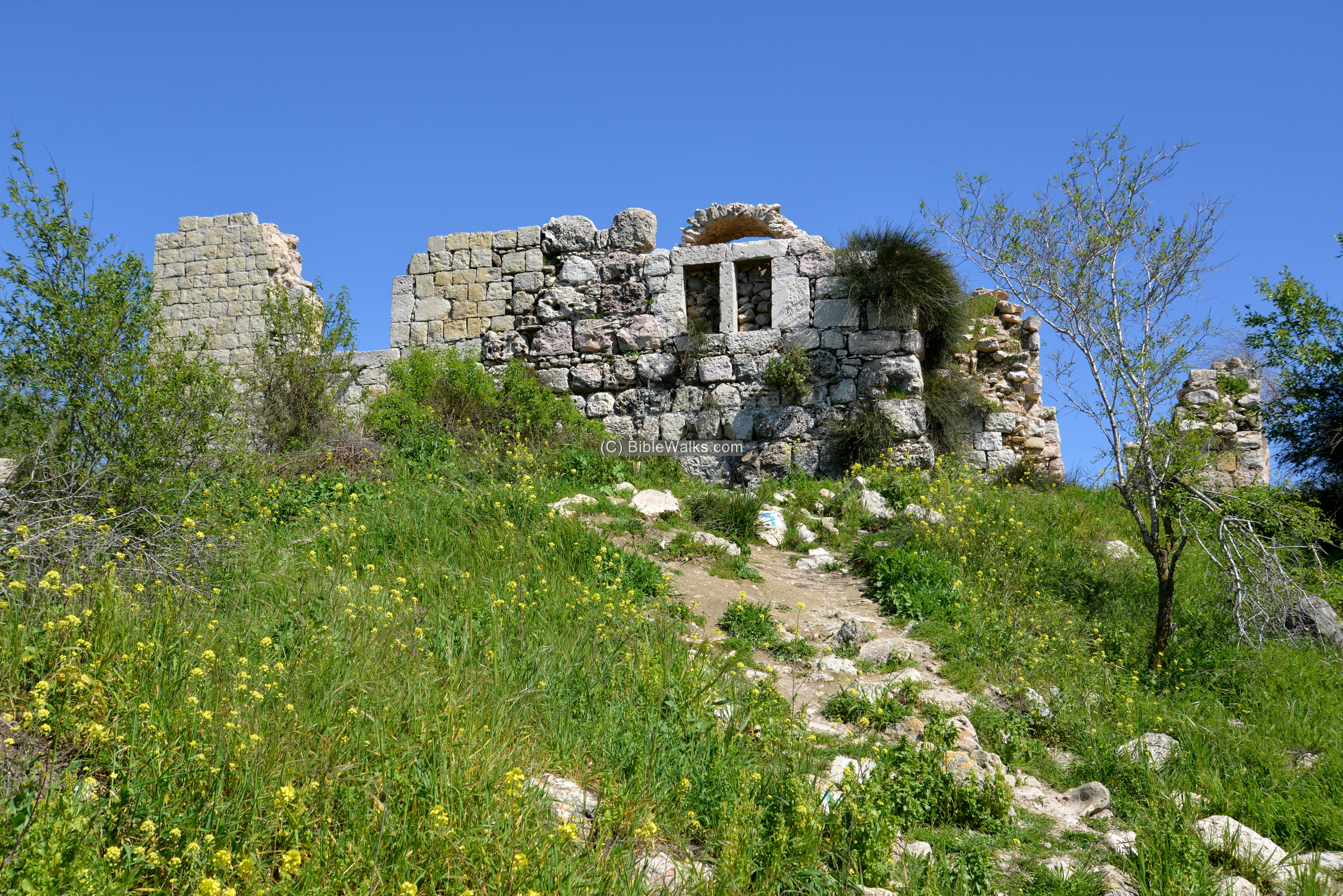
A trail leads up from the southern foothills.
Orna, Webmaster Rotem’s mother, stands at the entrance to the trail wondering what lays ahead.
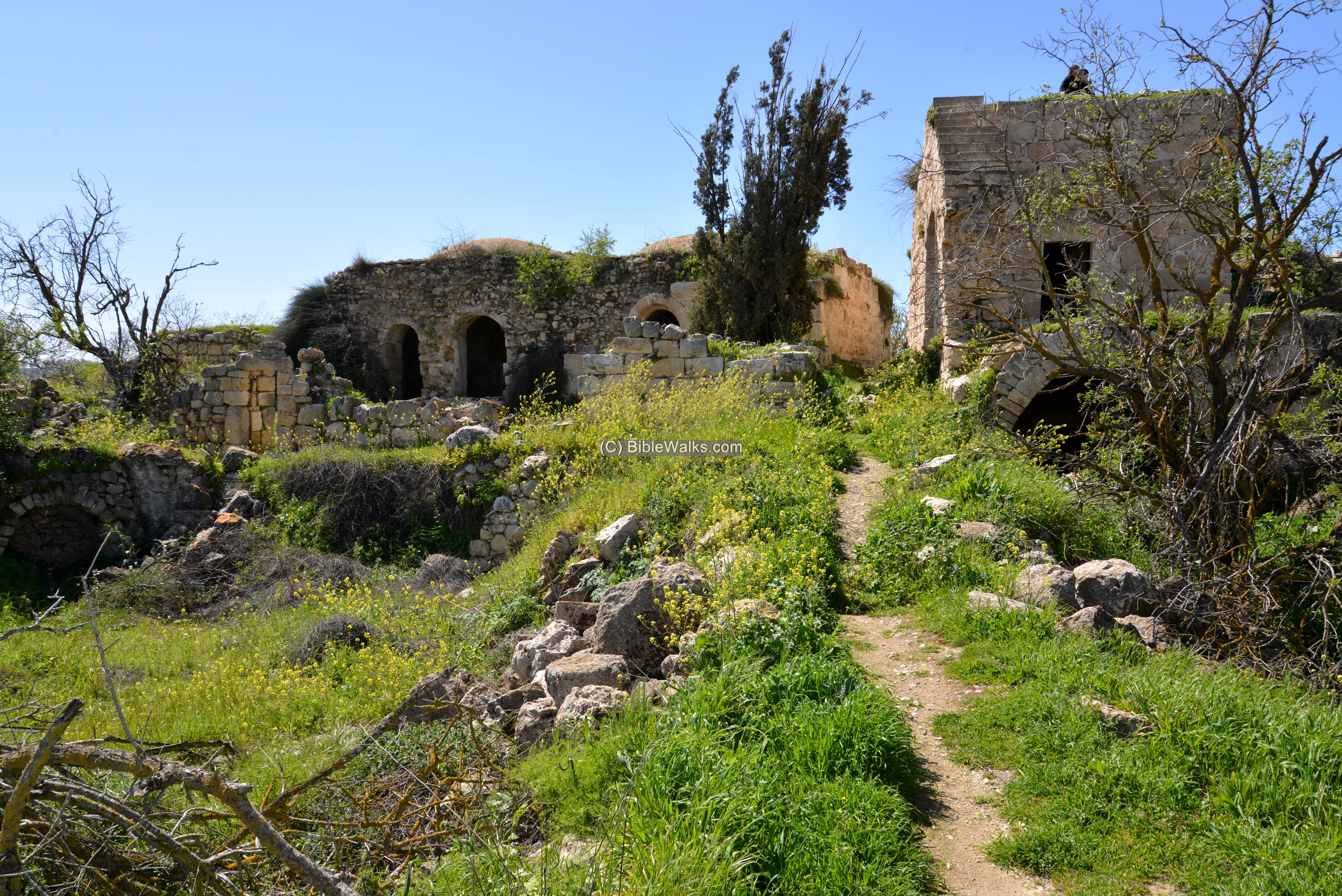
Ruins are scattered along the foothills, dated from the Roman period to modern times. However, most of the standing structures are located closer to the top of the hill.
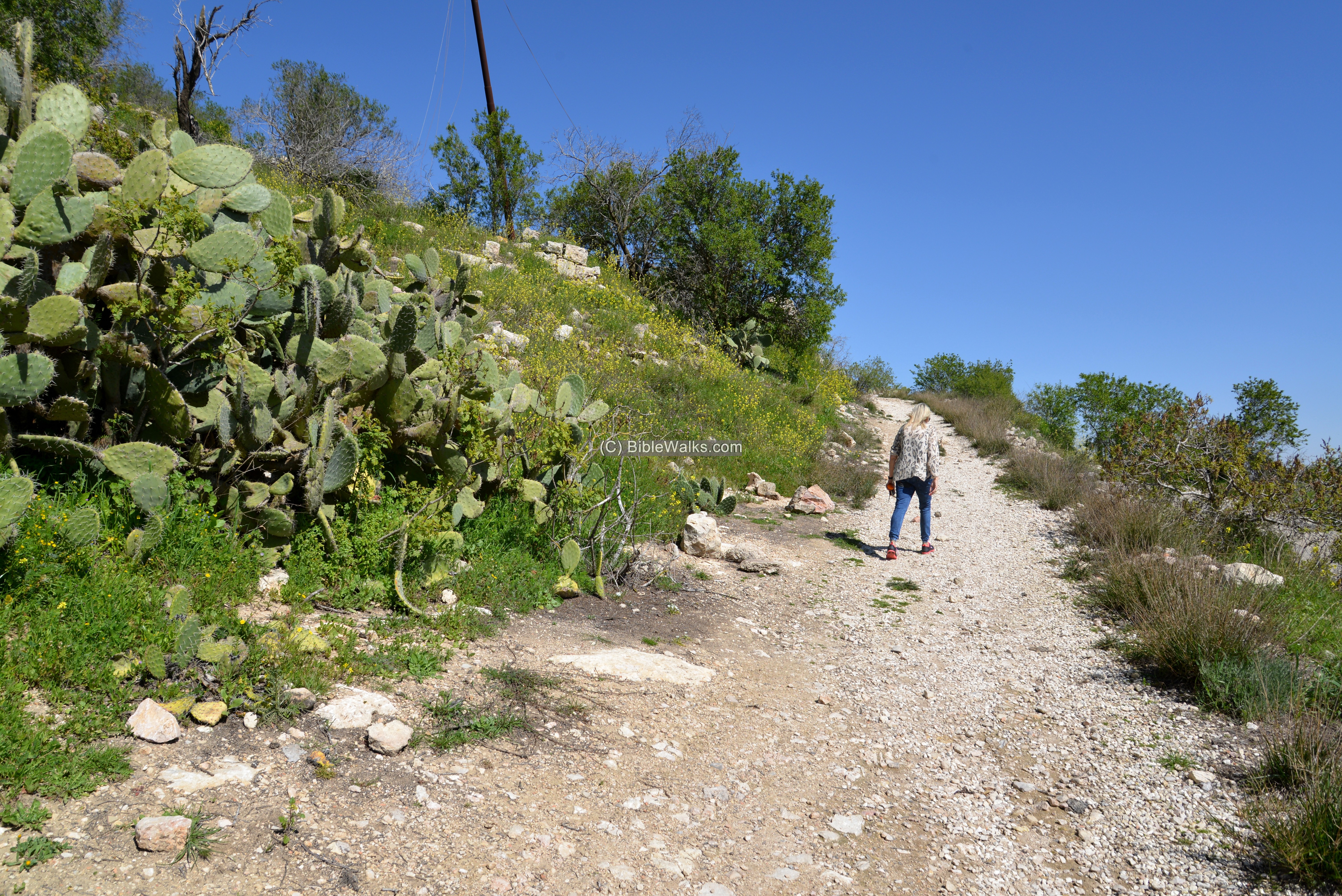
The views of the surrounding forest and farming areas are lovely.
In this view – towards the east – is a double arched structure – a Sheikh’s tomb.

Farther up the hill are ruins of a structure with two entrances. The structure is located just outside the ancient Crusader walls on the north east side of the castle.
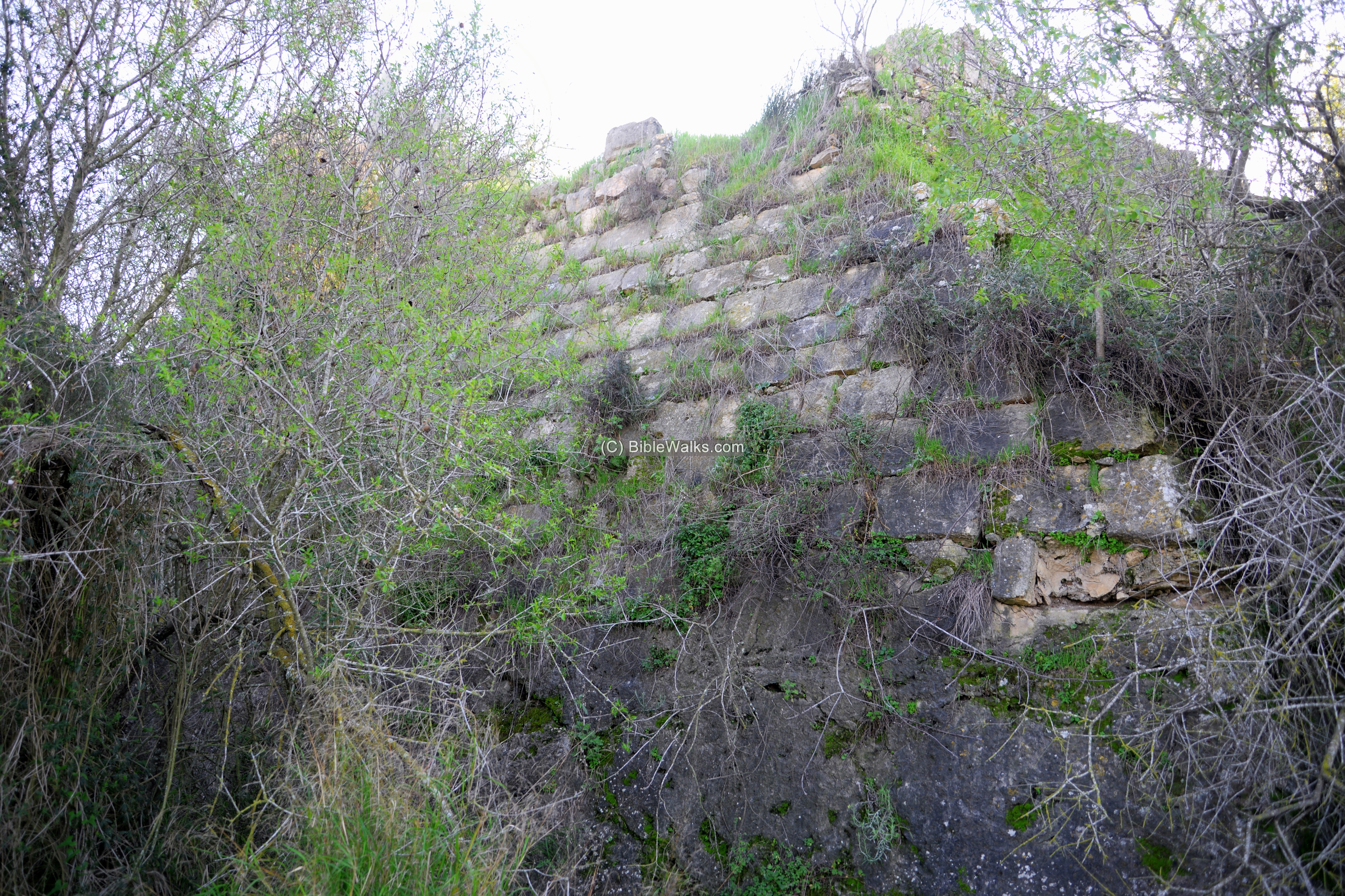
(c) Eastern walls
Turning up the hill are remains of the Crusader north eastern inner wall.
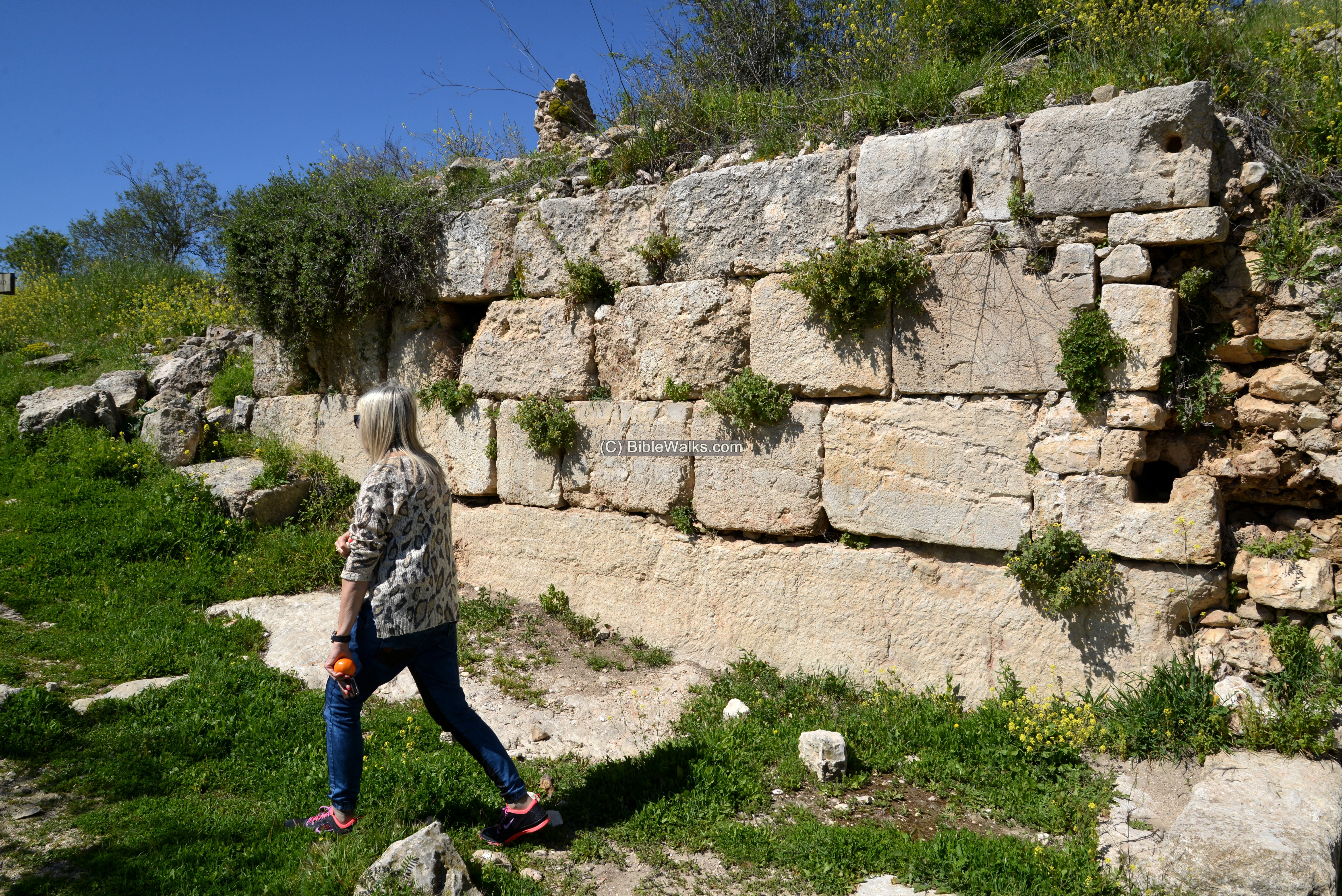
The location of this section of the north east wall is indicated by a yellow arrow on the illustration, as viewed from the north.
Another view of the north east section of the Crusader inner wall:
Only a small section of the wall remained standing at this side.
Beyond the Crusader wall are remains of the Arab village of Suba, which was built on the ruins of the fortress.
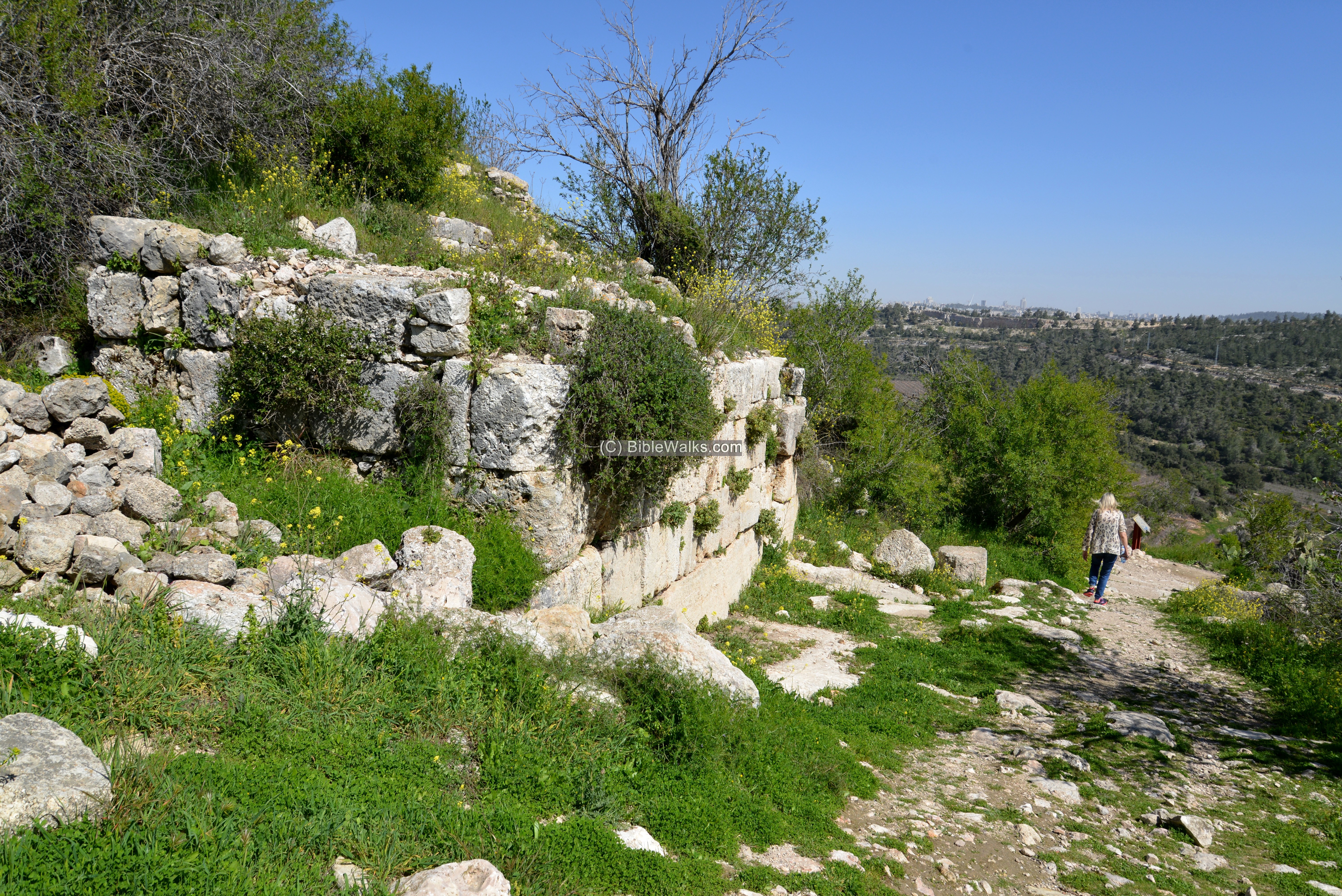
(d) South side
The south side of the Crusader walls are gone. Beyond the base of the wall is a view of the center of the fortress and remaining walls of the central tower.
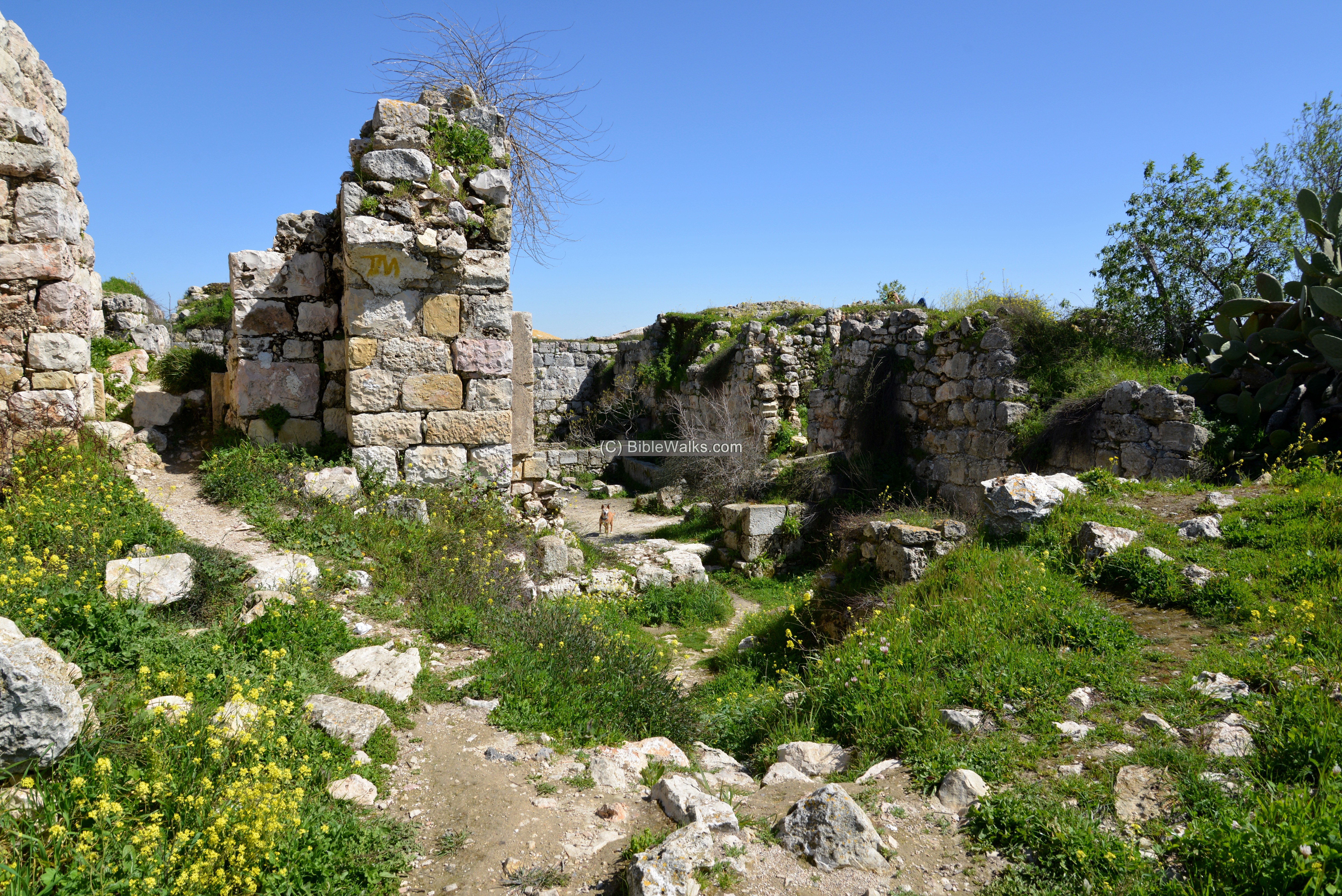
(e) Center of the Fortress
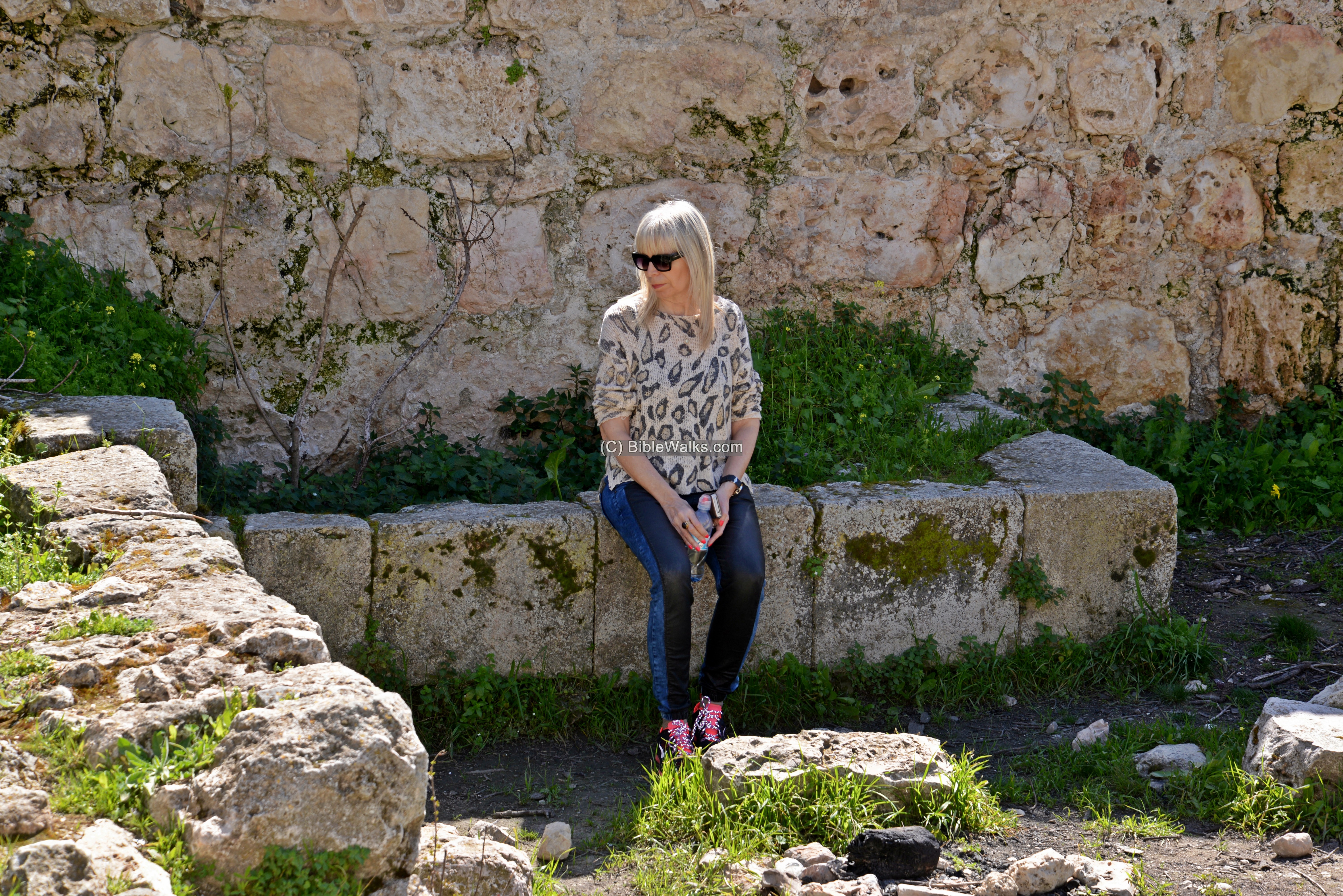
The area of the village square and its surrounding buildings are seen here from the southern entrance. This was formerly the courtyard of the fortress.
It is an open area, ~10m x 10m, enclosed by 3m thick walls.
Orna rests on a section of a wall in the eastern side of the courtyard.
On one of the stones embedded into the eastern wall is a carved illustration of a donkey.
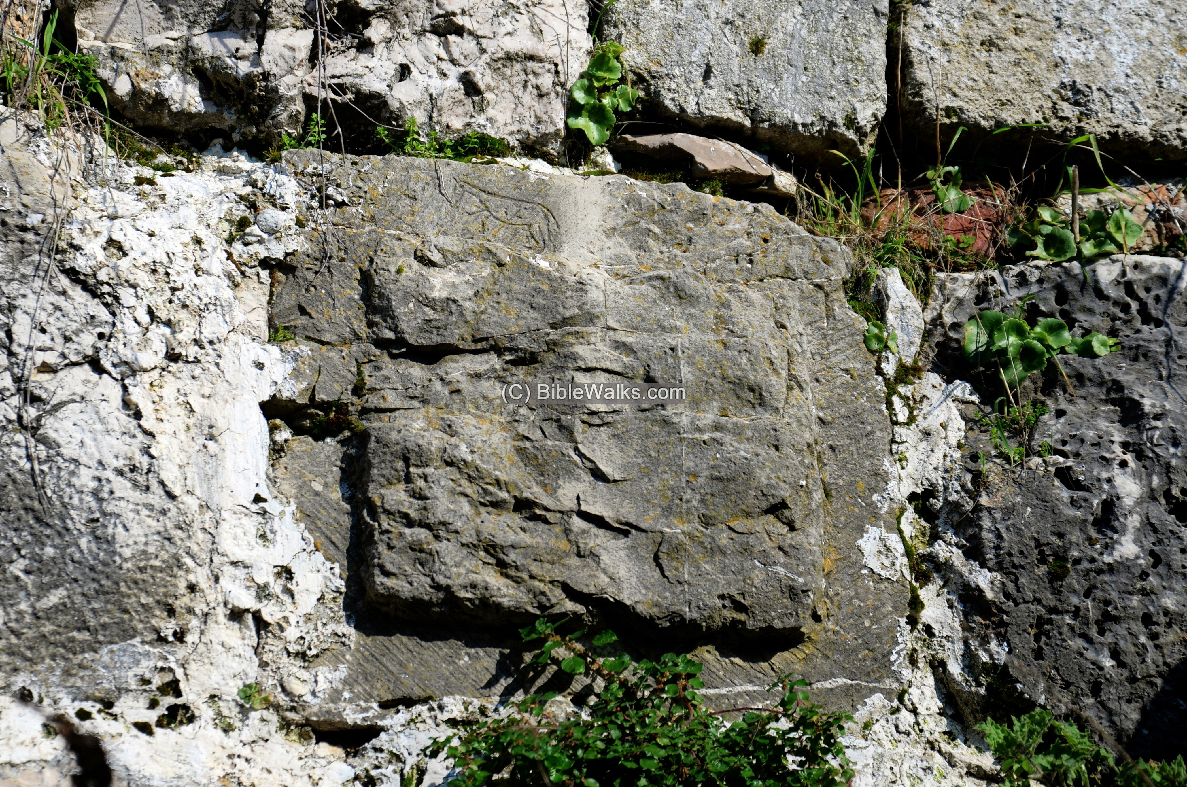
A closer view of the engraved donkey is below. Perhaps this Crusader illustration represents Jesus riding on a donkey to the Temple of Jerusalem.

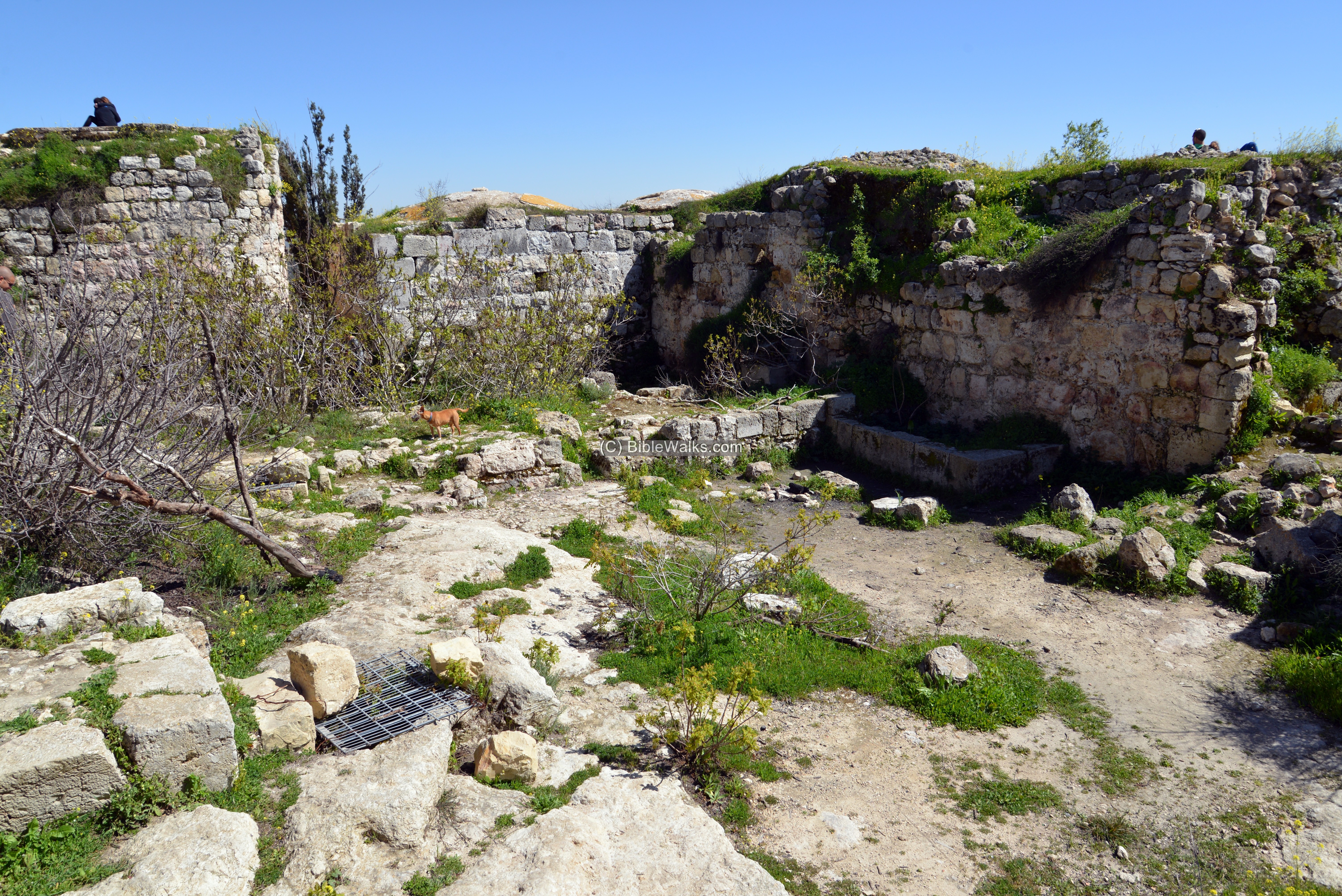
At the north side of the courtyard is an opening towards the inner gate of the Crusader castle.
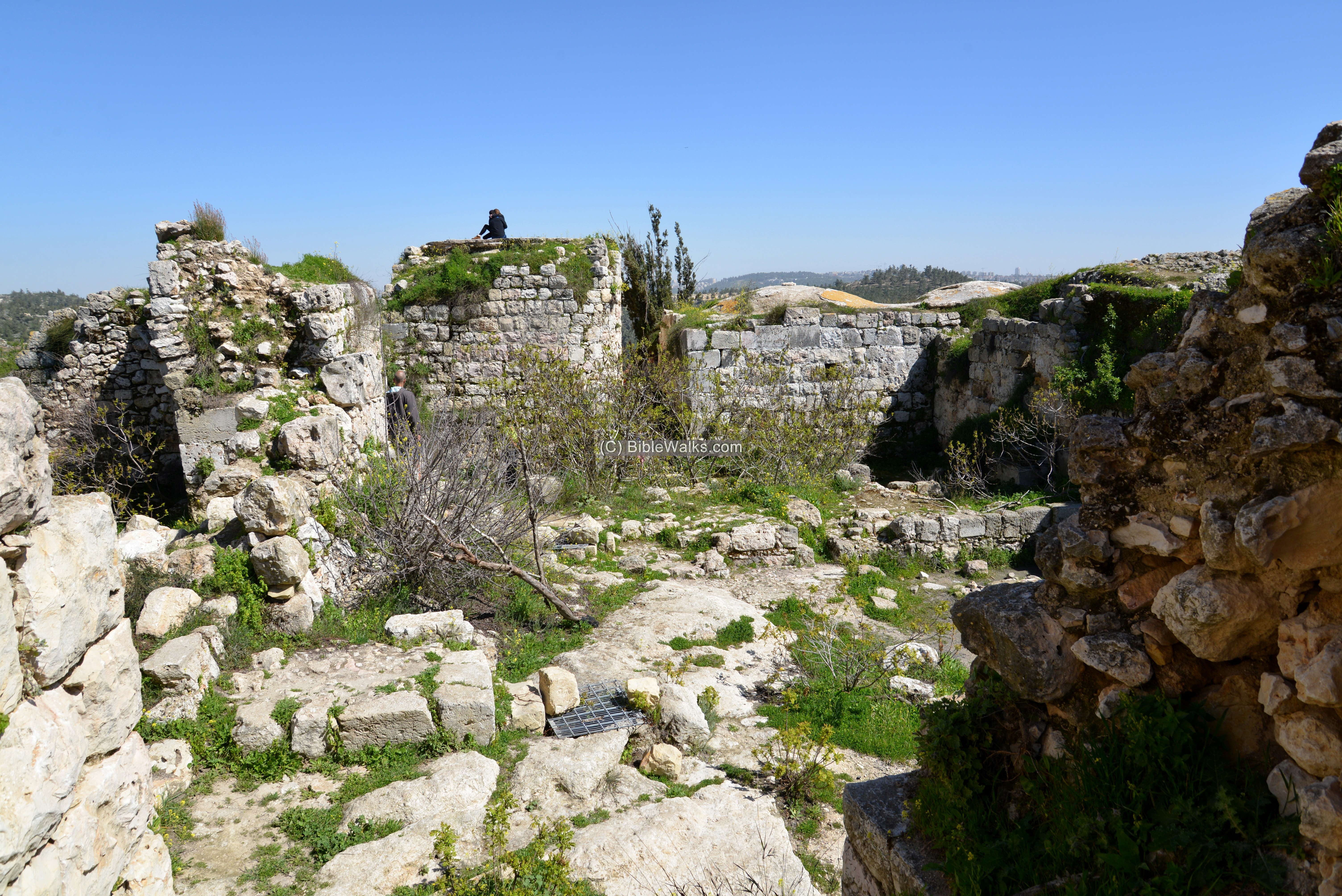
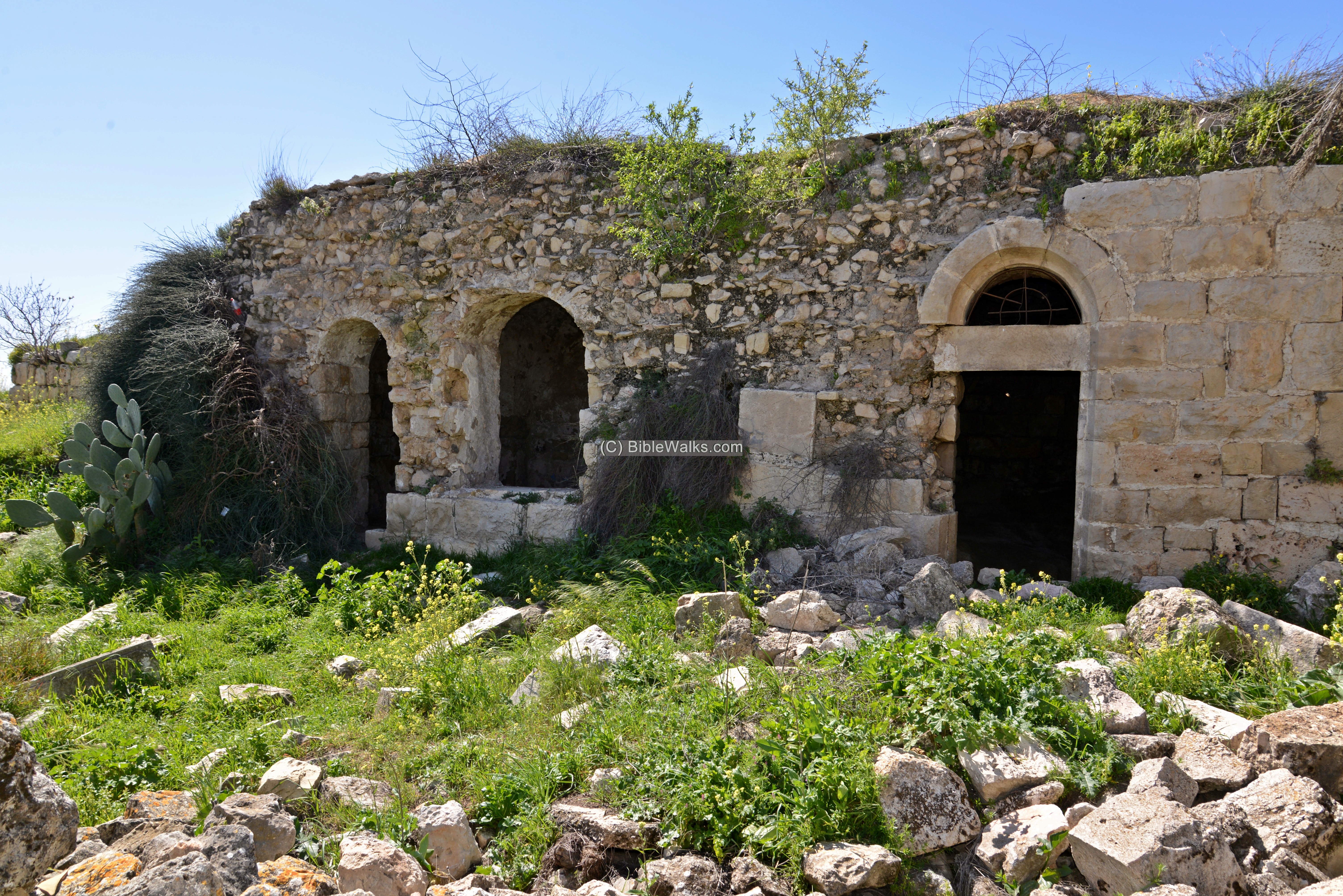
(f) Northern side
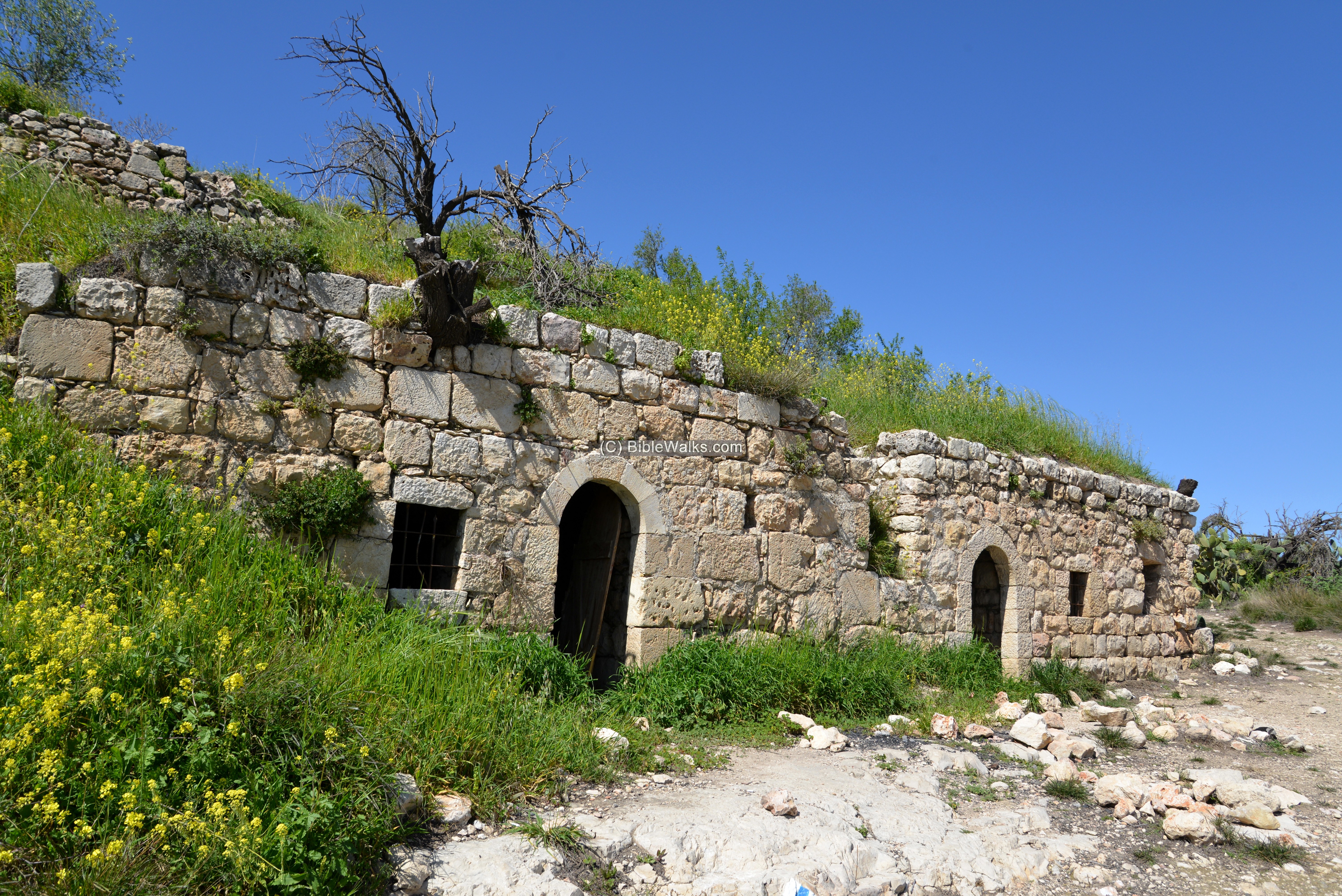
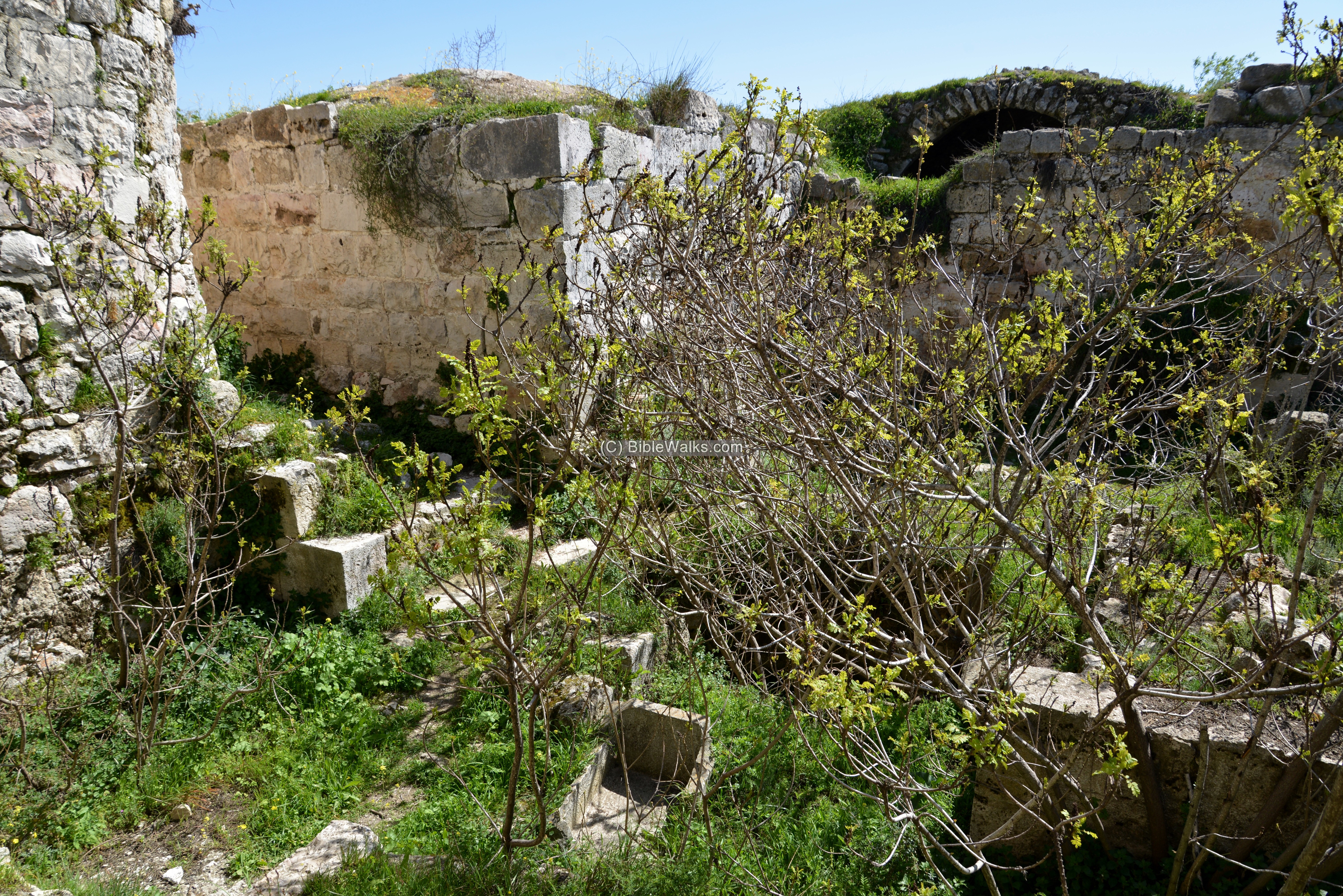
On the north side of the castle and village rare standing remains of several structures of the Arab village.
A closer view to one of these buildings:
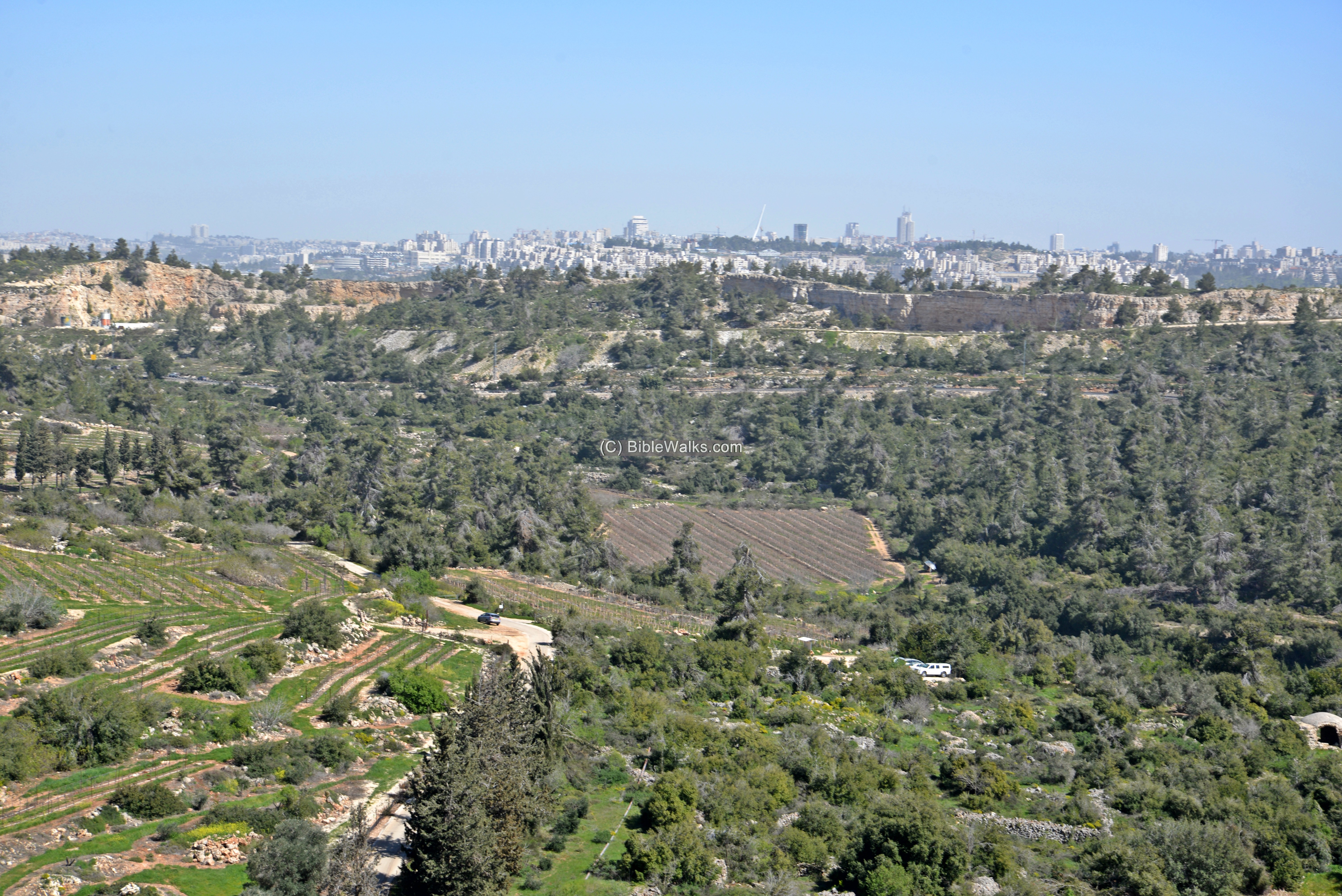
There are great views from the north side. This view is towards the east, with the center of Jerusalem in the far background.
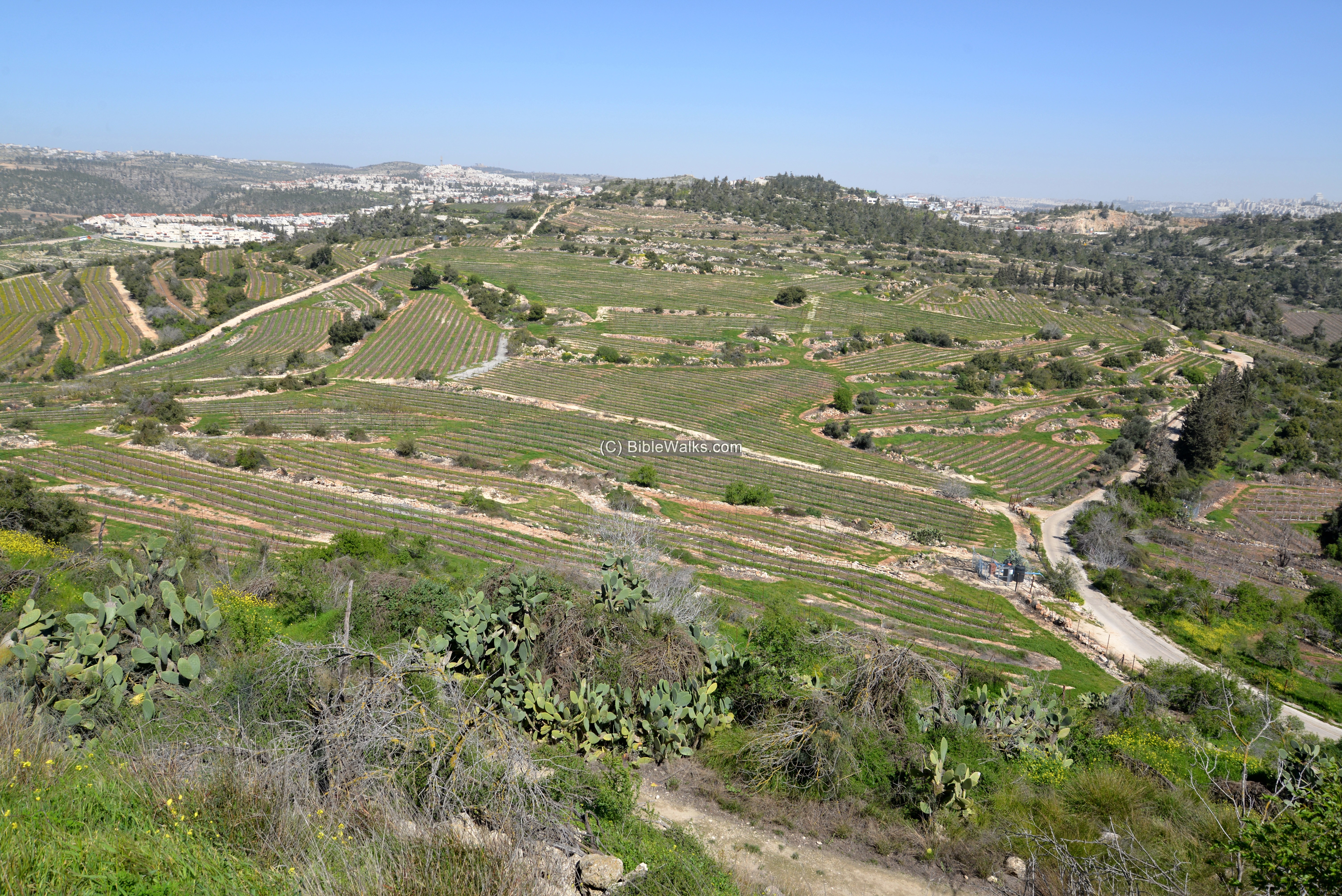
A closer view of Jerusalem is next. The new landmark of the city – the King David’s harp bridge – is seen as a diagonal pole in the middle of this view.
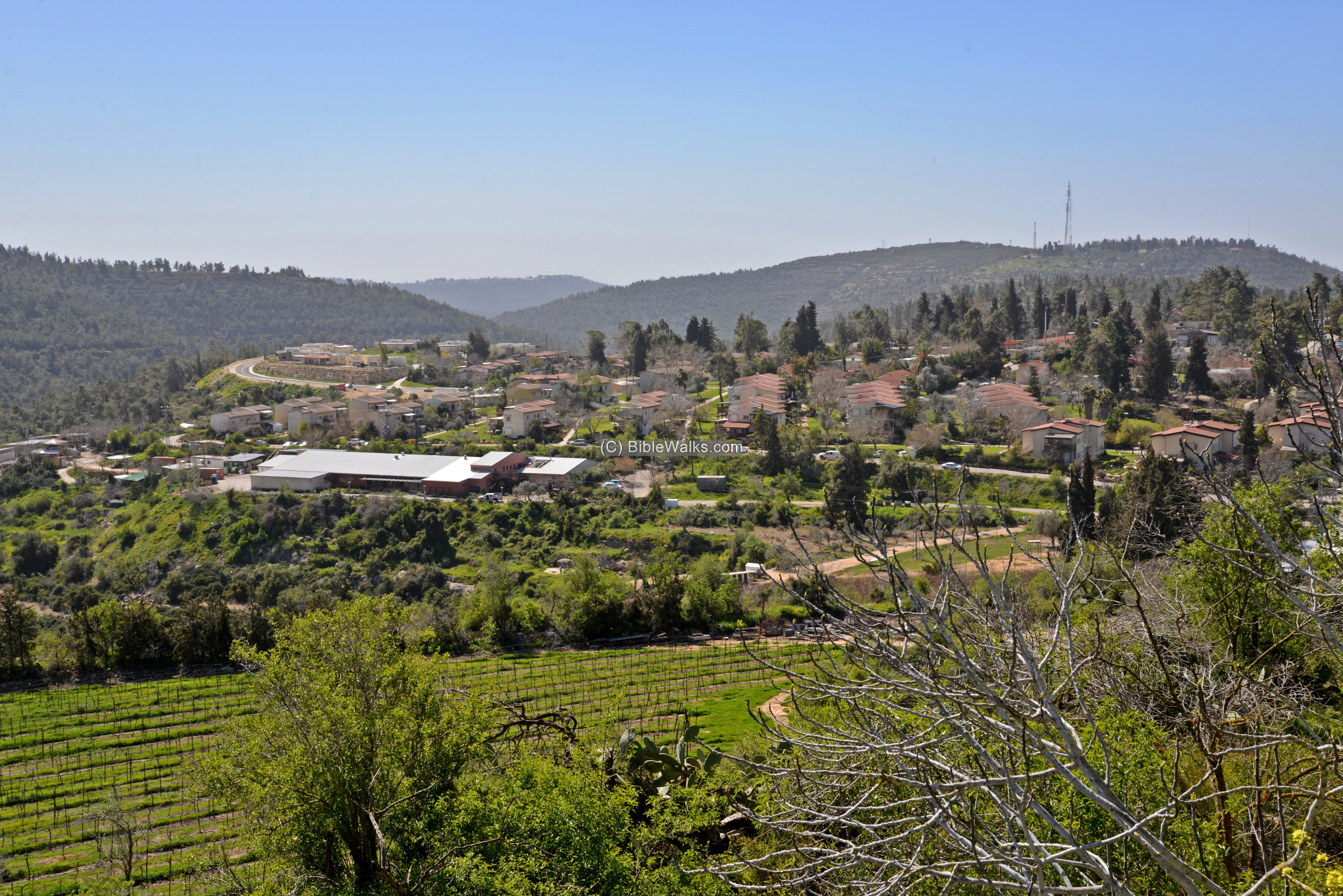
Another view toward the south west shows the houses of Kibbutz Tzova.
The antenna in the background is Mt. Eitanim, where a psychiatric hospital is located on a mountain.
Another view towards the north west shows the Arab village of Ein Rafa in the valley below.
In the far background is Abu Ghosh, where a Crusader Church still stands, and Tel Kiryat Jearim on a hill it where the Ark was stationed before it was carried by David to Jerusalem.
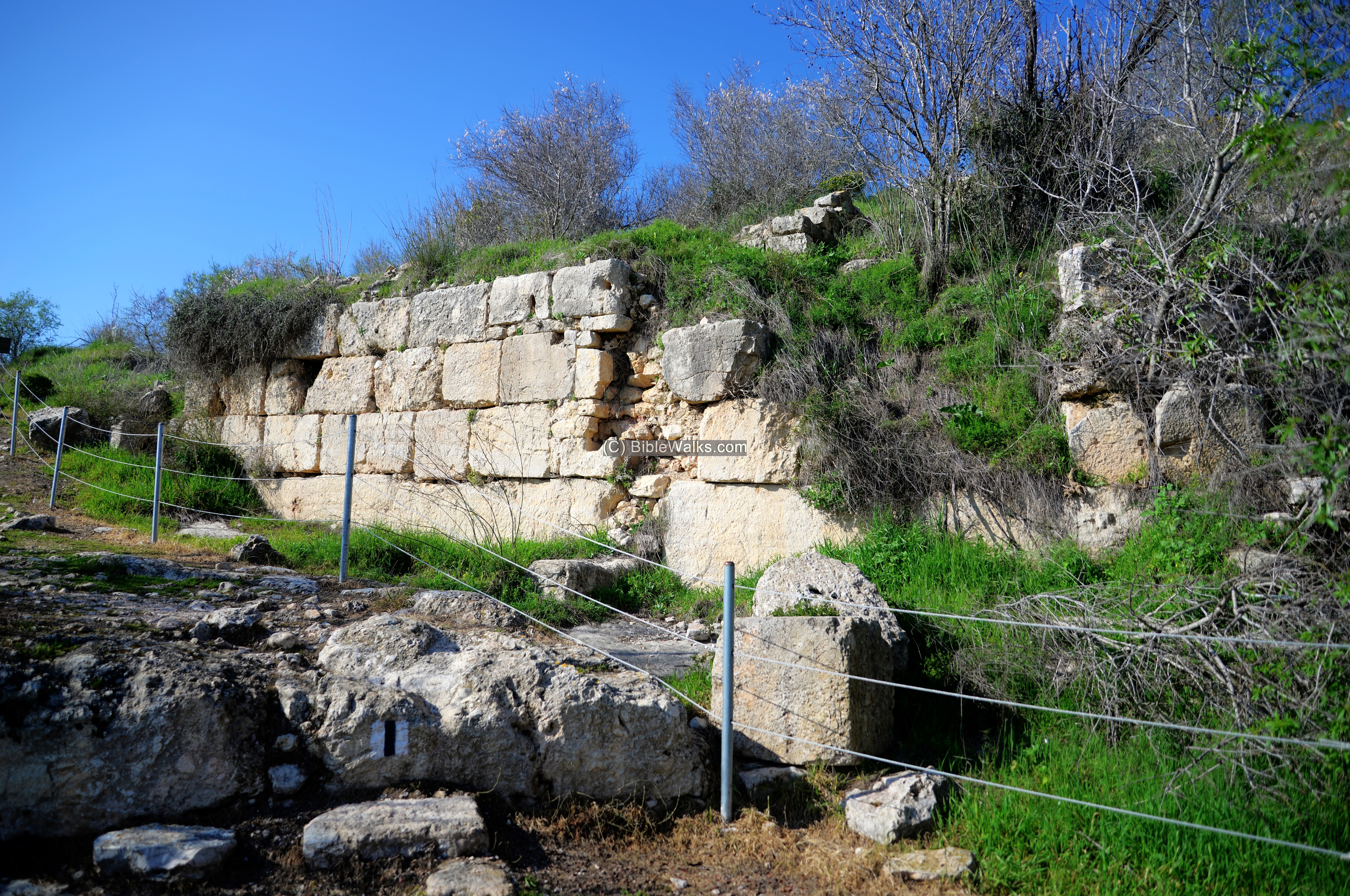
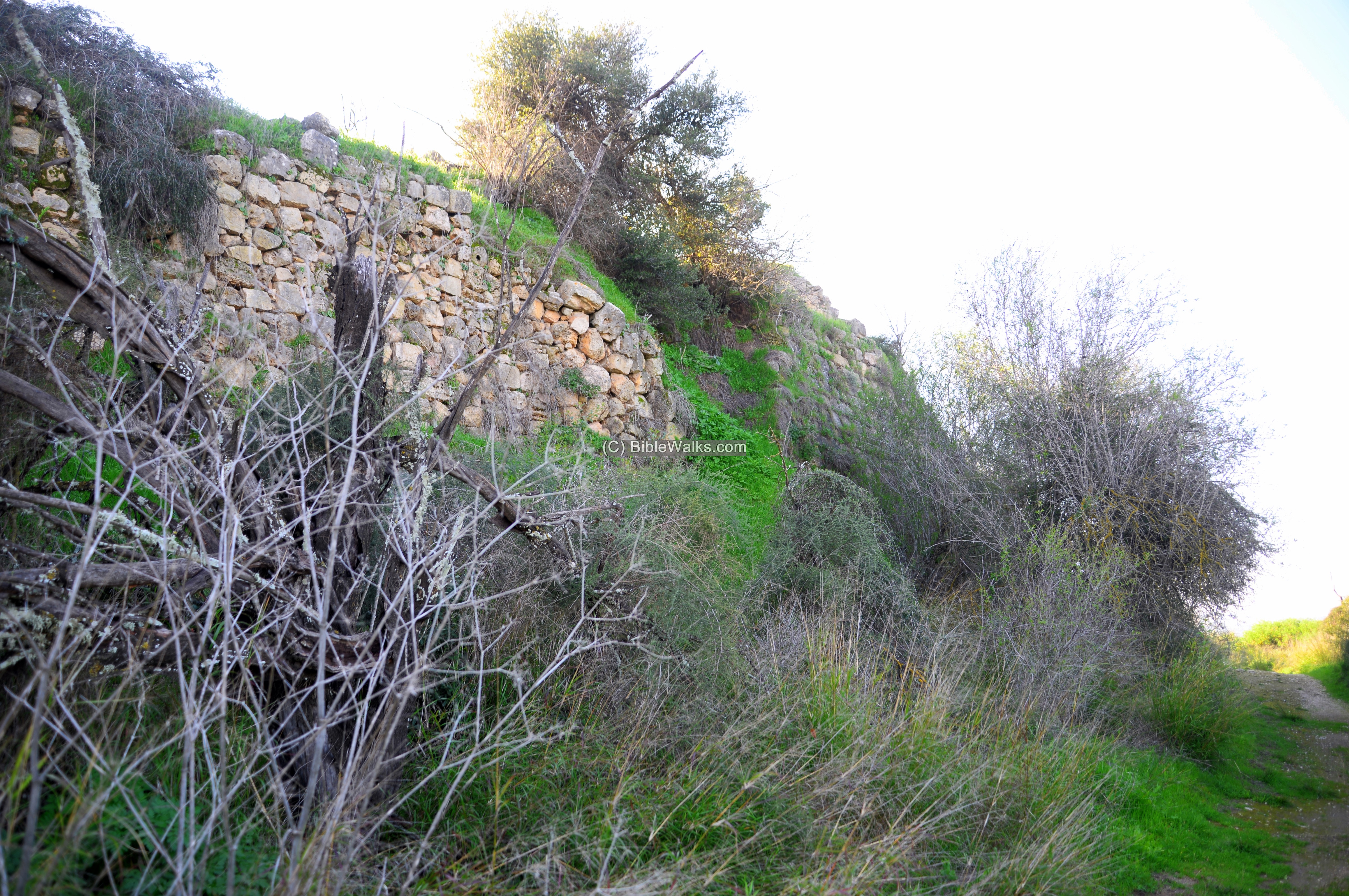
(g) Northern walls
The Crusader fortress had a strong inner wall surrounding its center. The north west corner still stands and is seen here.
The location of this section of the north west corner is indicated by a yellow arrow on the illustration, as viewed from the north.
A closer view of the north west corner of the inner wall is next. It was repaired in the 19th century by the Abu Ghosh clan, as the left section of the wall consists of smaller stones.
The trail passes along the bottom of the inner wall.
(h) Ancient trees
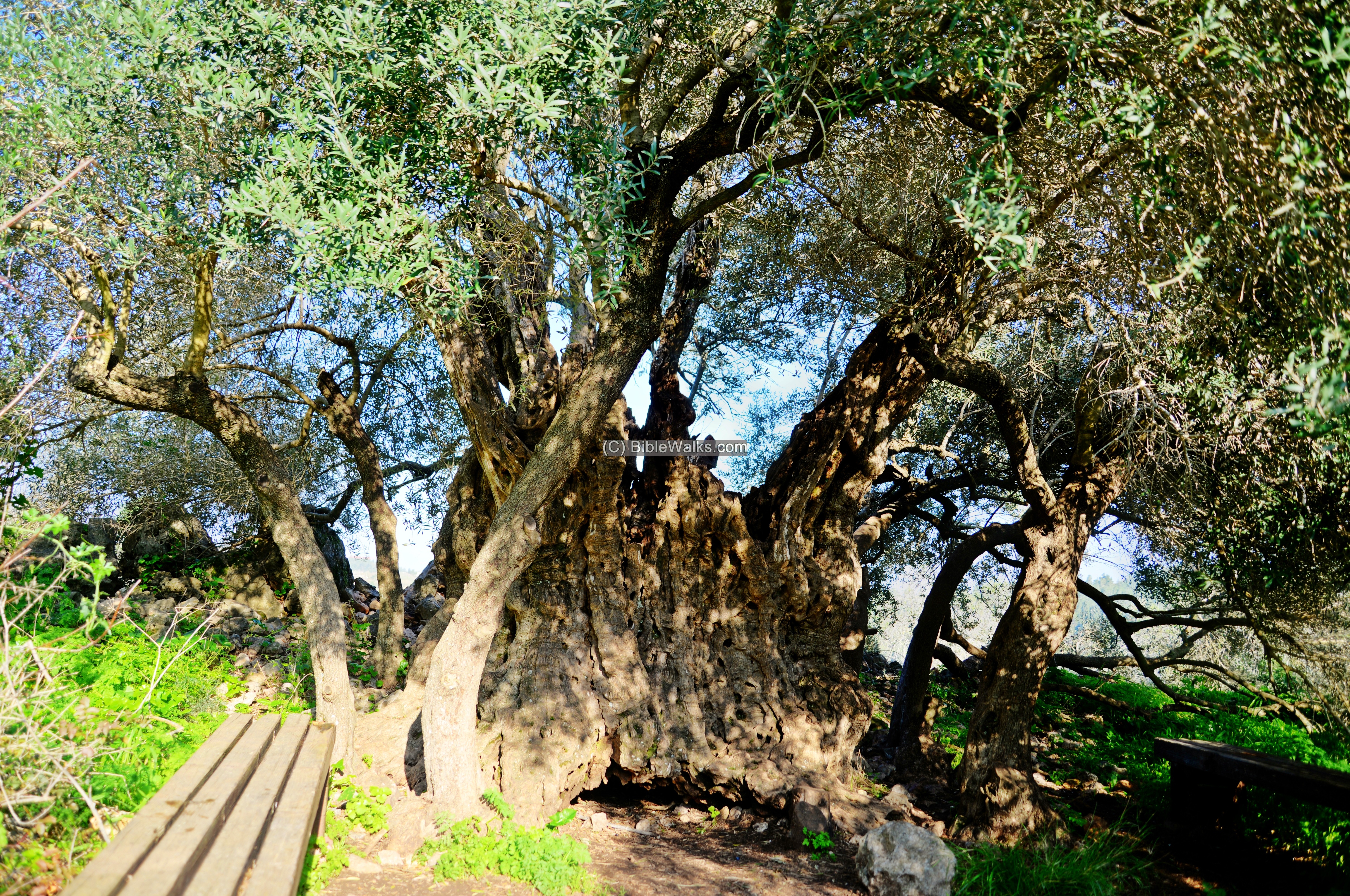
At a short distance along the southern foothill of Tel Tzova is the cemetery of Soba. This protected the trees inside the sacred place. Two trees, almost 1000 years old, can be seen here. This photo shows the ancient olive tree with its enormous tree bark.
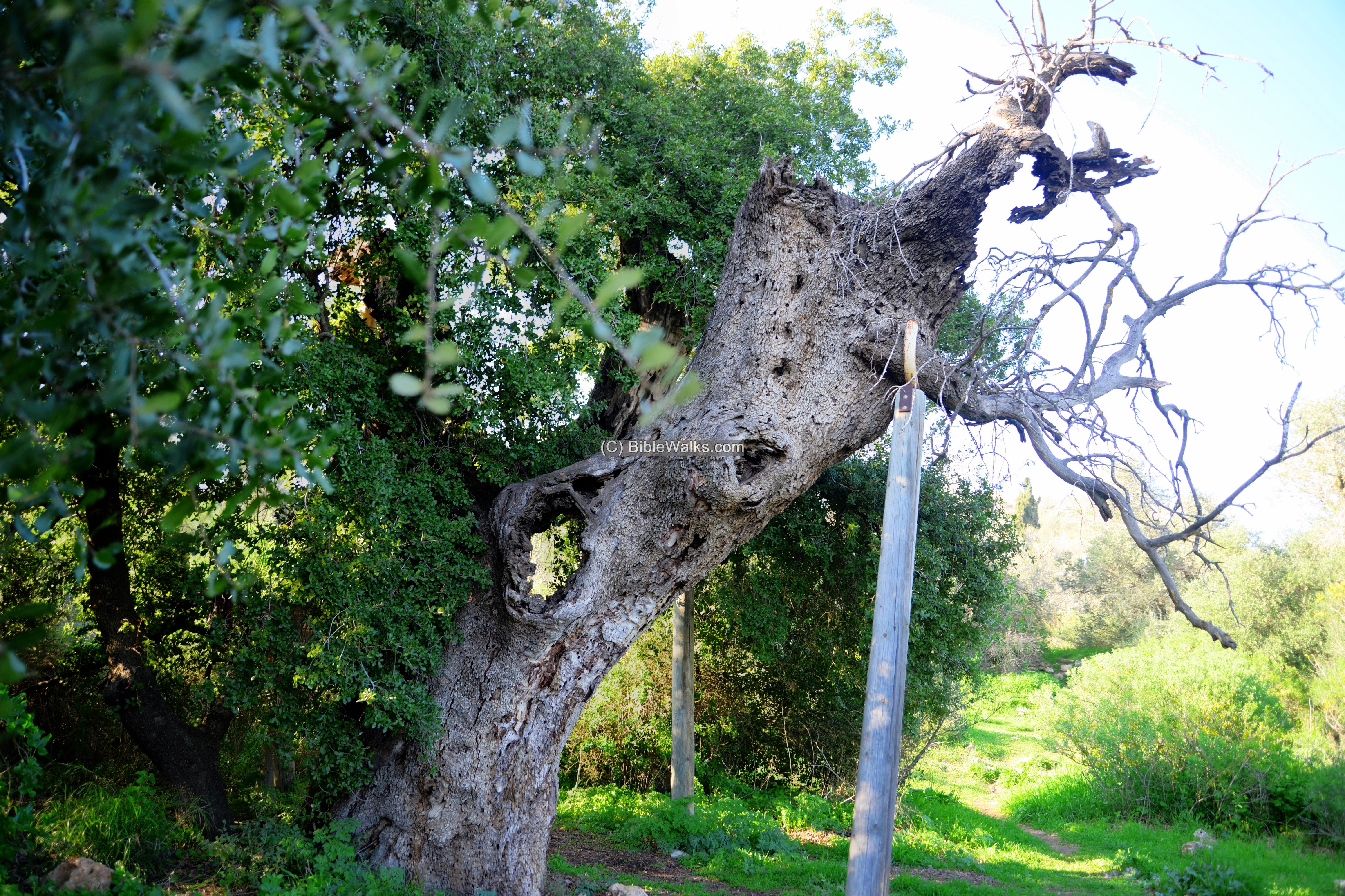
Another ancient tree is an oak , barely standing and assisted with a metal pole.
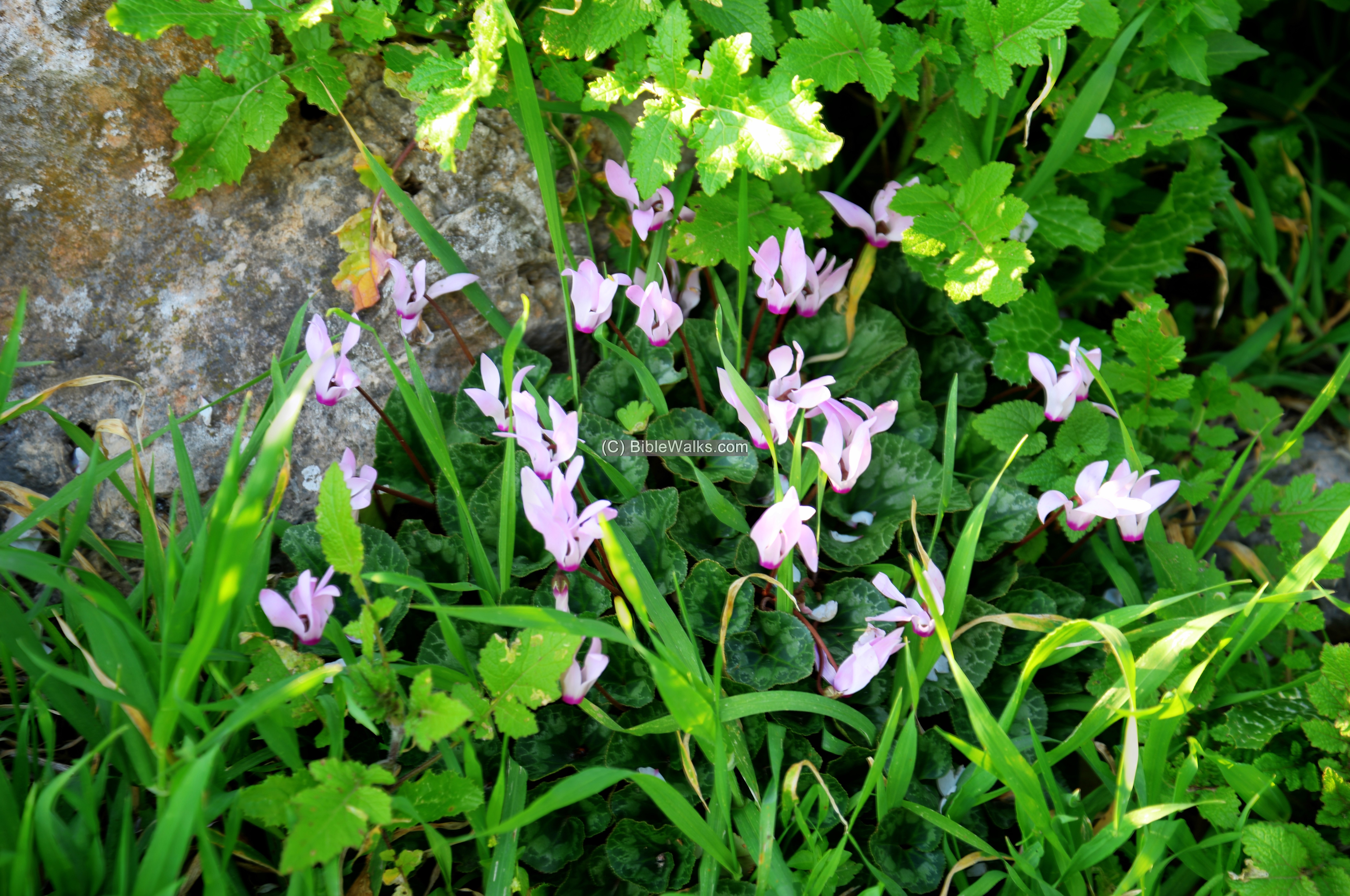
During our visit in January the wild flowers were blooming. In this photo are Rakefet (cyclamen) flowers.
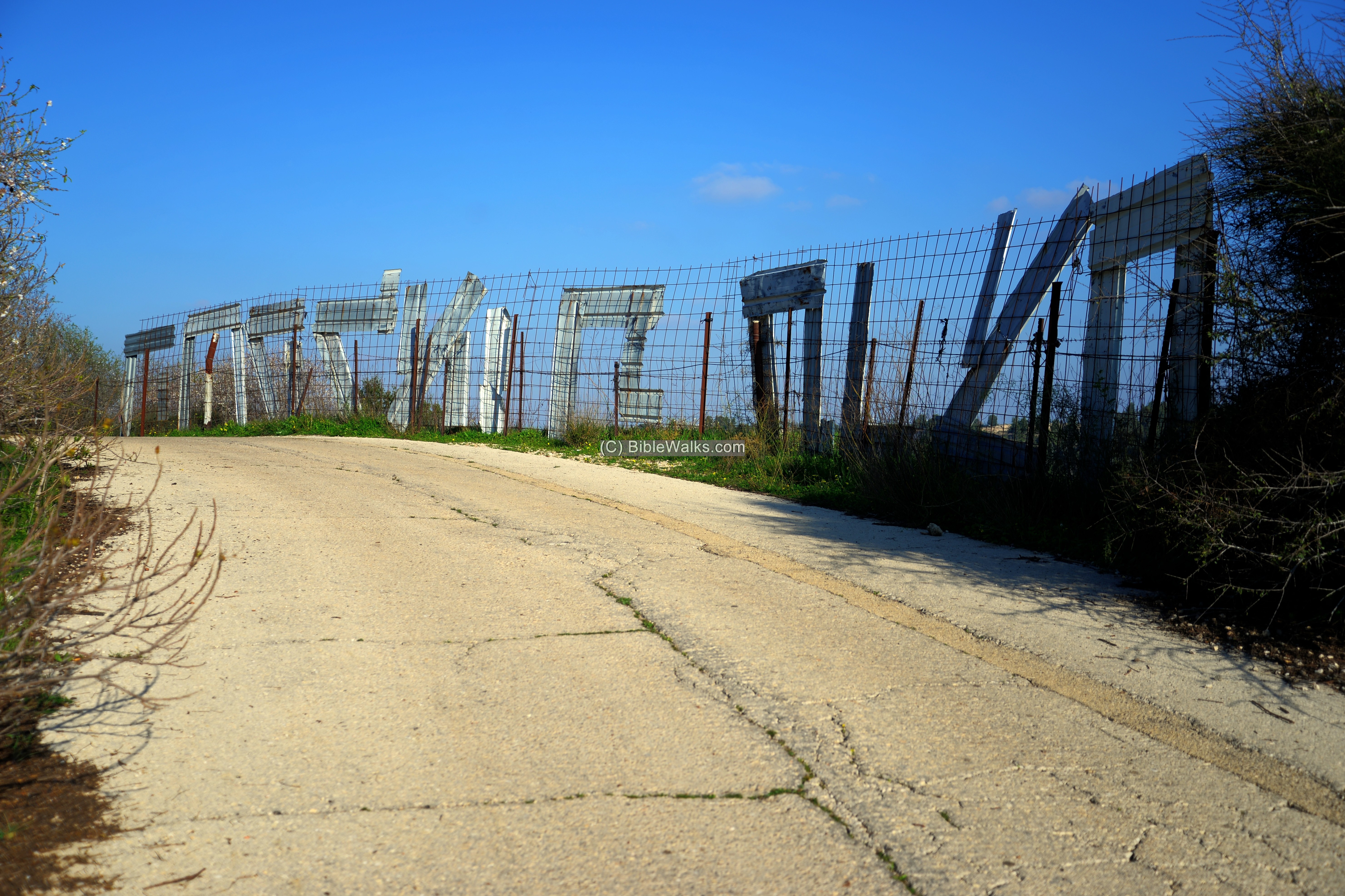
On the side of the road, at the southern foothills, is a sign “The agriculture wins” (החקלאות מנצחת).
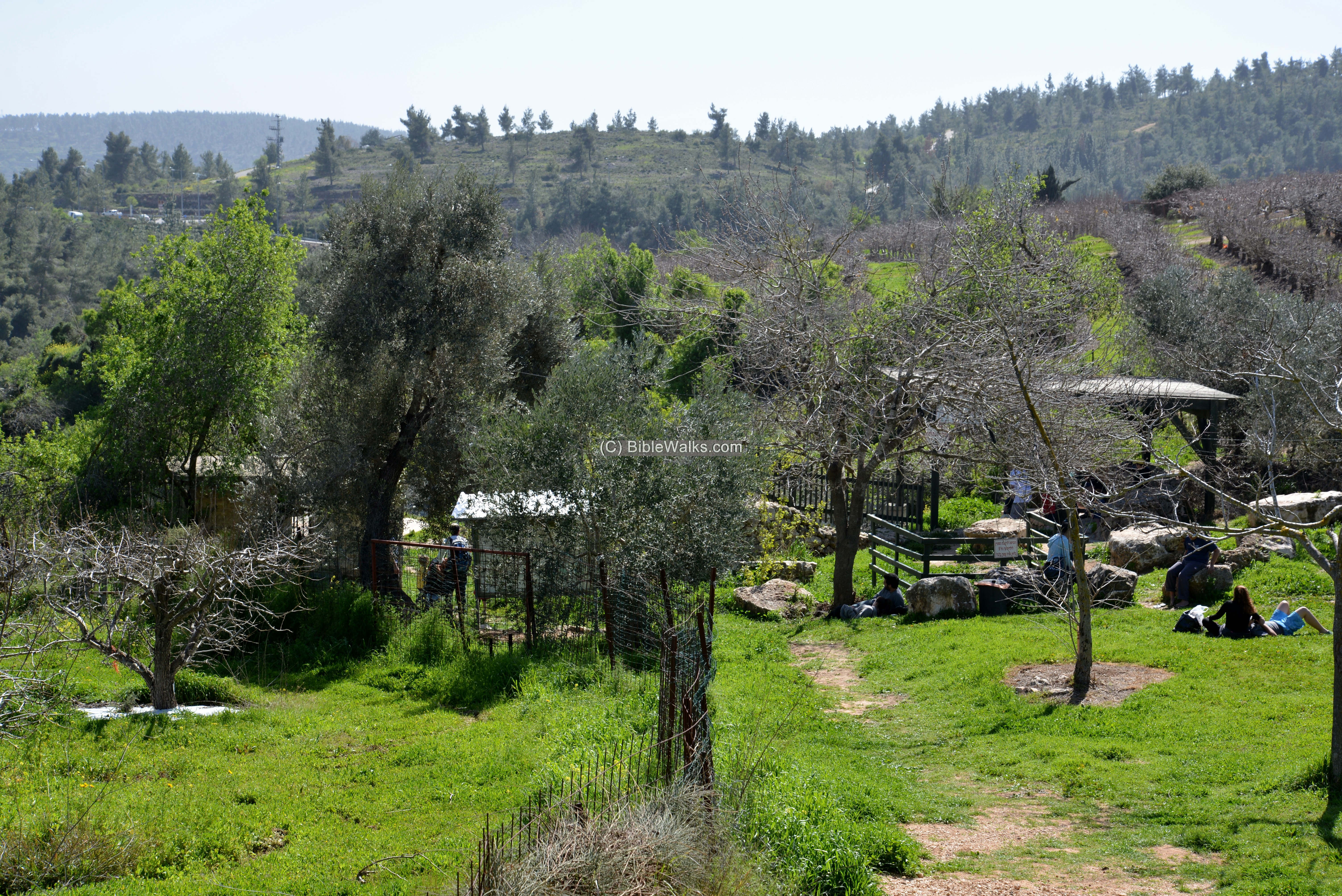
(i) Ein Tzova spring
In the valley south of Tel Tzova is a spring – Ein Tzova. Access to this location is by foot Kibbutz Tsova, along a paved road starting from the OSG factory.
The grass and trees around the spring offers a place for family picnics.
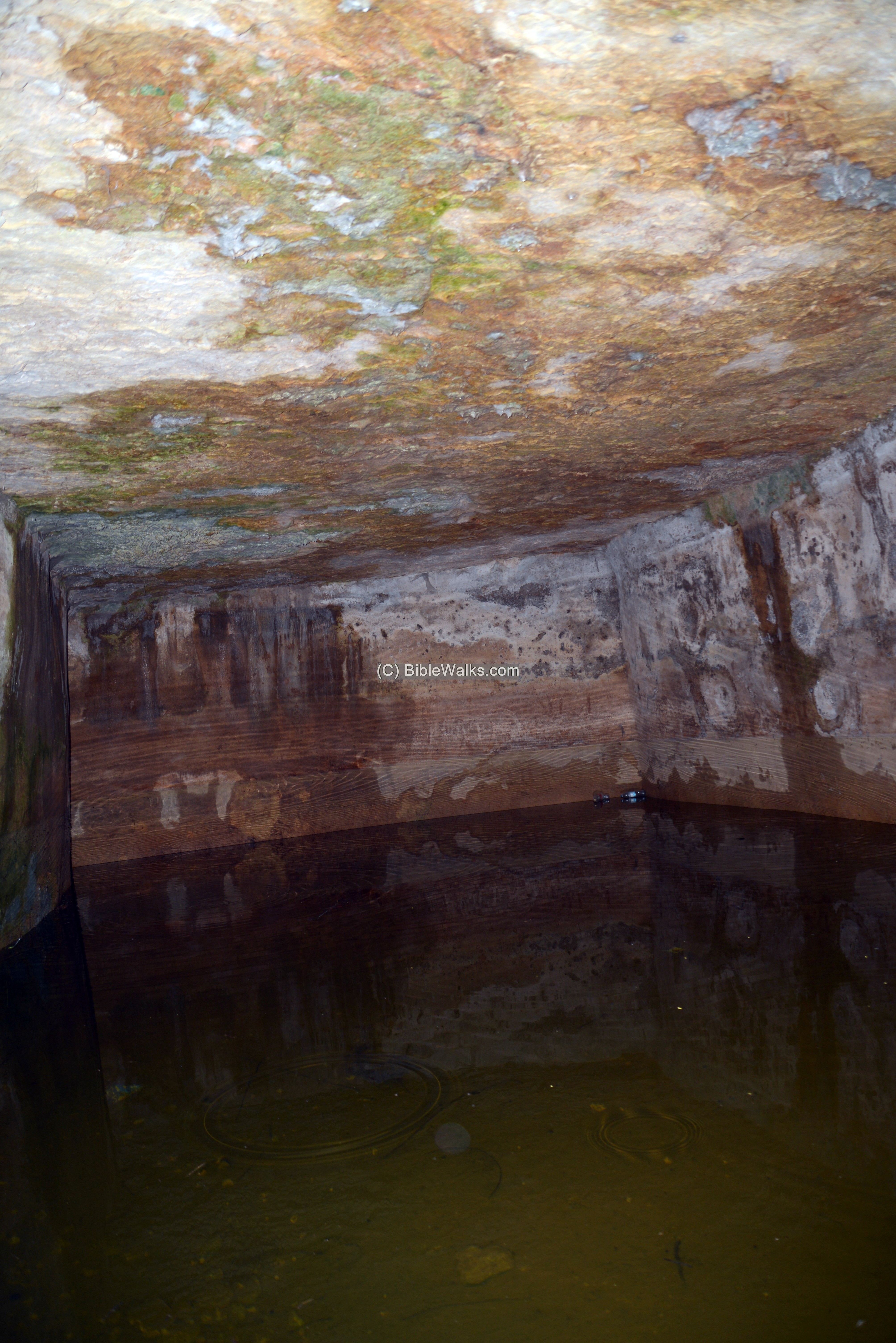
One of the openings to the source of the water is from an opening in the rock. Another entry is by a ladder, then a walk along a 43m tunnel.
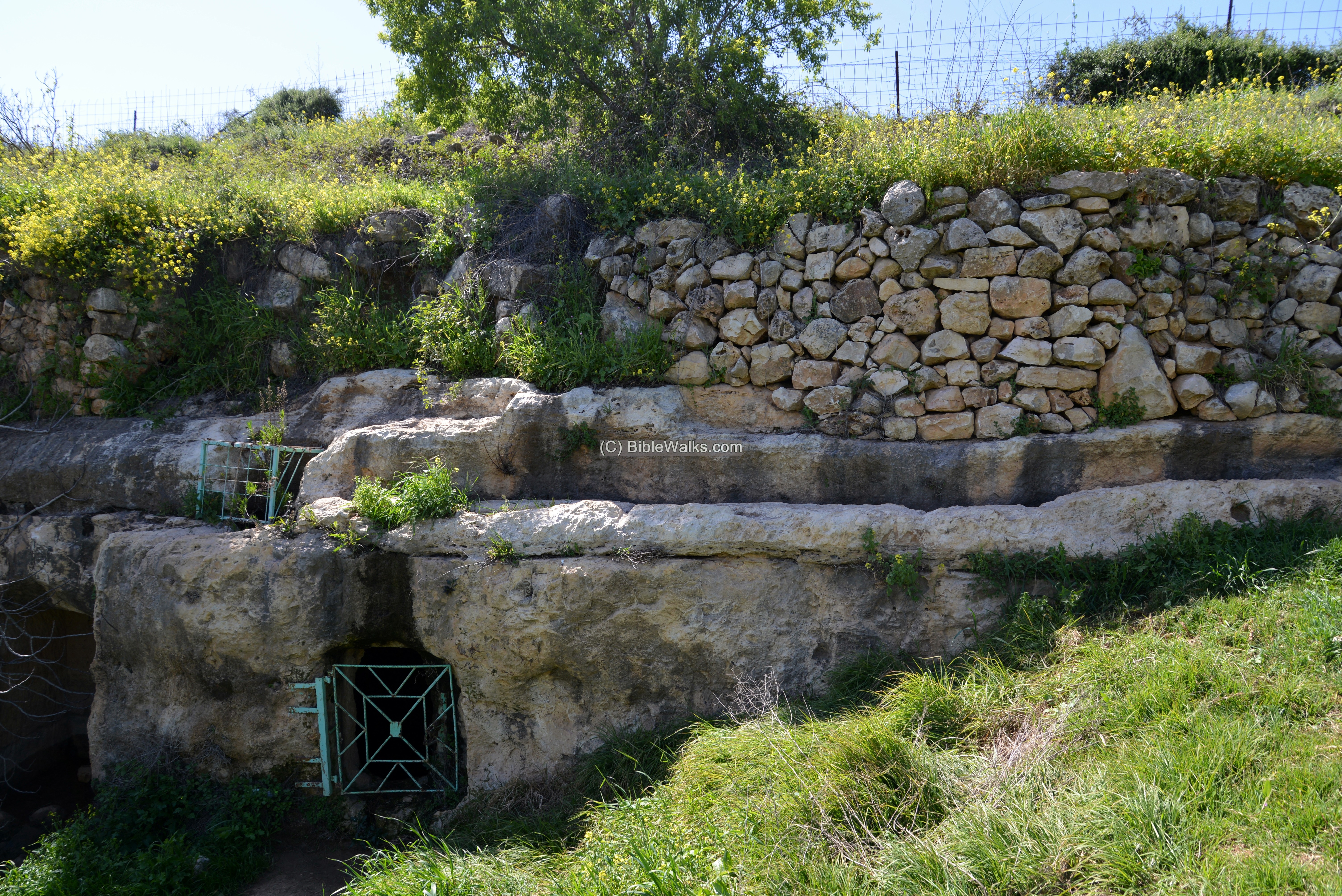
Inside – a reservoir that is fed by the spring.
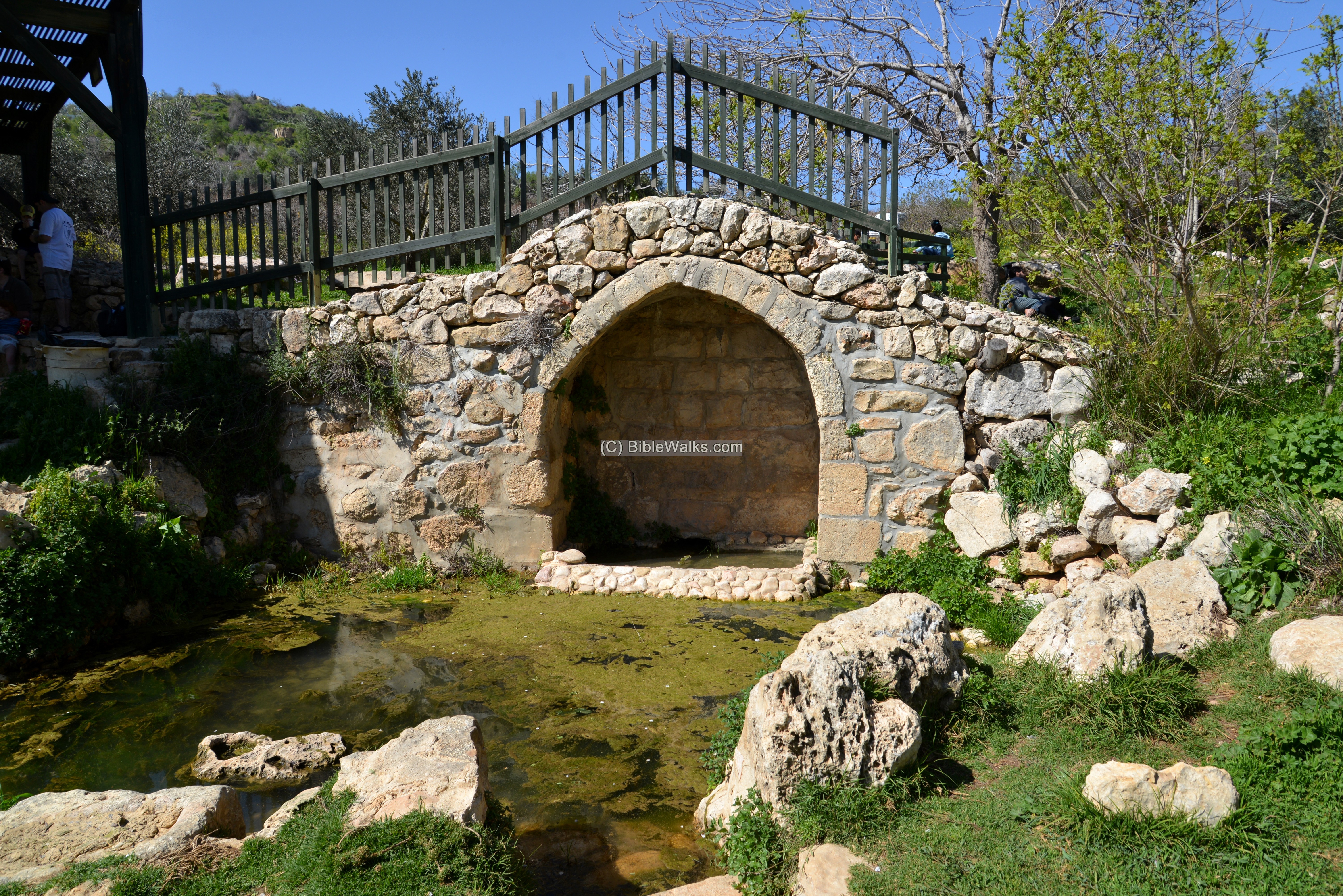
The spring waters were conveyed to a built structure, and a small pool in front of it.
(j) Video
![]() Fly over the site with this Youtube video:
Fly over the site with this Youtube video:
Etymology:
Names of the site:
- Tzova – Biblical name (2 Samuel 23:36): “Igal the son of Nathan of Zobah”.
- Soba – Arab village, preserved the Hebrew name
- Belmont – Crusader name of the fortress (meaning pretty mountain)
Links:
* Other Biblewalks pages:
- The Crusaders – overview and their sites
BibleWalks.com – travel with the Bible in hand
Castel<<<—previous site–<<< All Sites >>>—>>> —Next Judea site—>>>
This page was last updated on Feb 27, 2021 (added illustration)
Sponsored links: