A massive megalithic complex in the Golan heights, regarded as the “Stonehenge of the Levant”.
* Site of the Month Aug 2020 *
Home > Sites > Golan > Rujm el-Hiri (Gilgal Rephaim)
Contents:
Overview
Aerial Map
History
Photos
* Aerial views
* Inside Rujm el-Hiri
* Inside The Tomb
* Village
* Video
* Stonehenge
Etymology
Links
Overview:
Rujm el-Hiri is unique megalith complex in the Golan heights, regarded as the “Stonehenge of the Levant”. It consists of three concentric circles of walls of various diameters, a forth semicircle, and a central mound. The monument is made up of over 40,000 tons of stones, with some weighing up to 50 tons each. It was dated to the Early Bronze II period (3050–2700 BC)
The Arabic name (Rujm el-Hiri) translates to the “mound of the wild cat”. The Hebrew name (Gilgal Rephaim) means the “wheel of ghosts”.
Scholars suggest various functions of the site, including a worship center, a mega-Dolmen (megalithic tomb), an ancient calendar, and an astronomical observatory. In any case, this mystery spot in the Golan is unique and intriguing.
Map / Aerial View:
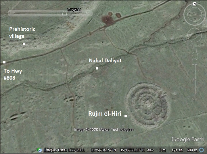
An aerial map is shown here, indicating the major points of interest around the site. The complex is on the south side of Nahal Daliyot brook.
History:
- Prehistoric periods
The circular complex is dated to the Early Bronze II period (3050–2700 BC). However, the center tomb is dated to the Middle or Late Bronze I period (1000 years later). These two phases of construction are still debated.
Nearby, on the bank of upper Nahal Daliyot stream, is a large prehistoric village dated to the Chalcolithic period (4500-3150 BC). This village may have been related to the complex.
- Biblical period
The Hebrew name (Gilgal Rephaim) means the “wheel of ghosts”. This name is based on the Biblical race of giants (Rephaim) who dwelt in the Bashan/Golan area before the Patriarchal age.
Deuteronomy 3:13: “And the rest of Gilead, and all Bashan, being the kingdom of Og, gave I unto the half tribe of Manasseh; all the region of Argob, with all Bashan, which was called the land of giants.”
- Modern period
The site was first excavated by Yonathan Mizrachi (4 seasons, 1988-1991), who researched the central tomb and areas inside the complex, dated the sherds to Chalcolithic, Early Bronze II, Late Bronze, and later. Additional surveys and excavations were conducted by teams of the Hebrew University since 2006.
The modern Hebrew name of the site is Gilgal Refaim. It can be accessed by foot or 4×4 car from Hwy #808, 2.5km from Daliyot junction. Access to the site is permitted only during Sabbath, as it is located inside a military firing zone, and not far from the border with Syria.
Photos:
(a) Aerial views
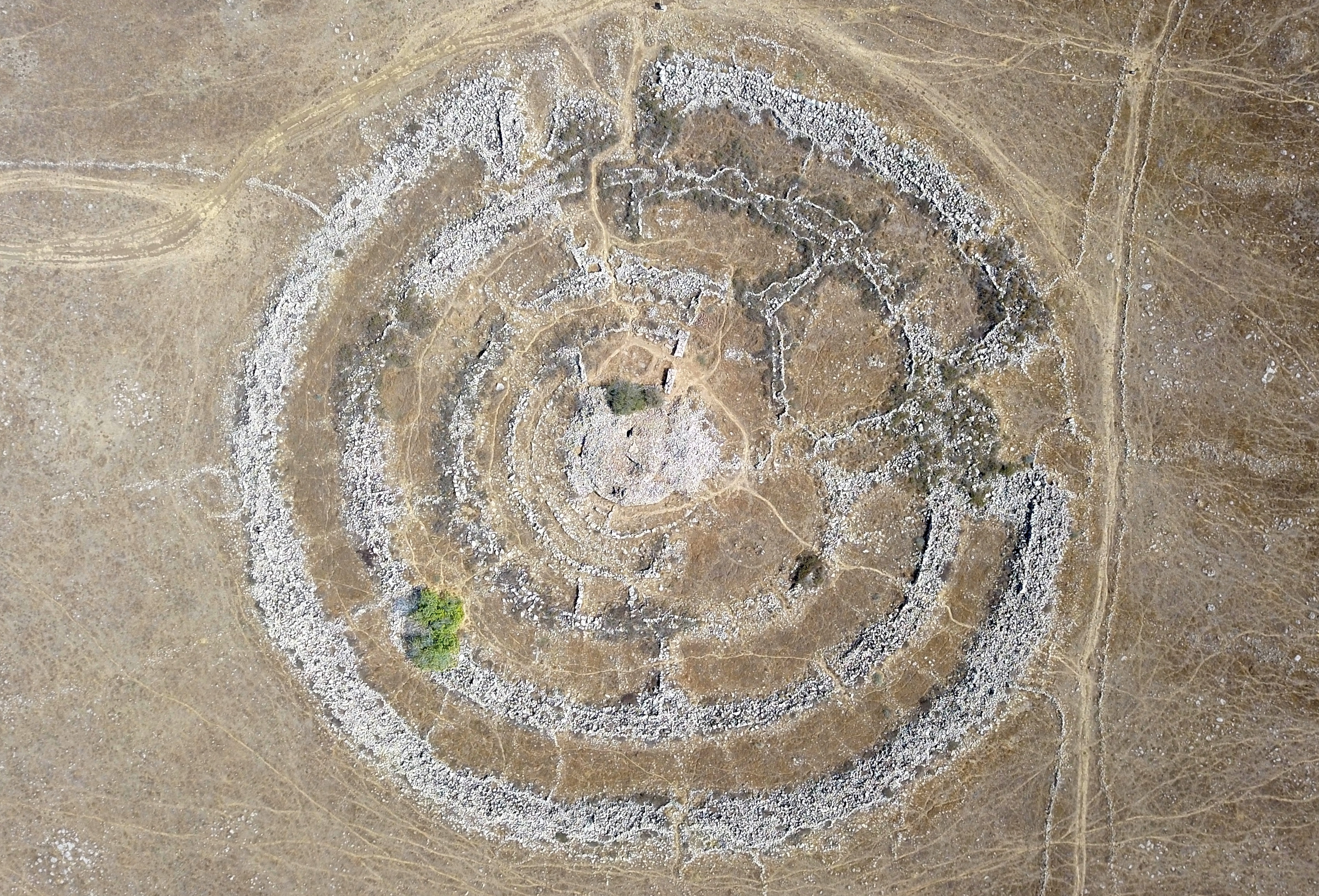
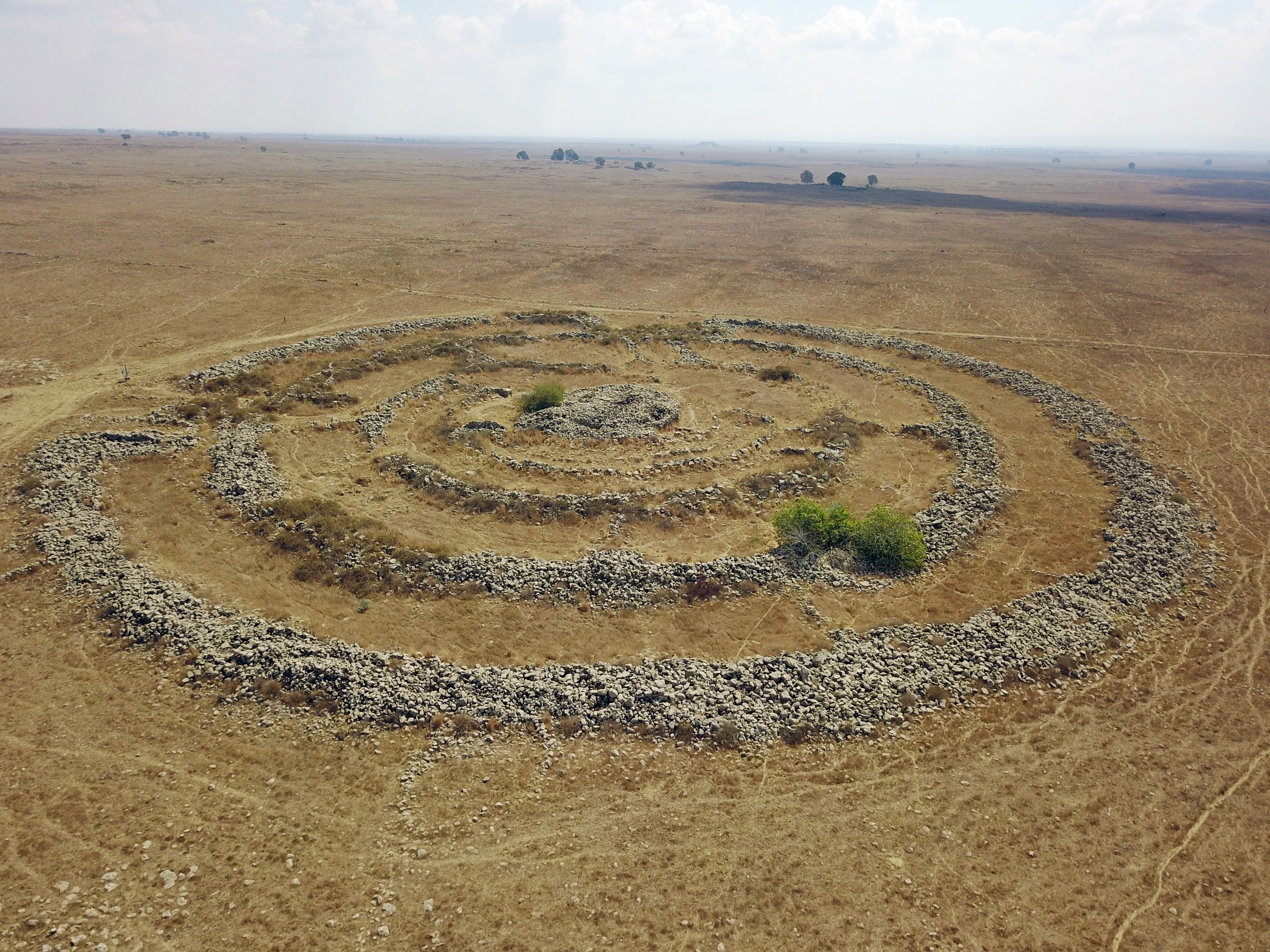
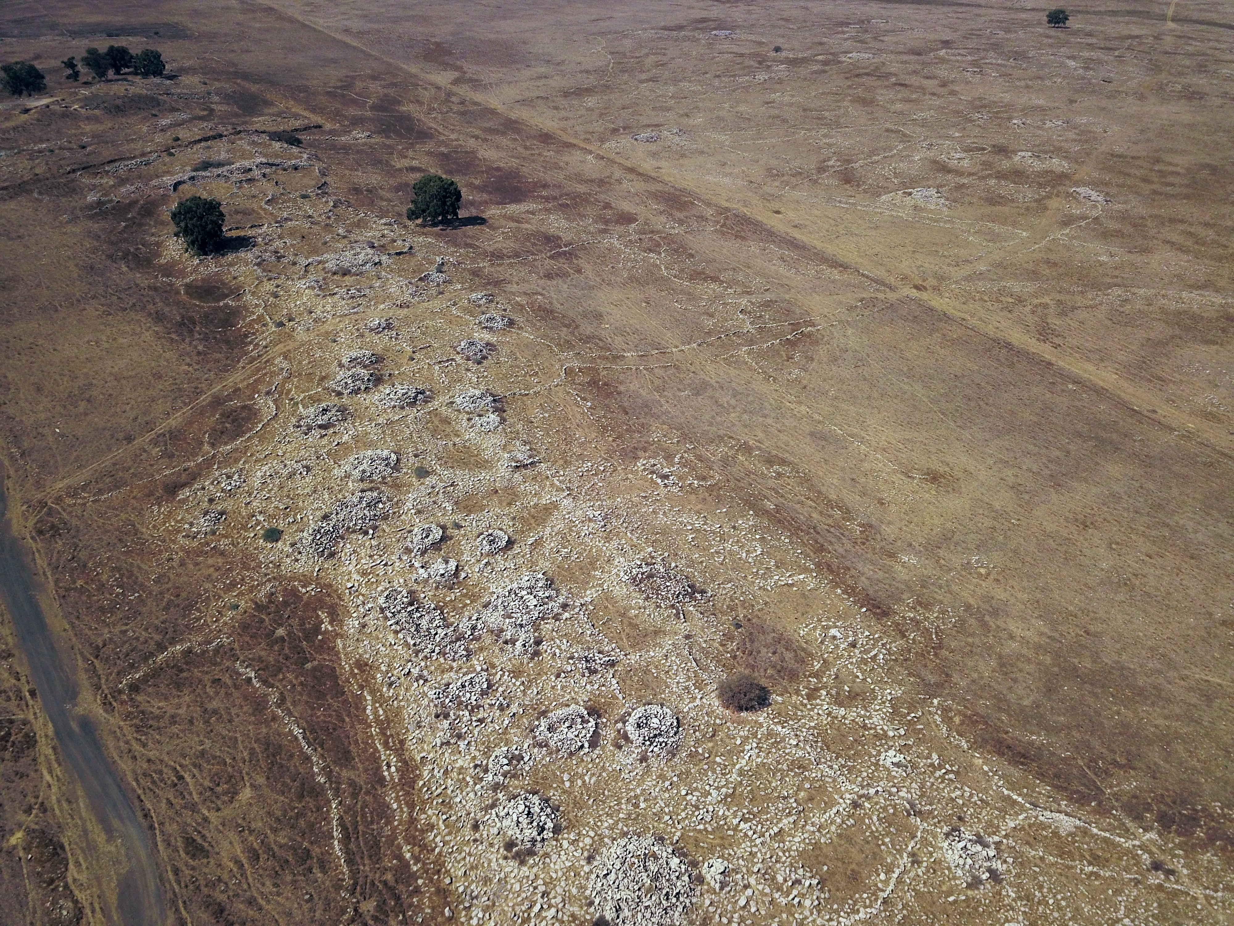
Rujm el-Hiri consists of three concentric circles of walls of various diameters (152m, 110m, 90m) and a forth semicircle (50m). In its center is a central tumulus (mound of stones over a grave), 20m in diameter and 4.6m high. Between the circular walls are inter-connecting radial walls, resembling a wheel. More than 40,000 tons of basalt rocks were laid in this monumental complex.
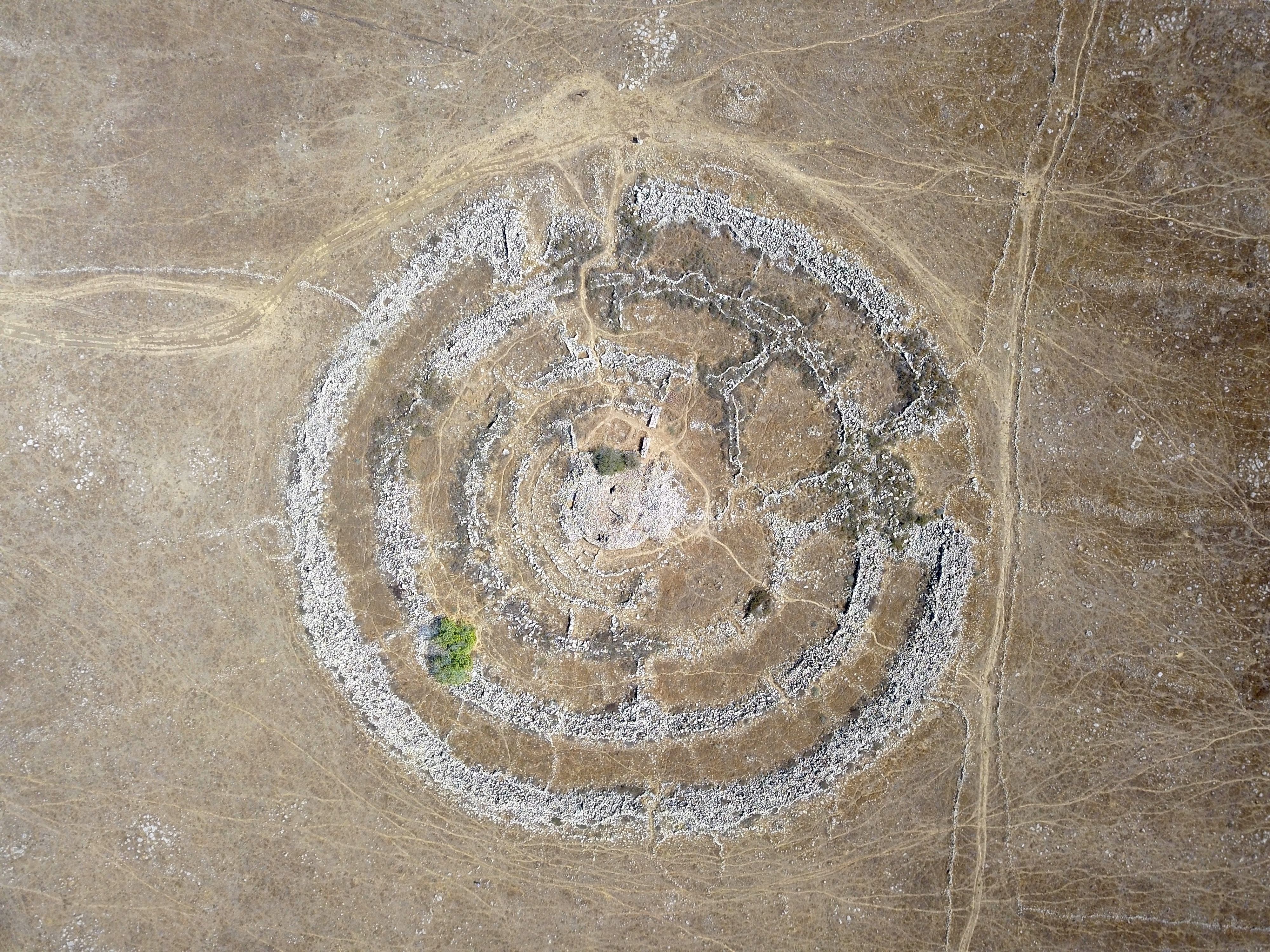
The complex plan may be related to the calendar: The line from the northeast entrance to the center is aligned to the sunrise solstice (day in midsummer when the sun reaches its highest position).
Another element related to a calendar is located on the eastern outer wall. At the two equinoxes (day of equal day and night time) the sun rays will pass between two colossal boulders (2m high and 2.5m wide) at its eastern edge, hence called the “equinox stones”.
There are two entrances to the center of the complex (58 degrees northeast and 140 degrees southeast), with a heap of rocks behind each entrance.
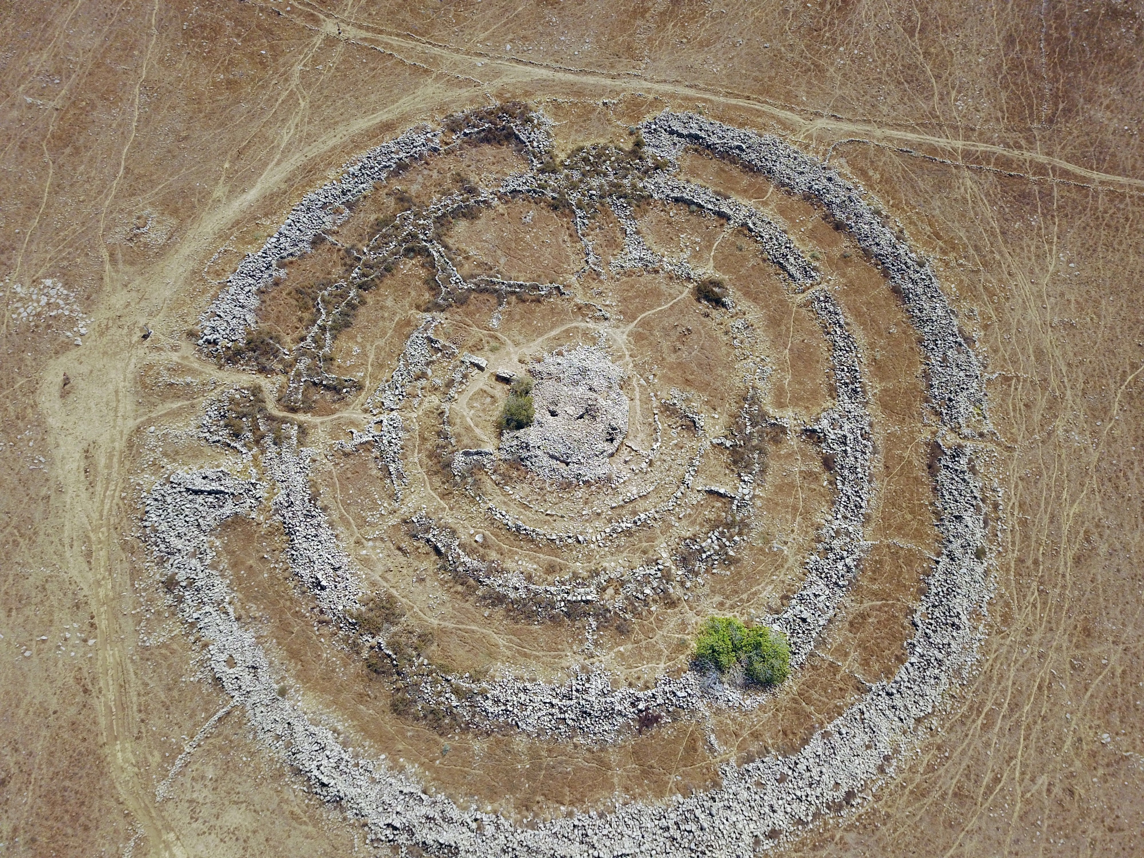
These details are summarized by the following illustration. There are 82 degrees between the two entrances.
The north east entrance (58 NE) does not coincide exactly with the modern angles of the rising sun: current sunrises are 62 degrees NE in summer, a 4 degrees offset. The anomaly could be explained by a shift of the sunrise angles during the 5,000 years that passed since it was built.
The south east entrance does not seem to have a calendar function, and probably was used for another purpose.

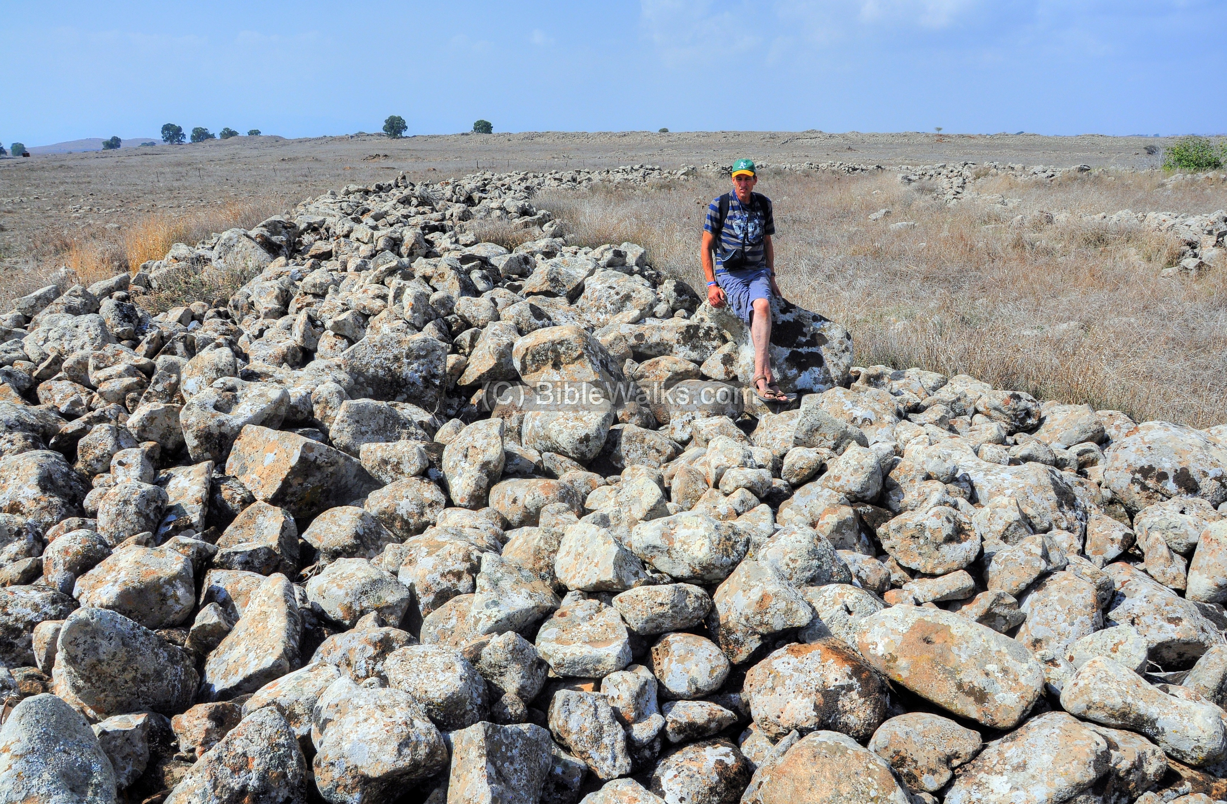
(b) Inside the walls of Rujm el-Hiri
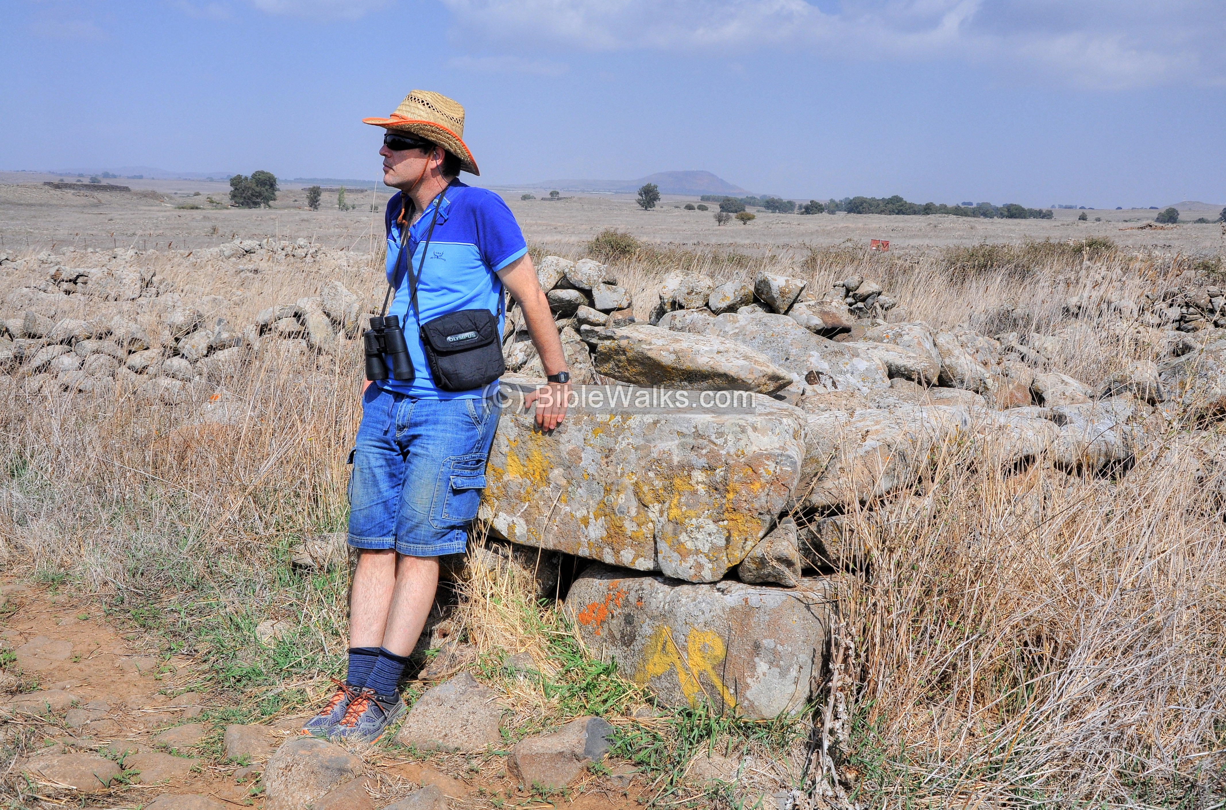
Uncle Amnon sits here on a section of the exterior circular wall. The walls were preserved to a height of 2-3m with a width of 3.2m. Their original height was more than twice as high. The circumference is 0.5KM, with a diameter of 150m.
The next photo is a view toward the center mound, raised higher than the circular walls, to a height of 7m.
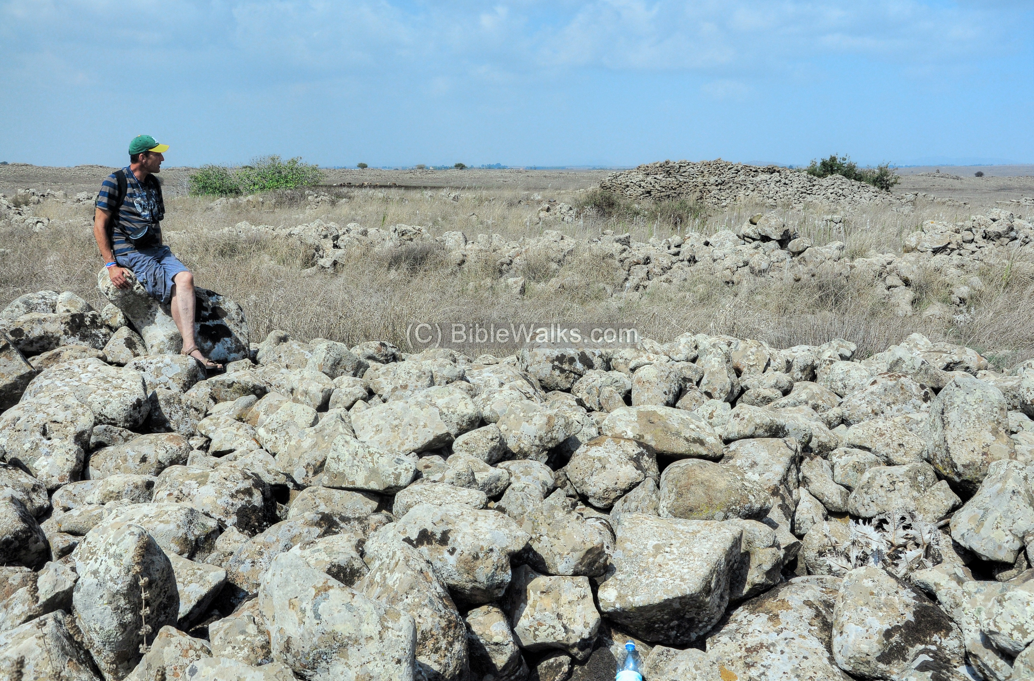
The next photos shows the north-east entrance to the second radial wall. This wall is 2.4m wide, with several opening such as this entrance.
Another view of the north-east entrance of the second wall, with Uncle Ronnie standing.
Notice in the center of the far background, at 45 degrees NE and 9km away, is a peak of a mountain. This is Mt. Peres (Tell el-Faras), an extinct volcano on the border with Syria. Summer solstice rises slightly right to that mountain.
From Rujm el-Hiri one can see two important mountains – Mt. Hermon to the North, and Mt. Tabor to the west. Both mountains were associated with sacredness, and so this may have been the reason why the site was located here.
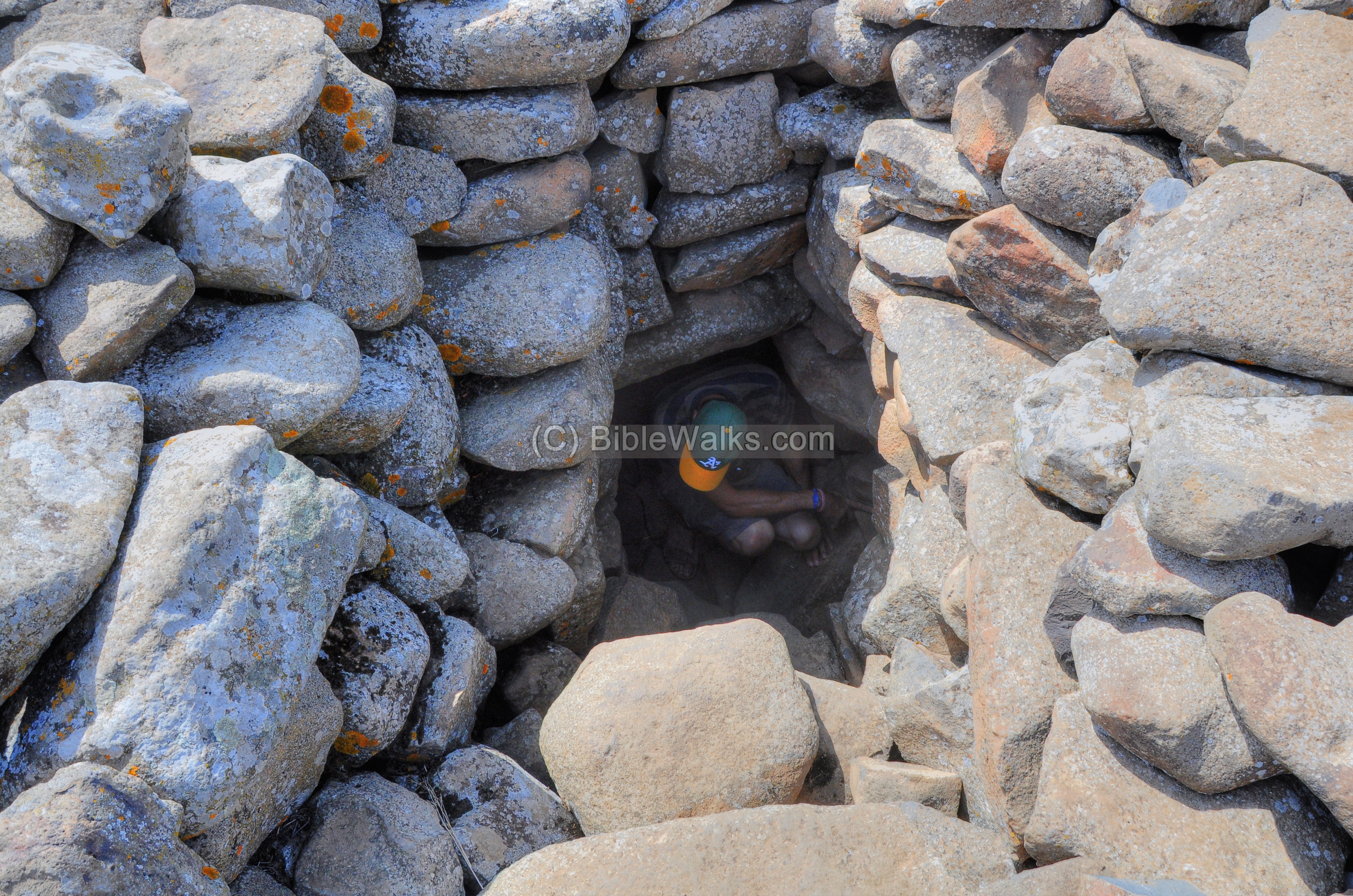
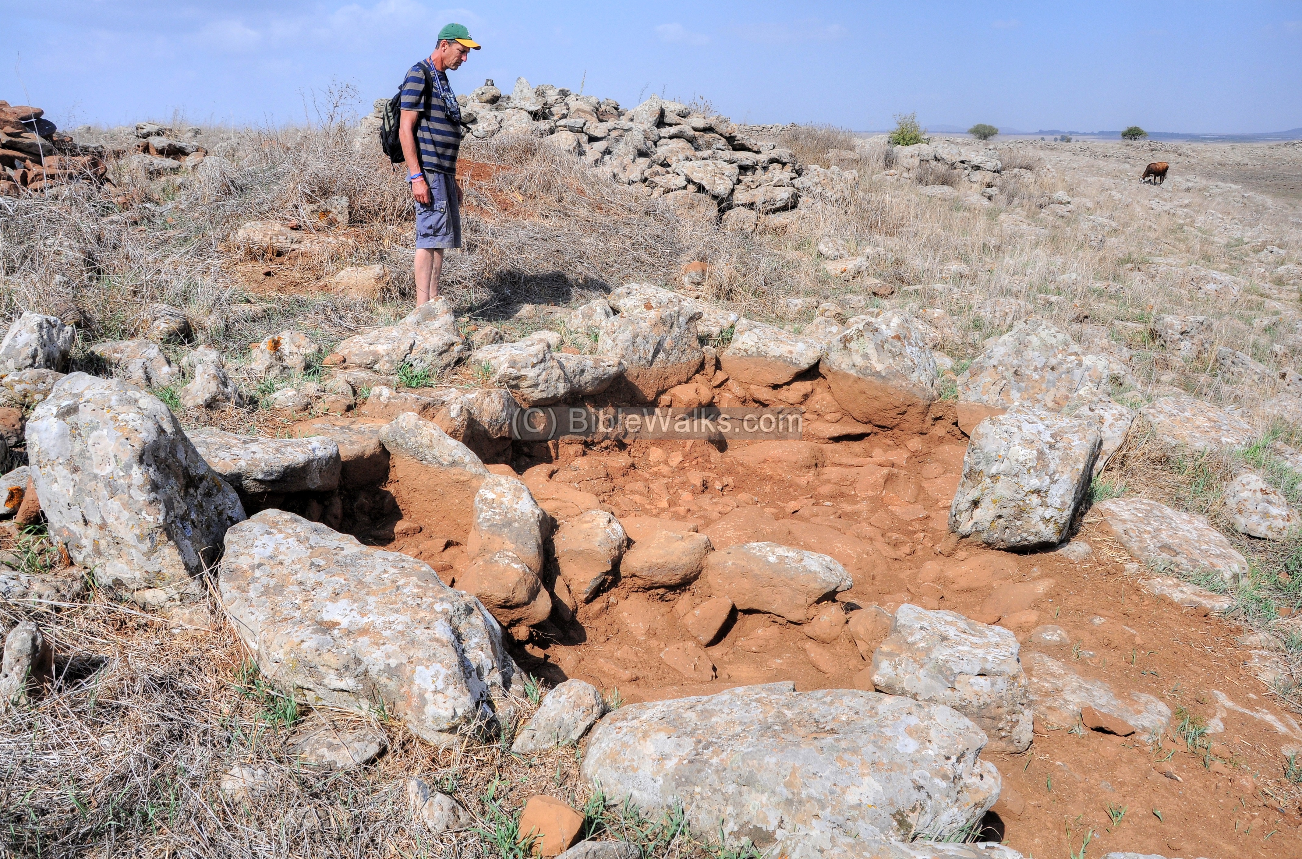
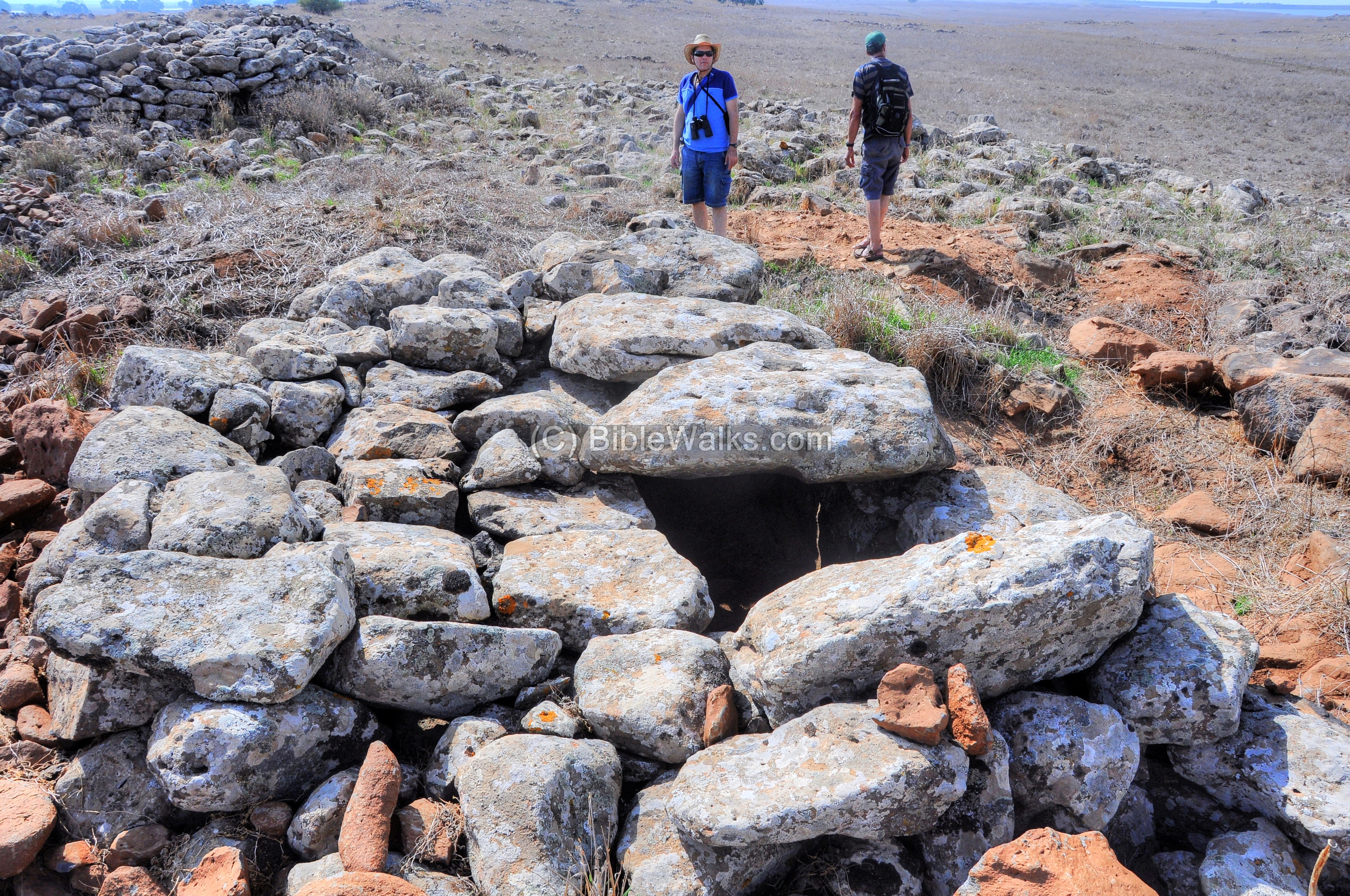
(c) Inside the Central tomb
In the center of Rujm el-Hiri is a tomb, covered inside a central cairn (small vertical pile of stones). It is dated 1000 years later than the circular walls – dated to the Middle Bronze or Late Bronze I period.
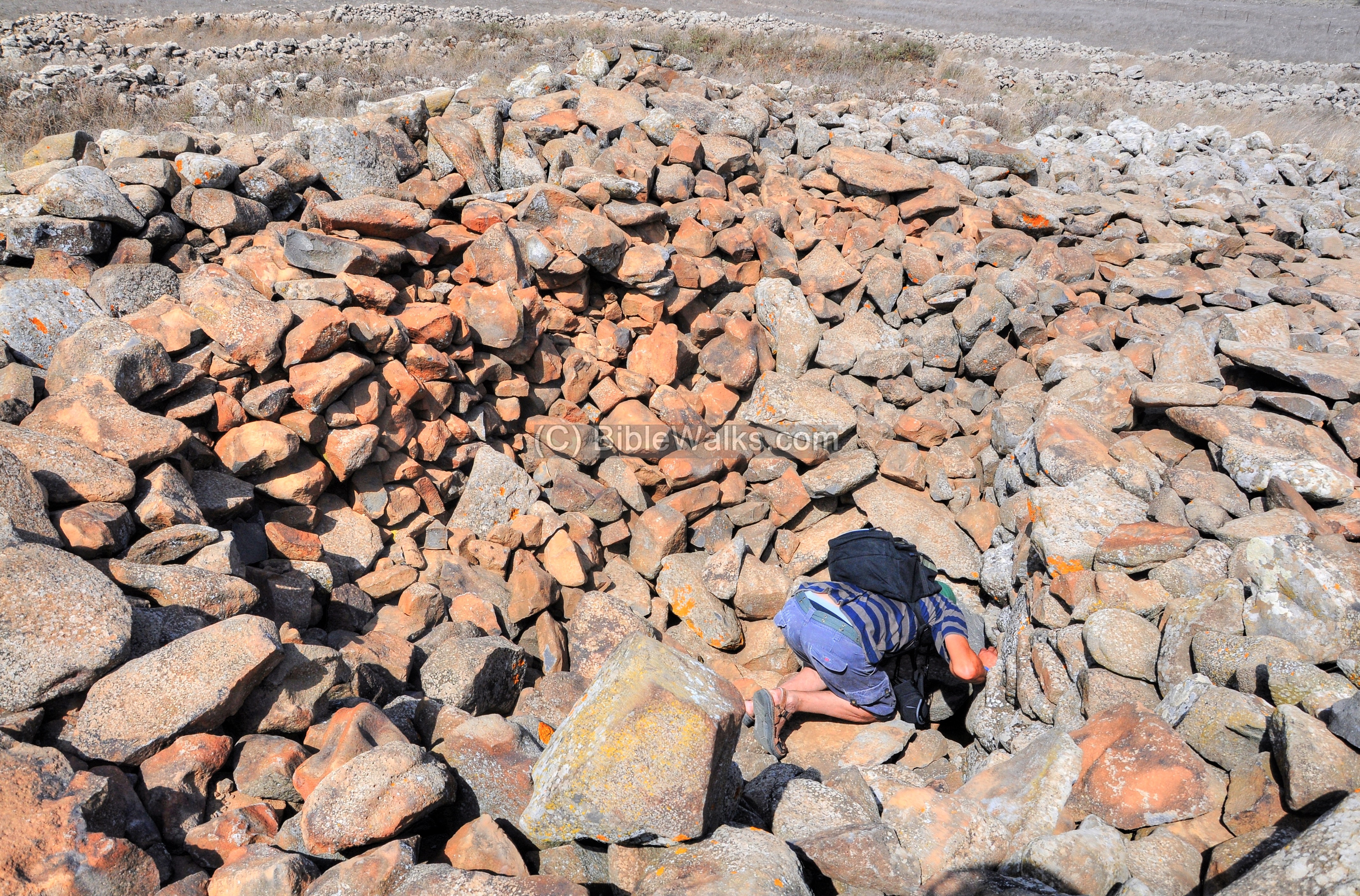
You need to crawl into the tomb…
The interior of the burial chamber is spooky and cool. Its questionable safety adds a measure of fright to the grave-like atmosphere. That’s why Uncle Amnon and Ronnie look a little frightened…
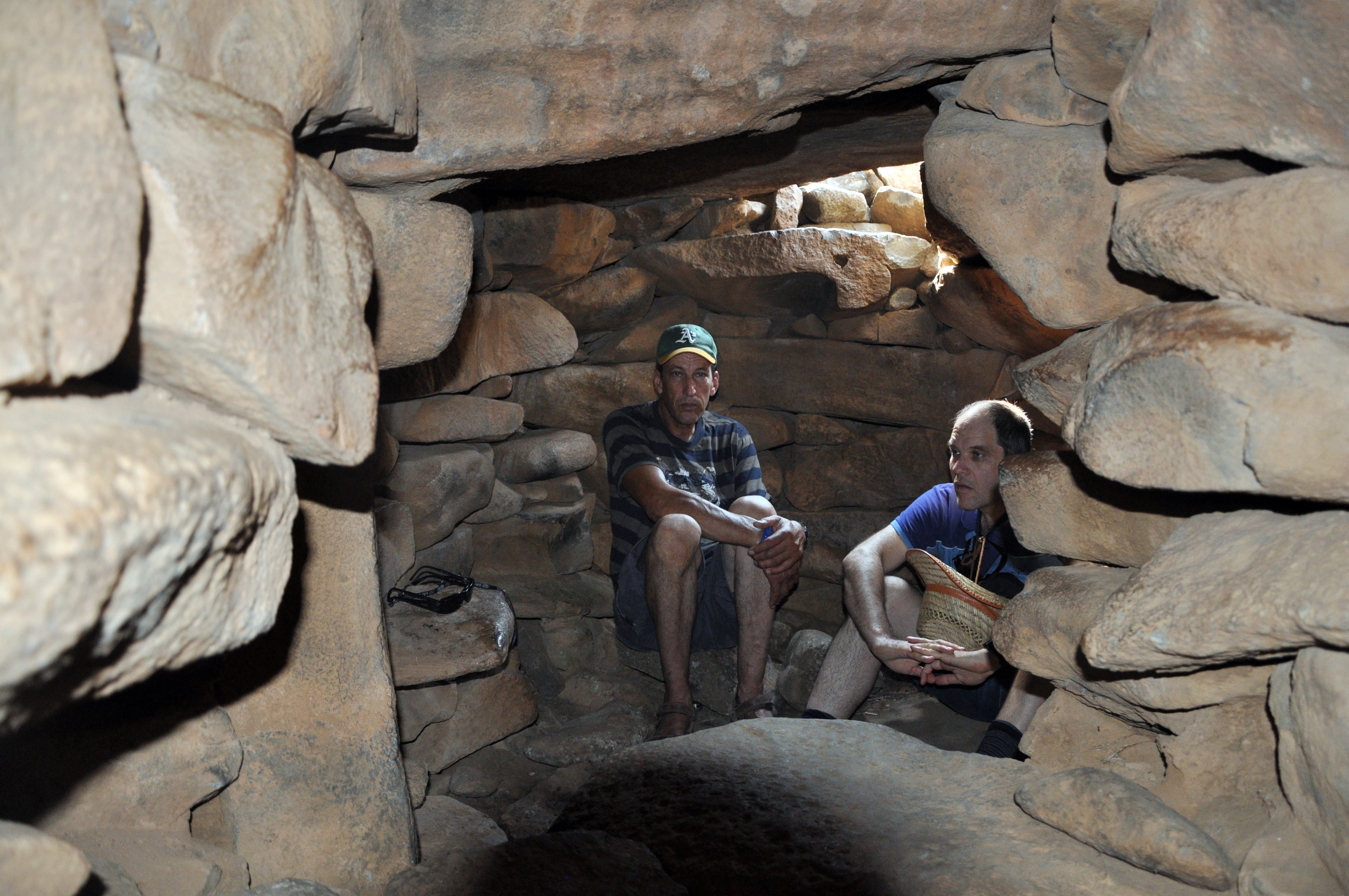
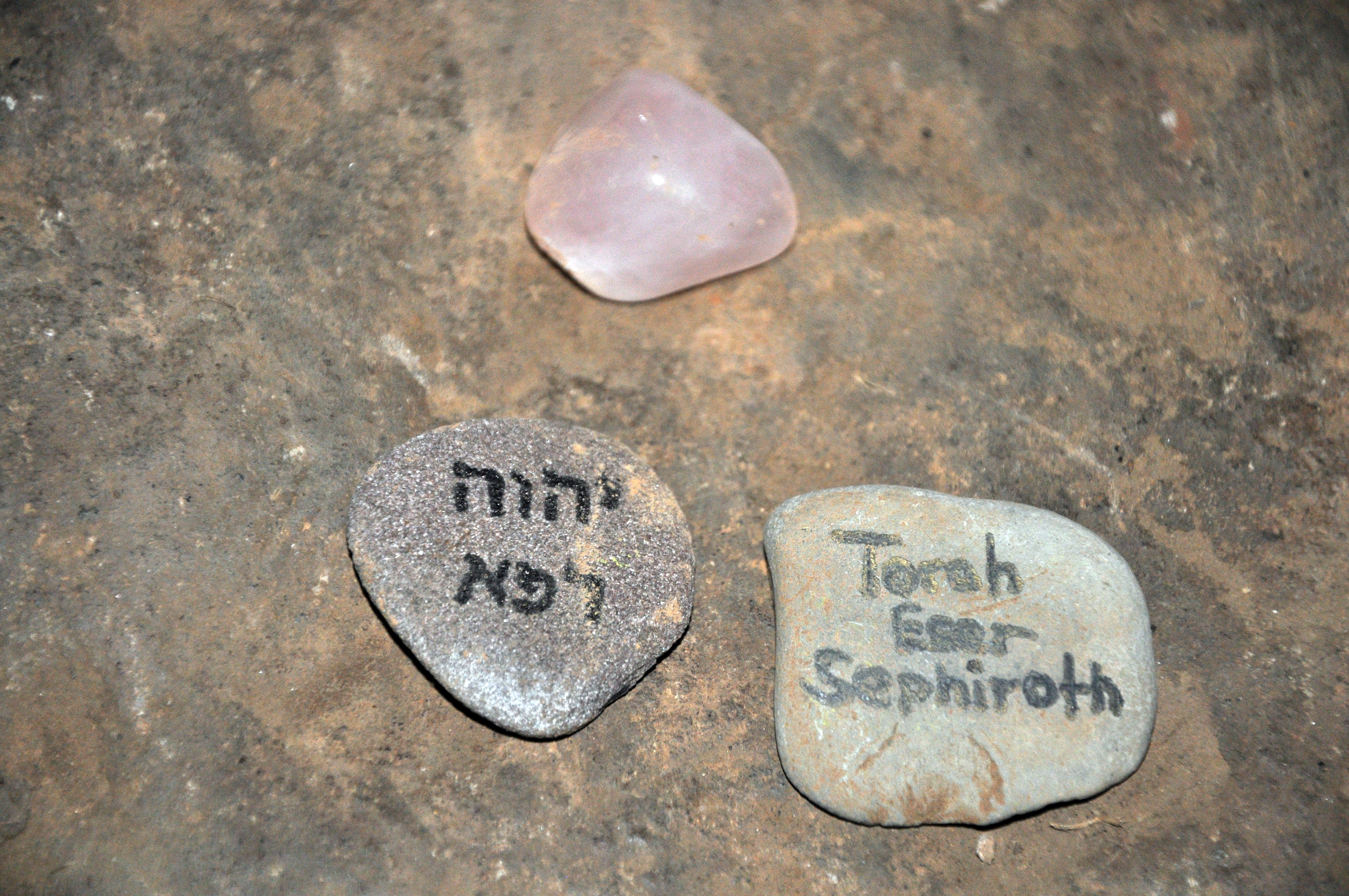
There are occasional ritual ceremonies practiced here for various reasons, adding to the mystery of the site. Small lucky charms and blessings are left over. In the photo below, the stone on the left spells “God will cure” (“יהוה רפא”), while the right stone is based on the tree of life of the Kabalah (“Torah Eser Sephirot”).
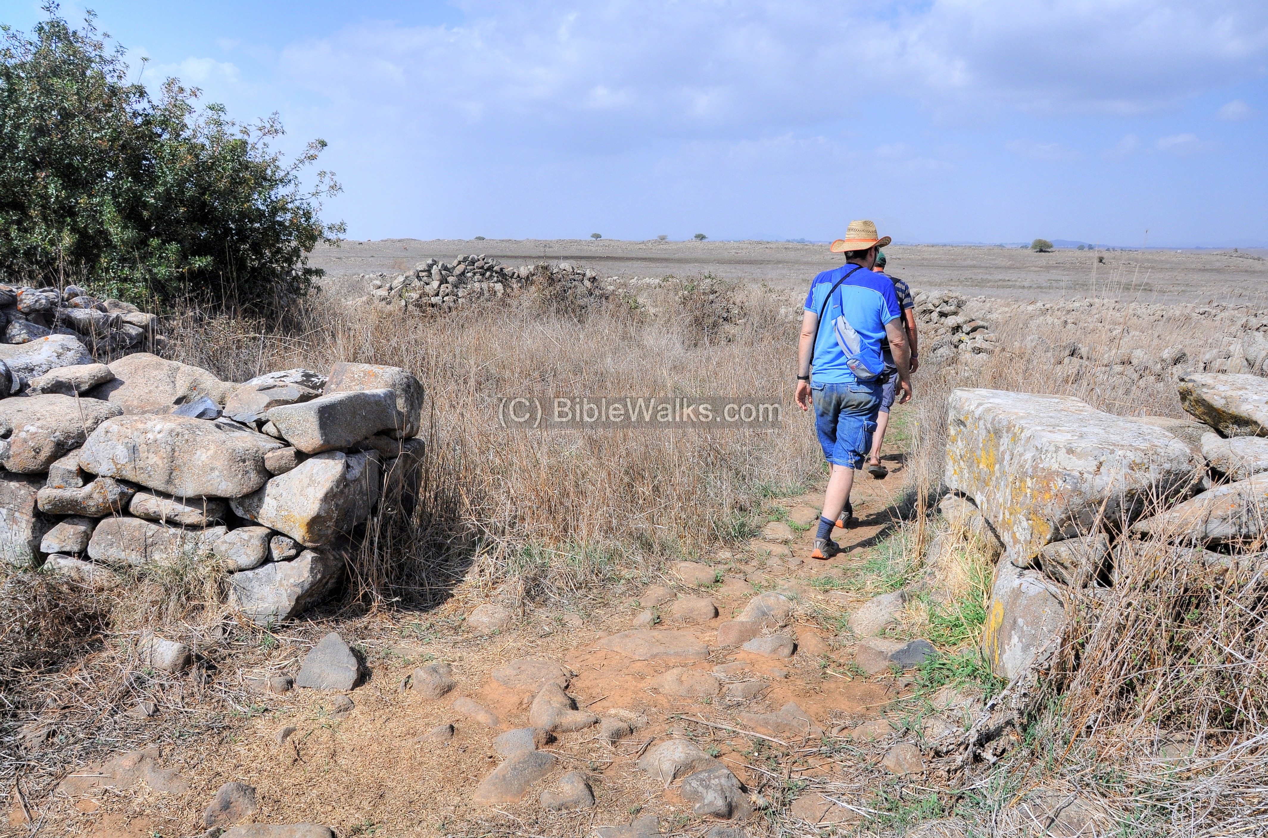
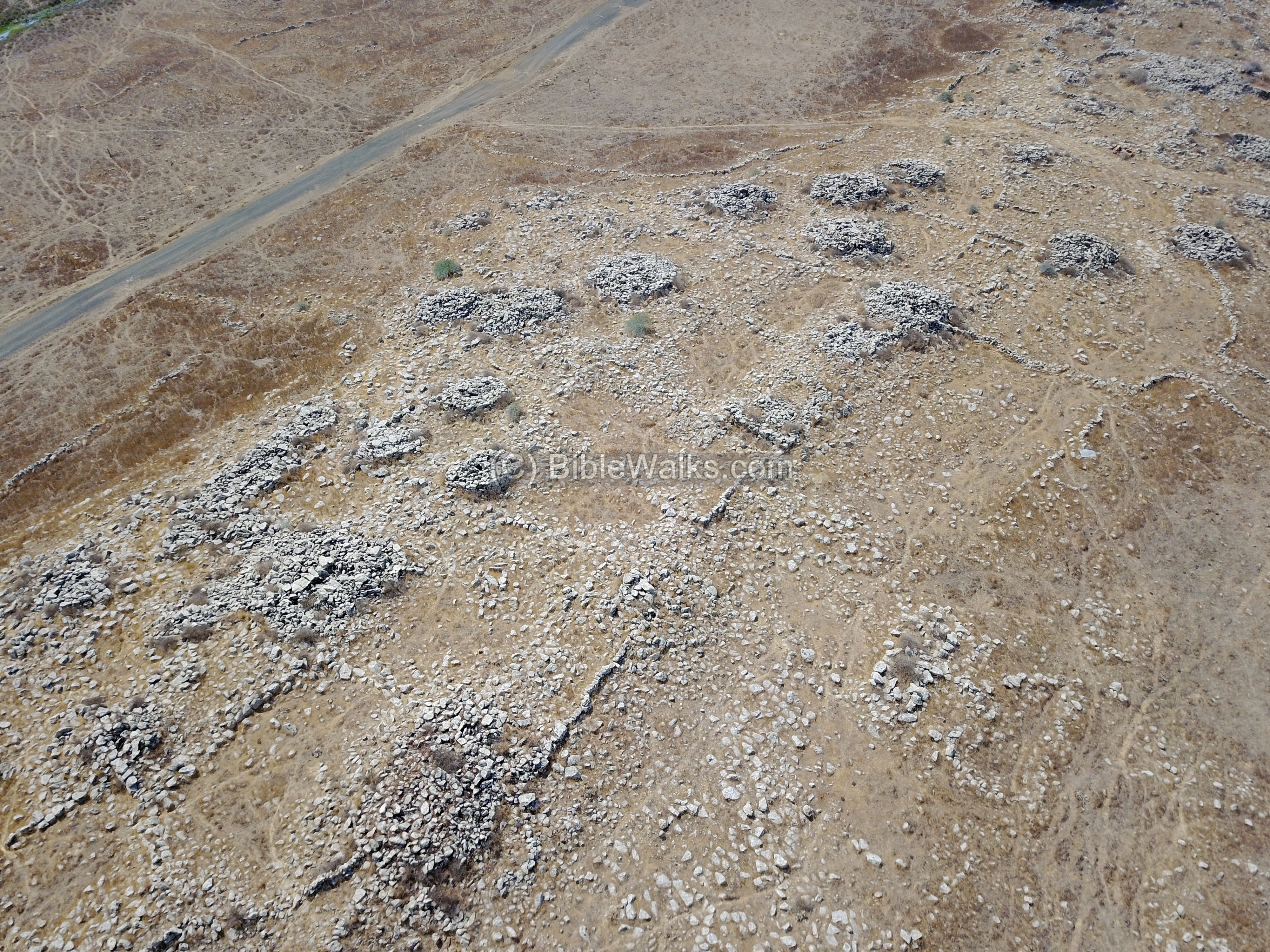
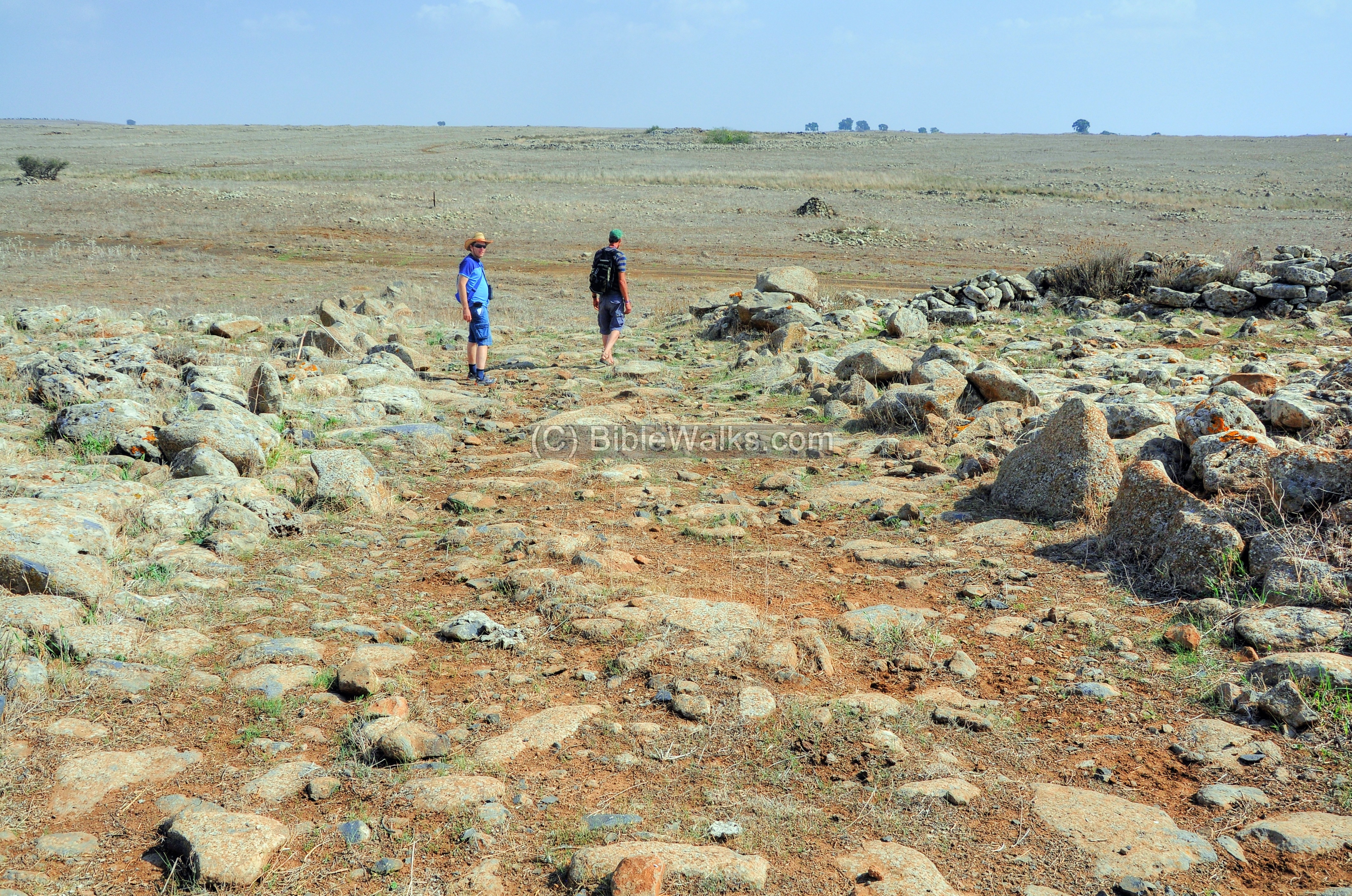
(d) The Prehistoric village
A view from the north shows Rujm el-Hiri in the background, just past the Nahal Daliyout brook. In the foreground are ruins of a large prehistoric village dated to the Chalcolithic period (4500-3150 BC). This village may have been related to the complex.

The next photo is another view from the south, with the ruins stretching along the ridge parallel to the dirt road.
Yet another view from the northern side:
Now to the ground level… Some of the ruins were excavated.
Among the ruins are covered tombs (Dolmen). There are about 100 Dolmens and pile of stones on the ridge north of Rujm el-Hiri, which itself may have been a mega-Dolmen and the center of this vast area of Megalith burial site.
An open road in the following photo leads towards the walls of Rujm el-Hiri, which is seen here in the far background raised above the flat area around it.
(e) Flight over the site
![]() A drone flight over the site is seen in this YouTube video.
A drone flight over the site is seen in this YouTube video.
(f) Stonehenge UK
Rujm el-Hiri/Gilgal Refaim is often regarded as the “Stonehenge of the Levant”. That famous English prehistoric site was constructed about the same time at the Bronze age period. According to UK archaeologists, the earthwork started at about 3200-3000 BC, and its stones were raised at 2400-2200BC, or perhaps earlier. This could have been a burial site, with bones dated as early as 3000 BC.
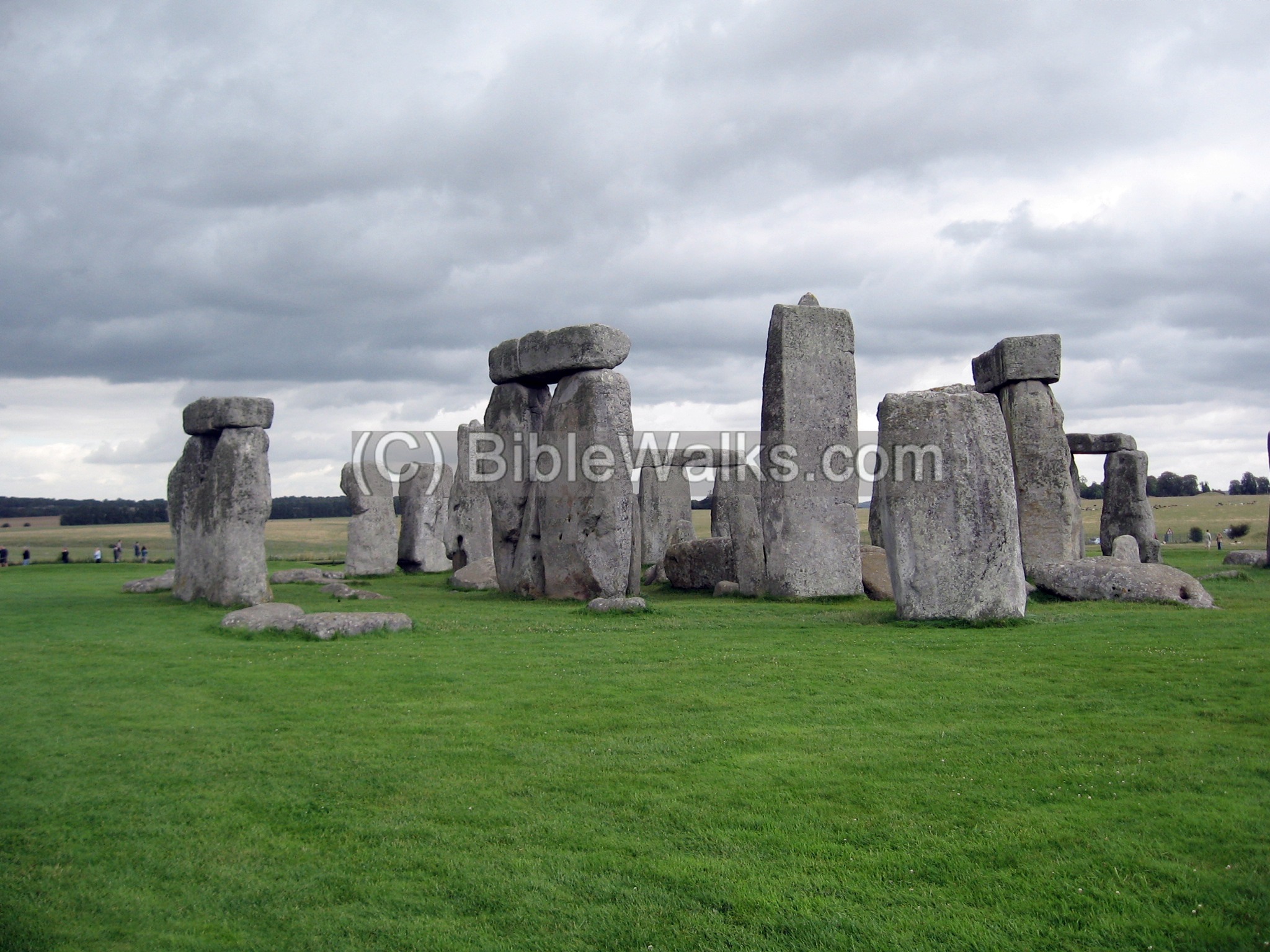
It also served as an astronomical calculator just like the site in the Golan. In Stonehenge, the summer solstice (dawn of June 21) was marked by a heel stone (a large block) outside of the perimeter (77.4m from the center). The sunrise at that date would align through it to the center of the circle.
Etymology – behind the name:
* Names of the site:
- The Hebrew name (Gilgal Rephaim) means the “wheel of ghosts”, a name is based on the Biblical race of giants (Rephaim) who dwelt in the Bashan/Golan area before the Patriarchal age.
- The Arabic name (Rujm el-Hiri) translates to the “mound of the wild cat”. Rujm/Rujem/Rujum means mound (like Regem in Hebrew). Why wild cat? Perhaps the site looks like a crouching cat.
* Other terms:
- Solstice, Litha – stopping or standing still of the sun. It is the longest day of the year and the time when the sun is at its maximum elevation
- Dolmen – from Celtic: “Stone table”
- Tumulus (tumuli in plural) – from Latin: small mound (pile of stones normally found above the Dolmens)
- Cairn – small pile of stones, usually vertical.
- Megalith – a large stone that forms a prehistoric monument (mega-large, lith-stone)
Links:
* External links:
- A Near Eastern Megalithic Monument in Context Mike Freikman [eTopoi V3 2012]
- Summer Solstice and Stonehenge
- Sun calculator – computation path for the sun
- Rujm el-Hiri (Hayadan, 2003; Hebrew)
- The Geometry and Astronomy of Rujm el-Hiri (pdf, 1998) – Aveni, Anthony & Mizrachi, Yonathan. (1998). The Geometry and Astronomy of Rujm el-Hiri, a Megalithic Site in the Southern Levant. Journal of Field Archaeology. 25. 475-496.
- Mystery widens: Researchers find Israel’s ‘Stonehenge’ in the Golan is not unique Rossella Tercatin, timesofisrael.com, Mar 2026
* Internal Links:
- Drone Aerial views – collection of Biblical sites from the air
- Golan maps – with location of sites reviewed in Biblewalks
- Dolmens in the Golan – prehistoric megalithic tombs
- Jethro’s Cairn – another megalithic site near Kibbutz Parod
- Prehistoric sites – Biblewalks info page
- Prehistoric Tools – info page on early man tools
BibleWalks.com – walks along the Bible land
Mt. Shifon<<<—previous Golan site—<<<All Sites>>> more sites will be added
This page was last updated on Mar 19, 2026 (add link)
Sponsored Links: