Ruins of a Israelite period desert fortress and settlement, later reused by the Nabateans.
Home > Sites > Negev > Horvat Halukim
Contents:
Background
Location
History
Photos
* Aerial views
* Fortress
* Four-Room house
* Tower
* Video
Etymology
Links
Overview:
Ruins of an Israelite period (Iron age IIa) fortress and village. The village consists of 25 structures, built along 3 valleys of the HaRo’a stream. The oval-shaped fortress was reused by the Nabateans during the Roman period.
Location and Map:
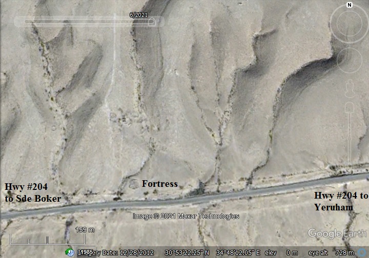
The site is located on the north side of Highway #204, 1.5 KM north east of Kibbutz Sde Boker, in the Ramat Negev desert area.
History:
-
Iron Age IIa period (1000-925 BC)
In the Negev area are over 40 fortresses of small to large sizes that were identified as “Israelite fortresses’ and dated to the Judean Kingdom period. The majority had common features – located near major trade routes, a plan of central courtyard with casemate rooms, have been built around the 10th century BC, and had small 4-room houses were built at their side.
The village and fortress of Horvet Halukim is one of the small forts. The village includes: an Oval shaped tower (23m in diameter) with 7 casemate rooms around a central courtyard, an entrance on the south east side; seven 4-room Israelite houses; a public structure (14 x 9m) on the west side; four cisterns; agriculture terraces.
- Who built the desert fortresses?…
Who built this fortress, as well as others in the desert area? Scholars offer various identifications. Some relate their construction to the royal administration of the Judean Kings, such as David and Solomon (only the small forts), or to Jehoshafat (870-849 BC) and Uzziah (mid 8th century) for the large fortresses with towers.The fortresses offered protection on the major trade routes and established control and royal presence.
The Bible tells us about these desert constructions (2 Chronicles 26: 9-10):
“Moreover Uzziah … built towers in the desert, and digged many wells: for he had much cattle, both in the low country, and in the plains…”.
Other scholars, however, offered other identifications such as relating their construction to the actions of the desert tribes – whether Israelite or foreign tribes.
- Trade route:
The area of Sde-Boker was a junction of ancient crossroads. One of these routes (known as the Incense & Spice route during the Roman/Nabatean period) led from Oboda (Avdat) to the port city of Gaza and the north of Israel. Its location is marked as a red square on the Biblical map below.
Another ancient road was the east-west route Darb al-Sultan (Arabic: Way of the Ruler, also Darb es-Sultani) that came from the nearby Zin valley ascent. Yet another road was a north-east bound route (same as road #204).
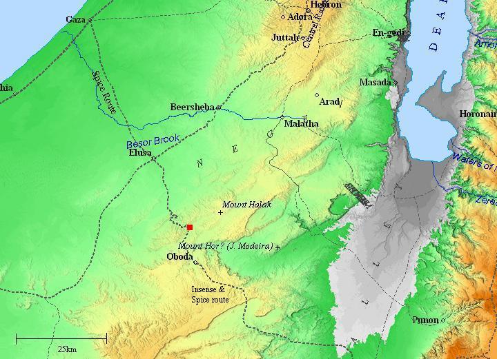
Map of the area around the site (marked by red square) – during the Roman/Byzantine periods (based on Bible Mapper 3.0)
- Roman period
During the Roman period a tower was built on top of the ruins of the Israelite period structure. The tower included 3 rooms, had two stories, and measures 8x8m. It was surrounded by a low fence, with nearby three animal pens.
-
Modern Period
The site was excavated by R. Cohen and Z. Meshel (IAA) in 1971-72. The ceramics were dated to the Israelite period II and Nabatean.
The site is in an open public area, at the side of highway #204.
Photos:
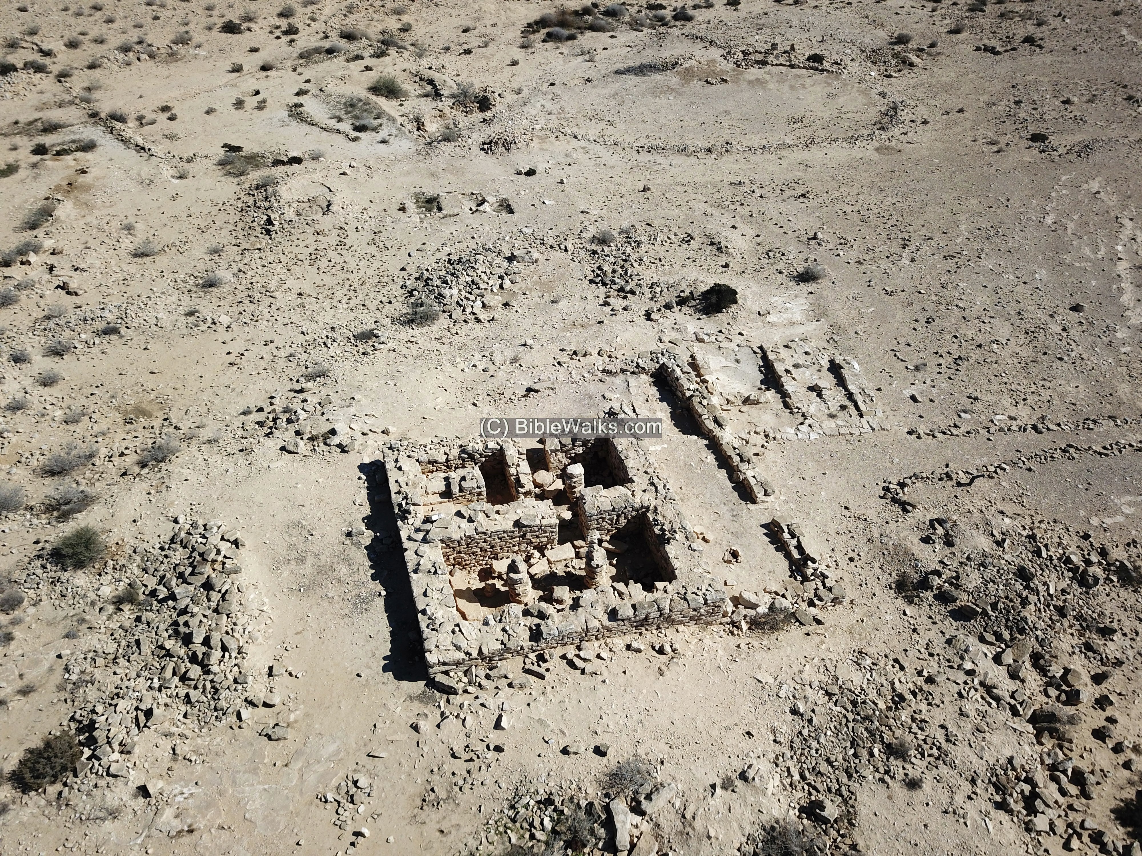
(a) Aerial Views
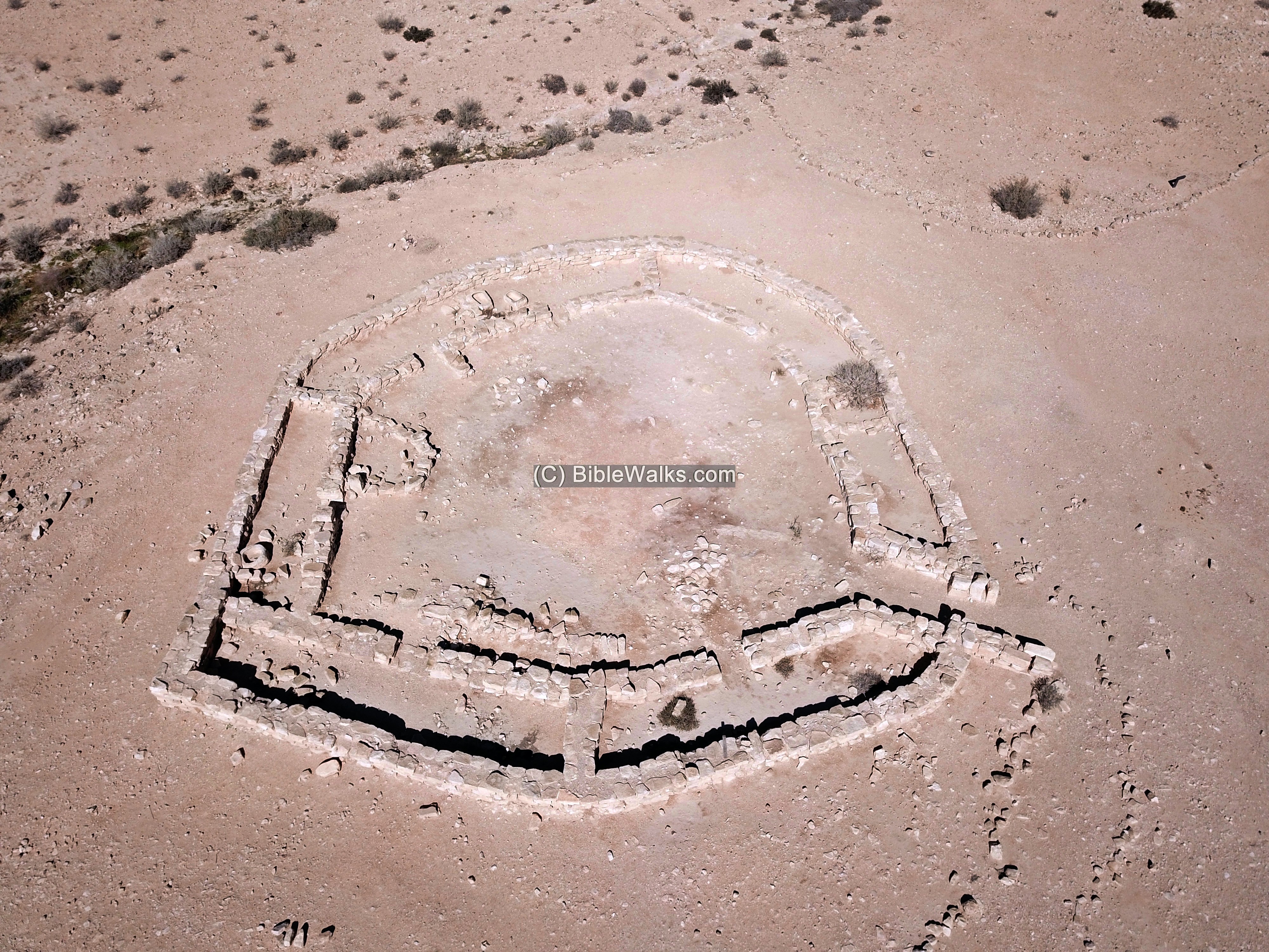
A drone captured this view towards the north. The oval shaped fortress is located close to the modern highway, where the ancient road once passed. Other sections of the ruin are spread around, with walking trails leading to some of the highlights.
Click on the photos to view in higher resolution…

Another section of Horvat Halukim is located north of the fortress. This view is from the “tower” towards the south.
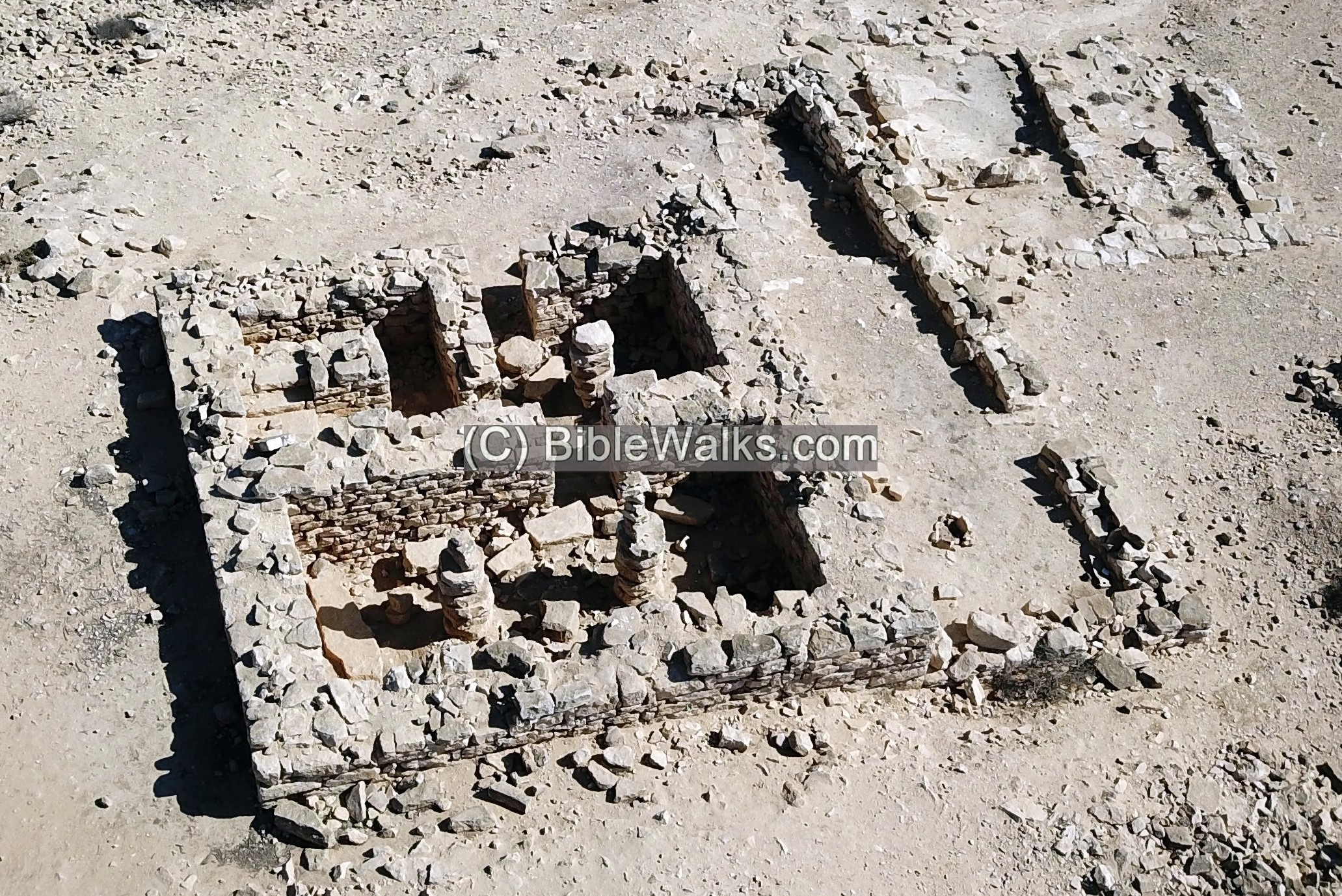
(b) Fortress
The fortress is an oval shaped tower, constructed during the Israelite period II. It was built at the edge of one of the valleys that feed into the Ha’Ro’eh stream, where the ancient (and modern) north-east route passed.
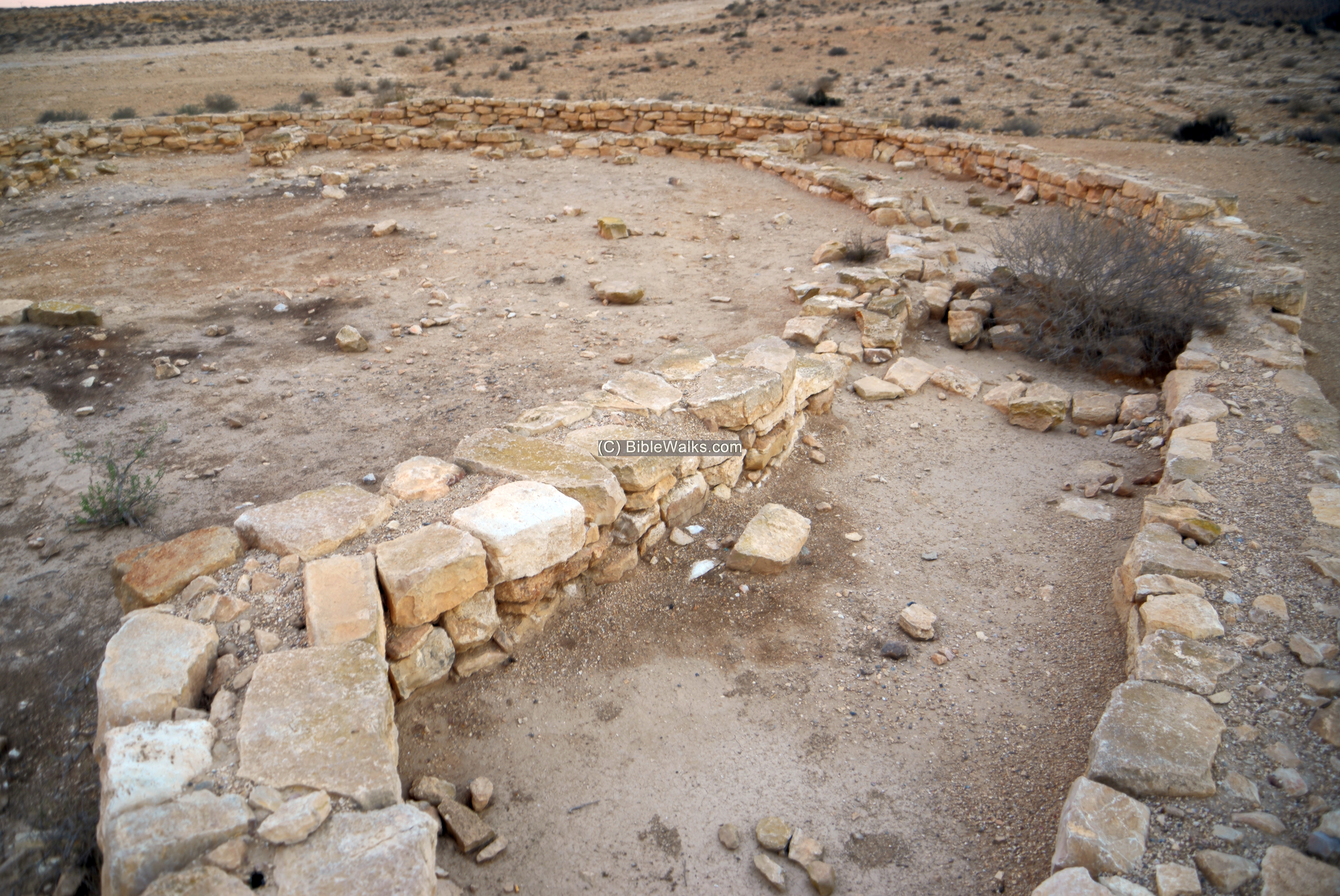
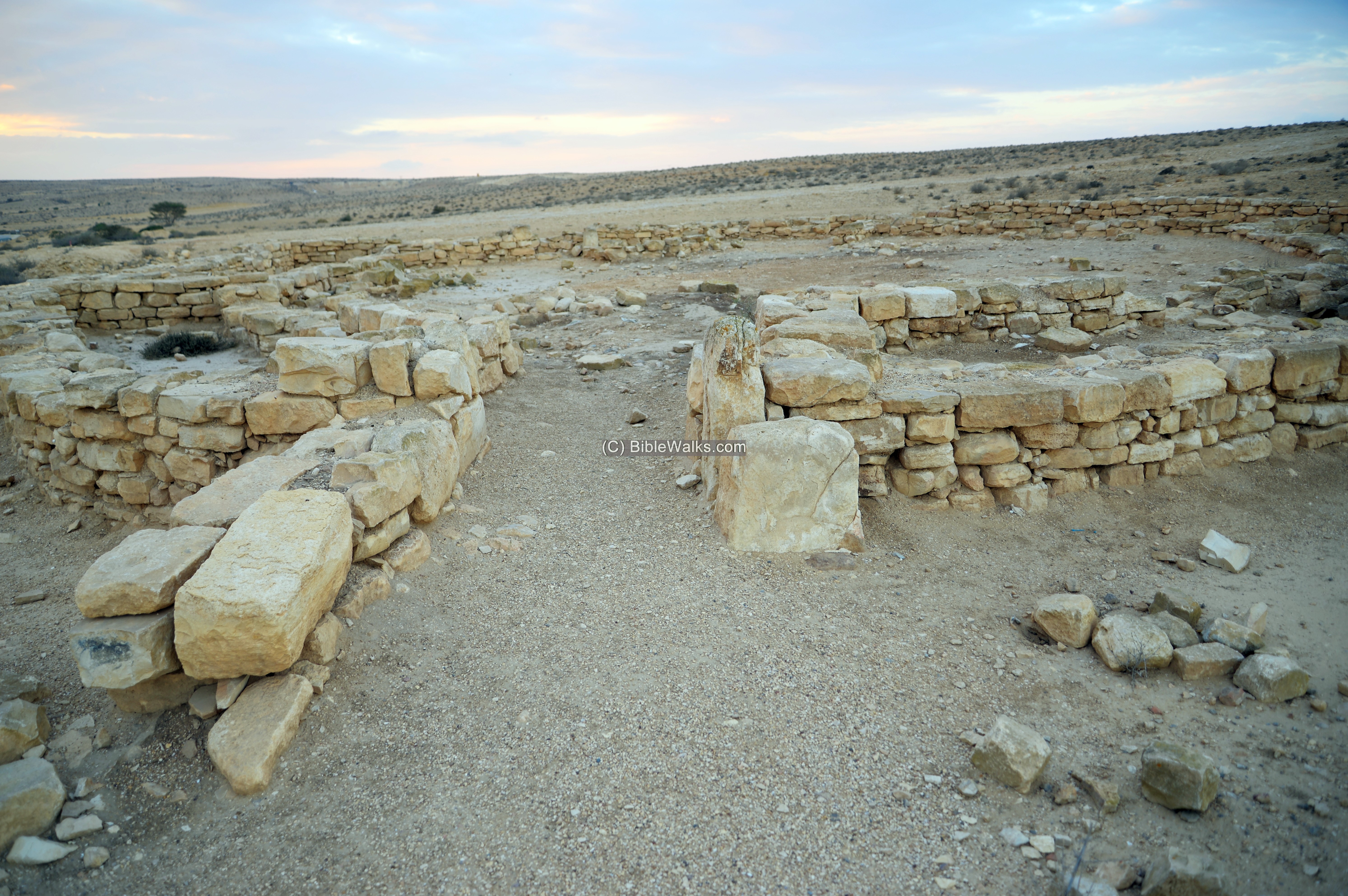
The fortress is 23m in diameter, with 7 casemate rooms arranged around a central courtyard. The walls consist of limestone slabs.
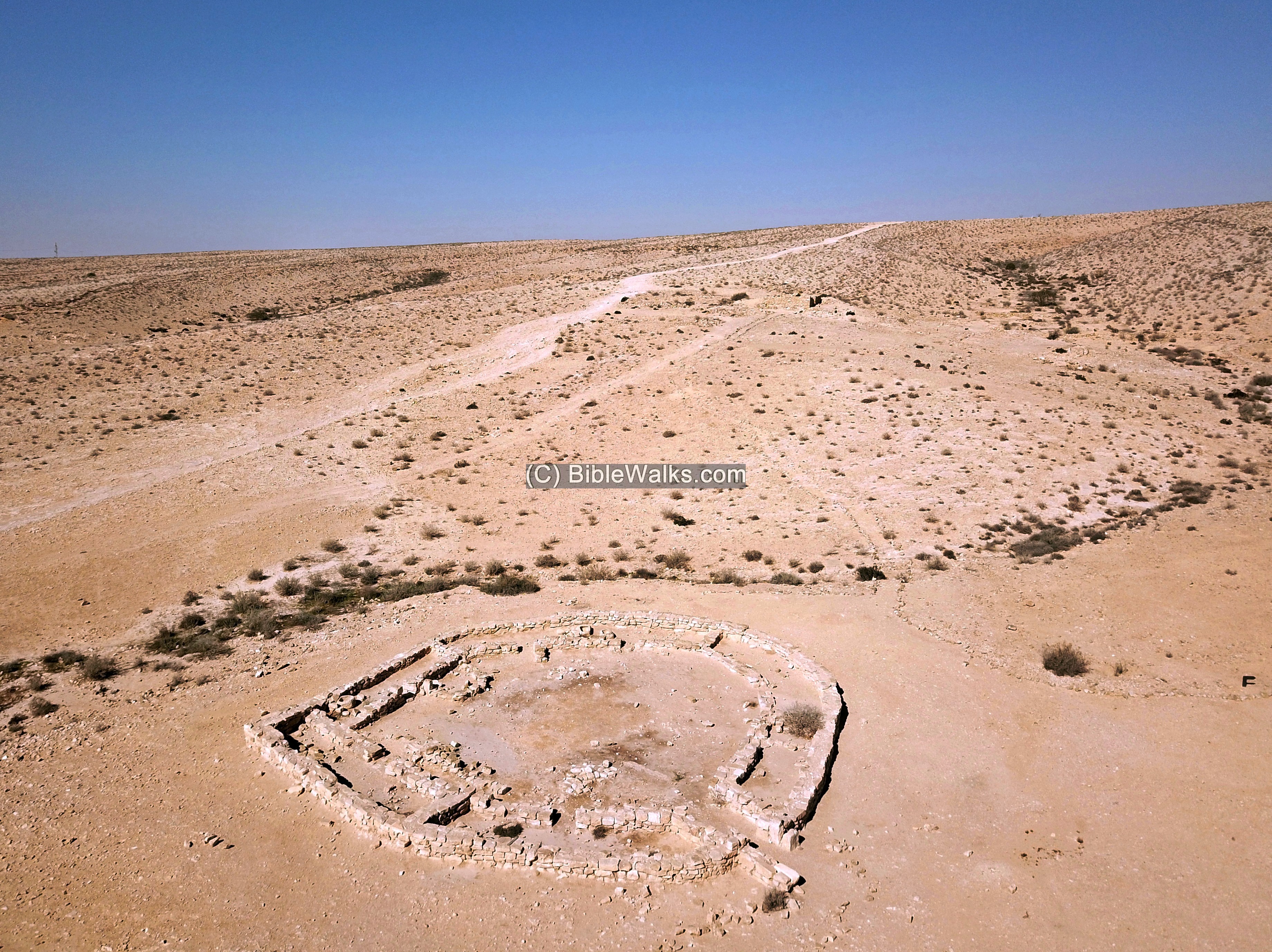
During the Roman (Nabatean) period a tower was built on top of the ruins of the front two casemate rooms of the Israelite tower. It included 3 rooms, had two stories, and measured 8x8m. It was surrounded by a low fence, with nearby three animal pens. The Roman period level was removed during the excavations.
In the north-most casemate room, seen below, were three stone vessels (one of the three was gone missing).
The eastern casemate room is seen with a closer view in the following photo.
The entrance to the fortress is on the south east side.
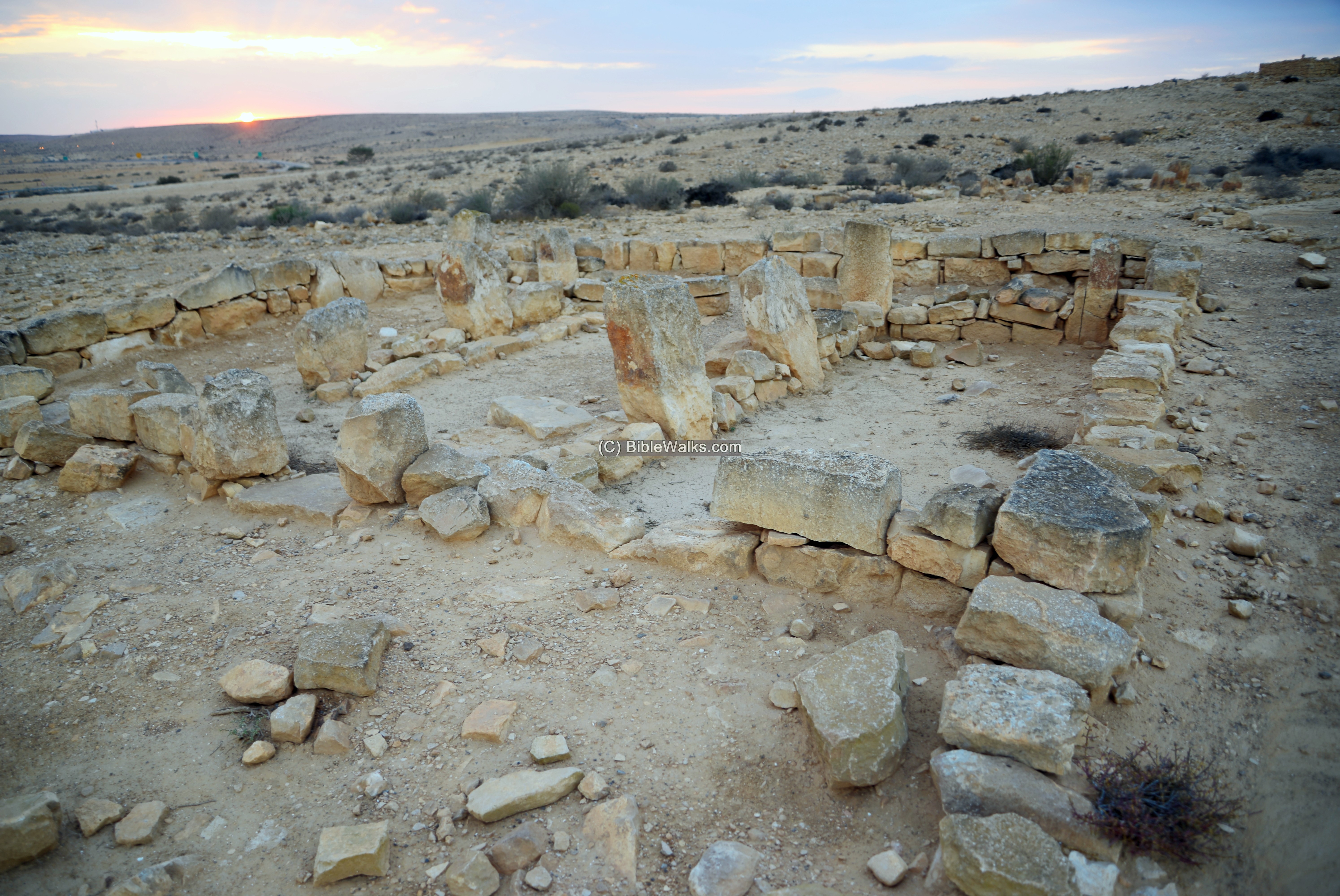
(c) Four-Room house
In the settlement are 7 structures with a “four-room” plan, a typical architecture of residential houses in the Israelite II period.
This house is located 90m to the north east of the fortress, at the end of a walking trail bounded by rocks. It has an open fenced area on its eastern side, and a 8m x 8m structure on the western side.
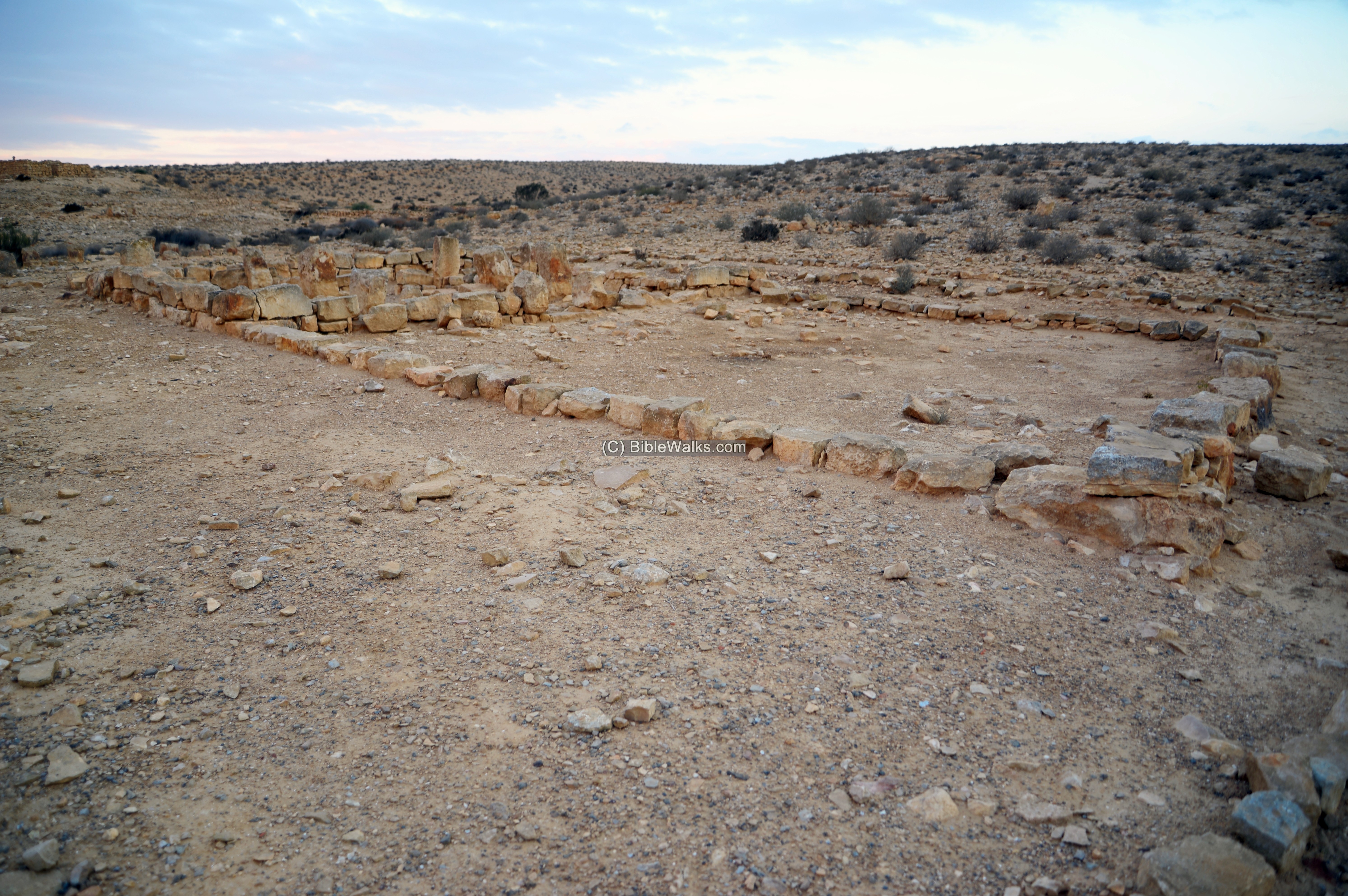
Inside the structure are two rows of monolithic columns that separate the rooms from a courtyard between them.
Other structures and agriculture dams were built on the foothills and long the valleys.

< a name=”Tower”>
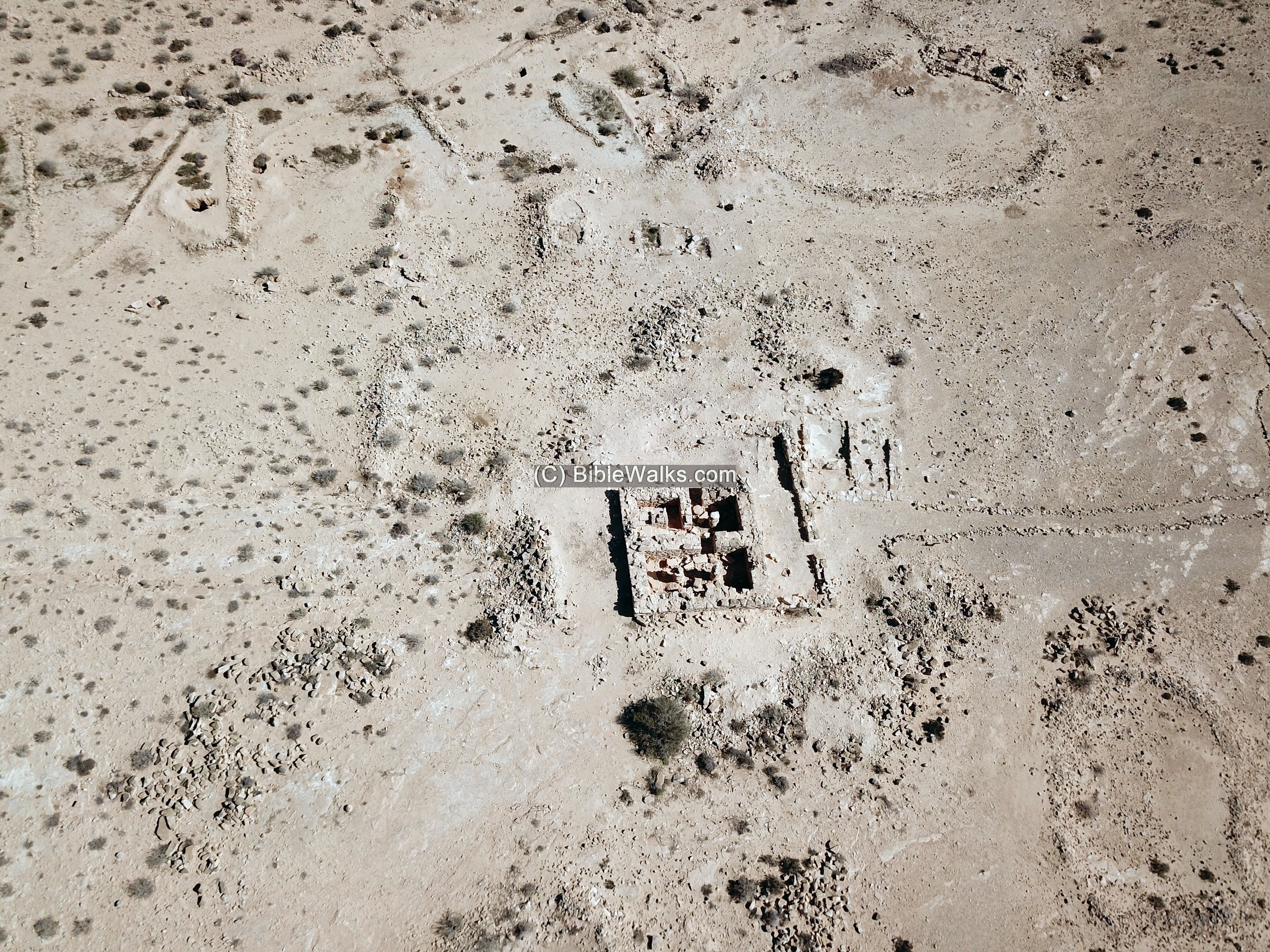
(d) The “Tower”
North of the fortress is a structure that was preserved to 1.7m high. This square structure, 8m x 8m, was built during the Nabatean/Roman period over an ancient structure (Israelite II).
The structure consists of 3 rooms, and was protected by a fence on 3 sides (except for the north side). In the area around the “tower” are 3 paddocks, and in the valleys are agriculture dams that were used for farming in order to support the inhabitants.
Next – is a ground view of the structure. The entrance is from the east side.
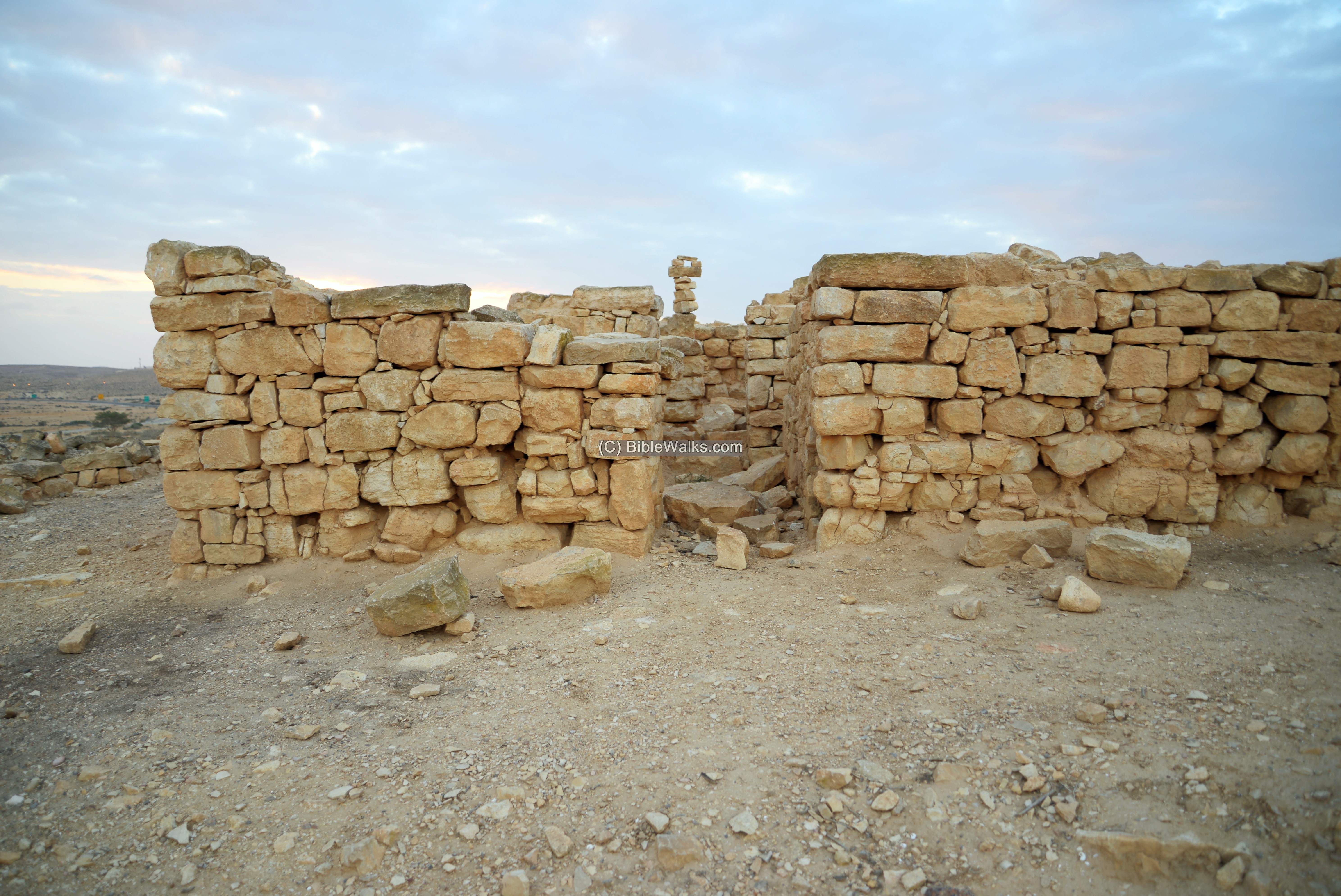
The entrance leads to a small room. In its center is a round column, consisting of 7 parts.
In the northern room is a a staircase that led to the upper floor or to a roof.

(e) Flight over the site:
![]() The following YouTube video shows a flight of a drone over the site. It starts from the south above the highway, then flies north and turns to view the “tower”.
The following YouTube video shows a flight of a drone over the site. It starts from the south above the highway, then flies north and turns to view the “tower”.
Etymology (behind the name):
- Sde Boker, Sede Boqer – Kibbutz, established 1952.Meaning (Hebrew): herding field. The Hebrew name is based on the Arabic name of Mt. Har Boker – Shajarat el Baqqar – as appears on the British map of 1946.
- Halukim (Haluqim) – Hebrew: pebbles. The modern Hebrew name is based on the Arabic name of the hill – Jebel Haleiqim – and the valley – Wadi Haleiqim. The names appear on the British map of 1946.
Links and References:
* External links:
- Archaeological Survey of Israel – Map 168 (Sde Boker East) –
http://survey.antiquities.org.il/index.html#/MapSurvey/19/site/4094
http://survey.antiquities.org.il/index.html#/MapSurvey/19/site/4093
- Who built the Israelite fortresses in Negev heights? – Zeev Meshel, 1975 (Hebrew, pdf) – a thorough review of the site
- Sde Boker – Home page of the Kibbutz (Hebrew)
* Song:
![]() “Va-yiven Migdalim…” – Hebrew song by Dudayim, on King Uzziah – builder of desert towers and cisterns (2 Chronicles 26: 9-10)
“Va-yiven Migdalim…” – Hebrew song by Dudayim, on King Uzziah – builder of desert towers and cisterns (2 Chronicles 26: 9-10)
* Other Iron Age II desert fortresses in BibleWalks:
- Ramat-Boker fortress nearby site
- Horvat Ritma nearby site
- Beerotayim near Nitzana
- Negev Iron Age fortresses
* Other Internal links:
- Horvat Hazaza – nearby Nabatean station
- Lost city near Sde-Boker – nearby Byzantine period settlement
- BibleWalks YouTube channel – join!
To complete this review – a sunset view towards the nearby Junction “Halukim”, where the road #204 joins highway #40 just before kibbutz Sde-Boker.

BibleWalks.com – Search for the lost cities of the Bible
Horvat Ritma<<<—previous site—<<<All Sites>>>—Next Negev site—>>> Mt. Eldad fort
This page was last updated on Mar 21, 2026 (add Hazaza)
Sponsored links: