Ruins of an Early Roman fishing village, near the Arbel cliffs, on the shores of Sea of Galilee. Known as the home of Mary Magdalene.
* Site of the Month Jan 2018 *
Home > Sites > Sea of Galilee> Magdala (Magdalene, Migdal, Taricheae)
Contents:
Background
Aerial Map
History
Photos
* General views
* Monastery
* Early Roman village
* Early Roman Synagogue
* Spiritual Center
* Aerial View North
Biblical Refs
Historical refs
Etymology
Links
Background:
Magdala, also known as Migdal, is a small town located on the western shore of the Sea of Galilee in northern Israel. It is historically significant as the birthplace of Mary Magdalene, one of Jesus’ followers who is mentioned in the New Testament.
In ancient times, Magdala was a prosperous fishing village and a major center for the processing of fish. It was fortified and severely damaged during the great revolt against the Romans. The archaeologists uncovered the remains of the village dating from the time of Jesus, and a large Byzantine monastery. Excavations in the village have revealed the remains of a first-century synagogue, which is believed to be one of the oldest synagogues in the world.
Today, the ancient site Magdala is a popular destination for Christian pilgrims visiting Israel. The town is home to the Magdala Center, which is a spiritual and cultural center that includes a museum, an archeological park, a chapel, and a guesthouse. The center’s mission is to promote Christian values and foster interfaith dialogue.
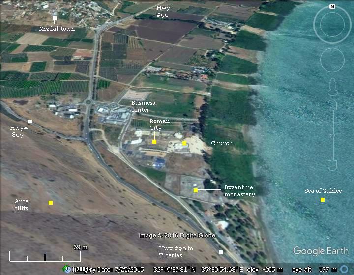
Aerial Map:
The ruins of Magdala (Migdal) are located on the north-west side of the Sea of Galilee, 5 Kilometers north of Tiberias, on the foothills of the Arbel cliffs. A modern town and business center are located north west of the ruins.
History:
Magadala, or its Greek name Taricheae, became an important city in the Hellenistic period. Its location on the ancient road made it strategically important (the road from Netufa valley, via the Arbel valley, through Gennesareth valley on the shores of the sea of Galilee, towards north and east). The water springs nearby, fertile land and fishing industry – all these made it the center city of one of the three Galilee regions in the Jewish Kingdom prior to the Romans.
The town reached its zenith in the Early Roman period. After Tiberias was established (18 AD) in the early Roman period, Magdala started to lose its importance, although initially the Jewish population refused to settle in the new city.
During the Jewish revolt it was fortified (66 AD), but suffered a tragic end (67 AD) by the Roman forces. It continued, on a smaller scale, as a Roman and Byzantine village.
Since the 19th century an Arabic village was located around the ruins of Magdala, called al-Majdal (in Arabic: “the Tower”), preserving the ancient name. The village was evacuated in 1948 and its buildings were cleared out of the area.
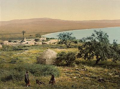
The village of el-Majdel, 1890-1900.
Part of “views of the Holy Land”; Library of Congress collection
Today, a new town is built nearby (west to ancient Magdala) and called Migdal. It was established in 1910 by Jewish settlers from Russia, became an agriculture Moshav, and continued to expand to include other residents and focus on tourism (B&B). It has a population of 2,000.
In 2009 the construction of a spiritual center started in the area close to the ancient ruins. Under the surface emerged ruins of a 1st century AD Jewish village. Emergency excavations, which still continue to date (2017), unearthed remarkable findings which are now part of the archaeological park.
Photos:
(a) General Views:
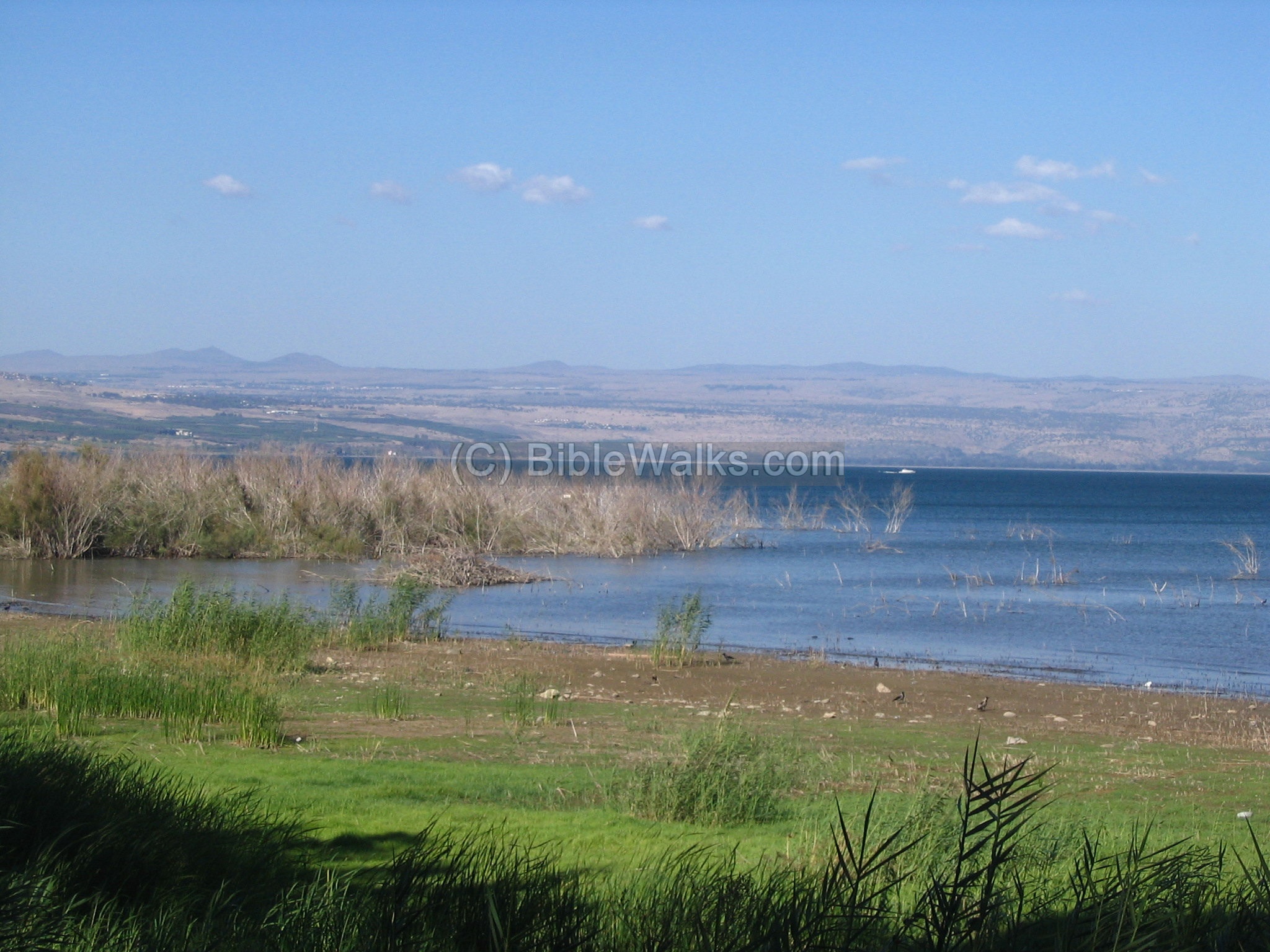
The village’s port is now submerged in the beach. This is a view of the beach at this point. A fisherman’s boat from that period was discovered when the sea retreated after a series of dry seasons. The boat was excavated, restored, and is now on display in Yigal Alon Museum in Ginnosar, the Kibbutz just north of Magdala. (see more details)
Click on the photos to view in higher resolution…
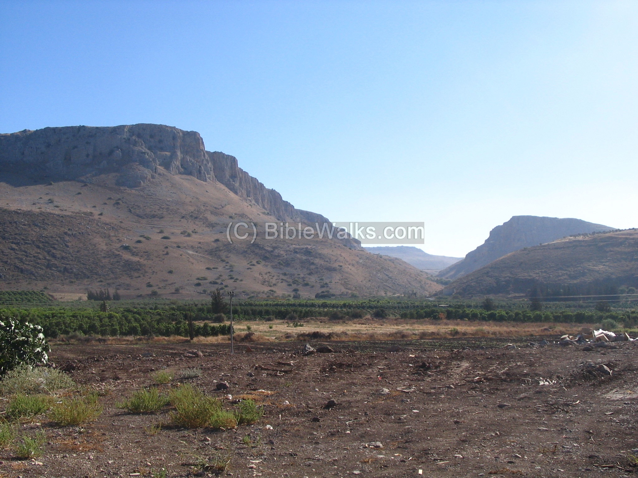
Looking to the direction of the south west, you can see the impressive Arbel cliffs which hang over the area. The Arbel creek flows through Magdala and was one of the reasons why the city was built at this point. Between the cliffs, in the valley, there is the path of the ancient road that leads to Sepphoris, Cana and Nazareth.
(b) Byzantine Monastery (south):
The first excavations in Magdala were first conducted in the beginning of the 20th century by a German architect, R. Lendle, who purchased the land and excavated a small area. It was later sold to the Franciscan Custodian of the Holy Land, who later financed the excavations.
In the 1970s large scale excavations were directed by V. Corbo. The team unearthed a large Byzantine monastery. It measures 100m along the eastern wall, by 33m along the northern wall, and is oriented south to north. The monastery was destroyed in the 7th century, but built again by the Crusaders. Some sections of it were damaged by the Arab village (Mejdel) that was built over it during the 19th century. The Arab houses were removed in 1948 using bulldozers, further damaging the antiquities.
An aerial view of the ruins are seen here, with North on the left side:

The following photo is a view from the walled area at the south-east side. The new Jewish village of Migdal is in the background.
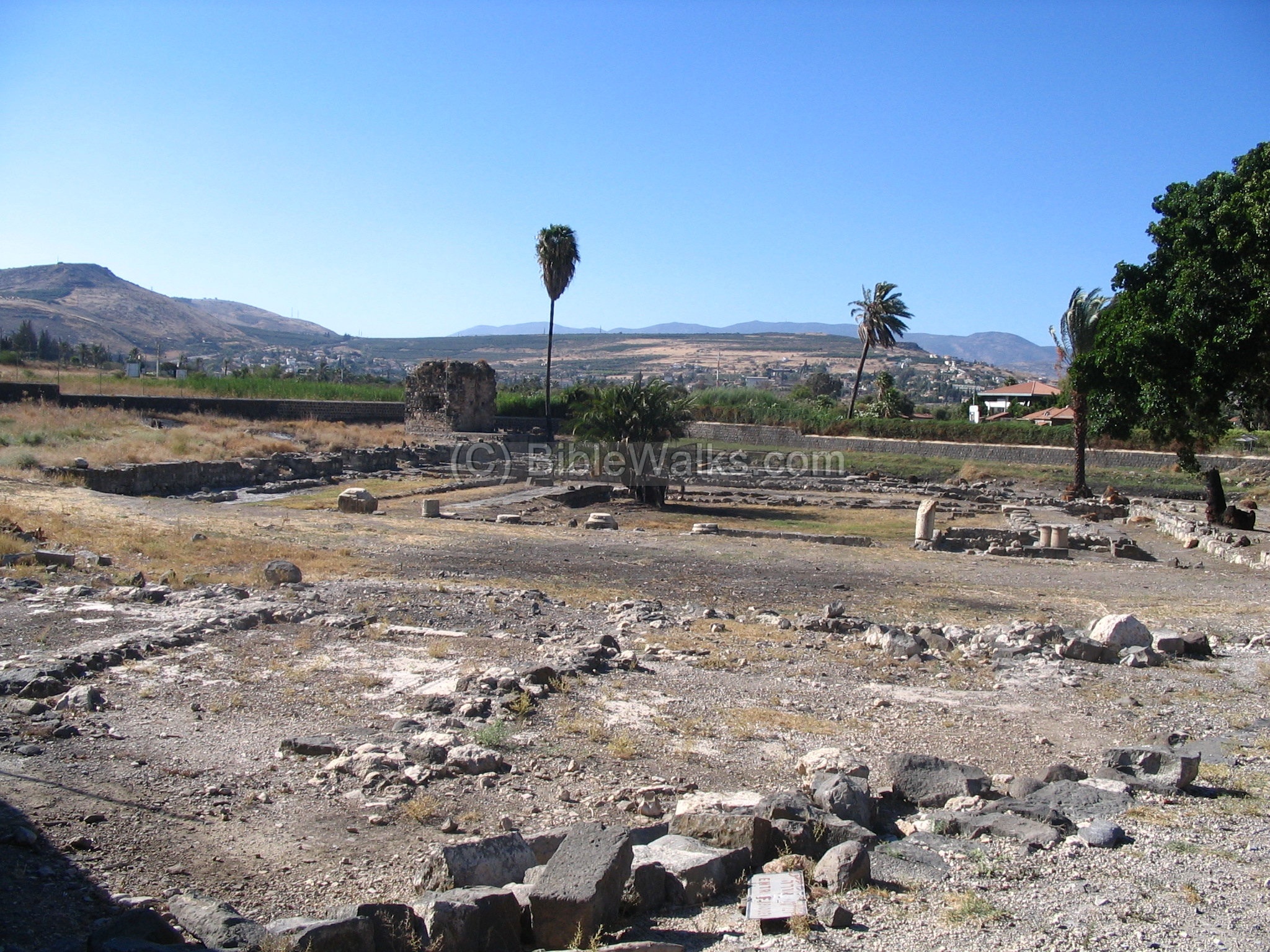
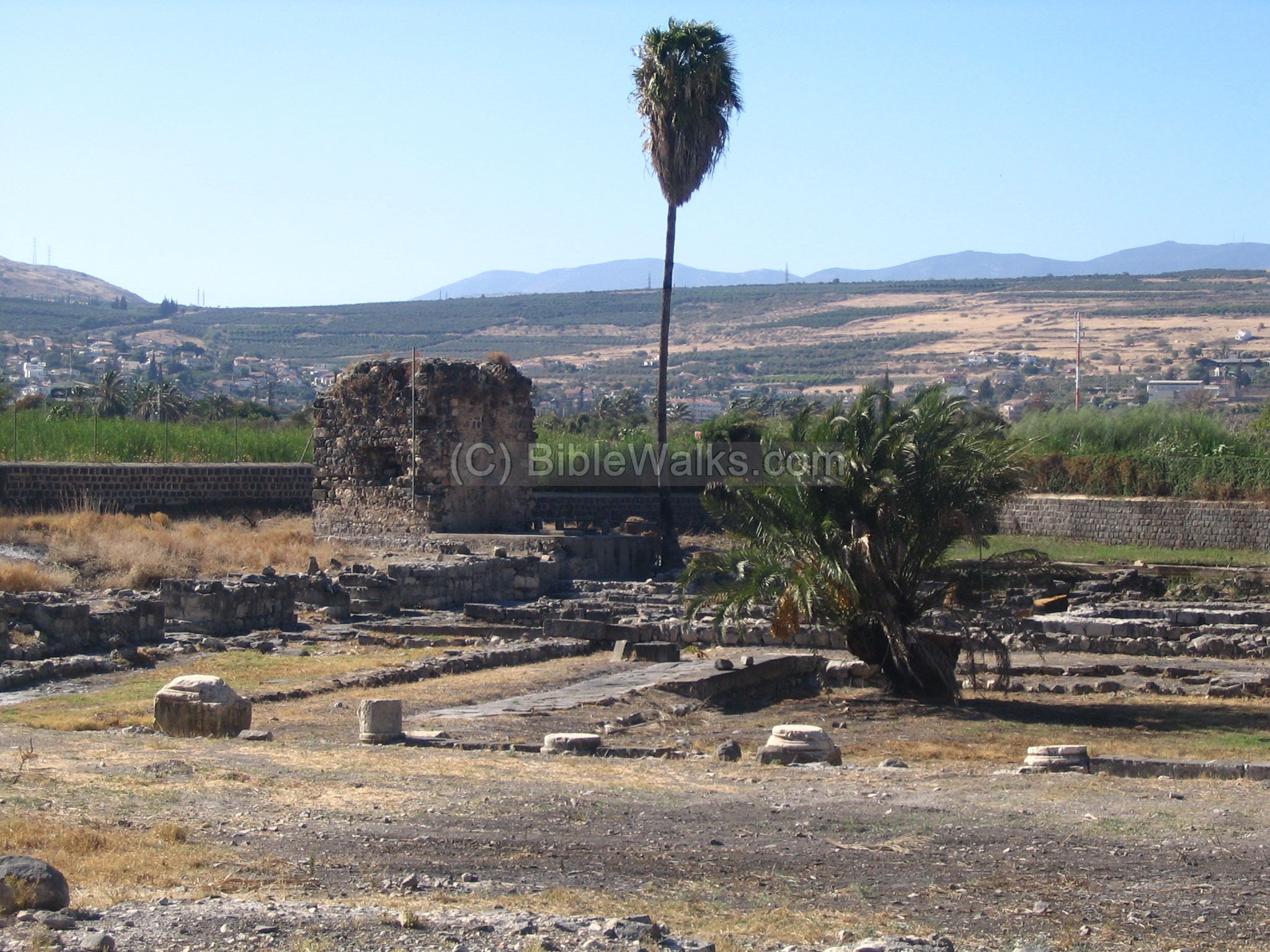
The next photo shows a closer detail of the site, focusing on the area of the excavated Byzantine monastery. The standing structure is an Arab Weli (chapel), and a wall which was built by the Franciscans.
The entrance to the Byzantine monastery was in the middle of the complex, on the east (beach) side. It opened to a large courtyard (19m x 19m). The archaeologists unearthed other sections of this unusually large complex.
The southern area is now a private walled area.
![]() The following YouTube video shows a flight over the Byzantine monastery:
The following YouTube video shows a flight over the Byzantine monastery:
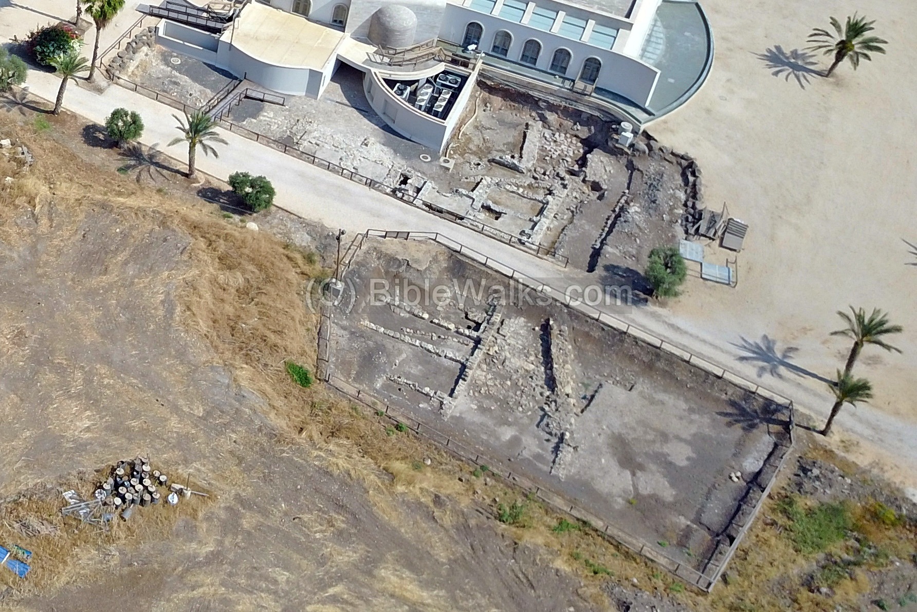
(c) Early Roman city (north):
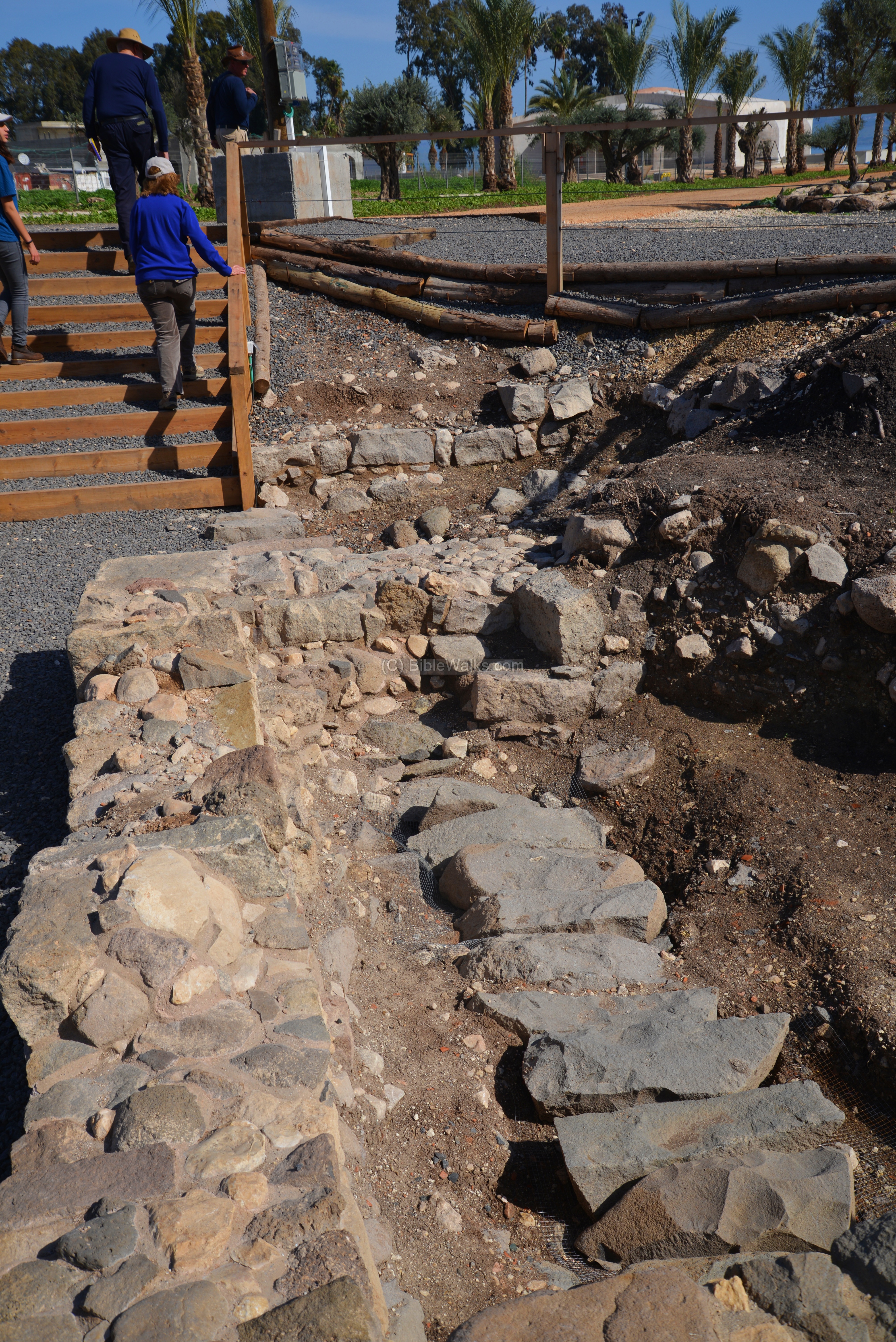
The archaeologists in the 1970s also excavated the northern parts of the ancient site – north of the Byzantine monastery. They revealed sections of paved Roman streets, a Roman period villa, public structures, aqueduct and water supply systems. Another remarkable finding was a mosaic depicting a sailing vessel.
New excavations were conducted in years 2009-2013, expanding the excavation of the Roman city north of the Franciscan walled area. The new areas were marked as ‘A‘-‘G‘-‘B’-‘C‘-‘D’, and are detailed below. The major settlement strata were Hellenistic (stratum 4 – few remains), Early Roman (stratum 3 – majority of remains), Late Roman (stratum 2 – few remains) and Byzantine (stratum 1 – some remains).
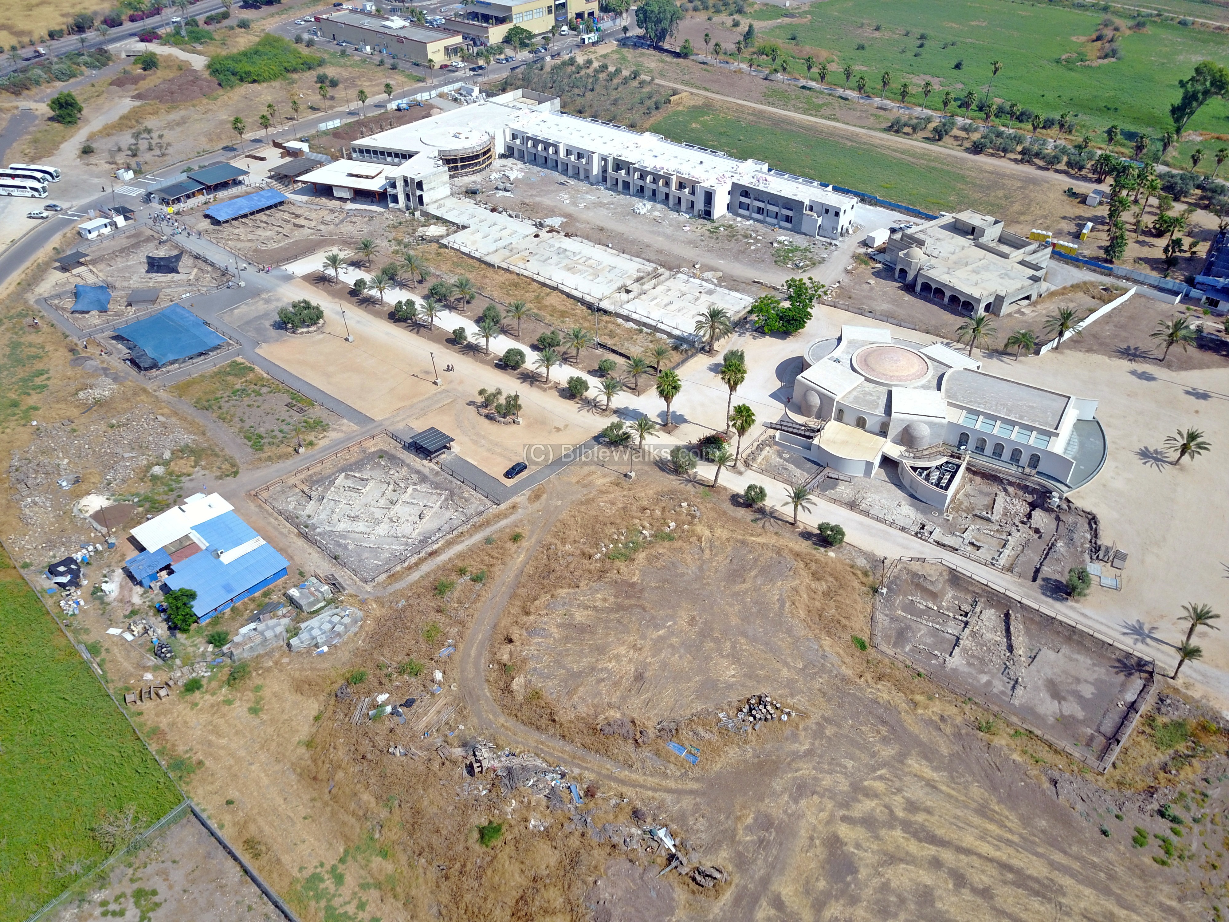
An aerial view of the north section is seen here, with the excavations areas on the lower side and the newly constructed spiritual center on the upper side.
The following sections describe the highlights of the excavation areas.
(c1) Area ‘G’:
Area ‘G’ is located closer to the Byzantine monastery, and consists of 3 areas: G-64 (2010), G2 (2011) and G-28 (2012).
An aerial view of Area ‘G’ is seen here from the south east side:
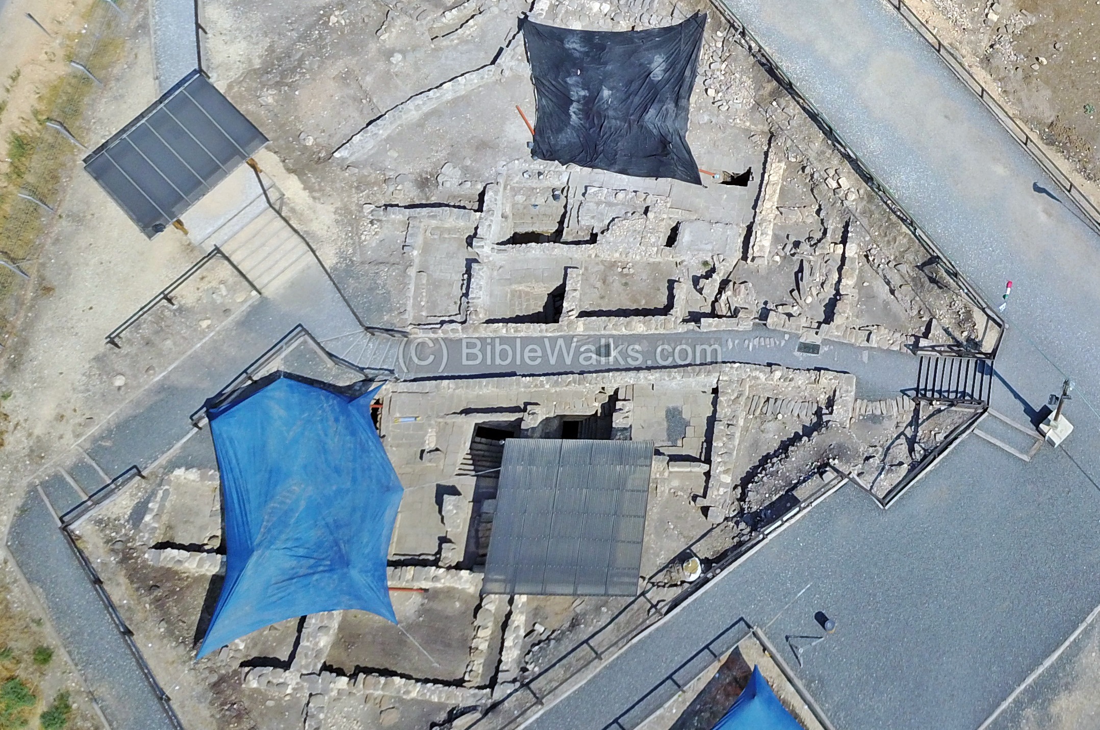
- Area G-64 (2010):
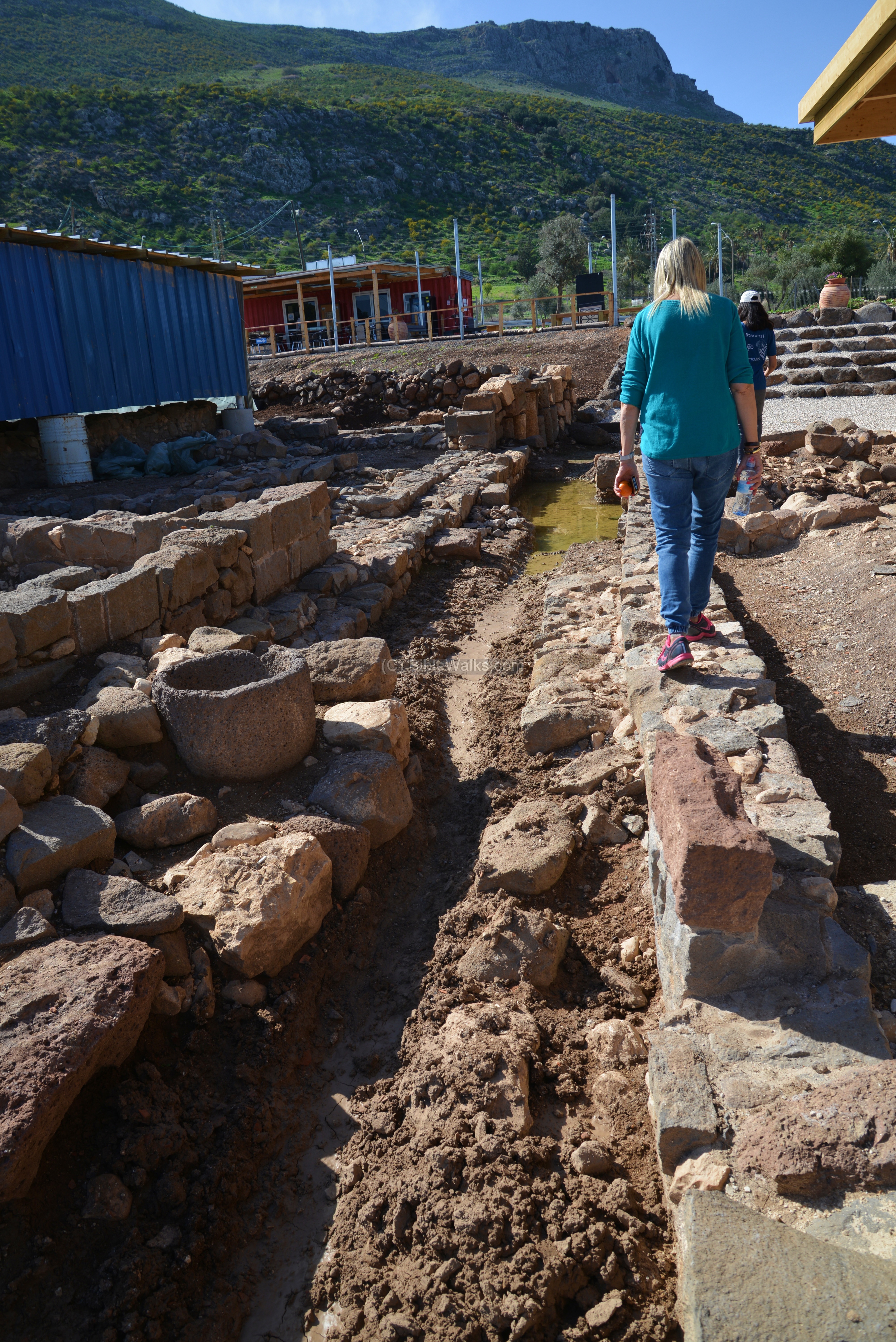
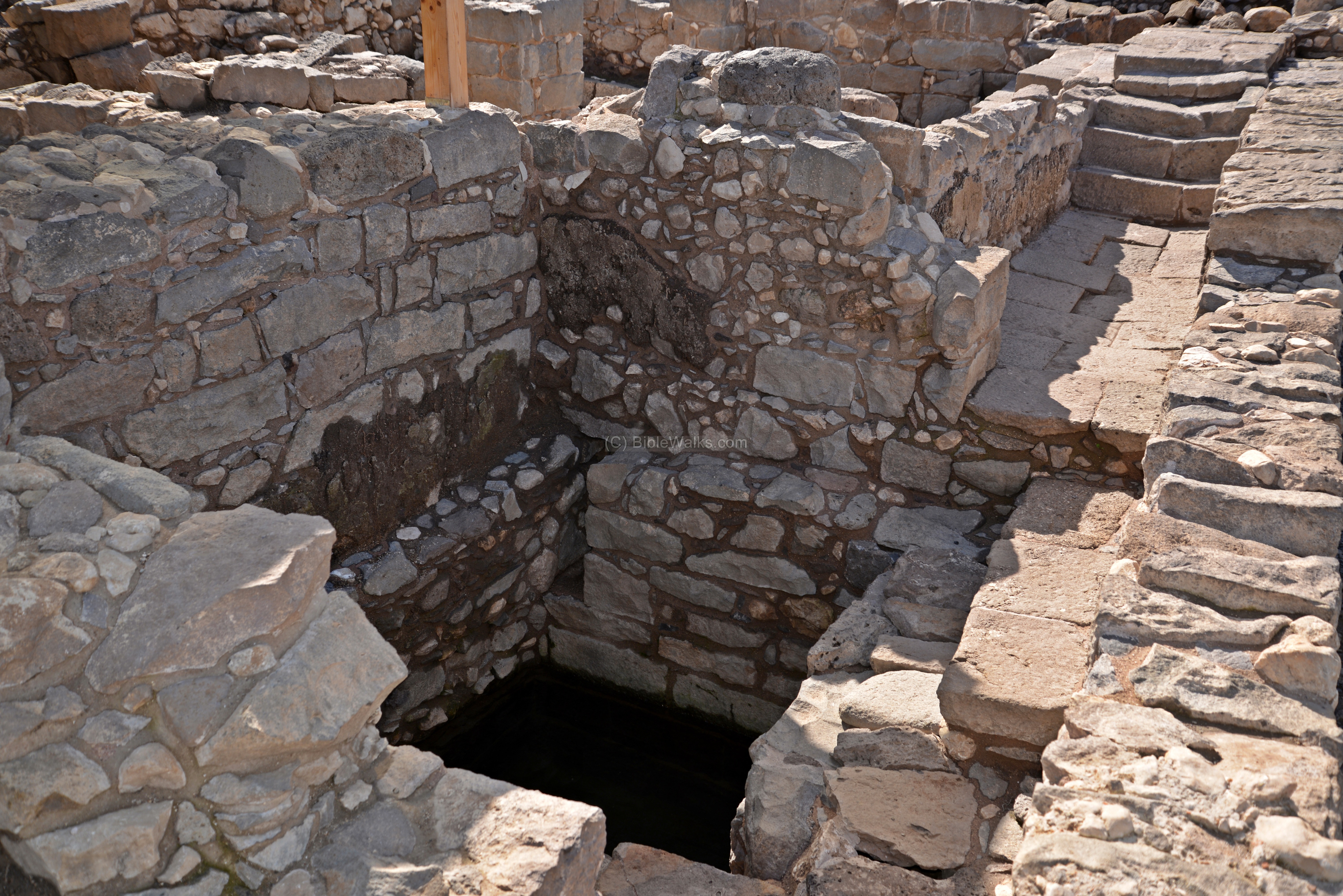
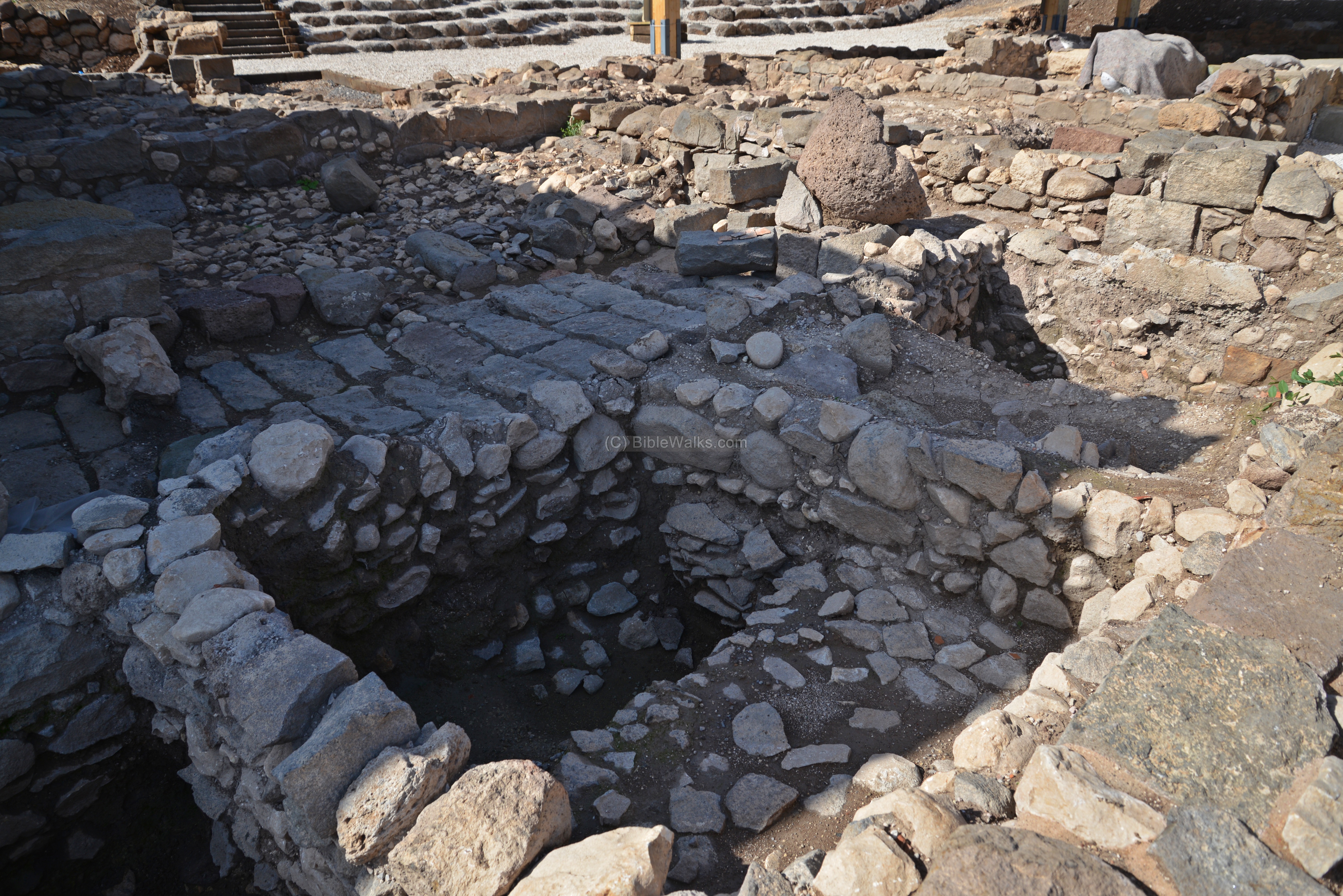
In this area are three interconnected ritual baths (Hebrew: miqva’ot – plural of miqveh). These installations enabled the religious Jewish residents of the town to maintain ritual purity. Their unique feature is that they used groundwater to fill the pools rather than spring or rain water.
This photo shows the ritual baths complex from the south west side. The upper sides of the houses and walls are now gone, and only the bases of the walls remained.
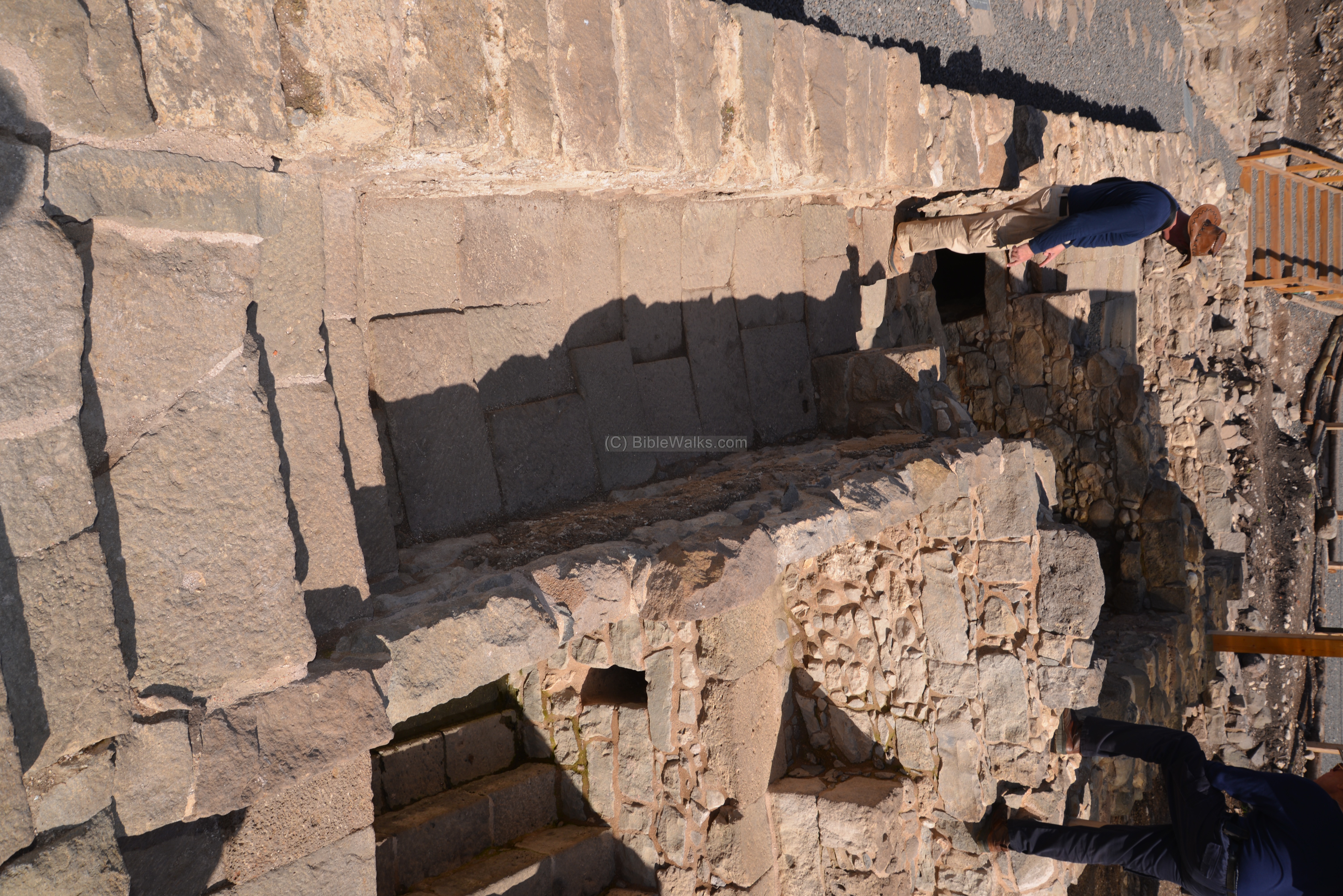
A narrow alley passes between the houses from south west to north east, as observed here between the parallel walls (W46, W49) that cross from right to left. The three pools in houses located on both sides of the alley – one on the western side of the alley (Miqveh #2,seen on the bottom right) and other two (#1, #3) within a single house on the other side of the narrow alley.
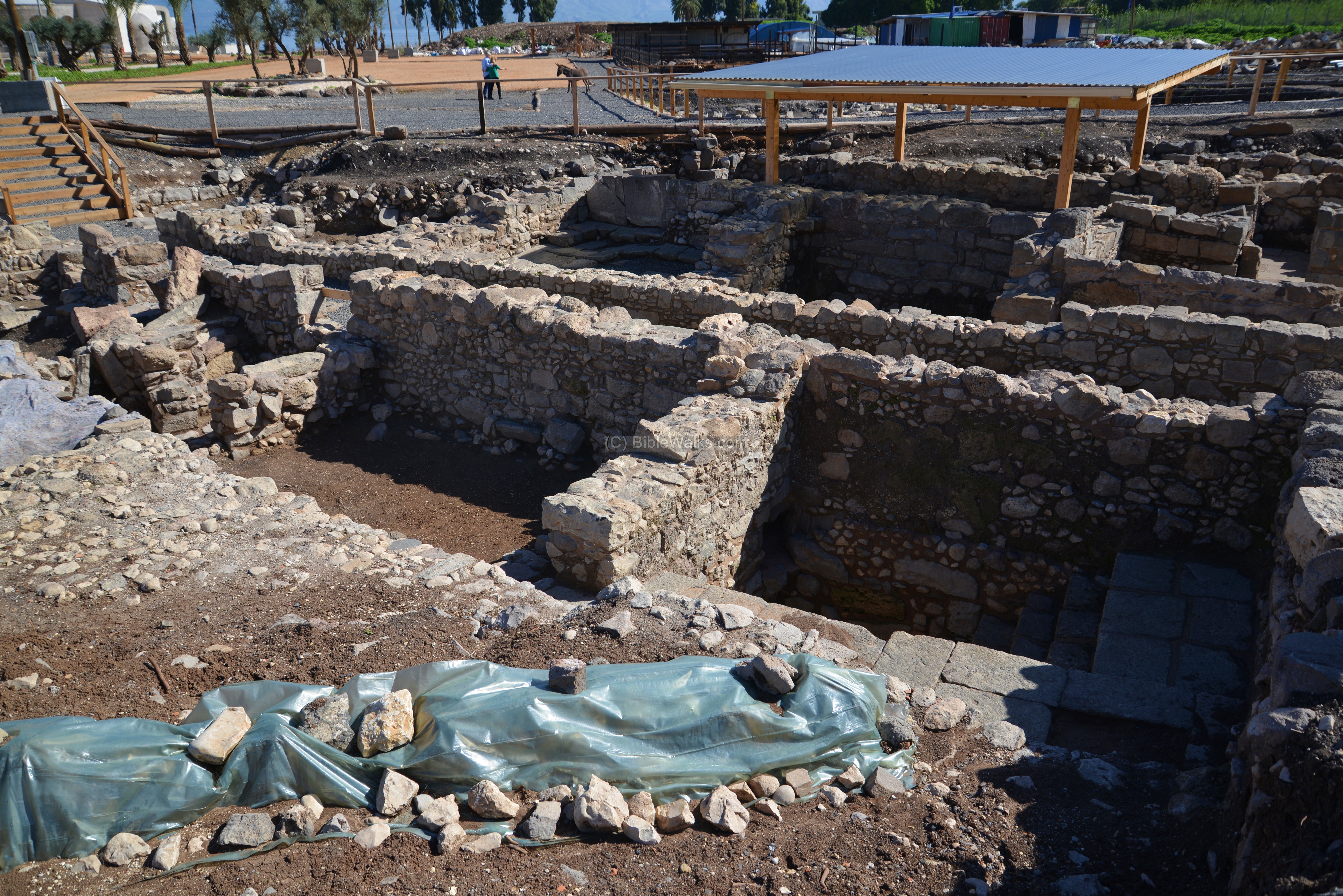
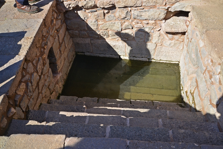
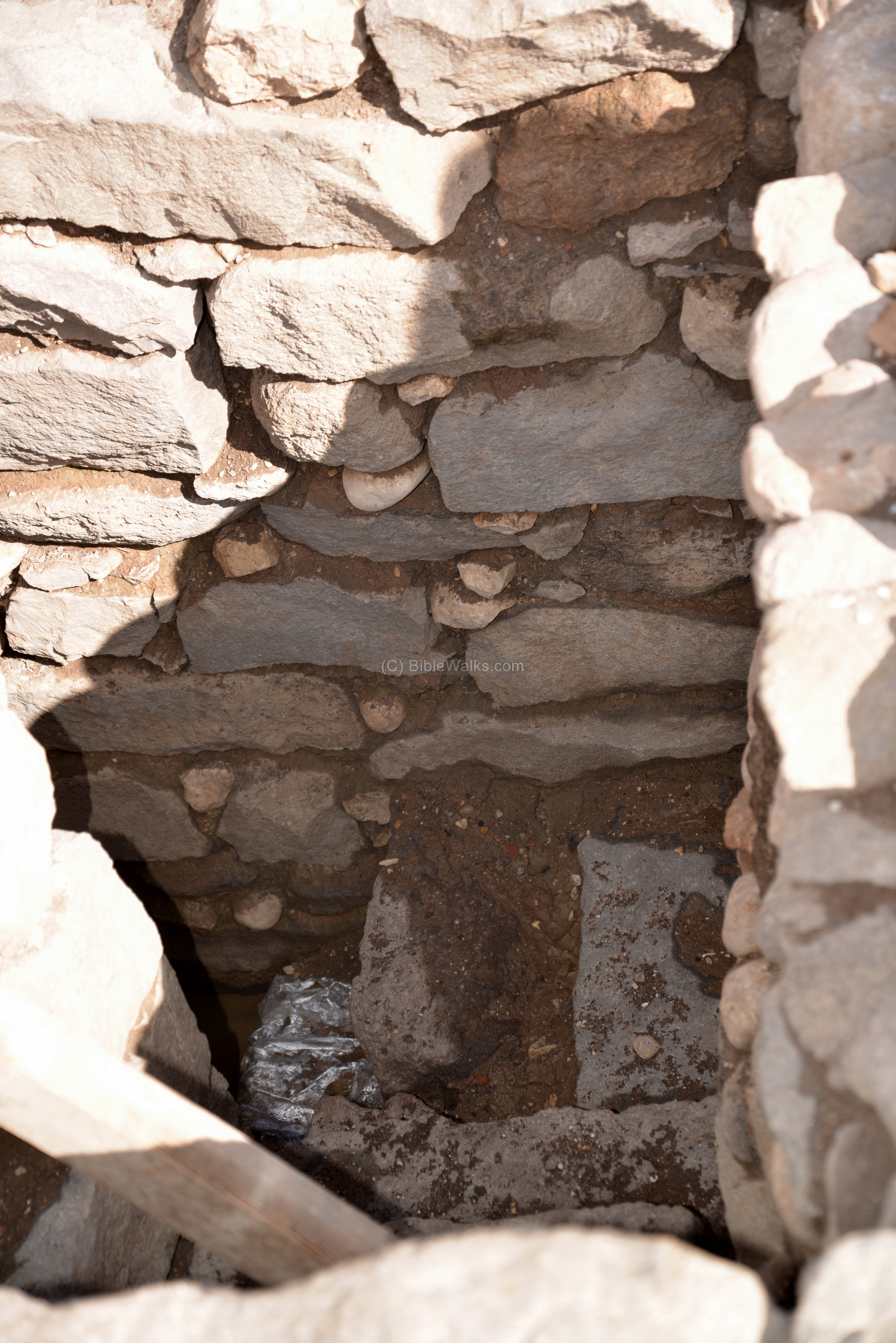
All three pools are similar in plan and design: steps lead down into the immersion pool, which is filled by the high level of the ground water. Steps lead down into the water.
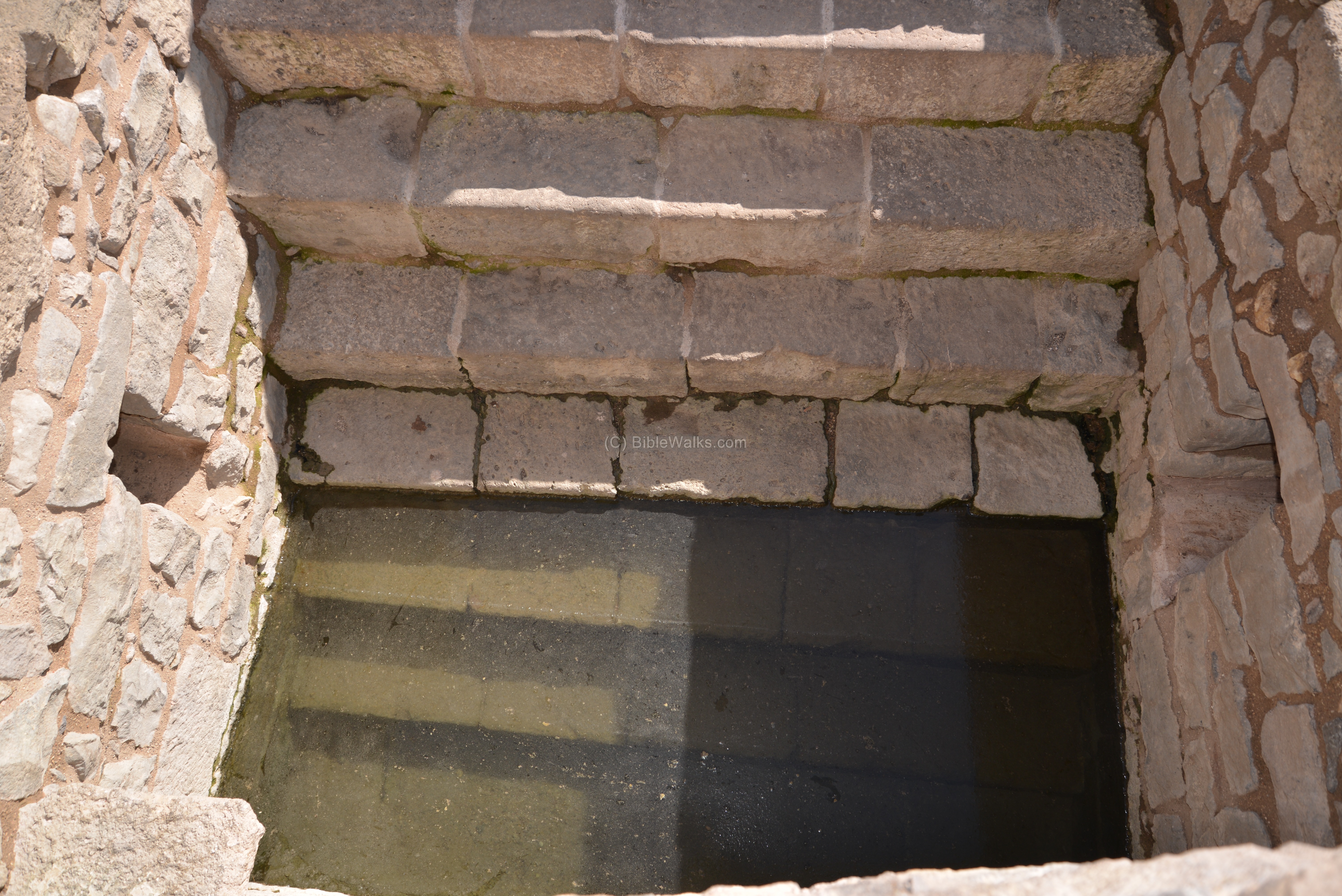
Miqveh #1 is in the south east side of the alley. It is accessed from a paved area within a house, then 7 wide steps lead down into the bottom of the pool. The are of the pool is 2.15 x 2.3m and it is 2.0m deep. The maximum volume of water is 4.9m3. The ground water enters through 20cm by 30cm openings on both side walls.
The miqveh is entered from a paved hall on the western side of the house, that connects both baths within the house. Behind the external wall of the house, on the left side, is the narrow alley between the houses.
The lower walls of the pools are constructed of small fieldstones, with a fill of earth and stone chips between them, but are not plastered. Only the walls above the water level are plastered. This unique construction is since the water enters through the walls and channels, while in all other ancient Miqva’ot the pools are sealed in order to prevent loss of their waters.
Furthermore, the groundwater type of Miqveh does not need a drainage channel, as the waters flow on through the unsealed walls.
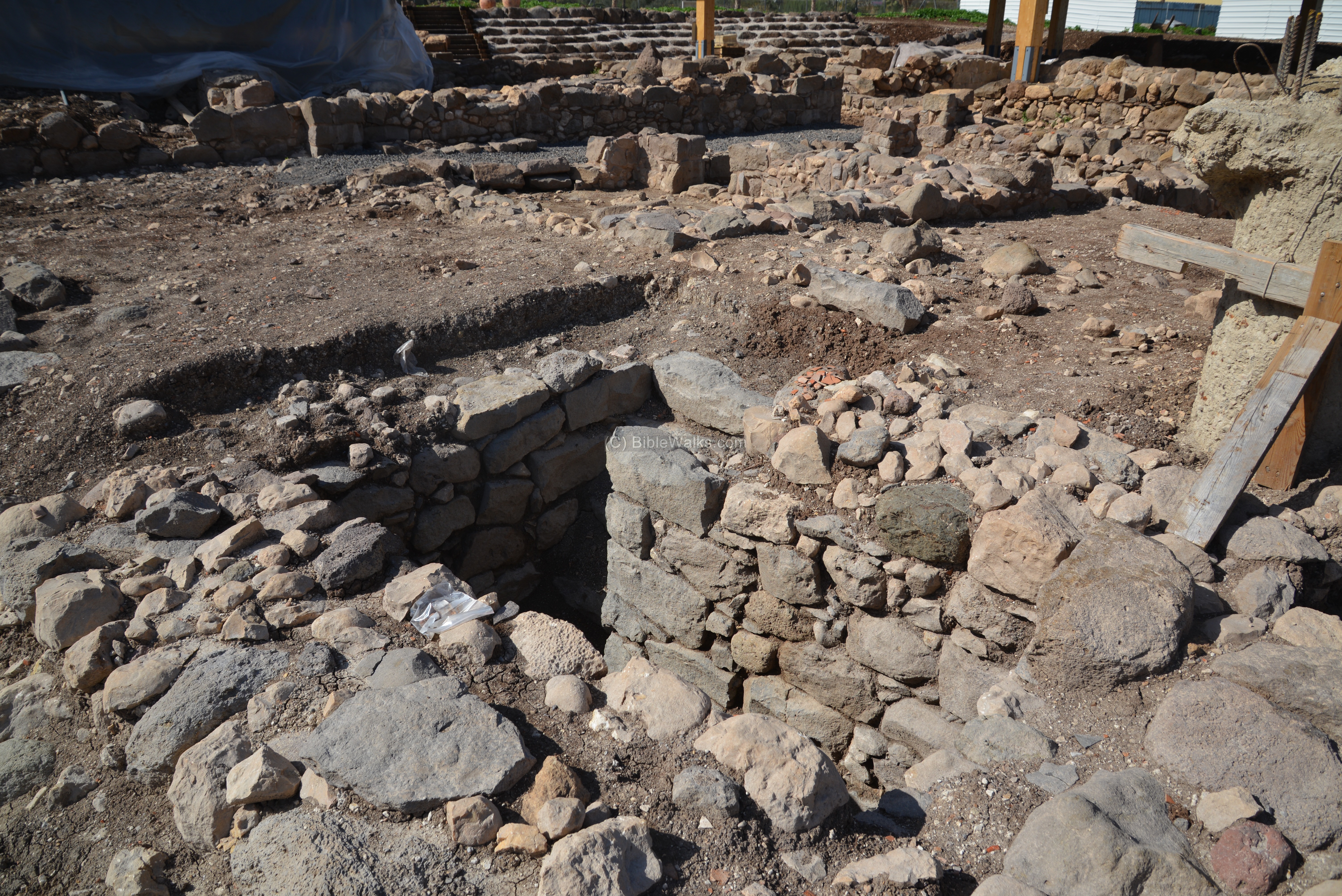
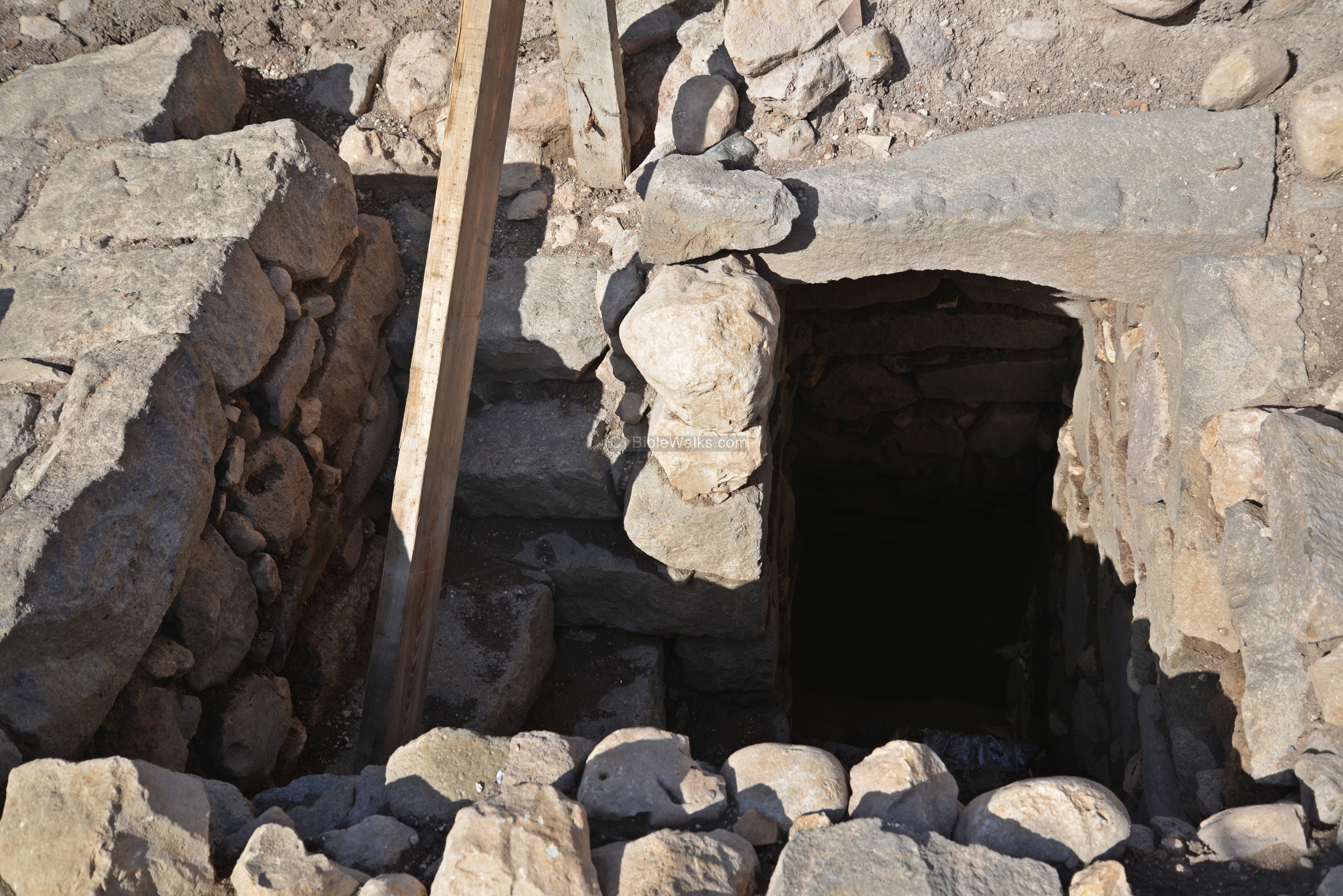
Miqveh #3 is located in the same house, to the north of #1. The following photo shows a view from the north side.
A closer view of Miqveh #3, also with seven steps:
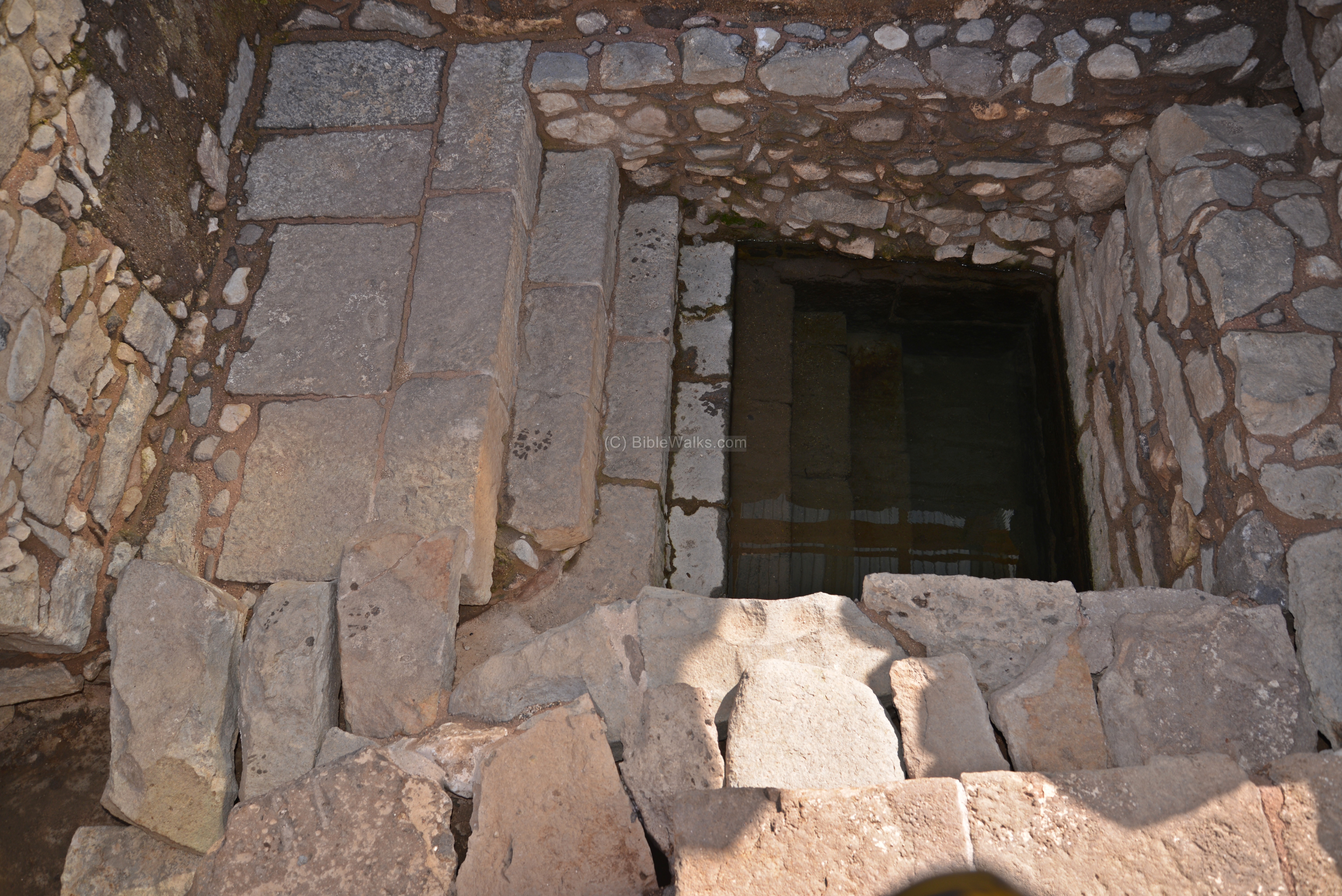
Next is yet another view of Miqveh #3. A small opening on the left, above the third step, functions as an overflow outlet. It carries the rising water to an overflow channel along the adjacent alley. Such overflow channel is required, since during heavy rains the excess ground water could have flooded the house. Similar overflow channels could be found in pools fed by flood waters, such as in Qumran.
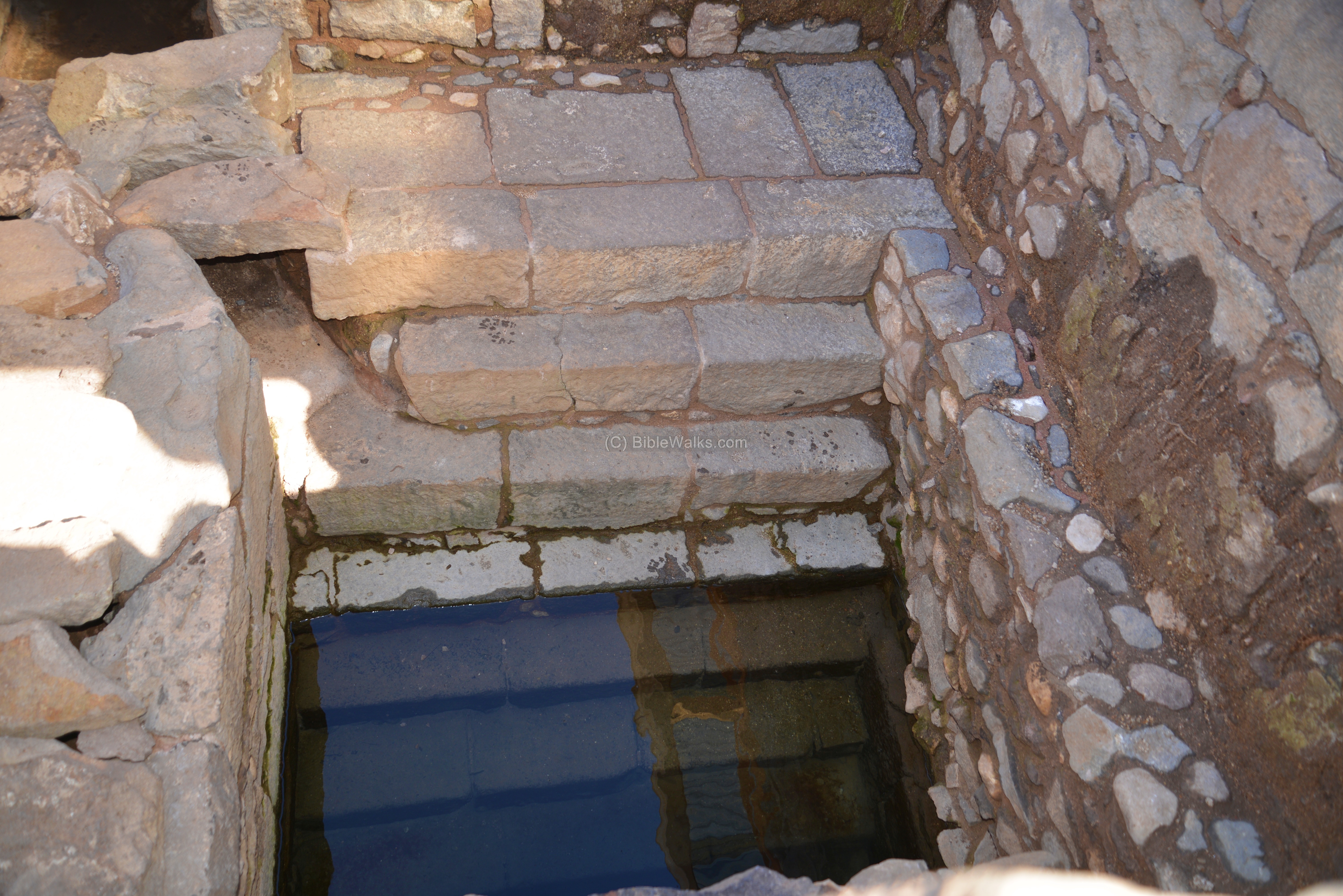
The access to Miqveh #3 is from a room with paved area on its north side.

The floor of the inner room is paved with a mosaic floor. In order to protect it, a roof was constructed over the floor.
Next is Miqveh #2, which is located inside another house, on the western side of the alley:
The tour of the archaeological park continues from this section to the east side, closer to the beach front.
Area ‘G-2’ (2011):
East of the previous area is another section of the excavation, marked ‘G-2’.
Another view from the east side is next. Notice the high cliffs of Arbel looming over the site.
(c2) Area ‘A’ (North eastern):
- Area ‘A’:
East of the section is G, closer to the sea, is Area A. It is split by the walking path to northern and southern sections.
- Area ‘A’ – North
A stone paved area was exposed on the northern section of area A, close to the shore of the Sea of Galilee. It may have been part of a north-south street. West of this street are remains of several rooms, including the basement of a large building, perhaps a storeroom. Its eastern side rested up against a 1.8m wide wall, which may have been used as a quay of the port.
- Area ‘A’ – South:
The southern section of area A has an extension of the south-north paved street and traces of walls of more buildings.
Notice a building on the far left. This is part of the enclosed Franciscan compound.

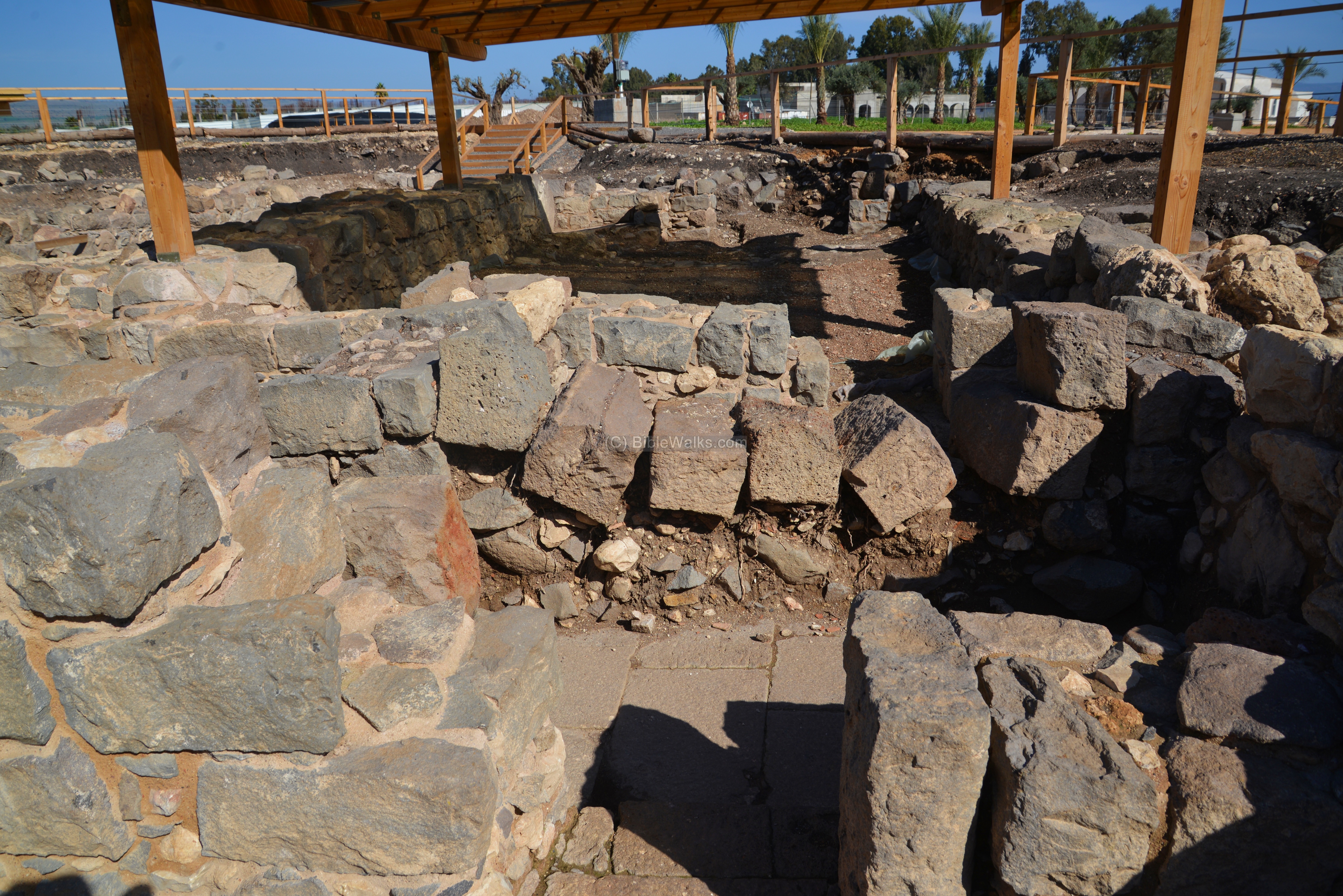
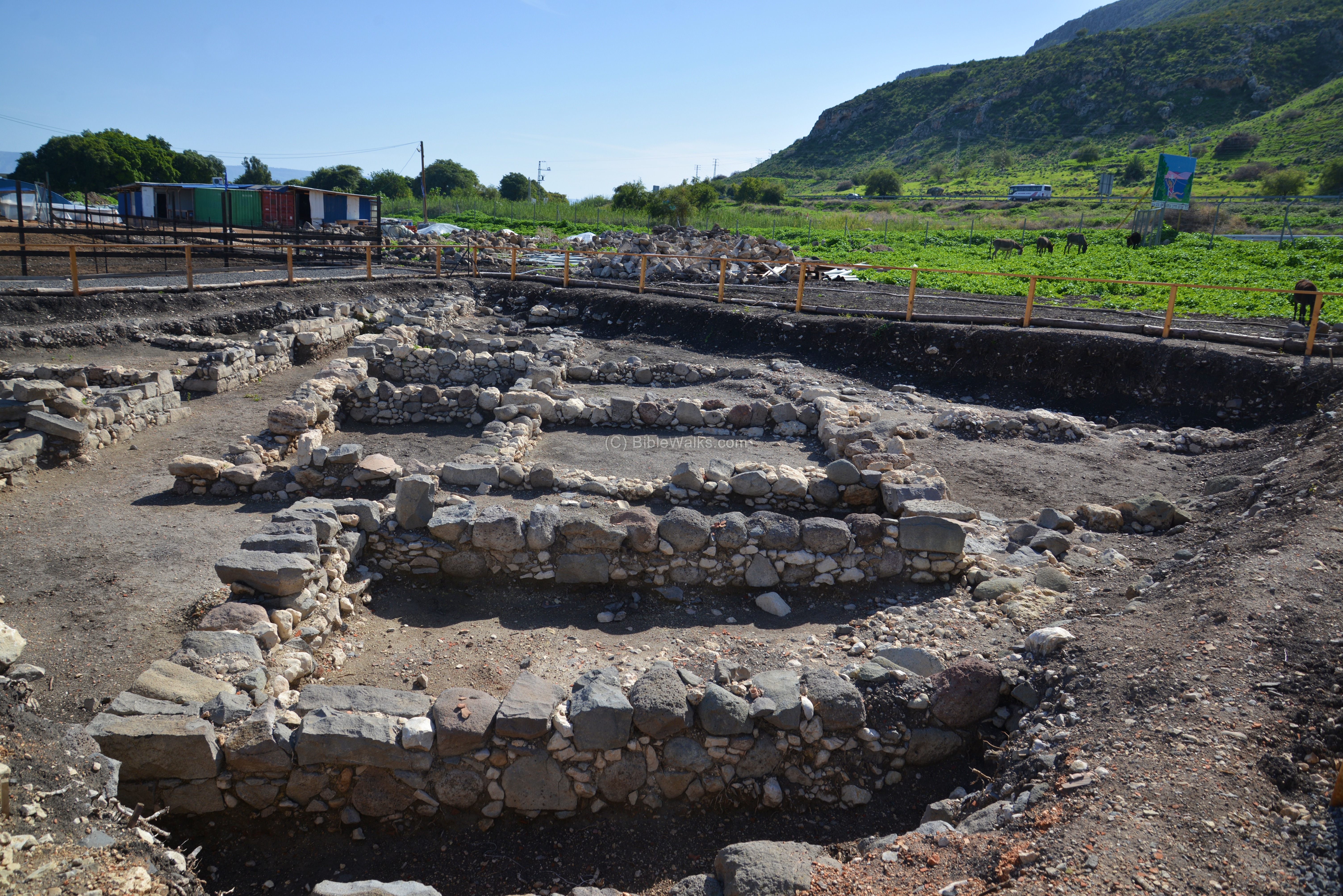
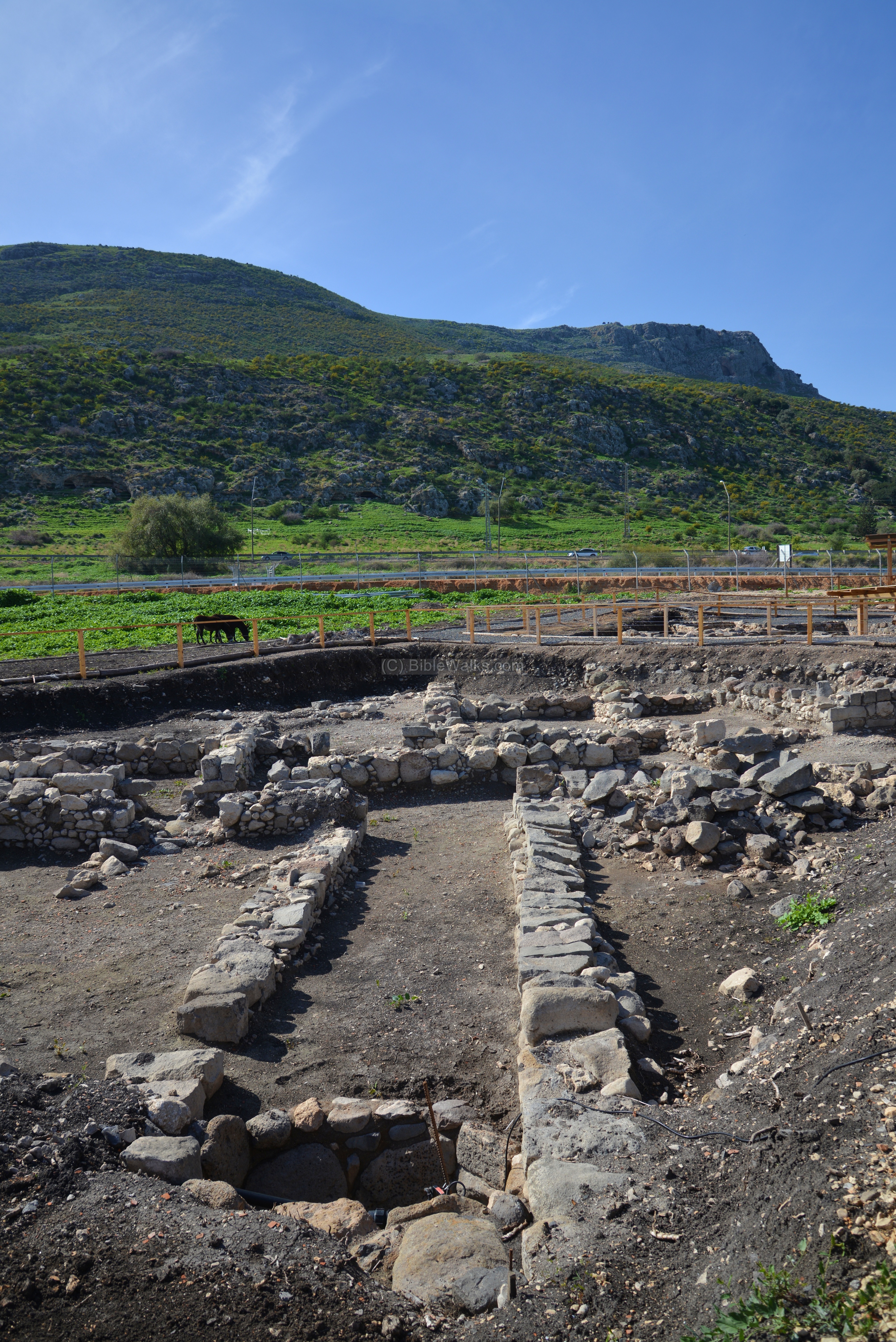
(c3) Area ‘C’ (North western):
On the north western side of the settlement, 500m west of area ‘A’, is area ‘C’ with Early Roman period structures.
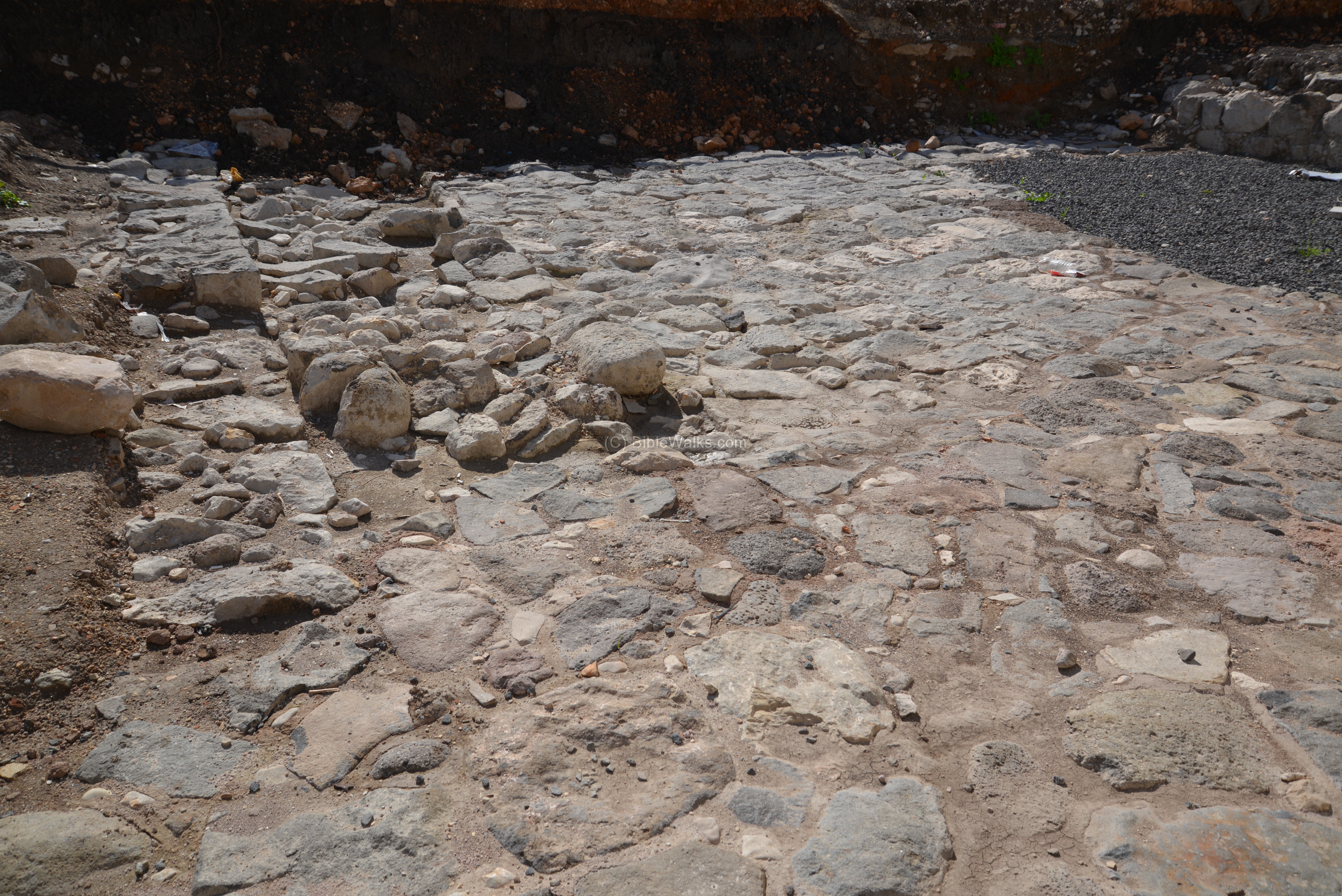
A 1.5m wide street, oriented east-west, was paved with small round stones.
On both sides of the street are remains of buildings. Four buildings were exposed in this area. They are built of roughly hewn basalt stones.
Three phases of construction were identified in the buildings.

Another view of the street from the west side:

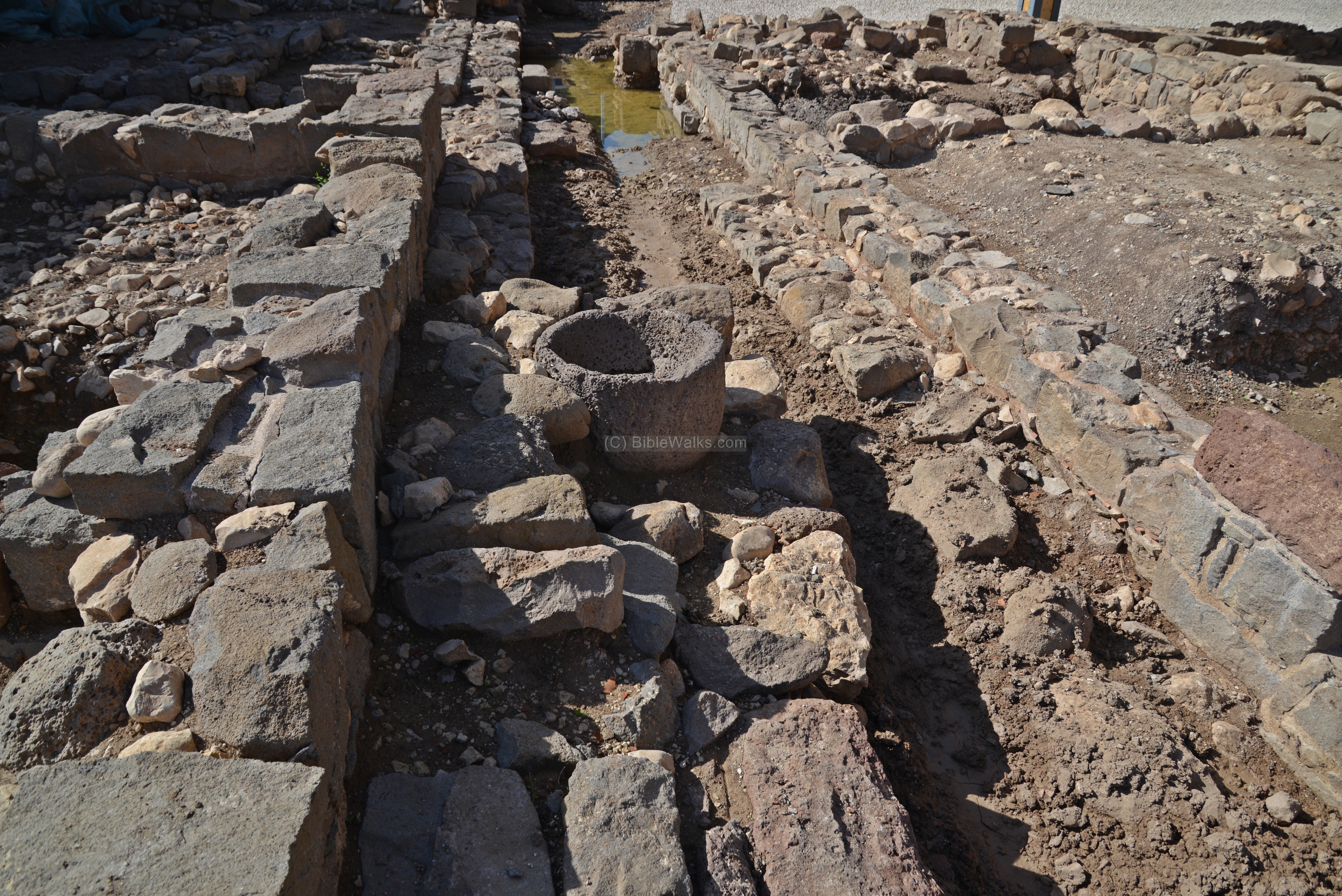
Along the buildings were square plastered pools, which may have served as part of a fish industry.
Near the pools are stepped shafts, that were flooded by the high level of stream water that flowed here.
The steps were used to descend down to the water level in order to fill up the pools.
A closer view of the stepped shaft:
Other views of the exposed structures:


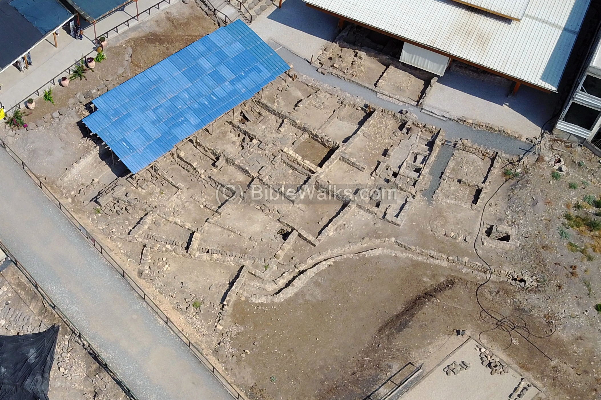
(d) Early Roman Synagogue (North West):
The Franciscan excavations in the 1970s uncovered a small Early Roman period synagogue, with a miqveh on its side. For a large Jewish town, there were probably more synagogues at that time.
Indeed, another synagogue was recently discovered in the 2009 season excavations. An Early Roman synagogue was exposed north of the Roman street, in area ‘C’. The structure was built in the beginning of the first century AD and destroyed in the middle of the century.
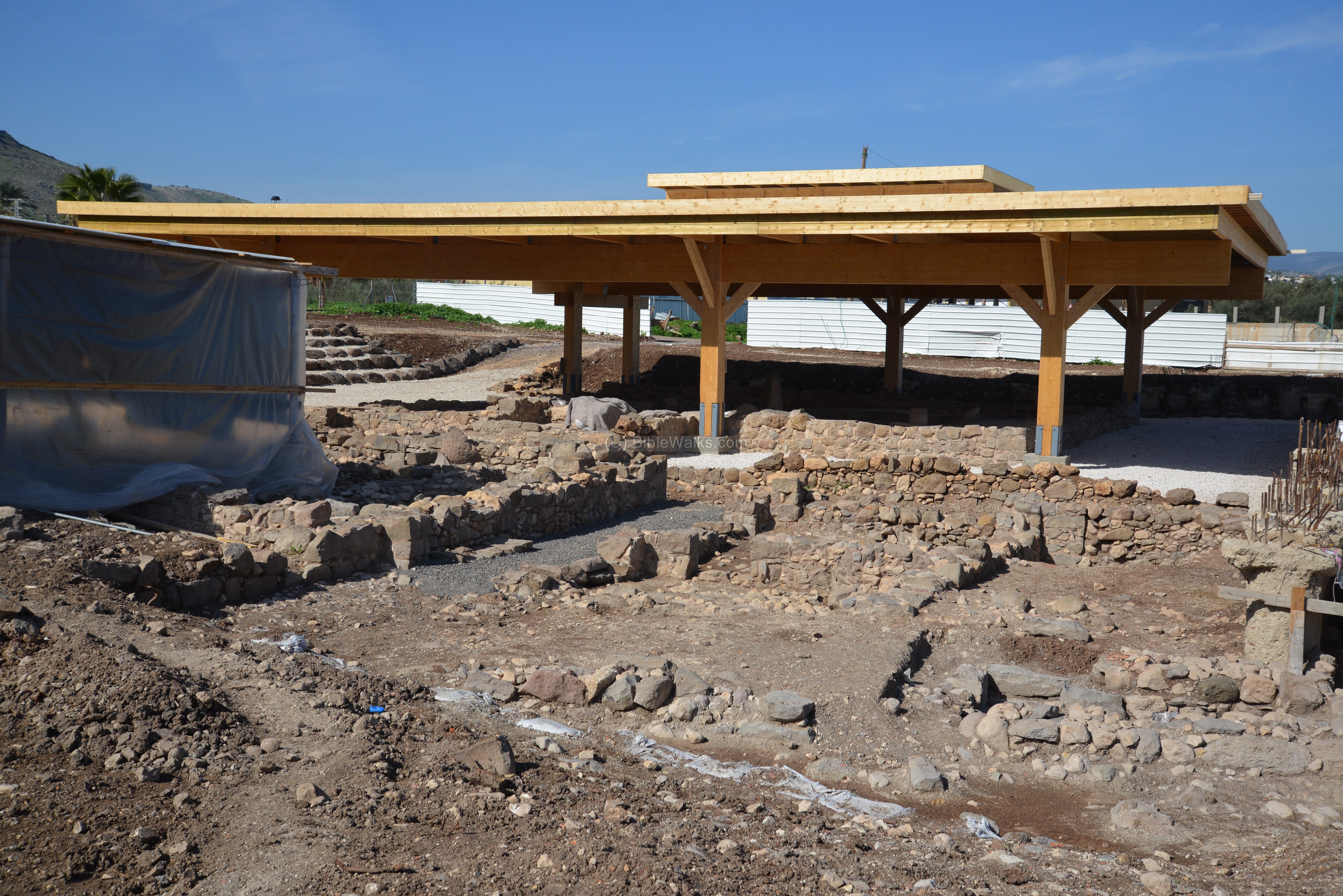
To protect the structure, a wooden roof was built over it. The complex covers an area of 120 square meter.
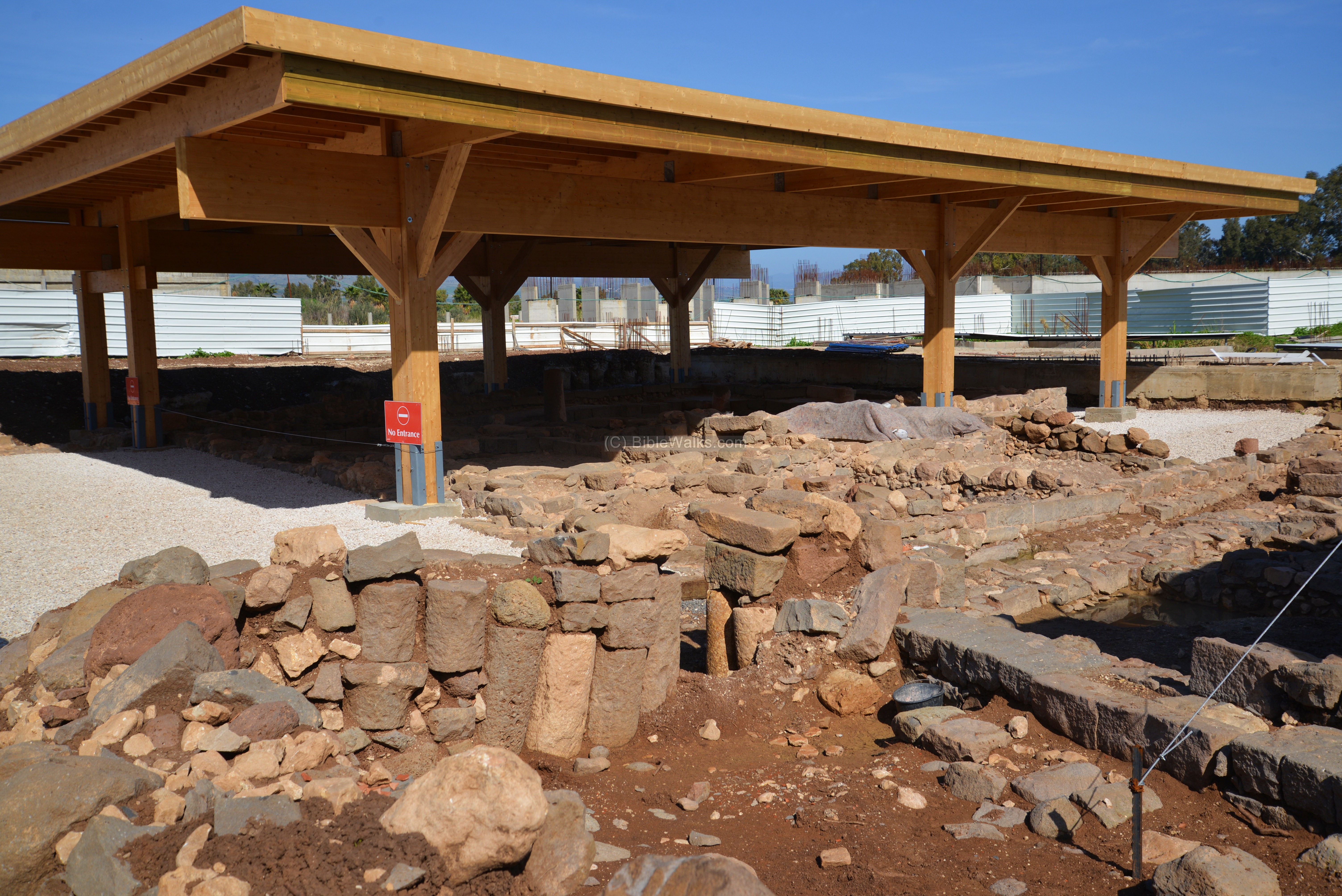
The synagogue consists of two large rooms – vestibule (on the western side) and reading room (eastern side) – and a smaller room (south western corner).

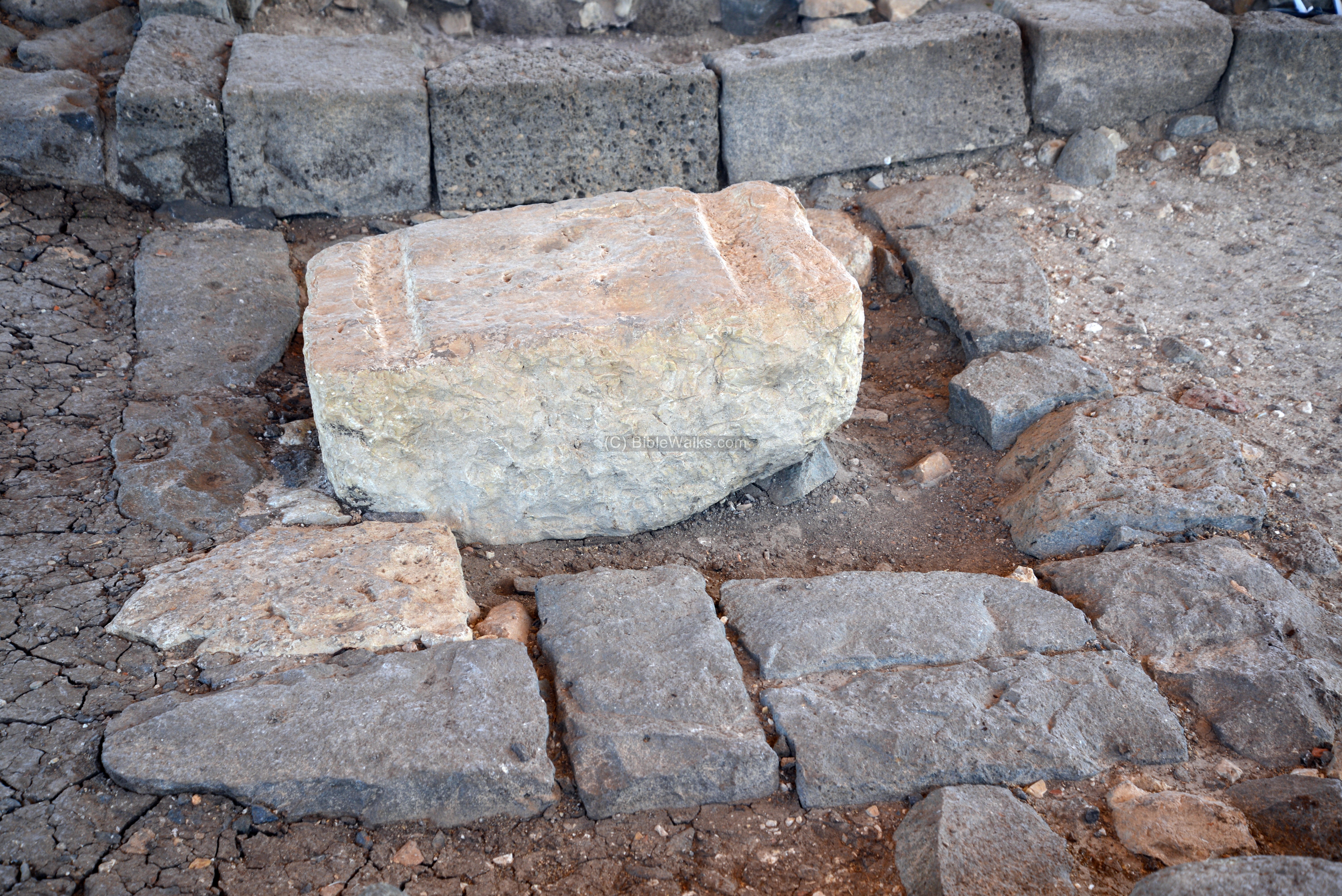
The vestibule, or hall leading into the synagogue, is the first room entered from the west. Behind it is the reading room. Its floor was based on tamped earth and crashed chalk, and was bounded by basalt flagstones.

In the center of the vestibule room lies a square limestone block. Perhaps it was used as a base of a table or chair.
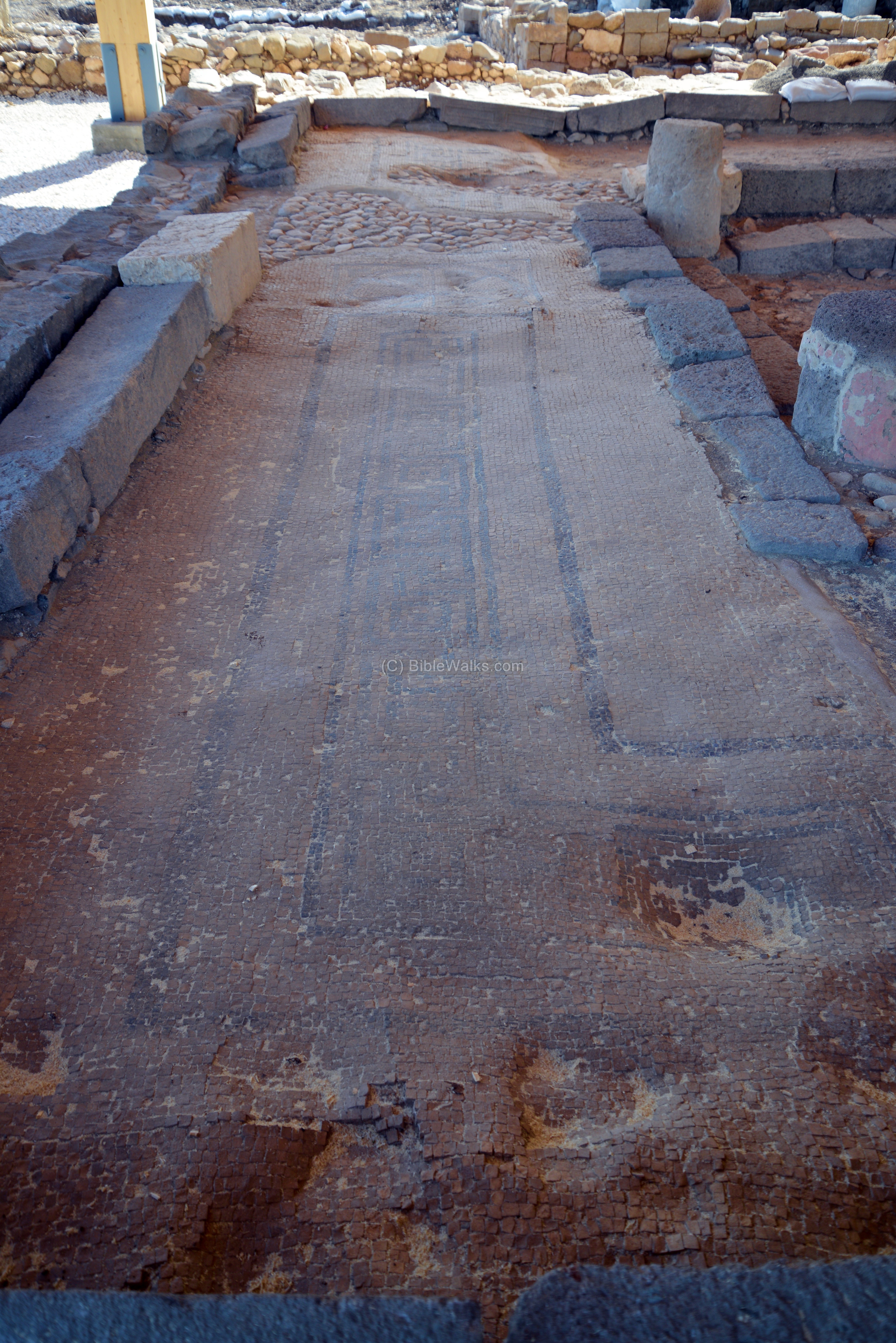
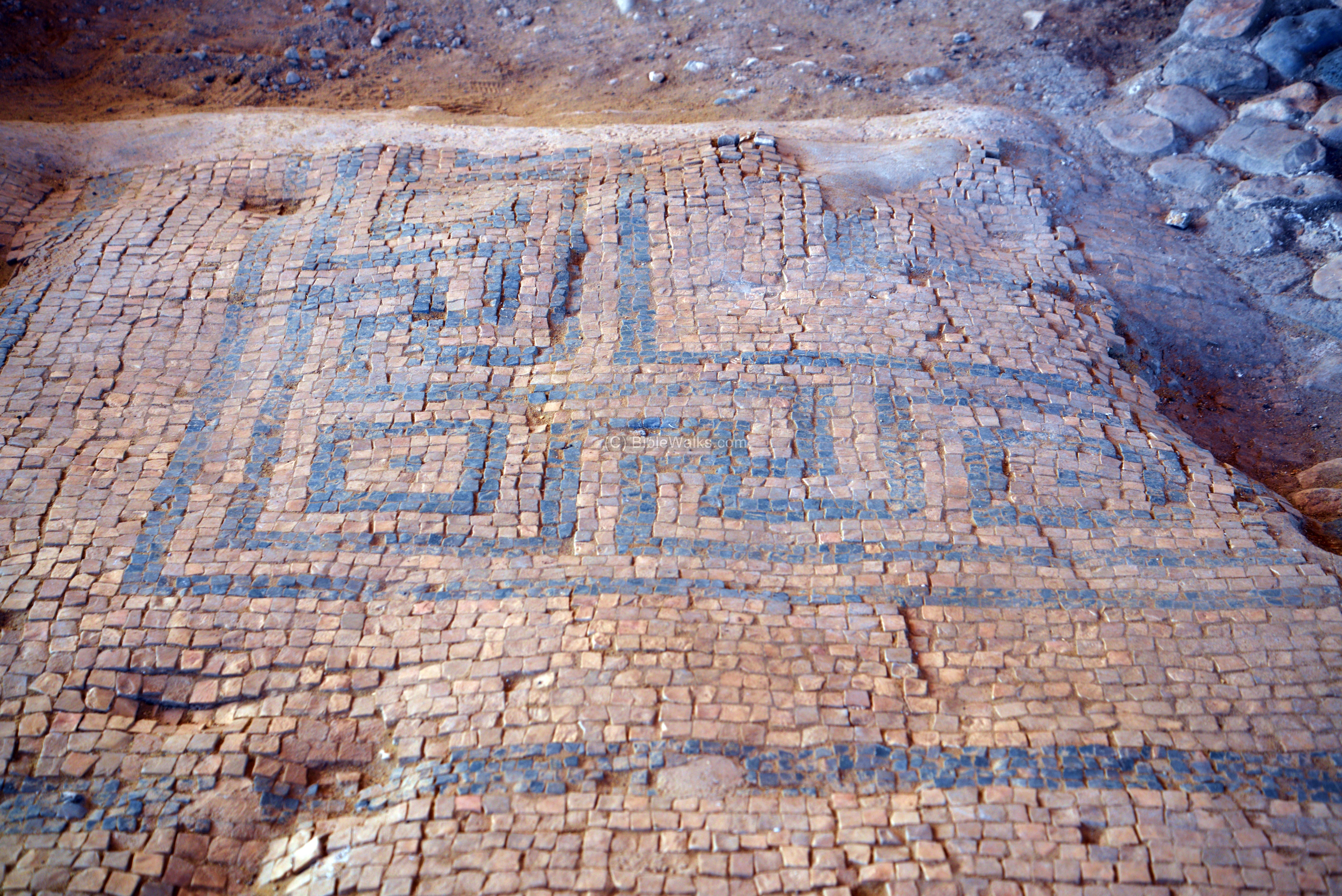
The center of the reading room is seen below, with a view towards the west. The floor in the center is made of pebbles. However, the floor may have been planned for mosaic paving but was destroyed before the job was carried out. Around the floor, on all sides, are stone benches.
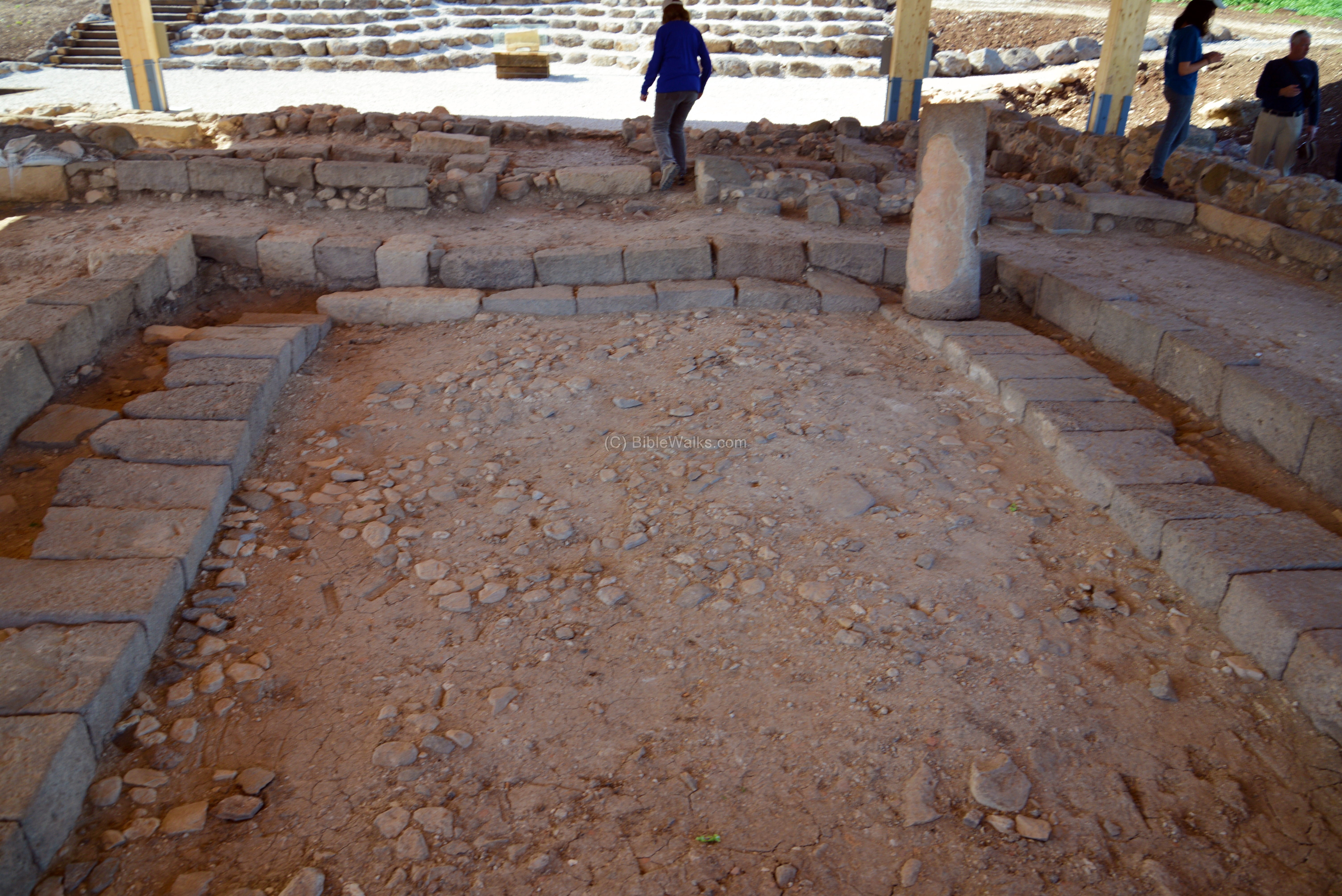
The reading room is surrounded on all its sides by a raised corridor, which is paved with a mosaic floor with geometric patterns.
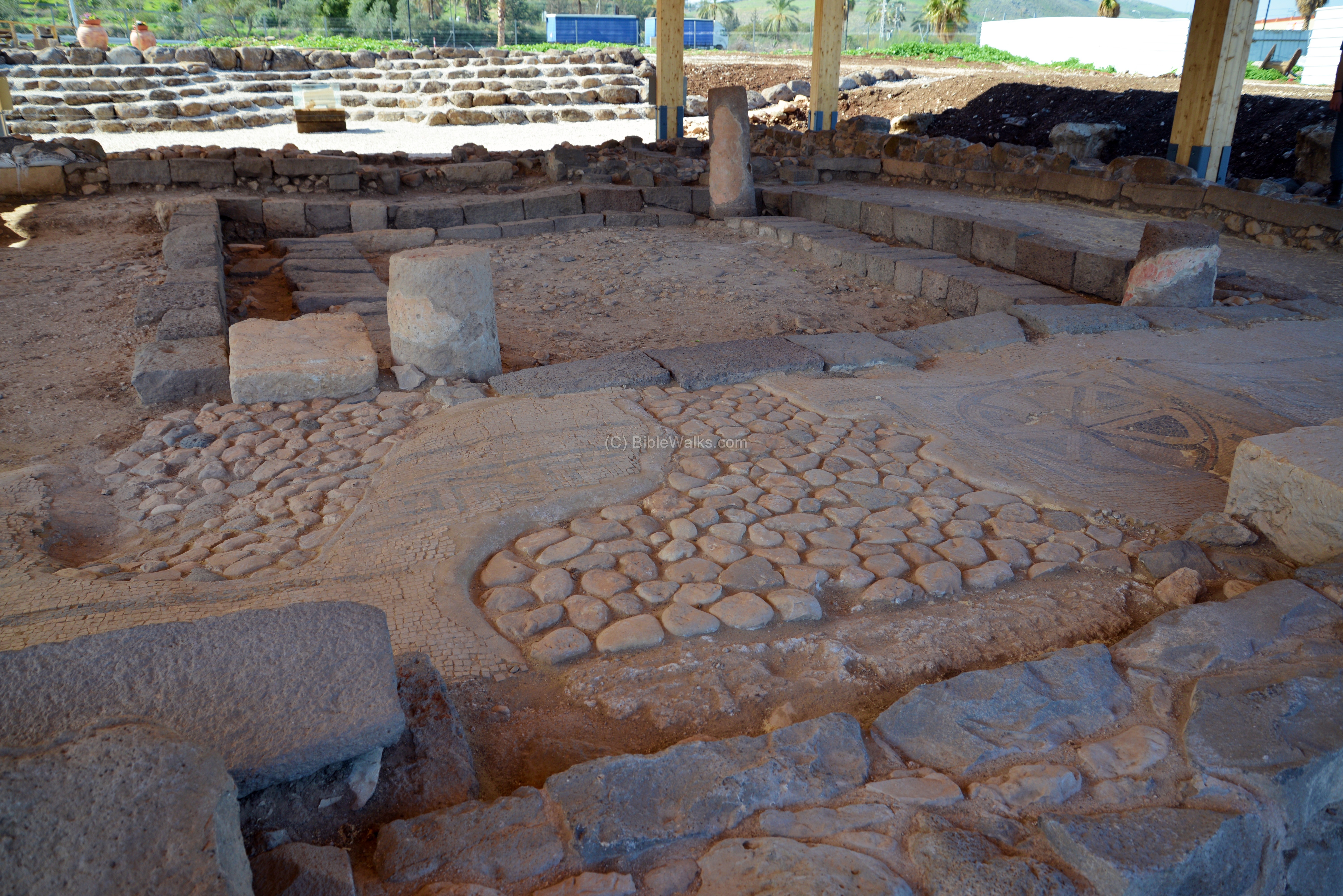
Stone bench were built against the walls, all around the corridor.
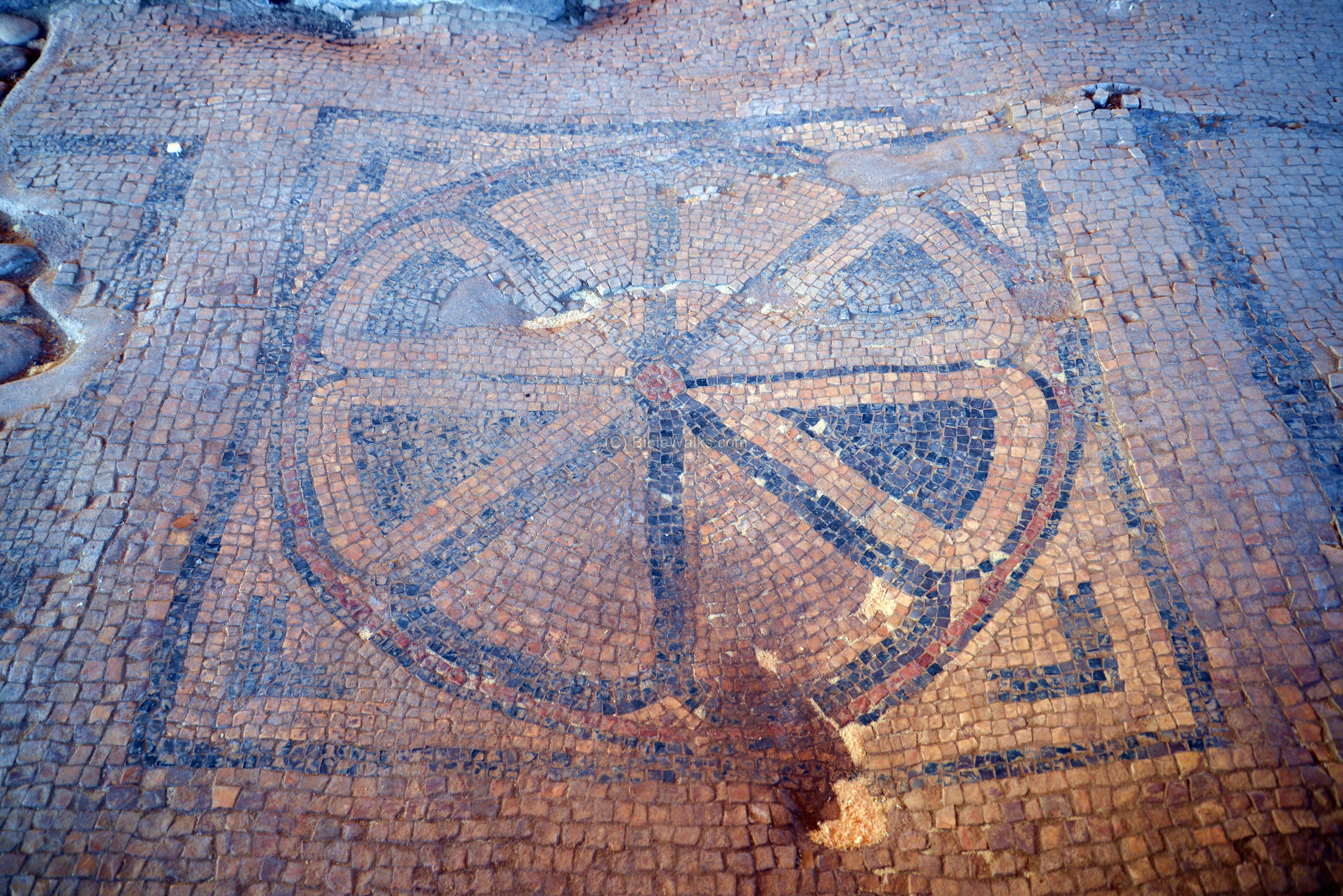
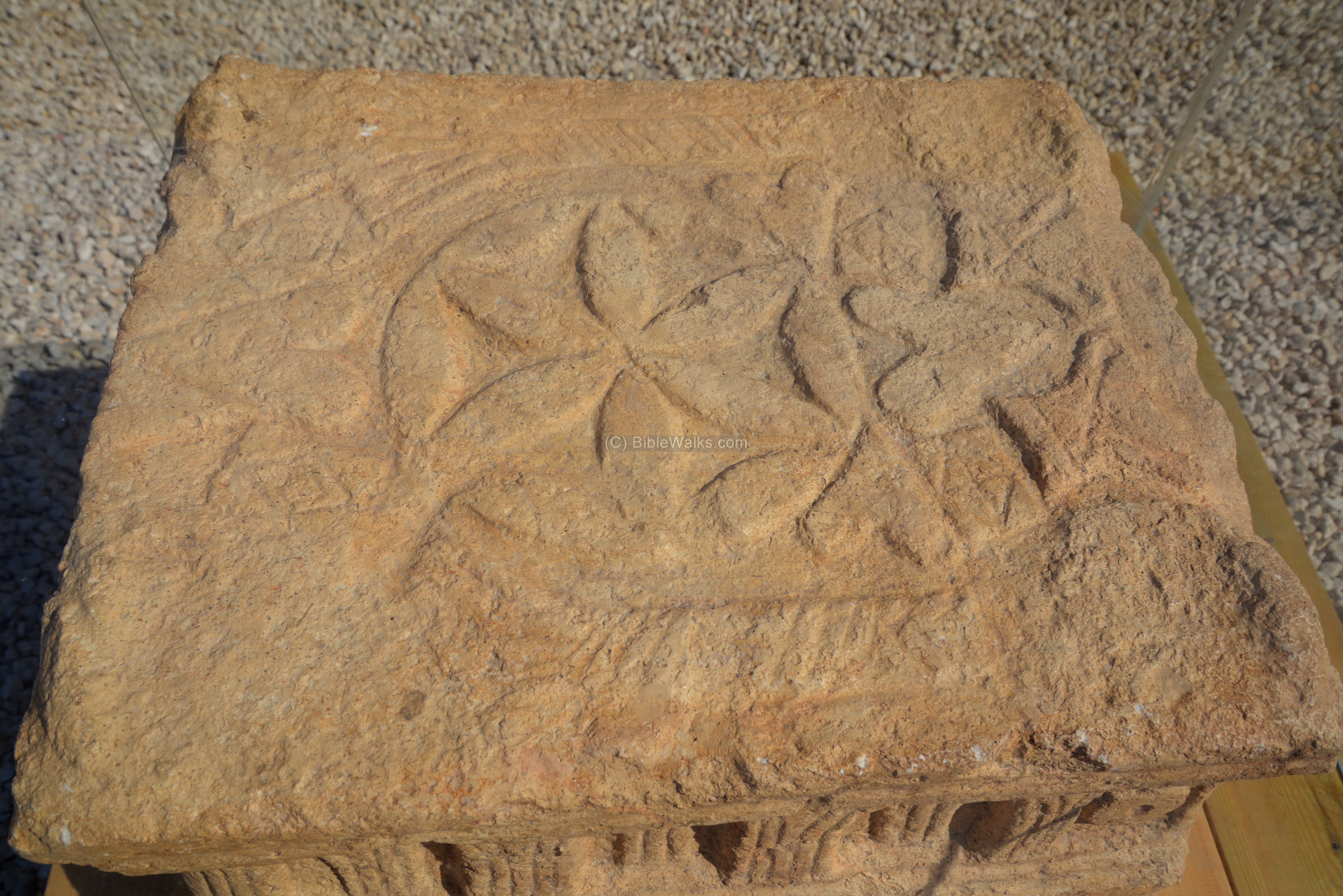
A large rosette pattern is illustrated on the mosaic floor, on the eastern side:
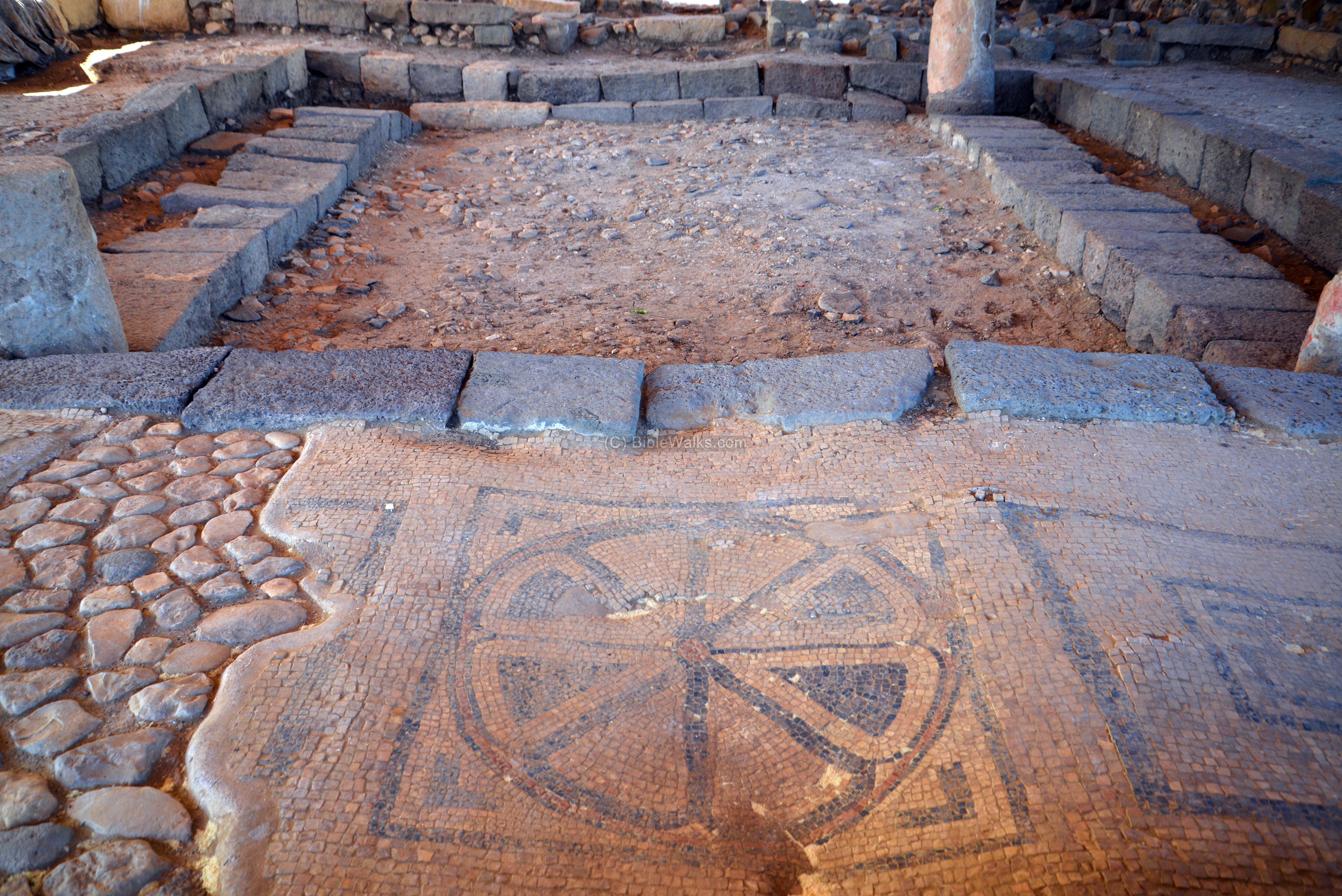
A larger view of the rosette:
Other sections of the mosaic floor have geometric patterns:
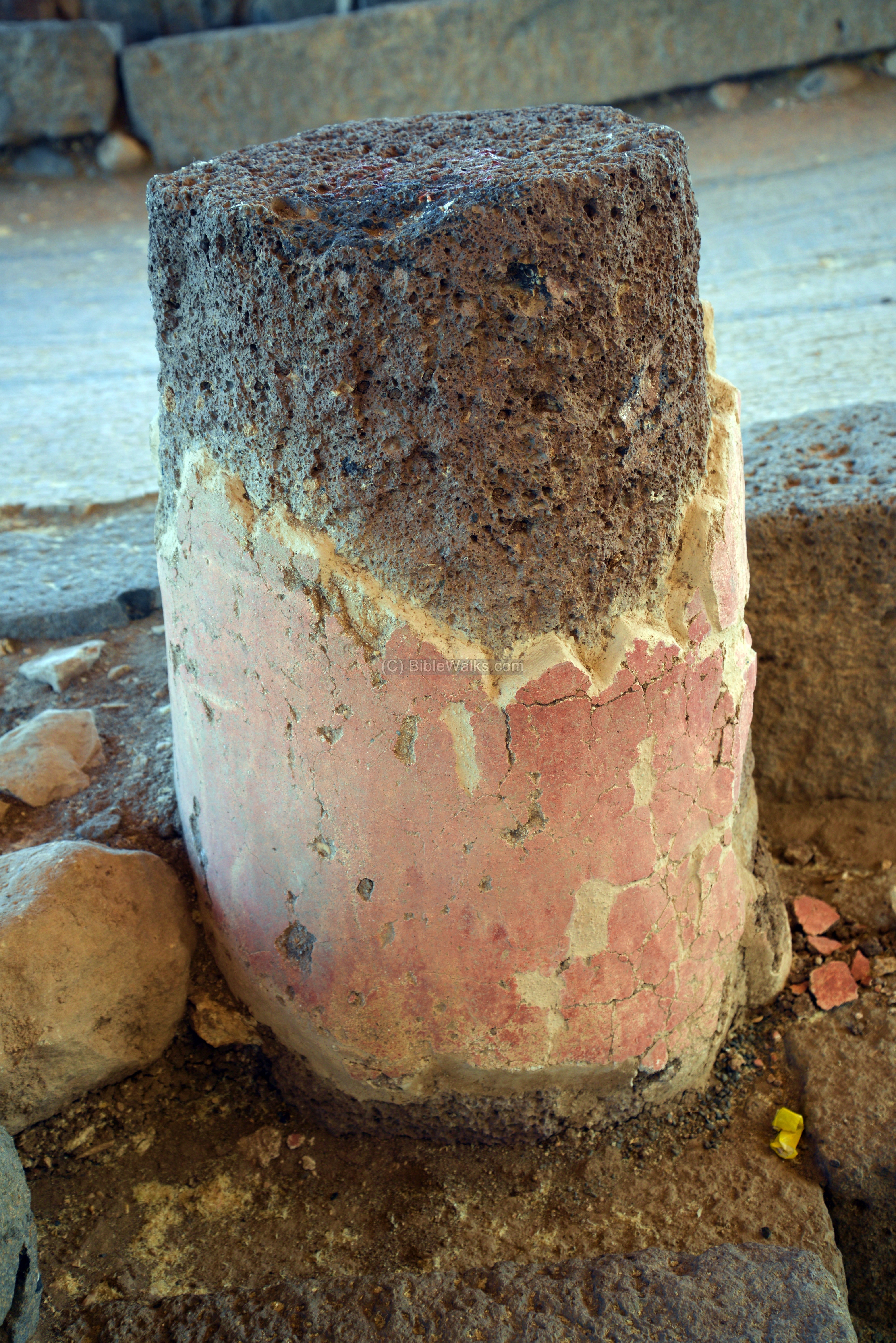
The walls and columns were covered with a colorful frescos (mural painting on a fresh lime plaster). The colors included dark red, mustard yellow and blue.
Two fragments of columns were found on the site, standing on top of stylobates (bases of columns). It was suggested that 6 columns were in the building which supported the ceiling. The ceiling was built with mortar on a base of wooden beams, and was coated with white plaster on the inner side.
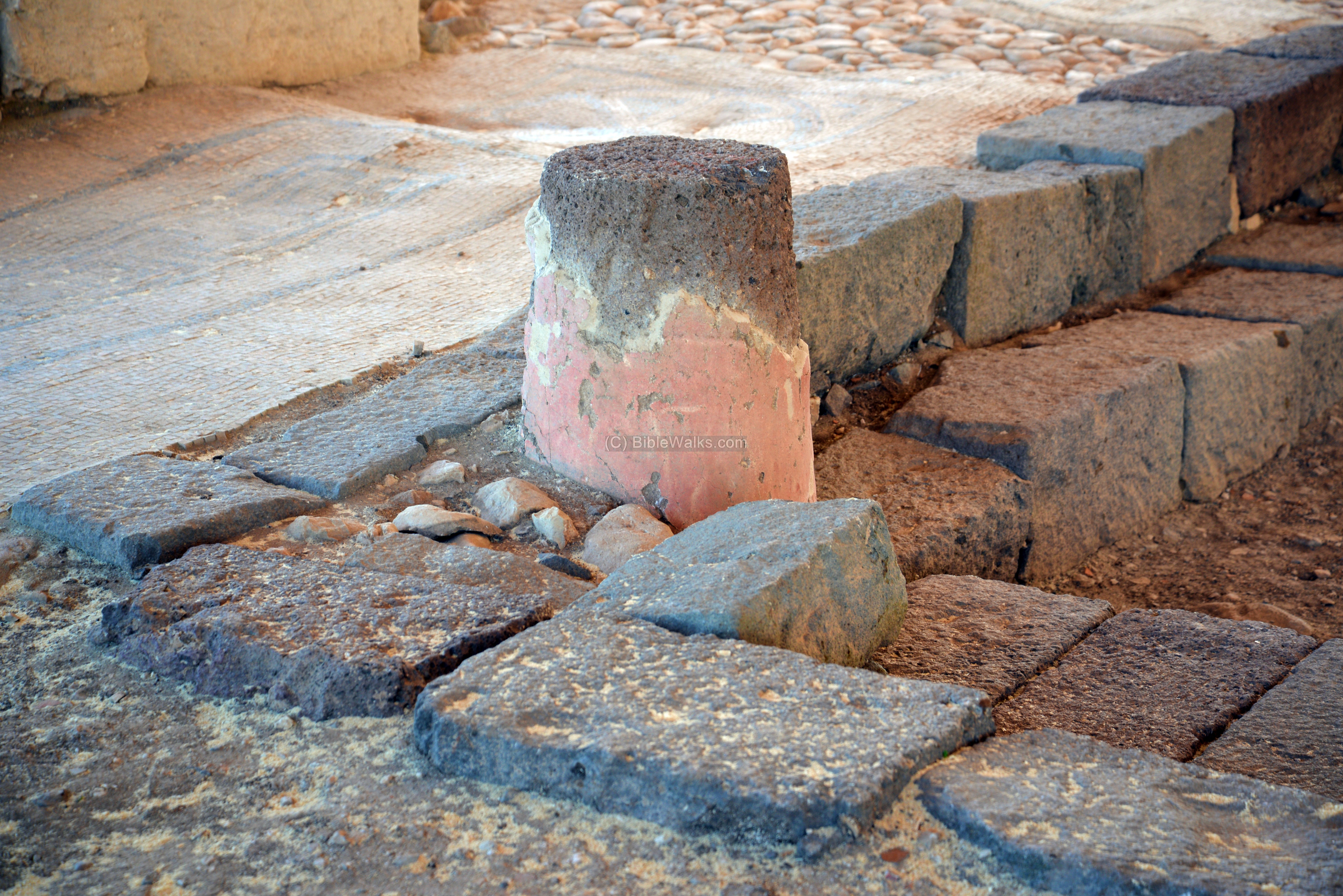
A larger detail of the colorful basalt column:
On the south western corner of the reading room is a smaller room, which is divided in two sections by a partition wall. It may have been used to store the scrolls.
-
The Magdala stone
A decorated rectangular stone was found in the room, which may have served as the base of a Torah reading table, which was set in the center of the synagogue. The stone is roughly 0.6m long, 0.5m wide and 0.4m high. It stands on four short legs. A replica is now on display in front of the synagogue.
On its short front side, seen below, are a number of carved symbols: a seven branch candelabrum (menorah), standing above a square pedestal, and flanked on both sides by two handled jugs (amphorae). The three objects are positioned under an arch which is held by two side pillars with bases and capitals.
The uniqueness of this finding is that the menorah was carved at the time it was still present in the temple in Jerusalem. It is the first appearance of the symbol in an early synagogue, and later adapted as a Jewish symbol.

The back side is shown below. It has three pillars – two side pillars and one central pillar – holding an arcade (series of adjoining arches). Below the arcade, on both sides of the central pillar, are symbols with the shape of a rosette on top and below them are 6 triangles arranged as a half circle. Above the arches are geometric shapes.
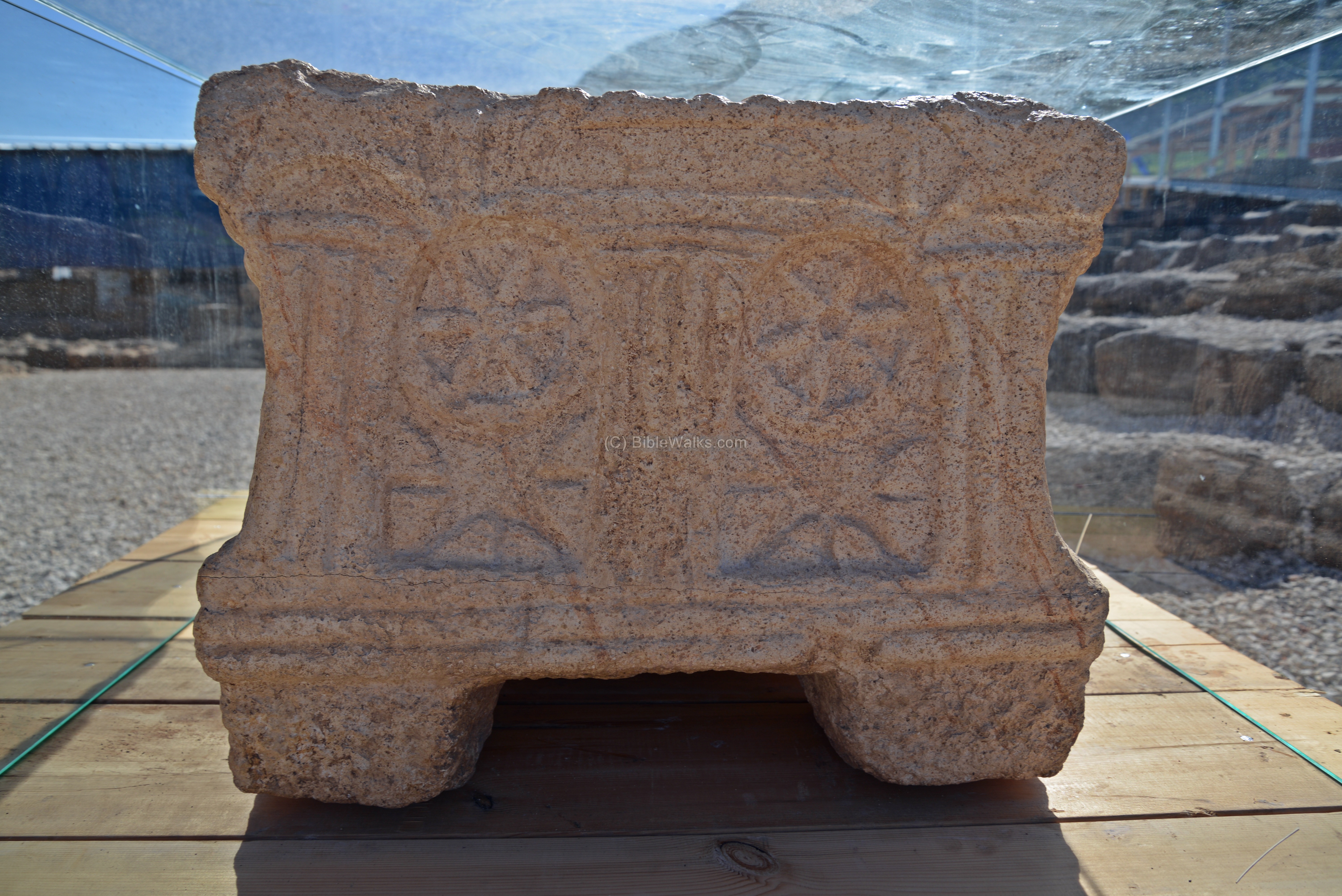
The two long sides are identical, showing four arches. The three left arches are filled with sheaves of grain, while the right most arch is filled with an object that may be an oil lamp.

The upper face is shown in the photo below. It is carved with floral and geometric forms, a large rosette in the center, and possibly palm trees on its side. On each side of the face are remains of round elements, which may have been the imprints of stone or wooden legs, that held a table on which the Torah was placed for readings.
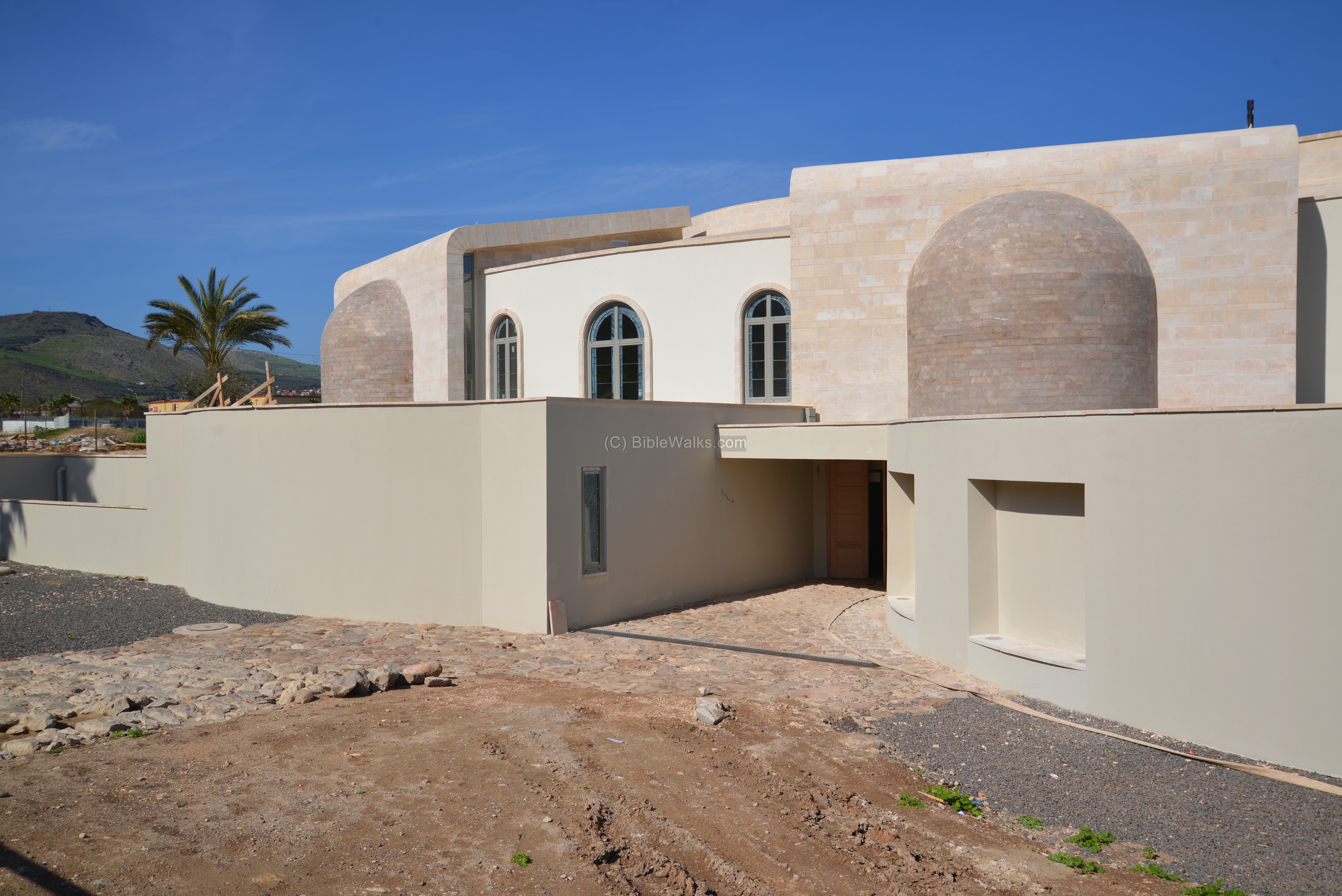
(e) Spiritual center (north east):
“Duc in Altum” (Latin: “put out into the deep”) is a spiritual center in Magdala. The center is located on the north side of area ‘A’, and housed in a new modern structure.
It is based on Luke 5:4, where Jesus teaches his disciples the experience of the miraculous catch of fish, implying that they could become the fishers of men: “Launch out into the deep, and let down your nets for a draught”.
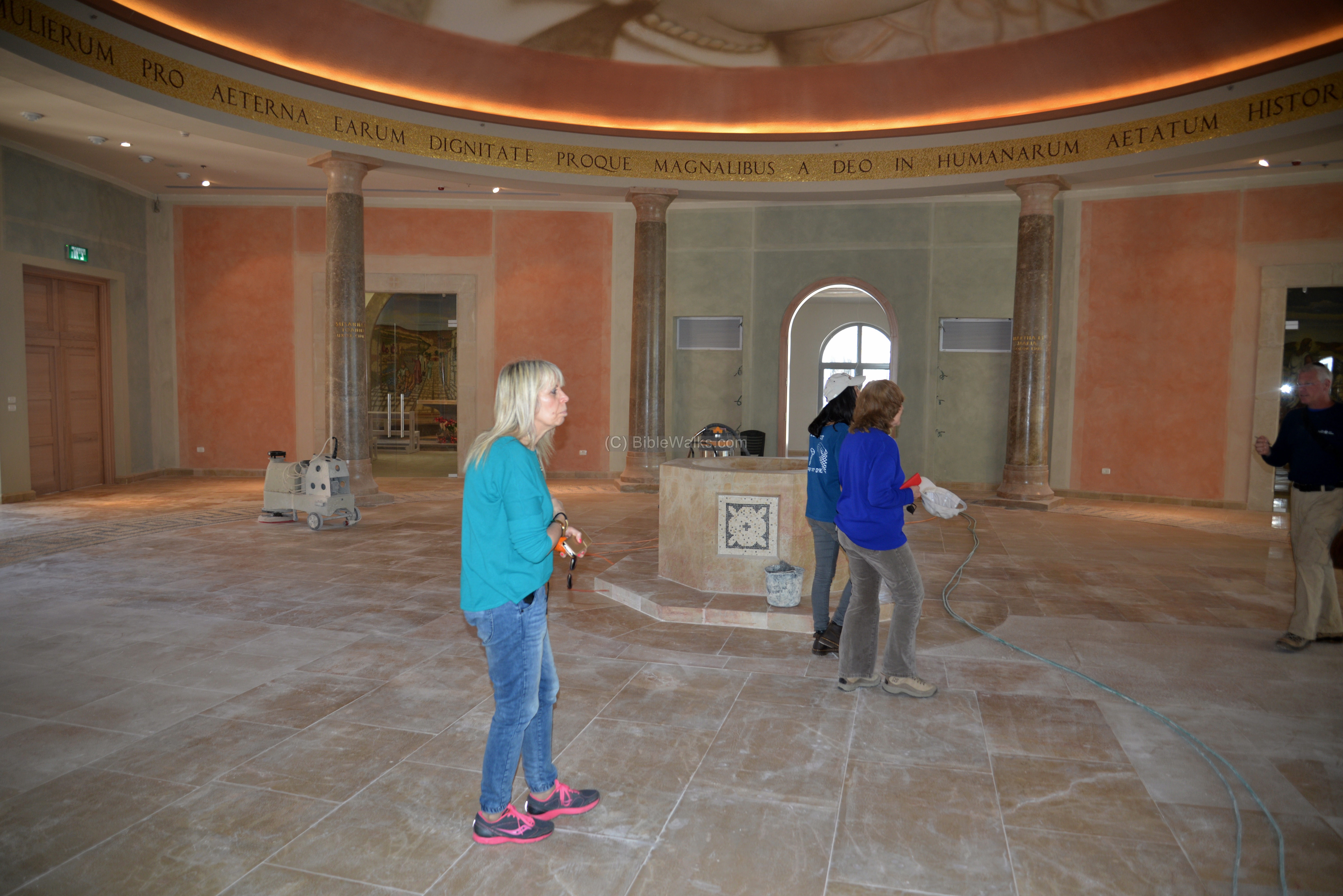
Inside are several sections – “Women’s Atrium”, “Boat chapel”, four mosaic chapels and the “Encounter chapel”.
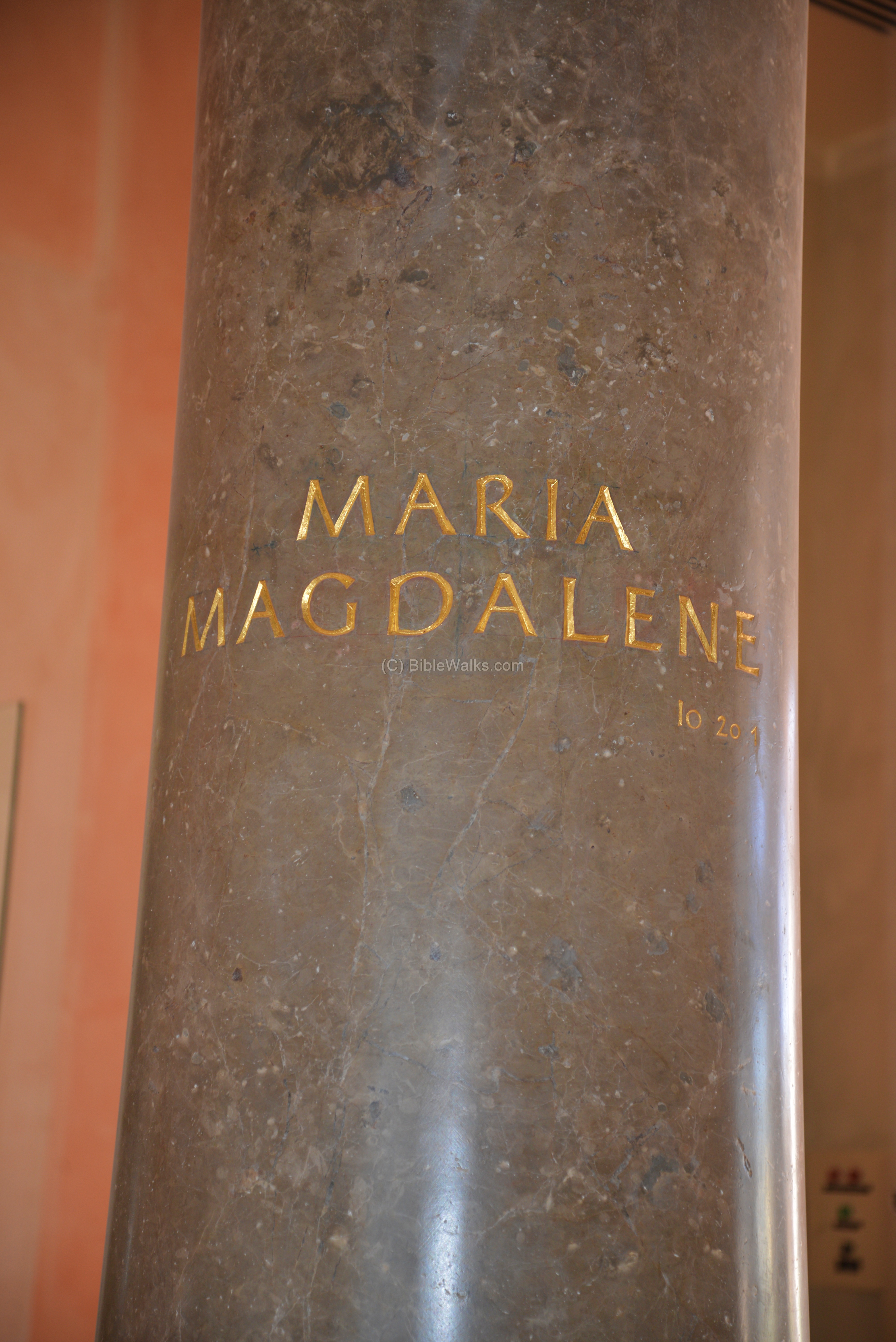
The “Women’s Atrium” is a round hall, featuring eight pillars. Seven pillars represent women followers of Jesus. A name is marked on the pillar. The eight unmarked pillar honors women of faith across all time.
The following photo shows one of the eight pillars, honoring Mary Magdalene – follower of Jesus and present at his crucifixion.
Another section, on the east side, is the “boat chapel”. Its altar is shaped like a boat, commemorating Jesus preaching from the boat. A tabernacle resides on the altar, which was blessed by Pope Francis during his visit to the Holy Land in 2014.

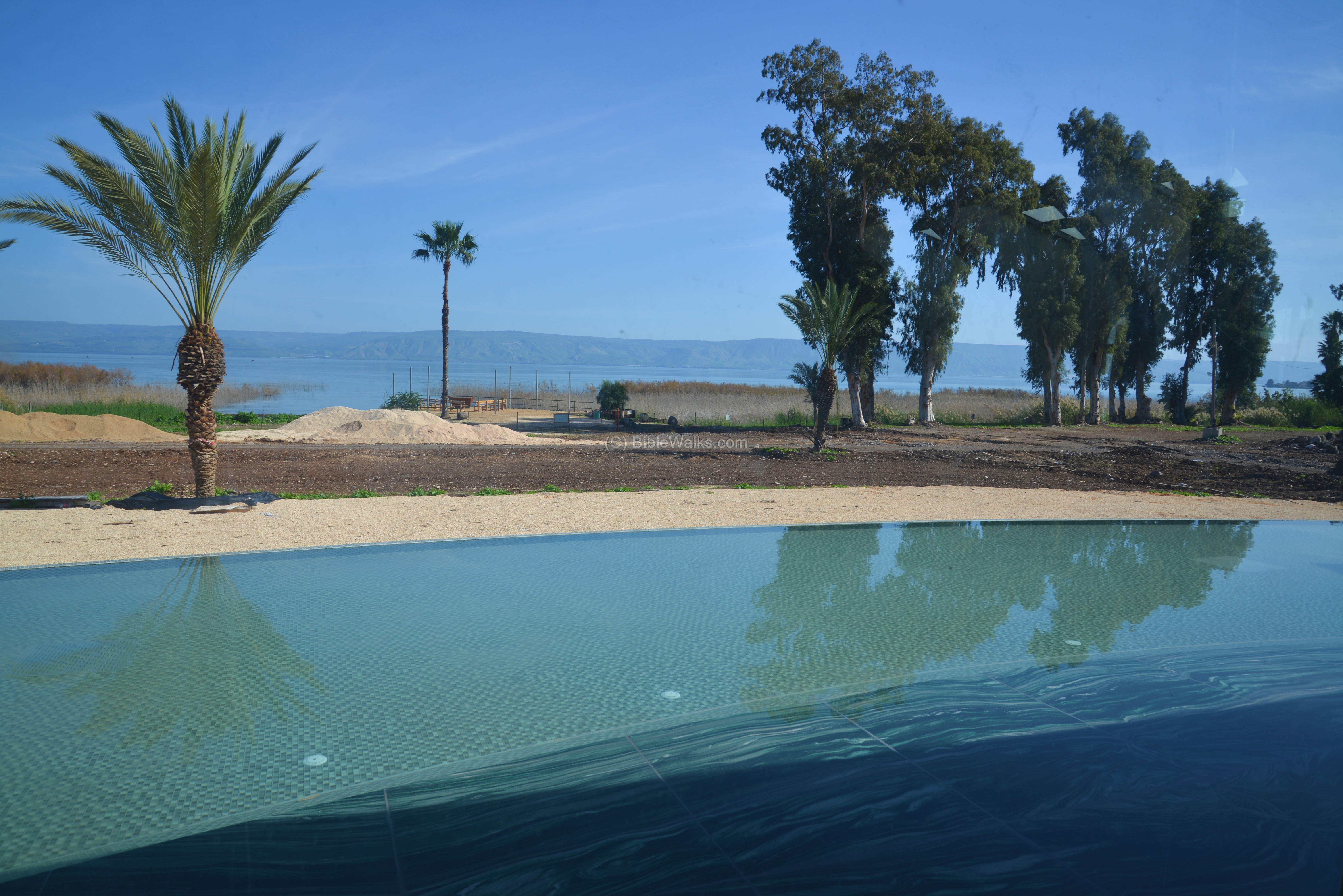
Outside the chapel, with a view of the lake, is a shallow pool that sets a background for the boat.
Four Mosaic chapels depict Biblical events near the Sea of Galilee. The one below is about the miracle of raising the daughter of Jairus from the dead. The golden inscription above reads (Mark 5, 41): “Talitha cumi” meaning “Little girl, get up!”.

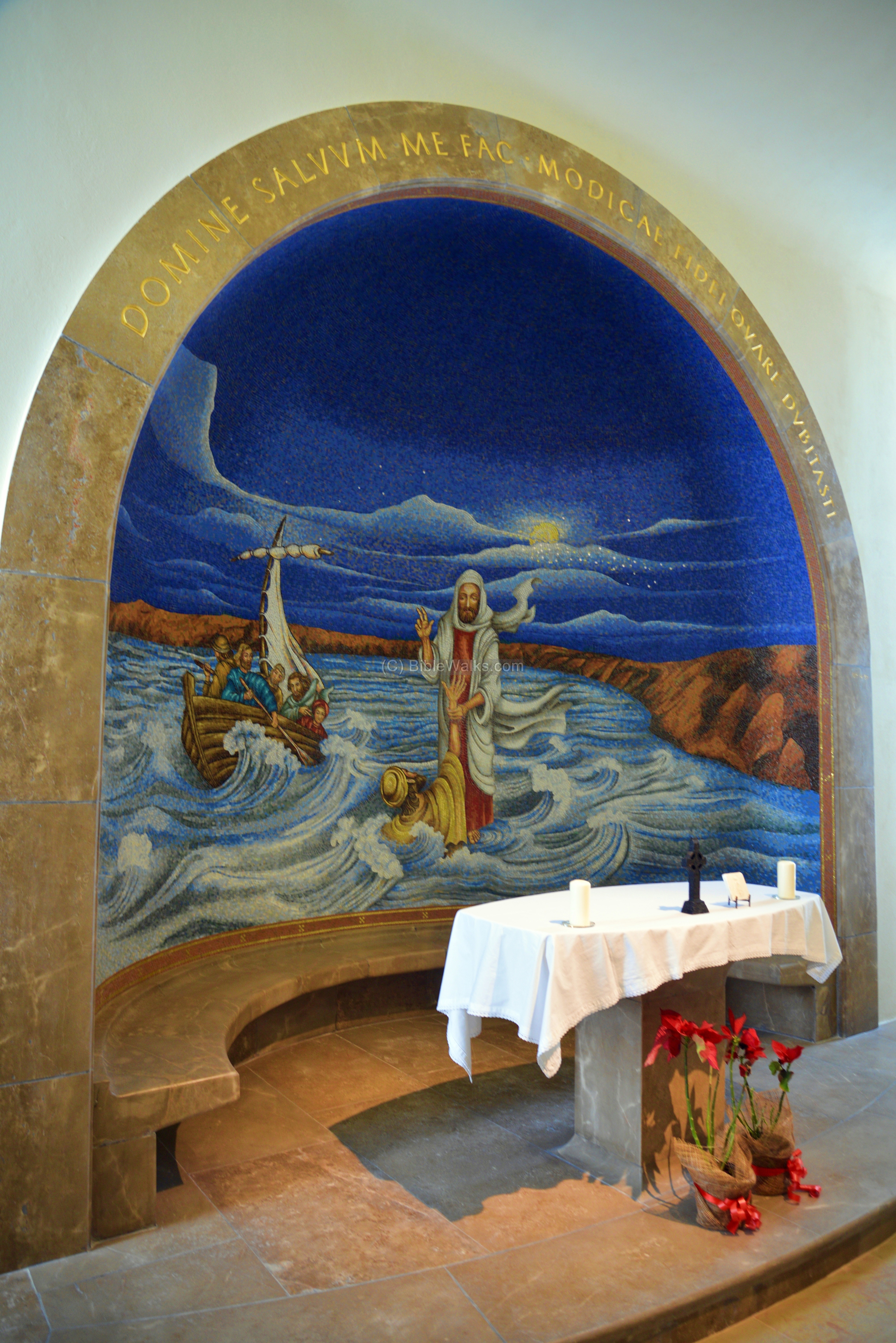
Another chapel illustrates the walking on the water. Peter’s faith is tested by walking on the water with Jesus (Matthew 14:29): “And when Peter was come down out of the ship, he walked on the water, to go to Jesus”.
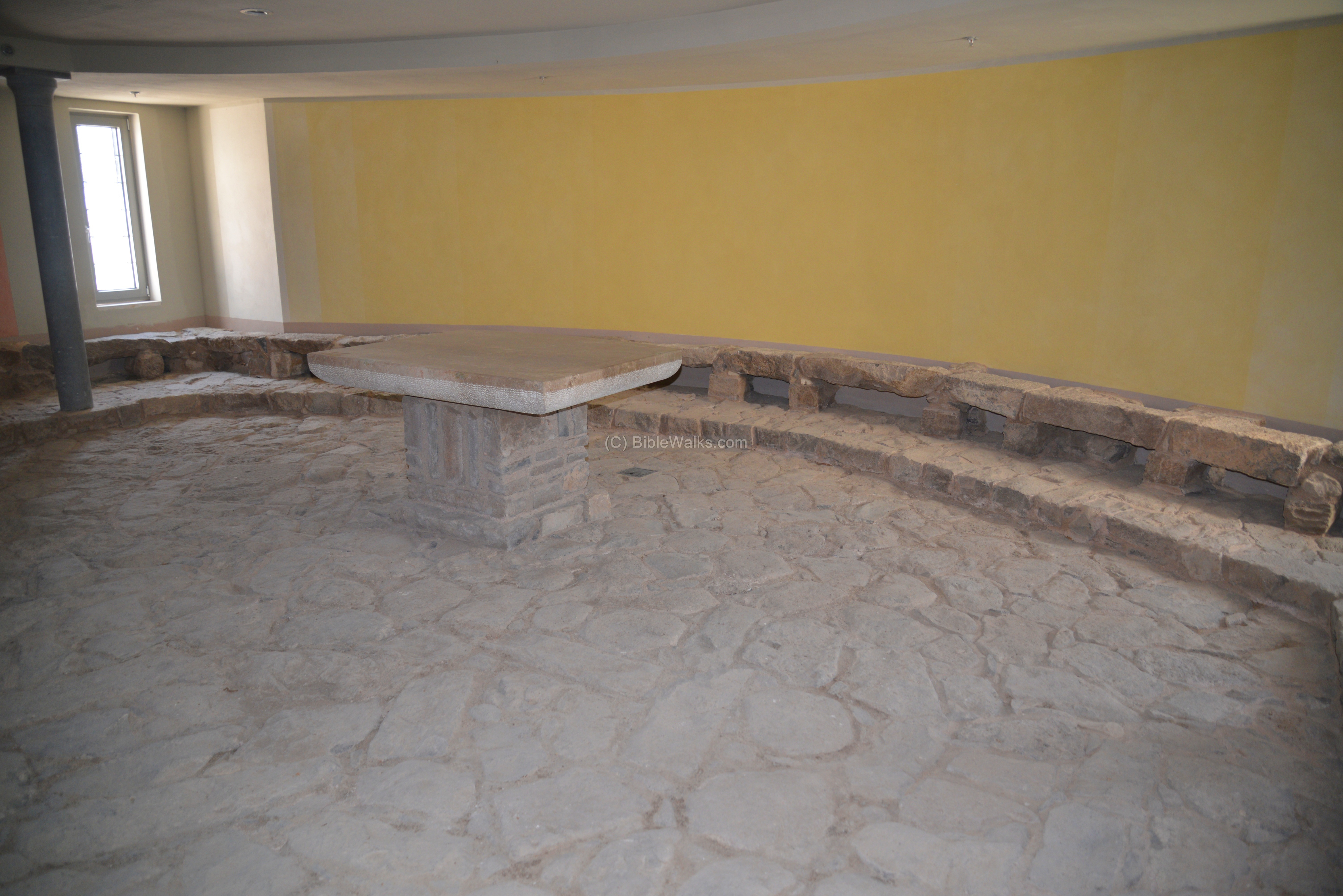
The chapel on the ground level is named “the encounter chapel“. Its floor is paved with stones of the original first century market place of Early Roman Magdala. A mural on the left illustrates yet another Biblical scene – the encounter between Jesus and the hemorrhaging woman (Mark 5: 25-29).
(f) Aerial view:
![]() The following YouTube video shows a flight over the northern excavations and the spiritual center:
The following YouTube video shows a flight over the northern excavations and the spiritual center:
Biblical References:
Mark 16:9
Mary was one of the women that were cured by Jesus:
“Now when Jesus was risen early the first day of the week, he appeared first to Mary Magdalene, out of whom he had cast seven devils”
Luke 8:2
A similar version appears in Luke:
“And certain women, which had been healed of evil spirits and infirmities, Mary called Magdalene, out of whom went seven devils,”
Matthew 15:39
Here the name of the village is slightly different in the NIV version:
“After Jesus had sent the crowd away, he got into the boat and went to the vicinity of Magadan.”
It is Magdala in other versions, such as KJV:
“And he sent away the multitude, and took ship, and came into the coasts of Magdala.”
Historical References:
Migdal (Magdala) was one of the fortified cities that was under siege by Vespasian, the Roman commander against the Jewish revolt (67AD). It is called Taricheae.
(a) Josephus Flavius (Life 32)
Josephus, the Commander of the Jewish revolt against the Romans, and later a historian of the period. He writes that he fortified the city of Tarichess (or, Taricheae). This name means in Greek: “the places where the fish are prepared”. He mentions that it is about 6KM away from Tiberias, on the shore of the Sea of Gaililee, which is where Magdala is located.
“for they had heard that the walls of Tarichess were already built…when I was gone to Tarichess, which was thirty furlongs distant from Tiberias…”
Since Magdala was a fishing village, it can therefore be identified with Tarichess.
(b) Josephus Flavius (Wars 1, Chapter 8:9)
According to an earlier text, Taricheae was a big city with 30,000 people (!) at the early Roman times of Pompey the Great (War 1, 8: 9):
“Cassius had fled into that province, and when he had taken possession of the same, he made a hasty march into Judea; and, upon his taking Taricheae, he carried thirty thousand Jews into slavery.”
(c) Josephus Flavius (Wars 3, Chapter 10)
The chapter starts with a description of the city:
“And now Vespasian pitched his camp between this city and Taricheae, but fortified his camp more strongly, as suspecting that he should be forced to stay there, and have a long war; for all the innovators had gotten together at Taricheae, as relying upon the strength of the city, and on the lake that lay by it. This lake is called by the people of the country the Lake of Gennesareth. The city itself is situated like Tiberias, at the bottom of a mountain, and on those sides which are not washed by the sea, had been strongly fortified by Josephus…”
The chapter continue with the description of how the Romans, under Titus (son of Vespasian), placed a siege over the city and finally captured it, and completely ruined it, killing its 40,000 defenders:
“There was also a great slaughter made in the city… one might then see the lake all bloody, and full of dead bodies, for not one of them escaped”.
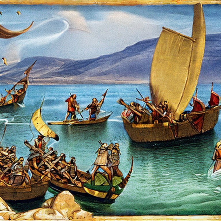
A Figurative Roman sea battle – AI generated by Stable Diffusion
After these tragic events the city did not recover. The fishing industry was replaced by a textile industry, and the place was renamed Migdal Tzabaya, where the latter word means painting.
Etymology (behind the name):
-
Migdal – means “tower” in Hebrew.
-
Magdala – Migdal in Aramaic
-
al-Majdal In Arabic: “the Tower”, name of the Arab village that existed until 1948 on the ruins of the ancient city.
-
Taricheae – in Greek: “the places where the fish are prepared”. Probably another name for Magadala, as reported by Josephus.
-
Migdal Nunaya – another name of the village, which means the tower of the fishermen.
-
Dalmanutha – In Mark 8:10 this name was referred as the site after he fed the 4,000. By comparing to Matthew 15:39 – which names “the borders of Magdala” – it is likely to be a town nearby. (Thanks David Shipley for the correction)
Links:
* Excavations reports:
- Migdal – 2002 excavation Final report – Hanaa Abu-Uqsa – Hadashot Arkheologiyot 117 2005
- Migdal – 2005 excavation Preliminary report – Dina Avshalom-Gorni – Hadashot Arkheologiyot 121 2009
- Migdal – Preliminary report 2013 – Dina Avshalom-Gorni and Arfan Najar – Hadashot Arkheologiyot 125 2013
- Migdal – salvage excavation 2010 – Gilad Cinamon – Hadashot Arkheologiyot 126 2014
- Migdal – salvage excavation 2007 – Dina Avshalom-Gorni and Edna Stern – Hadashot Arkheologiyot 128 2016
- A preliminary report on the Miqwa’ot of Migdal – R. Reich, M. Z. Meza; IEJ 2014
* Other links:
- New excavation planned – Bar, 2007
- One of the Oldest Synagogues in the World was Exposed at Migdal (9/13)
- Magdala.org visit
- Duc-in-Altum spiritual center
- Special Bronze Implements were Discovered in Archaeological Excavations at Magdala a 2,000 Year Old Jewish Settlement on the Sea of Galilee
- Magdala 2016: Excavating the hometown of Mary Magdalene Biblearchaeology.org
- Magdala stone – Motti Aviam
- The resurrection of Mary Magdalene book by Jane Schaberg, 2002
* Internal links:
- Jesus Boat – A 1st century AD fishing boat was found near Magdala
- Footsteps of Jesus – This pictorial presentation is arranged by BibleWalks staff. Magadla is in event #61-62.
- Drone Aerial views – collection of Biblical sites from the air
- Miqveh installations – info on ritual baths
BibleWalks.com – walk with us through the sites of the Holy Land
Arbel Cliffs <<<–previous site—<<<All Sites>>> —-next Sea of Galilee site –>>> Tabcha
This page was last updated on Mar 20, 2023 (new overview, replace illustration)