This page provides a map and aerial view of the sites that were visited by Jesus.
Home > Info > Jesus travel Maps
This page displays a selection of maps of the sites that were visited by Jesus and are described in the New testament.
Contents:
Sites of Jesus travels:
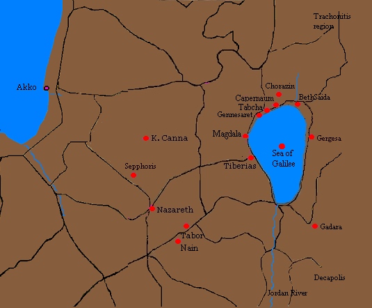
The following map shows the major places where Jesus visited in the 3 years of activities (27AD-30AD).
The sites are marked on the Google satellite/road map. Hover over the marker to see the title, and press on the marker to jump to that site’s review. Select Map or Satellite display.
A table of sites appear below it; selecting any row will jump to its marker on the map.
The colored markers on the map stand for the classes of sites:
● Blue = Old Testament
● Red = New Testament
● Purple= other ancient periods,
● Green= prehistoric, nature
● Yellow= regional galleries
Jesus travels map


![]() For a tabular detailed list – go to Jesus footsteps page.
For a tabular detailed list – go to Jesus footsteps page.
References and Links:
* External:
- Jesus Travel Maps (Italian) – Thanks for Ugo who recommended
* Internal:
- Tabular list of Jesus footsteps.
- Footsteps of Jesus – Pictorial presentation
BibleWalks.com – walk with us through the sites of the Holy Land
Jesus Footsteps <<<—Previous info—<<< All Info >>>—Next —>>> Aqueducts
This page was last updated on Feb 20, 2020 (New Google Maps)
Sponsored links: