Ruins of a second temple period village (Biblical Rabbah?), in the Judean foothills region south of the valley of Elah.
Home > Sites > Judea > Park Adullam> Horvat Rebbo
Contents:
Overview
Location
History
Photos
* Aerial views
* Access to the site
* Summit
* Cisterns and caves
* Installations
* Video
Etymology
Links
Overview:
Horvat Rebbo is an archaeological site, situated on a hill between the valleys of Nahal Shua and Nahal Shochah. The site is located 1km west of Moshav Aderet, within the Adullam-France National Park, in the area of the low hills (Shephelah) of Judea.
Its Arabic name is Kh. Rubba (also Raba, Ribbo), possibly based on the Hebrew word Rabbath (meaning ‘large’).
On the summit of the hill are ruins of residential complexes with hewn caves, cisterns, installations, and columbariums. The site was settled during the second Temple period. Hiding complexes of the Bar-Kochbah revolt and a ritual bath (Miqveh) indicate that it was a Jewish village. It continued to be settled in the Byzantine period.
Location:
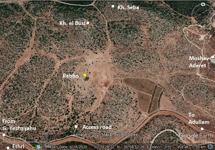
The following aerial view shows the area of the ruins. The site covers 100 acres, situated on the top of a knoll at an altitude of 414m.
Access to the site is from Highway #38 from a park road that starts near Moshav Tsafririm. Follow signs to Horvat Midras, but pass the turn to Midras, continuing 1.5km until a turn north to the site near a junction east of Matzad Hakhlil. A dirt road leads up to the ruins.
History:
- Second temple period
The Bible lists a village in the region of the tribe of Judah (Joshua 15:60): “…Kirjathbaal, which is Kirjathjearim, and Rabbah; two cities with their villages:”.
The 4th century AD Eusebius of Caesarea identified it as a village in his Onomasticon reference book of Biblical sites (line #779): “Rabboth – … There is now another village Robbo in the region of Eleutheropolis [Beit Jibrin] to the east”. The 19th century PEF survey wrote about the site (SWP Vol 3, p.360): “Khurbet Rubba —Caves, cisterns, and heaps of stones, ruined walls, bases of pillars and shafts much worn, two lintel stones with crosses…”
IAA surveys (Zisso and Genor, 2000-2001, Eitan Klein 2011-2013) uncovered various installations and building on and around the site. These included: mikveh (ritual bath), wine presses, parts of an oil press, quarries, underground storage chambers, cisterns and burial caves. They dated these to the Hellenistic, Hasmonean, Herodian, Early Roman periods. On one of the underground walls they dated a rare inscription of a boat to the Hellenistic-Early Roman period.
A map of the cities and roads of the Iron Age period is here. The site, marked in red (as Rabbah?), is 2km north west of Adullam and 2km south of Socoh in the valley of Elah.
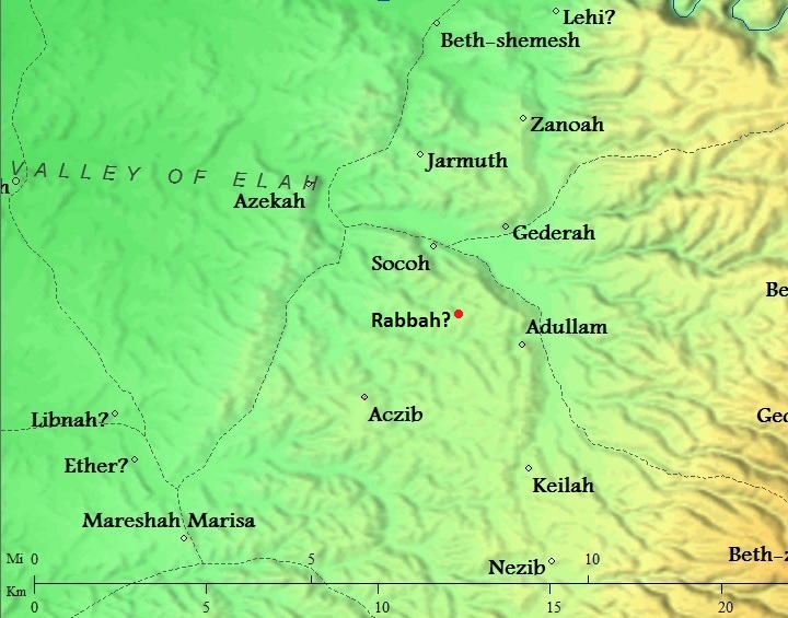
Cities and roads around Rebbo (Biblical Rabbah?) – during the Canaanite, Israelite, Hellenistic period – Bible Mapper 3.0
Horvat Rebbo is located near another village of the same period – Horvat Ethri, which is 2km to the west.
- Roman period
During the great revolt against the Romans the village was probably burnt and destroyed. A record of such destruction may have been implied in Josephus accords, when the nearby Jewish village (Ethri = Caphethhra) was destroyed by the 5th Legion in 69 AD (War IV:9:9):
“…but Cerealis, one of his commanders, took a body of horsemen and footmen, and laid waste that part of Idumea which was called the Upper Idumea, and attacked Caphethra, which pretended to be a small city, and took it at the first onset, and burnt it down”.
- Bar Kokhba hiding complexes
Hiding complexes of the Bar-Kochbah revolt were found on the hill.
During the second (Bar Kokhba) revolt in the 2nd century AD, Jewish residents across most of the villages in Judea tried to save themselves by constructing underground hiding places. Most of these rock cut tunnels and chambers were constructed under or near the residential buildings. The Roman historian Cassius Dius wrote about this (Historia Romania, 69, 12, 3):
“To be sure, they did not dare try conclusions with the Romans in the open field, but they occupied the advantageous positions in the country and strengthened them with mines and walls, in order that they might have places of refuge whenever they should be hard pressed, and might meet together unobserved under ground; and they pierced these subterranean passages from above at intervals to let in air and light”.
- Devastation of Judea
These hiding places may have saved some of the souls. However, the carnage that followed the onslaught left the village in ruins.
After its destruction, the Jewish population ceased, as all other Jewish villages in Judea. Cassius Dio, the historian of Rome, wrote about the devastation of Judea by Hadrian (Roman History, 69 13):
“Fifty of their most important outposts and nine hundred and eighty-five of their most famous villages were razed to the ground. Five hundred and eighty thousand men were slain in the various raids and battles, and the number of those that perished by famine, disease and fire was past finding out. Thus nearly the whole of Judaea was made desolate, a result of which the people had had forewarning before the war”.
Jews were forbidden to return to all settlements in the vicinity of Jerusalem. Eusebius Pamphili of Caesarea, a 4th century Greek historian of the Church, wrote about this ban in the 4th century (Church History, Book IV, Ch. 6, 3):
“…the whole nation was prohibited from this time on by a decree, and by the commands of Hadrian, from ever going up to the country about Jerusalem. For the emperor gave orders that they should not even see from a distance the land of their fathers..”.
- Byzantine period
According to the PEF report, the site was inhabited during the Byzantine period. Victor Guerin reported on remains of a Byzantine church. This led scholars to identify the site with Ribba/Rebbo, which was listed by Eusebius (Onomasticon) as located in the region of Eleutheropolis (Beit Gubrin):
“About 7 miles northeast is Kh Ribba, not on a Roman road, which retains the name”.
- Ottoman period – PEF survey and excavations (19th Century AD)
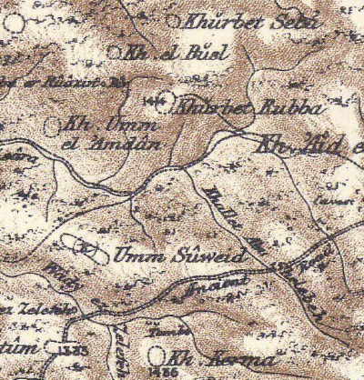
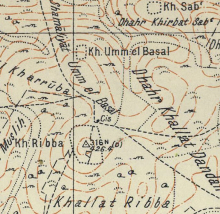
The area around the site was examined in the Palestine Exploration Foundation (PEF) survey (1866-1877) by Wilson, Conder and Kitchener. A section of their map is shown below, with the site in the center appearing as Khurbet Rubba. The area around the site was heavily populated with farms and villages.
They added a short review of the site, describing findings that are same as another site that they reviewed (Volume III, sheet XXI, p. 360):
“Khirbet Rubba (J u).—Caves, cisterns, and heaps of stones, ruined walls, bases of pillars and shafts much worn, two lintel stones with crosses, both measuring about 7 feet by 2 1/2 feet.”.
Three other nearby sites were reviewed (p. 352, 360, 369):
“Khirbet el Busel (J u).—Foundations, heaps of stones, cisterns, and ruined walls”.
“Khirbet Seba (J u).—Cisterns, foundations, and heaps of stones”.
“Khurbet Umm el ‘Amdan (J u).—Cisterns, caves, foundations, and heaps of stones. It appears to be a Byzantine ruin, but
pillars were not observed”.
Part of Map Sheet 21 of Survey of Western Palestine, by Conder and Kitchener, 1872-1877. (Published 1880, reprinted by LifeintheHolyLand.com)
- British mandate
A map published in the 1940s shows the area around the site – named Kh. Ribba. The majority of the ruins are marked (as small dots) on the summit (trig point 316N, altitude 426m).
https://palopenmaps.org – Palestine 1940s 1:20,000 map
-
Modern Period
Limited surveys were conducted, focusing on the burial and hiding caves.
Today the site is part of the Adullam-France National park, and is accessible to the public.
Photos:
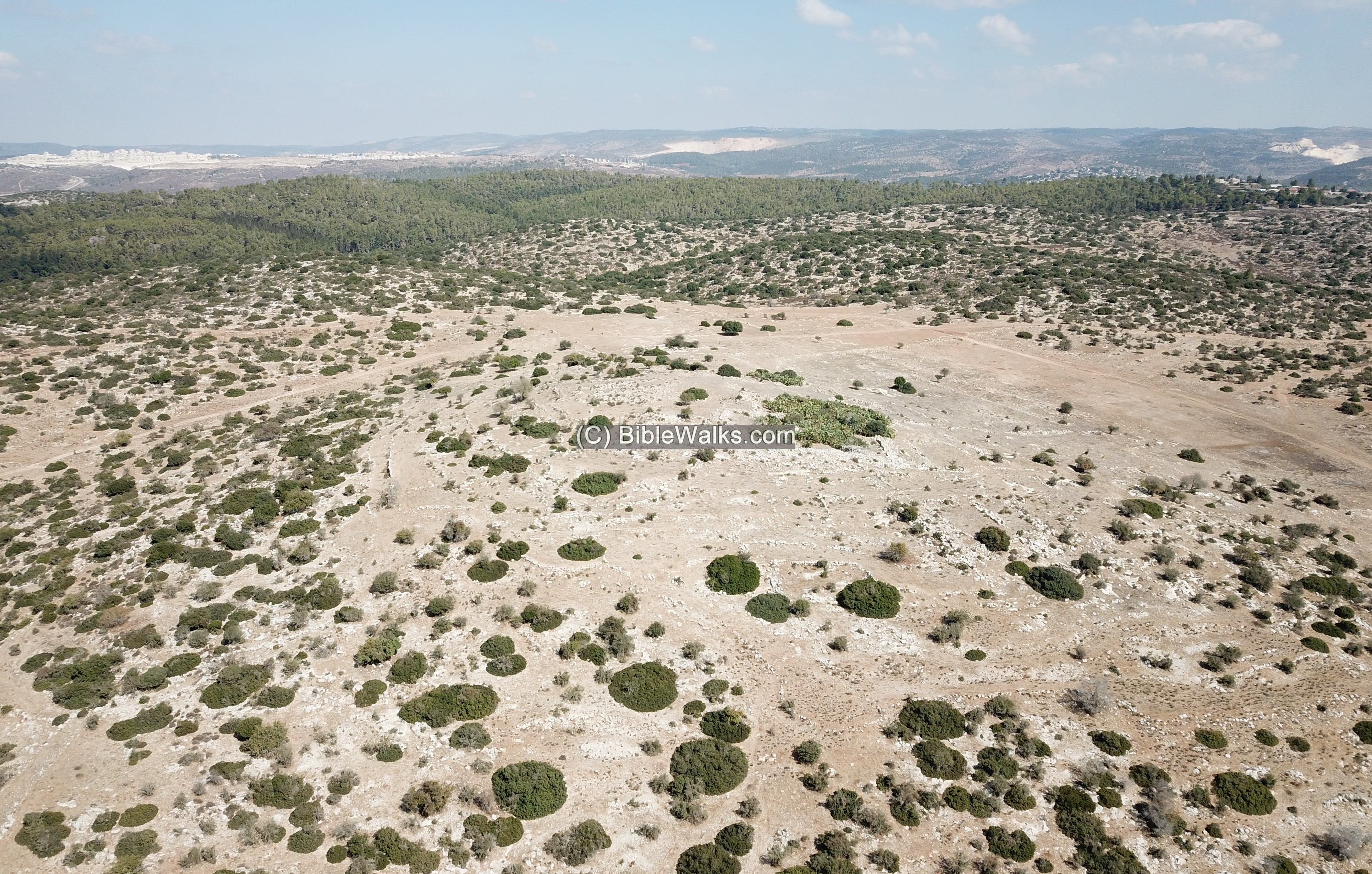
(a) Aerial Views
An aerial view was taken above the site, with a view towards the west. The mountains of Judea are seen in the far background, and Moshav Aderet is on a hill on the left side.
Click on the photos to view in higher resolution…
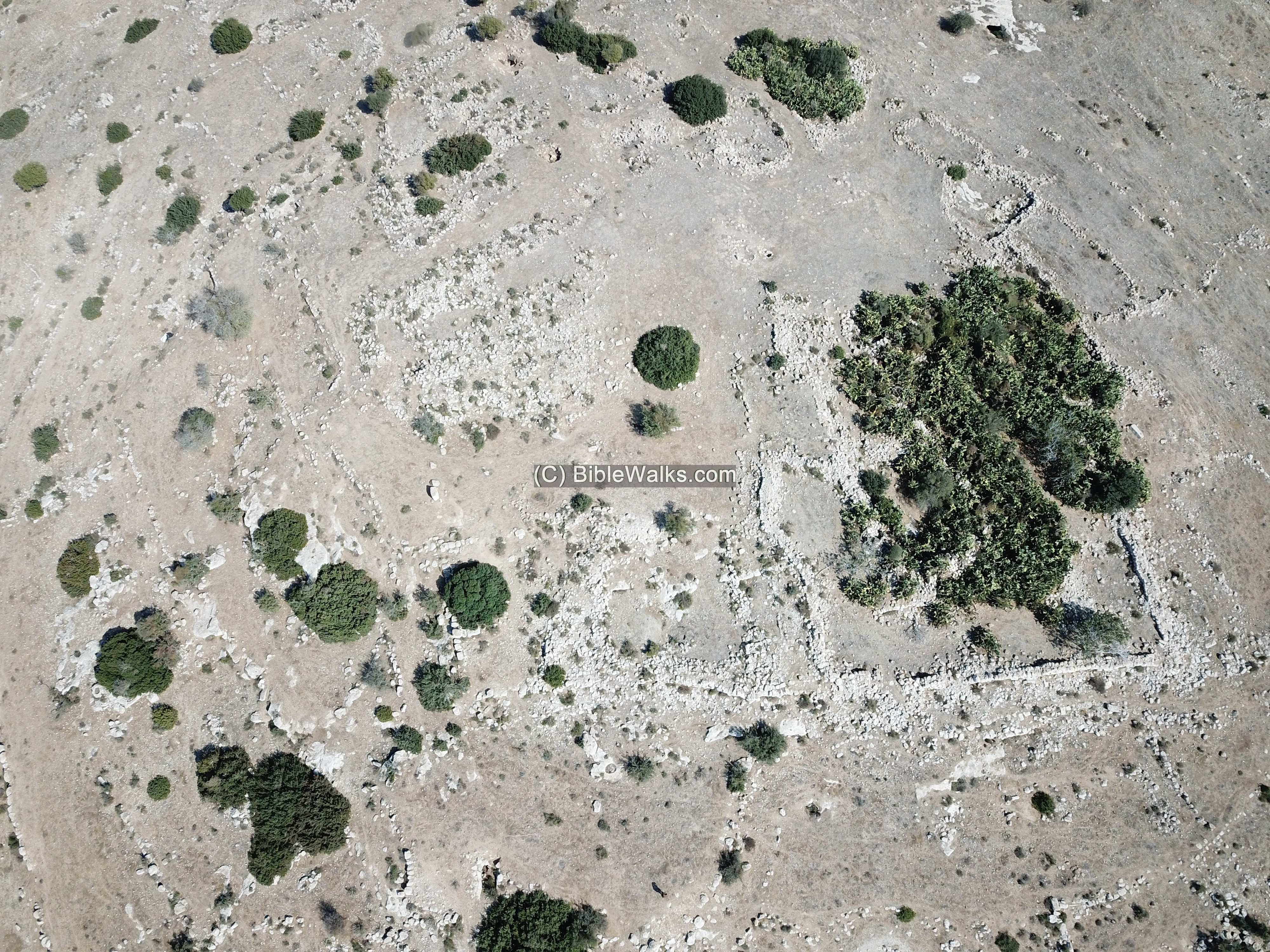
A vertical view of the hill is below, also viewing towards the west.
Traces of walls are seen on the summit.
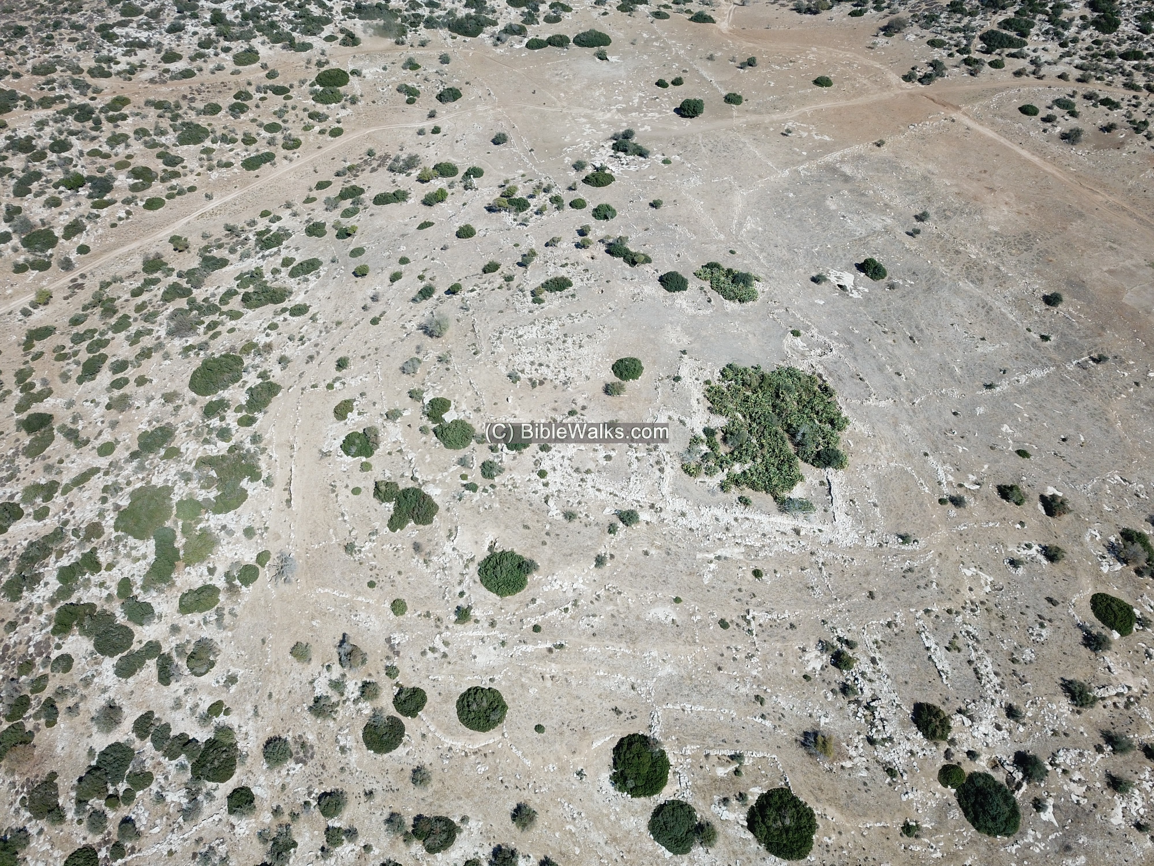
Scattered ruins cover the surface. The site was not yet excavated, and most of its remains are either covered under the ground or robbed and reused in nearby Arab villages.
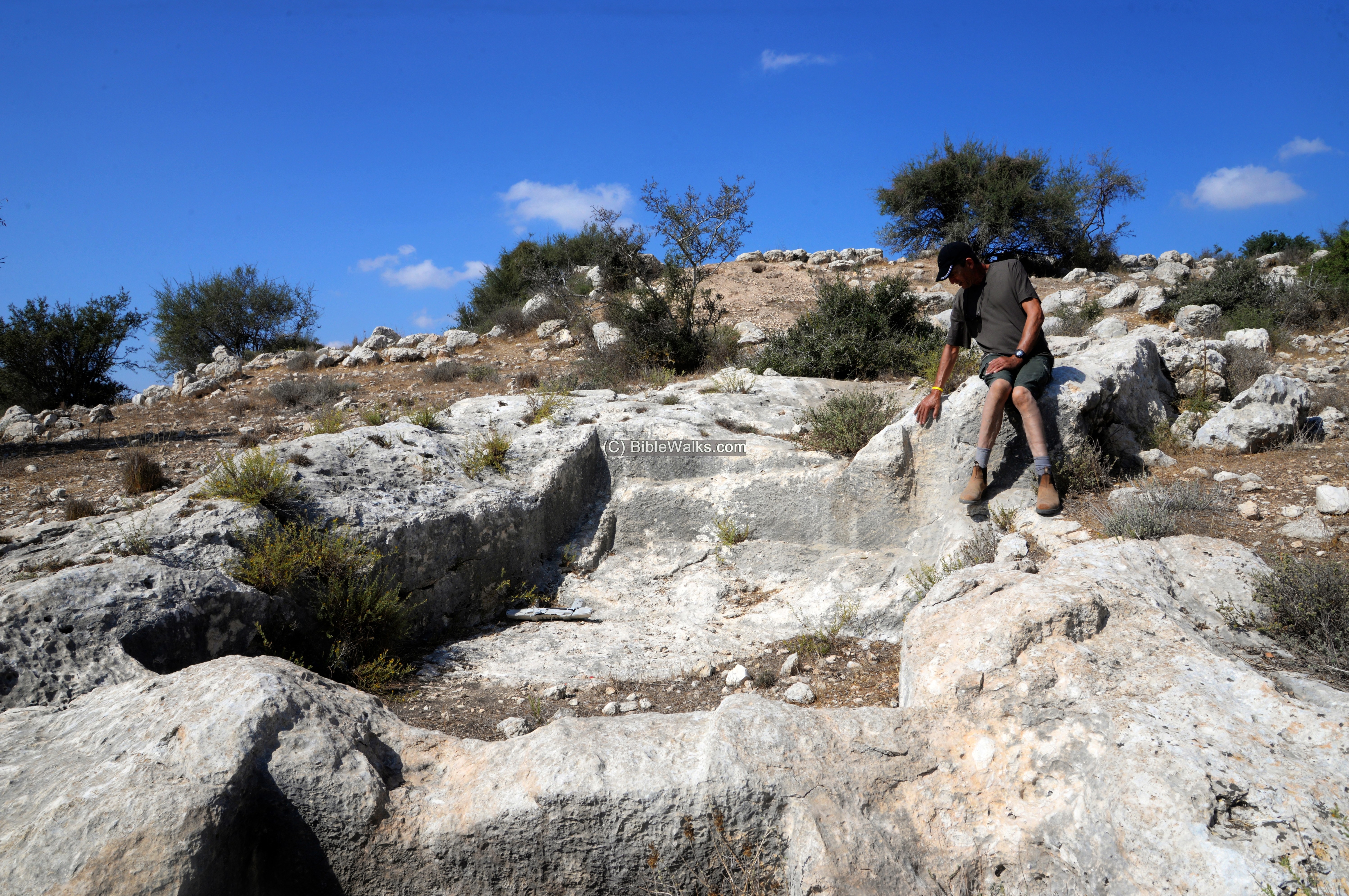
(b) Access to the site
We drove to the site along a paved road from Giva’at Yehayahu, and parked the car in the valley. Then, walked up the dirt road that ascends to the east side of the hill.
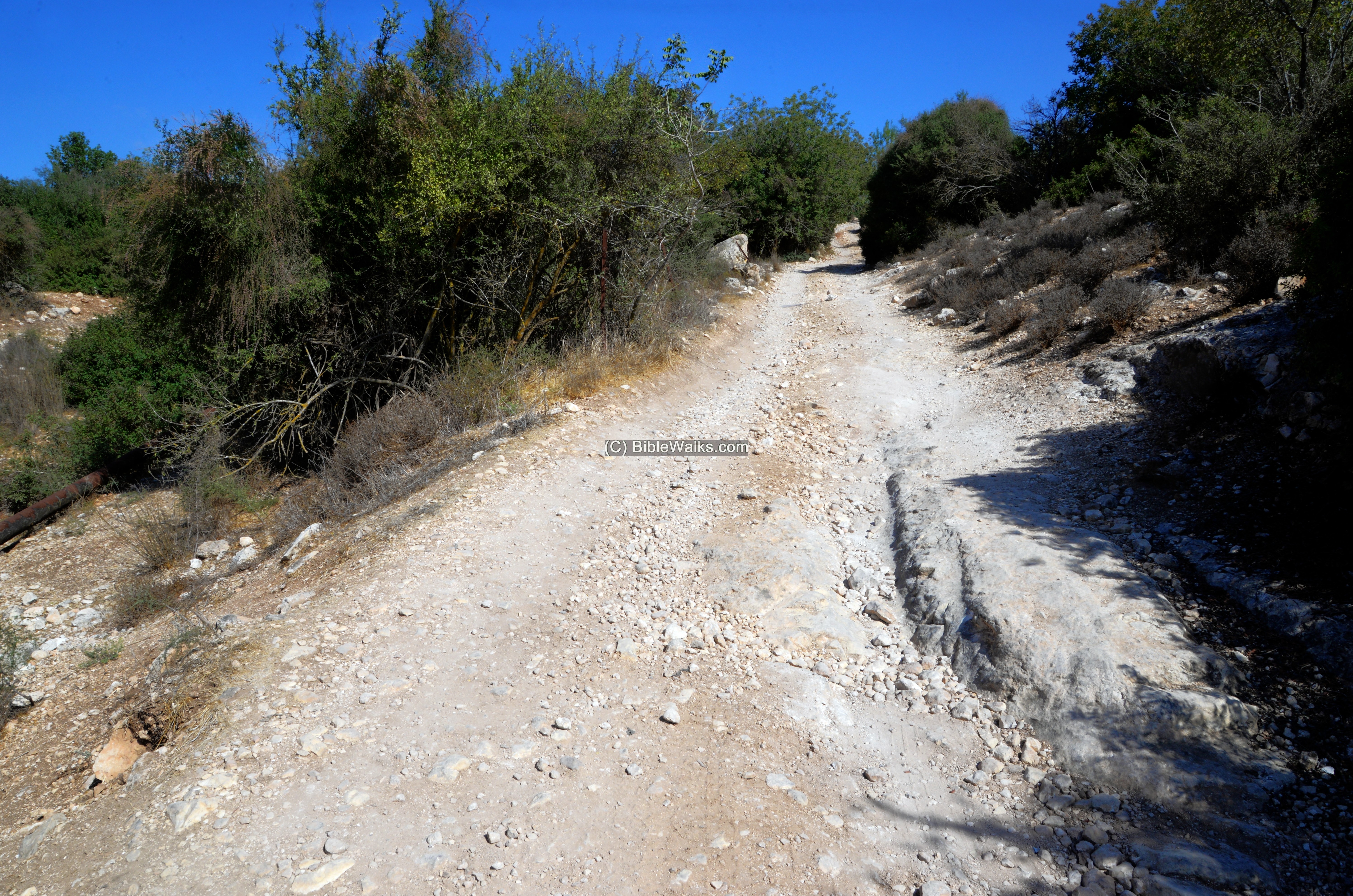
Along the ascending road are old agriculture terraces. The hill is seen here behind the bushes.
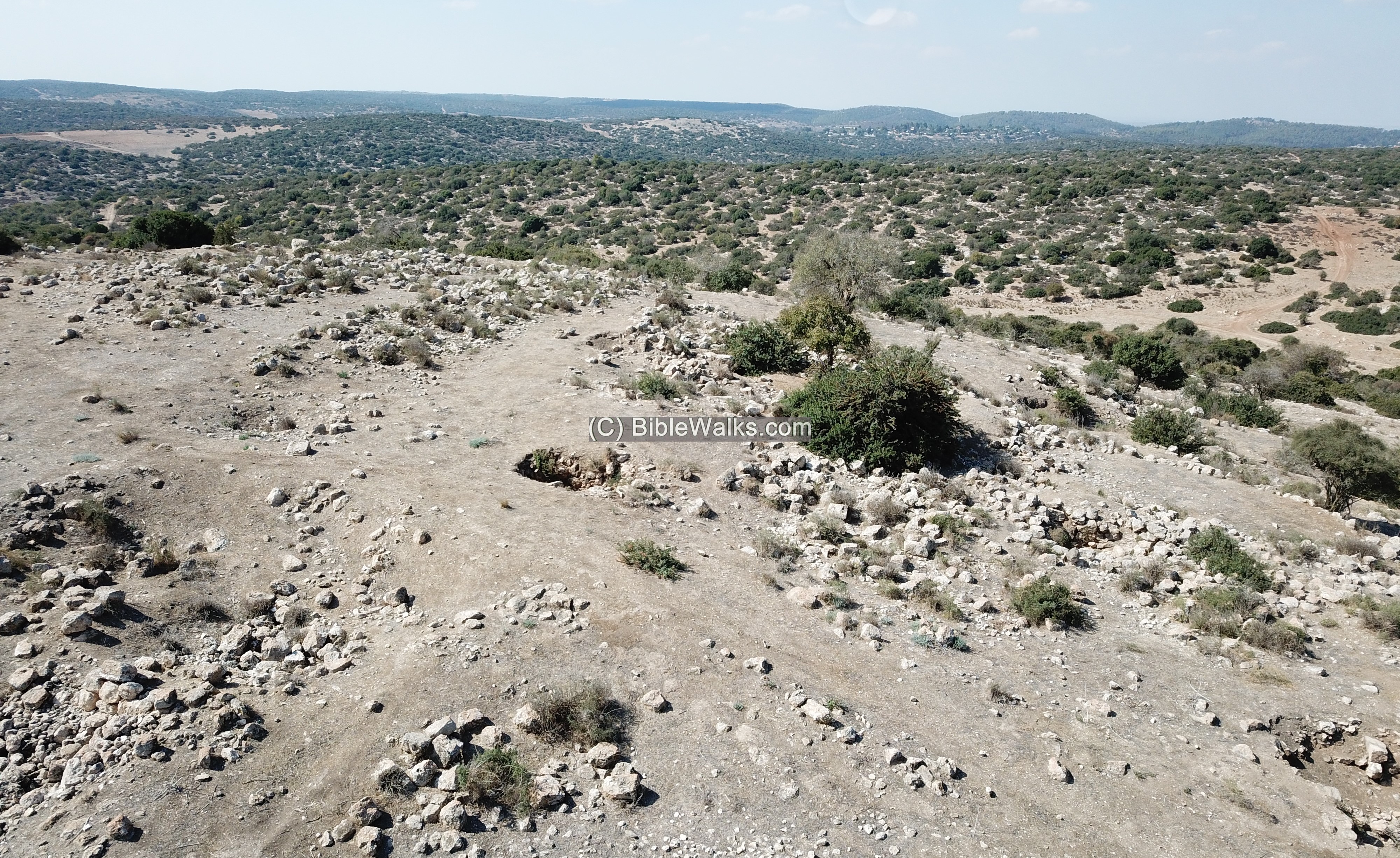
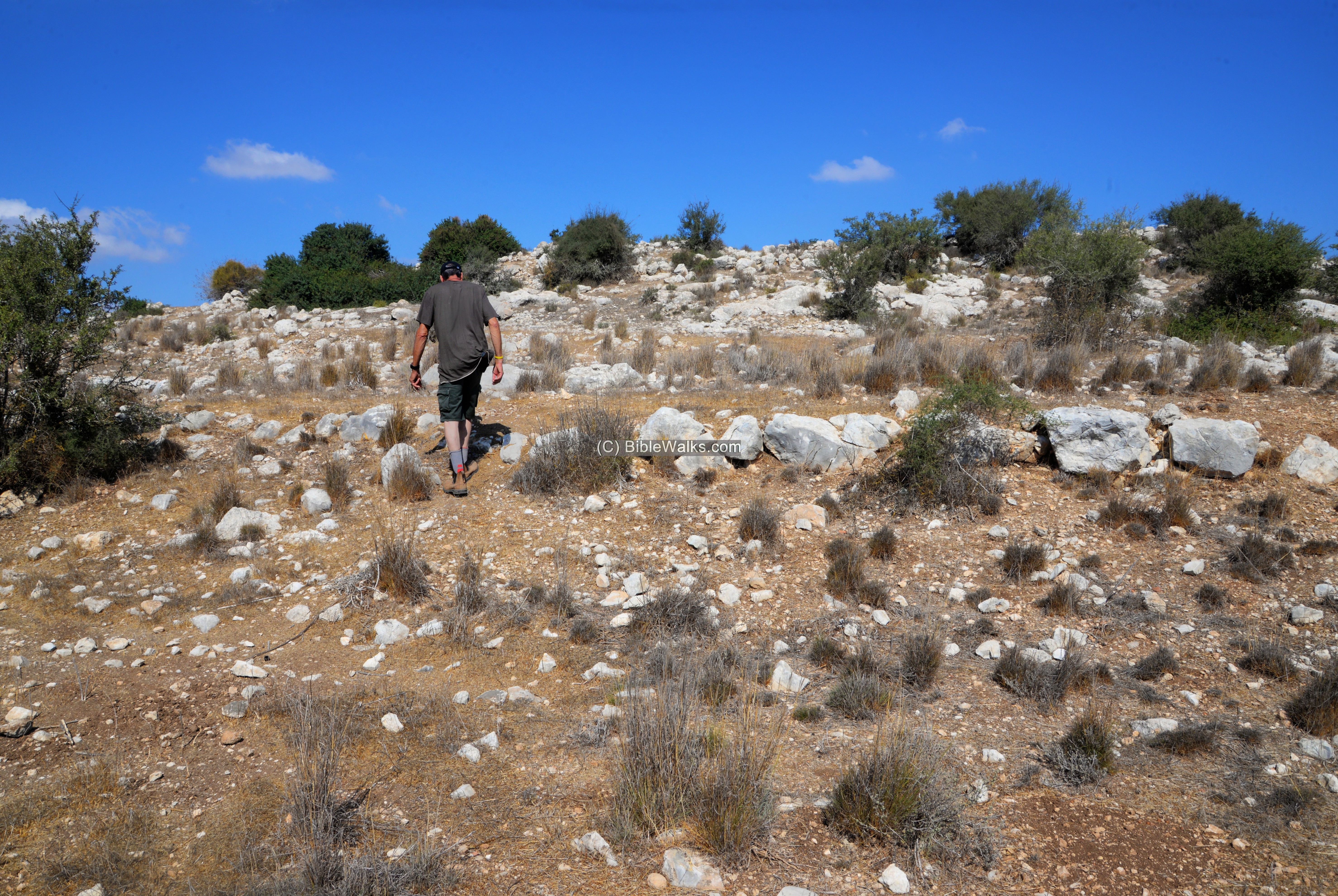
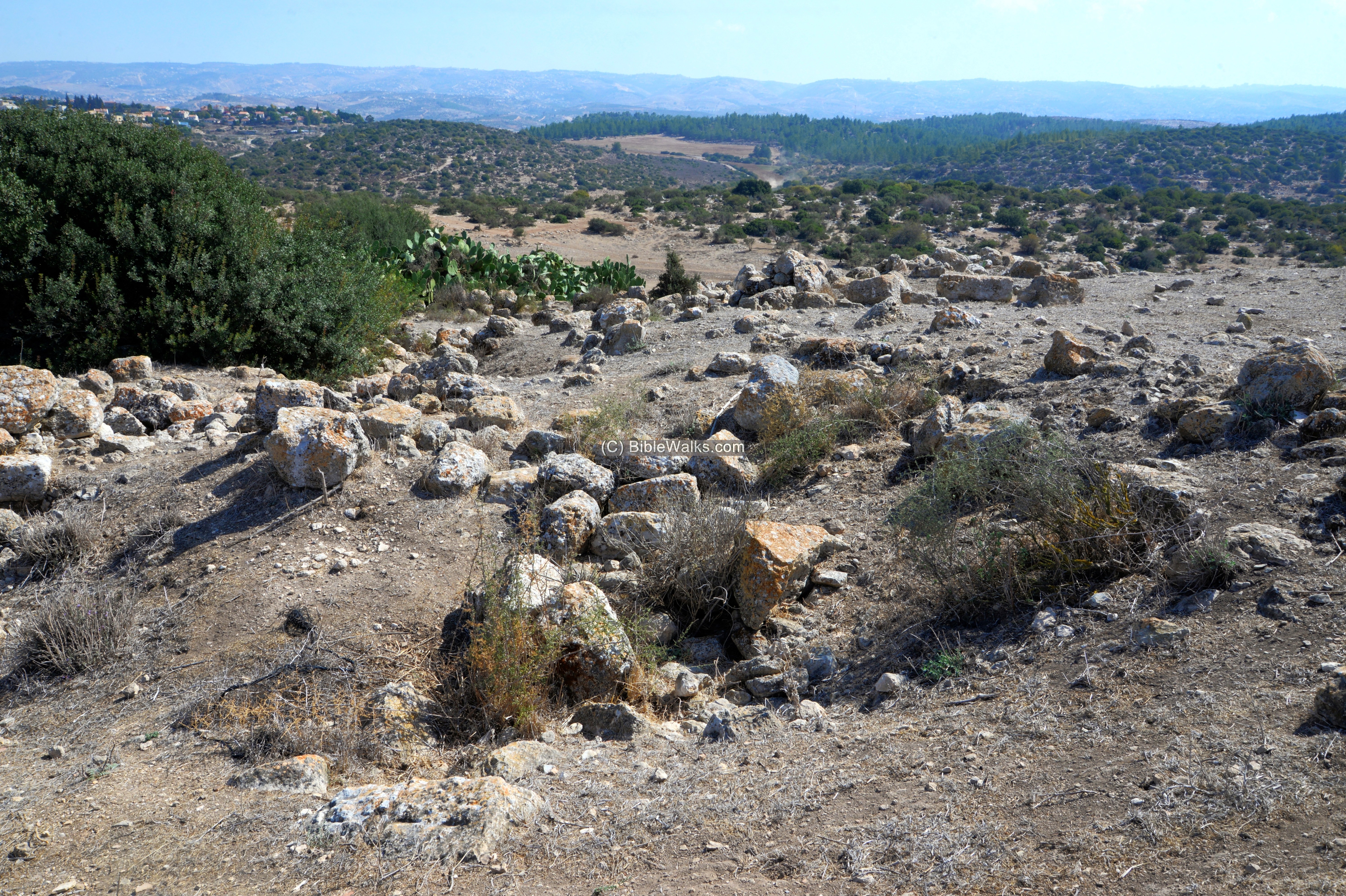
Then walked up the foothills…
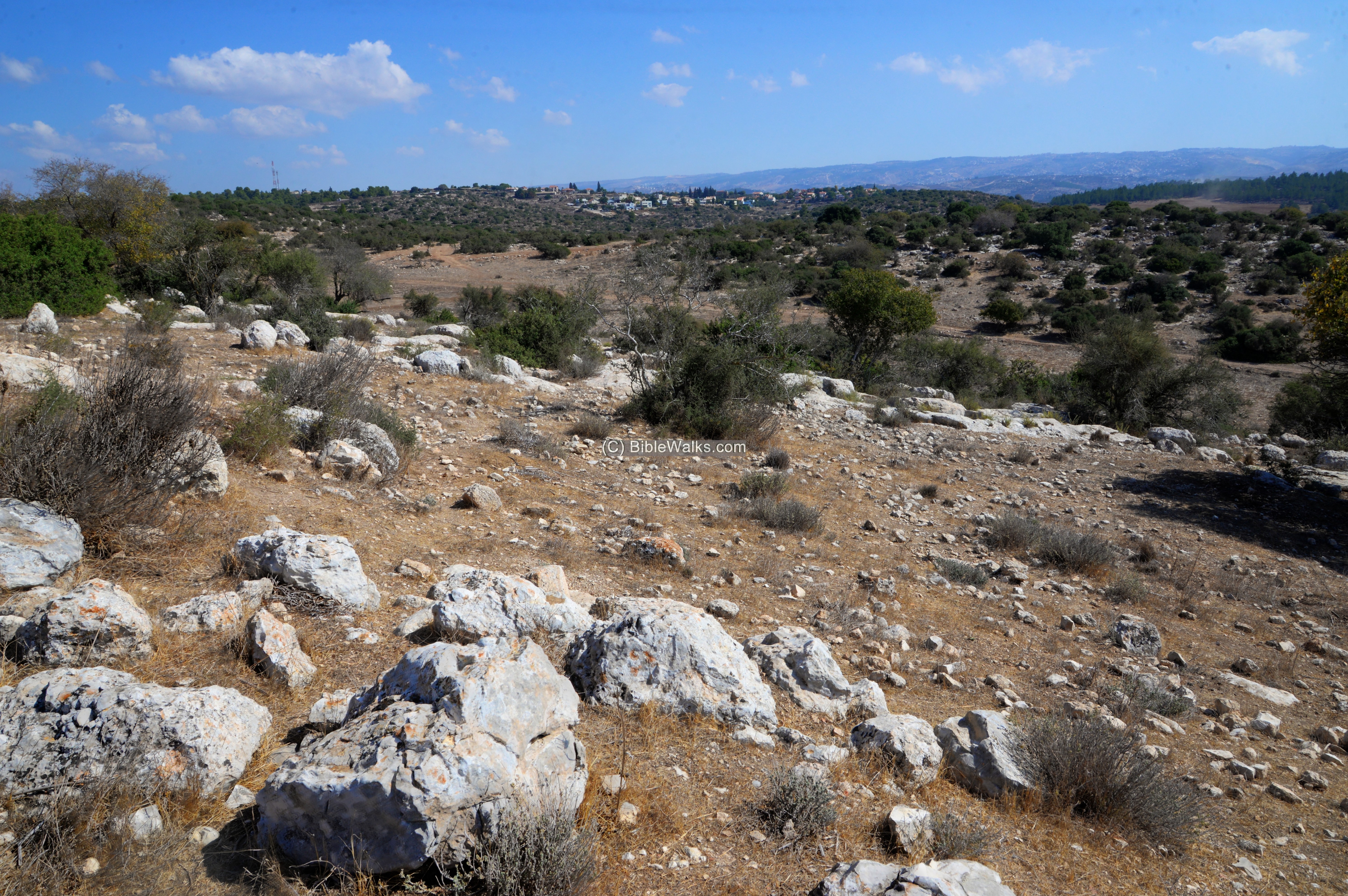
A view from the foothills towards the east:
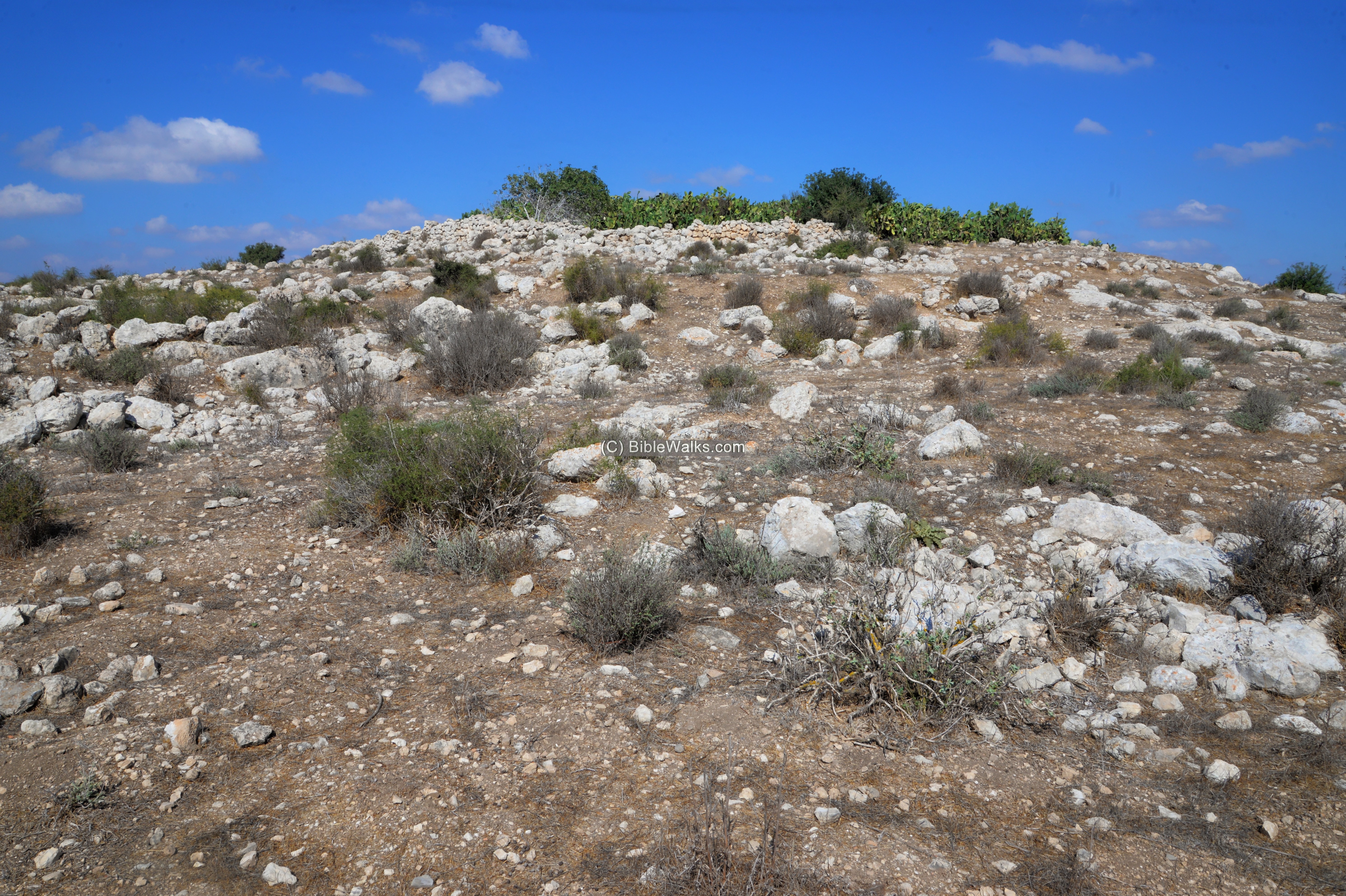
(c) Summit
An aerial view of the summit is seen here.
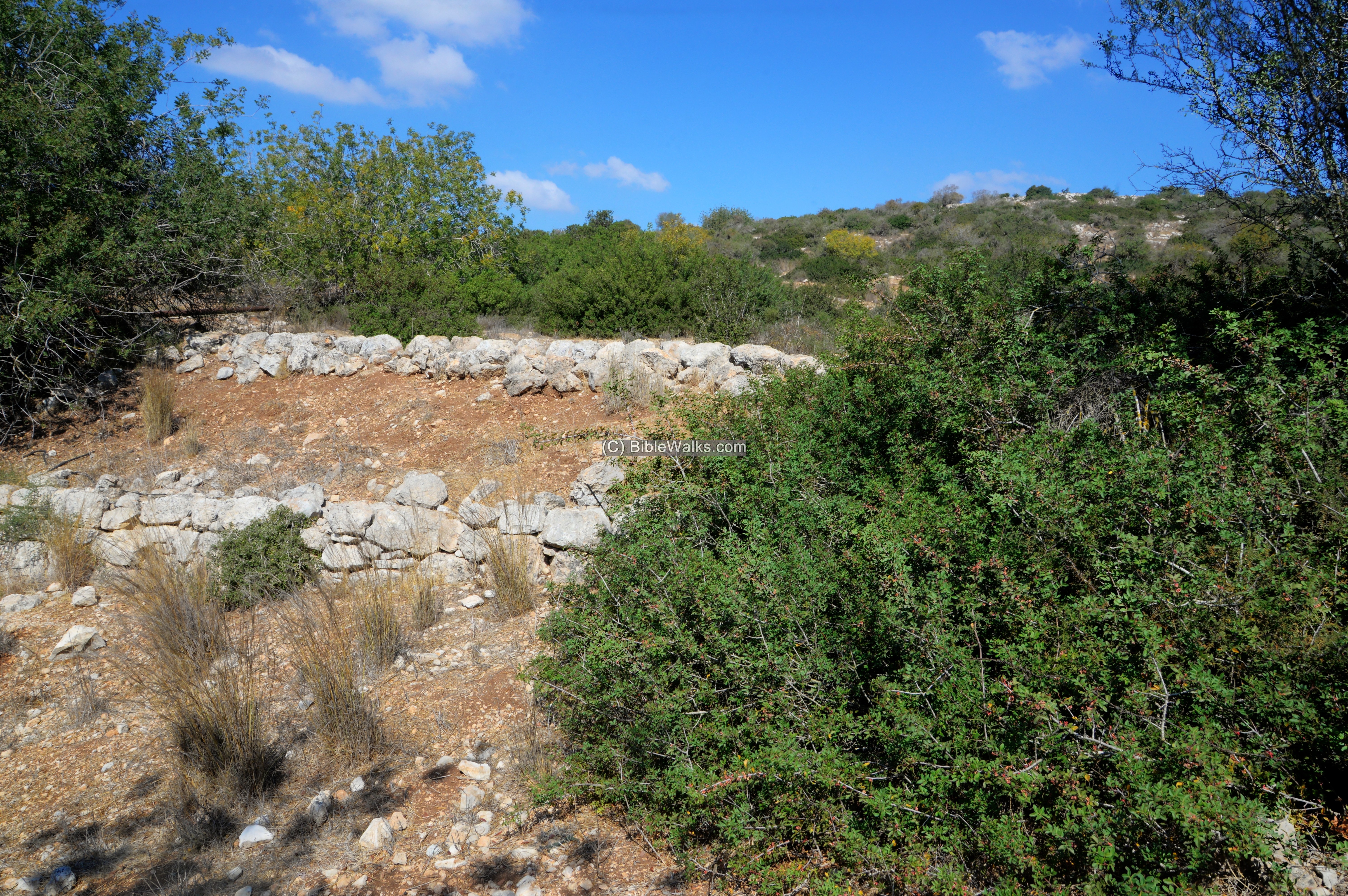
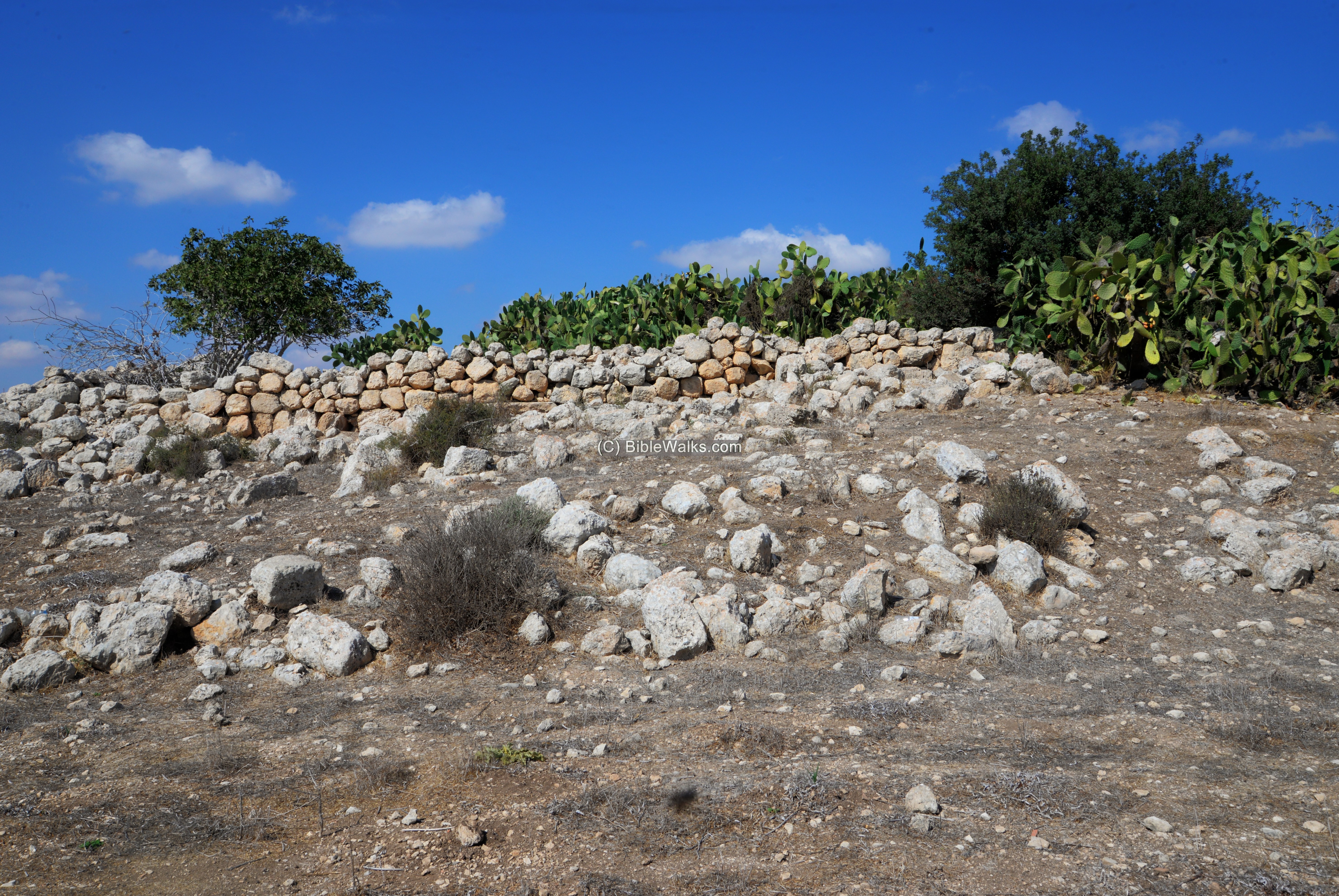
Below – a view of the ruins on the western side of the summit.
In the center of the site is an enclosed area with trees and bushes.
A low wall surrounds the central complex.
Looking around for architectural remains, we found this long carved stone, a threshold or part of an oil press.
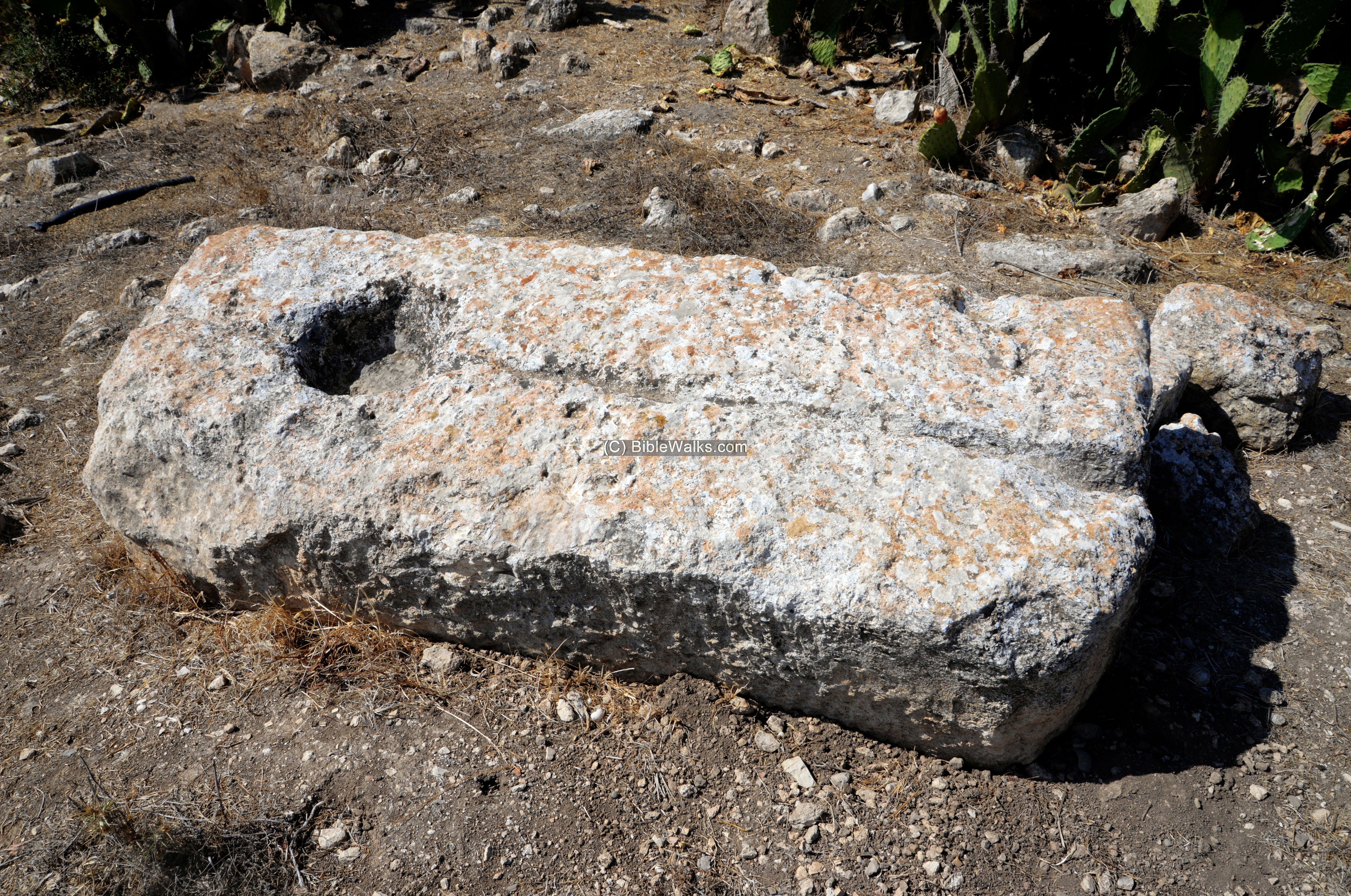
Nearby is a column standing inside the wall.

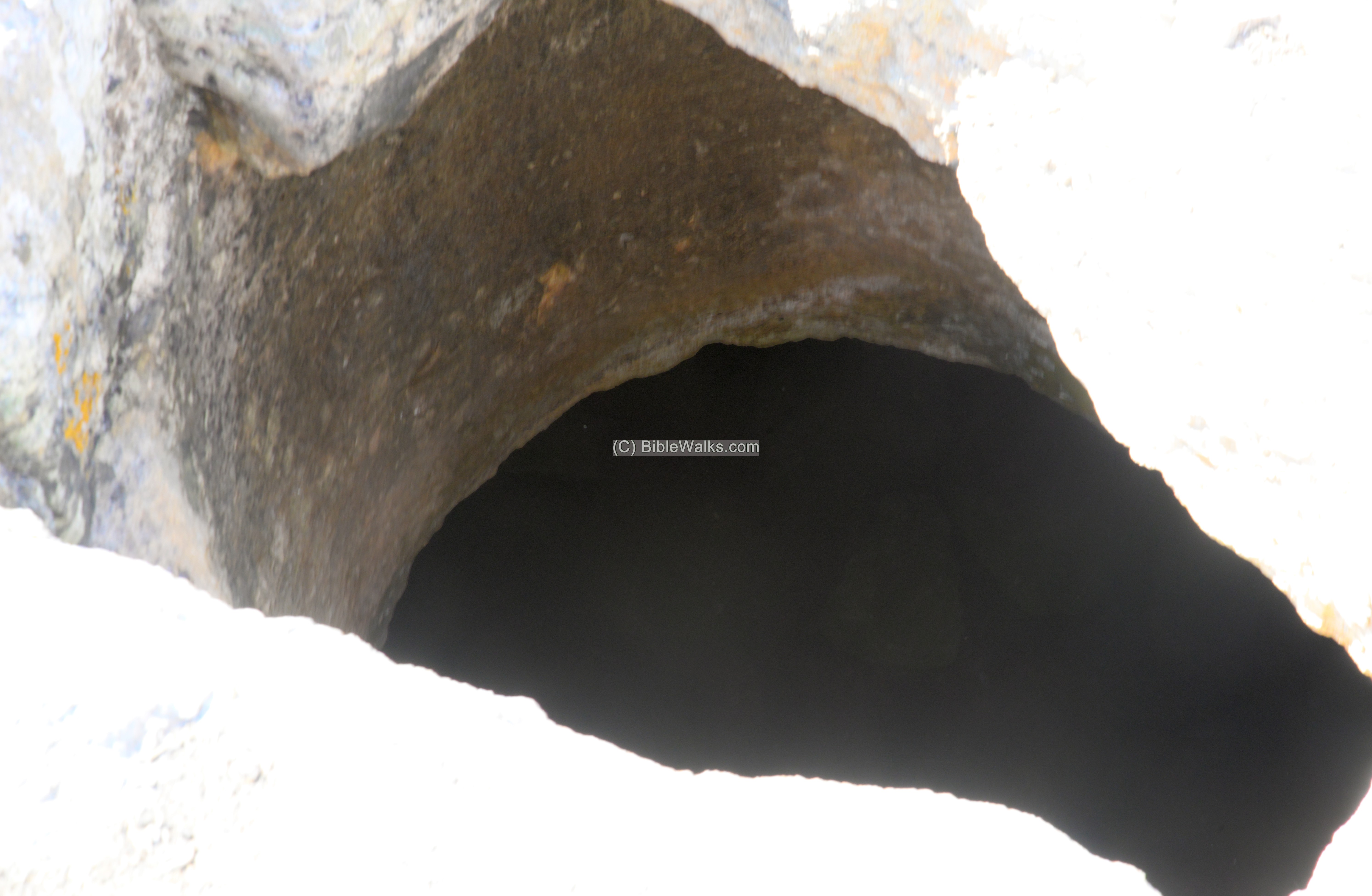
(d) Cisterns and caves
Below the surface are underground storage chambers, cisterns and burial caves. The following photos are samples of entrances.
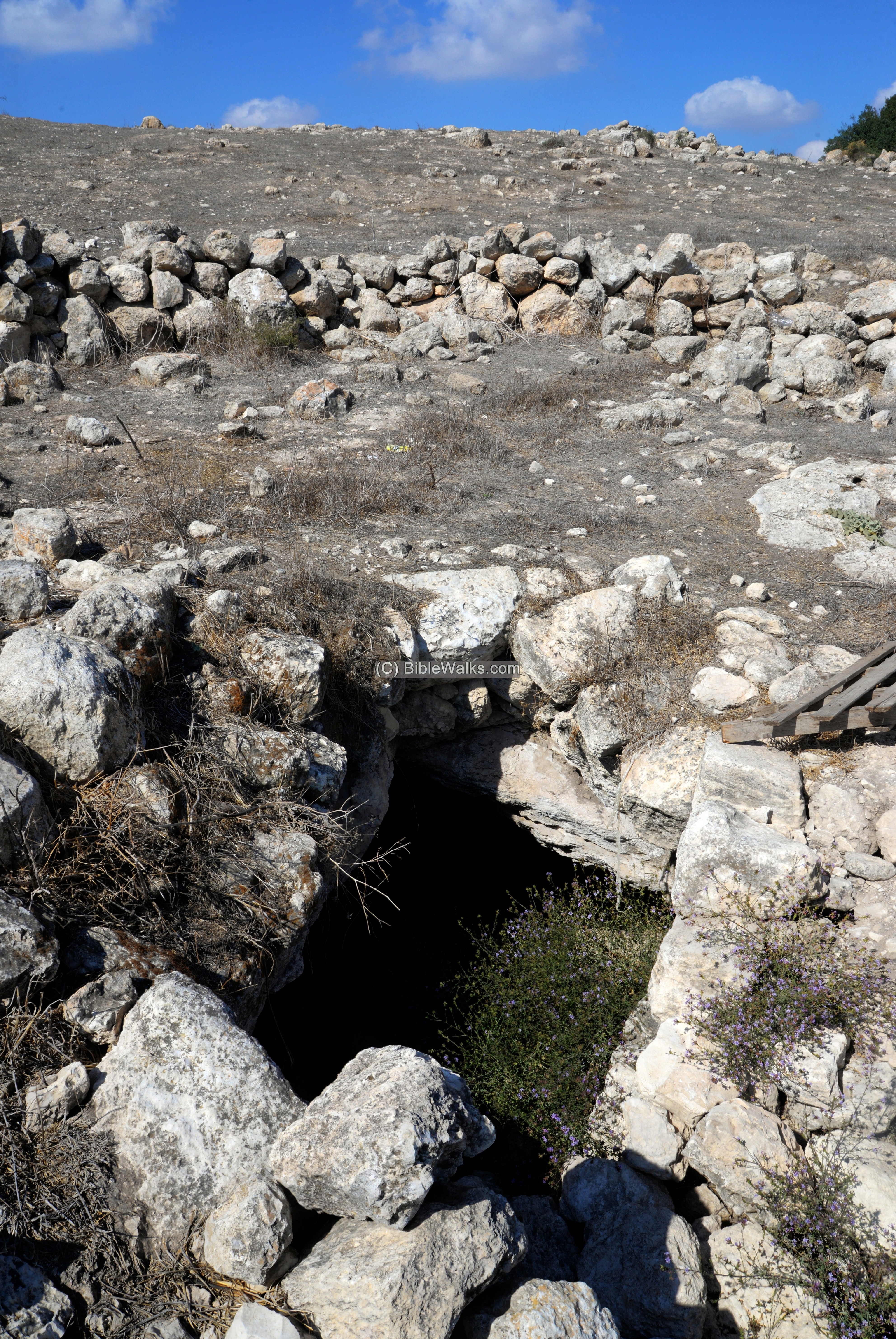
In one of the caves a ritual bath (miqveh) was identified: A rectangular corridor descends towards an opening with an arched lintel, then opens to a trapezoid chamber covered with gray plaster.
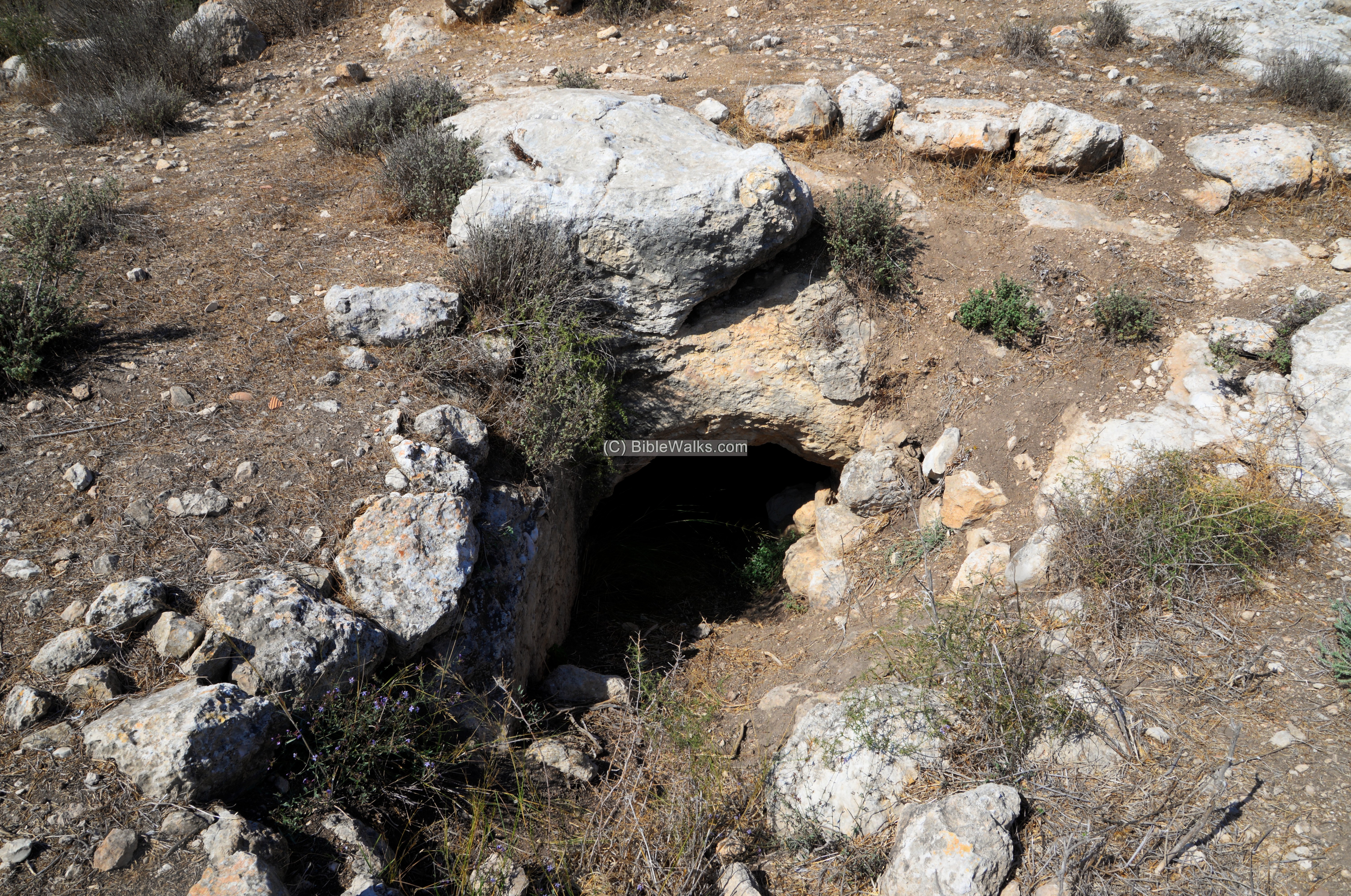
An opening to a cistern, part of an extensive underground system.
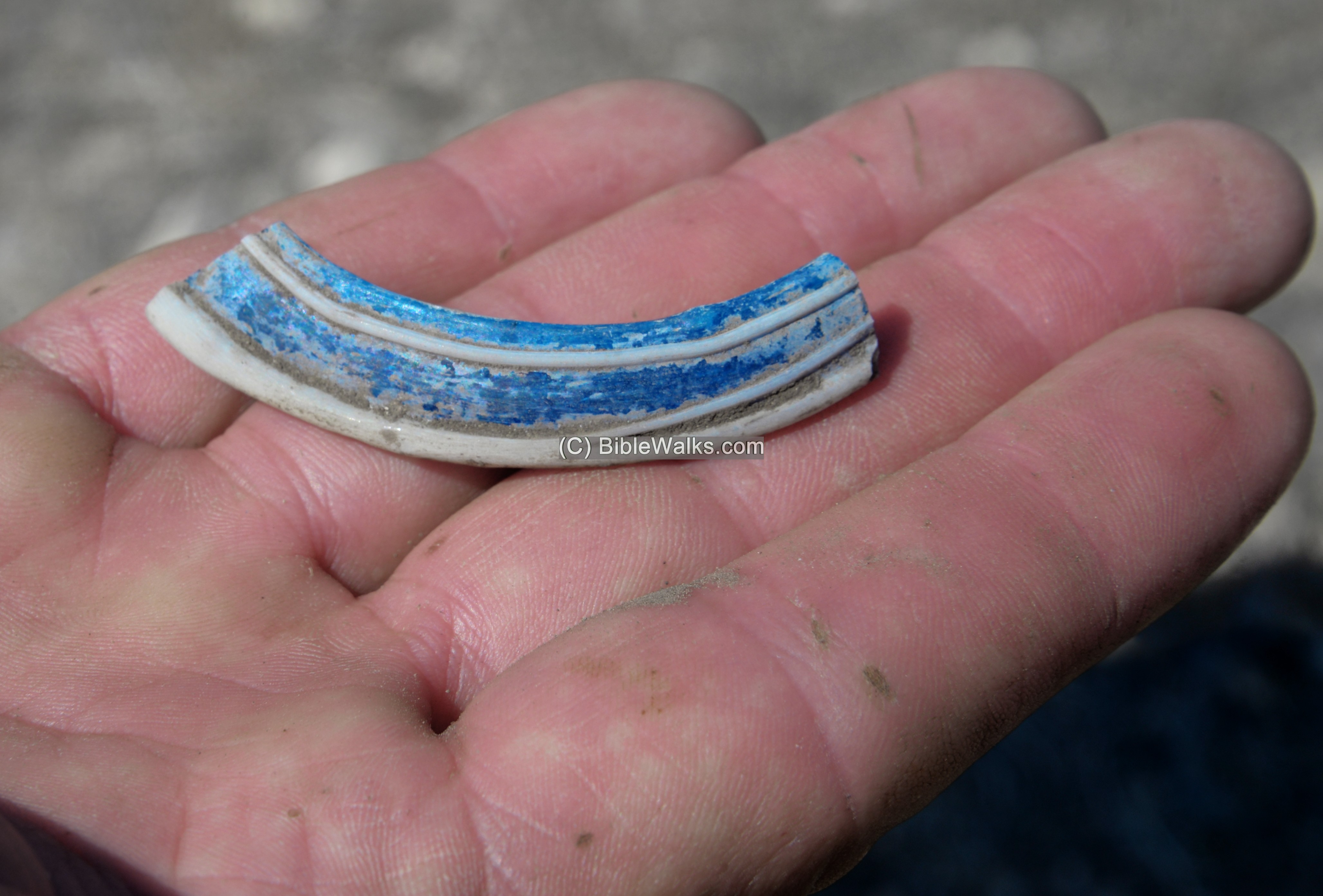
On the surface are ceramic fragments. Here is a sample:
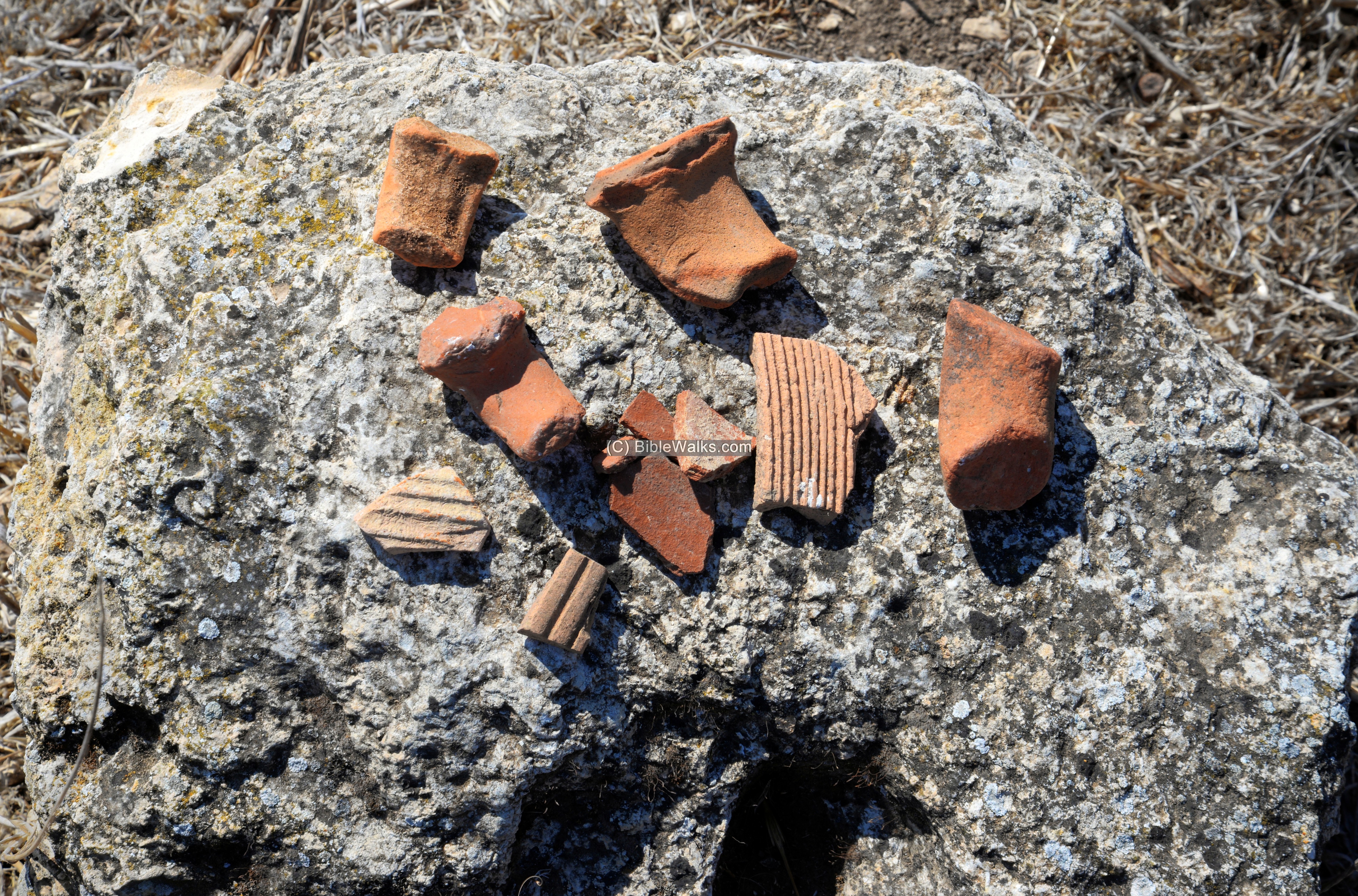
A piece of glassware was also spotted:
(e) Installations
On the eastern side we found a winepress, with a treading floor and a collecting pool:
(f) Video
![]() Fly over the site with this YouTube video:
Fly over the site with this YouTube video:
Etymology:
Names of the site:
- Rabbah – Hebrew: large; Biblical identification – (Joshua 15:60): “…Kirjathbaal, which is Kirjathjearim, and Rabbah; two cities with their villages:”.
- Kh. Rebbo – name as appears on old maps
- Kh. Rubba (also Raba, Ribbo) – Arabic name, possibly based on the Hebrew word Rabbath (meaning ‘large’).
Links:
* Archaeology:
- Graffiti of Boats from the Hellenistic and Early Roman periods – Eitan Klein, Boaz Zisso (2017) – Proc of the ICSAC
- Rock-Cut Hiding Complexes from the Roman Period in Israel Boaz Zissu and Amos Kloner (2009)
- Cassius Dio, Roman History
- Boaz Zissu academic papers
- Horvat Ethri -(HA 122, 2010; Hebrew) nearby site, with reference to Shua
* Internal – sites nearby:
* Other:
- Drone Aerial views – collection of Biblical sites from the air
- BibleWalks Youtube channel – join!
- Hiding Complexes info page
BibleWalks.com – exploring the Biblical landscape
Horvat Shua<<<—previous site–<<< All Sites >>>—>>> —Next Judea site—>>>Horvat Midras
This page was last updated on Dec 18, 2021 (New site)