A section of a Roman road north of Usha, between Kiryat Atta and Shefaram. An inscription on a rock (“CAB”) may have been an ancient Sabbath zone marker.
Home > Sites > West Galilee > Roman Road, Usha
Contents:
Background
History
Location
Aerial Map
Photos
* The road
* Sabbath marker
* Road to Usha
* Ben Baba tomb
Talmud Refs
References
Links
Background:
A section of a Roman road is located north of the ancient town of Usha (which was, for some time, the place of the Sanhedrin during the Roman period). This section was constructed during the Great revolt (68-70 AD) by Roman soldiers, and connected Acre to Sepphoris.
From Sepphoris the road continued east to Tiberias and south-east to Legio-Megiddo.
History:
-
Earlier times
This route was in use thousands of years before the Romans because of its easy path through the low hills of west Galilee. It was one of the east-west routes from Via Maris towards Netufa valley and the Sea of Galilee. There were alternative routes as well in the vicinity: through Evlayim creek (north of Shefaram), through Shefaram and Ofrat, and also through Sepphoris creek.
- Roman roads
Roman roads were an important part of the infrastructure built during the Roman period in Israel, which lasted from 63 BC to 324 AD. These roads were built by the Roman Empire to facilitate trade, communication, and the movement of troops throughout the region. They set up roads that enabled an efficient route through the tough terrain.
Some sections of these Roman roads are still visible today and can be explored by visitors to Israel. They are also found in the Galilee region, where they have been incorporated into modern roads and highways.

A Figurative Roman road – AI generated by Stable Diffusion
-
Revolt against the Romans
During the great revolt the Romans constructed new roads to make their long supply lines more efficient. Their mobilization of the army required better roads than were constructed previously. Josephus Flavius, the commander of the Galilee revolt which later wrote about these tragic events, describes one of such constructions (“Wars of the Jews”, book III chapter 7 par. 3):
“Accordingly, he sent both foot-men and horsemen to level the road, which was mountainous and rocky, not without difficulty to be traveled over by footmen, but absolutely impracticable for horsemen. Now these workmen accomplished what they were about in four days’ time, and opened a broad way for the army”.
Josephus also describes the heavily armed Roman Army, justifying why they required such roads – see the reference below.
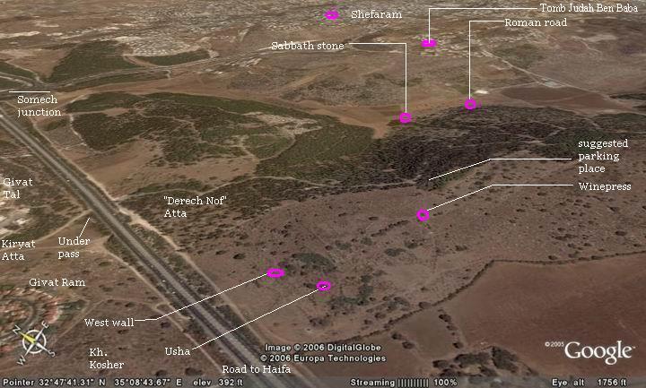
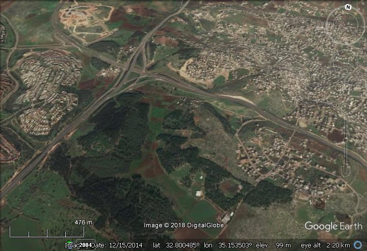
Aerial View / Map:
The following aerial view shows the points of interest and a map of the area.
Location:
This site is located between the following sites:
-
5-6 Km south-east to Tell Afek, which was located on the Via Maris (the main ancient highway).
-
0.5KM north-east to Khirbet Usha
-
1KM south-east to Somech junction, on the Afek-Shefaram road
It can be reached on foot – only a few minutes walk from the picnic tables near Khirbet Usha, on the park road (“Derech Nof”) that starts from Givat Ram/Tal in Kiryat Atta. See map above – the suggested parking place is marked on the right side of the map
Photos:
(a) The road:
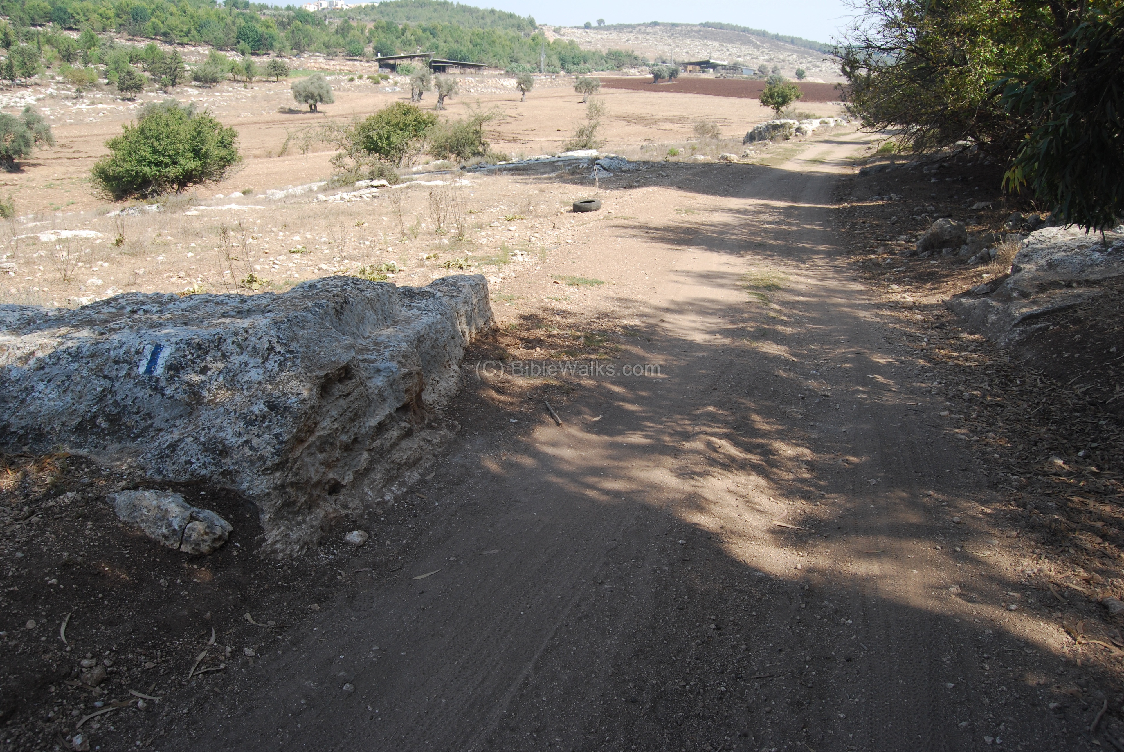
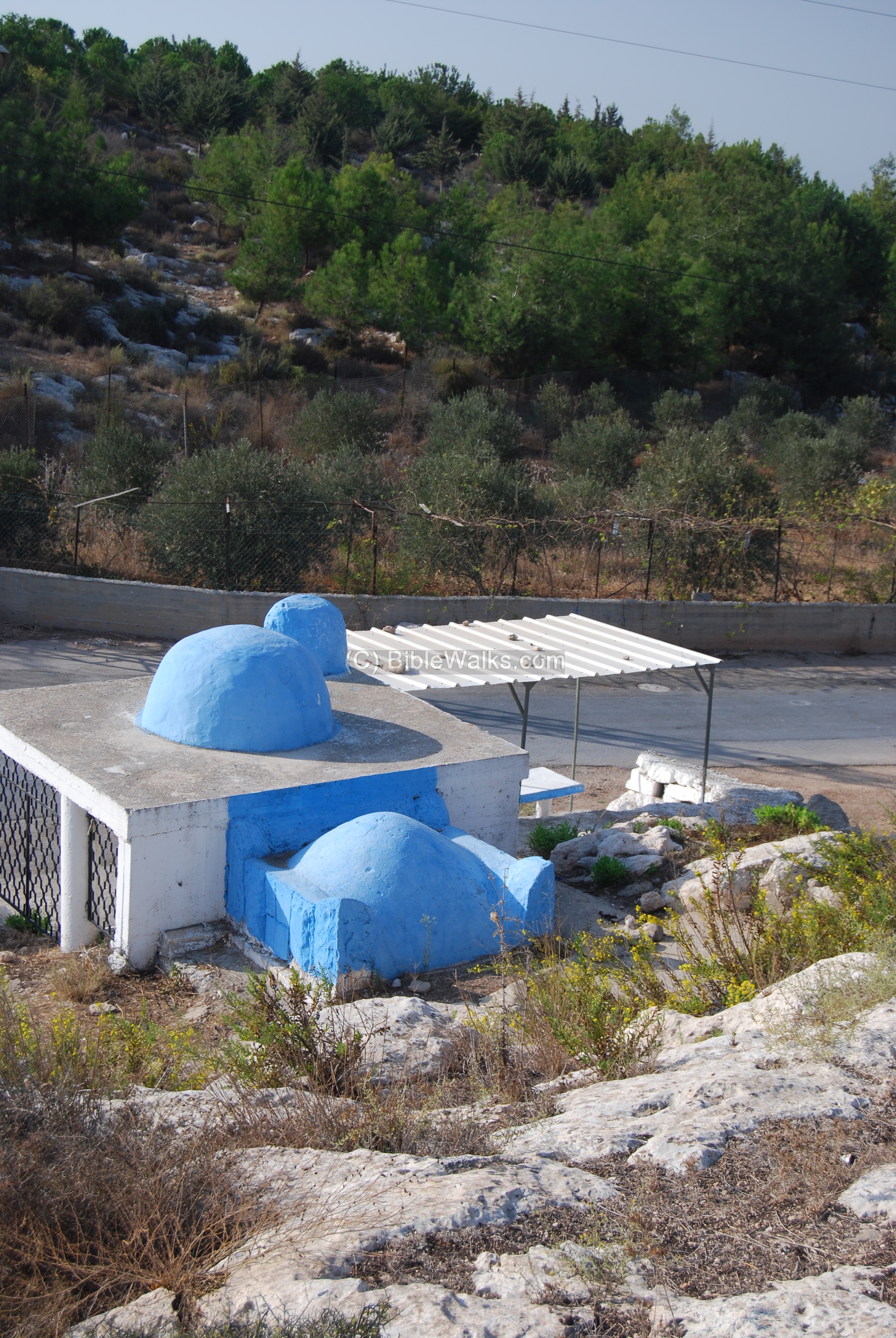
The photo below shows a view of a section of the road towards the west. In the background is a turn of the road to the left (towards the ancient village of Usha) and right (towards Afek).
Click on the photos to view in higher resolution…
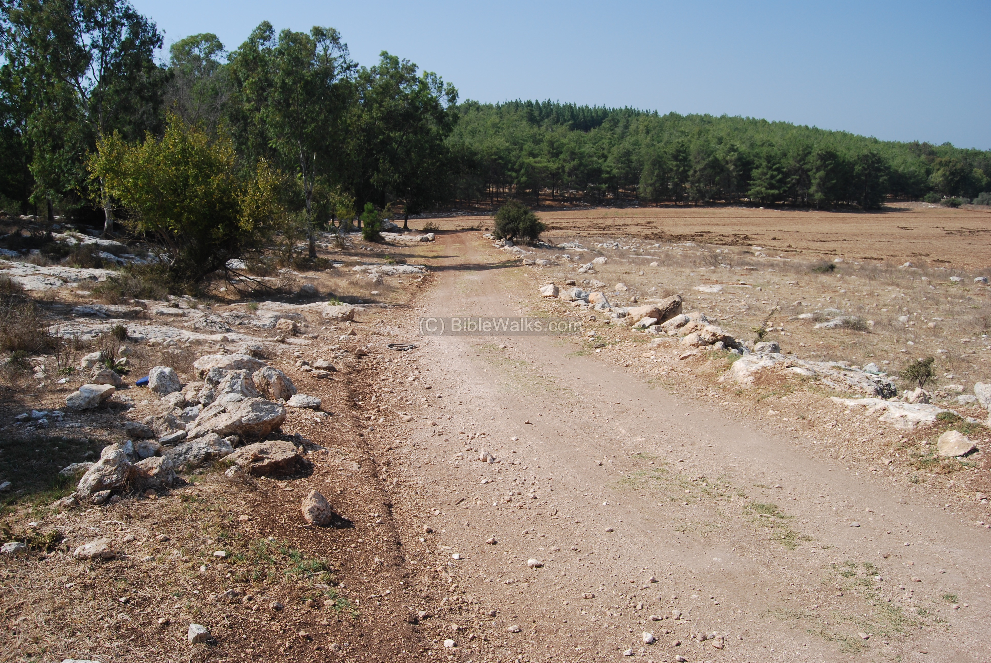
A view of the road towards the east. Shefaram is seen on the background.
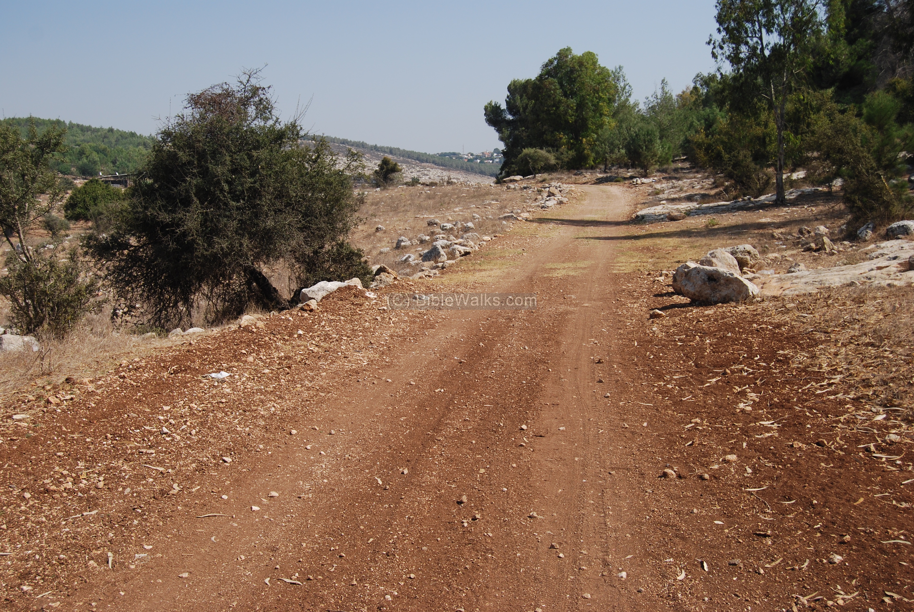
Another section of the road, with a view towards the east.
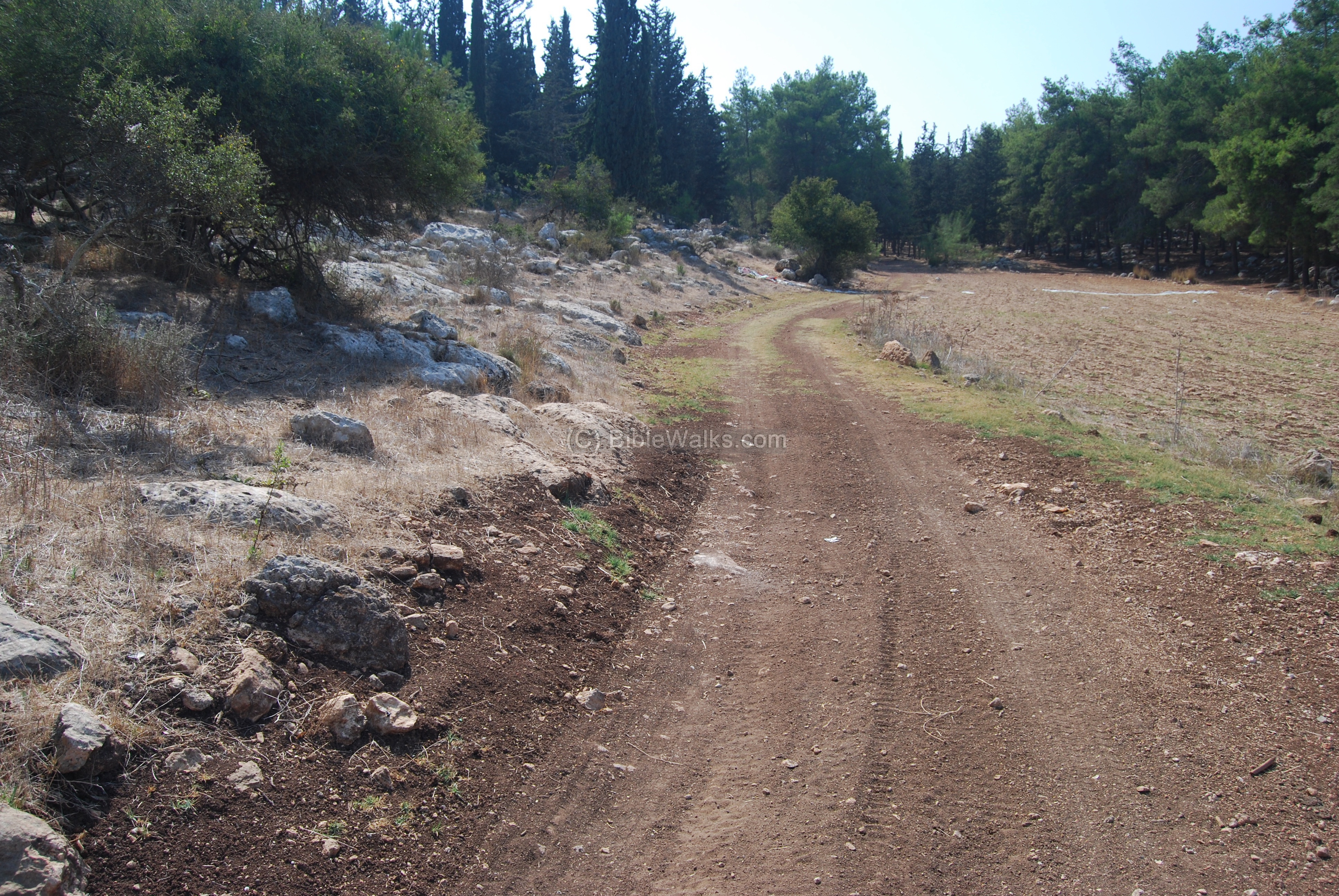
(b) Road to Usha:
A section of the road that climbs up to Khirbet Usha. Along the road, on the left side, are rows of stones. The hillside is also the location of the ancient cemetery of Usha, with burial caves and rock-hewn tombs.
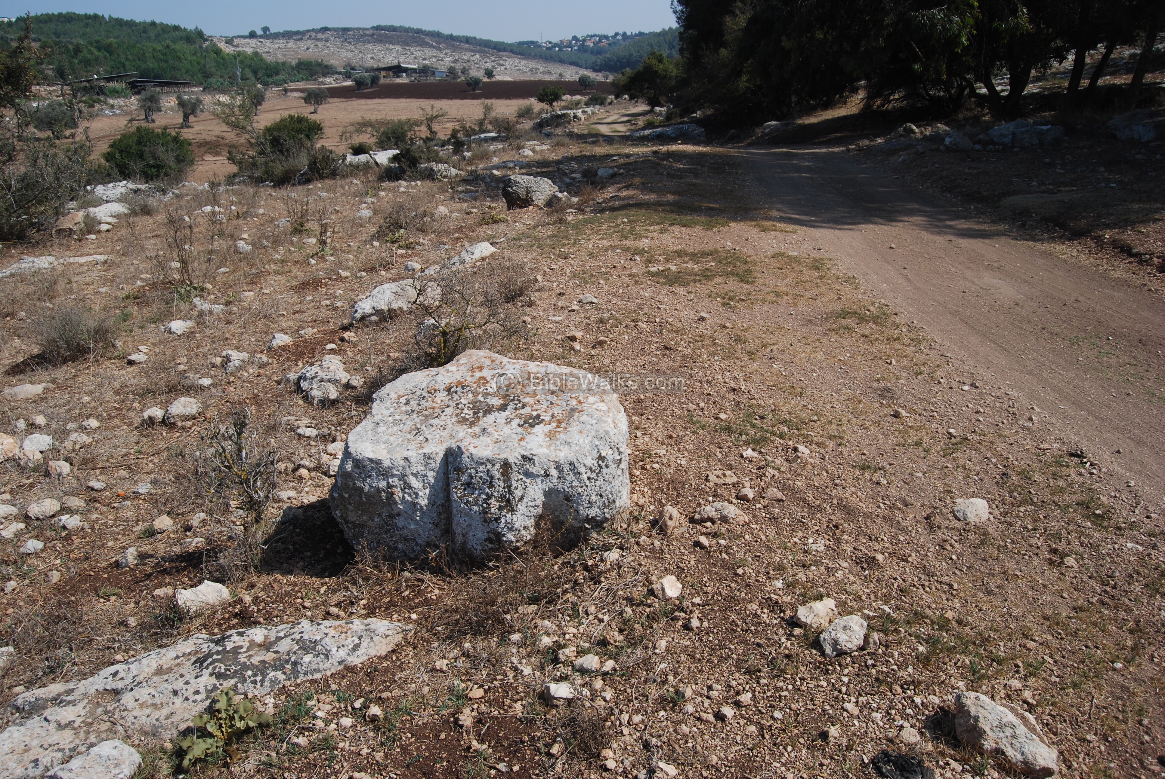
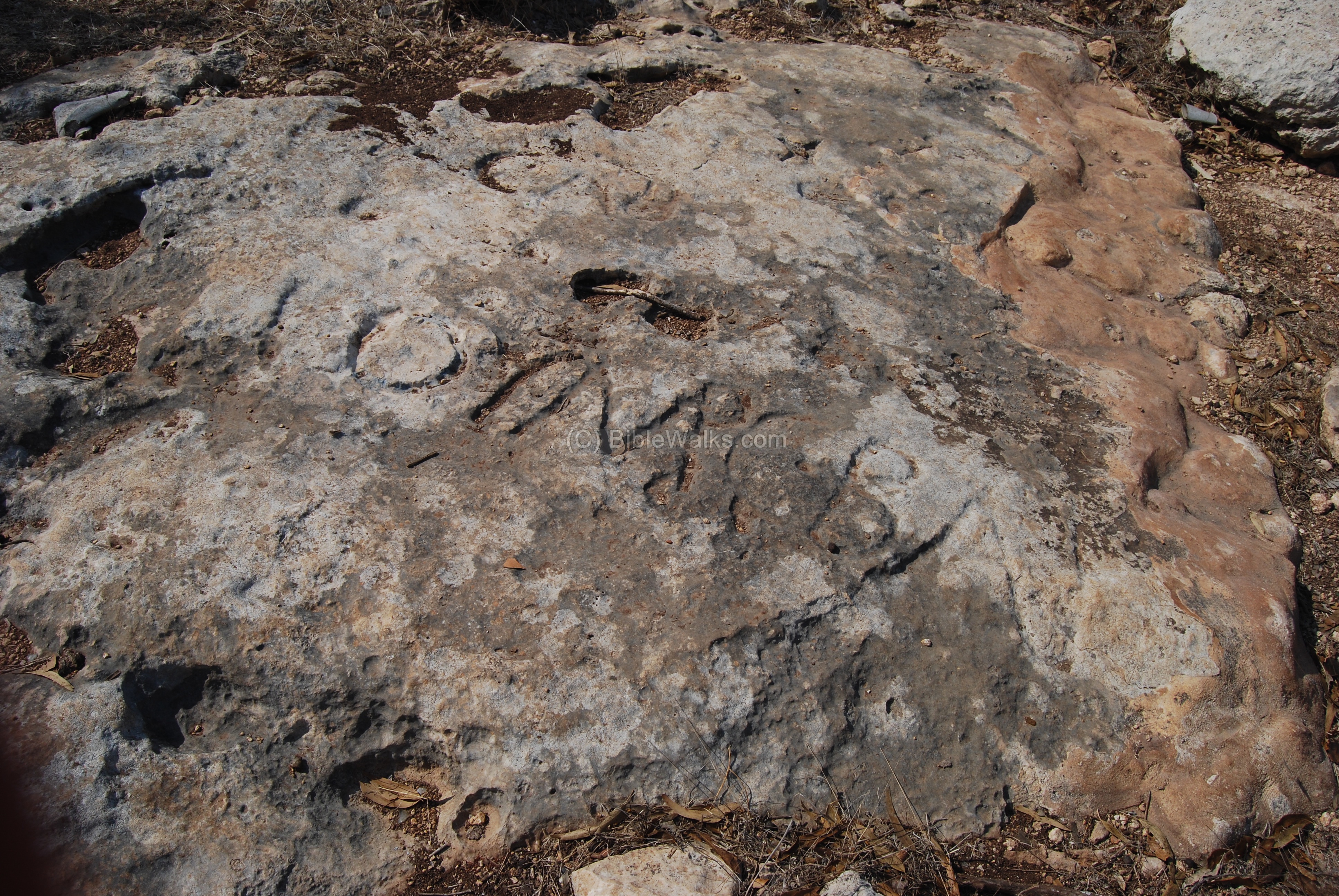
(c) Sabbath marker:
At the edge of the hillside, 500M north-east of Usha, is an incredible marker inscribed on the rock. It is located on the south side of the road, as seen below (on the right side – behind the stones).
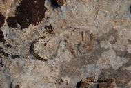
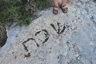
The photo below shows the inscription on the rock:
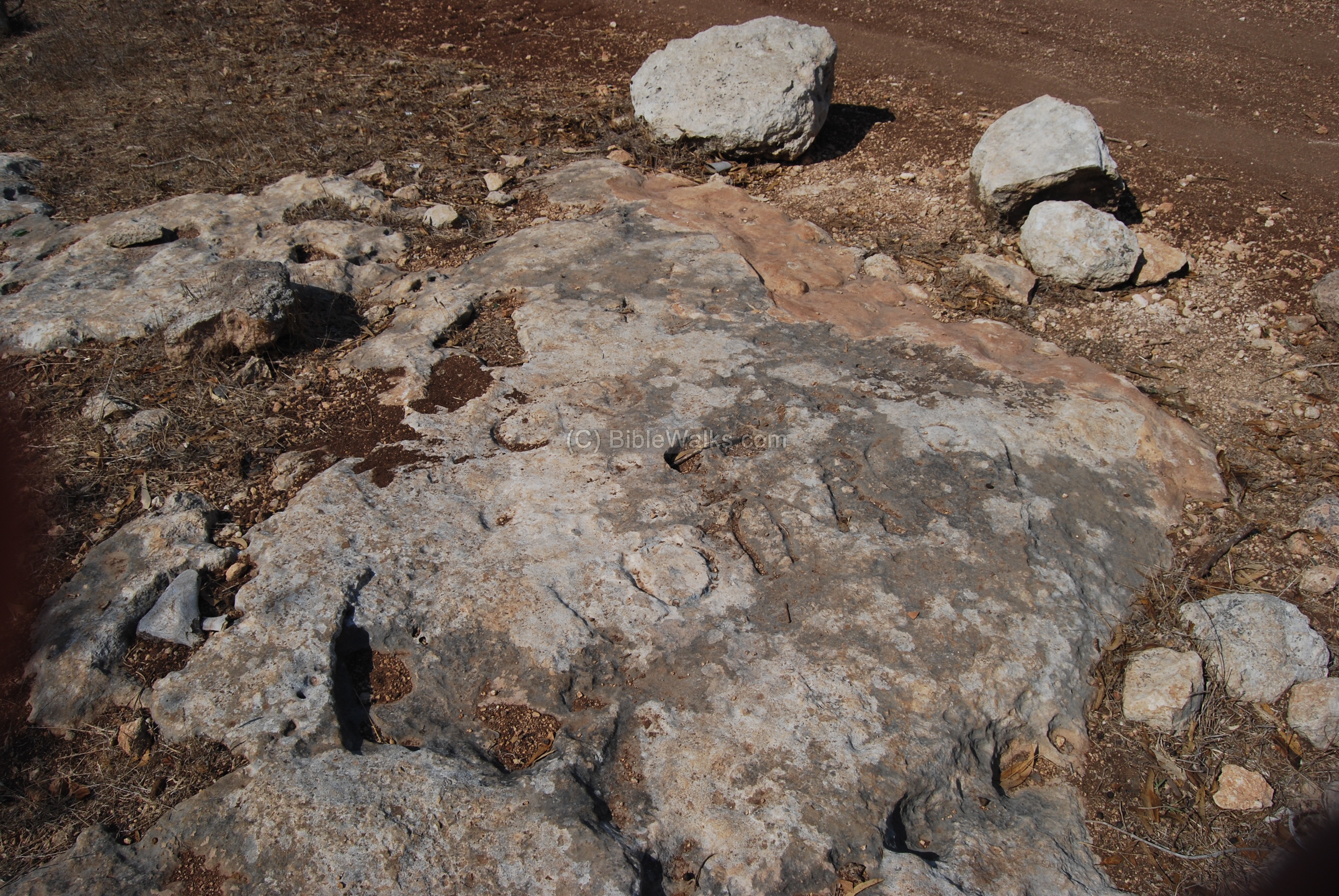
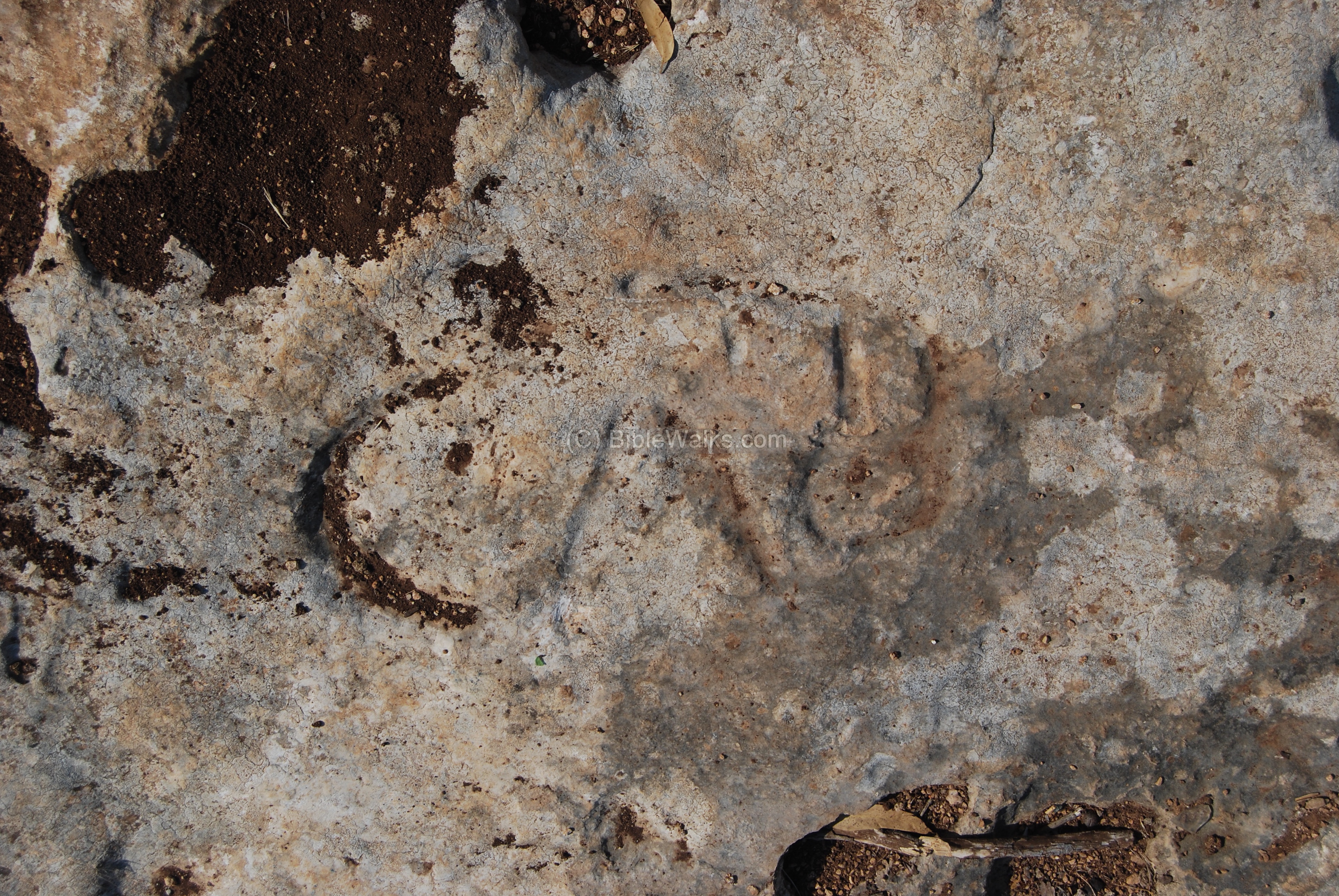
A detailed view of the inscription is seen below. The letters are in Greek, which was the common language used about 2,000 years ago after the country was controlled by the Seleucid Kingdom and during the Roman rule. The letters include two lines: “CAB” ” GOYMCBA”. The first part of the inscription is explained below, but the second section is not known, and according to some scholars it may be the name of the Shabbat zone.
A detail of the inscription is seen below. The letters “CAB” seen below are considered as the prefix of the word CABAT – Shabbat.
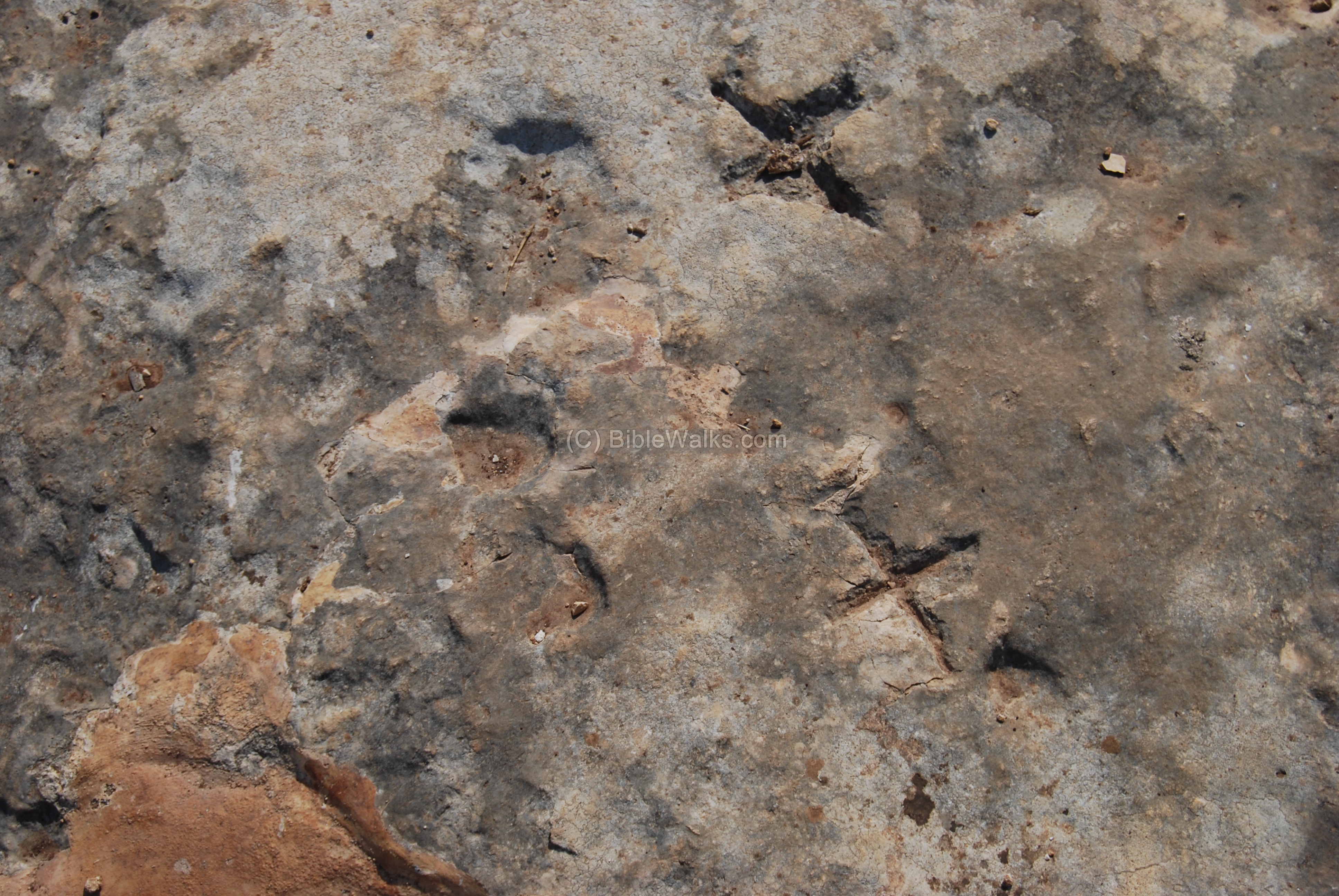
Another detail of the rock’s inscription – on the east side of the rock. It looks like double letters “X”. Maybe 20KM to Sepphoris or Acre?
The location of the marker is illustrated on the aerial map. It is about 1km from Shefaram, and 0.5km from Usha. According to Jewish customs, work is not allowed during Sabbath or Holidays, including traveling outside of the place of residence, but allowed within 2000 cubits (about 1km) from the edge of the village. This distance applies to Usha and Shefaram, where both Sabbath walkers could meet. The Talmud wrote about the Sabbath barrier between Usha and Shefaram: “What did R. Judah b. Baba do? He went and sat between two great mountains, between two large cities; between the Sabbath boundaries of the cities of Usha and Shefaram”.
An alternative explanation for the stone is a special exempt from the Sabbath city limit of only 2000 cubits, which allows an extension of another 2000 cubits beyond the city limit. It is named Eruv Techumim – Hebrew for “mixed borders”. This exemption applies in cases two villages are within 4000 cubits, such as this case, allowing walking between them after the Sabbath starts in Friday evening. The Talmud permitted two options for this exemption – (a) physically standing at the Sabbath boundary just before sundown when the Sabbath starts, then walking the extra distance, or (b) by placing food before sundown on a spot at the Sabbath boundary.
* * *
In July 2011 another Roman period Sabbath marker was found near Timrat, written in 3 Hebrew letters. The discovery and identification was performed by BibleWalks staff, and was published in our blog a week before the news spread across the Globe. (Read about this…)
Talmud References (Sanhendrin 14):
A section from Babylonian Talmud (Sanhendrin 14) tells the story of Rabbi Judah Ben Baba which relates to this site. This Rabbi defied the orders of the Romans to avoid ordinating (=giving a degree of a Rabbi) to others. These orders followed the second revolt against the Romans (131-135 AD: Bar-Kochva), and his act resulted in his death by the Romans, but helped to continue the Jewish leadership during these tragic days.
“… because once the wicked Government, decreed that whoever performed an ordination should be put to death, and whoever received ordination should he put to death, the city in which the ordination took place demolished, and the boundaries wherein it had been performed, uprooted. What did R. Judah b. Baba do? He went and sat between two great mountains, between two large cities; between the Sabbath boundaries of the cities of Usha and Shefaram and there ordained five elders: R. Meir, R. Judah, R. Simeon, R. Jose and R. Eliezer b. Shamua’. R. Awia adds also R. Nehemia in the list. As soon as their enemies discovered them he urged them: ‘My children, flee.’ They said to him, ‘What will become of thee, Rabbi?’ ‘I lie before them like a stone which none overturn, he replied. It was said that the enemy did not stir from the spot until they had driven three hundred iron spear-heads into his body, making it like a sieve”.
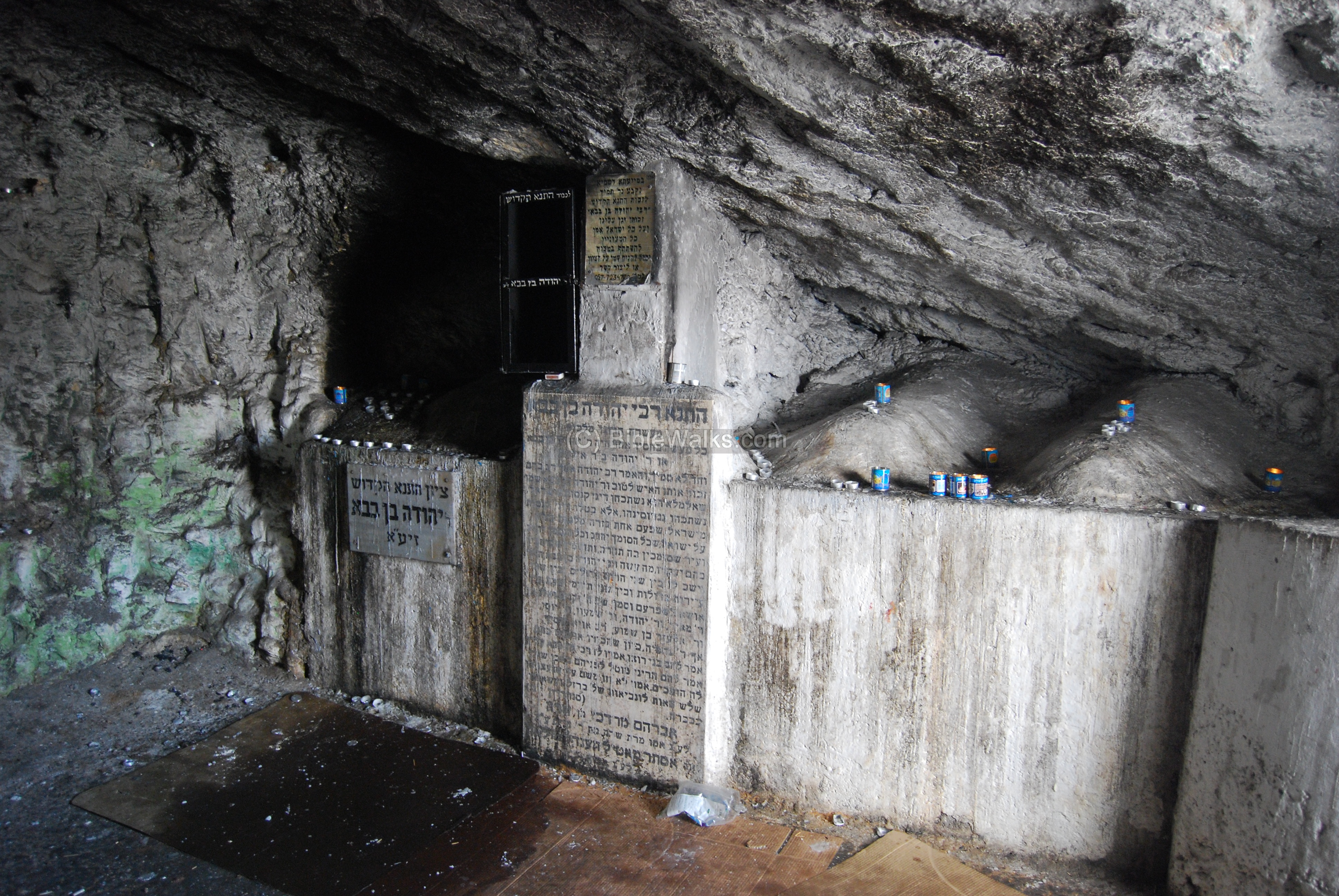
The site is in the vicinity of the site of the Sabbath rock – between Usha and Shefaram. The tomb of Rabbi Judah Ben Baba, seen below, is located in a cave 700M north-east. Also interesting to know that the modern junction north of the site is called “Somech” (ordinator), called after the Rabbi’s heroic acts.
This is the interior of the tomb of Judah Ben Baba. Its size is 5m x 5.5m, 1.8m high. On the right are 4 burial niches. The burial cave may have been cut in the Roman period.
On the old Mandatorian maps the site was named Mugharat Bint Ya’aqub – the cave of Jacob’s daughter (why?).
Historical References:
Josephus Flavius (Wars of the Jews, book III chapter 6 par. 2):
Josephus, the Galilee commander who fought the Romans, then served them as a historian, provides a fascinating description of the heavily armed Roman army, which justified rebuilding the old dusty roads of the Holy land.
“But as Vespasian had a great mind to fall upon Galilee, he marched out of Ptolemais, having put his army into that order wherein the Romans used to march. He ordered those auxiliaries which were lightly armed, and the archers, to march first, that they might prevent any sudden insults from the enemy, and might search out the woods that looked suspiciously, and were capable of ambuscades. Next to these followed that part of the Romans which was completely armed, both footmen ,and horsemen. Next to these followed ten out of every hundred, carrying along with them their arms, and what was necessary to measure out a camp withal; and after them, such as were to make the road even and straight, and if it were any where rough and hard to be passed over, to plane it, and to cut down the woods that hindered their march, that the army might not be in distress, or tired with their march. Behind these he set such carriages of the army as belonged both to himself and to the other commanders, with a considerable number of their horsemen for their security. After these he marched himself, having with him a select body of footmen, and horsemen, and pikemen. After these came the peculiar cavalry of his own legion, for there were a hundred and twenty horsemen that peculiarly belonged to every legion. Next to these came the mules that carried the engines for sieges, and the other warlike machines of that nature. After these came the commanders of the cohorts and tribunes, having about them soldiers chosen out of the rest. Then came the ensigns encompassing the eagle, which is at the head of every Roman legion, the king, and the strongest of all birds, which seems to them a signal of dominion, and an omen that they shall conquer all against whom they march; these sacred ensigns are followed by the trumpeters. Then came the main army in their squadrons and battalions, with six men in depth, which were followed at last by a centurion, who, according to custom, observed the rest. As for the servants of every legion, they all followed the footmen, and led the baggage of the soldiers, which was borne by the mules and other beasts of burden. But behind all the legions carne the whole multitude of the mercenaries; and those that brought up the rear came last of all for the security of the whole army, being both footmen, and those in their armor also, with a great number of horsemen”.
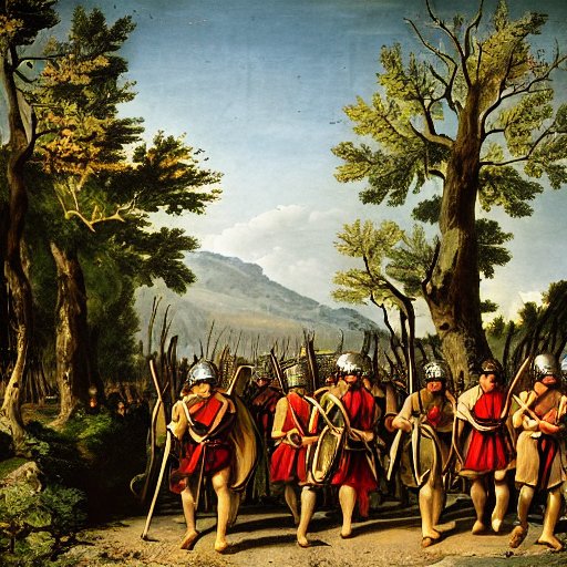
Roman soldiers march along a road – AI generated by Stable Diffusion
References & Links
-
Arch. Survey of Israel – Shefr’am Map (24) – Y. Olami & Z. Gal [1982] , site #77: Cemetery of Talmudic-period Usha, and Roman road.
- Roman roads in BibleWalks
- Usha – nearby Roman/Byzantine village
Other Sabbath Markers:
-
Sabbath boundary marker found near Timrat; first identified by BibleWalks
BibleWalks.com – walk with us through the sites of the Holy Land
Usha<<<–previous site—<<<All Sites>>>—Next West Galilee site—> Tell Zavat
This page was last updated on Apr 5, 2023 (add illustration)
Sponsored links: