Ruins of a large Upper Galilee village, dated to the Byzantine and Mameluke/Crusader period. Its nickname – “the lost city” – is derived from its obscurity, as it was hidden inside the thick forest.
* Site of the Month Oct 2019 *
Home > Sites > Upper Galilee > Center > Horvat Zonem (Kh. es Suwaneh)
Contents:
Overview
Location
History
Photos
* Along the trail
* Arches
* Ruins
* Nature
Etymology
Links
Overview:
Ruins of a large village, dated to the Byzantine and Crusader/Mameluke periods. Its nickname – “the lost city” – is derived from its obscurity, as it was hidden inside the thick forest.
Location and map:
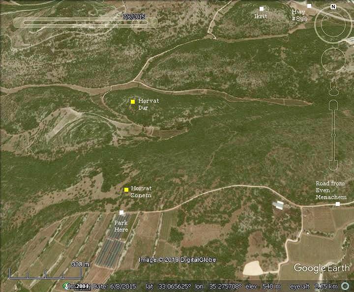
This aerial map indicates the major points of interest around the site. Drive to a parking place near the site along a partially paved road, starting from Moshav Even-Menachem off highway #899.
History:
-
Byzantine period
This Christian village was founded during the Byzantine period. Most of the structures were constructed during this period. It covers an area of 15 Dunams (4 acres).
-
Crusaders and Mameluke period
The village was also inhabited during the Crusaders/Mameluke period, reusing the Byzantine structures.
- Ottoman period (16th-20th century)
The area was examined in the Palestine Exploration Foundation (PEF) survey (1866-1877) by Wilson, Conder and Kitchener.
A section of their map is shown here. The site is marked as “Kh. es Suwaneh” (Arabic for: “ruin of flint”). It is located south of Akrith – the largest town in the area located on the main road to Akhziv on the shore.
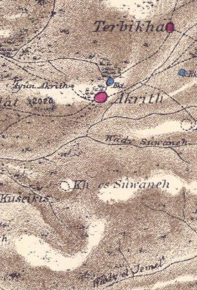 Part of map sheet 3, 1872-1877. (Published 1880, reprinted by LifeintheHolyLand.com)
Their report of Kh. es Suwaneh (Horvat Zonem) was simply (V1, p. 181):
“Heaps of large stones on terraced hill”.
- Modern Period
This ruins of this impressive site is hidden in a thick forest. A short trail leads from the parking plate at the side of the dirt road.
Photos
On the trail:
The ruins are hidden among a thick forest, giving the site a nickname of ‘hidden city’.
Click on the photos to view in higher resolution…
Along the trail, and beneath the ruined structures, are cisterns built of well dressed medium-large stones. Amit is seen here peeking into one of the cisterns, which was full of water after a very wet winter. The cisterns were the primary source of drinking water during the antiquity, as there are no springs in the site.
Arches:
One of the remarkable structures in Horvat Zonem is a set of arches which supported the upper floor of a large building, perhaps a public structure.
A view from another side shows the slabs of the upper level supported by the arches, creating a lower level.
The lower level, below the arches, served as a large underground water reservoir. The walls are plastered to keep the stored water.
A detail of the arches is in the next photo. Notice the plastered wall inside the chamber, and the quality of work on the base of the arch.
The ruins:
Horvat Zonem is one of the largest sites in the area, covered with dozens of ruined structures. Most of the buildings are covered by the bushes and trees. Ruins of a Church (Byzantine period) and a Mosque (Mameluke period) were identified in the site, but we could not find them.
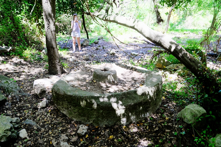
The base of a crushing stone, part of an olive oil press installation, is located on the northern foothills.
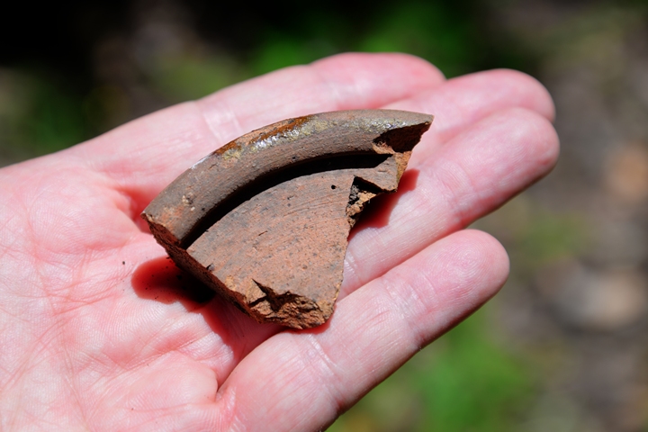
Of the ceramic fragments, we noticed this glazed ceramic sherd. The pottery dating to the Crusader/Mameluke periods consists of different types of glazed bowls and cooking ware.
Nature:
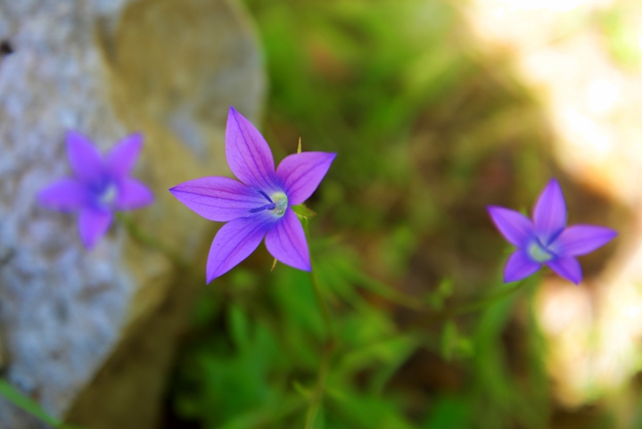
There are various wild flowers along the trail. During early May purple flowers were the majority of the flowers seen along the fringes of the forest. These annuals are identified as Campanula Sidoniensis (Hebrew: Pa’amonit Zidonit) of the Campanulaceae family. It is commonly known as the Sidon bellflower or Sidon harebell, and is native to the Mediterranean region, particularly in Lebanon and Syria. Campanula sidoniensis is a perennial herb that grows up to 30 cm tall. It has lance-shaped leaves that are about 3-6 cm long, and bell-shaped flowers that are about 3 cm long and 2 cm wide. The flowers are typically blue-purple in color and appear in late spring and early summer.
Etymology (behind the name):
* Names of the place:
- Horvat Zonem – the Hebrew name, based on the Arabic name. Zonem is also Zor – Flint. It is mentioned in the Hebrew Talmud as a hard rock such as flint.
- Kh. Es Suwaneh – as appears on the PEF report, meaning: Ruin of flint
- Kh. Es Suwwana – as appears on the mandate map
- Even Menachem – A Moshav community, established 1960, named after Arthur Menachem Hantke – A Zionist leader from Germany
Links:
* External sites:
-
Settlement and History in Hellenistic, Roman, and Byzantine Galilee: Uzi Liebner, pp.106-116
* Nearby sites:
* BibleWalks sites:
BibleWalks.com – Views of the Holy Land
Akhbara<<<–previous site—<<<All Sites>>>—next Upper Galilee site—>>> Horvat Dur
This page was last updated on Oct 3, 2024 (update links)
Sponsored links:
