Giv’at Yehonathan (Jonathan Hill, Horvat Karmet) is the site of an ancient walled city dating back to the Early Bronze Age, located on a low projecting spur of Mount Gilboa.
Home > Sites > Mt. Gilboa > Giv’at Yehonathan (Horvat Karmet, Karmat)
Contents:
Background
Location
History
Photos
* General View
* Monument
* The Hill and slopes
* Ceramic dating
* Aerial Video
Links
Etymology
Background:
Giv’at Yehonathan (Jonathan Hill, Horvat Karmet) is the site of an ancient walled city dating back to the Early Bronze Age, located on a low projecting spur of Mount Gilboa. It was proposed that this site was the place of the camp of Judge Gideon when he launched a strike against the Midianites.
Location:
The ruins of the site are located on a ridge overlooking the valley of Harod. Its height is 131m above sea level, 150m above the valley. The site covers an area of 35 dunams, and is surrounded by agriculture terraces.
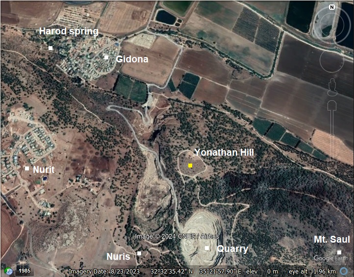
A closer view of the site is seen below.
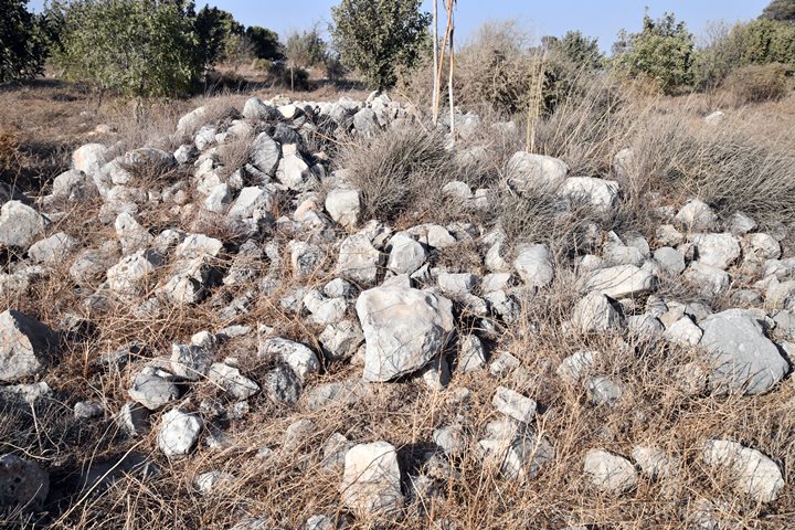
On the hill are stone clearance heaps, with traces of structures and pottery fragments between them. A dirt road that surrounds the upper level site, within the area of the walled city.
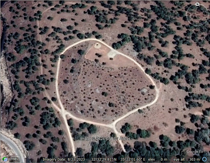
History:
- Earlier periods (~80,000 – 4,500 BC)
Flint tools of prehistoric periods were collected from the site and its surroundings by the survey conducted by N. Zori in the 1950s. The stone age periods include: Paleolithic, Epi-Paleolithic, Neolithic, Chalcolithic.
-
Chalcolithic period (4,500 – 3,150BC)
Horvat Karmet (Giv’at Yonathan) was first settled in the Chalcolithic period.
N. Zori who surveyed the site in the 1950s also found a cylinder seal impression dated to the transition period from the Chalcolithic period and the Early Bronze period. He also reported a find of a head of a bull figurine dated to the Chalcolithic period. This implies ties with Egypt and Mesopotamia during these early days.
- Early Bronze period I-II (3,700 – 2,900 BC)
Based on the structures and the ceramic and flint dating, the city was fortified from the Bronze period. Recent survey (2025) proposes that the major period of settlement was during the Early Bronze I (3700-3100 BC) and Early Bronze II (3100-2900 BC).
The city was protected by a large 3-5m high stone wall, covering an area of 22 dunam. Steep valleys surrounded the city from the west (Nahal Yonathan) and the North (Harod valley). According to the recent survey (2025), the walls were constructed during the end of the Early Bronze I period or the beginning of the Early Bronze II. During the end of the Early Bronze II period the city relocated to another location, perhaps to Tell Ein Yizreel (a small mound south of the spring of Ein Yizreel) where remains of the Early Bronze III period (2900-2500 BC) were uncovered.
A figurative illustration of the Bronze/Iron age city is below. We assume that the gate was on the south side, and the road to the Harod valley descended along the eastern foothill. Recent survey (2025) proposed that the entrance gate was rather on the south eastern side, but this needs an excavation to determine the exact location.
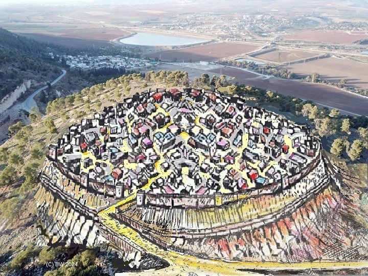
Illustration of the city during the Early Bronze period – view from the south – Drawing by BibleWalks
The city overlooked a major Bronze/Iron period route that passed in the Harod valley along the northern foothill. During antiquity the Harod river created swamps and marches along the valley. It was possible to cross the valley from the Jezreel Valley to Beit Shean only along the southern or northern edges of the valley. According to David Dorsey, based on the chain of Iron age sites found along the route, the west-east highway (“T7”) passed on the southern side of the valley (along the foot of Mt. Gilboa). One of the stations was the Harod spring, located below the city.
A Biblical map shows the location of the site, at the northern foothills of Mt. Gilboa, above the valley of Harod. The site is indicated by a red dot, 1km south east of the spring of Harod (‘Ain Jalud) that flows at the foothills of Mt. Giboa.
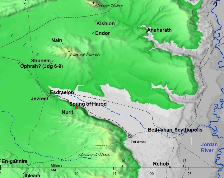
Map of the area around the site – from Canaanite/ Israelite to Roman period (based on Bible Mapper 3.0)
- Iron Age I (1200-1000 BC)
N. Zori proposed that the Bronze period city was the camp of the Biblical judge Gideon – the city of ‘Ein Harod. He based this identification on the lack of Bronze period sites in the vicinity of Harod spring, and that the Biblical text mentioned that Gideon “brought down the people to the water” implying that his camp was above the spring.
- Judge Gideon
The period of the Judges in the Bible refers to the time between the death of Joshua and the establishment of the monarchy in Israel, marked by the reign of Saul. This period is described in the biblical Book of Judges and portions of 1 Samuel. It is characterized as a time when Israel was a loose confederation of tribes without a centralized government, and “everyone did what was right in their own eyes” (Judges 21:25). The period of the Judges is often dated to roughly 1200–1020 BC, though this is debated among scholars due to the lack of precise archaeological evidence.
Gideon (also spelled as Gidon) is a prominent figure in the Bible, specifically in the Book of Judges in the Old Testament. He is known for his role as a judge and a military leader of the Israelites during a time of oppression by the Midianites that raided the Jezreel valley settlements from the lands east of the Jordan. The story of Gideon, hand picking his 300 soldiers, is recounted in Judges chapters 6 through 8.
“Then Jerubbaal, who is Gideon, and all the people that were with him, rose up early, and pitched beside the well of Harod: so that the host of the Midianites were on the north side of them, by the hill of Moreh, in the valley….
… And the LORD said unto Gideon, The people are yet too many; bring them down unto the water, and I will try them for thee there: and it shall be, that of whom I say unto thee, This shall go with thee, the same shall go with thee; and of whomsoever I say unto thee, This shall not go with thee, the same shall not go.
So he brought down the people unto the water: and the LORD said unto Gideon, Every one that lappeth of the water with his tongue, as a dog lappeth, him shalt thou set by himself; likewise every one that boweth down upon his knees to drink.
And the number of them that lapped, putting their hand to their mouth, were three hundred men: but all the rest of the people bowed down upon their knees to drink water.
And the LORD said unto Gideon, By the three hundred men that lapped will I save you, and deliver the Midianites into thine hand: and let all the other people go every man unto his place”.
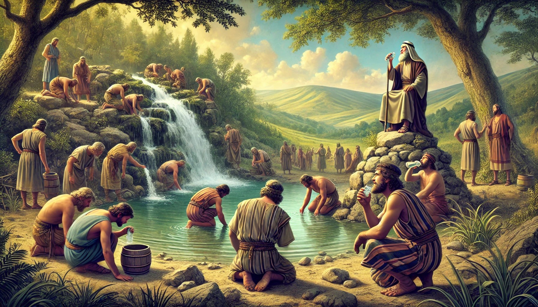
Illustration of the selection of the 300 fighters at the spring of Herod.
(Image created by AI using DALL·E through OpenAI’s ChatGPT)
In this story, the spring of Harod (Ein Harod) is where Gideon brought troops to drink water. The men who drank water by lapping it like a dog were chosen to stay and fight, while the rest were sent home. The connection to the spring underscores a key moment in Gideon’s story, where his army was significantly reduced to a small but dedicated group.
With this smaller force, Gideon went on to achieve a miraculous victory over the Midianites, demonstrating God’s intervention and guidance. In the middle of the night, Gideon’s 300 men surround the Midianite camp in the valley below. On Gideon’s signal, they break the clay jars, revealing the torches, blow their trumpets, and shout, “A sword for the Lord and for Gideon!”. The sudden noise, light, and confusion throw the Midianites into panic. Believing they are under attack by a much larger force, the Midianites turn on each other in the chaos and flee. Gideon and his men pursue the fleeing Midianites, securing a decisive victory.
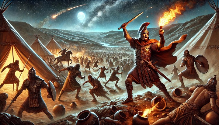
Illustration of the Battle of Gideon and the Midianites, capturing the intense and dramatic scene of the nighttime battle.
(Image created by AI using DALL·E through OpenAI’s ChatGPT)
- Iron Age II period (1000-586 BC)
The rule by the judges of Israel ended after the people demanded a rule by a King. King Saul was the first king of the unified Kingdom, but he was killed on Mount Gilboa by Israel’s arch enemies – the Philistines.
King Saul:
The Philistines, based in the southern Sharon area, planned to expand their territory to the Galilee. King Saul tried to block this move and prepared the Israelite armies near the nearby city of Yizreel, on the west side of Mt. Gilboa. Saul camped in the Yizreel spring on the foothills of the city. The Philistines, assisted by Saul’s rival (later King) David, set their camp in Shunem (at the foothills of Hamoreh hill, across the valley). (1 Samuel 29 1): “Now the Philistines gathered together all their armies to Aphek: and the Israelites pitched by a fountain which is in Jezreel”.”.
The battle was fought in the Jezreel valley and the Israelites fled to Mount Gilboa, where King Saul’s 3 sons first fell in the battle (1 Samuel 31:1-2):
“Now the Philistines fought against Israel: and the men of Israel fled from before the Philistines, and fell down slain in mount Gilboa. And the Philistines followed hard upon Saul and upon his sons; and the Philistines slew Jonathan, and Abinadab, and Melchishua, Saul’s sons”.
Saul was also wounded, and he killed himself to avoid being captured (1 Samuel 31:3-6):
“And the battle went sore against Saul, and the archers hit him; and he was sore wounded of the archers. Then said Saul unto his armourbearer, Draw thy sword, and thrust me through therewith; lest these uncircumcised come and thrust me through, and abuse me. But his armourbearer would not; for he was sore afraid. Therefore Saul took a sword, and fell upon it. And when his armourbearer saw that Saul was dead, he fell likewise upon his sword, and died with him. So Saul died, and his three sons, and his armourbearer, and all his men, that same day together”.
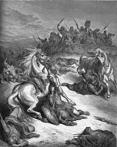
Death of Saul and his sons -by Gustav Dore (French artist, 1832-1883)
This hill was named after Saul’s son – Jonathan. Other hills in this area were also named after Saul and his sons.
The first Israelite King Saul did not manage to take the Canaanite enclave around Rechov and Beit She’an. Only his successor, King David, managed to take it in approximately year 1000 BC, extending his empire to the upper Galilee (1 Chronicles 18 3): “…And David smote Hadarezer king of Zobah unto Hamath”. Since then, the cities in this region were under the control of the Israelites.
Northern Kingdom:
In 928 BC the Israelite Kingdom ruled by King Solomon separated to the south (Judah) and the north (Israel), and the towns and cities in this region became part of the Northern Kingdom. The Northern Kingdom suffered from three major conquests, separated by a hundred years.
First conquest: After Solomon’s death, Egypt’s Shishak invaded Israel in ~924 BC (1 Kings 14: 25): “In the fifth year of King Rehoboam, Shishak king of Egypt attacked Jerusalem”. Shishak captured the cities and towns of Israel and probably has destroyed this city. Recent archaeological research has shown that this conquest was devastating.
Second conquest: A hundred years later there was another invasion. Omri was a general, who was made king (~882 BC) over the Northern Kingdom during the mutiny of Zimri (1 kings 16 16). After regaining the control of his Kingdom, Omri turned to defend his country against their arch-enemy – Aram-Damascus – and the rising empire of Assyria. Aram-Damascus headed by Hazael invaded in ~815-810, as per Biblical accounts (2 Kings 8:12, 12:18-19, 13:3+7; Amos 1:3) and (2 Kings 10 32): “In those days the LORD began to cut Israel short: and Hazael smote them in all the coasts of Israel;”. In one of these intrusions the city was probably destroyed again.
Third and final conquest: It came a hundred years later. In 732 BC was an intrusion to the North of Israel by the Assyrian King Tiglath-Pileser III, who annexed the area (as per 2 Kings 15: 29): “In the days of Pekah king of Israel came Tiglathpileser king of Assyria, and took … Galilee…and carried them captive to Assyria”. The Assyrians captured the cities in the region, and the Bronze/Iron age cities and towns were destroyed. Most of them were never rebuilt, such as this site.
- Roman/Byzantine period (63 BC- 634 AD)
As the result of the destruction of the Northern Israelite Kingdom, the fortified Tell on Horvat Karemet (Giv’at Yonathan) was destroyed and abandoned in the Iron Age period.
Note that during the Roman period the west/east road along the Harod valley used the northern route rather than the southern route. This may have reduced the value of this city as it had when the major traffic passed below the hill.
Some Roman pottery fragments and Roman coins were found on the site. However, the majority of the new site relocated to the site of Nurit south west of the old Bronze/Iron age city. It became a farming village, centered around the spring and along the valley that descends to the Harod valley. The villagers were also engaged in stone quarrying.
-
Ottoman Period – (1516-1918 A.D.)
The site was examined in the PEF survey (1866-1877) by Wilson, Conder and Kitchener. A section of their survey map below shows the Northern area of Mt. Gilboa. The site does not appear on this map, as well as other modern maps. It seems like this ancient city is a “lost city”, only to be rediscovered in the modern period.
The nearby village on this map is named Nuris, with a Sheikh tomb (Sh. Nimas) on its north east side. Mt. Saul appears here with its Arabic name – Jebel el Kaleily, meaning: the mountain with the peaks.
Part of Map sheet 9 of Survey of Western Palestine, by Conder and Kitchener, 1872-1877.
(Published 1880, reprinted by LifeintheHolyLand.com)
- British Mandate
A section of the British map of the 1940s is shown here, but the site does not appear on this map. The hill is marked by a triangle and the title “65.5 13/3”. The village (Nuris) covers the area south of the spring (marked by “Sp”). Mt. Saul is marked as Tell Quleila (Arabic: Jebel el Kaleily) on the east side.
The quarry in this map is limited to the lower foothill. Since then, the quarry grew in size and is now cutting away the eastern side of the ancient site.
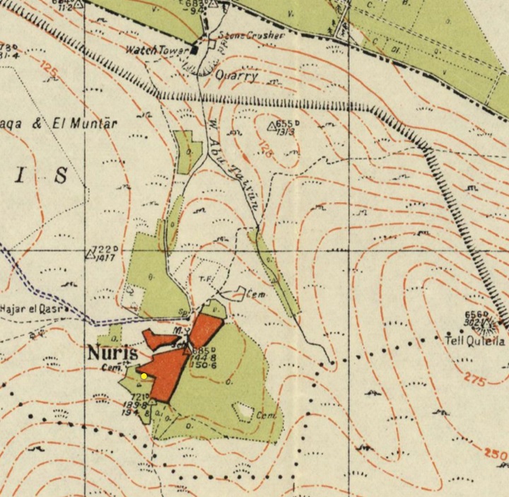
https://palopenmaps.org – Palestine 1940s 1:20,000 map
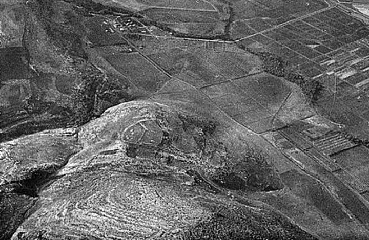
An old aerial photo of 1932 shows the state of the area before the modern settlement activities. The site is seen on the hill in the center with a wall around it. A road descends on its south east side to the valley below.
Photos of Library of congress – Air views of Palestine (1932). P/O Matson collection.
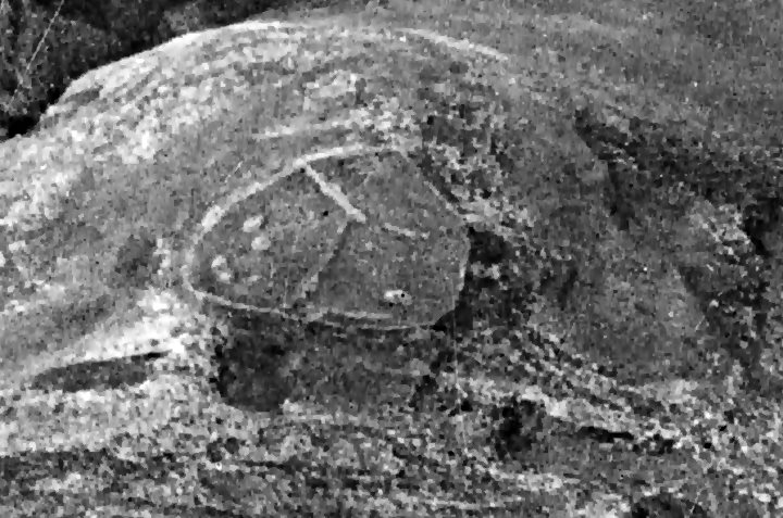
A closer view of the site shows a wall around it, 2-3 long internal walls within the enclosed area, and 6-7 stone heaps. Also seen is an entrance on the south side that leads to the road descending east to the Harod valley.
- Independence War:
During the Independence war terrorist gangs, operating in the Arab village of Nuris, attacked settlements in the valley. On March 19, 1948, soldiers of the nearby Jewish Kibbutz settlements conducted a failed attack on Nuris, sustaining 7 casualties. A memorial to the fallen 7 was erected on the north side of Giv’at Yonathan, overlooking the valley below.
-
Modern Times
A survey of the site was conducted by N. Zori (Nurit/Nuris, published 1954 and 1977). A new survey is now conducted by the new archaeological survey of Mt. Gilboa, as part of the Manasseh Hill Country Survey.
Photos:
(a) General Views
A great view of the site and the area around it is seen from the western side of Mt. Saul (“Saul’s Shoulder”). The site is spread on a flattened summit of the hill of Jonathan (Giv’at Yonathan). It overlooks the valley below it, and is close to the Harod Spring and the community of Gidona. On the west side is a valley (Nahal Yonathan) and large modern quarry. Farther to the west is the ecovillage Nurit.
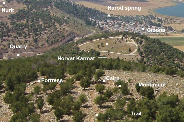
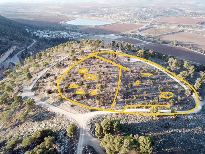
A drone view captured this view below in December 2024 from the south east.
Compared to the 1932 aerial view, some of the external walls could be traced and compared to the existing state. The following illustration suggests the outline of the site based on the old aerial photo.
As for the internal layout, the 6-7 stone heaps and 2 long internal walls seem the same as the 1932 aerial photo, so the layout did not change in the recent 100 years, except for the dirt road that surrounds the site.
(b) Monument
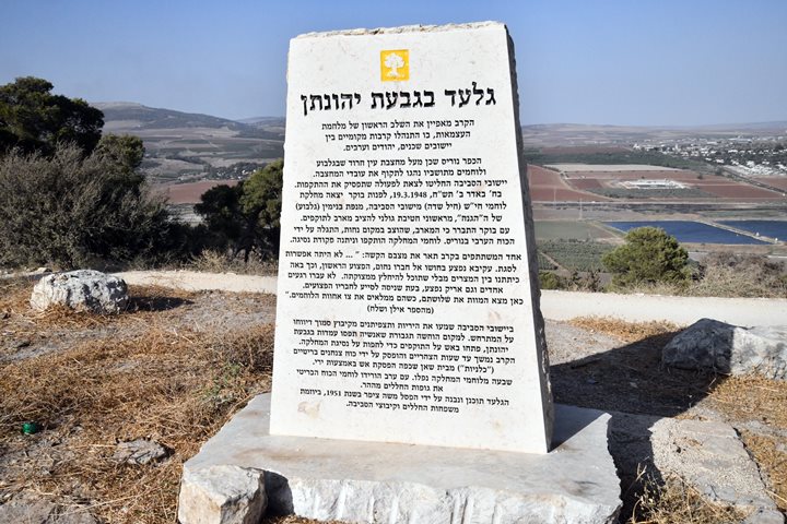
On the north side of the summit, overlooking the valley, is an impressive stone monument. It commemorates the fallen 7 soldiers of the nearby communities that attacked Nuris in the attempt to stop their harassments of the Jewish workers of the quarry.
The monument was designed by sculptor Moshe Ziffer and constructed in 1951.
Click on the photos to view in higher resolution…
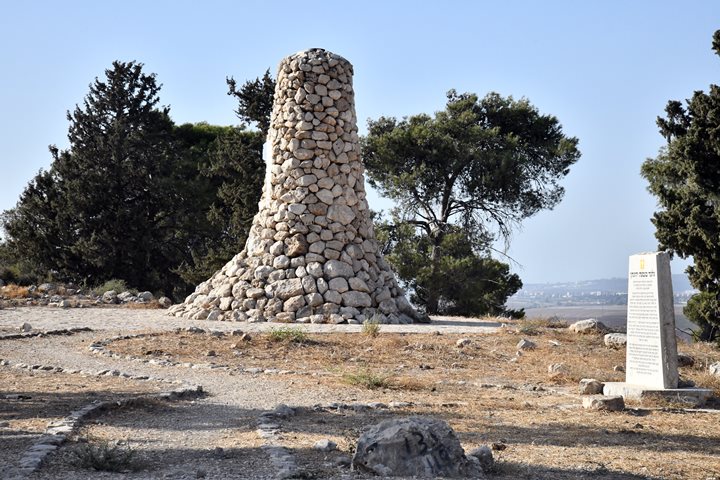
The memorial sign tells about the failed battle on March 19, 1948, and its tragic consequences.
(c) The Hill
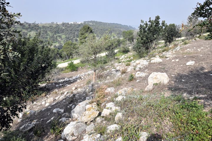
On the hill are about a dozen heaps of stones, piled up by farmers as they prepared the land.
(d) Foothills
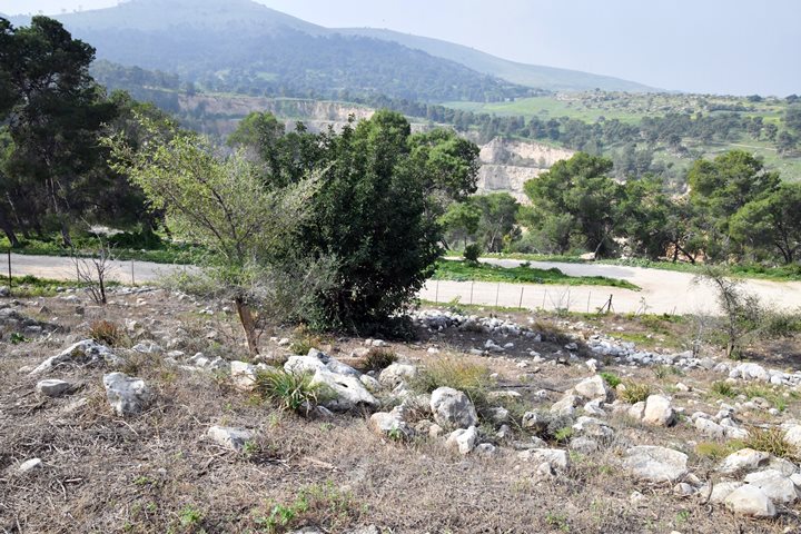
The top of the hill is surrounded by an ancient wall. It covers an area of 22 dunams, and is 3-5m high. Most of the peripheral wall has collapsed, forming slopes around the hill.
In this view towards the south west is a section of the fallen wall. In the background is the modern quarry that chopped away large areas west of the site. Behind the quarry are remains of the Arab village of Nuris that was built over a Roman period village. In the far left background is the north west side of Mt. Gilboa.
Another view of the slopes around the hill is in the following view towards the west. In the far background are some of the residential houses in the ecovillage Nurit.
Next photo – Another section of the wall, on the north west side, with a modern wall built on its side. The valley of Harod is seen in the background.
Another section of the wall is seen at the north west corner, that was cut by the dirt road:
(e) Ceramics dating
N. Zori conducted a survey in the 1950s, and dated the pottery remains to the Chalcolithic thru the Iron Age II periods. Roman ceramics and coins were also dated, but represent a later settlement period when the ancient city relocated to the Gilboa foothills 1km to the south west.
The 2025 survey team dated the majority of the sherds to the Early Bronze I period, with fewer of the Early Bronze II.
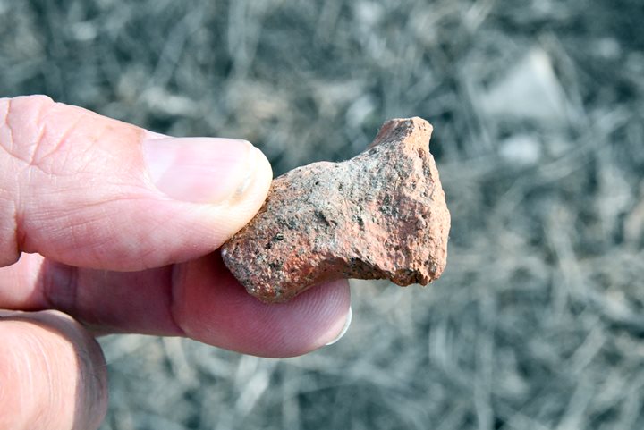
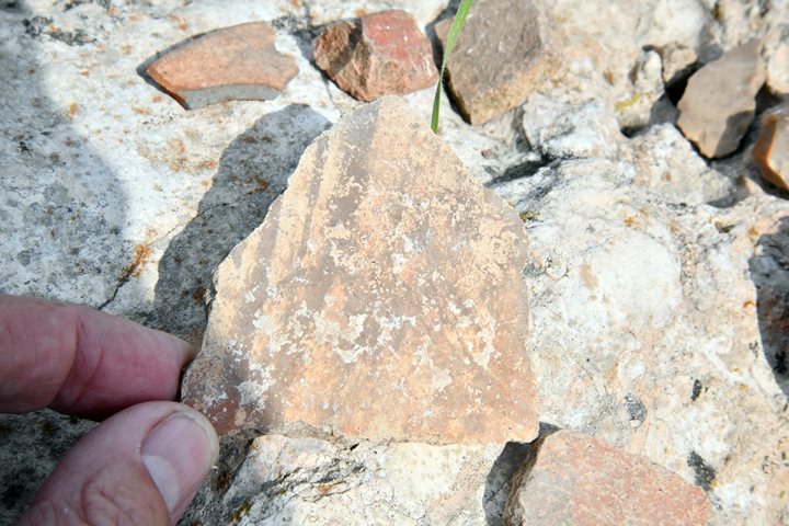
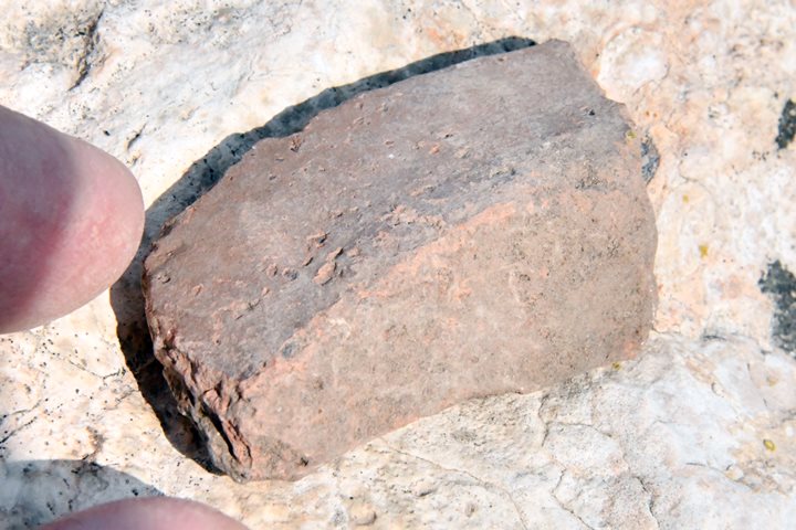
In our short visit we also found some of the Biblical period (Bronze/Iron age) ceramics, as shown here. A basalt stone, part of a grinding stone, is also seen on the bottom left side.
These pottery fragments were found in dozen of shallow pits that were dug in a recent time on the north side of the hill, used as a preparation for planting of new trees in the spring.
The following samples are shown in greater detail.
a. Pottery with 4 grooves (Bronze I b): This decoration is typical of the Early Bronze period, commonly appears under the rims of the jars or bowls. Date: EB1b (3300–3100 BC).
b. A double rim on the lip of a Middle Bronze period vessel:
c. A textile impressed pottery, typical of the Early/Middle period. This piece is an artifact of cloth imprint that was baked into the surface of ceramic vessel.
d. A Roman/Byzantine handle:
e. An Early Bronze 1 period vessel, with colored strips:
f. A cooking pot:
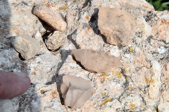
- Flint:
Flint tools of prehistoric periods were collected from the site and its surroundings by the survey conducted by N. Zori in the 1950s. The stone age periods include: Paleolithic, Epi-Paleolithic, Neolithic, Chalcolithic and Early Bronze.
Installation:
A possible agriculture installation was seen on one of the stones near the monument. On the center of this limestone rock is a long deep cut, and shallow grooves are on its sides. Additional basalt stone grinding tools were found during our surveys.
(f) Aerial Video
![]() The following YouTube video shows a flight of a drone around the hill. The video was captured on December 2024.
The following YouTube video shows a flight of a drone around the hill. The video was captured on December 2024.
Links and references:
* Archaeological links:
- “Gilboa mountains” – N. Zuri, 1954
- “The Land of Issachar survey” – site #5, pp. 8-10, N. Zori, Hebrew 1977
- Arch. Survey of Israel (Hebrew, English)- Map #62 – Ein Harod – site #26 (Nuris, Nurit)
- Gideon at Harod Spring – YouTube, 3:33 minutes, Hebrew
* Nearby sites:
- Saul’s Shoulder – Mt. Saul
- Yonathan Hill – nearby Bronze/Iron period walled city
- Harod spring – nearby attraction
- Tel Yizreel – nearby ruins of Israeli Kingdom palace
* Internal sites:
- Winepresses in the Holy Land
- Hiding complexes
- Mt. Gilboa archaeological survey
Etymology (behind the name):
* Site’s names:
- El Karm, El Kerem – Arabic name of the hill, meaning: vineyard (similar to Hebrew Kerem) that was planted on the hill.
- Horvat Karmet, Karmat – the Hebrew modern name, based on the Arabic name
- Giv’at Yonathan – The hill (Giv’a) was named after the son of Saul who fell with his father and brothers in the battle against the Philistines
- Yonathan (Jonathan) – Hebrew (יונתן): God has given. A son of king Saul. and close friend of David.
* Other names:
- Gilboa (גלבוע)– Biblical name of the mountain range. A possible source of the name is Gal-Nove’a (Hebrew for gushing-waves, named after its springs along the foothills).
- Saul (שאול)- Hebrew: Sh’aul, comes from the Hebrew verb Sha’al (ask).
- Jebel el Kaleily – Arabic name of Mt. Saul, meaning: the mountain with the peaks (source: PEF dictionary, p. 161).
- Gideon (גִּדְעוֹן): derived from the Hebrew verb “gāda” (גָּדַע), which means “to cut off” or “to hew down.” The name can be interpreted to mean “one who cuts down” or “mighty warrior.” This meaning is quite fitting considering Gideon’s role in the biblical narrative as a leader who led a smaller group of warriors to victory against a larger enemy force.
- Harod -“Harod” (חָרוֹד) is derived from the Hebrew root word “charad” (חָרַד), which means “to tremble” or “to be afraid.” The name “Harod” itself can be translated as “trembling” or “fear.” The connection between the name “Harod” and the spring in northern Israel, known as “Ein Harod,” likely relates to the geographical and historical context. The area around the spring has been associated with significant events in biblical history, such as the story of Gideon. The name might symbolize the awe or reverence inspired by the natural beauty of the spring and the historical events that took place there.
- Nurit (נורית) – A moshav west of the site, first established in 1950. Named after the “buttercup” flower (a Ranunculus species). Hareuveni suggested a Biblical identification as “Nitzanim” (הַנִּצָּנִים) (Song of Solomon, 2:12): “The flowers appear on the earth…”.
- Nuris – Arabic: a private name, preserving the ancient name.
BibleWalks.com – exploring the ancient sites of Israel
Nurit <<<—previous site—<<< All Sites>>>— next Gilboa site —>>>Horvat Mazarim
This page was last updated on Jan 16, 2025 (corrections after survey)
Sponsored links:

