A mysterious complex of caves above the Kziv stream, in the Upper Galilee area, with a large engraving of a Roman soldier on the surface of the cliff.
Home > Sites > Upper Galilee > Center > Temple Cave
Contents:
Overview
Location
History
Photos
* Caves complex
* Cave exterior
* Engraved soldier
* Cave interior
* Kziv stream
* Nature
Etymology
Links
Overview:
A mysterious complex of caves above the Kziv stream, in the Upper Galilee area. The central cave is called the “Temple cave” or the “Sacred cave” (from Arabic – El-Jalila cave). On the external wall of the cliff is a large engraving of what looks like a Roman soldier.
Location and map:
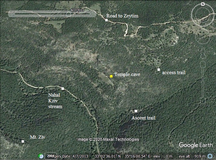
This aerial map indicates the major points of interest around the site. The temple cave complex is 120m above the valley of the Kziv stream, and is marked by a yellow square. The access trail (green and white stripes) is from the north east.
History:
- Roman period
According to the surveyors, A. Ovadiah and Y. Shivtiel (2016), the cave complex was in use in the Hellenistic and Roman periods. They concluded that during the Roman period the central cave served as a place of worship for a deity such as Sol Invictus or Mithras.
- Modern Period
The site is in a public area, but requires a long walk to get to the site. A trail leads to the caves from the east. This trail can be reached either from Mitzpe Abirim, or from the bottom of Kziv stream, or from a dirt road connecting to the Zaytim parking.
Photos
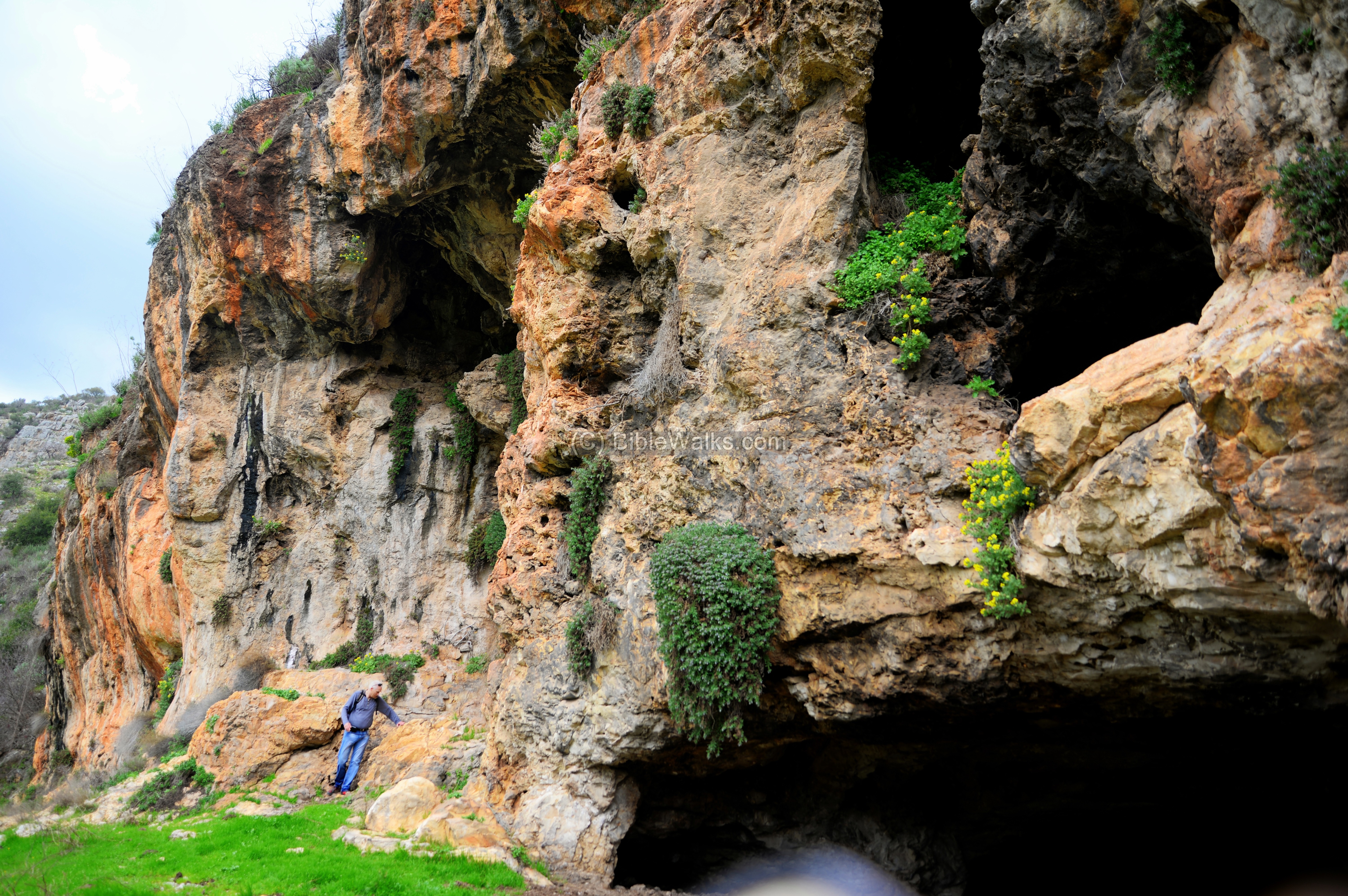
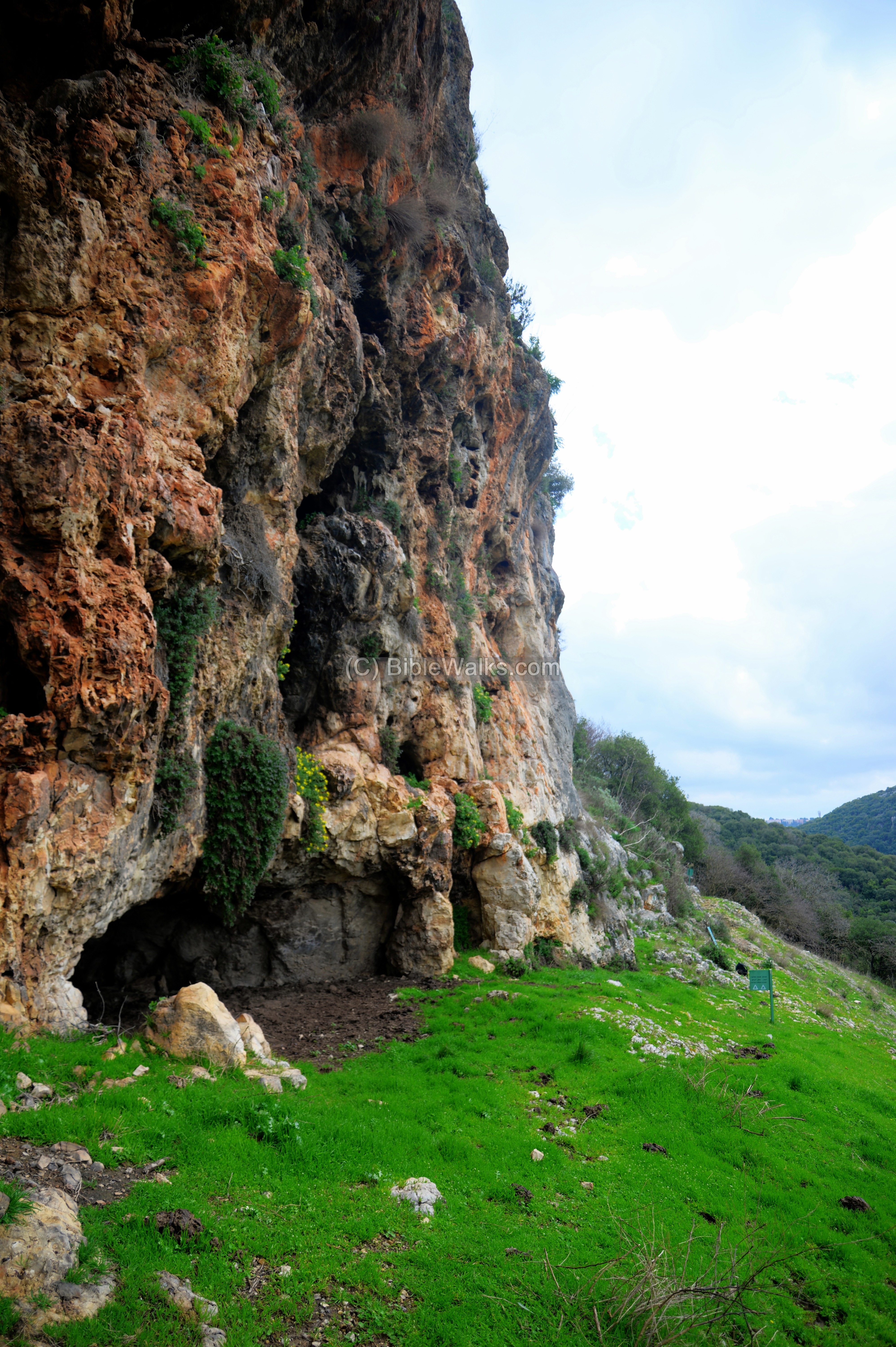
(a) The caves complex
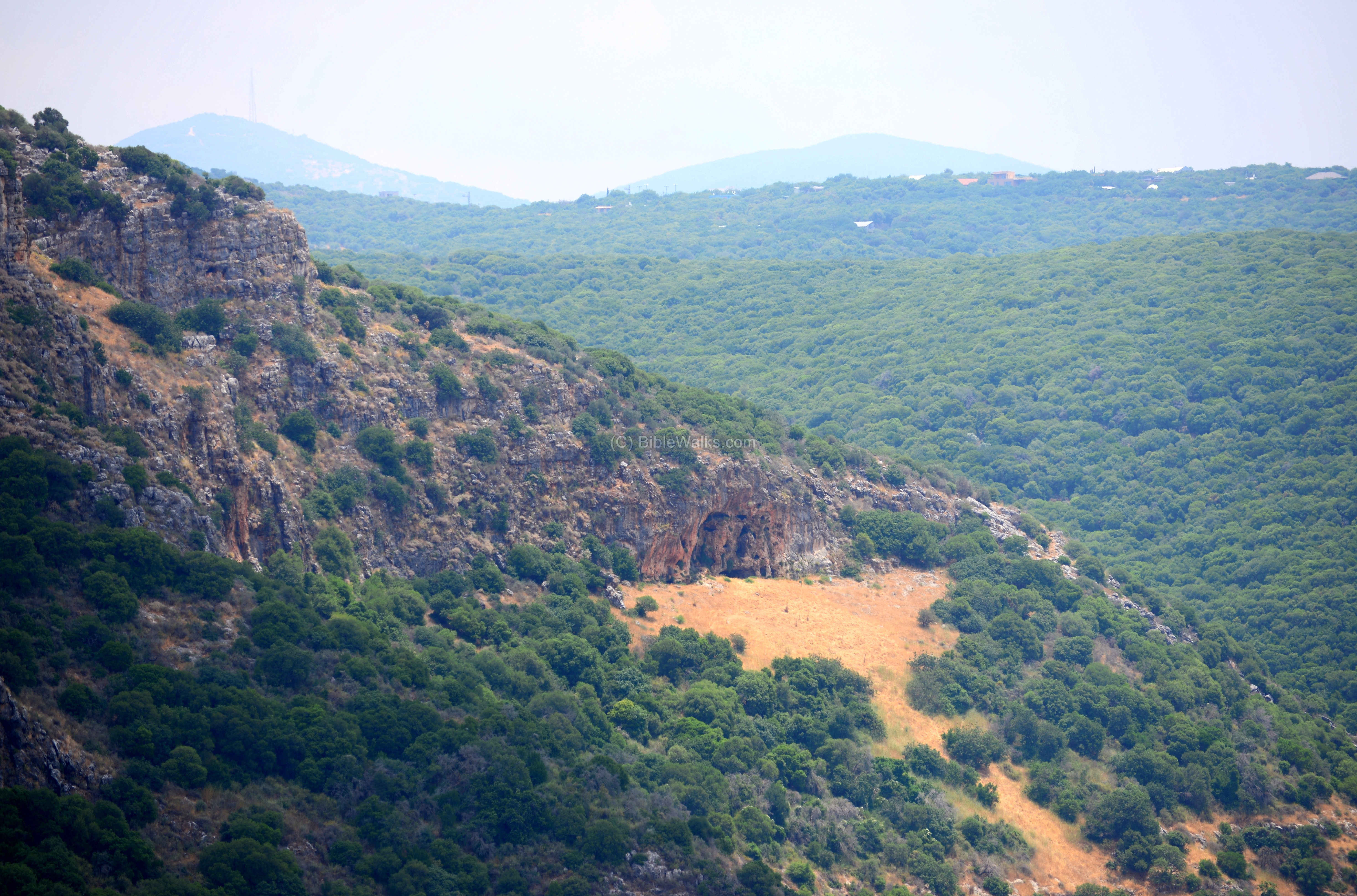
On the north bank of Kziv is an interesting complex of natural caves.
The caves are located on the upper third of the cliff on the northern bank of Nahal Kziv stream. The face of the cliff, where the caves are located, is 60m long and 17m high. An open area is below the cave, probably the result of collecting wood close to the entrance in order to light fire inside the caves.
Click on the photos to view in higher resolution…
We reached the site from the Kziv valley, by walking up a steep trail near the Crusaders farm house. This trail does not reach the caves directly, as the cliff is too steep. It first ascends thru a valley in direction of north-east, reaching 700m from the Abirim fortress, then descends south west to the level of the cave. An easier way to walk to the cave is from the Abirim fortress which is located in the entrance to Abirim on highway #8925.
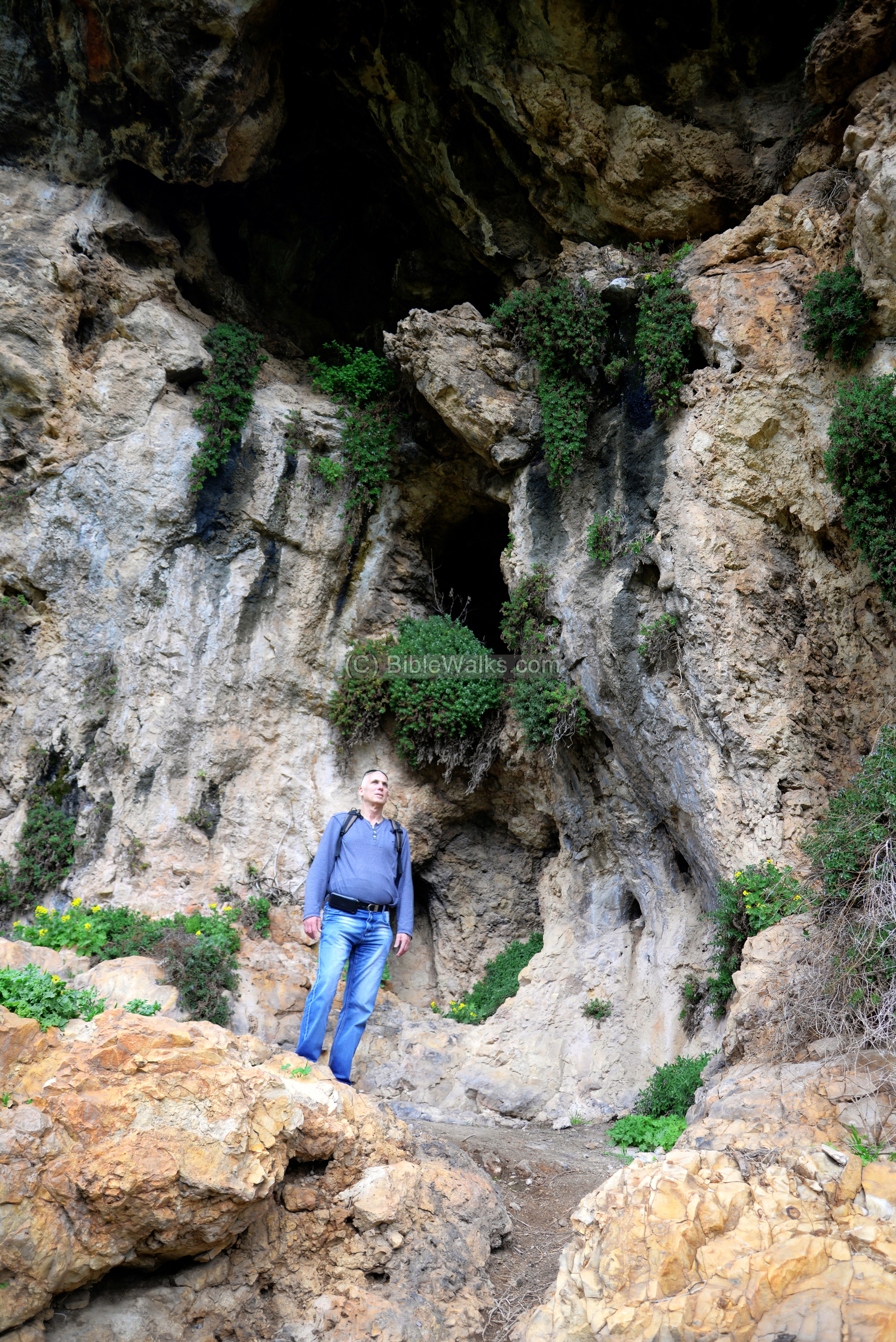
(b) Cave Exterior
The cave complex is reached from the east on a narrow trail. In some sections the trail is wider, and seems like a road leading to the cave complex.
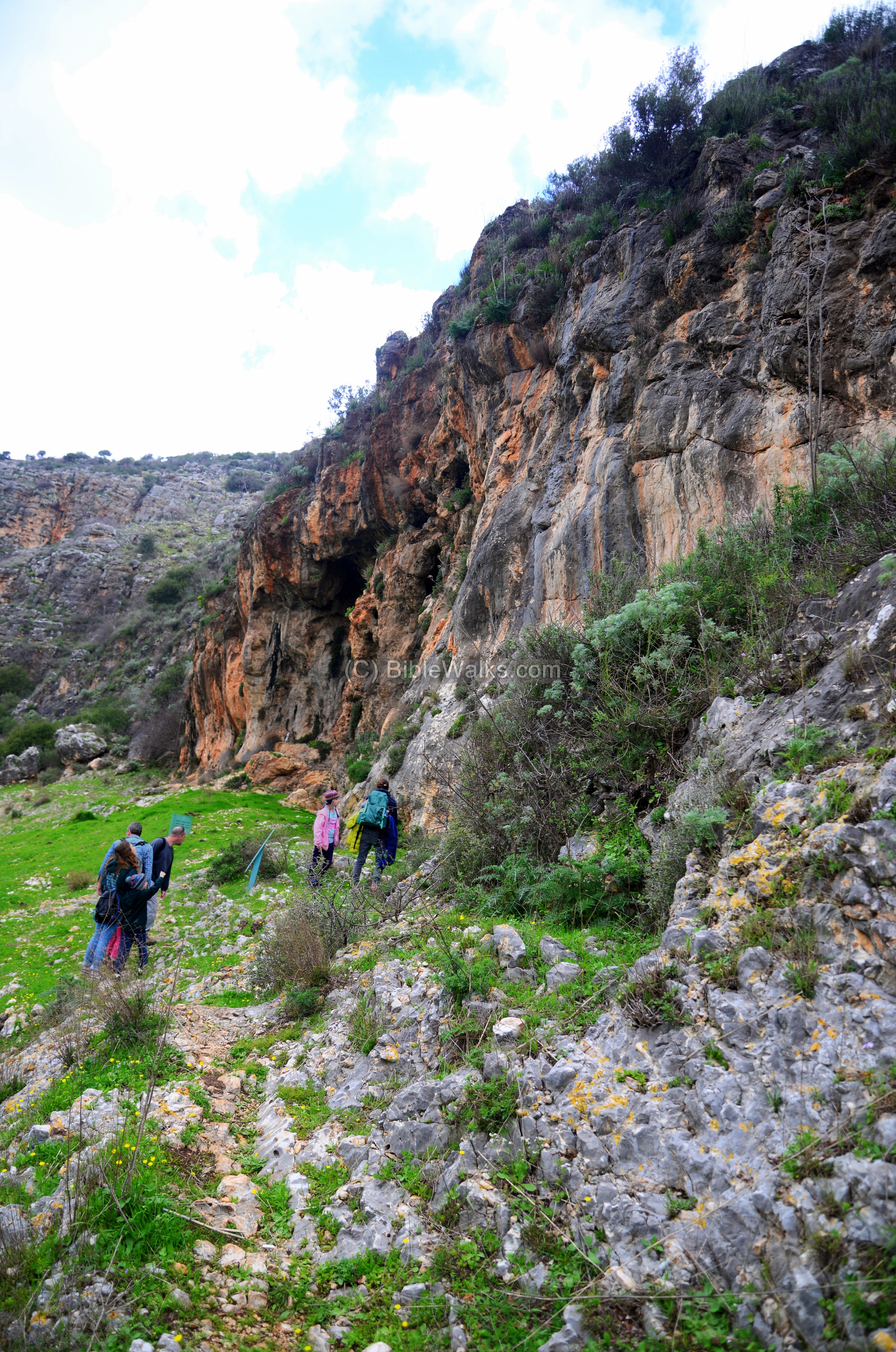
On the cliff is a cluster of 18 natural cavities. 15 of these caves are only accessible by repelling on the face of the cliff.
The caves were used for dwelling and as hiding places during peril times. The surveyors dated the ceramics to the Hellenistic, Early, Middle and Late Roman periods.
Tuvia is seen here standing near one of the caves.
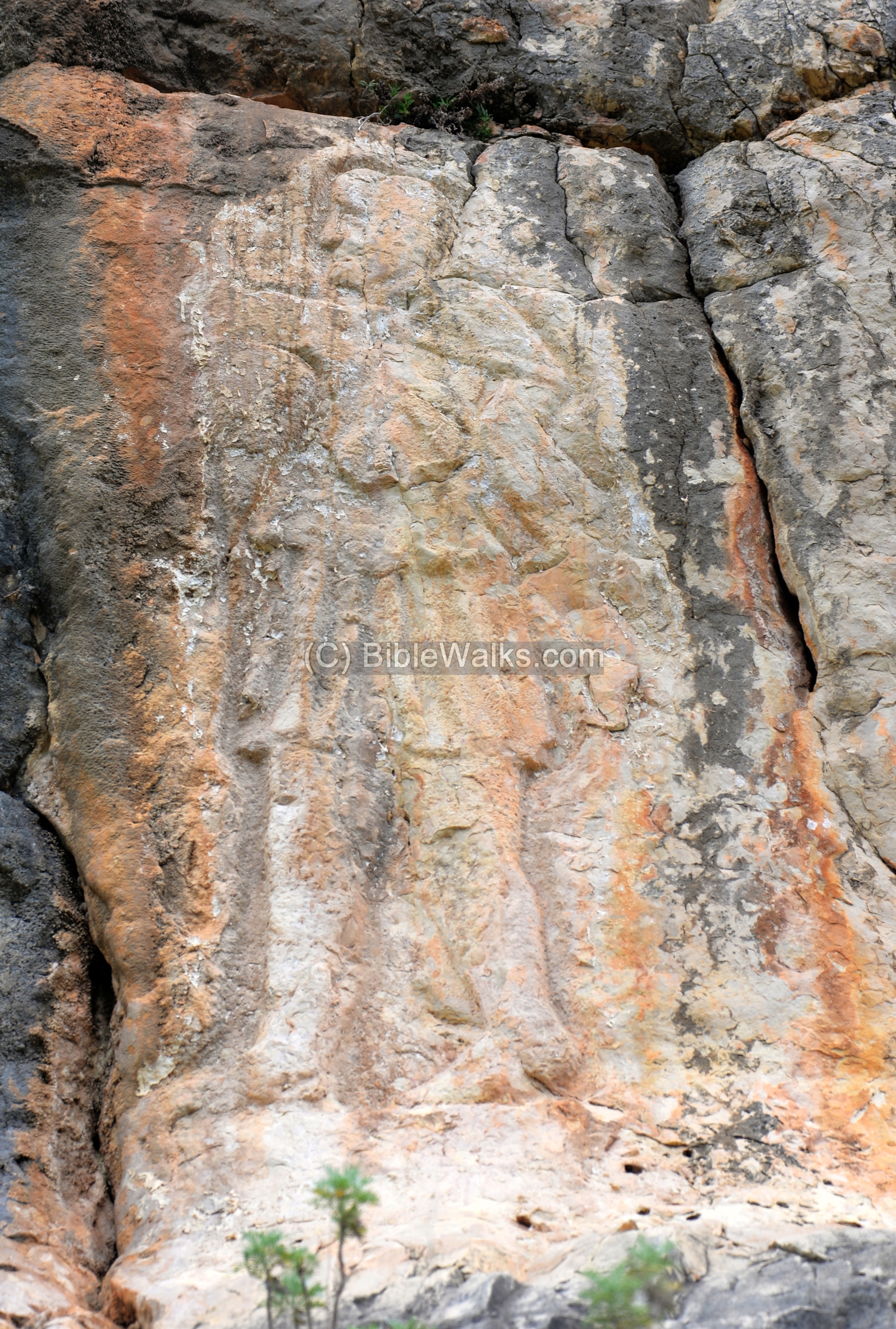
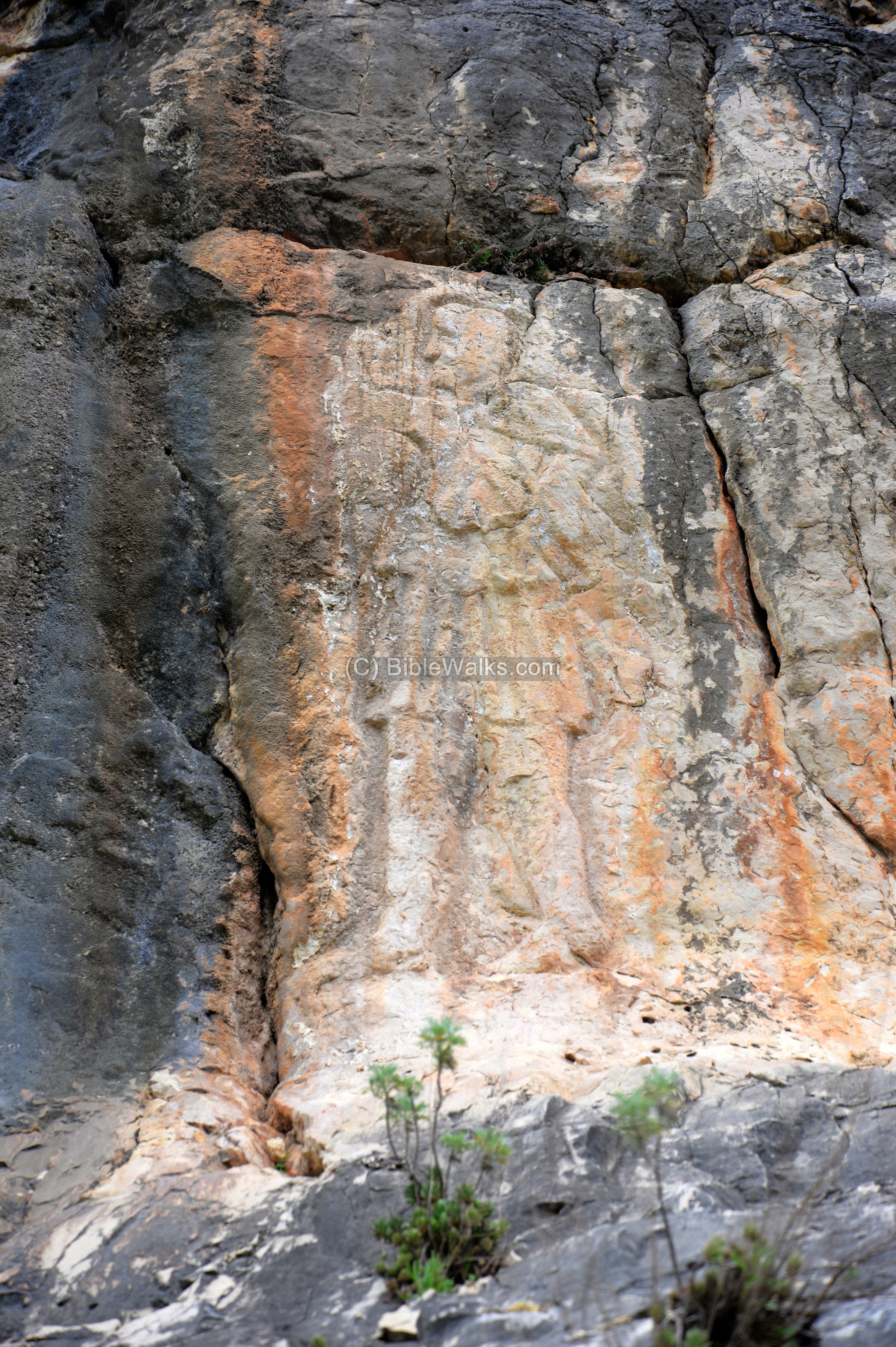
(c) Man on the wall
On the eastern side of the external wall of the cave complex is a large engraving of what looks like a Roman soldier. Its figure is 1.78m tall, and depicts a male soldier looking to the left. It is engraved on the hard surface of the rock, 25m east of the main cave entrance.
A sketch of the figure is below. The beardless man is wearing a tunic and outer garment over his left shoulder, typical of a Greek or Roman. He is walking barefoot, raising his right hand as a gesture. A radiant crown is above the head.
According to the article by Ovadiah and Shivtel , the figure may illustrate Sol Invictus (“Unconquered Sun”). In Greek mythology Sol was named Helios, the Titan son of God, illustrated in many mosaics in ancient synagogues.
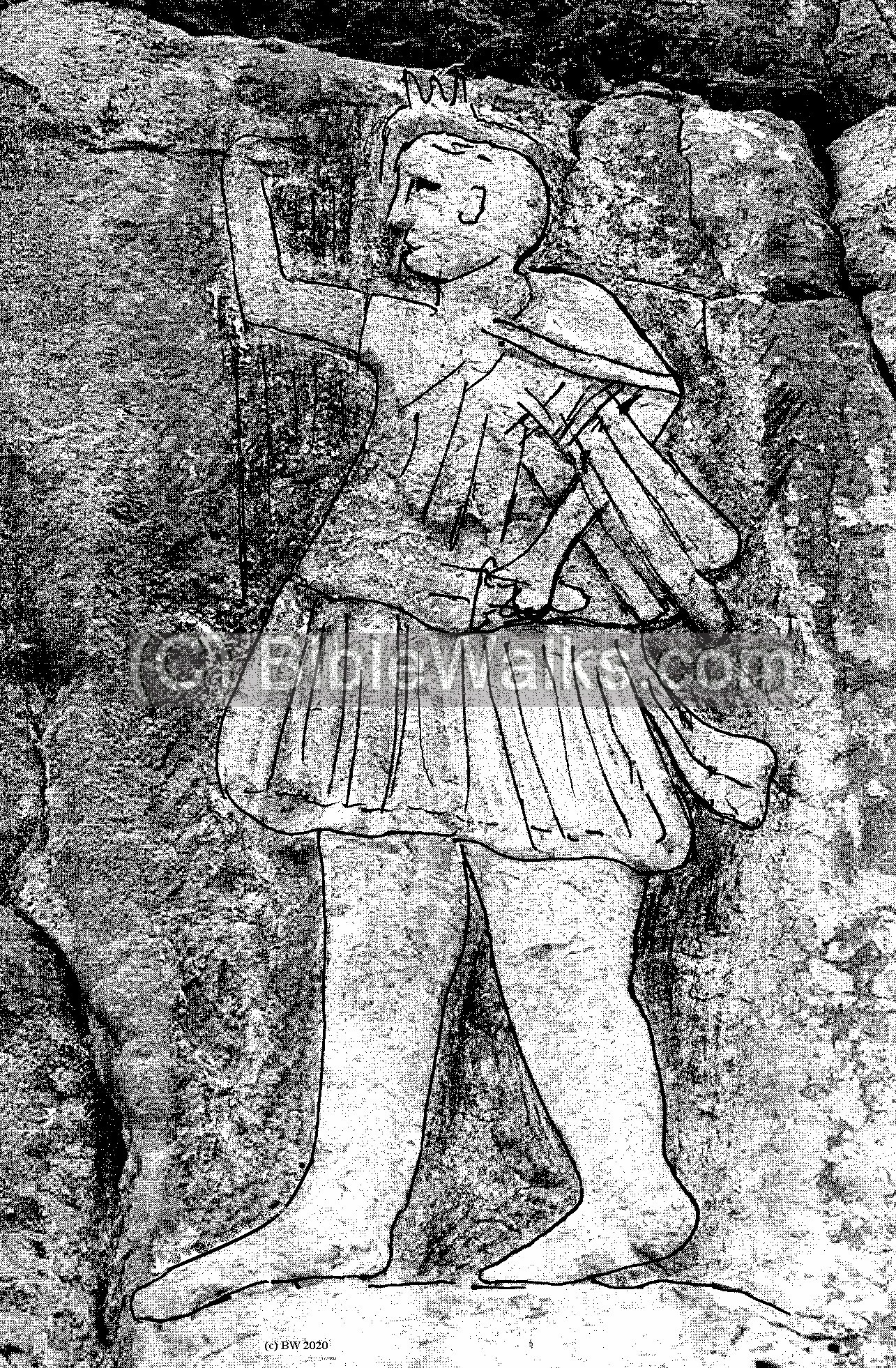
Sol Invictus was an official sun god of the late Roman period and patron of soldiers. Sol was favored by emperors from Aurelian through Constantine I. Based on this hypothesis, the figure could have been engraved in the 2nd-4th century AD.
The figure implies that the cave was used for ritual purposes, hence it was named as the Temple or Sacred cave. The cult of Mithras, a mystery God also favored by Romans and often equated with Sol Invictus, was practiced in cave temples such as this site. Its ritual temples were named Mithraeum.
Above the figure is an outline of a rectangular frame. It is blank, so perhaps it was intended for a place of an inscription but this was not completed.
(d) Inside the central cave
Lets go inside the central cave…
The entrance to the main cave is 10m wide and 2m high.
Inside the cave, the central hall is 11m by 23m, with a height of 5.5m. The floor is leveled with few stones. At the back are two 2m high boulders.
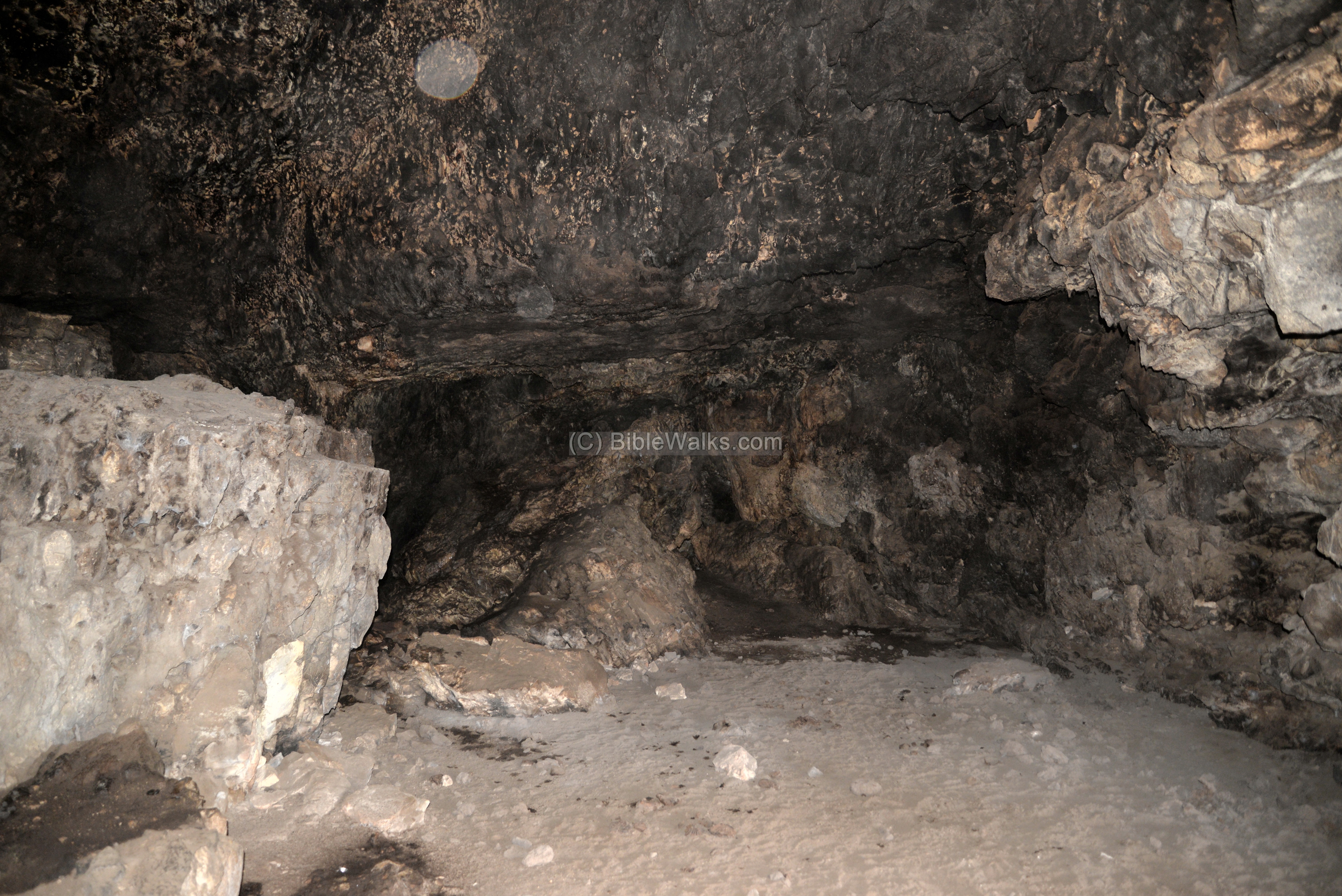
According to the ceramic findings, the central cave was occupied during the Roman period.
The following photo is from inside the cave, looking outwards towards the other side of the Kziv valley.
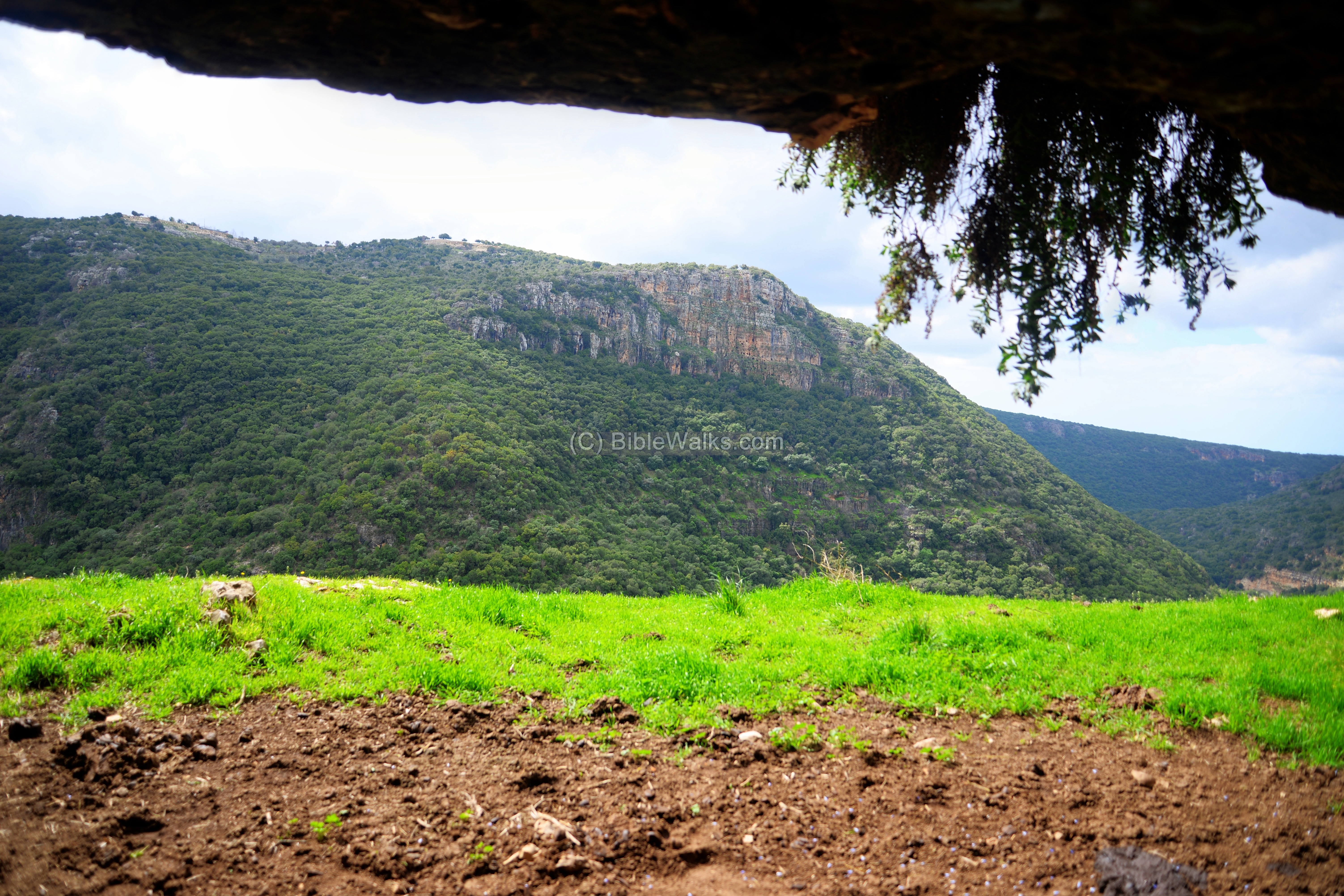
The surveyors concluded that the central cave functioned as a temple, practicing rituals for the worship of the god. It served the occupants of the other caves and for the people in the vicinity.
(e) Kziv stream
From the cave are great panoramas of the valley of Nahal Kziv. This view is downstream – westwards.
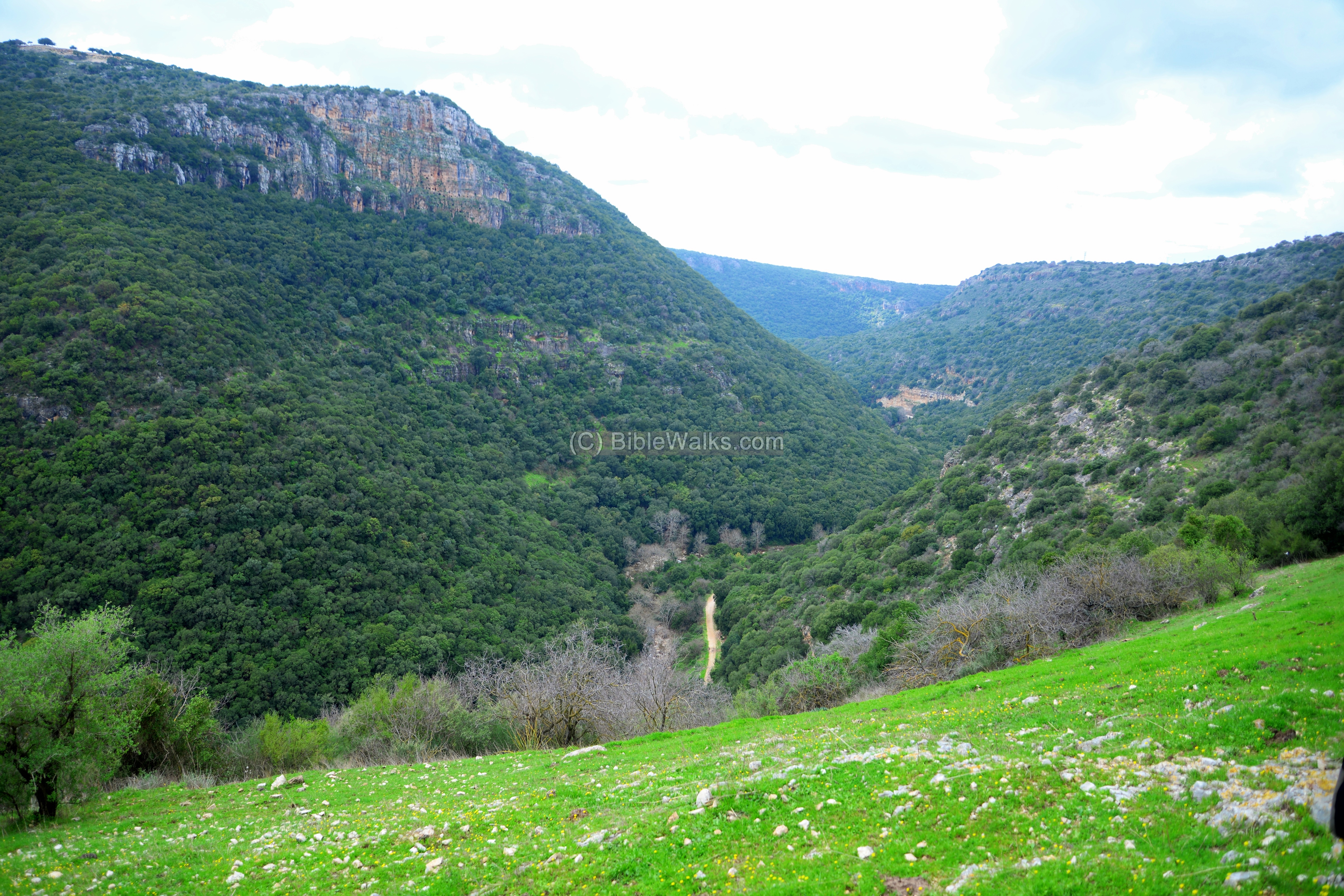
The height difference from the cave to the stream is 120m. Notice the hikers that walk along the valley.

The cliff on the south bank, Mt. Ziv, towers 270m above the valley. In this cliff, facing the temple cave, are dozens of small caves that were used as hiding places during the Great Revolt against the Romans (67-70 AD) and perhaps during other periods.

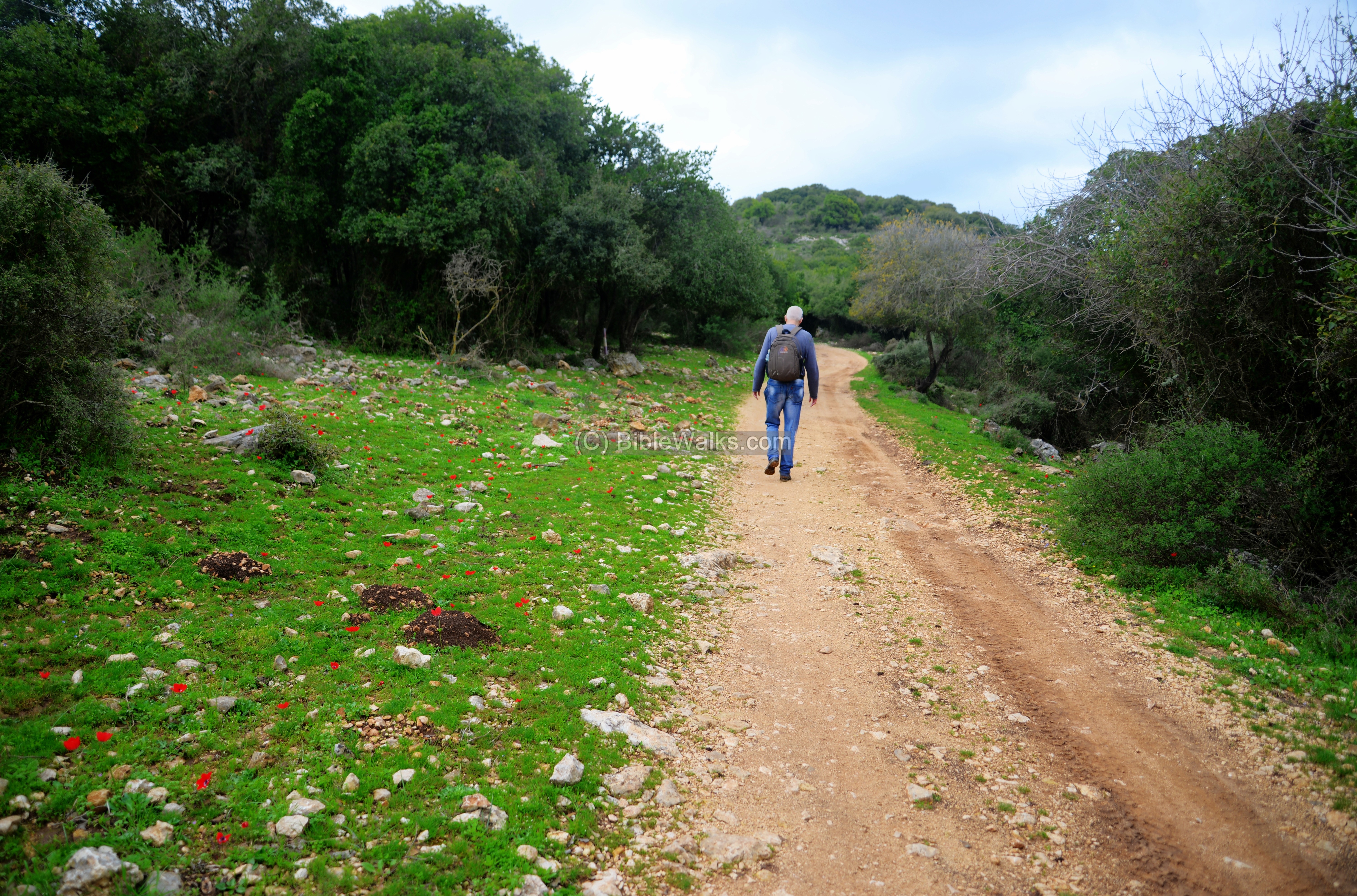
(f) Along the trail
We departed from the cave, heading along the trail above the northern cliffs. This road took us back to the Zeytime parking where we parked our car.
On the sides of the road are red Anemone (Calanit) wild flowers typical of the season (March).
Some of the fields along the trail are covered by a blanket of red Anemone (Calanit) wild flowers.
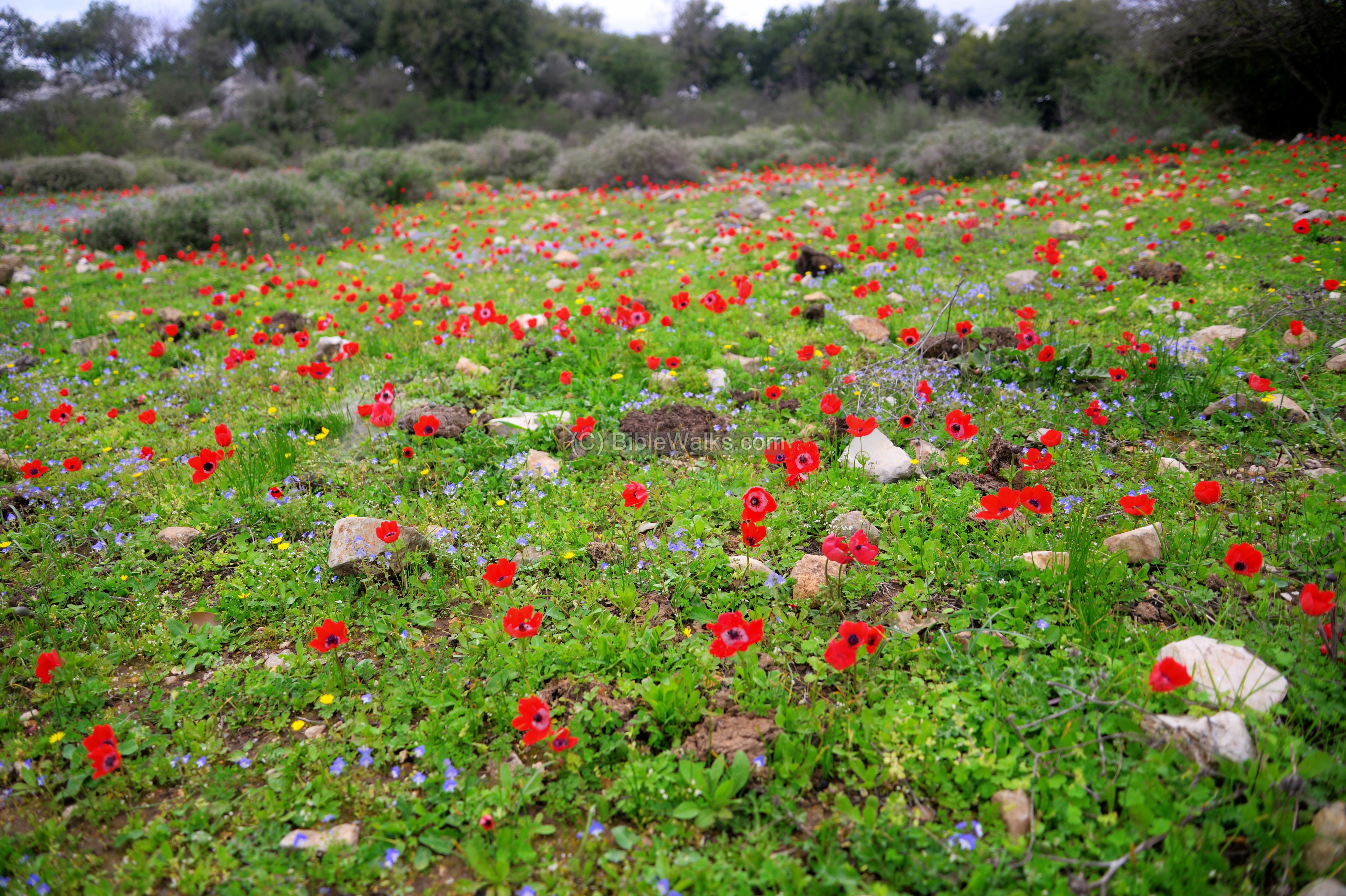
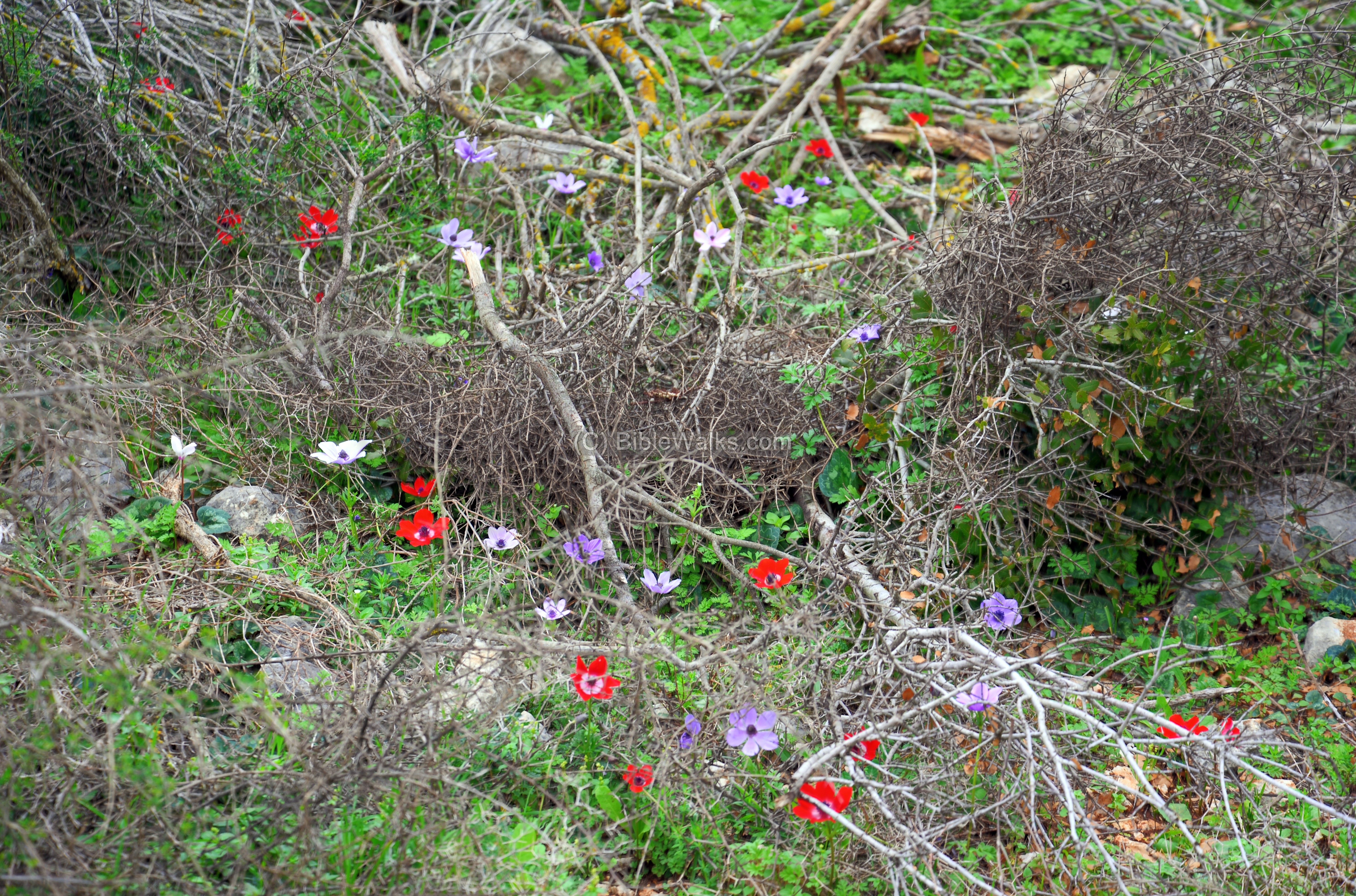
These flowers come in 3 basic colors – red, purple and white.
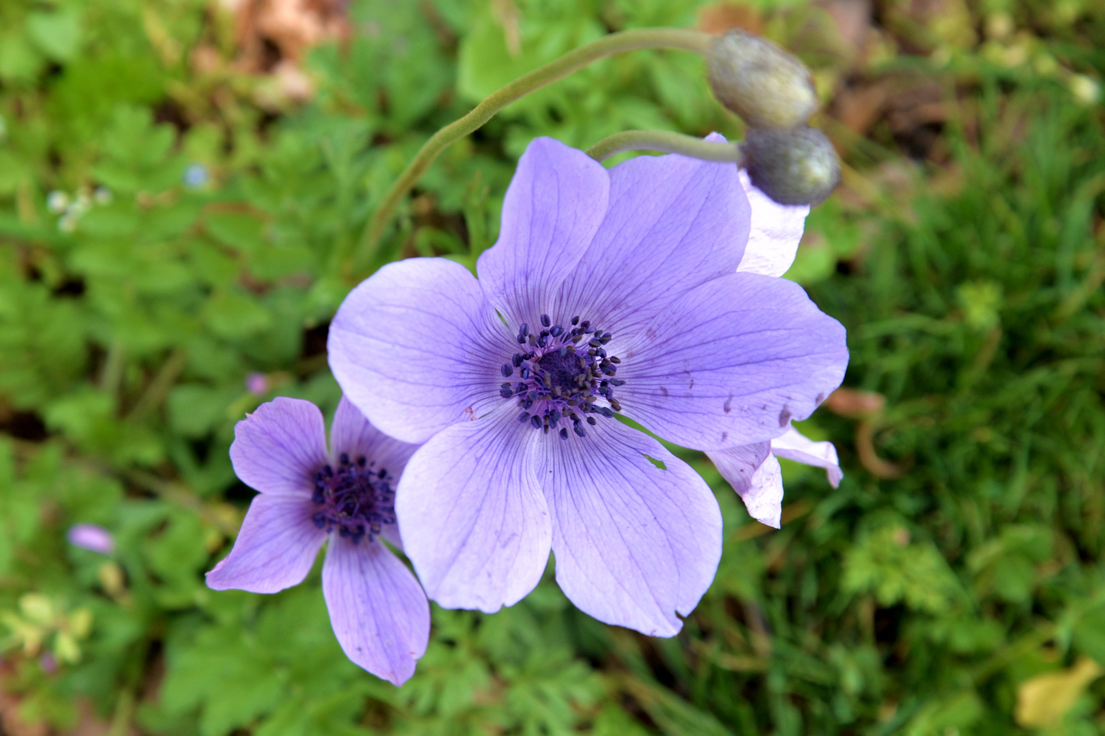
A close up to one of the purple Anemons.
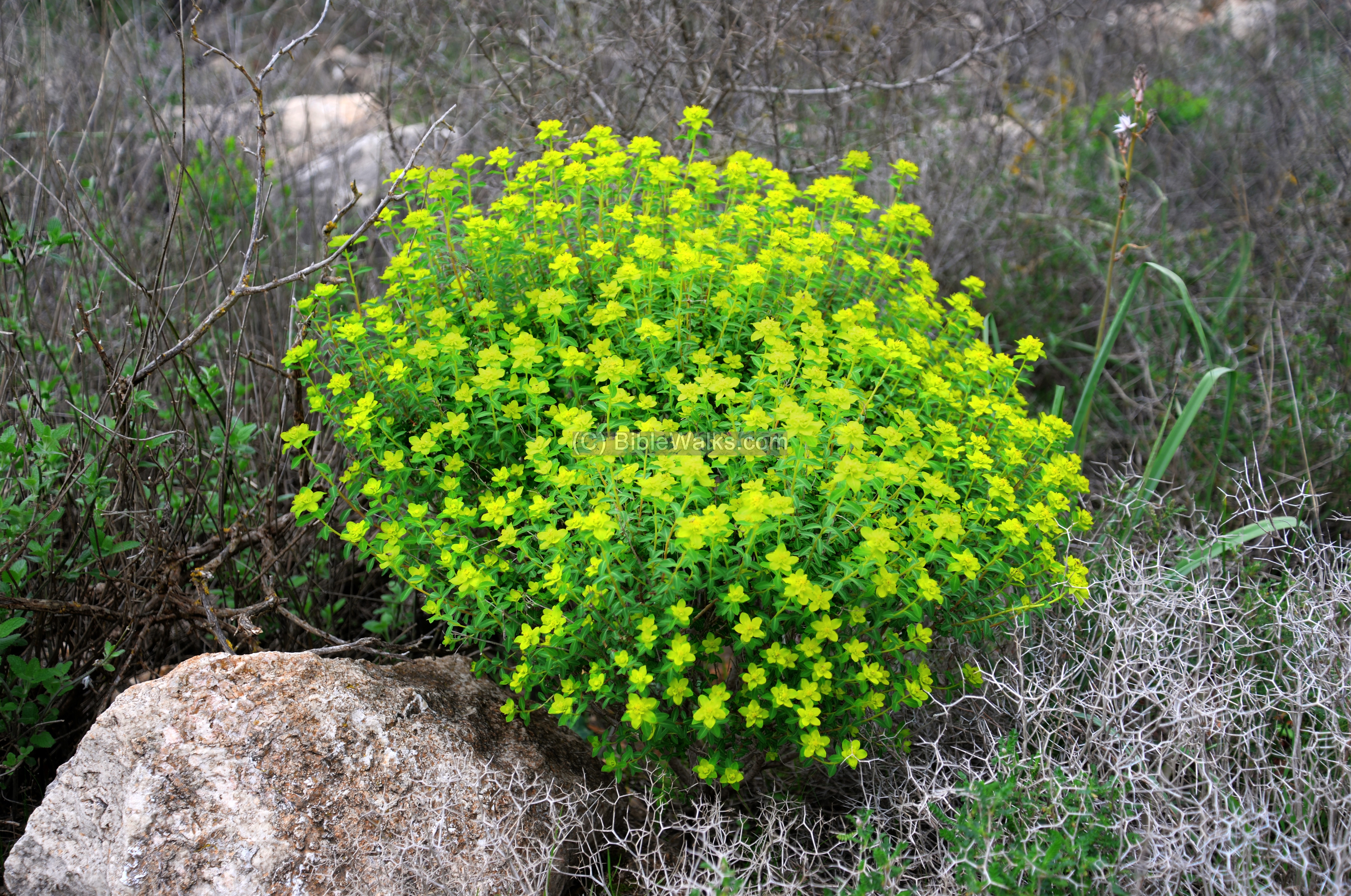
Other bushes and flowers can be seen, such as the Jerusalem Spurge (Euphorbia hierosolymitana, Hebrew: Halavluv Meguvshash).
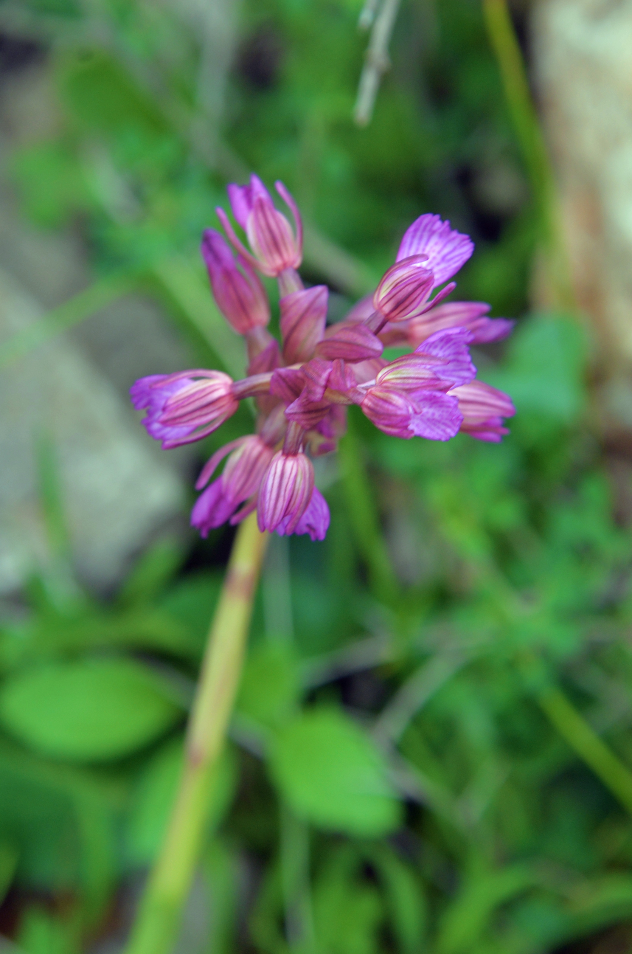
A Pink Butterfly Orchid (Sakhlav Parparani) also flowers at this time of early March.
Etymology (behind the name):
* Names of the place:
- Temple cave – based on the Arabic name – El-Jalila (sacred) cave
-
Ein Tamir – Hebrew: The hidden spring (named as such since it flows in a 15m long tunnel)
-
Zeytim parking (Henion Zeytim) – Hebrew: Olives parking place. Named after the olive trees around the site.
Links:
* References:
- Galilee refuge caves Malham (Hebrew); includes Kziv cliffs and temple cave. Article by Asher Ovadiah and Yinon Shivtiel
- Hiding Complexes info page
- Wildflowers of the Holy Land
* Nearby sites:
BibleWalks.com – Views of the Holy Land
Ein Tamir <<<–previous site—<<<All Sites>>>—next Upper Galilee site—>>> Naburiyah
This page was last updated on Apr 10, 2020 (new page)
Sponsored links: