A spring, park and multi-period archaeological mound on the foothills of Mt. Gilboa.
Home > Sites > Yizreel Valley > Tel Amal (Tel el ‘Asi, Nir David, Sakhne, Gan Hashlosha)
Contents:
Background
Location
History
Photos
* ‘Asi Stream
* Flour Mill
* Tel Amal
* Flax industry
* Museum
Links
Etymology
Background:
Tel Amal (Tell el ‘Asi) is an ancient tell and it is part of a region that has seen continuous human settlement for thousands of years. The area of Beit She’an Valley has been significant due to its strategic location along major trade routes connecting ancient civilizations like Egypt, Mesopotamia, and the Levant.
The name “Tel Amal” translates to “Hill of Labor,” which reflects the agricultural development of the area. Nearby natural springs, such as those at Gan HaShlosha (Sakhne) park, were crucial for sustaining ancient civilizations by providing fresh water, which was vital for agriculture and human habitation.
Location:
An aerial map of the site is shown here, focusing on the national park, the spring, and the stream. The ancient mound, built on two low connected hills, is located on the south bank of the ‘Asi stream. The archaeological museum was built on its east hill.
History:
- Iron Age:
Iron Age IIa was the major settlement period on Tel Amal. Artifacts from the Iron Age, including structures and pottery shards, have been uncovered during the excavations of the east hill. Tel Amal’s occupation during the Iron Age would have coincided with the rise of the ancient Israelite kingdom and neighboring powers like the Philistines and Arameans.
A Biblical map shows the location of the site in the valley of Harod. It is marked by a red circle, at the foot of Mt. Gilboa. The Harod valley is 11km long and 1-2 kilometers wide. The waters of the Amal spring, as well as waters from other springs at the foot of Mt. Gilboa, feed into the Harod river. The river actually starts from Mt. Moreh north west of the spring, flows eastwards thru the valley towards Beit-Shean (Scythopolis), and joins the Jordan river – a total length of 35km.
Map of the area around the site – from Canaanite/ Israelite to Roman period (based on Bible Mapper 3.0)
- Iron Age Roads:
West-East route: During antiquity the Harod river created swamps and marches along the valley. It was possible to cross the valley from the Jezreel Valley to Beit Shean only along the southern or northern edges of the valley. According to David Dorsey (“The roads and Highways of Ancient Israel”), basing on the chain of Iron age sites found along this route, the west-east highway (“T7”) passed on the southern side of the valley. One of the stations was the spring of Harod and another station was the spring of Amal. This changed in the Roman period, when the road passed along the northern edge.
North-South route: From Tel Amal an ancient road (Dorsey’s “T11”) ascended to Mt. Gilboa, continuing thru the village of Fakua, Beth Haggan (Jenin) and south to Samaria city and Shechem.
- Ottoman Period
* PEF Survey:
Conder and Kitchener surveyed this area during the Survey of Western Palestine (SWP), commissioned by the Palestine Exploration Fund (PEF) in 1873. A section of their map is seen here. The springs (‘Ain es Sokhneh, ‘Ain el ‘Asy) form the Nahal Amal (‘Asy) stream. The stream is marked in their map as flowing into the marshes west of Beit Shean. In modern period the stream is directed to the Harod river (Nahr Jalud).
P/O Sheet 9 of SWP, by Conder and Kitchener, 1872-1877.
(Published 1880, reprinted by LifeintheHolyLand.com)
Notice the ancient road, marked as a double dashed line, ascending west to Mt. Gilboa, en route to Samaria and Shechem. This route, marked as an “Ancient Road” in another section of the map, was used in previous periods. It bypasses the springs from the west side, then climbs up the high mountain, or continues north west to Jezreel and beyond.
Burial graves, excavated on the eastern hill, were dated to the Ottoman period (19th-20th century AD).
- British mandate
Kibbutz Tel Amal was established as part of the “Tower and Stockade” settlements (Homa u’Migdal) during the 1936–1939 Arab Revolt in British Mandate Palestine. These settlements were a defensive strategy used by Jewish pioneers to establish new communities under difficult conditions and during periods of intense conflict. Tel Amal (Kibbutz Nir David today) was among the earliest of these, founded in 1936.
The “Tower and Stockade” method involved rapidly constructing a watchtower and stockade wall to provide protection for settlers, who could then cultivate the surrounding land and establish a sustainable community. Tel Amal became a symbol of resilience and determination, as it helped lay the foundation for many other kibbutzim and moshavim across Israel.
A section of the British map of the 1940s is shown here. The spring (‘Ain el ‘Asi) is shown in the middle of this section. Two water powered flour mills are marked along the stream.
https://palopenmaps.org – Palestine 1940s 1:20,000 map
- Modern period
Today, Tel Amal (Nir David) is a thriving kibbutz. It is built along the banks of the ‘Asi stream that emerges from the spring. The stream joins the Harod river and flows east to the Jordan river.
Gan HaShlosha national park serves as a popular recreational and historical destination. The park’s modern Hebrew name, Gan HaShlosha, means “Garden of the Three” and commemorates three Jewish pioneers who were killed during the establishment of the area.
The park surrounds the spring and the stream, the ancient mounds of Tel Amal, and the archaeological museum. The site’s combination of ancient history, modern pioneering spirit, and natural beauty makes it unique in Israel.
Photos:
The park is part of a larger effort to preserve both natural beauty and historical significance in the Beit She’an Valley. This west view was taken on the bridge that crosses the Nahal Amal ( ‘Asi) stream. The hills in the background are Mt. Gilboa, and the spring emerges from its foothills.
Click on the photos to view in higher resolution…
Sakhne, known today as Gan HaShlosha National Park, is a natural spring and popular recreational site adjacent to Tel Amal. The warm spring waters remain at a consistent temperature year-round, making it a favorite destination for both locals and tourists. Its name, “Sakhne“ derives from the Arabic word for “hot” due to the warm water.
b. Flour Mill
Flour mills were popular in the Holy Land during the Crusaders, Mameluke and Ottoman periods. Ruins of many water powered mills are found in Israel along the streams. Flour mills were used to grind grains such as wheat, barley, and oats into flour, which was used to make bread, a staple food in the region.
Along the ‘Asi stream are two flour mills that are marked on the British map close to the spring. This mill, seen in the photo below, is located in the center of the park.
The following photo shows the interior of the mill.
Falling water turned the water wheel, spinning a vertical shaft attached to a grinding stone. Wheat grains were introduced into the wooden box (a reverse pyramid brown box), and the grains fell unto the grinding stone where they would be crushed, creating powder – flour. Flour was then collected and packed into sacks, and the owner kept one tenth of the yield as the fee.
c. Tel Amal
On Tel Amal are remains of a multi-period ancient settlement, covering a total area of 3 dunams. The site is built on two low hills on the south bank of the ‘Asi stream.
Western hill:
This photo shows the larger western hill, covering an area of 2 dunams. The hills are separated by a depression seen here on the left side, where a modern sidewalk was built. The Western hill was not yet excavated.
Eastern hill:
N.Zori’s survey of the Eastern hill identified the following levels: Levels I-II – Early Arab – poor remains, Level II – Byzantine – a grand structure with damaged mosaic floor; Level IV – Persian; Level V – Iron Age II.
Excavations were conducted on the top of the eastern hill (1962-1966 Levy and Edelstein; 1983-1985 Feig ) when an archaeological museum was constructed there. The excavations by Levy and Edelstein revealed 5 levels, while Feig ‘s excavations revealed 7 archaeological settlement layers:
Level VII – Early Bronze IV (23th-21th century BC) – 12 Burial installations. Researchers suggest they were burials of people from the Early Bronze settlement on Tel Itstaba, Beit Shean.
Level VI – Middle Bronze 2A (19th-18th century BC) – no structural remains; 3 ceramic vessels. One grave was dated to this period without certainty.
Level V-II – Iron Age IIa (10th-9th century BC) – This was the main settlement period, with many structures that were spread on the hill. The structures were built on a base of a layer or two of rough stones, with sun dried mud brick walls that were built above the bases. The mud bricks sizes were 10 × 28 × 50cm. All layers were destroyed by fire and were found in a poor condition.
Special findings during Levy and Edelstein excavations:
- Workhouses for weaving and dyeing, along with the ceramic vessels and loom weights.
- A large (225 square meters) structure, unearthed in layer II, was used as a ritual place.
Levels II (Levy and Edelstein): Iron Age IIb (8th-7th century BC) – after a settlement gap of 2 centuries, these layers contain few structural remains.
Level I: Burial graves on the hill were dated to the Ottoman period (19th-20th century AD).
The discovery of workhouses for weaving and dyeing, along with the ceramic vessels and loom weights, suggests that textile production played an important role in the daily life of the ancient inhabitants of the Tel Amal region.
- Weaving and Dyeing Workhouses: These facilities were likely central to the community’s economy. The presence of loom weights and dyeing installations indicates that textile production, possibly for clothing or trade, was highly organized. Dyeing was particularly important in ancient times, with colors like purple being especially valuable due to the difficulty of production.
- Ceramic Vessels: These vessels were probably used for storing dyes, water, or other materials essential to the textile production process. The different types of ceramics found could also provide information about the trade connections of the settlement, as different styles of pottery were often imported.
- Loom Weights: Loom weights are typically found in areas where weaving took place. They were used to keep the warp threads taut in a vertical loom, a common type in the ancient world. The number and distribution of these weights might help archaeologists understand the scale of textile production at the site.
Flax (Hebrew: Pishtan, Pishtim) was a crucial plant in the ancient world, primarily for its use in producing linen, one of the oldest known textiles. Flax was a major winter crop in the Levant from the early Neolithic period through the Roman times.
Flax is listed in the Gezer tablet (“One month, cutting flax”). It is mentioned in various Biblical verses (e.g. Isaiah 19:9: “Moreover they that work in fine flax, and they that weave networks, shall be confounded.” and Proverbs 31:13: “She seeketh wool, and flax, and worketh willingly with her hands.”);
The presence of weaving and dyeing workhouses in the Tel Amal archaeological site, and the loom weights discovered at the site, reinforce the idea that flax was cultivated and processed into linen. The Tel Amal region, part of the fertile Beit She’an Valley, would have provided suitable conditions for flax cultivation due to its access to water and fertile soil. Linen, made from flax fibers, was highly prized for its durability and comfort, and it was used for making clothing, ropes, and even burial shrouds.
Tel Amal Archaeological Museum is a small but significant museum located in the Kibbutz Nir David, located on the eastern hill of Tel Aamal. It focuses on the archaeology of the region, which has a rich historical heritage due to its location along ancient trade routes and near the Jordan River. The museum houses artifacts from different time periods, including:
- Prehistoric tools: Items from the Neolithic and Bronze Ages, such as flint tools and pottery.
- Biblical and Canaanite periods: Objects from Canaanite and Israelite settlements, including pottery, tools, and religious artifacts.
- Roman and Byzantine periods: Mosaics, coins, and sculptures that reflect the area’s importance during these eras.
The museum also provides insights into the early Zionist settlement in the Beit She’an Valley and the establishment of Kibbutz Tel Amal (later renamed Nir David), highlighting the connection between archaeology, history, and modern settlement efforts in the region.
This photo shows a view of the garden area near the entrance to the museum. The hills of Mt. Gilboa are seen in the background.
Photos in this section – courtesy of the archaeological museum in Gan Hashlosha, Nir David
- Sarcophagi
A grand limestone sarcophagus, dated to the Roman period, is one of the displayed antique objects on display in the garden. It is dated to the 2nd-4th century AD and was standing in the necropolis of nearby site of Old Tel Yosef.
A sarcophagus (sarcophagi in plural) – in Greek – means “flesh eater”. It is a stone coffin, intended to be a multiple use box that contained the body of the deceased for the first phase. After the flesh decomposed the bones were removed to a smaller container or pit, allowing the next member in the family to be placed in the coffin.
A Roman limestone sarcophagus depicting geometric rosettes, from the village of Nuris (on the north west edge of Mt. Gilboa).
A decorated limestone sarcophagus lid, depicting the director of the games in the amphitheater in Beit Shean, 2nd-4th century AD.
Milestones:
Another object is a Roman milestone. Its inscription indicates the 7th mile from Beit-Shean/ Scythopolis to Shechem. The limestone milestone, dated to 162 AD, refers to Lucius Severus (Roman Caesar from 145 to 211AD) and Marcus Aurelius Antoninus (Caracalla, son of Severus, reigned 198 to 217 AD).
Agriculture installations:
In the back of the museum are several stone weights that were used in a lever-based oil press. The stone weights were tied to the edge of the wooden lever, pushing the lever down, thus placing force of a stone down on baskets with olives, extracting their olive oil.
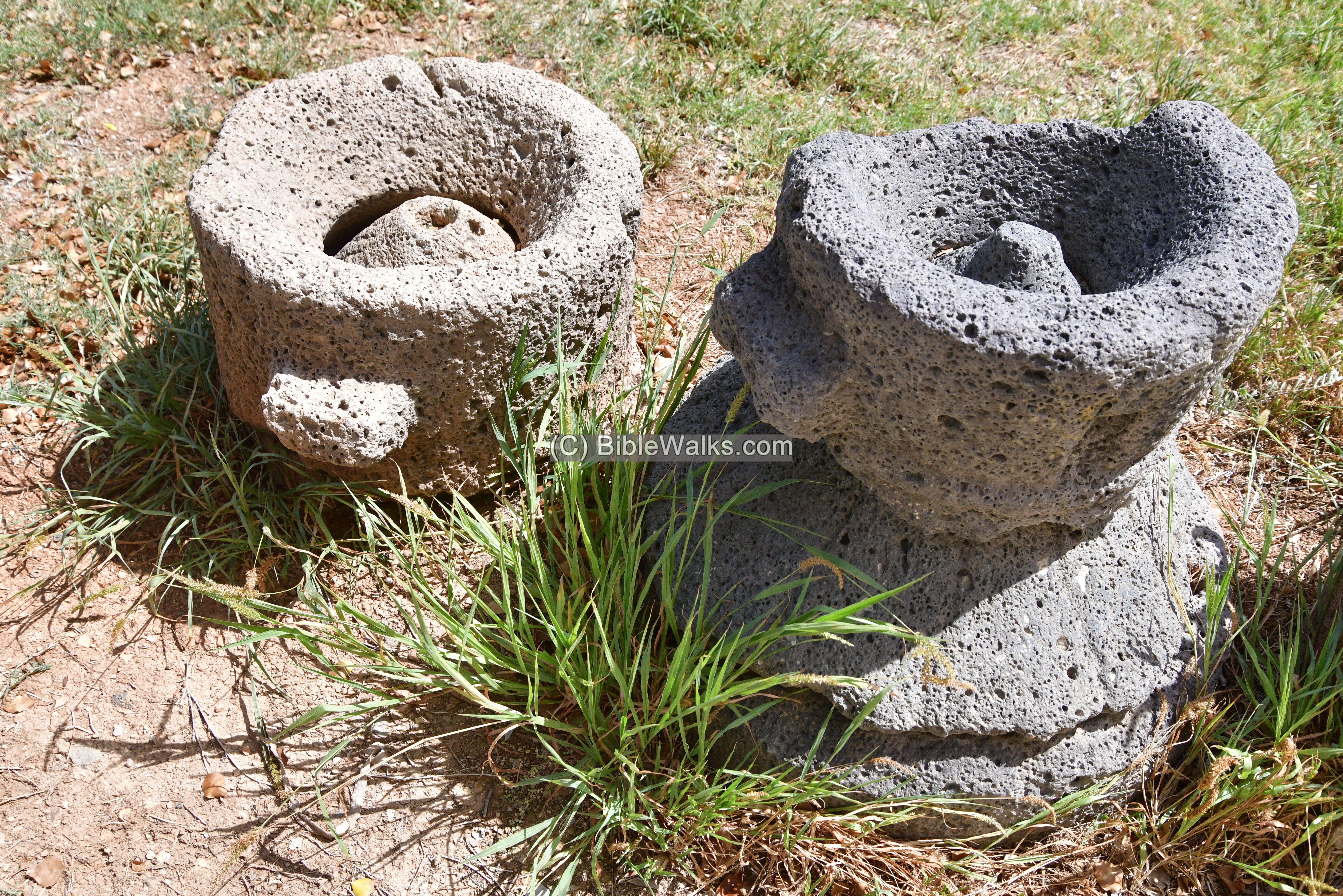
Grinding stones are also seen on the back side of the museum. These millstones are of a type called “Pompeian” (or: Donkey mill). The pair of stones on each grinding installation are a complete set – with both the upper and lower millstones. The process of the grinding was as follows: the wheat grain was placed into the top hole, then the upper millstone was turned around, and the ground grains would fall to the bottom. As opposed to the water powered mill, these manual agriculture installations handled a fraction of the grain and were in use a millennium earlier.
Links and references:
* References:
- Tel Amal – The New Encyclopedia of Archaeological Excavations In The Holy Land – 1992 – Volume 4 pp. 1583-1586
- Tel Amal (Tell el ‘Asi) – N. Zori 1962, pp. 184-185 Site 132 (221)
- First Settlement of the Wall and Tower Tel Amal
- Tel Amal – HAESI Volume 125 Year 2013 Tel ‘Amal
- Burial Caves of the Early Bronze Age IV at Tel ‘Amal
- Flax seed production: Evidence from the early Iron Age site of Tel Beth-Shean, Israel and from written sources; Mordechai E. Kislev, Orit Simchoni, Yoel Melamed, Lior Maroz; Oct 2011
- Gan Hashlosha national park
* Internal:
Etymology (behind the name):
- Sakhne – derives from the Arabic word for “hot” due to the warm water.
- Harod -“Harod” (חָרוֹד) is derived from the Hebrew root word “charad” (חָרַד), which means “to tremble” or “to be afraid.” The name “Harod” itself can be translated as “trembling” or “fear.” The connection between the name “Harod” and the spring in northern Israel, known as “Ein Harod,” likely relates to the geographical and historical context. The area around the spring has been associated with significant events in biblical history, such as the story of Gideon. The name might symbolize the awe or reverence inspired by the natural beauty of the spring and the historical events that took place there.
- Ein – Hebrew for spring (‘Ain in Arabic)
BibleWalks.com – Discovering the Biblical scenes
Harod spring<<<—previous Yizreel Valley site—<<< All Sites>>>
This page was last updated on Sep 21, 2024 (new writing)
Sponsored links: