Tell Sheikh edh Dhiab – Iron Age mound, on the eastern section of Fazael brook; Rujm Abu Mukheir – Iron Age round fortress that protected the road to Samaria.
Home > Sites > Jordan Valley> Tell Sheikh edh Dhiab, Rujm Abu Muhkeir
Contents:
Overview
Aerial Map
History
Photos
* Tell Sheikh edh-Dhiab
* Rujm Abu Mukheir
* End Note
Links
Etymology
Background:
The eastern section of Fazael brook includes a number of springs, a Roman period aqueduct, ruins of an Ottoman flour mill, a Biblical Tell which is identified as Ataroth. Joshua 16 5,7: “And the border of the children of Ephraim … went down from … to Ataroth…” An aqueduct and reservoir, along the southern bank of the brook, once supplied water to the Herodian city of Fazael (Phasaelis) and was also used for farming.
An important road passed near the site, ascending from the Jordan valley to Samaria mountains. It was protected with the Iron age fortress of Tell Sheikh edh Dhiab and the Iron age fortified round tower of Rujm Abu Muhkeir.
Map / Aerial View:
The aerial map below shows the east side of Fazael brook (Hebrew: Nahal Fatsael). The sites reviewed in this web page are on the eastern edge of the valley, on the side of the old road that ascended from the Jordan valley to Samaria. Both sites are on an open public area.
History:
- Iron (Biblical) Age
An Israelite settlement was established on Tell Sheikh es-Dhiyab, a small mound on the edge of the brook. It existed from the 10th century BC until the 8th century BC, during the Israelite Kingdom. This site was suggested by scholars to be Biblical Ataroth (Joshua 16:5,7):
“And the border of the children of Ephraim according to their families was thus…And it went down from Janohah to Ataroth, and to Naarath, and came to Jericho, and went out at Jordan”.
Another identification is a Levite city called Jokmeam (1 Chronicles 6:64,68):
“And the children of Israel gave to the Levites these cities with their suburbs…And Jokmeam with her suburbs”.
David Dorsey (“The roads and highways of ancient Israel”, pp. 177-178) identified a major Bronze/Iron road, “S20”, that descended from Shechem and the Samaria hills down to the to the Jordan valley. The road passed at Tell Sheikh es-Dhiyab (Site #582) and the Iron age fortress of Rujm Abu Meheir.
A Biblical map shows the area around the site (marked by “Ataroth”). A major road passes near the site, descending from Shechem, and the hills of Samaria, down to the Jordan valley. It is marked with a dashed line from Akrabatta (modern village Akraba). A modern road passes along this route (highway #505), as well as a Roman road (see the PEF map below).
Roads and cities during the Canaanite/Israelite periods thru the Roman period (based on Bible Mapper 3.0)
-
Early Roman period
During the time of King Herod, the Jordan valley witnessed an unprecedented growth, which included construction of new roads, villages and water supply systems. The Fazael valley was one of the areas that benefitted from this growth. Herod established the desert town of Fazael (Phasaelis) on his estate, and named it after his brother. The water supply for the town came by an aqueduct from the springs of Fazael brook, about 6KM to the north-west. Its waters were collected in a large reservoir (40x40x8m) which is located on the west side of Moshav Fazael. The water supply was used also for its palm trees, which gave the town its fame and income.
After Herod’s death (4 BC), Herod’s sister, Shelomit, inherited the town and the estate around it. After her death the estate was given to Livia, Augustus’s wife. During the great revolt the town, like Jericho, was damaged by the Romans.
-
Byzantine period
During the late Roman and Byzantine period, Fazael became a large agriculture village. Its residents were both Jewish and Christian. The aqueduct was maintained and repaired for hundreds of years, allowing the town to flourish.
The Arab period did not affect the village, but it gradually declined after the Crusader period (13th century).
The ruins of Fazael are located in Khirbet Fazael, on the south side of the modern Moshav Fazael.
-
Ottoman period
An Arab village was built at the end of the 18th century on the south side of the Roman town, called Fasail, which preserved the ancient name. The villagers, of the wealthy Nimer family, came from Shekhem. The villagers reused the stones from the ruins of the Roman village, repaired the aqueduct and built a flour mill near the springs.
The site was examined in the PEF survey (1866-1877) by Wilson, Conder and Kitchener. A section of their map is seen here:
P/O Sheet 15 of SWP, by Conder and Kitchener, 1872-1877.
(Published 1880, reprinted by LifeintheHolyLand.com)
-
Modern times
The Jordan valley underwent a total reconstruction after the six day war (1967) under Israeli control. New agricultural settlements were established in the area – Fazael east of Tell Sheikh edh Dhiab, and Ma’ale Efraim north west of Rujm Abu Mukheir.
Photos:
(a) Tell Sheikh edh Dhiab, Fazael
A small artificial mound at the eastern outlet of the brook is called in Arabic “Tell es-Sheikh Dhiyab”. It guarded the bottom of the descent from Shechem to the Jordan valley, then east thru the Jordan river fords or south to Jericho.
The site was excavated in 2000, and was dated to the Iron age. This site is identified by some scholars as Biblical Ataroth, part of the region belonging to the tribe of Ephraim (Joshua 16 5,7: “And the border of the children of Ephraim … went down from … to Ataroth…”). Its existence in this dry climate was based on the springs of Fazael brook.
- The Mound:
The cone shaped mound rises 10-15m above the area. It is 50m by 60m, covering an area of 2 dunams.
This view is from the south side. On the southern foothill is a long retaining wall.
A detail of the hillside:
On top of the mound is the base of a rectangular structure. It is 15 wide and 20m long, with internal rooms. The walls are made of two rows of local stones. According to ceramics collected on the mound, it is dated to the Iron Age II. This may have been a fortress than guarded the road, the springs and and the pools.
The next view is from the east. The dirt road passes along the foothills and connects to the paved road along the north side of the mound.
Another long retaining wall, 75m long and built of large stones, stretches along the eastern side.
On the east side of the mound, just above the dirt road, is a ramp. The ramp is 10m wide and 50m long, built of a bright soil, as seen below in this view towards the east. The purpose of the ramp is not clear, Zartal suggested it may have been used as building material, or more likely used as a siege ramp.
Another ramp is piled up on the south west side of the mound. It could have been the material dug out of the pool on the south side of the mound.
- Reservoir:
South of the mound is a large built reservoir. It is a square 45m x 45m, and 4-5m deep. It can store 15,000 cubic meters of water. It was probably built in a later period than the mound – during the Early Roman Herodian period.
The walls of the reservoir are 3-3.5m wide, built of 2 rows of large unhewn stones with a fill between the rows. The internal side of the wall is covered with a layer of small stones, covered with plaster. On the south-west corner are remains of a staircase.
The reservoir was filled by water reaching along the Fazael aqueduct. In the photo below is a section of the aqueduct that continues east towards the ancient city of Fazael.
Below – a view of the reservoir and the mound behind it.
- Findings:
According to Zartal’s survey, the ceramics collected on the site were dated to the Early Bronze (6%), Late Bronze (12%), Iron Age I (2%), Iron Age II (53% – majority), Persian (7%), Hellenistic (3%), Early Roman Herodian (10%).
We also collected some ceramics, and left them on site. The majority of the ceramics were Roman period.
We also spotted a flint blade (Iron Age period?):
And another piece – colored glass (Roman period):
And a basalt grinding stone (Iron Age period?):
- Prehistoric site
In the valley north of the site are remains of a large Chalcolithic settlement. We need to return here to further explore the site.
(b) Rujm Abu Mukheir
The ancient road, ascending to the hills of Samaria, passed on the north bank of the Fazael valley. In this west view from the mound the road is seen on the right side.
The ascent was used in thousands of years as a main route from the Jordan valley to the high country of Samaria. The paved road, seen in the following photo, continued along the side of the roads of various periods: Bronze/Iron period route, the Roman road Fazael-Shechem road, the Ottoman and British roads, and the modern highway #505 via Ma’ale Efraim.
This section of the paved road is now closed to traffic, as the modern highway cut a different, yet more convenient, route on the north side.
The now closed section of the old road passes near Rujm abu Mukheir, seen here in the background to the left of the tree.
Rujm abu Mukheir is an Iron Age round tower that protected the ascending road. It is 1.5km north west of Tell Sheikh edh Dhiab, and 190m above it.
The tower is composed of 2 concentric walls. The outer wall is 17.2m in diameter, while the inner circular wall is 8.7m in diameter.
A supporting wall, 5m high, supported the outer wall with a 70 degrees slope.
The width of the external wall is 1.5m, while the inner wall is 1.2m in diameter.
The space between the walls is divided by radial walls, 1.2m wide, into 8 chambers.
The floor of the radial chambers was covered with small and medium sized stones. Storage jars were found laying on the floor.
The tower was dated to the Iron Age 2 and 3. It was probably built at the same time of Tell esh-Sheikh Diyab and was also used to protect the road that ascended from the Jordan valley to Samaria.
Other round towers dating to the Iron age were found in nearby Khirbet Makhruk, on Mt. Poriya west of the sea of Galilee, in Umm Ghazal and Muntar esh Shakk in Northern Samaria. They served as fortified watch towers on the side of major roads. These Iron age round towers were characteristic of towers found in Amon west of the Jordan river.
(c) End Note
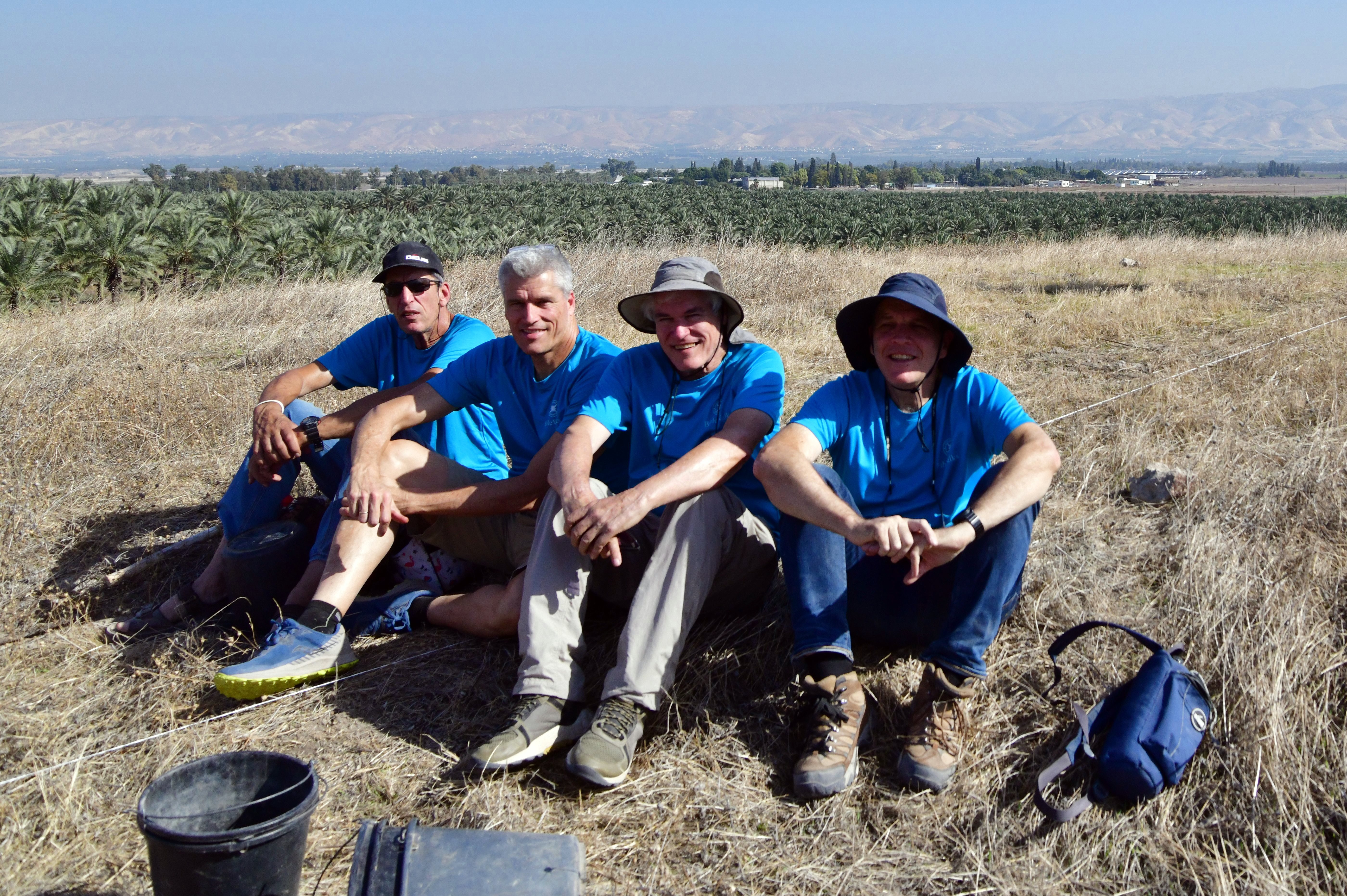
This BibleWalks hike was conducted by the Hofman family brothers, as part of Yoram’s 70th year birthday.
Links:
* External links:
- “The Manasseh hill country survey” Volume 5 [Adam Zertal , 2012]
-
- Site 23 – Tell esh-Sheikh Diyab (pp 147-150)
- Site 5 – Rujm Abu Mukheir (pp 106-108)
- Three Iron Age Fortresses in the Jordan Valley and the Origin of the Ammonite
Circular Towers – Israel Exploration Journal , 1995, Vol. 45, No. 4 (1995), pp. 253-273
* Internal links:
- Aqueducts – information page
- Fazael Brook -BibleWalks site on the springs and aqueduct
Etymology – behind the name:
- Fazael (Phasael, Phasaelus, Phasaelis) – A prince, younger brother of Herod the Great, who died in 40BC during the fight with the Parthians . Herod, later a “King of the Jews” under Roman rule (37BC-4BC) named the new founded nearby city after his brother.
- Wadi, Vadi – Arabic: valley
- Wadi Fazael – Fazael valley
- Rujm – Arabic for ‘stone heap’
BibleWalks.com – walks along the Jordan river
Jordan-Jericho <<<—previous site—<<<All Sites>>>—next Jordan Valley site—> >> St. Gerassimos
This page was last updated on Aug 2, 2024 (end note, add diagram)
Sponsored Links: