Ancient Iron Age and Hellenistic period city, with an amazing underground lower city. A UNESCO World heritage site.
* Site of the month Feb 2017 *
Home > Sites > Judea> Beit Guvrin > Tel Maresha (Tell SandaHanna)
Contents:
Overview
Aerial Map
History
Photos
* The Tel
* Corner Tower
* Polish cave
* Columbarium cave
* Bathtub cave
* Oil press cave
* Residential house
* Cisterns
* Maze cave
* Maze – Oil press
* More
Biblical
Links
Etymology
Background:
Tel Maresha (Tell Sandahanna) is an ancient city in the lowlands (Shephelah) region of Judea. It was occupied in the Iron Age, Persian and Hellenistic period and was destroyed by the Hasmoneans in the end of the 2nd century BC. The city was reestablished during the Roman period in the nearby Beit Guvrin.
The fame of the site is due to its hundreds of man made caves and cavities. The national park, a UNESCO World heritage site, offers a unique experience of exploring several of these hewn caves.
Other sites around Tel Maresha and Beit Guvrin – the land with a 1,000 caves – are covered in Maresha-2 page and more sites will be added soon in other pages.
Location:
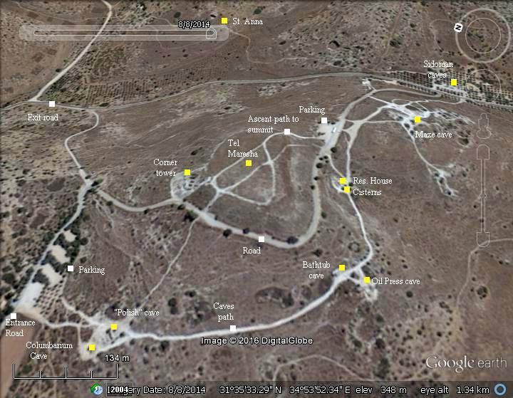
An aerial map of Tel Maresha is illustrated here, with indication of the major points of interest. This section is part of the large Beit Guvrin-Maresha national park. It is accessed from a road south of Kibbutz Beit Guvrin, which is located on the side of road #35, and reached from highway 6 (via Kiryat Gat interchange).
Two parking lots are located on the west and east side of Tel Maresha, and a path between them passes along the points of interest.
History:
-
Biblical periods – Early Canaanite to Israelite periods (3150 BC- 586 BC)
Maresha was part of the kingdom of Judea. (Joshua 15:20, 44): “This is the inheritance of the tribe of the children of Judah according to their families… And Keilah, and Achzib, and Mareshah“”. It was settled in the 9th century. Rehoboam fortified the city (2 Chronicles 11: 5-8): “And Rehoboam dwelt in Jerusalem, and built cities for defense in Judah… He built … And Gath, and Mareshah, and Ziph,…”.
In ~900 BC, Asa King of Judea staged a war near the city against a formidable army of a million (!) soldiers. The head of the enemy is named Zerah the Ethiopian, but this was probably an Egyptian and Libyan army. The Bible records a great victory for the Judean forces (2 Chronicles 14:9-12): “And there came out against them Zerah the Ethiopian with an host of a thousand thousand, and three hundred chariots; and came unto Mareshah. Then Asa went out against him, and they set the battle in array in the valley of Zephathah at Mareshah. And Asa cried unto the LORD his God, and said, LORD, it is nothing with thee to help, whether with many, or with them that have no power: help us, O LORD our God; for we rest on thee, and in thy name we go against this multitude. O LORD, thou art our God; let no man prevail against thee. So the LORD smote the Ethiopians before Asa, and before Judah; and the Ethiopians fled”.
The prophet Micah, who prophesied during the end of the 8th century, names Maresha among other fortified cities of Judea in a description of a conquest, probably the Sennacherib destruction of 710 BC (Micah 1:15): “Yet will I bring an heir unto thee, O inhabitant of Mareshah: he shall come unto Adullam the glory of Israel”.
The cities and roads during the Biblical periods are indicated on the Map below. Maresha (later Marisa) is indicated as a red point, and is positioned near the roads between Hebron and Gaza, and roads to other fortified cities of Judea such as Lachish, and the road to Jerusalem via the valley of Elah.
Area of Maresha – during the Biblical to the Roman periods (based on Bible Mapper 3.0)
-
Hellenistic period (4th-2nd century BC)
Maresha was renamed Marissa during the Hellenistic period, preserving the Hebrew name. Most of the structures found on the top of the hill and the lower city are dated to this period, as it became an important city. Immigrants from Sidon and Idumeans started to settled in the city.
-
Hasmonean period (2nd Century – 1st Century BC)
Maresha/Marissa was captured by the Hasmonean King John Hyrcanus (reigned 134-104BC), as part of his campaign against the Idumeans in 110 B.C. Most of the population was forced to leave the town, while a small garrison was left in Maresha. Thus came the end of the Idumean control of the area, as promised by the prophecy (Obadiah 1, 19): “And they of the south shall possess the mount of Esau”.
According to the historian Josephus Flavius, the Idumean cities and villages (an area around Hebron and Beersheba) were converted to Judaism by the Hasmoneans (Antiquities 13 9:1):
“Hyrcanus took also Dora and Marissa, cities of Idumea, and subdued all the Idumeans; and permitted them to stay in that country, if they would circumcise their genitals, and make use of the laws of the Jews; and they were so desirous of living in the country of their forefathers, that they submitted to the use of circumcision, and of the rest of the Jewish ways of living; at which time therefore this befell them, that they were hereafter no other than Jews”.
Coin of John Hyrcanus
-
Early Roman period (63 BC – 1st century AD)
Parthian destruction: During the beginning of the reign of Herod the Great, at ~40 BC, the city was destroyed by the Parthian empire. The Parthian army, who came from a region in what is today Iran and Iraq, invaded Syria and Israel during the period of civil unrest in Rome, following Julius Caesar’s assassination. The Parthian invasion was coordinated with Antigonus son of Aristobulus, the Hasmonean rival to Herod. After they captured Jerusalem, but found insufficient treasures, the Parthian army captured and destroyed Maresha/Marissa in order to finance their campaign.
Josephus wrote about this (Ant. 13:3,9):
“Now, in the second year, Pacorus, the king of Parthia’s son, and Barzapharnes, a commander of the Parthians, possessed themselves of Syria….But when it was day, the Parthians plundered all Jerusalem, and the palace, and abstained from nothing but Hyrcanus’s money, which was three hundred talents. A great deal of Herod’s money escaped, and principally all that the man had been so provident as to send into Idumea beforehand; nor indeed did what was in the city suffice the Parthians, but they went out into the country, and plundered it, and demolished the city Marissa”.
Why was the city picked by the Parthians for plundering? Perhaps, the city was known to be rich. Another theory is that Herod was born and lived in Marissa, and therefore the city became a target.
King Herod first retreated to Edom (39 BC), and after a visit to Rome, launched a counter attack and returned to reign Judea in 37 BC. However, Marissa did not recover the destruction, and the city was rebuilt in a nearby site of Beit Guvrin.
-
Ottoman Period – (1516-1918 A.D.)
The area was examined in the Palestine Exploration Foundation (PEF) survey (1866-1877) by Wilson, Conder and Kitchener. It appears on the map of sheet 20 and described in Volume III.
A section of the map is here on the right. The site is named “Tell Sandahannah”, located south of Beit Jibrin (the Arab village on the ruins of Roman Beit Guvrin). On its west side passes a major Roman road, illustrated with double dashed lines. To the north west is Kh. Merash, which preserved the ancient name
Part of map sheet 20 of Survey of Western Palestine,
by Conder and Kitchener, 1872-1877.
(Published 1880, reprinted by LifeintheHolyLand.com)
The plan of the ruins of Tel Maresha, known as Tell SandaHanna during that time, was published in the PEF quarterly reports (1900). The archaeologists excavated almost the entire top of the mound, identifying 5 layers (Iron Age, Persian, Ptolemaic Hellenistic, Seleucid Hellenistic and Hasmonean).
The plan of the upper city, during the Hellenistic Seleucid period, appears on page 326. It is roughly circular, with a diameter of 150m (500 ft).
Map by Bliss and Macalister; Part of PEF Quarterly statements, 1900
A section of their description of the plan of the ruined city appears on pages 327-328:
“The town is roughly divided into blocks by streets (see plan). The most important is Street A, running east and west for a distance of 350 feet from the “barracks” to the houses along the west wall. It is paved in places with rude blocks of soft limestone, and has a maximum breadth of 20 feet. Several of the other streets are paved. Opening out of Street A to the north we have, first. Street B, 7 feet to 10 feet wide, which runs straight for some 65 feet, and then turns east for about the same distance, terminating in a cul-de-sac [=dead-end]; secondly, the short Street T, of irregular width, also terminating in a cul-de-sac; and, thirdly. Street A, from 7 feet to 18 feet wide, and over 160 feet long, which does not extend to the city wall. The pavement is preserved only in some places ; two of these occur within a short distance, and as they differ in level by some 3 feet, we assume that the street must have been stepped down. Opening from Street A to the south we find the narrow Street E, which bends around the “barracks,” and Streets Z and H, which, with Streets A and 6, enclose what appears to be the most important block of the town. This block, which, roughly speaking, measures about 140 feet square, shows signs of rebuilding, especially at the south side, and of adaptation to public uses. Immediately under the ground-level of the ” Court ” and ” Paved Court ” are found foundations of houses, which appear to have been destroyed when the block was unified, so to speak. I would suggest that these may have been pulled down when the block was adapted as the house of the governor. In its north-west corner we find the court a, surrounded by eight rooms, which may have constituted the private apartments. The large rectangular ” Court ” (50 feet by 62 feet) is partly surrounded by a passage, which appears to have been divided into rooms in later times by the walls hatched on the plan. At the north this passage is separated from the “Paved Court” by still another passage. These courts may have been places of public assembly. The rooms at the south-western portion of the block may have been devoted to government offices”.
-
Modern period
Tel Maresha is part of the Beit-Guvrin/Maresha national park. It was recognized in 2014 as a UNESCO World heritage site. This is one of the most interesting antiquities in Israel. The unique visit to the underground city will certainly etch in your happy memories of the Holy Land.
Photos:
(a) Tel Maresha
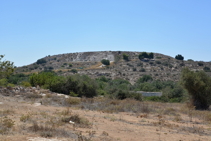
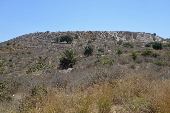
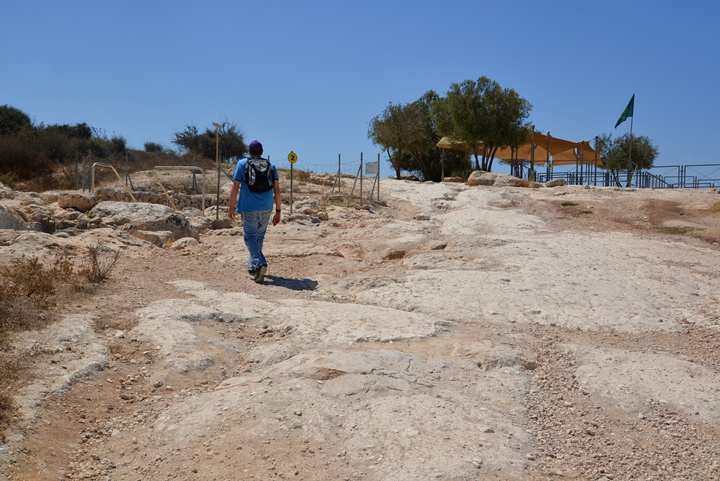
Tel Maresha is located on a high mound, at an altitude of 357m above sea level and 30-40m above the area around it. The total area of the mound, where its “Upper City” was located, is 24 Dunam (6 acres). Around the mound is the “Lower city”, covering an area of 320 Dunam (80 acres).
Click on the photos to view in higher resolution…
A view from the north is in the following photo. On top of the hill (and on the area around the hill) are five layers, which were excavated and published in 1902 by Bliss and Macalister of the PEF (Tell SandaHanna). They identified the following 5 layers:
-
Iron Age (8th-6th century BC) – Israelite Kingdom
-
Persian period (5th-4th century BC)
-
Hellenistic under Ptolemy (3rd century BC)
-
Hellenistic under Seleucids (2nd century BC)
-
Hellenistic under the Hasmoneans (end of 2nd century-beginning of the 1st century BC) – small garrison that occupied the city
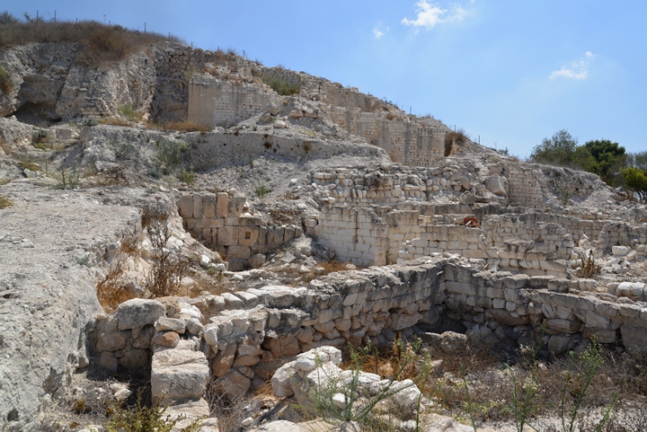
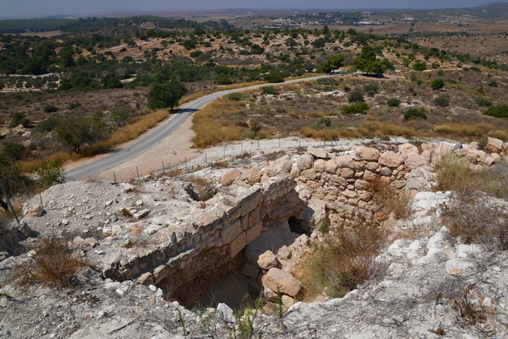
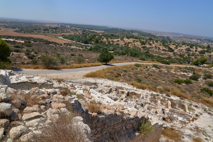
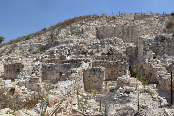
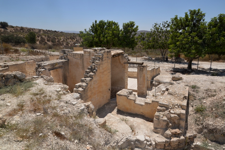
On the northern slopes is an area (#100) which was recently excavated, revealing the ruins of the north-west corner tower, and the inner and outer walls.
The following photo shows a northern view from above the NW tower.
The paved road, traversing the western foothills, is part of the circular (one way) road of the national park. Kibbutz Beit Guvrin is seen in the far background, 2KM to the north. Adjacent to the Kibbutz are ruins of the Roman/Byzantine Beit Guvrin (Eleutheropolis), which is covered in a separate page.
Another view towards the north west, above the ruins of the corner tower, is next.
The PEF report wrote about the inner and outer walls:
“…the inner wall runs either along the edge of the Tell or in a line slightly down the slope. The outer wall (hatched on plan) is, of course, still further down the slope. It was traced along the entire south side of the city, pieces were found at the west, and a section, 140 feet long, was excavated at the east… In places the space between
the two walls is barely 15 feet, while in two instances the towers of the two systems touch each other. That the two walls are of the same period is proved by the fact that the face of one of the towers of the inner line is extended beyond the place for the true corner to bond into the outer line. It seems to
me to be probable that the outer wall never rose to any great height above the surface, but merely served the purpose of a revetment to strengthen the upper wall which rested on debris. The outer wall also rests on debris. Its masonry shows the large and small rubble of the upper line, as well as the limestone “bricks,” but the large well-squared stones are wanting, and in general the construction is inferior. It is about 6 feet thick”.
The PEF report wrote about this NW tower:
“Some of the towers are built of thin, brick-like blocks of soft limestone, dressed with a broad chisel, often used diagonally’ ; this is the characteristic building material of the town. It is found in the part of the wall between the north-west tower and the offset which marks the position of an internal tower. The stones average about 21 inches in length, 6 inches in height, and 11 inches in thickness, the courses Being laid in English bond, that is, a course of stretchers alternating with a course of headers. The internal tower is of irregular shape, and probably contained small chambers at different levels, though only one remains; the part of the tower blackened in was found solid, and represents mere foundation work. Eastwards from this point to the north-east tower, and southwards from this tower to the gate, the masonry consists of large stones, set in mud, with wide joints. These stones range in length from 2 feet 10 inches to 3 feet 9 inches, in height from 1 foot 6 inches to 1 foot 9 inches, in thickness from 6 inches to 9 inches, and are laid in English bond. They are roughly flaked, with no distinct dressing, though in some cases there has been a rude attempt to form a boss and margin”.
The excavations on the south side of the NW tower identified structures dated to the Hellenistic period, including residential houses and five stores on the ground floor which were opened to the street.
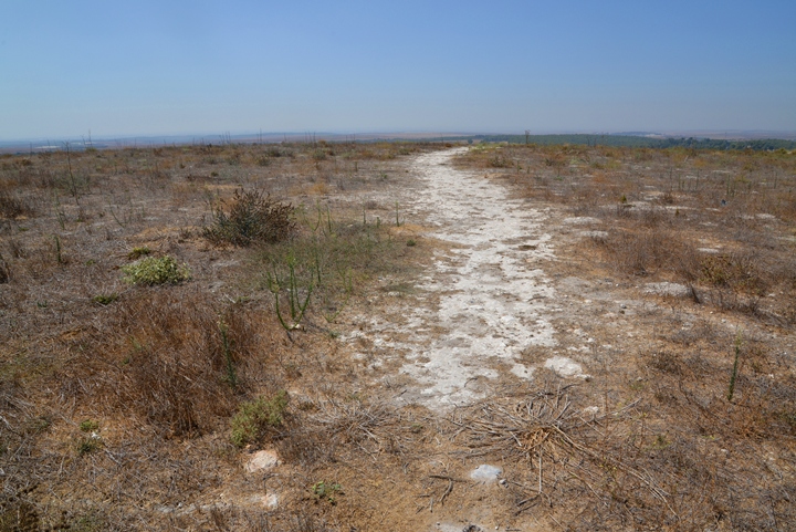
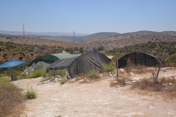
The top of the hill was covered after the 1900 excavation. This is how it looks today – flat and no view of any structures:
The most interesting parts of Tel Maresha, which are opened to the public, are the caves and structures of the “lower city”, located on the west and south sides of the hill. The remainder of this web page focuses on the “lower city” – the city of the cave dwellers.
(b) Polish Cave
In 1900 Bliss and Macalister explored the underground city along the foothills, and identified 63 underground complexes. In each complex a number of connected rooms were mapped and documented.
Since then, the archaeologists mapped 162 cave complexes around Tel Maresha, on all sides of the hill. Only a few of those are accessible by the public. The following sections are caves that are part of the self led tour, starting from the west towards the east side of the hill.
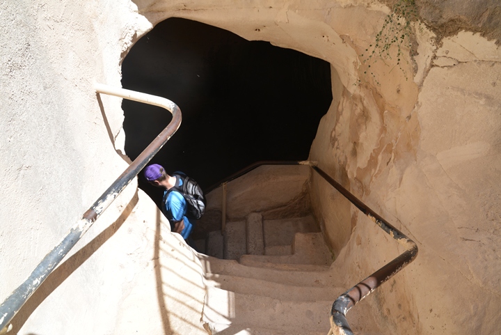
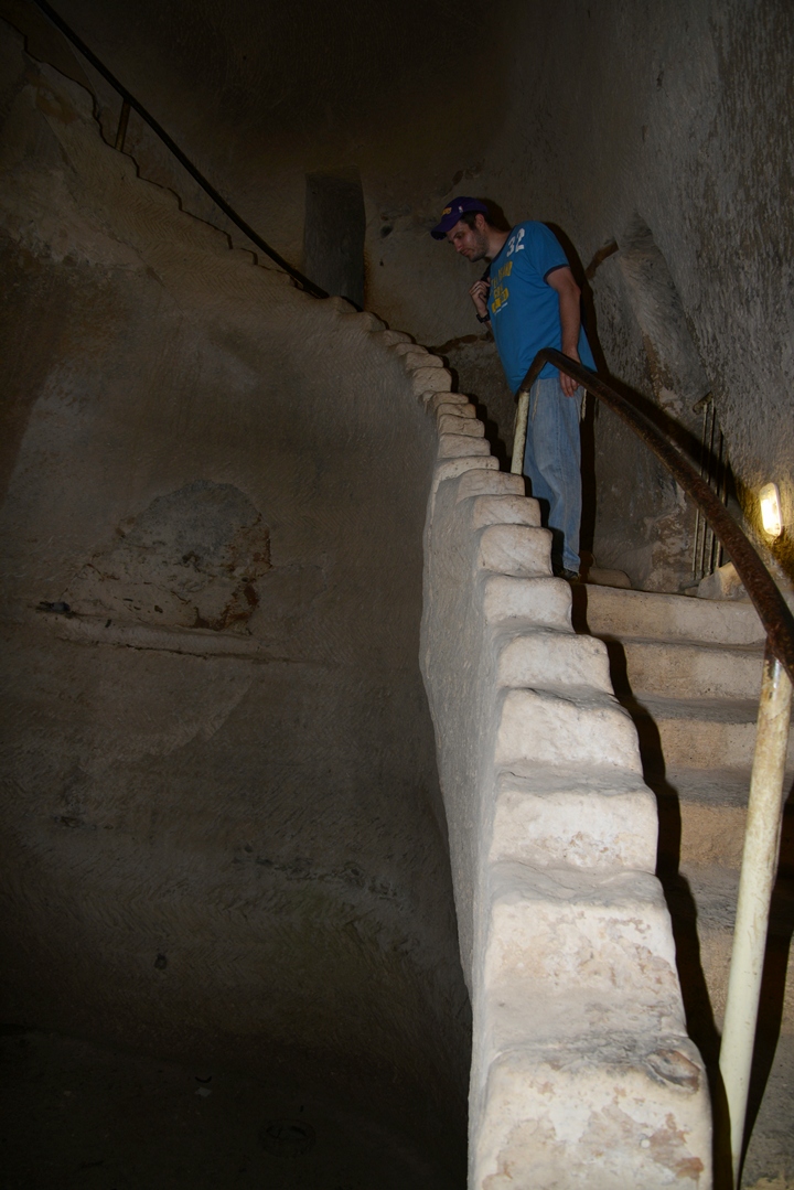
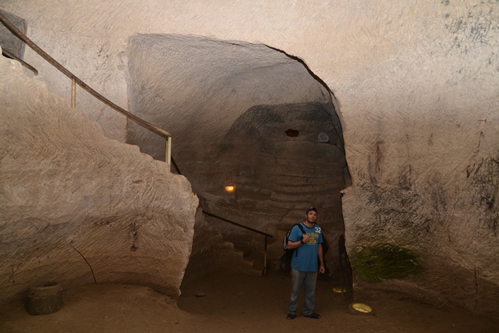
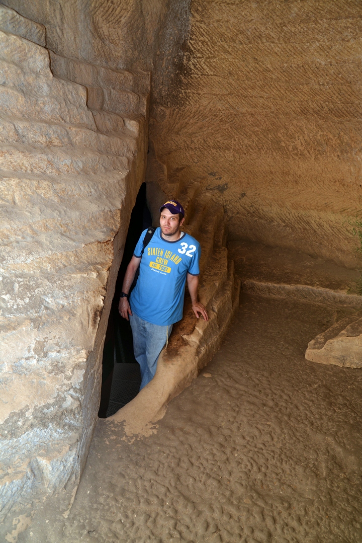
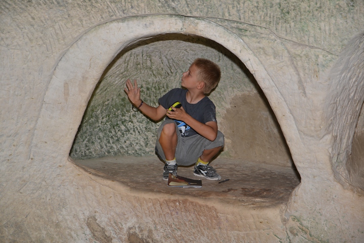
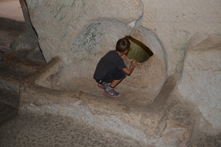
The first cave on this tour is the “Polish cave”. We will accompany Itai, Webmaster Rotem’s brother from Los Angeles, along this tour of the west and south sides of Tel Maresha.
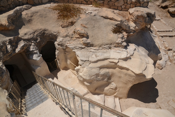
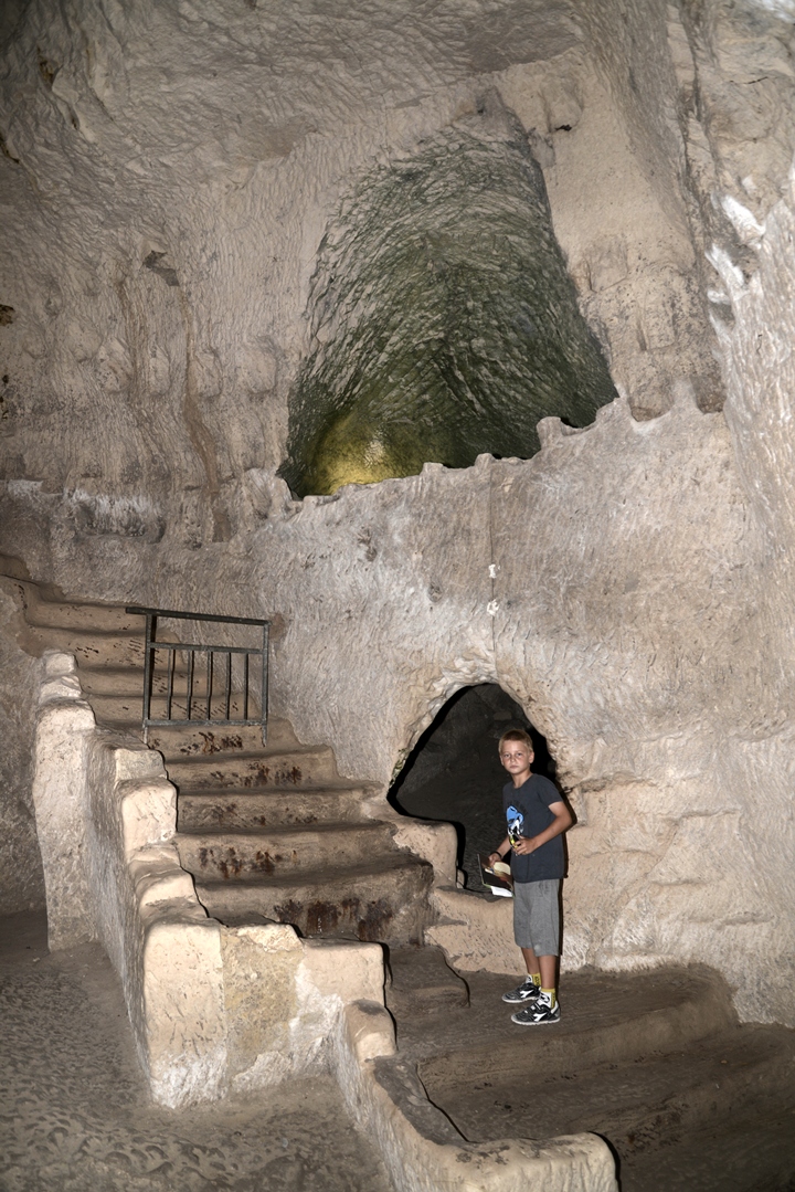
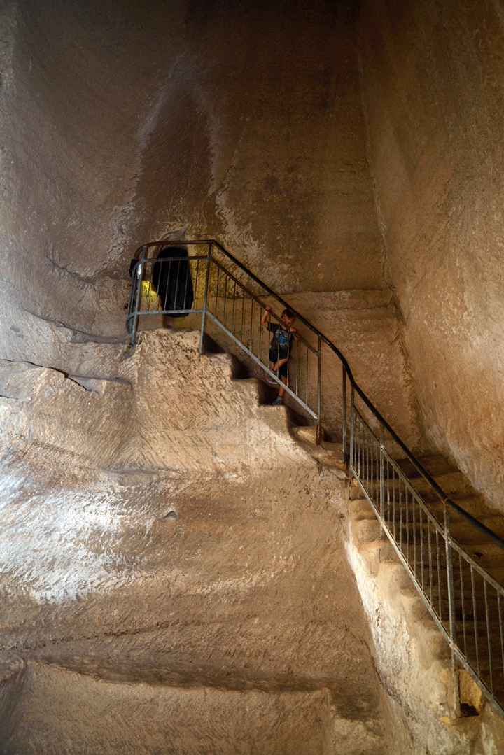
Modern steps lead down into the cave. This cave is dated to the Hellenistic period.
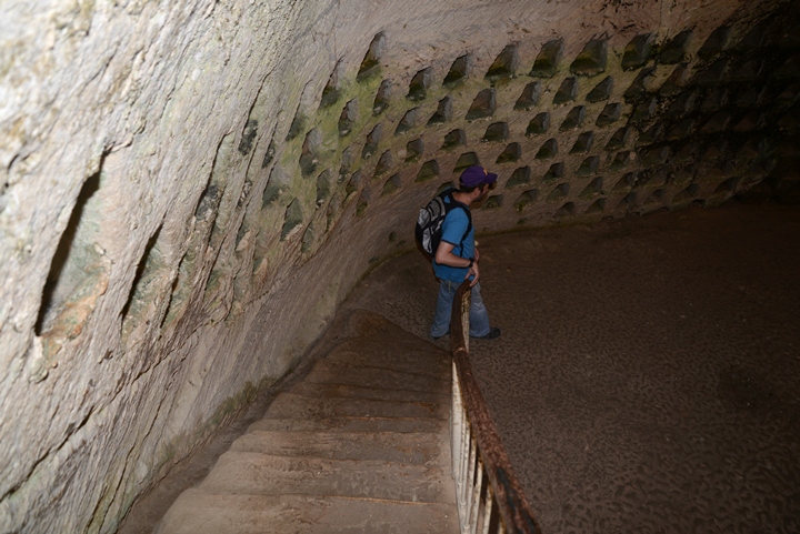
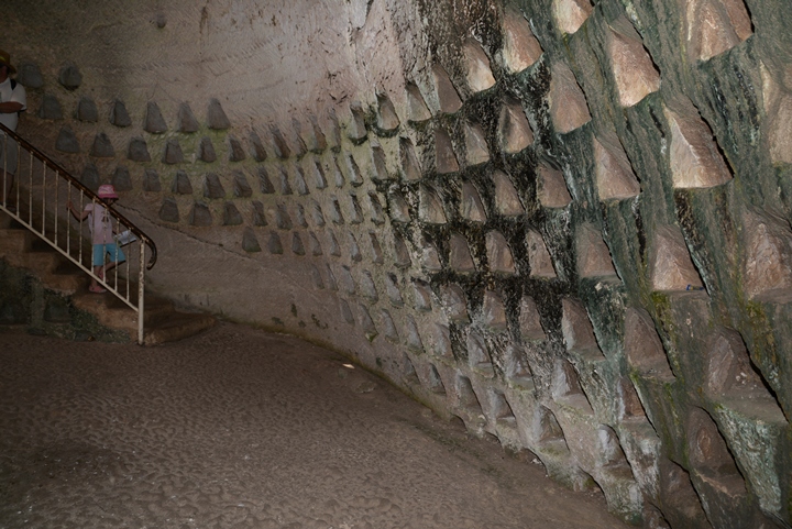
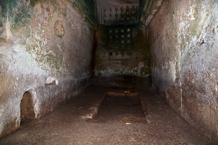
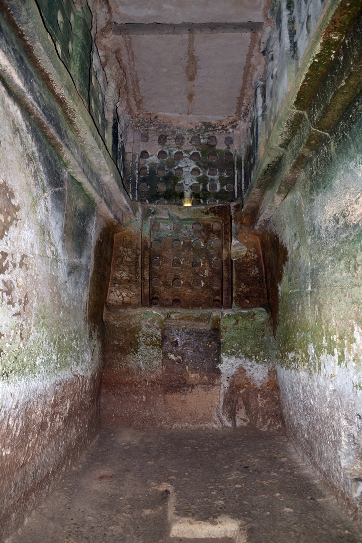
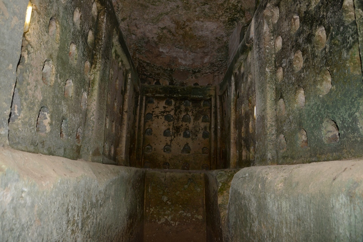
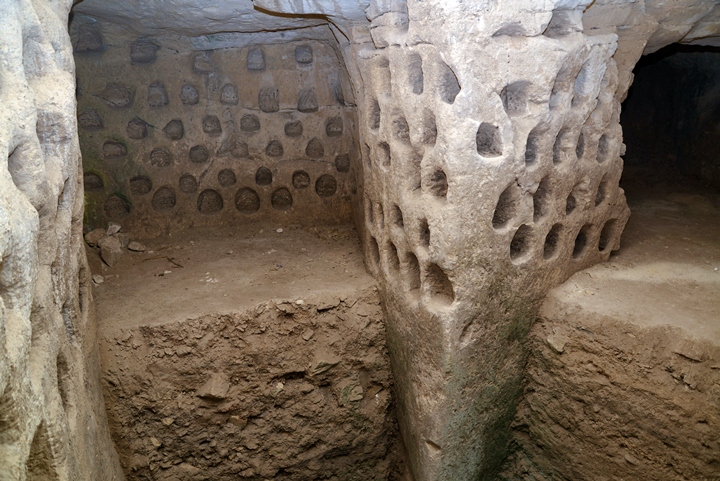
Along the walls are dozens of niches for raising doves and pigeons. This was a housing structure for doves and pigeons, which were raised in the caves for fresh meat and eggs supply. The bird droppings were also used as a fertilizer for growing food.
This type of structure is called “columbarium”. The word is based on the Latin Colomba, which is based on the bird family of pigeons and doves (Latin: Columbidae). Another term for the bird structure is “dovecote”.
The term Columba is the Latinized form of the Ancient Greek word kolumbos, meaning a diver, as the birds have an ability to dive (hence also named “dove”).
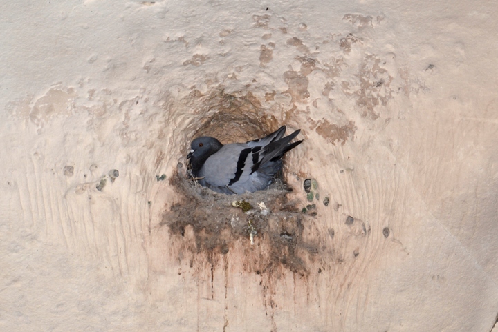
In one of the holes we noticed one of the pigeons nesting.
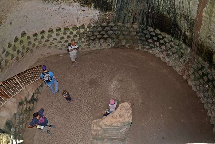
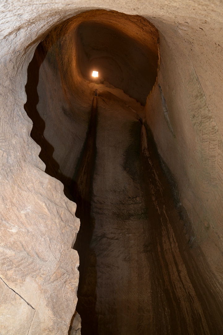
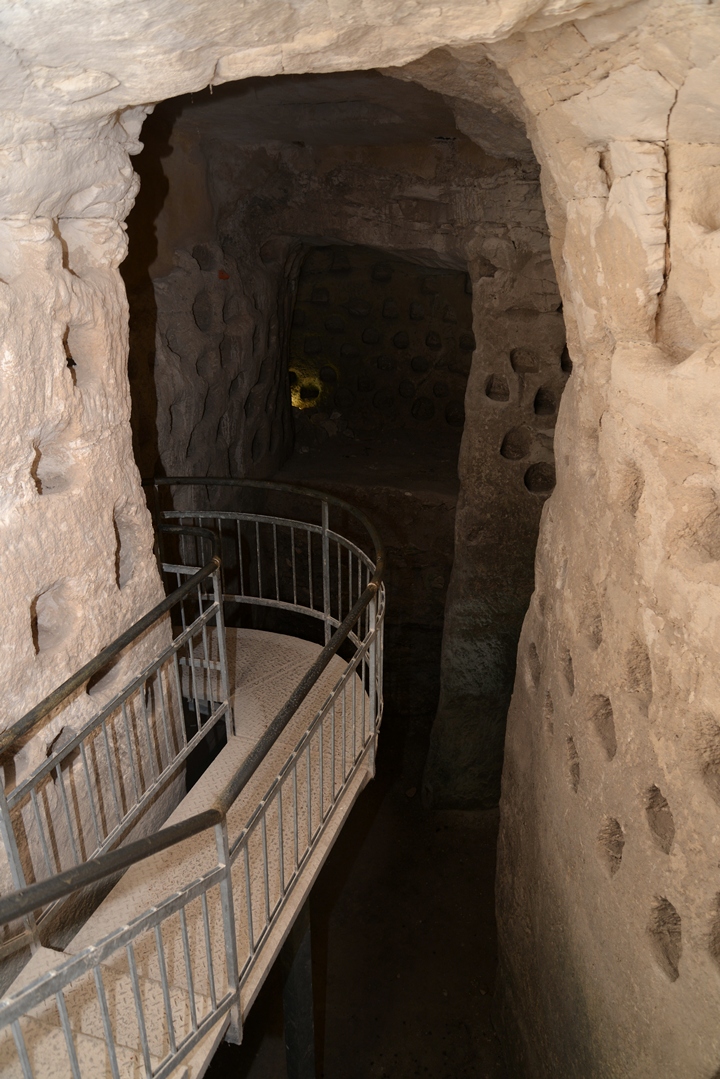
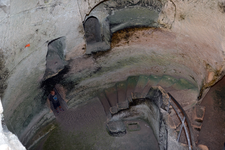
Another view from the top of the stairs shows the structure of the cave, which is typical of the columbarium caves with a bell shaped structure. The cave was hewn by digging a hole into the ground, then cutting out the rock around a square column in its center, expanding the circumference while digging downwards. After completing the bell shaped cave, the niches are cut into the walls and the central block. Then, the top entrance is blocked and a side staircase entrance is added.
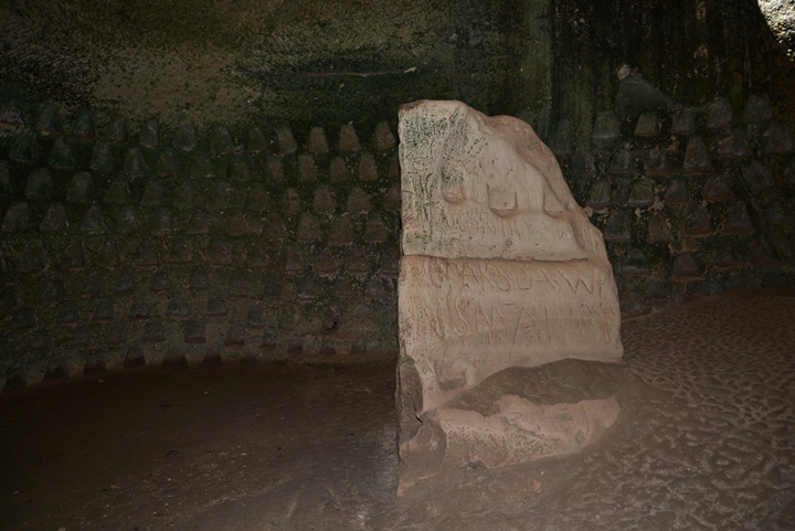
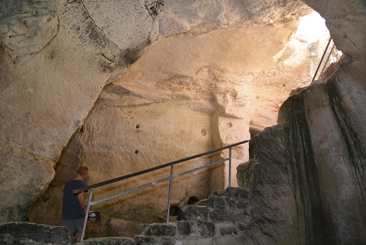
The cave is named after the soldiers from General Władysław Anders’ Polish-Soviet army , a force that was stationed in the area during WWII. They visited the place and carved on the central column with the year “1943”, the city “Warsaw” (letters seen under the middle line), “Poland”, and added an illustration of an eagle – the symbol of the Polish Land forces. Carving on these soft rocks is strictly forbidden, and will result in fines rather than naming the cave after you…
(c) Columbarium cave
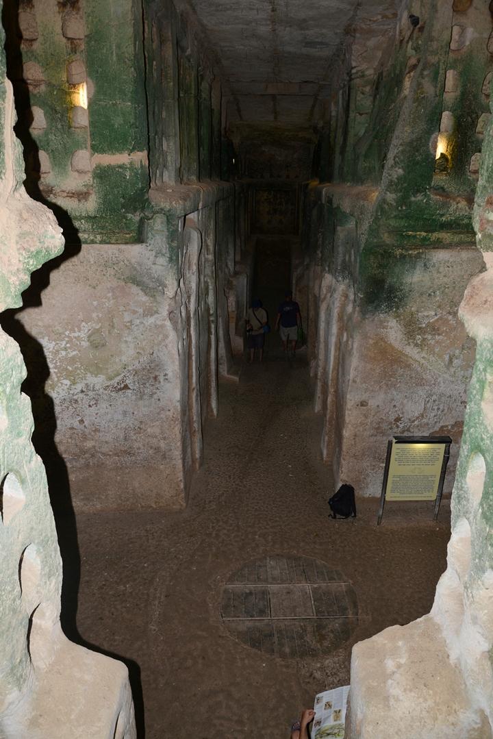
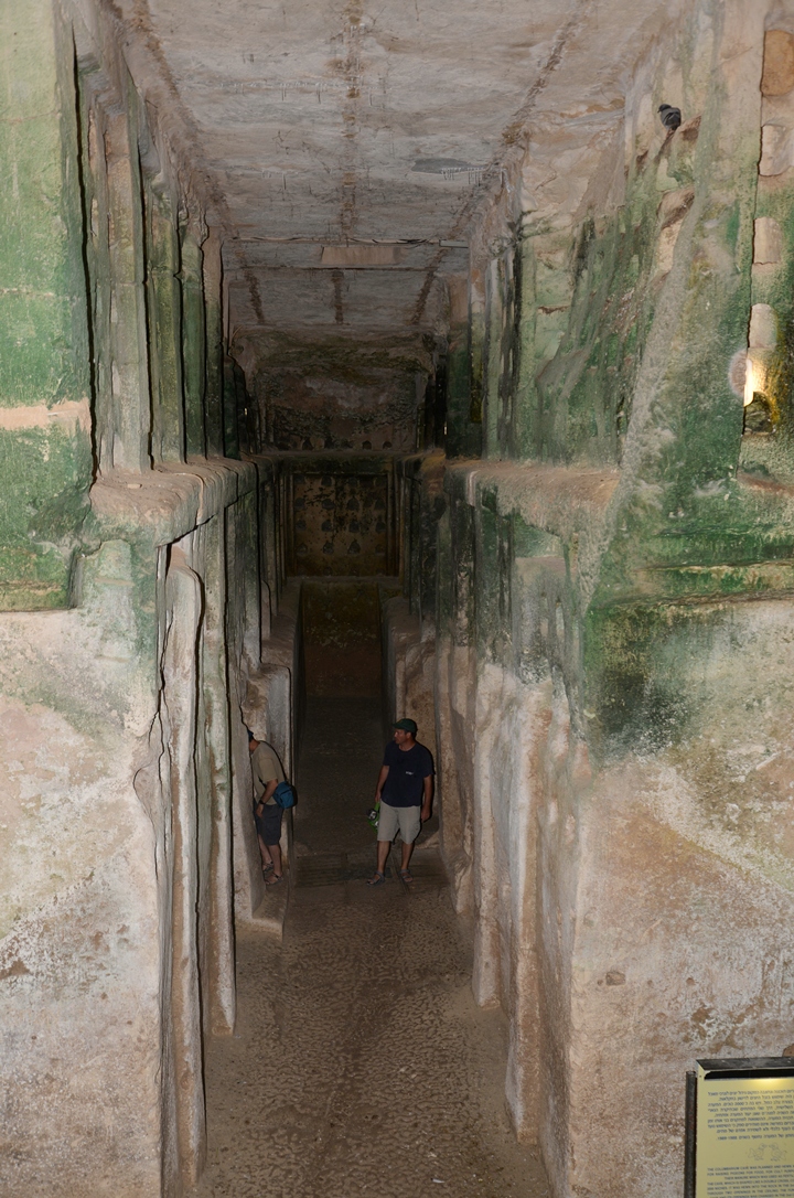
A larger structure of a commercial columbarium is located near the “Polish” cave. The cave was known as “es-Suk” (the market), and now is known by the name “columbarium” cave. It is the largest and best designed cave in Maresha.
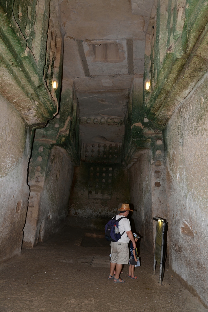
Its form belongs to another type of columbarium caves, arranged as rectangular halls arranged in a cross form. These columbarium caves are dated to the 3rd century BC (Hellenistic period) and were in use until the first of second century AD. The cave started as a columbarium, but during the beginning of the 2nd century BC it was converted to other commercial uses such as storing goods.
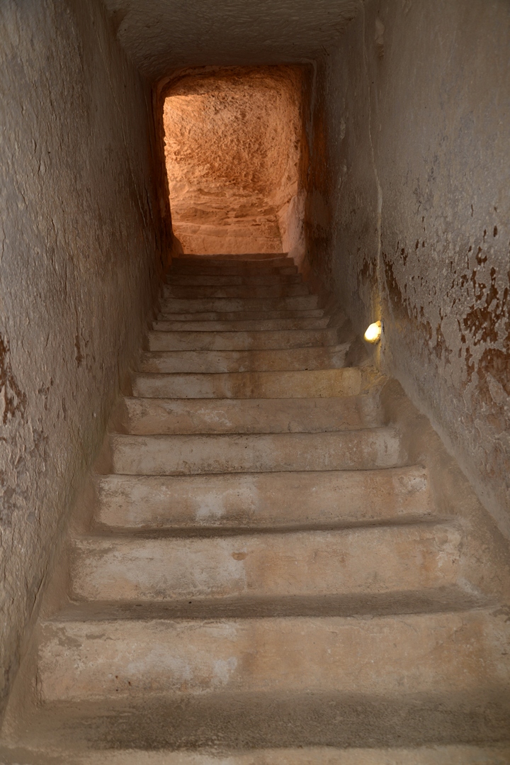
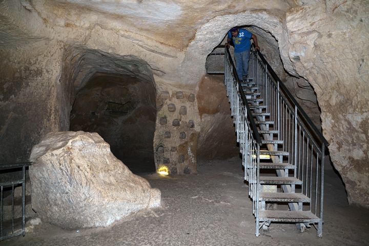
Steps lead down from the surface to the bottom of the cave:
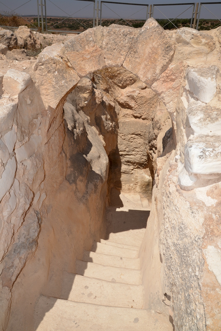
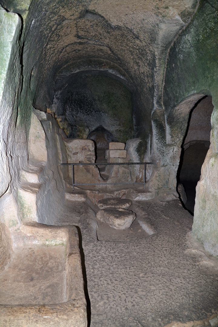
These ancient steps are carved into the soft chalk rock. This entrance is located on the south east side of the complex, while another exit is located on the north west side.
Inside this cave are more than 2,000 pigeon niches. The columbarium caves are common in Judea. In Tel Maresha alone there are 85 known columbarium caves, with a total of tens of thousands of niches.
A closer view of the hall is in the following photo. Pigeons are nesting in some of the niches, as in this photo on the right side of the upper row.
The columbarium structure is composed of several halls, arranged in the form of a double cross, as illustrated below.
The PEF report in the quarterly statement of 1901 (page 10, plate I) showed a plan of the cave, here on the right.
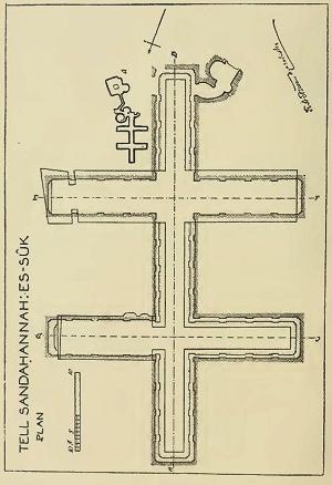
PEF quarterly statement, 1901, page 10
The first section of their detailed report (pages 11-24) is as follows:
“The present entrance is through a square hole, about 5 feet across and 6 feet deep, which opens into the top of a large irregular chamber much blocked with debris. This is about 80 feet across. At one side there are traces of rows of niches, showing that the chamber has been used as a columbarium. Immediately opposite to these niches is the entrance to a narrow creep passage. Though creep-passages are common elsewhere in the neighborhood this is the only existing specimen in the 50 or 60 labyrinthine excavations on the slopes of Tell Sandahannah. The passage is 3 feet across, 2 feet 8 inches high, and 33 feet long. A drop of 4 feet leads to the level of the floor of a lobby, from which two circular chambers open. These are to the left of the end of the passage ; to the right there seems to have been an exit, now blocked. Of these chambers, the diameter of one is about 19 feet, that of the other 15 feet.. “.
A closer view of this hall is below.
During the 2nd century AD the cave was changed again into a hiding place, and tunnels were cut into the original structure to make it suitable for a concealed habitation during the Bar Kochba revolt. Such underground hiding places are found in other caves.
Some scholars relate the first phase of these types of caves to Hellenistic rituals, while in the second phase they were converted to agriculture uses of raising pigeons and doves.
A stepped corridor connects the columbarium to the surface. This exit, in the west side of the center of the complex, was discovered only in the modern excavations of 1990-1991.
(c) Bathtub cave
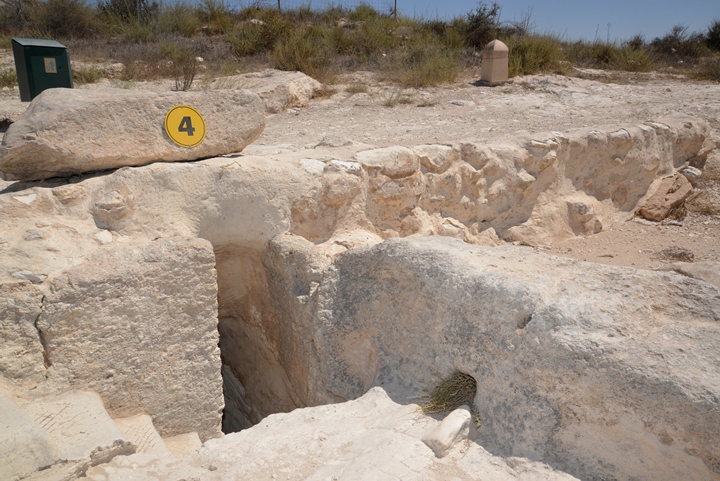
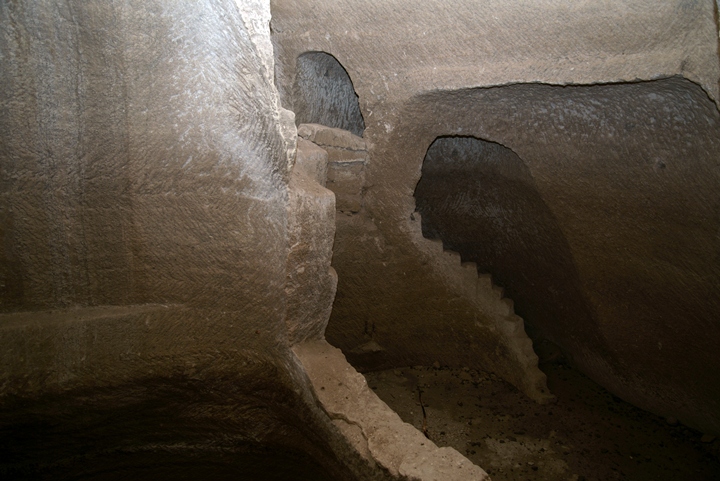
This small cave consists of a staircase and two small chambers. Water was poured over the bather sitting on a seat in one of the chambers, while the person pouring the water from the other chamber would not see the bather. This was a ritual bathing tub, one of twenty found in the Tel. It is dated to the Hellenistic period (3rd-2nd century BC), and is typical of Idumean purification methods.
(d) Oil Press cave
Twenty two oil press installations were found in the caves of Tel Maresha, as the production of olive oil was one of the major agriculture activities in Maresha, with exports to neighboring countries. The area around the city was planted with ~1800 dunams of olive tree orchards.
The largest cave is located near the bathtub cave. It was constructed during the 3rd century BC.
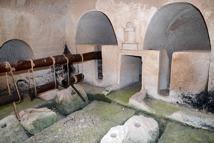
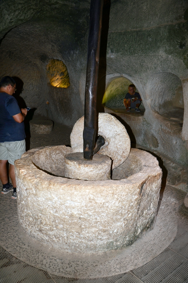
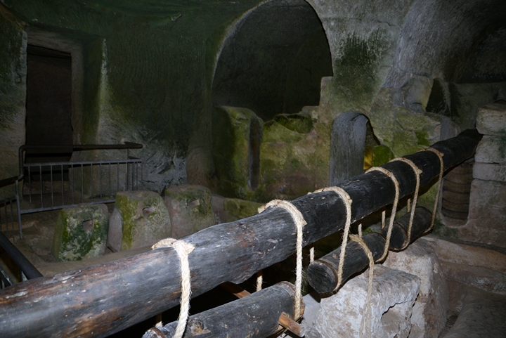
Inside the cave are several chambers of the oil production process, which was based on 3 phases: crushing, squeezing and collecting.
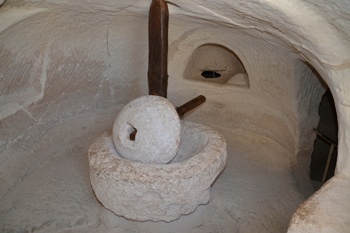
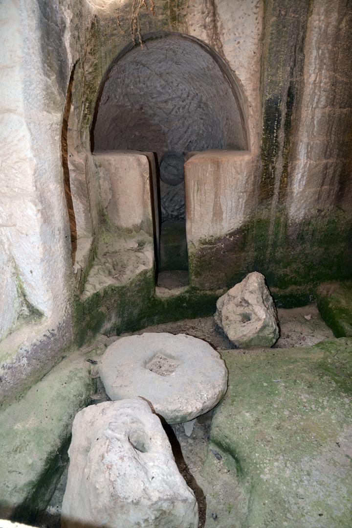
The first phase was to crush the olives using a crusher. The stone was held upright by an axis, which was connected to a long handle. The handle was pushed by human or donkey. The mashing stone rolled along a cavity on the circumference of the base, crushing the olives. The crushed olives would then be collected into a basket and then further processed by the oil press.
The oil press device was the second phase in the olive oil production (squeezing), where the crushed olives were pressed with force in order to extract their juice.
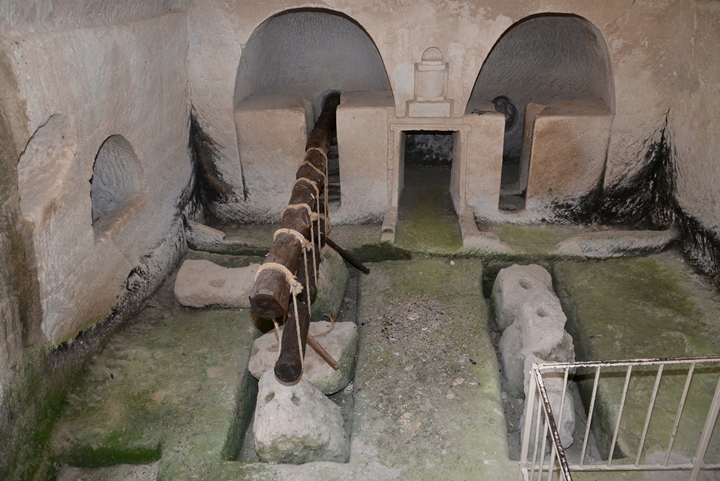
In this oil press type, 3 stone weights were tied to the edge of the wooden lever, pushing the lever down. The use of a lever exerts a large force over a small distance. The force of the lever pushed a flat stone down on a number of baskets, which contained the crushed olives. The baskets were located inside the inner chambers, at the end of the wooden beam.
The stone squeezed the baskets, extracting the precious olive oil.
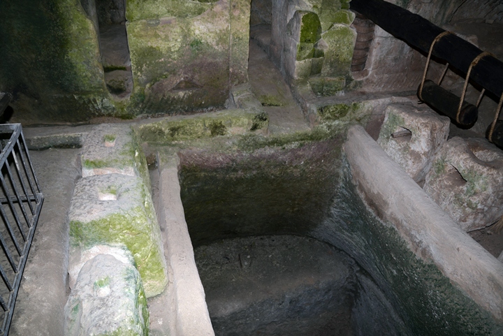
Now starts the third phase of the process: the juice flowed down into a hewn collecting vat under the baskets. The olive juice contained water and oil. After a few days, the lighter oil in the juice floats above the water, and it is then collected and stored in jars.
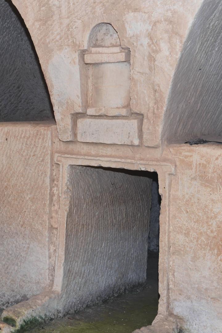
An interesting feature in the Hellenistic installation is a ritual niche – a small rock-cut altar – located between the two pressing chambers. Inside the cultic niche was a statue of the Idumean goddess Qos (Kos), which the locals placed in order to bless them with a great harvest.
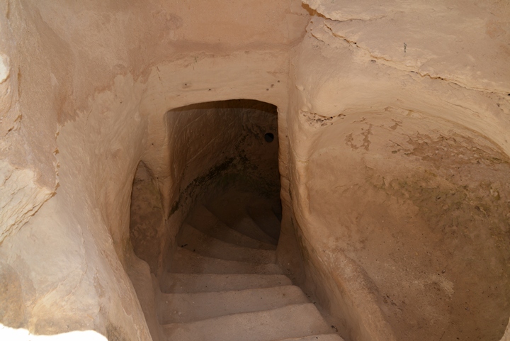
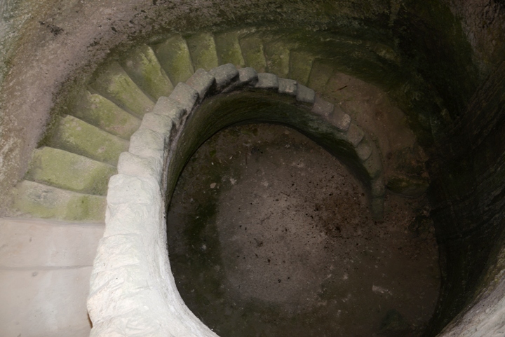
Water cisterns were also constructed near this cave, also dated to the Hellenistic period. Many such cisterns were constructed in Tel Maresha, as part of the water supply solution for this dry area. The cisterns collected runoff rain water from the surface through channels, and stored the water for later use.
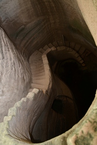
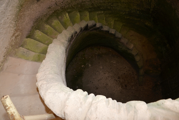
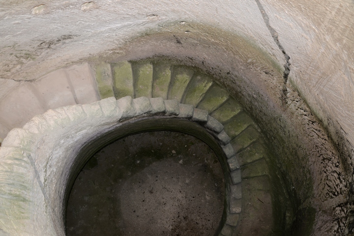
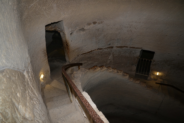
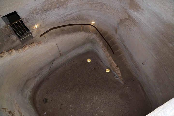
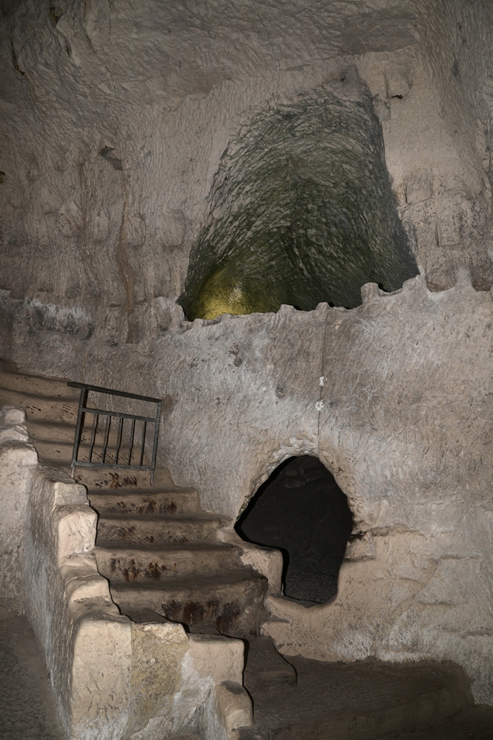
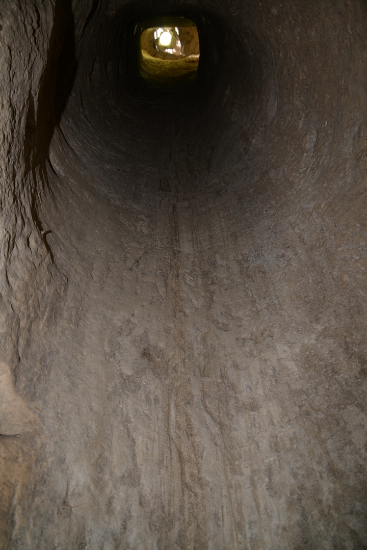
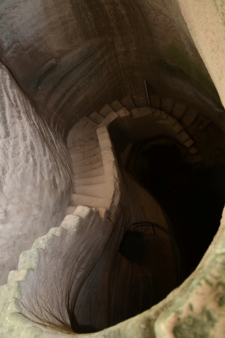
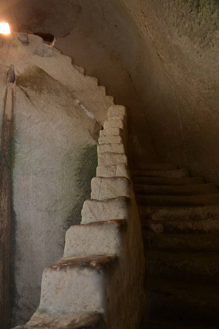
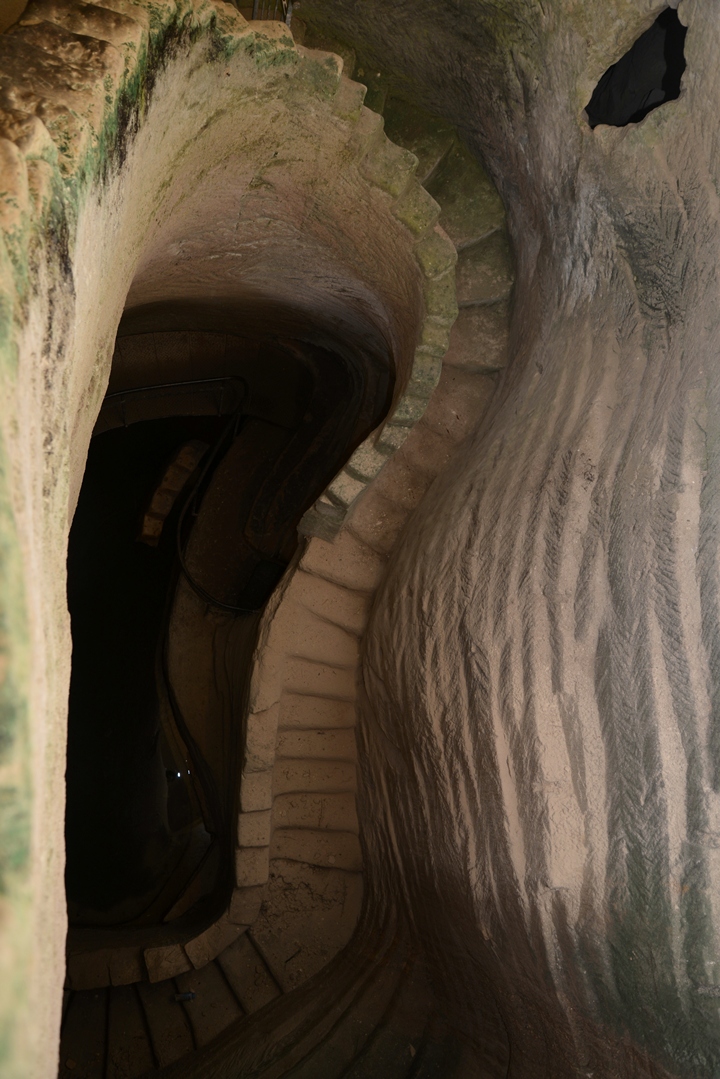
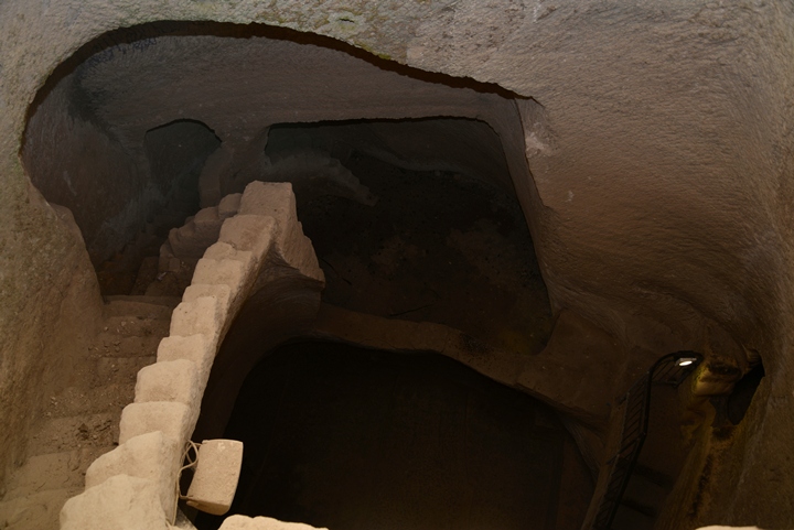
The common structure of these reservoirs was a spiral staircase that allowed access to the bottom of the cistern, following the level of the water. The walls were plastered in order to seal and thus protecting the soft stone and prevent leaks.
As seen in the photo, the lower stairs have a greenish color while the upper stairs have a bright color. This indicates the level of the water reached in the previous seasons.
(e) Residential house
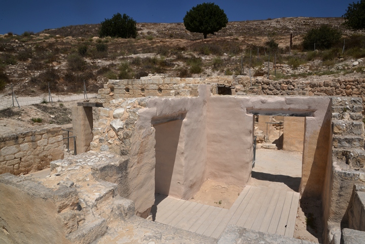
Above the ground, covering the entire area around the mound, were houses. An estimate was a city with 2,500 rooms, part of ~800 houses, with about 12,000 residents. This makes it one of the largest cities in the area during the Hellenistic period (3rd-2nd century BC).
Only about 20 houses were excavated to date, a fraction of the entire lower city. One of these houses were reconstructed and are part of the walking tour. This residential house is dated to the 3rd and 2nd century BC.
The area of the house on the ground level was 150 square meter, and is composed of a central courtyard (25 m2) connected to a number of rooms around it. A staircase led down to the underground section of the house.
Another spiral staircase led up to a second floor, where the family living quarters were located. The roof was constructed with wooden beams, which were covered by pressed earth. Note that the use of roof tiles started only after the middle of the 1st century AD.
A hoard of 25 silver coins was found under the floor of one of the rooms, minted in Ashkelon between 125-113 BC. The last coin in this collection is dated to 113 BC. This and other findings suggests that the city (Marissa) was conquered by the Hasmonean king John Hyrcanus at that time, as part of his campaign against the Idumeans (Antiquities 13:9): “Hyrcanus took also Dora and Marissa, cities of Idumea…”.
(f) Water Cisterns
Under many of the houses were underground caves, covering an area larger than the house above the ground. The underground cavities were used for various purposes, and the primary use was water reservoirs.
About two hundred cisterns were found in the area of Tel Maresha. One such system was cleaned under the residential house and open to the public.
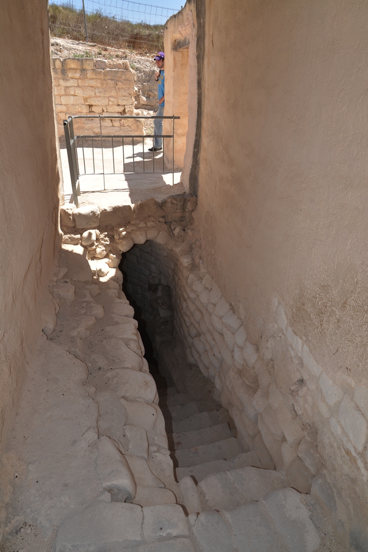
Under the house is an example of water cisterns which are typical of the area. The runoff rain water was collected by channels from the courtyard and roof, led into the cisterns under the house.
From the house was a spiral staircase that led down to the cisterns. Along the side of the stairs is a narrow channel that leads the water down.
The staircase was used to descend to the level of the water collected in the cistern.
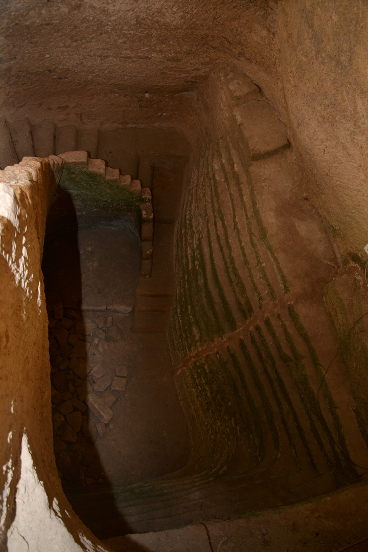
The bottom of the cistern is here in the following photo. Notice the green tone of the stone, indicating that the waters were present at this level.
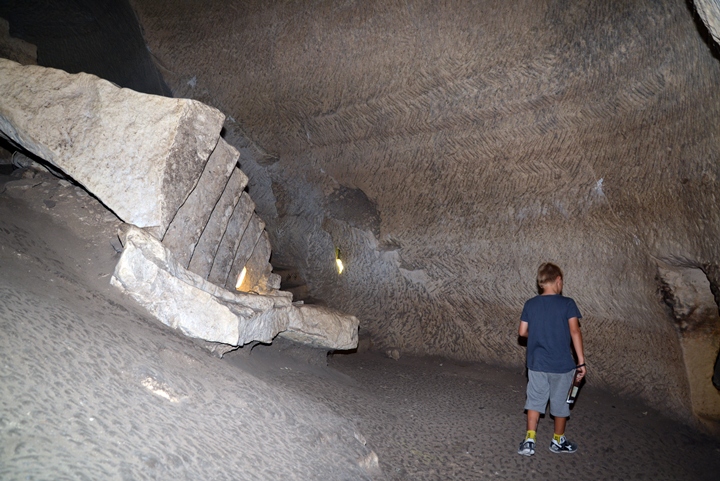
At a later stage additional chambers were opened on the sides of the cisterns in order to cut building blocks. This was a large underground quarry, which is common in the area. This industry started at Maresha in the 8th century BC and continued until the 2nd century AD.
The hewn caves served two objectives: the quarry produced building blocks of chalk used for constructing the houses above the surface, while the resulting cavities were then used for storage of goods and water reservoirs.
A closer view of the cut stone is in the following photo.
(g) Maze cave
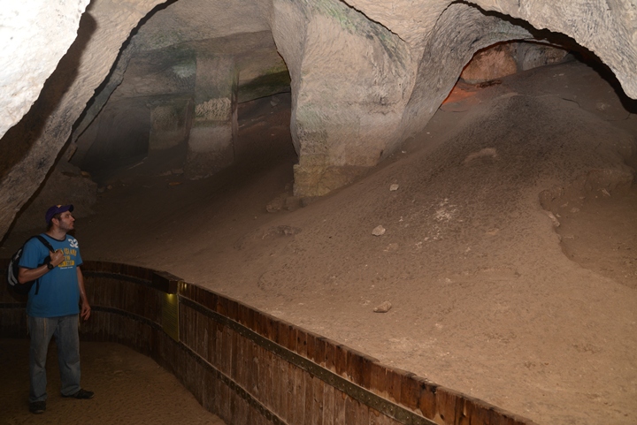
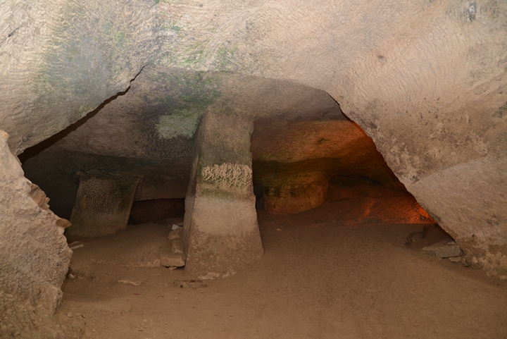
The maze cave, on the south east of the residential house, has many more exciting chambers to visit. The cave is also dated to the Hellenistic period.
On top of the maze cave are a number of residential houses, which are yet closed to the public. However, under the surface is an exciting underground world.
These interconnecting chambers look like an endless maze, and some old rumors once told that you may never find yourself back to the surface…
These underground systems were used for dwelling, columbarium and cisterns.
The following photos speak for themselves…
More photos of spiral curving staircases leading down to the bottom of the cisterns:
A large columbarium has a large number of bird niches:
Finally, a way out of the “endless” maze…
(h) Oil Press
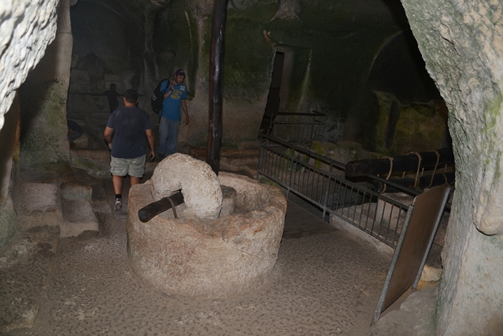
At a later stage during the Hellenistic period, one of the cisterns in the maze cave was converted to an oil production facility with several olive oil presses in connecting chambers.
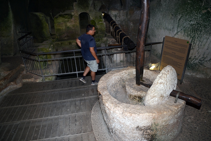
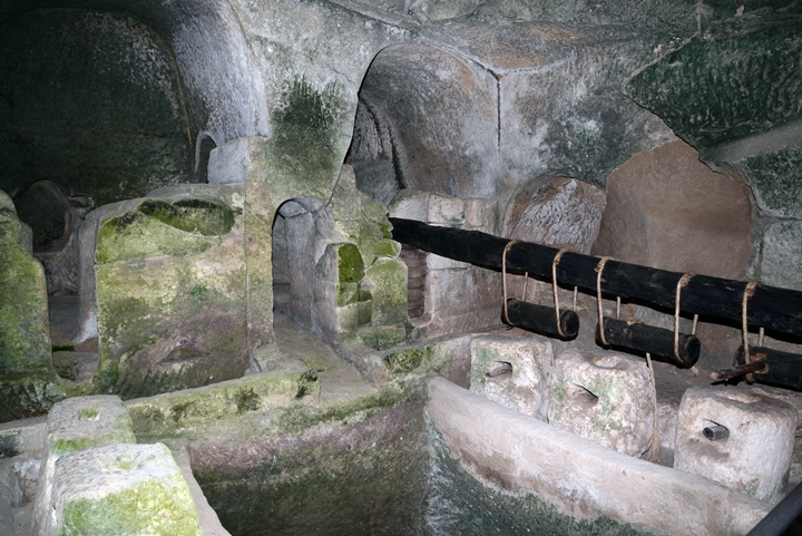
The oil production process was based on 3 phases (crushing, squeezing and collecting). The following photo shows the elements of the installation – a crusher in the front, squeezing installation behind it, and the collecting basin behind the rail.
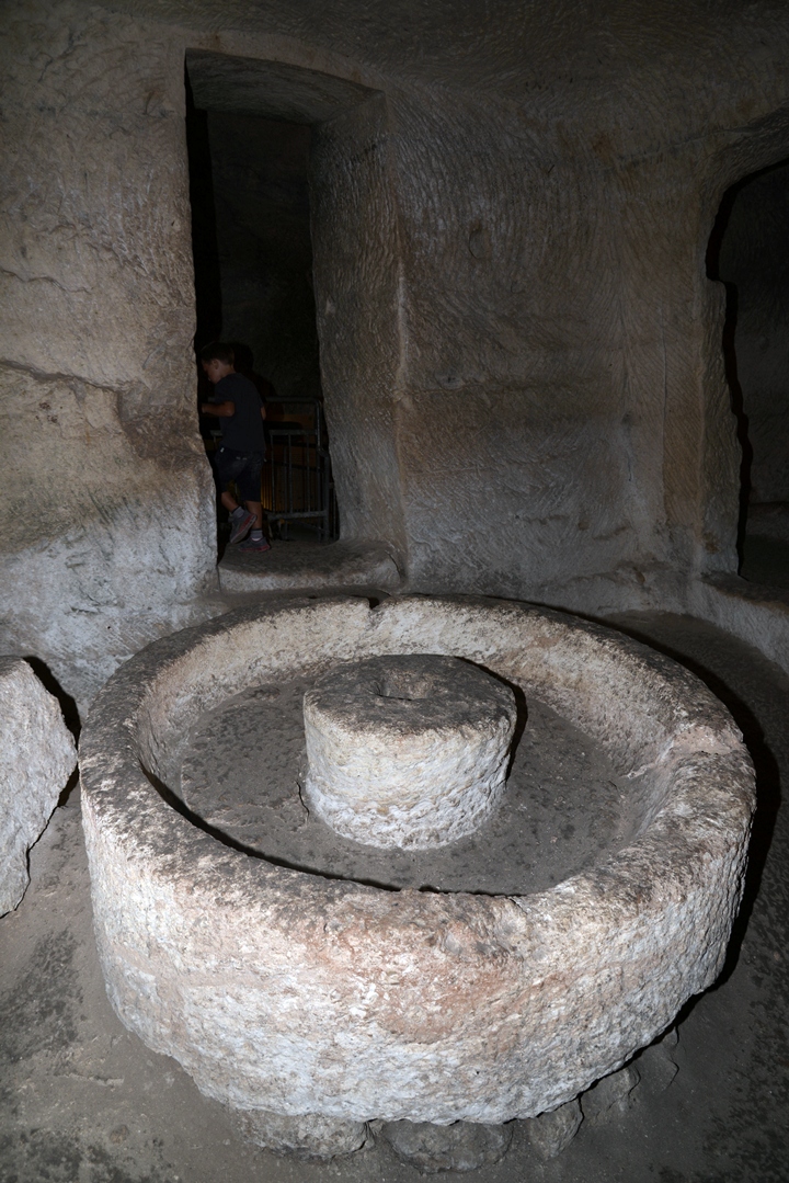
The first phase was to crush the olives using a stone crusher. The stone was held upright by an axis, which was connected to a long handle. The handle was pushed by human or donkey. The mashing stone rolled along a cavity on the circumference of the base, crushing the olives. The crushed olives would then be collected into a basket and then further processed by the oil press.
Another crusher basin stands in the nearby room:
The second phase was to squeeze the crushed olives. In this oil press type, 3 stone weights were tied to the edge of the wooden lever, pushing the lever down. The use of a lever exerts a large force over a small distance. The force of the lever pushed a flat stone down on a number of baskets, which contained the crushed olives.
The stone squeezed the pile of baskets, extracting the precious olive oil.
In the third phase of the process: the juice flowed down into a hewn collecting vat, seen here on the side of the weights.
The olive juice contained water and oil. After a few days, the lighter oil in the juice floats above the water, and it is then collected and stored in jars.
Additional views of the installation are shown here:
(i) More caves?
The caves open to the public are just a fraction of what’s out there under the ground. Around Tel Maresha are many more caves, some of them in the process of excavation and preparation for the public.
Around Tel Maresha are other points of interest in the national park, which will be detailed in other pages. These include the Sidonian caves on the east side of Tel Maresha, the ruins of the Crusaders St. Anna church on the north east, the large bell caves on the north, and Roman Beit Guvrin to the north.
Links:
* External links:
- Welcome to Bet Guvrin-Maresha national park – pdf; useful info
- Tel Maresha and Beit Guvrin – Prof. Amos Kloner, Bar Ilan Univ, 2006 (Word 23 pages, Hebrew)
- Amos Kloner and Boaz Zissu – The Subterranean Complexes of Maresha. An Urban Center from the Hellenistic Period in the Judean Foothills, Israel – 2013 pdf; Opera Ipogea pp. 45-62 best resource!
- Zerah – the Kushite
* Other sites on the national park:
- Sidonian caves, St. Anna church, Bell caves, Beit Guvrin – coming soon in other pages
* Internal links:
- Oil presses in the Holy Land
- Columbariums – installations
- Hiding Complexes info page
Etymology – behind the name:
* Names of the site:
- Tell SandaHanna – Meaning: Mound of St. Anna; an Arabic name of the ancient city, named after St. Anne ruins which are on its north side
- Maresha – the Hebrew name of the city, perhaps based on the word Rosh (head), as the hill overlooks the area
- Marissa – the Greek name of the city, preserving the Hebrew name
BibleWalks.com – walks along the Jordan river
Wadi Qelt<<<—previous site—<<<All Sites>>>—next Judea site—>>> Maresha (2)
This page was last updated on June 17, 2016
Sponsored Links:
