In Jaffa are several public fountains (Sebils) dated to the Ottoman period, built by Abu Nabbut.
Home > Sites > Sharon > Jaffa > Sebil Abu Nabbut
Contents:
Overview
Location
Photos
* On road to Jerusalem
* Ruslan street
* On wall of Mosque
Etymology
Links
Overview:
Sebil Abu Nabbut is an amazing public structure on the road from Jaffa to Jerusalem. Another two fabulous fountains are located in the old city. They were constructed during the Ottoman period, two by the Governor Muhammad Al-Shamai (“abu Nabbut”), offering drinking water for the travelers and residents of the city.
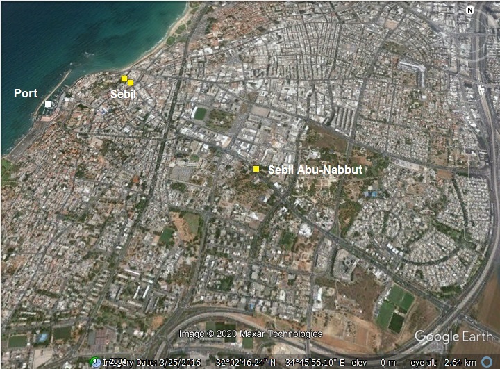
Location:
The Sebils are marked on the map with yellow squares. There are two in the old city, close to the sea. The larger one – Sebil Abu-Nabbut – is located on the old road to Jerusalem.
History:
- Ottoman period
Napoleon headed the French army in their advance from Egypt towards the heart of the Ottoman kingdom, and captured Jaffa in 1799 after a siege and fierce bombardments. After the French retreat – in the same year – the city was rebuilt and became an important fortified port city in the Ottoman empire.
Two of the Sebils were built at the beginning of the 19th century. Muhammad Al-Shamai, also known as Abu Nabbut (‘father of the club’), was the Ottoman governor of Jaffa and Gaza (1808-1817). He rebuilt Jaffa after the devastating conquest of Napolean. His large building works included rebuilding the city walls, rebuilding the Mahmoudiya mosque, building markets, and adding the Sebils featured in this page. Sebils were an excellent way to publicize the power and wealth of the ruler. He could be named Abu-Sebil...
- PEF survey
Conder and Kitchener of the Palestine Exploration Fund (PEF) surveyed the area during the Survey of Western Palestine (SWP) in 1874-75. Their map shows the area of Jaffa at that time. The Sebil outside the city walls is marked ‘Sebil Abu-Nabbut’ along the main road east to Ramla and Jerusalem.
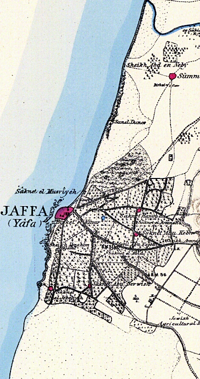
Part of map Sheet 13 of Survey of Western Palestine, by Conder and Kitchener, 1872-1877.
(Published 1880, reprinted by LifeintheHolyLand.com)
- Sebil on the road to Jerusalem
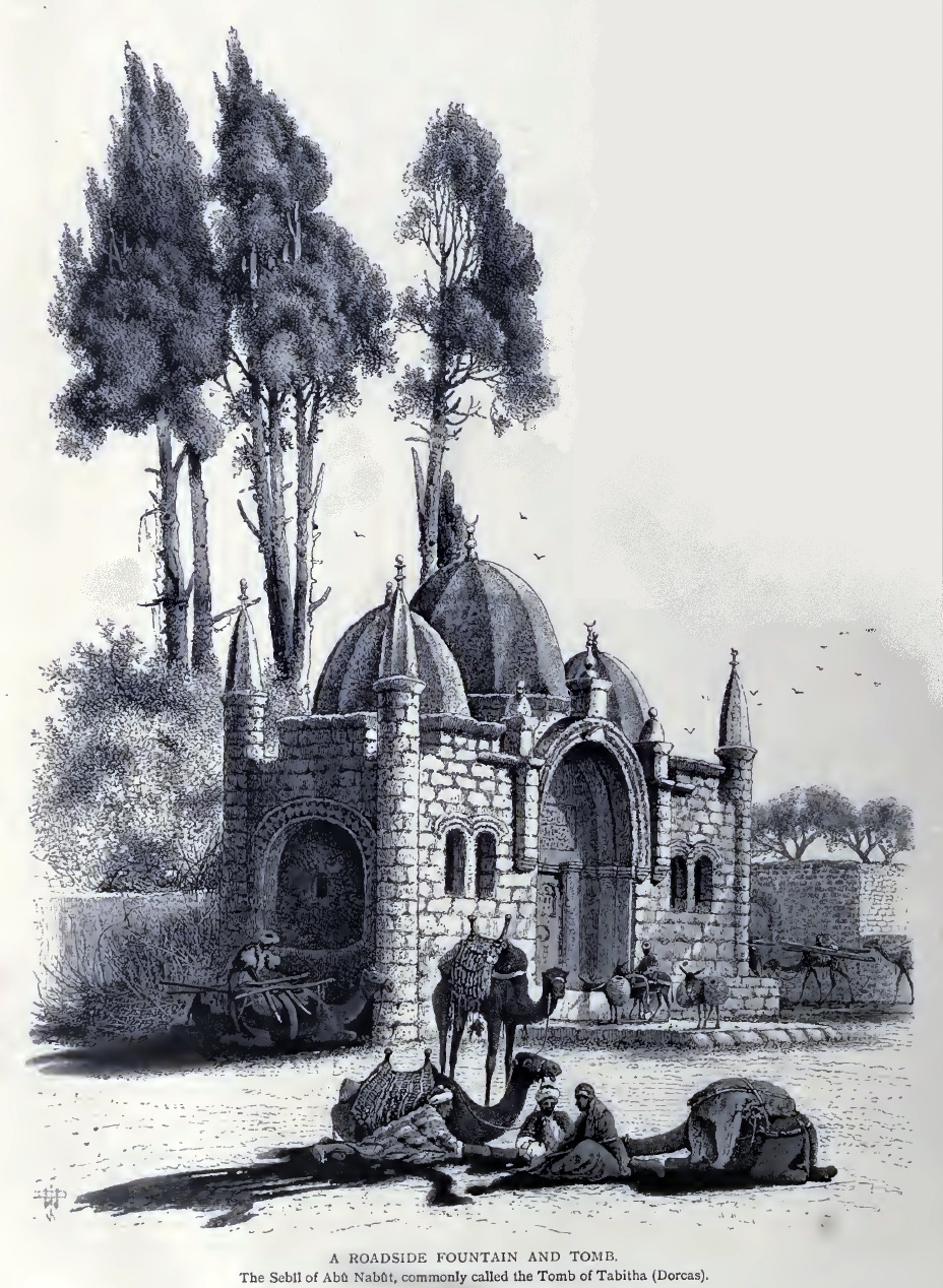
An amazing illustration of the Sebil along the Jerusalem road, dated 1882, was published in a book by CH. W. Wilson , one of the PEF explorers. The title of this drawing: “A roadside fountain and Tomb”. The subtitle: “The Sebil of Aba Nabbut, commonly called the Tomb of Tabitha (Dorcas).”.
Ch. W. Wilson, Picturesque Palestine, 1882, Vol III P. 136; engraving on wood
Another photo was captured in 1900-1920, showing a small group of camels waiting to ride to the east. The sebil was a meeting place for caravans setting for the ride to the east.
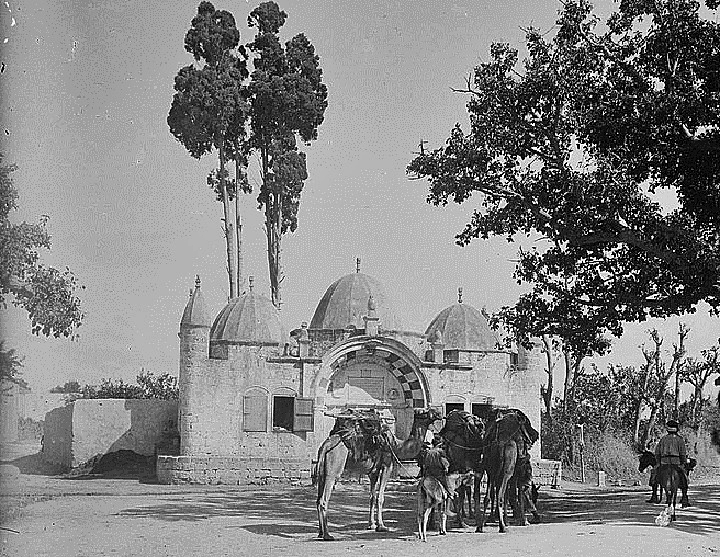
1900-1920, American Colony, Matson collection(Library opf Congress)
- Modern Period
The Sebils are accessible to the public. In recent years the municipality and the IAA are conducting conservation projects in the antiquities of Jaffa, including the Sebils.
Photos:
(a) Sebil abu-Nabbut – on road to Jerusalem:
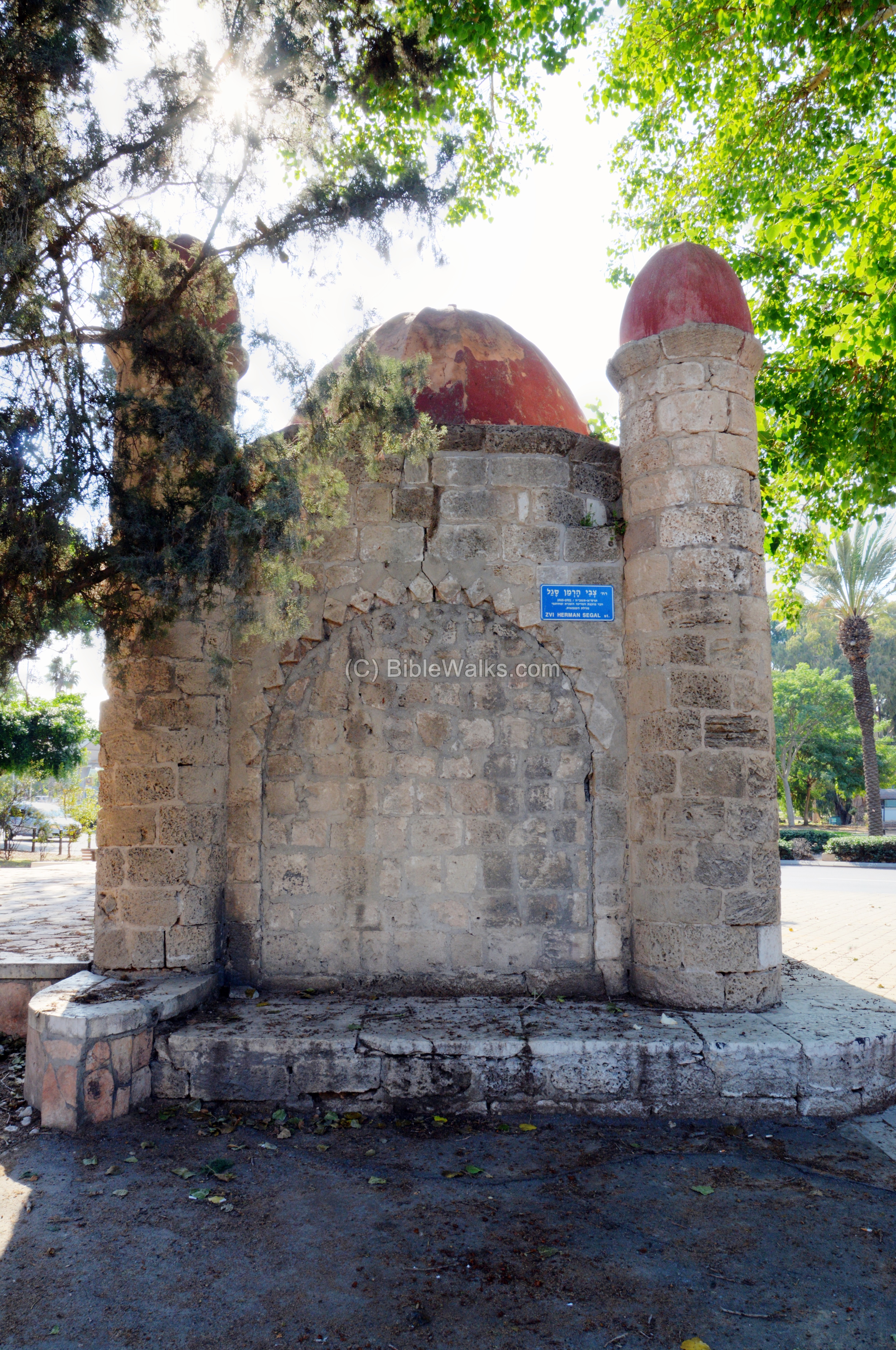
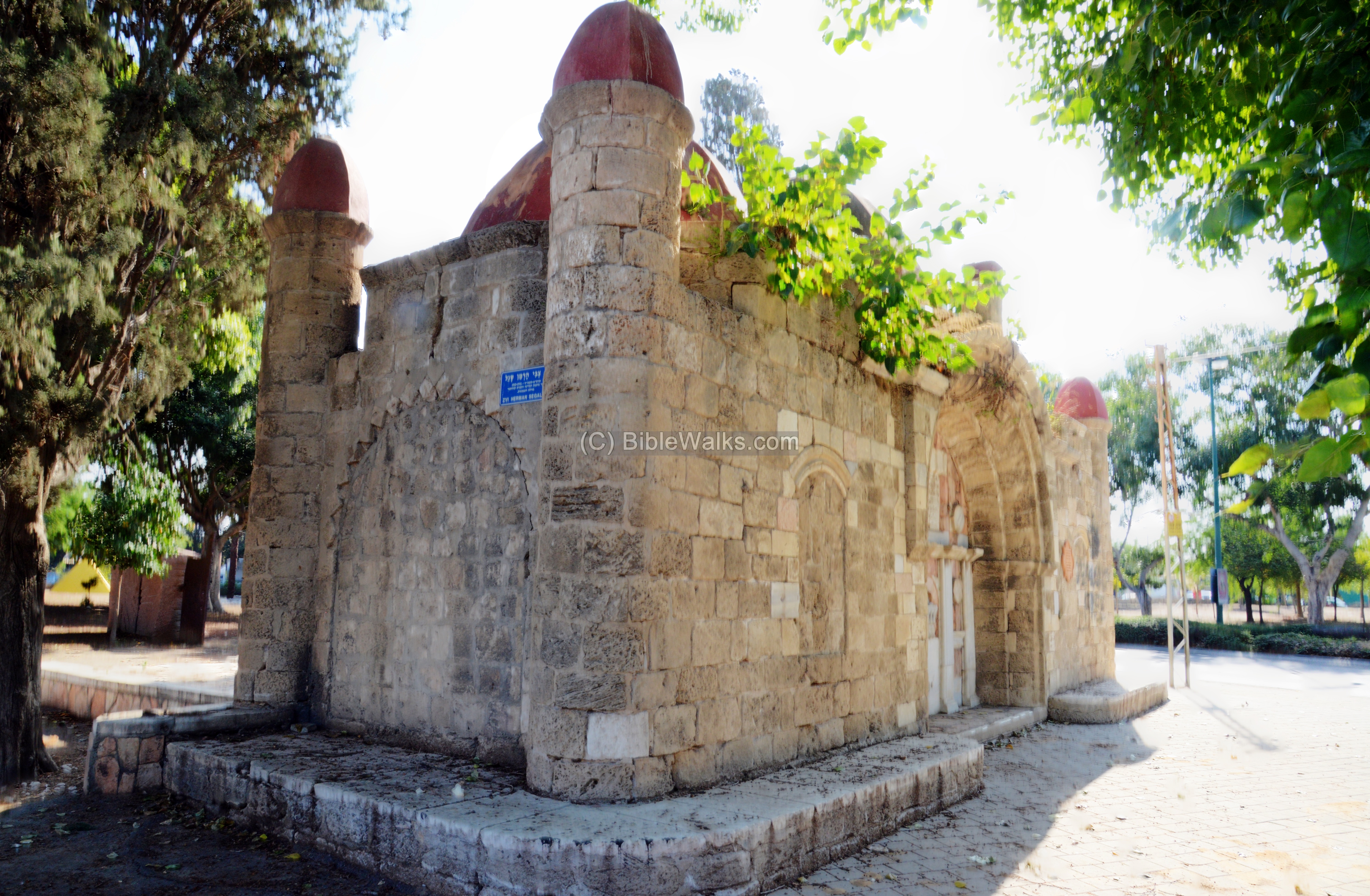
This Sebil was located outside the walled city of Jaffa, on the main road to Lydda, Ramla and Jerusalem. The structure was built by Muhammad Al-Shamai, Jaffa’s governor in the beginning of the 19th century. His cruelity earned him the nickname Abu Nabbut – ‘father of club’.
Click on the photos to view in higher resolution…
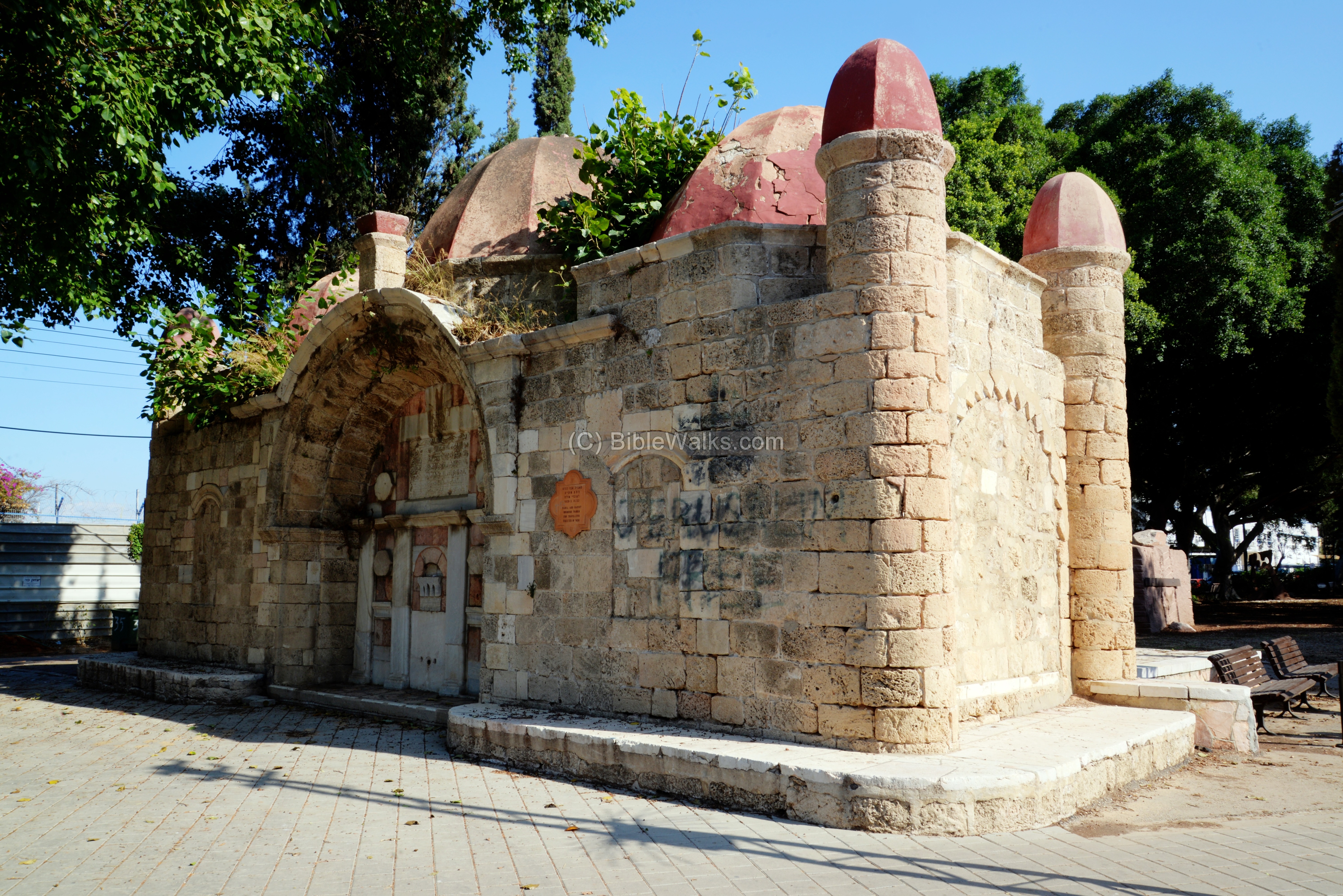
This rectangular structure was built in the Seljuk style. It has three red domes above, and 4 towers capped with red domes on each corner. It is primarily made of Kurkar stones, with marble on the western side and some limestone.
The entrance is on the eastern side, seen below, but it is blocked.

A following photo shows the western side, with an arch in the middle. The marble stones embedded in the arch, are made of red and white elements.
In the center of the arch are the water fountains.
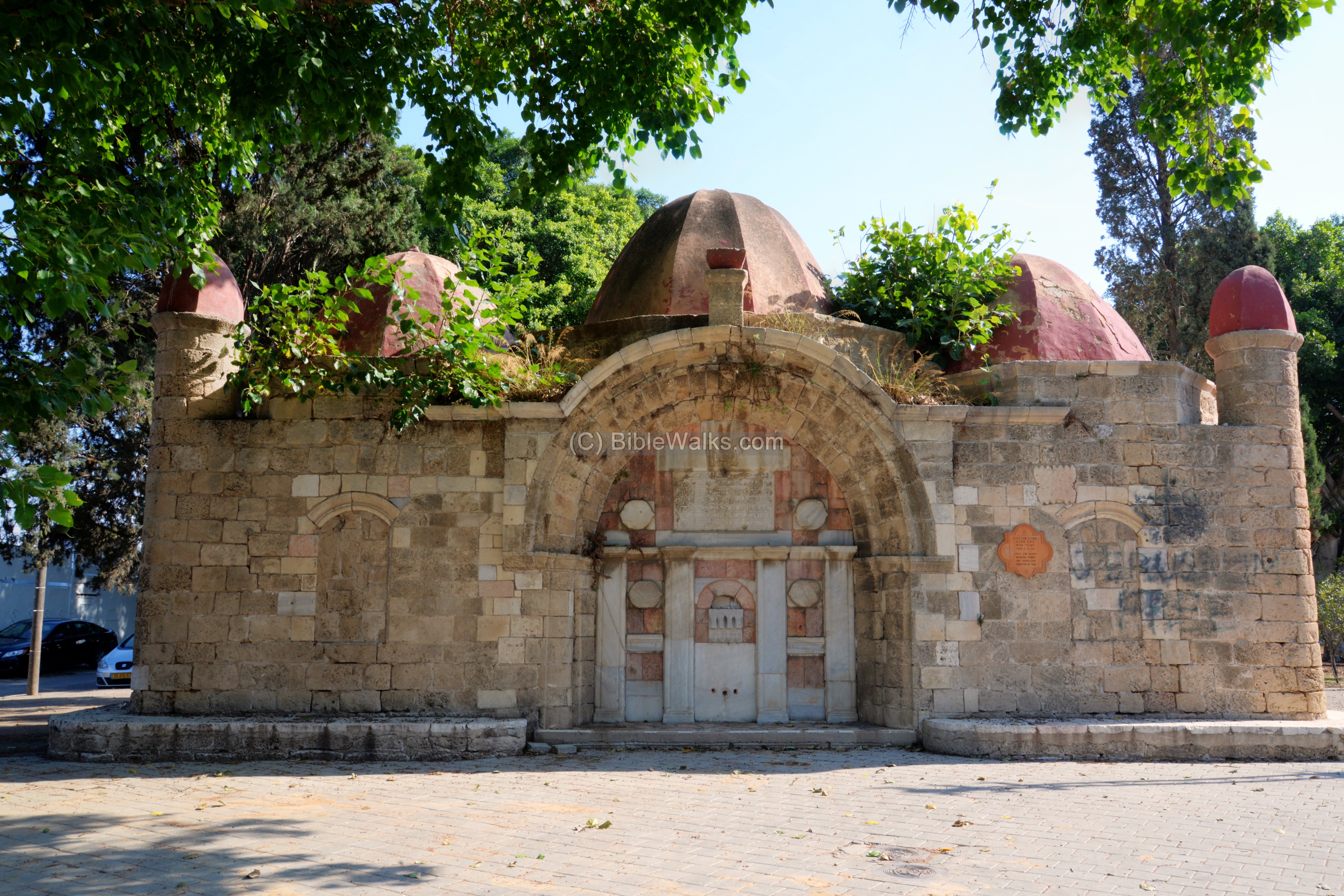
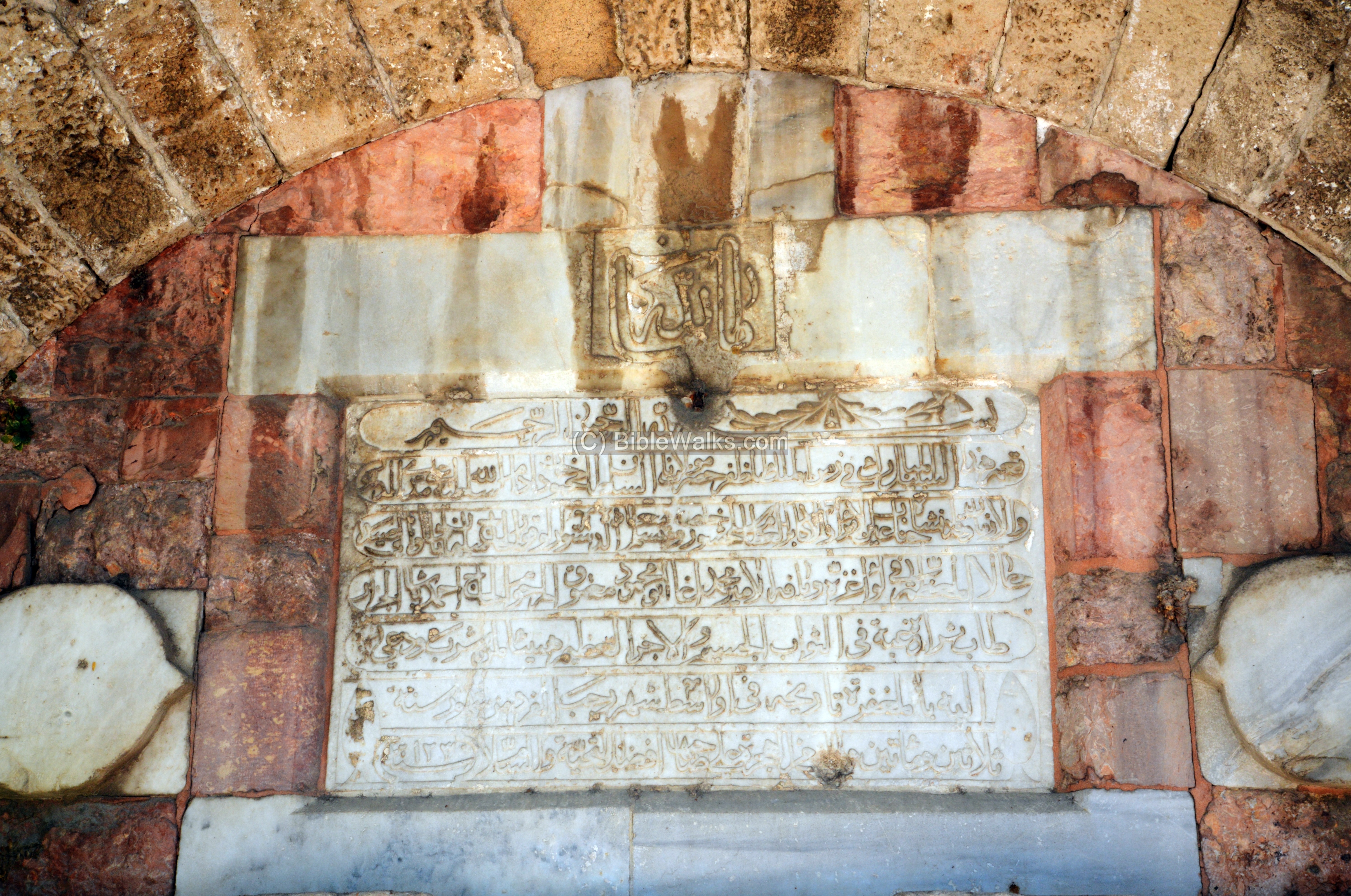
Getting closer to the arch… An Arabic inscription is located above the fountains. Its Arabic text blesses the Sultan, Mahammed the Second, and wishes the health of the drinking persons.
An orange sign to the right of the arch dates its construction to 1820 (1236 H.), stating is was intended as a drinking trough for travelers. An ugly graffiti was painted on that section, requiring a periodic cleanup of the walls.

Two tombs are located inside the structure, each tomb was entered from the southern or northern wall. These entrances were blocked, as well as the eastern windows that looked into the tombs.
Below – southern side facing the road:
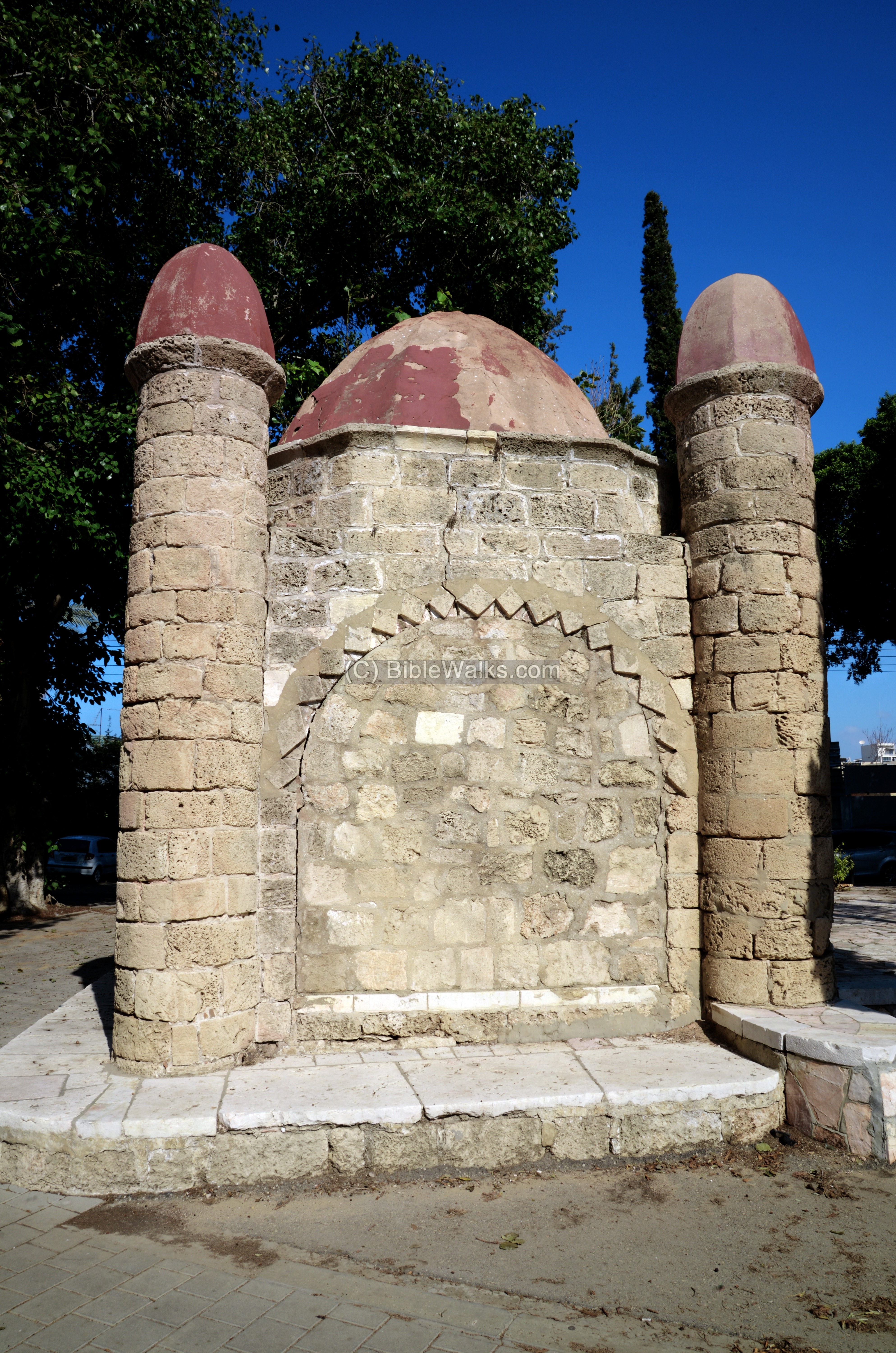
Next – northern side, facing the park:
Yet another view from the north is next.
There was a claim that Abu-Nabbut was buried in a tomb nearby, which survived until 1950 (Link Peterson).
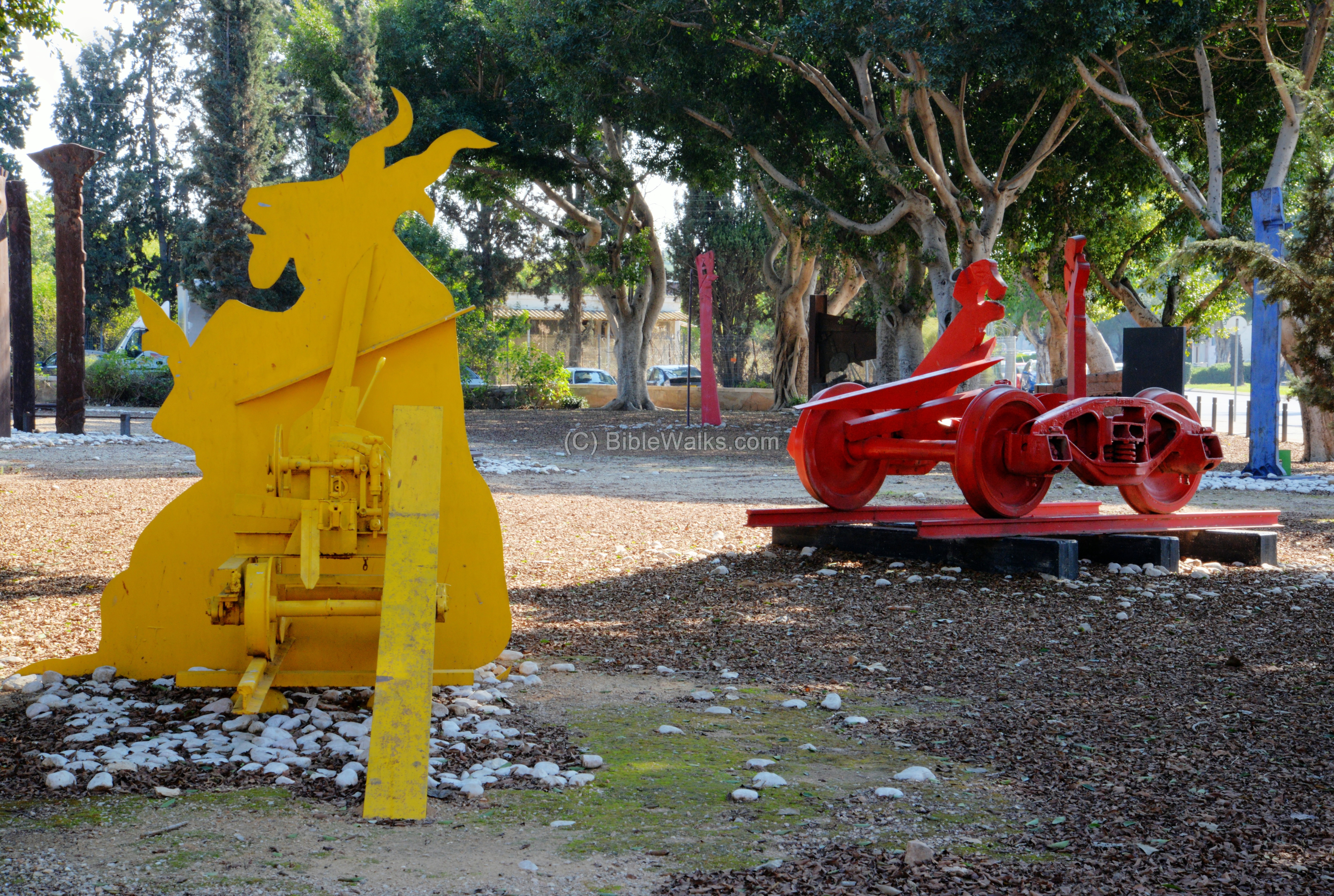
Behind the Sebil, in the park, are colorful metal artworks, with a theme of railroads.

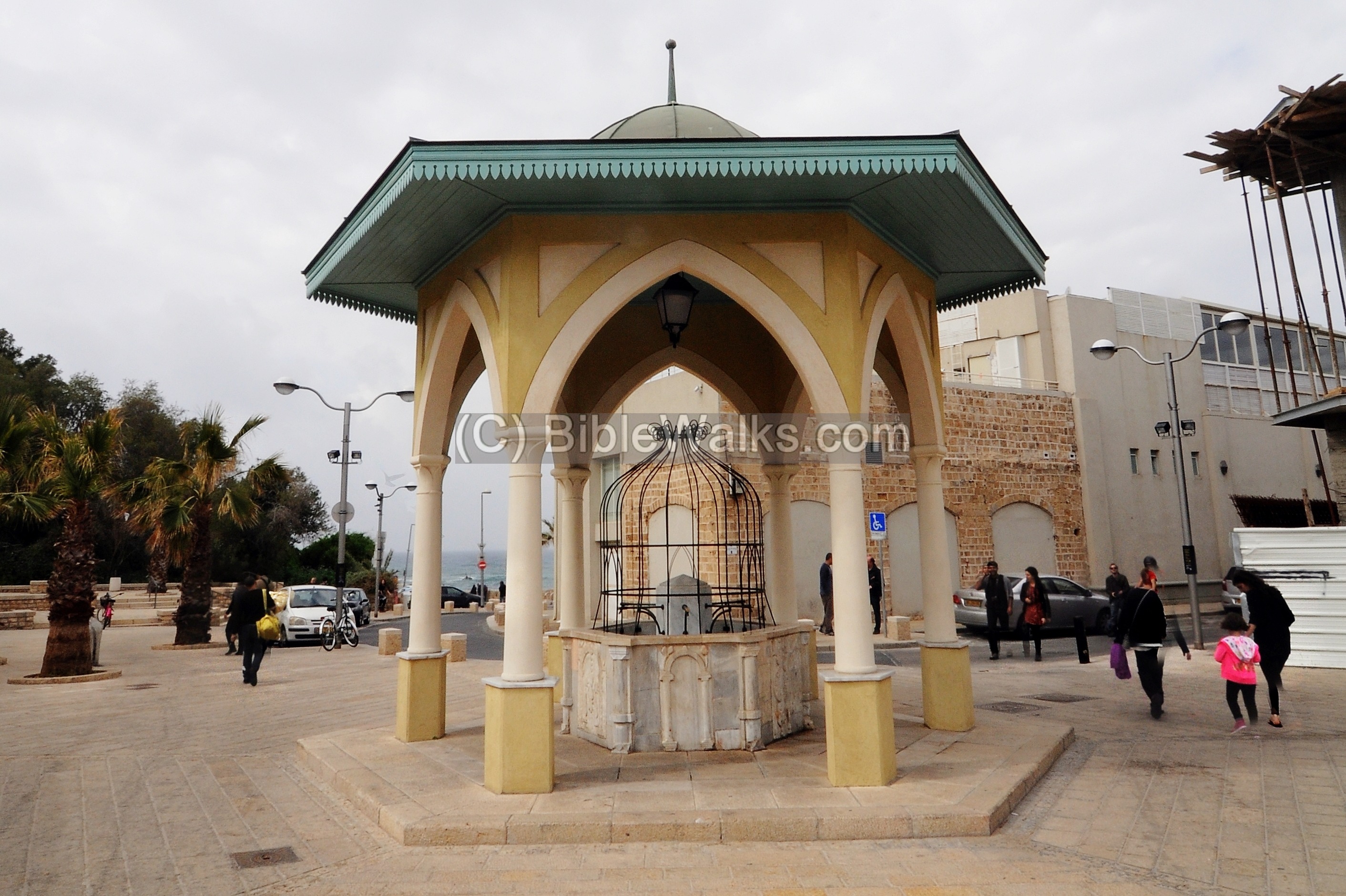
(b) Sebil Abu Nabbut on Ruslan street
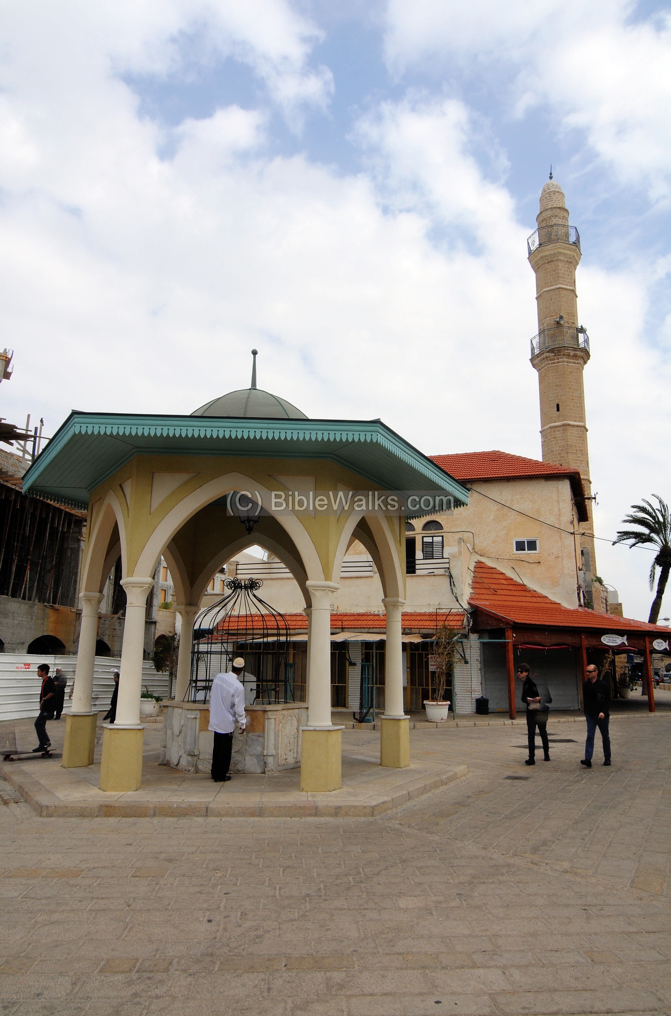
Another Sebil of Abu Nabbut was erected near on Ruslan street, close to the sea, on the west side the Mahmoudiya mosque. Behind the sebil in this photo is the minaret of the mosque.
This mosque is the largest and most important mosque in old Jaffa, located at the walls of old Jaffa. It was built in 1730, rebuilt in 1814 by Abu Nabbut.
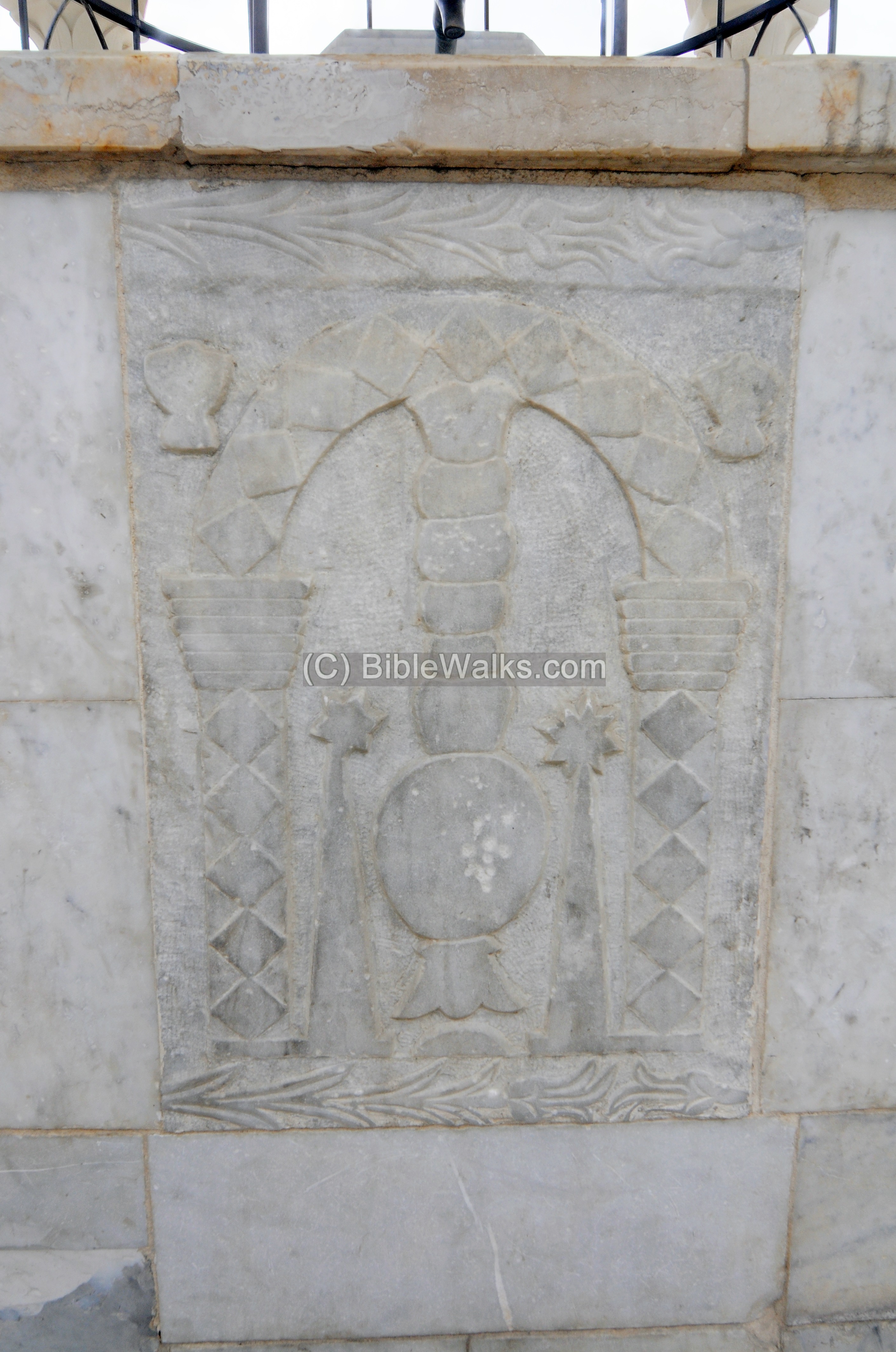
This sebil has an hexagonal shape, with 6 marble panels.
The next photo is towards the sea, which is seen in the background.
On each of the sides of the base of the fountain are geometric forms lightly carved into the marble panel. This south-east panel shows an arch, supported on two columns, a lamp hanging in the center, two palm trees on both sides of the lamp, and a cup flanking each side of the arch.
(c) Mahmoudiya mosque – on Tayelet street
A grand Sebil is located on the southern wall of Mahmoudiya Mosque, viewed on the city’s Tayelet Mifraz Shlomo Street.
It is comprised of a large arch (8m wide, 4m high) resting on columns. Embedded are marble panels, inscriptions and fountains. It was constructed in 1890-1891(1308 H.)
The Sebil supplied water to people who entered the walled city. The public fountain was built during the Ottoman period. During a restoration work, a 14th century inscription was found embedded in the structure, probably reused from another site.
Etymology (behind the name):
- Sebil – a Turkish name for a drinking fountain. It is based on the Arabic name of a “path” , since the Sebil was located near roads. in Hebrew a path is called “Shvil”, which is very similiar.
- Rahat – Hebrew name for Sebil. Biblical reference of Rahat, translated to troughs (Exodus 2 16): “Now the priest of Midian had seven daughters: and they came and drew water, and filled the troughs to water their father’s flock”.
- Sebil Abu Nabbut – The wayside fountain of Abu Nabbut.
- Abu Nabbut – Governor of Jaffa at the commencement of the 19th century. Arabic for: Abu – father, Nabbut – club. He earned his nickname due to his cruelty.
Links:
*External links:
- Ancient Arabic inscription discovered in Jaffa – On Ruslan street; MFA June 2013
- Gazetteer of Building in Muslim Palestine (Part 1) Peterson 2001, pp. 1701-71
* Internal sites – of Jaffa area:
-
Jaffa – an overview
-
St. Peter’s Church
-
Simon the Tanner‘s house
-
Tel Yafo excavations
* Other:
BibleWalks.com – walk with us through the sites of the Holy Land
Jaffa <<<–previous Sharon site—<<< All Sites>>>– next Sharon site —>>> St. Peter
This page was last updated on Apr 20, 2020 (new page)
Sponsored links: