Remains of an ancient multi-period Tel, the largest and important archaeological site along the Nahal Alexander river.
Home > Sites > Sharon > Tel Hefer (Tell ‘Ifshar, el Afshar)
Contents:
Overview
Location
History
Photos
* Aerial views
* Video
* River side
* River mouth
Etymology
Links
Overview:
Remains of an ancient multi-period Tel, the largest and important archaeological site along Nahal Alexander. Its natural defenses, strategic location and inland seaport made it an important city during the Bronze and Iron ages. The peak settlement period was the Middle Bronze period IIa (2000-1750 BC). Hefer was one of the Canaanite cities that were captured by Joshua.
The low plains around Tel Hefer, surrounding the course of Nahal Alexander river, are named in modern Israel “Emeq Hefer” ( עמק חפר -Valley of Hefer). It covers the coastal plain area of the Sharon between Hadera in the North and Netanya/Kfar Yona in the south. This was also a term used by the Bible: (1 Kings 4:10): “…and all the land of Hepher”.
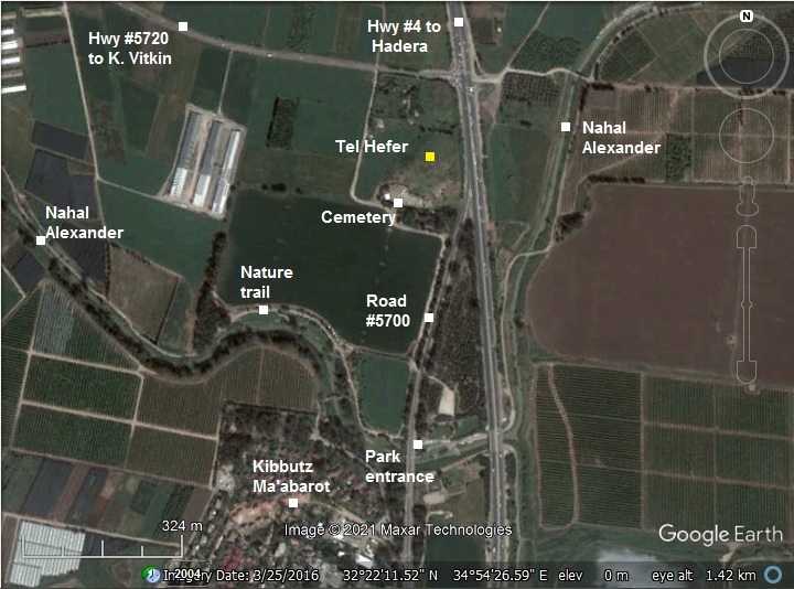
Location:
The aerial map shows the location of the site on the west side of the highway #4. It is 4km upriver from the Sea, on the banks of Nahal Alexander river, that surrounded it on all three sides. The river flows thru a 300m gap in the sandstone ridge.
The mound, built over a Kurkar sandstone ridge, is 15m above the level of the area, and its size is 40 dunam (4 Hectares). It is higher on the south side, and narrow and lower on its north side.
History
- Prehistoric times (Early Bronze I)
The fertile land and the stream attracted settlements throughout the ages, starting from the early ages.
A small settlement was founded in the Early Bronze period I on the south east side of the mound. Prehistoric findings were also located in the grounds of the Kibbutz, including 12 burial shafts and artifacts, dated to the Early Bronze period.
A hoard of 37 Copper tools and weapons were found in nearby Moshav Kfar Monash (2KM south east), dated to Early Bronze Age II-III.
There was a settlement gap during the EB II (3000 BCE – 2700) and III (2600-2200BC). This was a common settlement shift in the Levant. Towards the end of the Early Bronze period most of the large fortified cities were depopulated in the Levant. Old empires collapsed, like the Old Kingdom in Egypt that witnessed turbulent times and chaos. It may have been a result of onset of drier climatic conditions, which resulted in insufficient resources to support the large cities. This was a dramatic social change – the shift from urban to non-urban life. The sources of income also changed to a pastoral and agricultural society, with emphasis on herding rather than farming. The population moved to smaller, seasonal and scattered camp sites that required less resources. None of these sites were fortified, as opposed to the formidable cities of the Early Bronze period. Settlements were mostly inhabited by nomads or semi-nomads, and built on summits or slopes of high hills.
Middle Bronze period I
A small Middle Bronze I (2200-2000 BC) settlement was found on the south east side of the mound. Burial caves of this period were found in the Kurkar sandstone ridges south and north of the site – in Kibbutz Ma’abarot (south) and Moshav Eliashiv (north).
- Middle Bronze period II
The settlement grew into a formidable Canaanite city during the Middle Bronze II. Several layers were identified in the Middle Bronze period. The city reached a peak in the MB IIA period (2000-1750 BC). It’s strategic location along major highways, the fertile land, and the inland seaport, where ships could sail along a wide river, made it rich and powerful.
Egyptian pottery of the Middle Kingdom were found in this layer. This finding is important, as it demonstrates the commerce ties between Egypt and the Levant, Cypress and the Aegean.
On the west side, in area A, a large public structure was excavated, perhaps a palace. It was dated to the end of the MBIIA period.
A layer above it, at the end of this period, was found to be burnt. Scholars suggested this destruction to the Egyptian conquest during the reign of Pharaoh Senusret III (1878 – 1839 BC) of the 12th dynasty. In the Sebek-khu Stele inscription, the city of Shechem (SKMM) was mentioned as a city that was captured by Senusret III, which may have included Hefer as a station along the route to Shechem.
A storage complex was also unearthed in 1990. Its charred grains were examined for analysis of farming during this early period.
Roads: In ancient times major roads passed here. According to D. Dorsey (“The Roads and Highways of ancient Israel”,2018), Map #2 (p. 71), major roads passed thru Tell ‘Ifshar during the Bronze and Iron periods. These are the roads (as shown on the illustration):
- I20a (North) – to the coastal road and Megiddo/Yokneam, passing via Sheikh Hilu
- I21 (North East) – To Tel Esur via Tel Zeror and Tell ‘Ifrein, then via Megiddo or Yokneam passes
- To I19 (South West) – Coastal road to Joppa
- To Samaria and Aphek (South East) – via Burgetta or Tel Haniel
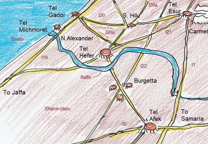
Hefer’s commercial importance was due to its inland seaport positioned on the banks of Nahal Alexander river. Boats would bay at the mouth of the river, and their goods floated on rafts to and from the city. The trade routes leading to the city brought goods from the entire region in order to export them thru the maritime route.
- Late Bronze period
In later periods the size of the settlement has decreased. Several layers of the LB period (1550-1200 BC) were identified in Area A on the west side, which included grain silos and ovens, and a storeroom . The last settlement was burnt at about 1200BC.
An alternative seaport was established in Tel Mikhmoret at the mouth of the river, along the coast line. This may have diminished the importance of Hefer as an inland sea port.
- Iron Age
A small settlement was established in the 11th-8th century, which included grain silos, grinding stones and a structure.
Hefer (Hepher) is mentioned in the Bible as one of the cities captured by Joshua (Joshua 12:7,17):
“And these are the kings of the country which Joshua and the children of Israel smote on this side Jordan on the west… The king of Tappuah, one; the king of Hepher, one;”
A Manasseh family head (Joshua 17:2-3):
“There was also a lot for the rest of the children of Manasseh by their families; for the children of Abiezer, and for the children of Helek, and for the children of Asriel, and for the children of Shechem, and for the children of Hepher, and for the children of Shemida: these were the male children of Manasseh the son of Joseph by their families.”
And: A 3rd province during Solomon (1 Kings 4:7,10):
“And Solomon had twelve officers over all Israel, which provided victuals for the king and his household: each man his month in a year made provision. And these are their names: .. .The son of Hesed, in Aruboth; to him pertained Sochoh, and all the land of Hepher:”
The settlement was destroyed by the Assyrians in the 8th century, and was abandoned for 1000 years.
The identification of this site as Biblical Hefer is not certain. Adam Zertal identifies it in Tell el-Muhaffar (Kh. Umm el Haffeh) , a 120 dunam tel located in the valley of Dothan, which preserved the name. Reference: “The Menasseh hill country survey” – site 23, volume 3 pp. 108-111 [Adam Zertal – Nivi Mirkam, 2000].
- Roman/Byzantine period – (1st century BC to 7th century AD)
The site was inhabited again during the Late Roman and Byzantine periods, with a center in the lower section of the mound (Area B on the north side). During the Byzantine period it expanded to the whole area of the mound and in the areas to the north and east of the mound. The excavated layers included Roman (2nd-3rd century AD) and 3 Byzantine layers above (II-IV). Emergency excavations, conducted North east of the mound, unearthed ruins of a bathhouse and wine press installation dated to the Byzantine period.
The Roman village (2nd-3rd century) and first Byzantine level (4th-5th century) was settled by Samaritans or Jews, as attested by an absence of pig bones. Prof. S. Applebaum suggested that the Roman/Byzantine village was a Samaritan village named Kefar Parhsai (כפר פרשאי), referred by Babylonian Talmud (Avodah Zarah 31:1), as its wine was forbidden for ritual purposes (“אסור מפני כפר פרשאי”).
The population changed to Christian during the 6th century, perhaps following the destruction of the Samaritan villages in 529 AD after their mutiny failed.
The site was destroyed and abandoned in the 7th century, either by revenging Samaritans during the Persian conquest (614 AD) or by the Arab conquest (638 AD).
Roads: The Roman/Byzantine village was located on the side of the Roman road from Caesarea to Neapolis (Shechem, Nablus) . This ancient road passes through Wady esh Shair (Shechem stream, which flows into the Alexander stream), and continues to Jerusalem.
The Peutinger Map (Tabula Peutingeriana) is a medieval map which was based on a 4th century Roman military road map. The map shows the major roads, with indication of the cities, and geographic highlights (lakes, rivers, mountains, seas). Along the links are stations and distance in Roman miles (about 1.5KM per mile). The roads are shown as brown lines between the cities and stations. In the section shown below is the area of Jerusalem, drawn in a rotated direction (Egypt on the left, the Mediterranean sea on the top). Jerusalem is illustrated in the center as a double house icon, which represents a major city. It is listed as “formerly called Jerusalem, now called Aelia Capitolina” (antea dicta Hierusalem n(unc) Helya Capitolina).
The section where the Roman road passes through Hefer is indicated as a red square, close to Caesarea (“Cesaria”). This Roman road, from Caesarea to Nepolis (Shechem – marked with a double-house icon), is XXXI (31) Roman miles, or 46 KM.
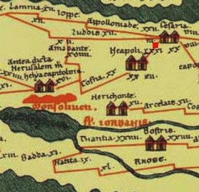
Part of Peutinger map, based on 4th century Roman road map.
- Crusaders (1099 -1291 AD)
The Crusaders protected their routes and their farming estates with a series of forts and police stations. In the Sharon region are a number of Crusader fortifications and towns.
A Crusaders town, Casale Latinae or Montdidierat, was located at the crossing of Nahal Alexander (Nahar Iskandaruneh) near the Biblical Tel. It is known as Khirbat Madd ed-Deir, now its ruins are located inside the modern Kibbutz Ma’abarot. The road to Caesarea passed thru the town.
-
Mamlukes period (1250-1516 AD)
The Mamelukes were Turkish prisoners who were sold to the Sultan of Egypt, trained by him and served as his palace guards. In 1250 they seized the control of Egypt, and defeated the Mongols (1260). The Mamelukes took the Sharon area in 1265, and dismantled the Crusaders town of Madd ed-Deir.
-
Ottoman period (1516-1917 AD)
Conder and Kitchener surveyed this area during the PEF Survey of Western Palestine (SWP) in 1873. A section of the survey’s map, part of Sheet 10, is shown here. The site is named “Tell Ifshar”, named according to the surveyors after the Afshar Turkumen tribe.
As seen on this map, the river Nahr Iskanderuneh (Nahal Alexander) surrounded the site on all 3 sides, thus providing a natural defense. Marsh lands are located around the area, providing additional defense. A road (depicted by a dashed line) passed along its southern side, avoiding the crossing of the river. Ruins of the Crusaders town were located in Kh. Madd ed Deir.
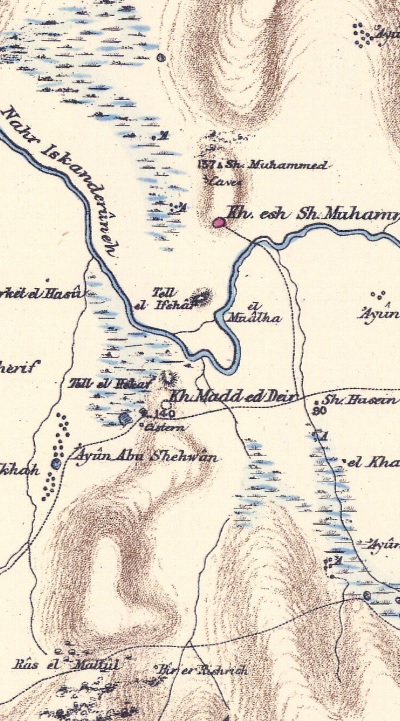
Part of Map Sheet 10 of Survey of Western Palestine,
by Conder and Kitchener, 1872-1877.
(Published 1880, reprinted by LifeintheHolyLand.com)
Their report of 1873 in Sheet X (Volume 2, p. 143) was short, tagging it as an ancient site:
“Tell el Ifshar —A small mound, apparently artificial”.
Other points of interest in this section were described:
“Khirbet Madd ed Deir —Part of a ruined vault, with a cistern to the south, cemented inside”.
“Nahr Iskanderuneh, and is a sluggish stream some 15 yards across, with marshes on either side, in which are numerous springs, which feed the stream. The river is fordable near its mouth. This stream is called ‘the Salt River’ by Geoffrey de Vinsauf in 1191 (Itin. Ric, ch. xv.)”.
-
British Mandate
In 1938 the inspector of antiquities reported on damages to a cemetery that Kibbutz Ma’abarot has built on the slopes of the mound, and warned the settlement against further burials and tree planting (Reference). The cemetery was not removed, and exists today on the south western slopes of the mound.
A 1940s British map shows the previous path of the river (closer to the south eastern foothills) and the road #5700 before highway #4 was paved (and shifted the course of the river).
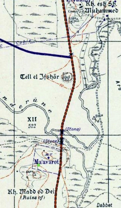
British survey map 1942-1948 – https://palopenmaps.org topo maps
License: public domain under the UK Copyright, Designs and Patent Act 1998
-
Modern period:
Kibbutz Ma’abarot was founded in 1933 and built to the south of Tel Hefer.
Excavations on the mound were conducted in 1979-1992 by Y. Porath and S. Paley, as part of the Emek Hefer Archaeological Research Project (EHARP). The teams excavated 4 areas (A-B-C-D) on the mound.
The site is in an open area, easily accessed from a dirt road on the west side. Unfortunately, there are no visible ruins to see.
A recommended hike is to the park south of the site, 350m south along Road #5700. Park your car after the entrance, and walk along the stream.
Photos:
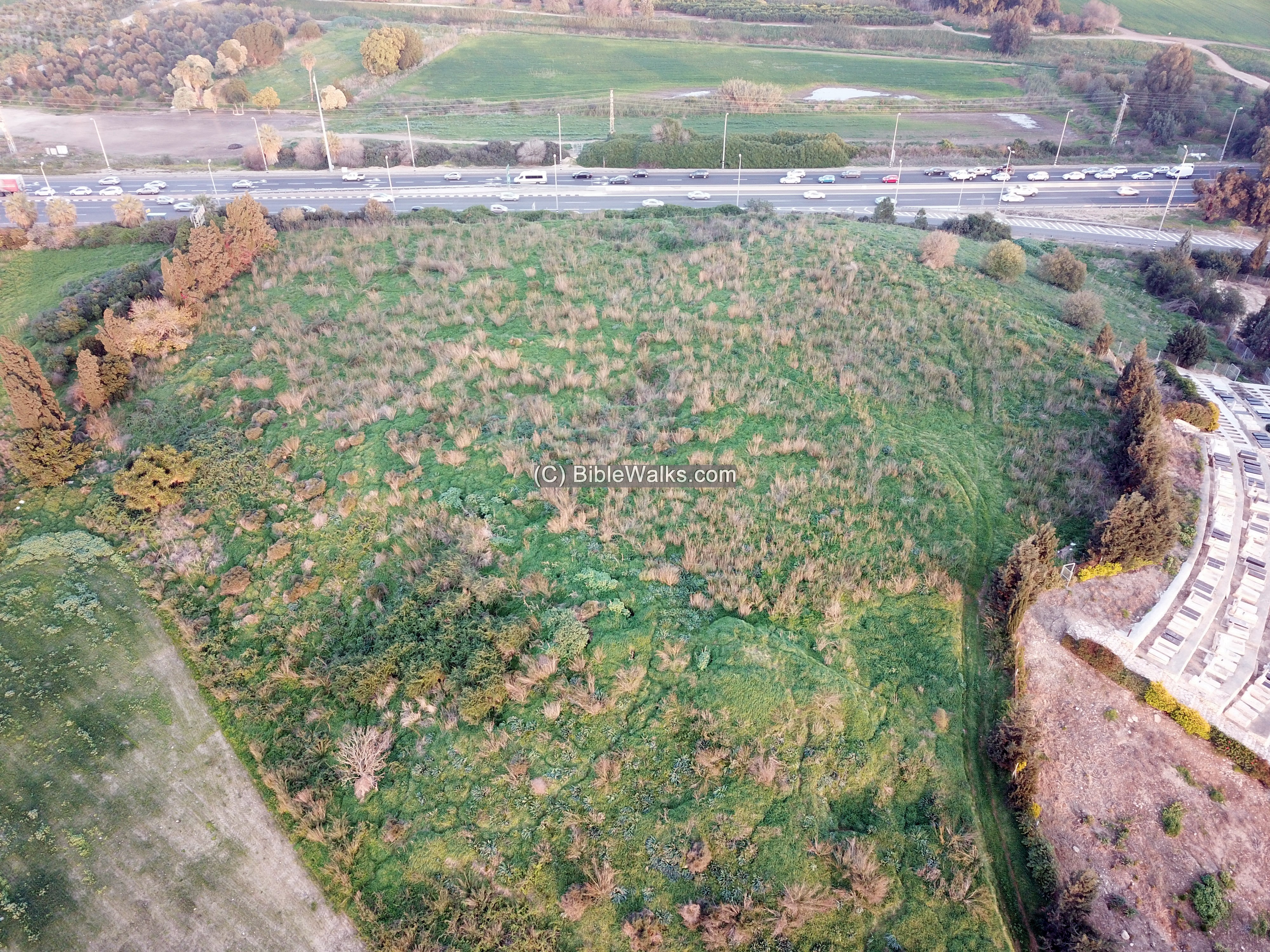
(a) Aerial views
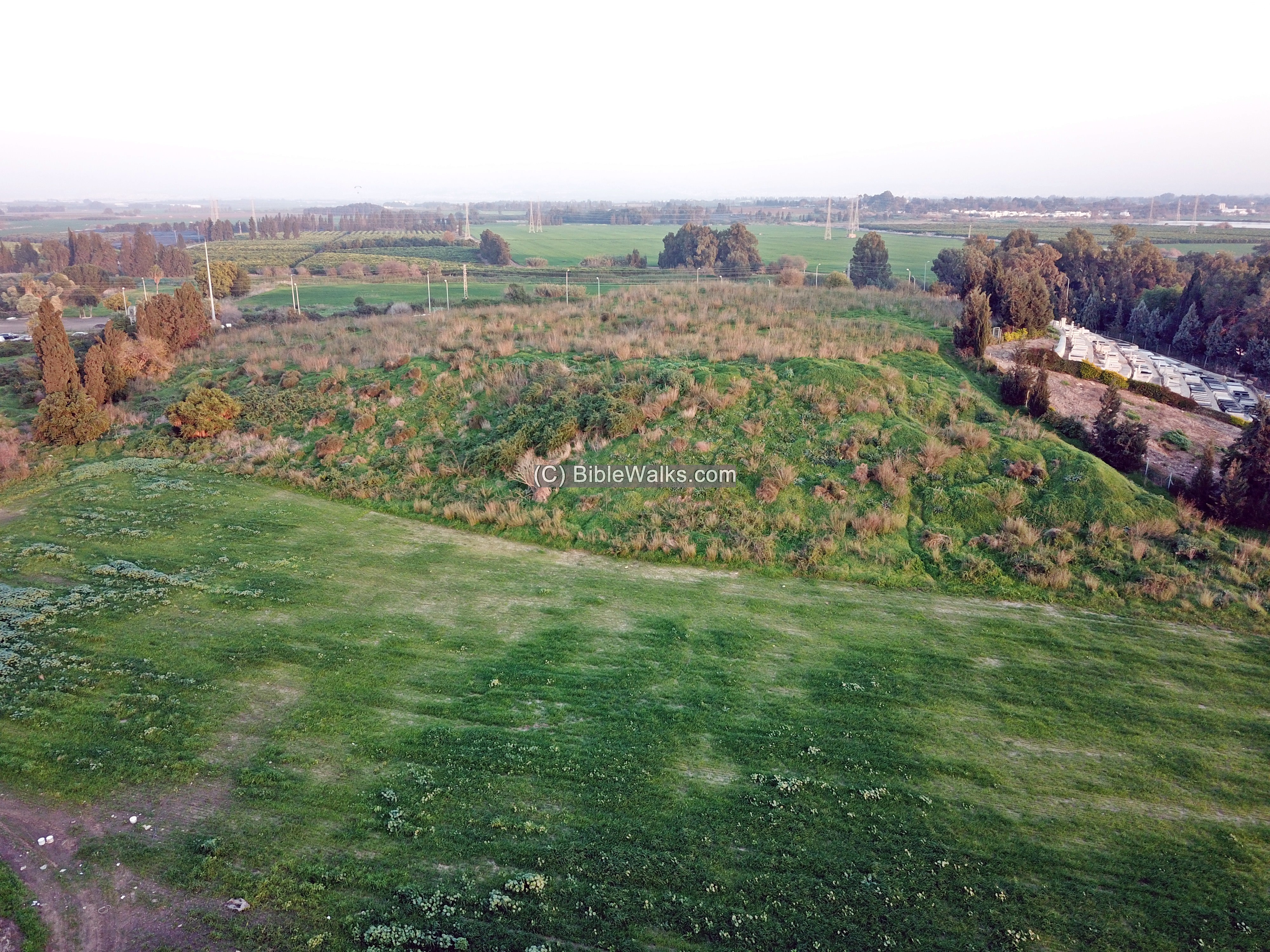
An aerial view of the mound from the west side was captured by the drone. The busy highway #4 is on the east side of the foothills. Nahal Alexander is seen on its east side. In ancient times it was possible to reach Hefer from the sea using the Nahal Alexander river.
Parts of the mound were removed, during the ancient times, for soil quarrying and due to natural erosion.
Click on the photos to view in higher resolution…
The following view is from the north side. In the far background are the houses of Kibbutz Ma’abarot. Nahal Alexander loops around towards westwards the sea (right wise) in the area before the Kibbutz.
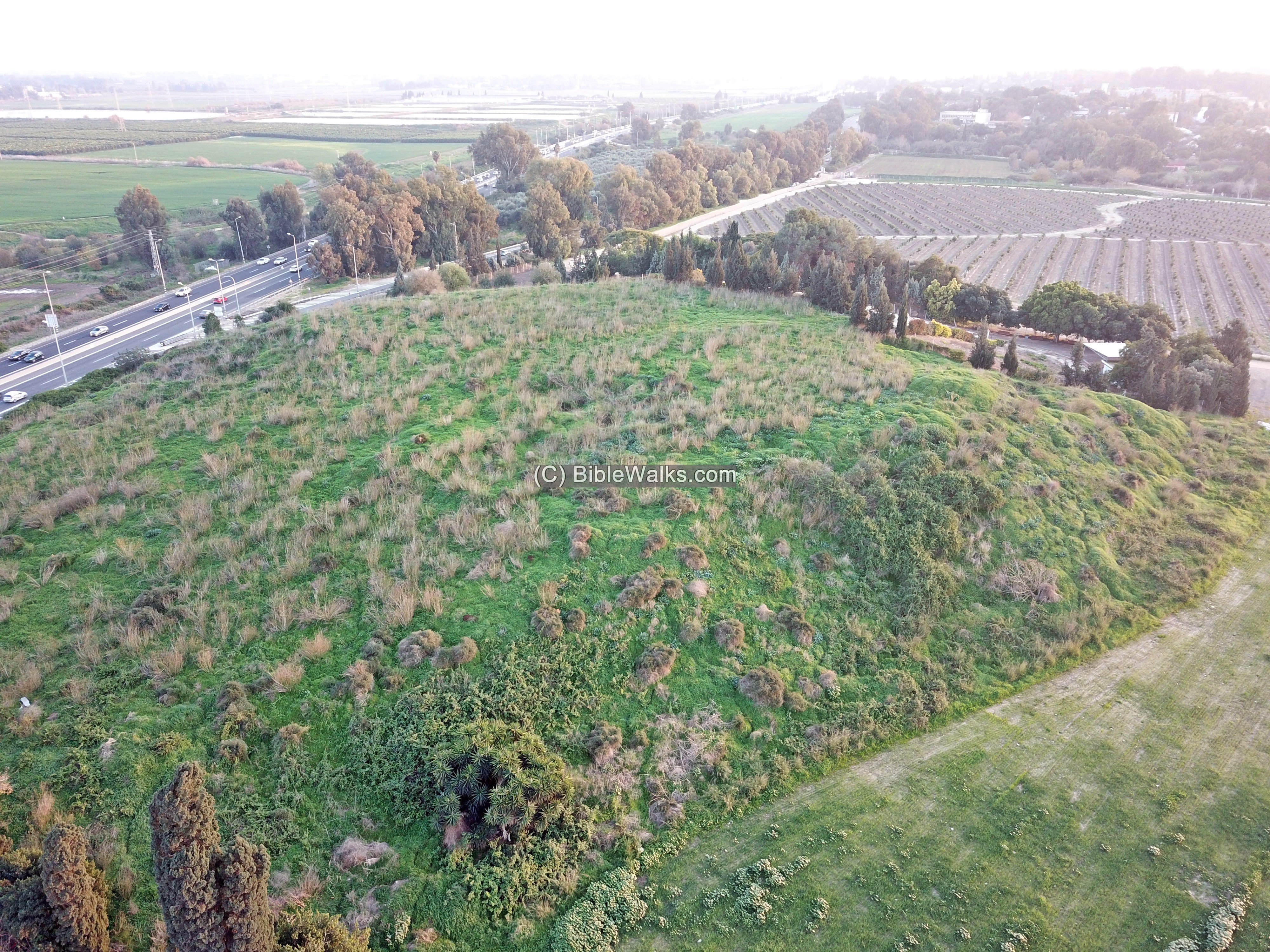
A lower view of its north west side is in the next drone view. The cemetery is located along the south western side, seen here on the right side.
(b) Video
![]() The Youtube video was also captured by the drone:
The Youtube video was also captured by the drone:
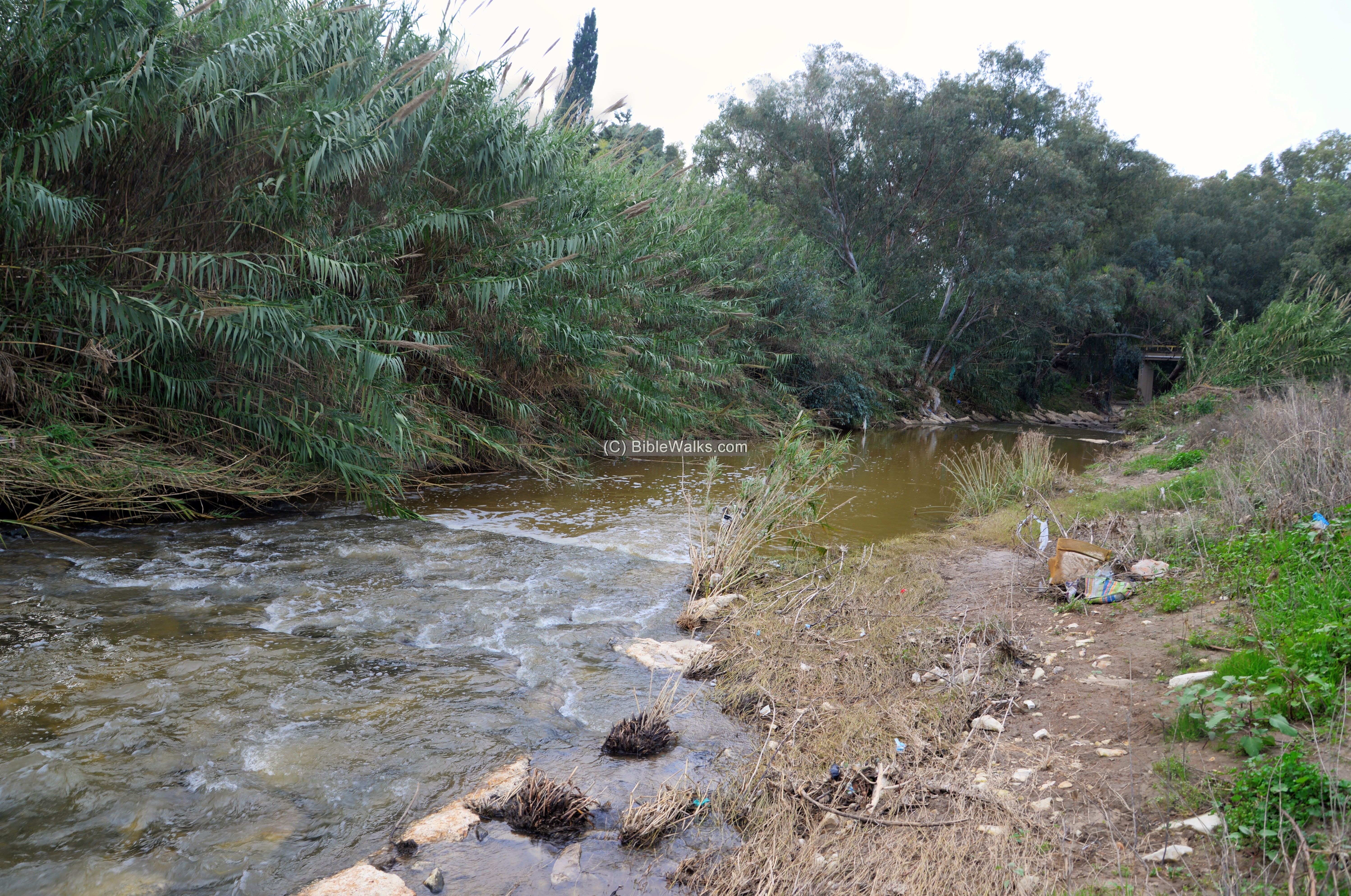
(c) Nahal Alexander – near the site
Nahal Alexander flows around the mound. At this point, close to the site, it is narrow. It widens as it flows downriver closer to the shore 4KM away.
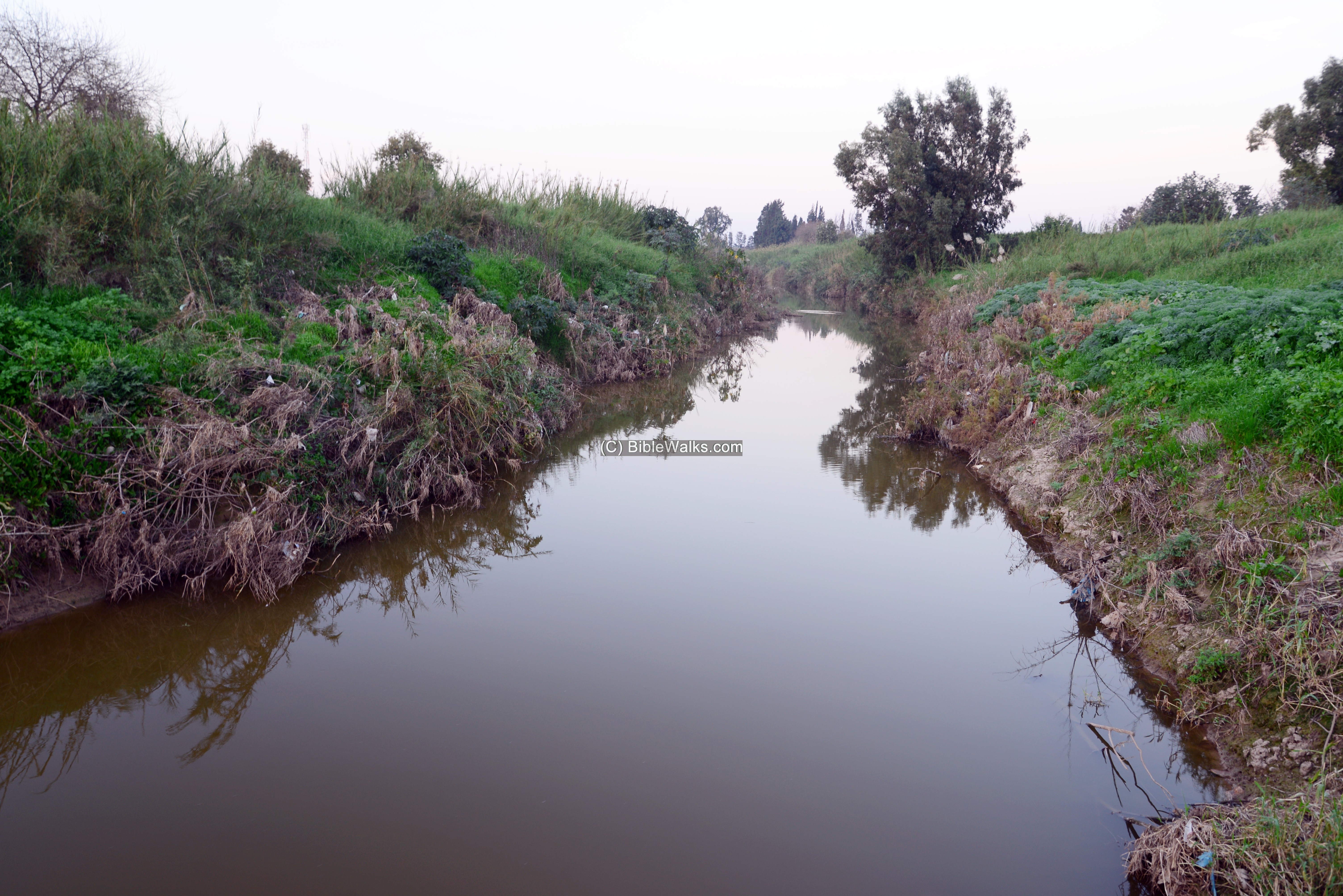
A public park, stretching along along its banks, is accessible from road #5700.
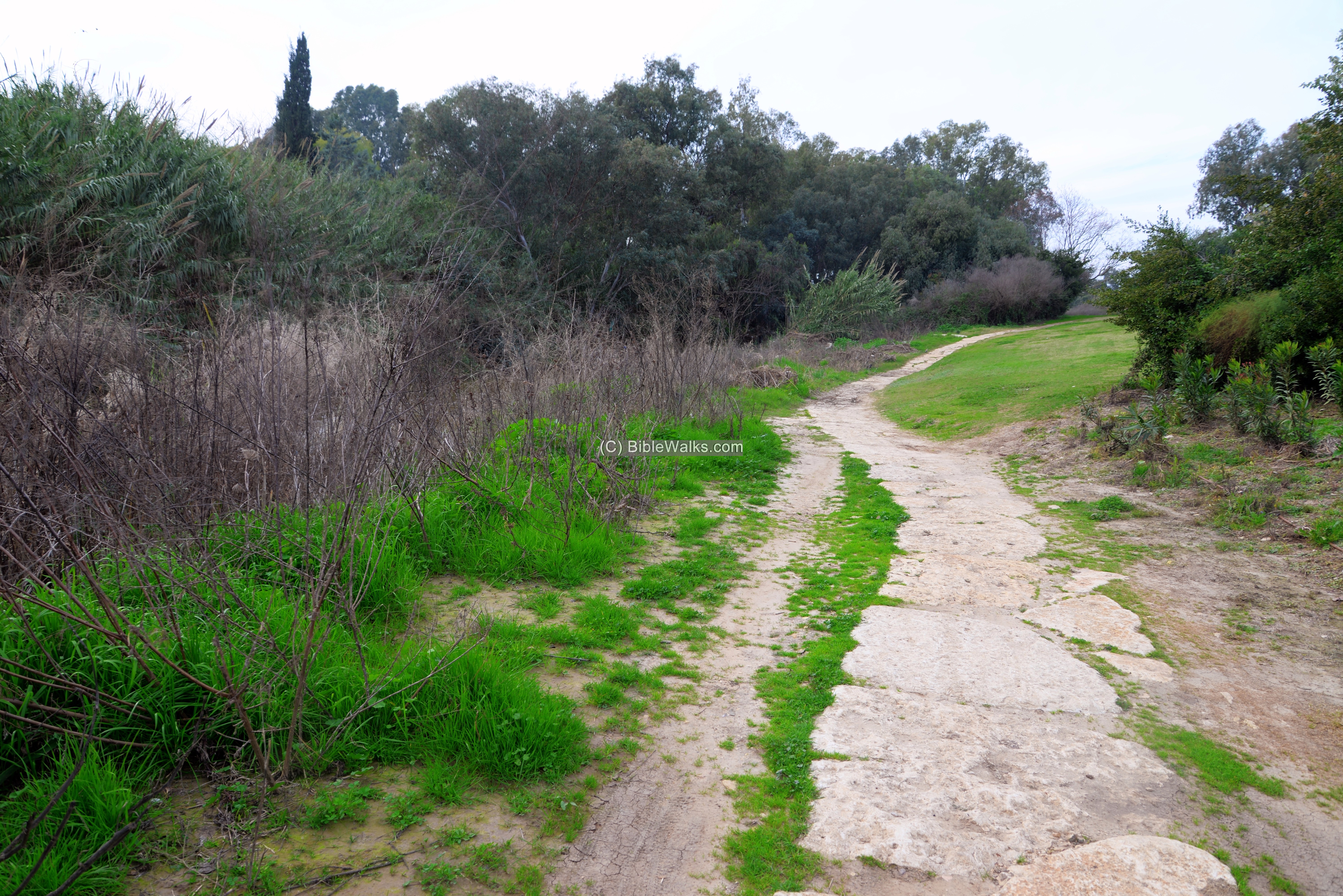
The trail advances westward along the stream.
Along the nature trail is a bridge and other points of interest.
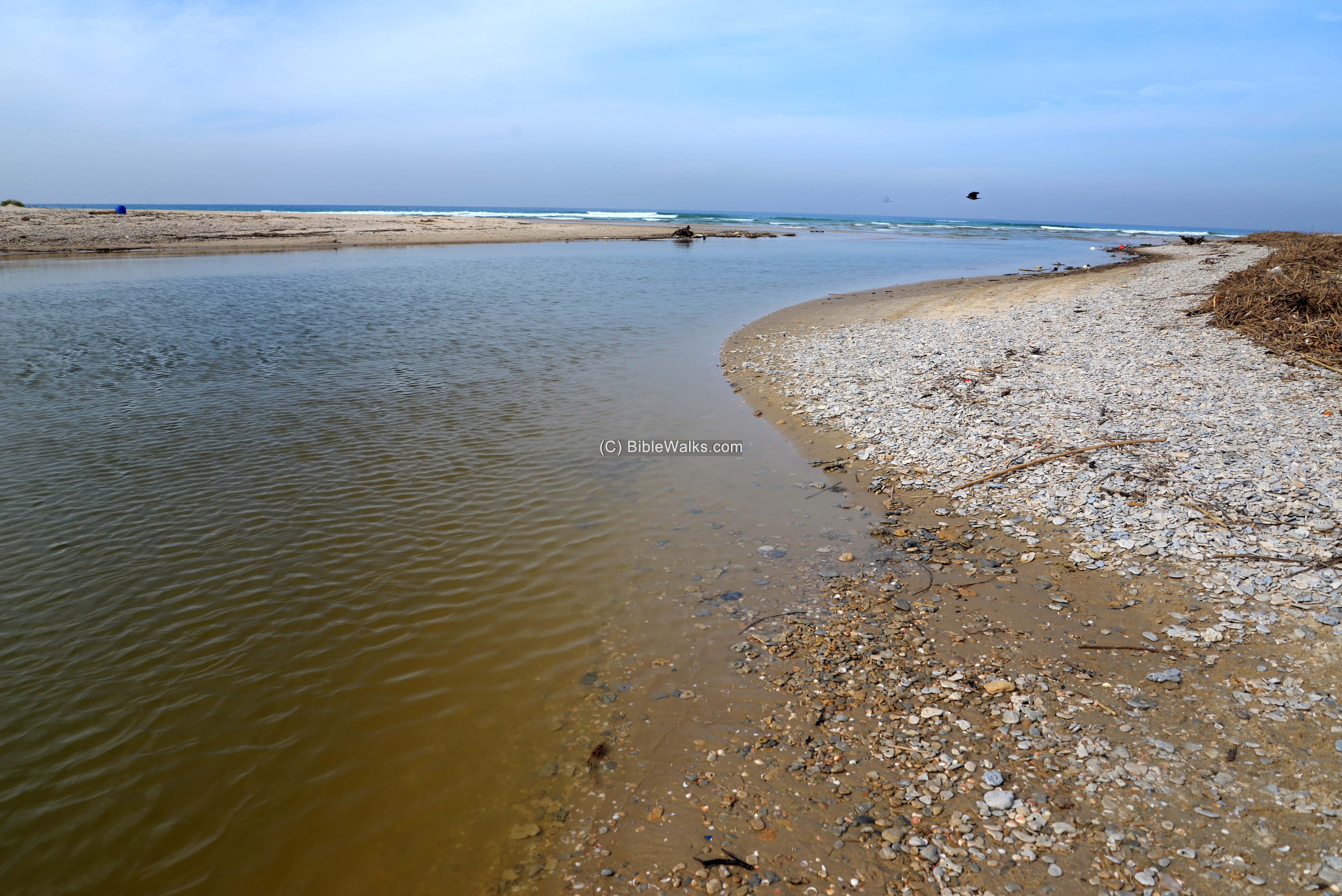
(d) Nahal Alexander – at its mouth
The river is wider at its mouth.
Highway #2 crosses the river on a bridge which is seen in the background of the photo.
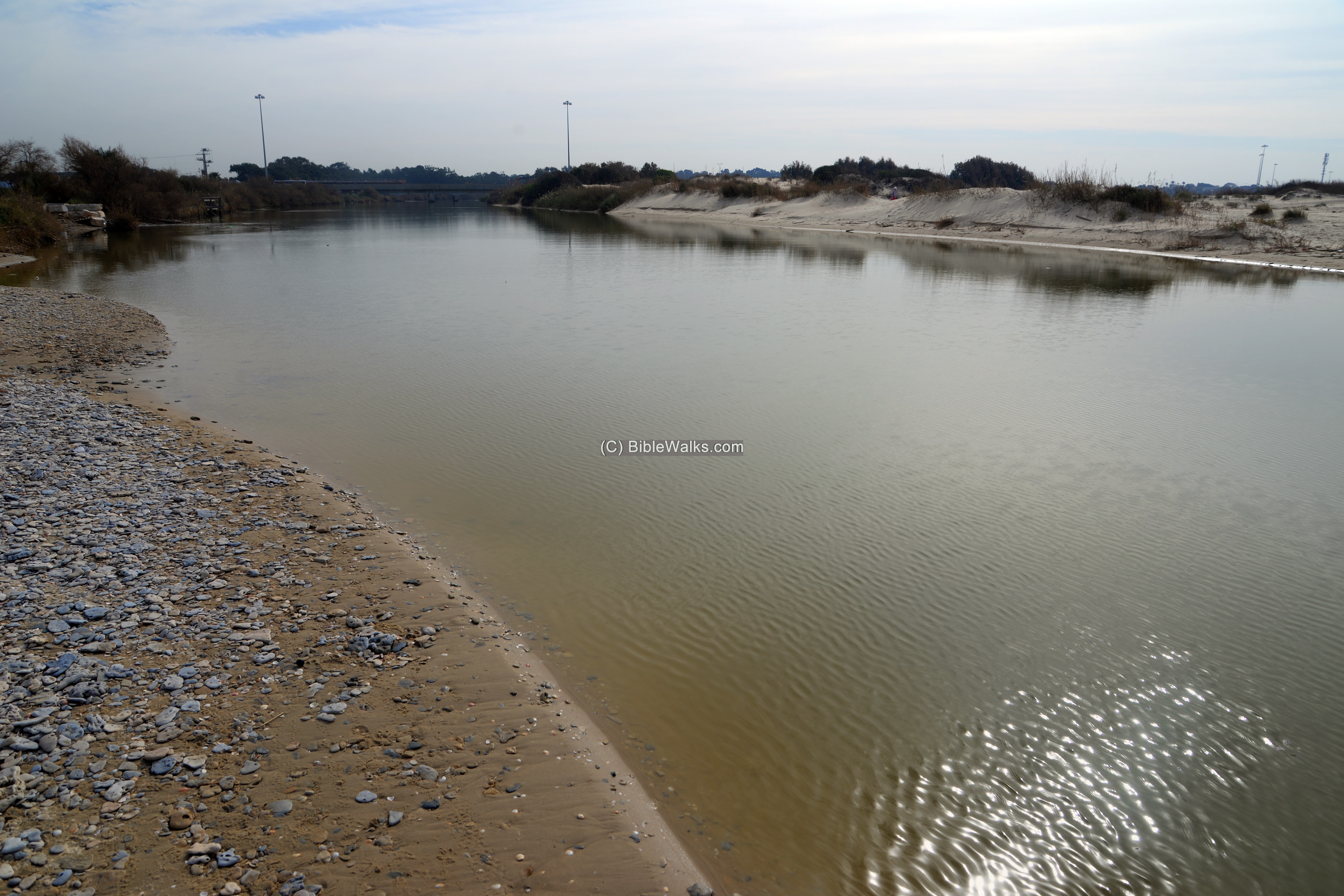
The next photo shows the mouth of the river on the coast line, 0.5 km south of Moshav Michmoret. It is part of a national park, that is open to the public.
Etymology (behind the name):
* Names of the site and vicinity:
- Hefer/Hepher – A Manasseh family head (Joshua 17:2-3): “… the children of Manasseh by their families… and for the children of Hepher.” The name may have been based on the Hebrew root word H-F-R (חפר dig).
- Ma’abarot – Adjacent Kibbutz was founded in 1933 on a KKL land. It is a modern name, based on the location of the settlement – a passage way to all directions (Ma’avar means passage in Hebrew). In British 1940 maps the name is Ma’avarot.
- Khirbct Madd ed Deir. The ruins of the Crusaders town. Arabic: The ruin of the glebe (land) of the monastery (from the PEF dictionary).
- Kirbet esh Shikh Muhammed. The ruin of Sheikh Muhammed ( a private name).
- Tel Ifshar – The mound of the Ifshar. The 19th century PEF dictionary stated: It is the name of a Turkumen tribe. Afshar was one of 24 Oghuz Turkumen tribes. Its Turkumen name means: obedient, agile.
- Nahr Iskanderuneh: Arabic name of the river. Named either after Alexander the Great, or after Iskender (Alexander) Abu Zabura – a 19th century merchant and land owner who used the river for floating watermelon on rafts to the seasonal port of Minet Abu Zabura (Mikhmoret).
- Nahal Alexander – Hebrew name, based on the Arabic name. The river is 32 KM in length, starting from the central Samaria hills around Shechem, then flowing to the Mediterranean Sea.
- Emeq Hefer – Hebrew: עמק חפר -Valley of Hefer. Until 1927 the area around the river was an uninhabitable marshland, infected by malaria.
- Wadi al-Hawarith – Arabic name of the valley of Hefer – the area along Nahal Alexander. It was named after a Palestinian Bedouin tribe that lived there illegally.
Links and References:
* Archaeology:
- Tel Hefer – salvage excavation on the southern slope (HA Volume 126 2014)
- Kibbutz Ma’abarot – official site (Hebrew)
- Ifshar/Hefer – in Ancient Near East Tripod
- Dynamics of Cereal Production at Tell el Ifshar – M. Chernoff and S. Paley (Journal of Field Archaeology — Volume 25 1998)
- The Early MBIIA Phases at Tel Ifshar and their external relations -E. Marcus, Y. Porath, S. Paley (2008)
- “Watermelon” – articles of the 19th century, including Abu Zabura (Baruch Ben Ezer, 1887-1960, pdf , copied by Ehud Ben Ezer; Hebrew)
- Tel Hefer – The New Encyclopedia of Archaeological Excavations In The Holy Land – 1992 – Volume 2 pp. 525-529
* Internal:
- Tel Michmoret -port of Minet Abu Zabura
- Drone Aerial views – collection of Biblical sites from the air
- BibleWalks Youtube channel – Join!
BibleWalks.com – after the lost Biblical cities
Red Tower<<–previous Sharon site—<<< All Sites>>>—next site–>> Tel Michmoret
This page was last updated on Apr 2, 2025 (add map)
Sponsored links: