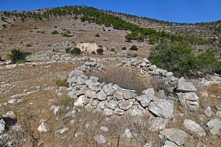
This overview page describes the new archaeological survey of Mt. Gilboa, as part of the Manasseh Hill Country Survey, in which Biblewalks participates.
Home > Sites > Jordan Valley > Mt. Gilboa Archaeological Survey
Contents:
About the Survey
Mount Gilboa
PEF survey
Surveyed sites
Adam Zertal
Links and References
About the Survey:
On Oct 2024 a new archaeological survey team was formed to add the area of Mt. Gilboa into the framework of the Manasseh Hill Country Survey. The results of the survey will be added as a new chapter (“10”) in the comprehensive project started by late Professor Adam Zertal. The survey will be headed by archaeologists Shay Bar of the Haifa University and Ayelet Keidar-Goldberg of the Hebrew University. The team will also include Yoram and Roni Hofman of BibleWalks, as well as other members.
Our survey activities are generally conducted on a weekly basis, specifically on Fridays. Following these field excursions, we diligently process the findings and subsequently add them into the newly edited chapter focusing on Mt. Gilboa. Estimated completion time is end of 2026.
The Mt. Gilboa survey will also incorporate material that was previously collected by previous surveys conducted in this region by N. Zori during the 1960s and 70s. Additional inputs will be based on BibleWalks Jordan valley survey.
Mount Gilboa Overview:
Mount Gilboa is a mountain range in northern Israel, located southeast of the Jezreel Valley and stretching towards the Jordan Valley. It holds biblical, historical, and geographical importance. Here’s a comprehensive look at Mount Gilboa:
Geographical Overview:
- Location: Mount Gilboa lies in the northern part of Israel, forming part of the larger geographical region that includes the Jezreel Valley to the north and the Jordan Valley to the east. The range consists of several peaks, with its highest point reaching around 500 meters (1,640 feet) above sea level.
- Scenic Beauty: Gilboa is known for its scenic landscapes, offering views of the surrounding valleys and mountains. In modern times, the area has been reforested and is home to various plant species, making it a popular destination for nature lovers and hikers.
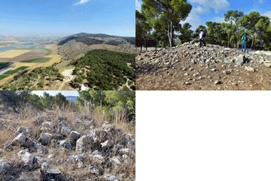
Northern Mt. Gilboa – seen from Saul’s Shoulder
Biblical Significance:
Mount Gilboa is most famously associated with a tragic event in the history of ancient Israel — the death of King Saul and his sons during a critical battle.
- Battle of Mount Gilboa (1 Samuel 31):
- The most significant Biblical account connected to Mount Gilboa is the battle between the Israelites, led by King Saul, and the Philistines. In this battle, the Philistines defeated the Israelite army, and King Saul’s sons, including Jonathan, were killed.
- Mortally wounded and facing defeat, Saul ultimately took his own life by falling on his sword to avoid capture by the Philistines. This event marked the end of Saul’s reign and paved the way for David to become king of Israel.
- After Saul’s death, the Philistines displayed his body and those of his sons on the walls of Beth Shan, a city near Gilboa (1 Samuel 31:8-13).
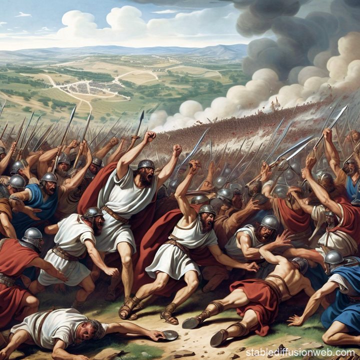
The fall of King Saul and his sons on Mt. Gilboa – AI generated by Stable Diffusion
The tragedy of Saul’s defeat on Mount Gilboa became a symbol of mourning for Israel. David later lamented the deaths of Saul and Jonathan in a famous elegy, where he cursed the mountain (2 Samuel 1:21):
“O mountains of Gilboa, let there be no dew or rain upon you, nor fields of offerings” .
Historical and Archaeological Significance:
Though its biblical importance is central to the narrative of King Saul’s downfall, Mount Gilboa also has historical and strategic importance in ancient times. Gilboa overlooks key valleys and trade routes, including the Jordan and Jezreel Valleys, which were strategic areas for ancient armies. Control of this region would have provided tactical advantages for any group seeking to dominate the area.
Horvat Ner – southern ruins. View towards the Gilboa hills.
Modern Significance:
- Tourism and Hiking: In modern times, Mount Gilboa is a popular destination for hikers and outdoor enthusiasts. Trails across the mountain provide scenic views, especially in spring when wildflowers bloom, creating a beautiful contrast to its barren biblical curse.
- Nature Reserves: The area has been reforested and is part of several nature reserves aimed at preserving its natural beauty. The Gilboa Iris, a rare and protected species of flower, blooms in the region, adding to its ecological significance.
- While the Biblical curse on Mount Gilboa was symbolic of drought and loss, in modern times, the flourishing nature and blooming flowers represent renewal and rebirth. It reflects a transformation from a site of tragedy to a place of life and beauty.
Key Sites Near Mount Gilboa:
- Beth Shean (Beit She’an): Located near Mount Gilboa, this ancient city played a significant role in the biblical story of Saul. Archaeological finds there include impressive ruins from both the Canaanite and Roman periods.
- Jezreel Valley: The valley to the north of Mount Gilboa is one of Israel’s most fertile agricultural regions and has been a significant site of settlement and conflict throughout history.
- Jordan Valley, which lies to the east of Mount Gilboa, was a highly populated and strategically important region during the Bronze Age and Iron Age. Its location and natural resources made it an attractive area for settlement and agriculture, as well as for trade and military purposes. The Jordan river serves as a natural boundary between Israel and Jordan and was historically a corridor for trade and migration.
Mount Gilboa PEF Survey:
Conder and Kitchener of the Palestine Exploration Fund (PEF) surveyed the area during the Survey of Western Palestine (SWP) in 1874-75. This is a section of their map, focusing on the area.
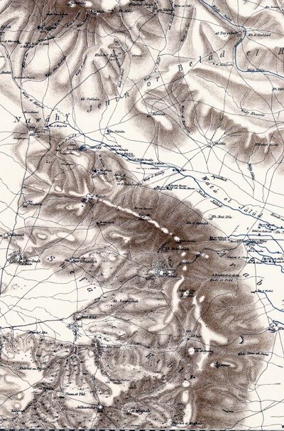
Part of map sheet 9 of Survey of Western Palestine, by Conder and Kitchener, 1872-1877.
(Published 1880, reprinted by LifeintheHolyLand.com)
The surveyors described Mt. Gilboa (Vol 2, Sheet IX, pp. 75-76)
“The Gilboa range forms the watershed between the Kishon basin and the Jordan valley. The shed runs north from the saddle at Wady Shubash [Nahal Bezeq] for 41/2 miles, and the highest point at Jebel Abu Madwar has an elevation 1,420 feet above the plain, and of 1,520 feet above the Jordan valley. North of this point the watershed curves until it runs nearly east and west, the ground gradually falling, until at Zerin, 7 miles from the last point, the elevation is only 400 feet above the sea. The water parting from this point to the isolated hill of Neby Duhy [Givat HaMoreh] is still lower, being only 260 feet above the sea.
The western slopes of the range are gradual, but those facing north, near Nuris and Zer’in [Tel Yizreel] are steep, averaging 25° to 30°, with precipices in many places, and the ground is extremely rugged. The eastern slopes over the Jordan valley are also steep, in places precipitous, especially towards the south.
Guerin’s description about Mt. Gilboa was also added in their report (Vol 2, Sheet IX, pp. 75-76):
“This mountain lies west-north-west and east-south-east, being about eight miles long by three to five miles in breadth. It is cultivated in parts, and is divided into several plateaux and summits by valleys and ravines of greater or less depth. Here and there basaltic stones are found, but limestone predominates. The soil is for the most part of a reddish colour, and is fit for cultivation in many places. Wheat and barley grow on the more gentle slopes and on the plateaux; clumps of olives and figs, hedges of cactus surrounding gardens, and where man has not seized upon the soil, wild grass and brushwood ; at other points naked rock such is the appearance of this mountain, once the scene of the death of Saul and Jonathan, against which David pronounced his malediction.’
The surveyed sites:
The following table shows the date of survey, the surveyed sites, and a link to their publication on BibleWalks.com or to Biblewalks’ YouTube channel.
| Survey | Date | Site Name | Web page | YouTube |
| 1 | 16/11/24 | Nurit (part 1) | Nurit | |
| 2 | 6/12/24 | Nurit (part 2) | Nurit | Field survey |
| 3 | 10/1/25 | Nurit (part 3) | Nurit | |
| Horvat Karmet | Giv’at Yehonathan | Field survey | ||
| 4 | 17/1/25 | Nurit (part 4) | Nurit | |
| 5 | 21/1/25 | Nurit (part 5) | Nurit | |
About Adam Zertal:
The late Professor Adam Zertal (Univ. of Haifa) was a distinguished archeologist who focused on the early periods of the Israelite period. Adam and his team also published 5 volumes of the Samaria region archaeological sites (“”The Manasseh Hill country survey””) with hundreds of surveyed historical places. His team continued to publish more volumes, and we are honored to continue this project together with archaeologist Shay Bar who was a team member and author.
Adam Zertal also discovered the site of an altar on Mt Ebal, an Iron age site he attributes to Joshua. Adam Zertal’s amazing discoveries in the site and excavation surveys in Samaria were published in his book “A nation born- The Altar on Mt Ebal and the origins of Israel” (2000).
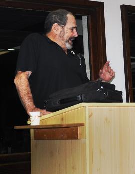
Prof Zertal lecture in Kibbutz Geva – Jan 6, 2010
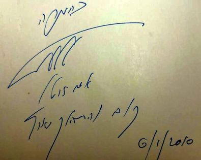
He signed on our copy of his book – “with appreciation – Adam Zertal”, and added a line from Genesis 13:17: “Get up and walk around the land”.
Adam Zertal passed away on October 2015.
Links and References:
* References:
- “The Manasseh hill country survey” Books
- Volume 1 – The Shechem Syncline [ Adam Zertal, ISBN 965-311-012-8; Hebrew; 1992)
- Volume 2 – The Eastern Valleys and the Fringes of the desert [Adam Zertal, ISBN 965-311-012-8; Hebrew, 1996]
- Volume 3 – From Nahal ‘Iron to Nahal Shechem [Adam Zertal – Nivi Mirkam; Hebrew, 2000]
- Volume 4 – From Nahal Bezeq to Sartaba [Adam Zertal , ISBN 965-311-012-8, Hebrew, 1996]
- Volume 5 – Middle Jordan Valley [Adam Zertal , Hebrew, 2012]
- Volume 6 – Eastern Samaria shoulder [Shay Bar, Adam Zertal, 2016, ISBN 978-965-92204-1-0]
- Survey of Western Palestine, Vol 2 Sheet IX
* Internal pages:
-
- Jordan valley Archaeological survey – BibleWalks survey
- Jordan Valley map
- Jordan Valley sites gallery
- BibleWalks YouTube channel
- Jordan valley aerial views, YouTube playlist
This page was last updated on Feb 8, 2025 (add YouTube column)
BibleWalks.com – “Arise, walk through the land in the length of it and in the breadth of it…” (Genesis 13:17)
Horvat A-Dir<<<—previous Jordan Valley site—<<< All Sites>>> — Next site—>>>
Sponsored links:
