A fortified Tel, situated near an ancient strategic road in the Northern Samaria region.

Home > Sites > Samaria > Ferasin
Contents:
Overview
Aerial Map
History
Photos
* Aerial views
* Eastern Structure
* Western Structure
* Western Cistern
* Eastern Miqveh
* Illicit Diggings
Etymology
Links
Overview:
Khirbet Ferasin is a fortified Tel in the Northern Samaria, 1km west of Hermesh. It was situated on the side of the Roman road from the Valley of Dothan to the plains of Israel. Walls surrounded the ancient site around the hill at half its height.
Ferasin has a long history: first established during the Iron Age (perhaps named Peresh), continued thru Persian/Hellenistic periods. During the Roman period it was a Jewish town of Kefar Parshai (as per Talmud Bavli). During the Crusader/Mameluke periods it was named Afarsin. The Jordanian army fortified it (1948-1967).
On its summit are ruins of two Ottoman arched buildings and other structures, agriculture installations, terraces, cisterns and ritual baths.
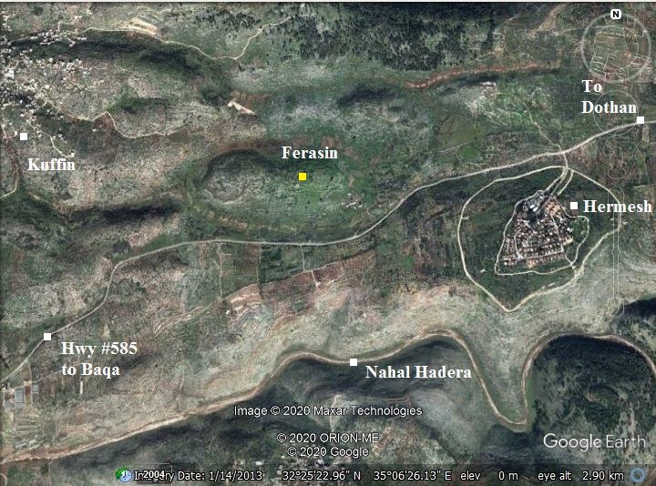
Map / Aerial View:
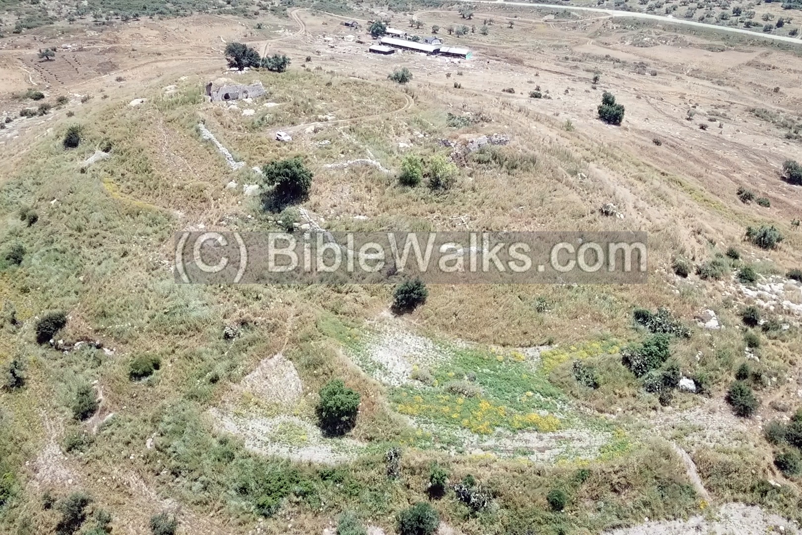
An aerial map is shown here, indicating the major points of interest around the site. The site is located on the north side of the main road connecting Dothan valley to the west. A modern highway #585 traverses the ancient east-west route.
The oval shaped hill raises 40m above the area, covering an area of 40 dunam. It has steep foothills on all sides, except for the south east side where the entrance road is located.
History:
- Biblical periods (Bronze and Iron age)
The road that passed thru Ferasin was used since the antiquity, as it passes along a convenient route, using a 7km long, 600m wide watershed between two tributaries of Nahal Hadera – Wadi Jiz in the south and Wadi Asi/Amiq in the north. It was a more convenient and shorter route than the Megiddo pass on the north. This route was the southern path that was suggested by the military advisors to Thutmose III on his inquest of 1492 BC just before the battle of Megiddo. However, he rather took the middle route thru the narrow ‘Ara (Iron) valley.
The cities and roads during the ancient periods are indicated on the Biblical Map below. Ferasin is marked (yellow square) on the side of the main road (the “King’s road” – Tarik es-Sultan) from Jezreel valley, via the valley of Dothan, towards the coast. A line of Iron Age sites were identified along this route.
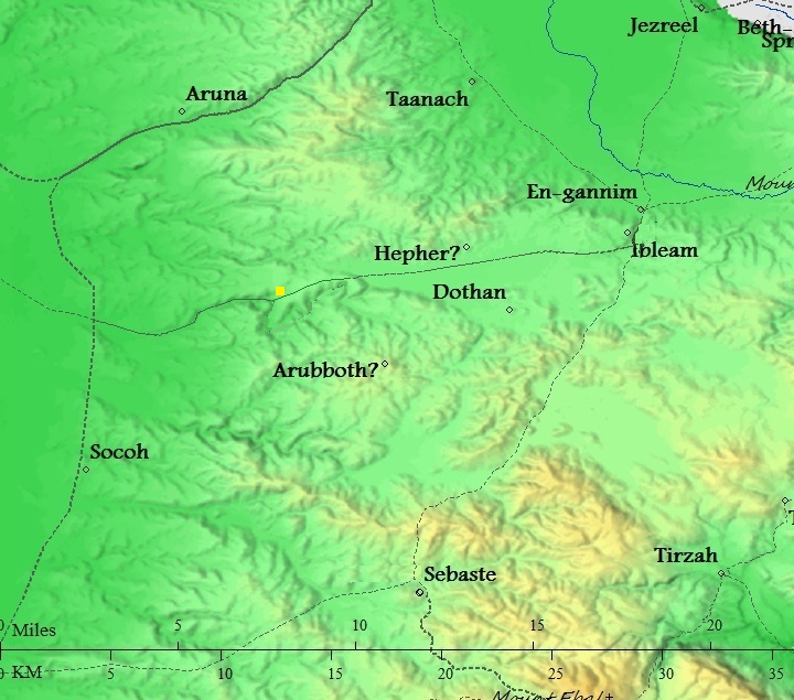
Map of the area around Ferasin from Canaanite/ Israelite to Roman period (based on Bible Mapper 3.0)
One of the Biblical events involved traveling along this route from Dothan to the coast and down to Egypt. Joseph, favorite son of Jacob, and his envy brothers were stationed at that time in nearby Dothan (Genesis 37: 17):
“And Joseph went after his brethren, and found them in Dothan”.
The brothers, envy of Joseph, threw him into a pit, then selling him (Genesis 37:28):
“Then there passed by Midianites merchantmen; and they drew and lifted up Joseph out of the pit, and sold Joseph to the Ishmeelites for twenty pieces of silver: and they brought Joseph into Egypt”.
The route was used by the Ishmeelites merchantmen who came from Gilead, taking him to slavery in Egypt.
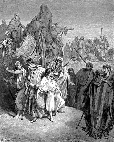
Joseph sold to the merchantmen – illustration by Dore
Due to the importance of its location, a fortified town was built on top of the hill. Ceramics survey show a presence during the Iron Age (10% of the ceramics, Iron Age 2). The site was identified by some scholars as the town of Peresh of the Manasseh tribe.
- Hellenistic/Hasmonean (3rd-1st century BC)
The site continued during the Persian and Hellenistic period, as determined according to the ceramics survey (10% of the collected pottery).
-
Roman Period – (1st century BC – 4th century AD)
The Dothan route continued to be a principal Roman road, connecting Caesarea to northern samaria. During the Roman period the fortress was identified as a Jewish town of Kefar Parshai (as per Talmud Bavli). The ceramics survey counted 20% of the pottery belonging to this period.
- Byzantine period (4th century-7th century)
The site continued during this period (15% of the collected ceramics).
- Crusaders/Mamelukes (12th-16th century)
The town was known as Afarsin, belonging to the region of Caesarea (30% of the collected ceramics).
- Ottoman Period – (1516-1918 A.D.)
The course followed by this road during the Biblical times continued in the modern period.
During the Ottoman period Ferasin was a small town. Ruins of two large arched structures still remain on the summit.
The area was examined in the Palestine Exploration Foundation (PEF) survey (1866-1877) by Wilson, Conder and Kitchener. This map is part of sheet 8 of their survey results.
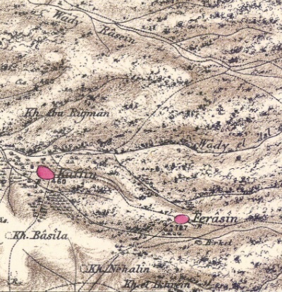
Part of map sheet 8 of Survey of Western Palestine, by Conder and Kitchener, 1872-1877.
(Published 1880, reprinted by LifeintheHolyLand.com)
Their report of the site was merely (Volume 2, p. 47): “A small village on a rocky hillock, with a well to the south-east”. They wrote about the road (p.50):
“Jenin to Sharon.—The road leaves No. 1 at the head of Wady Beiameh, and passes along the Plain of ‘Arrabeh north of Dothan, descending by Wady el Ghamik. This is also a very easy line for crossing Palestine, as it runs through plains, excepting one pass of about 4 miles, with a fall of less than 100 feet per mile at most, the highest point being only about 800 feet above the sea-level. This road was probably the one by which the Midianites descended to Egypt with Joseph; but it is not now a main line of communication”.
- British mandate
A map published in the 1940s, with the name “Firasin”.
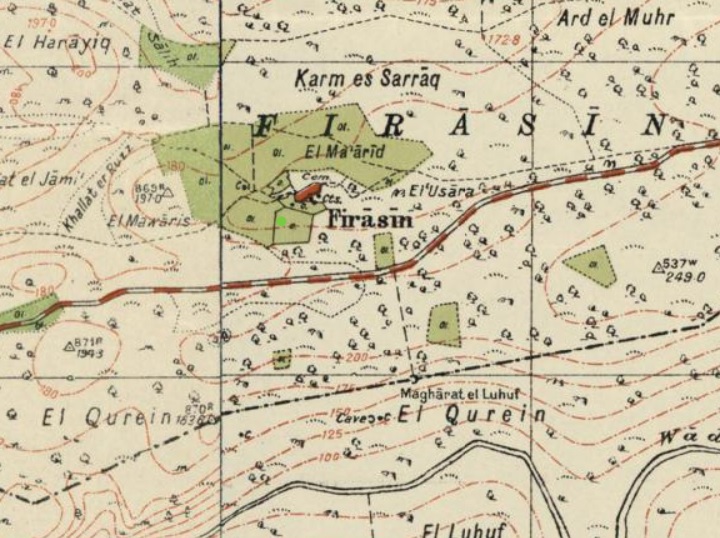
https://palopenmaps.org – Palestine 1940s 1:20,000 map
- Modern period
During the period between the Israeli independence and the 6-day-war (1948-1967), the Jordanian army cut communication tunnels and bunkers along the hillsides, damaging the ancient wall around the hill.
The Har Menasseh country survey by Adam Zertal and Nivi Mirkam surveyed the site (volume 3, site 127, pp. 298-301; 1978-1984) .
The place is within Area ‘A’ of the Palestinian Authority. Security limitations prevent Israelis to visit the site.
Photos:
The photos were taken on May 2020, under the supervision of Dr. Dvir Raviv who conducted a survey of the cisterns, and we thank him for joining his team.
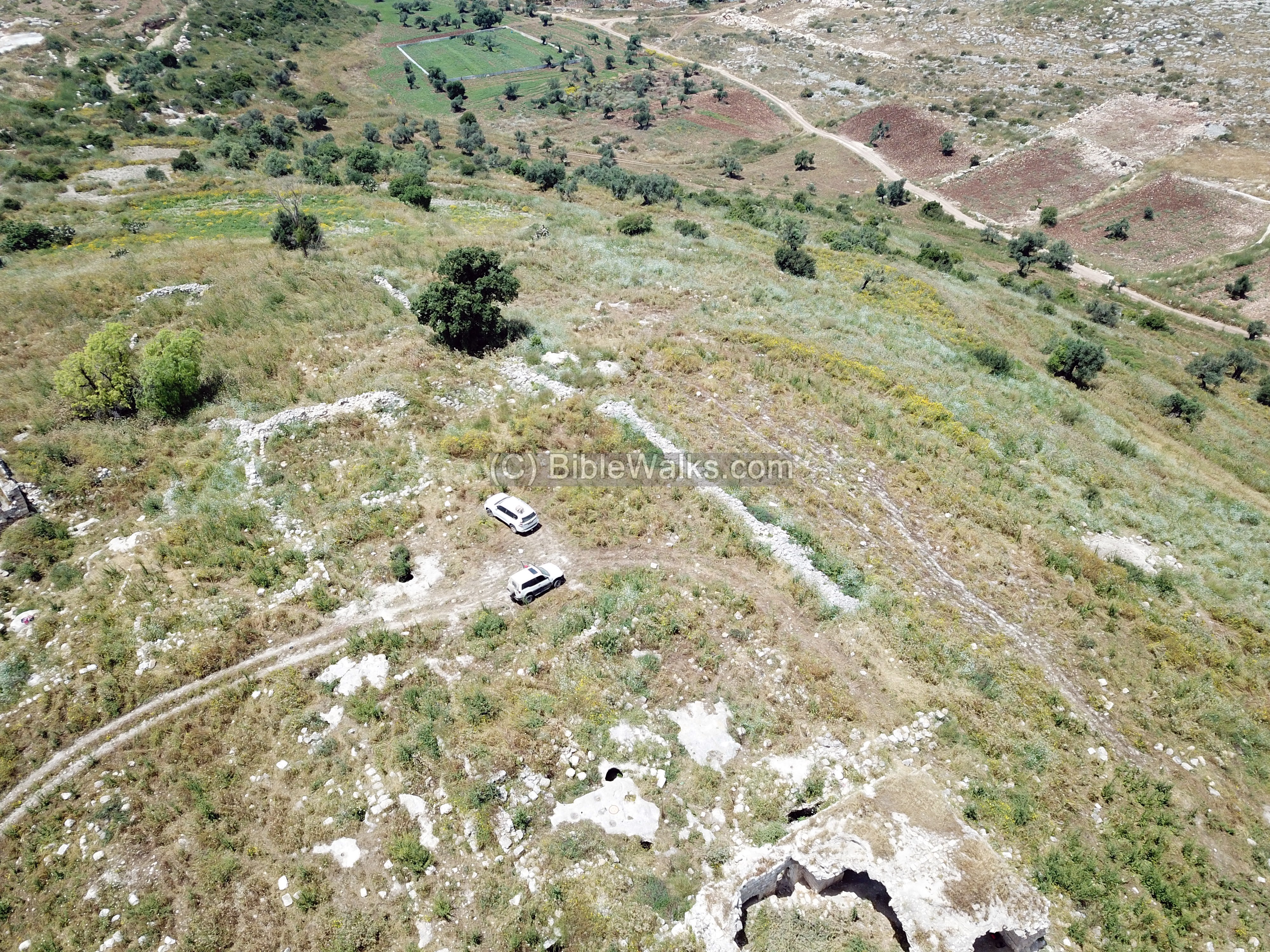
(a) Aerial Views
The following drone views show the hill from all sides, starting from the east sides.
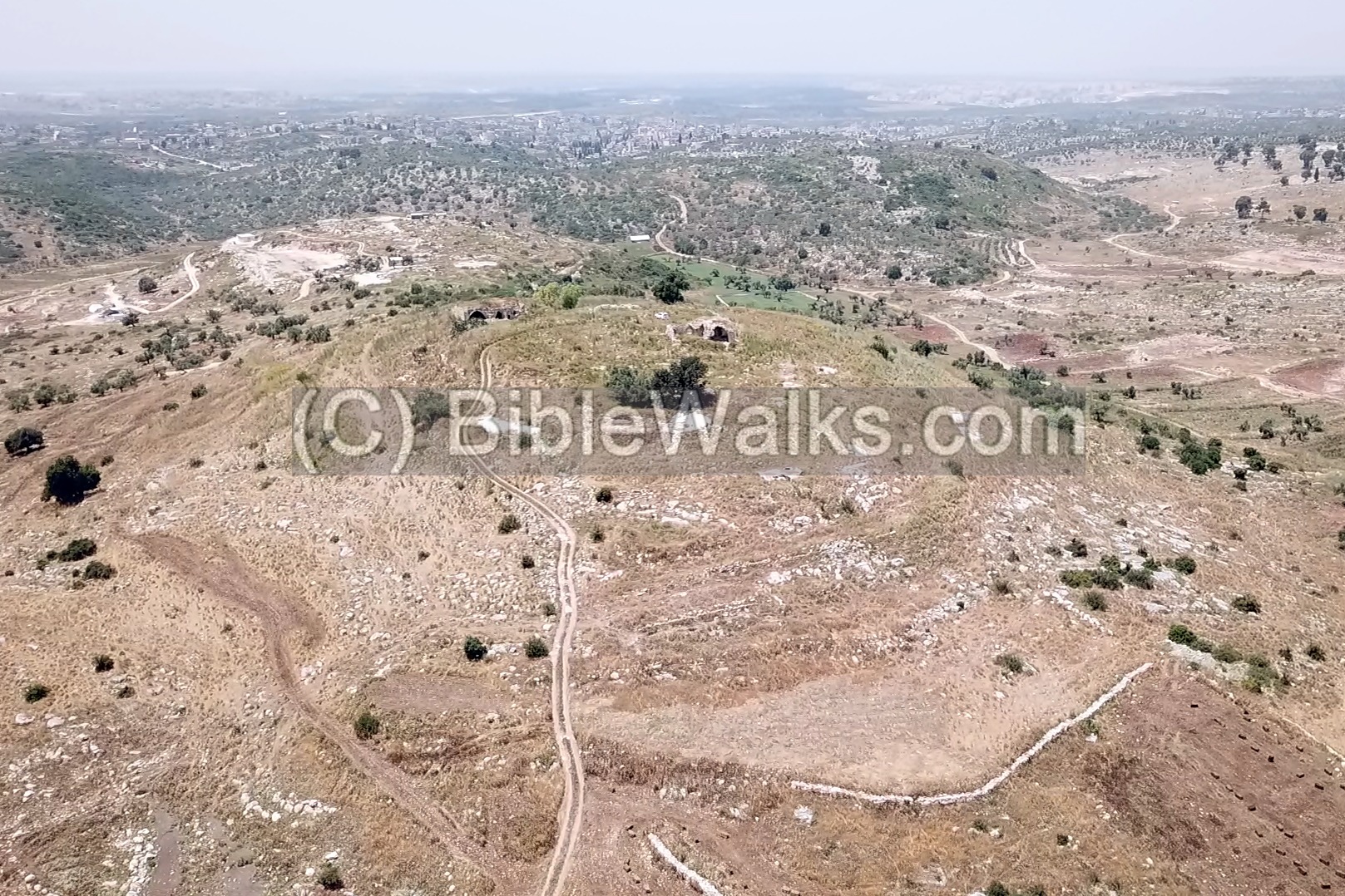
- North east:
The hill raises to an altitude of 205m, overlooking 40m above the area around it. The ancient route, now hwy #585, passes along the south side.
Click on the photos to view in higher resolution…

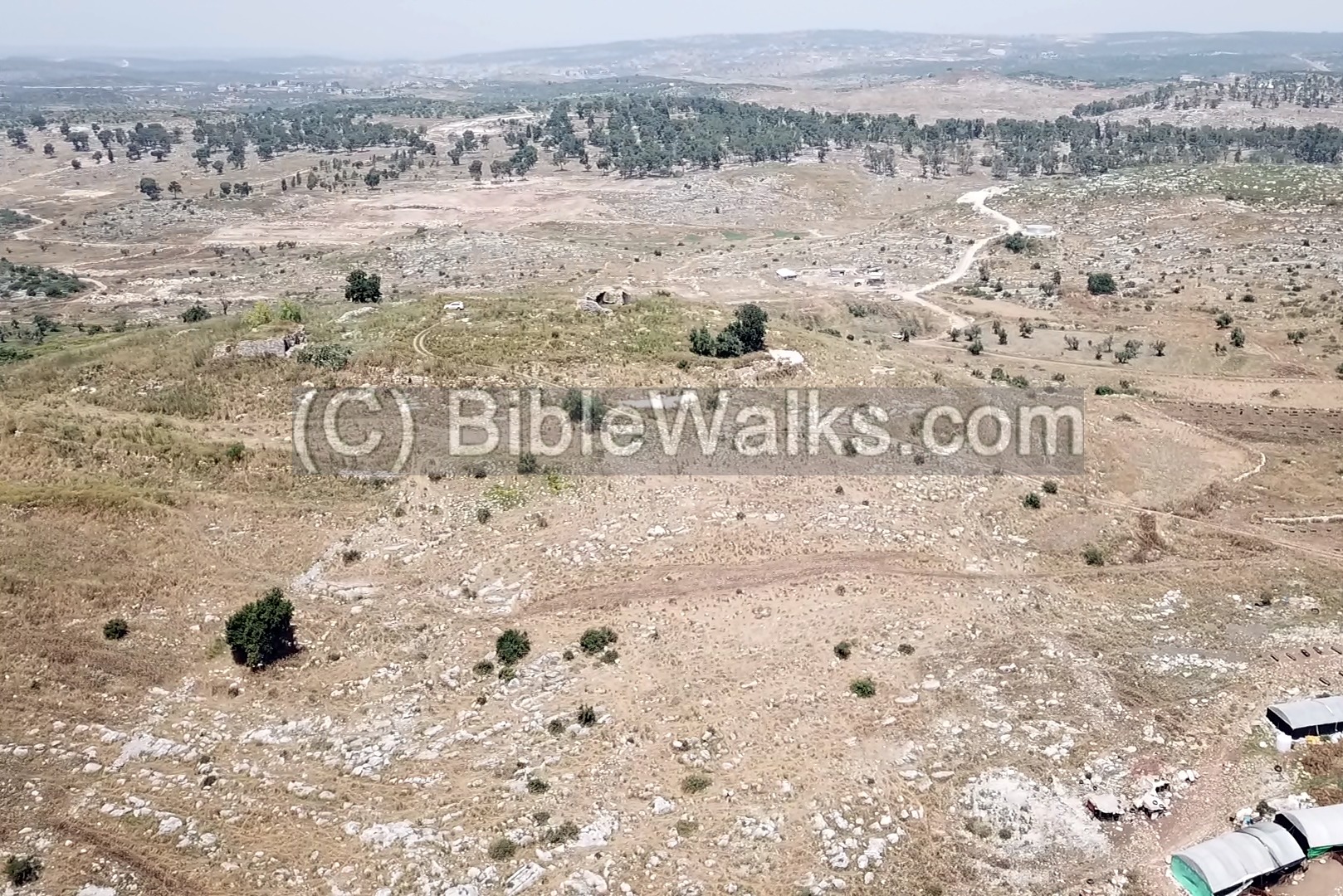
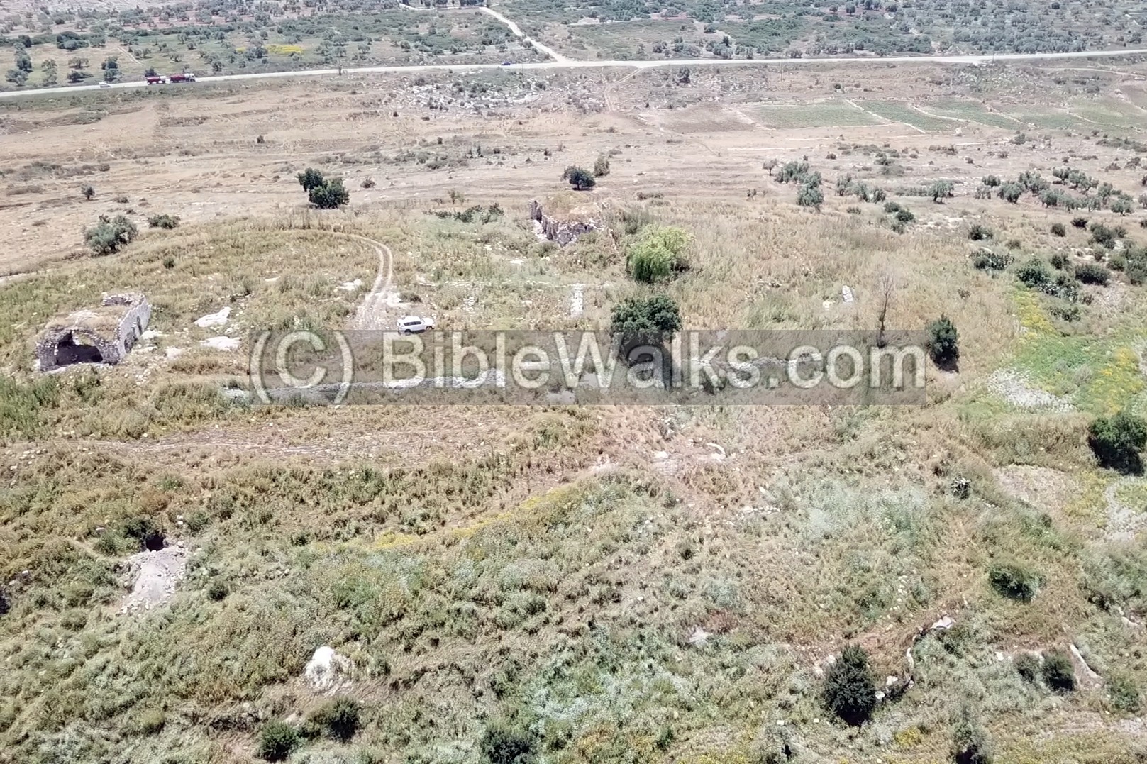
- South east:
This side has a gradual ascent as compared to the other sides of the hill. The ancient entrance road entered on this side, as the path of the modern access road.
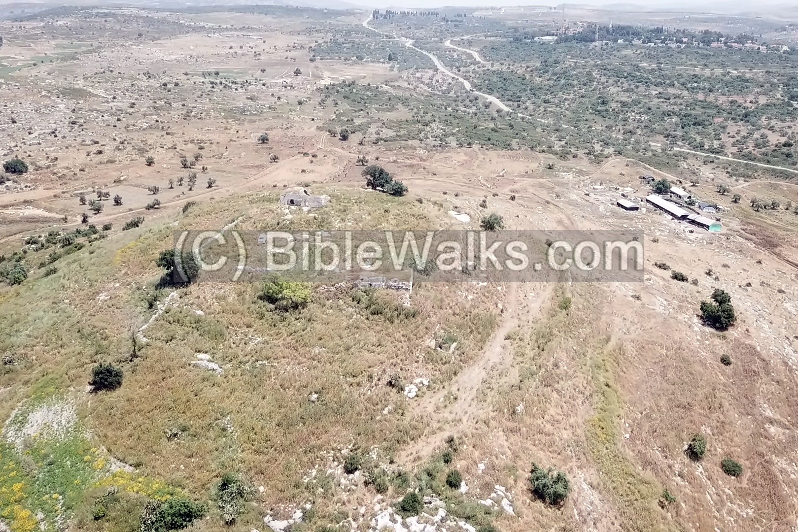
- South:
The original peripheral wall remained intact on this side to a height of up to 5m. It is visible here along the foothill at the height of 10m (alt. 195m) under the summit (alt. 205m).
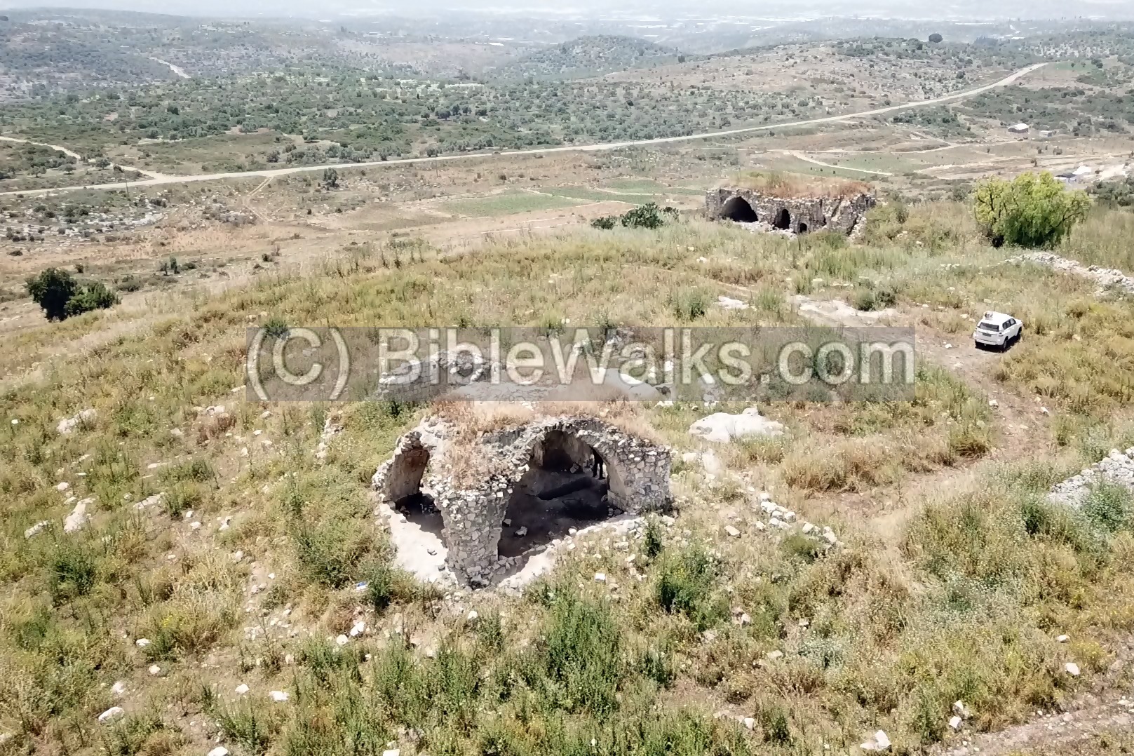
- South west:
On the summit are two Ottoman period arched structures. Around them are scattered ruins of structures from Ottoman and earlier periods.
In the background, on the far south side, is the Israeli community of Hermesh, founded in 1984.
- North west:
Yet another viewing angle of the summit.
- North:
In this northern view, the main road is seen to the south of the hill. It commanded this important ancient pass.
![]() The following video shows a view of the site and its surroundings, as captured by the drone. It starts over the south side, then turns to the west.
The following video shows a view of the site and its surroundings, as captured by the drone. It starts over the south side, then turns to the west.
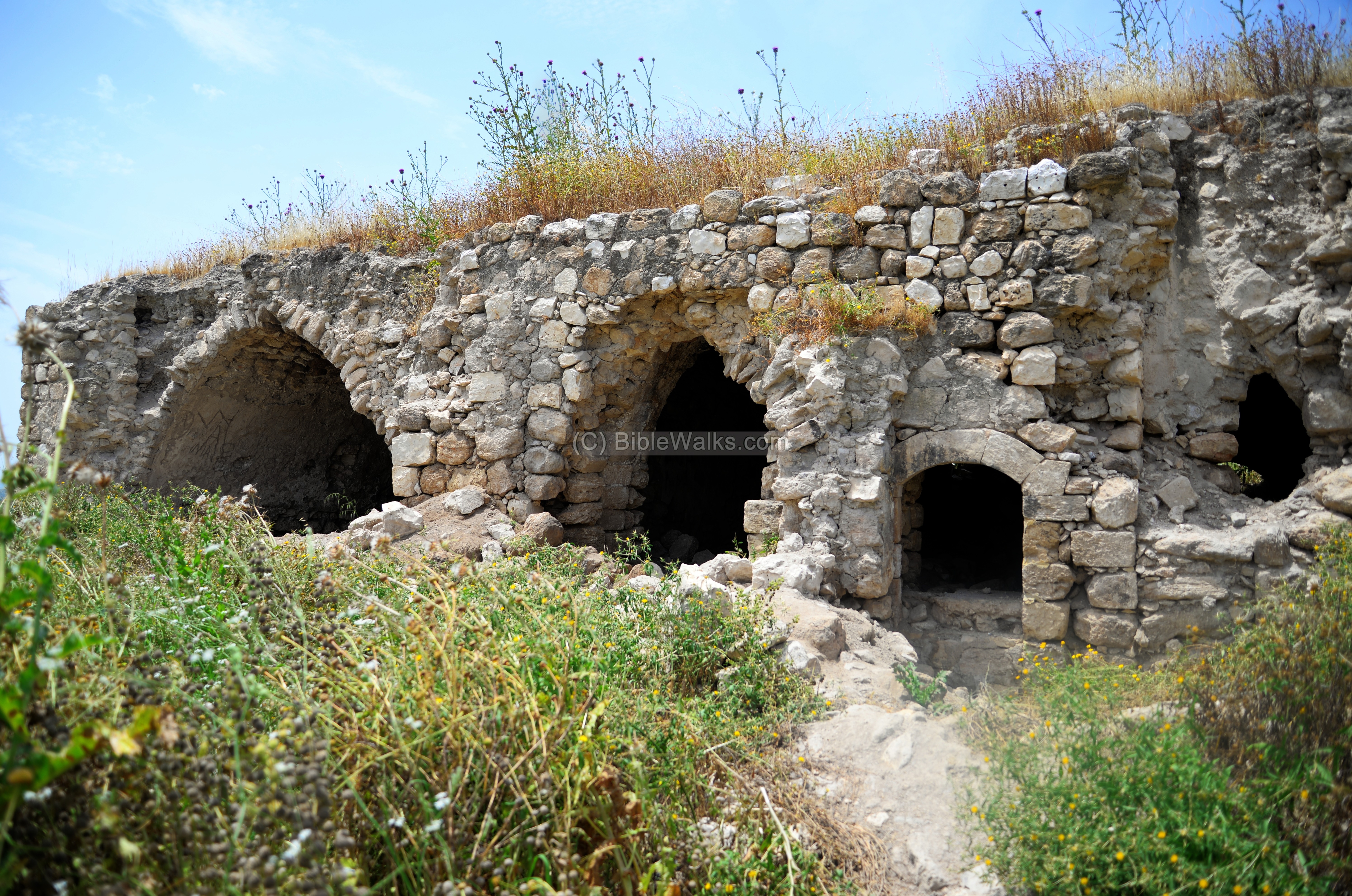
(b) Eastern structure
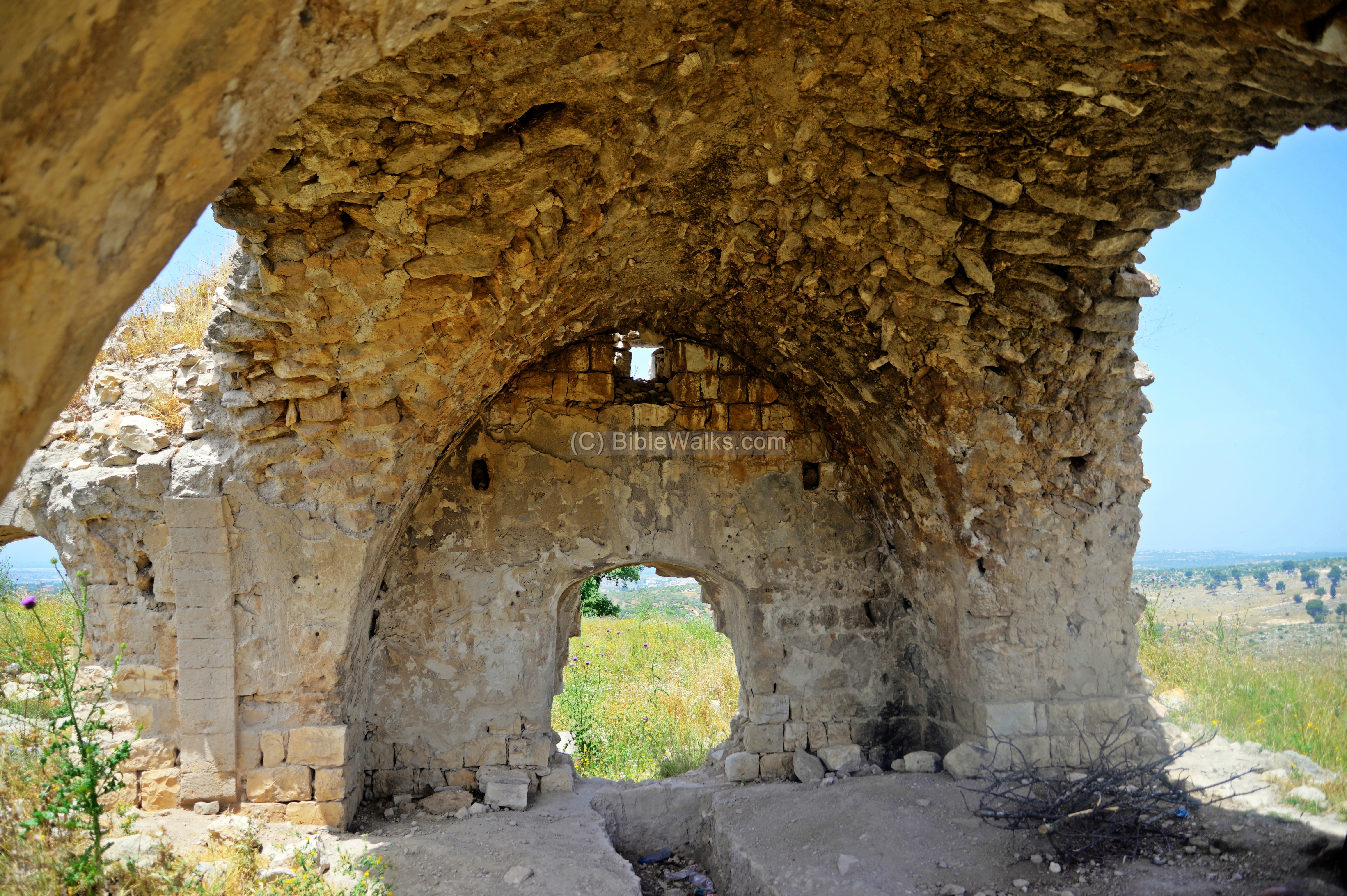
The Ottoman structure on the east side is 20m by 15m. It is mostly ruined, except for the central arch.
A north side of the structure shows the profile of the arch.

The space under the arch was useful, as we ate lunch there hidden from the hot sun.
Around the structure are remains of installations, cisterns and bases of houses and courtyards. This aerial view shows the area in front of the structure.
Here are some of the cisterns and installations seen in front of the eastern structure:


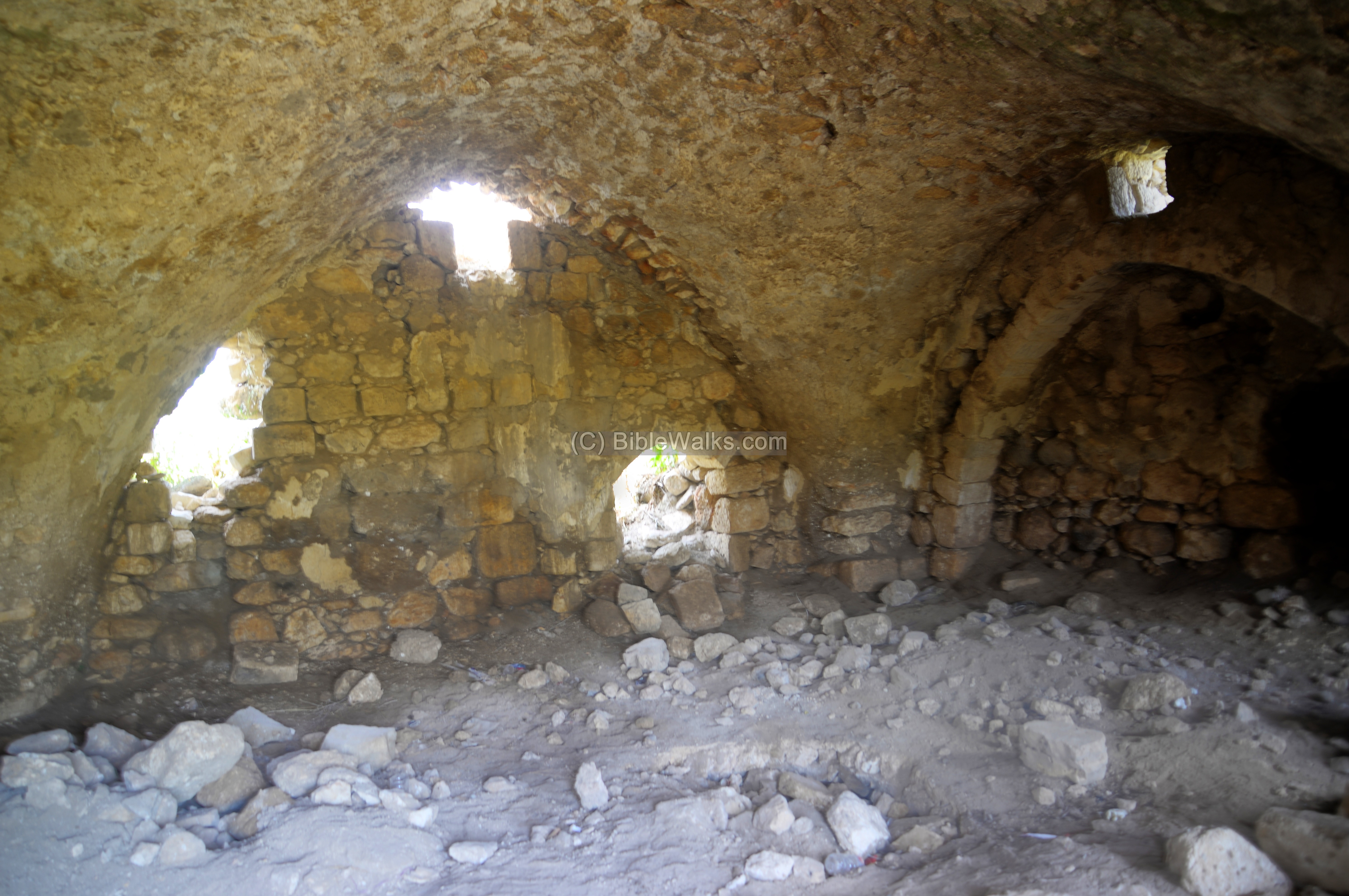
(c) Western structure
Ruins of an Ottoman period structure is located on the western side of the summit.
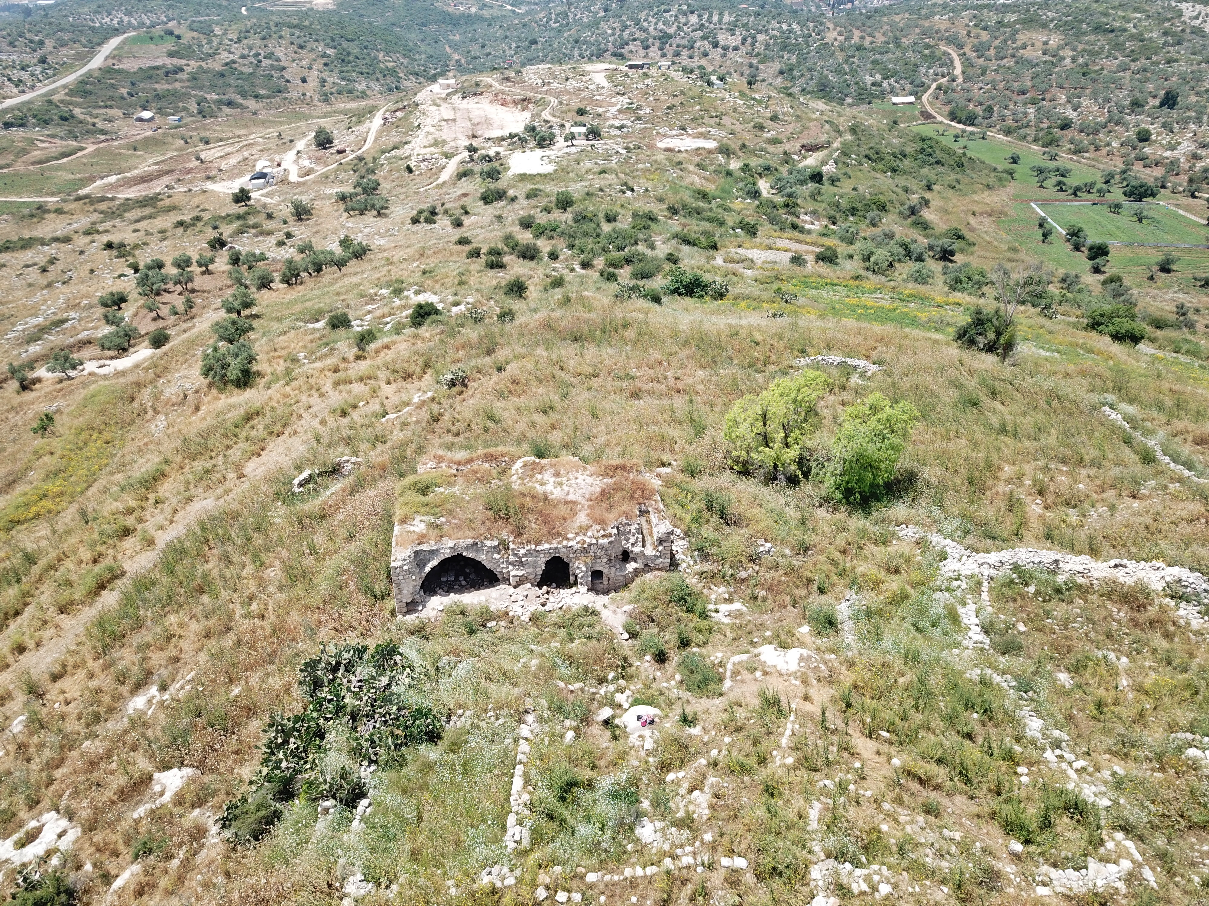
The structure is larger than the eastern one, covering an area of 25m by 15m.
This structure is based on three arches. Around the arched structure are remains of rooms, courtyards and installations.
This is a view inside the structure.
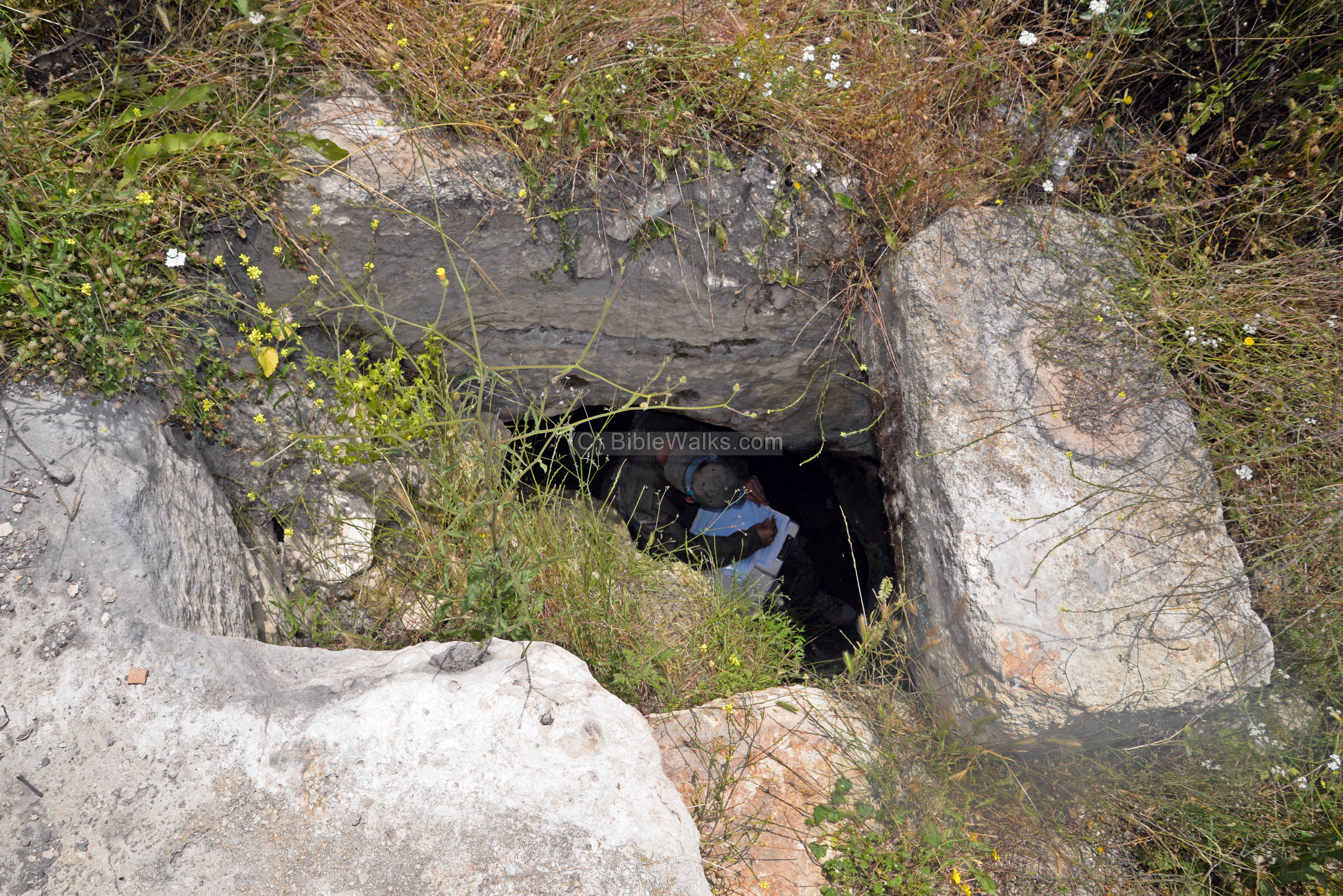
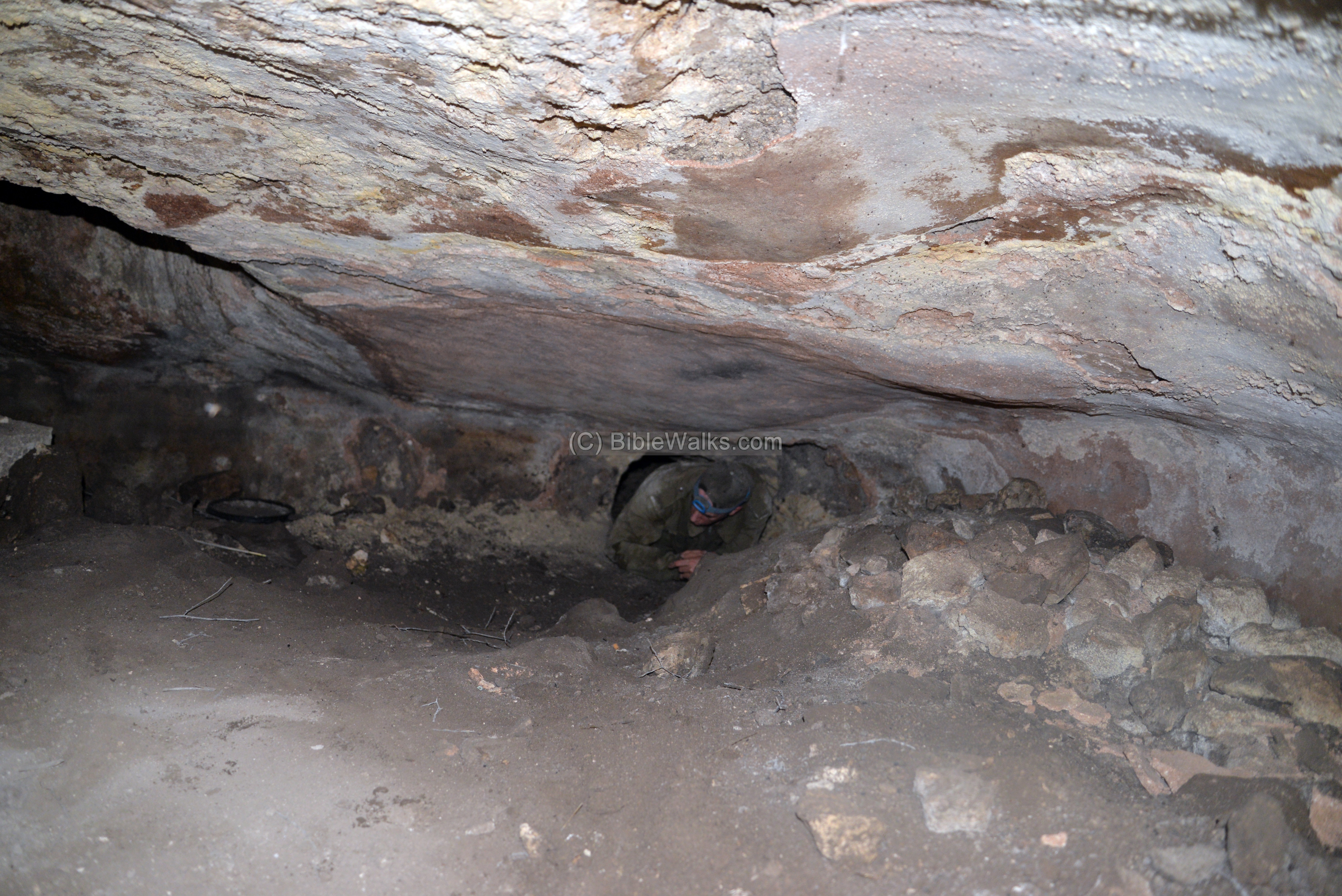
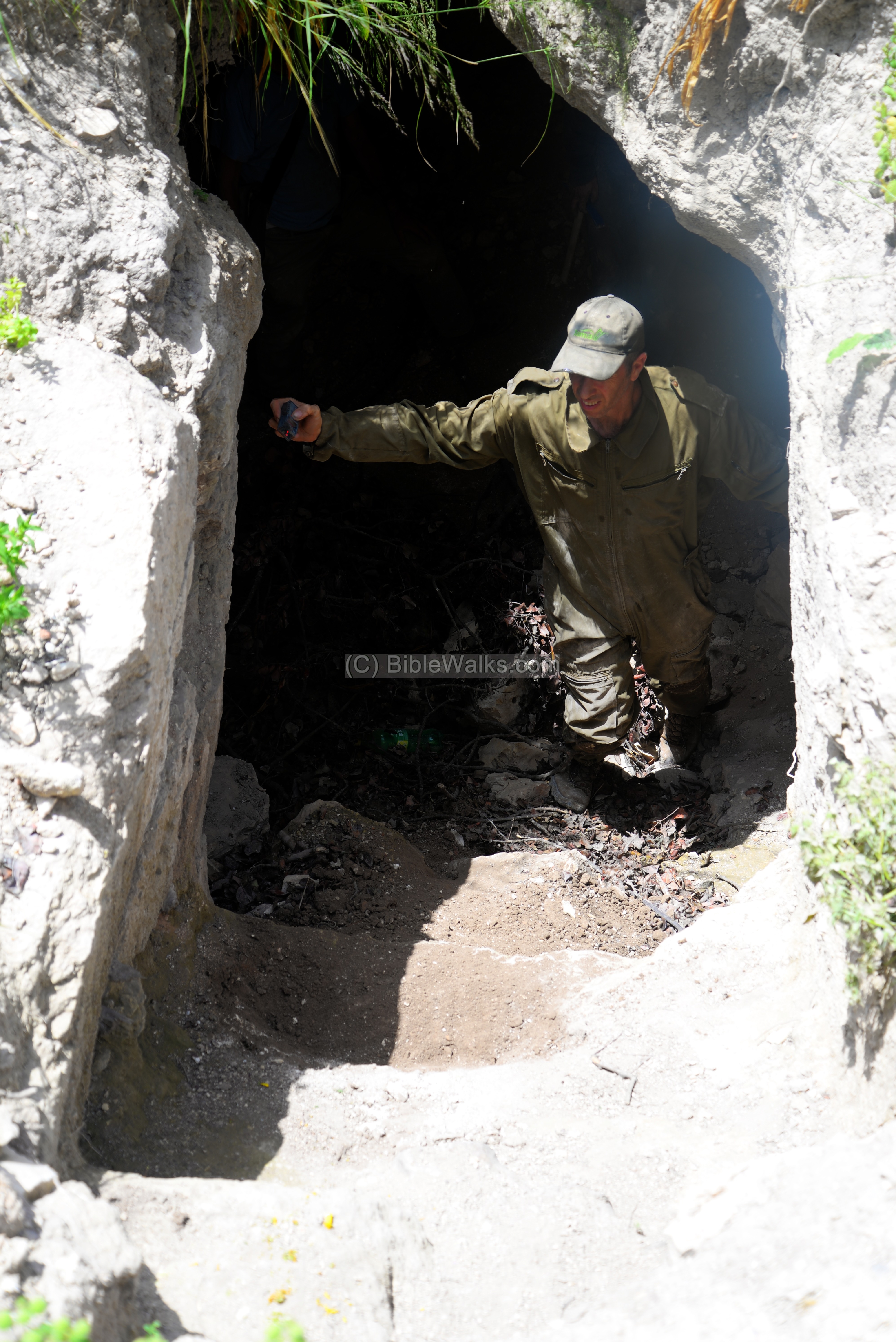
On its floor were remains of soil pulled out from a freshly dug tunnel. Illicit digging is everywhere. A member of the survey team crawled inside in order to explore the tunnel.
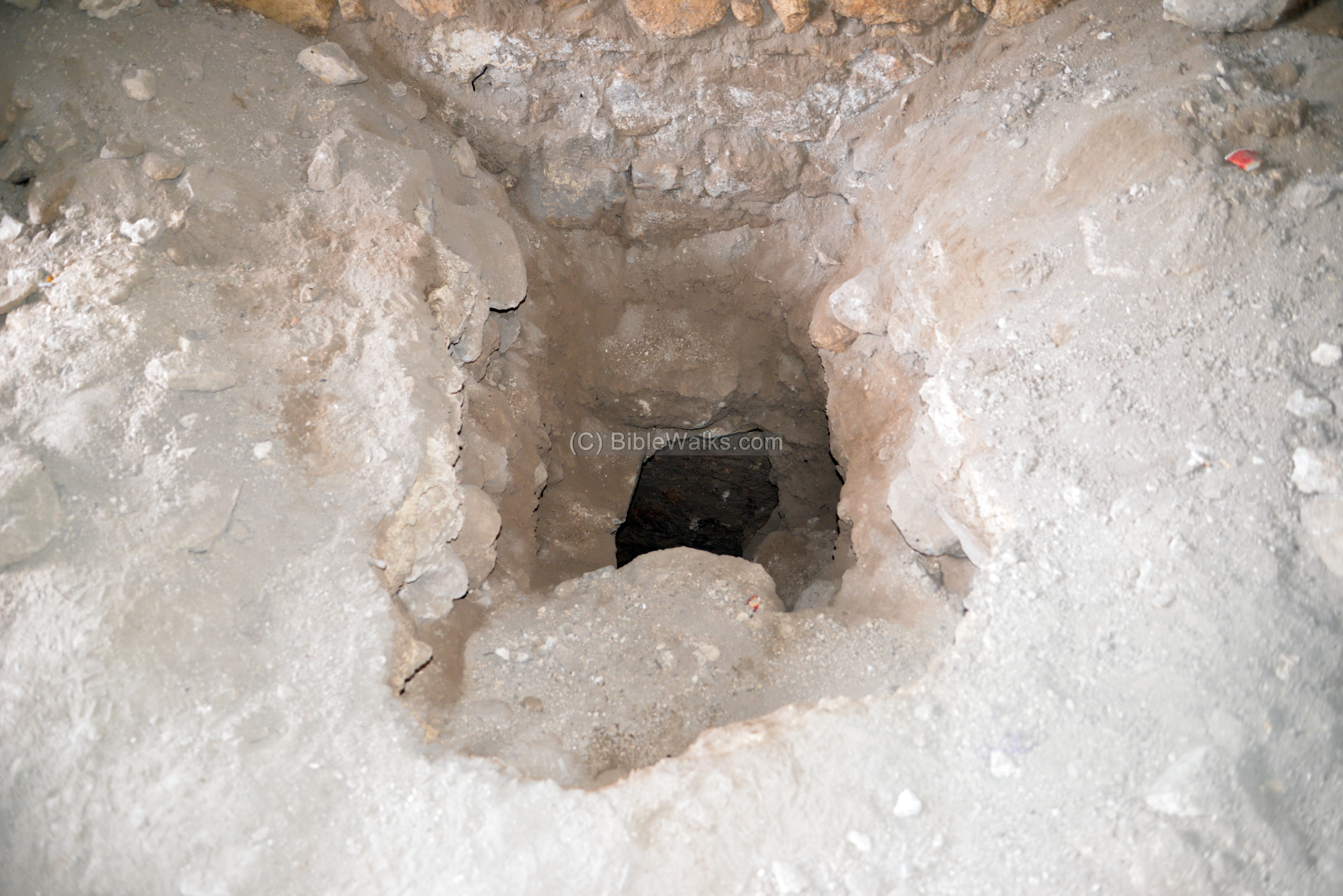
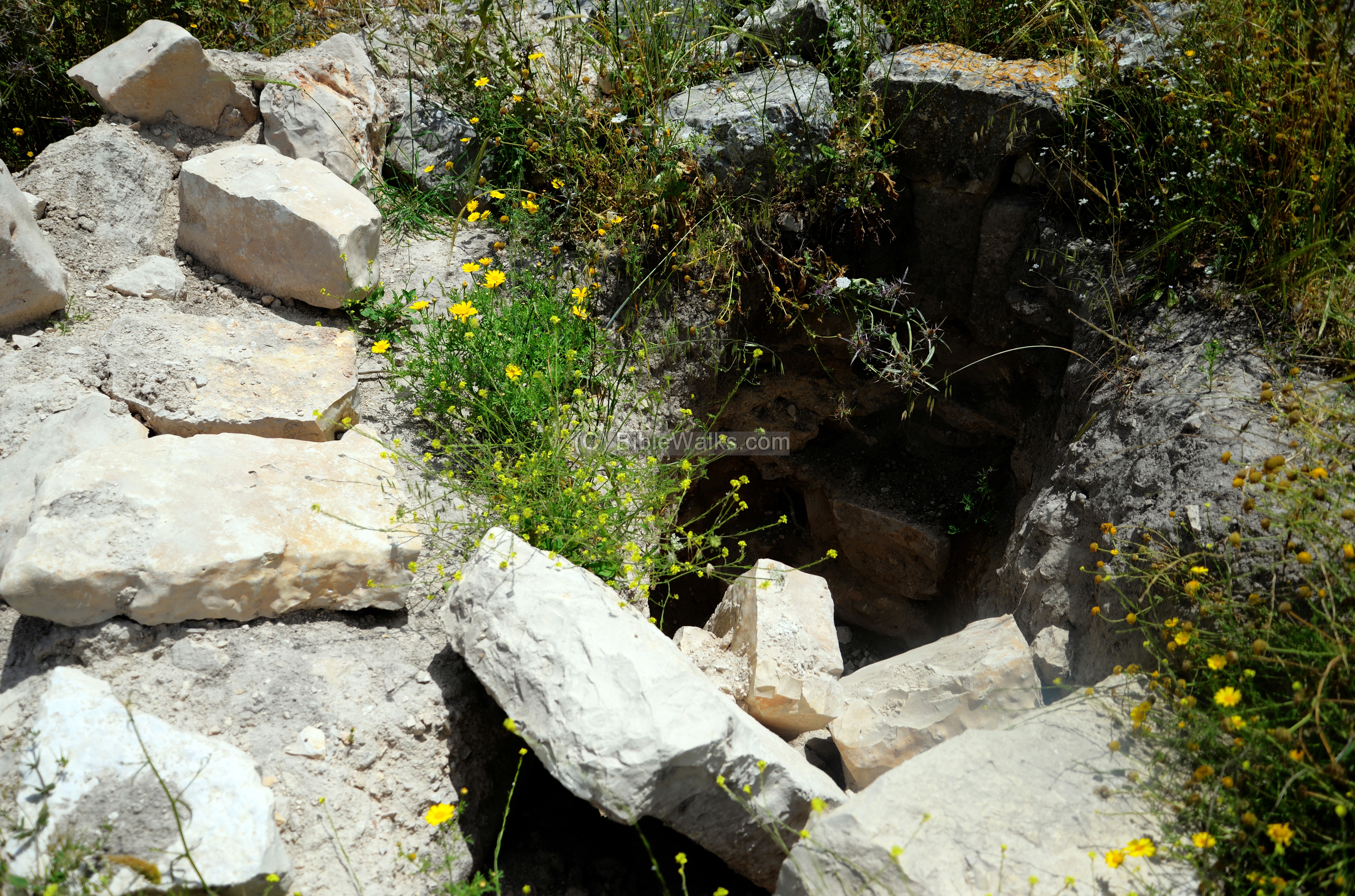
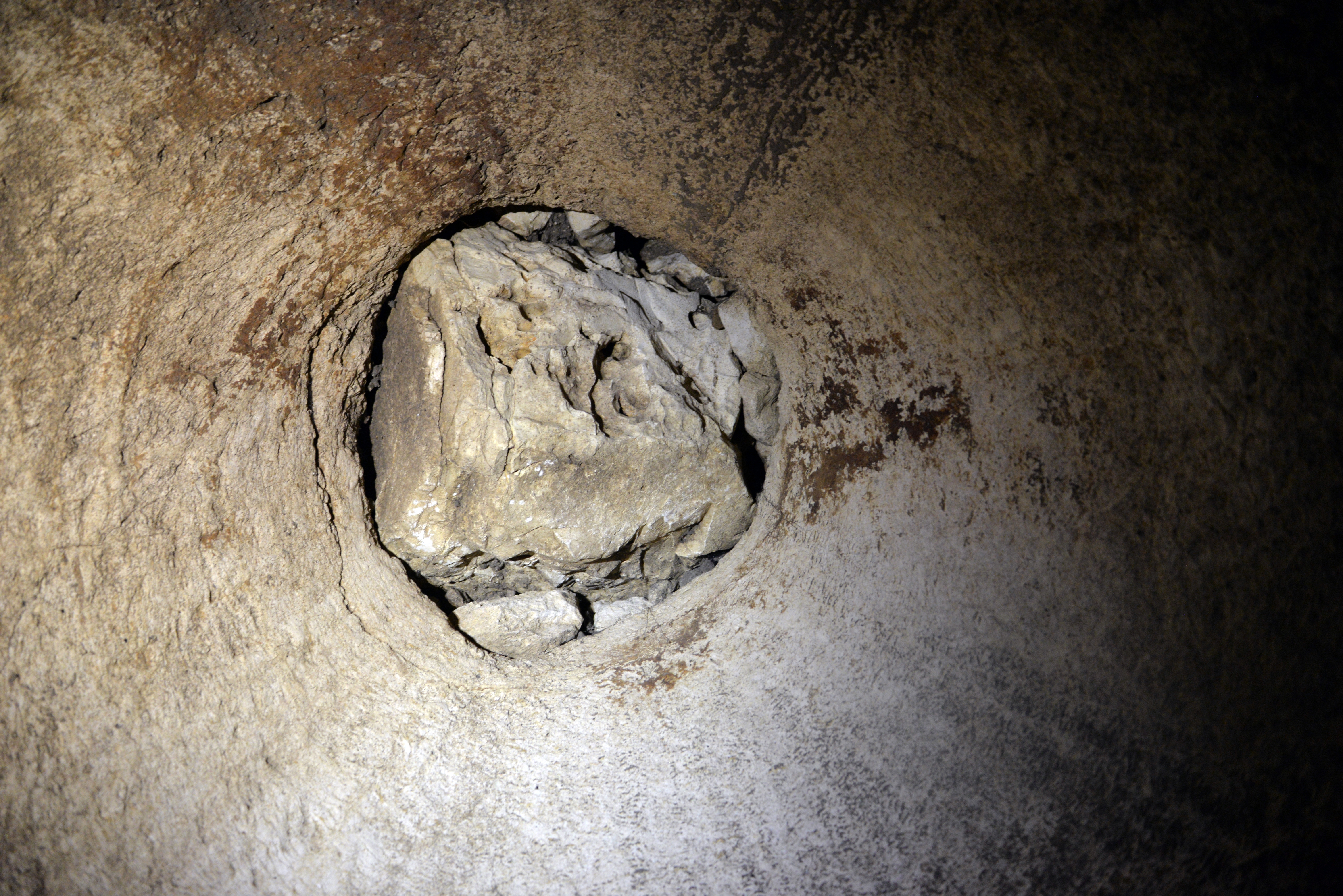
(d) Western Cistern
There are 20 known cisterns on Ferasin. The were built to supply water on top of the hill, supplied by runoff rain water that filled the cisterns during the wet season.
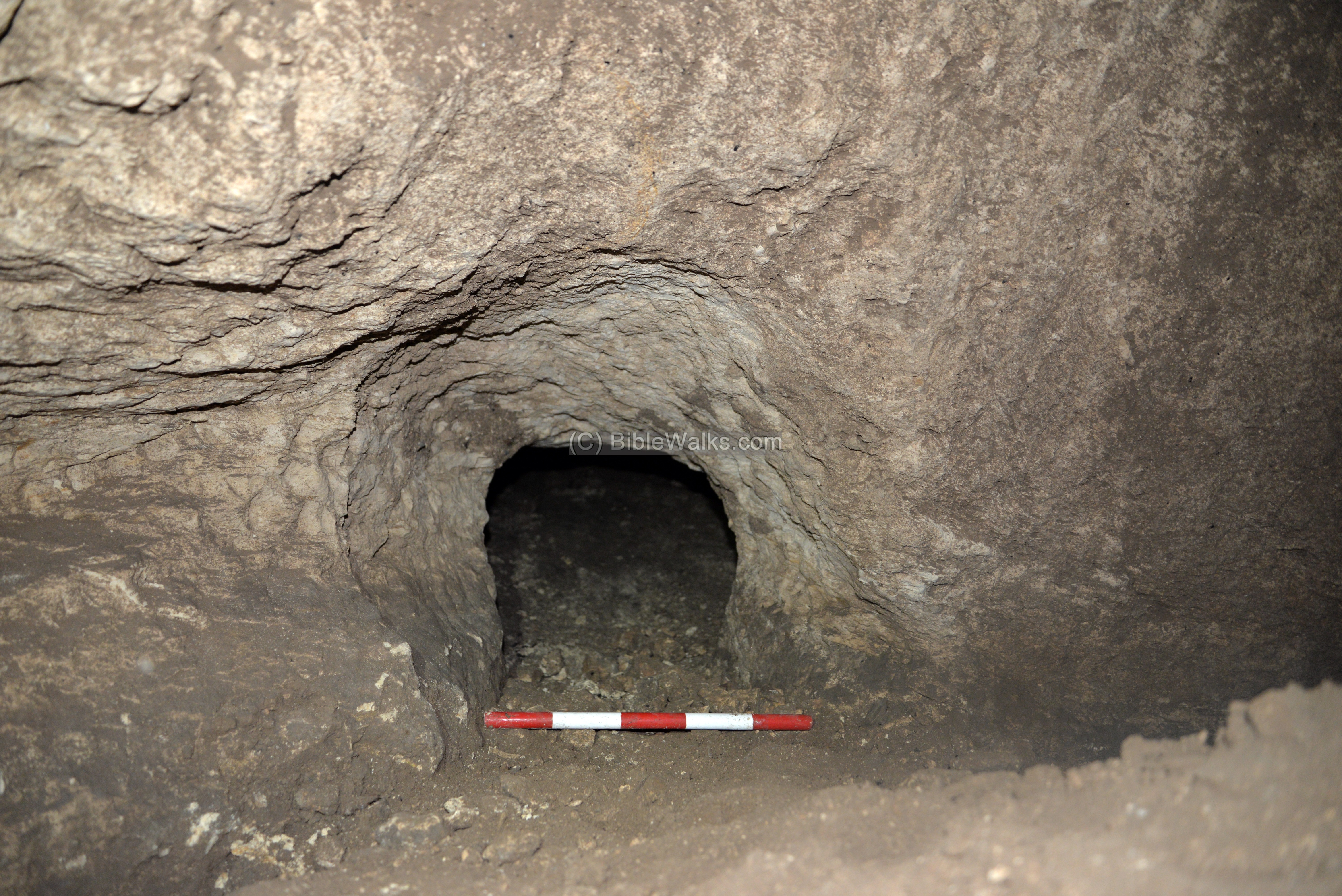
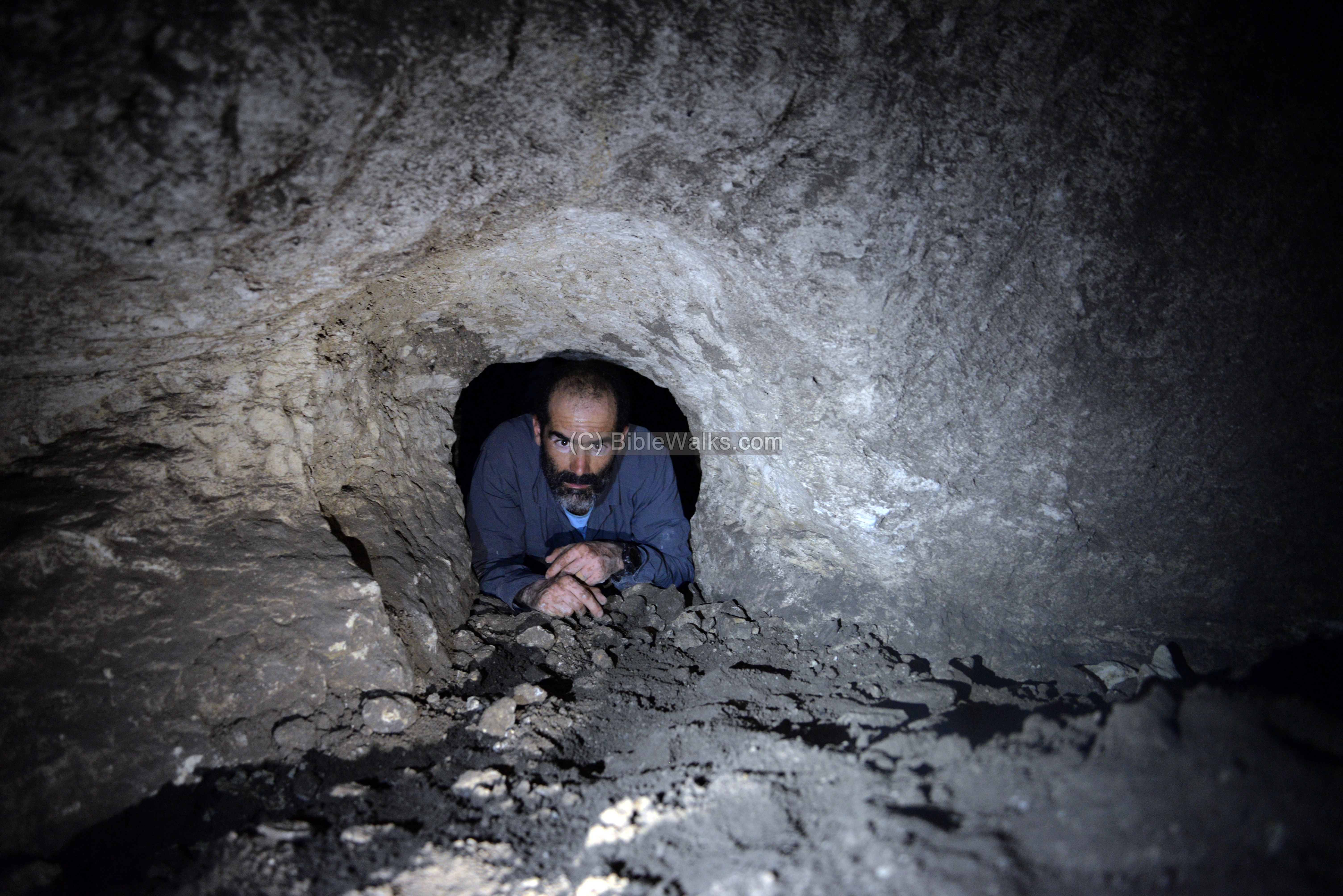
In this visit we explored 2 cisterns, in order to document the hiding tunnels cut into the cistern in order to provide protection during tight times.
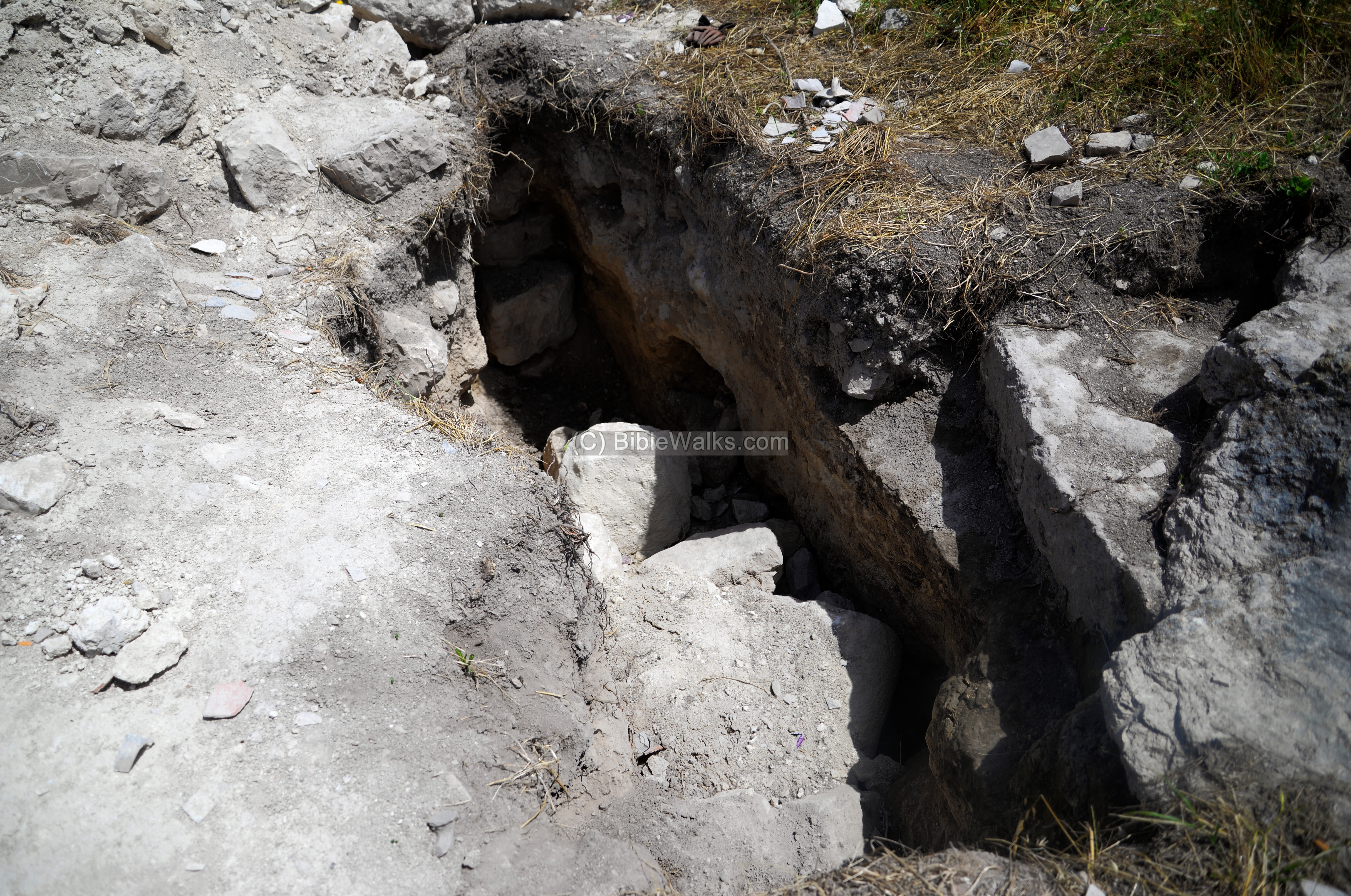
The western cistern that was documented is just a few meters east of the western Ottoman structure. Its entrance is seen in the lower left corner of the photo.

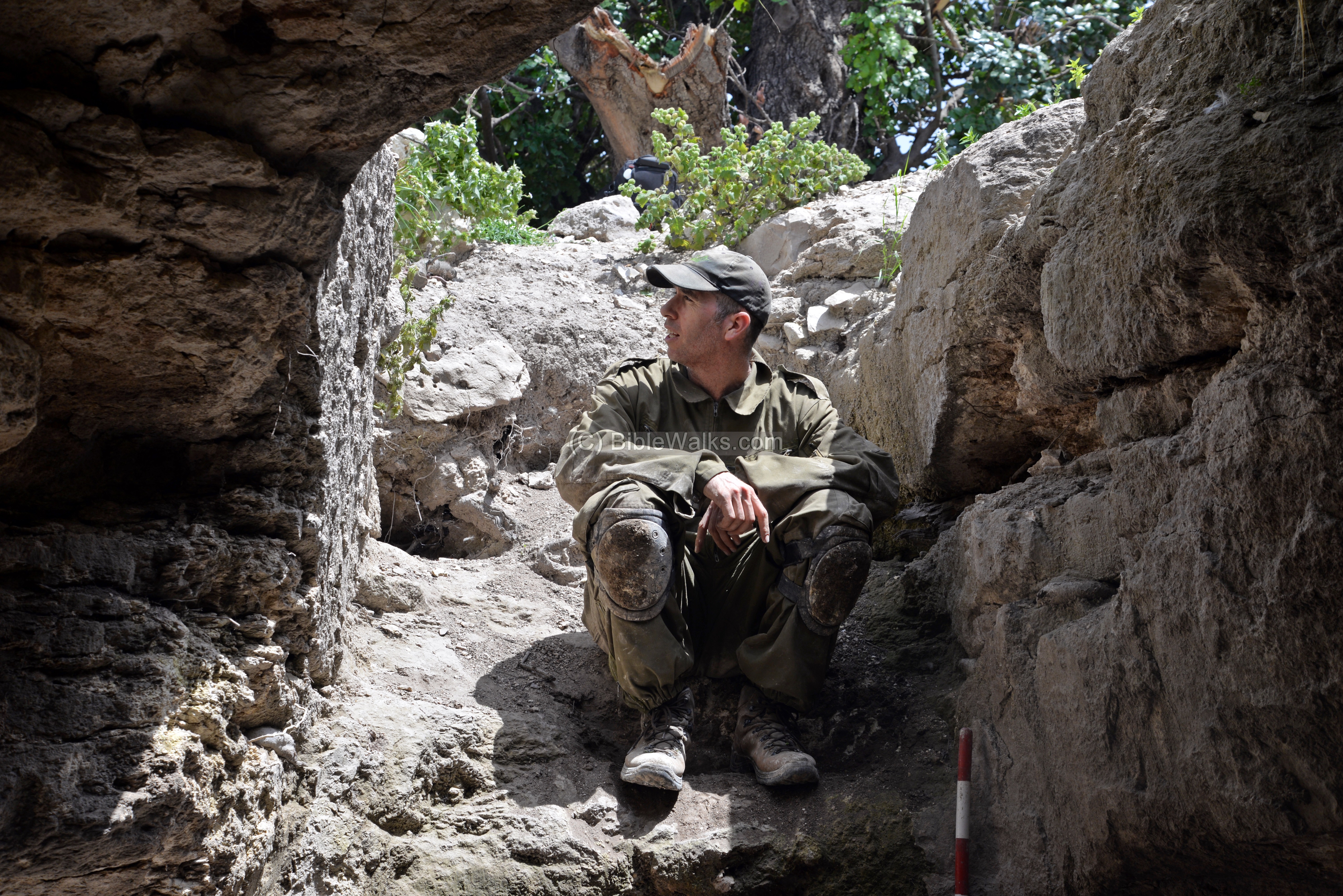
In the photo below is the entrance to the cistern, with Dr. Dvir Raviv measuring and marking the dimensions of the cistern and the hiding tunnel.
The entrance to the Roman period hiding tunnel was explored, as seen in the following photos.
(e) Eastern Miqveh
On the east side of the hill, under the tree, is an entrance to an underground complex, which includes a ritual bath – miqveh.
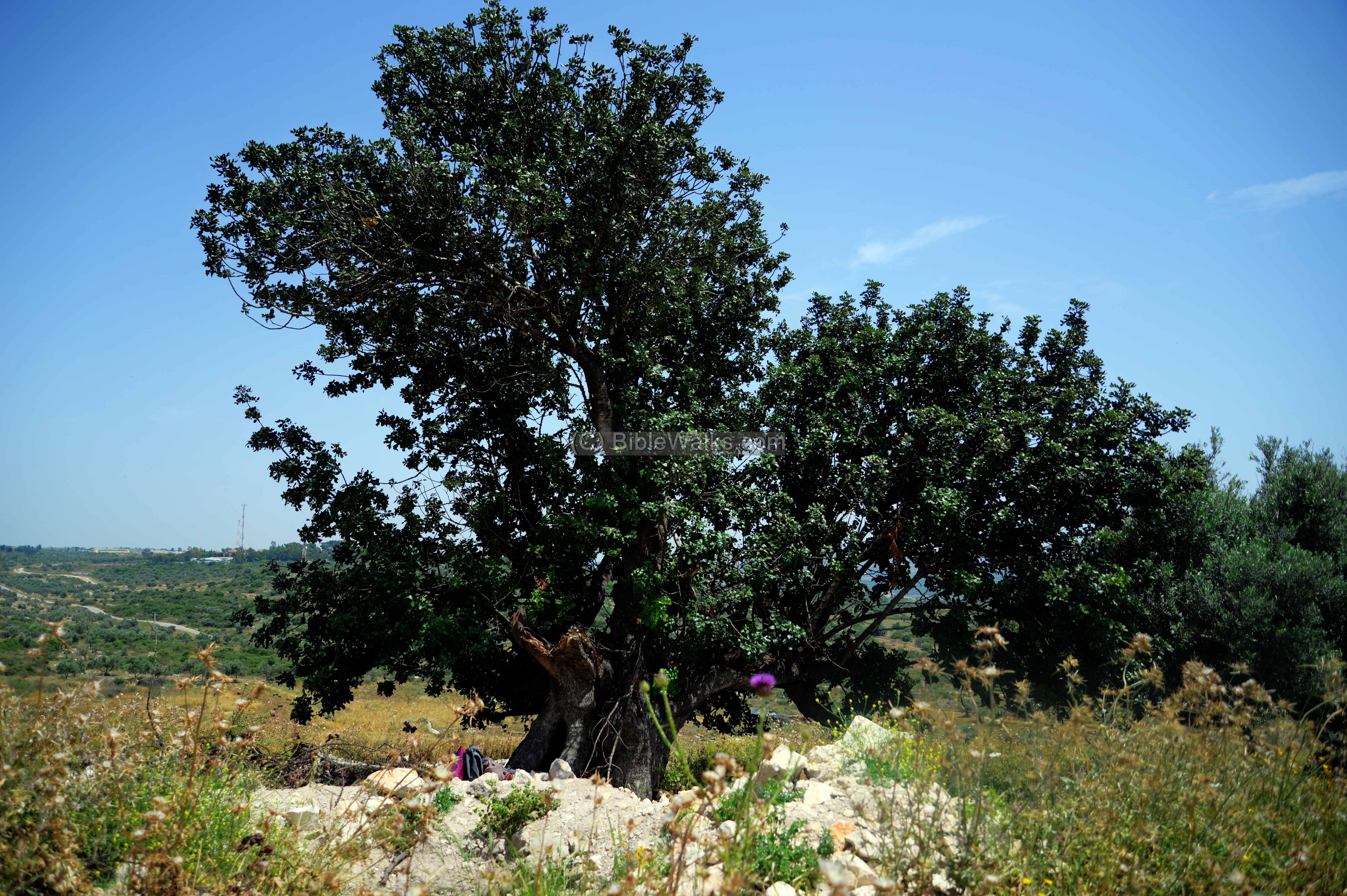
Dr. Raviv stands on the entrance steps.
An internal view of the stepped entrance:
(e) Illicit diggings
There are many illegal diggings on the hill. Remains of their excavations lie near the tunnels and trenches, as they did not find commercial value of the findings.

During our survey, a person came to the site asking what we were doing there. He claims that these activities are causing damages to his family land, and intends to protect it. The robbing of archaeological sites is happening across all lawless Samaria and Judea, accelerated during the Covid-19 corona virus lock down which confined people to their homes without the ability to work.
Etymology – behind the name:
* Names of the site:
- Peresh – possible Biblical name.
- Kefar Parshai – as per the Talmud Bavli
- Afarsin – Crusaders/Mameluke name
- Ferasin – the PEF survey dictionary defined it as a private name. Perhaps based on the Crusaders/Mameluke name.
Links:
* External links and references:
- “The Menasseh hill country survey” – volume 3 pp. 327-332 [Adam Zertal – Nivi Mirkam, 2000]
- “The new encyclopedia of archaeological excavations in the Holy Land” [1992 E. Stern editor, Volume 2 pp. 499-502]
- The roads and Highways of ancient Israel – Road B5 on Map 4 (Dothan-Jezreel-Shunem road)
- A Palestinian family invaded into the ruin (Jan 2021)
* Internal Links:
- Drone Aerial views – collection of Biblical sites from the air
- Tel Dothan – on the eastern edge of the valley
BibleWalks.com – tour the land
Kh. el Hamam <<<—previous site—<<<All Sites>>>— next site—>>> Tel Dothan
This page was last updated on Jan 24, 2021 (new link)
Sponsored Links: