An ancient site located on a steep round hill on the bend of the Hilazon (snail) brook, south of Karmiel.
Home > Sites > Hilazon > Khirbet Fachir (Fahir, Fukheikhira)
Contents:
Background
Location
History
Photos
* Aerial Views
* General views
* West side
* Ottoman
* Top of hill
* South east
* East side
* North east
* North
* Bike rides
* Nature photos
Links
Etymology
Background:
An ancient site located on a steep round hill above the bend of the Hilazon (snail) brook, south of the city of Karmiel. The majority of the remains are dated to the Iron age 1 (1200-1000 BC).
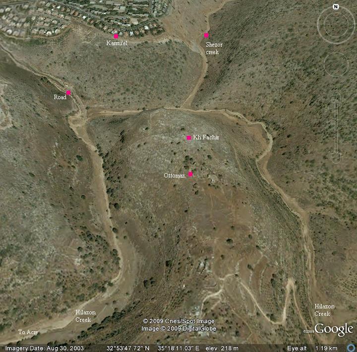
Location:
The site is located on the summit of a high hill (altitude 261M) in the center of a loop of the Hilazon brook, south of the city of Karmi’el. The valley around the steep hill is at an altitude of about 150M, more than 100M lower than the top of the hill. On the southern foothills are structures dated to the Ottoman period, and a Bedouin farm.
History:
Bronze/Iron age:
On top of the hill are traces of ruins spread over an area of (roughly) 80M x 80M. There is a trace of a wall around the circumference.
Inside the enclosed area are bases of houses. Fragments of crude pottery are located everywhere. A well is located in the center of the hill which used to supply water.
The stones found in the site are made of medium size un-hewn (rough, natural) rocks. A small stone quarry is located on the north side.
This was probably an Iron age (Biblical) period site. Another site from that period – Khirbet Yanin – is located several KM down the brook and is identified by scholars as the Biblical city of Ne’iel, which was mentioned in the region of the tribe of Asher (Joshua).
Ottoman period:
On the southern foothills are a number of structures, including an Ottoman period arched house.
The area was examined in the Palestine Exploration Foundation (PEF) survey (1866-1877) by Wilson, Conder and Kitchener. A section of their map is shown here. They did not mark any antiquities on the hill, at the spot where we marked with a red rectangle. However, other ruins are marked in the area of Karmi’el, such as Kh. Tiret el Kezaz (Kh. Zagag) and Khirbet el Kabu (Kh. Kav).
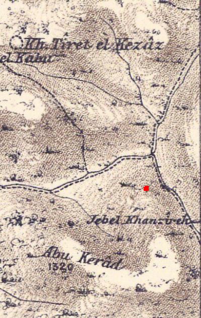
Part of map sheet 5 of Survey of Western Palestine,
by Conder and Kitchener, 1872-1877.
(Published 1880, reprinted by LifeintheHolyLand.com)
Ancient roads:
The Hilazon (Chilazon- “snail”) brook was an ancient trade route from Acre to the east, and the site protected this route and provided services. This is marked as a dashed line looping around the hill, although the topographic details were not drafted accurately in this section.
An additional route was along Shezor brook – the dashed line going up north. It was one of the ancient trade routes from the plains of Acre, along Hilazon brook, into Beit-Kerem valley and eastwards. Alternative routes were more difficult due to the high mountains that surround Beit-Kerem.
Modern times:
Around the Ottoman period structure is a Bedouin farm, which raises goats and cows. Further south are additional houses occupied by Bedouins.
A settlement named Eshchar was established in 1986 on the hill south-west to the site (1.5km). It is accessed from the road to Yuvalim.
Photos:
We visited the site on 3 occasions: April 2009, October 2018 and August 2023. The photos are of the mixed periods.
(a) Aerial Views
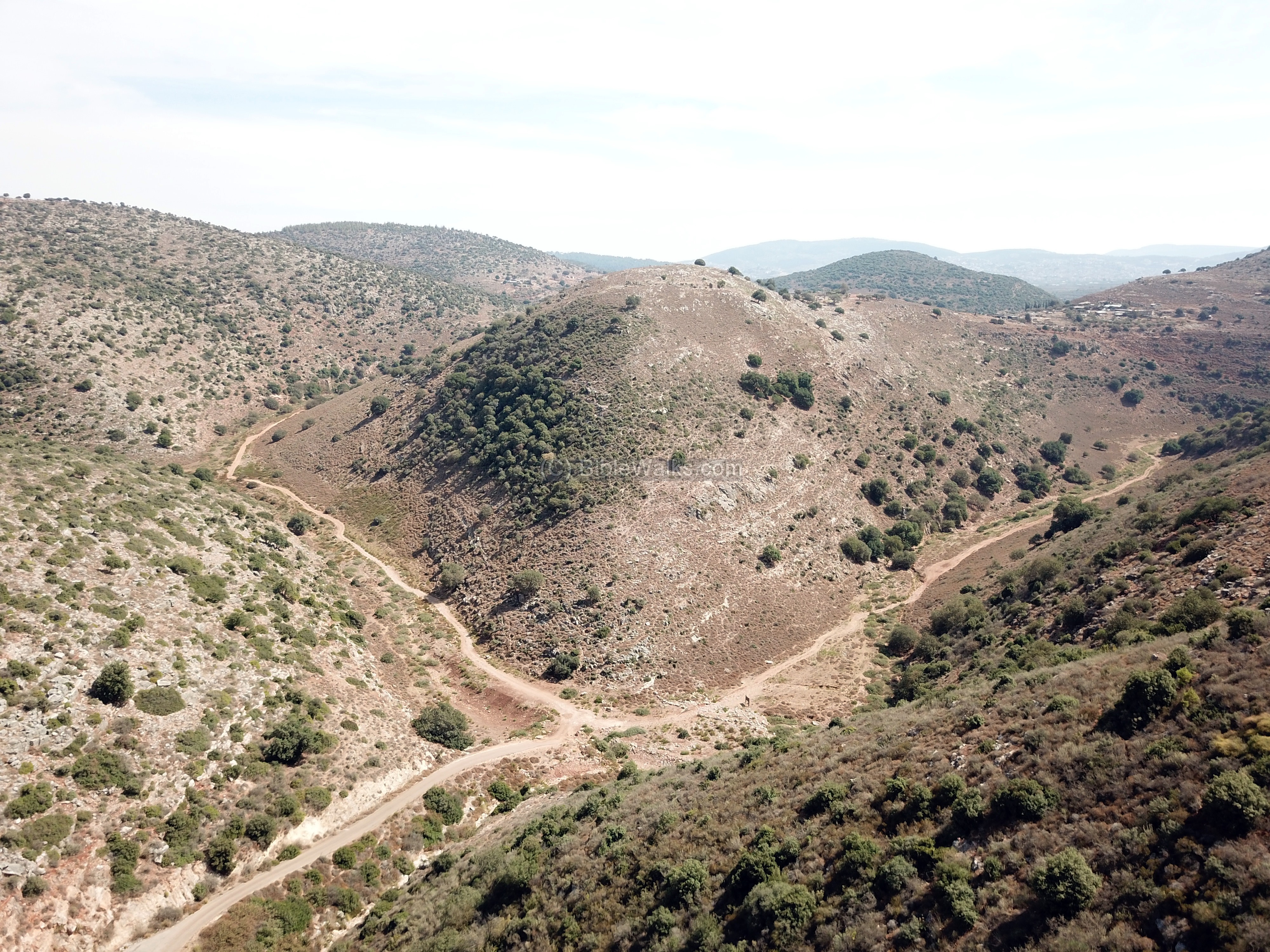
A drone captured this view from the north west side (on October 2018). The Hilazon brook loops around the hill from left to right, and is joined by two other valleys.
Click on the photos to view in higher resolution…
![]() The following YouTube video shows a flight of a drone around the site. The drone starts from the north west side above the road from Karmiel, and turns around the north side of the hill. It was captured in October 2018.
The following YouTube video shows a flight of a drone around the site. The drone starts from the north west side above the road from Karmiel, and turns around the north side of the hill. It was captured in October 2018.
Another drone video was captured on August 2023, viewing the area around the summit.
(b) General views
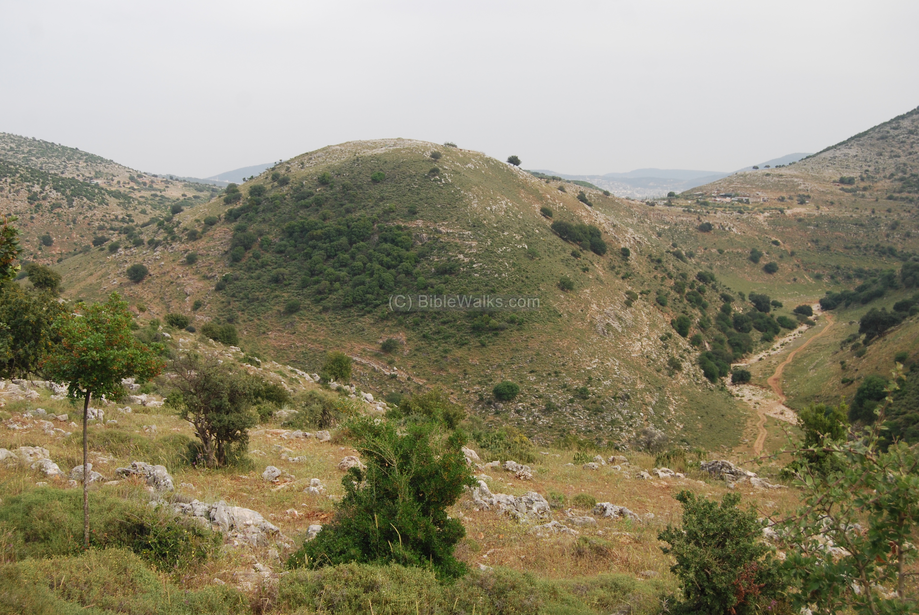
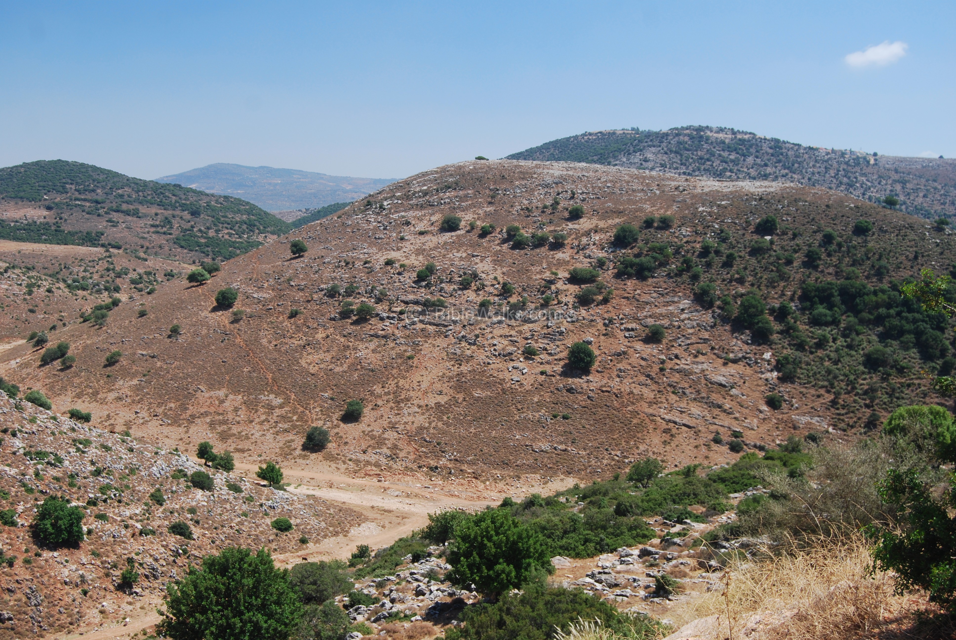
The site is located on top of the hill seen in the photo below, which is seen from the southern neighborhood of Karmi’el. The Hilazon brook bends around the hill, and flows from left (east) to right (west) towards the plains of Acre.
(c) West side
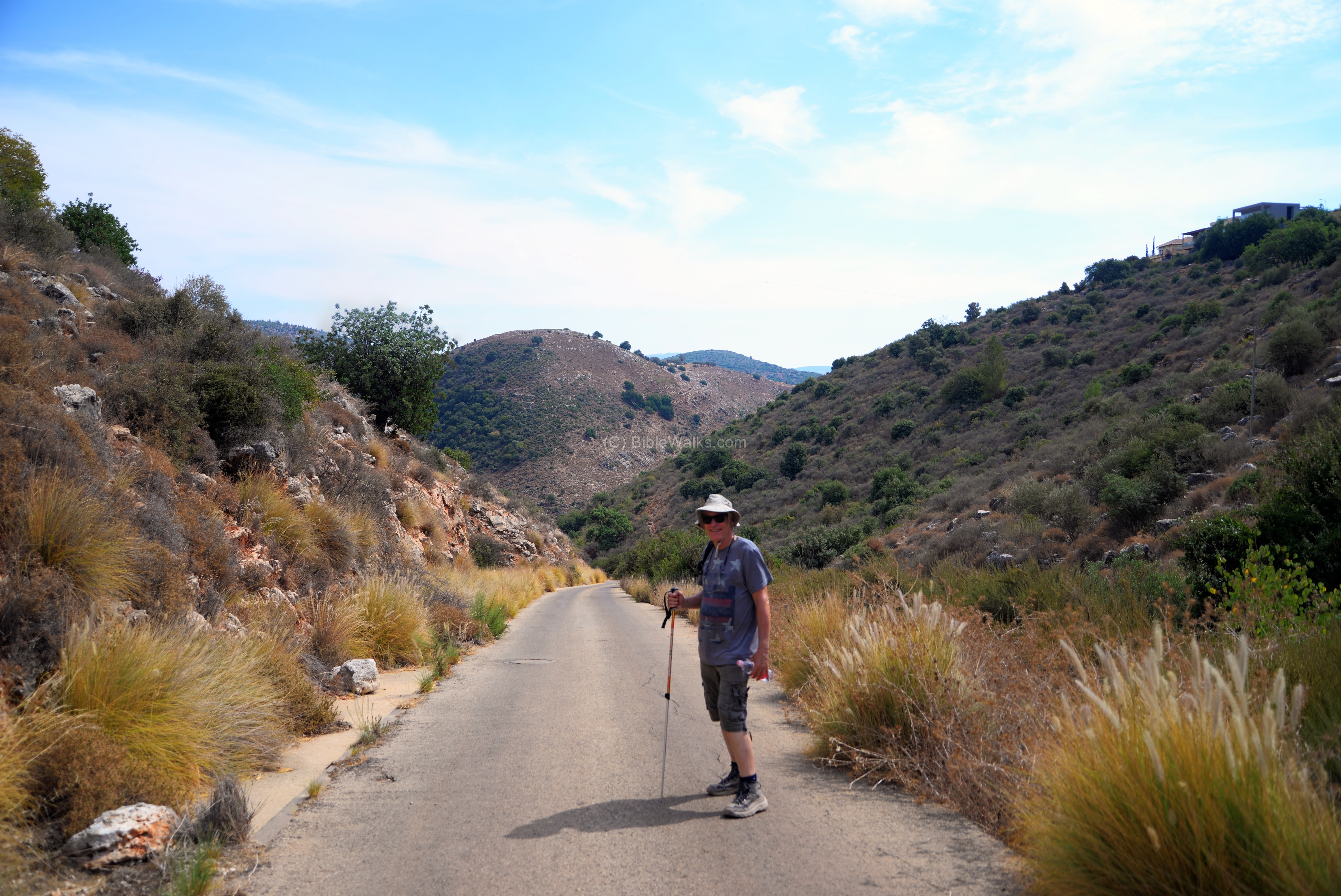
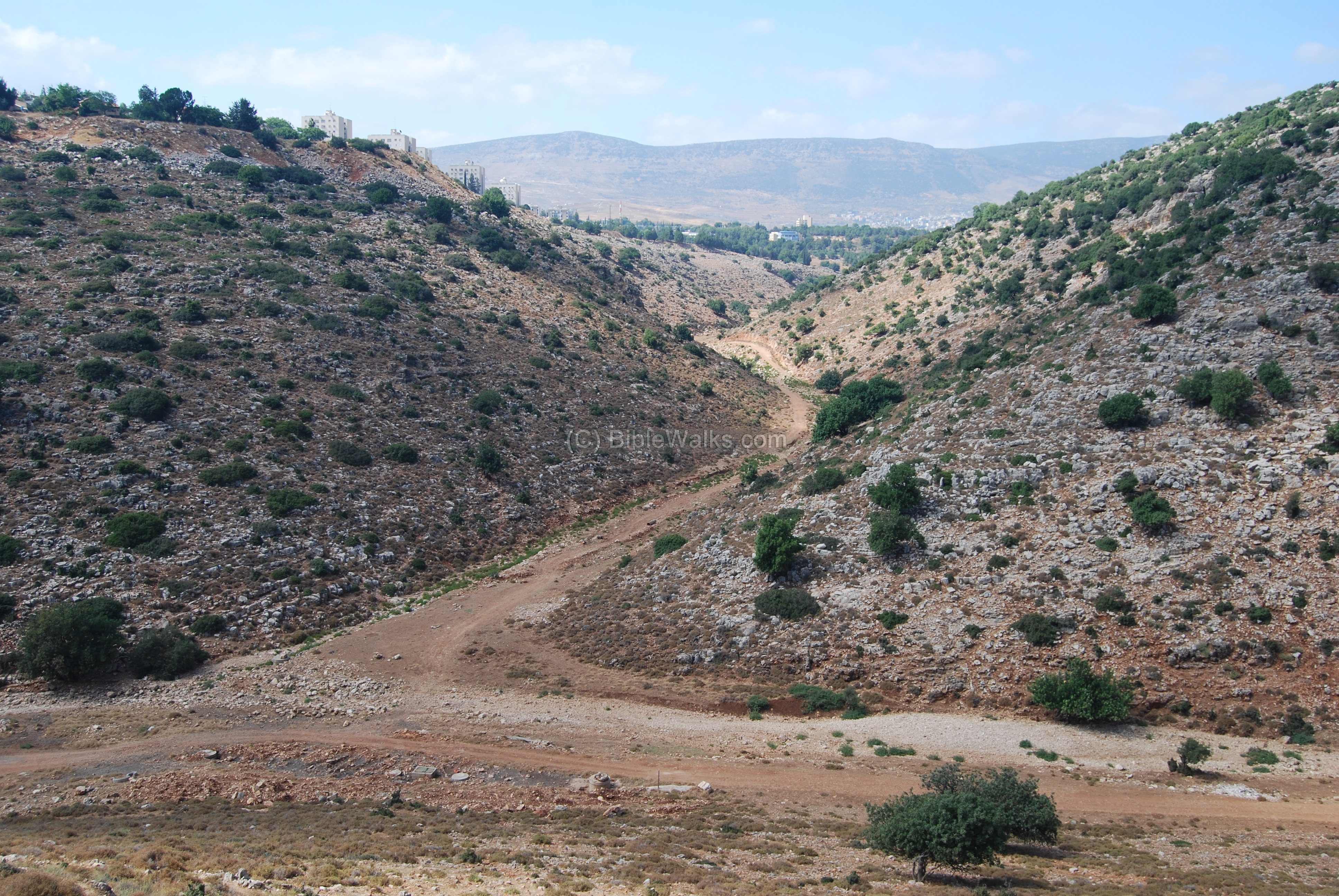
The west side of the hill is seen below, with the Hilazon brook flowing to the sea towards the right side. A section of a paved road is seen on the right side, ending in the bottom of the brook. It enables an easy ride down the steep hill from Karmi’el (at Hohit street) to the bottom of the brook.

The paved road is currently (2018) blocked, and only municipality vehicles are allowed to take this road. Walking down the road is the only option except for biking. In August 2023 the gate was found open.
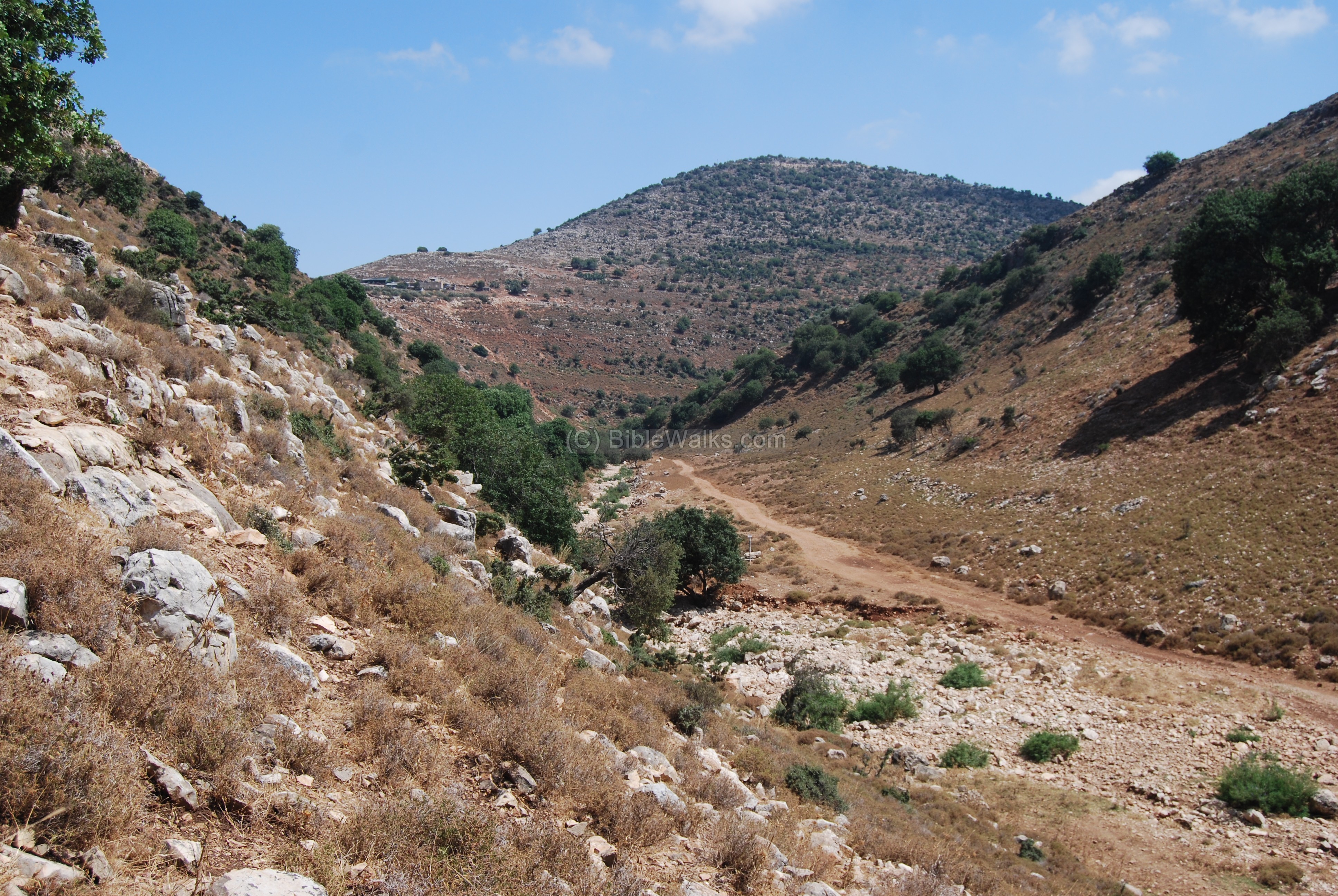
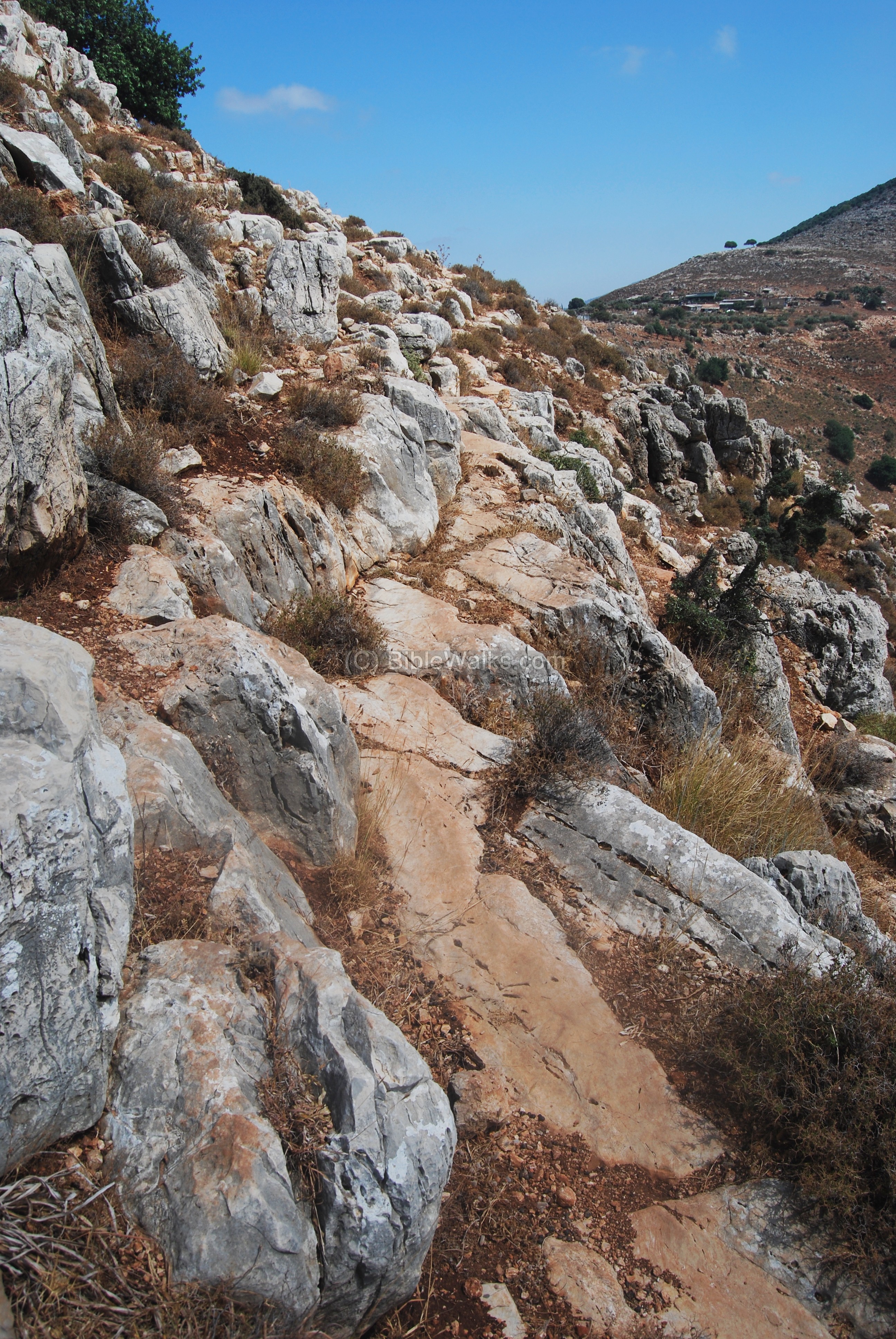
After reaching the bottom of the deep valley, you can then climb up the foothills seen on the left side of the photo below (looking towards the south). We have used this side to climb up, but due to its steep climb (100M of altitude difference) we reached breathless to the south side. Therefore, our advice is to use an access either from the north-east side or from the south-west side farther down the brook.
The photo below shows a view of the western side. In the background are the Bedouin buildings, south of the site.
After walking on the west side, you reach a flat area on the south side. The trees seem to be bent to the left even without wind. This is due to the fierce winds that blast here almost constantly. The Hilazon brook acts like a funnel, causing strong winds to flow from the sea and reshape the trees.

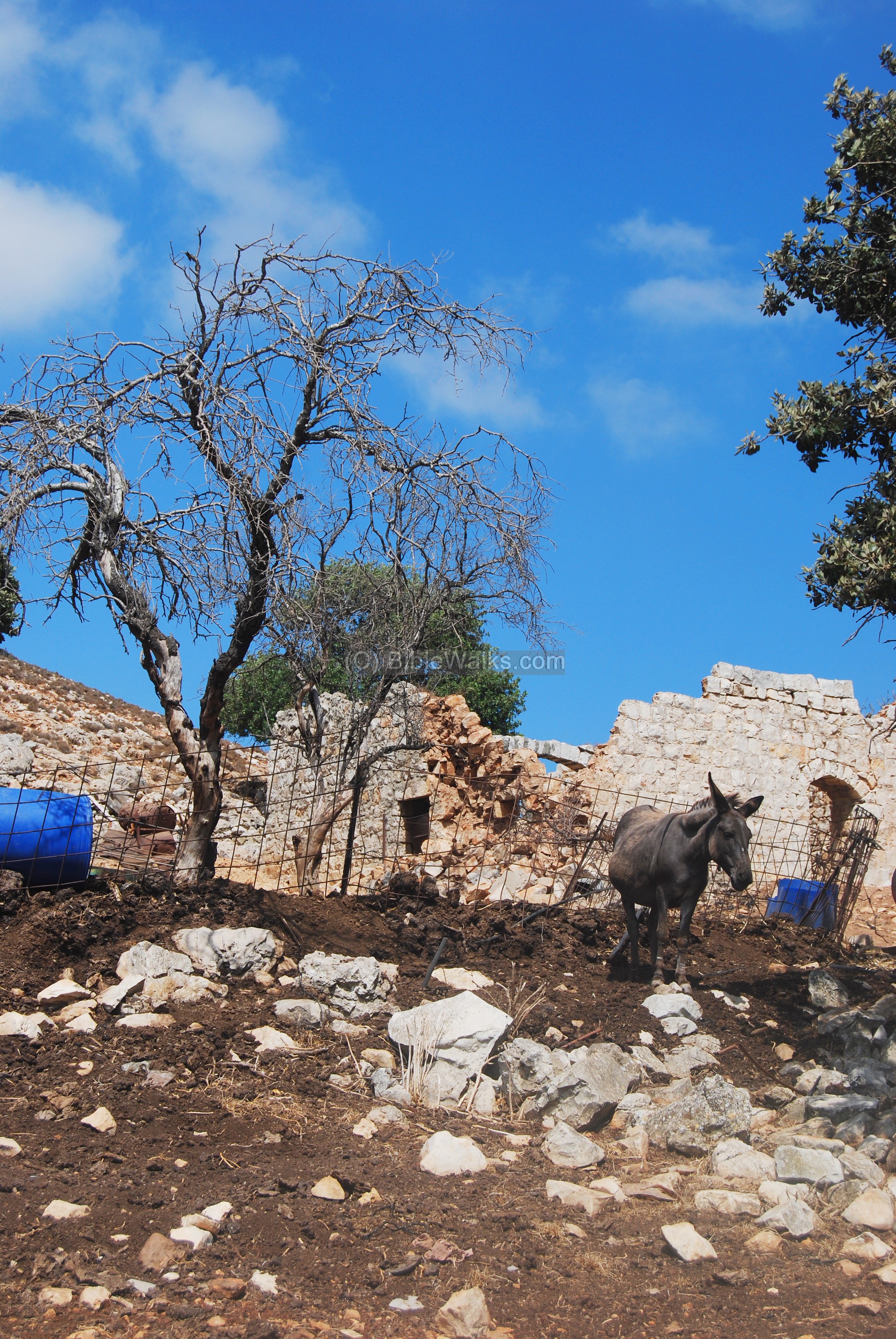
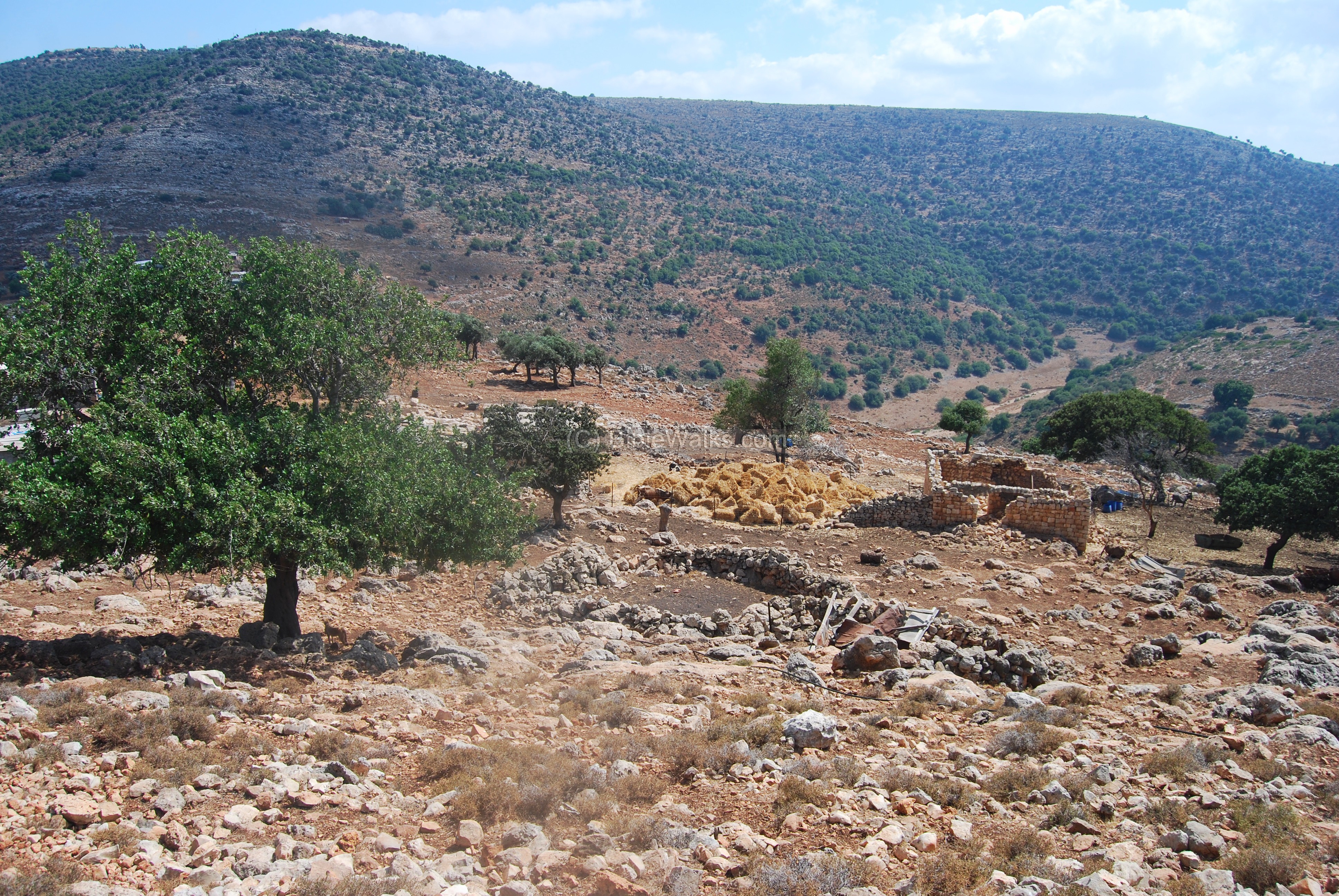
(d) Ottoman period structures – south side
A general view of the south side of the hill is seen in the photo below. The closer structures include the ruins of an Ottoman period house, seen on the right side. The other farm houses are modern, and the Bedouins raise goats and cows.

The Ottoman period structure, seen below, is used as part of the farm.
A closer view of the ancient structure is seen below. In the center of the house is an arch, which was used to support a roof. This is a common Ottoman architectural design in the Galilee, where arches were used to support the roof on top of wooden beams or plates of stones.

Another view of the farm is seen below. The dogs are tied up to the trees to protect the livestock and bark against strangers (like us). A small stone sheepfold is seen on the right side of the ancient structure.
On the far-right background are the houses of the southern neighborhood of Karmi’el.

The photo below shows another view of the Ottoman structure, as seen from the road that climbs up to the top of the hill. On the far left side, on top of the hill, is the new settlement of Eschar (established in 1986).
(e) Top of hill
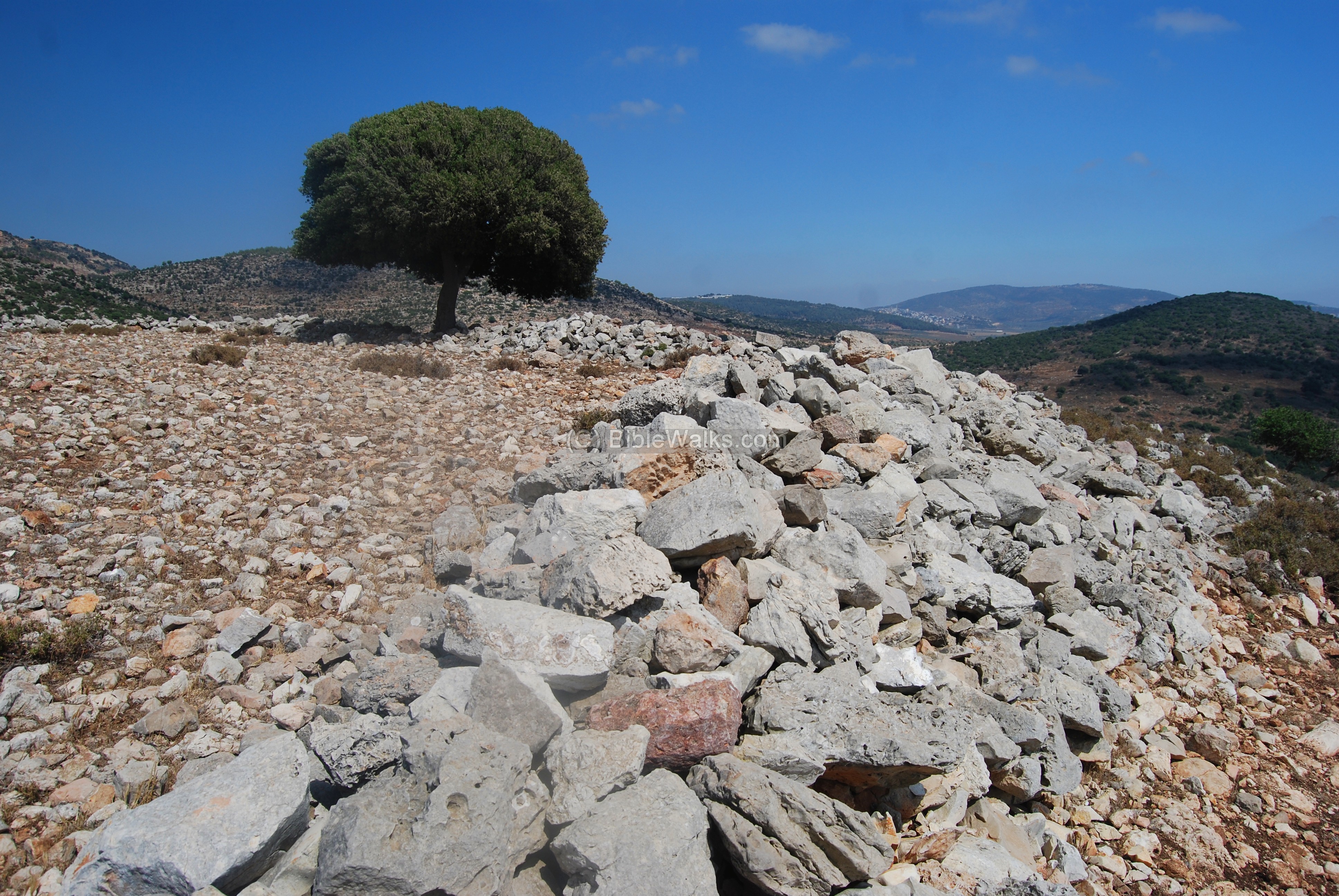
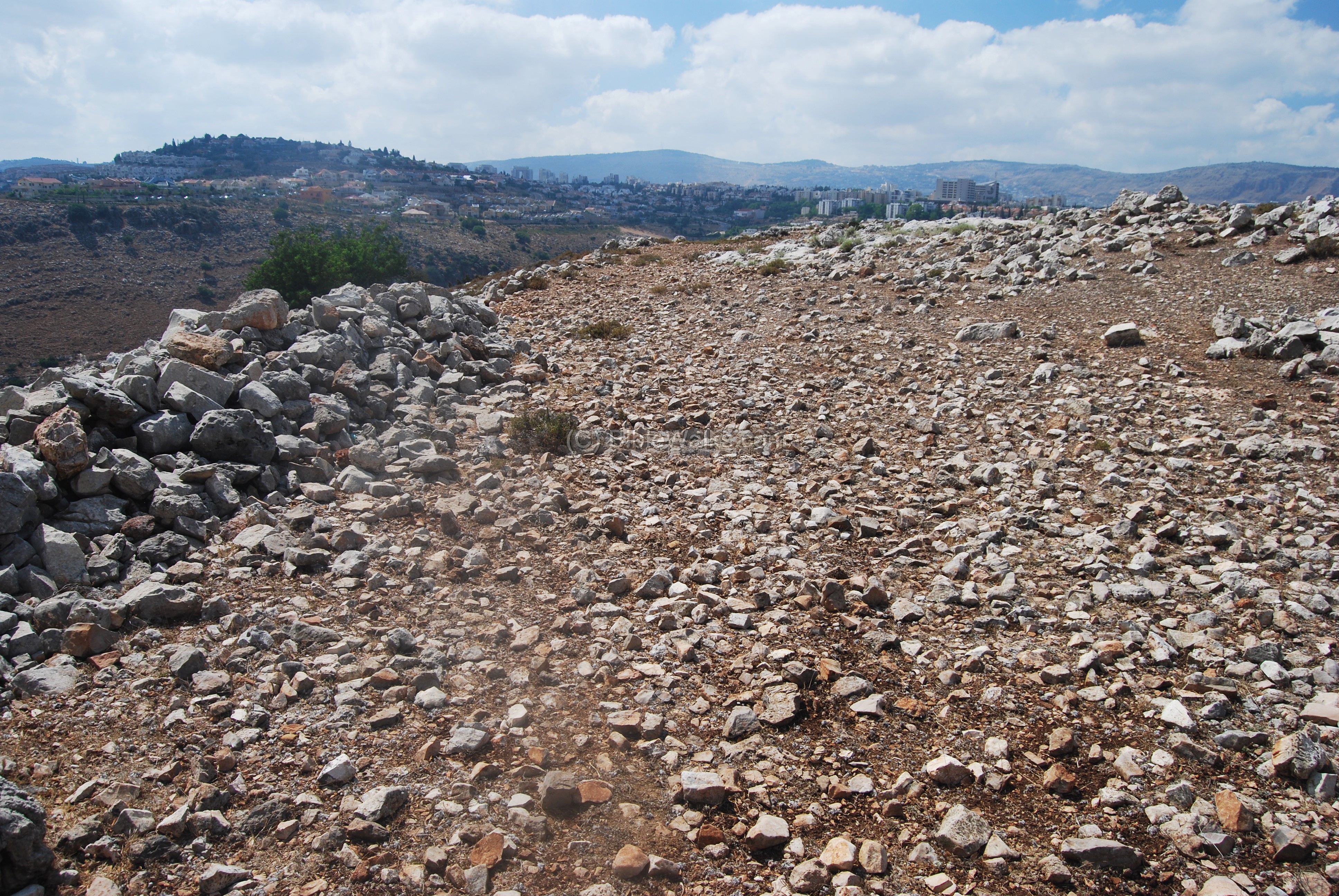
Walking up the south side of the hill we reach to the top (alt. 261M). The wall around the top of the hill is clearly seen.
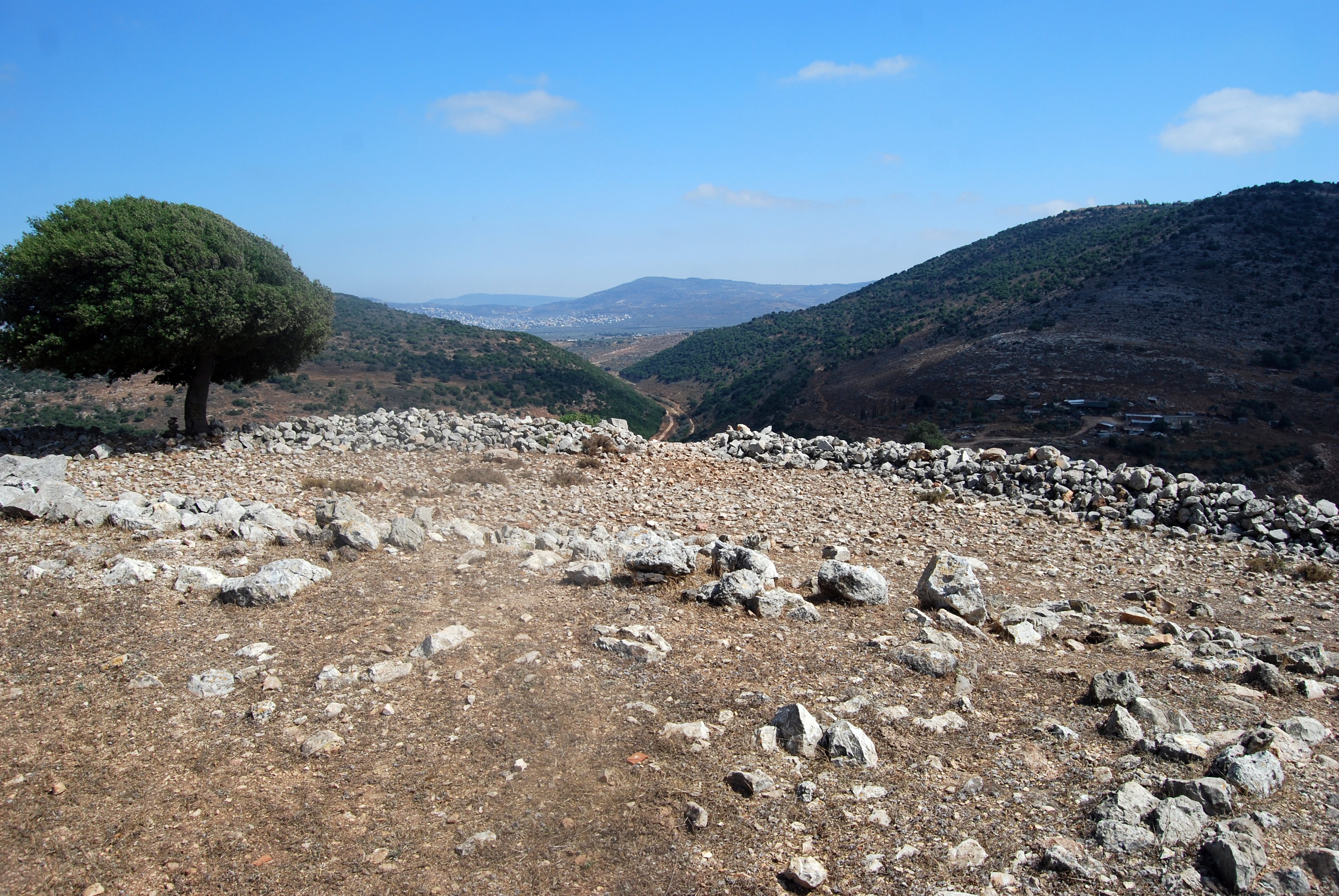
A view towards the south is next. Notice the Hilazon brook continues east after looping round the hill. In the far background are the towns of Arraba and Deir Hanna.
Another view of the area, looking towards the north. The wide walls are seen here on the left side. The city of Karmi’el is seen in the far background.
The wide peripheral walls cover an area of roughly 80m x 80m. Inside this enclosed area are traces of ruins of ancient structures, located within a raised area measuring roughly 30m x 40m. It is seen in this photo:
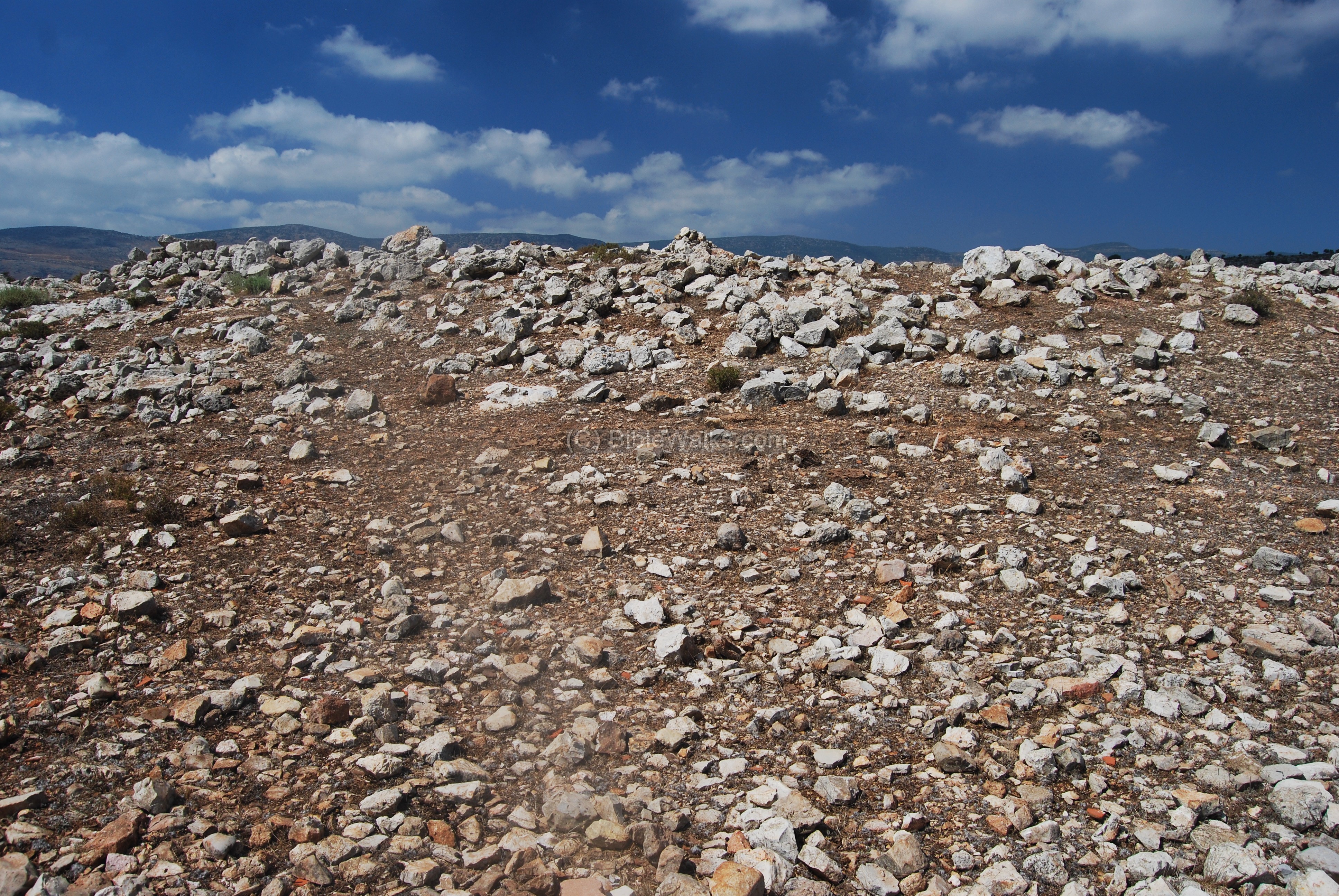
The area is littered by fragments of crude ancient ceramics, identified to the Iron age I.

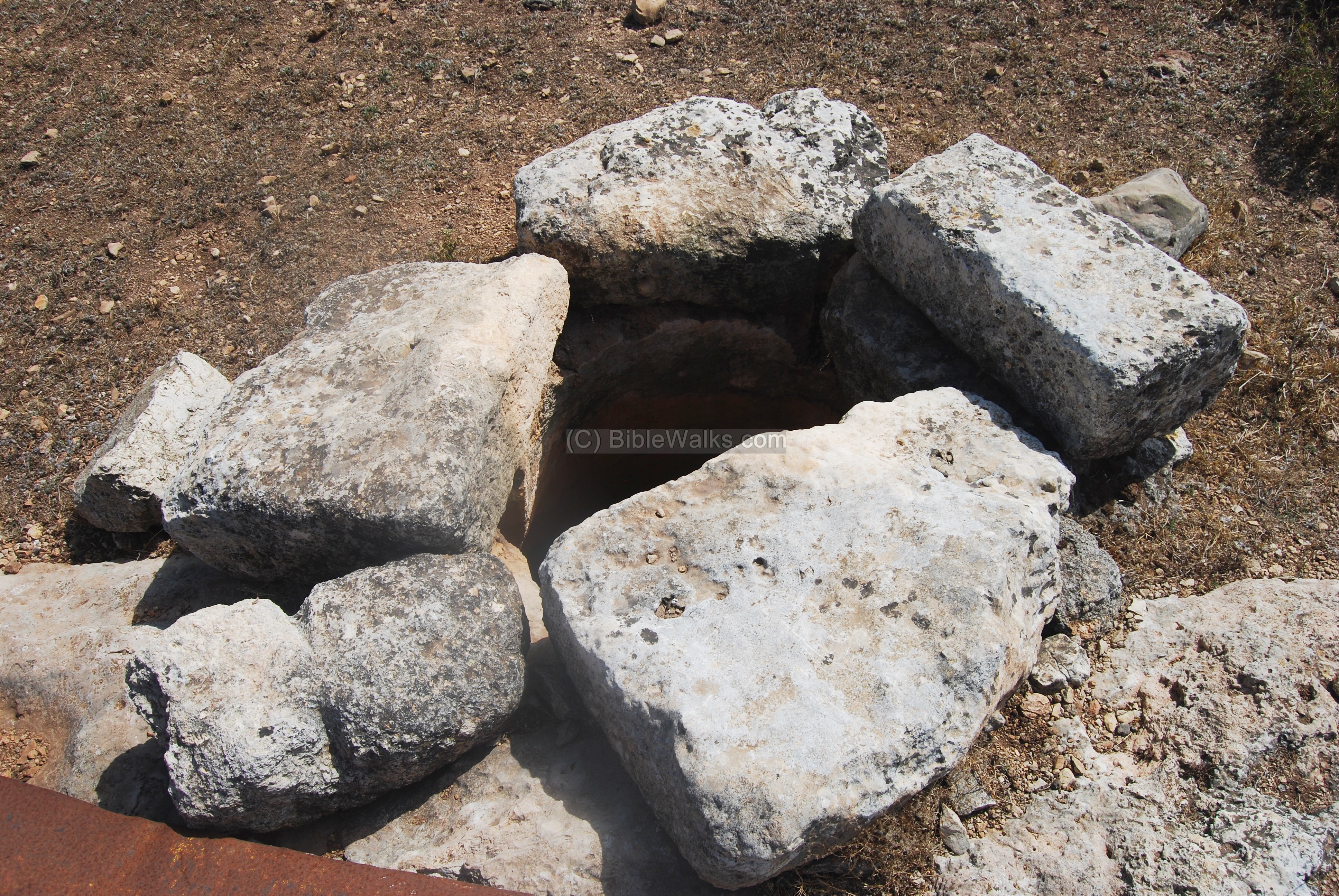
A well is also located between the ruins. It is normally covered by the iron sheet. You can notice that the stone on the bottom left has scars, which were carved by the ropes that were used to pull up the buckets while fetching the water.
There are also some stone heaps, such as the one seen below in the center of the walled area.
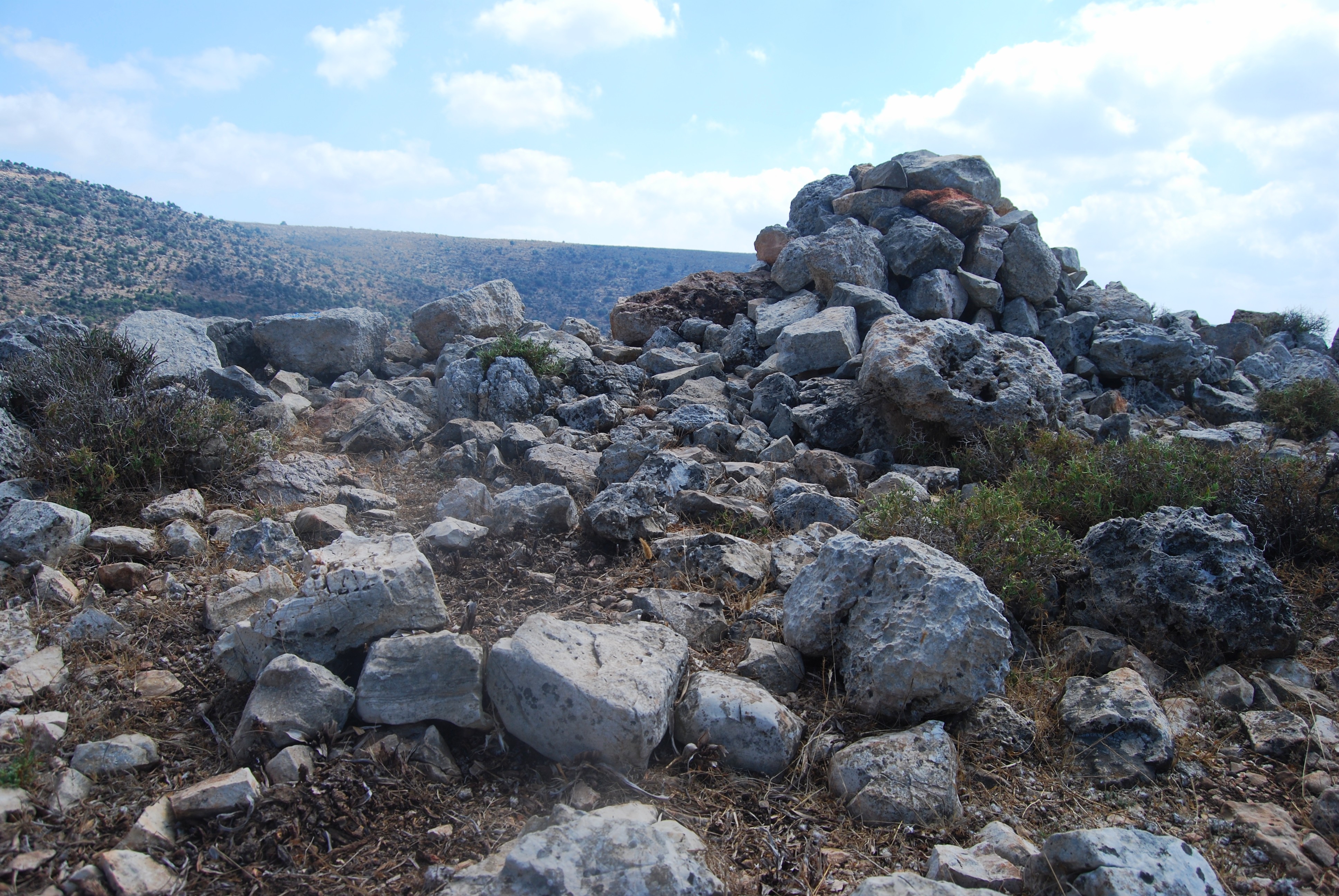
The stone heap in the center was found dismantled by an illicit digging after a revisit in 2023, probably looking for ancient burial artifacts. It unearthed several hewn slabs at the bottom. Iron Age pottery was found at the side of the dig.

A drone view of the summit provides a better view of the area in the center.
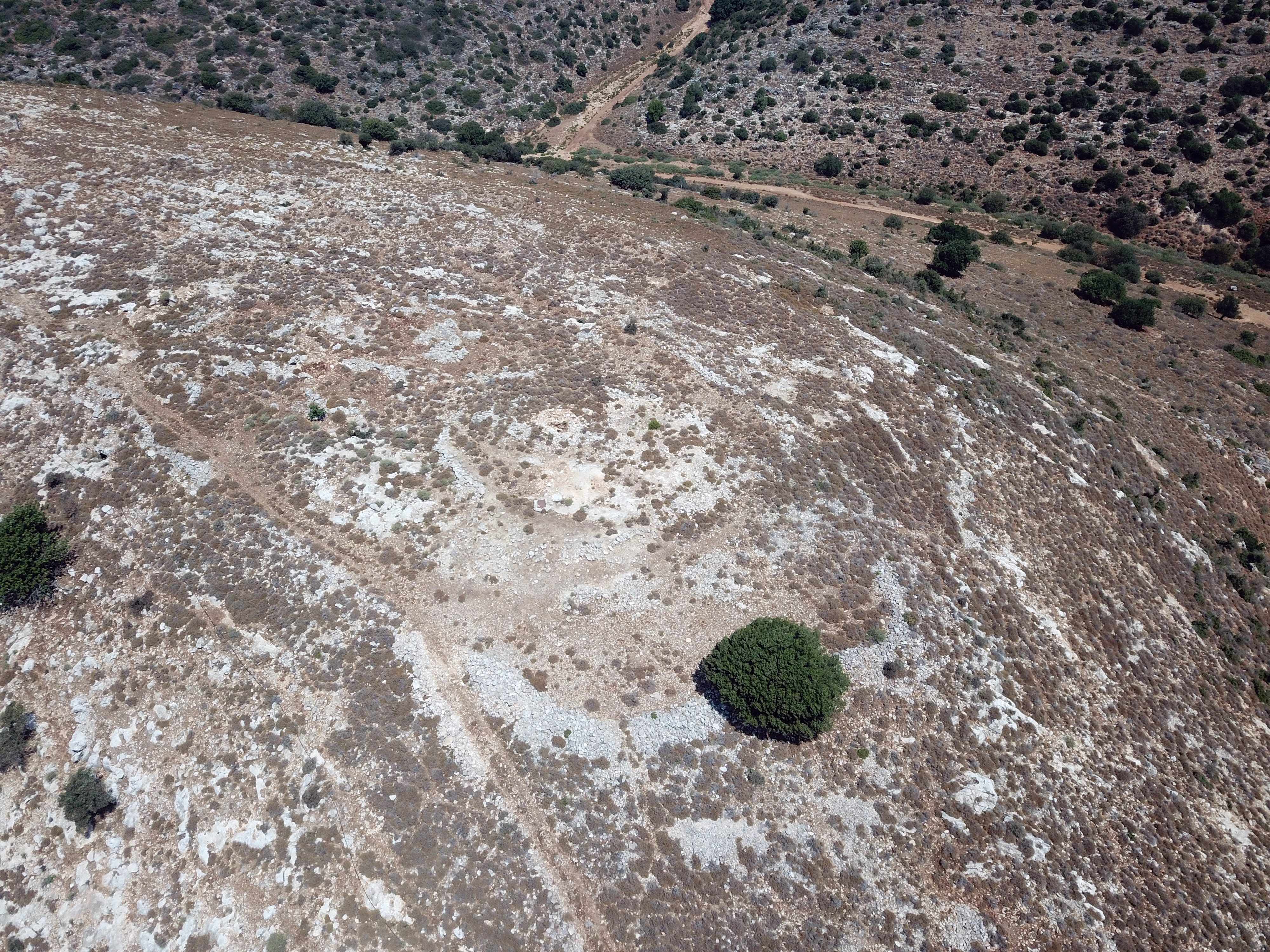
An analysis of the summit was performed by archaeologist Ayelet Goldberg-Keidar. It shows an enhanced view of the walls (turquoise color lines), with altitude contours (brown color lines), superimposed on the drone image patches.
(f) South-East foothills
A view towards the south-east side is seen below, with the peripheral wall seen at the edge of the hill. In the background is the east side of the brook, which bended around the hill and is oriented to the south. In the far background are the large Arab villages of Sachnin (mostly hidden behind the right hill) and Arab’e.
Small heap of stones are located behind the tree in the foothill. These could be remains of structures. Below them is a modern grave yard with dozens of tombs.
(g) Eastern foothills
The photo below shows a closer view of the bend of the brook, as seen from eastern foothills.
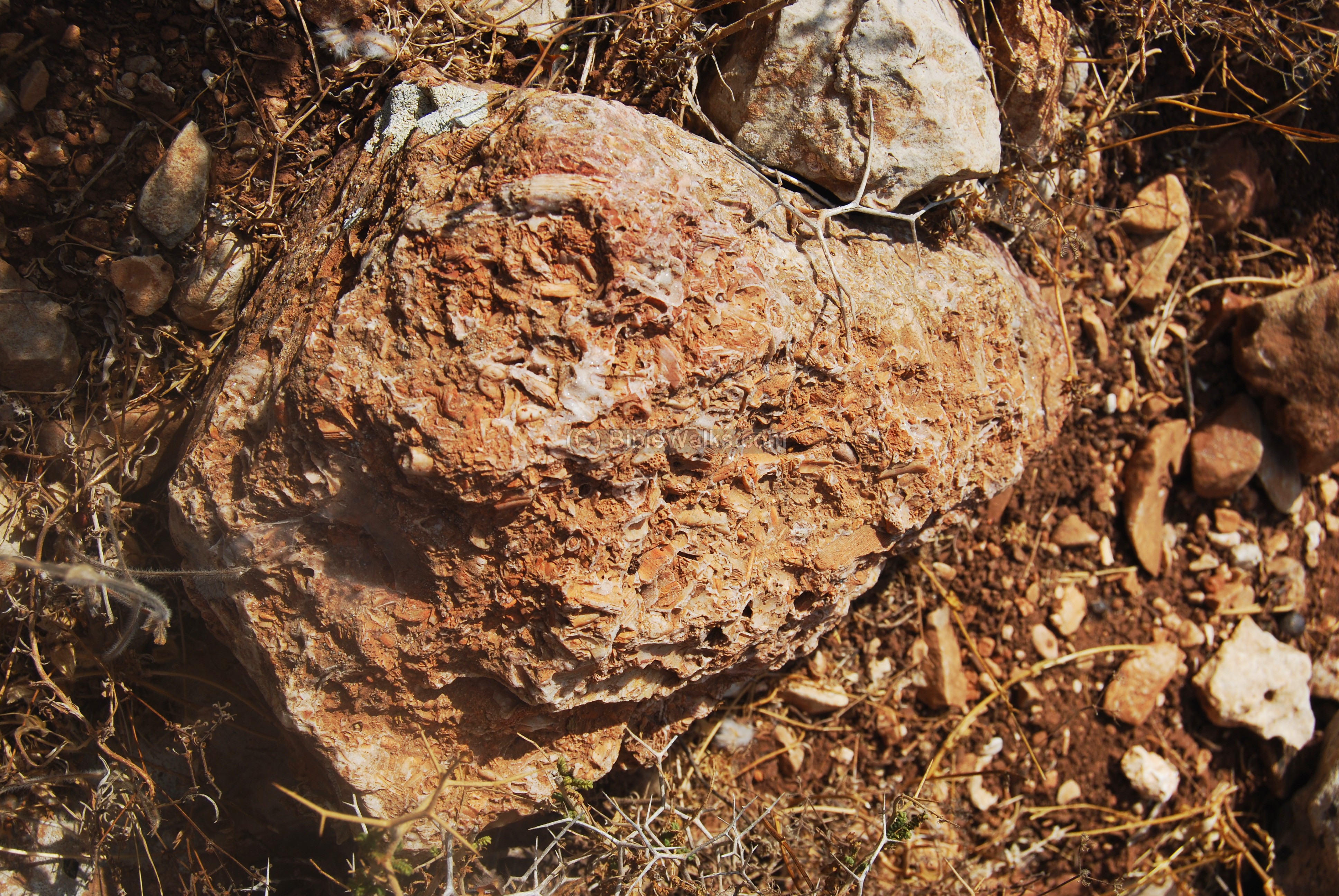
A fossilized rock is seen along the foothills:
(h) North-East foothills
The north-east side foothills are seen below. The high mountain on the other side of the valley is called “Zuf” hill (alt 347M).
There is a small ancient stone quarry just below the top side – square rock cuttings which are seen in the center of the photo below.

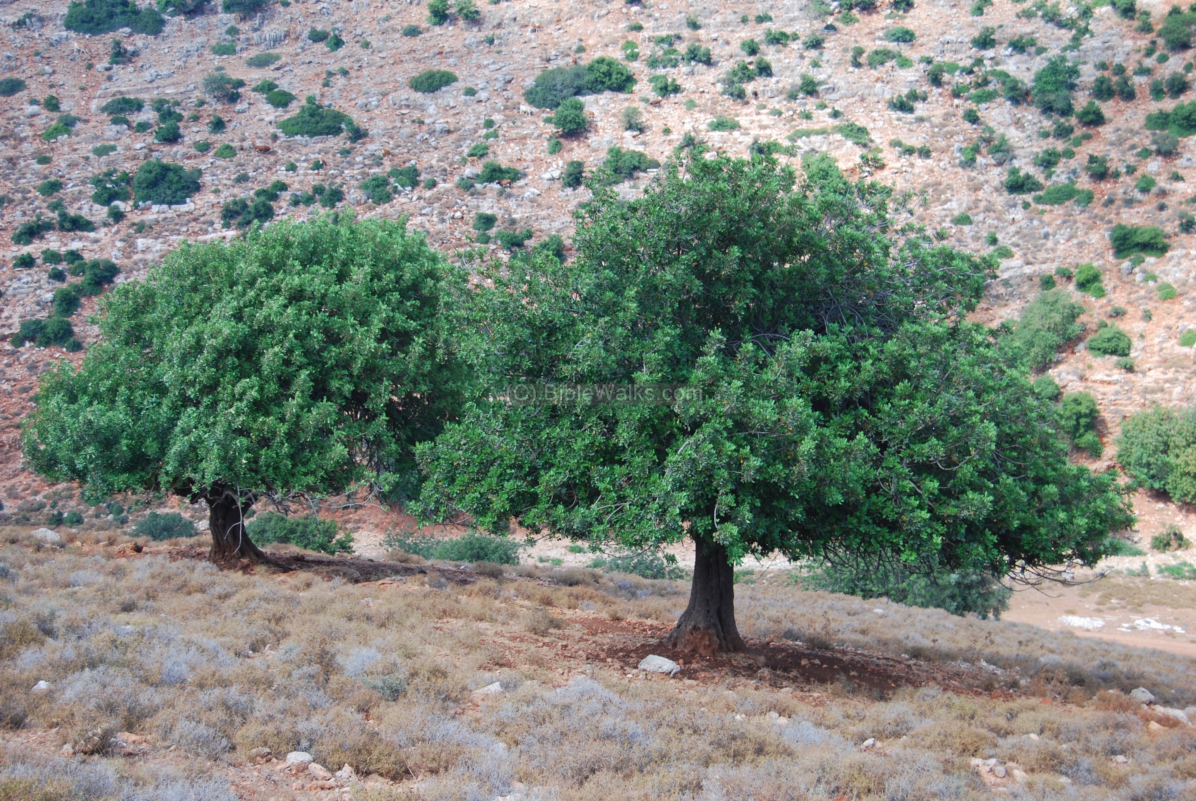
A pair of carob (Harub) trees are seen in the lower foothills.
The cows easily walk the foothills, as seen below.
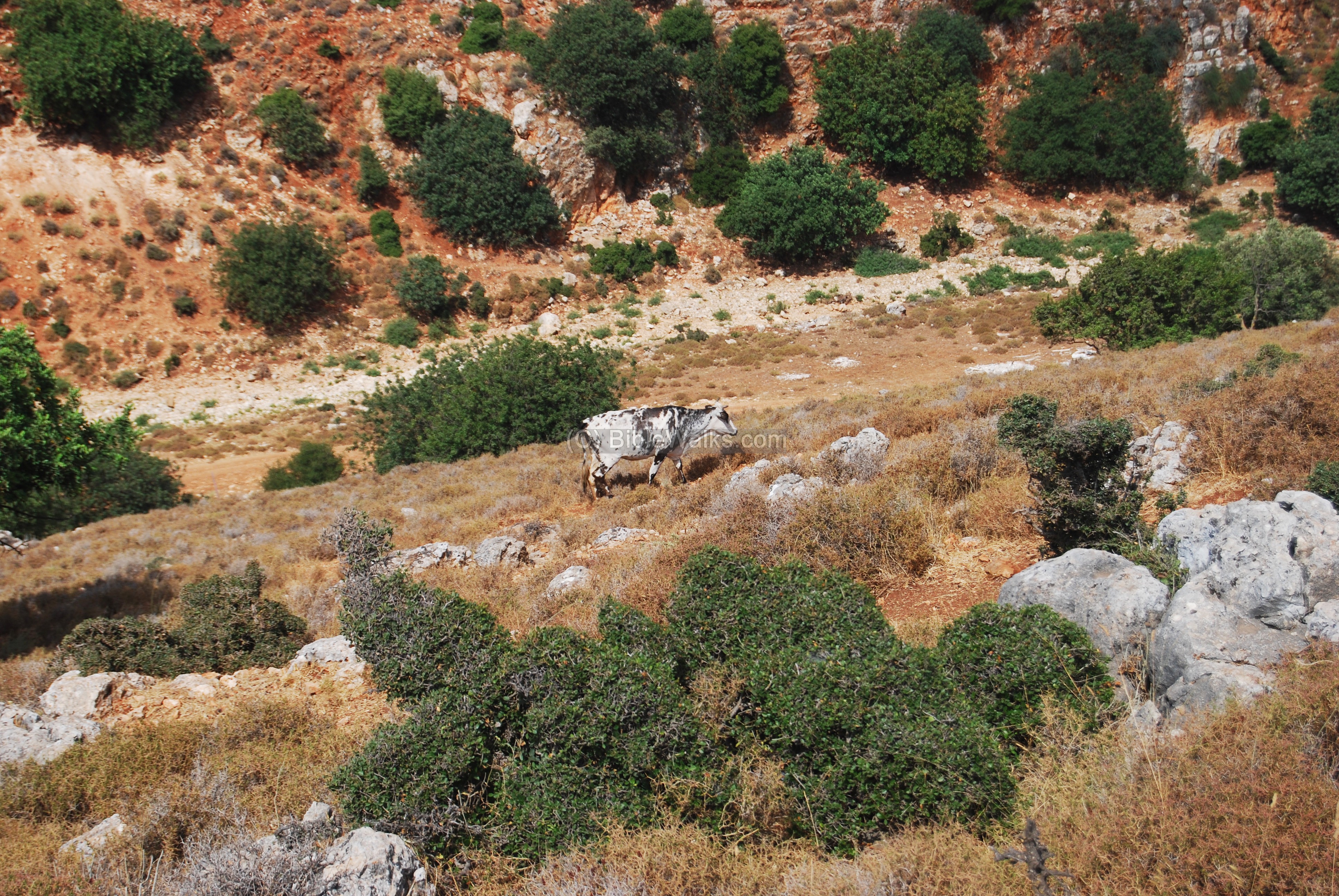
Due to the high winds blowing up the brook, the bush along the foothills lean away towards the east, and are “skinny” due to the grazing of the goats and cows.
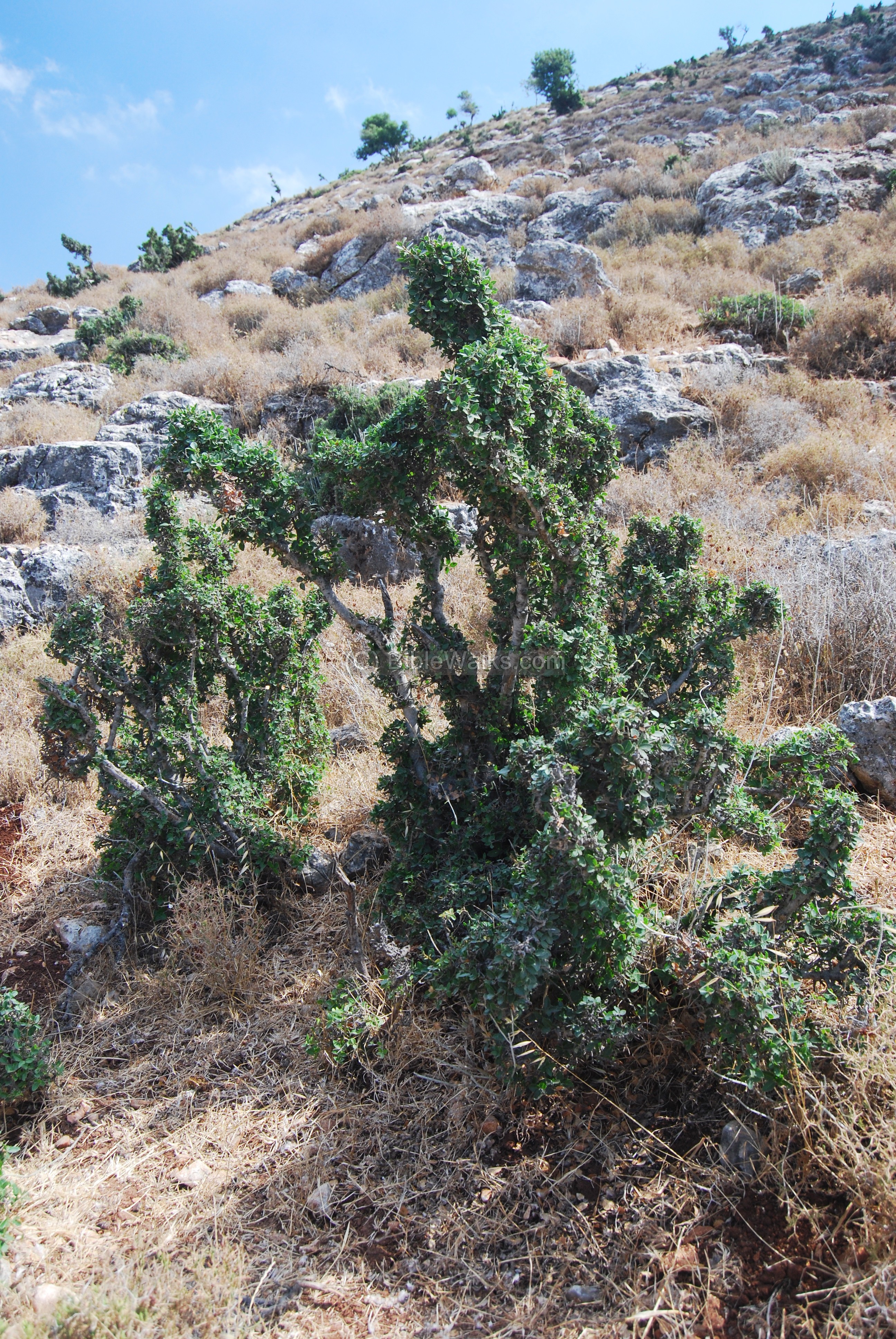
These natural sculptures bring surprises, such as the one seen below. This bush looks like a scene of the soldier on the right hitting the fallen soldier on the left (a typical icon on Roman coins). Feel free to use your imagination and come up with alternative scenes.
Another work of natural art is seen in the photo below.

The rocks also are part of this natural museum. Come and visit – Nature does not collect admission fees!

(i) North view
A view of the north side of the hill is seen from the neighborhoods of Karmi’el. This is the junction of two brooks – Hilazon from the top left side, and Shezor from the bottom left side. A trail is seen going up the foothills from the center towards the left, which seems like a good choice for climbing up the steep hill on our next tour of the site.
A view from the other side is seen below. This path along Shezor brook was probably one of the ancient trade routes from the plains of Acre, along Hilazon brook, into Beit-Kerem valley and eastwards. Alternative routes were more difficult due to the high mountains that surround Beit-Kerem.
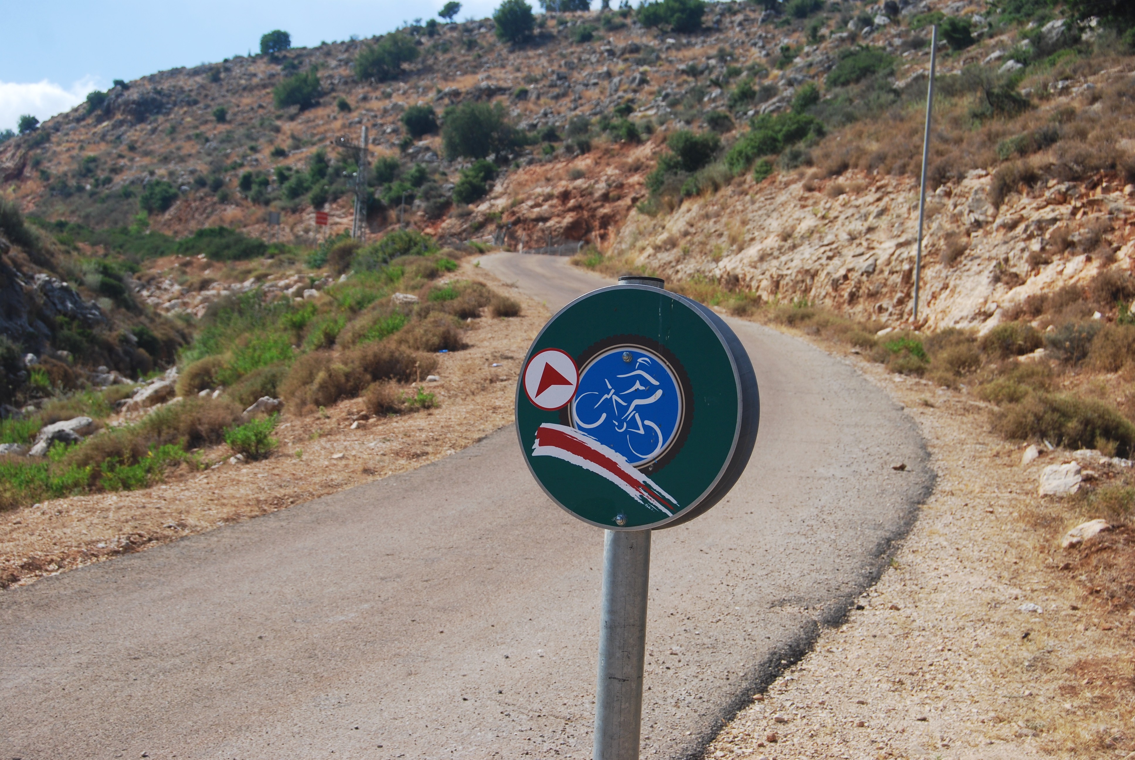
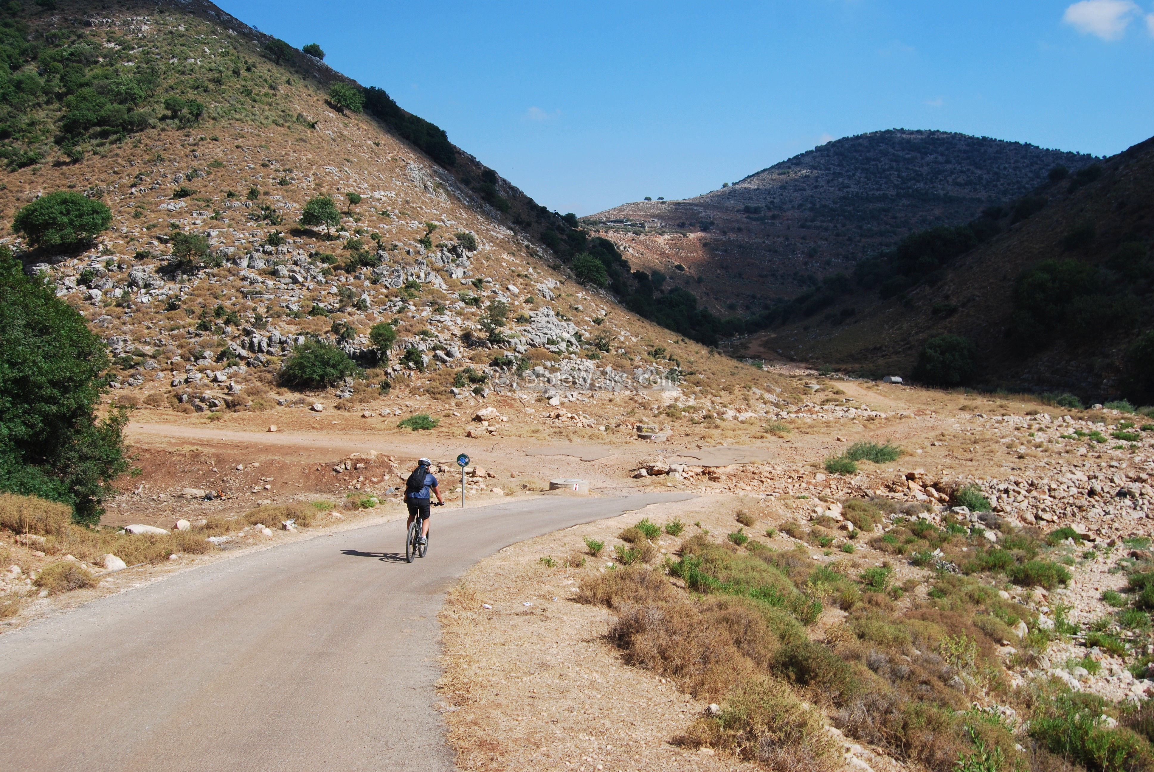
(j) Bike route
A bike route was established along the Hilazon brook. The sign points to the next stop, up the hill to Karmi’el.
A biker is seen riding the paved section, just before reaching to the brook.
(k) Nature photos
Along the path we saw a Hyrax (rock rabbit, or Hebrew: Shafan Sela) which is a typical mammal along the Hilazon brook and the upper Galilee.
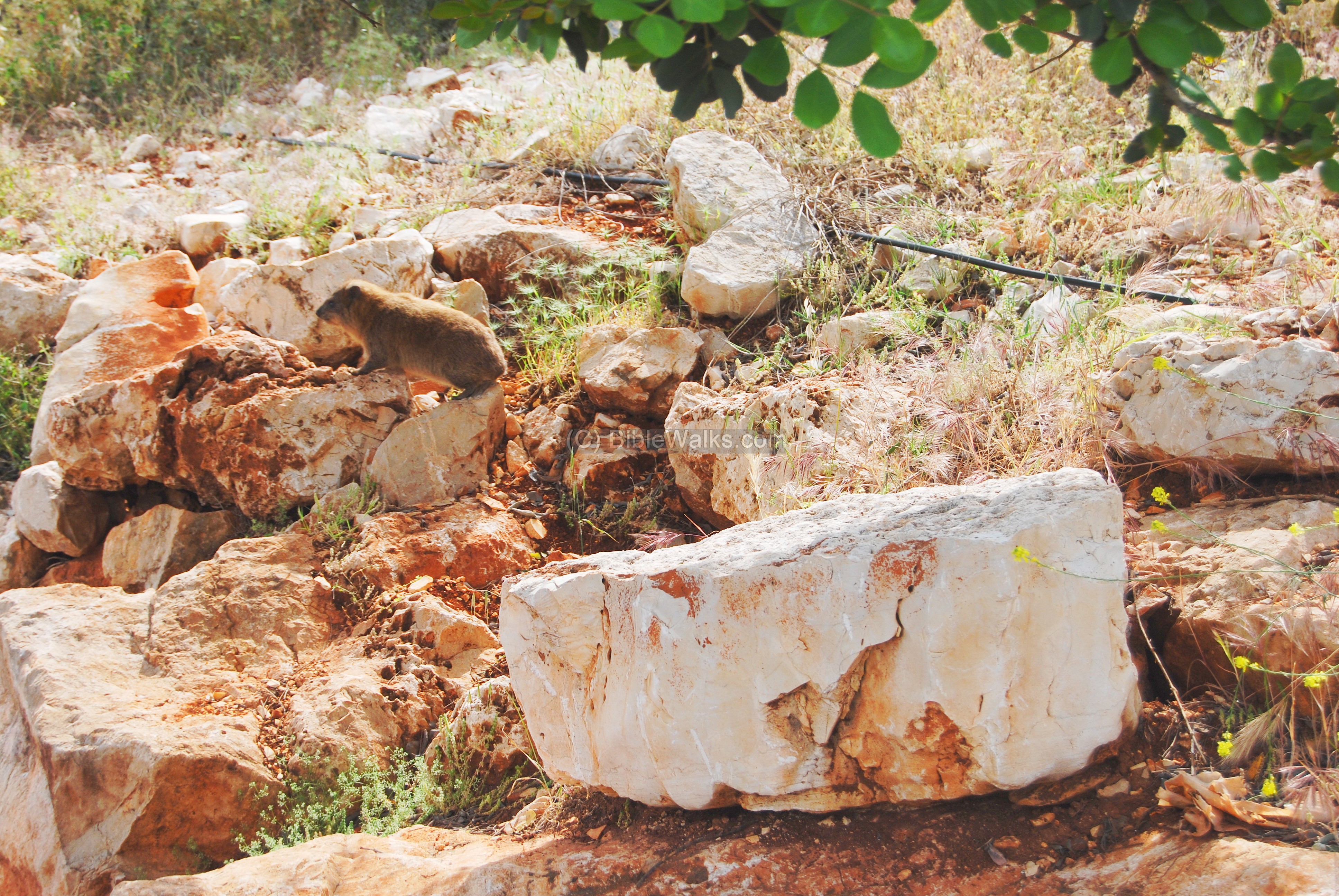
A closer view of the cute rock-rabbit is seen below. The Hyrax is mentioned in KJV Bible as coney (an English word for rabbit, “Shaphan” in Hebrew), as in Leviticus 11 5:”And the coney, because he cheweth the cud, but divideth not the hoof; he is unclean unto you”.
The Bible does not allow to eat these mammal’s meat – rabbits and hares are not Kosher (“unclean”). As per Leviticus 11,4: “Nevertheless these shall ye not eat of them that chew the cud”. Cud is the part digested food that animals bring back into their mouths from their first stomach, to chew at leisure. The animals who chew the cud (“ruminate”) are Kosher only if they have cloven (split) hooves. As in verse 3: “Whatsoever parteth the hoof, and is cloven-footed, and cheweth the cud, among the beasts, that shall ye eat”. Thus, goats and sheep are clean (Kosher to eat), but the Hyrax are not – they fail the cloven-hoof requirement.

In 2018 the Israeli authorities permitted to hunt these mammals – within certain restrictions – in order to depopulate them, as they host the Cutaneous Leishmaniasis disease (aka “Shoshanat Yericho” – rose of Jericho). It causes a severe skin infection, caused by a parasite that is transmitted to Humans by the bite of a sandfly. In the past years a dramatic increase in the spread of the disease required drastic measures to cope with this.
Links and references:
* Internal Links:
- Beit-Kerem sites gallery
- Neiel – Ya’anin hill in the entrance to the Hilazon brook
- Hilazon – a tour along the brook
- Youtube – more Aerial videos and the site specific drone video
Etymology (behind the name):
- Hurvah, Harvat – Hebrew: ruins (Arabic: Khirbet). Based on the root word “Harev” – ruined.
- Names of the site: Fachir, Fahir, Fukheikhira, Fukheikira. Appears on the British map of 1940s. Fakhir in Arabic means: lavish, luxury.
- Eshchar – name of the nearby residential village; also a type of plant/tree (called Rhamnus).
- Hilazon (Chilazon) – Also known as Mollusc snail, the name of the brook south of Beit-Kerem and Karmi’el. In ancient times the snail was used for producing colors for textiles (purple-blue argaman and sky-blue indigo), which were prized and expensive.
BibleWalks.com – Experience the Bible by foot
Kavul<<<–previous site—<<<All Sites>>>—next Hilazon site—>>> Hilazon brook
This page was last updated on 21/8/2023 (Add summit analysis)
Sponsored links: