This web page reviews additional points of interest on the temple mount.
Home > Sites > Jerusalem > Temple Mount > Other sites
Contents:
Overview
Photos
* West walls
* Chain Gate
* Kasem Basha
* Qa’it Bay
* Golden Gate
* Solomon’s stables
Etymology
Links
Overview:
This web page covers additional points of interest on the temple mount that are not covered by the other web pages – Al-Aqsa and the Dome of Rock.
For a detailed floor plan of the temple mount – see the Temple Mount web page.
Photos:
The order of the sites below is following a “clockwise” order, from south: west–> north–> east.
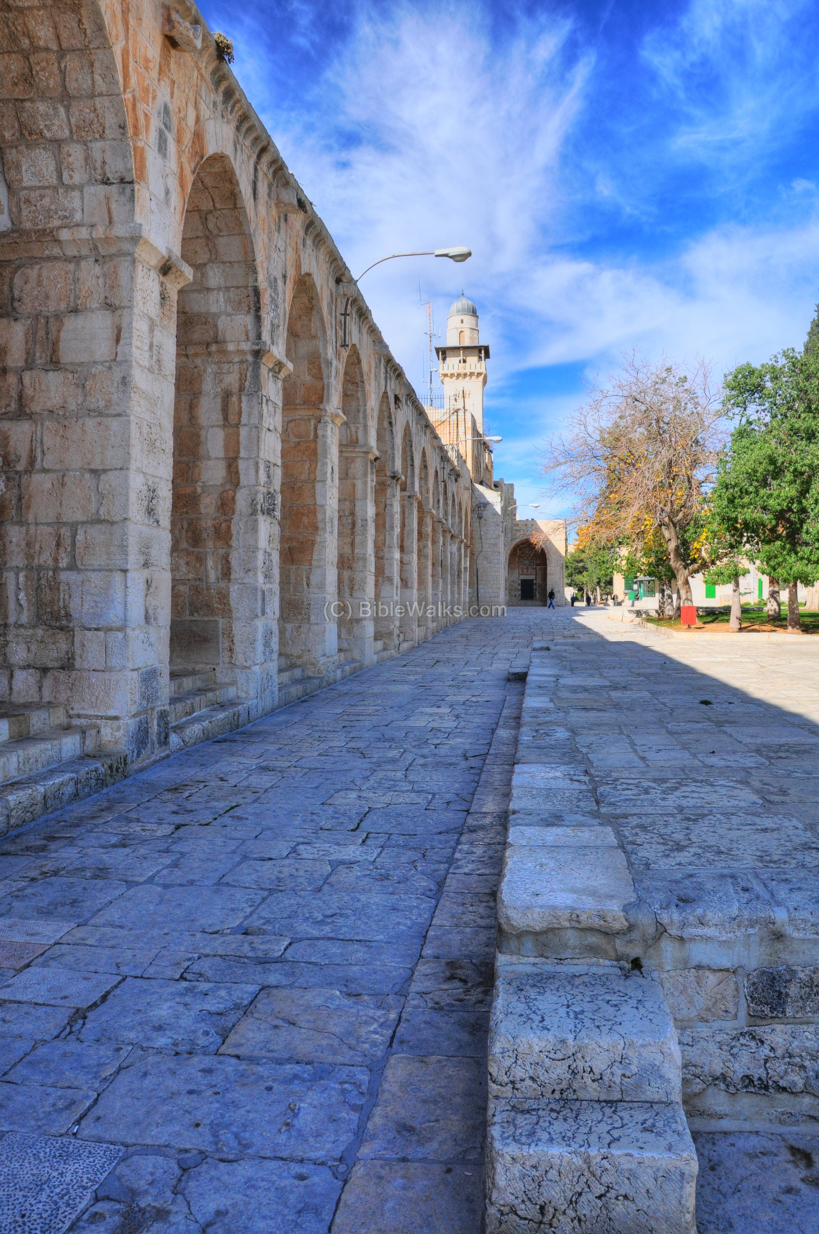
(a) West Walls
The south-western side of the temple mount is shown in the photo below. At the far end of the arched wall is the tower of the Chain – Silsilah Minaret (Manarah al-Silsila).
Click on the photos to view in higher resolution…
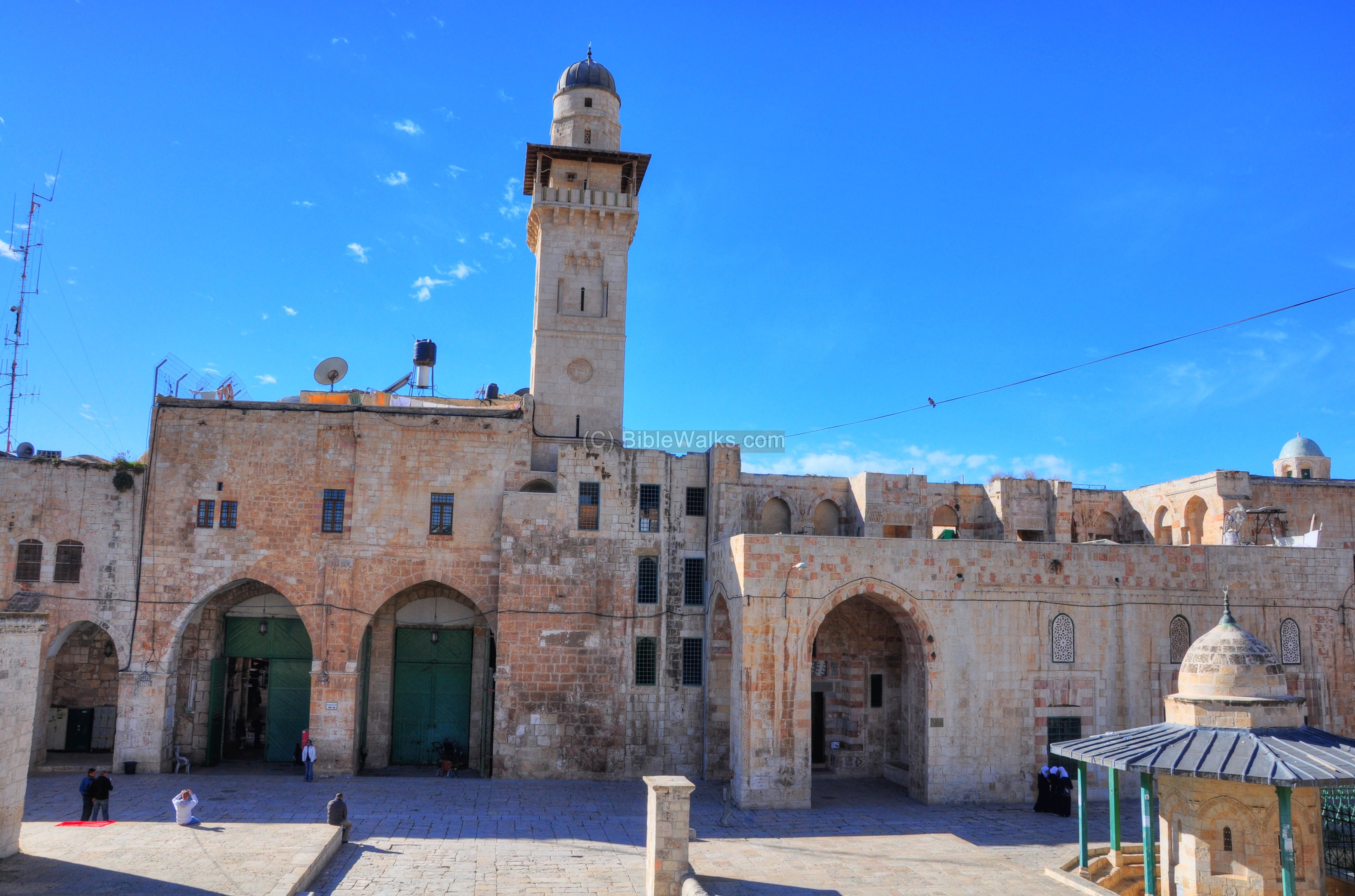
(b) Chain gate and Minaret
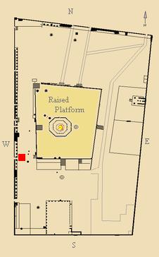
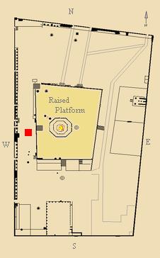
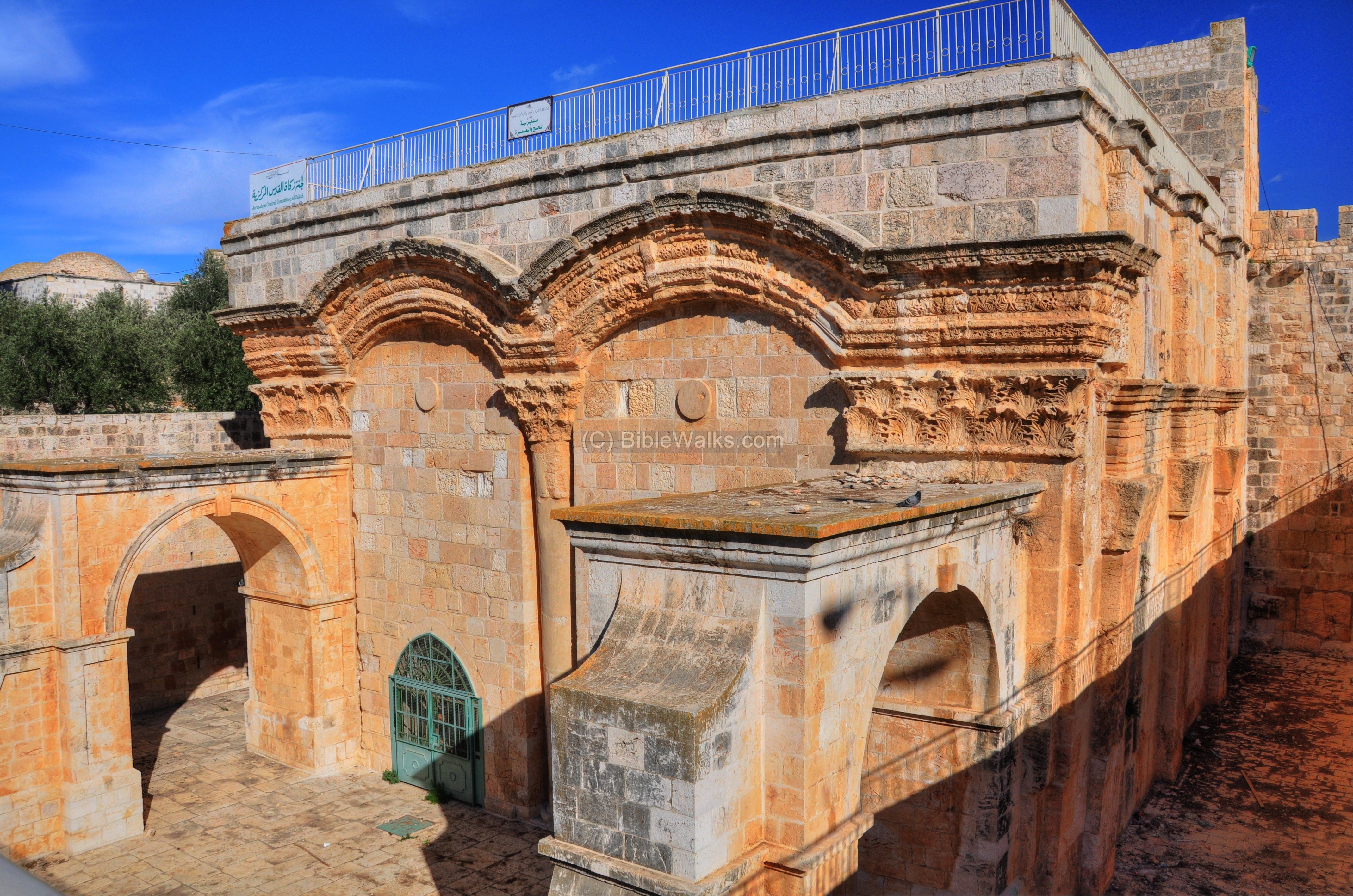
In the center of the western wall is the Chain gate (Bab Al-Silsilah), as indicated by a red square on the plan of the temple mount.
It seen below as a double arched gate on the left side of the picture below. This is the main western gate to the temple mount. It is based on a Crusaders gate, and some of the ancient Crusaders columns are embedded in the structure. An earlier gate existed here, dated to the Hasmonean and Herod’s second temple. The chain gate street actually is placed over the arches of a bridge (known as Wilson’s arch) that once connected the temple mount to the upper city.
A single closed gate called Bab al-Sakina (Gate of Tranquility or the Divine Presence) is located to the right (north) of the Chain gate.
Above the gate is a prayer tower – The Silsilah Manarah (Chain Minaret). It was built in 1329 by the Governor of Damascus, Emir Tenkiz.
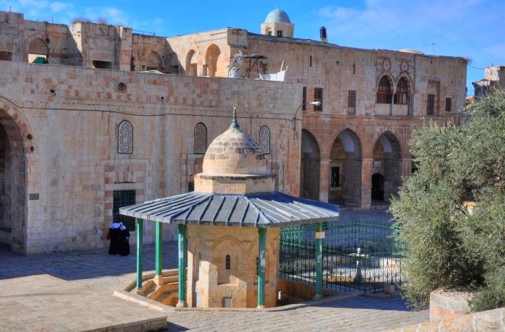
(c) Sebil Kasem Basha
A “sebil” is a Turkish public drinking fountain. There are several such fountains in the city, as reviewed in our special web page. They provided water to the visitors of the temple mount.
One of these fountains is located just before the Chain gate (30m NE), as indicated as a red square on the plan of the temple mount.

The Sebil and adjacent pool was built by the Governor of Egypt in 1527, and was the first Ottoman public structure built after the Ottomans conquered Jerusalem from the Mamluks (1516). This Octagon shaped structure is caped by a pointed dome. Its lead roof is supported by 8 columns.
A 7m x 7m square shallow pool on the north side was used for bathing before climbing up the stairs to the shrine of the Dome of Rock, which are located near the structure.
(d) Sebil Kaitabai (Qa’it Bay)
Another grand fountain structure is the Kaitabai (Qa’it Bay) Sebil, located on the western wall between the two adjacent gates – Bab al-Silsila (Chain Gate) and Bab al-Qatanin (Cotton Merchants Gate). It is indicated on the temple mount plan as a red square.
The fountain was constructed in 1455 by the Mamluk Sultan Enal (Al-Ashraf Sayf ad-Din Enal, reigned 1453 – 1461), then repaired in 1482 by the Mamluk Sultan Kait-Bai (Al-Ashraf Sayf al-Din Qa’it Bay, reigned 1468-1496), and was named after him. Under the fountain is an underground reservoir.
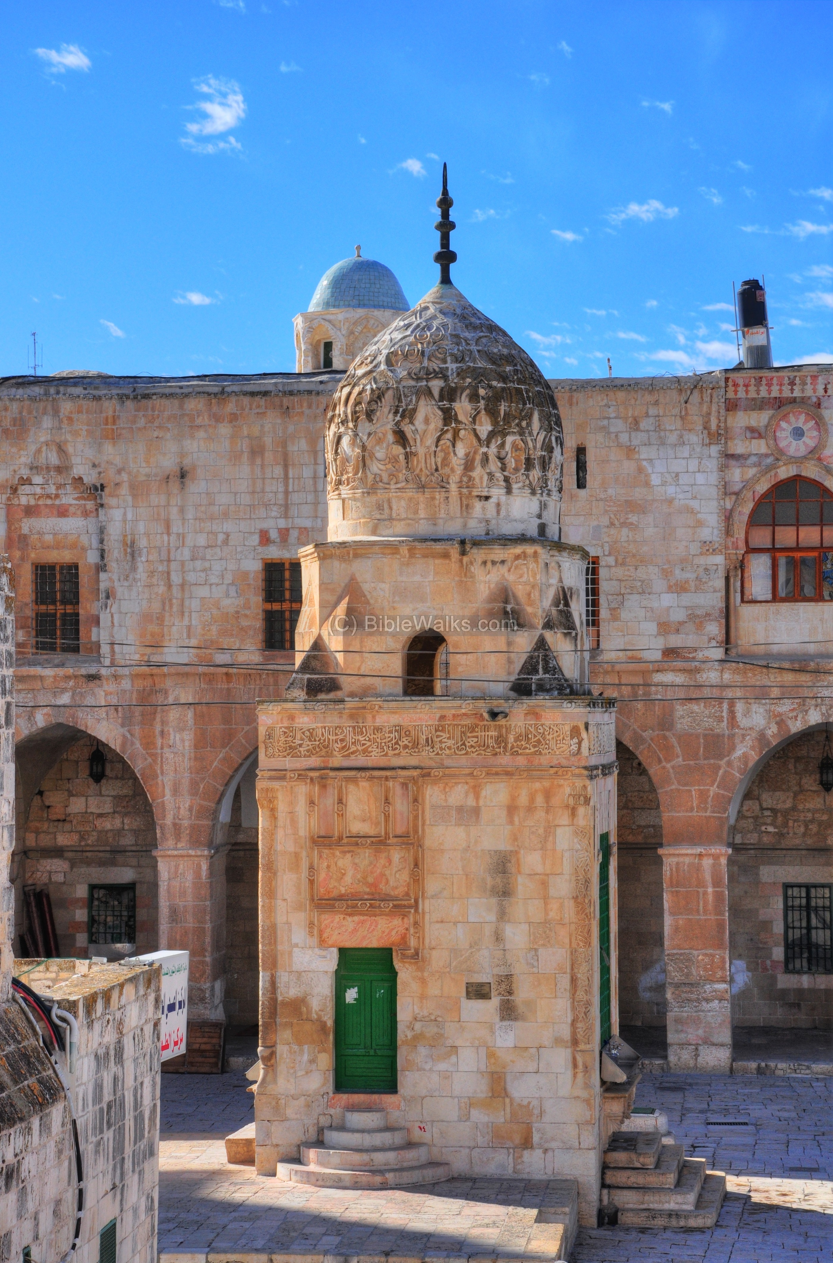
The square tower of the Kaitabai sebil is 13m high. On its top is an upright crescent moon – a symbol of Islam – stands above the roof of the dome, facing north-south.
The following picture shows the fountain from the platform of the Dome of the Rock. Behind it, on its right side, is the Bab al-Qatanin (Cotton Merchants Gate). On its left side is another gate – Bab al-Mutarah (the Ablution Gate).

(e) Golden Gate
An ancient gate is located on the eastern side of the temple mount, as indicated with a red square on the temple mount plan.
This is the “Golden Gate”, or: “Gate of the Mercy”, which is regarded as a Holy site for all faiths – Jewish (arrival of the Messiah) and Christian (entrance of Jesus on Palm Sunday) and Muslim (site of future resurrection).
The gate was built in the 6th/7th century AD over the ruins of the second temple gate, and sealed since the 16th C.
The following picture is a view of the gate house from the south-west side. There are several steps that lead from the temple mount down into the level of the gate house.
![]() For more information – check the Golden gate web page.
For more information – check the Golden gate web page.
(f) “Solomon’s stables”
Solomon’s Stables is an underground vaulted space, covering an area of 500 square meters, located 12.5m under the level of the southeastern corner of the temple mount. Built as part of the temple mount extension by Herod, this level supports the upper level by vaults resting on 88 pillars (as seen below in this 19th century photo). Originally used as storage area in the second temple period, it was then used as a stable during the Crusaders period.
The substructure area was left unused since the Crusaders period. It has been converted to a prayer hall since 1996. During the conversion works the soil was removed from the halls and dumped near the Mount of Olives. A salvage operation was undertaken to sift the soil for archaeological artifacts dated to the first and second temple periods and later periods.
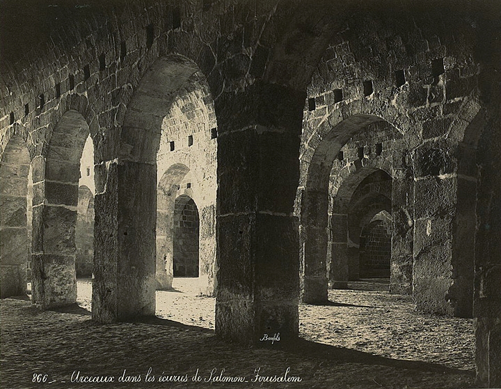
Photos of the LOC, Photographer: Maison Bonfils, 1867-1899
Etymology (behind the name):
- Manara(h): Arabic for lighthouse. In English: Minaret – a distinctive architectural feature of an Islamic mosque, and used for calling for prayers and a visual landmark.
- Sebil – Turkish fountain.
- Bab – Arabic: gate.
Links:
* External:
* Internal:
- Temple Mount (overview)
- Al-Aqsa mosque and sites around it
- Dome of the Rock and sites on its platform
- Second Temple gates
BibleWalks.com – great places to visit with the Bible
Dome of Rock<—previous site–<<< All Sites >>>—next Jerusalem site–> Second Temple Gates
This page was last updated on Dec 26, 2020 (Add LOC photo)
Sponsored links: