Remains of an ancient village, located on a rocky hill in the southern Judean hills.

* Site of the Month Mar 2014 *
Home > Sites>Judea> South > Khirbet Yattir
Contents:
Background
Location
History
Photos
* General view
* Ascent
* Western side
* Western Church
* Center
* Plan of houses
* Mosque
Northern Church
* Underground
* North Eastern side
* Panorama
* Nature
Etymology
Links
Overview:
Remains of an ancient village, located on a rocky hill in the southern Judean hills. The village dates to the Iron age and was a large Christian village during the Byzantine period.
Joshua 21:14: “And Jattir with her suburbs”.
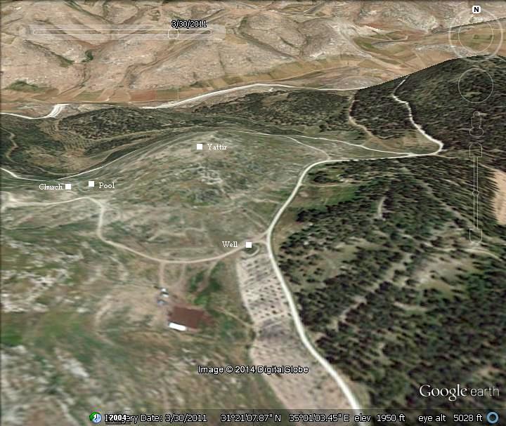
Location and Aerial map:
The ruins of Khirbet Yattir are located on a low ten-acre rocky hill in the Southern Judean hills, on the edge of the Negev desert. The site is part of the area known as the Yattir forest – the largest planted forest in the country, which is named after the ruined city.
The ruins are located 12KM north west of Arad, close to the pre-1967 green line. It can be reached from Highway #31 (Arad-Beersheba) via Highway #80 (from Tel Arad junction) or from highway #316.
History of the place:
-
Chalcolithic and Early Bronze periods
Fragments of ceramics were found in the excavations, mainly in Area B in the center of the site. But there were no structures dated to these earlier periods. Although only few areas of excavations were conducted, the village was probably built during the 10th Century B.C.
-
Biblical (10th – 6th century B.C.)
Yattir (Jattir) is referred in several Biblical texts, implying that the city was established and inhabited during the Kingdom of Judea (10th-7th Century B.C.):
- Joshua 15:48: “This is the inheritance of the tribe of the children of Judah according to their families…and in the mountains, Shamir, and Jattir, and Socoh,…”
- Joshua 21:13-14: “Thus they gave to the children of Aaron the priest… And Jattir with her suburbs, and Eshtemoa with her suburbs,…”
-
1 Samuel 30:27: “To them which were in Bethel, and to them which were in south Ramoth, and to them which were in Jattir”.
- 1 Chronicles 6:57: “And to the sons of Aaron they gave the cities of Judah, namely, Hebron, the city of refuge, and Libnah with her suburbs, and Jattir, and Eshtemoa, with their suburbs,”.
The archaeologists found pottery remains of the late Iron Age period (7th Century B.C.) in most of the site, and especially in its center.
The village was destroyed in the 6th century, following the intrusion of the Babylonians headed by Nebuchadnezzar (587 B.C.). The destruction of Judea brought the Idumeans from the south to occupy the region, after they were driven out their country by the Nabateans.
-
Persian (6th – 4th century B.C.)
Few pottery remains were found from this period.
-
Hellenistic, Hasmonean and Early Roman periods (4th Century B.C. – 2nd Century A.D.)
The pottery remains of this period are common in the site, especially in its center, indicating a growth of the population.
Yattir was captured by the Hasmonean King John Hyrcanus (reigned 134-104BC), as part of his campaign against the Idumeans in 110 B.C. Thus came the end of the Idumean control of the area, as promised by the prophecy (Obadiah 1, 19): “And they of the south shall possess the mount of Esau”.
According to the historian Josephus Flavius, the Idumean cities and villages (an area around Hebron and Beersheba) were converted to Judaism by the Hasmoneans (Antiquities 13 9:1):
“Hyrcanus took also Dora and Marissa, cities of Idumea, and subdued all the Idumeans; and permitted them to stay in that country, if they would circumcise their genitals, and make use of the laws of the Jews; and they were so desirous of living in the country of their forefathers, that they submitted to the use of circumcision, and of the rest of the Jewish ways of living; at which time therefore this befell them, that they were hereafter no other than Jews”.
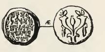
Coin of John Hyrcanus
The Jewish rituals practiced in Yattir during the second temple period are evident in the findings of stone vessels in several locations.
The fate of Yattir during the great revolt is not known, although the converted Idumeans were known of their brave combats against the Romans, which may have resulted in tragic results in Yattir. During the second revolt against the Romans – known as the Bar-Kochba revolt (132-135 AD) – the village was destroyed.
-
Late Roman period (2nd – 4th century A.D.)
As a frontier desert village, Yattir was probably settled by veteran soldiers at the end of the 2nd Century. These settlers received land for raising crops, and also assisted in the protection of roads and fortresses around the site. The settlements were part of the empire’s attempts to fortify the eastern frontier of the Roman empire – the Limes Arabicus. The border line extended 1,500km from Northern Syria to the Red Sea, and its defense was based on supporting villages, forts, watchtowers and connecting roads. This protected the empire from attacks of the barbarian tribes of the Arabian desert. At the end of the 3rd century the Limes was restructured by Diocletian, renamed to Limes Palaestinae. It continued to support the defenses of the Byzantine empire until the 6th Century.
The cities and roads during these periods are indicated on the Biblical Map below. Yattir (Jattir) is indicated as a red point, and is positioned near the road from Hebron and Beersheba, and the road between Hebron and Malatha. Note that Malatha is where the regional Roman military cavalry headquarters – the Cohors I Flavia Equitata – were located during the Byzantine period.
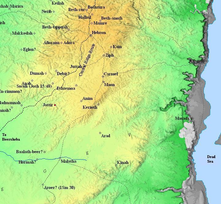
Area around Yattir (Jattir) – Biblical through Roman periods (based on Bible Mapper 3.0)
-
Byzantine period (4th-7th century A.D.)
Yattir was a rich and large village during the Byzantine period.
Eusebius Pamphili (better known as Eusebius of Caesarea), a 4th century Greek historian of the Church, wrote in his book “Onomasticon” about Yattir that it is located 20 miles south of Eleutheropolis (Beit Guverin). At his times, Yattir (here: Ietheria) became a Christian village.
“There is also now a (very) large village (named) Ietheria twenty miles from Eleutheropolis in the (interior of) Daroma near Malathōn. All its inhabitants are Christian”.
Most of the architectural remains and coins dated to the sixth and early seventh century.
The village also appears on the 6th century Madaba map, its icon is illustrated as two red roofed structures flanked by three towers. The title above the icon reads “Iethor also Ietheria”. Iethor refers to Ether, another Biblical site listed in Judea, which the mosaic combined into the same place (Joshua 19:7): “Ain, Remmon, and Ether, and Ashan; four cities and their villages”.
-
Early Arab period (7th-10th century AD)
The village was not destroyed during the early Moslem occupation. The eastern church was converted to a mosque, which continued through the tenth century.
During a long period (10th to 13th century) – the site was abandoned. It was reoccupied during the Mamluke period, which was the last phase of occupation.
-
Ottoman Period (19th century)
Conder and Kitchener surveyed this area during the Survey of Western Palestine (SWP) in 1873. They correctly identified the site (Volume 3, p404):
“Jattir (Joshua xv. 48), a place in the same group with others on this Sheet, mentioned next to Socoh (Shuweikeh), is probably the ruin of ‘Attir. In the ‘Onomasticon’ the same place is mentioned as near Malatha (Tell el Milh), in Daroma, and all its inhabitants are said to have been Christians. ‘Attir is 10 English miles from Tell Milh”.
Part of map Sheet 25 of Survey of Western Palestine,
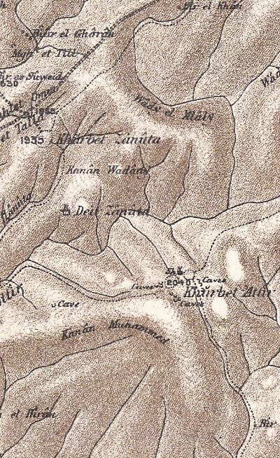
by Conder and Kitchener, 1872-1877.
(Published 1880, reprinted by LifeintheHolyLand.com)
Their report of the survey is short (p. 408): “Khurbet ‘Attir -Foundations, and heaps of stones. A great many caves. A ruined masonry tomb ; several fallen pillar-shafts and cisterns. There is a Kubbeh at the ruin, which stands on a knoll. Many of the caves have masonry arches to the doors. A large building remains, four courses of the wall being left. Below the ruin on the hill-side is a large oil-press”.
- Modern Period
Excavations were conducted here during 1995-1999, headed by Hanan Eshel, Jodi Magness and Eli Shenhav. Four excavation sections, numbered A through D, were opened and examined.
Photos:
The order of the photo section is from the western side of the hill towards the north east side.
(a) Overview
View of Khirbet Yattir is seen here from the east. The ruins are scattered around the hill and its surroundings.
Click on the photos to view in higher resolution…
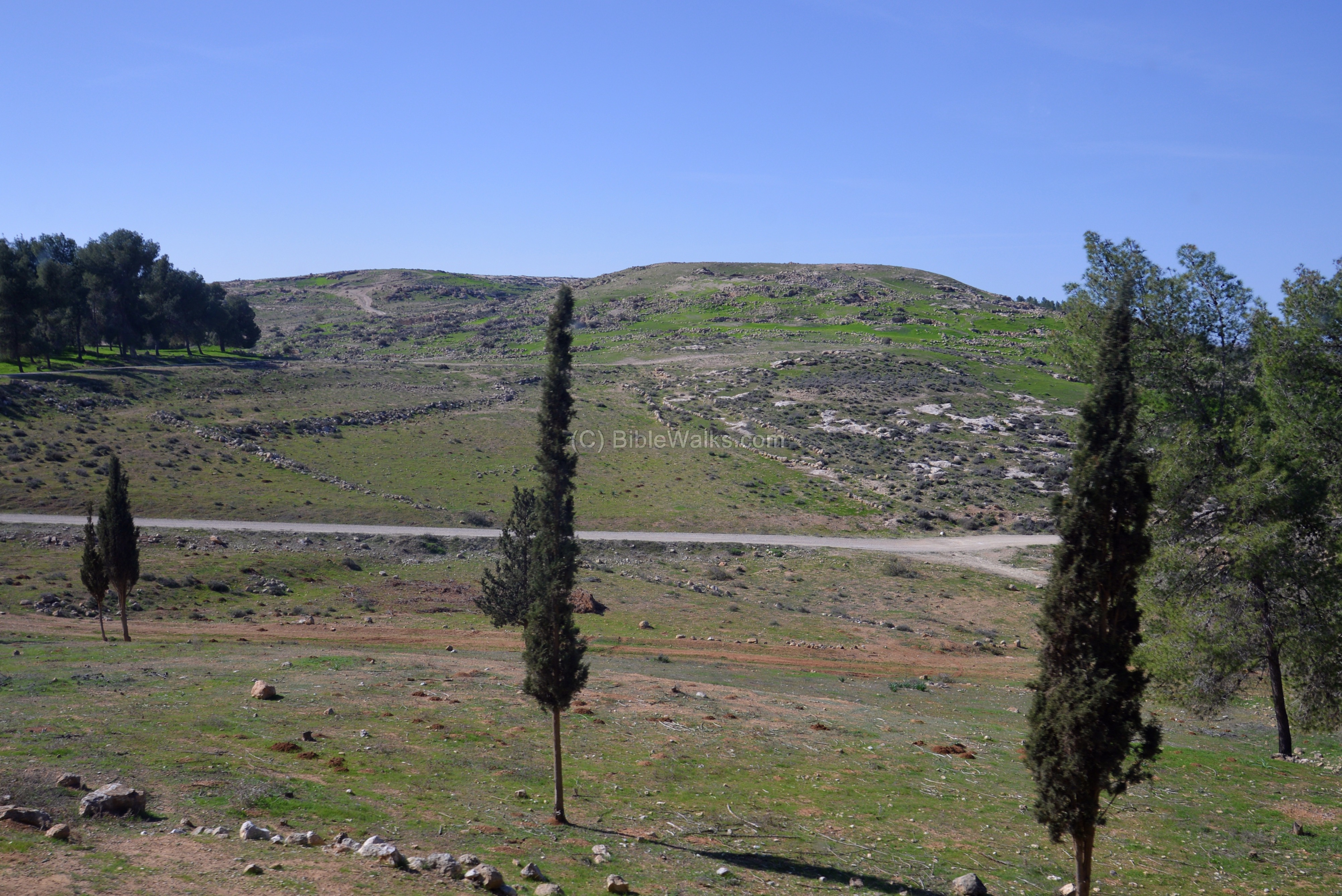
The site is located on the side of the Israel National trail (marked by orange-blue-white strips), which crosses the entire country from Dan to Eilat.

(b) Ascent to the western side
This tour was produced by “Tagliot” (Hebrew: Discoveries), and was directed by the archaeologist Eli Shinhav, who was one of the excavators of the site.
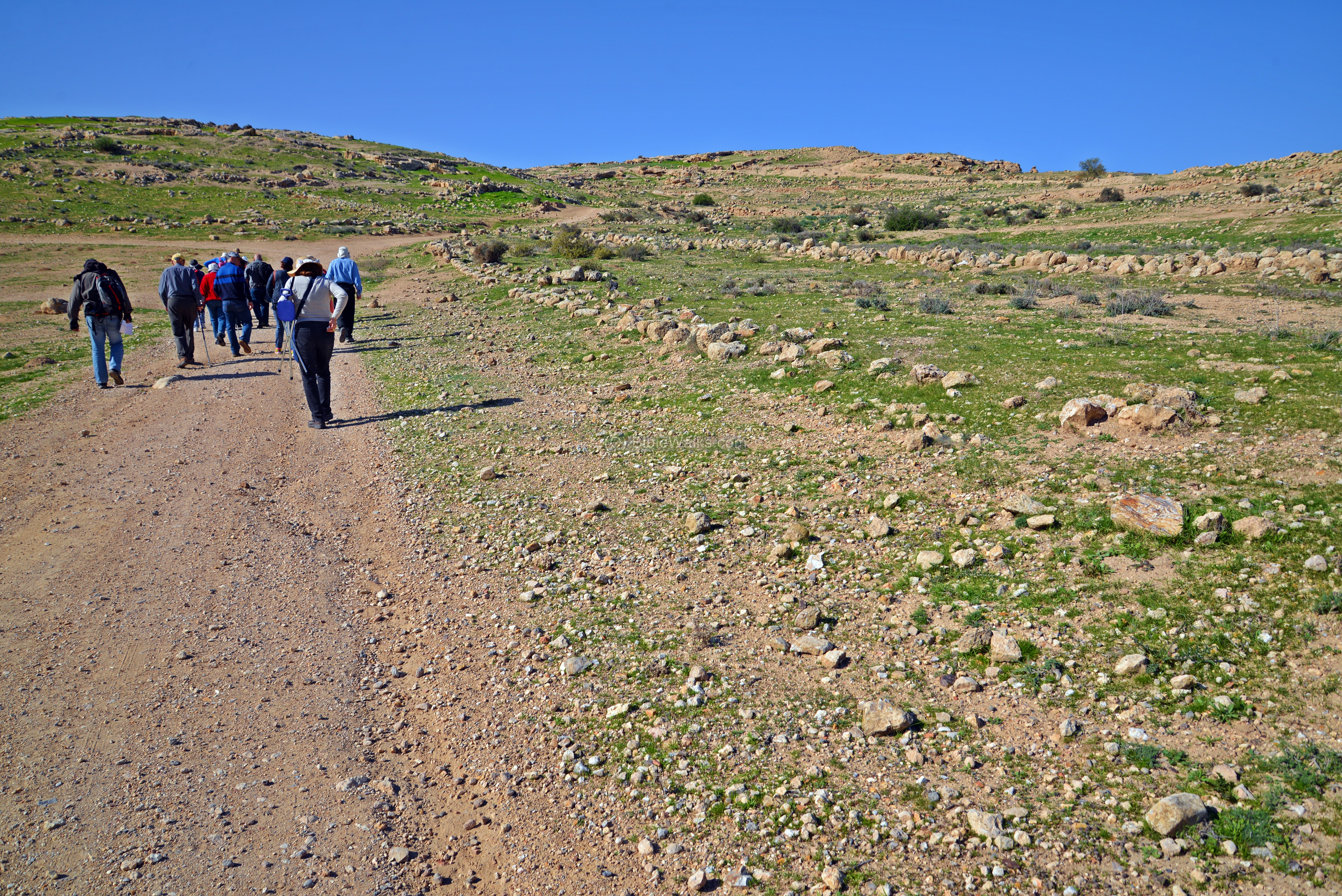
The tour to Khirbet Yattir started on the western side of the hill. The photo shows a view from the south, along the ascending road. Remains of a street can be seen here.
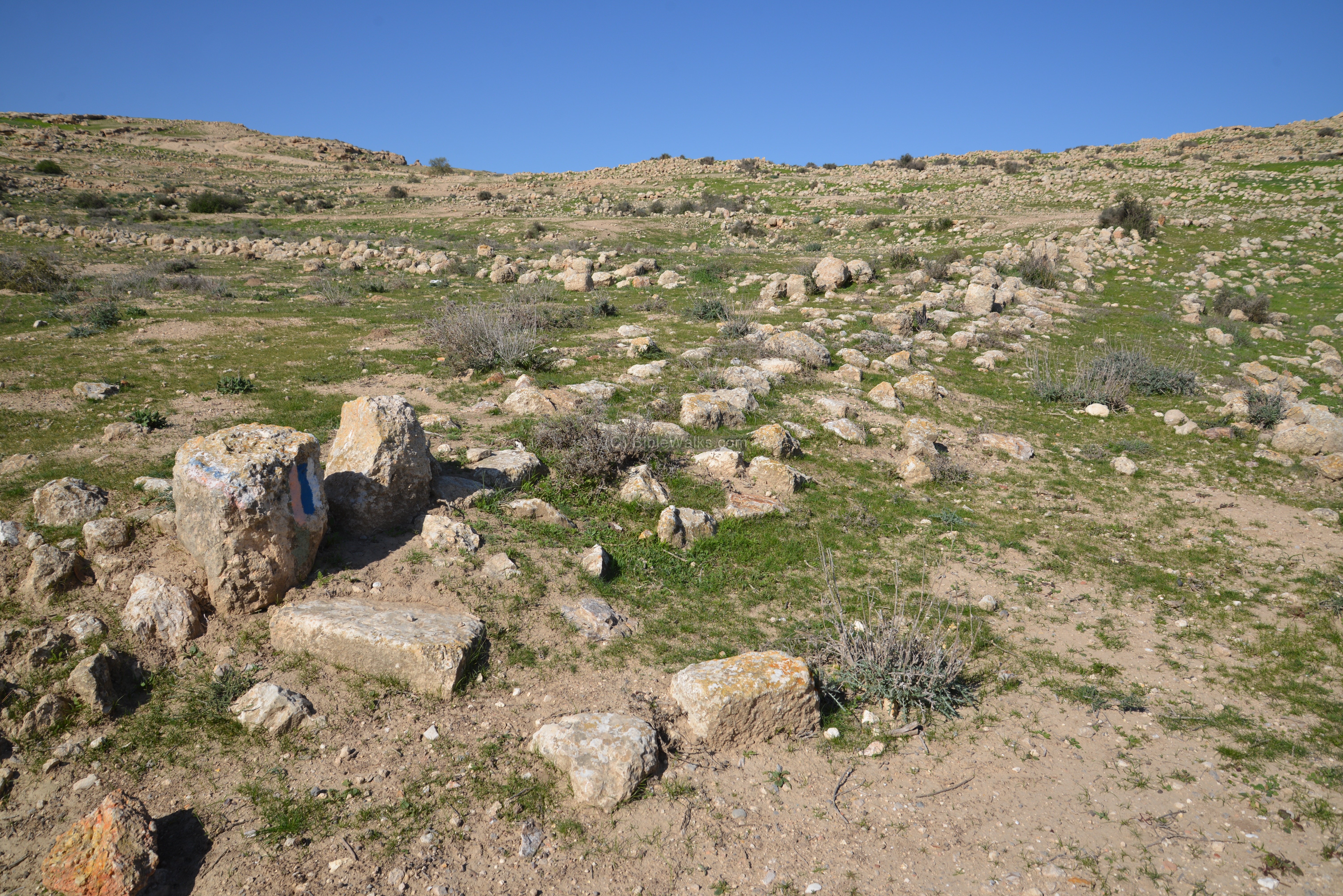
(c) Western section
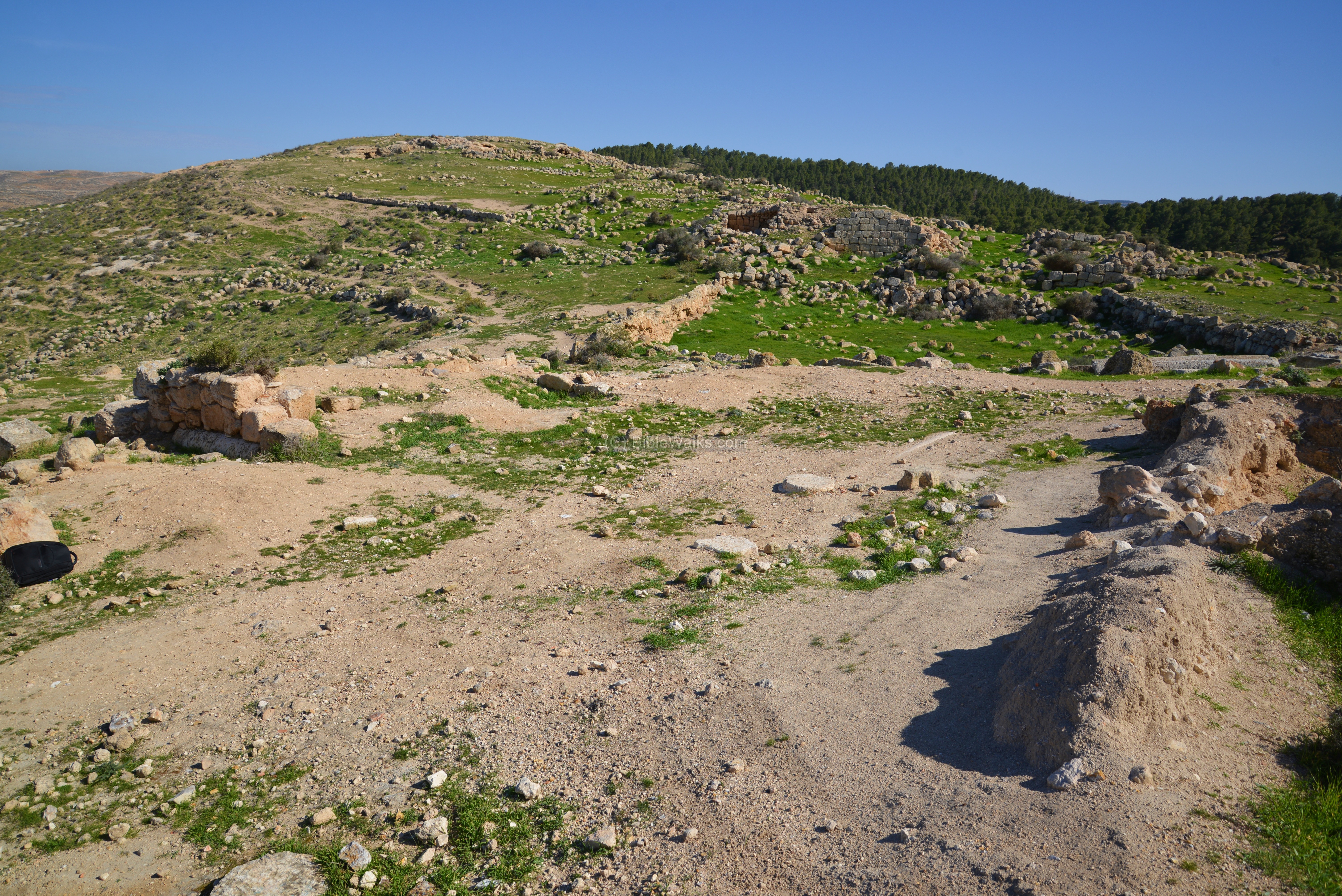
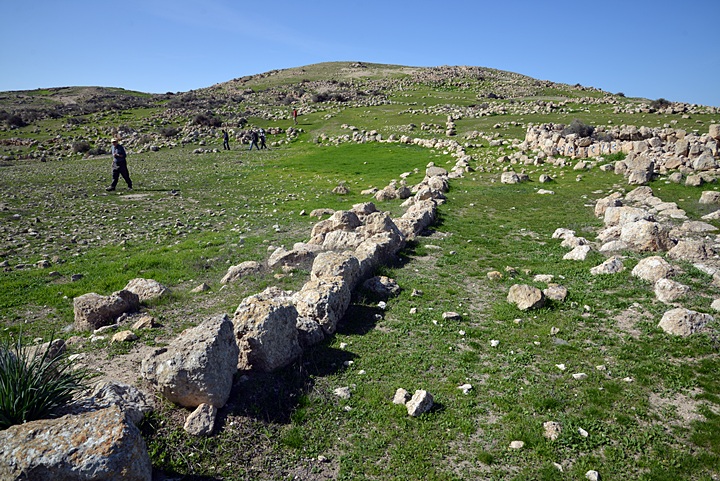
The following photo is a view from the south west of the summit. The southern hills of Hebron are visible in the far background.
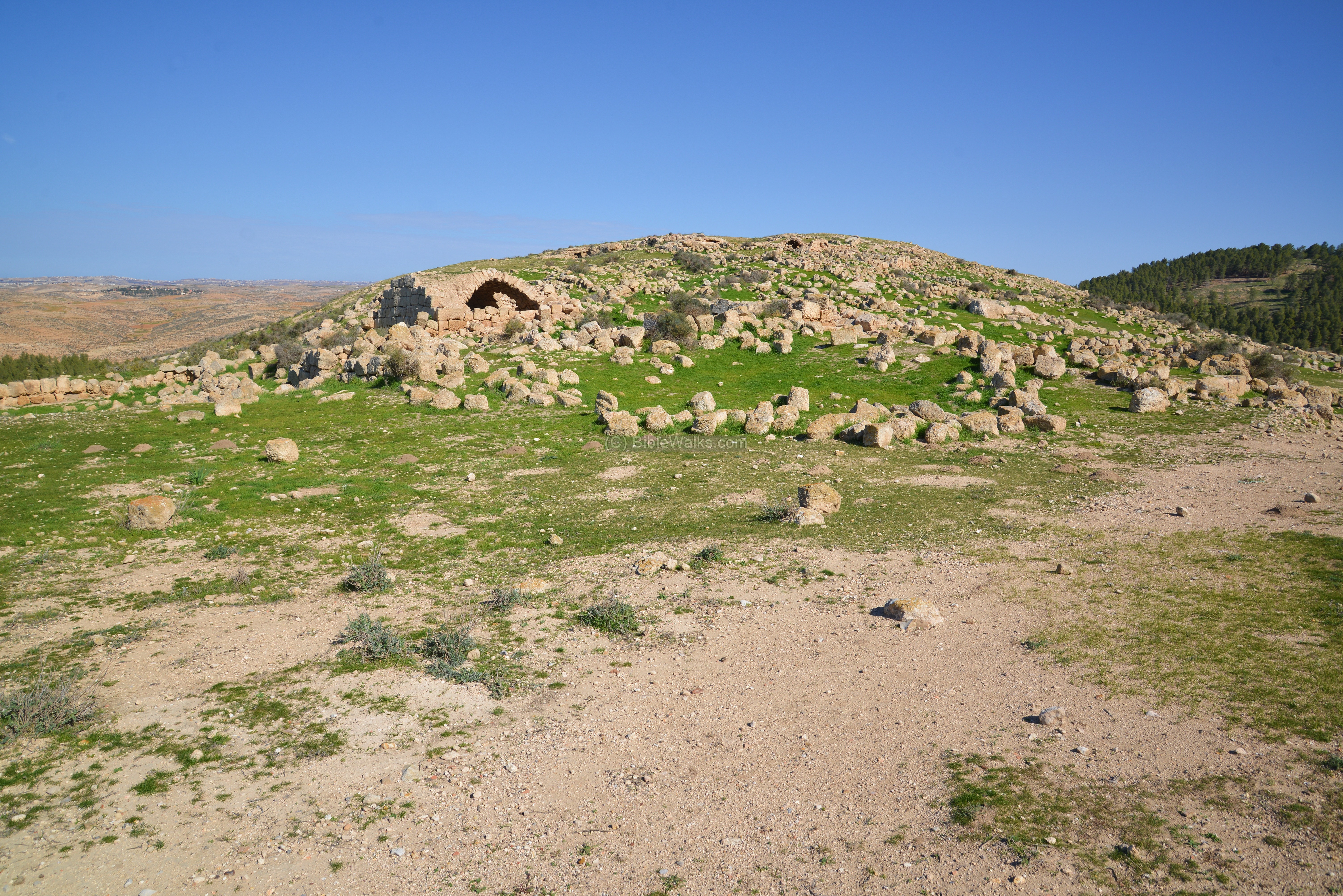
Closer to the summit are the majority of the ruins, scattered along the eastern side of the hill. The north western slope is mostly bare.
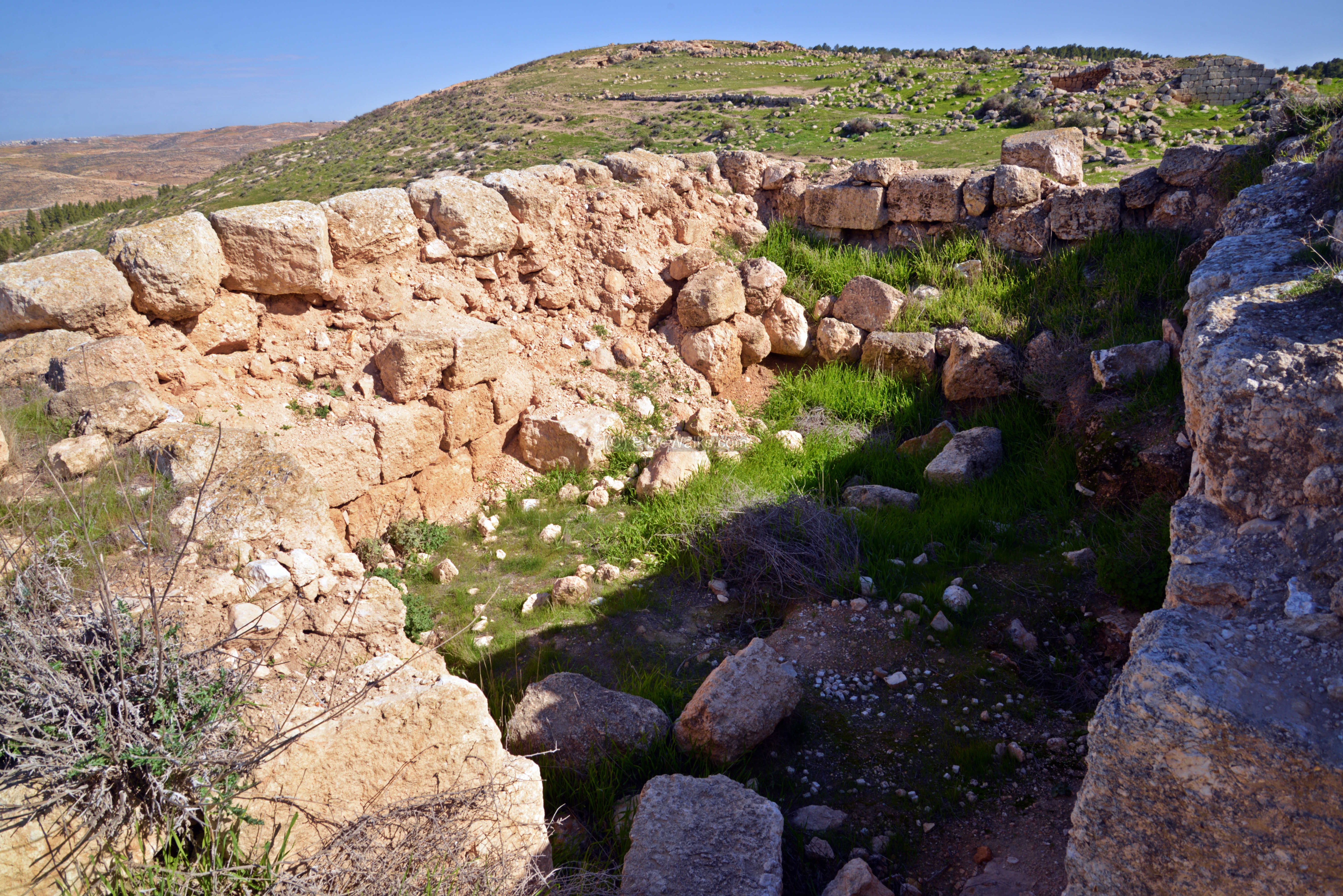
The ancient remains include stone walls and vaults. Most of the structures visible on the site are dated to the Byzantine period, although earlier periods are found among the ruins, or integrated into the later period houses.
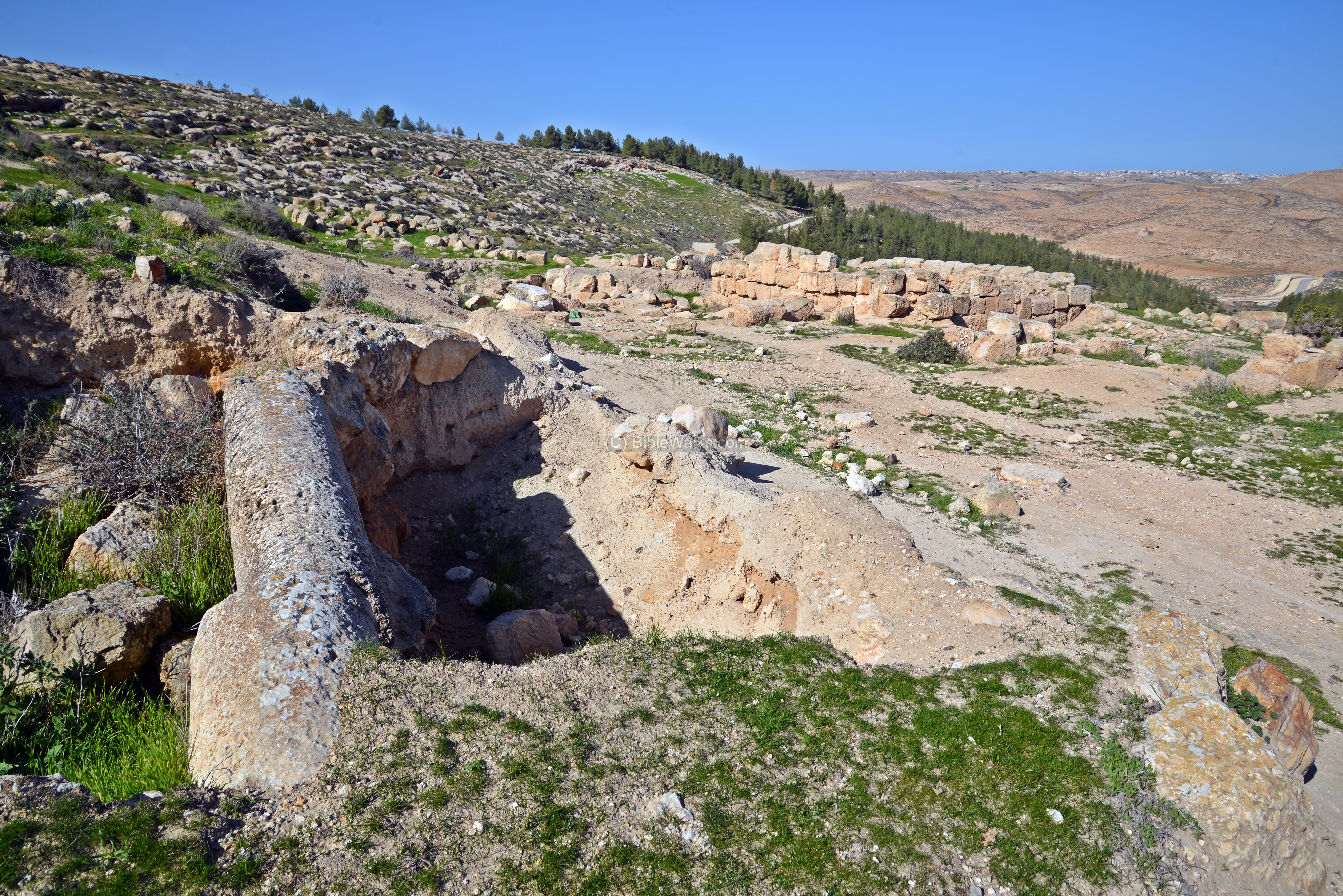
On to the top of the western side of the hill is a large area where a pool was once located, as seen in the next photograph. This oval shaped reservoir is 32m long by 23m wide. It received waters from aqueducts and collection of runoff rain waters.
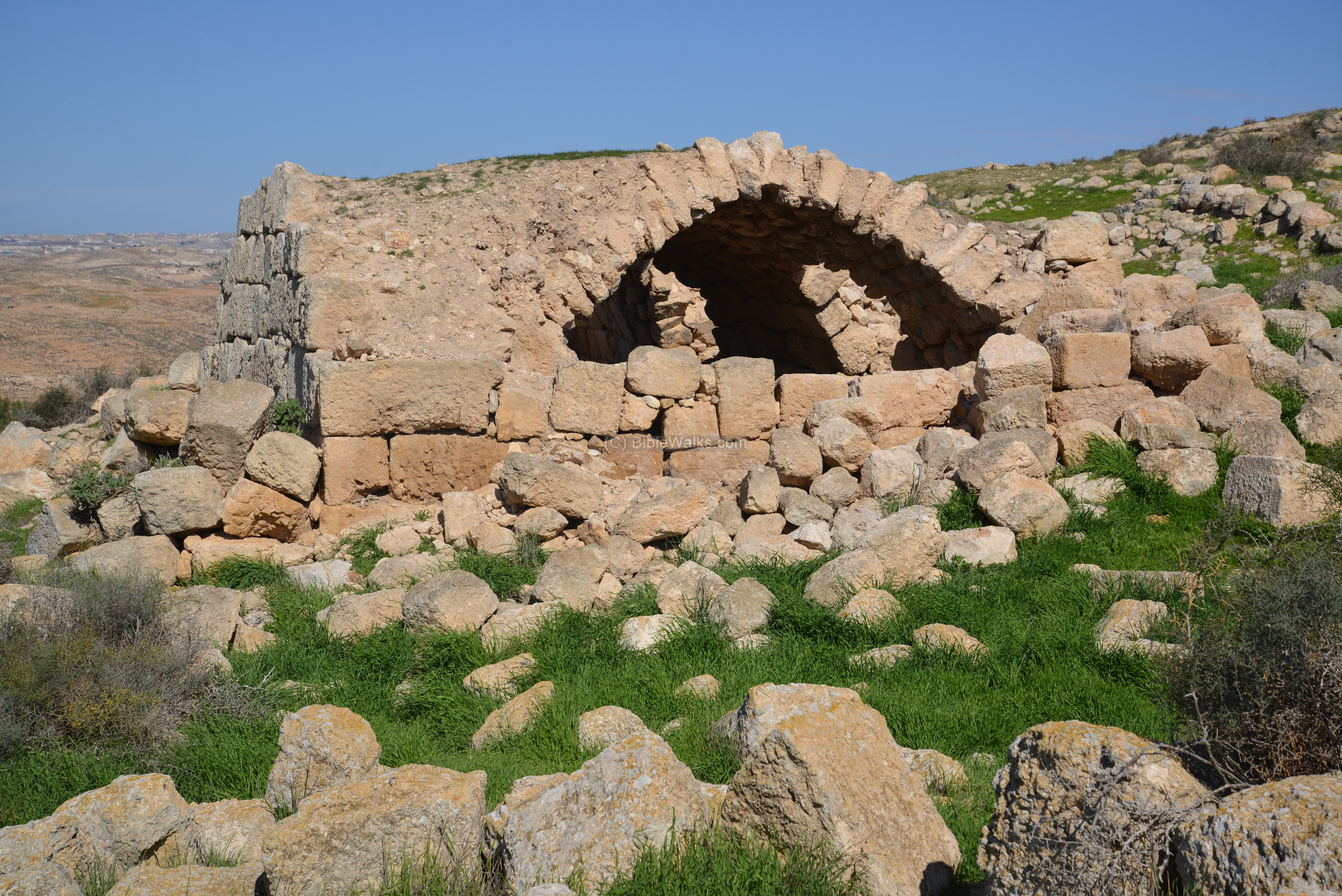
 On the edge of the reservoir is a structure with an intact vault. The use of vaults in this area is common, as this architectural element is strong and supports the weight of the roof. The use of stone is also common here, due to the lack of wood, and due to its great insulation (keeps the house cold during the heat of the day, and warm during the cold desert nights).
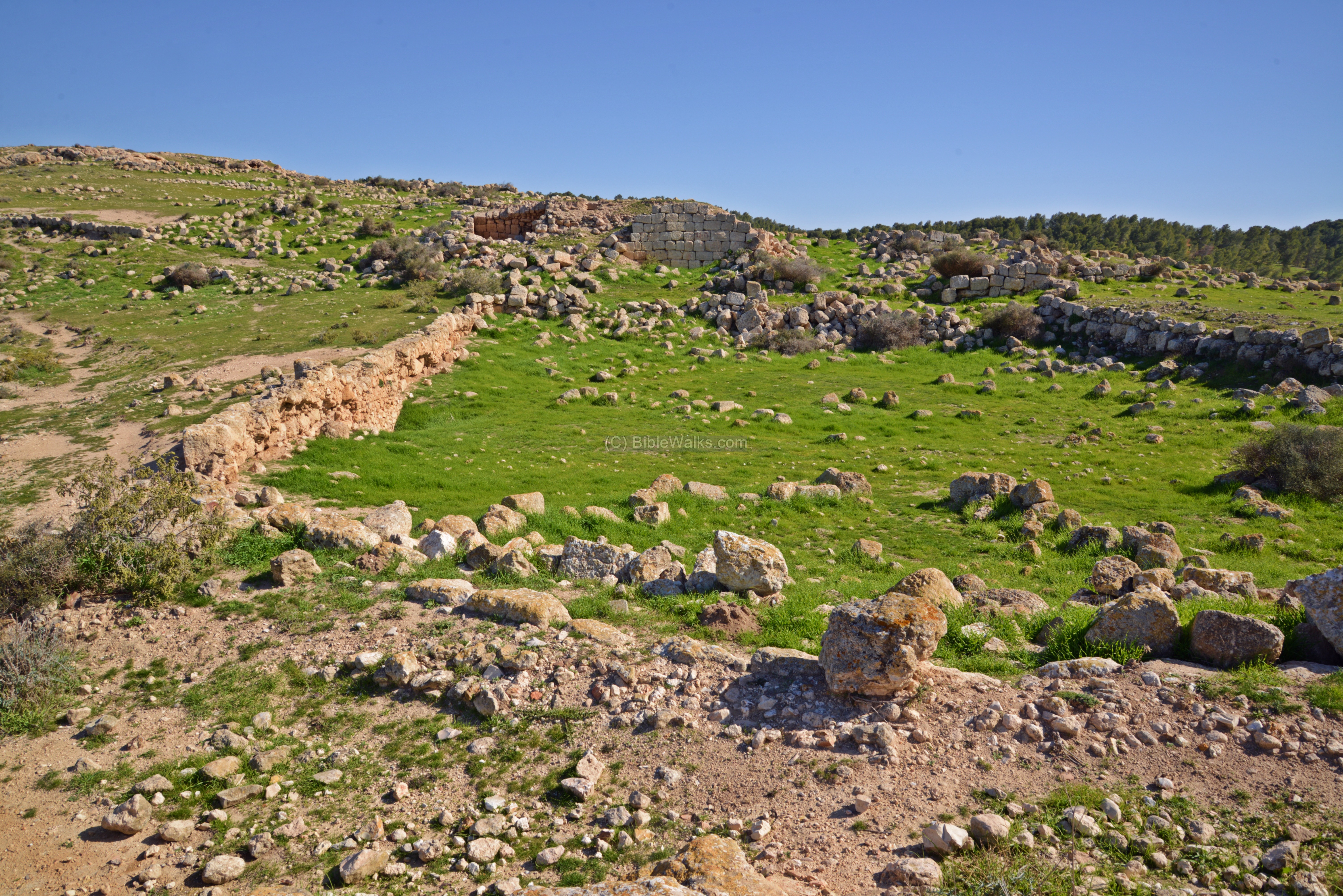
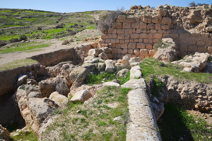
Western church:
To the west of the large reservoir are remains of the western church, 21m long (facing east) and 13m wide. It is dated to the 7th century. The church is built on the edge of the town, indicating it was added at a later phase of the settlement.
The structure was reoccupied during the Mamluke period, with three rooms built along the northern aisle.
A number of columns lie on the side of the remains of the church. Some of these are reused Nabatean columns.
The apse of the Byzantine church is located on the eastern side, just 3m from the edge of the reservoir.
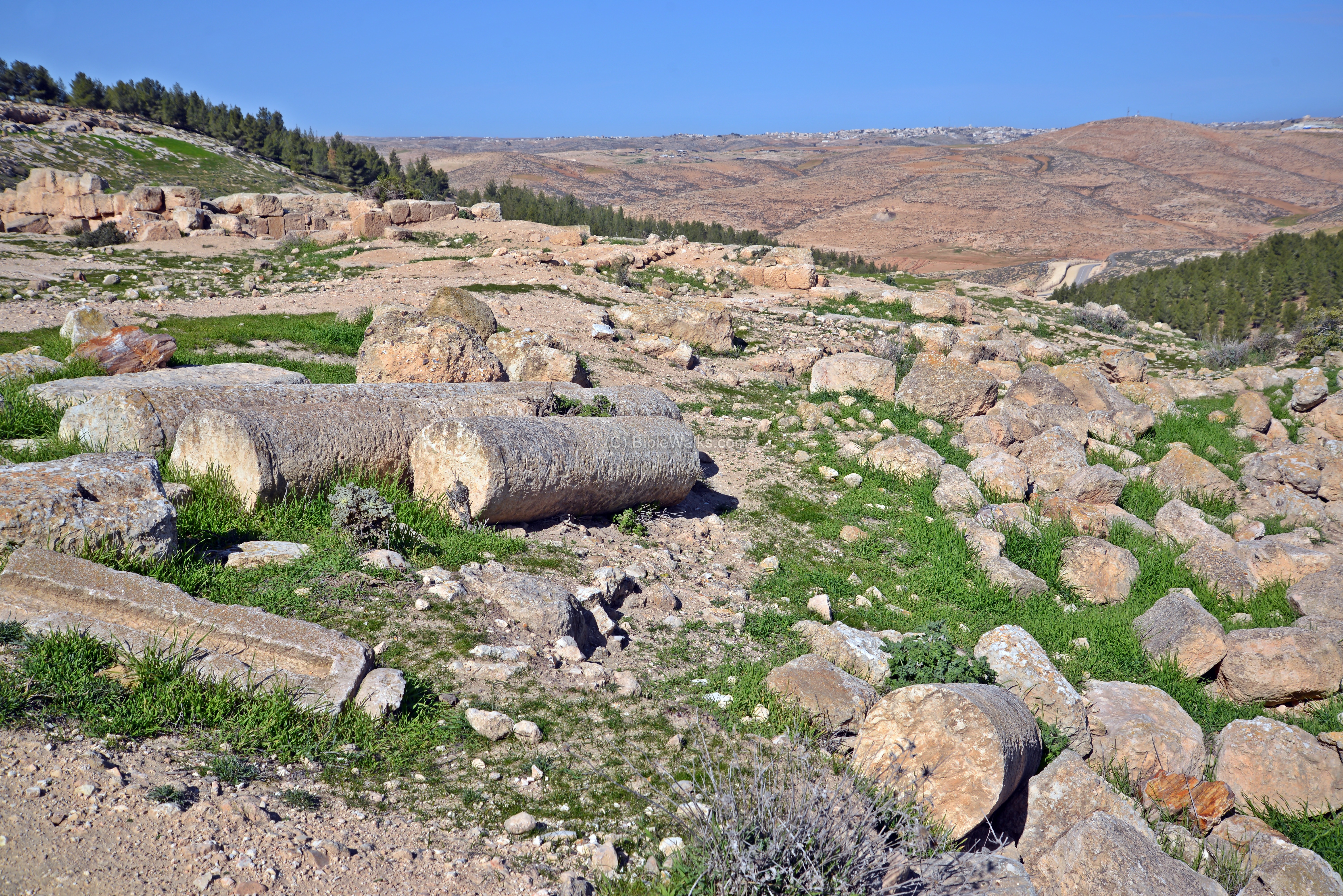
The plan of the church is basilica, with two rows of six columns each diving the hall into two side aisles. The columns stood on pedestals, each pedestal with a different style. Hundreds of terra cotta roof tile fragments and dozens of nails attest that the church was covered by a tile roof.
The aisles were paved with a simple white mosaic carpet, with decorations of stylized flowers.
An ancient cistern was found in the center of the atrium.
The water was collected into the cistern from the mosaic floor. The overflow waters were carried through underground channels to a cistern on the north side of the church.
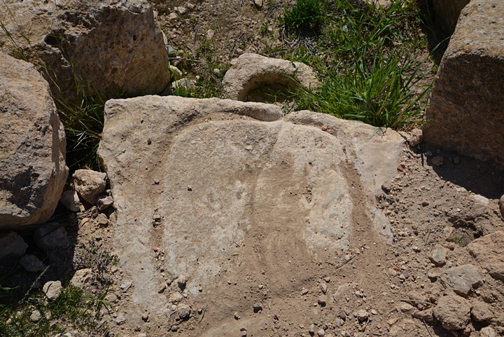
Sections of the mosaic floor are seen on the edges of the ruins. The mosaic floor, which was found at a depth of 180 cm below the modern ground level, was covered after the completion of the excavation in order to protect it. Two phases of the nave floor were identified. On the lower floor were illustrations of four birds and medallions of vines. The latter floor is divided into 23 strips, containing magic symbols and holy names.

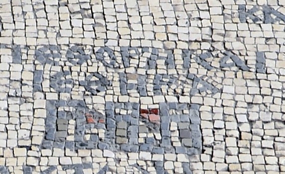
A panel containing a 12-line Greek inscription is located in the center of the mosaic floor, under a large cross. It is dated to 631/632, and reads1: “This work was completed in the month of March in the 6th Indiction, year 526 of the era of the city, for the benefit of the salvation and the aid of Thomas the most holy, abbot of the monastery. [The work was done] by me hands, Zacharias, son of Yeshi the builder, servant of God”.
1. Translation from article by Eshel, Magness and Shenhav; Israel Exploration Journal, Vol 50 3/4 2000 p .158

Photo of mosaic – courtesy Eli Shenhav
A room stands on the north side of the church. It may have been a chapel, and was later converted to a house during the Mamluke period.
The interior of the room is seen in the following photo.
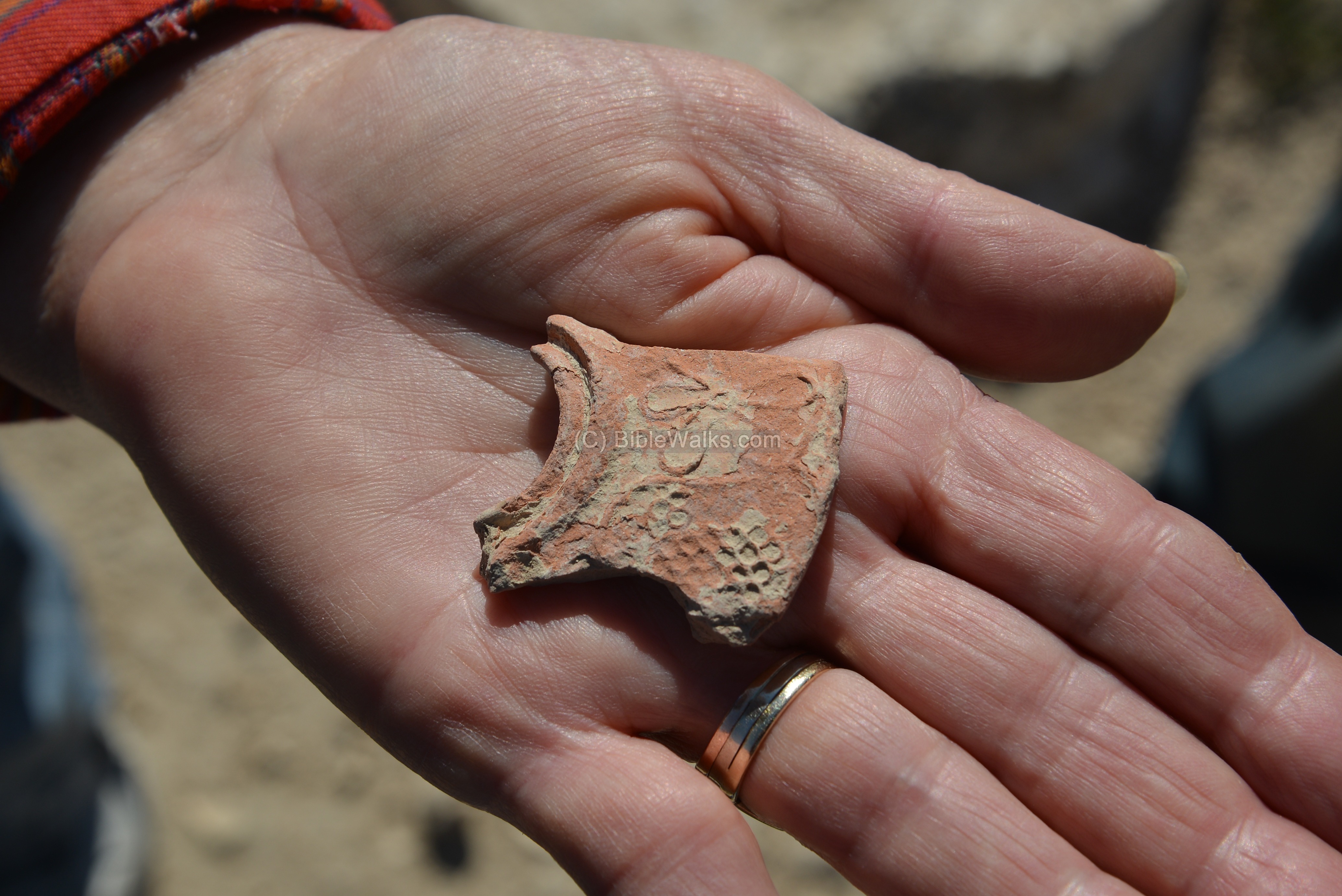
A fragment of an oil lamp was found among the ruins.
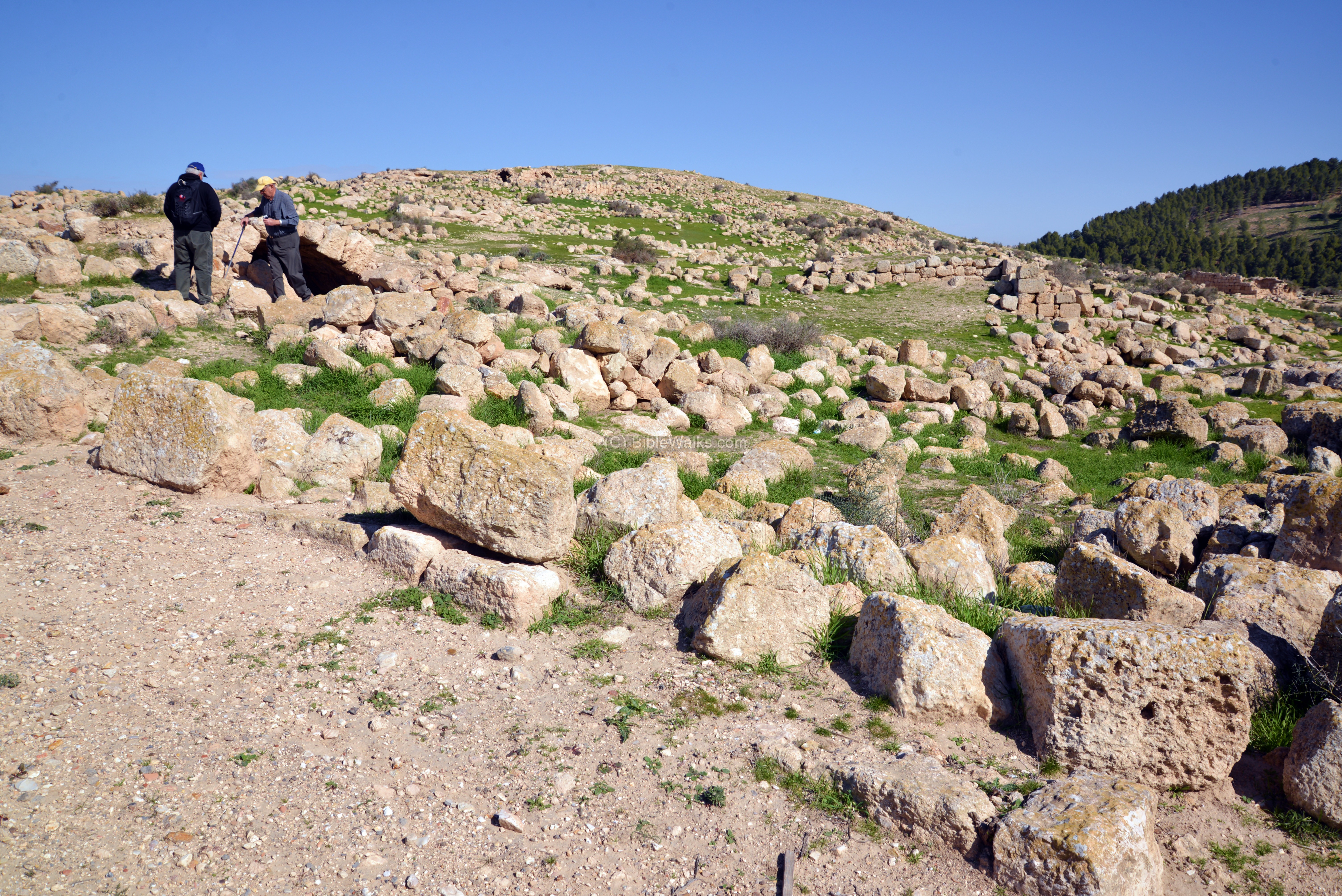
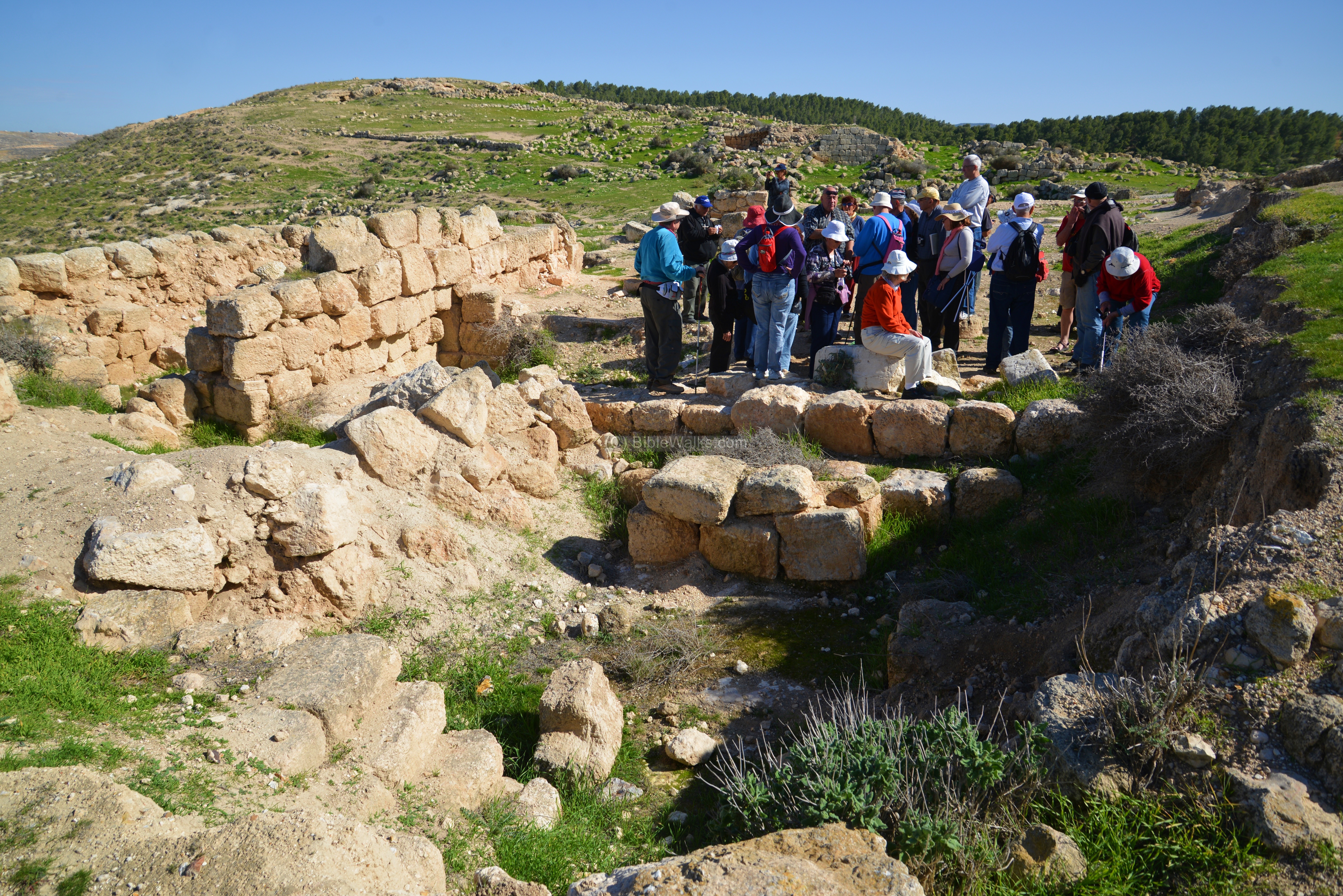
Center of site:
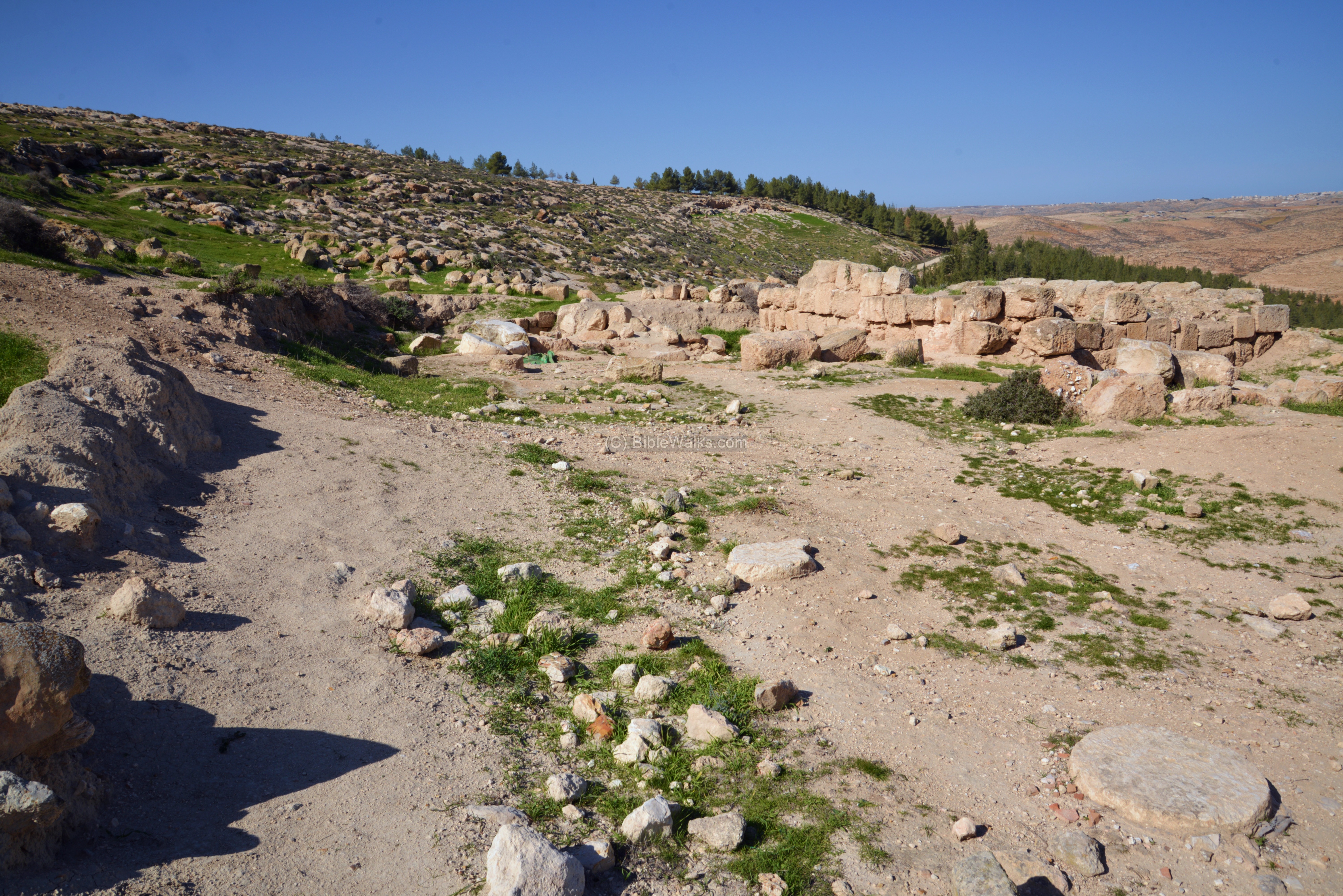
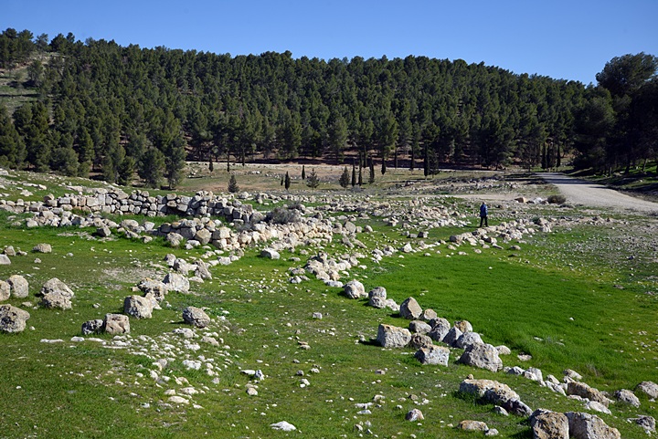
To the east of the church are the scattered ruins of the ancient city.
Remains of the ancient structures, caves, courtyards and streets are visible along the slopes of the hill.
Plan of the houses:
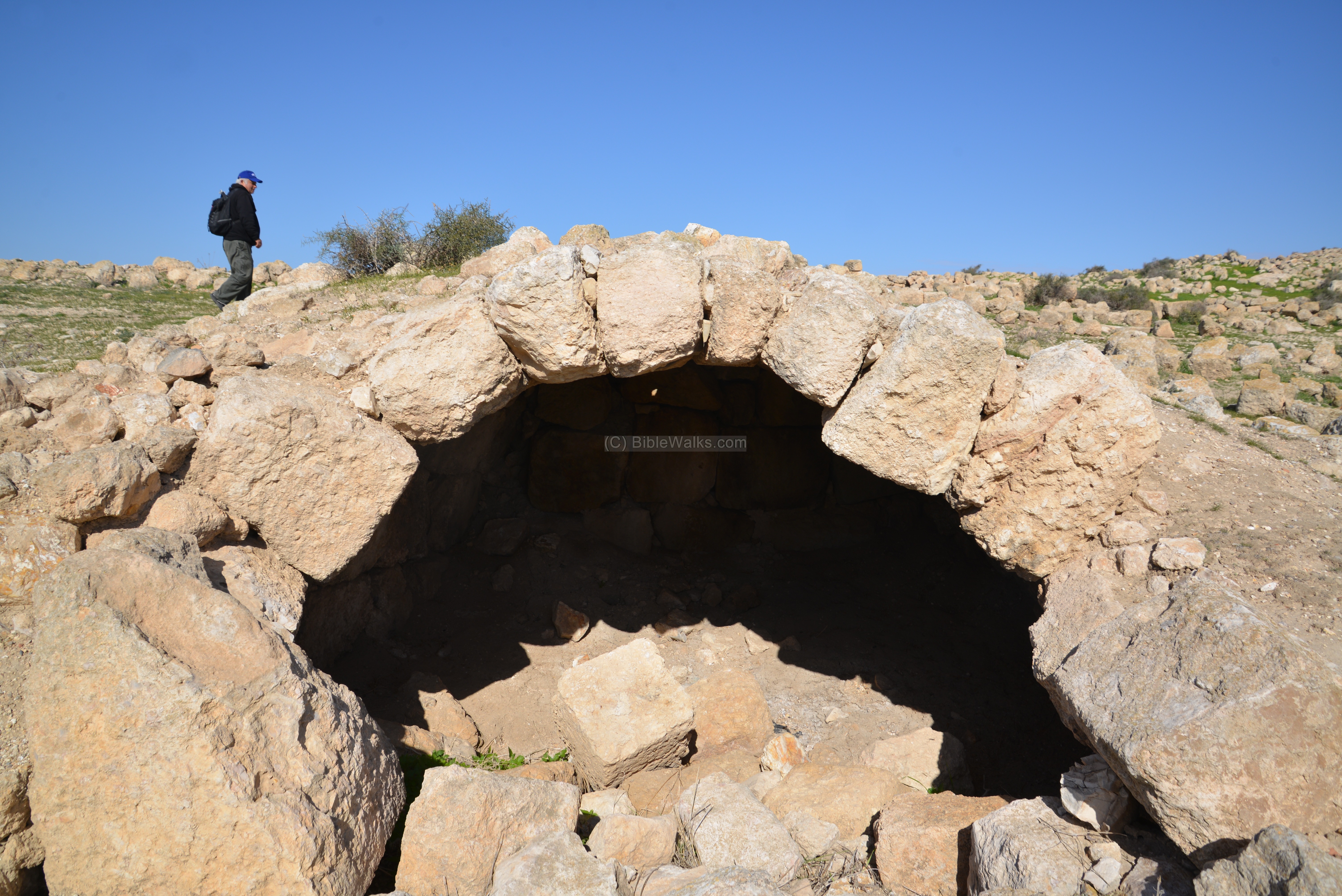
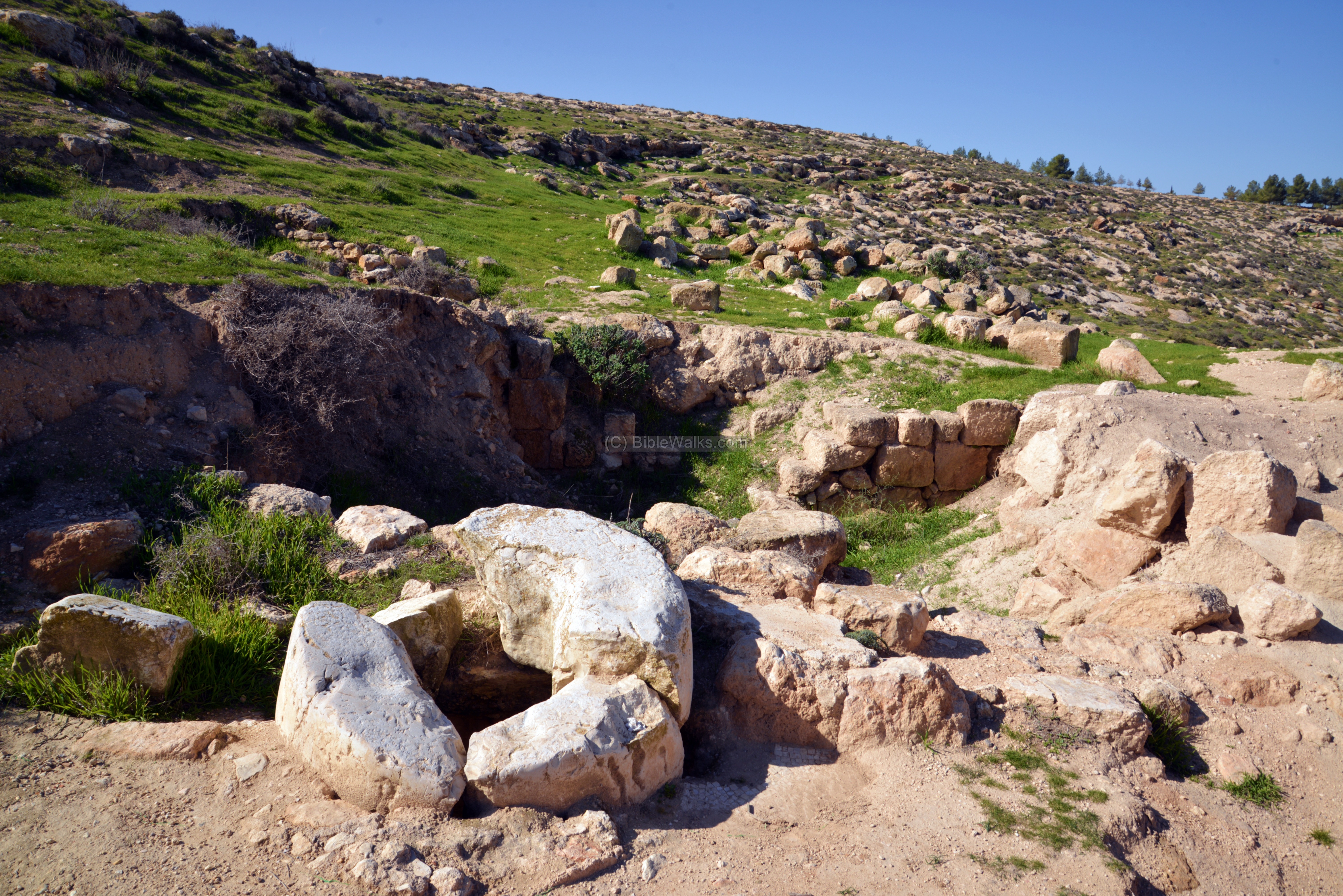
The standard design of the ancient houses in Yattir included a central courtyard, with a rock-hewn cistern serving as the local water supply.

The hill was built of limestone, overlaid by thick layer of chalk, and covered by a harder crust of nari (light chalky limestone). Once piercing thru the crust, one can easily cut into the soft layer of chalk. One of the characteristics of the chalk is it blocks the passage of water, making it perfect for cutting water cisterns and caves.
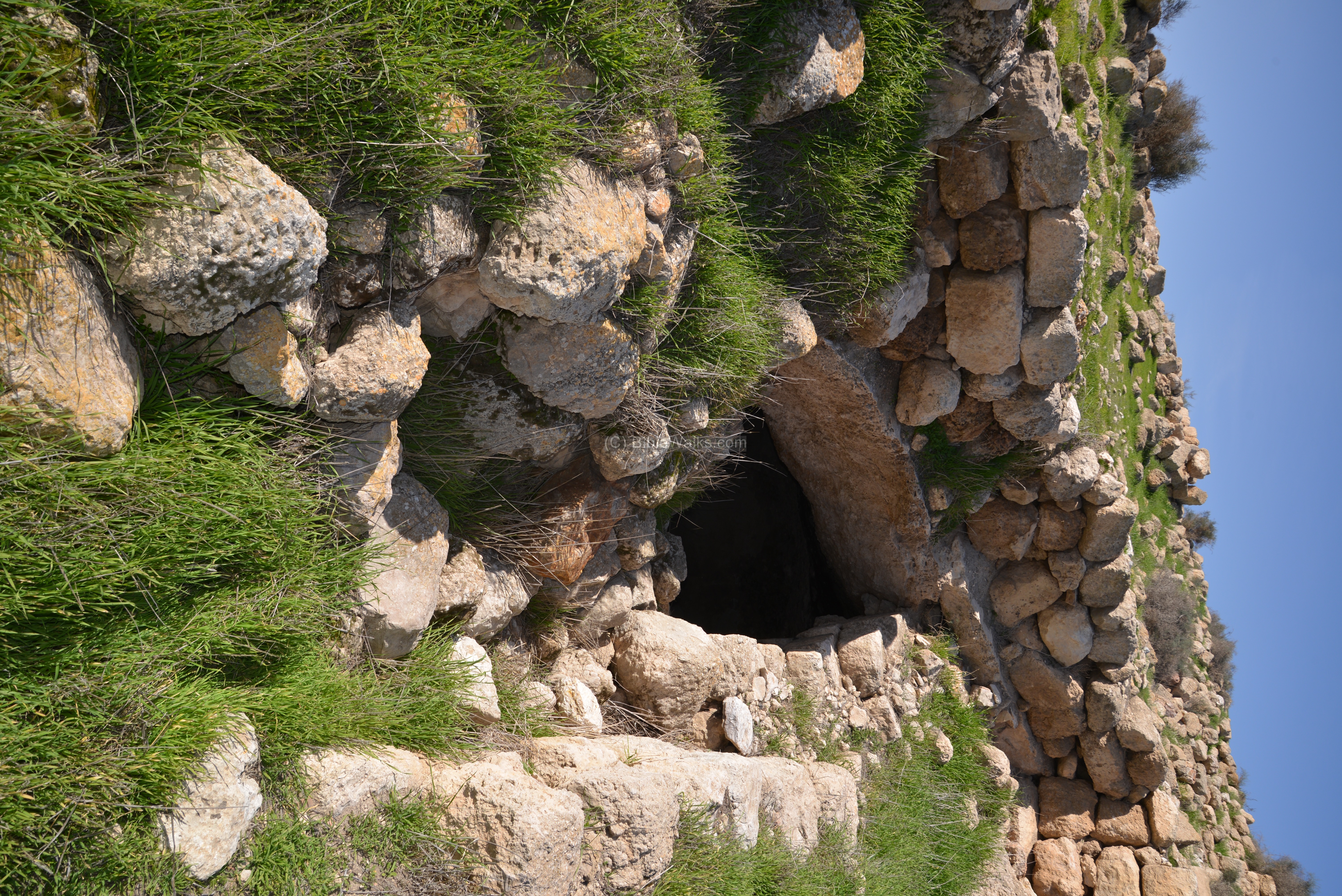
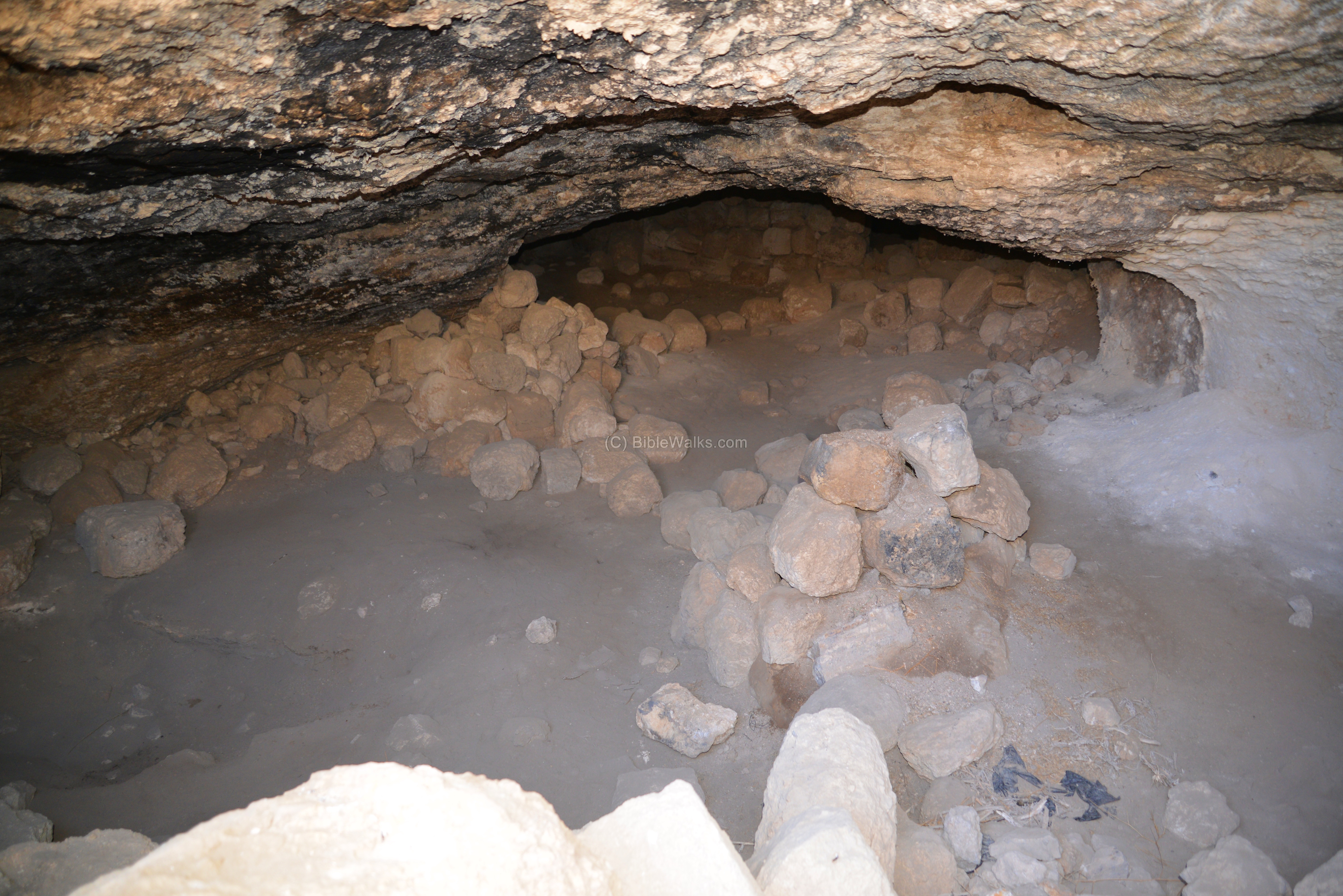
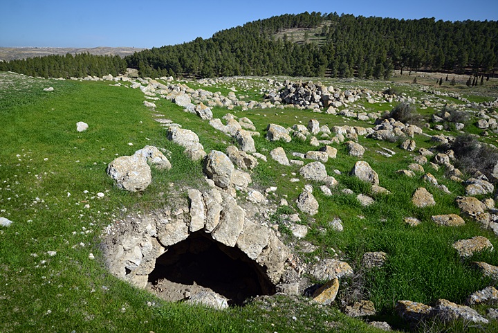
A rock-hewn cave was used for both dwelling and storage. Inside this cave are remains of dividing walls.
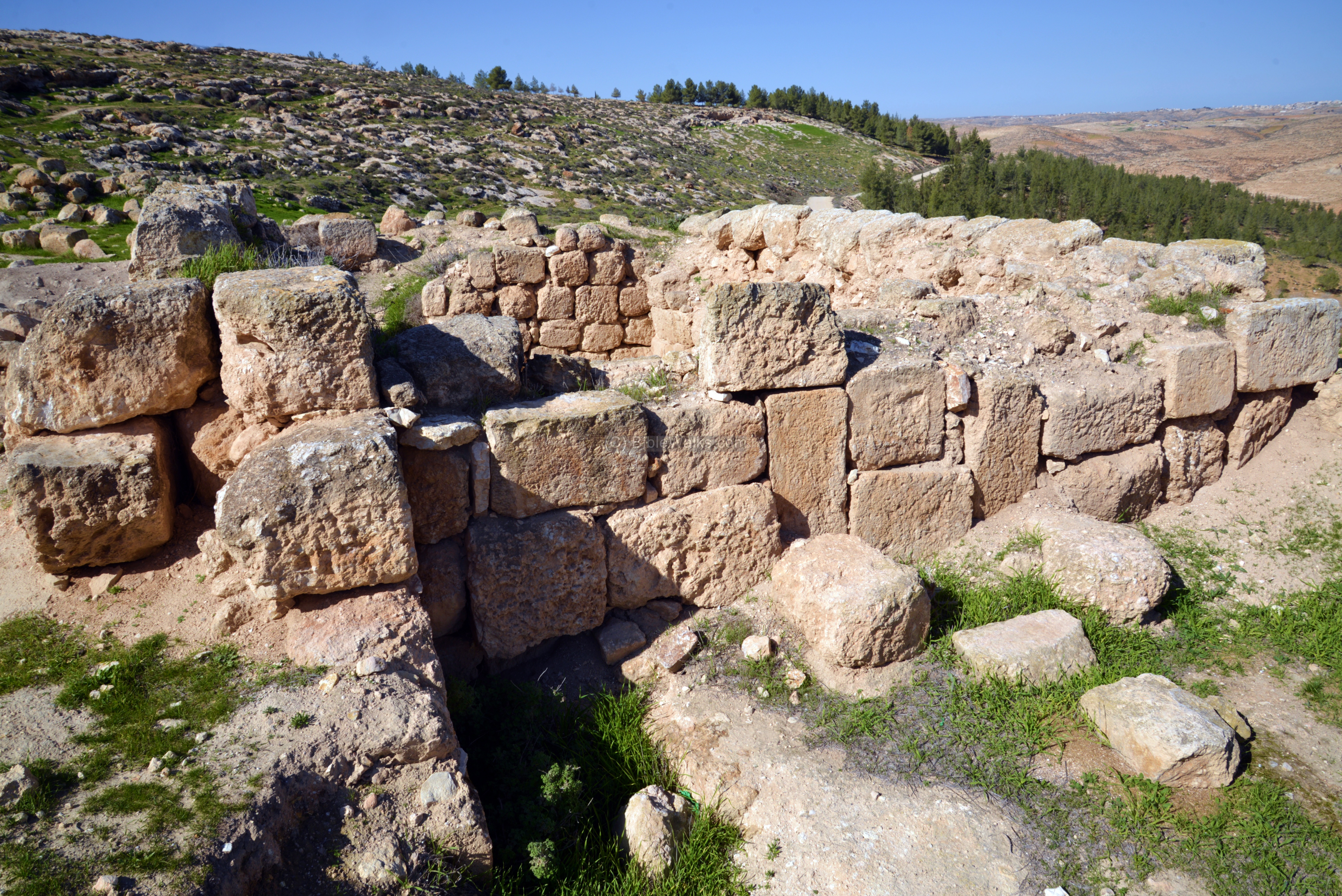
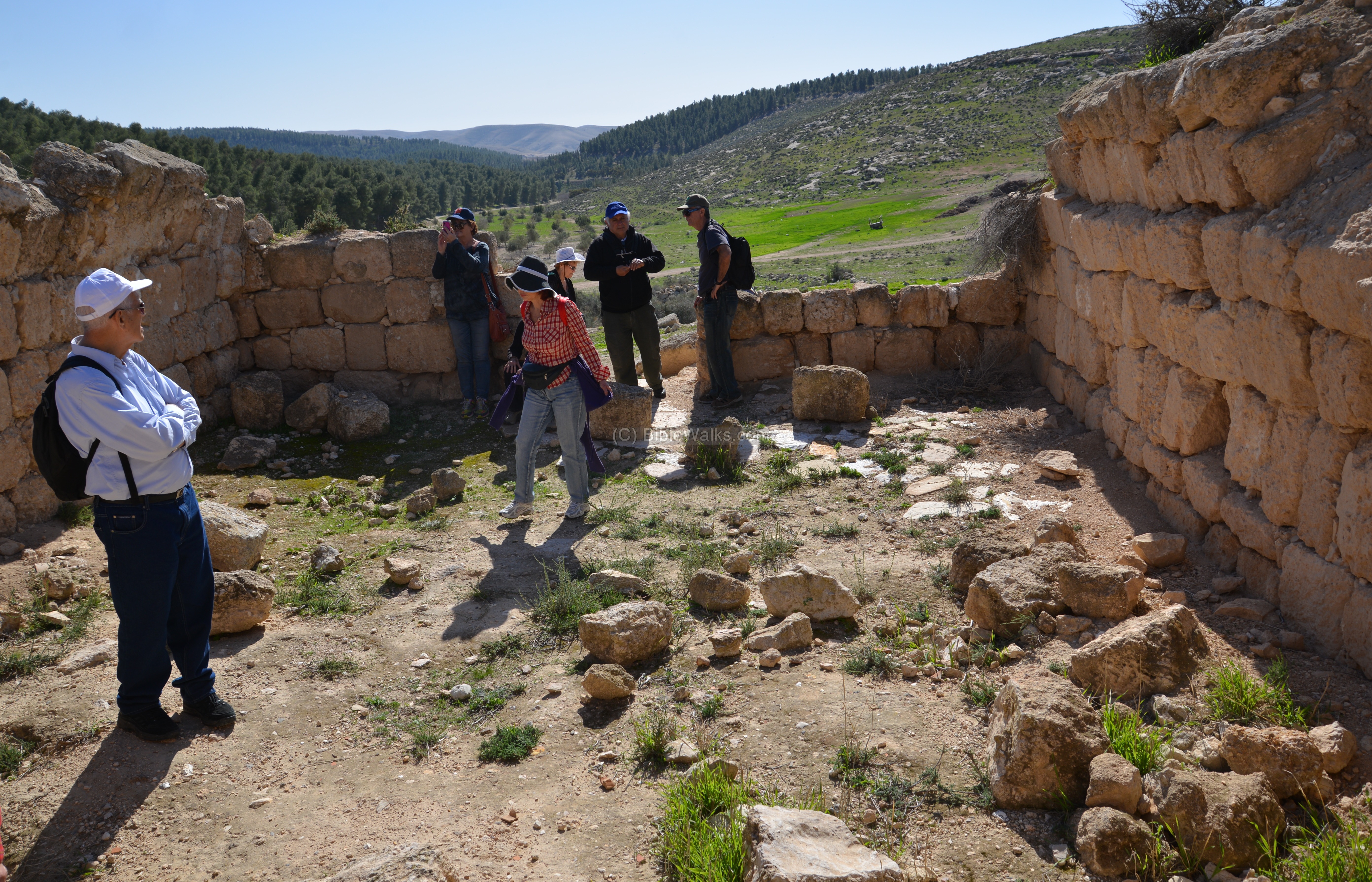
Area B: Mosque
Area B is located on the eastern side of Yattir. The excavations focused on a square stone building, with the size of 11m by 9.7m and thick (1.2m-1.5m) walls. The structure is a single room which was standing with a one storey high. Its floor was paved with reused stone tiles. Its orientation is north-south, so it might have been a synagogue in earlier phases of Yattir. The columns found on the east side of the structure also imply that this was a public structure.
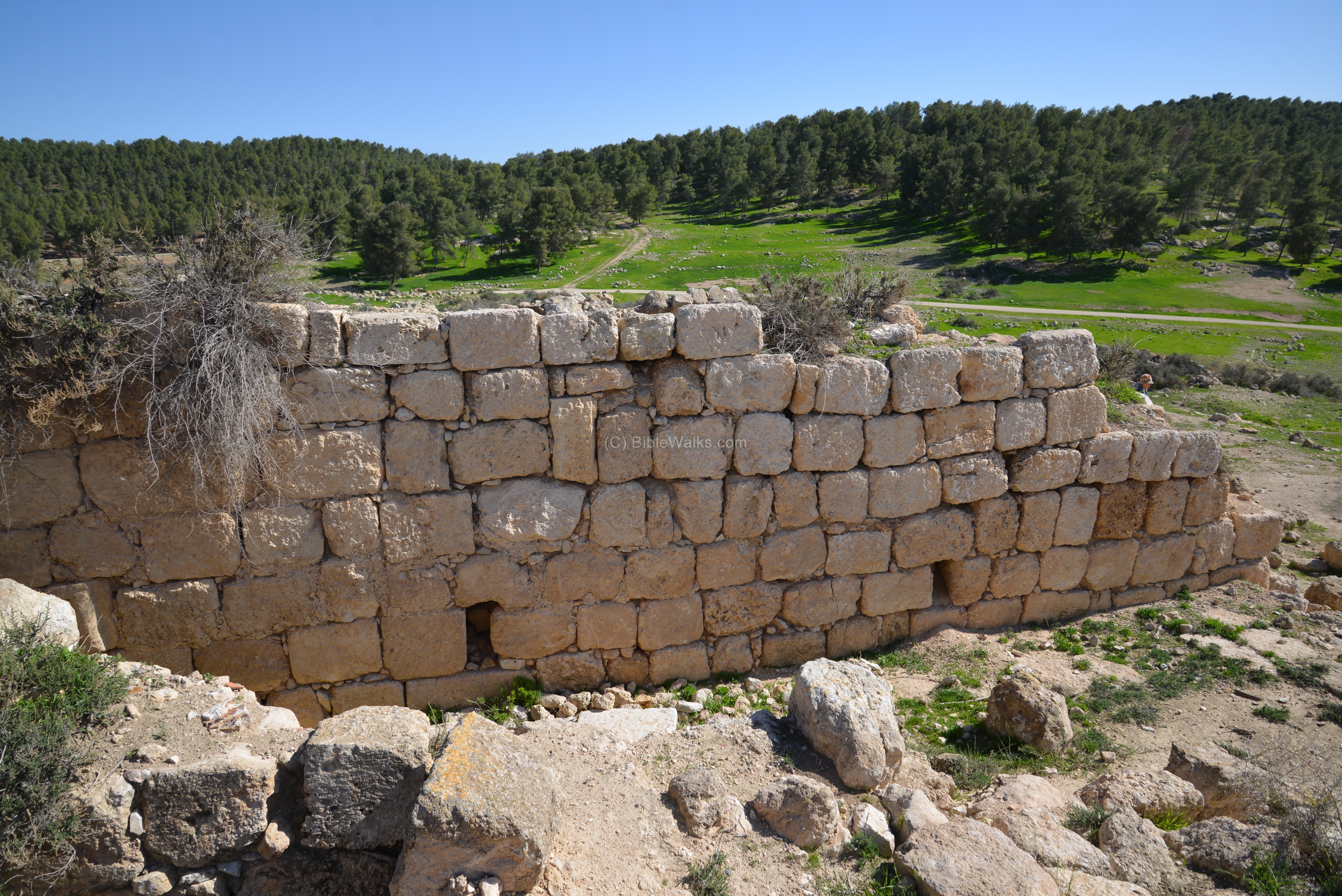
Inside the structure are remains of a built vault; its base is visible on the left and right sides of the following photo. The collapsed stones of the vault were found inside the structure.
A curved niche (73 by 67 cm) is seen in the middle of the south wall, implying that the structure was converted to a mosque. The fill on the front and back of the structure includes remains from previous periods of Yattir, especially Iron age ceramics.
Outside the southern wall are remains of a road, paved with flagstones. A reused column was laid in order to create a step above the road.
A small olive press was found near the structure. Around the site, on the north and south sides of the hill, were the majority of the agriculture installations, with 14 ancient wine presses and four olive presses.
Area D: Northern Church
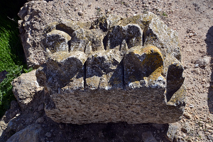
Area D, near the summit on the north side of the hill, is where the ruins of another Church was found. The excavations of this area was opened after finding the large stylized Corinthian pilaster capital on the surface.
The excavations revealed a large Byzantine basilica-type church.
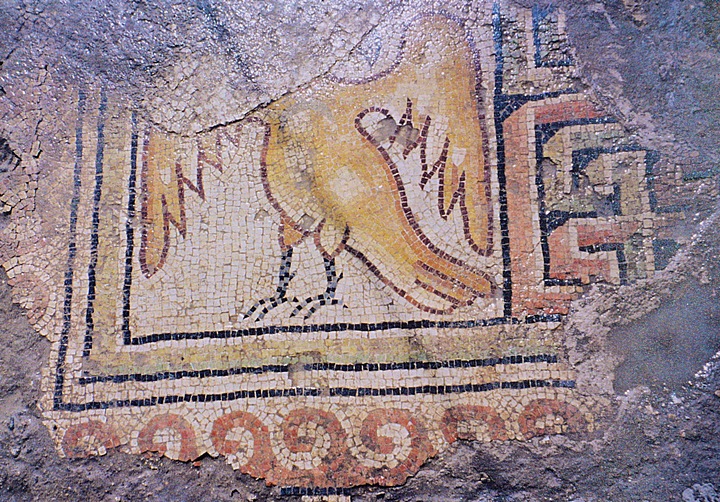
On the north-western side of the nave, a section of the mosaic floor survived with a part of an eagle:
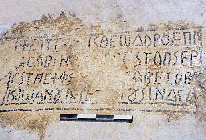
This 4-line Greek inscription on the mosaic floor of the church, opposite of the entrance from the narthex, reads2:
“In the days of the most Holy Bishop Theodoros and Sabinios the Presbyter, all of the work on the mosaic was done [by] Absobo and Jonathan and Jeremiah in the fourteenth Indiction”.
2. Translation from article by Eshel, Magness and Shenhav; Israel Exploration Journal, Vol 50 3/4 2000 p .165
This mosaic was covered by plaster during the early Muslim period, as seen on the top and bottom of the photo.
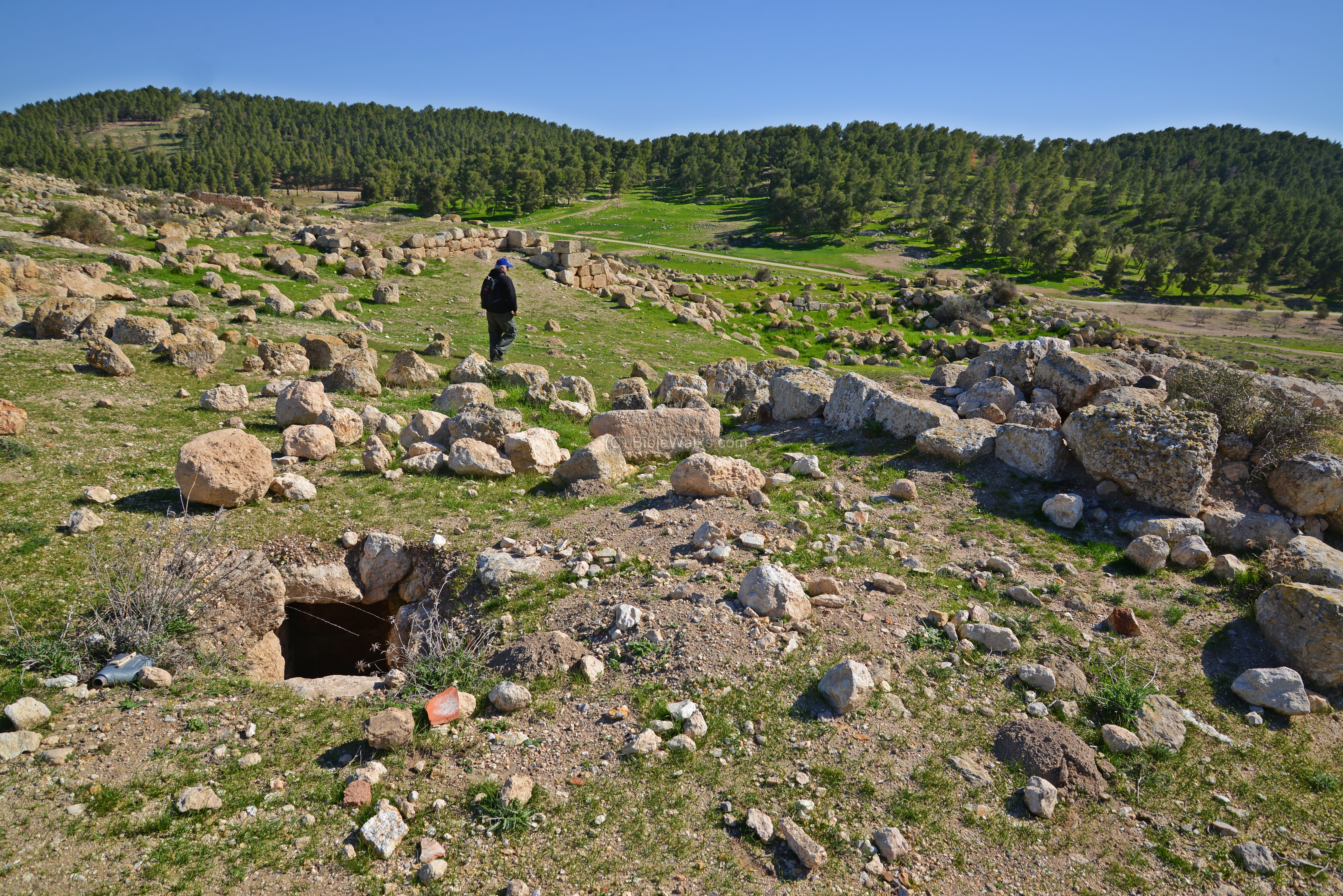
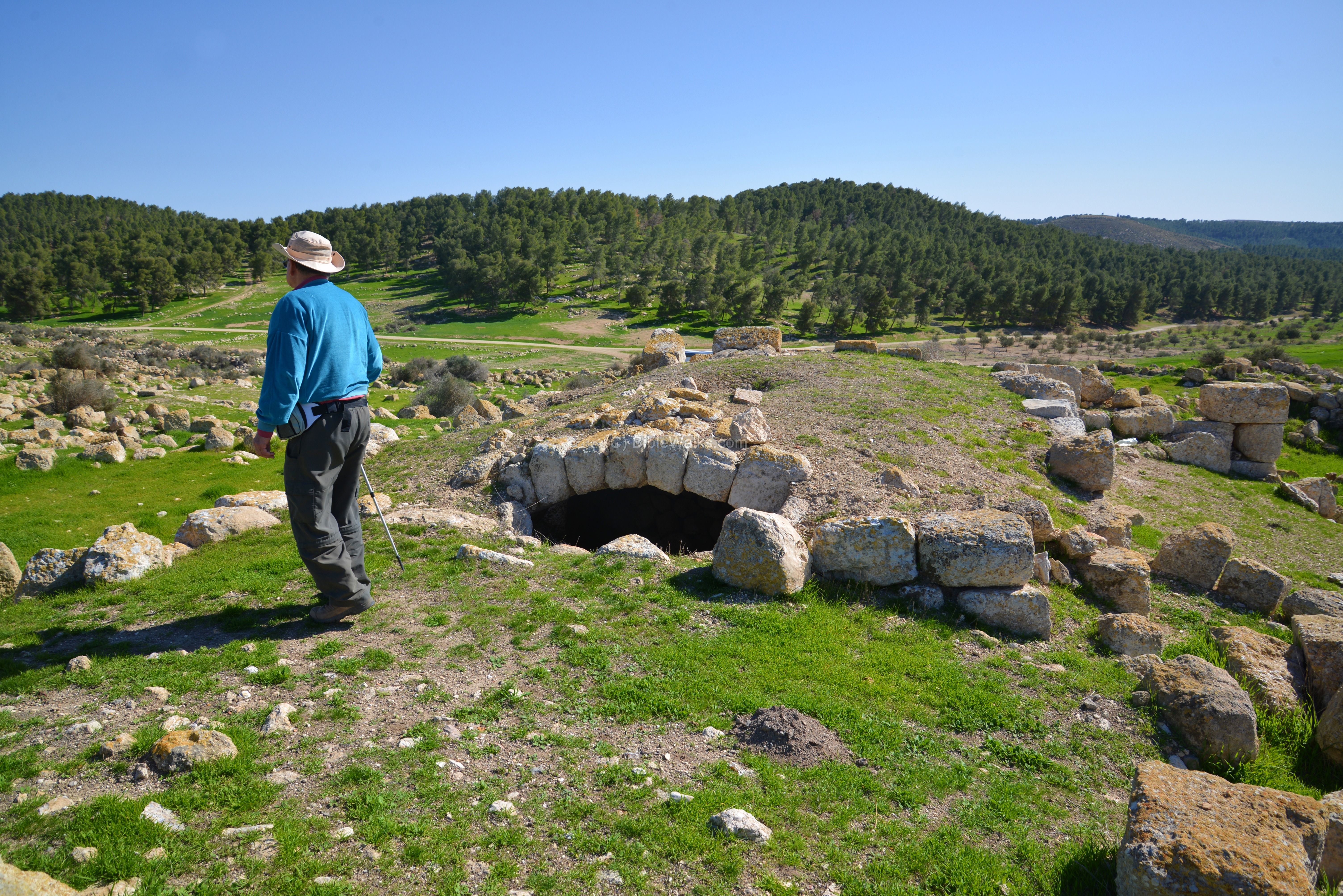
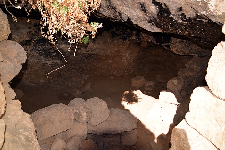
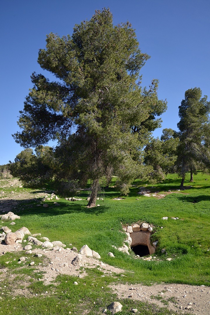
Underground :
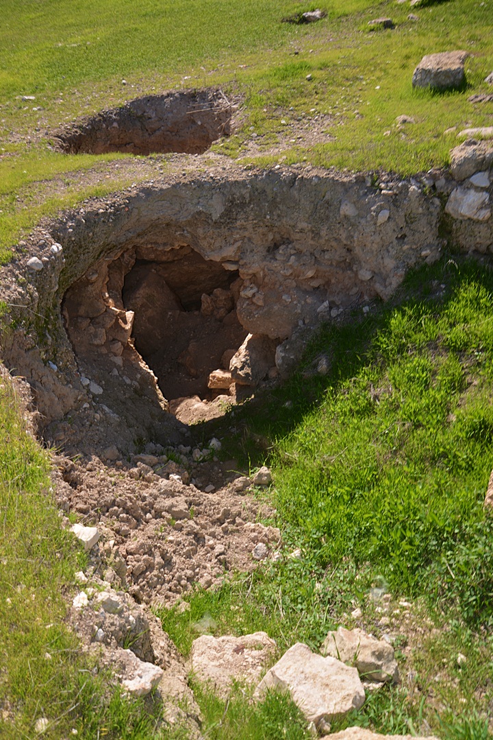
Many cisterns and caves were hewn in the soft chalk layer below the nari crust. The site is potted by caves, holes and tunnels.

Recent heavy rains penetrated the surface, resulting in cave-ins.
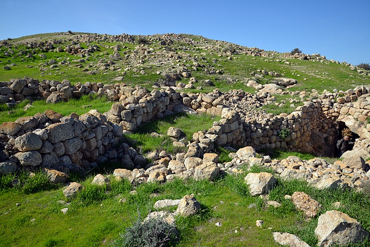
North-Eastern Side :
The north eastern side of Yattir is covered by traces of stone walls and houses, vaults and streets.
The ancient houses of Yattir included a cave cut into the soft chalk layer. The cave was separated by walls, and was used for storage and dwelling purposes. Perhaps, some of these caves were used as hiding places during the revolts against the Romans.
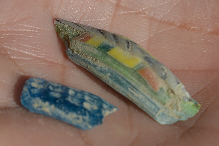
Some interesting colored glass fragments were collected among the ruins:
Among the houses are vaults, such as this one:
Remains of a street lead down to the eastern side of Yattir.
A view from the end of the street towards the summit:
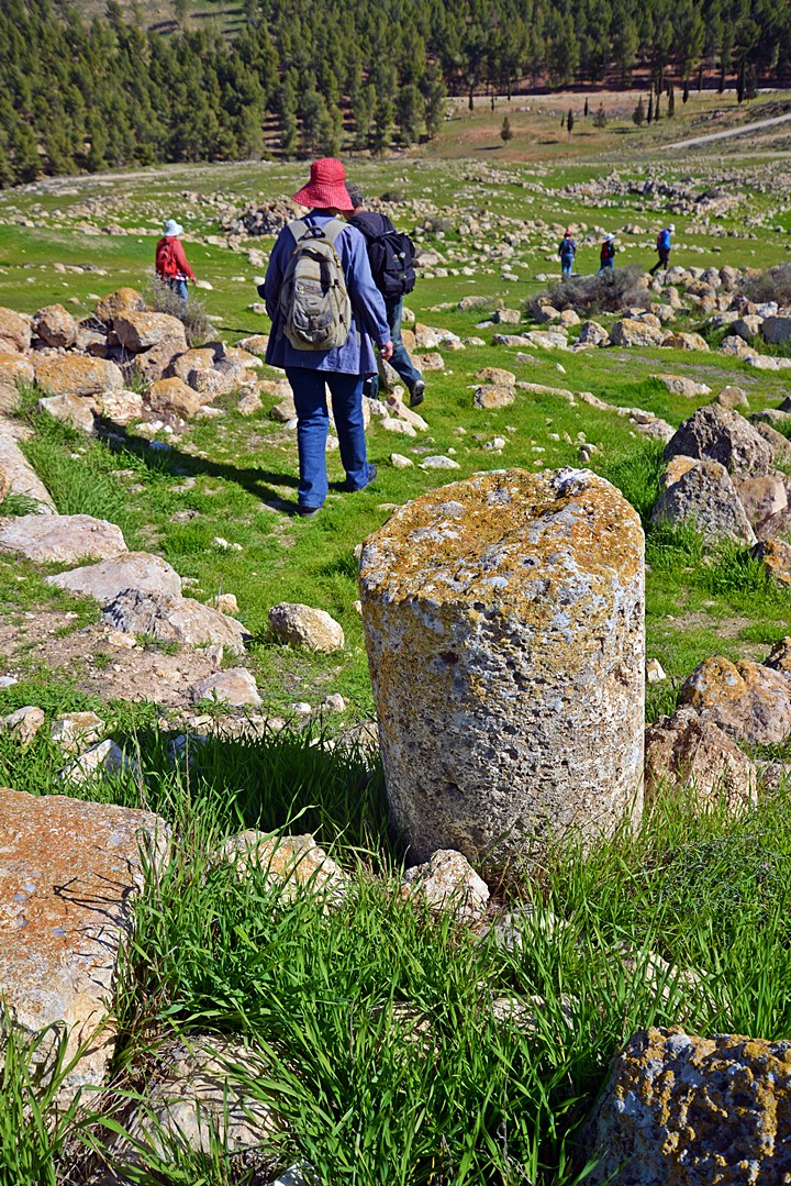
To the east of Yattir are wells, tombs and agriculture installations.
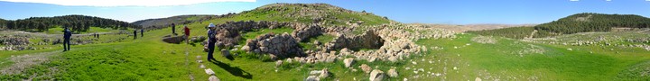
Panorama:
A panoramic view of the sights from the north-east side of the site is seen in this next photo. Pressing on this picture will pop up the panoramic viewer. Using this flash-based panoramic viewer, you can move around 360 degrees, zooming in and out – viewing the site in the amazing full screen mode (like you are really there). Points of interest are indicated on the view. It may take minutes to upload, but then its worth the waiting time.
To open the viewer, simply click on the photo, then tour the area around:
Nature Photos:
During winter these big dark-green leaves appear, and a cluster of purple flowers emerge in its center. These are the Mandrake flowers (Hebrew: Duda’im).
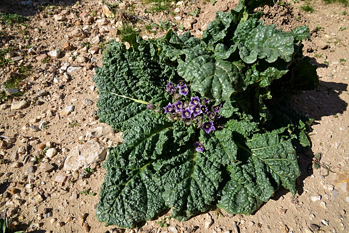
The fruits of this plant were used for treating fertility problems, as told in the Bible (Genesis 30:14): “And Reuben went in the days of wheat harvest, and found mandrakes in the field, and brought them unto his mother Leah. Then Rachel said to Leah, Give me, I pray thee, of thy son’s mandrakes”.

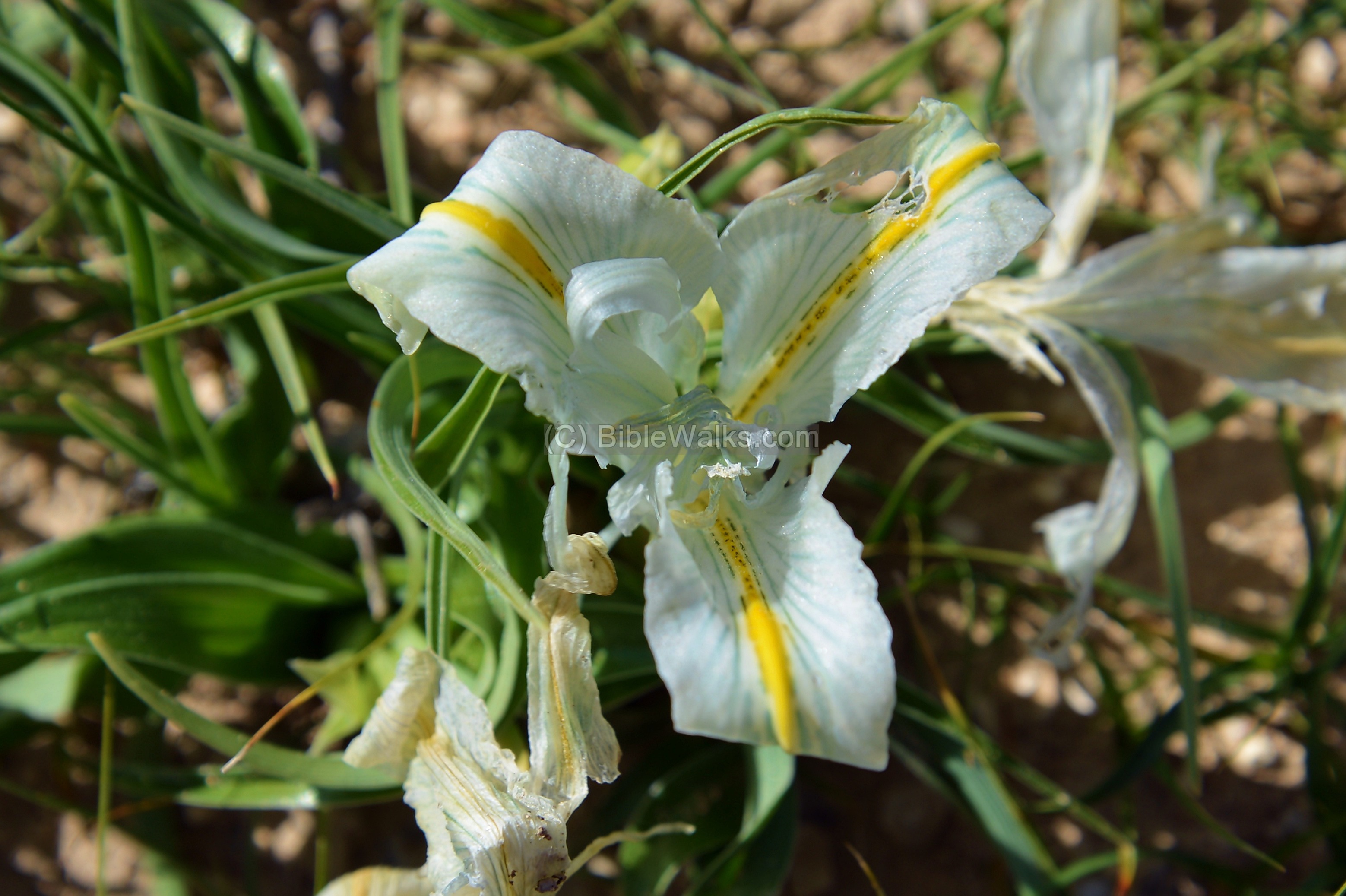
Iris: Another winter flower is the Iris Palaestina (Israeli Iris), a small flower with white flowers and yellow strips.
Turtles: There are also shy turtles here, pulling their head under the cover of the shell.

Another shy turtle was crawling around another section.
Biblical references: The turtle (Hebrew: “Tzav”) is mentioned in the Bible as an attribute of “being covered” since it has a covering shell. A type of wagon was called “turtle” in the Hebrew version in 2 references: Numbers 7 3: “And they brought their offering before the LORD, six covered wagons,…” and Isaiah 66 20: “And they shall bring all your brethren for an offering unto the LORD out of all nations upon horses, and in chariots, and in litters…“. The latter word was not properly translated in the KJV version but in the Hebrew it appears as a sort of covered wagon.

Etymology (behind the name):
* Names of the site:
- Yattir, Jattir –Biblical name
- Ietheria – the name during the Byzantine period, as referred in the Omnasticon.
- Iethor, Ietheria – Appears on the Madaba map as “Iethor also Ietheria” (ΥΕθΟΡ, ΗΚΑΙ ΙΕθΗΡΑ).
Its location on the map was misplaced to be south-west of BeerSheba.
- Attir – Arabic name of the ruins. A holy Sheik’s tomb on top of the hill preserved the ancient name of Yattir – Sheik el ‘Attiri.
- Daroma – Hebrew: south (region south of Hebron, referred by the Onomasticon)
- Onomasticon – a book of Biblical places, written by Eusebius Pamphili (better known as Eusebius of Caesarea), a 4th Century Greek historian of the Church
- Idumea – Greek word of Edom (the Biblical name), a region south of Judea and in TransJordan.
* Biblical references:
- Joshua 15:48: “And in the mountains, Shamir, and Jattir, and Socoh,…”
-
Joshua 21:14: “And Jattir with her suburbs, and Eshtemoa with her suburbs,…”
-
1 Samuel 30:27: “To them which were in Bethel, and to them which were in south Ramoth, and to them which were in Jattir”.
- 1 Chronicles 6:57: “And to the sons of Aaron they gave the cities of Judah, namely, Hebron, the city of refuge, and Libnah with her suburbs, and Jattir, and Eshtemoa, with their suburbs,”.
Links:
* External:
-
Yattir preliminary report
-
Yattir forest – KKL-JNF page on the largest planted forest in Israel
-
Hadashot ESI – Survey along the border fence final report 2009 (Hebrew)
-
South Hebron area – Yehuda Guvrin (Hebrew; great article)
-
Christians in south Hebron – Word, Hebrew
* Nearby sites:
BibleWalks.com- Have Bible, will Travel!!
Herodion<<<—previous site—<<< All Sites >>>—next Judea site—>>> Horvat Anim
This page was last updated on Mar 15, 2014
Sponsored links: