Tel Ya’af is a biblical site located east to Rosh-Pinna, on the route of the ancient road to Syria.
Home > Sites > Upper Galilee > Tel Ya’af (Tell el Qusab), Rosh Pinna
Contents:
Background
Location
History
Aerial Map
Photos
–General view
–South
–North
–Rosh Pinna
Biblical
Etymology
Links
Background:
Tel Yaaf (Ya’af) is a biblical site – east to the town of Rosh-Pinna. It is not identified, but may be one of tribe of Naftali cities (such as Adamah or Ramah).
The Tel is split among two hills – the lower city on the north and the upper city on the south.
After the Hellenistic period the Tel phased out, and transferred to the west hills above.
Location:
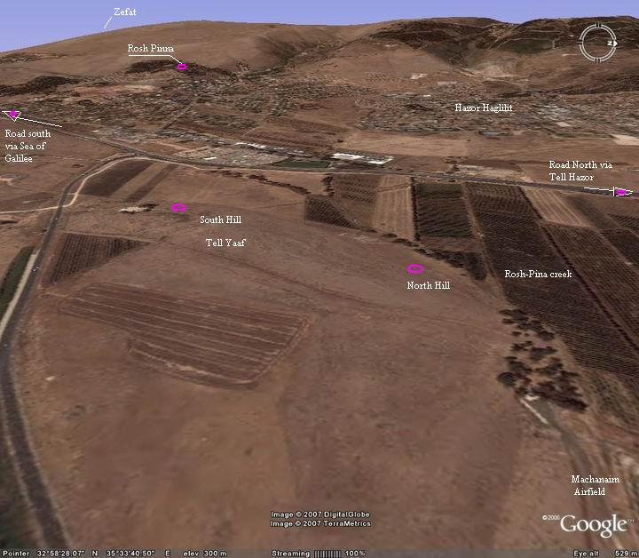
Tel Ya’af is located a hundred meters from the main road east of Rosh-Pina industrial zone.
An aerial photo of the Tel is shown below, indicating the major points of interest.
History:
The Tel (mound) was populated in the Iron age, as established in emergency excavations (2006) in a small area in its southern section.
This ancient city was located on the main ancient road through Syria to Babylon. There was one route north, following the modern road through Tel Hazor. It is seen in the Biblical map below as dashed line, with the site marked as a red circle.
Another route went east, through the road that passes Tel Yaaf from the south, crossed the Jordan river and up to the Golan heights. There are many other ancient ruins around – Tel Nes (1.5Km south), Khirbet Shura (1.5KM east), and other smaller sites, all located on the path of the ancient trade route.
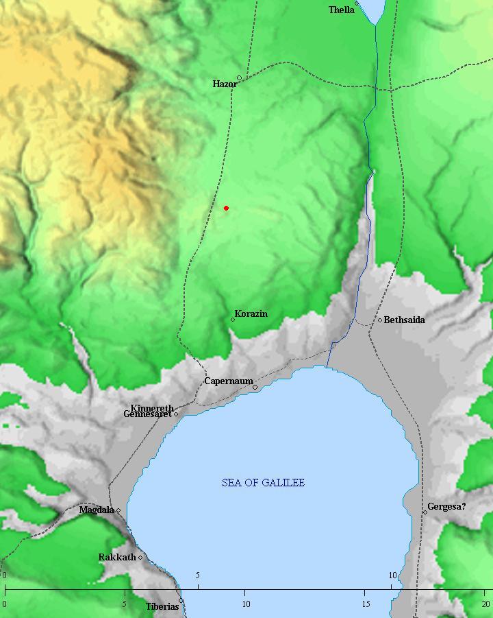
Roads and cities during the Israelite to Hasmonean period, 12th- 1st century BC (based on Bible Mapper 3.0)
Most of the Tels phased out during the Hellenistic period, and so did Tel Yaaf. The ancient city expanded to the hill above, where the town of Rosh-Pinna exists today. In this area there was a Roman village, but only traces of that village were found, such as a Roman wine press stone, and some stones that might have been part of an ancient synagogue.
In later periods an Arab village existed – Ja’uni. This village existed until 1948, and gave Rosh-Pinna its initial name – “Gia-Onni”.
Rosh-Pinna is today a town that was founded in 1878, first as a farm, and later (1882) as a Colony (Moshava), part of Rothschild’s Israeli Colonies. These early buildings are now undergoing reconstruction and some of the restored houses are open to the public.
Photos
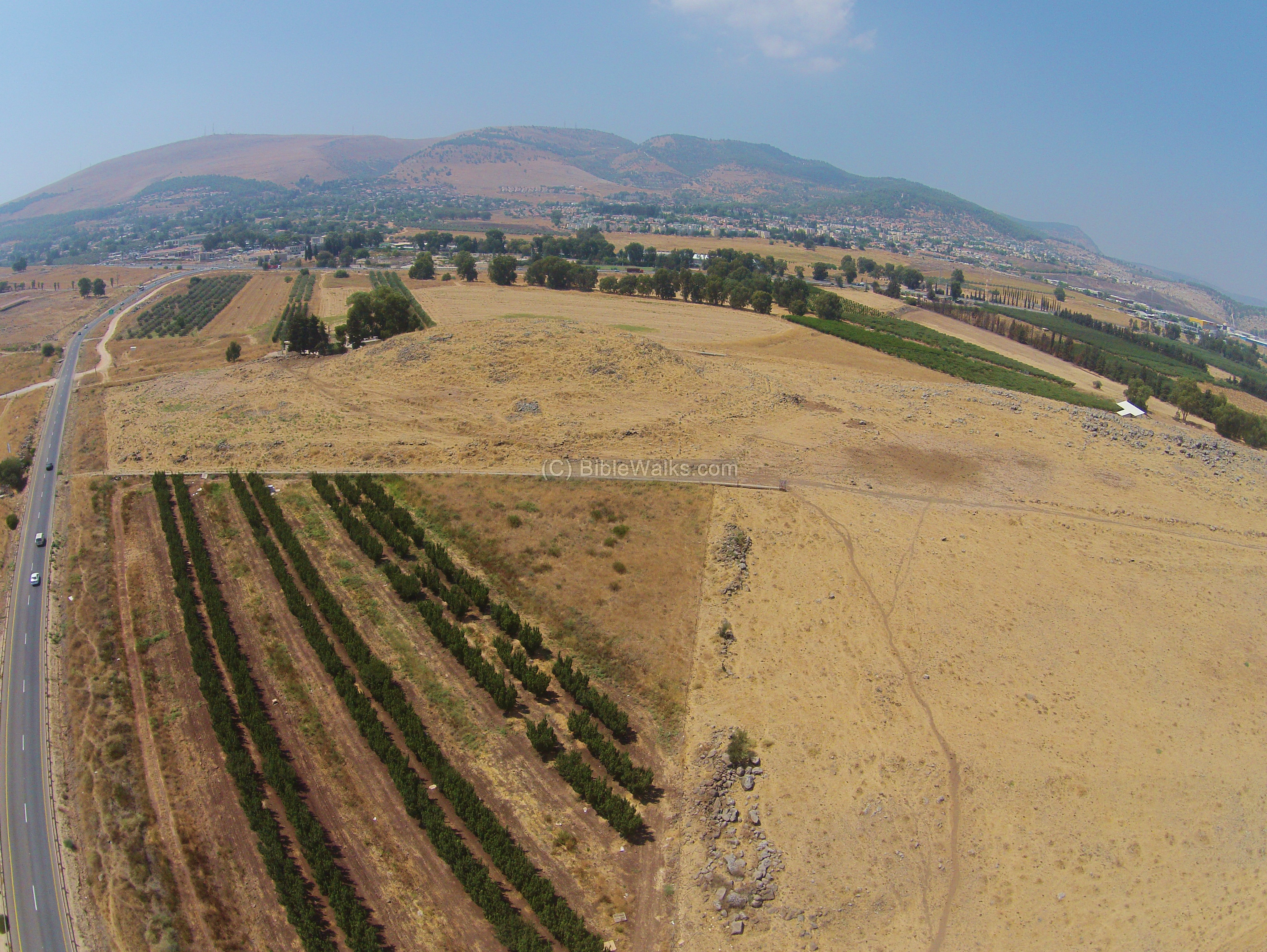
(a) General views:
An aerial view from the south east side is shown here. On the left side is the higher south hill, while on the right is the lower hill. The modern village of Rosh Pinna is in the far background.
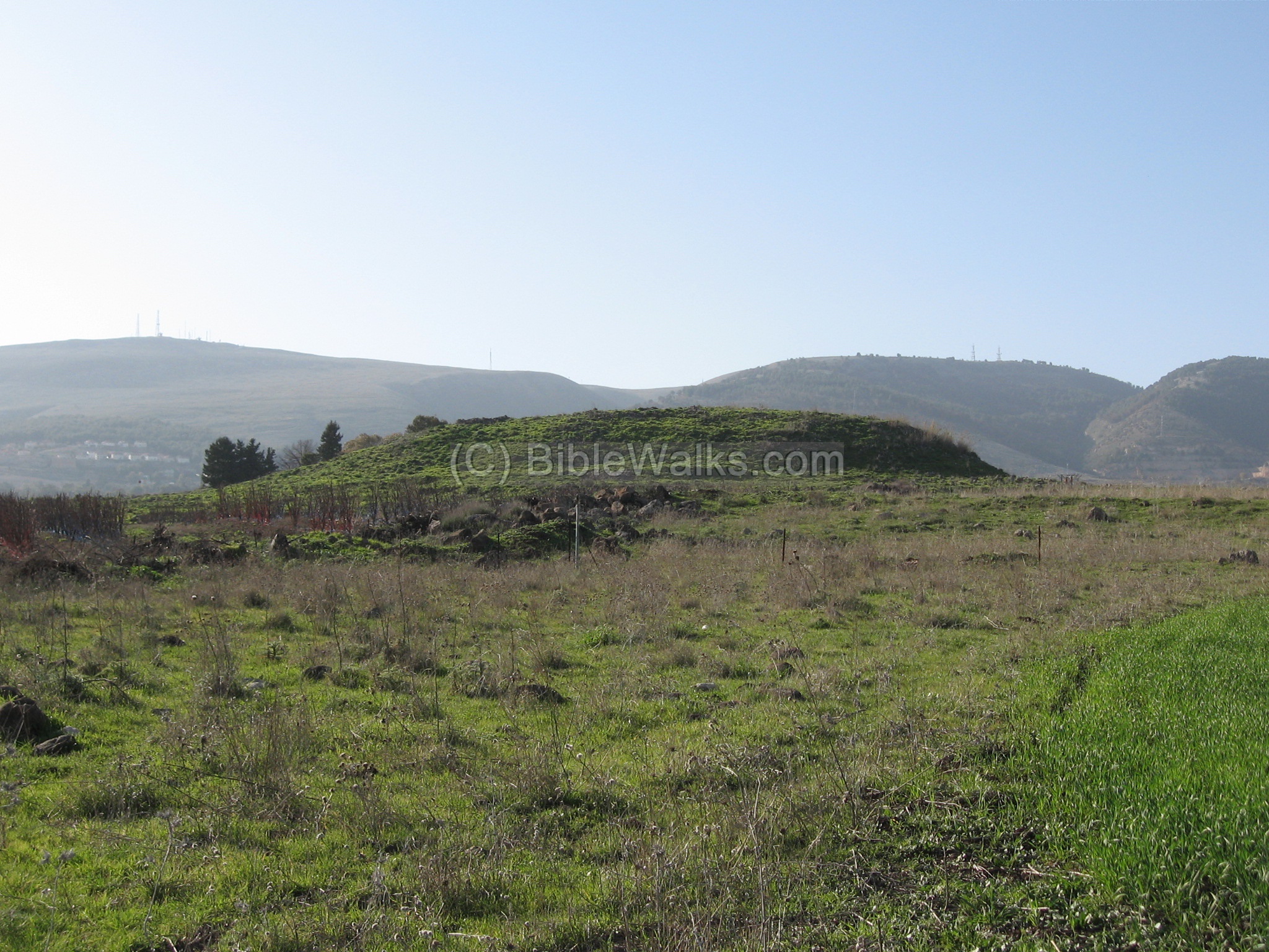
The next photo shows a ground view of the Tel from the west side.

(b) South Hill
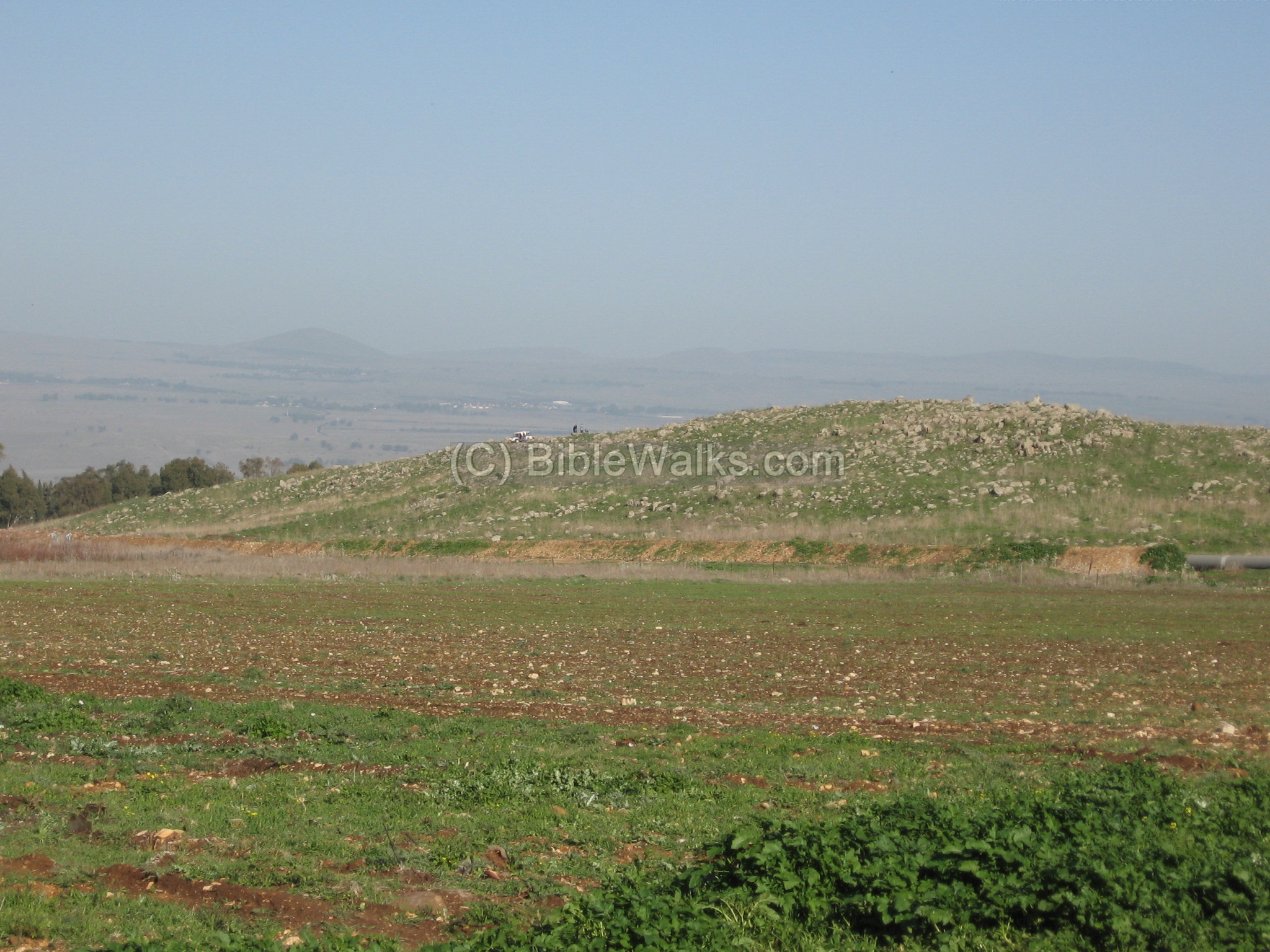
This photo shows a closer view of the south hill. It may have been the “upper city”.

A view of the south hill from the east is in the next photo.
In the background is Canaan Mountain, and the outskirts of Zefad. On is foothills, close to the Tel, is the town of Rosh-Pinna, established in the 19th century AD.
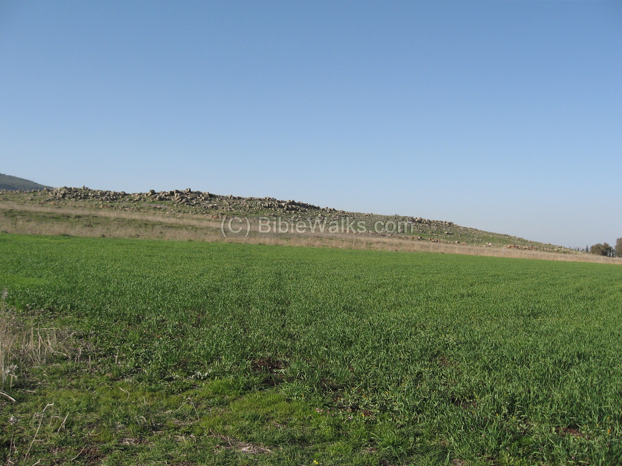
(c) North Hill
The north hill is seen in the following photo, as viewed from the west side. On the top of the hill is a group of jeeps. In the far background are the Golan heights.
A view of the north hill – from the east side.
(d) Rosh Pinna:
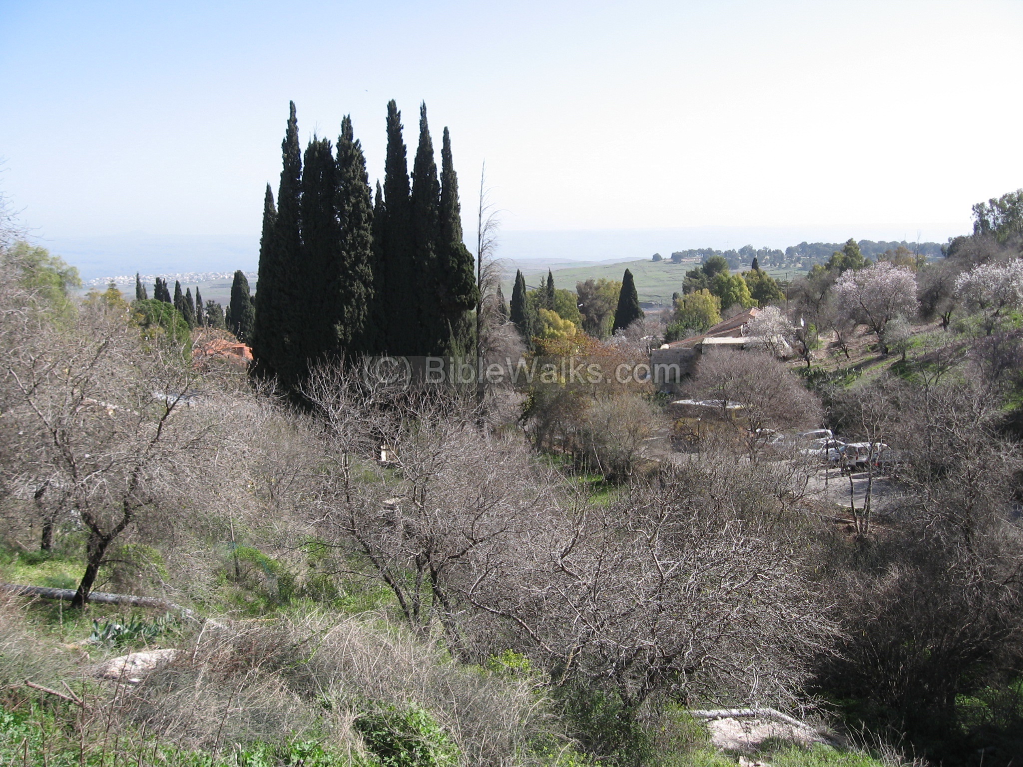
Rosh-Pinna was established in the 19th century AD, and the restored section at the top of the town is a nice place to visit, strolling along the cobblestone streets and visiting the restored houses.

Another view of the hillside of Rosh Pinna, towards the east. The Rosh-Pinna creek starts from the spring at this area, flows down and around Tel Ya’af, east into the the Jordan river, and finally into the Sea of Galilee.
Biblical References:
Joshua 19: 32, 35-36
This text describes the territory of Naphtali tribe. According to the order of the cities that appear in the Biblical text, south to north, Tel Ya’af may be found after Chinnereth – as either Adamah or Ramah. However, this identification is not precise, and there are other identification options.
“The sixth lot came out for the children of Naphtali…And the fortified cities were Ziddim-zer, and Hammath, and Rakkath, and Chinnereth ; and Adamah, and Ramah, and Hazor”;
Etymology (behind the name):
-
Yaaf (Ya’af) – In Hebrew: flight. The name is derived from the Machanaim airfield – which is located nearby.
-
Tel – mound (See more on the story of a Tel).
-
Tell el Kusab – Arabic name of the site – “mound of the reeds”
-
Rosh-Pinna – The village near the Tel, established in 1878. In Hebrew: Rosh = “head”, Pinna = “corner”, or: head of the corner, which refers to the corner of a building. It is called after Psalms 118: 22: “The stone which the builders refused is become the head stone of the corner. “.
-
Hazor Haglilit – A town adjacent to Rosh-Pinna, established in 1952 as an expansion of an immigrants transit camp. Its name is derived from Tel Hazor, and the prefix “Haglilit” means “the Galilee”, since there are other places with the name Hazor.
Links:
* External links:
- Rosh-Pinna excavations (Hebrew) – IAA publication on excavations inside Rosh-Pinna, which revealed various layers: Iron Age (13th thru 10th century BC), Hellenistic, and Roman thru Early Arab.
* Internal links:
-
Drone Aerial views – collection of Biblical sites from the air
* Nearby sites:
-
Tel Nes – nearby site
- Naburiya – ruins of a Roman/Byzantine Jewish village and synagogue
- Zefat – major city in the Galilee
BibleWalks.com – walk with us through the sites of the Holy Land
Tel Hazor <<<–previous site—<<<All Sites>>>— next Upper Galilee site—->>> Montfort
This page was last updated on Dec 21, 2018 (Added Biblical map)
Sponsored links: