The last and most important fortress of the great Jewish rebellion against Rome, and one of the most impressive archaeological sites in Israel.
Home > Sites > Dead Sea >Masada (Mezada, Metzada)
Contents:
Overview
Location
Structure
History
Photos
Biblical
Josephus
Etymology
Links
Overview:
Masada is located on a steep and isolated hill on the edge of the Judean desert mountains, on the shores of the Dead Sea. It was the last and most important fortress of the great Jewish rebellion against Rome (66-73 AD), and one of the most impressive archaeological sites in Israel.
The last stand of the Jewish freedom fighters ended in tragic events in its last days, which were thoroughly detailed in the accords of the Roman historian of that period, Josephus Flavius. Masada became one of the Jewish people’s greatest icons, and a symbol of humanity’s struggle for freedom from oppression. Israeli soldiers take an oath here: “Masada shall not fall again.”
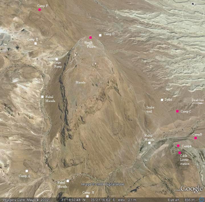
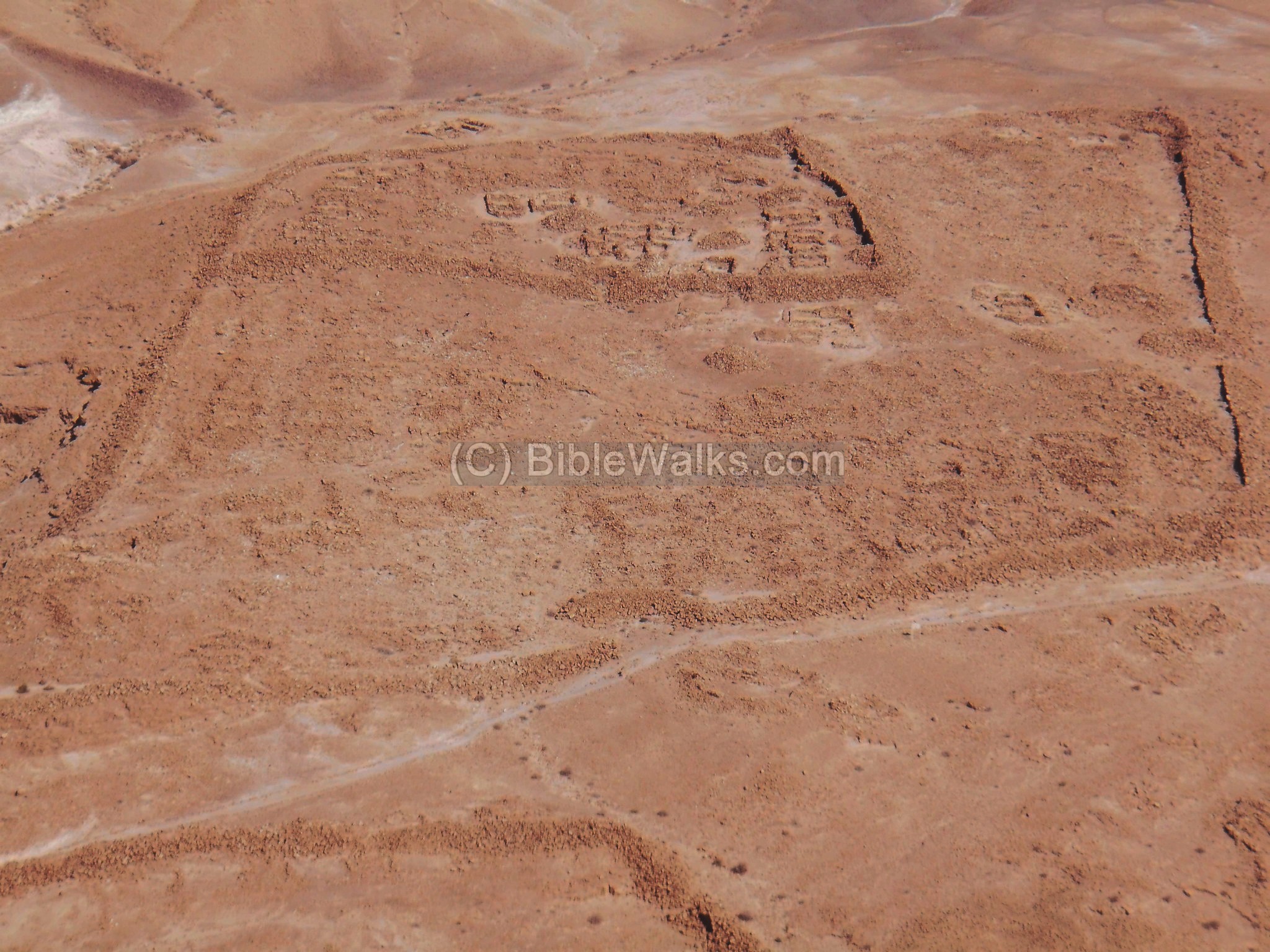
Location and Aerial map:
Masada is located on a diamond-shaped flat plateau (600M x 200M, 80 Dunam or 8 Hectares). The hill is surrounded by deep gorges, at a height of roughly 440M above the Dead sea level. It is accessed by roads from the east (Dead sea coast road #90) or from Arad on the west (road #3199).
During the Roman siege it was surrounded with a 4KM long siege wall (Dyke), with 8 army camps (A thru G) around the hill.
An aerial map below shows the table hill of Masada in the center, indicating the major points of interest.
History:
| Period | Date | Event |
| Biblical | 1000 BC | David hides in the desert fortresses (Masada?) |
| Hellenistic | 2nd C BC | Hasmonean King (Alexander Jannaeus?) fortifies the hill |
| Roman | 31 BC | Major earthquake damages the Hasmonean fortifications |
| 24 BC | Herod the great builds the winter palace and fort | |
| 4 BC | Herod dies; Romans station a garrison at Masada | |
| 66 AD | Head of Sicarii zealots, Judah Galilee, is murdered | |
| Eleazar Ben-Yair flees to Masada, establishes and commands a community of zealots | ||
| 67 AD | Sicarii sack Ein Gedi on Passover eve, filling up their storerooms with the booty | |
| 66-73 AD | great Revolt of the Jews against the Romans | |
| 70 AD | Jerusalem is destroyed by Romans;
last zealots assemble in Masada (total 1,000), commanded by Eleazar Ben-Yair |
|
| 73 AD | Roman 10th Legion under Flavius Silvia, lay a siege; build 8 camps, siege wall & ramp | |
| 73 AD | After several months the Romans penetrate the walls with tower and battering ram | |
| Masada falls; the defenders commit suicide | ||
| Josephus Flavius writes (in Rome) the story of the siege and fall | ||
| Byzantine | 5th century | Monastery founded by hermits |
| Arab | 7th century | Monastery ceases to exist |
| Ottoman | 19th century | Travelers arrive |
| British | 1932 | First survey of the fort |
| Israel | 1949 | Masada is under Israel’s rule; becomes a symbol |
| 1955-56 | Survey excavations | |
| 1963-65 | Yigal Yadin excavates Masada | |
| 1971 | Cable car constructed | |
| 1989, 1995+ | Large scale development project and excavations (Ehud Netzer, Guy Stiebel) | |
| 2001 | UNESCO World Heritage site |
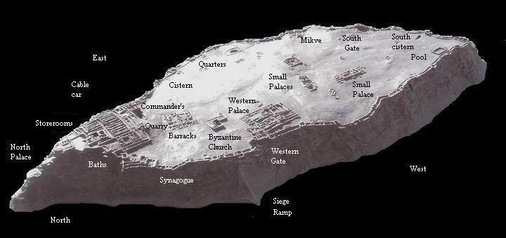
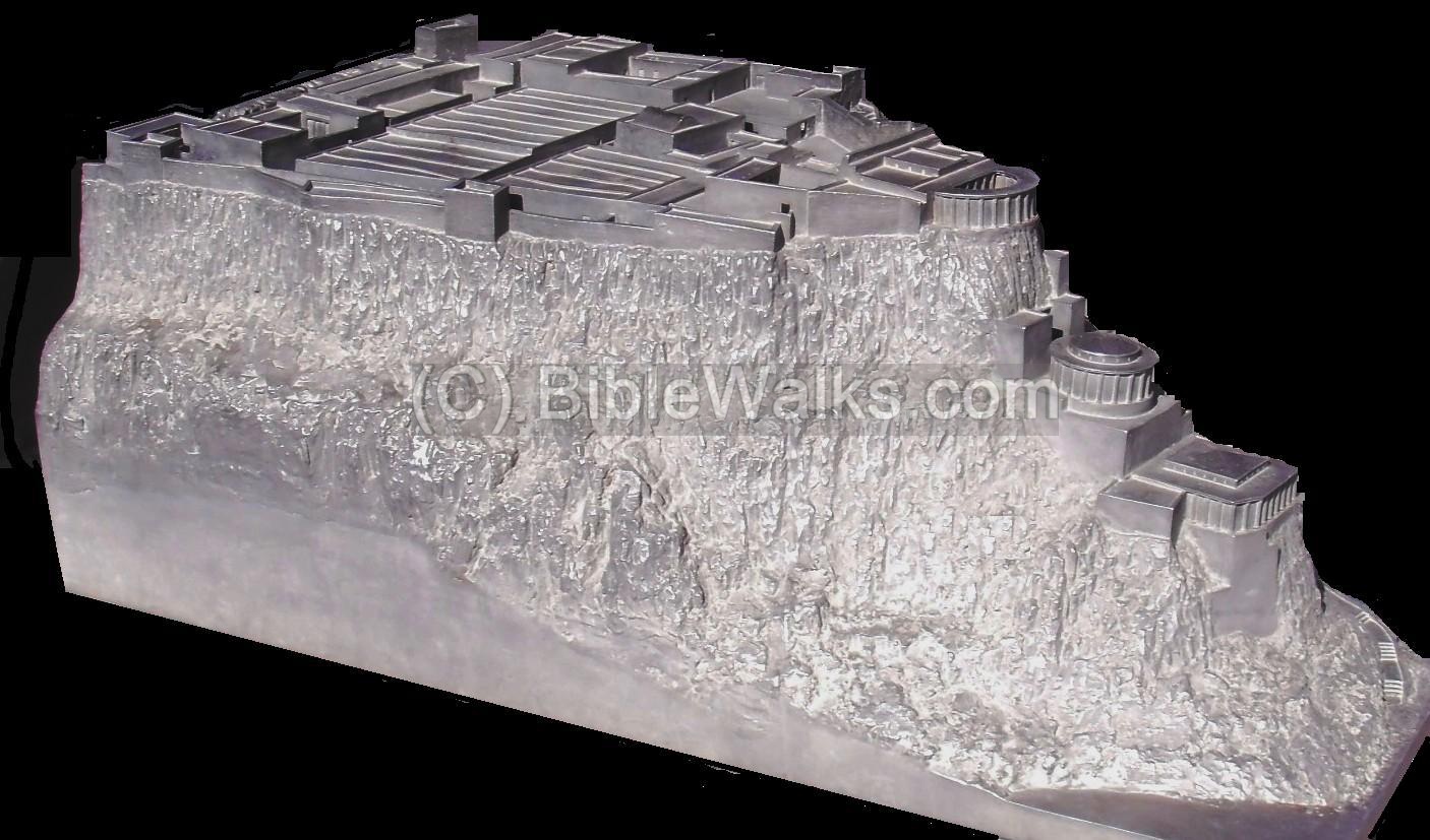
Structure:
The following illustration is a model of Massada, with indication of its major sites.
Photos:
The photos are organized in the order of a counter-clockwise tour – starting from the east side, then to the northern edge, through the western side, then to the south edge – and back to the east.
Most photos by Tuvia & Shachar Liran.
(a) Entrance: by Cable car
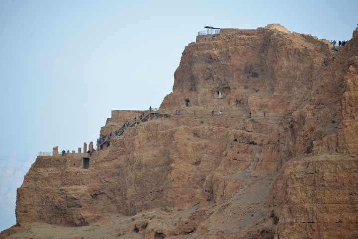
There are three ways up to the mountain – on the east side via cable car, or walking up the steep “snake” trail, or on the west side via the siege ramp.
The cable car is the easiest way up from the visitor center on the east side of the Mountain.
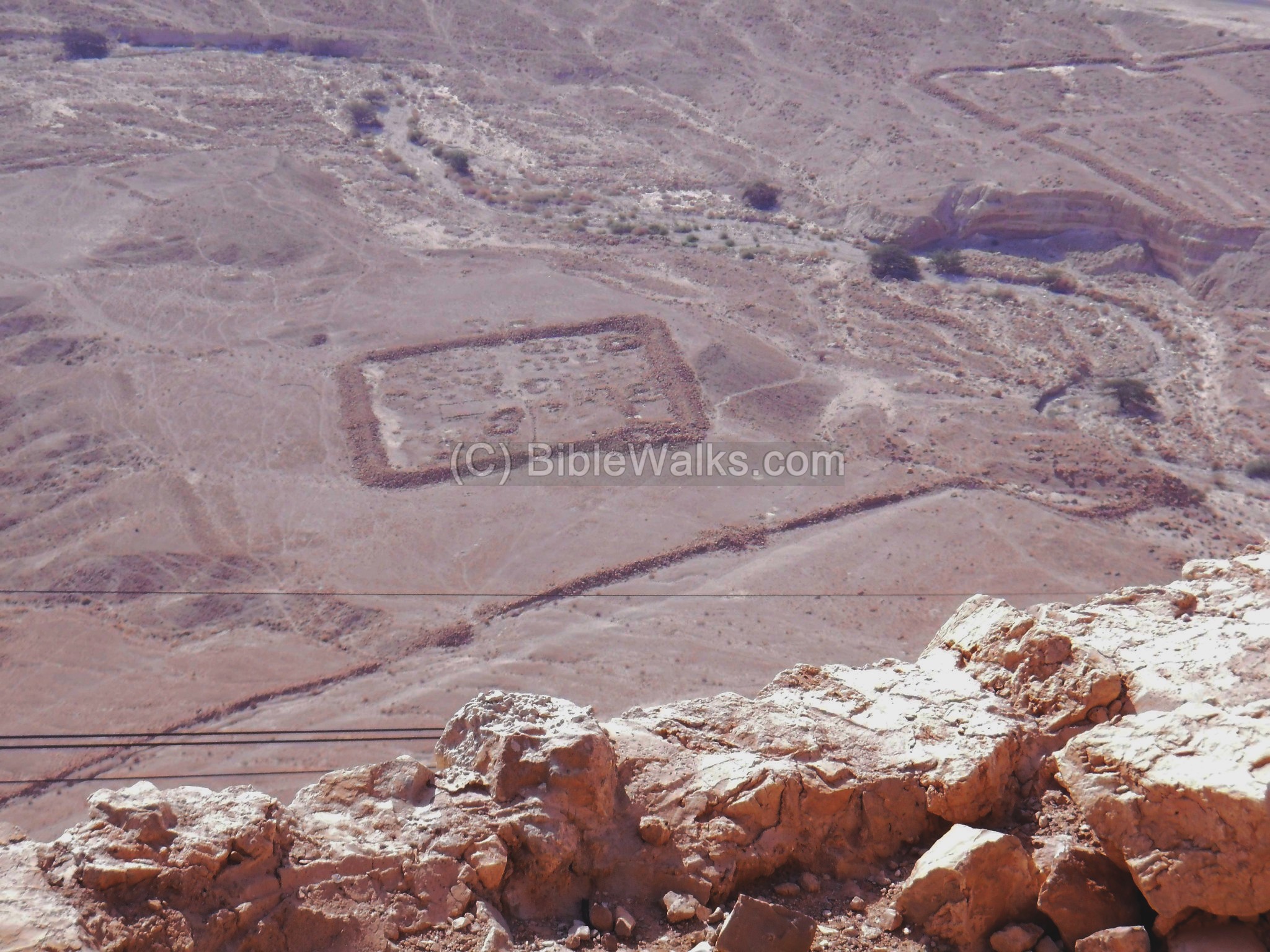
The cable passes above one of the eight Roman camps that surrounded Massada during the siege. A dyke wall stretches to both sides which was used to seal off the defenders from the rest of the world. This camp (“A”, 55M x 54M) is located inside the dyke. A larger rectangular camp (“B”) is seen behind it.
Click on the photos to view in higher resolution…

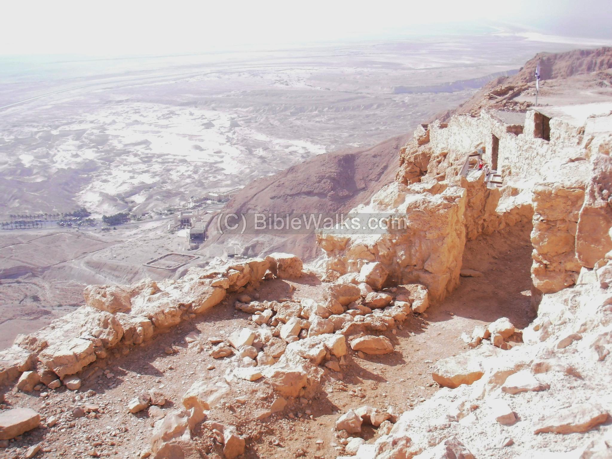
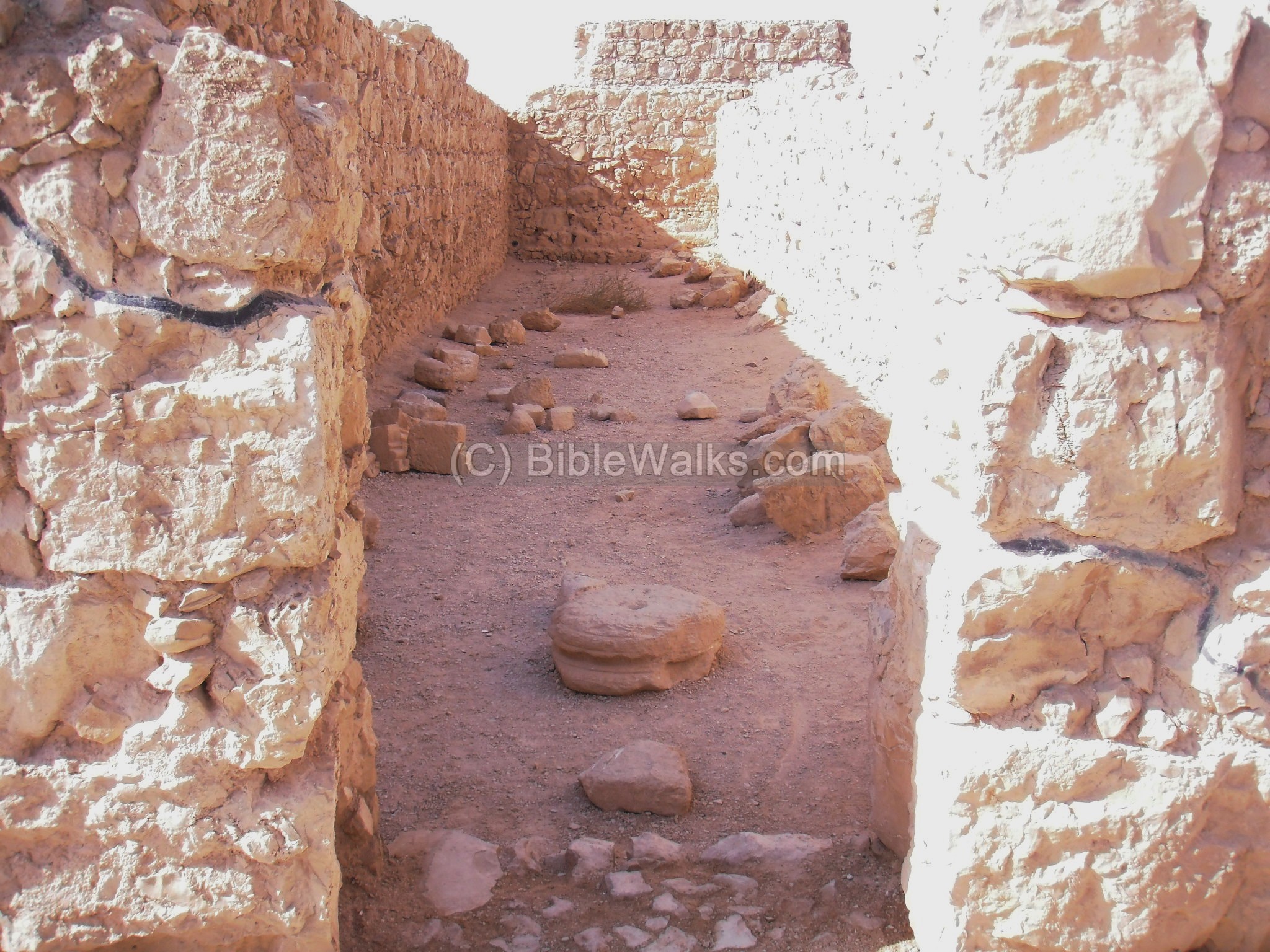
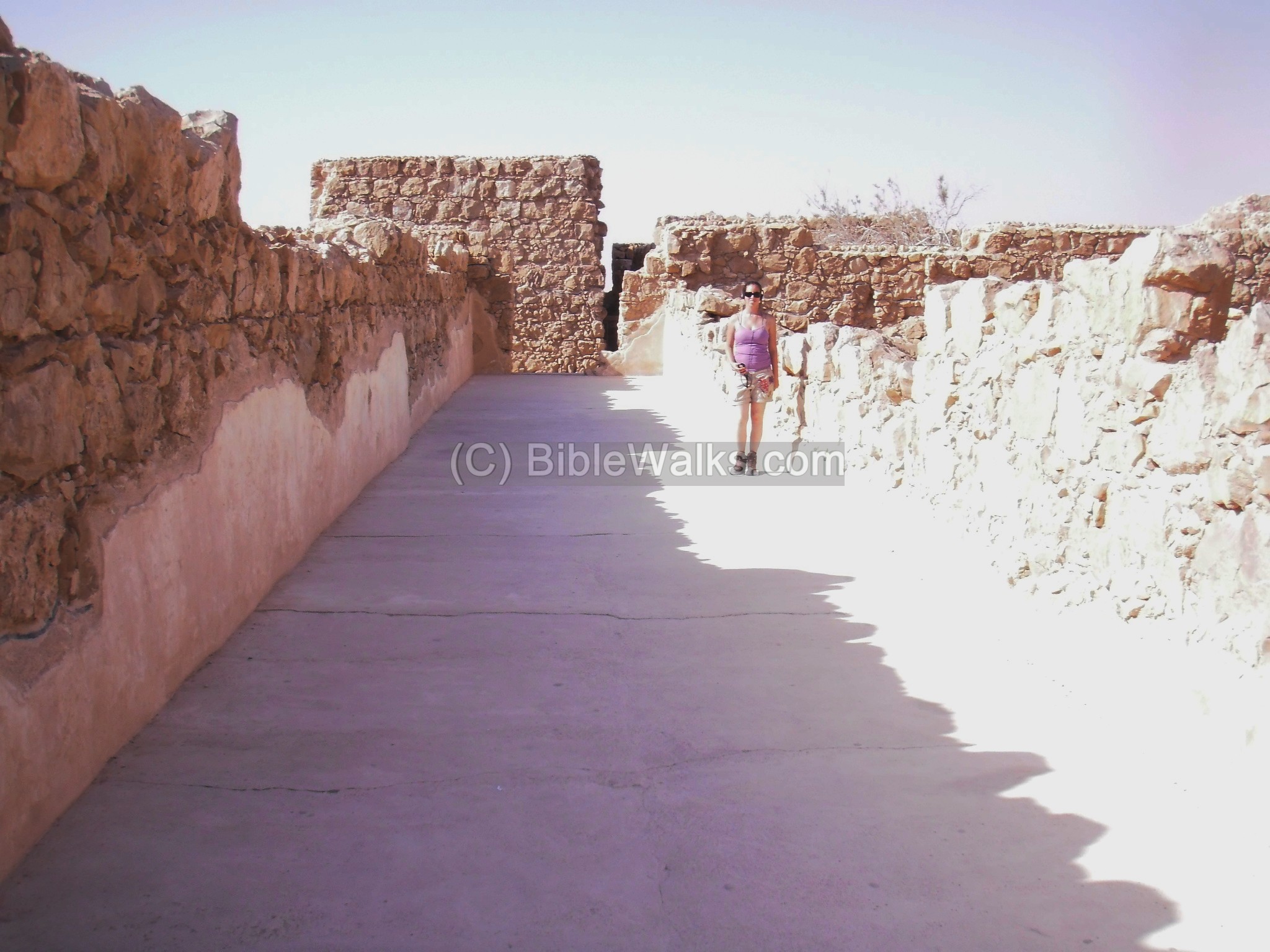
A view from the eastern side towards the lower cable station is seen in the photo below. A portion of the casemate wall (parallel walls with spaces between them) which completely surrounded the edge of the hill, is seen in the foreground. In the far background is the Dead Sea.
The wall, built by Herod, was 4M wide and 6M high, with 37 towers 25M high every 70-80M. As per Josephus (Wars VII 8 3): “(Herod) also built a wall round about the entire top of the hill, seven furlongs long; it was composed of white stone; its height was twelve, and its breadth eight cubits; there were also erected upon that wall thirty-eight towers, each of them fifty cubits high…”. The wall was also used during the siege as living quarters for the rebels.
A view of another Roman camp (“C”, with 2 gates) is seen in the center of the photo below, locateds outside of the dyke and on the north bank of Nahal Massada brook. Another camp (“B”, with 4 gates) is on its right side, on the south bank of Nahal Massada.
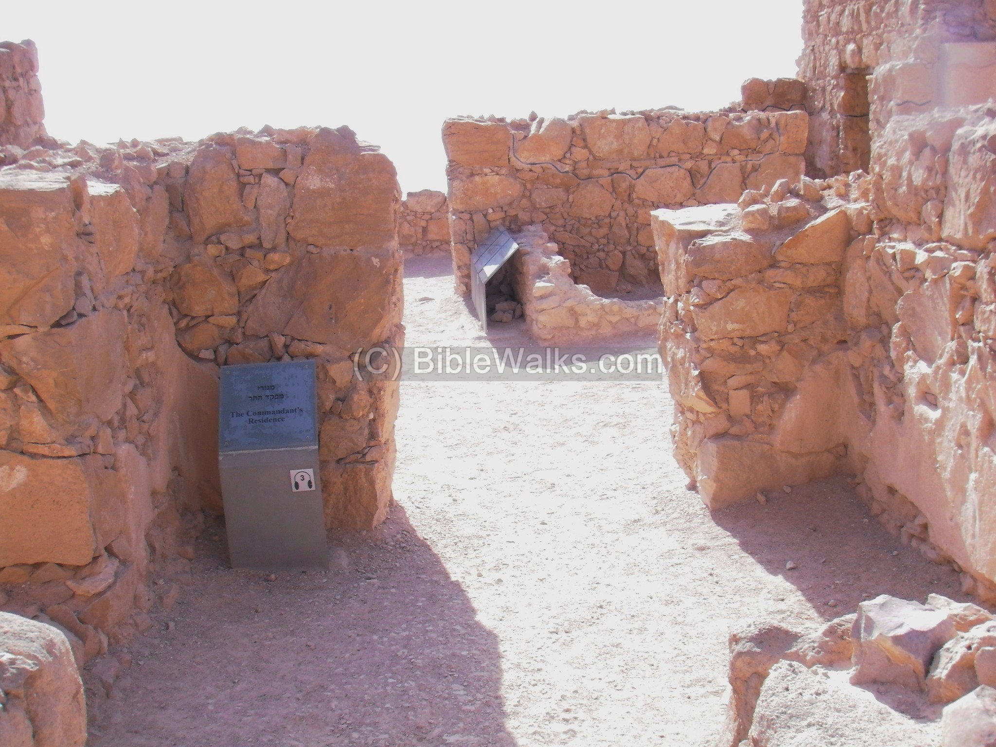
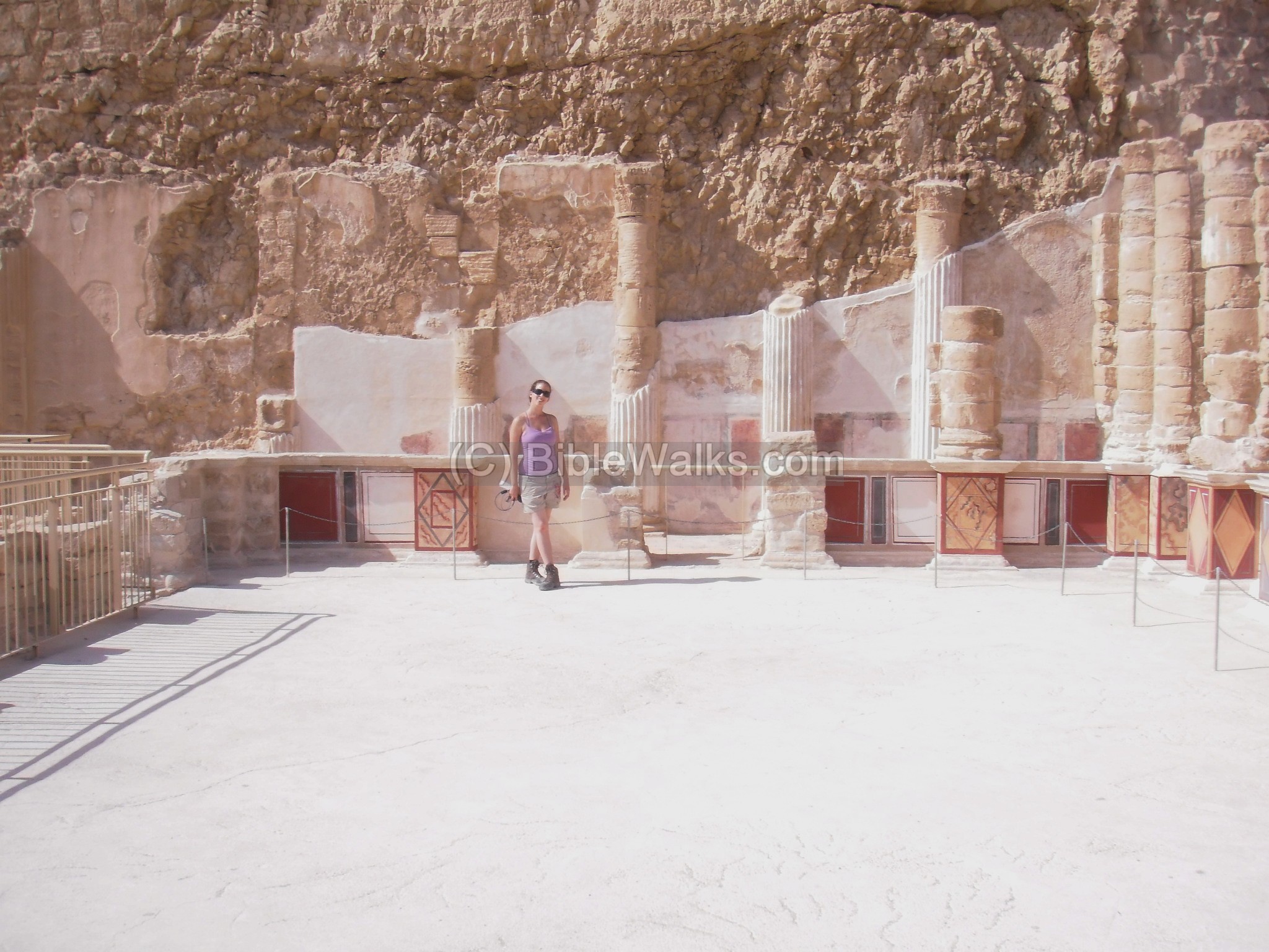
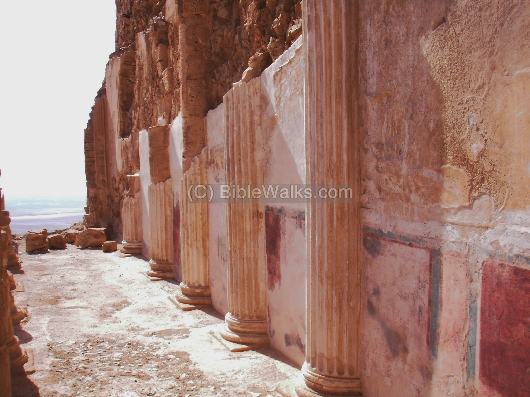
(b) Commander’s residence:
A grand residential house is located on the east side, close to the storerooms and the north palace. The structure consisted of several rooms arranged around a central yard. This was the residence of the commander of Masada.
A section of the central yard and a colonnaded passage is seen in the photo below. The walls are covered by plaster, which were painted in color (fresco).
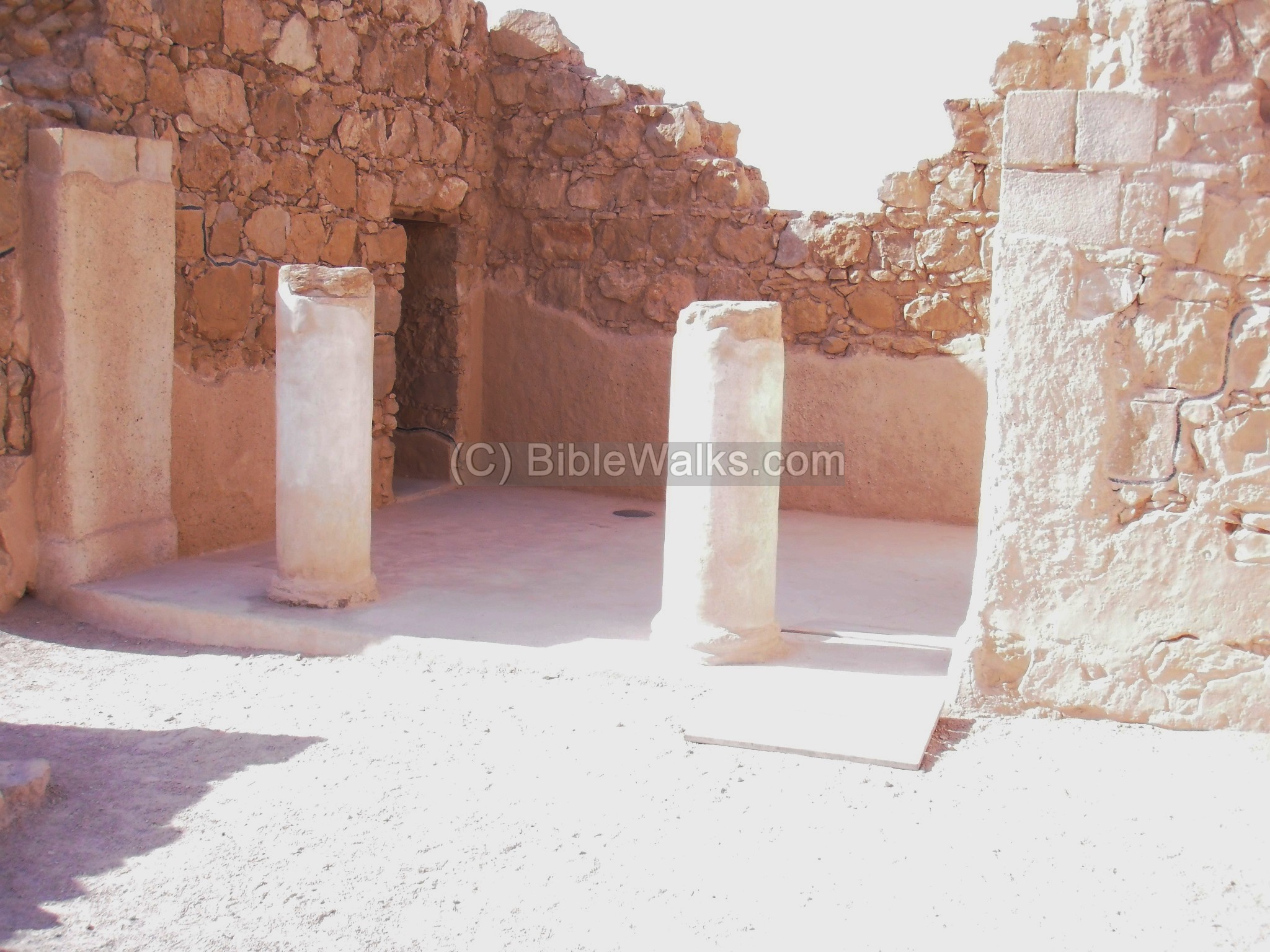
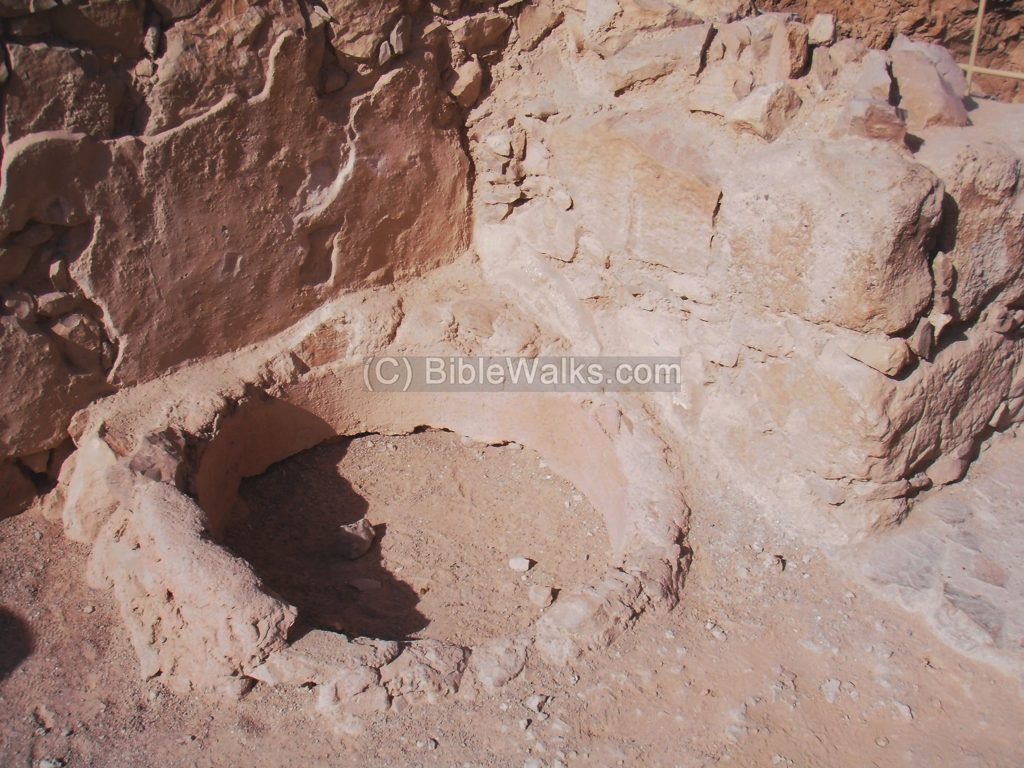
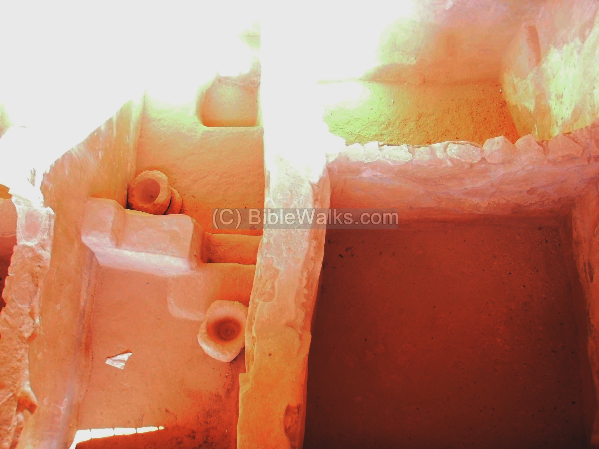
During the siege the structure hosted a number of families, who made some alterations to the structure, including the makeshift stone oven seen below.
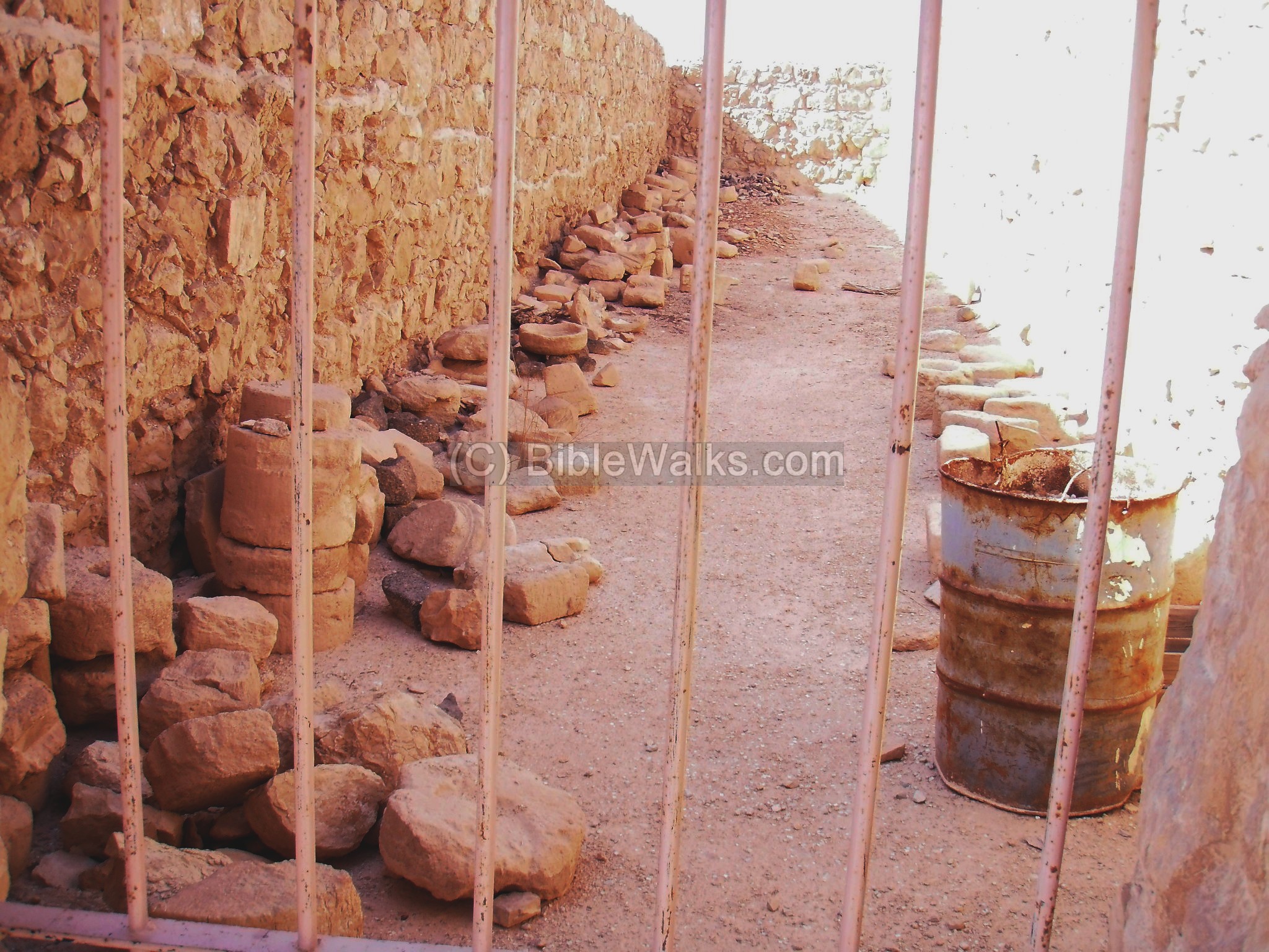
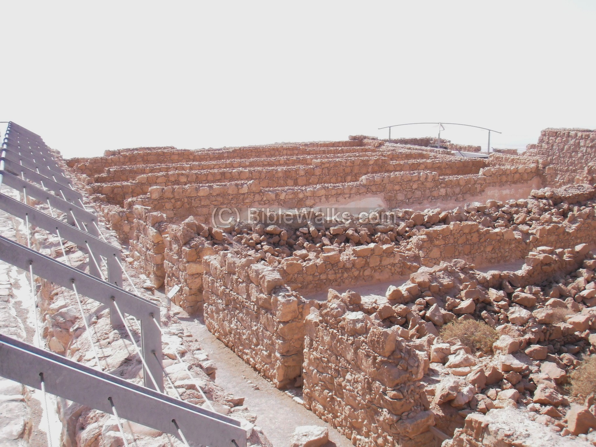
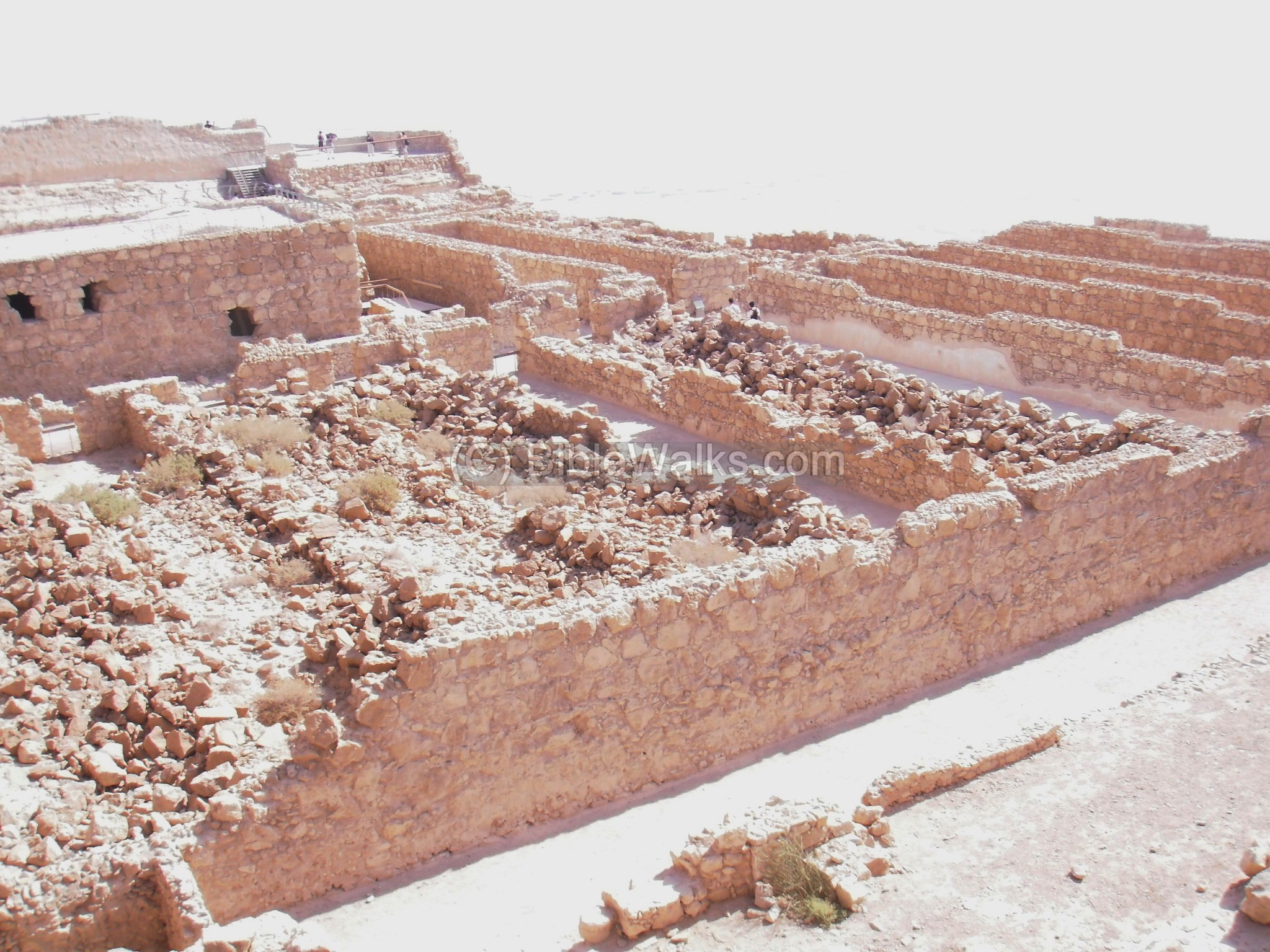
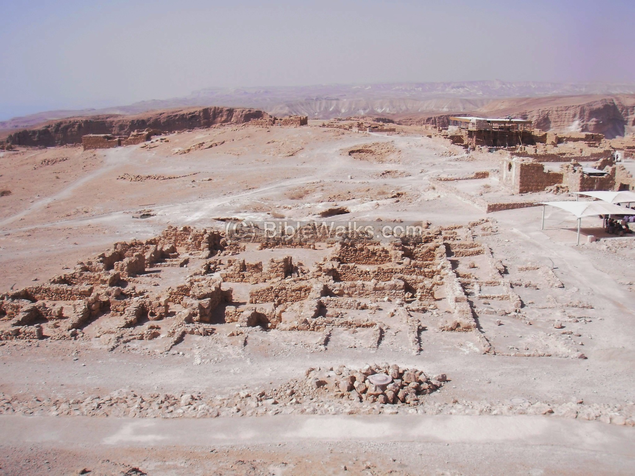
(c) Storeroom complex:
A large complex of store rooms is located near the northern side of the hill. The complex includes 29 long halls, which were constructed by Herod and contained food and armory.
The photo below shows a detail of one of the reconstructed storerooms, with the black line indicated the level of the walls prior to their reconstruction.
The photo below shows other storerooms (with Shachar). Josephus wrote about these storerooms (Wars VII 8 4): “…for here was laid up corn in large quantities, and such as would subsist men for a long time; here was also wine and oil in abundance, with all kinds of pulse and dates heaped up together; all which Eleazar found there, when he and his Sicarii got possession of the fortress by treachery. These fruits were also fresh and full ripe… . There was also found here a large quantity of all sorts of weapons of war, which had been treasured up by that king, and were sufficient for ten thousand men; there was east iron, and brass, and tin, which show that he had taken much pains to have all things here ready for the greatest occasions…”.
Yet another storeroom is seen below. Each hall contained a different type of commodity. This depot kept the 1,000 defenders alive during the siege.
The zealots filled it up during the great revolt (on Passover eve, 67AD), by sacking Ein-Gedi (Wars IV 7 2): “…they came down by night, without being discovered by those that could have prevented them, and overran a certain small city called Engaddi… they slew of them above seven hundred. Afterward, when they had carried every thing out of their houses, and had seized upon all the fruits that were in a flourishing condition, they brought them into Masada. “.
A view of the storerooms is also seen below. The walls were found half fallen due to the earthquakes that occurred over the last 2,000 years.
(d) Large bath house:
A Roman bathhouse complex is located on the north side, one of several bath houses built by Herod on Masada. It is composed of several rooms – a cold, warm and hot baths, and dressing room.
The photo below shows the baths house on the left side, adjacent to the storeroom complex.
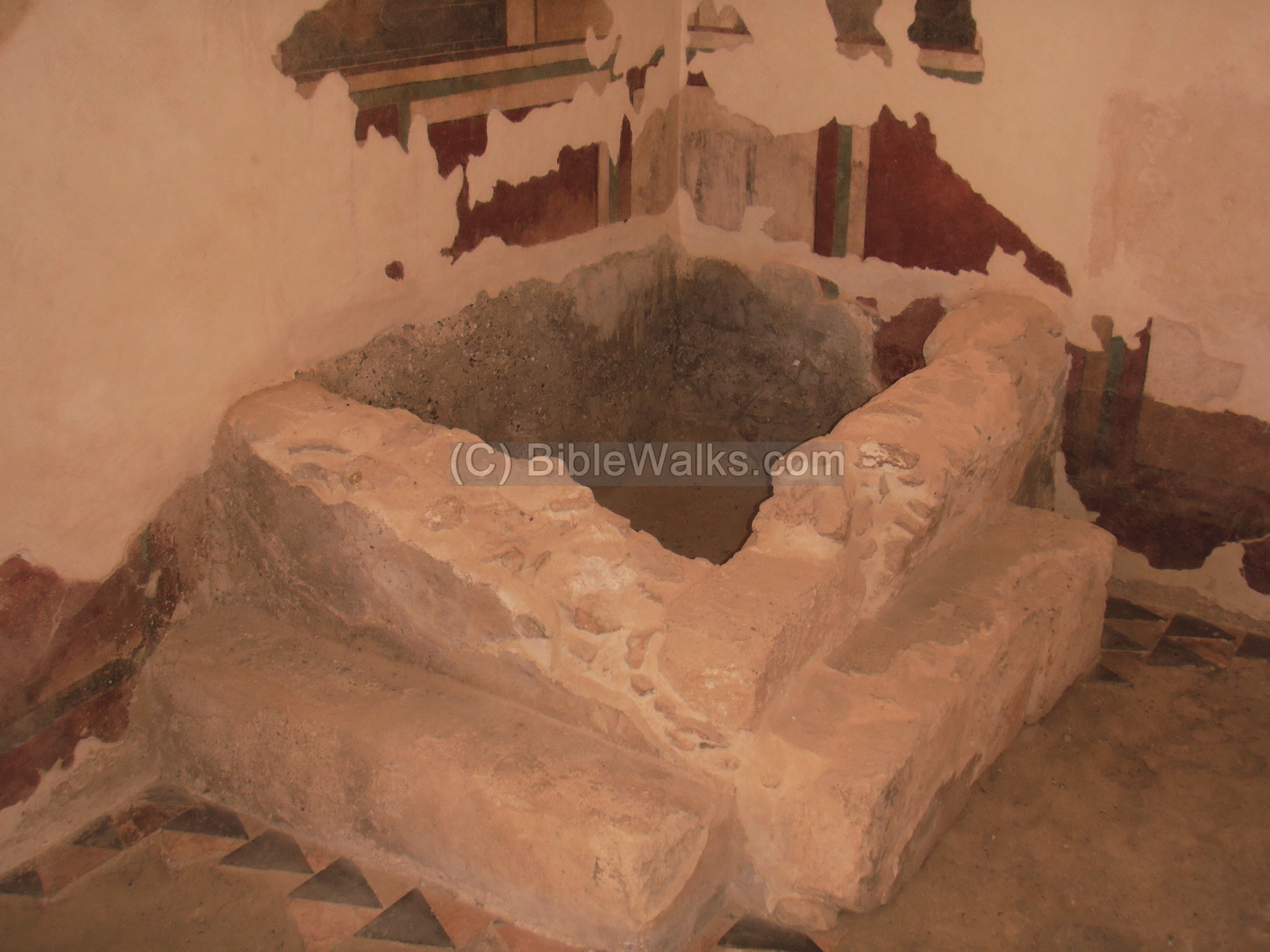
Inside the bath house, the Romans first arrived to a dressing room (apoditerium). This room is decorated by Frescoes (painted walls) and tiles (triangle shaped patterns on the floor). A small bathing pool, with a crude finish, was later added by the zealots or Romans.
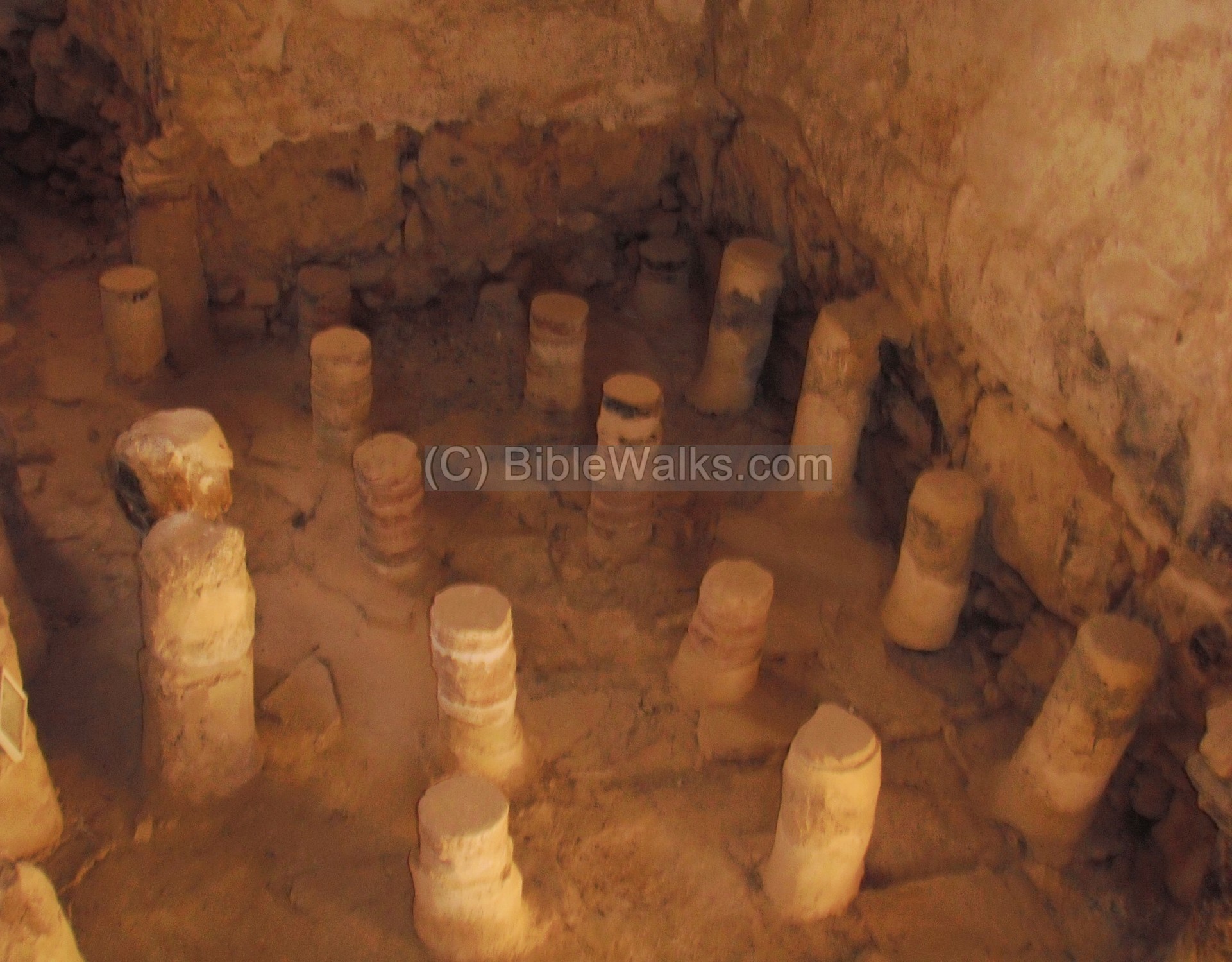
A section of the hot room (Caldarium) is seen below, with a double floor suspended over small stones and clay pillars. An external stove warmed the waters inside the bath, using the Hypocaust method (under floor heating system, based on hot air which was pumped under the floor and heated the waters) . Hallow clay pipes are seen along the walls, and were used to allow the hot air to warm up the side of the pool.

The photo below shows another view of the pillars, out of a total of 200, that held to suspend the floor and allow the hot air to warm the water.
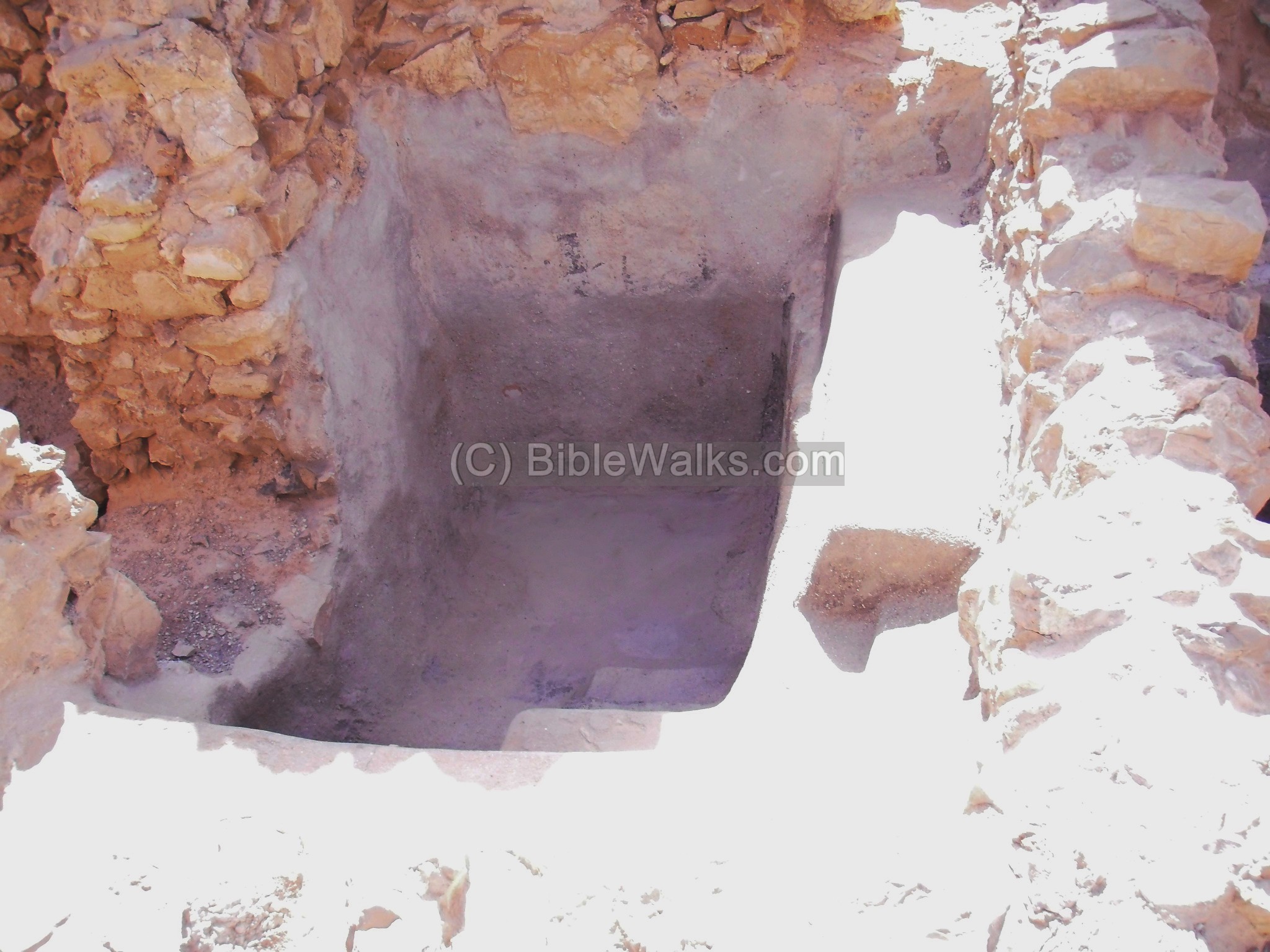
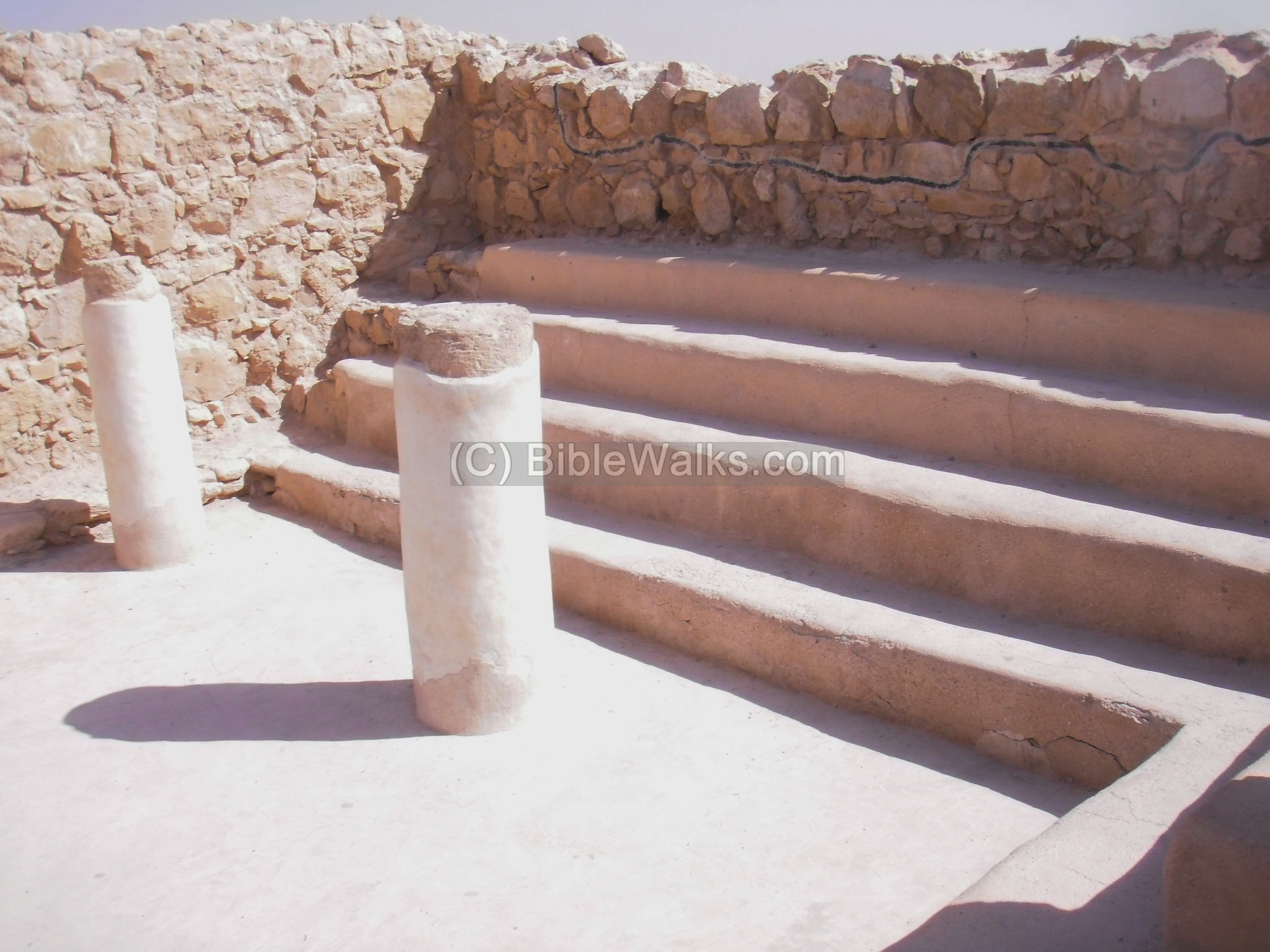
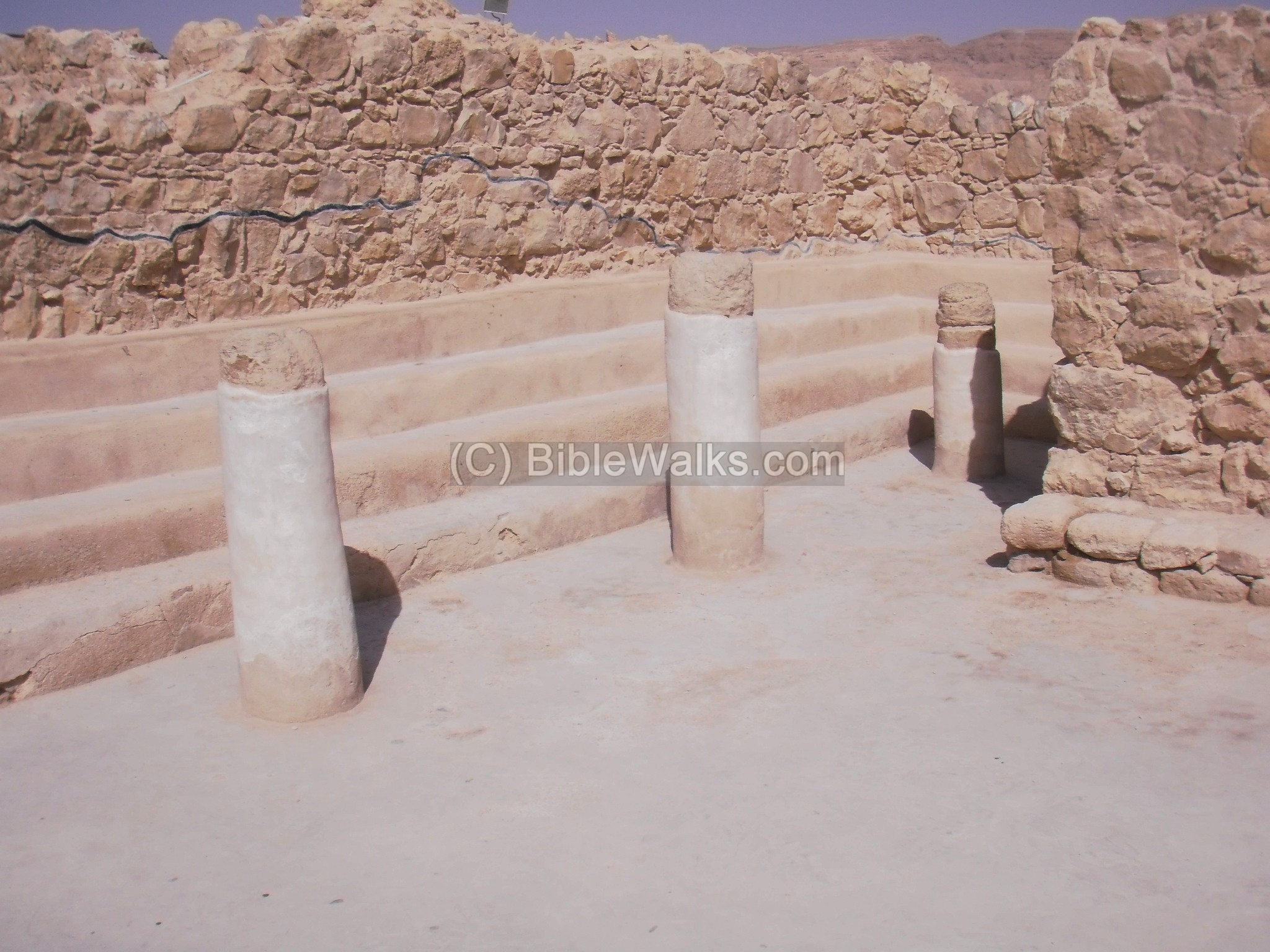
Two installations of Mikveh (baptismal) were constructed during the siege, one near the baths house (below) and the other on the south side.
(e) Northern palace:
The architectural highlight of the Herod’s design is the palace located on the north tip of Masada. It is composed of 3 levels, embedded into the rock, with a total height of 30M. The following photo is a view of these levels, as seen from the west side.
A model of the palaces is presented in the next photo. The upper deck was Herod’s dwelling place, while the lower levels hosted his guests. A model of the palace is seen below, with the upper deck at the north side of the storerooms.
An closer view of the triple-level palace is seen below from the west side. On this side was the ancient staircase, which was partially damaged by earthquakes.

The lower level of the north palace is 30M lower than the top level. It is seen in the photo below, a square yard (9 x 10M) surrounded by a row of double columns.

Another view of the lower section is seen below, with colorful wall paintings and columns.
The lower level is seen again, from the north most edge, in the photo below.
The details of the southern wall of the lower level can be seen below. The walls are painted and the columns embedded into the wall.
(f) Northern views:
The largest Roman camp (“F”, also called “Silva” named after the Roman siege commander) is located on the north side. A section of the siege wall is seen on the bottom.
Josephus wrote about the siege walls and camps (Wars VII 8 5): “(Silva)… put garrisons into the most proper places of it; he also built a wall quite round the entire fortress, that none of the besieged might easily escape; he also set his men to guard the several parts of it; he also pitched his camp in such an agreeable place as he had chosen for the siege, and at which place the rock belonging to the fortress did make the nearest approach to the neighboring mountain, which yet was a place of difficulty for getting plenty of provisions; for it was not only food that was to be brought from a great distance [to the army], and this with a great deal of pain to those Jews who were appointed for that purpose, but water was also to be brought to the camp, because the place afforded no fountain that was near it…”).
(g) Officers barracks:
In the center of the hill, south of the storeroom complex, is a residential area – the officers quarters. These are seen in the photo below. To the right of it is a Byzantine church (from a later period), and behind the church is the western palace.
(h) Synagogue on west side:
On the north-west side were the location of the stables of the Herodian Masada. During the siege the zealots converted it to a synagogue, by adding benches (seen in the two photos below), columns and a room. This is one of the oldest synagogues found from that period, dated to the siege (67-70AD).
Under the floor, inside archiving cisterns (Gnizah), the excavators found fragments of Bible scrolls, including the “dry bones” verses (Ezekiel 37:1-14).
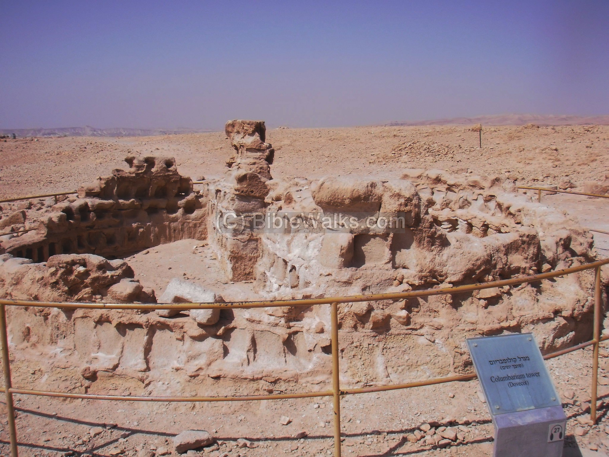
(i) Columbarium:
A Columbarium (housing structure for doves and pigeons) is seen on a tower on the west casemate wall. It was used for multiple purposes – as an observation tower, raising pigeons for their meat, and bird droppings which were used as a fertilizer for growing food.

Another columbarium tower is located on the south side of Masada, but this one is round.
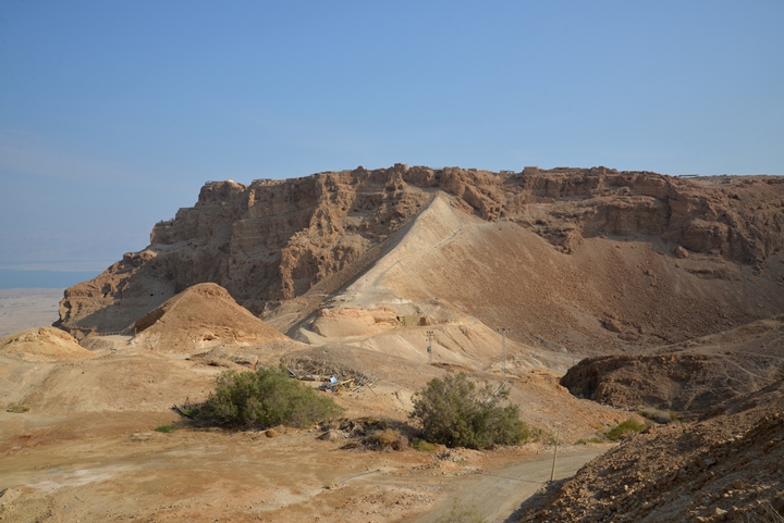
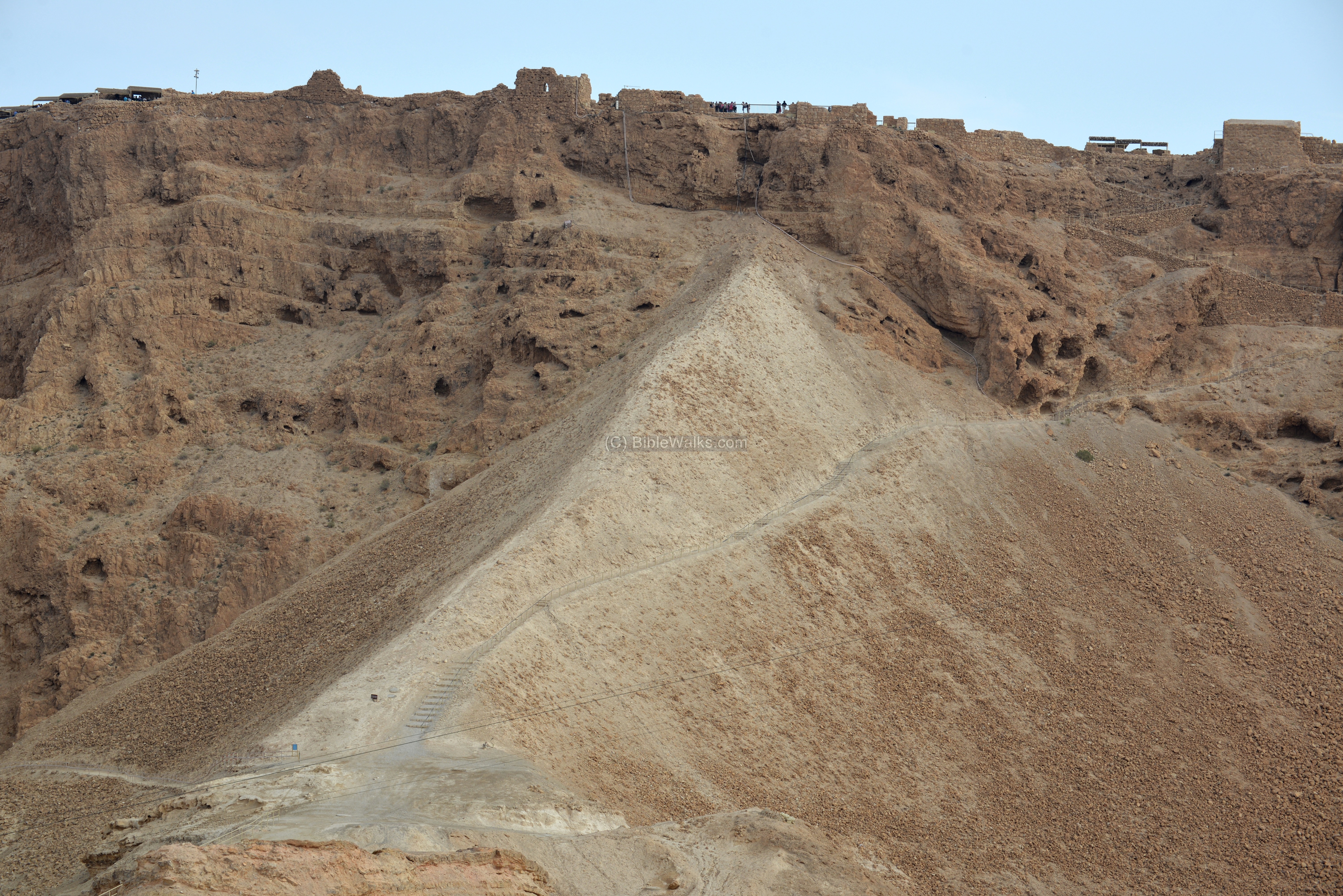
(j) Siege ramp:
During the siege the Romans constructed a ramp on the west side, which was used to overcome the height differences, raise a tower with a battering ram, and to penetrate the defenses. This photo shows the west side of Masada, and the Roman siege ramp. A modern staircase leads up along the sides of the ramp, one of three ways open for visitors to reach the top.
Josephus wrote about the construction of the ramp (Wars VII 8 5):
“Accordingly, he got upon that part of the rock, and ordered the army to bring earth; and when they fell to that work with alacrity, and abundance of them together, the bank was raised, and became solid for two hundred cubits in height. Yet was not this bank thought sufficiently high for the use of the engines that were to be set upon it; but still another elevated work of great stones compacted together was raised upon that bank; this was fifty cubits, both in breadth and height”.).
The west side was the weakest point in the fort, and one of the two access paths into Masada. As Josephus writes (Wars VII 8 3): “Now, of the ways that lead to it … and another on the west, where the ascent is easier”.
A view of the ramp as seen from the west side of Masada.
The Romans penetrated the city from the ramp, after knocking down the walls at its edge. The missing casemate walls testify to this event. The breaching point is seen below, with a new gate added later during the Byzantine period.
This was the site of the original Herodian tower, which also protected the western entrance. Josephus wrote about this (Wars VII 8 3): “…and for the western road, he built a large tower at its narrowest place, at no less a distance from the top of the hill than a thousand cubits; which tower could not possibly be passed by, nor could it be easily taken; nor indeed could those that walked along it without any fear (such was its contrivance) easily get to the end of it; and after such a manner was this citadel fortified, both by nature and by the hands of men, in order to frustrate the attacks of enemies”.

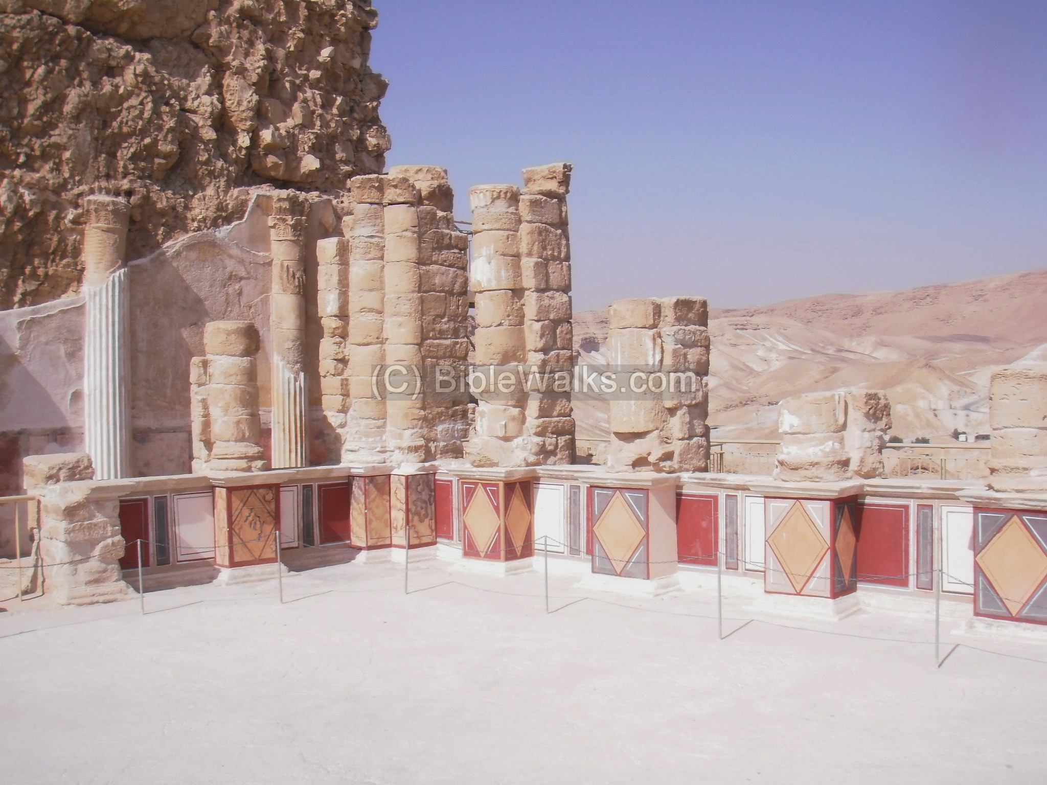
(k) Western Palace:
The western palace is the largest structure in Masada, covering 3,700 square meters. Josephus wrote about this grand palace (Wars VII 8 3): “Moreover, he built a palace therein at the western ascent; it was within and beneath the walls of the citadel, but inclined to its north side. Now the wall of this palace was very high and strong, and had at its four corners towers sixty cubits high. The furniture also of the edifices, and of the cloisters, and of the baths, was of great variety, and very costly; and these buildings were supported by pillars of single stones on every side; the walls and also the floors of the edifices were paved with stones of several colors”.
A section of the western palace is seen below. This was part of the palace’s dining room.

A section of the mosaic floor, in the entrance to the “throne” room, is seen below.
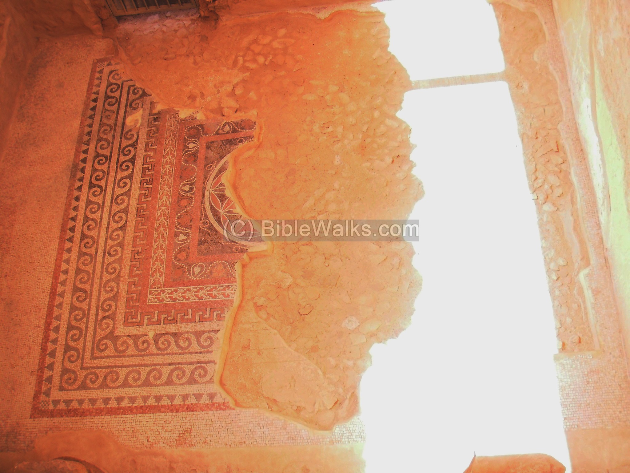
Another mosaic floor is seen in the corridor that leads to the bathroom.

(l) Tannery:
On the west side of the Western palace is a tower. In its basement was a workshop for leather (a tannery).
(m) South views:
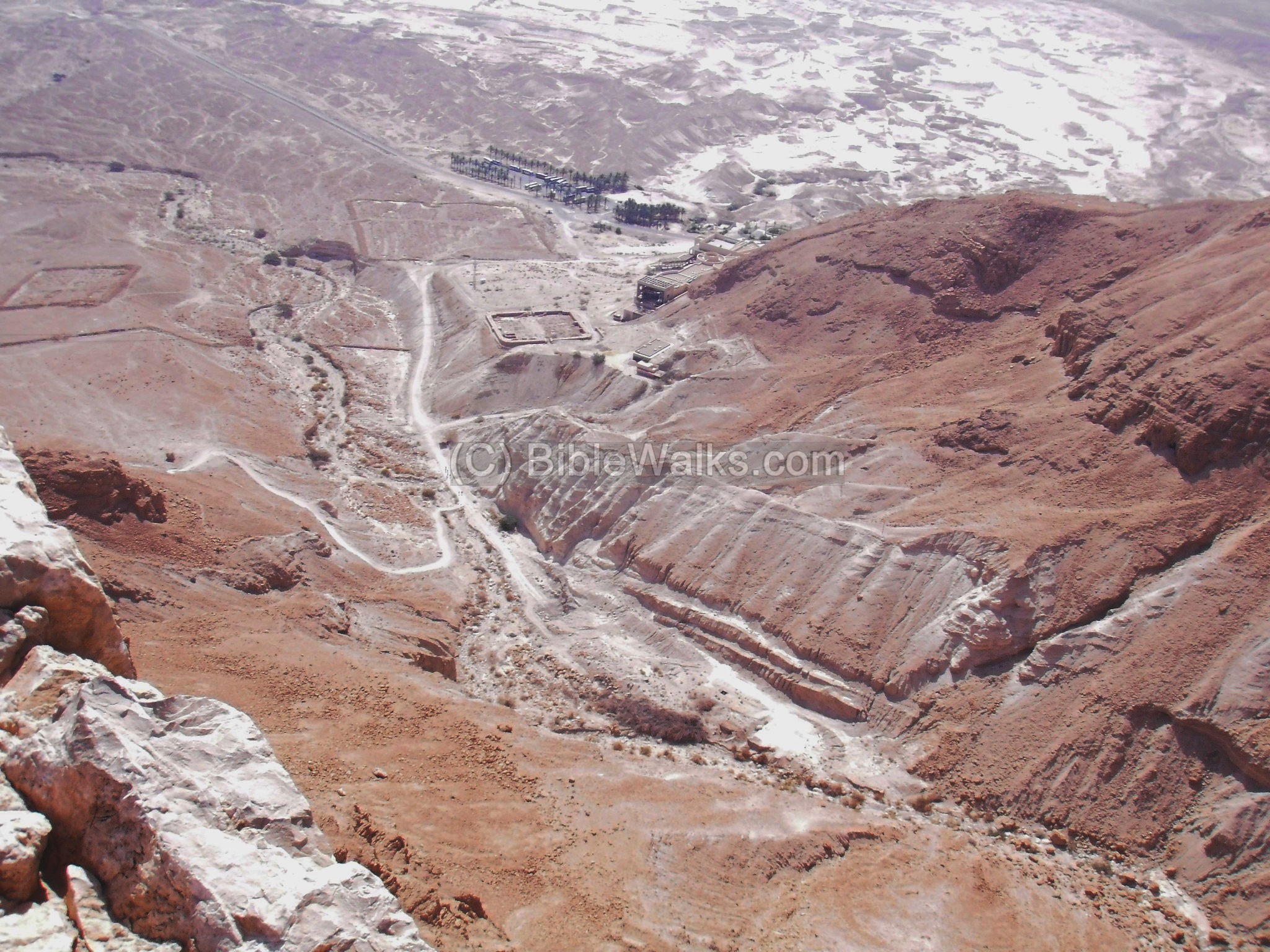
A view of the desert on the south-west side of Masada is seen below. Roman “Camp H” is located on the top of the left mountain (Mt. El’azar).

Looking towards the south-east is Nahal Masada, the lower cable station, and the three Roman camps (A-C). The beginning of the ancient snake trail is seen on the left. Josephus wrote about it (Wars VII 8 3): “…the one of these ways is called the Serpent, as resembling that animal in its narrowness and its perpetual windings…”.
Biblical references:
1 Samuel 23, 14; 1 Chronicles 12, 8
At about 1000BC David hid in the desert, on a mountain. The Hebrew text names the site as “Metsudut” (fortresses) which may have been the ancient name of Masada. In Chronicles there is another verse about the soldiers that accompanied David in the desert. Note that Ziph is identified as Tell-Zif , 7KM south-east of Hebron, in the Judean desert.
“And David abode in the wilderness in strong holds, and remained in a mountain in the wilderness of Ziph. And Saul sought him every day, but God delivered him not into his hand”.
“And of the Gadites there separated themselves unto David into the hold to the wilderness men of might, and men of war fit for the battle, that could handle shield and buckler, whose faces were like the faces of lions, and were as swift as the roes upon the mountains”.
Josephus Flavius:
Wars of the Jews VII Chapters 8,9
Josephus Flavius was a former Jewish commander in the Galilee (named Yosef Ben Matityahu – Joseph, son of Matthias). He surrendered to the Romans in Yodfat (Jotapata), and became a famous Roman historian in the court of Rome. The siege and fall of Masada are detailed in Josephus accords, and are partially listed below.
“When Bassus was dead in Judea, Flavius Silva succeeded him as procurator there; who, when he saw that all the rest of the country was subdued in this war, and that there was but one only strong hold that was still in rebellion, he got all his army together that lay in different places, and made an expedition against it. This fortress was called Masada. It was one Eleazar, a potent man, and the commander of these Sicarii, that had seized upon it..”.
…
“For now it was that the Roman general came, and led his army against Eleazar and those Sicarii who held the fortress Masada together with him…”
…
“There was a rock, not small in circumference, and very high. It was encompassed with valleys of such vast depth downward, that the eye could not reach their bottoms; they were abrupt, and such as no animal could walk upon, excepting at two places of the rock, where it subsides, in order to afford a passage for ascent, though not without difficulty”.
…
“Upon this top of the hill, Jonathan the high priest first of all built a fortress, and called it Masada: after which the rebuilding of this place employed the care of king Herod to a great degree; he also built a wall round about the entire top of the hill, seven furlongs long; it was composed of white stone; its height was twelve, and its breadth eight cubits; there were also erected upon that wall thirty-eight towers, each of them fifty cubits high; out of which you might pass into lesser edifices, which were built on the inside, round the entire wall; for the king reserved the top of the hill, which was of a fat soil, and better mould than any valley for agriculture, that such as committed themselves to this fortress for their preservation might not even there be quite destitute of food, in case they should ever be in want of it from abroad. Moreover, he built a palace therein at the western ascent; it was within and beneath the walls of the citadel, but inclined to its north side. Now the wall of this palace was very high and strong, and had at its four corners towers sixty cubits high. The furniture also of the edifices, and of the cloisters, and of the baths, was of great variety, and very costly; and these buildings were supported by pillars of single stones on every side; the walls and also the floors of the edifices were paved with stones of several colors. He also had cut many and great pits, as reservoirs for water, out of the rocks, at every one of the places that were inhabited, both above and round about the palace, and before the wall; and by this contrivance he endeavored to have water for several uses, as if there had been fountains there. Here was also a road digged from the palace, and leading to the very top of the mountain, which yet could not be seen by such as were without [the walls]; nor indeed could enemies easily make use of the plain roads; for the road on the east side, as we have already taken notice, could not be walked upon, by reason of its nature; and for the western road, he built a large tower at its narrowest place, at no less a distance from the top of the hill than a thousand cubits; which tower could not possibly be passed by, nor could it be easily taken; nor indeed could those that walked along it without any fear (such was its contrivance) easily get to the end of it; and after such a manner was this citadel fortified, both by nature and by the hands of men, in order to frustrate the attacks of enemies”.
“Since therefore the Roman commander Silva had now built a wall on the outside, round about this whole place, as we have said already, and had thereby made a most accurate provision to prevent any one of the besieged running away, he undertook the siege itself,…”
“Accordingly, he (Silva) got upon that part of the rock, and ordered the army to bring earth; and when they fell to that work with alacrity, and abundance of them together, the bank was raised, and became solid for two hundred cubits in height. Yet was not this bank thought sufficiently high for the use of the engines that were to be set upon it; but still another elevated work of great stones compacted together was raised upon that bank; this was fifty cubits, both in breadth and height.”
“At the same time Silva ordered that great battering ram which he had made to be brought thither, and to be set against the wall, and to make frequent batteries against it, which with some difficulty broke down a part of the wall…”
“When Silva saw this, he thought it best to endeavor the taking of this wall by setting fire to it; so he gave order that the soldiers should throw a great number of burning torches upon it: accordingly, as it was chiefly made of wood, it soon took fire; and when it was once set on fire, its hollowness made that fire spread to a mighty flame.”
“Eleazar …… gathered the most courageous of his companions together, and encouraged them to take that course by a speech…”
” … slay their own wives and children with their own hands…these people died with this intention, that they would not leave so much as one soul among them all alive to be subject to the Romans”.
“Now for the Romans, they expected that they should be fought in the morning… they came within the palace, and so met with the multitude of the slain, but could take no pleasure in the fact, though it were done to their enemies. Nor could they do other than wonder at the courage of their resolution, and the immovable contempt of death which so great a number of them had shown, when they went through with such an action as that was”.
Etymology (behind the name):
- Masada – Hebrew for fortress (“metzad”).
- Nahal – Hebrew for brook or river (Wadi in Arabic). Biblical reference: (Ecclesiastes 1 7): “All the rivers run into the sea; yet the sea is not full”. This verse is very much applicable to the Dead Sea – it is indeed not full…
- Sicarii – Jewish zealots at the time of the great revolt; Based on the Latin plural of Sicarius (‘dagger’ )
- Sebbeh – Arabic name of Masada (as in the PEF map); preserved the ancient name.
Links:
- National Park – Masada (pdf)
Internal Biblewalks:
- Biblewalks Youtube – view from the west side
- Columbariums – installations
BibleWalks.com – Tour the Holy Land with the Bible
Dead Sea<<<—previous site—<<< All Sites >>>—next Dead Sea site—>>> Nahal Hever
This page was last updated on Dec 20, 2015 (Added west side photos)
Sponsored links: