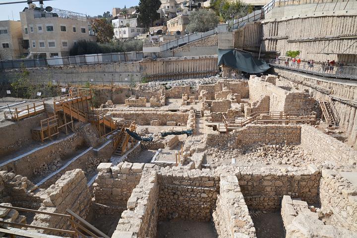
Central water drainage system of the second Temple period, an underground tunnel connecting the west side of the temple mount to the area of the Shiloah pool.
Home > Sites > Jerusalem > City of David > Central drainage canal
Contents:
Overview
Location
History
Photos
* Southern section
* Northern section
* Cistern
* 1st temple cistern
* Western wall
* Exits
* Findings
Etymology
Links
Overview:
Herod rebuilt and enlarged the Second Temple at the end of the 1st century B.C. In order to drain the runoff rain water, an underground drainage facility was constructed along the course of the Tyropoeon valley. This channel was recently excavated and cleaned, allowing visitors to walk along its 650m course from the Shiloah pool to the western wall of the Temple mount.
Location:
The location of the southern entrance to the central drainage canal is located on the north side of the Shiloah pool. Its exits are at the Givati lot parking excavation site, and on the southwest side of the temple mount. Its lowest section, and other sites in the area of the “City of David”, are shown in this aerial view. (Thanks Yehuda for the Typo correction)

History:
For a comprehensive description of the first temple history of this section of Jerusalem, see the city of David
-
Herod (37 – 4 B.C.)
Herod the Great, King of Israel under the Romans (37 BC – 4 BC), enlarged and rebuilt the second temple, and made it a magnificent temple. Herod reshaped the city, constructing public houses, streets, bridges, tunnels, and fortifications. An illustration of Jerusalem at the end of the 1st Century B.C. and the beginning of the 1st Century AD, is shown here with the city’s major points of interest. The distance from the south side of the temple to the southern edge of the city is 720 m.
An underground canal was constructed at the end of the 1st Century BC along the lower city. This new drainage facility substituted for the natural runoff flow of rainfall along the Tyropoeon valley (“Valley of the Cheese-makers”). A 650m long underground canal was constructed, starting from the west side of the temple mount, leading the water down to the south side of the lower city.
The course of the central drainage canal is illustrated as a yellow dashed line between the southwest side of the Temple mount and the Shiloah pool, a 70m descent. The canal continued out of the city, into the valley of Kidron. It did not flow into the Shiloah pool, which received waters from the Shiloah tunnel.
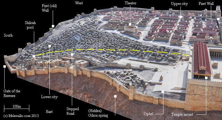
Jerusalem Museum model of Herod’s Jerusalem – south side – dashed yellow line indicates course of the underground canal
- Plan of the canal
On the north side, the drainage canal was cut into the rock, and then covered with a stone vault. Along its path are a number of branching tunnels and cisterns which were integrated into the complex, including a cistern dated to the First Temple period. The canal passes at a depth parallel to the lower level of the western wall.
On the south side, perhaps an extension added at a second phase, the channel was built over the slope of the valley. Two parallel walls were built on its sides, and flat stone slabs covered it.
The course of the canal coincided with the pilgrimage road that ascended from the Shiloah pool to the south of the temple mount, so its ceiling supported the stepped road.
-
Great Revolt (70 AD)
The underground channel also served, in its final role, as a hiding place for the remaining Jewish rebels during the last days of the destruction of Jerusalem in 70 AD. Holes punctured into the pavements above the drainage canal are visible signs of the attempts of the Legionnaires to locate the rebels and their families hiding under the paved street. A Roman sword and its leather scabbard was found inside the channel, an evidence of the Roman search. Josephus wrote about this tragic hide and seek (Wars 6, 9:4): “Romans slew some of them, some they carried captives, and others they made a search for under ground, and when they found where they were, they broke up the ground and slew all they met with”. His account of the desperate struggle of the Jews, following the destruction of the city, really comes alive here.
- Modern Period
The water channel was excavated and cleaned in 2011, following the excavations of Ronny Reich and Eli Shukron at the newly discovered Shiloah pool. The archaeologists cleared out the debris that accumulated during the past 2,000 years, unearthing interesting findings during these works. One of the interesting artifacts found in the drainage canal excavation, on the north side of the pool, was a tiny golden bell which may have been part of the robes of a high priest. Another finding included a rare engraved Menorah (candelabrum) on a stone object.
The central water drainage canal is part of the City of David archaeological park, and is accessed from the Shiloah pool.
Photos:
(a) South side
The southern section starts at the north side of the newly discovered Shiloah pool, dated to the second temple period. This section is located under the Herodian stepped road that ascended to the temple. The two walls on each side were erected above the ground level of the surface, and flat stone slabs were laid above the walls. Above the tunnel was the stepped pilgrimage road.
Click on the photos to view in higher resolution…
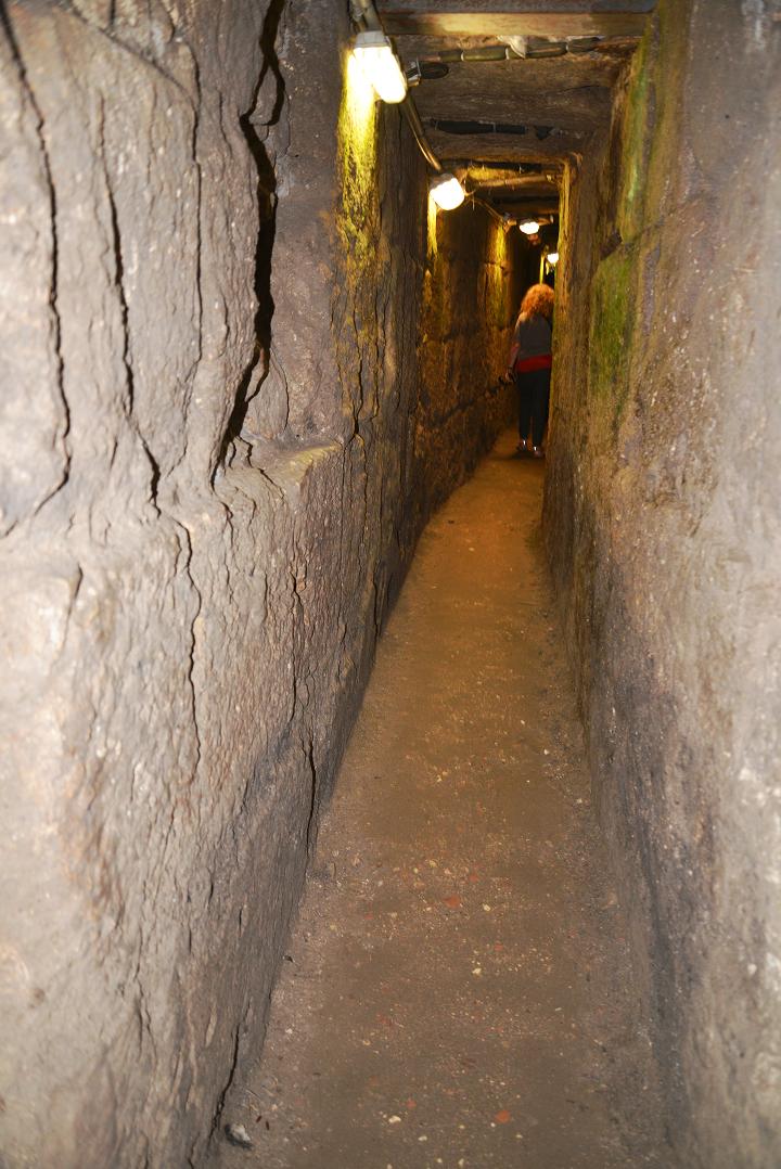
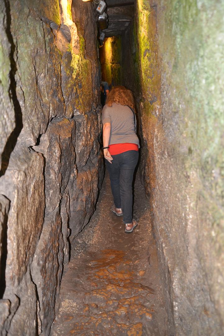
The tunnel is illuminated along the ascent. The walk up, from an altitude of 655m in the Shiloah pool area, to an altitude of 725m on the southern wall area, takes about 30 minutes along the distance of 650m.
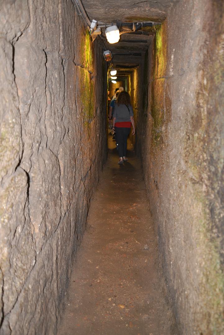
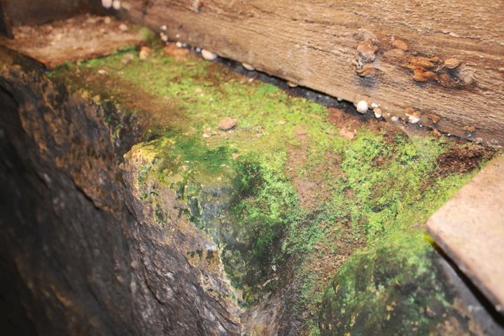
Under the lights are green patches of algae. These plant-like microbiological organisms are photo synthetic. They contain chlorophyll, which absorbs the red and blue spectrums, thus leaving the green spectrum to be seen.
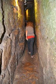
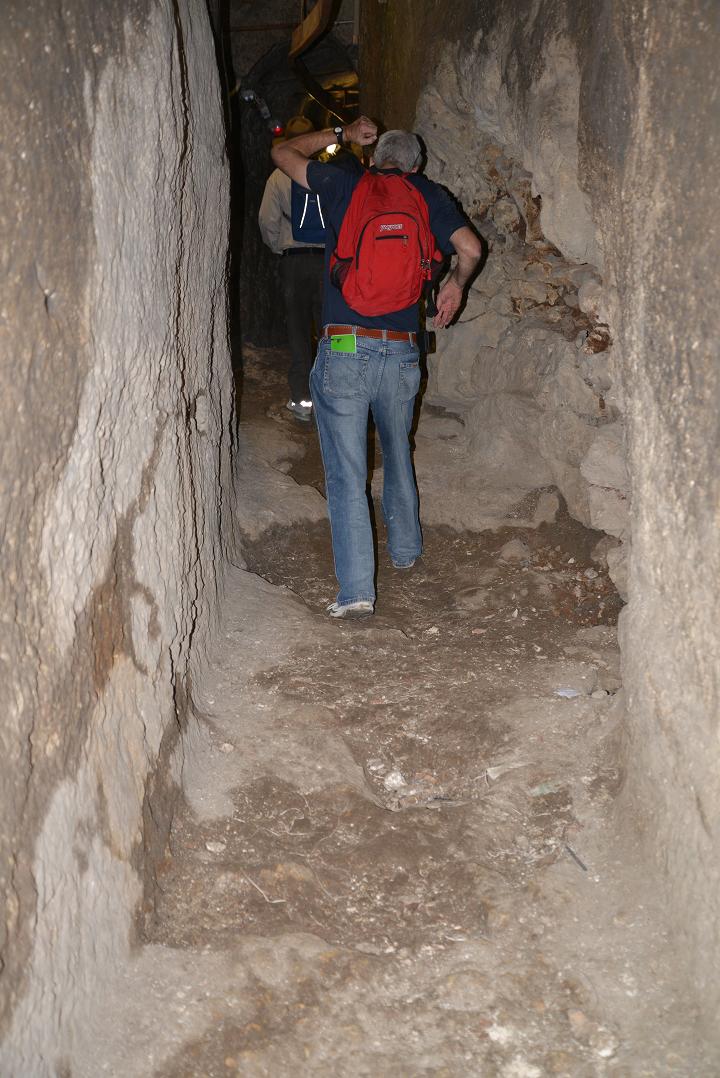
Several sections are narrow…
(b) Northern section
The northern section of the drainage canal was cut into the rock, and then covered with a stone vaults. The channel continues along the original course of the Tyropoeon valley (“Valley of the Cheese-makers”). All along the course of the canal is the Herodian street.
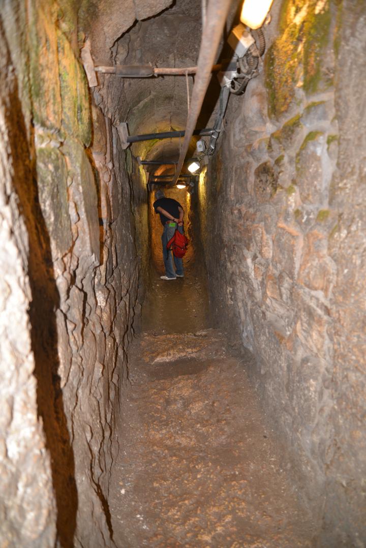
Sections of the tunnel are narrow, and require to remove the backpack, carrying it in the front or the rear. You also need to watch your head in some of the low sections.
(c) Cistern
Along its path are a number of branching tunnels, cisterns and Jewish baptismal installations which were integrated into the complex and predate its construction. These are remains of an earlier residential area, which was built over during the construction of the expanded Temple Mount by the builders of Herod the Great.
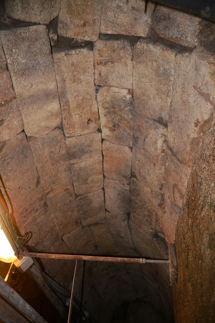
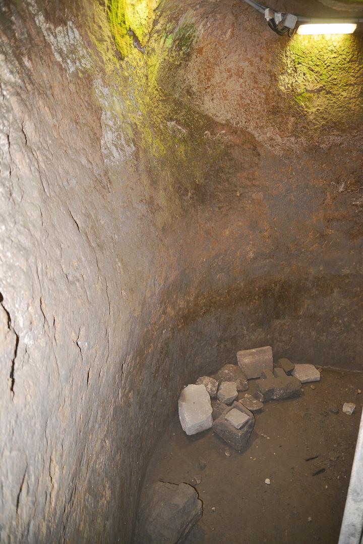
This cistern is located close to the southwest corner of the Temple Mount. The course of the tunnel integrated some of the older cisterns that were crossed along its route, including this one – an Iron Age (first Temple) period rock hewn water cistern.
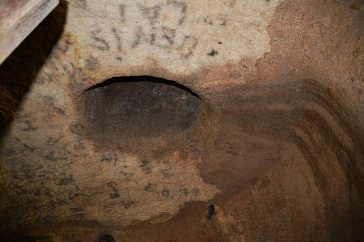
An opening in the ceiling is its entrance shaft into the cistern.
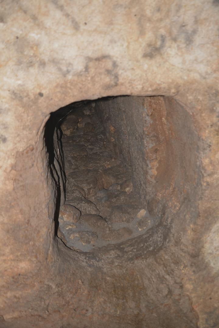
At this point the tunnel branches to the north, along the west side of the Temple Mount, and to the East, along the south wall of the Temple.
(d) First Temple period cistern
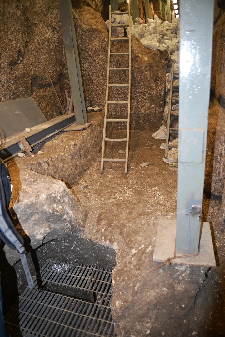
During the cleaning process, the archaeologist Eli Shukron and his team found an opening to another cistern, which is dated to the first temple period. Its bottom is located 5m lower than the previous cistern and the level of the drainage canal. The capacity of the reservoir is 250 cubic meters.
After opening the hatch cover, a metal ladder allows the descent into the bottom of the cistern.
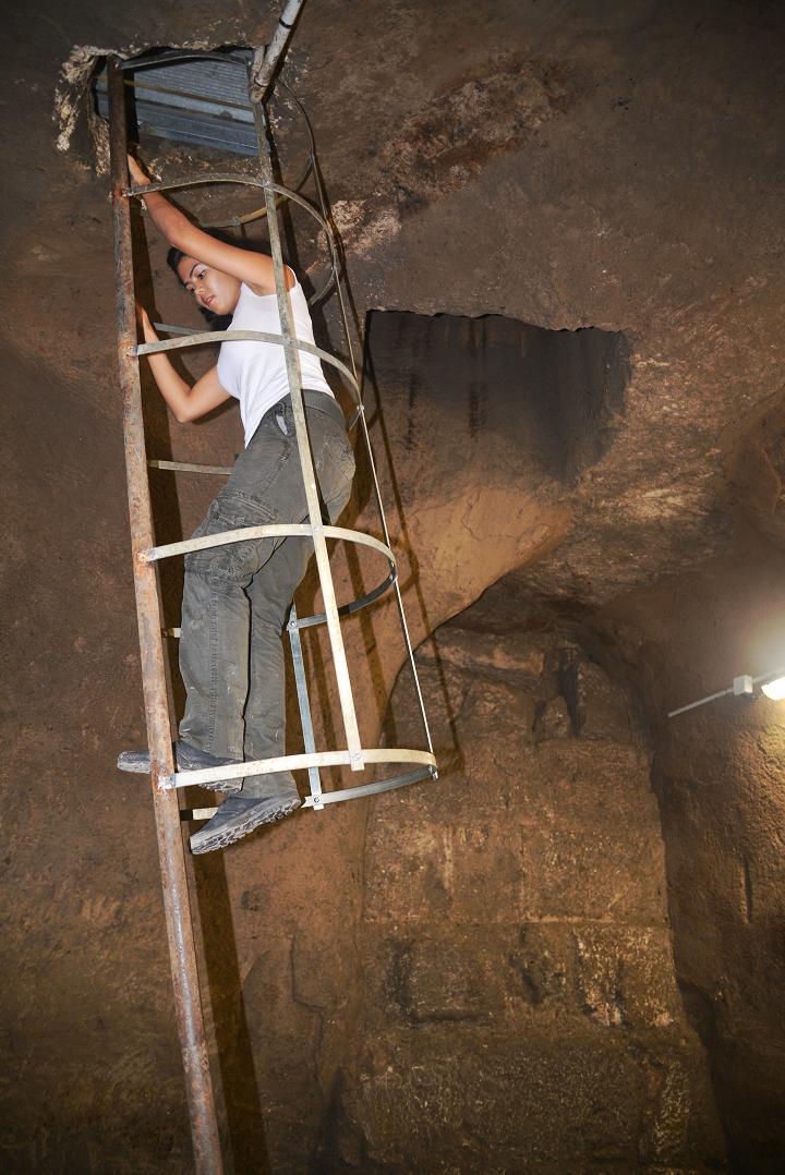
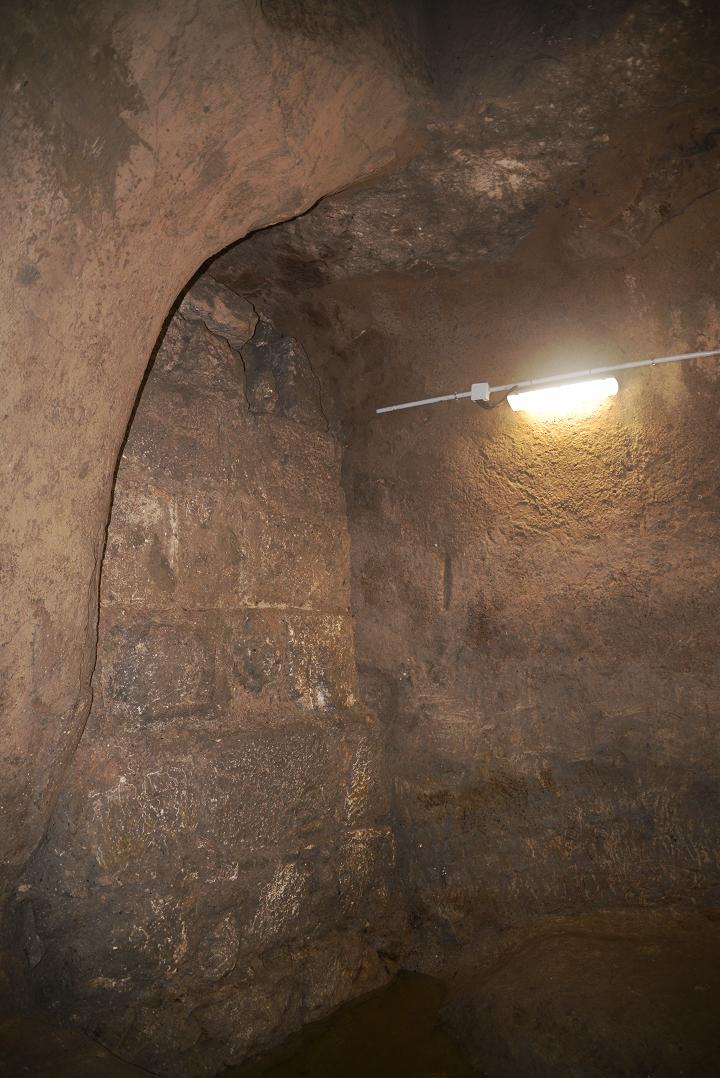
The construction of this cistern is typical of the 1st Temple period. The 3,000 years old plaster on its walls is original. The stones of the wall are actually the foundations of the Western Wall of the Temple, which were cut into the older cistern while building the western wall of the Temple Mount.
![]() The acoustics inside the cistern are great, so the group sang the song “Jerusalem of Gold”. Eli Shukron also described the discovery and purpose of the cistern. You can listen to the singing and the story in Hebrew, recorded live and uncut, for 4:34, by clicking here.
The acoustics inside the cistern are great, so the group sang the song “Jerusalem of Gold”. Eli Shukron also described the discovery and purpose of the cistern. You can listen to the singing and the story in Hebrew, recorded live and uncut, for 4:34, by clicking here.
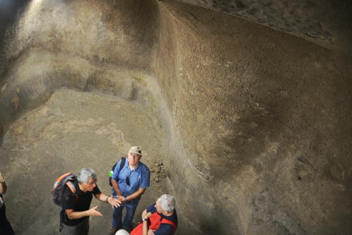
This discovery was announced in the IAA report (Sep 2012), which quoted Eli Shukron: “It is now absolutely clear that the Jerusalems water consumption during the First Temple period was not solely based on the output of the Gihon Spring, but that it also relied on public reservoirs.
Dr. Tvika Tsuk, chief archaeologist of the Nature and Parks Authority and an expert on ancient water systems, added: The large water reservoir that was exposed, with two other cisterns nearby, is similar in its general shape and in the kind of plaster to the light yellow plaster that characterized the First Temple period and resembles the ancient water system that was previously exposed at Bet Shemesh. In addition, we can see the hand prints of the plasters left behind when they were adding the finishing touches to the plaster walls, just like in the water reservoirs of Tel Beer Sheva, Tel Arad and Tel Bet Shemesh, which also date to the First Temple period. Dr. Tsuk says, Presumably the large water reservoir, which is situated near the Temple Mount, was used for the everyday activities of the Temple Mount itself and also by the pilgrims who went up to the Temple and required water for bathing and drinking.
(e) Bottom of the Western wall
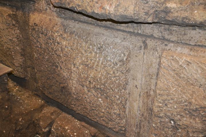
The canal passes on the side of the bottom of the western wall. You can notice these fine hewn stones, the first levels of the 27m (40 layers) high wall, dated to the 1st Century B.C.
Like in the Wailing Wall above the canal, here too the visitors push notes into the cracks between the stones, and write requests that they hope will be read by the Divine spirit, and their wishes will be granted.
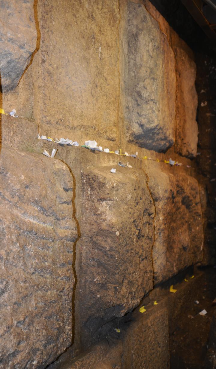
This is the lowest level of the western wall. This level was under the street level, so they were buried inside the ground since the construction of the second temple.
(f) Exits
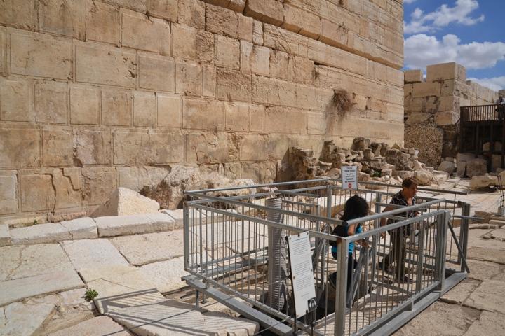
The northern exit of the drainage canal is located on the Herodian street, near the Robinson arch which is part of the south wall archaeological center. This new opening is connected with steps to the drainage canal, 6m below the surface.
Another opening is located at the Givati parking lot excavation area, just south of the Dung gate and west of the entrance to the City of David archaeological park. The opening is behind the green curtain, at the northwest corner of the excavation site.
(g) Findings
The archaeologists cleared out the debris that accumulated during the past 2,000 years, unearthing interesting findings during these works. Here are samples of the findings, as reported by the Israeli Antiquities Authority (IAA):
Gold Bell:
According to the excavation directors, archaeologists Eli Shukron and Professor Ronny Reich of Haifa University (IAA, July 2011): The bell was exposed inside Jerusalems main drainage channel at that time, among the layers of earth that had accumulated along the bottom of it. It seems the bell was sewn on the garment worn by a high official in Jerusalem at the end of the Second Temple period (first century CE). .
They added: “Apparently, the high official was walking in the Jerusalem street in the vicinity of Robinsons Arch and lost the gold bell that fell from his garment into the drainage channel beneath the road.
We know from sources that the high priests, who served in the Temple, used to hang a gold bell from the fringes of their robe. Thus, for example, in the Tetzaveh Torah portion, in the Book of Exodus, there is a description of the high priest Aarons robe: Allof blue
it shall have a binding of woven work
And upon the skirts of it thou shalt make pomegranates of blue, and of purple, and of scarlet, round about the skirts thereof; and bells of gold between them round about. It is impossible to know for certain if the bell did indeed belong to one of the high priests; however, the possibility should not be entirely discounted.”
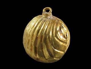
Gold Bell – Photo courtesy IAA
Matanyahu Seal:
Remains of a building dating to the end of the First Temple period were discovered below the base of the ancient drainage channel, adjacent to the western wall. According to Eli Shukron (IAA report, April 2012): ” a personal Hebrew seal from the end of the First Temple period was discovered on the floor of the ancient building. The seal is made of a semi-precious stone and is engraved with the name of its owner: Lematanyahu Ben Ho meaning: Belonging to Matanyahu Ben Ho ). The rest of the inscription is erased.”.
He added: “People used personal seals in the First Temple period for the purpose of signing letters and they were set in a signet ring. The seals served to identify their owner, just as they identify officials today. The name Matanyahu, like the name Netanyahu, means giving to God. These names are mentioned several times in the Bible. They are typical of the names in the Kingdom of Judah in latter part of the First Temple period from the end of the eighth century BCE until the destruction of the Temple in 586 BCE. To find a seal from the First Temple period at the foot of the Temple Mount walls is rare and very exciting. This is a tangible greeting of sorts from a man named Matanyahu who lived here more than 2,700 years ago. We also found pottery shreds characteristic of the period on the floor in the ancient building beneath the base of the drainage channel, as well as stone collapse and evidence of a fire.
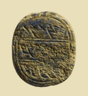
Matanyahu seal – Photo courtesy IAA
- Cooking pots and oil lamps:
Three complete cooking pots and a small ceramic oil lamp were uncovered inside a small cistern in a drainage channel. According to the IAA report (June 2013):
“Recently a small cistern belonging to a building was exposed in an archaeological excavation the Israel Antiquities Authority is conducting near the Western Wall, in the vicinity of Robinsons Arch in the Jerusalem Archaeological Park. Inside the cistern were three intact cooking pots and a small ceramic oil lamp that date to the time of the Great Revolt”. According to Eli Shukron, excavation director on behalf of the Israel Antiquities Authority, This is the first time we are able to connect archaeological finds with the famine that occurred during the siege of Jerusalem at the time of the Great Revolt. The complete cooking pots and ceramic oil lamp indicate that the people went down into the cistern where they secretly ate the food that was contained in the pots, without anyone seeing them, and this is consistent with the account provided by Josephus.
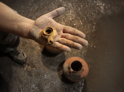
Oil lamp and cooking pot – Photo courtesy IAA
Etymology:
Tyropoeon Valley – also known as the “Central valley”, descends from the west side of the temple, towards the Shiloah pool. It separates mount Zion and mount Moriah. The drainage canal passes under the path of the valley. The name is based on Josephus “Valley of the Cheese mongers”, but its source is not clear.
Links:
* External links:
- City of David – Ancient Jerusalem archaeological park
- Central water drainage channel description of the site, with video
- The cistern where starving people hid (June 2013, Hebrew)
* Biblewalks sites:
- City of David – overview page
- Gihon spring – the water supply of the ancient cities
- Shiloah Pool – second temple period pool
- Givati Car Park – excavation area
BibleWalks.com – Bible comes alive
Shiloah Pool <<<—previous Jerusalem site–<<< All Sites >>>—>>> Givati Car Park
This page was last updated on June 14, 2017 (typo fix)
Sponsored links:
