An impressive fortified Byzantine monastery, built over a Late Roman fortress.
* Site of the Month – Mar 2020 *
Home > Sites > Samaria > South > Deir Samaan
Contents:
Background
Location
History
Photos
* Overview
* Installations
* Pool
* Threshing floor
* Muslim structure
* Reservoir
* Inside the fortress
Etymology
Links
Overview:
Deir Samaan (Sam’an) is the ruins of a Byzantine monastery in the Western Samaria area. It started as a Late Roman fortress that guarded strategic roads in the Western Samaria Area, then converted to a monastery. This is one of the most impressive ancient sites in the region, located inside the community of Leshem (Alei Zahav B) in the western Samaria region.
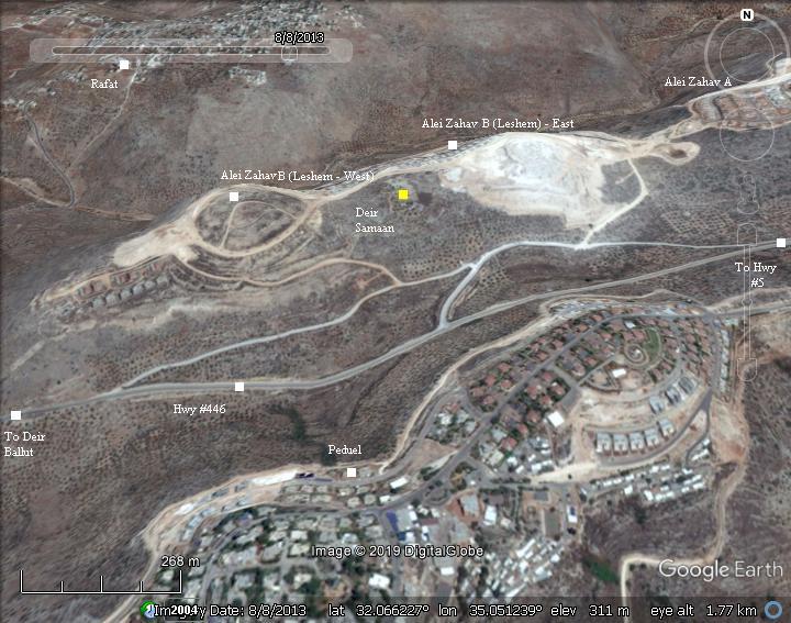
Location and Map:
Deir Samaan is located on the summit of a ridge, at an altitude of 379m, about 100m above the valley of Deir el-Emir where highway 446 passes.
An aerial map of the area around the site (in yellow) shows the major points of interest. This image is several years old, and since then the community of Alei Zahav have grown, now covering both sides of Deir Samaan (West and East). The new housings are named Leshem, also known as Alei Zahav B.
History:
-
Late Roman period
Deir Samaan was initially one of the Late Roman fortresses that protected an important Roman road. It is dated to the middle of the 4th century AD. During the excavations, coins were dated to the end of the 4th century with the earliest of Constantius Gallus (351-354).
A west-east road, connecting Deir-Ballut and el Kefr (ed Dik), passed at the southern foothills of Deir Samaan. This road was a section of the Roman road from Afeq (Antipatris) to Shechem (Nablus).
Roman Roads:
The Peutinger Map (Tabula Peutingeriana) is a medieval map which was based on a 4th century Roman military road map. It is oriented west-east.
In ancient times two major roads passed near the site. These routes passed through Shechem (Neapolis, seen here in the center as a double-house icon) and connected –
-
Shechem, through Migdal Afek to the south west (Lod/Lydda) and to the port of Jaffa (here marked as Joppe on the coast line);
-
Jerusalem (left side of the map), through Gofna and Shechem, to the north west (Sharon, Caesarea).
-
The first construction phase of Deir Samaan was a Roman fortress that overlooked the road.
The location of the the site is indicated by a red square on the side of the road from Shechem/Neapolis to Caesarea.
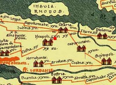
A section of the Peutinger Map (Tabula Peutingeriana)
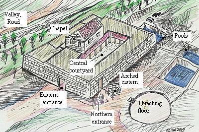
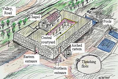
The plan of the fortress was a central courtyard that was surrounded by rooms and a peristyle (continuous porch formed by a row of columns surrounding the courtyard). Its area was 39.0m by 36.50m. The entrance was from the east, and at later stage a northern entrance was added. The water supply was based on a cistern under the central courtyard and another in the southern wing. An open pool was cut on the northwestern corner of the fortress.
The walls were made of finely hewn large ashlars. The building material was hewn on the side of the structure, and later was converted into pools. Additional quarries were found east of the site.
-
Byzantine period
In the 6th century the Roman fortress was converted to a monastery. During this conversion the structure was made fit to serve the new residents, by adding a chapel, agriculture installations, and water reservoirs.
A chapel was built as a second story on the southern wing of the compound. A wide staircase led up to the chapel.
A northern entrance was added to the fortified complex. Two covered pools and a cistern were added outside of the structure on the north side. A large threshing floor and winepress was also added to support the community.
The monastery was named after St. Simeon. This is the source of the Arabic name – Deir Samaan, meaning “the monastery of St. Simeon”. Who was St. Simeon? This is yet unknown.
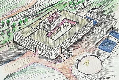
Illustration of the Byzantine monastery
Deir Samaan has strong similarities to Deir Qal’a, 1.5km southwest of the site, with similar construction methods and two stages of construction – a fortress in the late Roman period and then a monastery during the Byzantine period.
According to the archaeologist Y. Hirschfeld, who conducted a survey in Samaria and this site, the large number of monasteries in the area were built in order to protect the Christian villages in the area south of Nahal Shiloh, following the Samaritan uprisings in the 6th century.
-
Early Islamic period
The Byzantine Christian monastery was then abandoned. During the Umayyad period an oil press was added, and an arched structure was built between the northern walls and the pools.
- Ottoman period
Conder and Kitchener surveyed this area during the Survey of Western Palestine (SWP) in 1873.
A section of their map (part of sheet 14) is shown here. Deir Samaan is written as “Deir Siman”, situated above a rocky spur at an altitude of 1200 feet. The ancient Roman road appears on the map as a dashed line, just below the site, just above the valley.
The surveyors described the place (Volume 2 p.319-320), and attached an illustration of the plan of the monastery:
“Deir Siman: A building similar to Deir el Kulah, but less well preserved, being razed to the foundations. The area enclosed is a rectangle, 135 feet east and west by 125 north and south, with a smaller rectangle on the north-east, 50 feet north and south, ’77 feet east and west…
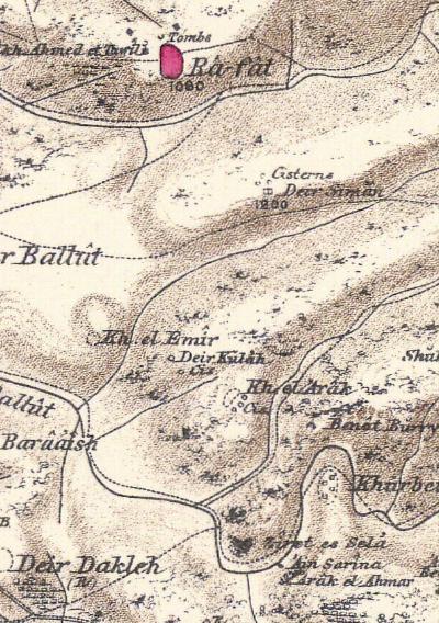
Part of maps Sheet 14 of Survey of Western Palestine,
by Conder and Kitchener, 1872-1877.
(Published 1880, reprinted by LifeintheHolyLand.com)
…Adjoining this on the west are two rock-cut tanks, 30 feet long. The chapel appears to have been towards the south, and had a bearing 82°. The traces of various other chambers can be made out.
The most curious detail is on the north, where is a rock platform with a circular bath, 2 feet 9 inches deep, 14 feet diameter ; three steps lead down into it, and immediately west is a tomb of the kind called ‘ rock-sunk,’ as at Iksal. The steps are 8 feet 2 inches wide, 2 feel 6 inches tread, 8 inches rise. Two pillar shafts were found, with a double fillet round the end, and a small vault exists at a lower level. One cross was observed. A portion of the wall was measured, consisting of drafted masonry on the outside. This is a good instance of the general character of the Byzantine masonry.
The drafts were about 2 inches deep and 4 or 5 inches broad.
Visited and planned, 30th May, 1873″.
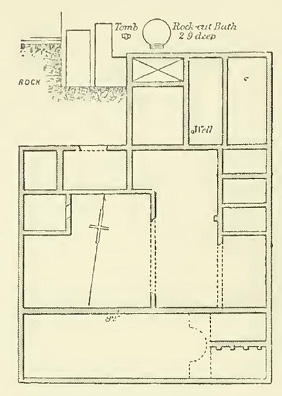
PEF survey illustration (V2 p.320)
- Modern Period
The site is behind fences, in order to protect it and to add safety against drowning in the pools. It is possible to request the lock’s opening number from the neighbors or from the security officer of Leshem/Alei Zahav.
Photos:
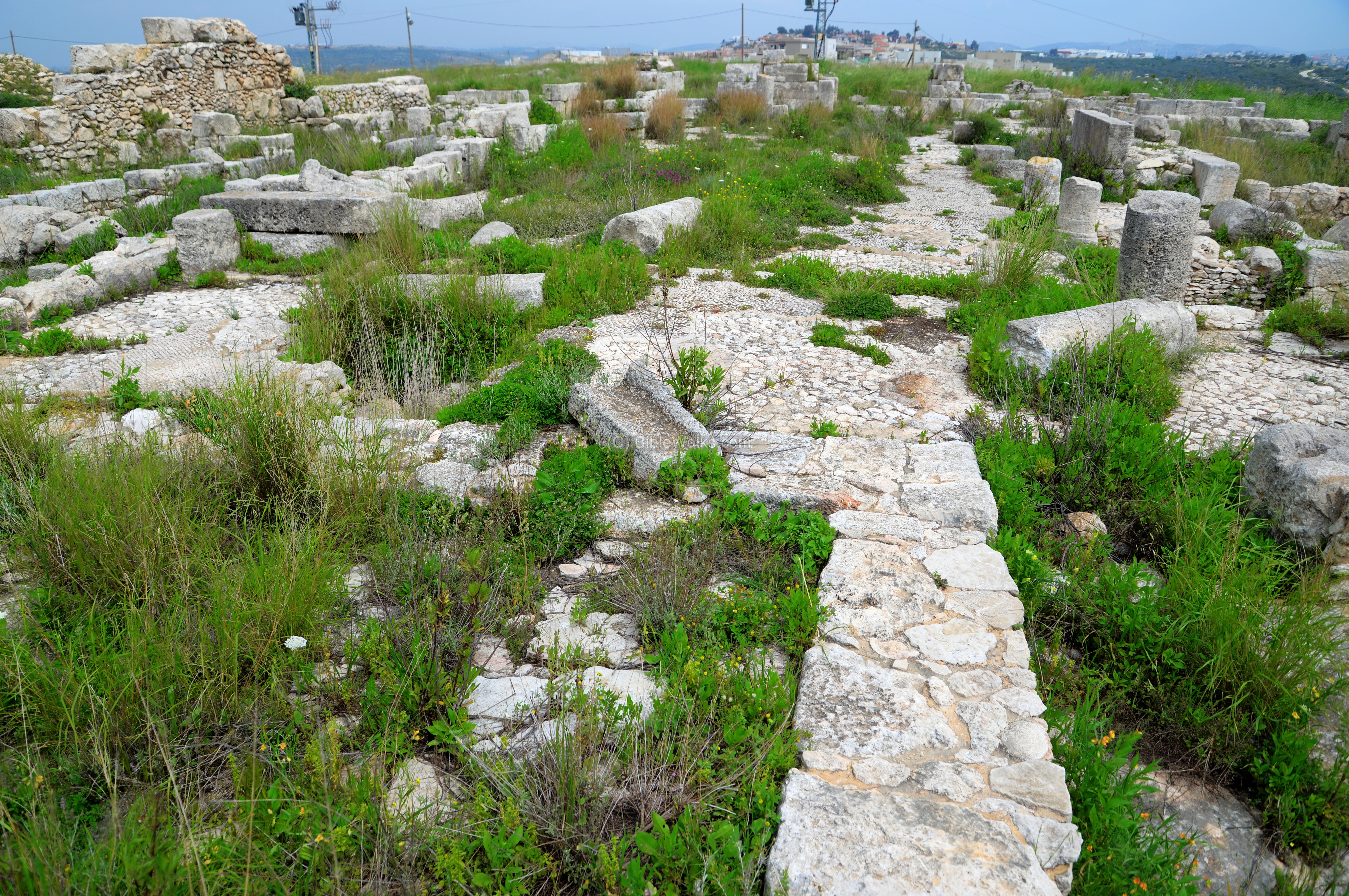
(a) Overview
The ruins of Deir Samaan are located on the summit of a ridge. An eastern view of Deir Samaan, as taken from the community of Peduel, is here. On the foothills below the monastery are terraces with olive trees. The modern road, Hwy #446, follows the ancient route on the northern bank of the valley (Wadi Deir el-Mir).
Click on the photos to view in higher resolution…

(b) Installations
After entering into the enclosed archaeological site from the north side, a number of agriculture installations are found cut into the rock foundation, such as this winepress.
Yet another winepress is next, where a round treading floor is seen, with a groove leading to collecting the pool. This is where the grapes are laid and then crushed by the feet of the workers, extracting the juice. The juice, together with the crushed grapes, were left for preliminary fermentation.
Another view of the winepress, which is dated to the Byzantine period:
A closer view of the winepress is in the next photo. Notice the holes: they were first used to block the juice during the fermentation process. Then, to let only the juice flow through, while the grape shell and pits remain in the treading floor.

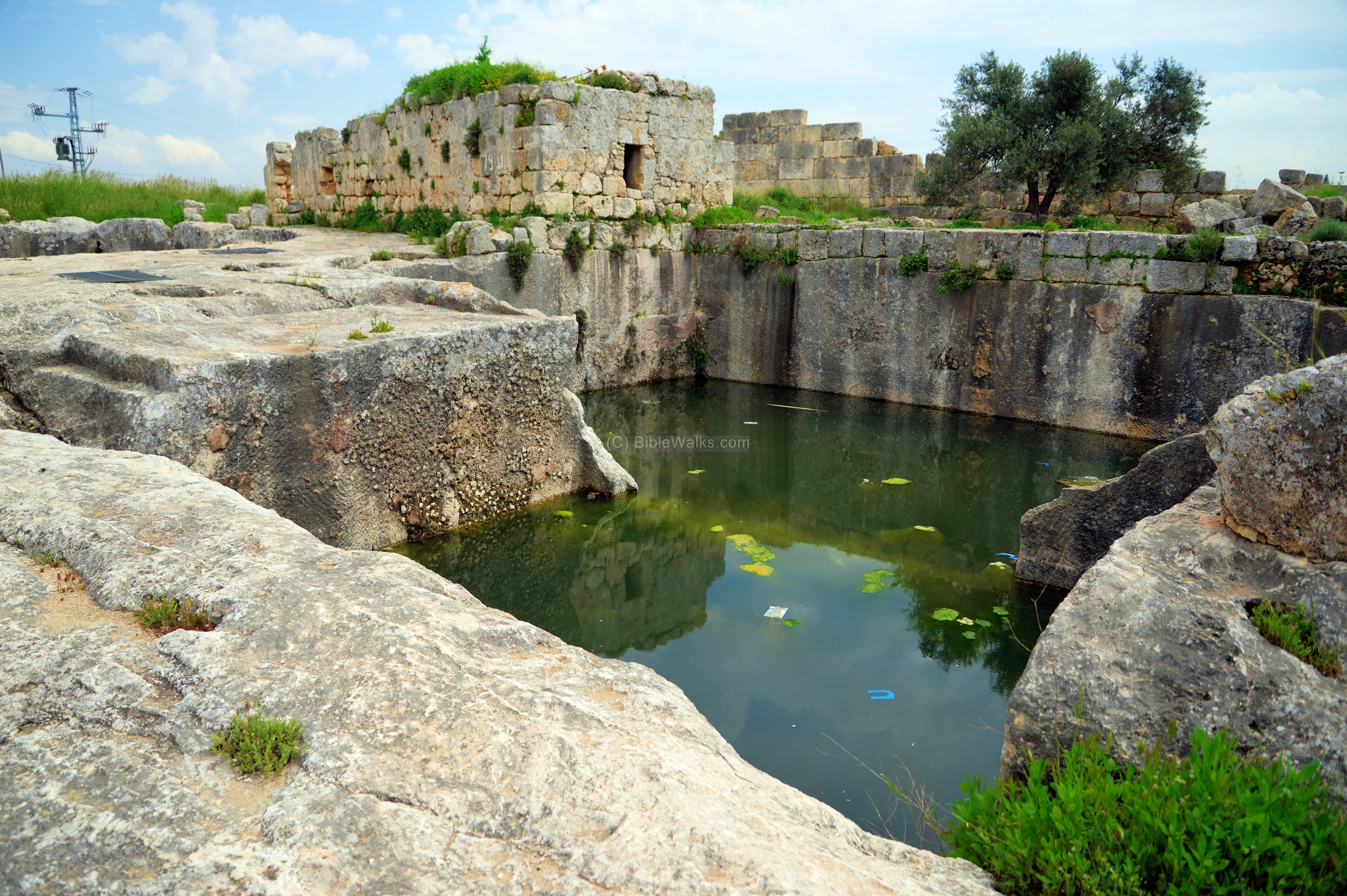
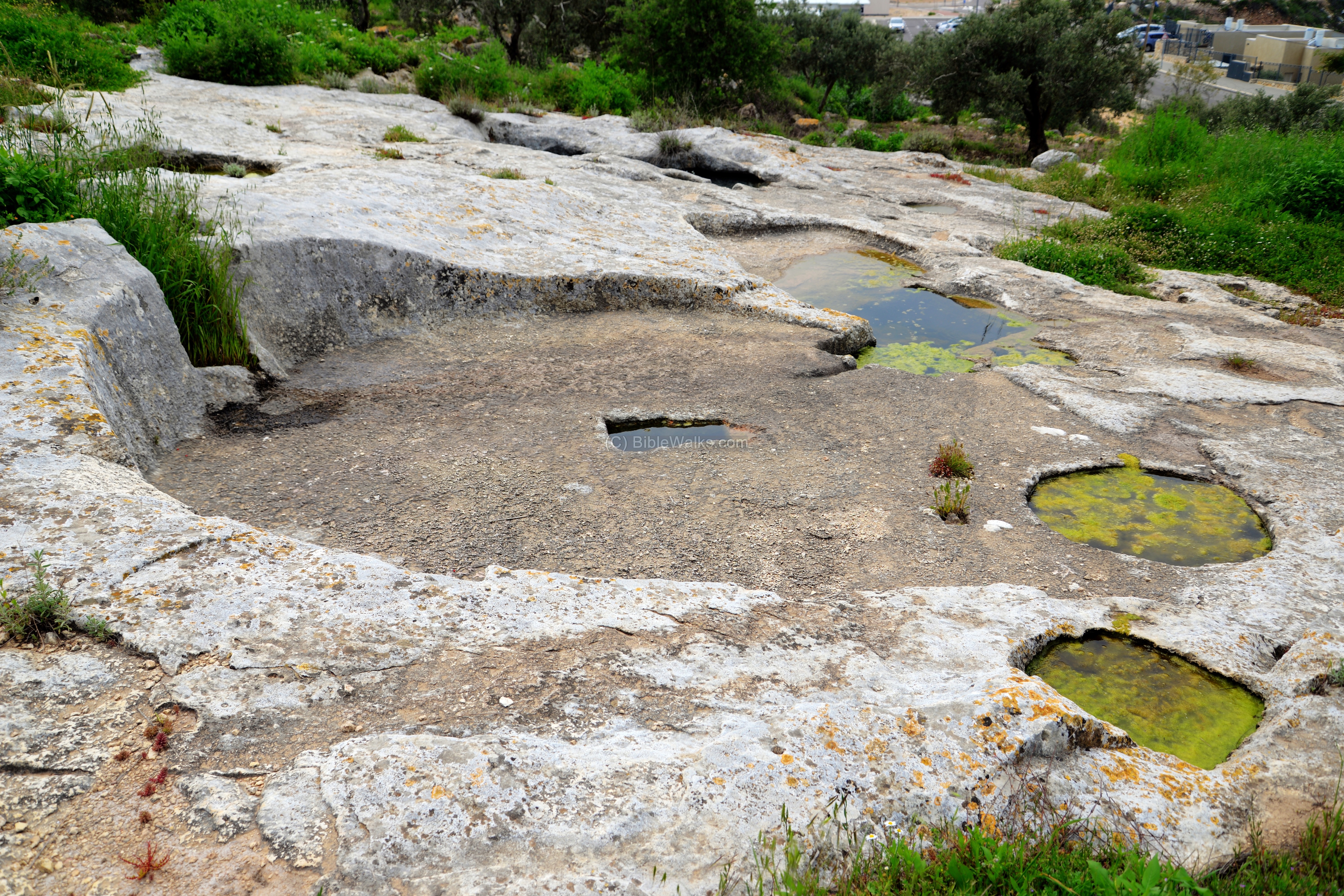
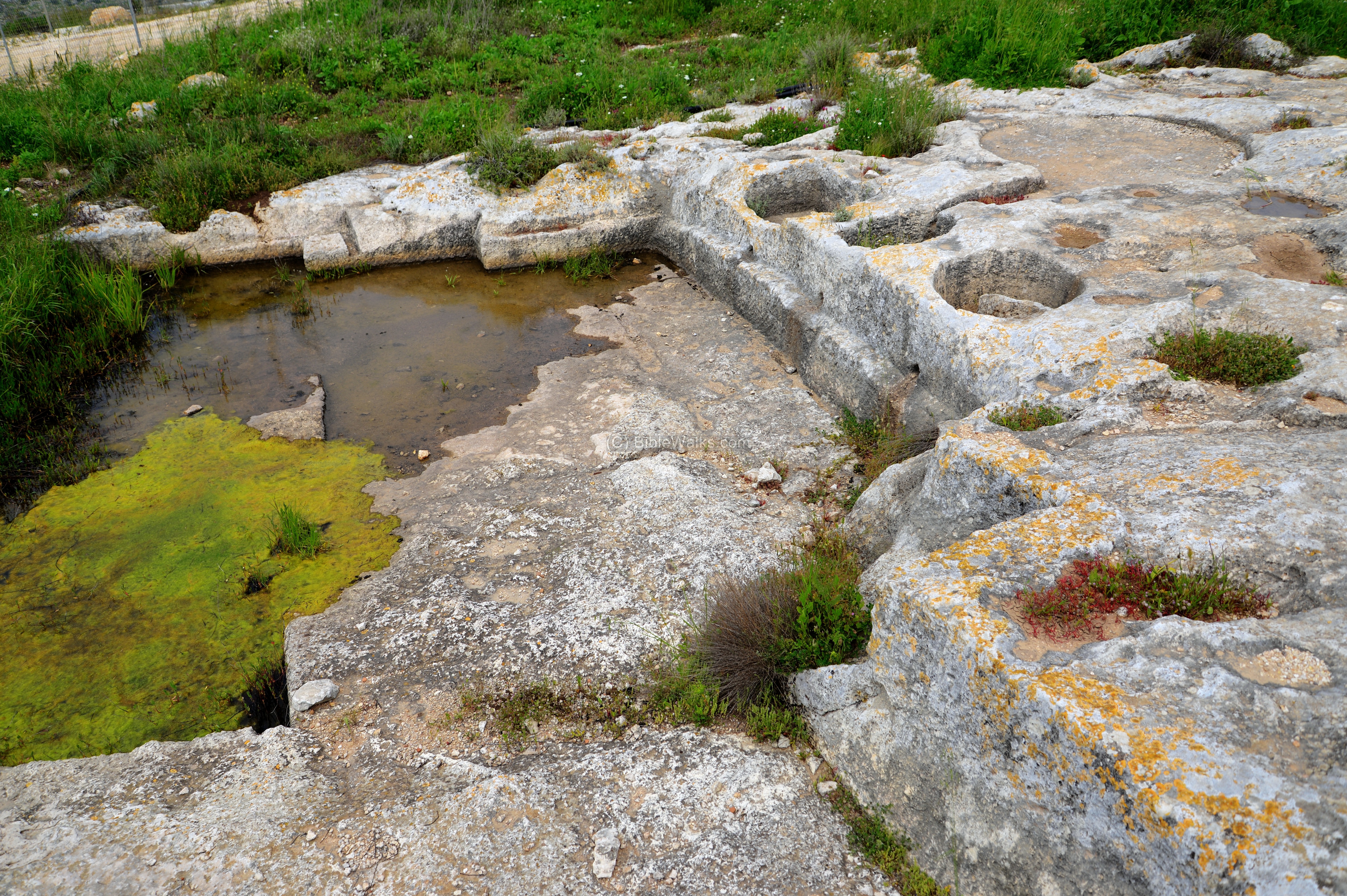
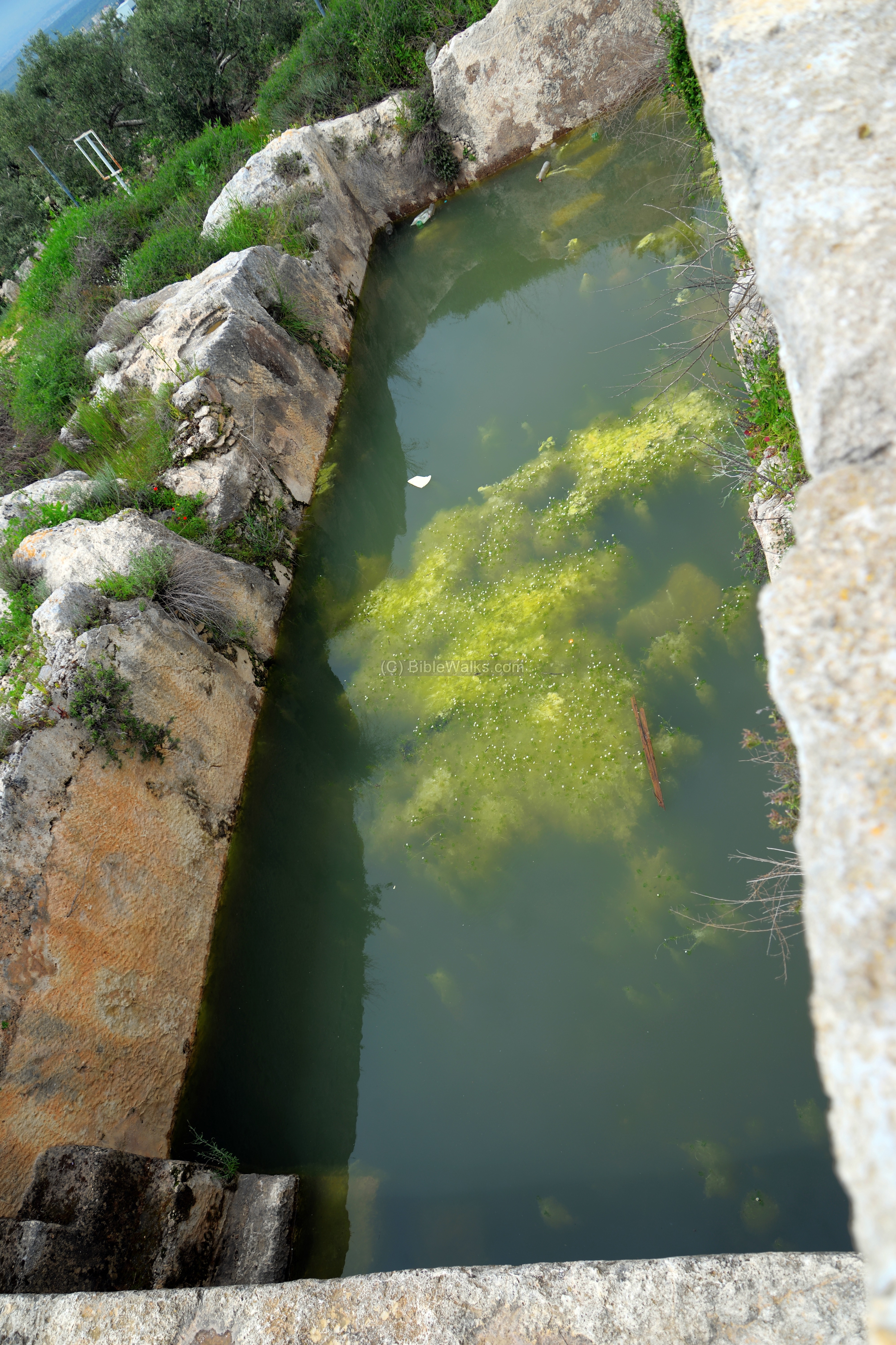
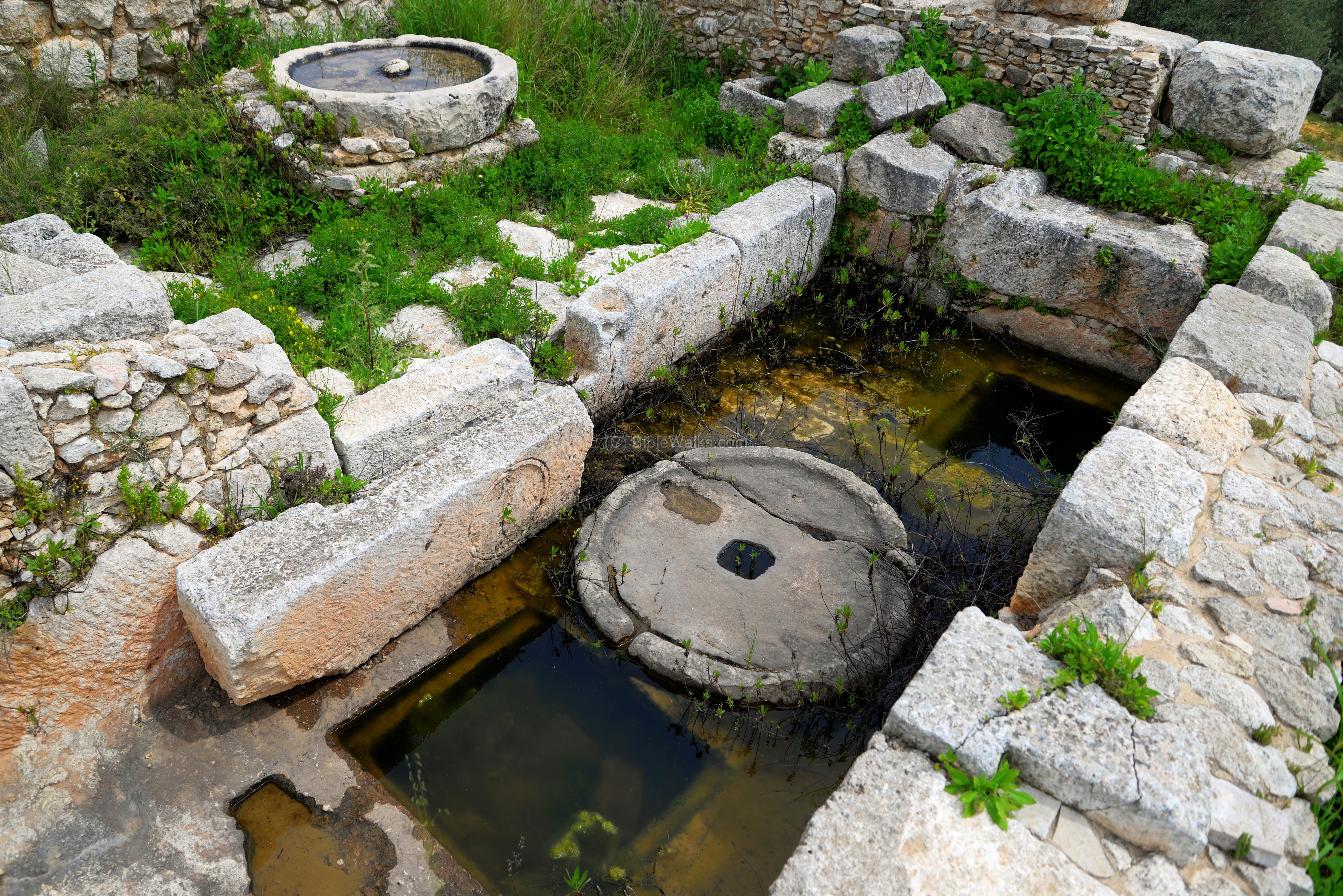
(c) Pool
On the west side of the monastery are pools cut into the rock.
Initially these pools were quarry pits that were used for cutting building stones for the monastery.

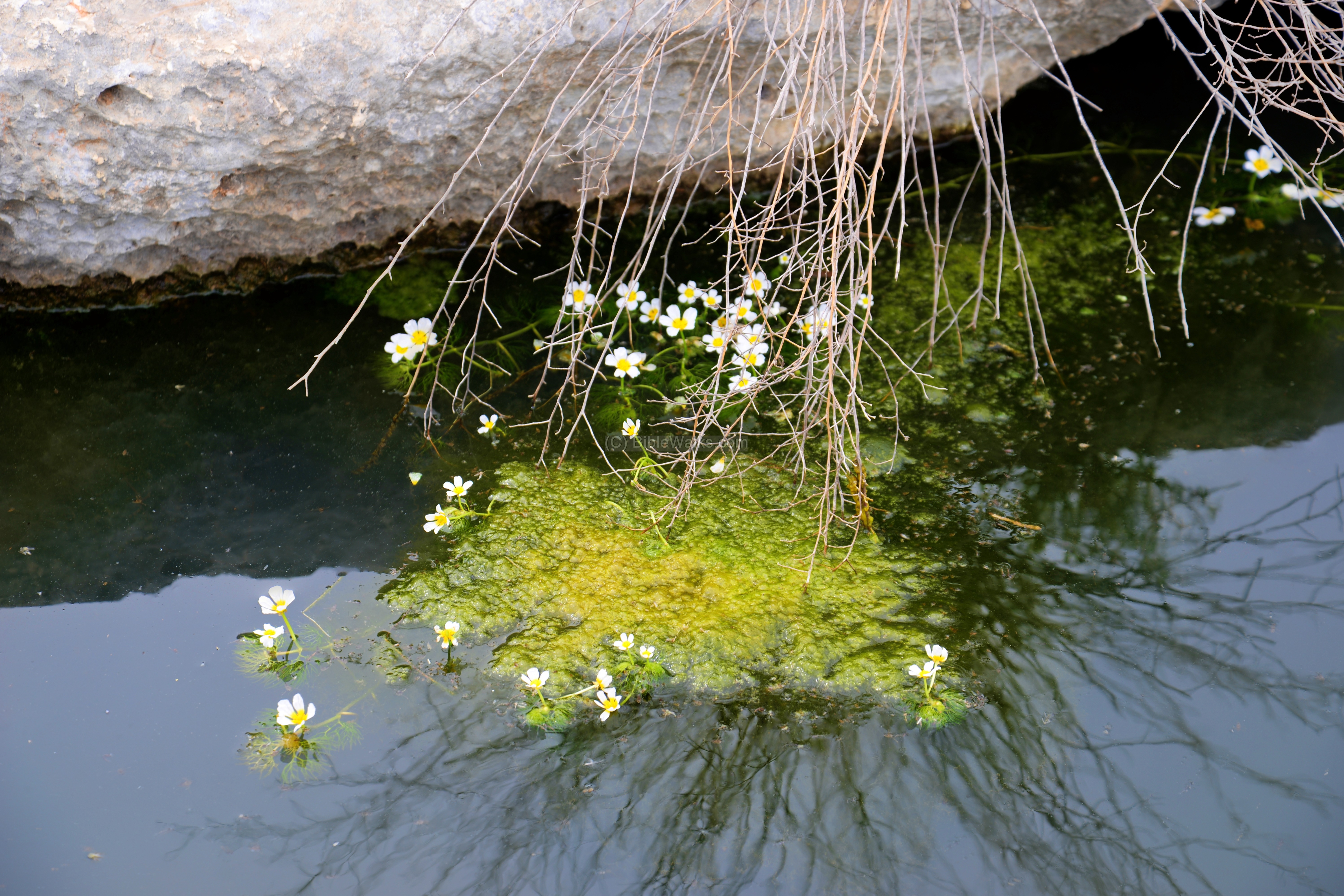
The pools were later used as reservoirs, storing run off rain water. The pools supplied water to the orchids and drinking water for the herds.

Some dare to swim in the pools. Due to safety issues, the compound of Deir Samaan is totally surrounded by a fence and a padlock in order to deter the local children to come unattended to the pools.
Sections of the pools are covered with water flowers and algae.
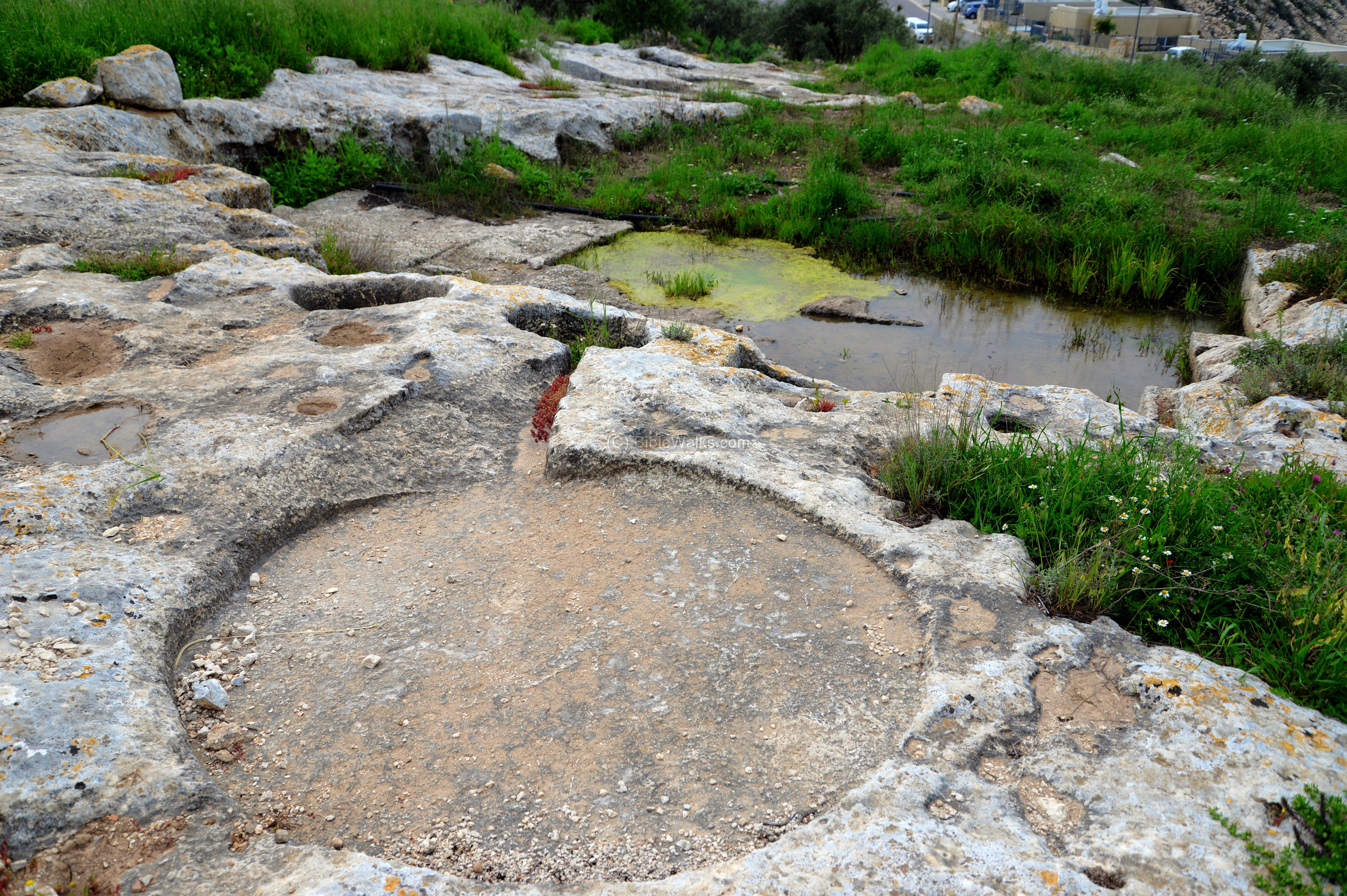
(c) Threshing floor
A large circular threshing floor is cut into the rock in front of the monastery. This installation was used to separate the grains from the wheat, using a pair of donkeys or oxen . The size of the floor is 14 feet in diameter (430 cm) and its depth is 2’9″ (83 cm).

Threshing is the process of loosening the edible part of grain from the inedible chaff that surrounds it (see video in the links section). The crop of wheat or barley is spread on the floor of the circle, then the animals walk along the perimeter of the floor, pulling a flat thrashing board with teeth, and thus separate the grain from the straw.
The Bible refers to this process while describing the power of the Israelites (Isaiah 41:15):
“Behold, I will make thee a new sharp threshing instrument having teeth: thou shalt thresh the mountains, and beat them small, and shalt make the hills as chaff”.
The installation in Deir Samaan is the largest built threshing floor in Samaria. The harvest from the fertile valleys nearby were brought here to separate the grain.
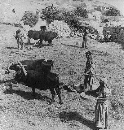
Threshing floor in the Galilee (Library of Congress – JF Jarvis, ~1900)
Three steps, near the entrance to the structure, lead down into the threshing floor. On the north side of the threshing floor is a hewn sun dial that was used for some timed process.
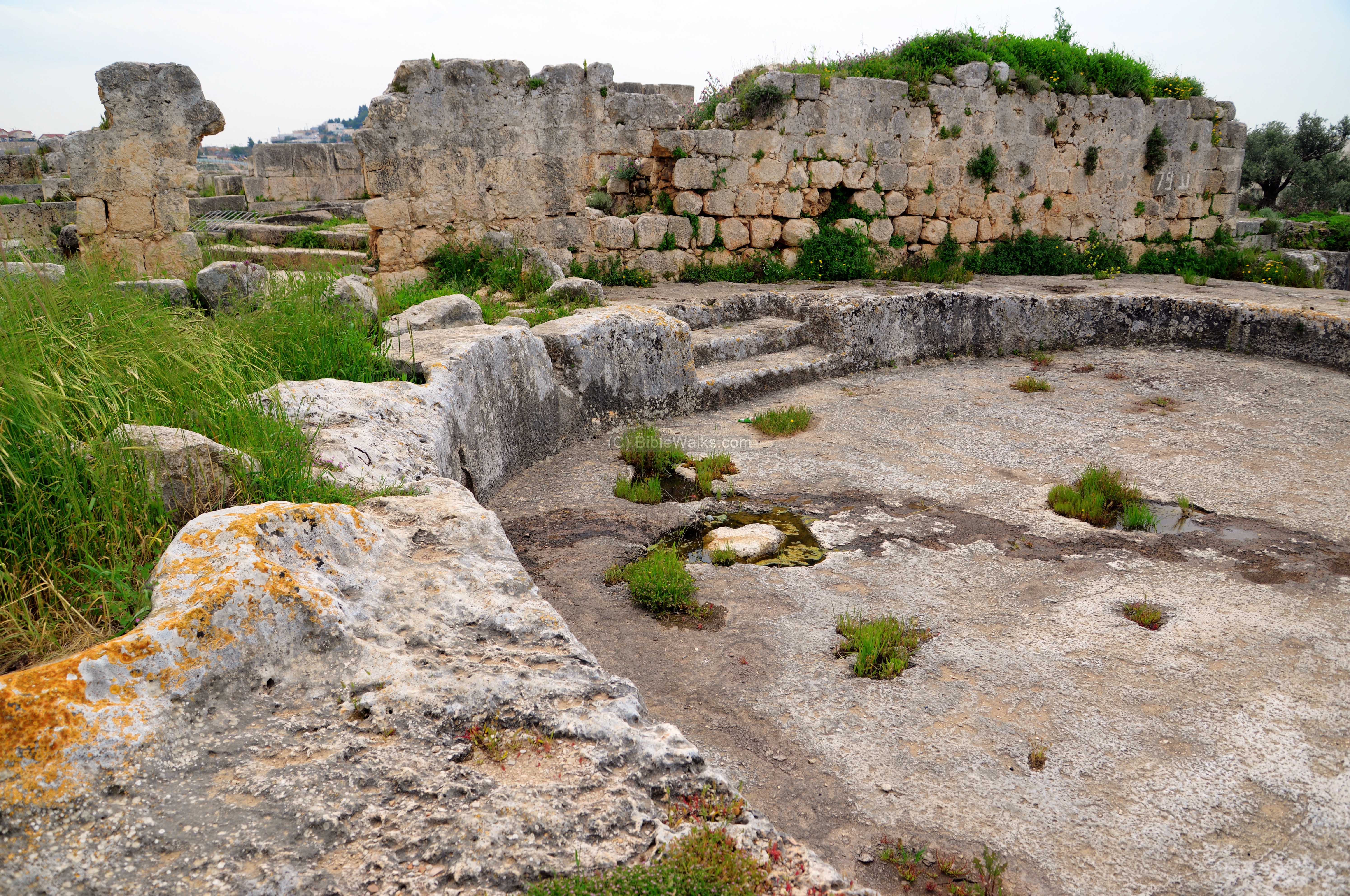
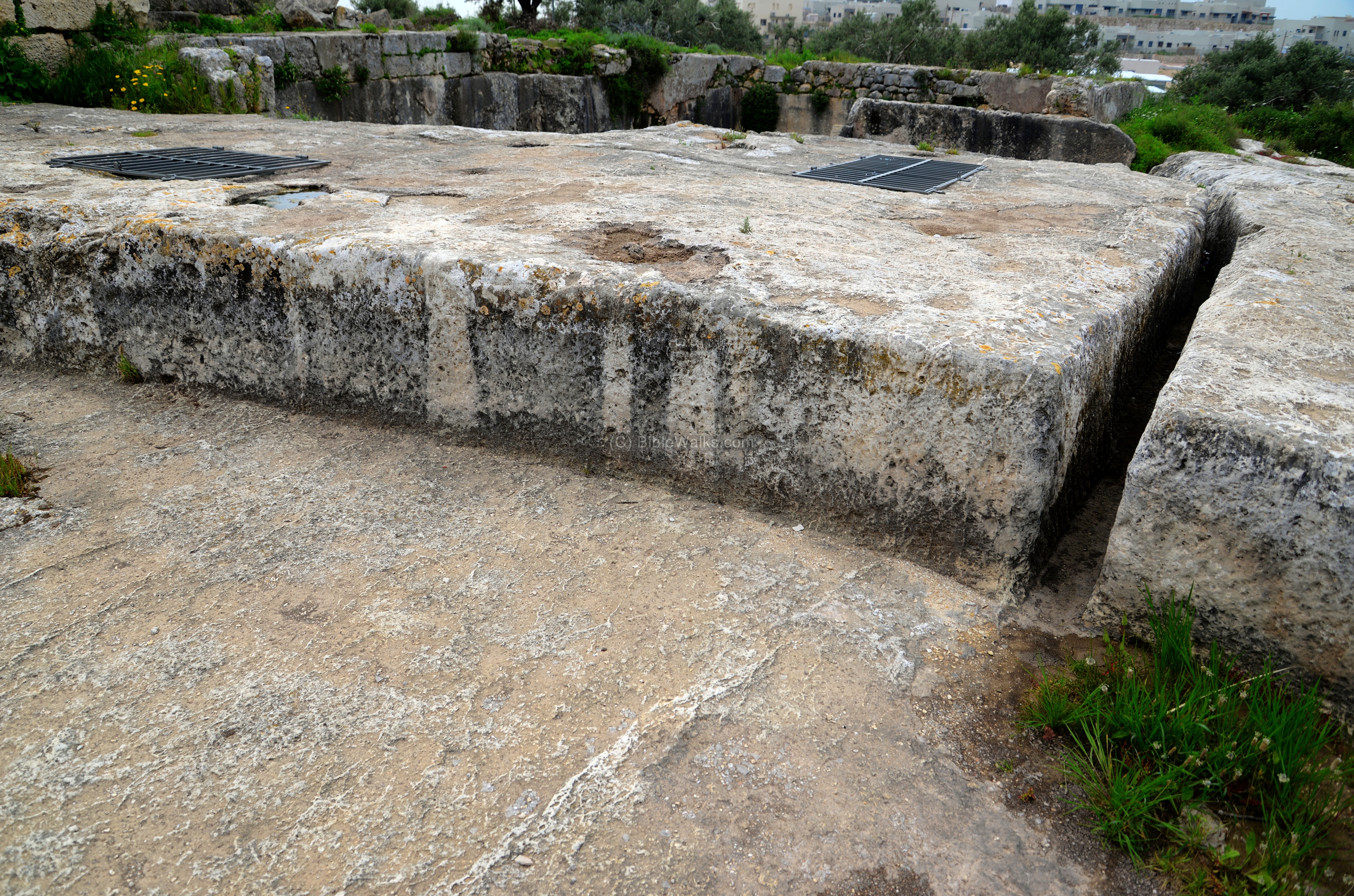
To prevent the rain water to fill up the pool, the threshing floor was drained into the pool using a narrow channel.
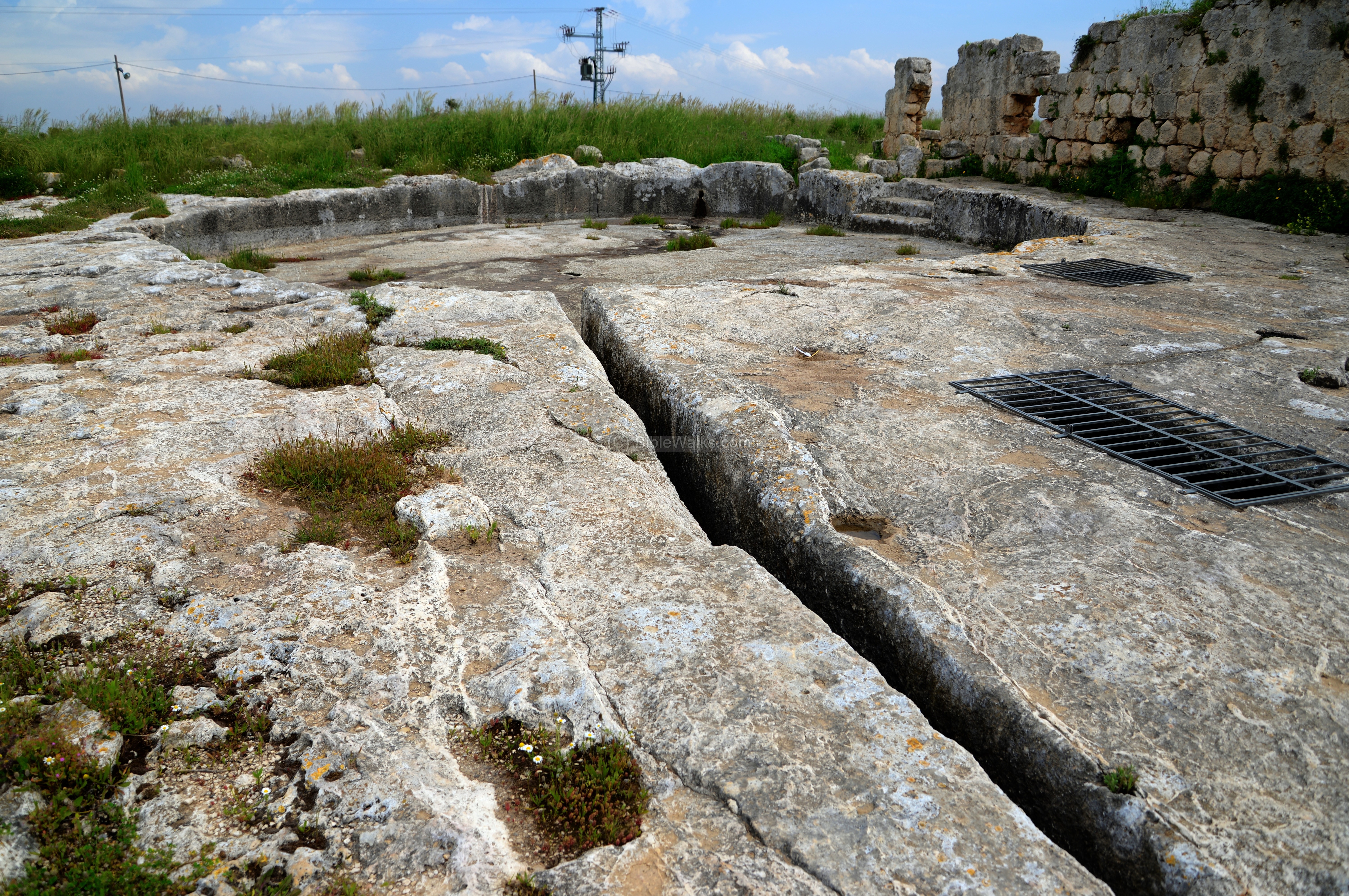
The next photo is a view of the drainage channel as seen from the threshing floor.
In the flat area between the threshing floor and the pool, seen here with an iron cover, is an entrance to a “rock-sunk” tomb dated to the Roman/Byzantine period.
Now let’s go inside the enclosed compound…
To the south of the threshing floor, beyond the entrance, is a view of the northern side of the the enclosed compound. To the right is an arched structure, on the left is the original wall of the Late Roman period fortress, and in between is a covered pool.

(c) Muslim structure
The arched structure is adjacent to the external wall.
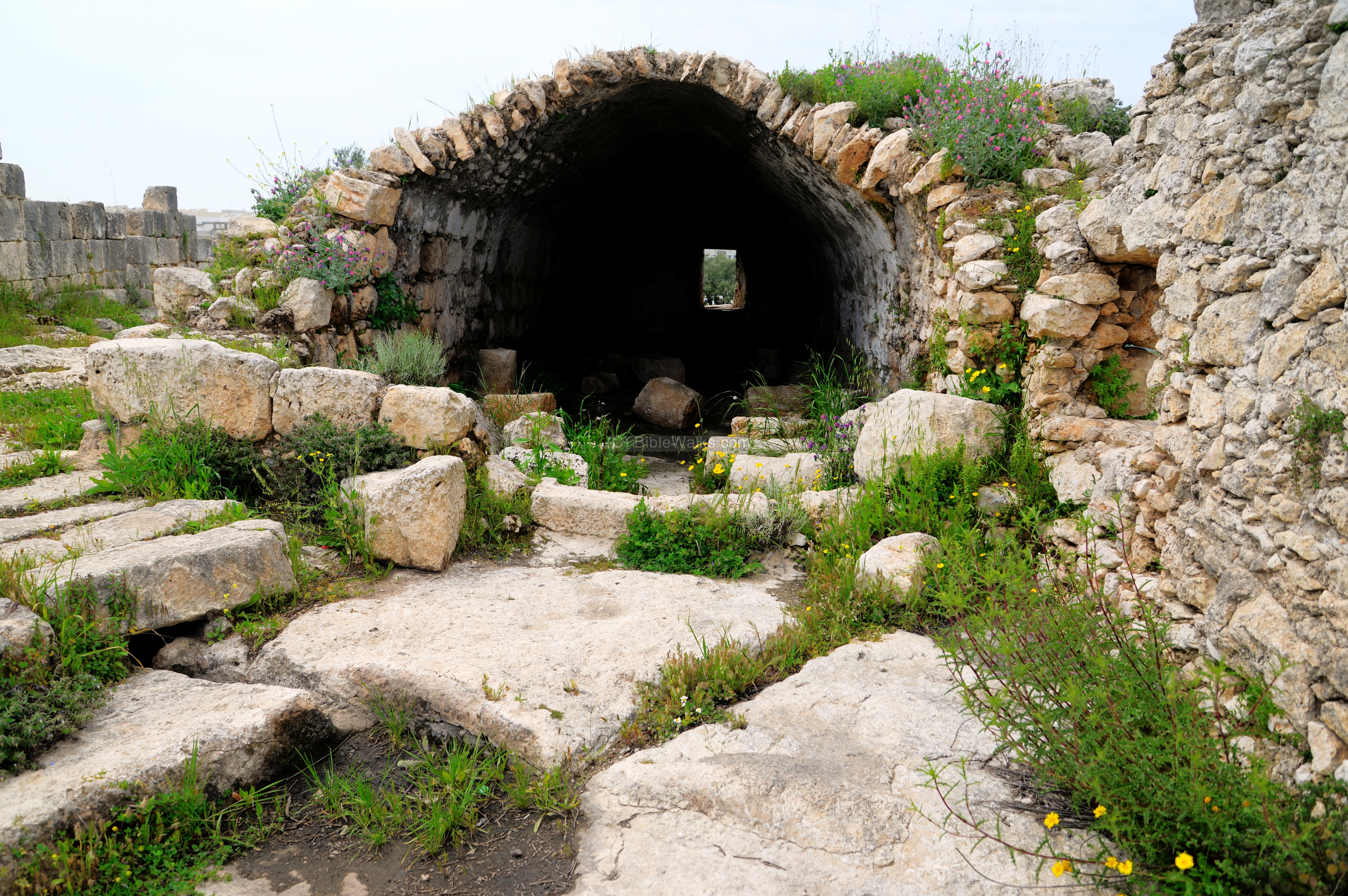
This structure is dated to the early Islamic period (7th-8th century). Inside are elements collected from the monastery.
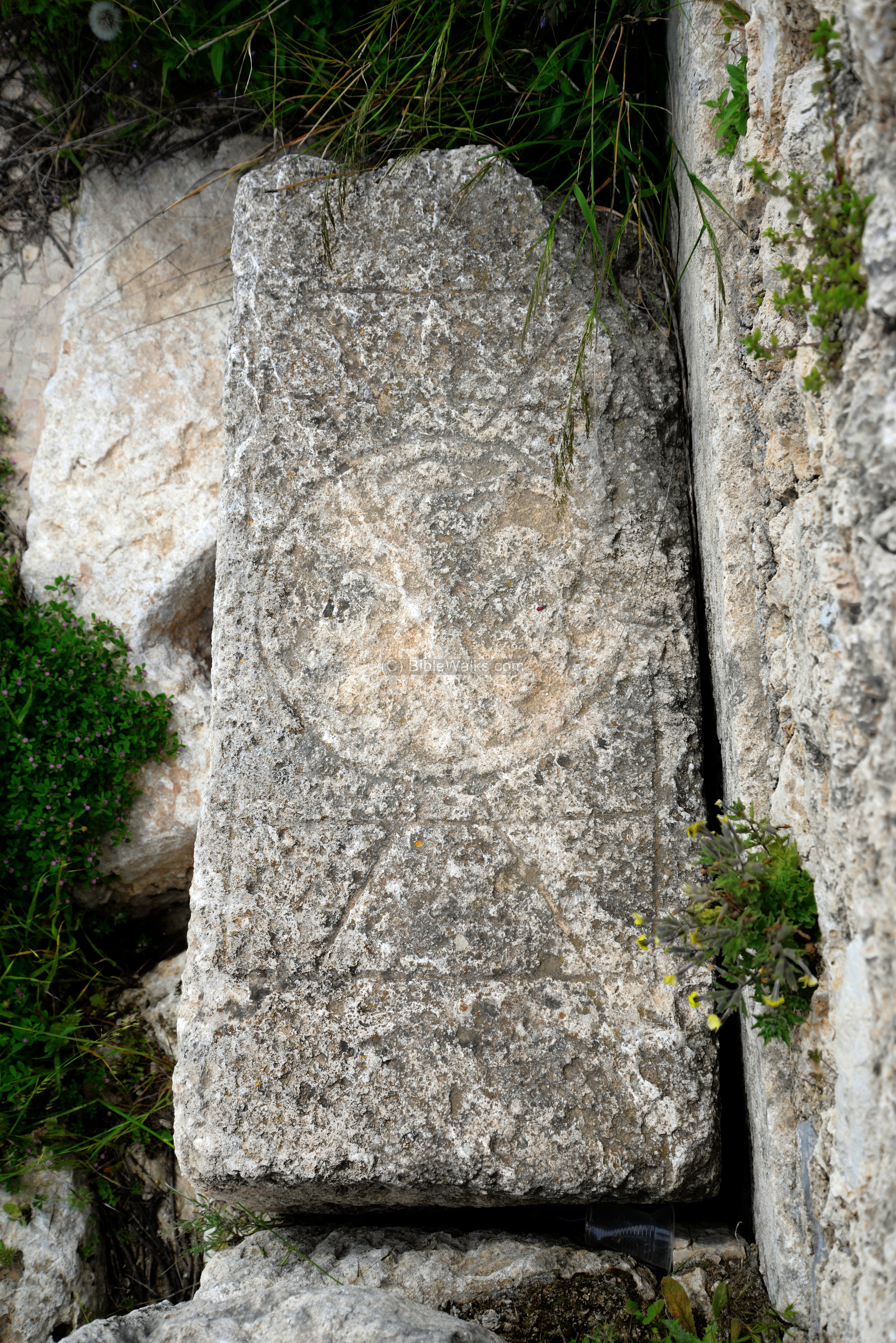
One of the stones has an engraved cross.
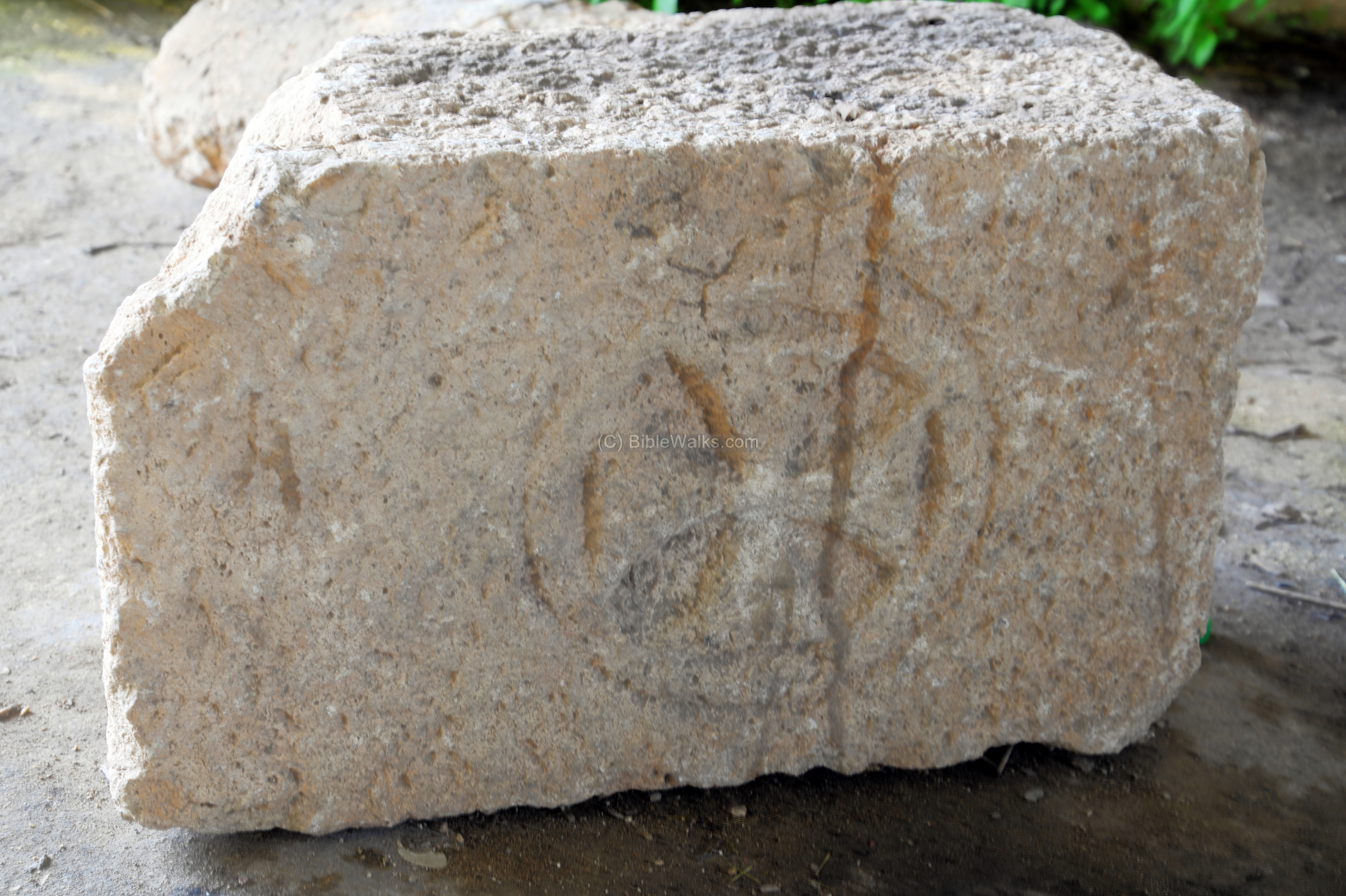
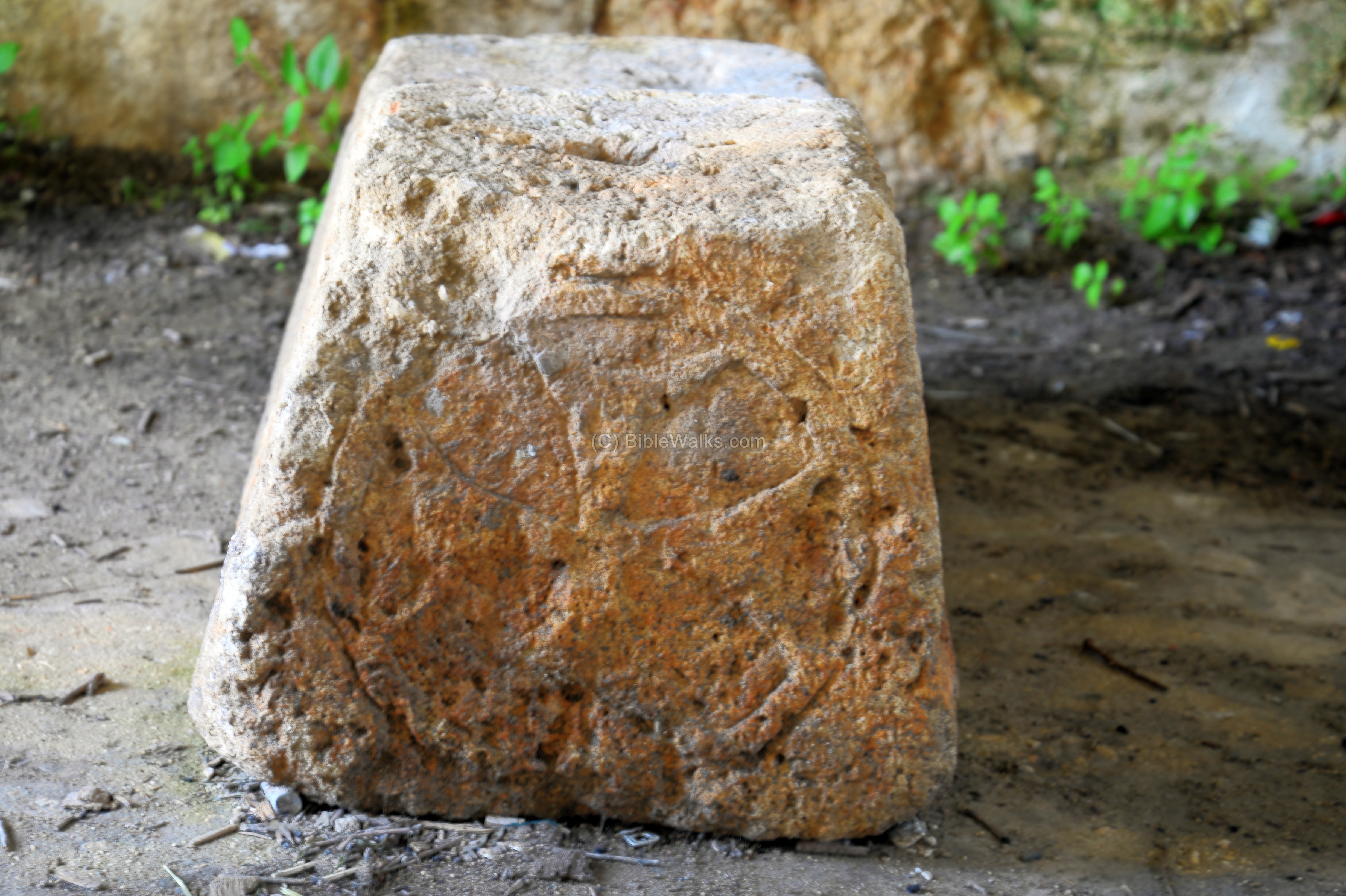
Yet another stone has a cross is in the following photo. There were many stones bearing crosses, dated to the second stage of construction when the Late Roman fortress was converted to a Christian monastery.
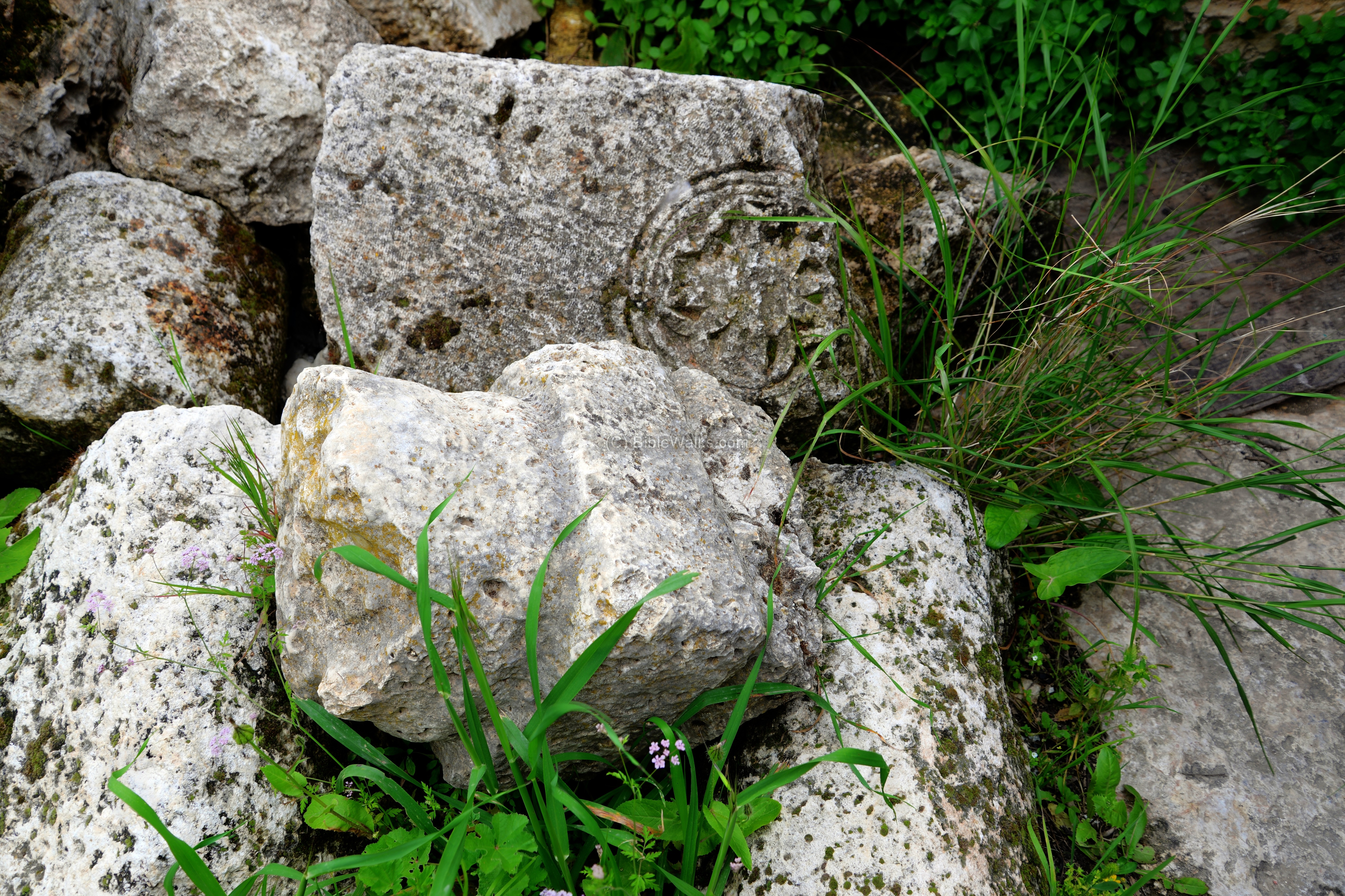
Other interesting architectural elements are seen in this collection inside the arched structure.
Yet another engraved stone:
From a window, on the edge of the structure, is a side view of the pool.

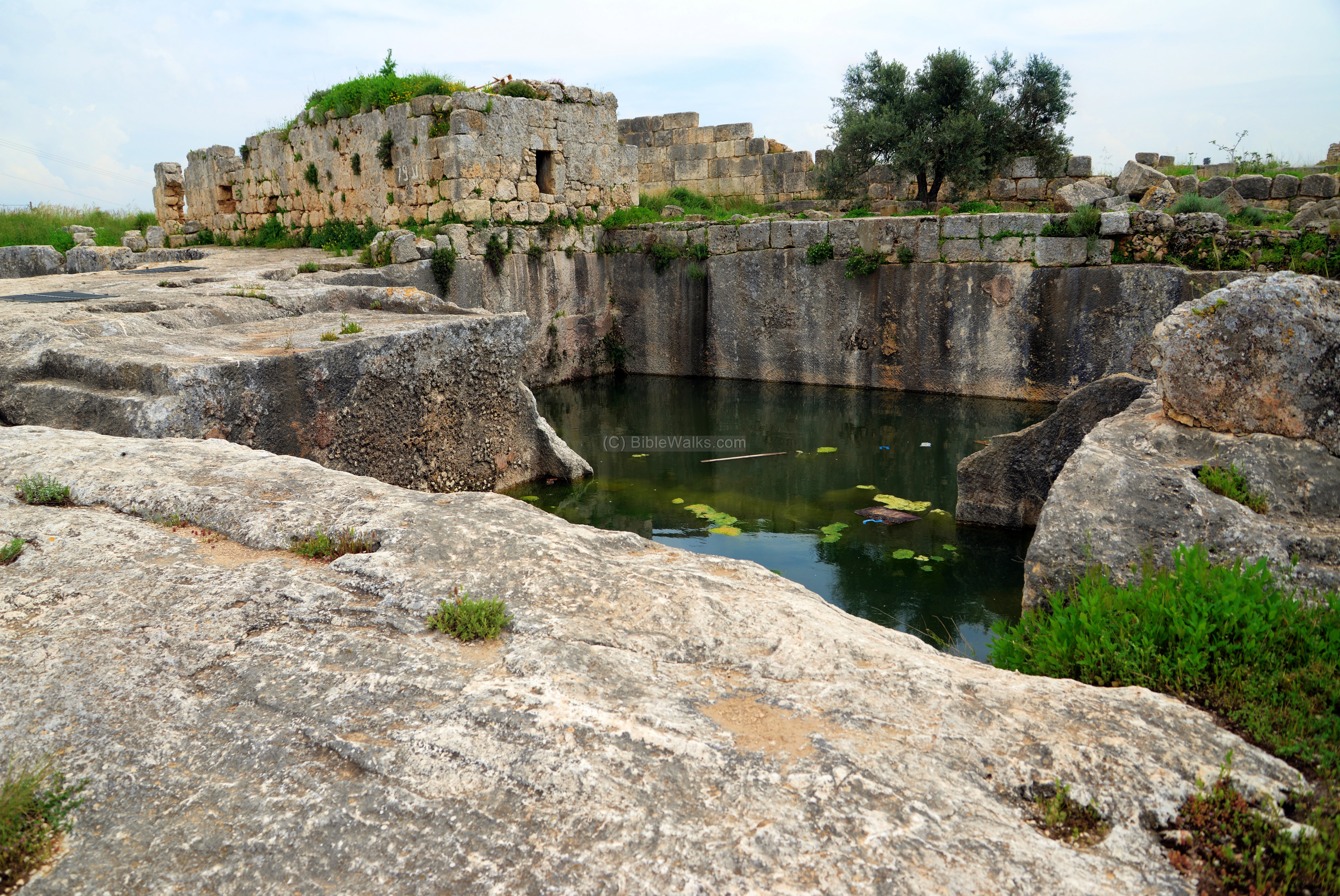
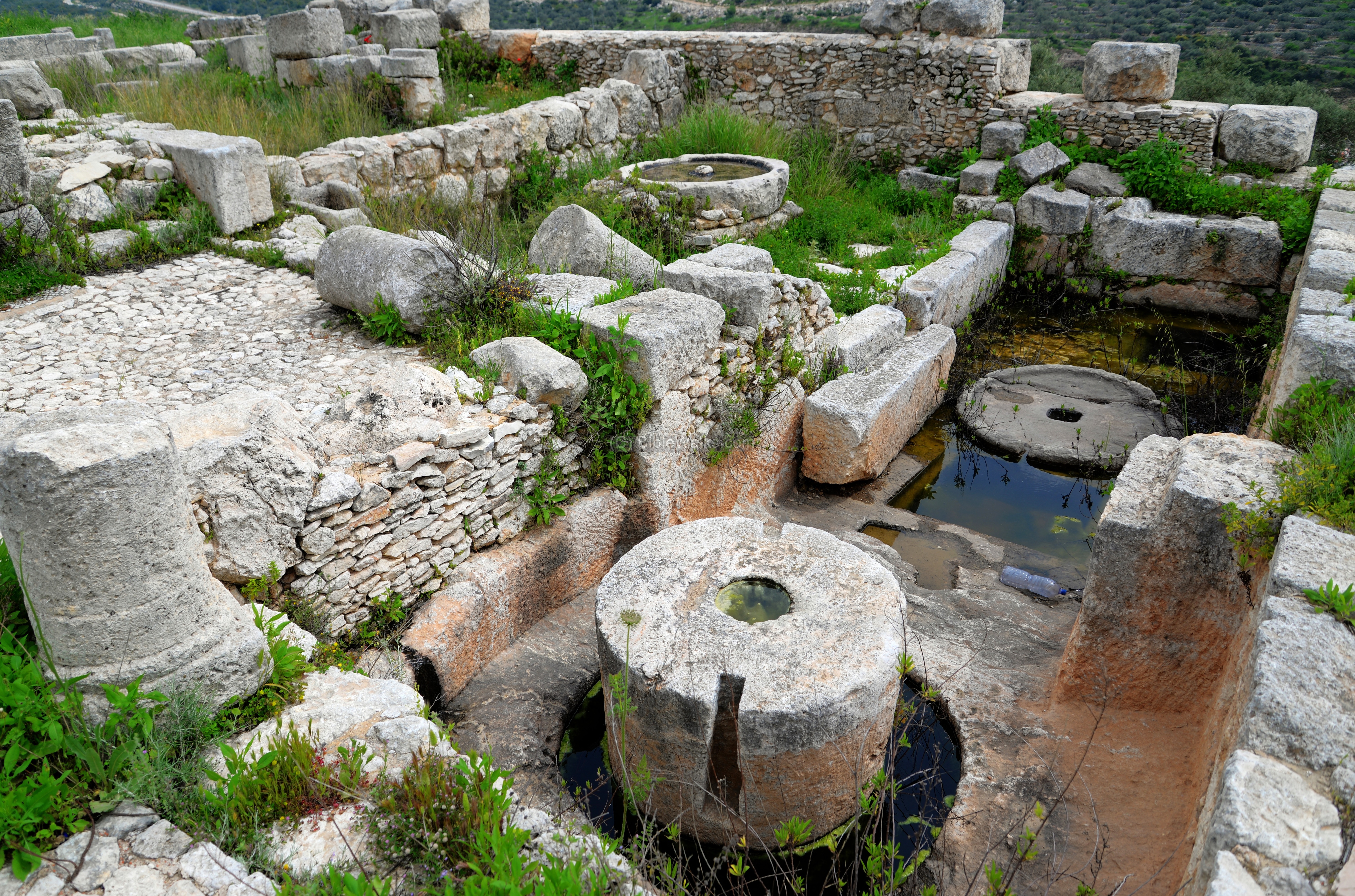
(d) Covered reservoir
On the side of the arched structure is a covered pool.
The roof of the pool consists of large slabs that rest on three large arches.

Steps lead down into the pool, where you can swim in the cool waters.
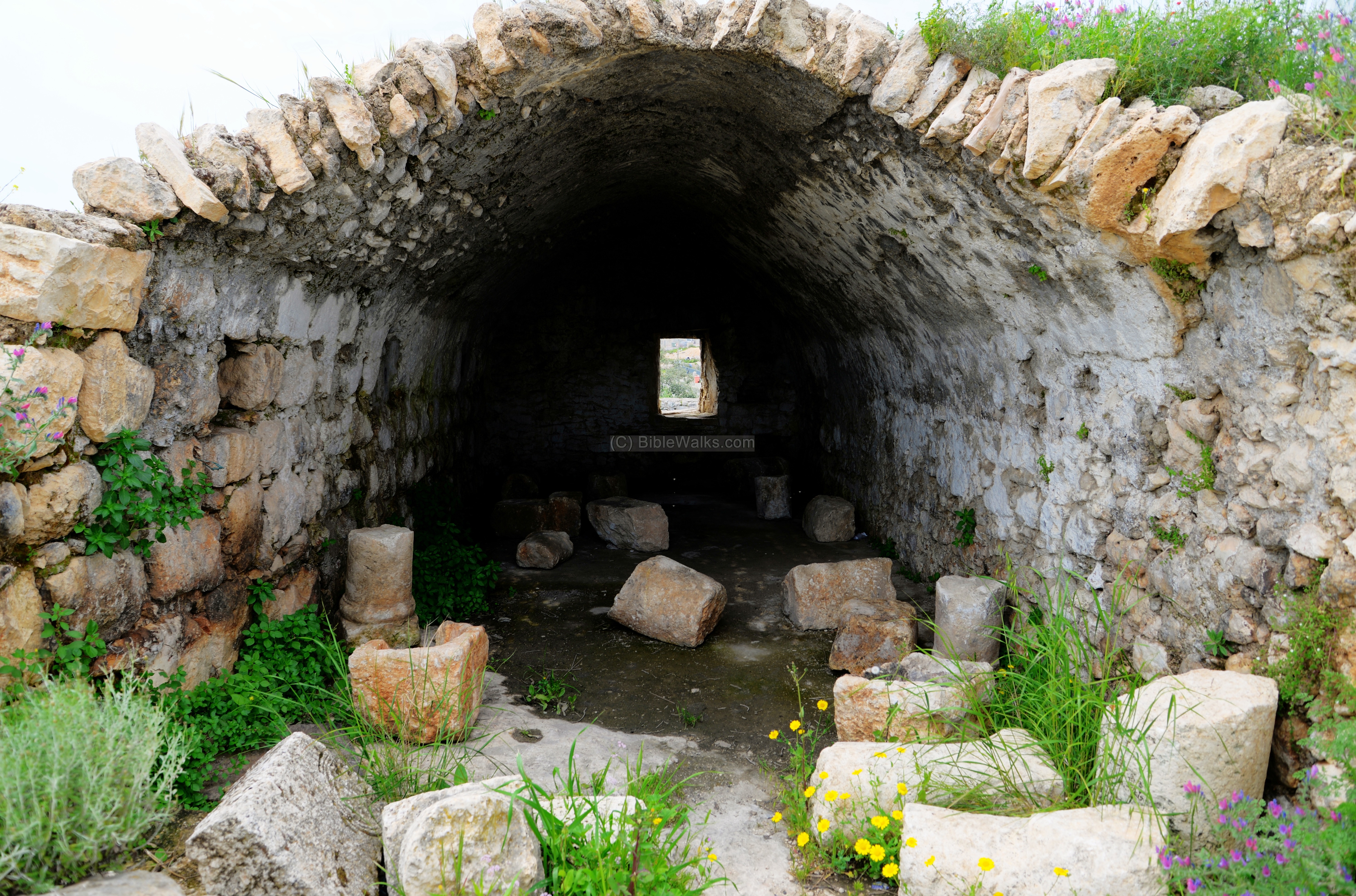
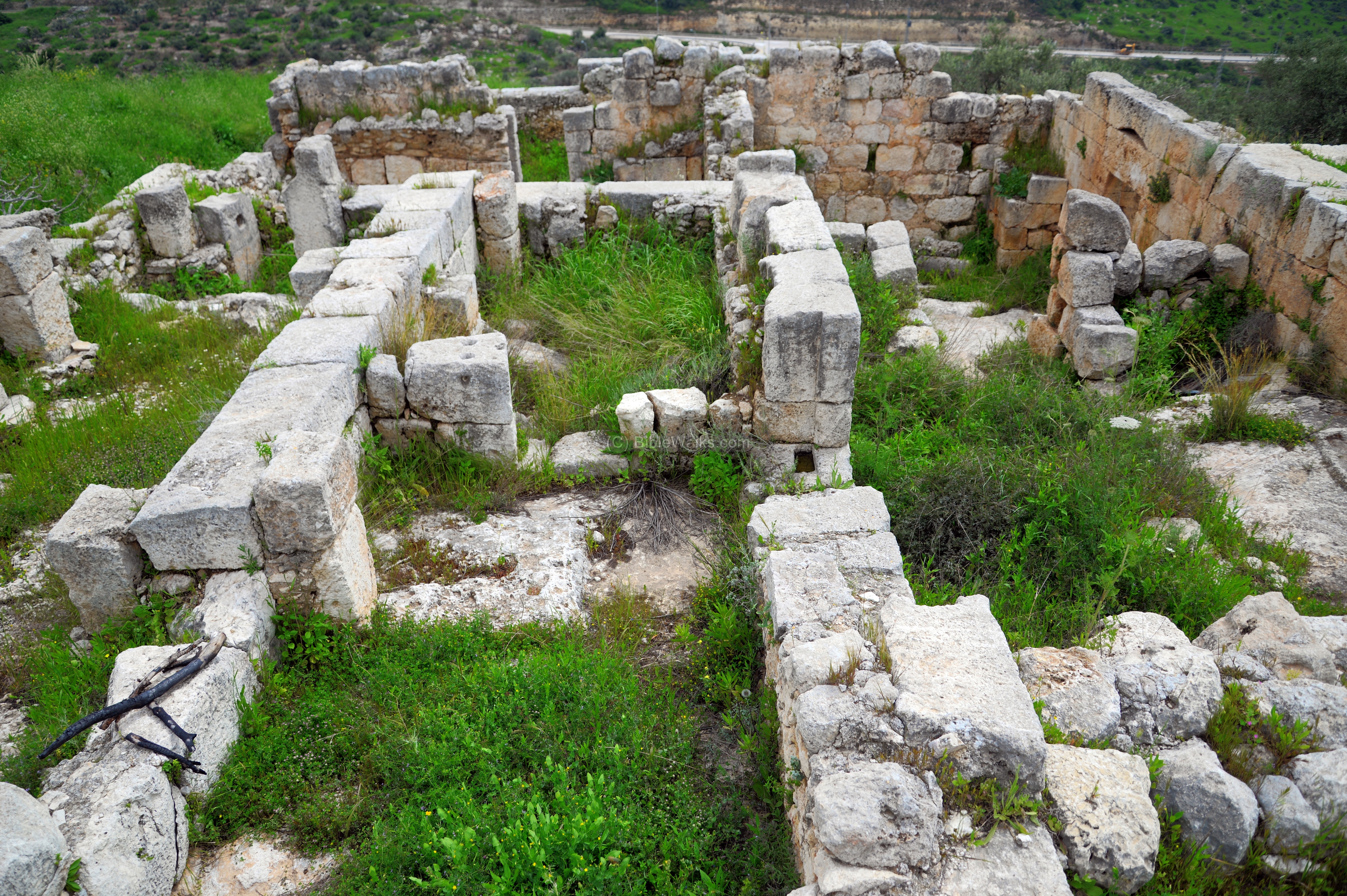
(e) Inside the Monastery
An entrance to the fortified monastery is located on the northern wall, near the covered reservoir. It was was added at a later stage, probably during the Byzantine period when the fortress was decommissioned and turned into a monastery.
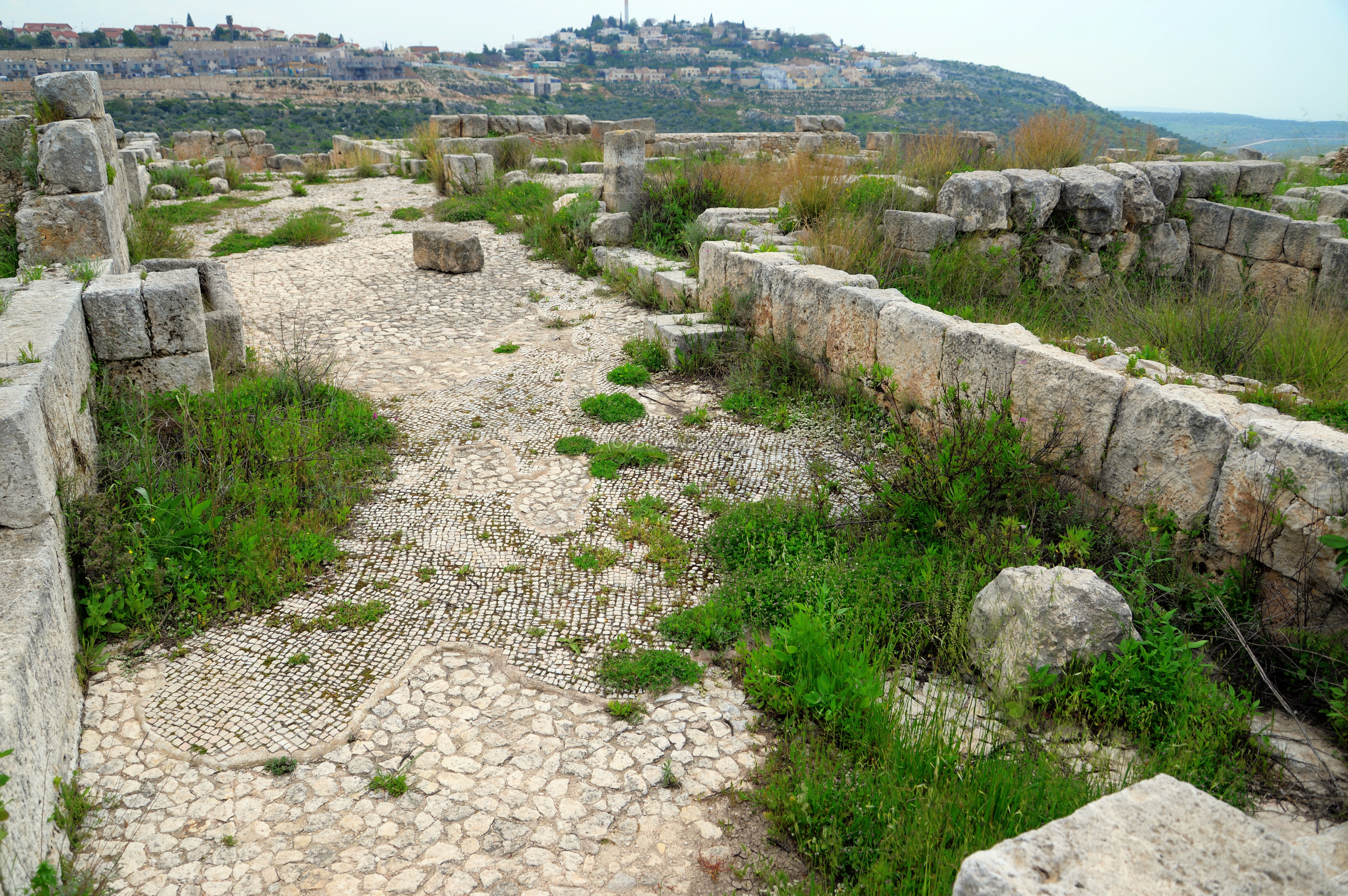
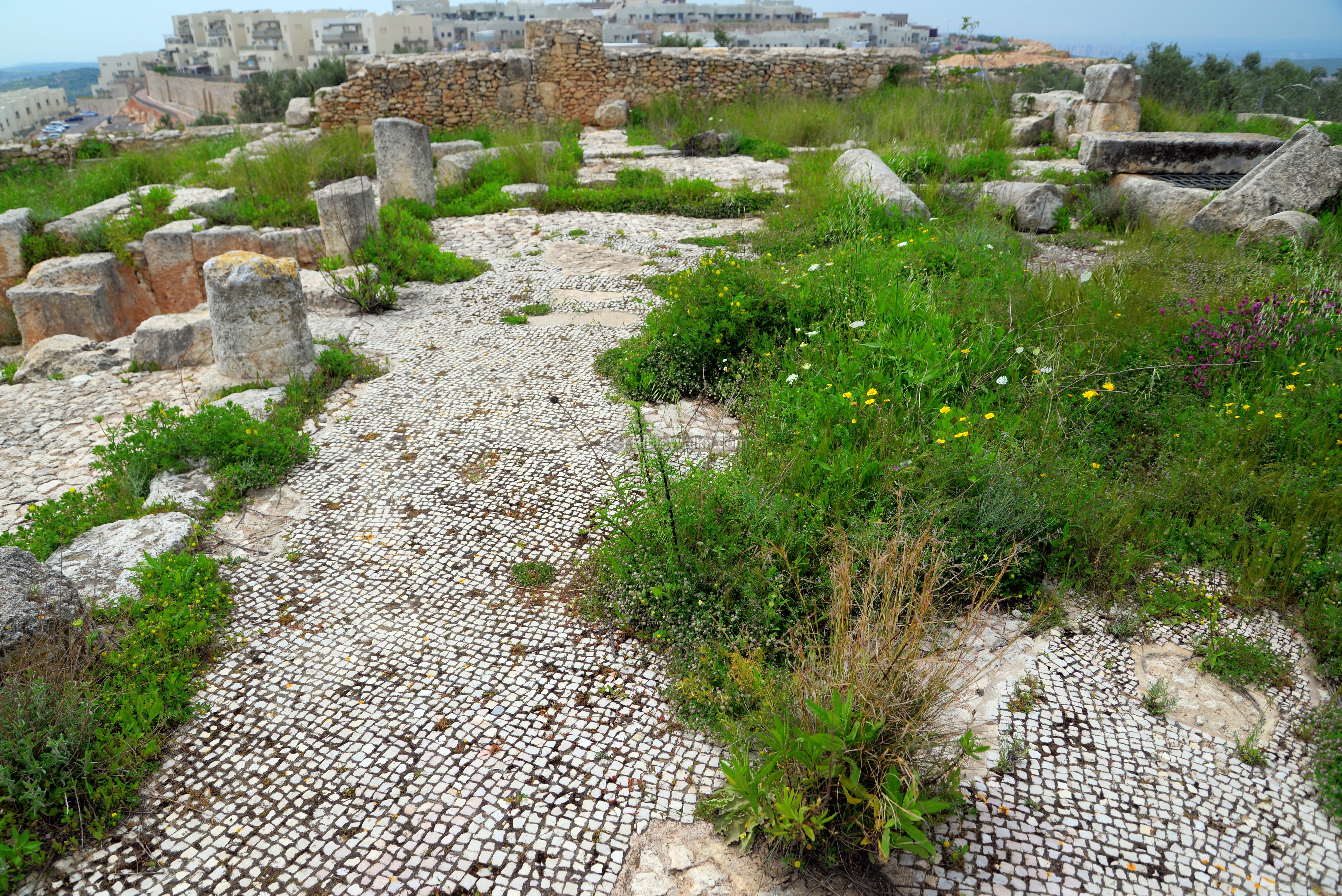
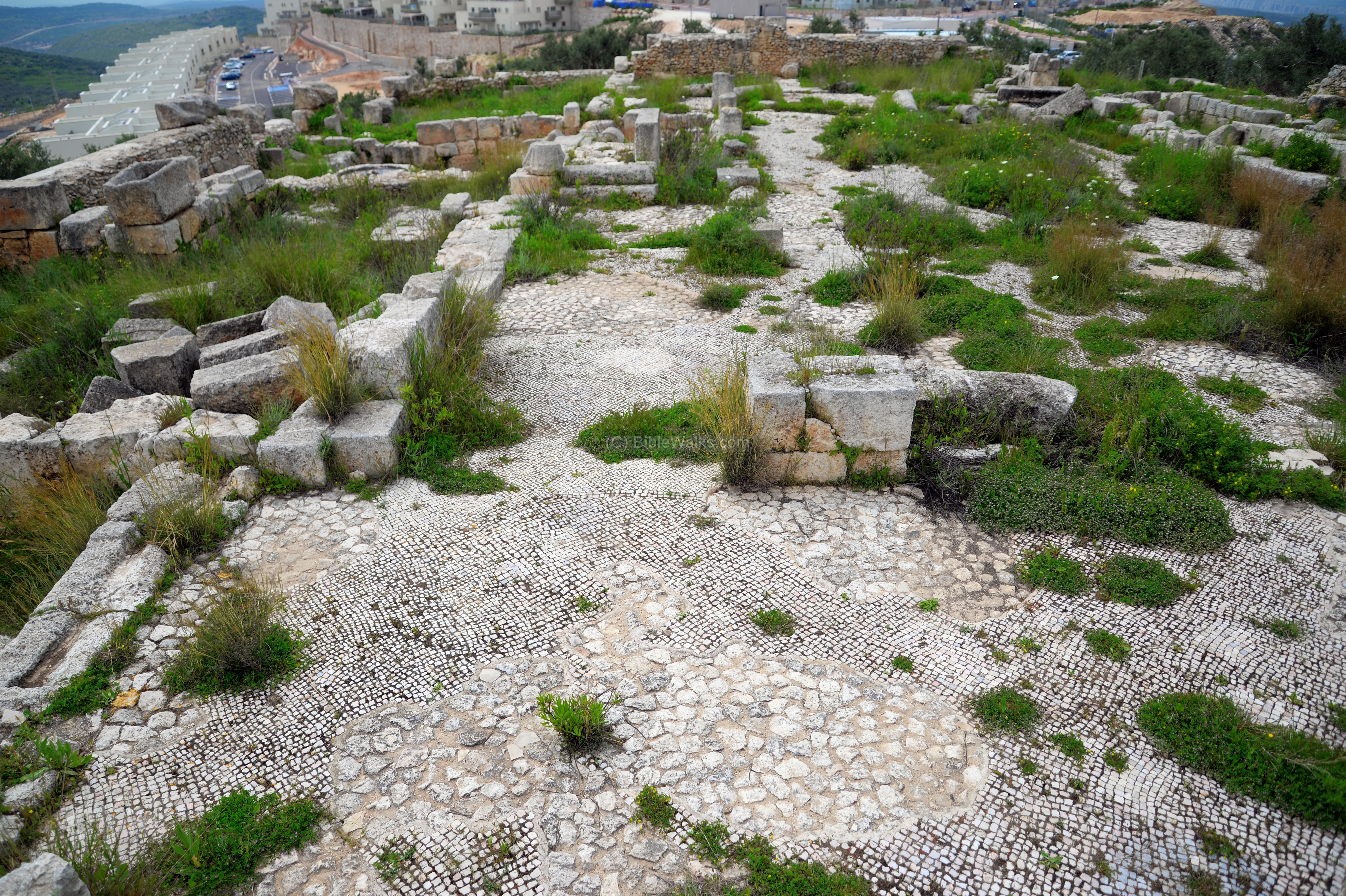
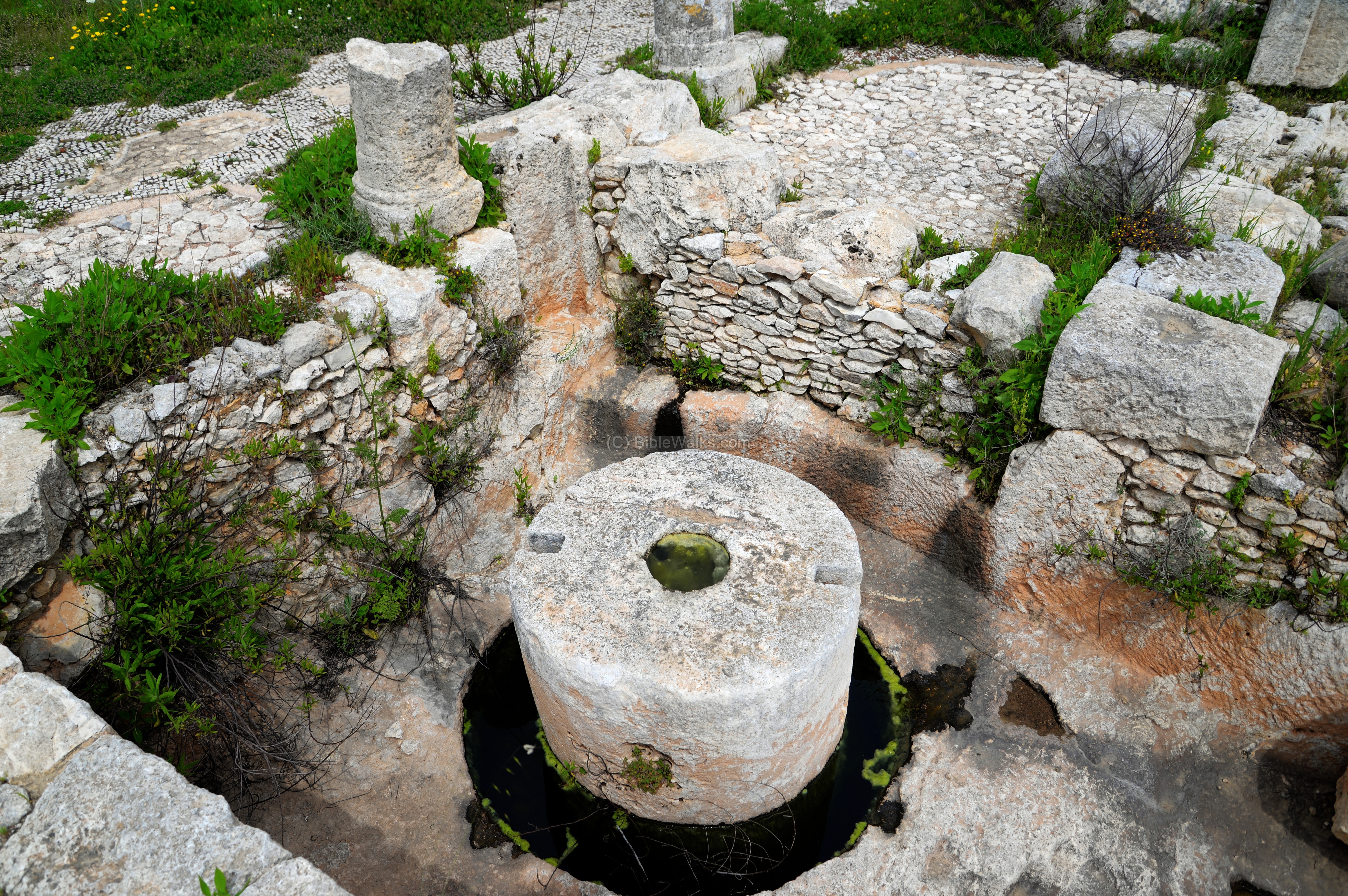
After passing the Northern, the inner side of the complex is seen. The area of the enclosed complex is 39.0m by 36.50m, covered by a mosaic floor on top of a layer of stones. The building walls were placed over the rock foundation. This view is towards the south, with the community of Peduel, in the far background, situated on the hill across the valley.
The next view is towards the opposite side – north.
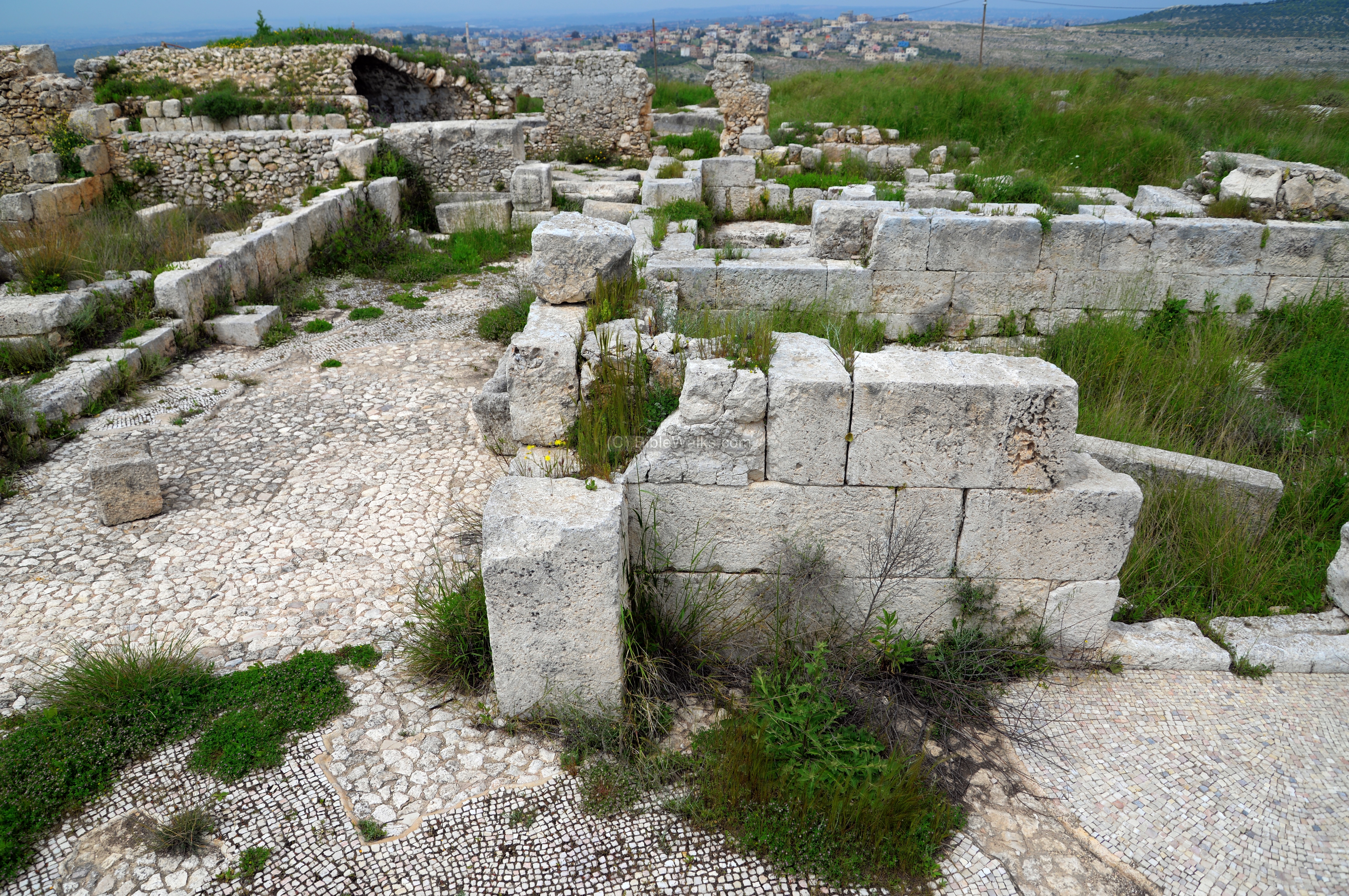
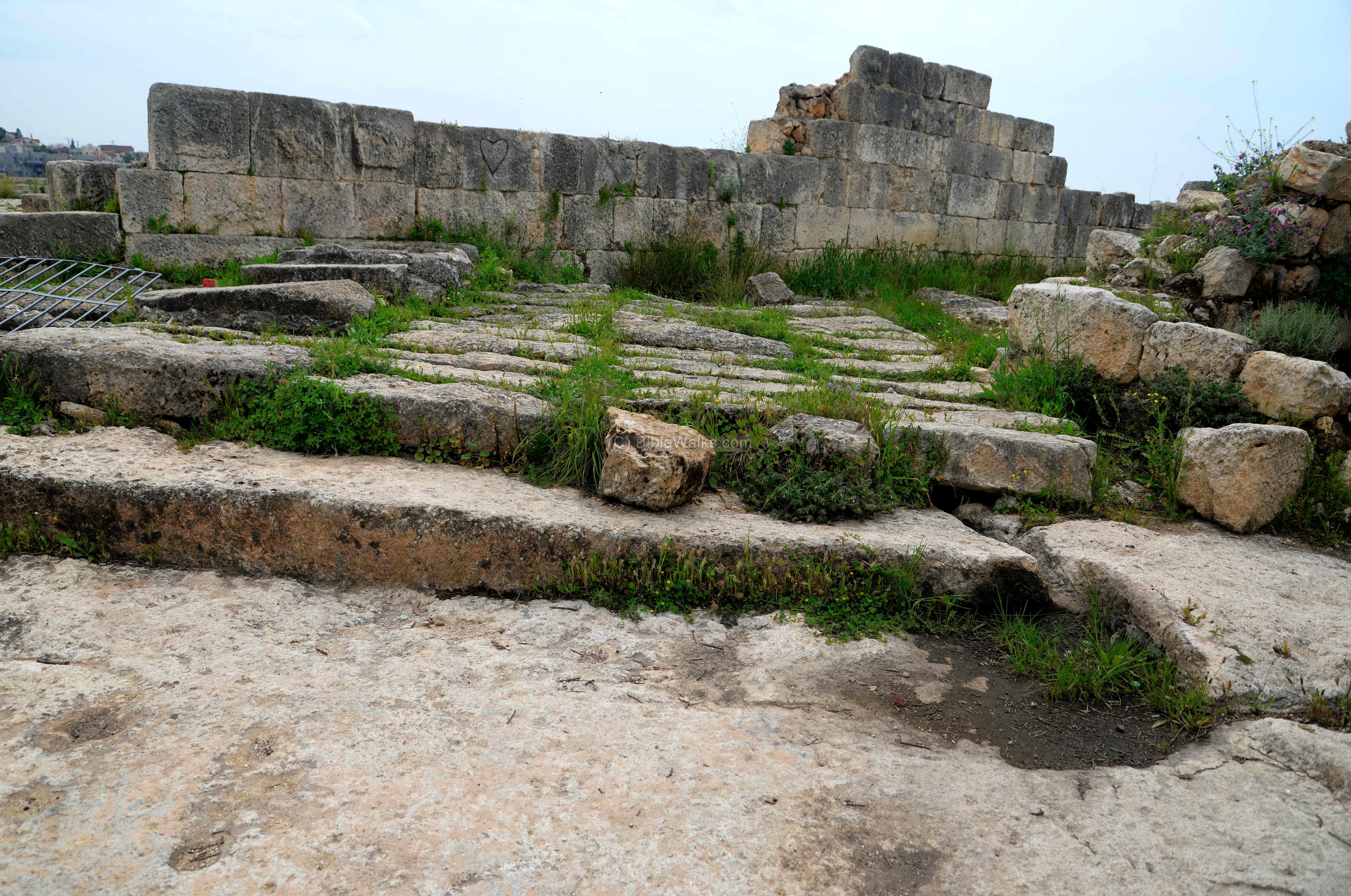
The walls, made of large and finely cut ashlars, were built on top of the rock foundations.
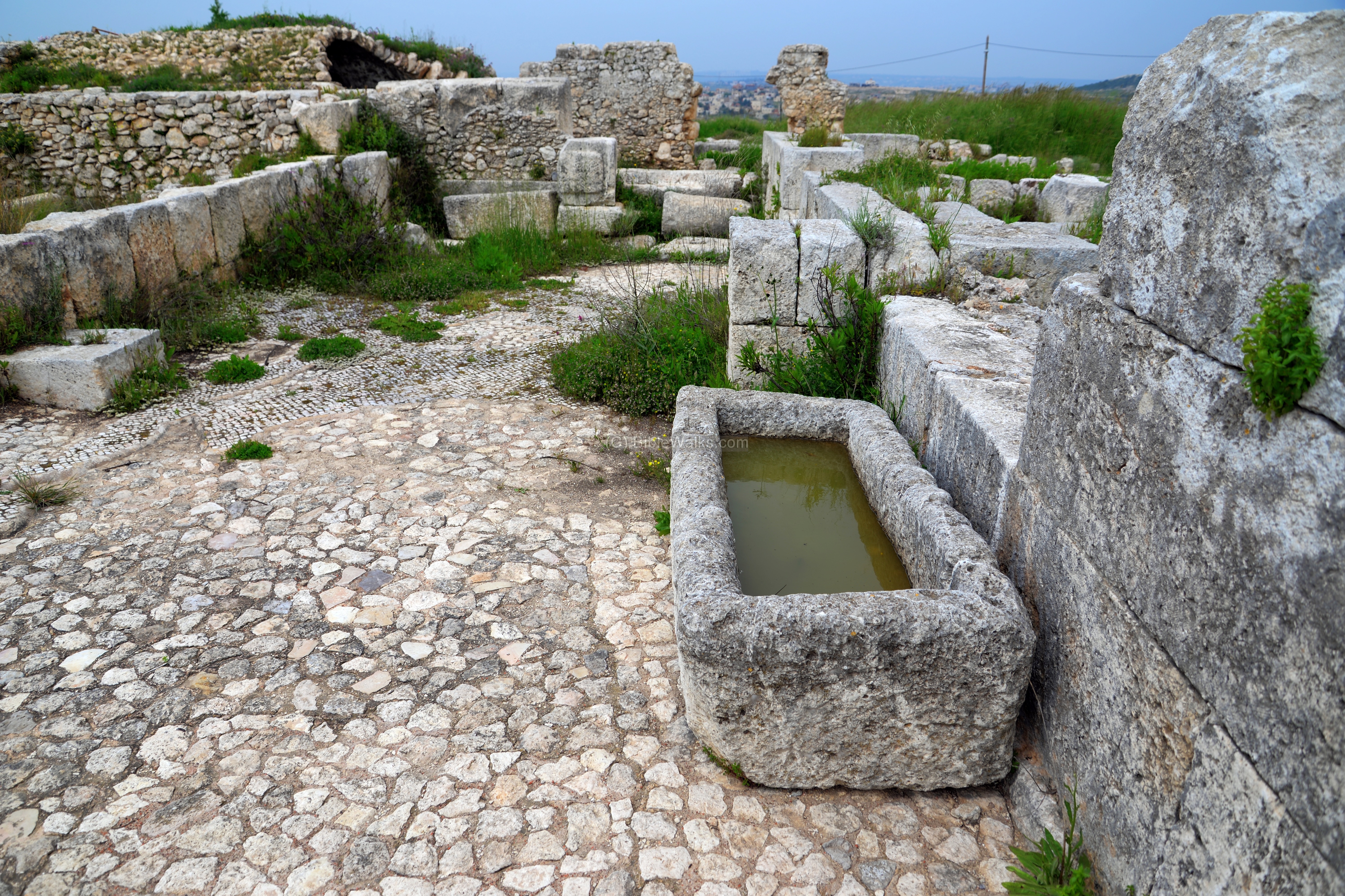
A water trough for horses is seen here adjacent to the wall.

-
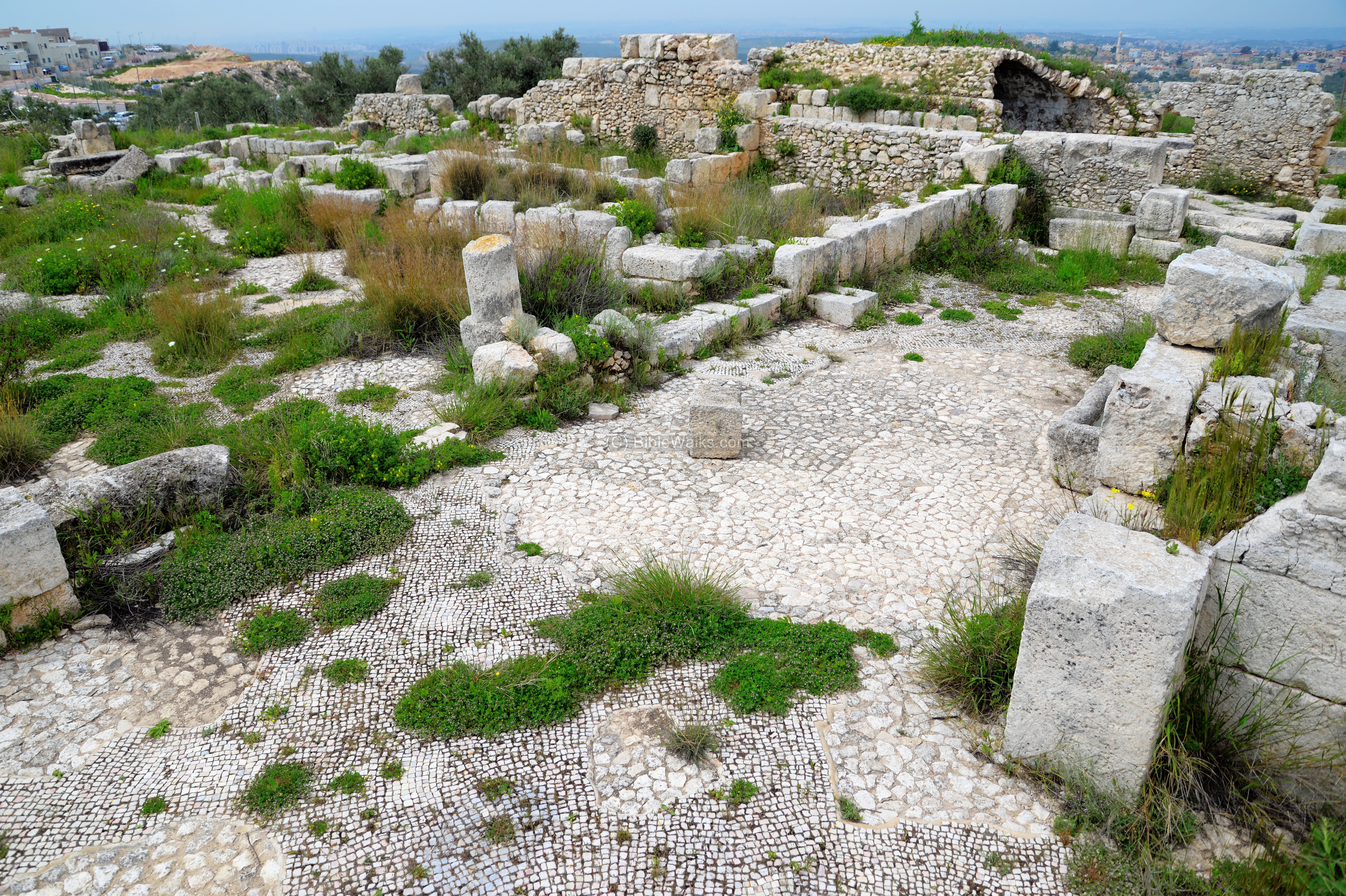
Central Courtyard:
The plan of the fortress, later converted to a monastery, was a central courtyard that was surrounded by rooms. The original entrance to the complex was from the east side, which connected it thru an antechamber to a long corridor that lead to the central courtyard.
The courtyard’s plan is of a peristyle – a continuous porch formed by a row of columns surrounding the open space of a courtyard or a garden. This was a Greek/Roman architectural style creating inner courtyards and inner gardens. This style was in use until the middle of the 6th century. The advantage of this plan was that there were no need for windows along the peripheral walls, while light was admitted thru the open space in the center.
The view below is from the eastern side towards the west. Some of the columns are seen standing around the center of the courtyard.
The water supply was based on a cistern under the central courtyard and another in the southern wing. An open pool was also cut on the northwestern corner of the fortress in order to increase the water supply capacity.
An opposite view of the central courtyard, with the columns of the peristyle around it, is seen in the next view.
-
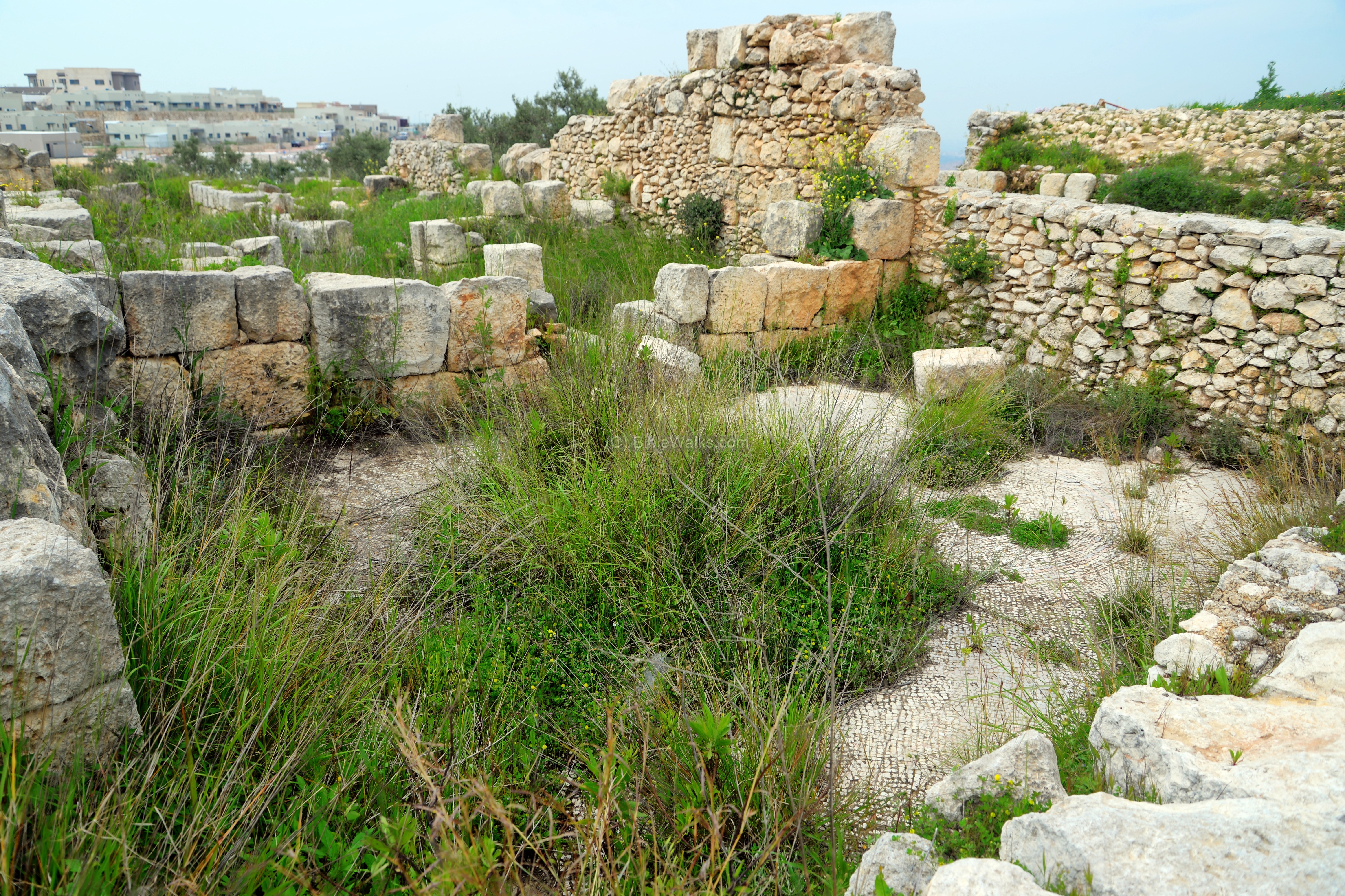
Eastern side:
The eastern side of the monastery is in the next photo. It consists of several rooms that are built along the eastern wall.
Another view of the eastern side. The original entrance was from the eastern wall (here on the hidden left side). At at later stage a northern entrance was added.

In one of the north eastern rooms is a burial cave. The opening of the tomb is rectangular, leading to dual chambers on both sides. It is dated to the Late Roman/Byzantine period. Its presence inside the residential area indicates it is not a Jewish or Samaritan tomb, as such burials are forbidden according to Jewish/Samaritan customs.

-
Northern side:
A view of the northern side of the complex is shown here.
Rooms are aligned along the northern wall.
-
Northwestern pool
An open pool was cut on the northwestern corner of the complex. It started as a quarry for the building blocks, then used as a water reservoir.
-
Southern side:
The original Roman plan was a set of rooms aligned along the southern wall. During the Byzantine period a chapel was was added on the second level of the southern wing. A wide staircase led up to the chapel.
An apses is located on the eastern side, part of a small church.
-
Oil press:
An oil press is located in one of the rooms in the southern wing. It was constructed during the Early Arab period (Umayyad caliphate, 661-750 AD), after the monastery was abandoned. It continued to be used until the Abbasid caliphate period (750-1258 AD).
Below is the cylindrical weight of the oil press, used to press down a wooden lever over a basin. A screw was used to increase the pressure, hence it is termed Lever-screw-cylindrical weight (“type 6” as per R. Frankel definitions). Both the screw and lever are now gone, as the wood disintegrated, leaving only the stones to witness the location of the oil press.
The wooden lever pressed baskets, containing crushed olives, over a pressing base. That base is seen below. The olive oil then would pour thru grooves on the basin into a collecting vat (now filled with water).
Etymology (behind the name):
* Names of the site and vicinity:
- Deir Samaan (Sama’an, Siman)- Arabic: Monastery of St. Simeon. Not known who this Simeon is.
- Alei Zahav – the community on both sides of Deir Samaan. Founded in 1983. Named after Aliza Begin – wife of former prime minister Menachem Begin.
- Leshem (aka Alei Zahav B) – the new development on both sides of Deir Samaan. Hebrew: one of the gem stones of the priestly breastplate (Hoshen).
Links and References:
* External:
- Ancient way of Wheat Thresher (Youtube)
- Judea and Samaria Researches and Discoveries – Y. Magen 2008 (kh. Deir Sam’an pp. 188-189) – detailed description
- The Samaria Travel Guide – Volume B: Samaria & Shilo region – N. Netanel & D. Raviv 2014 pp 69-77 (Hebrew)
* BibleWalks nearby sites:
- Deir Qala’a – another Late Roman fortress turned Monastery
* Other Biblewalks sites:
BibleWalks.com – tour the Bible Lands
Kh. Esh Shuan <<<—previous Samaria site—<<<All Sites>>>—next site—>>>Kh. el-Hamam
This page was last updated on June 20, 2019 (new)
Sponsored links: