Ruins of a Roman/Byzantine agriculture village in the Upper Galilee region.

Home > Sites > Upper Galilee > Center > Horvat Danaila (Kh. Inaileh)
Contents:
Overview
Location
History
Photos
* Aerial
* Entrance
* Path
* Ruins
* Oil press
Etymology
Links
Overview:
Ruins of a Roman/Byzantine period village in the Upper Galilee region. The site is located near the community settlement of Gornot HaGallil and Moshav Goren. It is a perfect place for a picnic, nature walk and visit to the ruins.
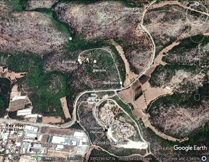
Location and map:
The park is located north of the Gornot HaGalil community. A circular road loops around the ancient site, which is covered by trees that were planted years ago by the KKL. The parking place is on the west side, at the end of the road. Here couples and families come for a picnic, then enjoy a walk through the forest along the discovery path that crosses the ruins.
History:
- Roman/Byzantine periods (1st century BC – 6th century AD)
During the Roman period (~100 AD), an agriculture farm was established here. The site grew into a village during the Byzantine period (~500 AD).
-
Early Arab to Mameluke periods (7th – 16th century AD)
The village was abandoned following the Early Arab period (at ~750 AD). It was reestablished during the Mameluke period (~1400 AD) for some time, reusing the ancient structures. After then, the site was deserted and fell into oblivion. The bush covered the forgotten village, waiting for 500 years to be rediscovered.
- Ottoman period (16th-20th century)
The ruins of the site (here it appears as Kh. Inaileh”) were examined in the Palestine Exploration Foundation (PEF) survey (1866-1877) by Wilson, Conder and Kitchener.
A section of their map is shown here. The map shows that the ruins are located on a ridge which is located between two valleys – Wadi ed Dafin and Wady Kirat. An ancient road (dashed line) passes nearby, connecting Kh. Jelil and Akrit.
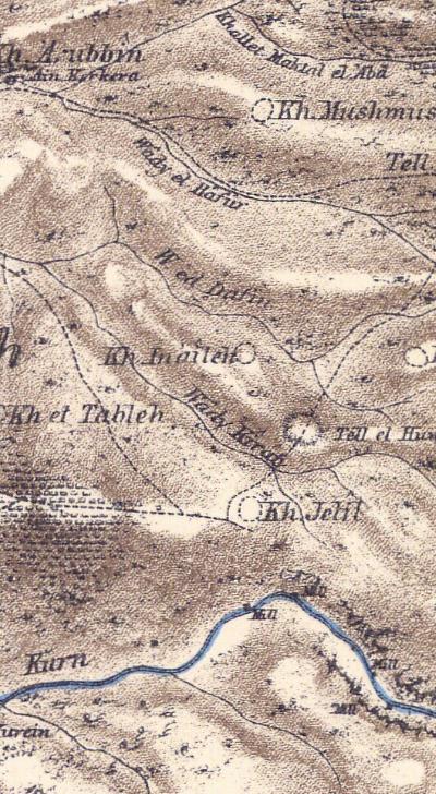
Part of map sheet 3 of Survey of Western Palestine,
by Conder and Kitchener, 1872-1877.
(Published 1880, reprinted by LifeintheHolyLand.com)
The PEF dictionary (p. 48) translated the Arabic names:
-
Khirbet Inaileh: “The ruin of the horseshoes”.
-
Wady Dafin: “The valley of the buried”.
-
Wady Kirat: The valley of the Kirat (a measure)
This is their short report on the ruins (Vol 1, Sheet III, pp 176):
“Kh. Inaileh: Traces of ruins ; some large stones”.
The PEF name, Kh. Inaileh, was later changed in modern times to Kh. Danila.
- Modern Period
Excavations were conducted here in 1984 and 1986, headed by Rafi Frankel. The site underwent conservation in 2001 by the IAA (Israeli Antiquities Authority) and the KKL (Keren Kayemet Le’Israel), and then opened to the public.
The site is opened to the public – a great combination of picnic, nature and history.
Photos
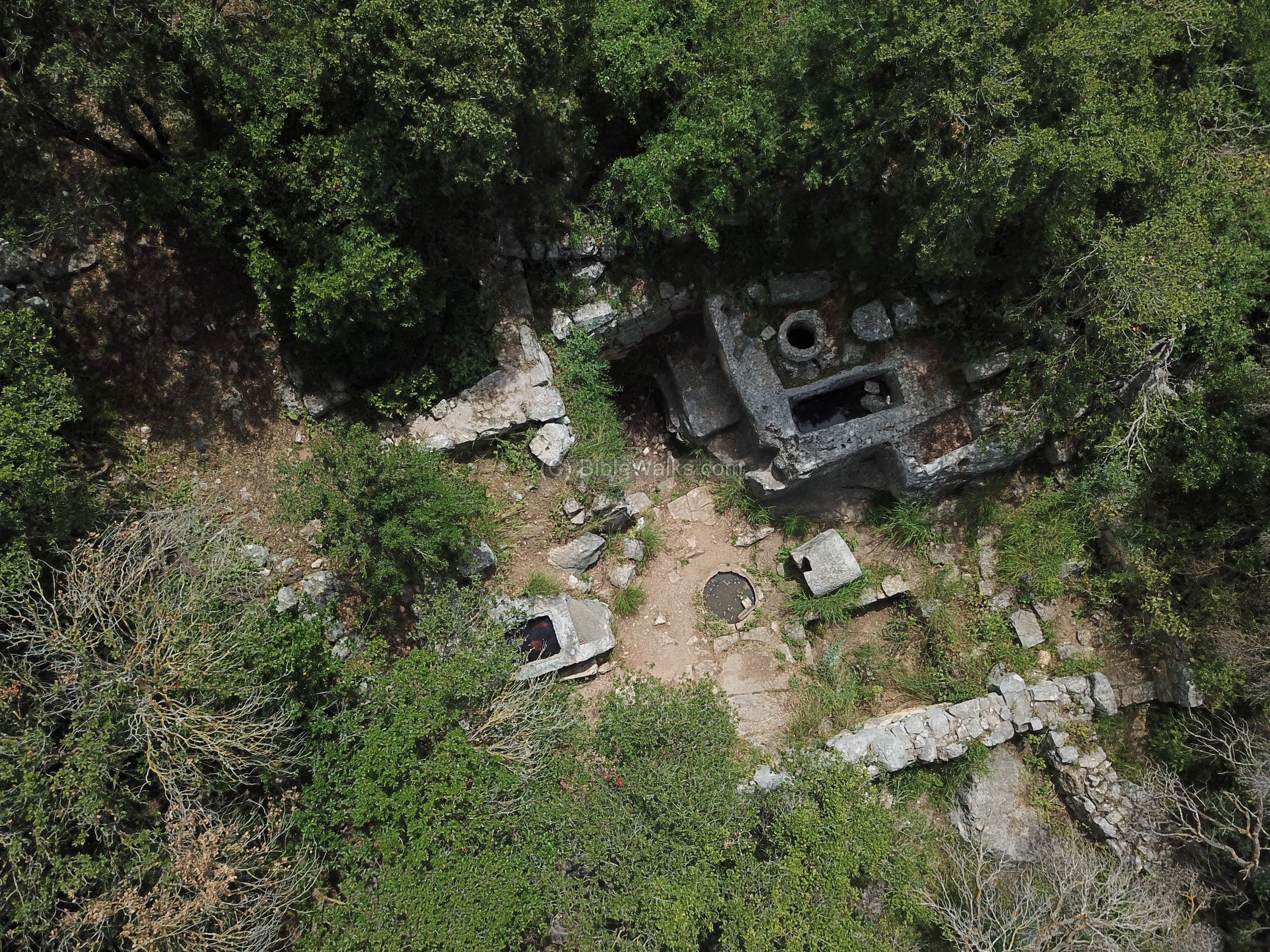
Aerial view:
A drone view of the site shows an area almost completely covered by trees and bush. In the center are some visible ruins. On the left side is a section of the access road.
Click on the photos to view in higher resolution…
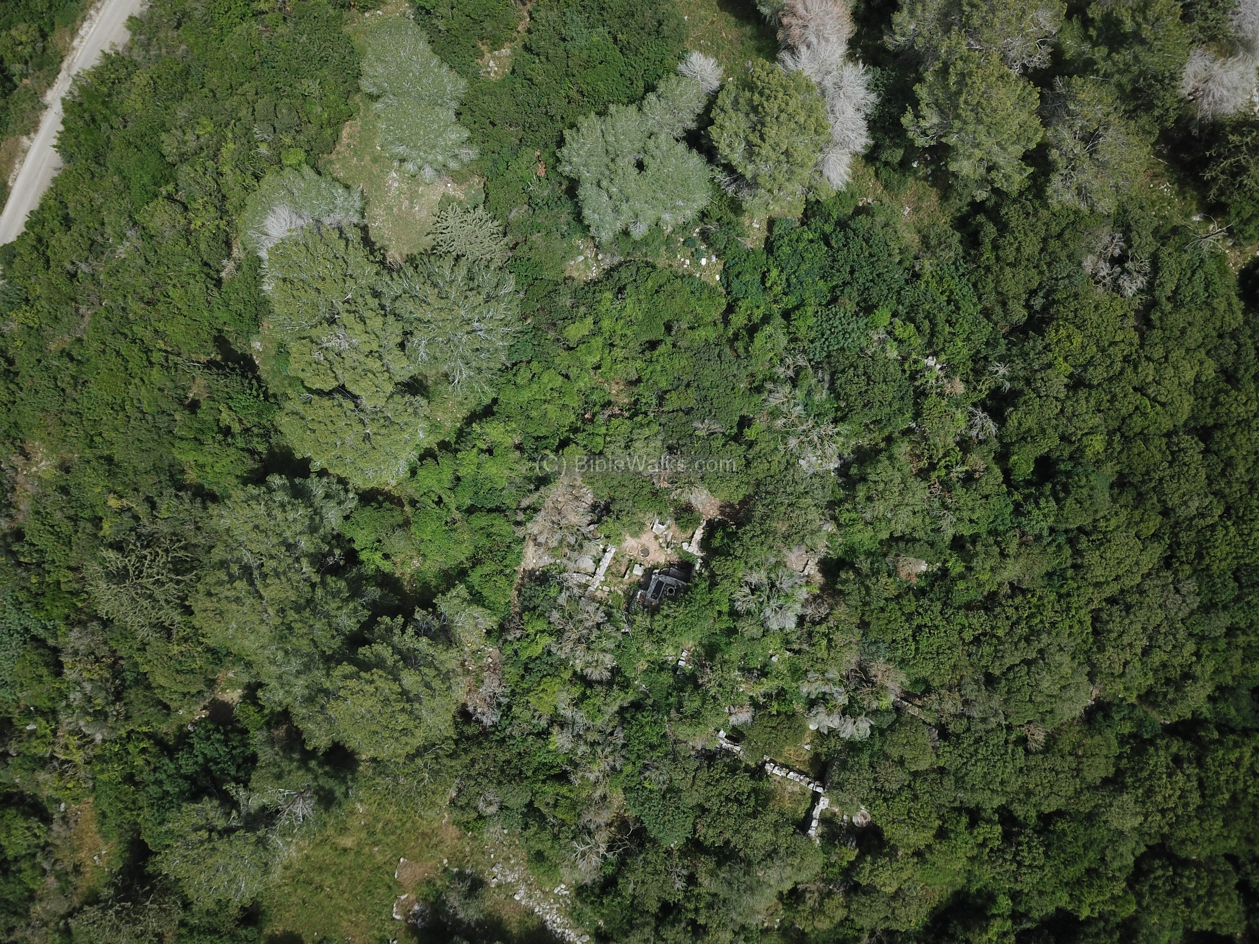
A closer view of the clearing shows the highlight of the ruin – the Byzantine period oil press installation.
Entrance:
The access road leads to the parking place. Here, in front of the entrance to the ruins, is a memorial for the fallen soldiers of the Ma’ale Yosef settlements.

The sign describes the history of the site and provides a map of the ruins.
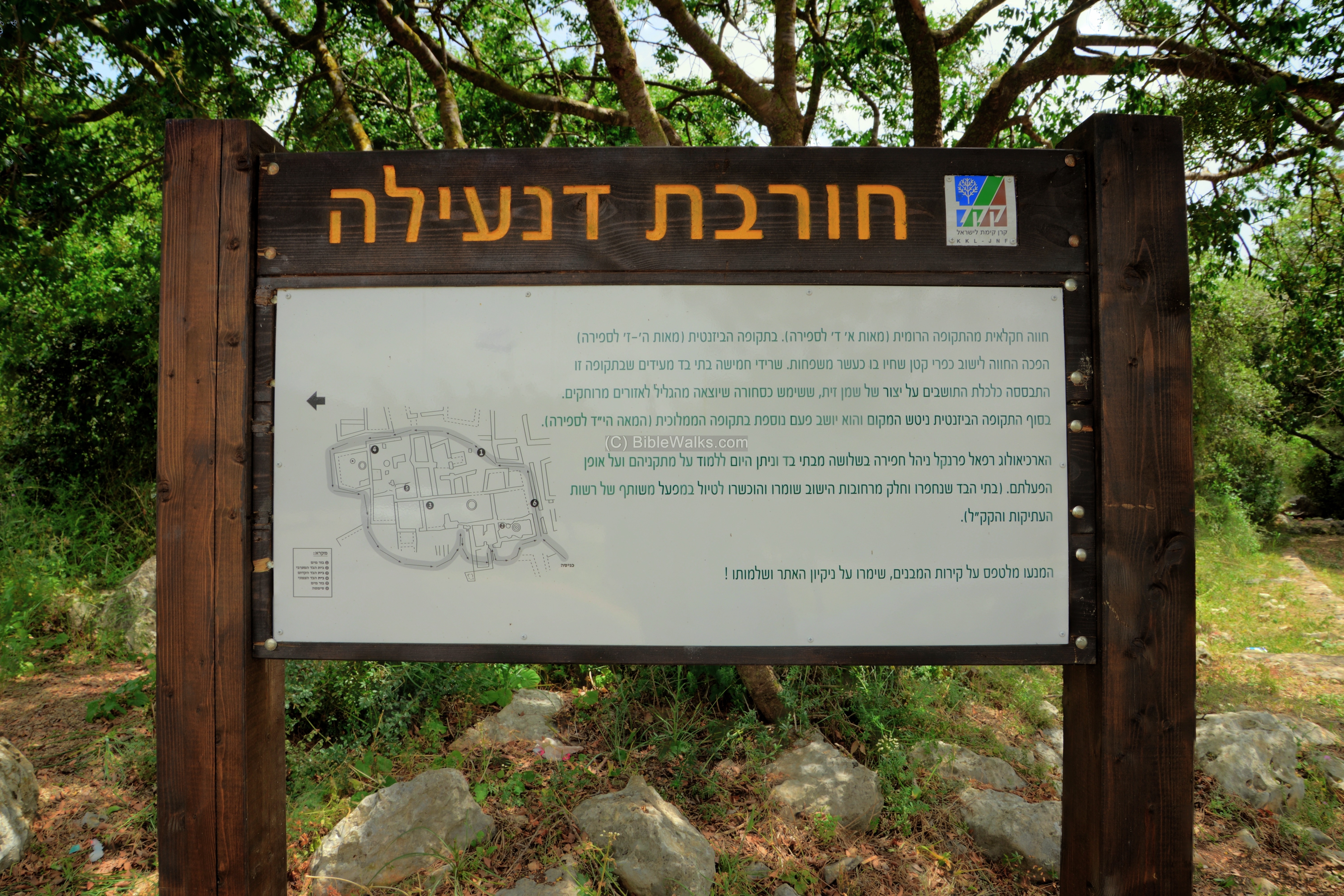
A closer view of the map shows the plan of the site, and the route of the discovery path. The numbers on the map are: 1. Cistern, 2. Western oil press, 3. Early oil press, 4. Northern oil press, 5. Cistern, 6. Alley

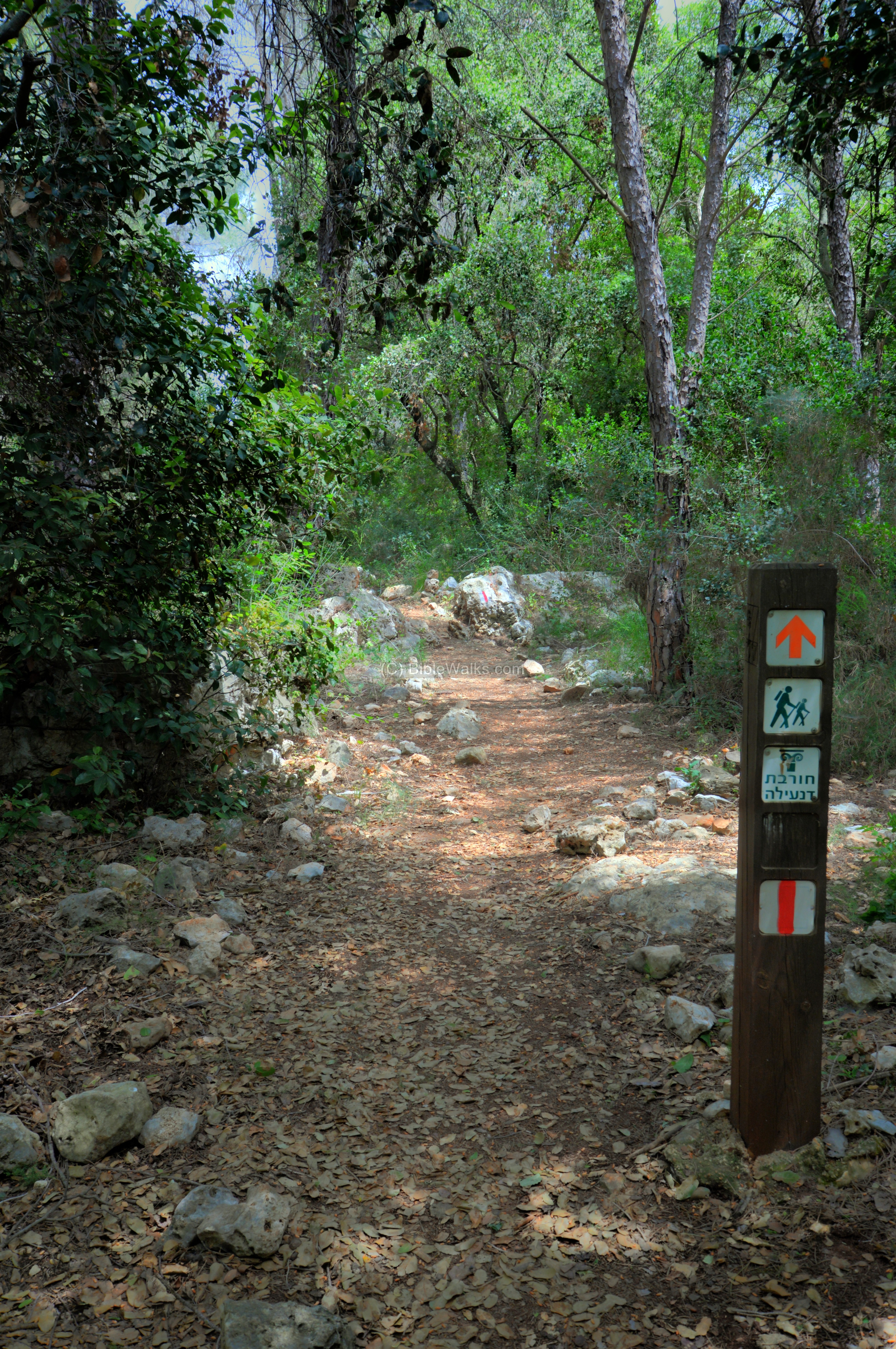
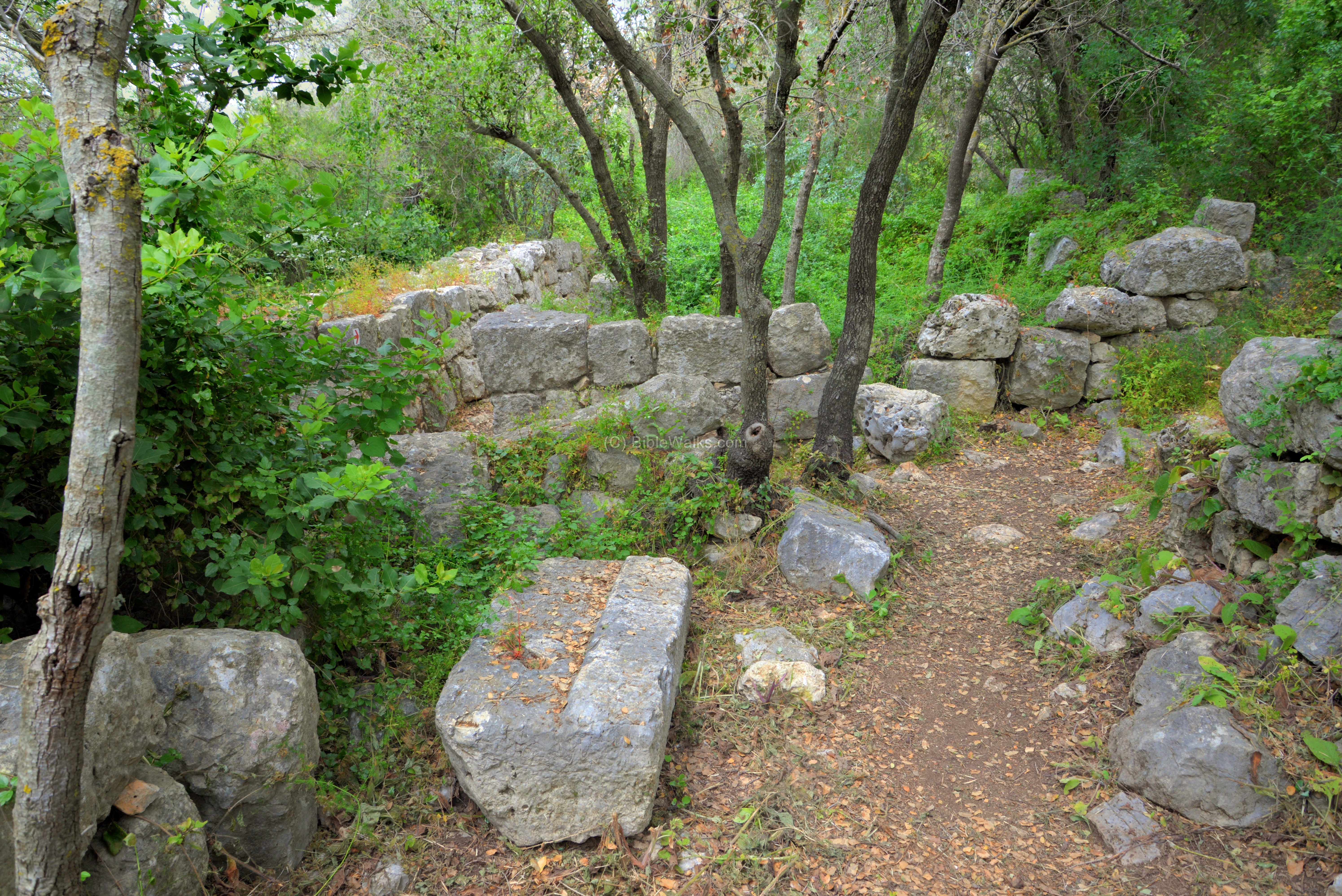
Along the path:
The path crosses the forest to reach the ruins of the site.
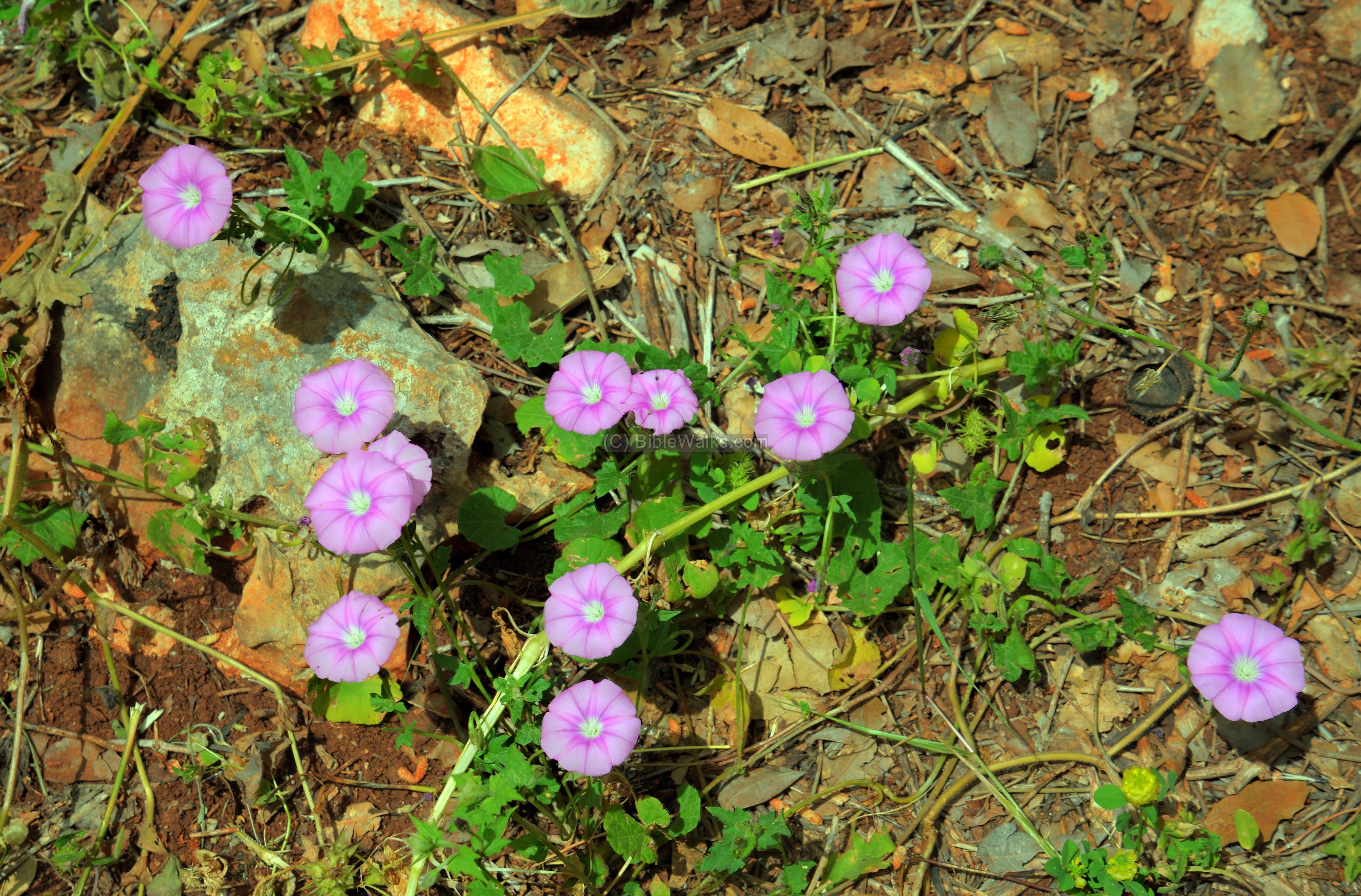
Along the path are seasonal wild flowers and bush. This annual vine, Syrian Bindweed (Latin: Convolvulus Coelesyriacus Boiss, Hebrew: Havalval Suri), flowers in March to May.
The ruins:
After a short walk the path reaches the south west edge of the ruined village.
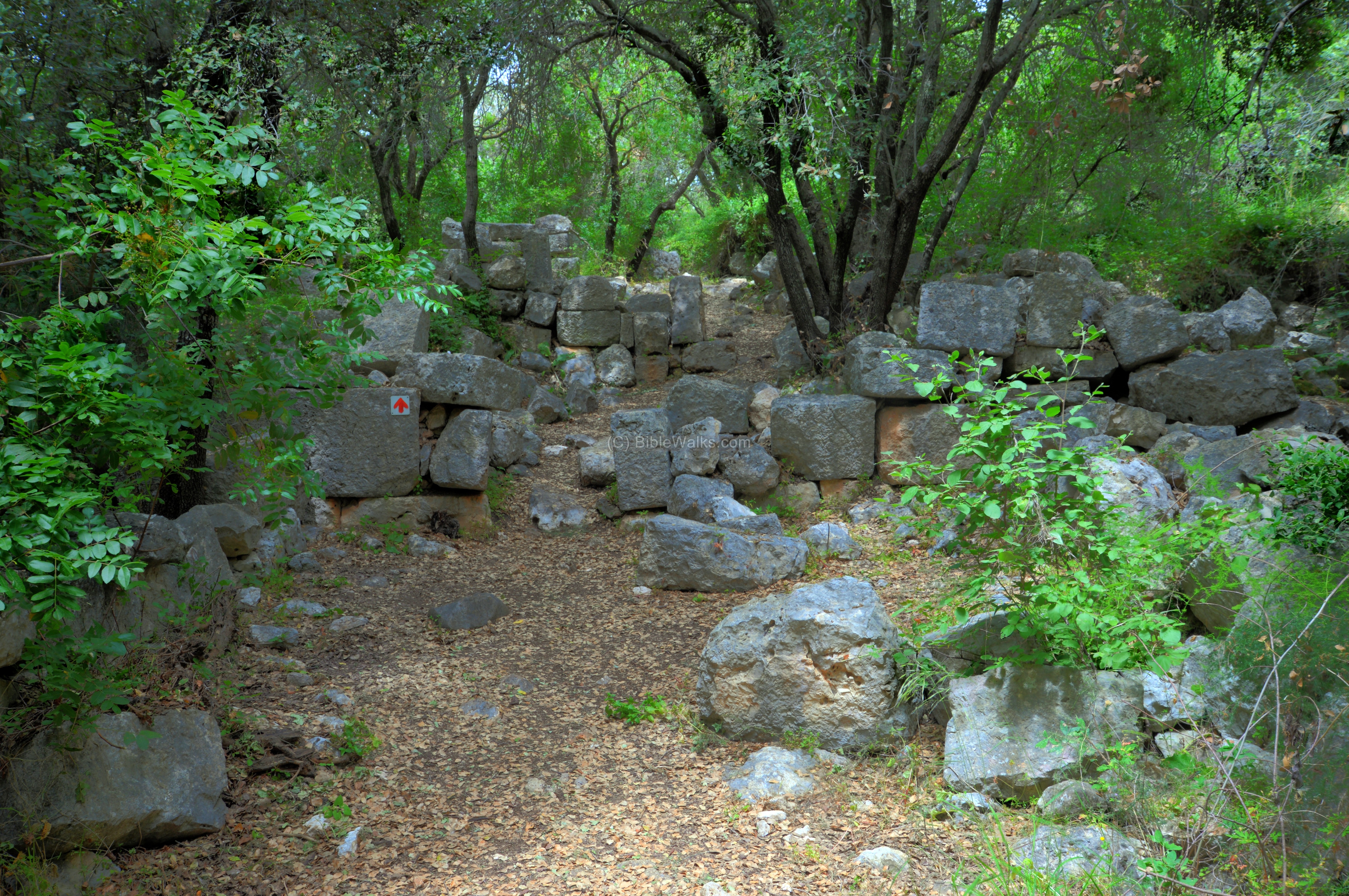
The walls of the structures are made of large building blocks.

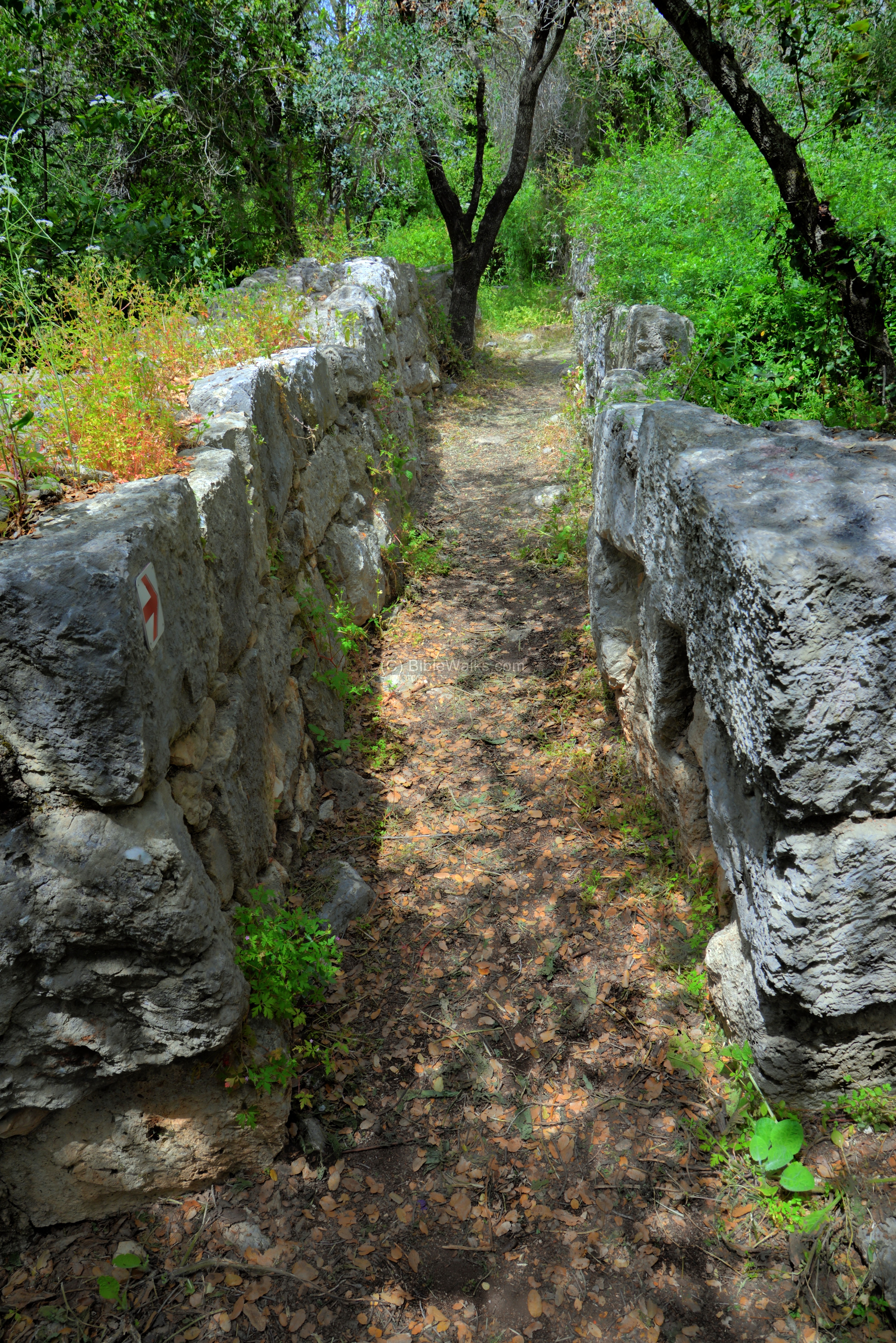
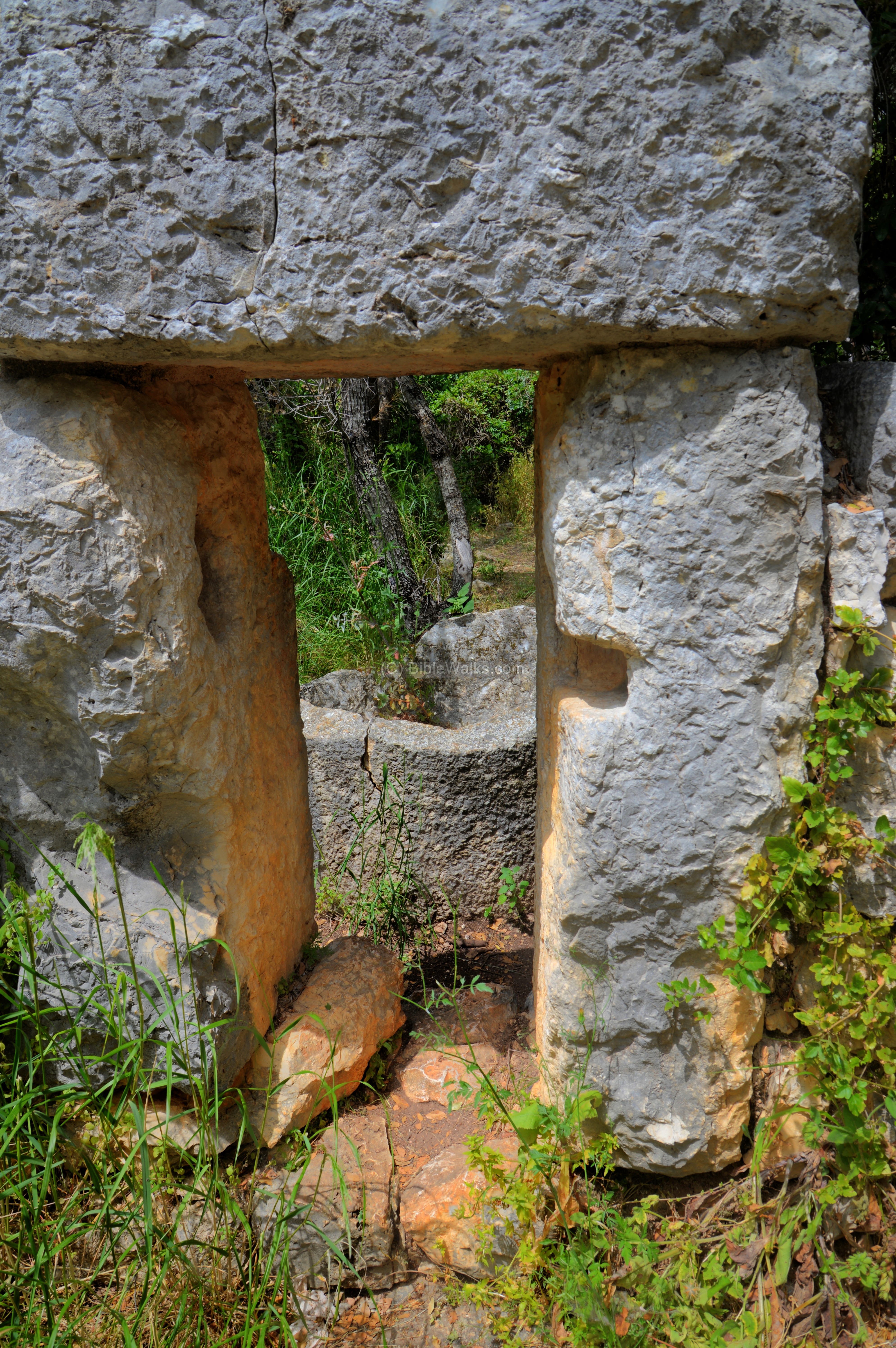
The path leads thru a narrow corridor – the alley between two houses.
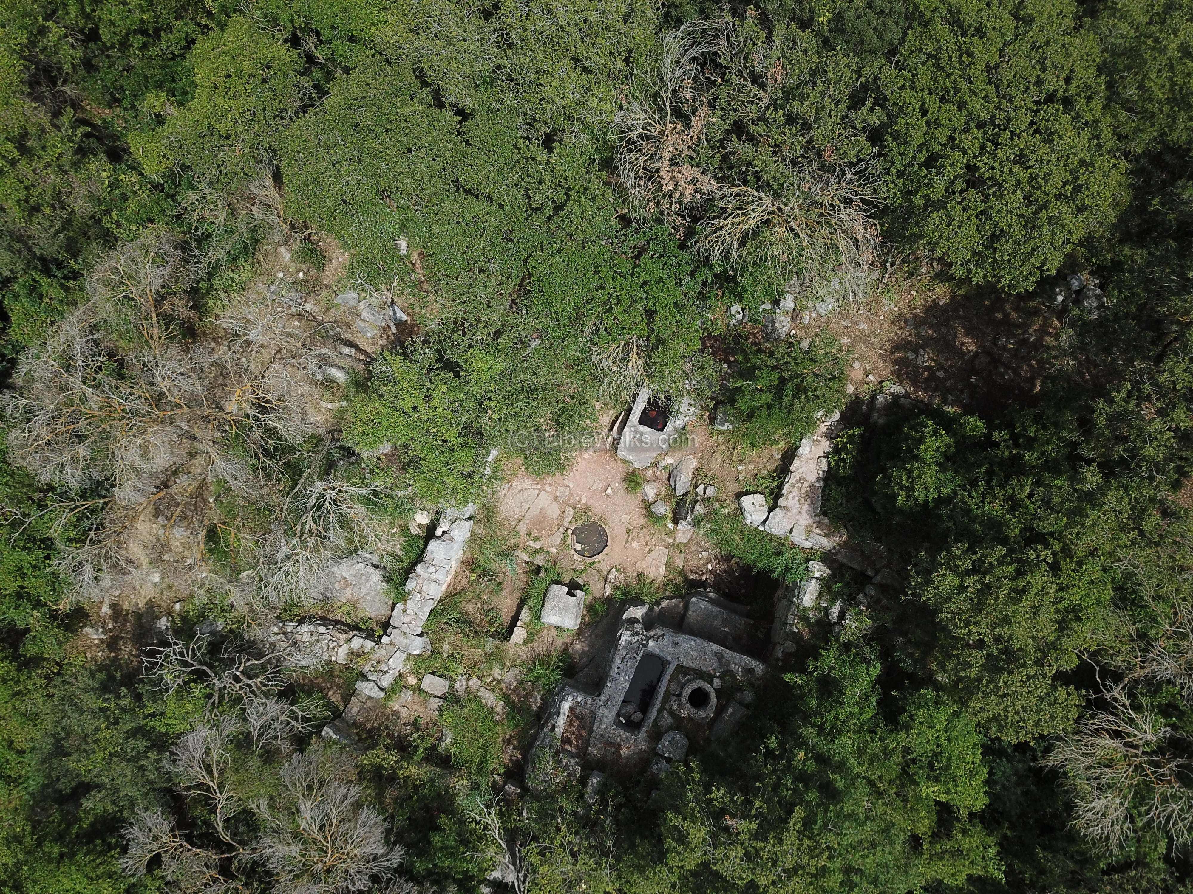
Byzantine Oil Press:
The path reaches the highlight of the village – an oil press installation – located on its north east side. This is one of the several oil press installations unearthed in the ruins.
A view from the south side is seen here. This ancient oil press, known as Lever-screw-cylindrical weight (“type 6“) – was based on a lever forcing down on a collection of olives using a wooden screw. The lever and the screw, which were made of wood, are way gone, and only the stone elements (the base, the basin, and the weight) remained.
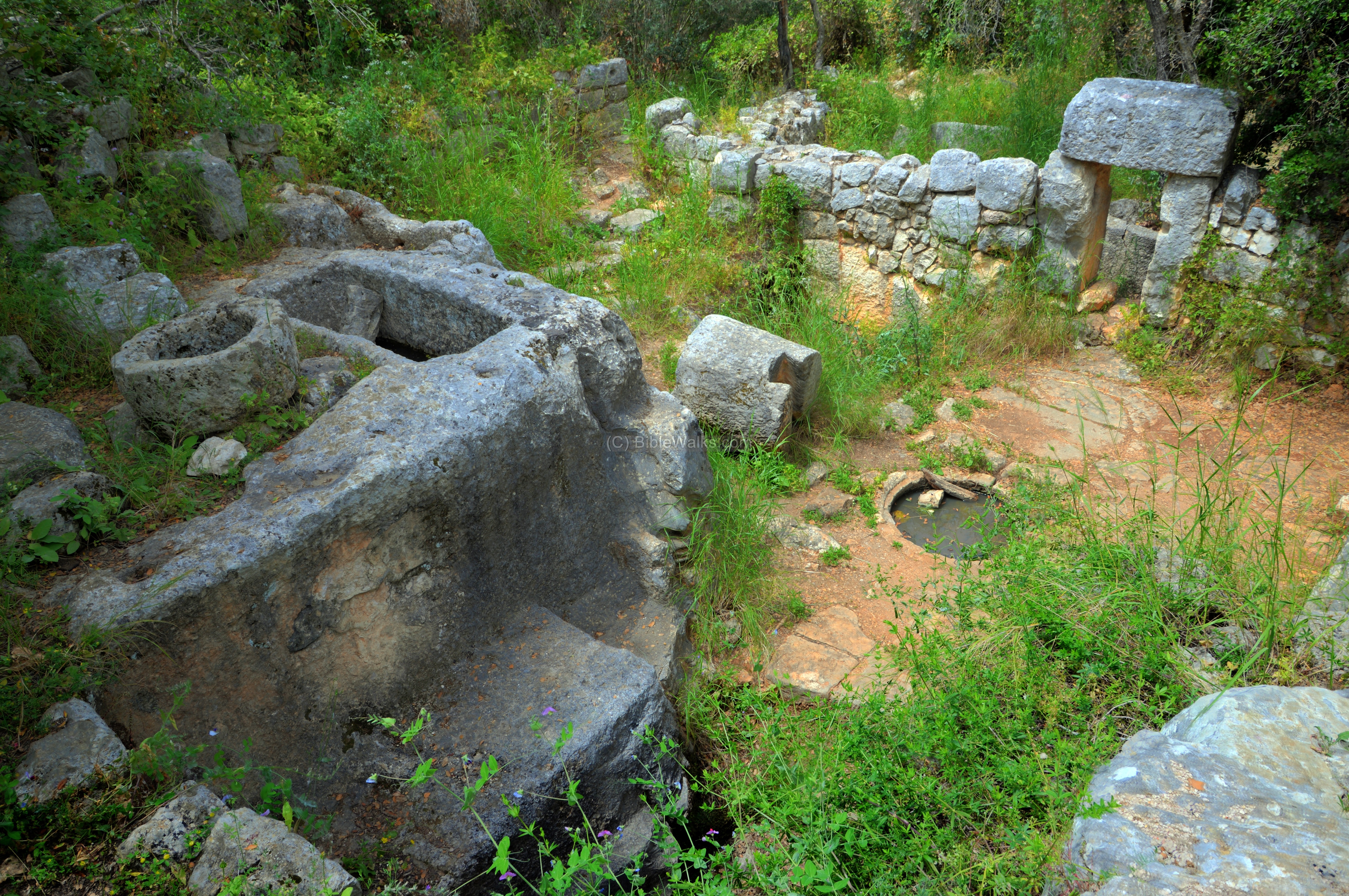
This type is a hybrid of the lever based type and the screw type. The pressure on the lever was made with a screw that pushed down the lever.
A wooden lever was held on its edge by an arch, and a screw installation on its other end above the weight. A wooden installation was connected to the side of the weight, held upright by the fork. The heavy cylindrical weight, (weighing more than 1 ton) forced the lever down when the screw was tightened up. The lever pushed down the baskets of olives which were placed on top of the basin, with a force of 6 tons. The extracted oil then poured out of the outlet into a collecting vat.
A sign (with Hebrew title: “Byzantine Oil press”) on the eastern wall describes the operation of the oil press, and illustrates its design. The legend of its elements is as follows: (1) baskets with crushed olives, (2) pressing base, (3) lever, (4) arch, (5) large wooden screw, (6) cylindrical weight, (7) collecting vat.
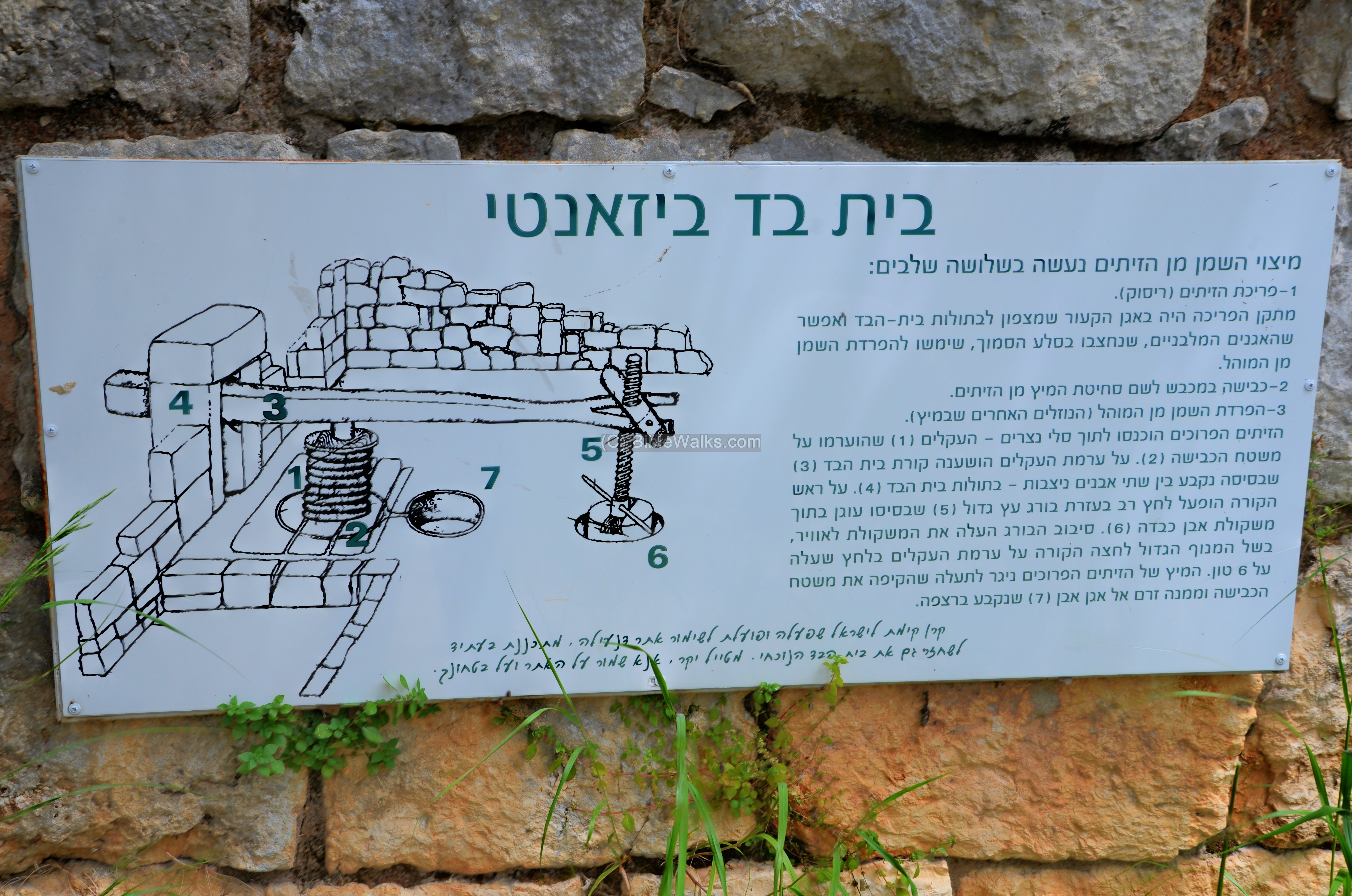
The base of the lever was held firm by a heavy stone arch, built of the vertical stones and a horizontal block.
The next photo is a view of the rear side of the oil press. The cavity on the edge of the installation was where the weight was placed at the end of the lever.
The cylindrical weight stone stands to the side of the collecting vat, now filled with rain water rather than olive oil. On the cylindrical weight stone is a trapezoid groove, where wooden plank held the lower section of the screw firmly to the weight.
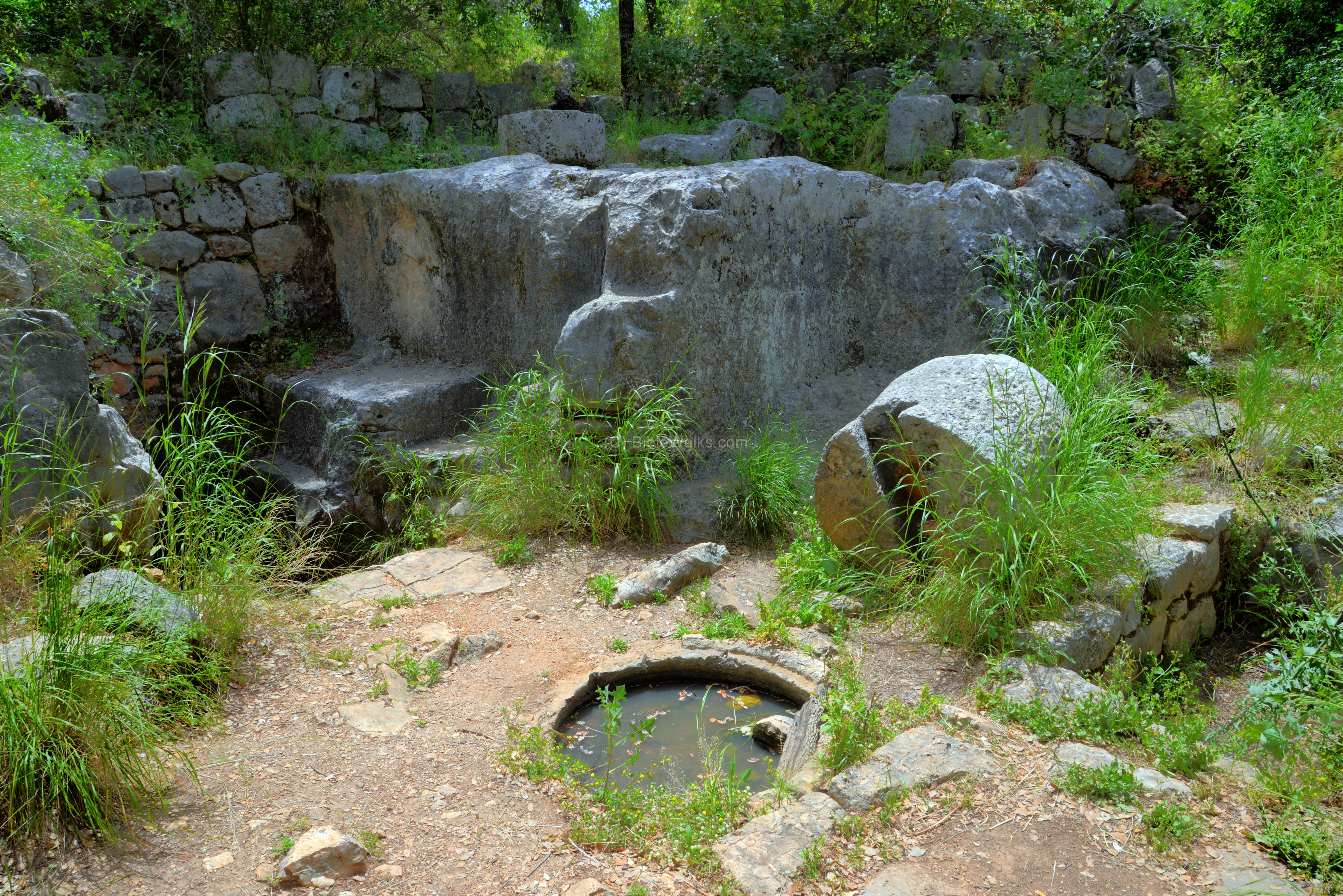
Another view of the structure is below. A water cistern is located on the corner of the room.
Another view of the water cistern:

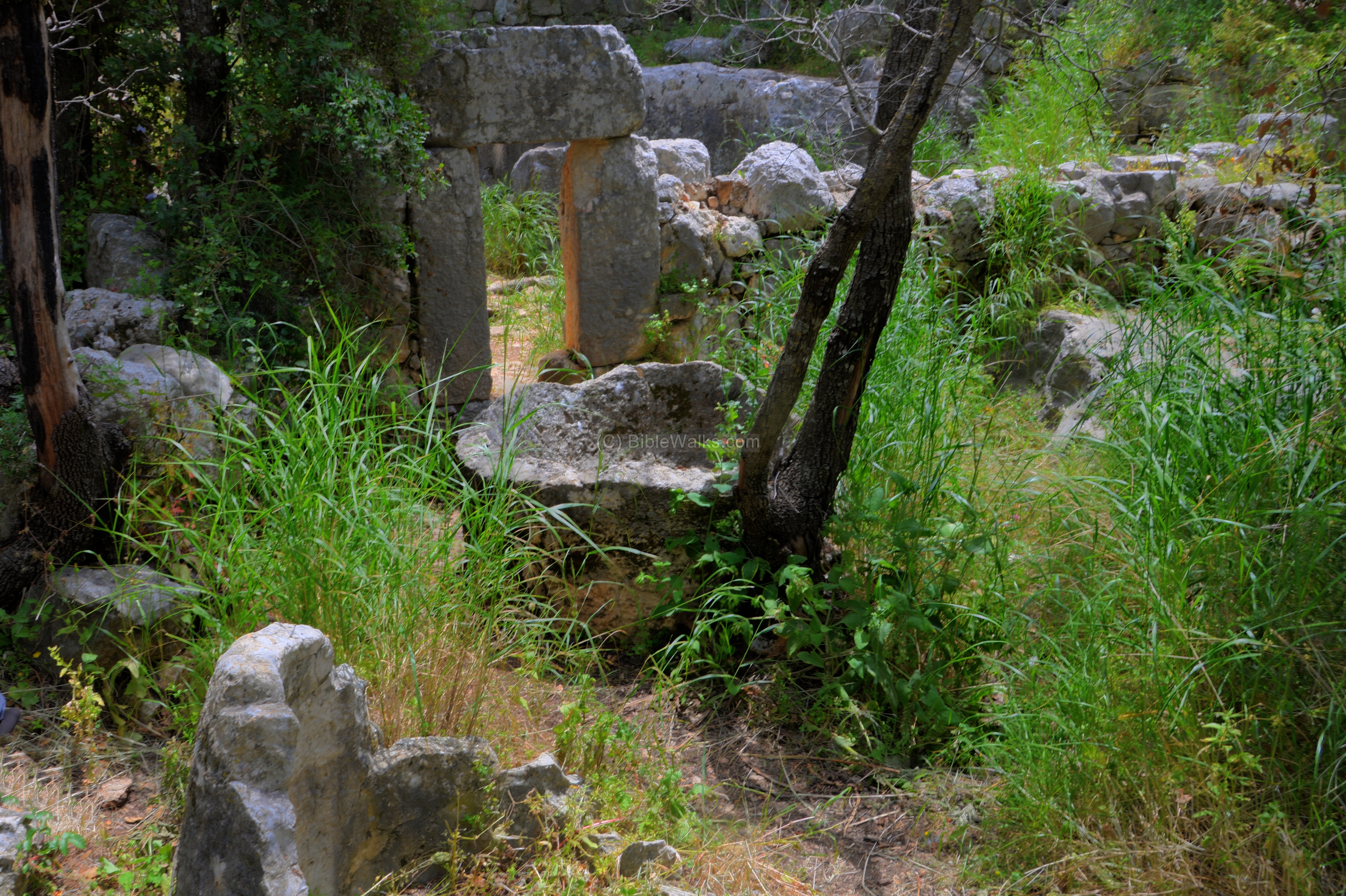
North of the oil press structure are another element of the installation – a concave base used to crush the olives prior to the pressing phase.
Etymology (behind the name):
* Names of the place
-
Kh. Inaileh – the Arabic name on the PEF 19th century maps, meaning: “The ruin of the horseshoes”.
-
Kh. Dinila, Kh. Nueila – other names by the PEF
-
Kh. Dja-ileh – the name used by Guerin in the 19th century
-
H. Danaila – the modern name (based on the Arabic name)
-
Kh. Danehyle – the name used in the Crusaders period (1220)
Note:
-
Kh. – Khirbet, meaning in Arabic: ruin;
-
H – Horvah, meaning in Hebrew: ruin;
Links:
* External sites:
- Touring with KKL (Hebrew)
* Nearby sites:
- Montfort Crusader castle
- Horvat Zonem – another “lost city”
* BibleWalks links:
- Ancient Oil presses
- Wild flowers, herbs and plants in the Holy Land
- Youtube – more Aerial videos
BibleWalks.com – Walking the Bible trails
Hunin Fortress<<<–previous site—<<<All Sites>>>—next Upper Galilee site—>>> Tel Nes
This page was last updated on Apr 28, 2018
Sponsored links: