Tel Kinneret is a high hill on the north-west side of the sea of Galilee, where the Biblical city of Kinneret once was located. The south side of the hill is used today for the National Waters Carrier project.
Home > Sites > Sea of Galilee> Tel Kinneret (Kinrot, Kinnaroth, Uereimeh, Genesareth, Gennesaret, Chinnerot)
Contents:
Background
Location
History
Photos
* Overview
* Excavations
* South view
* West view
Biblical
References
Etymology
Background:
Tel Kinneret (also Tel Kinrot) is a steep hill on the north-western corner of the Sea of Galilee. It is identified as the Biblical city of Chinnereth (Kinneret), one of the fortified cities in the Naftali tribe region. Joshua 19, 36: “…And the fenced cities are Ziddim, Zer, and Hammath, Rakkath, and Chinnereth,”
The strategic location of the ancient site, which was a gateway on the main road from west to east, made the city an important Bronze age (Canaanite) and Iron age (Israelite) city.
Location:
Tel Kinneret is located on the north-west corner of the sea of Galilee, west of Tabcha. It is 75m above the lake and 125m under the Mediterranean sea level. The site is located on a steep hill on the north-west corner of the Sea of Galilee, and the main road passes on the west and north side of the site.
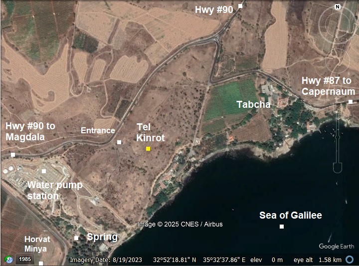
The road from Tiberias to the north and to the east passes through the western side of the hill. The south side of the hill is now closed by the National Carrier project, where powerful pumps push water from the sea of Galilee to the center and south of Israel.
History:
- Prehistory
During the prehistoric period the area south-east to the Tell, at the edge of the Amud creek, was populated starting in the Early Paleolithic period (150,000 to 80,000BC). Fragments of skeletons were found in the Amira cave and Skull cave and other caves along that creek, about 2KM from the Tell.
Settlement on the hill itself started on the Chalcolithic period (4500-3300 BC), and even earlier during the Neolithic period (5500-4500 BC).
- Early Bronze period (Strata X-IX)
The Tel was first fortified starting in the Early Bronze II period (3150-2900BC). Remains of this early period were found on the south eastern side, close to the shore. The size of this early city is not clear, but it may have been large and even extend the area of the hill. The archaeologists also do not know if the city was walled at this stage.
The city was deserted from the end of the Early Bronze III until the Middle Bronze IIB.
- Middle Bronze IIB to Late Bronze I (Strata VIII-VII)
The Bronze city was resettled during the Middle Bronze IIB (1750-1550 BC), continuing up to the Late Bronze I period (1550 -1300 BC). A massive defense wall, 12.3 m wide (!), was found along the east foothills. The wall was secured by steep earthen ramparts and impressive glacis that extended from the wall. The area of the walled city covered the northern summit and the southern foothills.
Egyptian pharaoh Thutmose III (reigned 1479 BC to 1425 BC) listed “Kinneret” as one of the cities conquered during his inquest to the north in 1468 BC. On the wall in Karnak are illustrations of Canaanite princes, depicted with hands tied behind their backs, and their city names appear in Egyptian hieroglyphics.

Thutmose III smiting his enemies (7th pylon in Karnak). Photo by Markh; public domain.
In 1928 a fragment, from a Egyptian basalt tablet, was found on the hill. It is believed to be from the time of Egyptian Pharaoh Thutmose III.
Also, a scarab was found bearing the name of the queen of Amenophis III (1390-1353 BC) indicates an activity during the end of the Late Bronze I, close to the demise of the Bronze period city.
Cities and roads during the Bronze/Iron periods are indicated on the Biblical Map below. Kinrot/Kinneret is marked with a red circle. A major Bronze/Iron age road passed on the wets side of the city, continuing north to Hazor and beyond. David Dorsey (“The roads and Highways of Ancient Israel”, 2018) marked it as “B1” – the main Megiddo– Beq’a valley highway, linking Egypt with the north.
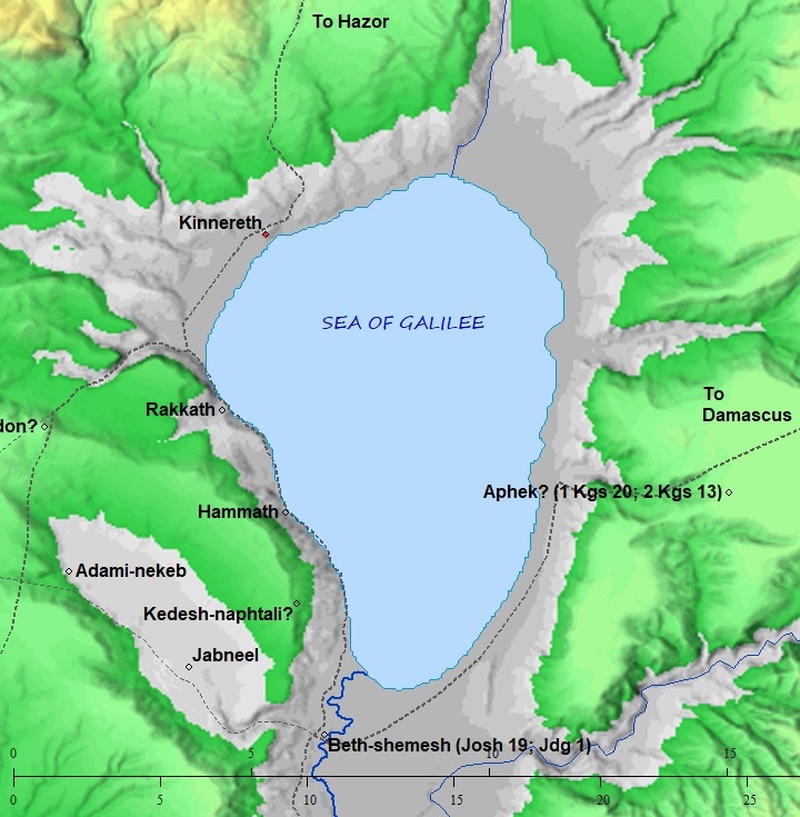
Map of the area around the site – from Canaanite/ Israelite periods (based on Bible Mapper 3.0)
- Late Bronze II period (1400-1200 BC)
As seen in the excavations, during the Late Bronze II the site was deserted. This is also supported by the lack of reference of the city in the Amarna letters (mid 14th century).
- Iron Age 1A (1200-1100 BC) – (Strata VI)
During this period a fortified city was established on the hill.
- Iron Age IB (1100—900 BC) (Strata VI-V)
Kinneret became a major city and regional center during the Iron Age 1B, probably replacing Hazor in its importance. The city occupied 100 dunam on the summit and the foothills. A new population founded the Iron Age IB city, without a continuity to the Bronze period, and more advanced. The city was surrounded by a massive wide wall – up to 12m wide(!).
This Late Canaanite city was a carefully planned urban center, with carefully arranged neighborhoods. Wide streets were constructed along the steep foothills on the south eastern side of the hill. Sophisticated drainage channels conveyed the waste water to the lake.
A large trapezoid dwelling complex, 30m in length, was unearthed on the slopes. It is one of the most remarkable well planned structures ever found of the Iron I period. The structure included many rooms, some with installations and areas of food preparation.
The excavations revealed that the inhabitants engaged in various industries and manufacturing. They used the lake for fishing and transportation. Farming villages around the city, and on Tel Hadar across the lake, supplied it with meet, fruits and vegetables.
The Iron IB city strata VI was probably destroyed by a powerful earthquake. Such earthquake (estimated 7.0 magnitude, as per C. Migowski et al 2004, p. 307 ) destroyed the Iron Age I cities in the Galilee at 1050 BC (as per C14 dating by Migowski et al. 2004).
The city continued after the earthquake, as seen on layer strata V. However, it came to a violent end at ~1000 BC, and was abandoned. The reason for this demise is yet open to debate, and could be due to the Israelite unified Kingdom, or another powerful earthquake that hit the city.
- Iron Age IIA (1000-900 BC) – (Strata IV)
During this period there was only squatter inhabitation on the hill. Remains of this town was found on the lower south side (areas K and W). The city was not rebuilt, and the structures did not align with the previous city outline. The settlement was abandoned after 100 years.
A settlement gap of another 100 years separated from this phase to the next one.
- Iron Age IIB (900-700 BC) – (Strata III-I)
During the Iron IIB period, at 9th century BC, a tower was built on the summit, on the north end of the hill. This fortification was found in layer III.
The fortress was then expanded to a heavily fortified fortress, as found on strata II. This expansion was probably during the reign of Jeroboam II (787-747 BC). It occupied a section of the earlier fortified city, with a small area of 7.5 dunams on the summit. A broad wall, 5m wide, protected the city. The gate was on the south side (“Area D”).
The Bible names this fortified city as part of the border cities of Naftali tribe (Joshua 19, 36): “…And the fenced cities are Ziddim, Zer, and Hammath, Rakkath, and Chinnereth“.
- Assyrian conquest
The Assyrian empire conquered the North Kingdom of Israel in 732 BC, destroying most of the cities and villages in the land. They exiled some of the population and introduced harsh taxation. (2 Kings 15: 29): “In the days of Pekah king of Israel came Tiglathpileser king of Assyria, and took Ijon, and Abelbethmaachah, and Janoah, and Kedesh, and Hazor, and Gilead, and Galilee, all the land of Naphtali, and carried them captive to Assyria”.
Kinneret, a city within the “land of Naphtali”, was destroyed during the the Assyrian conquest.
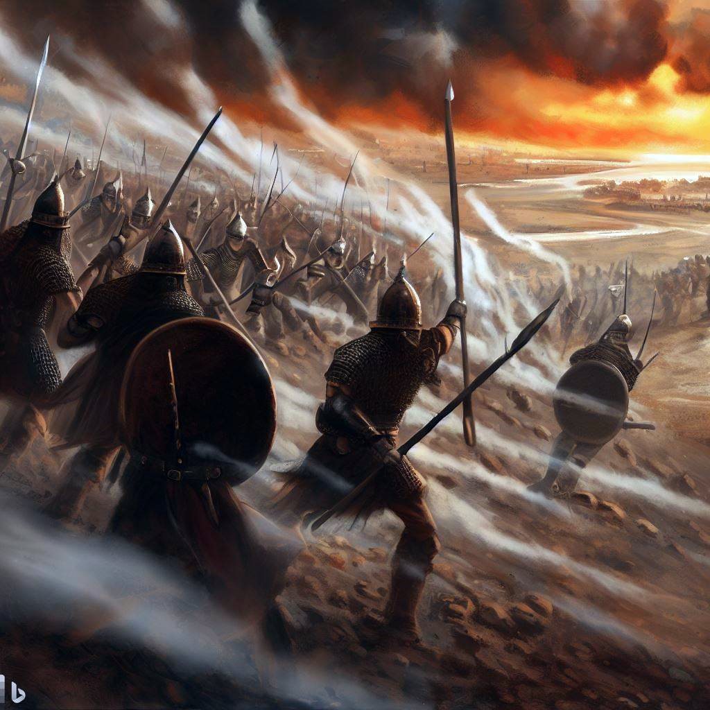
Assyrian forces attacking – AI generated by Bing
- Babylonian/Persian/Hellenistic
The Tel continued as a poor settlement until the Hellenistic period (4th-1st century BC), and then was relocated to Cappernaum, following a common pattern of relocation from the Biblical Tells to the new and larger villages. The hill was used since then for farming and limited settlement.
- Roman/Byzantine period
At Jesus times, the road from Capernaum to/from the Galilee and Jerusalem passed at this site, so all his many travels (see the events list of Jesus footsteps) have passed here. Judging from the topography, this was probably at the side of the shore of the lake, through the seven springs (Tabcha) and near Khirbet Minya. It may have also been the place where he healed many people – Gennesaret (Mk 6:53, Mt 14:34).
- Ottoman period:
A view of the plain of Ginosar (Gennesaret) was illustrated by the early traveler W. M. Thomson in his book of 1861 (“The Land and the Book” Volume 2). The view is from Tel Kinneret towards the south.
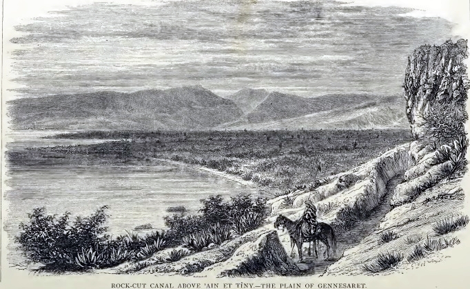
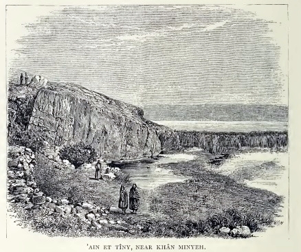
A spring is located on the south side of Tel Kinneret, named ‘Ain et Tineh. The illustration shows an aqueduct on the foothills above the spring.
Thomson wrote about it (p. 408) and illustrated the spring and Tel Kinneret behind it (p. 412):
“’Ain et Tiny is the most northern fountain of the plain, but so low and so near to the lake—on the shore, in fact—that it could not have been extensively used. That portion of the plain is not so well watered as the southern, and the stream from ’Ain et Tabi-ghah appears to have been brought into that region to supply the deficiency. In the summer-time all the streams which enter the plain disappear before they reach the lake….”.
- PEF survey
Conder and Kitchener surveyed this area during the Survey of Western Palestine (SWP), commissioned by the Palestine Exploration Fund (PEF) in 1873. A section of their map is seen here. Tel Kinneret (Kh. el ‘Oreimeh) is in the center. Kh. Minia is marked below it. The spring of ‘Ain et Tineh, the source of water for Tel Kinneret, is located near it, as well as Khan Minia. An aqueduct conveyed the waters northward for irrigation of the fields in the Tabghah basin and powering the flour mills.
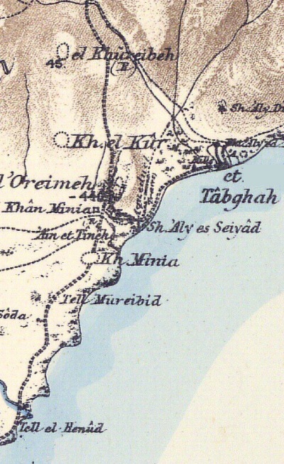
Part of Map Sheet 6 of Survey of Western Palestine, by Conder and Kitchener, 1872-1877.
(Published 1880, reprinted by LifeintheHolyLand.com)
They wrote about the site (Vol 1, p. 403-404):
“Kh. el ‘Oreimeh: An artificial plateau, 195 feet by 86 feet, feet, on the top of a rocky hill. In the north-west angle of the plateau there are the remains of walls and ruins of a building, probably a fortress or stronghold of some sort. The great Damascus high- road ran just below to the west”.
- British Mandate
A section of the 1940s British map shows the area around the site (marked by its Arabic name Kh. ‘Ureima). This is before the water pump station was built on the south west side.
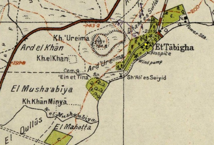
British survey map 1942-1948 – https://palopenmaps.org topo maps
License: public domain under the UK Copyright, Designs and Patent Act 1998
- Modern times:
The Tell is in ruins since then. In the 1960s a national water works project was constructed in the south side of the hill as the base of the water pumps, that raised the sweet water up to the plains above the sea of Galilee depression, and then down all the way to the south of Israel.
Photos:
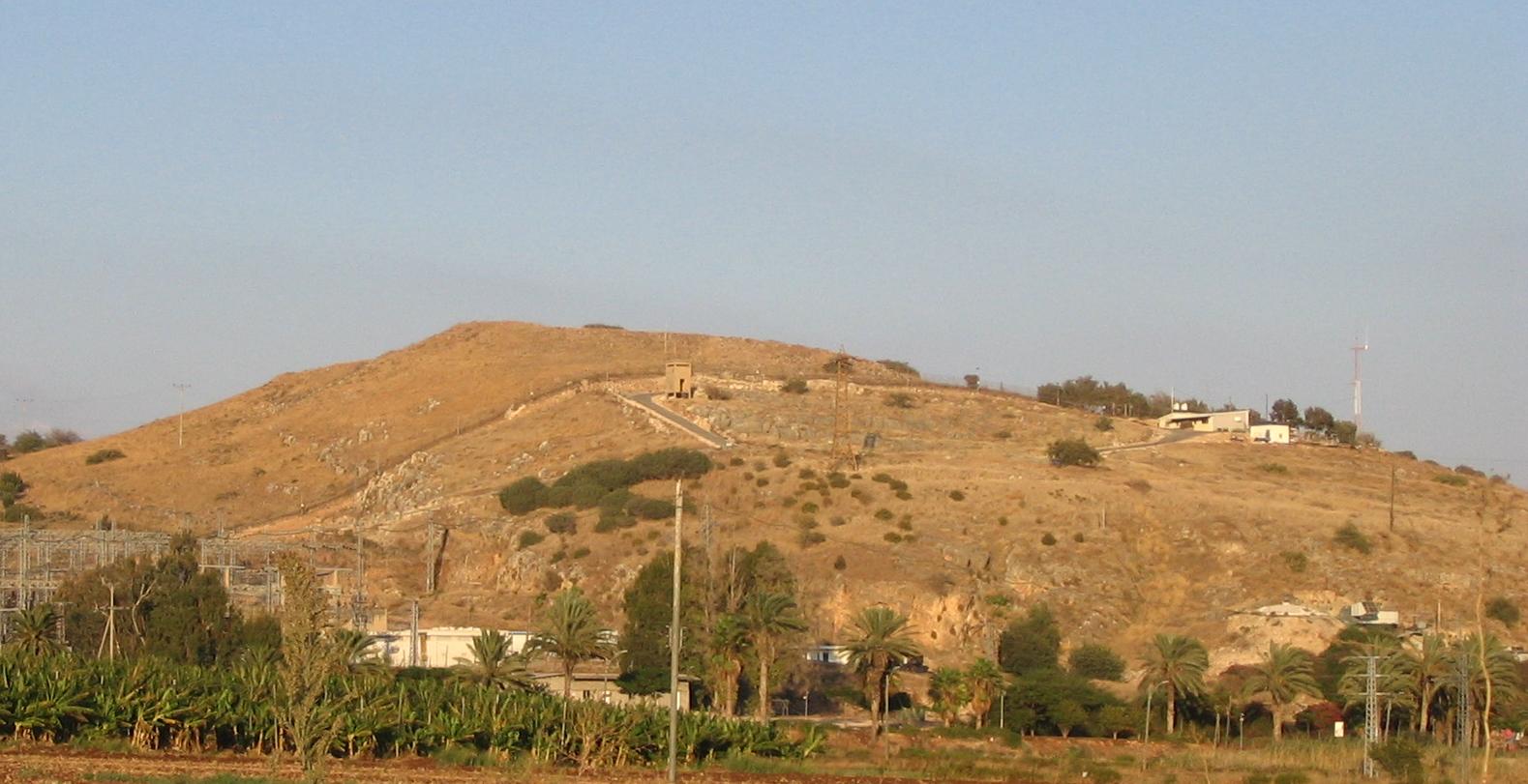
(a) Overview:
This is a view of the Tel from the south. The ruins are scattered on the hill and mostly on the summit. The National Carrier water pumps are located in parts of the hill.
Click on the photo to view it in higher resolution…
Below -a view from the north, seen from the entrance to Mount Beatitudes. On the right side is the hill, behind it is the Arbel cliffs, and on the left is Tabcha.
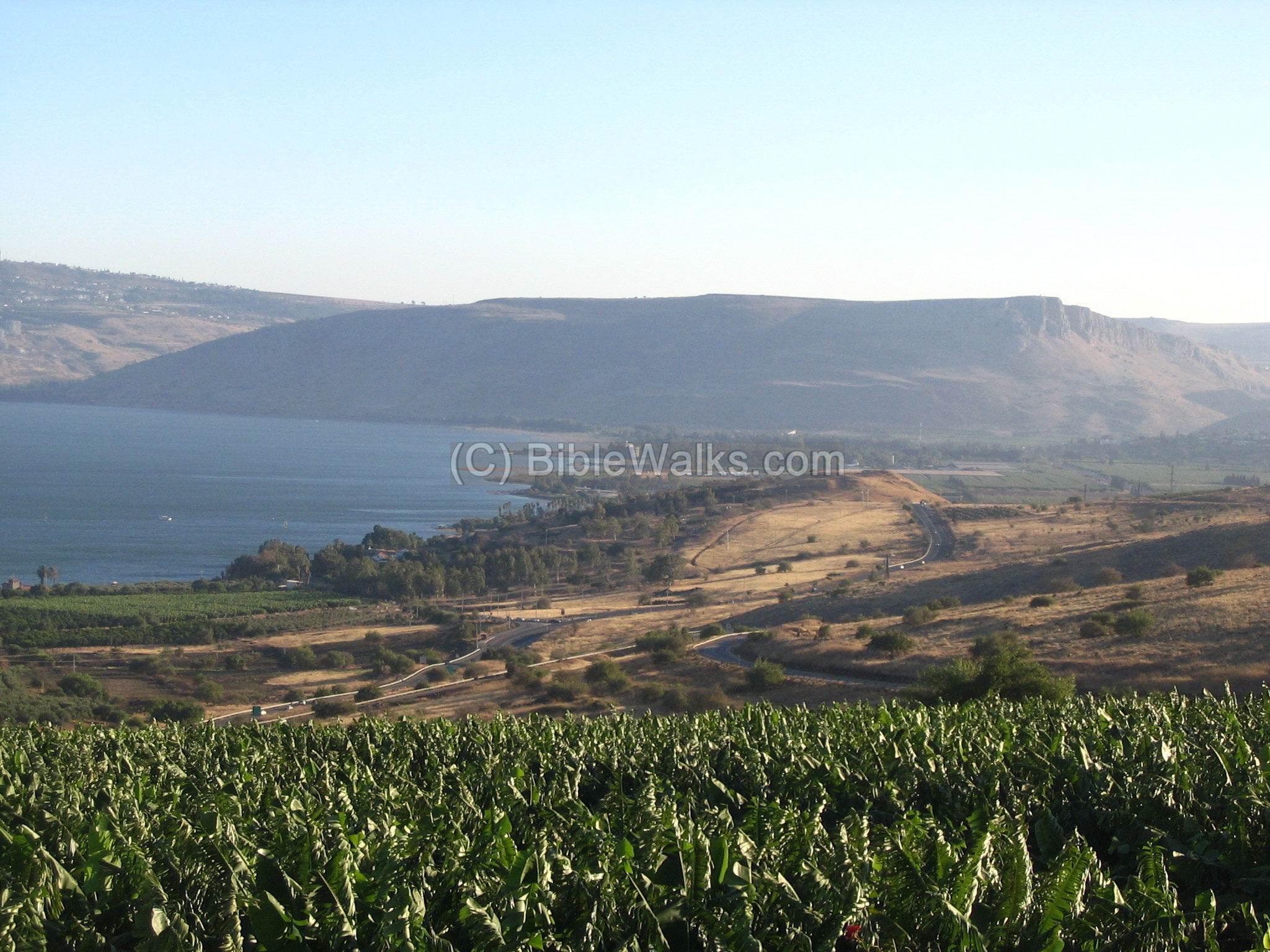
When driving northward and after passing the summit, there is an entrance on the right side to the National park of Tel Kinnaroth. You can park the car on the side of the road, and walk up the hill.
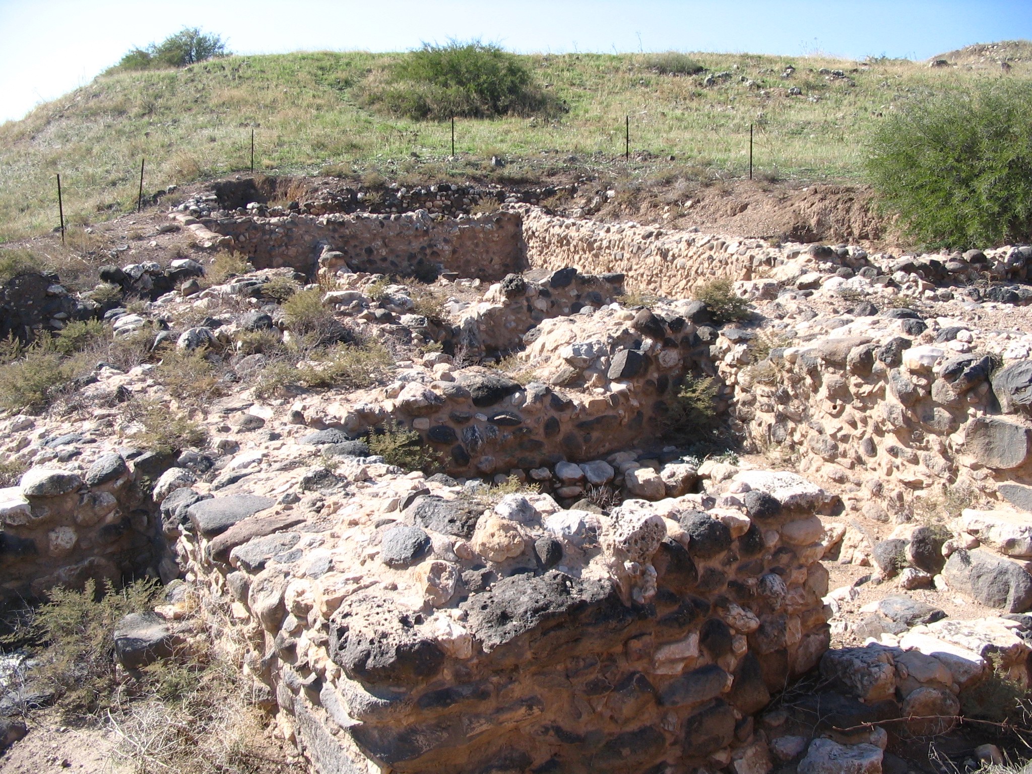
(c) Excavations on the Tel
On the sides of the Tel and on the peak there are large size excavations that revealed the walls and the buildings.
In the photo below are sections of the excavated areas (area ‘A’). This photo is on the eastern slope facing the lake.
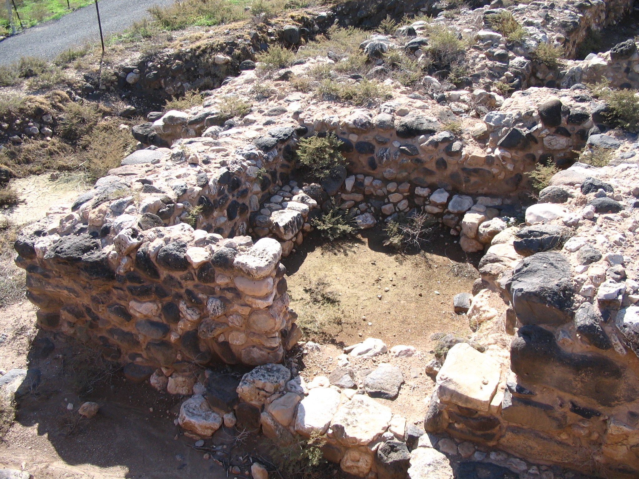
A detail of one of the rooms is seen below, part of the Iron Age IIB gate.
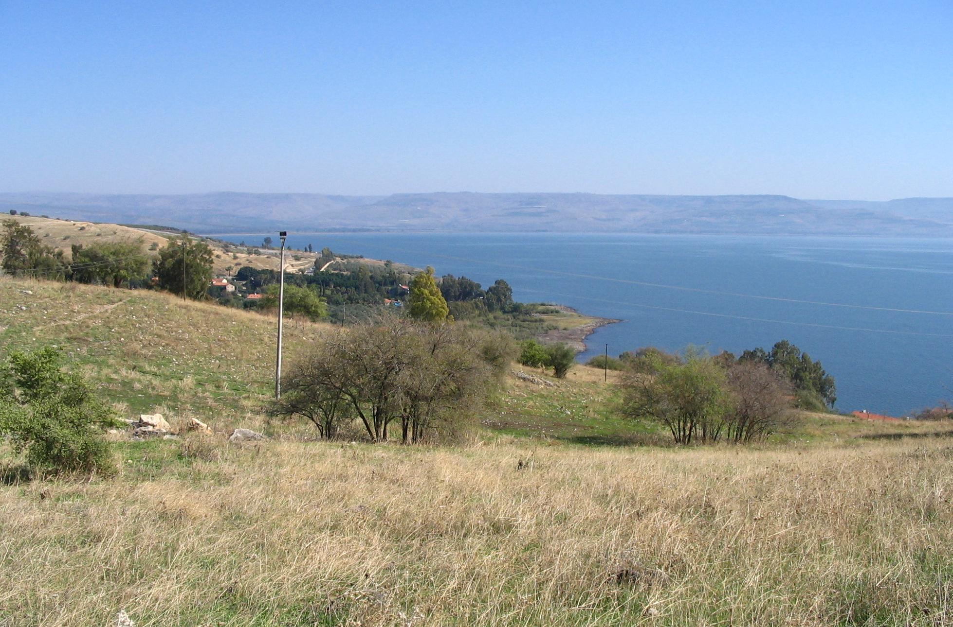
(d) View to the south
From the top of the hill is a great view of Horvat Minya, the plains of Ginossar, and the Arbel cliffs in the background.

(e) View to the west
This photo is on the western side of the top of the hill. A section of the city wall is seen here. The wall surrounded the city and was built with widths of 11m.
On the left side of the photo (the west side of the hill) is highway #90. In the background is the church of Mt Beatitudes.

Biblical References:
(a) Joshua 19:32, 35, 36
This text describes the region of the Naphtali tribe, and the fenced city of Chinnereth was one of its cities.
“The sixth lot came out to the children of Naphtali, even for the children of Naphtali according to their families….
…And the fenced cities are Ziddim, Zer, and Hammath, Rakkath, and Chinnereth,
And Adamah, and Ramah, and Hazor,”
(b) Joshua 11:1-2
This text describes the war of Mei-Merom, when the kings of north Canaan cities assembled together to fight Joshua, and lost:
” And it came to pass, when Jabin king of Hazor had heard those things, that he sent to Jobab king of Madon, and to the king of Shimron, and to the king of Achshaph,
And to the kings that were on the north of the mountains, and of the plains south of Chinneroth, and in the valley, and in the borders of Dor on the west,”
(c) Kings 1 15:20
This text describes the intrusion of the King of Damascus, Benhadad I, in 885BC, to the area along the north Jordan valley.
“So Benhadad hearkened unto king Asa, and sent the captains of the hosts which he had against the cities of Israel, and smote Ijon, and Dan, and Abelbethmaachah, and all Cinneroth, with all the land of Naphtali”.
(d) Mark 6:53-56; Mathew 14:33-36
In these texts Jesus lands on the shores of the “land of Gennesaret”, which is called after Tell Kinneret (the main city at this area) or the valley south to it (along the shore until Magdala). Here he heals many people.
“And when they had passed over, they came into the land of Gennesaret, and drew to the shore. And when they were come out of the ship, straightway they knew him, And ran through that whole region round about, and began to carry about in beds those that were sick, where they heard he was. And whithersoever he entered, into villages, or cities, or country, they laid the sick in the streets, and besought him that they might touch if it were but the border of his garment: and as many as touched him were made whole”.
“Then they that were in the ship came and worshipped him, saying, Of a truth thou art the Son of God. And when they were gone over, they came into the land of Gennesaret. And when the men of that place had knowledge of him, they sent out into all that country round about, and brought unto him all that were diseased; And besought him that they might only touch the hem of his garment: and as many as touched were made perfectly whole”.
Links and References:
-
Tel Kinrot, Kinneret Regional Project – HAESI 121 2009;
Stefan Münger, Juha Pakkala and Jürgen Zangenberg, 04/05/2009, Preliminary Report
- Kinneret – an Urban center at crossroads: Excavations on Iron IB Tel Kinrot at the Lake of Galilee -S. Münger, J. Zangenberg, J. Pakkala; NEA June 2011 – great article
- The Land and the book (3 volumes) -Thomson, William M. (William McClure), 1806-1894 from the Internet archive
- Tel Kinrot – Tell el-‘Oreme – Kinneret – Juha Pakkala – Stefan Münger – Jürgen Zangenberg; report 2 2004; great article
* Internal links:
- Horvat Minya – Ruins of a grand winter palace for the Arabic rulers from Damascus. Built in the 8th century AD near Tel Kinneret.
Etymology (behind the name):
- Kinneret – the name in Hebrew for the city and the lake (sea of Galilee). The source of the name is not known, but some options are offered in the Sea of Galilee overview page.
- The Bible named the Sea of Galilee after the city (Numbers 34:11): “…and the border shall descend, and shall reach unto the side of the sea of Chinnereth eastward:”There are are Biblical verses that name the sea after the city, for example (Deuteronomy 3:17): “The plain also, and Jordan, and the coast thereof, from Chinnereth even unto the sea of the plain, even the salt sea, under Ashdothpisgah eastward.”
-
Kinneroth, Kinrot – plural in Hebrew for Kinneret.
-
In Christian texts the name has transformed to Genesareth.
BibleWalks.com – walk with us through the sites of the Holy Land
Poriya<<<–previous site—<<<All Sites>>> —-next Sea of Galilee site –>>>Minya
This page was last updated on Feb 23, 2025 (misc updates)
Sponsored links: