Acre Lighthouse
The lighthouse is located on the south-western corner of Acre. It is located over the foundations of the Crusaders Templar fortress.
Home > Sites > Acre > Lighthouse (El Manara)
Contents:
Background
Location
History
Photos
* Lighthouse
* Views
* Burj Kashla
Links
Etymology
Background:
The modern lighthouse is located on the south-western corner of Acre, near the base of the Ottoman tower “Burj El Sanjak”.
The structure is located over the foundations of the Crusaders Templar fortress, currently submerged in the bay near the lighthouse. A secret tunnel was discovered recently, that once connected the Templars fortress to the ancient port.
The site is also the starting point of a walk over the southern walls, from the light house, to the marina on the eastern side.
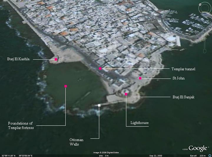
Location and Aerial map:
The following aerial view shows the location of the lighthouse, on the south western side of the old city.
History:
Period Date Event Crusaders
1104 AD: Crusaders conquer the city ; fortify the city; their port is on the eastern side
1118 AD: Establishment of the military-religious Templars order, naming their organization after the temple: the guards of the temple. Their task, as defined by the pope, was to protect the pilgrims and patients that visited the Holy Land.
1187 AD: Saladin takes the city after capturing Jerusalem; Christians are evacuated
1191 AD: Richard the Lion Heart retakes the city on the 3rd Crusade
Acre becomes the capital of the remnant of the Kingdom of Jerusalem
Beginning 13th century:
The Templars build a fortress on the south-western side
Mameluke
1291 AD: After siege, Mamelukes capture the city; they destroy it completely, including the Templars fortress;
The city remains a small village Ottomans
Ottoman
1517 AD: Ottomans take the city; city falls into total decay end of 18th century
Jezzer Pasha improves and fortifies the city – including the external (present) walls
The Burj el Sanjek tower is built as part of the defense walls
1912: The modern lighthouse structure is built on the ruins of Burj el Sanjek Israel
Today: The light house is closed to the public, but there is an easy access to its base
Photos:
Lighthouse:
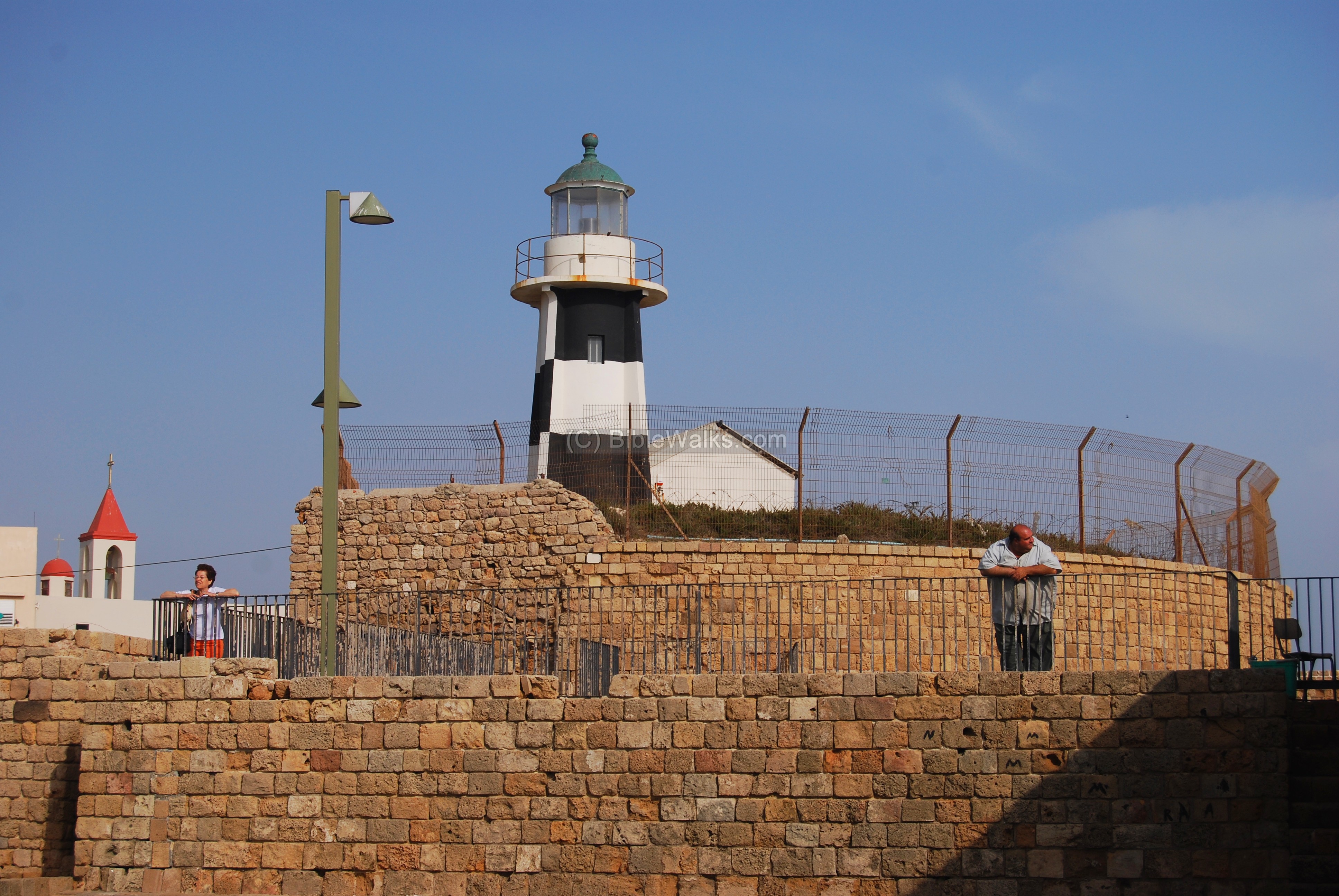
The photo below shows the lighthouse, one of Acre’s landmarks, located on the south-west corner of the old city. It is located on the ruins of an Ottoman tower – Burj El-Sanjak (“flag tower”). The lighthouse, a white concrete tower painted with black horizontal stripes, checkerboard style, is 33M high above sea level. It warns the sailors in the Acre bay on the position of the edge of the city.
Click on the photos to view in higher resolution…
A view of the lighthouse from the tower of Kashla. In the background – Mount Carmel and the bay of Haifa. On the left side – the houses of the Arabs that live in the old city. It is also the western side of the Templars tunnel – its entrance is on the far left side.

Views from the Lighthouse:
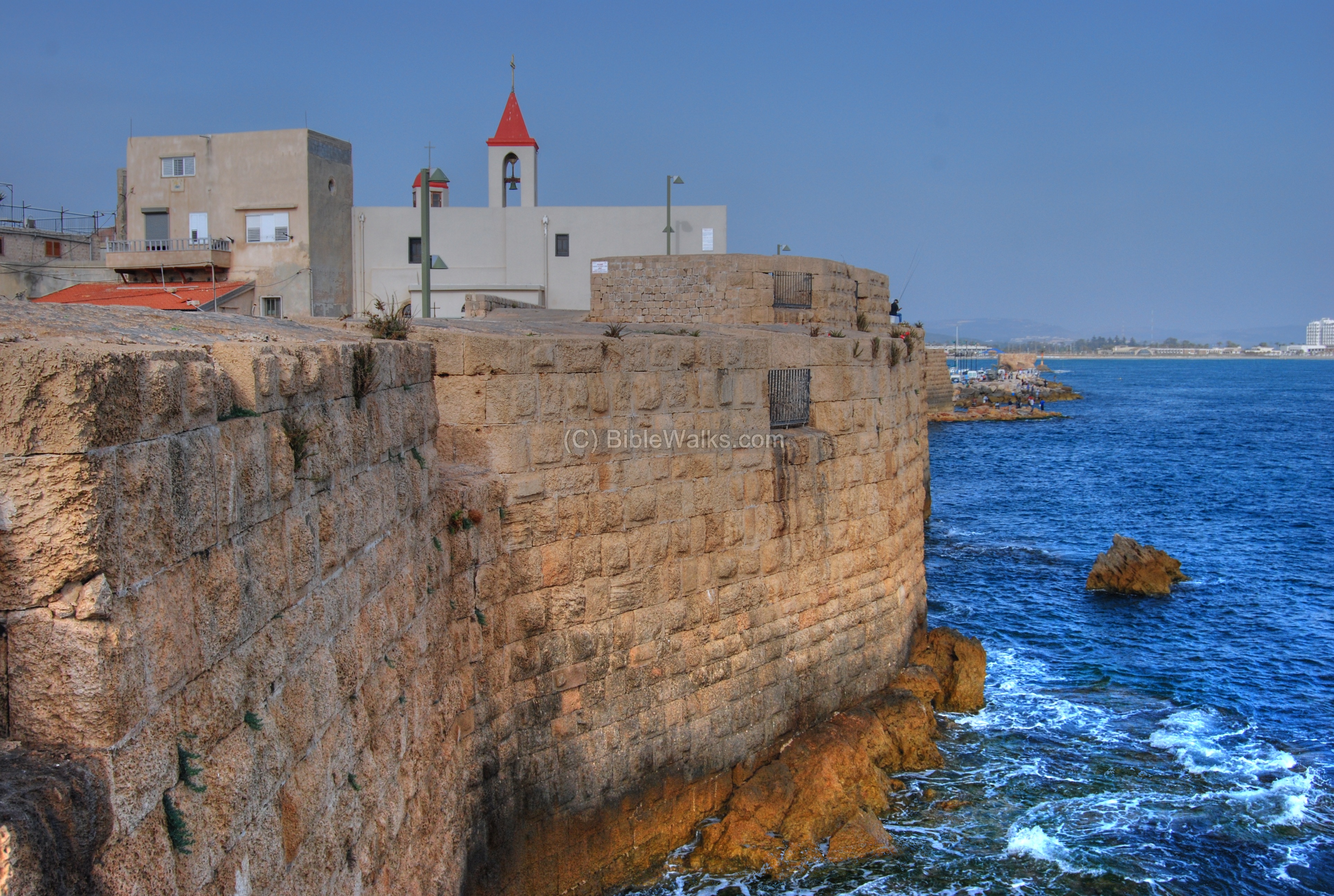
This is a view from the lighthouse, towards the north-east. The shallow waters in the bay cover the foundations of the Crusaders Templar fortress. This was the strongest tower in the Crusader city. Its entrance was protected by twin towers with 9m wide walls, and two more side towers. It was totally dismantled, and its stones were reused to build new housing above the ruins of the Crusader city.
On the far left is an Ottoman period tower (Burj el Kashla).
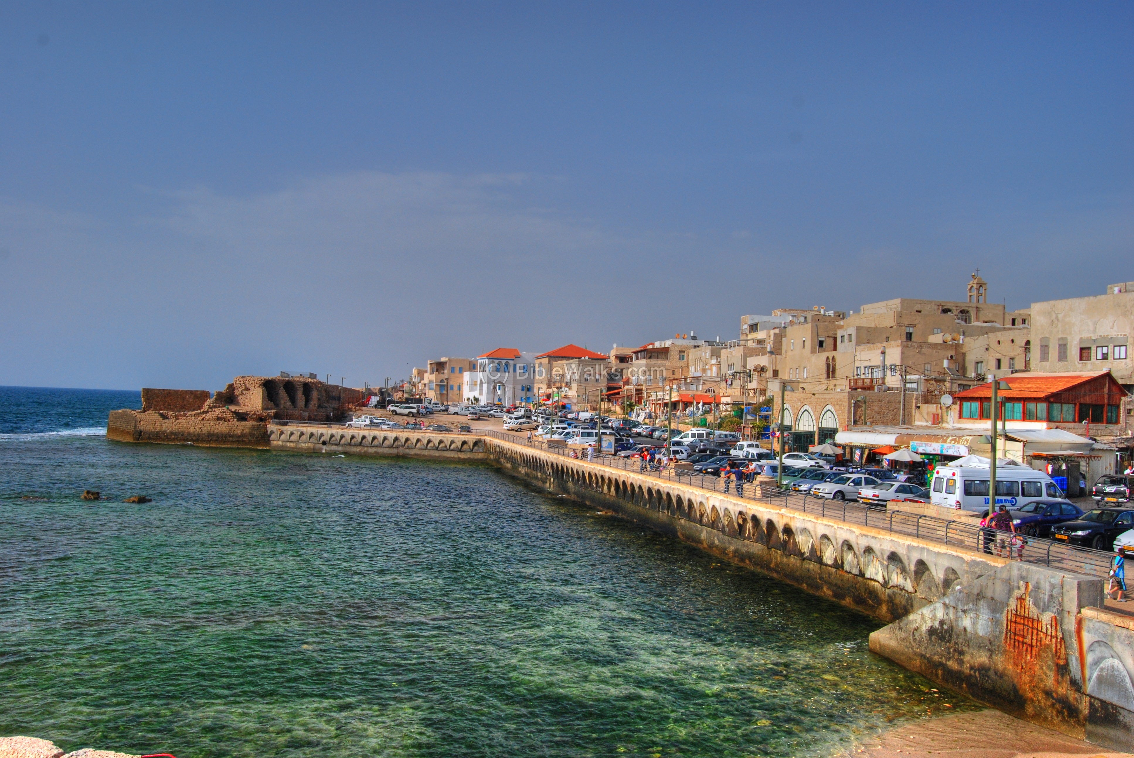
Another eastward view from the lighthouse, with the southern walls of Acre, is seen below. The church is St. John, and the port of Acre is seen in the right background. It is recommended to walk along the walls towards the port.
Burj El Kashla:
The ruins of an Ottoman tower is located across the small bay, at the end of the parking lot. There are stairs that lead to a balcony on the top, seen on the left side. The tower is called Burj El-Kashla, a distortion of the Turkish name Burj al-Qishla (Tower of Barracks).
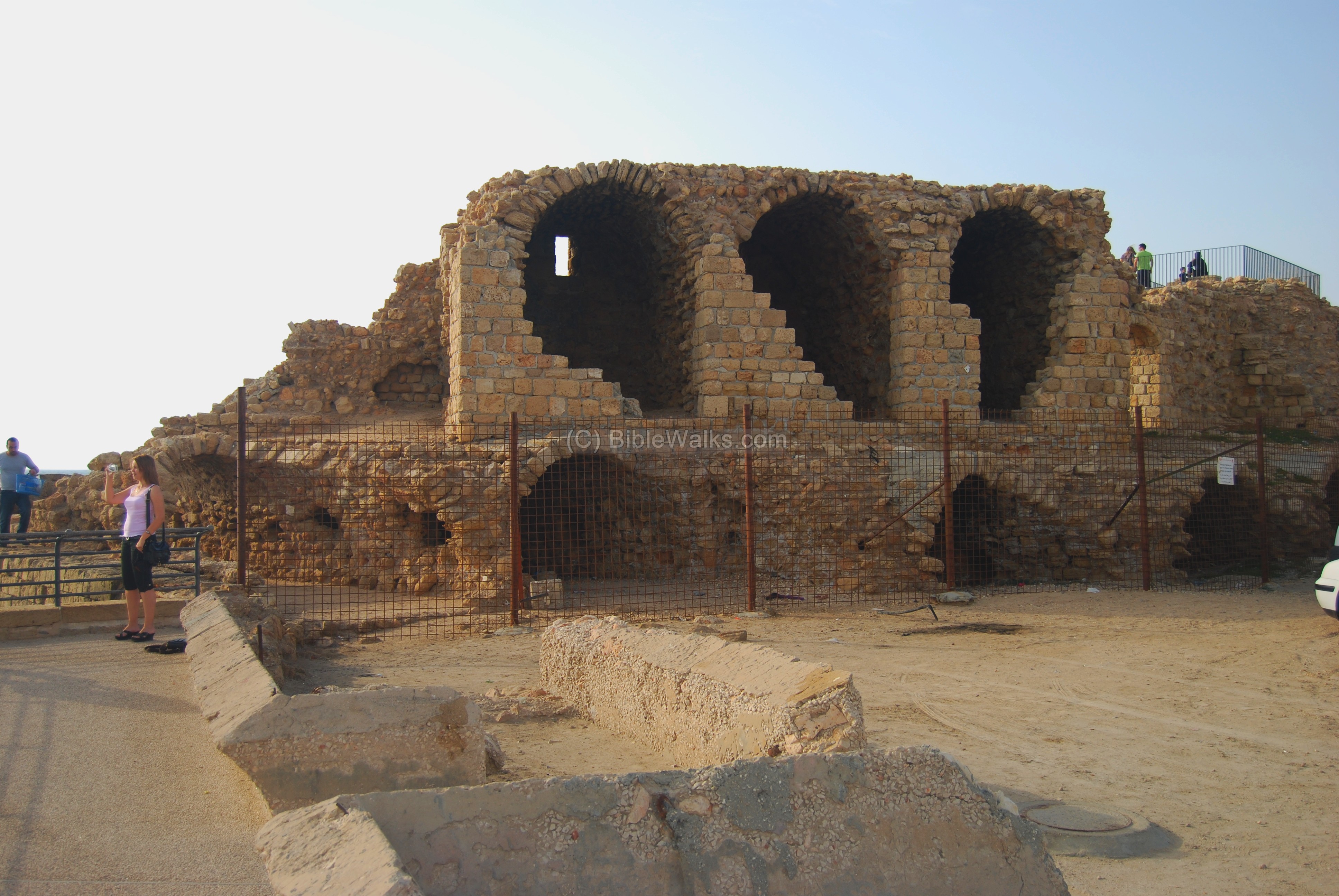
The photo below shows the view from the terrace on top of the tower. The mountain in the far background is the Carmel and the city of Haifa.
The line of rocks that form a breakwater were once the western wall of the Templar fortress.

Links:
- Old Acre Development company
- The Maritime Capital of the Crusader Kingdom
- Conservation of Burj el-Kashla – Igor Demchenko, Bin Li and Judy Zheng Jia; Instructors: Yael Alef, Dr. Danny Siyon, Tsili Giladi MIT IAA 2011
Etymology (behind the word):
- Burj – Arabic: tower.
- Burj el Sanjak – Meaning: flag tower
- Burj el Kasha – a distortion of the Turkish name Burj al-Qishla (Tower of Barracks).
- Manara – Arabic: lighthouse (based on fire, strong light). Sounds close to the Hebrew name Menorah.
BibleWalks.com – walk with us through the sites of the Holy Land
Majadele Mosque <<<–previous Acre site—<<<All Sites>>>—>>> Byzantine City
This page was last updated on Mar 2, 2023 (misc changes)
Sponsored links: