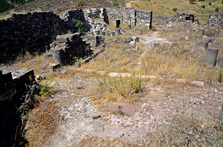
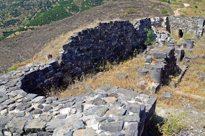
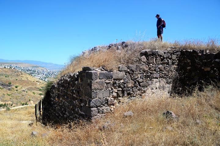
Ruins of a 8th century church located on Mt. Berniki (Berenice), high above the Roman city of Tiberias. Nicknamed ‘the Anchor Church’ based on a relic stone found embedded in its apse.
Home > Sites > Sea of Galilee> Tiberias> Berniki Hill
Contents:
Background
Location
History
Photos
* Aerial views
* Aerial video
* Church
* City Walls
Etymology
Links
Overview:
Ruins of a 8th century church are located on Mt. Berniki (Mt. Berenice), high above the Roman city of Tiberias. The hill is named after the Jewish Queen Berniki, the sister of King Agrippa II.
The church was first built during the 6th century, probably above the early Roman palace. It was damaged in the 749 earthquake and rebuilt during the 8th century, and used until the end of the Crusaders presence in the Holy Land.
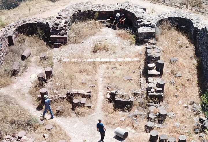
The church is built of Basilica style and is well preserved. It consists of two rows of columns and three apses, covering an area of 1400 square meters. Inside the central apse is an anchor stone, perhaps a sacred relic, giving the church a common name of the ‘anchors church’.
The church is adjacent to the earlier Byzantine period city walls, near the western gate to the Roman city. A section of the 6th century Byzantine wall, 2.5m wide, passes at the edge of the cliff, on the northern side of the structure. A pair of towers and a section of the wall are located on a higher altitude above the church.
Location:
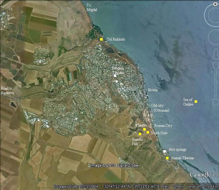
The site, a National park, is located on the southern side of Tiberias, on a hill 200m above the Sea of Galilee.
An aerial photo is shown below, indicating the major points of interest.
History:
- Early Roman
Tiberias was founded in 18 AD by Herod Antipas, son of Herod the great and Jewish ruler of the Galilee (4 BC-39 AD). He was appointed by Augustus Caesar as the ruler of Galilee and Peraea, the east bank of Jordan. Herod Antipas made the new city his capital, and named the city after the Roman emperor, Tiberius Caesar.
In 61 AD the city was added to the kingdom of Agrippa II, who ruled from Caesarea-Philippi (modern Banias). His sister Queen Berniki (Berenice) co-ruled with him from Caesarea-Philippi. The hill was named after Berniki. She became the lover of Titus, son of Vespesian. Both generals, Titus and Vespesian, became Roman emperors, benefiting from the campaign against the Jews.
Berniki (Berenice) is mentioned in the New Testament. In this event Agrippa and Berniki pardoned Apostle Paul who was on trail before Festus, the procurator of Judea in years 59-62 (Acts 25:13):
“And after certain days king Agrippa and Bernice came unto Caesarea to salute Festus….And on the morrow, when Agrippa was come, and Bernice, with great pomp, and was entered into the place of hearing, with the chief captains, and principal men of the city, at Festus’ commandment Paul was brought forth….But when I found that he had committed nothing worthy of death, and that he himself hath appealed to Augustus, I have determined to send him”.
- Great revolt:
During the great revolt against Rome (66-70 AD) a wall was constructed by the Josephus Flavius – the Jewish commander of the Galilee that later wrote the book (Wars 2:20:6):
“Josephus … knew the Romans would fall upon Galilee, he built walls in proper places about Jotapata, and Bersabee, and Selamis; and besides these, about Caphareccho, and Japha, and Sigo, and what they call Mount Tabor, and Tarichee, and Tiberias..”.
When the Roman legion arrived the city surrendered, and the walls remained (Wars 3:9:8):
“…upon which the citizens opened to him their gates, and met him with acclamation of joy, and called him their saviour and benefactor”.
The city continued to be part of Agrippa II’s kingdom until his death (96 AD). Starting from 100AD the city was under direct Roman control, and prospered.
- Byzantine period
In the 5th-6th century a new wall was constructed around the Byzantine city, probably during the reign of the great Byzantine builder, King Justinus (527-565 AD). The length of the wall was 2.8km, covering 750 dunams (75 hectares). A section of this impressive city wall crosses the Berniki church. The walls and towers are also seen to the west and south of the church.
The church was first built during the 6th century. It was an important religious place for the Byzantine Kings, and may have been the reason why the colossal wall was built around the Church and the city.
- Arab periods
The church was damaged in the great 749 earthquake. It was rebuilt in the middle of the 8th century, under the rule of the Abbasid Caliphate, a rare case of a Christian structure built during the Arab period. The reconstruction of the church was with few changes of the basic structure of the original Byzantine walls, but built with lower columns.
A nearby structure might have served as a mosque, coexisting with the church. This is a rare instance of coexistence during those times of clashes between Christians and Muslims.
The Arab name of the ruins on the mountain is “Qasr bint el-Maliq”, meaning the ‘castle of the King’s daughter’, which is similar to its common name.
- Crusaders period
The church continued until the end of the Crusaders presence in the Holy Land (13th-14th century). The Crusaders added the massive retaining walls on the sides, and also added a bell tower.
After the fall of the Crusaders (1187), the church was abandoned. It was in partial use for residence until the 13th century, when it was finally ruined perhaps by one of the earthquakes. It remained in ruins until the modern excavations.
- Modern period
Mt. Berniki was excavated in 1990-1992 by Yizhar Hirschfeld, in attempt to discover the Roman palace. Instead, he unearthed the church, a section of the Byzantine wall and the twin towers. The Early Roman palace, once believed to be buried under the ruins, were not found in these excavations and its location is yet to be discovered. It is assumed now that the palace was close to the shore.
This location, an open National Park, is highly recommended for a quick one hour detour. A dirt road in good condition, and accessible by private cars, climbs up to the mountain from Tiberias.
Photos:
(a) Aerial views
The church is located at the edge of a cliff, at the western edge of the Roman/Byzantine city area. In this aerial view the Byzantine wall is seen in the foreground, with twin towers that protected the western side.Each tower is 7.5m square, once reaching a height of 15m.
The wall continues towards the cliff, passing along the north west corner of the church.
The next view was taken just above the edge of the cliff. The church overlooks the area of the southern side of the Roman city. Notice the Roman theater at the foot of Mt. Berniki (at the point where the trail descends), and the southern gate of Tiberias to the south of it.
On the far right side is a section of the Byzantine city wall descending to the city along the steep descent.
A closer view of the church is next. As common in almost all churches in the Holy Land, it faces the east.
Notice the wide wall on the lower left side which is a section of the Byzantine period city wall, dated to the 5th-6th century AD. The wall stops at the abyss of a modern quarry, which cut away the north side of the hill. During the Byzantine period farther north.
The structure is built of Basilica style and is well preserved. Its dimensions are 48m long (west to east) and 28m wide (north to south). It was covered by a tile roof. Additional residential rooms on the south and north sides were used by the monks.
Retaining walls support the structure from the sides. A bell tower is located on the side of the entrance, seen here on the bottom right side. Both retaining walls and bell tower were added by the Crusaders in the 13th century.
The Church consists of a hall with two rows of columns and three apses on its eastern side.
Inside the central apse is an anchor stone, perhaps a sacred relic, giving the church a common name of the ‘anchors church’. The monolith stone is seen here in the middle of the apse, with a hole inside it.
(b) Aerial video
![]() The drone captured these views on June 2020:
The drone captured these views on June 2020:
(c) The Church
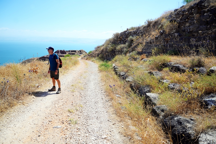
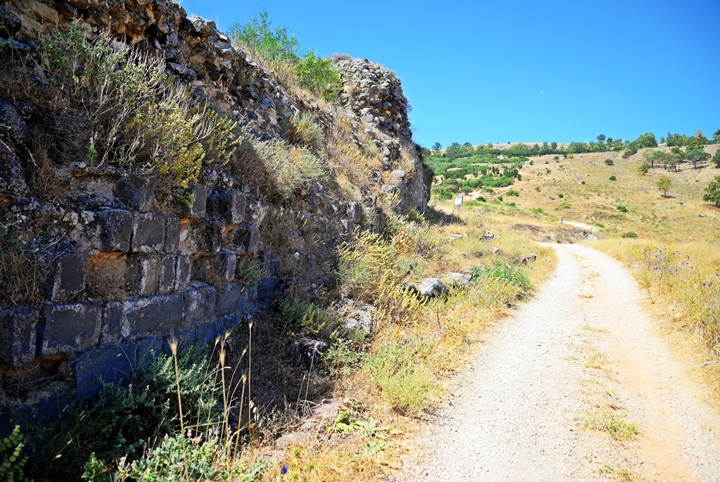
A dirt road leads down from the parking place to the Church. The Byzantine period walls stand on the right (southern) side of the road, while on the left side is the edge of the cliff.
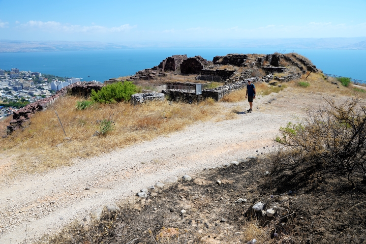
The ruins of the Church overlook the Sea of Galilee and the modern city of Tiberias on the north side.
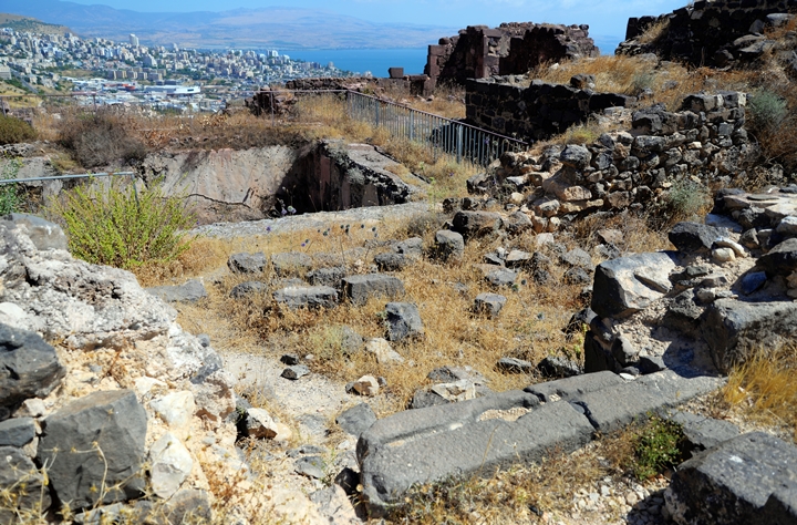
Remains of a gate are located on the western edge of the southern wall. Behind is an open courtyard – the atrium of the church. On the right side are the massive base of the bell tower.
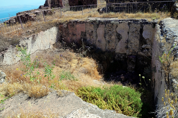
In the courtyard is a large cistern – a water reservoir. It was hidden under the floor, with a capacity of 300 cubic meter.
Outside the courtyard, on its western side, is a round pit, which was part of the water supply complex. It allowed the filth of the runoff rain water to sink before the water was conveyed into the cistern.
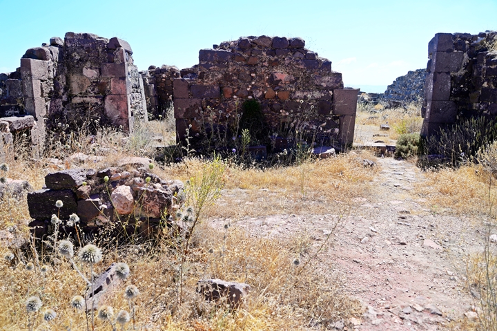
Next to the open courtyard, on the western end of the church, is the narthex – an area just outside the entrance.
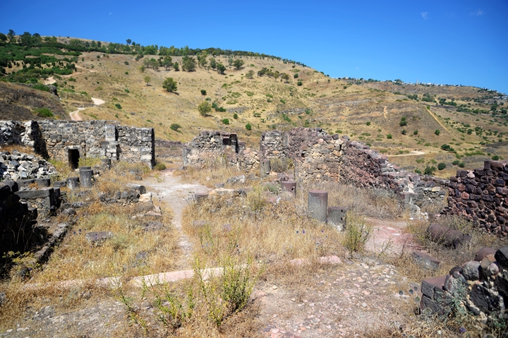
The church was entered thru three openings – a wide central one (here on the right) and two narrow side openings (the northern one is on the left side). Triple entrances is a common plan in many churches in the Holy Land.
Passing the entrances is the prayer hall. The mosaic floor was decorated by colorful fruits (grapes and pomegranates) and birds, and also covered with marble tiles.
The church was built in basilica style. It had two rows of columns and three apses.The columns supported the tiles and wood roof.
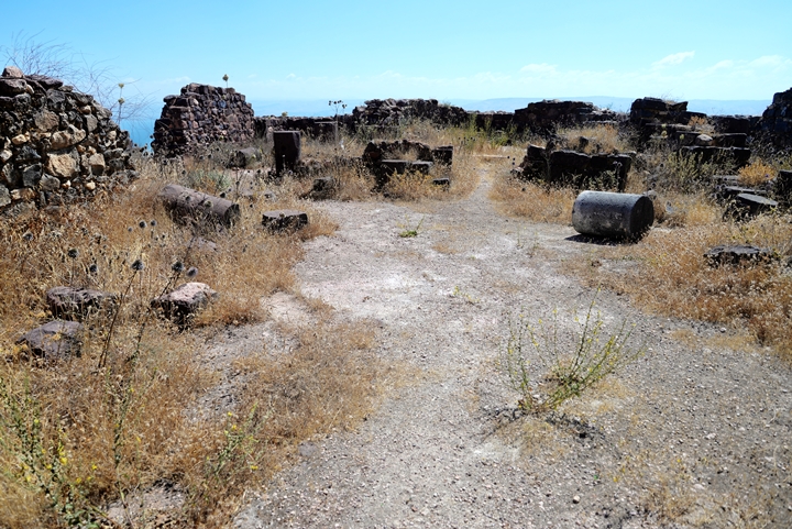
In the photo below is a view of the church from the main apse towards the west.
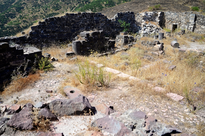
In front of the central apse was a lower area surrounded by benches. It is seen in the photo above between the bases of the columns.
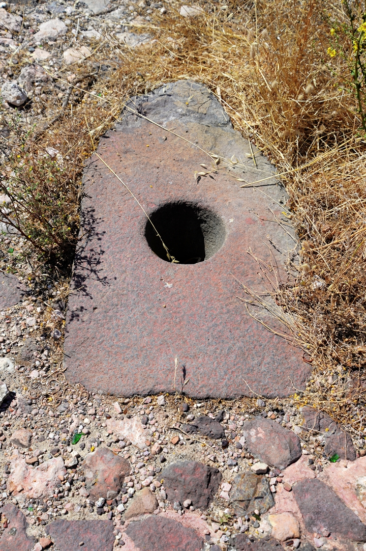
In front, in the middle of the central apse, was the bema – a raised platform with the sacred altar. A marble plate rested under the altar. The archaeologists were surprised to find, just several centimeters below it, a large basalt stone with a hole in its center. This monolithic stone, seen below, is an ancient anchor, once used for mooring fishing boats in the lake below. It weighs 478 kg, 1.1m tall, with a cross section of 35cm x 55cm, and a hole 18cm in diameter.
Since the anchor is much heavier and larger than common ancient anchors, the archaeologist assumed that it was modeled after such anchors but was crafted in larger proportions. This was apparently a sacred relic, perhaps prepared thousands of years before during the Bronze age and later moved to the church. Similar stones were found in other sites in the southern side of the Sea of Galilee, such as in the gate of Beit Yerach.
The monumental stone became the prize highlight of the church, a symbol related to the association of Jesus with the fishermen of the Sea of Galilee. The Sea of Galilee was a central area for Byzantine pilgrimage, and this fabulous church became a pivot for attracting the thousands of religious visitors.
Another view of the main and southern apses:
A western view from the main apse is seen in following photo.
On the hill along the summit is a nature trail – Switzerland park. There is a steep road that descends to the Church, as seen on the left side, but it is recommended to approach the site from the city of Tiberias.
Below is a view of the southern apse. In the far background are remains of the ancient city wall that descended down to the ancient city.
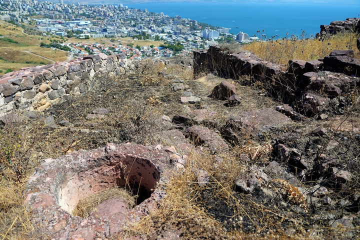
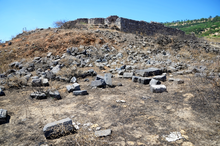
On the foothills below the church are more remains of its walls. A recent brush fire cleared out the weeds, making the area around the ruins more visible.
The church is adjacent to the earlier 6th century (Byzantine period) city walls. A section of the 6th century Byzantine wall, 2.5m wide, passes at the edge of the cliff, on the northern side of the structure. The wall was constructed in order to secure the anchor church within the protection zone of the city.
From Berniki hill are great views of Tiberias and the Sea of Galilee. In this south western view is the southern gate to the Roman city, and the hot springs of Hammat Tiberias.
(d) The city walls
A pair of towers and sections of the wall are located on a higher altitude above the church.
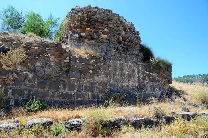
The northern tower, one of two towers that were built here, protected the western entrance to the city. Each tower is 7.5m square, once reaching a height of 15m.
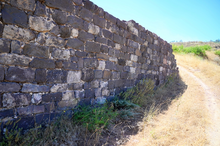
The road down to the Church passes along a section of the 6th century wall that was built on the cliffs above the city. The wall reaches a height of 6m, but was 8-10m during the Byzantine period. It is build of cut basalt stones, with cement holding the stones together.
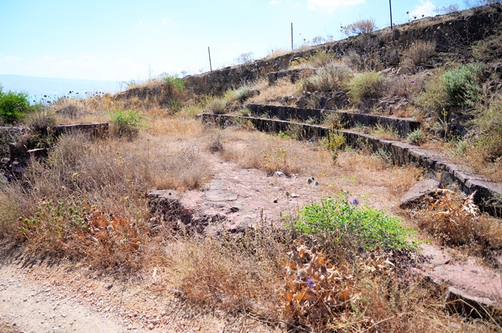
Near the road down to the church are stone benches arranged in a semicircular design.
Etymology:
- Berniki – Greek for “Bearer of victory”; Berenice, Bernice – Roman form. Veronica – Latin form. Queen Berniki was the sister of Herod Agrippa II, and Grand daughter of Berenice daughter of Salome (sister of Herod the Great).
Links:
* External:
- The sacred stone of Mt. Berniki Times of Israel
-
The “Anchor Church” at the Summit of Mount Berenice near Tiberias” – Y. Hirschfeld (https://www.jstor.org/stable/23681299).
* Internal – sites of Tiberias:
BibleWalks.com – enter the gates of the Holy Land
Tiberias Theater <<<–previous site—<<< All Sites>>> —-next Sea of Galilee site –>>> Skull cave
This page was last updated on July18, 2020 (Add details and photos)
Sponsored links:
