Remains of a Crusader fortified farmhouse, in the center of et-Taiyibe in the Jezreel valley.

* Site of the Month Oct 2018 *
Home > Sites > Yizreel Valley > Taibe in the Galilee (et-Taiyibeh)
Contents:
Background
Location
History
Photos
* General views
* Aerial views
* Mosque, center
* West
* East
* North
* South
* Farmhouses
Links
Etymology
Background:
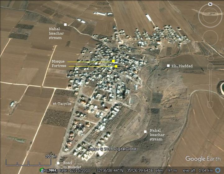
Remains of a Crusader fortified farmhouse (“Le Forbelet”). The foundations of its tower, walls and farm houses are located in the center of a Muslim village (et-Taiyibe, meaning: “the goodly”) in the Jezreel valley, near the stream of Nahal Issachar.
Location:
The village of et-Taiyibe is located in the Jezreel valley, west and north of Nahal Issachar stream. A single road (#717) leads 2km south to the entrance of the cooperative village of Moledet (Bnei Brit), and from there to the main highway (#716 – Ein Herod to Endor). The antiquities are mostly buried under the modern houses and in the ruins of Khirbet Haddad east of the stream. In the center of the village, adjacent to the mosque, are the remains of the fortress and a some structures.
History:
-
Canaanite period (Bronze Age)
The ancient site during the Canaanite period is identified by scholars as Tubi. The city is mentioned in the the lists of the Egyptian pharaoh Thothmes III (reigned 1479-1425 BC), which were captured when Megiddo fell.
Thothmos III (Thutmosis III) conducted the great campaign against the Canaanites, winning the battle of Megiddo. In the Karnak temple complex, near modern Luxor, is a wall with Egyptian hieroglyphs listing 119 place names, depicted by icons of princes with their hands tied behind their backs.
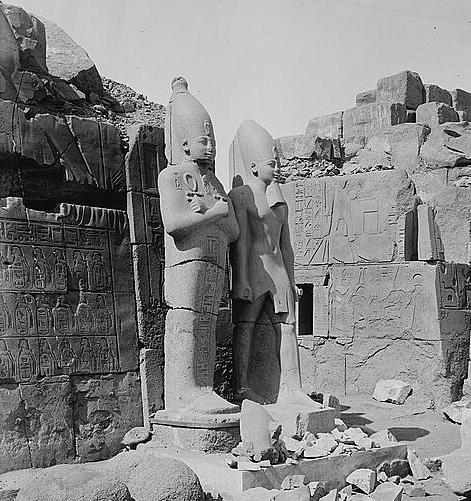
Statues of Thothmes III in Karnak, with a conquest wall at left
Photo of the Library of congress (American Colony, taken 1900-1920)
Potsherds dating to the Early Bronze Age were found in the vicinity of Horbat Haddad, east of the modern village.
-
Israelite period (Iron Age)
After the conquest of Canaan by the Israelites, the area was within the inheritance of the tribe of Issachar.
The site was also identified by some scholars as Ophrah – the city of the judge Gideon. (Judges 6:11: “And there came an angel of the LORD, and sat under an oak which was in Ophrah, that pertained unto Joash the Abiezrite: and his son Gideon threshed wheat by the winepress, to hide it from the Midianites”.
Some of its remains are located east of the village in the ruin named Horbat Haddad. The name Ophrah was translated to the Arabic name Taibe, meaning: “good”.
The cities and villages (circles) and roads (dashed lines) during the Canaanite to Roman periods are indicated on the Biblical Map below. The site is indicated in its center as a red dot. Although it is not situated along a major road, there was a route that passed nearby, connecting the ancient highway south of Mt. Tabor, via Endor, to Beth Shean.
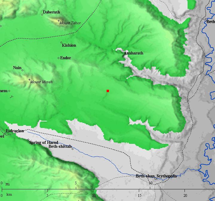
Map of the area around the site (marked by a red circle) – during the Canaanite to Roman periods (based on Bible Mapper 3.0)
Potsherds dating to the Hellenistic period were found in the vicinity of Horbat Haddad, east of the modern village.
-
Roman/Byzantine
The town grew in the Roman and Byzantine period and covered a large area – now occupied by the modern village. On the north east side of the village was the graveyard of the Roman city, as several sarcophagi (stone coffins) were found in archaeological surveys. According to the finding of a decorated bronze incense shovel, it was a Jewish town.
Excavations on the east and north side of the modern village, and surveys conducted around the village, revealed architectural remains and other findings (pottery, glass, metallic) dating to the Roman and Byzantine periods. Two pools were exposed along Nahal Issachar that were filled by an aqueduct, and were dated to the Byzantine period.
-
Crusaders
The Crusader fortified farmhouse (named “Le Forbelet”) is located only 7KM west of the Belvoir Crusader fortress. It defended the Crusaders passage to their strongholds in Mt Tabor, Beit Shean and Afula. The fortress was occupied by the knights of the Hospitallers order. This quasi-military structure was probably constructed in 1168, on Roman foundations. This was the same year the main fortress of Belvoir was constructed, in order to fortify the north eastern front of the Crusader Kingdom.
Battle of Forbelet – 1182
In May 1182 a 2-year truce between Saladin and the Crusaders ended. Saladin then attacked and conquered Crusader castles in Beit Shean and Tabor.
On 13 July a large battle in an open field was fought near Le Forbelet, between Saladin’s forces and the Crusaders headed by king Baldwin IV. Saladin’s forces were 20,000 strong, much larger than the Crusader forces of 700. It ended as a tactical draw. Both forces retreaded with light losses, but the Crusaders demonstrated tactical military superiority to overcome the larger army. It was a substantial defeat to Saladin.
The castle was sacked by Saladin in 1183, but then restored by the Hospitallers. During the campaign against Belvoir (1187/88) the castle was used as a Arab base to besiege Belvoir.
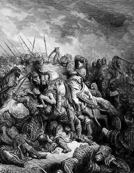
Battle of Arsuf between Richard the Lionheart and Saladin (1192 – 10 years later)
– illustration by Gustav Dore (French artist, 1832-1883)
The tide against the Crusaders turned after 5 years when Saladin’s forces defeated the Crusaders in the decisive battle of Hittim (July 4, 1187). Following this victory, the Galilee remained without a regional force that could repel the Ayyubid forces, and the fortified Crusader cities – Acre, Tiberias and Haifa – were captured. The Belvoir fortress was on siege for a year and a half. But on January 5, 1189, the Muslim fighters managed to knock down the eastern tower and walls of Belovoir, resulting in the surrender of the defending Knights.
These defeats led to the 3rd Crusade (1189-1192), headed by Richard the lionheart (Richard I King of England), in an attempt to re-conquer the Holy Land from Saladin. The Crusaders managed to reclaim most of the lost land, but failed to recapture Jerusalem.
After 100 more years of turmoil, the Crusaders kingdom of Jerusalem finally fell in 1291.
-
Mamelukes (1250-1516 AD)
The Mamelukes were Turkish prisoners who were sold to the Sultan of Egypt, trained by him and served as his palace guards. In 1250 they seized the control of Egypt. The Mamelukes controlled the Holy Land for the next 250 years.
The fortress was used by the Mamelukes (renamed Afrabala) and the town grew around it. Excavations on the east and north side of the modern village exposed revealed architectural remains dating to this period.
-
Ottoman Period – (1516-1918 A.D.)
The site was examined in the PEF survey (1866-1877) by Wilson, Conder and Kitchener. A section of their survey map is below.
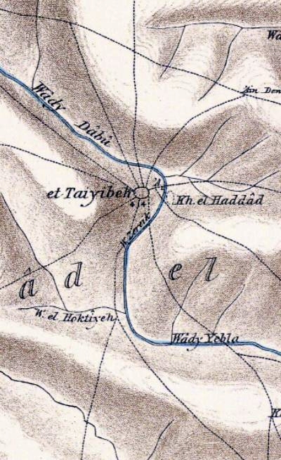
Part of Map sheet 9 of Survey of Western Palestine,
by Conder and Kitchener, 1872-1877.
(Published 1880, reprinted by LifeintheHolyLand.com)
They described the site (volume 2, p. 87 and 127):
“Taiyibeh – A straggling village, of moderate size, lying on flat ground, and containing several good stone houses. There is one in the middle of the village, belonging to the Sheikh, which is larger than the rest. A muddy pool was observed near this house, and a spring east of the village. A few scattered blocks of hewn basaltic stone were lying here and at the ruin close by (Khirbet el Haddad), but no other signs of antiquity were observed. The Sheikh’s house, which resembles a tower, is not built of very good masonry.This place is perhaps the Tubi of the Lists of Thothmes III., mentioned next to Sarana (Sarona, .Sheet VI), the name being identical.
Et Taiyibeh – This village, poor and miserable, is now nothing but a wretched relic of an important city, situated on the slope of a hill whose summit was surrounded by a fortress. This was formerly constructed of very fine basaltic blocks, cut and dressed with care ; a ditch cut in the rock and now three-fourths filled up surrounded it, at least on the south and west. There remain of this stronghold several thick parts of the wall, and within vaulted magazines which now serve the fellahin for refuge : rude dwelling-houses have also been built within the enclosure. One of these houses, more considerable than the others, and partly constructed of good basaltic stones taken from the ruins of the fort, occupies the top of the acropolis, which I regard as ancient, although allowing that it may have received attention from the Mohammedans or the Crusaders. As for the city, which extended to the north and east of the castle, it now, with the exception of a few courses still upright, presents nothing but a heap of ruins. (Gurin, ‘Samaria,’ i. 126.)”
During the Ottoman period (~1873), Bedouins of the Zoabi clan were invited by the Ottomans to immigrate from Irbid, Jordan, to the plains of Isschar. Their original came from Iraq. The Zoabis populated a dozen or so villages around the area of Mt. Givat Moreh, and their leadership is in Nazareth.
-
Modern Times
The modern town of Et-Taiyibe was founded in 1920 by the Zoabi clan, which is one of the largest and most influential families in the town. The Zoabis are known for their political activism and have played a significant role in the town’s history and development.
The name “Et-Taiyibe” is derived from the Arabic word for “good,” and is thought to reflect the area’s fertile land and agricultural abundance. This name, et-Taiyibeh, is a common name for a dozen Arab villages in Israel, and that’s why a prefix of “the Galilee” or “the valley” is added here. One of the other Taiyibeh villages are in the northern Gilead mountain region near Irbid (origin of the Zoabi clan) – perhaps another reason for using this name.
The castle was surveyed by D. Pringle (published in 1991). The ruins are in bad shape and we hope that the site will undergo conservation works and open to the public.
Photos:
The tour of the site was with Uncle Ronnie, who lives nearby and has many friends and co-workers in the village.
(a) General Views
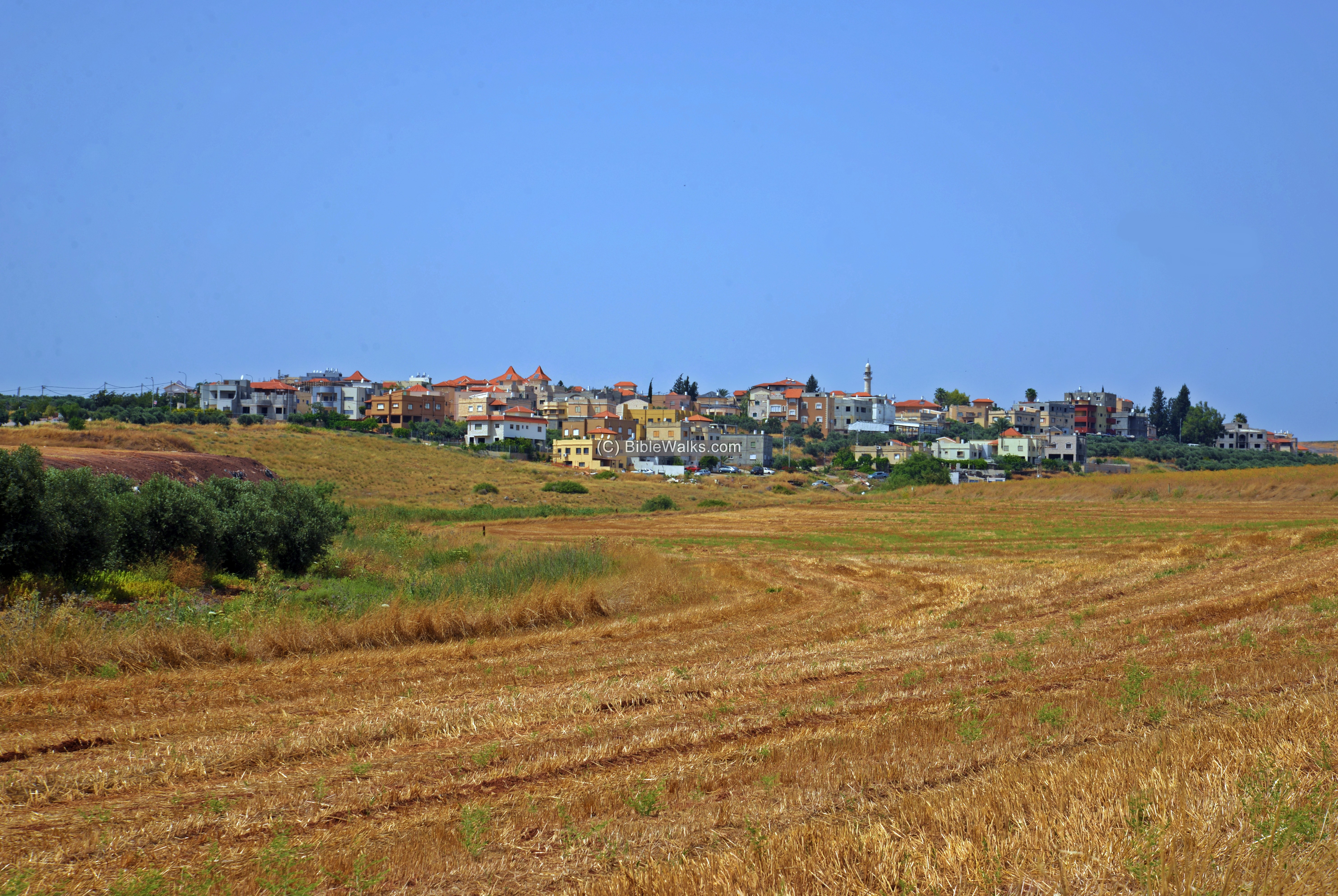
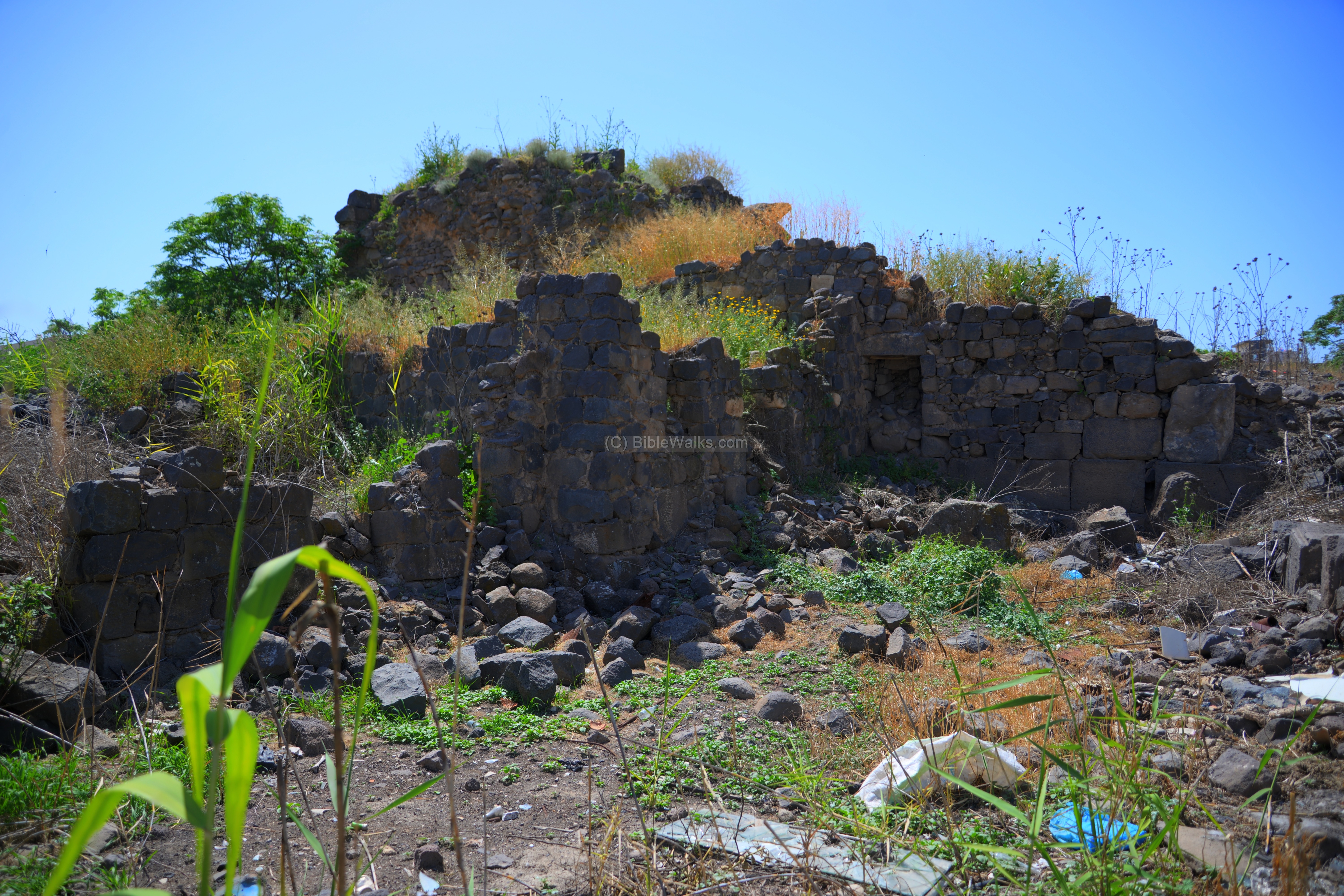
A view of the village is seen here from the south east.It grew out of the center, and is surrounded by farming fields.
The stream of Nachal Issachar passes thru the village and along its eastern side.
(b) Aerial views
A drone captured this view of the center of et Taiyibeh from the northeast side. On the right is the mosque. In the center are ruins of the Crusader fortress. On the left are remains of the Crusader and Mameluke town.
Click on the photos to view in higher resolution…

A closer aerial view of the fortress is seen next, captured from the east side.
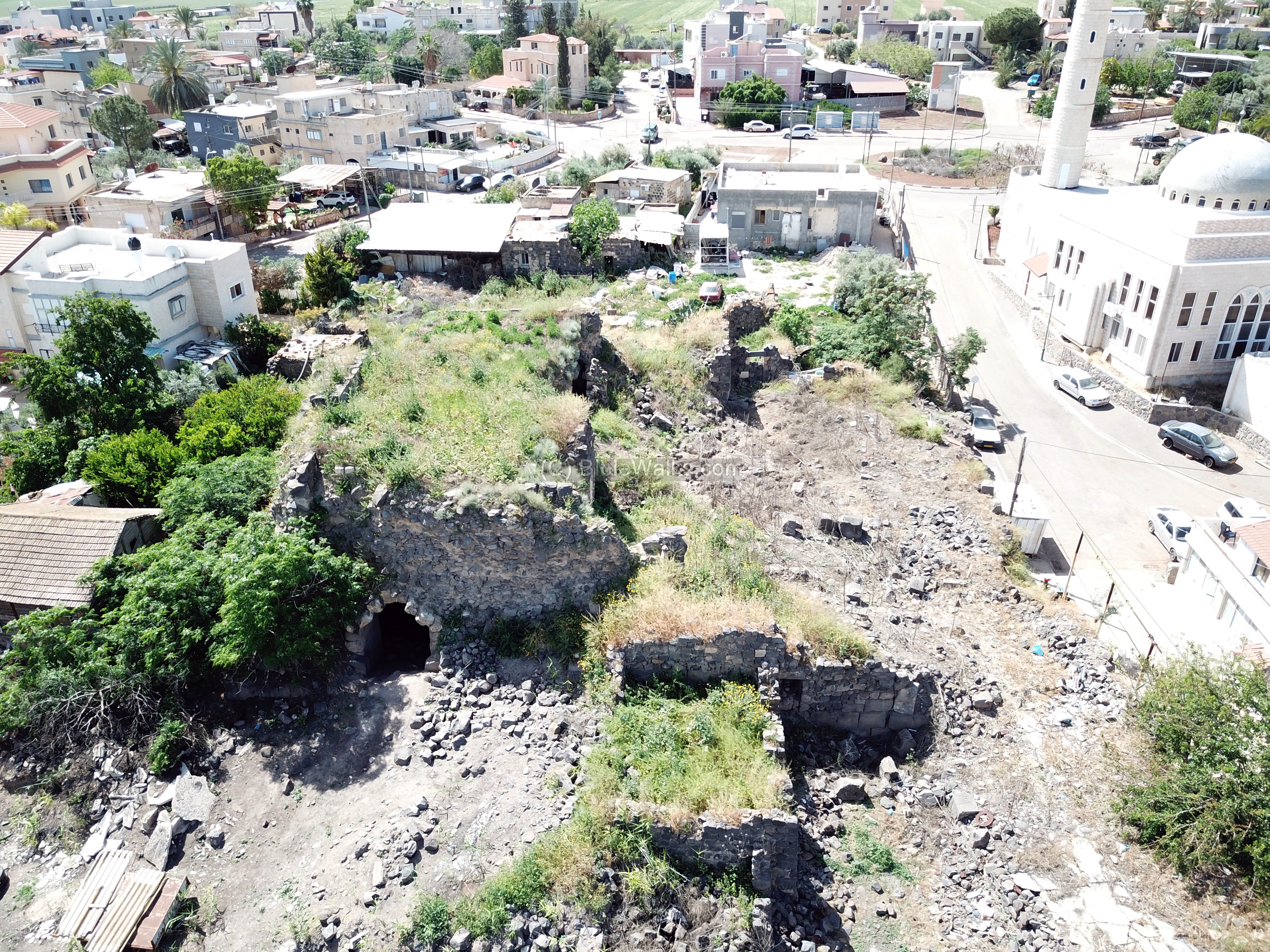
The following photo is a vertical view of the fortress.

![]() This YouTube video shows a flight over the site:
This YouTube video shows a flight over the site:
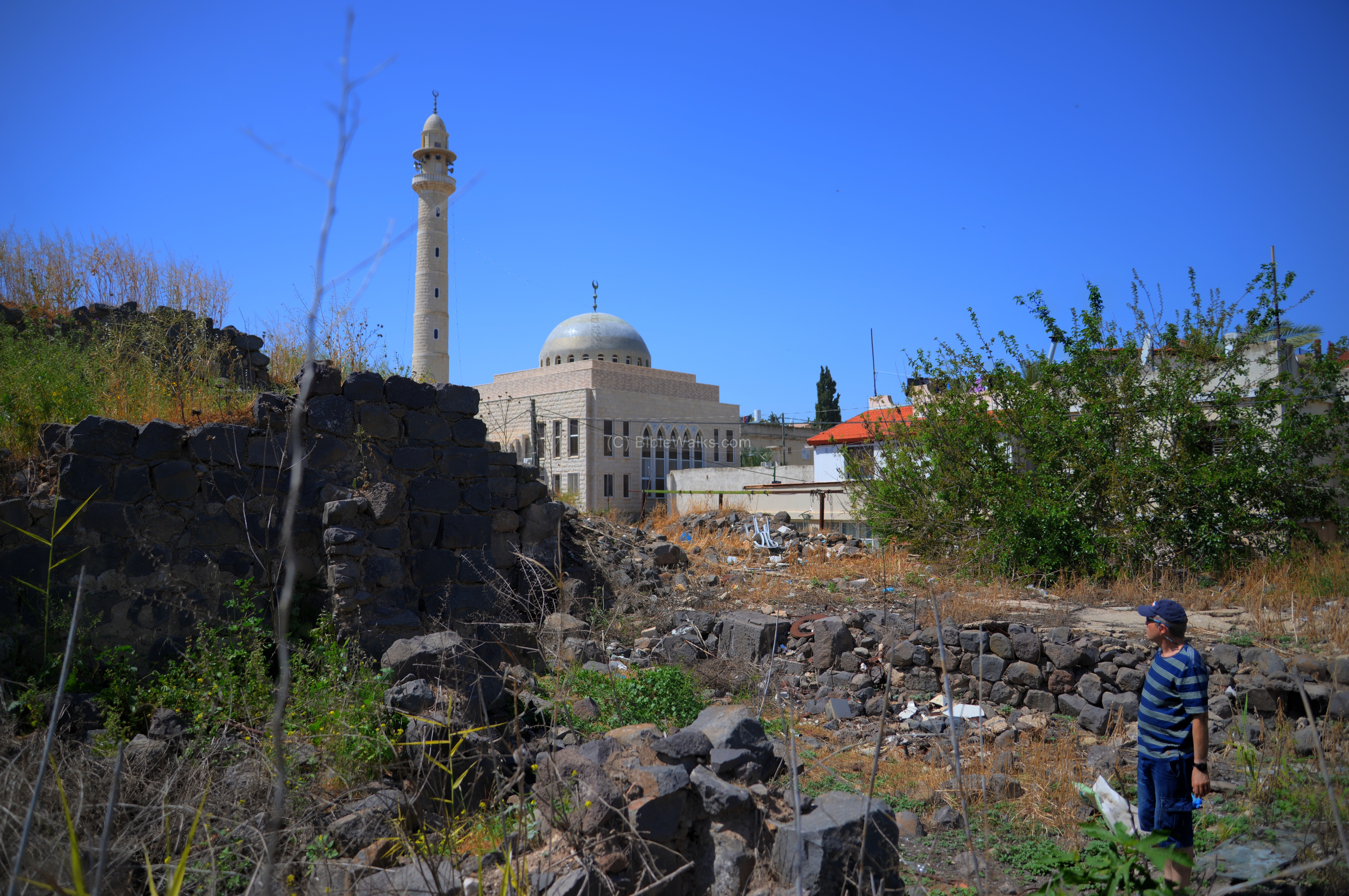
(c) Center of village, Mosque
In the center of the village is the mosque. The minaret (call-for-prayers) tall tower and the structure of the mosque is viewed here from the west side.
In 2008 the villagers painted the dome of the mosque in blue and white colors – Israel’s national colors. This was an unusual gesture of solidarity for the country’s 60th birthday.

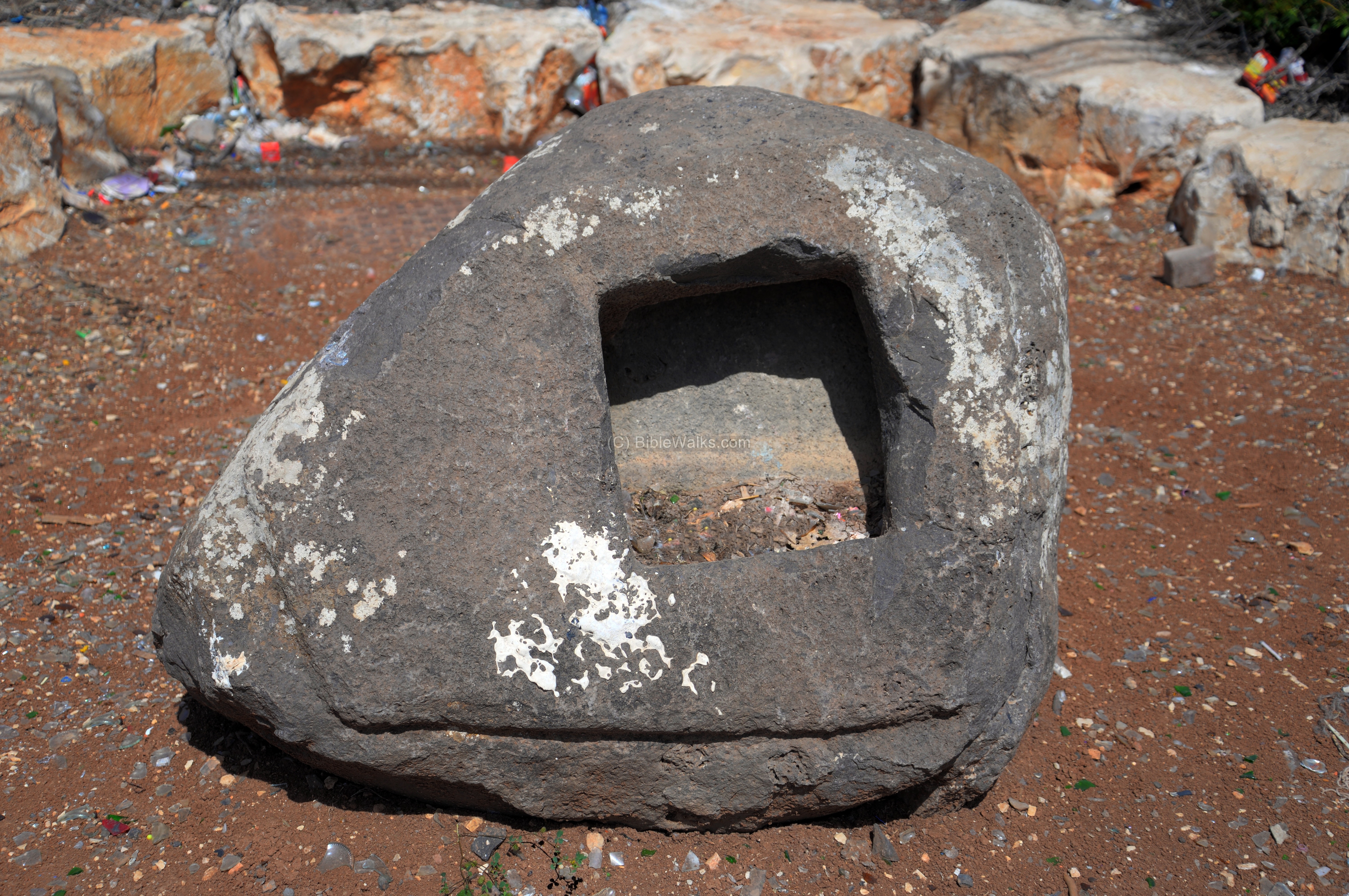
In the center of the roundabout, west of the mosque, is a carved in basalt stone. Perhaps, a foundation stone from one of the ruined structures.
(d) West side
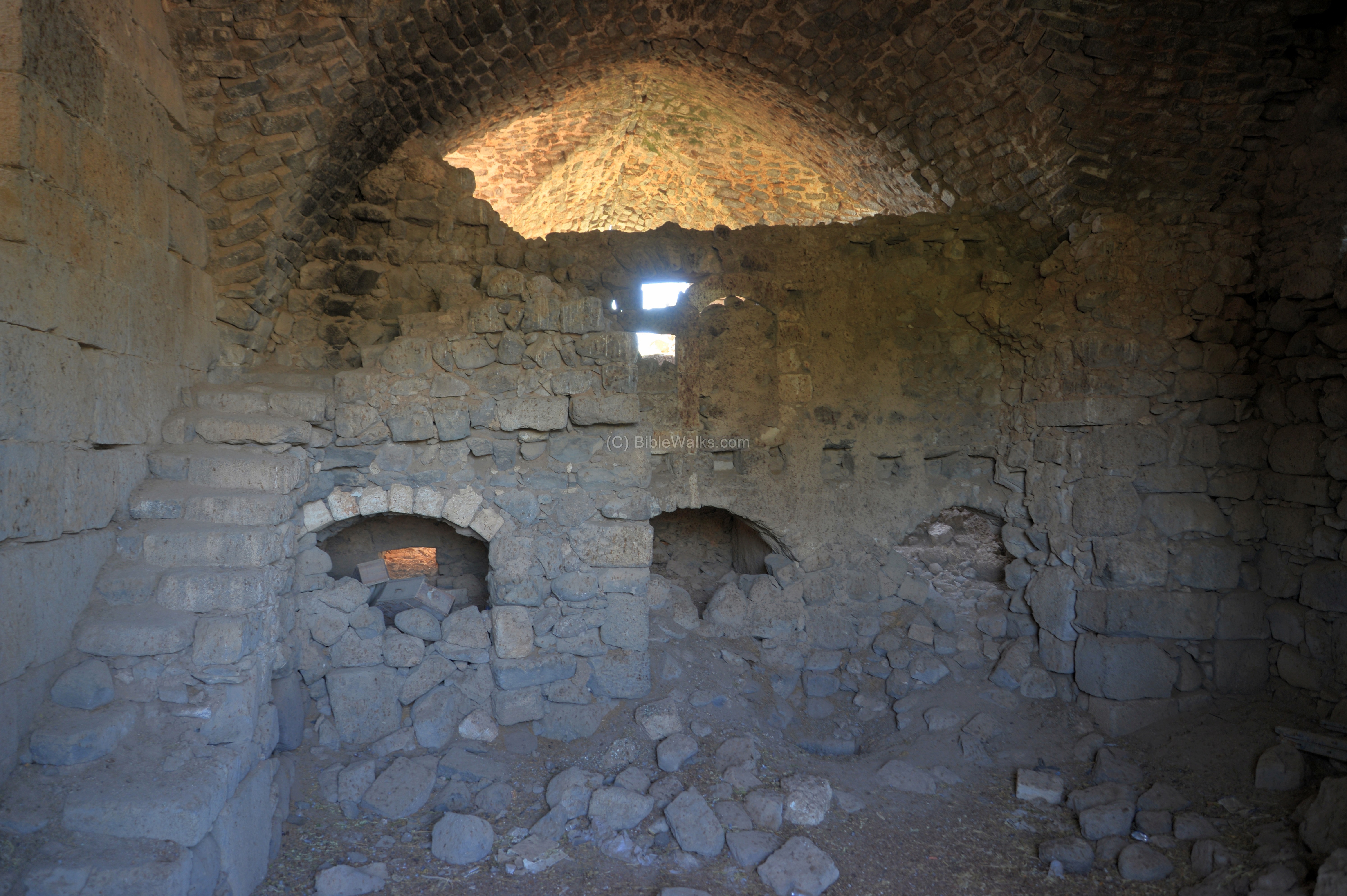
The castle consisted of a strong tower-keep, with a square (26.3m) plan. The tower had 4 groin-vaulted bays.The vaults were supported on massive central pier (2.1m square) and the walls are 4.1m thick.
* Note: A groin (or cross) vault is formed by the perpendicular intersection of two barrel vaults. It was in use since 1050 AD.
This photo shows a western view of the ruins.
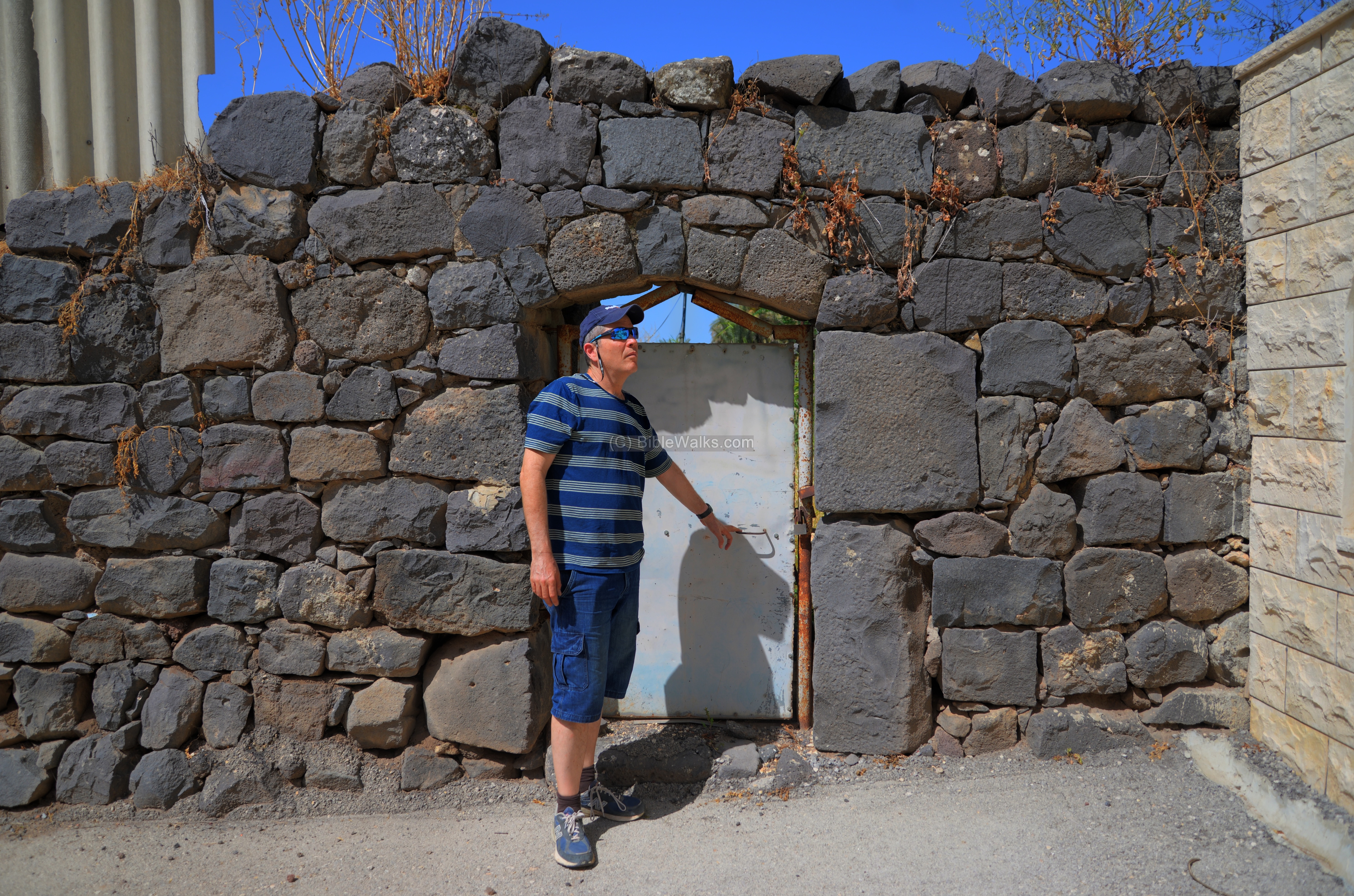
(e) East side
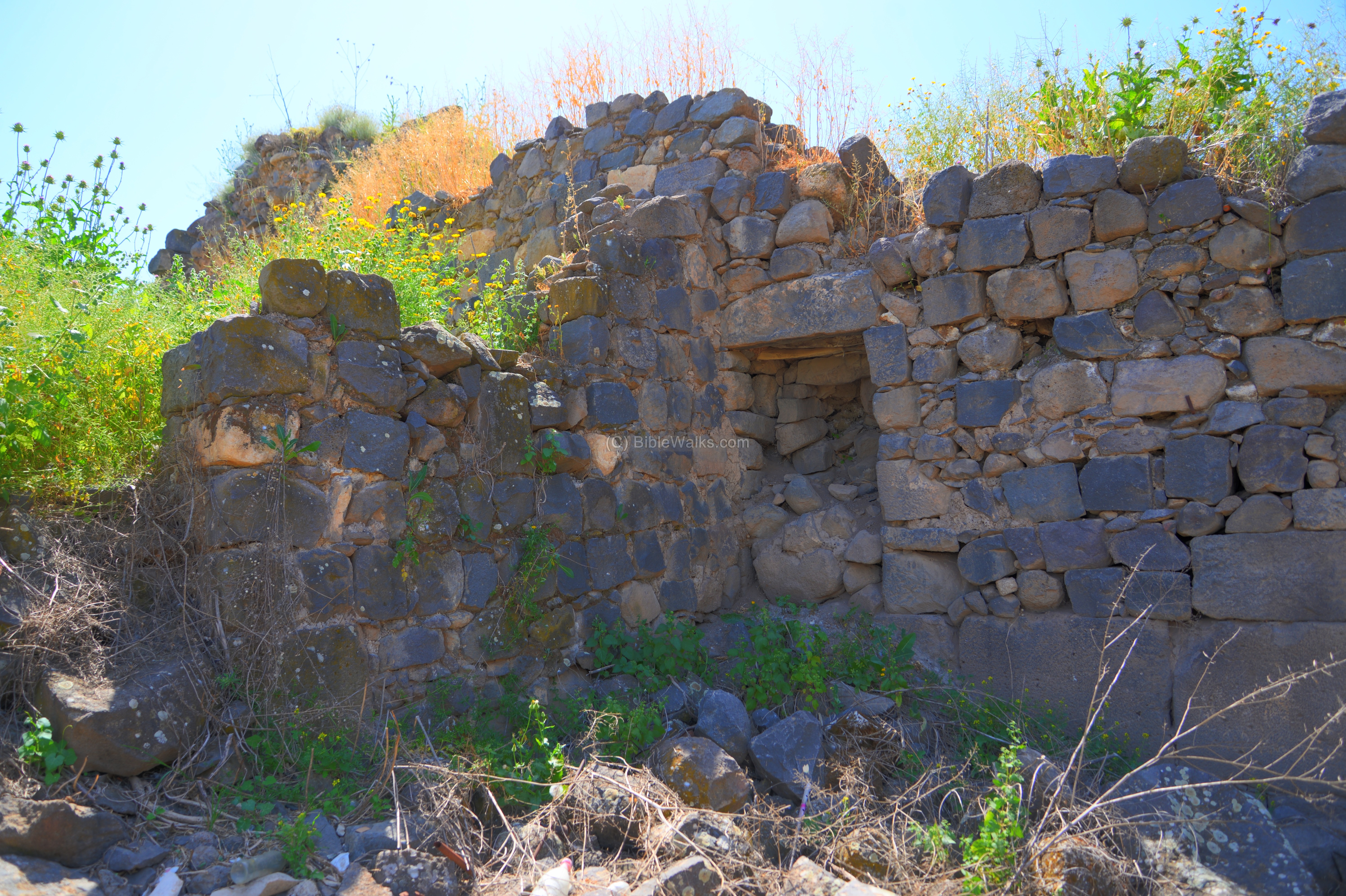
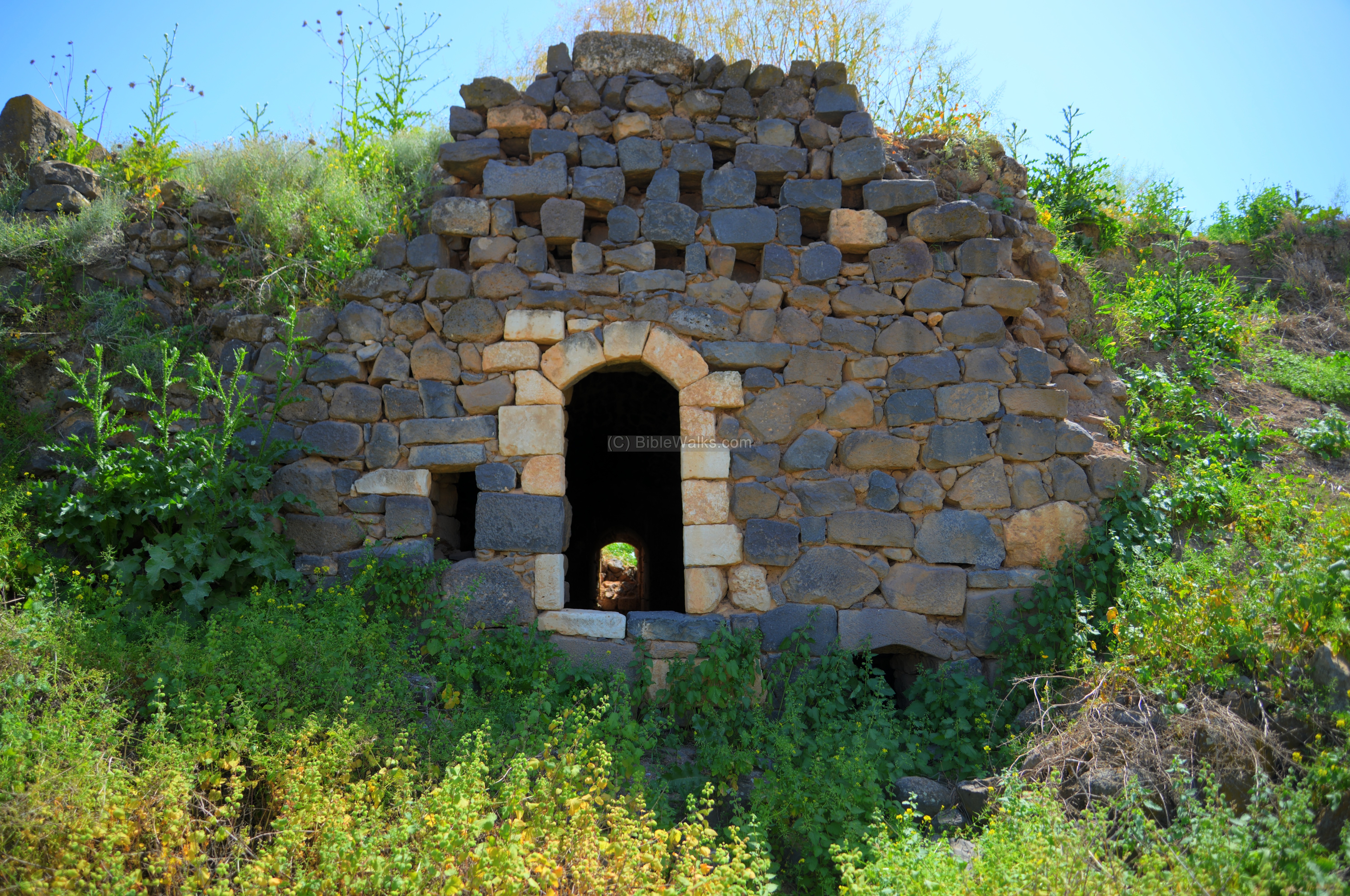
The entrance to the basement of the tower is from the east side.
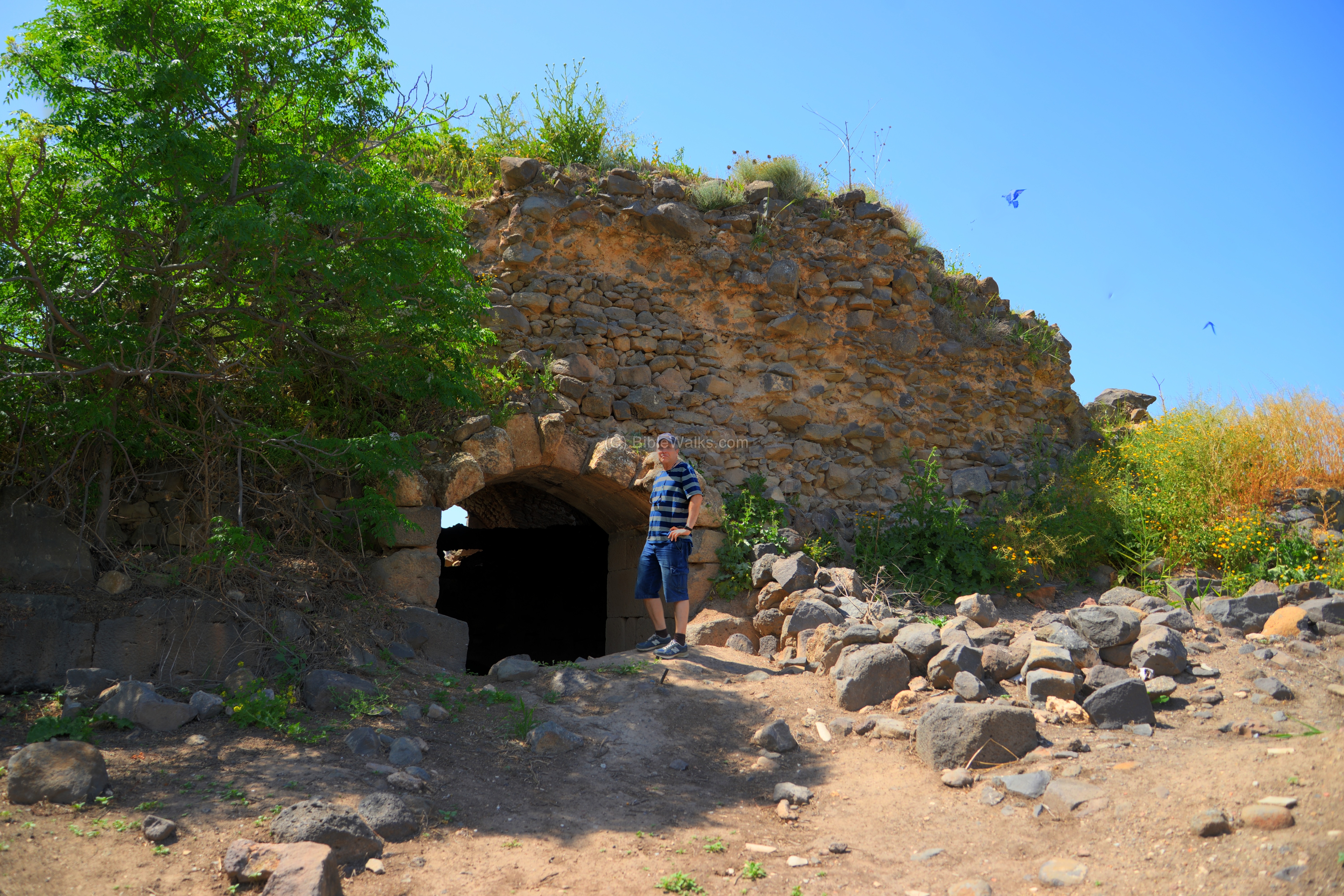
Only the south half of the basement of the tower survives.
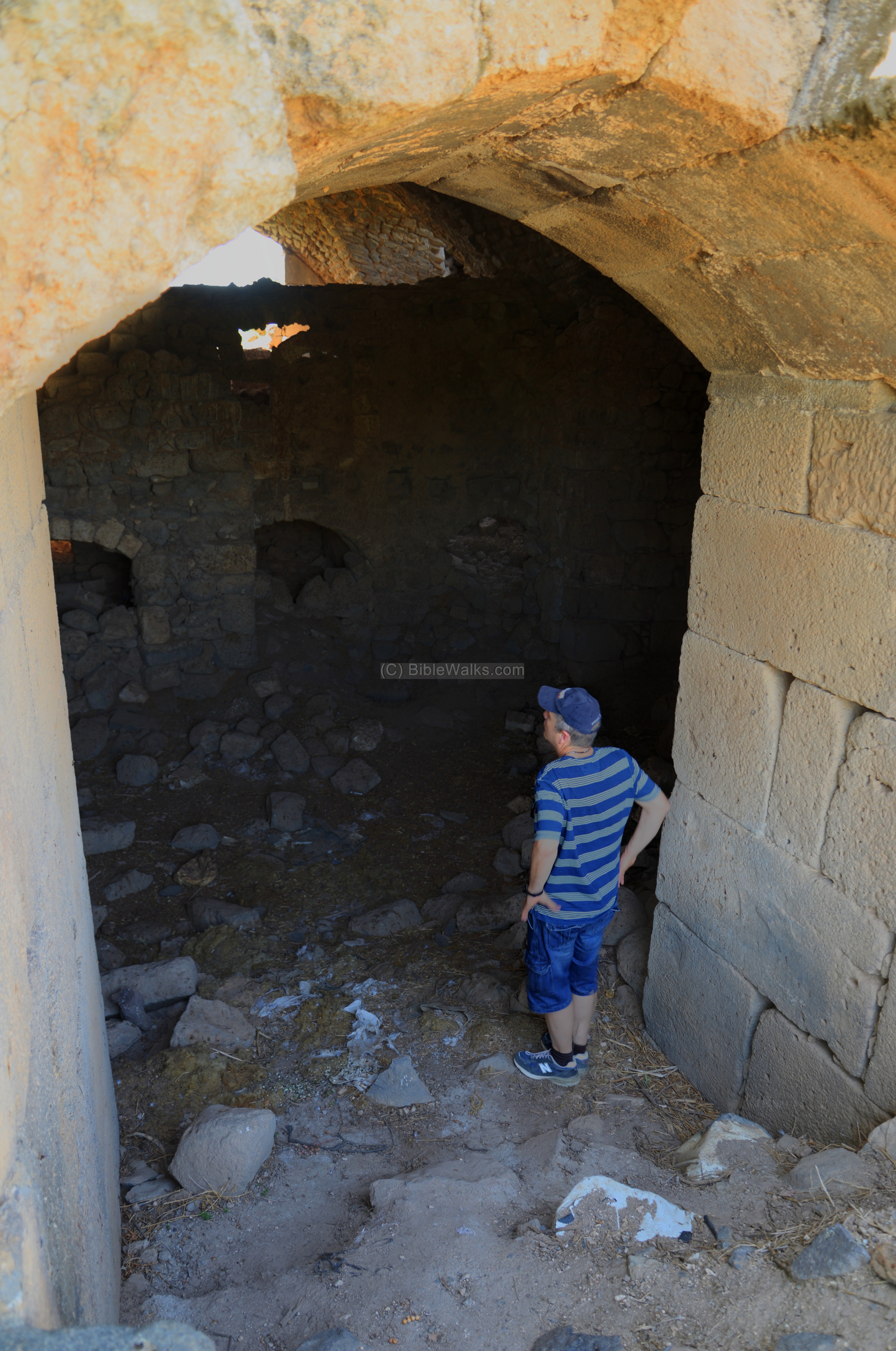
In the photo below is a view of the interior of the tower’s basement. The staircase on the left side is modern.
Notice a hole in the ground in the center, behind the pile of rocks. We did not try to descend into it, but a villager told us that there was an escape tunnel that led from the castle to the stream (150m to the east).
The villager also told us that this place is spooky and he dares not enter into here. This was due to an old practice of placing the corpse of a deceased villagers before it was carried to the nearby graveyard.
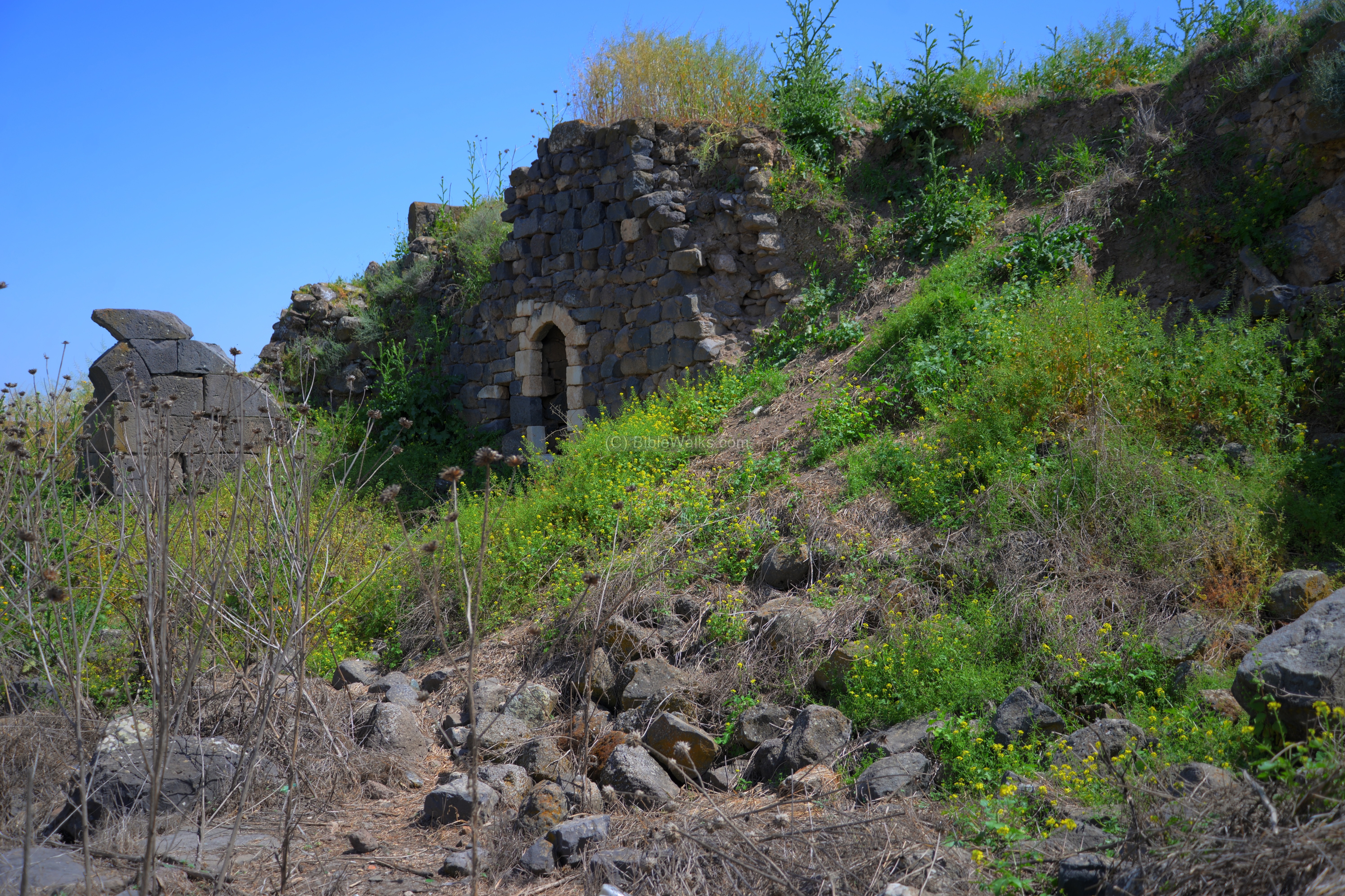
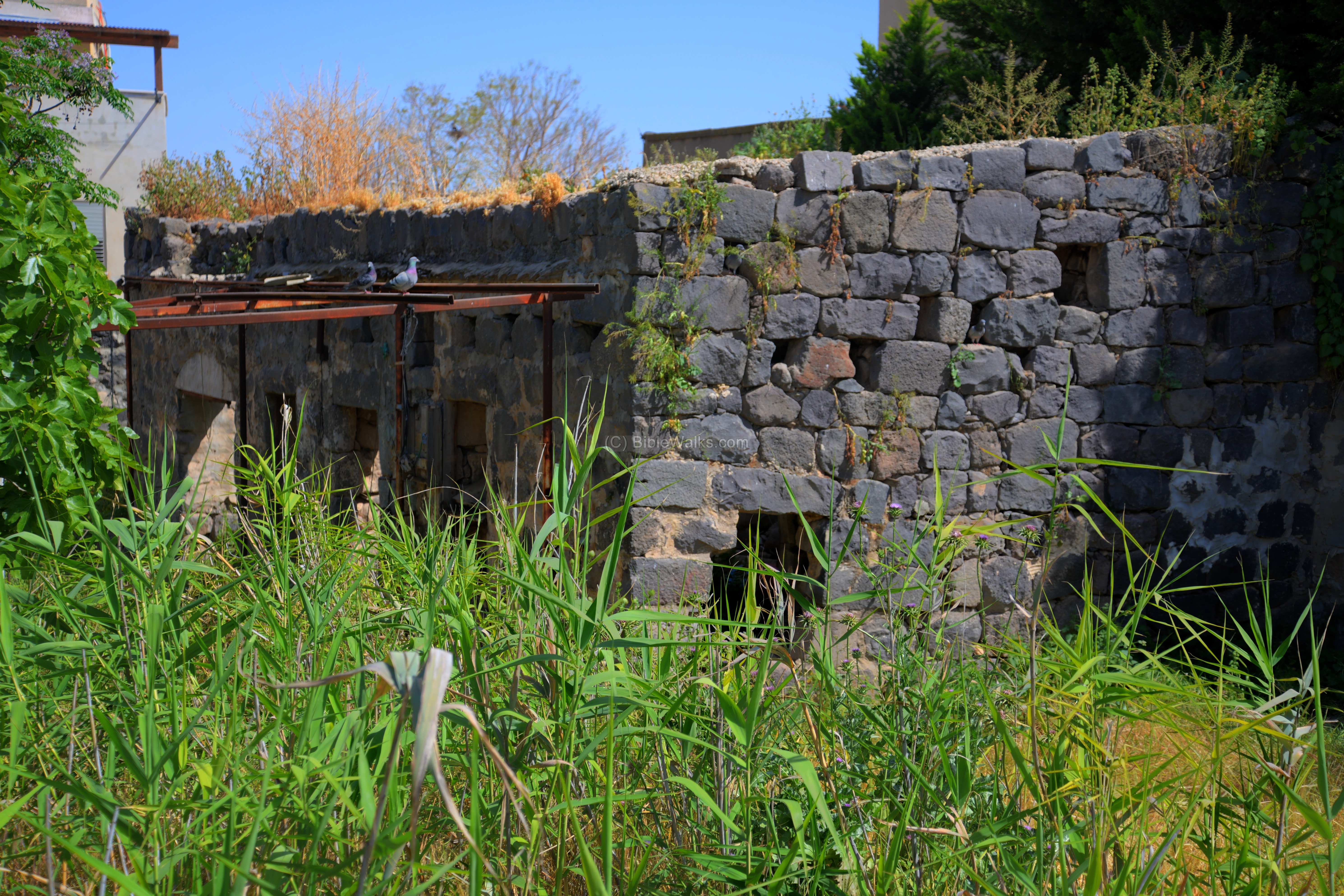
On the north side of the entrance are more remains of the fortress.
A closer view of the north east side of the ruins. Unfortunately, there is much garbage scattered around here.
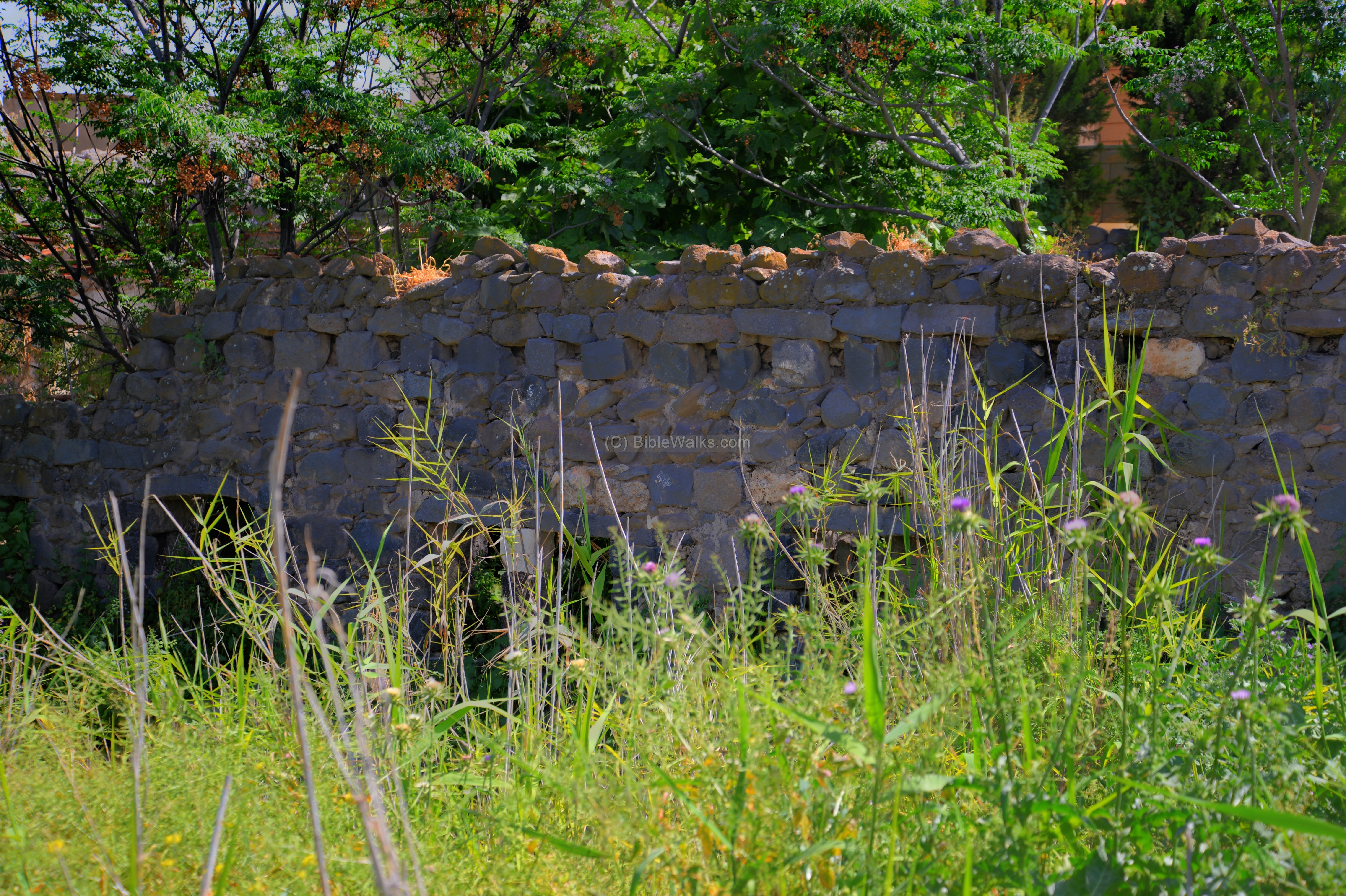
(f) North side
The north side of the ruin is adjacent to the mosque.

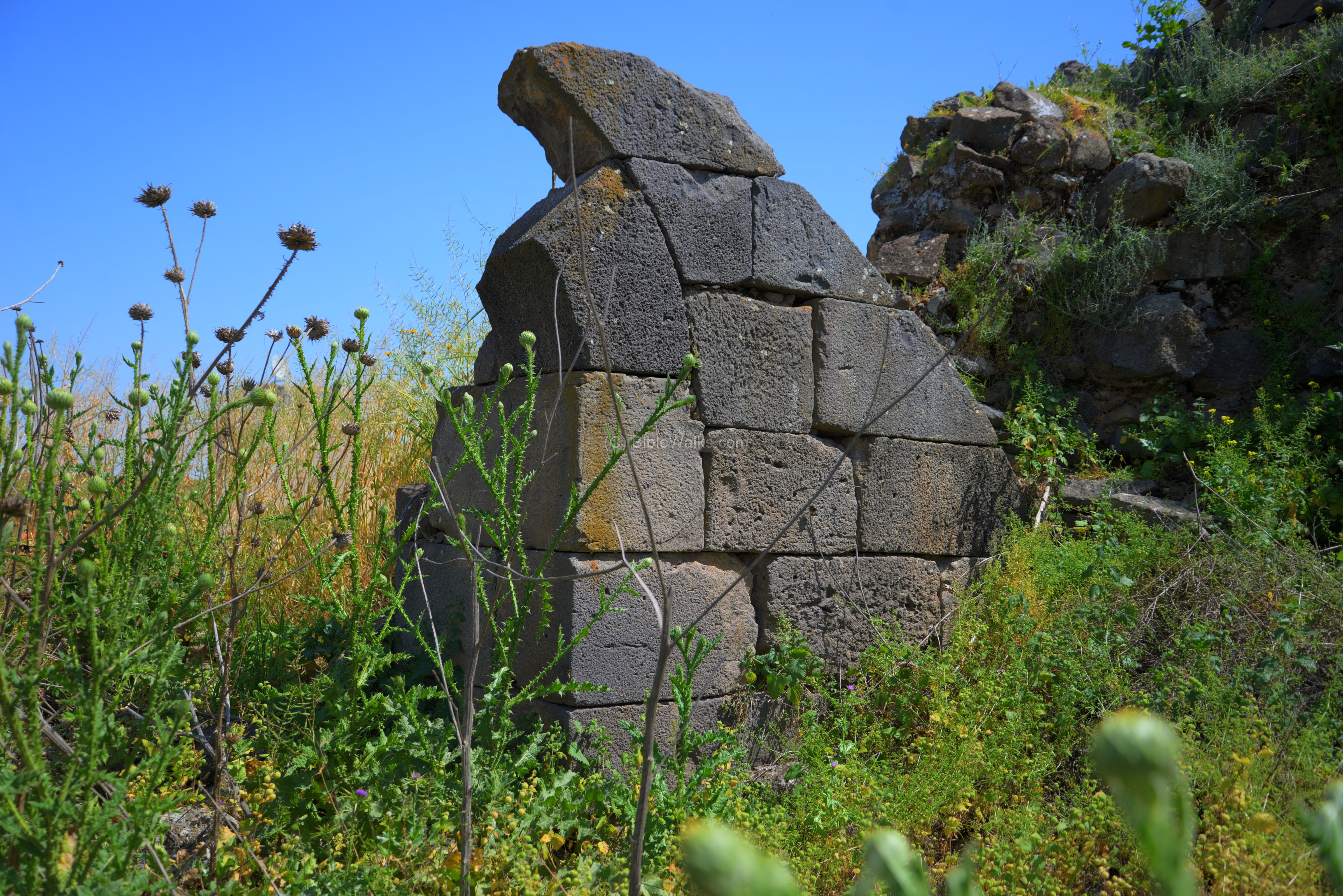
Another view of the northern wall:
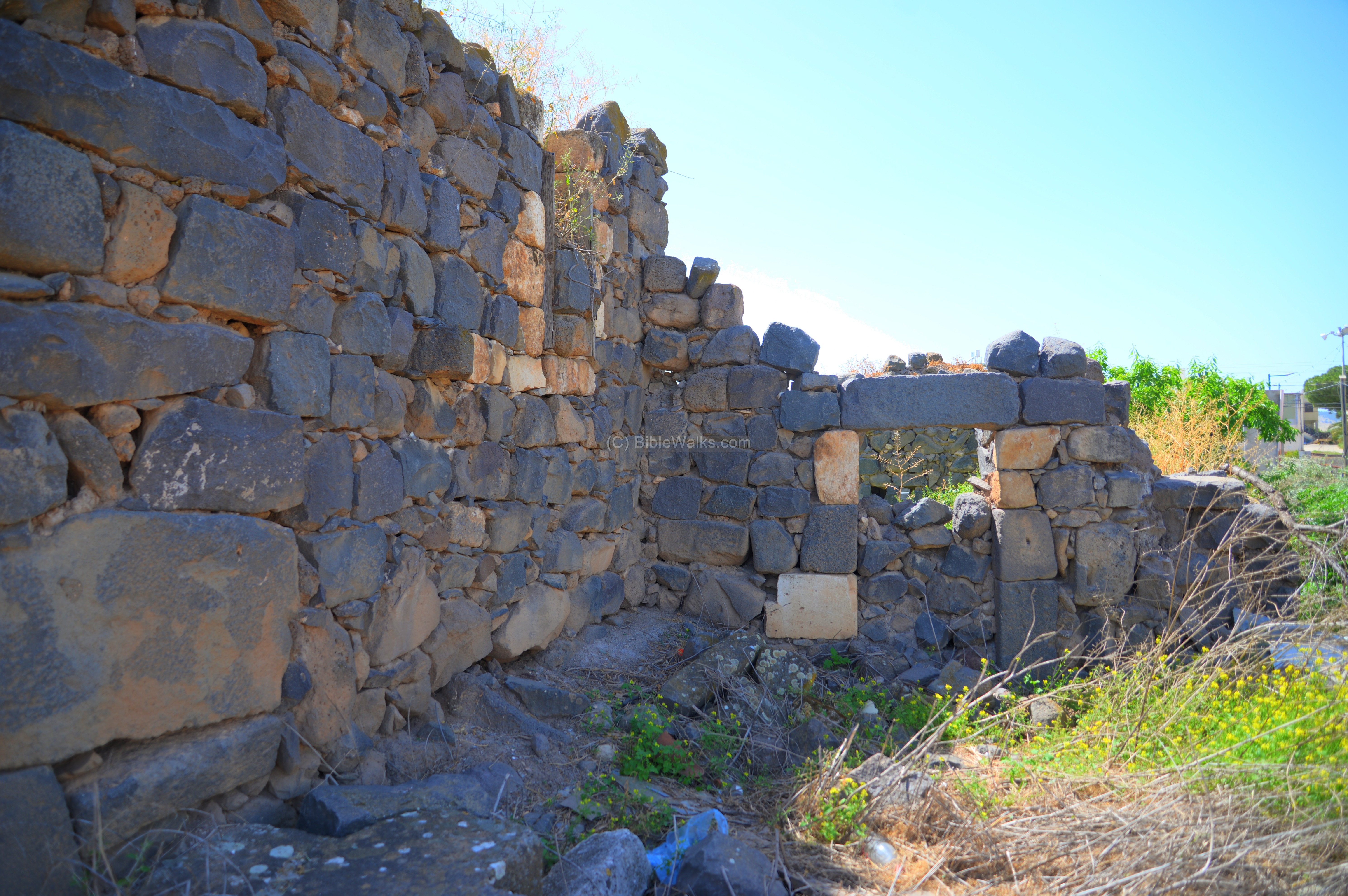
Another section of the wall:
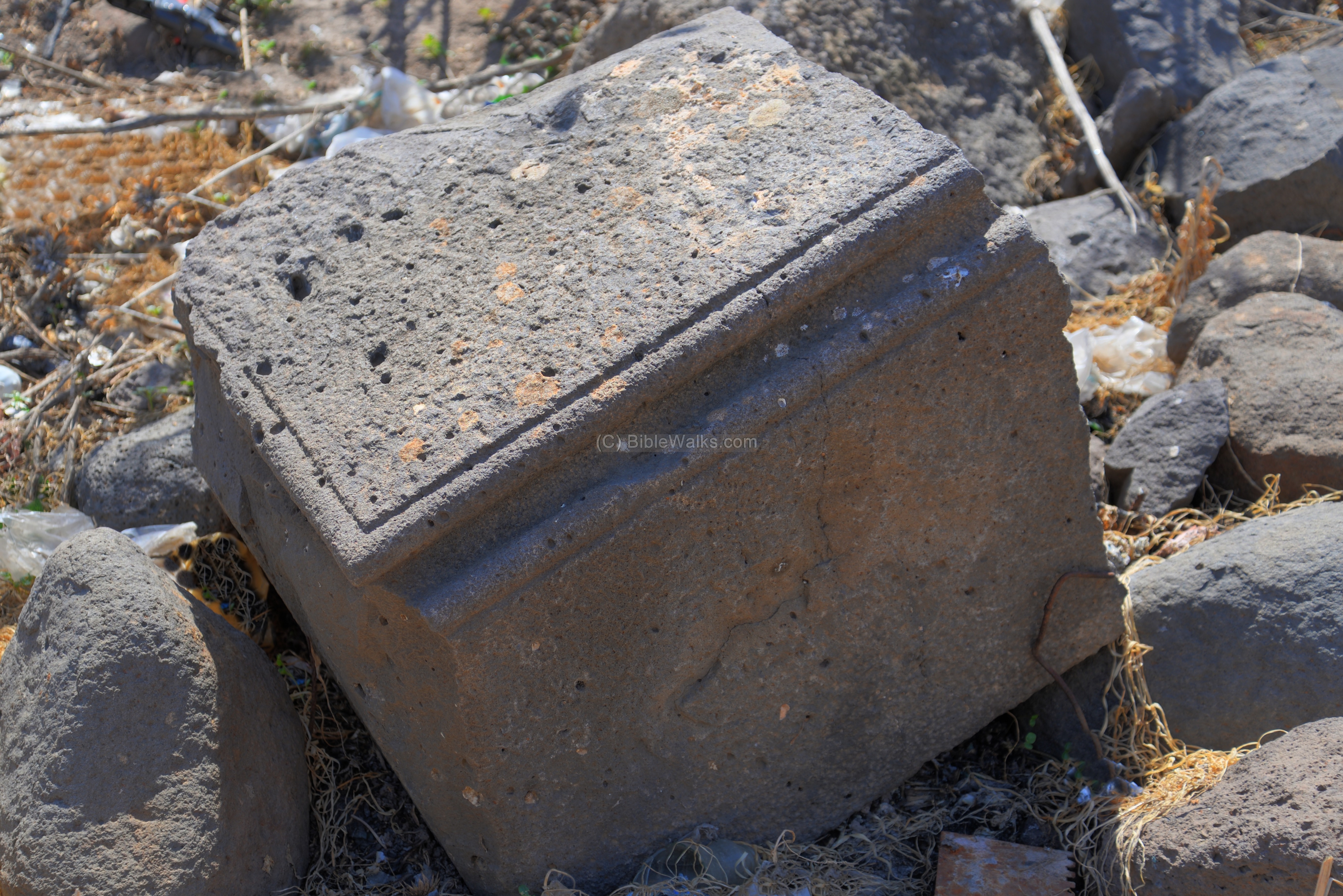
Among the rubble surrounding the northern section are some interesting building blocks:
The excavations conducted next to the fortress revealed three strata – Crusader, Mameluke and Ottoman. No remains predating the Crusader period were yet exposed.
A view towards the east:
A closer view of the arched window:
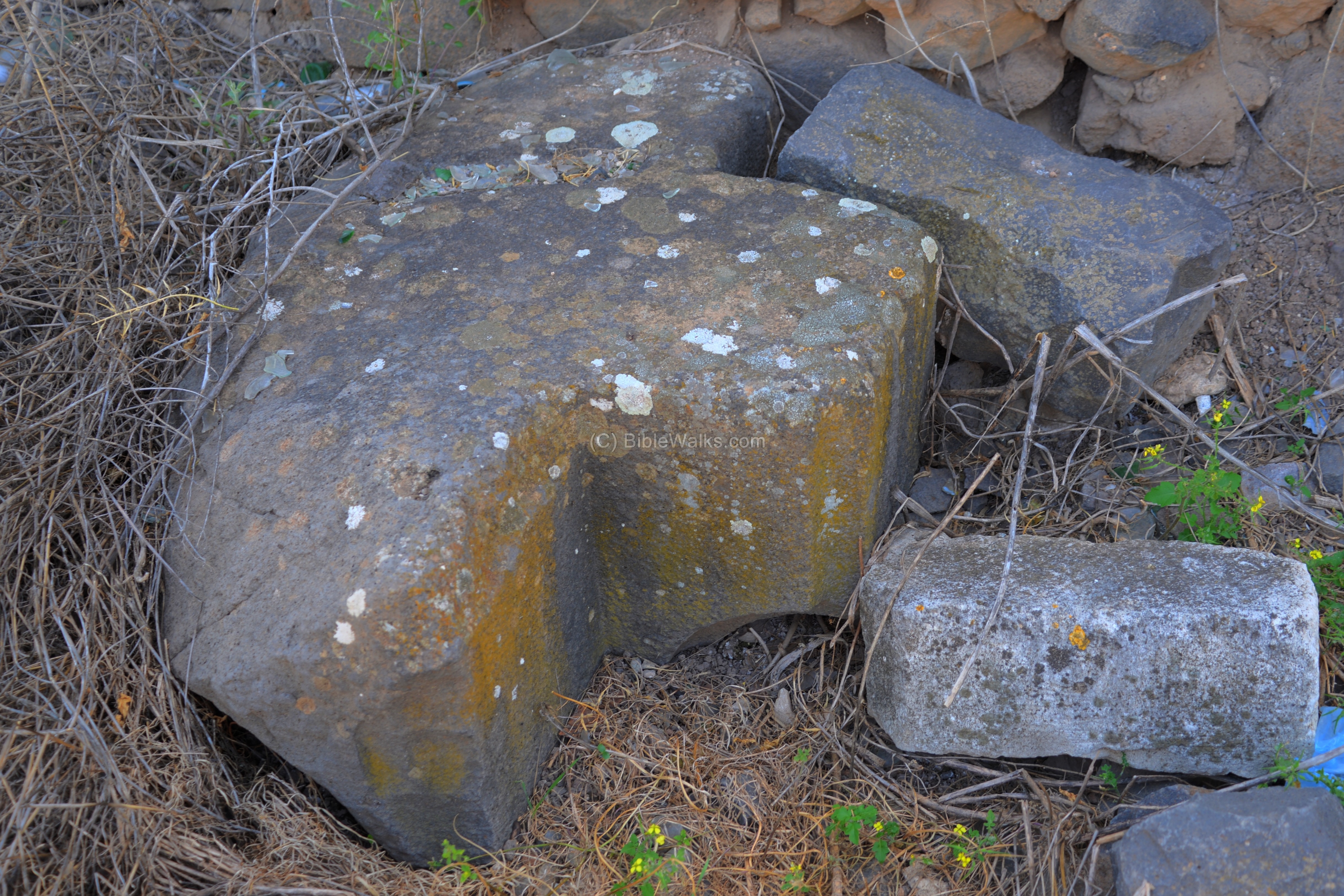
An element on the north side:
An interesting carved basalt stone:
Along the walls grow a sort of nasty “nettle” plants – as captured in the following photo. The local type is called Sirpad (Roman Nettle – “urtica pilulifera“), which grow small green balls that cause severe stinging and rash. It is named after the Romans since their troops used it for medical purposes and propagated it throughout the empire, planting it near their camps. Each of the dozens of balls that grow on such plant has hidden sharp poisonous needles. It is advised to wear long pants and closed shoes while walking off the hiking trails, and avoid being pricked by these stinging balls and leaves.
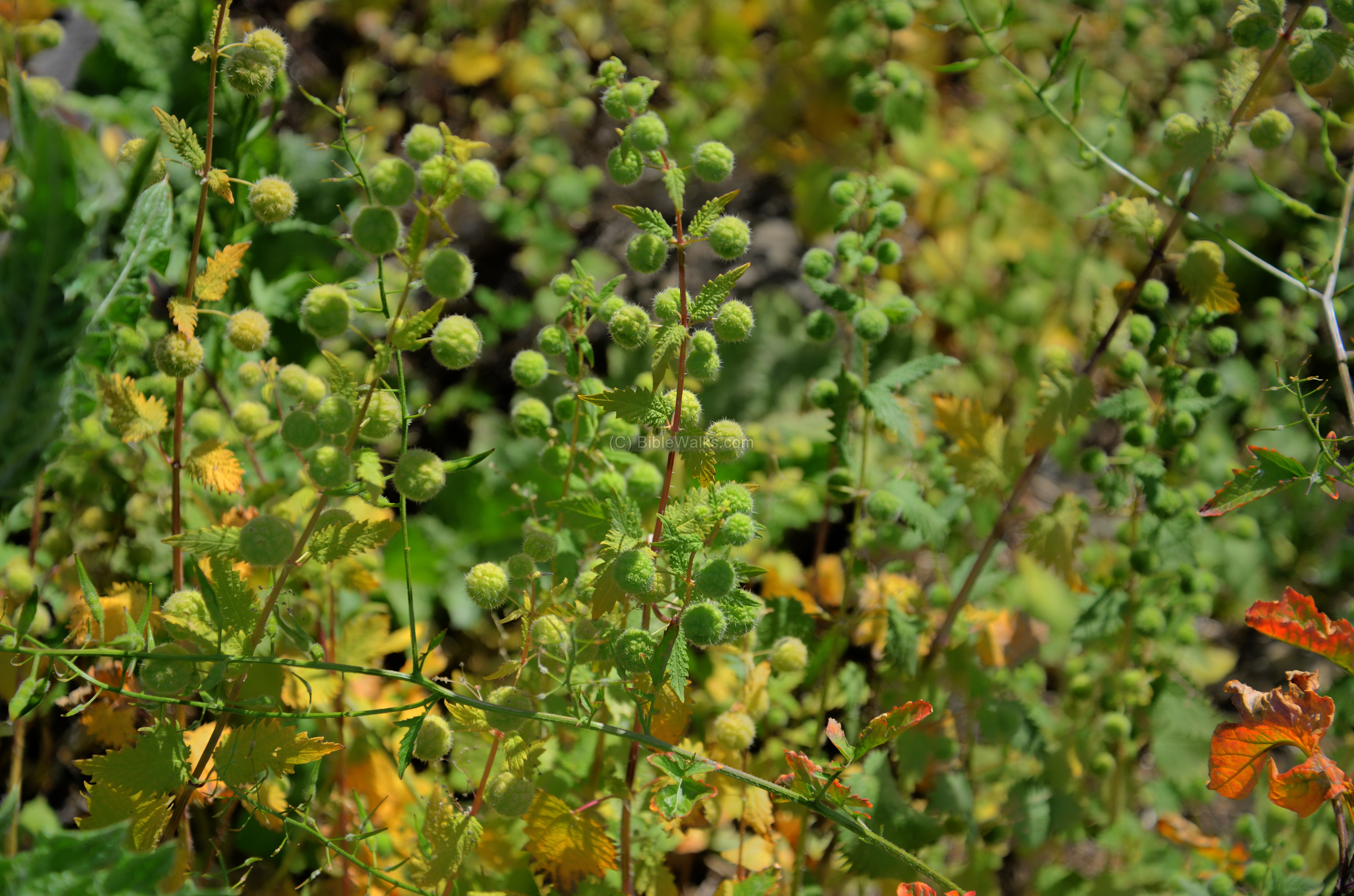
The sirpad (Roman nettle) can be found in the several Biblical texts:
(a) Isaiah: In the Hebrew text it appears as “sirpad”, and in the KJV version it appears as “brier” which means a thorn. Isaiah 55: 13: “Instead of the thorn shall come up the fir tree, and instead of the brier shall come up the myrtle tree”.
(b) Job: In the Hebrew text it is called “charul” and in KJV it is “nettle”. Job 30, 7: “Among the bushes they brayed; under the nettles they were gathered together”.
(g) South side
On the south side of the ruined tower are modern structures, and an old shack. Not a very attractive view, but still an interesting composition of structures.

This poor condition of the site calls for a conservation work. In several decades ago the fortress was standing taller and in better shape. Time and neglect are grave factors for the preservation of the site.
(h) Residential quarter on East side
On the east side of the fortress are remains of almost complete structures, dated to the Crusaders, Mameluke and Ottoman periods.
Another wall of a structure is seen next. The higher section (stratum I) is 0.8-1.0m wide, with 3.0-3.5m preserved height, and was dated to the Ottoman period (18th-19th century). Some of the foundations (stratum II) are dated to the Mameluke period, while an earlier building dated to the Crusader period, built on the bedrock (Stratum III), was also exposed in the archaeological excavation (see HA link volume 123).
The excavations on this side concluded that the site was first settled in the Crusader period. After the destruction of the fortress in the Mamluke period, the settlement continued to exist and new building were constructed on the Crusader remains, reusing their stones. During the Ottoman period a residential quarter was constructed alongside the fortress ruins.
Uncle Ronnie stands near the entrance to one of the structures.
Links and references:
* Hadashot Arkheologiyot (HA) – Excavations and surveys in Israel:
-
- Greek inscription found in Horbat Haddad – (IAA, Hebrew, Jan 20, 2021)
* References:
-
Denys Pringle – Secular Buildings in the Crusader Kingdom of Jerusalem
-
Karmon Y. – An Anaylsis of Jacotin’s Map (pdf)
* Internal:
-
Belvoir – nearby Crusader major fortress
-
Drone Aerial views – collection of Biblical sites from the air
Etymology (behind the name):
- Taiyibeh (Arabic) PEF dictionary translates it to: “The goodly”
- Kh. el Haddad – (Arabic) “The ruin of the blacksmith”
BibleWalks.com – exploring the ancient sites of Israel
Saul’s shoulder <<<—previous site—<<< All Sites>>>— next site—>>> Horvat Qisi
This page was last updated on Mar 5, 2023 (update of modern period)
Sponsored links: