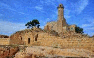
The holy site of Nebi Samuel is the traditional tomb of prophet Samuel, with remains from the Hasmonean period (2nd century BC) through the Crusaders period (12th century AD).
Home > Sites > Judea > West > Nebi Samuel (Samwil) – Overview
Contents:
Overview
Location
History
Photos
* General
* Hasmonean
* Crusaders
* Ottoman
* Panoramic
Biblical Refs
Etymology
Links
Overview:
Nebi Samuel, on the outskirts of Jerusalem, is the traditional tomb of prophet Samuel, with ancient remains from the Hasmonean period (2nd century BC) through the Crusaders period (12th C AD). It is a holy place for the Jewish, Christians and Muslims.
1 Samuel 10 17: “And Samuel called the people together unto the LORD to Mizpeh”
This is an overview page, with additional pictures and info added in the following sub pages:
Location:
The site is located on a high hill (885m), which overlooks the area of the Judean hills and the western gateway to Jerusalem. It is situated along road #436, which connects highway 443/45 to Ramot. The road loops around the hill.

History:
-
Biblical period
Samuel was one of the most important prophets in the Bible. Under God’s directive, he shifted the leadership of the Israelites from the judges to the Kings. He anointed the first King – Saul – with Holy Oil on his head. Afterwards, Samuel anointed King David, thus establishing the royalty Davidic line (“Royal house of David”). (Thanks to Coretta Miller for her correction).
According to two Biblical verses, Samuel died and was buried in a place called “Ramah”, which was the home city of the prophet:
-
(1 Samuel 25 1): ” And Samuel died; and all the Israelites were gathered together, and lamented him, and buried him in his house at Ramah.”
-
(1 Samuel 28 3): “Now Samuel was dead, and all Israel had lamented him, and buried him in Ramah, even in his own city.”.
There are several questions related to the location of the burial site:
1. Where is Ramah?
The location of Ramah is not known, but according to its meaning (Hebrew for heights) it should be a high hill in the vicinity of Jerusalem. There are several suggested places that can fit Ramah. One of them is “A-Ram” (or: “er Ram”), a village 5.5KM to the north-east of Nebi Samuel, which resembles the Biblical name. It was suggested by the PEF survey (Sheet 17, V III p 13): “A small village in a conspicuous position on the top of a high white hill, with olives. It has a well to the south. This place is the ancient Ramah of Benjamin”. Other places were suggested, also with the same root word, is Ramallah (9KM to the north) and Ramleh (30km North-west, which is less likely).
2. Why is the traditional tomb of the prophet located in Nebi Samuel?
This question also has several answers. One of them, which started during the Byzantine period, suggested that the prophet’s bones were relocated to this site. Another answer is that Nebi Samuel is not the actual burial place, rather it is a memorial shrine to one of the most important prophets. However, its better not to argue with tradition (of the three religions – Christian, Jewish and Islam).
According to the tradition, Samuel anointed Saul at this site, which is called “Mizpeh” (Hebrew for tower). As per the Bible (1 Samuel 10: 17-25):
“And Samuel called the people together unto the LORD to Mizpeh; And said unto the children of Israel …… ye have said unto him, Nay, but set a king over us. … and Saul the son of Kish was taken …And Samuel said to all the people, See ye him whom the LORD hath chosen, that there is none like him among all the people? And all the people shouted, and said, God save the king”.
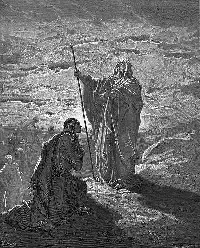
Samuel blesses Saul – – by Gustav Dore (French artist, 1832-1883)
Is this hill – where Nebi Samuel is located – the Biblical Mizpeh? Perhaps this tradition gave the site is holiness, and associated it with Samuel. Nebi Samuel is located on a high hill 1.5 KM south of the Biblical city of Gibeon, which was one of the famous cities in the tribal territory of Benjamin (Samuel’s tribe). This may have granted it the religious status, and over the years this linkage to Samuel eventually evolved into being the prophet’s burial place.
This might also be the “high place of Gibeon” where King Solomon made an offering and had a dream, asking God for wisdom rather than long life and riches (1 Kings 3 4-5): “And the king went to Gibeon to sacrifice there; for that was the great high place: a thousand burnt offerings did Solomon offer upon that altar. In Gibeon the LORD appeared to Solomon in a dream by night: and God said, Ask what I shall give thee”.
The archaeological excavation have identified a Biblical city at the site, starting from the 8th-7th C BC, with remains from the Persian period (6th -4th century BC). There are some tombs located around the hill which are dated to the first-temple period.
The cities and roads during the Canaanite and Israelite periods are indicated on the Biblical Map below. The place is situated on a hill above a major ancient roads – which connected the plains (the road passed through Emmaus and Beit Horon) to Jerusalem.

Map of the area around Nebi Samuel – during the Canaanite and Israelite periods (based on Bible Mapper 3.0)
-
Hasmonean /Hellenistic period
The Hasmoneans defeated the Greek Seleucids and created an independent country. As part of the military campaign of 165 BC, known as the Emmaus battle, Judas Maccabaeus assembled the Jewish forces in Mizpah, and launched a successful attack against the Syrian forces.
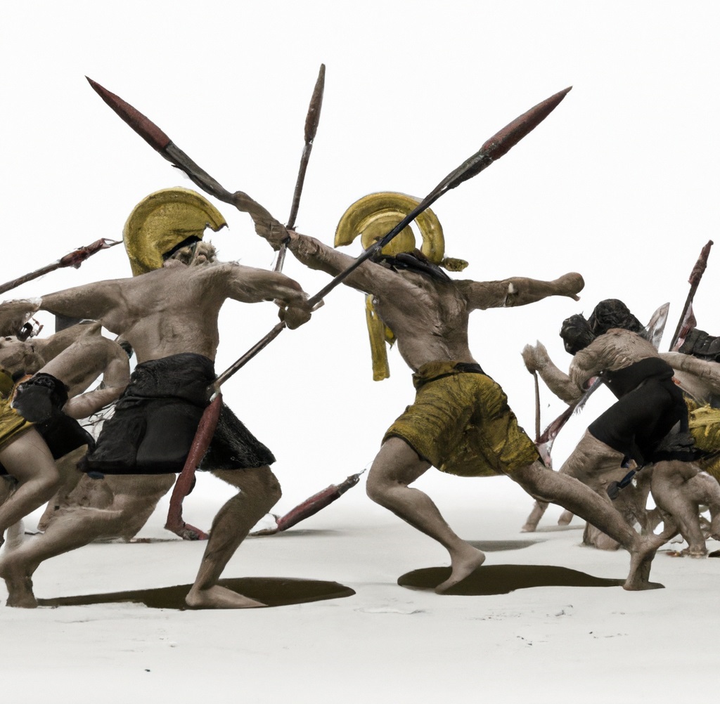
Dall-E 2 illustration of Greek fighting
The text even describes Mizpah as a place of prayer ( 1 Maccabees/Hasmonean 3 46): “Then they gathered together and went to Mizpah, opposite Jerusalem, because Israel formerly had a place of prayer in Mizpah”. If Mizpah is indeed at Nebi Samuel – which makes sense for a good place for launching the attack – then the practice of a holy site is evident as early as the 2nd century BC.
During the extensive archaeological excavations held in Nebi Samuel, the excavators found a surprising large quarter under the Ottoman and Crusader layers. It was dated to the Hasmonean period – from the 2nd century BC to the 1st century BC. This section is located on the south side of the mosque, since the Crusaders totally cleaned the other sides. The archaeologists reconstructed a section of a village, with well preserved houses and streets. This village existed until the end of reign of King Alexander Jannaeus (Hasmonean King, 103-76BC), when suddenly the site was evacuated for yet unknown reason.
-
Roman/Byzantine period- Monastery
During the Byzantine period (5th-7th century AD), a large Monastery was constructed at the site. There are few remains from that period, since the Crusaders built their fortress over the monastery. It was probably designed as a shrine rather than a tomb, and only later traditions held that the place was Samuel’s tomb. The monastery served as a hostel for the Christian pilgrims who came to visit Jerusalem. It existed until the early Arab period (7th-10th century AD). According to some accord, the monastery (“Deir Samwil”) still existed in the 10th century.
-
Crusader period – Mountain of Joy
The crusade to liberate the Holy Land and free Jerusalem started in 1096.
On June 7, 1099, three years after the military expedition started in Europe, the Crusaders finally approached the gates of Jerusalem. They first arrived to the site of Nebi Samuel, which is west of the city.
The Crusaders were so joyful on viewing the Holy city for the first time, that they later named this site as the “Mountain of Joy” (Mons Gaudii). An illustration of this event is shown here.

First view of Jerusalem – by Gustav Dore (French artist, 1832-1883)
In 1140 the Crusaders upgraded the site as a military fortress as well as a holy shrine. They cut into the bedrock on the west, north and east sides – thus creating a defensive moat. The hewn rocks were used for the building material of the church of St. Samuel on the top of the hill. The quarry also served as stables for the horses, water reservoirs and other structures. The fortress was a rectangular structure (67m by 100m), with the church at its center and over the traditional tomb of the prophet.
-
Arab and Mameluke period
The Crusaders were driven out of Jerusalem in 1187 by Saladin, and retreated from the site. The fortified church was destroyed by the Arabs in order to prevent its recapture.
In 1267 the Mamlukes captured the city and controlled the Holy Land until 1517. Remains from this period include two ceramic ovens near the stables.
The site continued to serve as a synagogue during the 15th and 16th century, which attracted worshippers.
-
Ottoman period
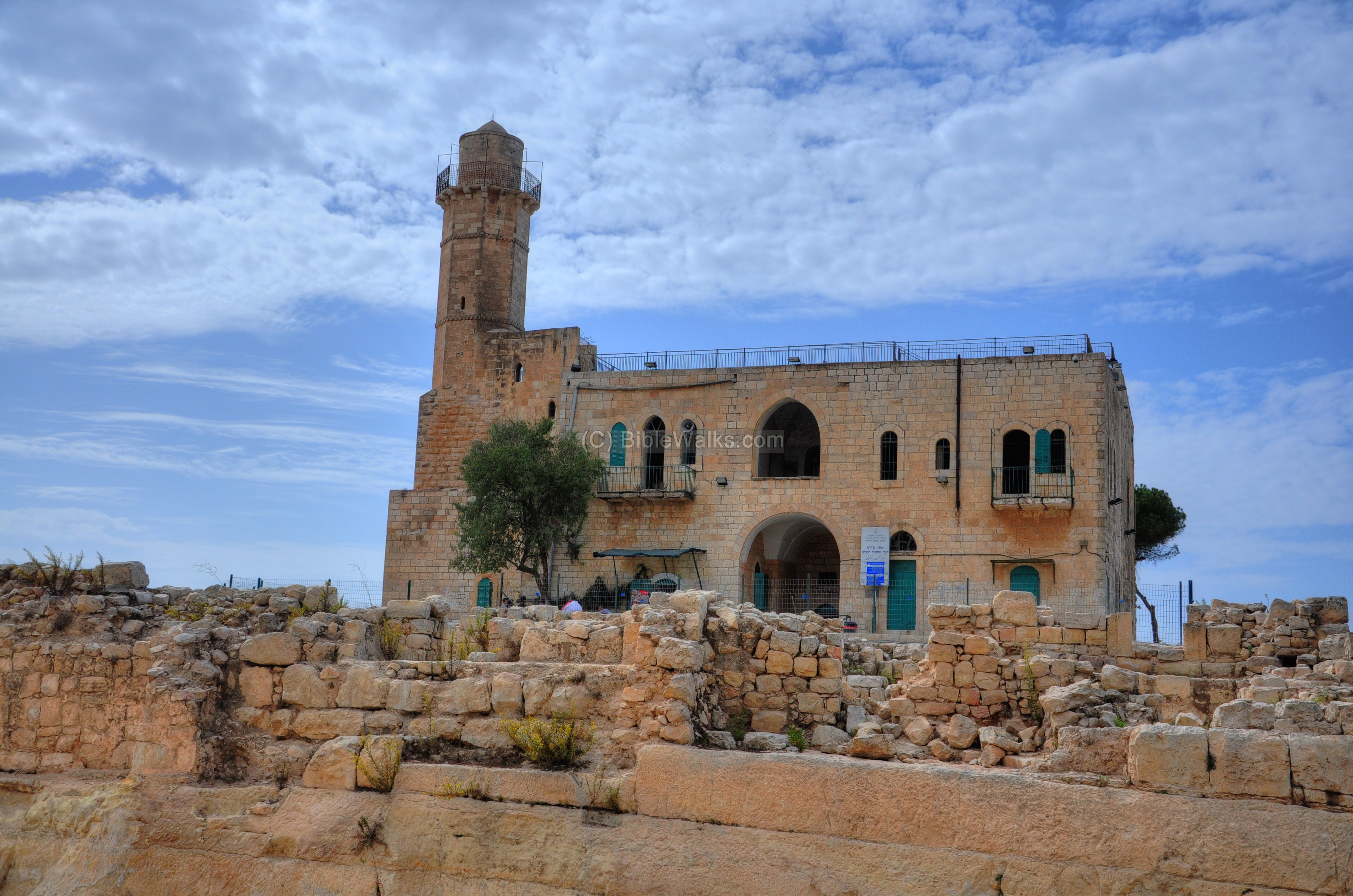
The Crusader ruins were converted by the Ottomans to a mosque in 1730.
The site was examined in the PEF survey (1866-1877) by Wilson, Conder and Kitchener. It appears in the center of the section of this map of 1878. They named the site as Neby Samwil (on the map).

Part of Map Sheet 17 of Survey of Western Palestine,
by Conder and Kitchener, 1872-1877.
(Published 1880, reprinted by LifeintheHolyLand.com)
They wrote about Neby Samwil (SWP III p 12): “A small hamlet of mud hovels; is perched on the top of the ridge, amid the remains of the Crusading ruins. There is a spring to the north. This place is apparently first mentioned by Procopius as St. Samuel; in the Middle Ages it went by the same name, and was also identified with Shiloh (Benjamin of Tudela), and called Mount Joy (‘ Citez de Jherusalem ‘). The church was finished in 1157A.D. Benjamin of Tudela speaks of the removal of the bones of Samuel from Ramleh to Neby Samwil at the time of the taking of the former place by the Crusaders. In the twelfth century the place was a fief of the Holy Sepulchre”.

Nebi Samuel 1874; From SWP Volume 3 p. 152
In the years 1890-1895 there was a failed attempt to settle the hill by Jewish settlers.
The mosque was reconstructed in 1910. The inscription above the door is from that time. A minaret tower was added on the south-east side.
-
British Period
During WW1 there was a heavy fighting between the British and Turkish forces, since it is a strategic hill on the outskirts of Jerusalem. It was followed by a massive bombardment (Nov 1917), which completely destroyed the Crusader and Ottoman village.

British trenches in Neby Samuel, 1917; American colony, Photos of the LOC
The mosque was repaired after WW1 and the current building is from that time.
-
Modern Period
In 1948 the Israeli forces battled against the Jordanians, but failed to capture the site after sustaining heavy casualties. It was liberated only in 1967.
Excavations were conducted here from 1992 to 2000, headed by Dr. Yitzhak Magen. Today, the site is a national park and open to the public, and even has night tours. The mosque and synagogue are also active all year round.
Photos:
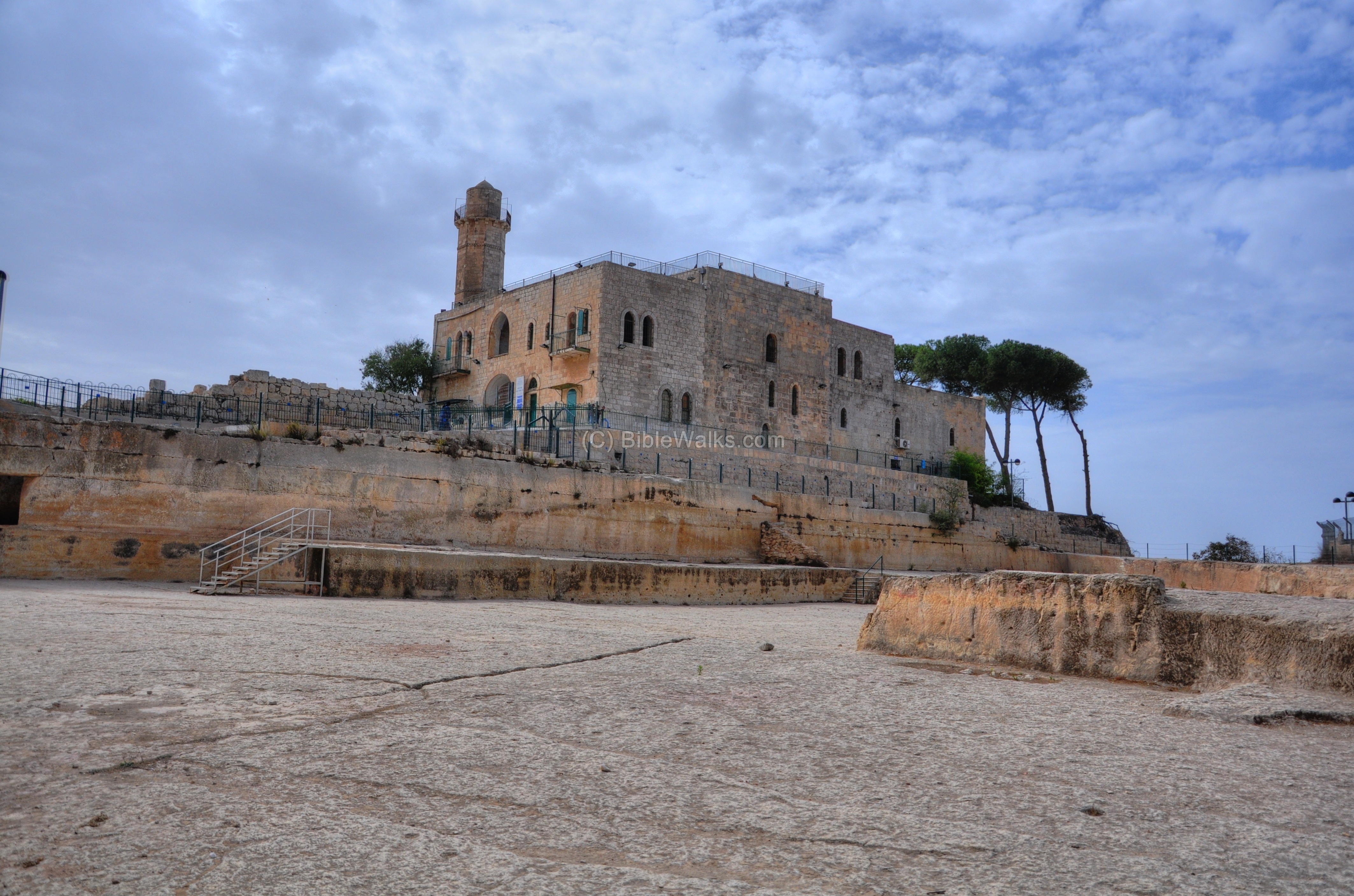
(a) General View:
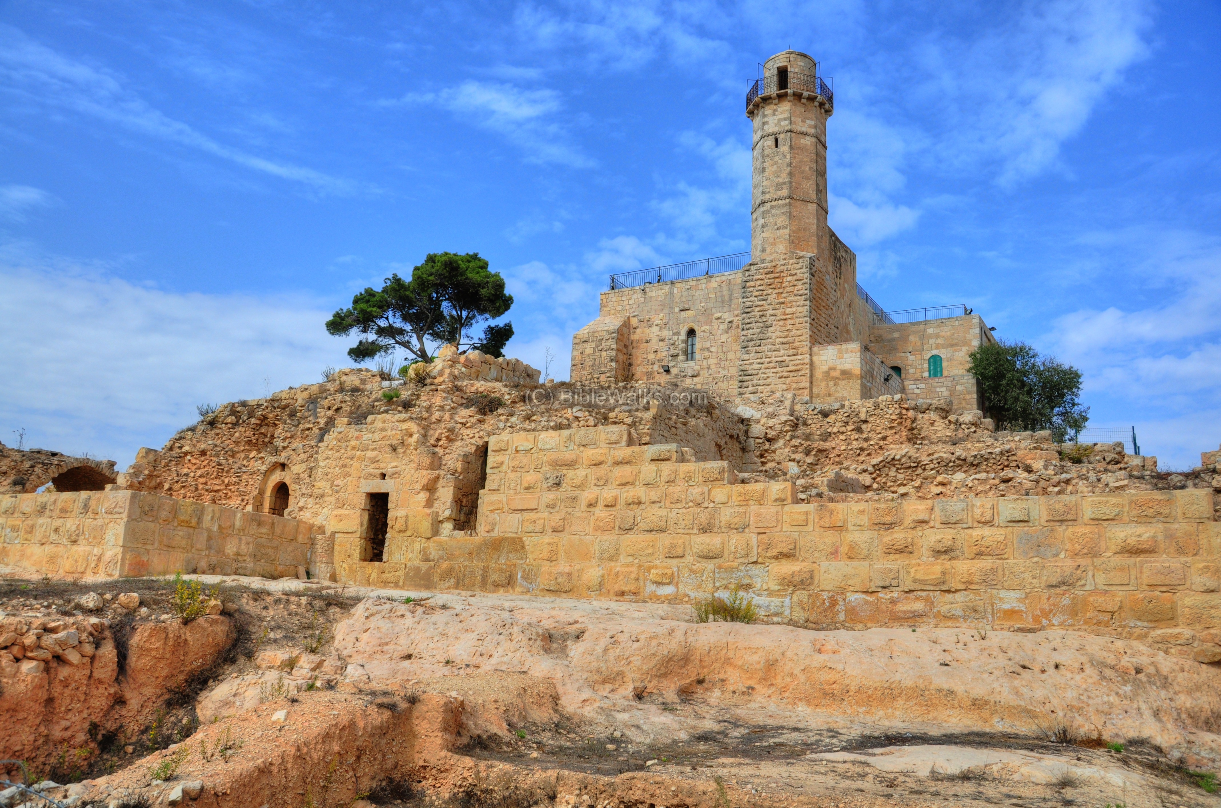
The modern structure of the tomb of Samuel is shown from the east, where the entrance to the mosque is located. On the right (north) side is the entrance to the underground tomb. In the foreground are ruins of the Crusaders fortress, which are located above a moat.
Click on the photos to view in higher resolution…
The following photos are just a sample of the pictures and information for each one of the major periods in Nebi Samuel. Each section is detailed further in additional pages.
(b) Hasmonean period:
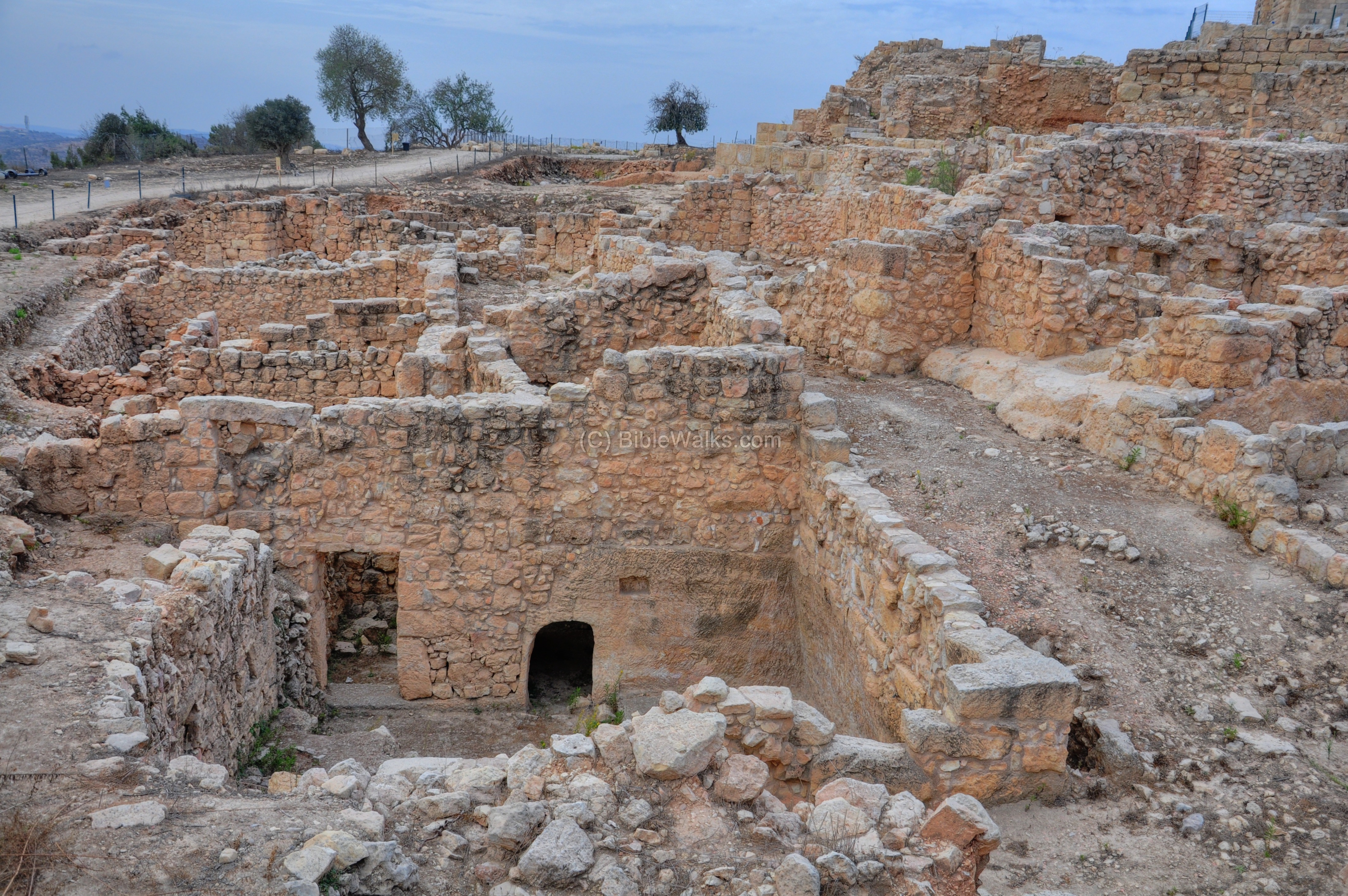
On the east side of the hill are remarkable remains of the Hasmonean period village, dated to the Hasmonean period (2nd to the 1st century BC). This area was not damaged by the Crusader rock cutting, probably since they did not have time to complete the work.
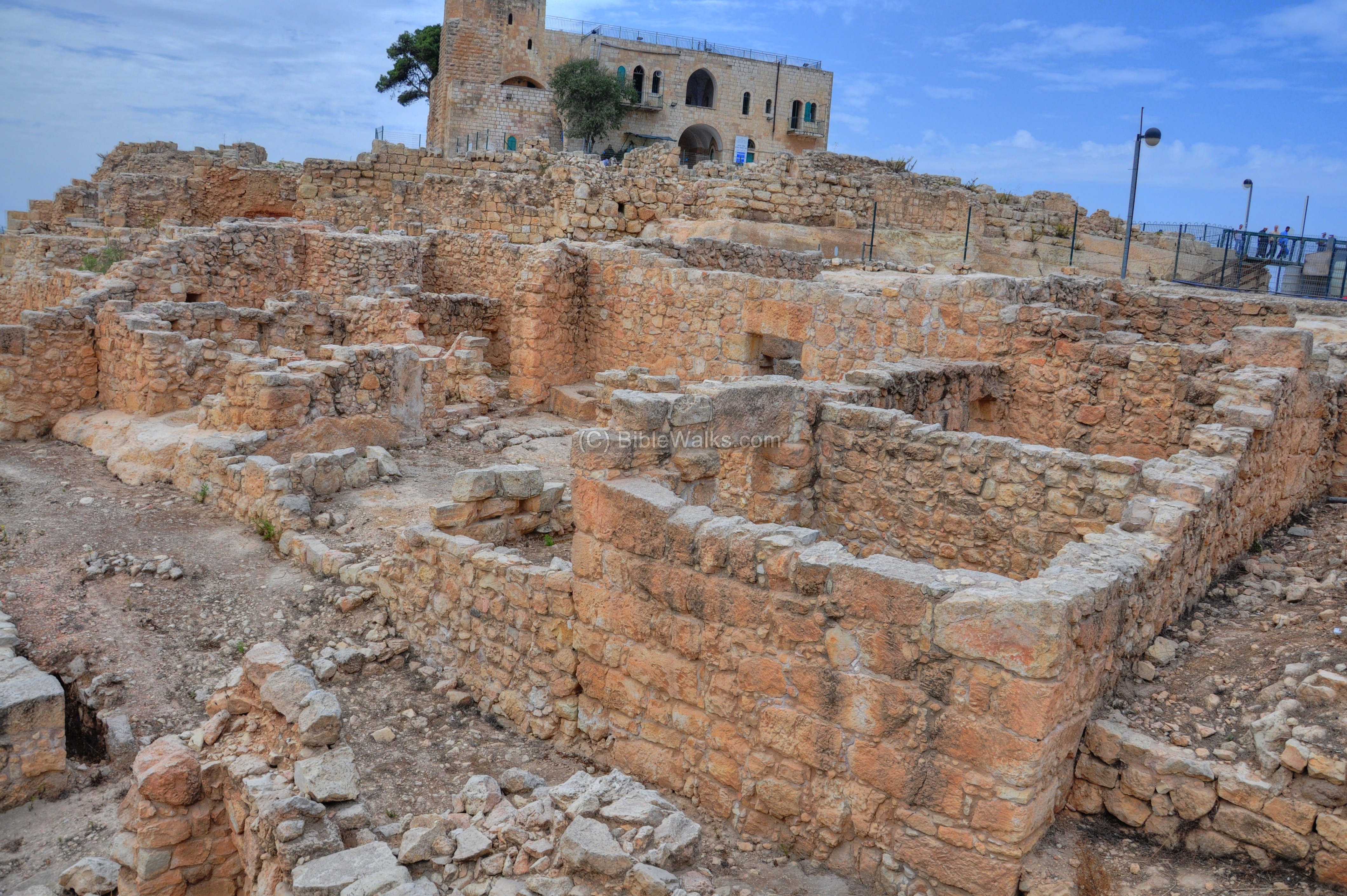
The archaeologists reconstructed a section of a village, with a number of well preserved two-story houses (one of them is seen below on the left side) and streets (such as this one on the right). This village existed until the end of reign of King Alexander Jannaeus (Hasmonean King, 103-76 BC), when suddenly the site was evacuated for yet unknown reason.
![]() For a detailed description and more photos of the Hasmonean/Hellenistic period in Nebi Samuel –
For a detailed description and more photos of the Hasmonean/Hellenistic period in Nebi Samuel –
see the Hasmonean page.
(c) Crusaders period:
Remains of the Crusaders structures, with their typical arches, are seen on the south and west sides.
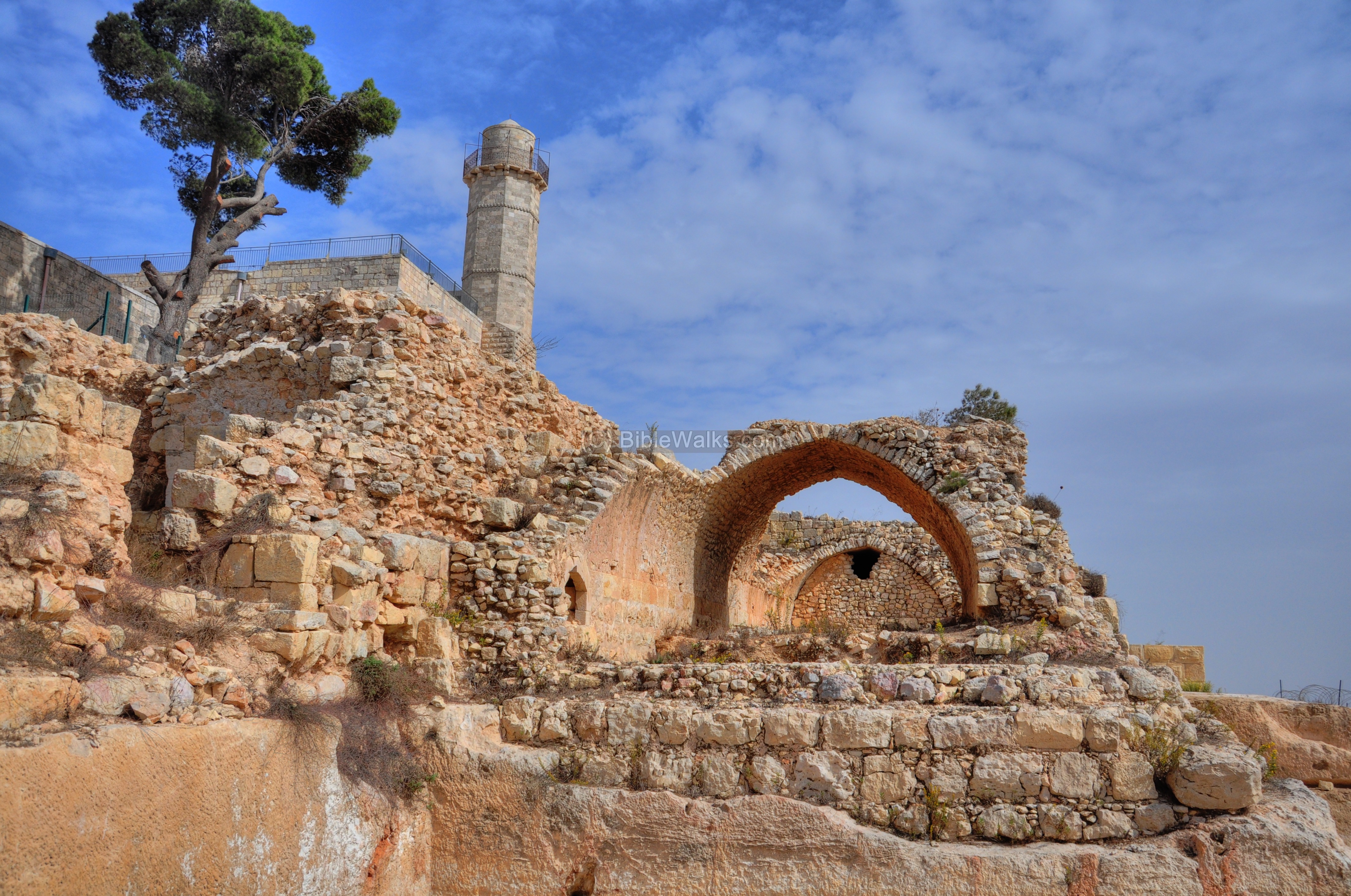
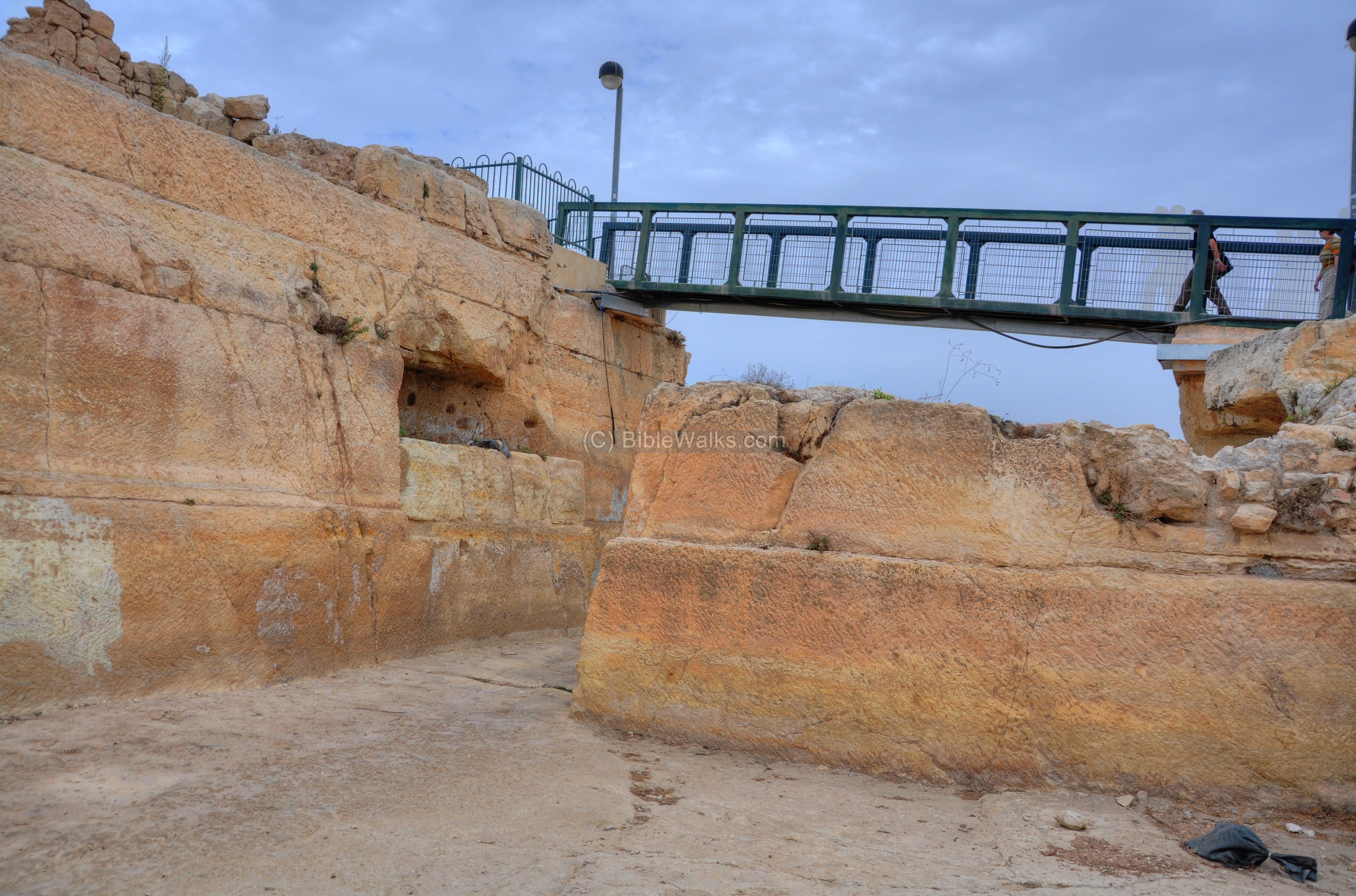
On the north and north-east side, the Crusaders cut way the bedrock 5m below the surface. The stones were used to build their structures and fortress, and the great cavity served as a defensive dry moat around the fortress. This large flat area (37 x 47m) was used as a camp by the army and as a hostel by the Christian pilgrims.
A modern pedestrian bridge is located over the Crusader moat on the north-east side.
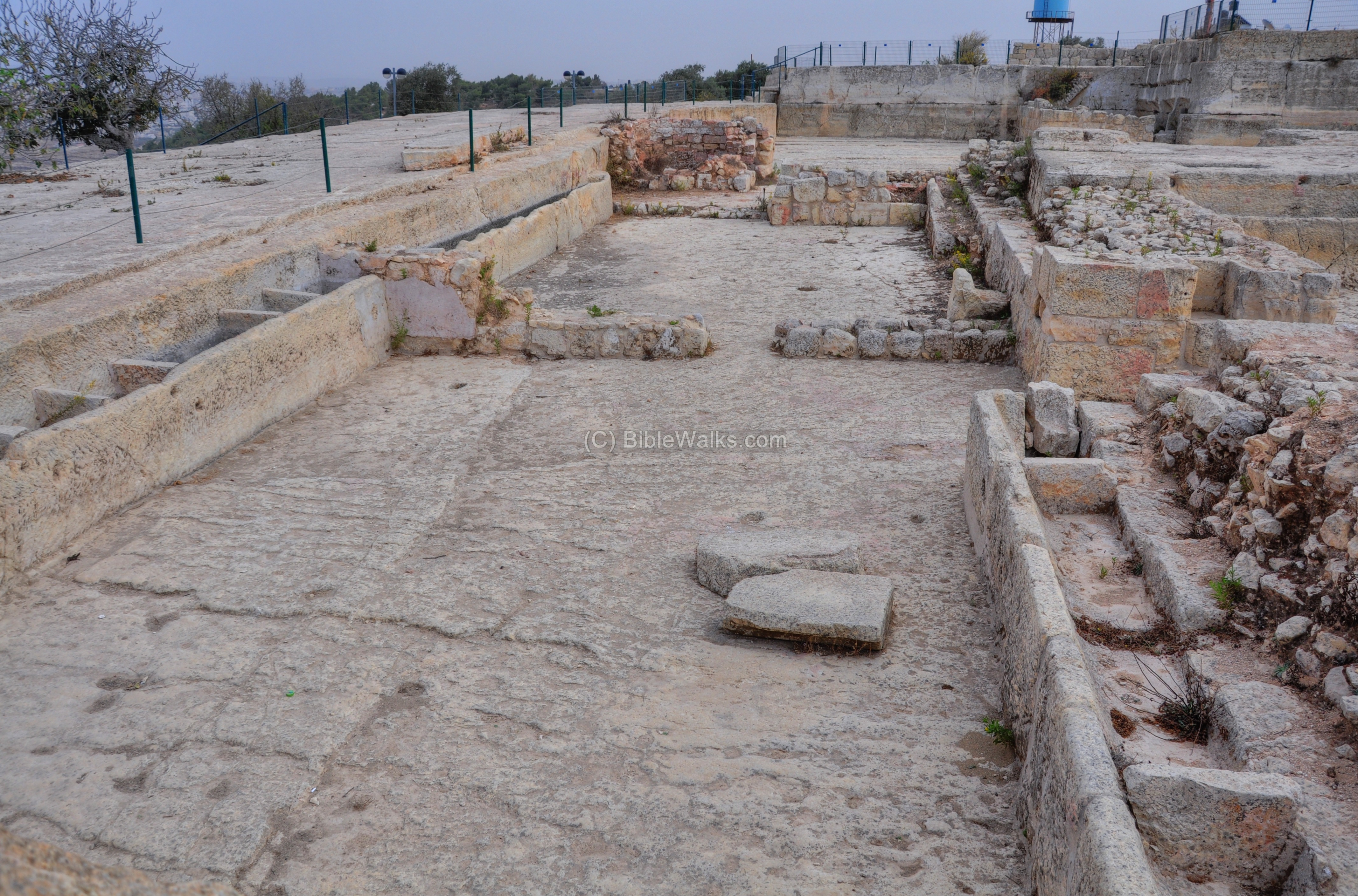
On the north side, within the quarried area, are a number of hewn structures. In the photo below is a large stable, with rock-cut troughs. There are also pools, cisterns, rock-hewn tombs and agriculture installations.
![]() For a detailed description and more photos of the Crusaders fortress in Nebi Samuel –
For a detailed description and more photos of the Crusaders fortress in Nebi Samuel –
see the Crusaders page.
(d) Mameluke, Ottoman and British periods:
The minaret of the modern mosque towers above the site on the south-east side.
![]() For a detailed description and more photos of this period – check the Ottoman/British page.
For a detailed description and more photos of this period – check the Ottoman/British page.
(e) Panoramic views:
Nebi Samuel provides a great observation point to the region of the Judean mountains. In the northern view below is the site of ancient Gibeon, the Arab village of el-Jib to the left of it, and the city of Ramallah in the far background.
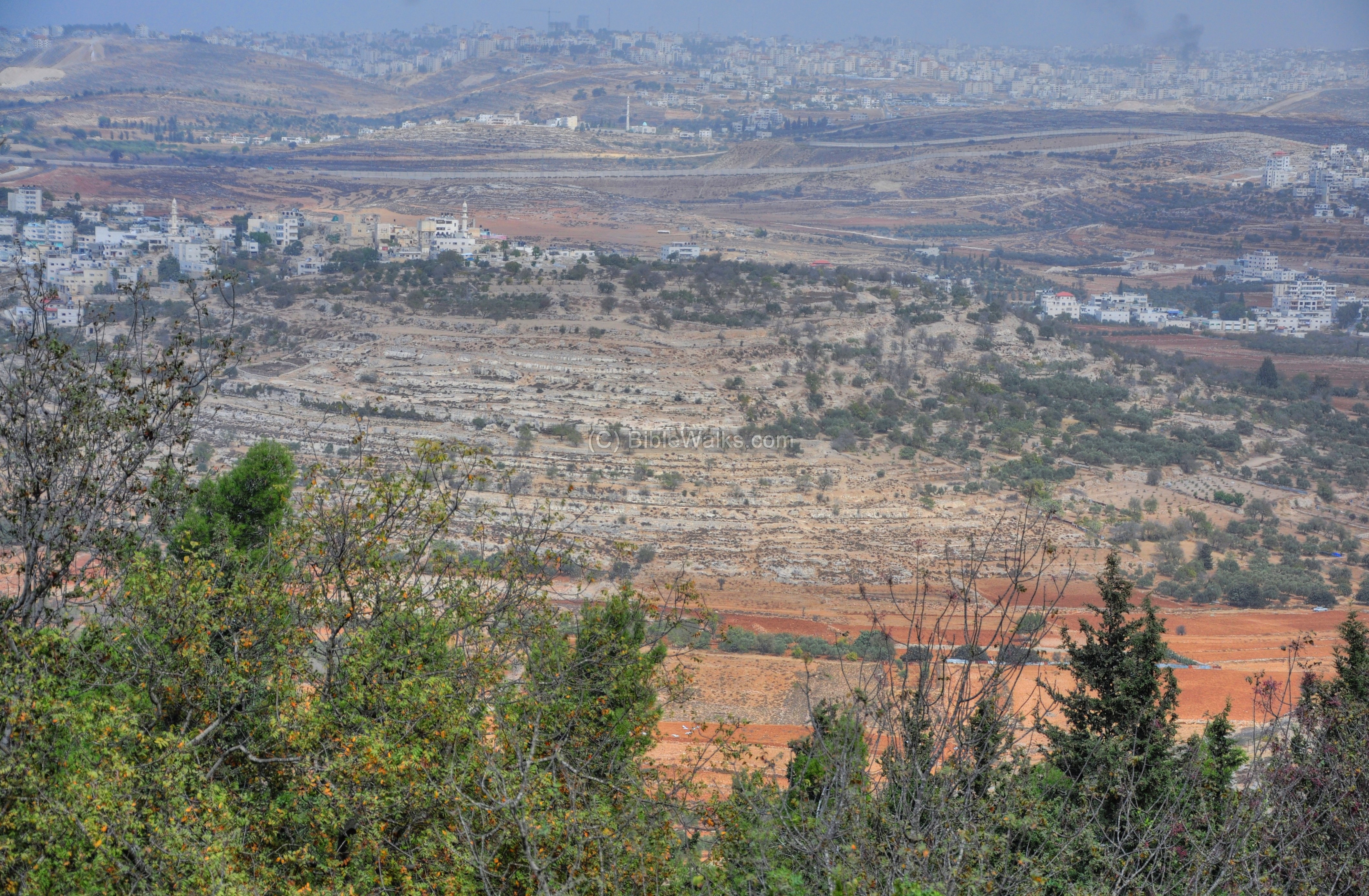
The southern view below shows the western side of Jerusalem, with the modern neighborhood of Ramot in the foreground, and the city of Jerusalem in the background. This was why the Crusaders were so happy when the first reached here on their journey to take the Holy City – it was the first time they could see the target of their long Holy Crusade.

Biblical References:
Etymology:
- Samuel – Hebrew: Shmu’El or: “Asked from God”, or “Heard by God”. The Bible interprets this name (1 Samuel 20): “and called his name Samuel, saying, Because I have asked him of the LORD”.
- Ramah – Hebrew: heights. It was the birth and burial city of Samuel.
- Nebi – Arabic: prophet (Hebrew: Navi).
- Samwil – Arabic: Samuel.
- Nebi Samwil, Nebi Samuel – Arabic – the shrine of prophet Samuel
- Kever Shmuel – Hebrew: The tomb of Samuel
Links:
* Archaeology:
- “Nebi Samwil is not Mizpah”
* Other:
- National Park (Hebrew)
- Itinerary of Benjamin of Tudela
- Illustrations of the Crusades – Gustav Dore
* Movies:
- High Place of Gibeon and the tomb of Samuel (Youtube video; 8:45 minutes)
* Internal:
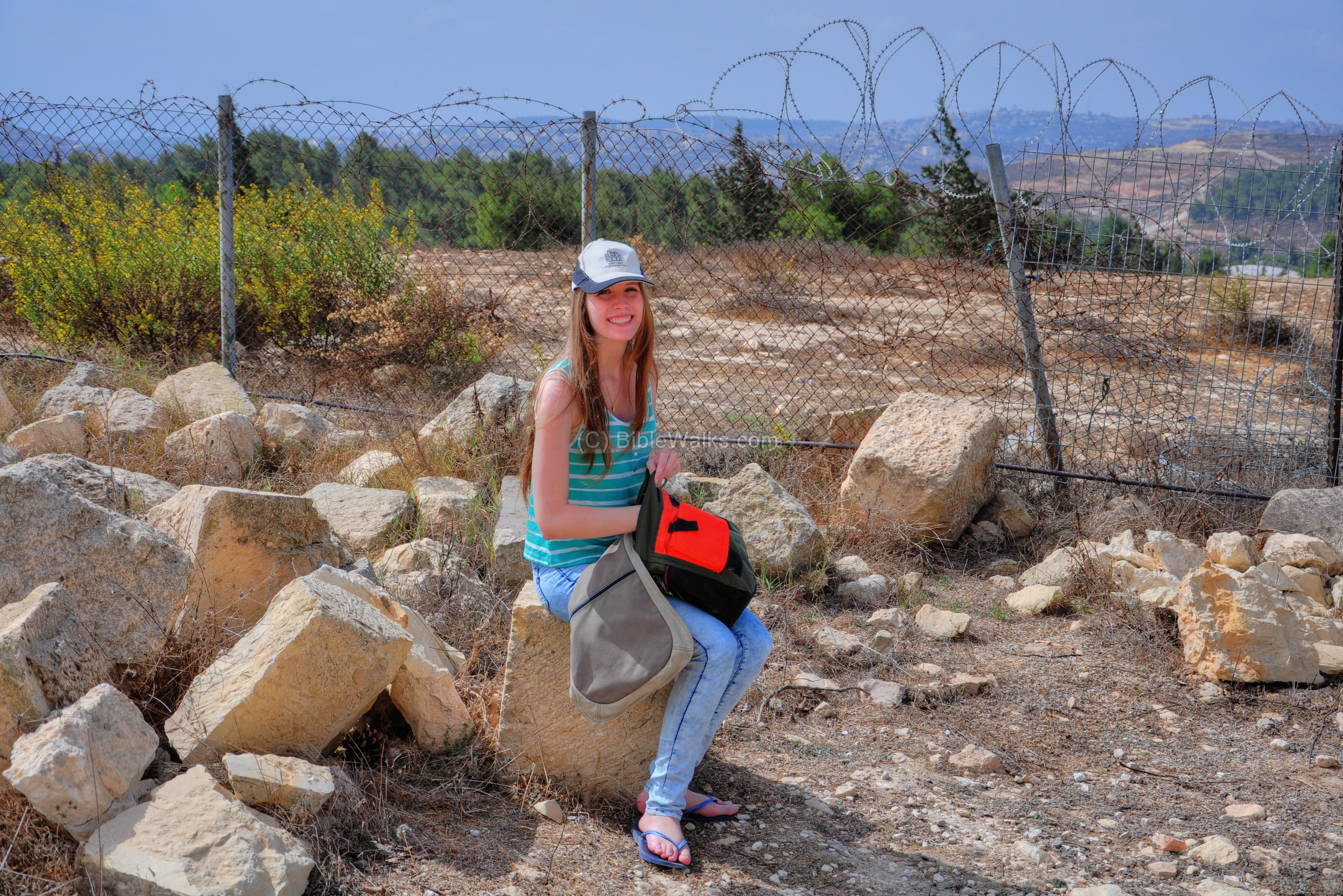
Amit, Webmaster Rotem’s sister, visited the site and recommends it
BibleWalks.com – touring the Bible land
Kathisma <<<—previous Judea–<<< All Sites >>>—>>> Nebi Samuel – Hasmonean
This page was last updated on Feb 25, 2023 (add Dall-E 2 illustration)
Sponsored links: