This page focuses on the Roman and Byzantine city in Banias.
Home > Sites > Golan > Banias > Roman & Byzantine city
Contents:
Background
History
Photos
Biblical
Etymology
Links
Background:
Banias, also known as Caesarea Philippi, was a city located in the region of the Golan Heights in modern-day Israel. During the Roman Byzantine period, Banias was an important center of pagan worship, and it was known for its famous temple to the god Pan.
In 20 BC, Banias was conquered by Herod the Great and became part of the Roman province of Syria. The Roman emperor Augustus granted Banias the status of a free city, which meant that it was exempt from paying taxes to Rome. Under Roman rule, Banias prospered and became an important city. Ant 20 9 4: “About this time it was that king Agrippa built Cesarea Philippi larger than it was before, and, in honor of Nero, named it Neronlas.”
During the Byzantine period, Banias continued to be an important center of pagan worship. However, in the 4th century CE, Christianity began to spread throughout the region, and Banias became an important center of Christian worship as well. The Byzantine Emperor Constantine the Great is said to have built a church in Banias to commemorate the confession of Saint Peter, who according to Christian tradition, declared Jesus to be the Son of God at this location.
The city of Banias was destroyed by an earthquake in the 8th century AD, and it never regained its former glory. Today, Banias is a national park in Israel, and visitors can see the remains of the ancient city and its famous temple to Pan.
This page focuses on the Roman and Byzantine city in Banias. For other pages and an overview on Banias – see: Overview page
Location:
The Palace of Agrippa and the Roman/Byzantine city is located on a large area south of the entrance to the park.

History:
For a complete history on the Roman period – check the Banias overview page.
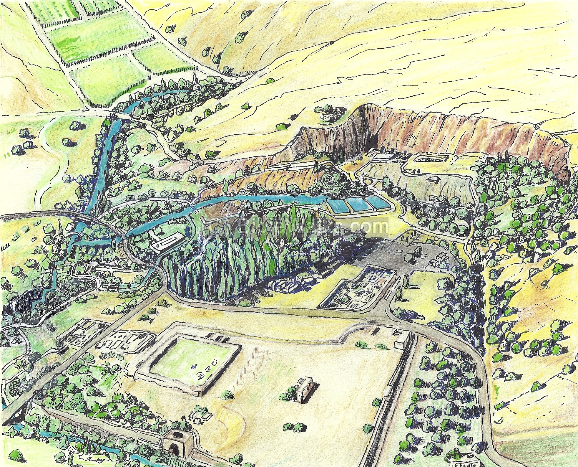
The area of Banias is shown in the illustration below, with ruins of the Roman city in its center. During the Roman period, the city spread over a 300 x 300m area. The main north-south street (Cardo Maximus) connected both ends of the vast city. A large public structure, believed to be the Palace of Agrippa II, was excavated here, as well as other structures of the period, including streets, aqueducts, courtyards, a synagogue and a bathhouse.
The major Roman sites include:
- Agrippa’s palace on the western side
- The Roman main road, the Cardo Maximus, in the center
- A Byzantine Church near the entrance to the park
Photos :
(a) Agrippa’s palace – West side
Remains of the city of Herod Philip (King 4BC-33AD) and Agrippa II (King 50-90AD) lies on the western side of the Roman city. The road to Golan crosses the excavation area on top of one of the Roman arches.
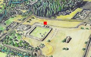
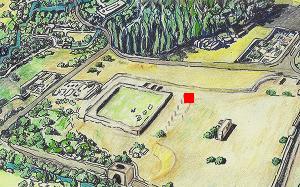
The red square on the illustration indicates the location of the western side of the Roman city. The remains of two rounded structures were excavated here, which served as watchtowers guarding the entrance to Agrippa’s palace.
The base of one of the rounded towers is seen in the photo. Behind its walls was an apsidal hall, which was part of the entrance halls to the palace. A gated entrance was located on the right side of the tower.

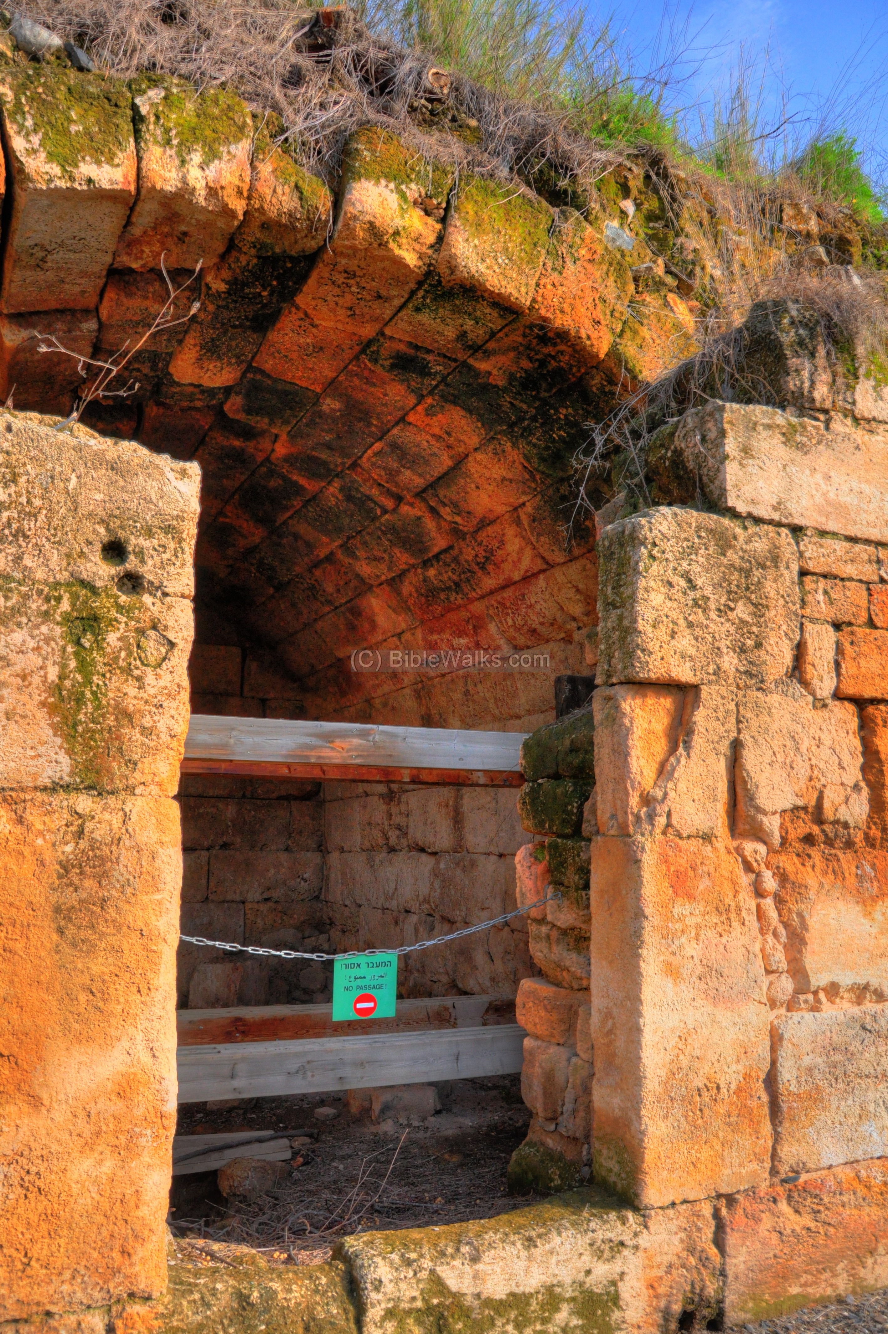
The base of the second rounded tower is seen on the right side below. An underground passage is seen on its left side.

The underground passage served as an aqueduct that carried water from the Banias springs to the palace and the areas around it. The modern trail uses this Roman aqueduct to pass under the modern road (located behind the trees) in order to get to the eastern side of the palace.
This arched aqueduct was located under the ground level of the palace. The levels above the ground were removed in antiquity, and reused in later-period structures.

(b) Agrippa’s palace – East side
The trail passes under the modern road through a series of arched chambers, following the course of the ancient aqueduct. A staircase is located on the eastern side, and used to climb up again to the ground level.
Above, on the ground level, a large area of public buildings is seen around the beginning of the trail. This 2,000 square meters complex is believed to be the palace of Agrippa II, one of the largest and magnificent buildings in ancient Israel. It served as an administrative complex, and was built in Roman style with marble facing, arches, and apses. Josephus writes about the city of Agrippa (Ant 20 9 4): “About this time it was that king Agrippa built Cesarea Philippi larger than it was before, and, in honor of Nero, named it Neronlas.”

On the eastern side of the palace, seen in the background below, are a number of arched vaults. In the foreground are the ruins of the palace’s internal courtyards, rooms, halls and pools.
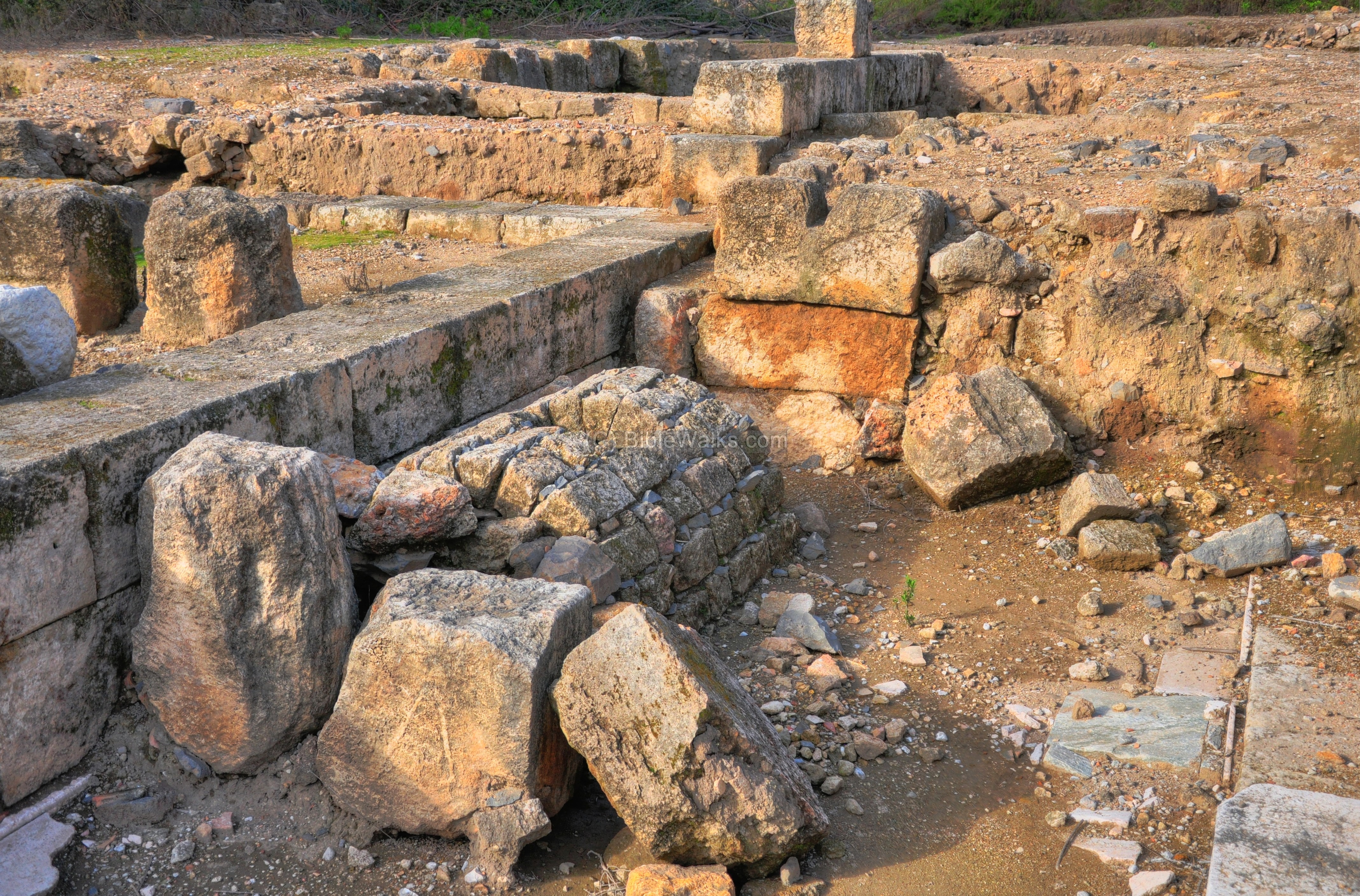
The southern side of the palace is seen in the next picture. The base of a rounded tower is seen on the left side. In the lower center are remains of an underground water channel, and above it was the southern gate to the palace.
Another view of the rounded tower is shown below. Inside the center of this complex are ruins of a large rectangular hall (basilica) which may have been the thrown room.
A view of this section, looking towards the west, is shown in the next photo.
According to Josephus, Vespesian and his son Titus, heads of the Roman armies during the Great revolt, camped here. This is where they would have stayed. Wars 3 9 7: “Vespesian… went to that which is called Caesarea Philippi and there he refreshed his army for twenty days, and was himself feasted by king Agrippa, where he also returned public thanks to God for the good success he had had in his undertakings”.

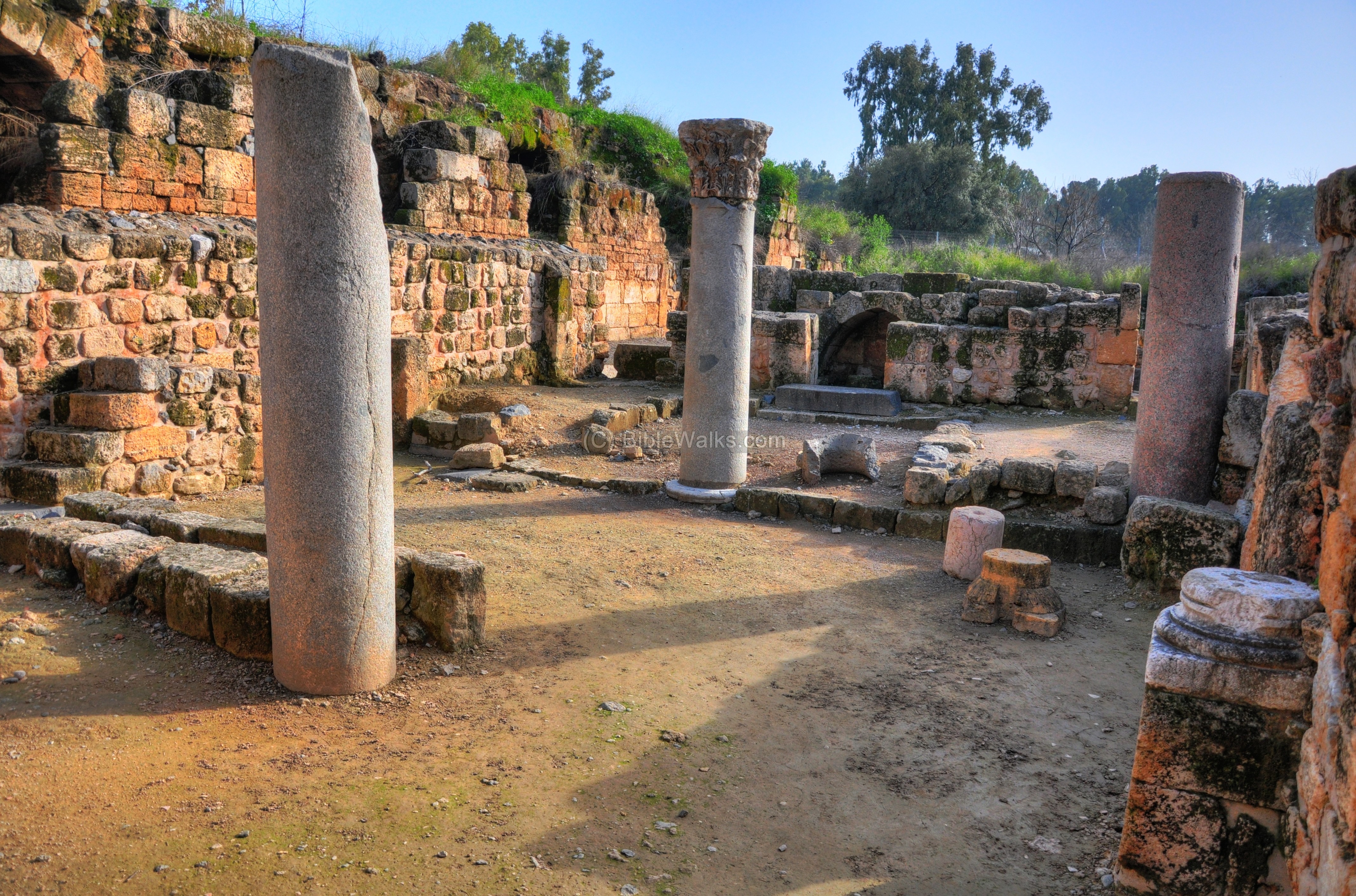
The section to the east of the tower is shown below. A structure on the left side, with columns inside its courtyard, is identified as a synagogue.

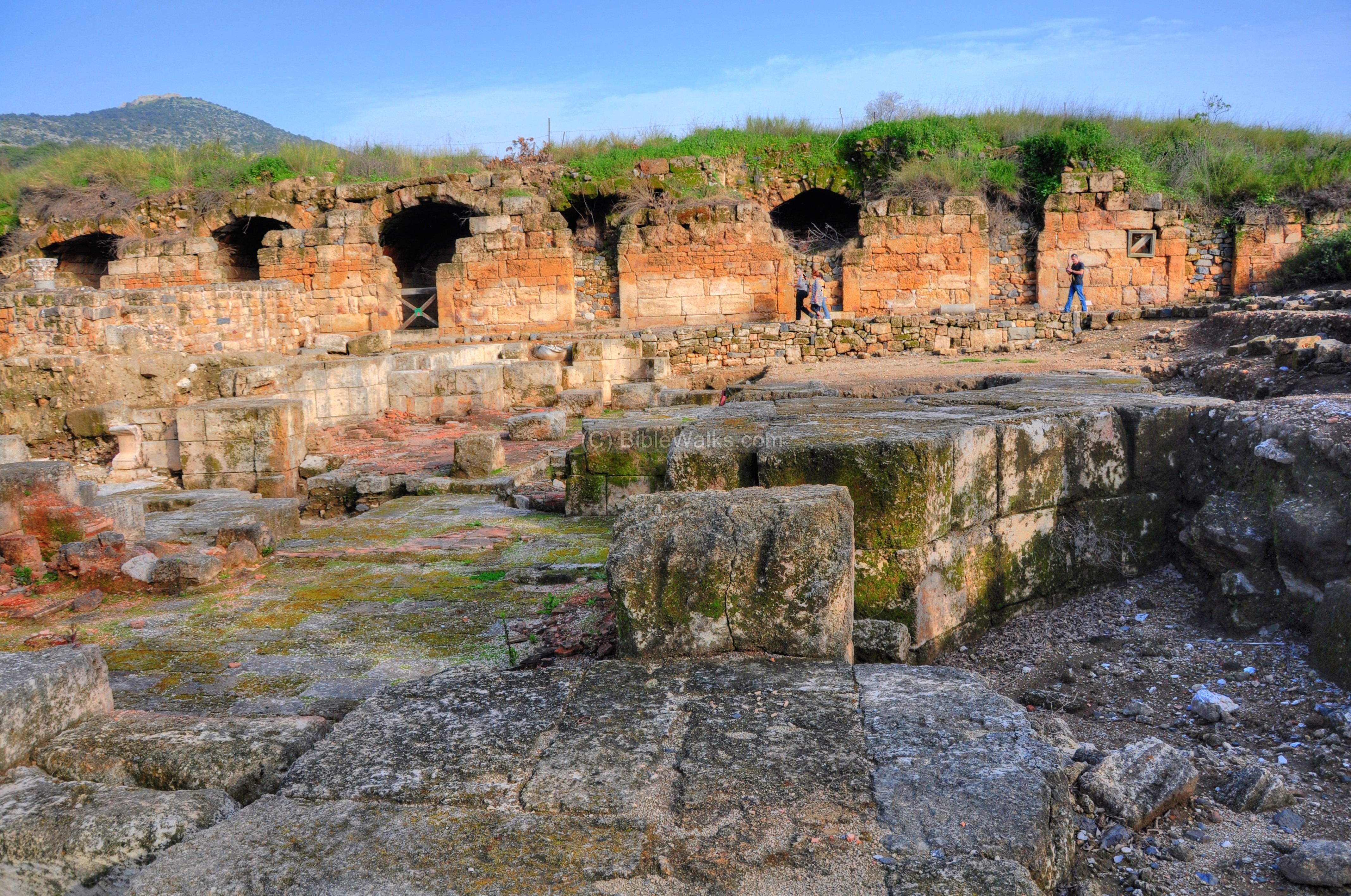
(c) Eastern wall of Agrippa’s palace
The park’s trail passes along the inner side of the eastern wall of the palace.
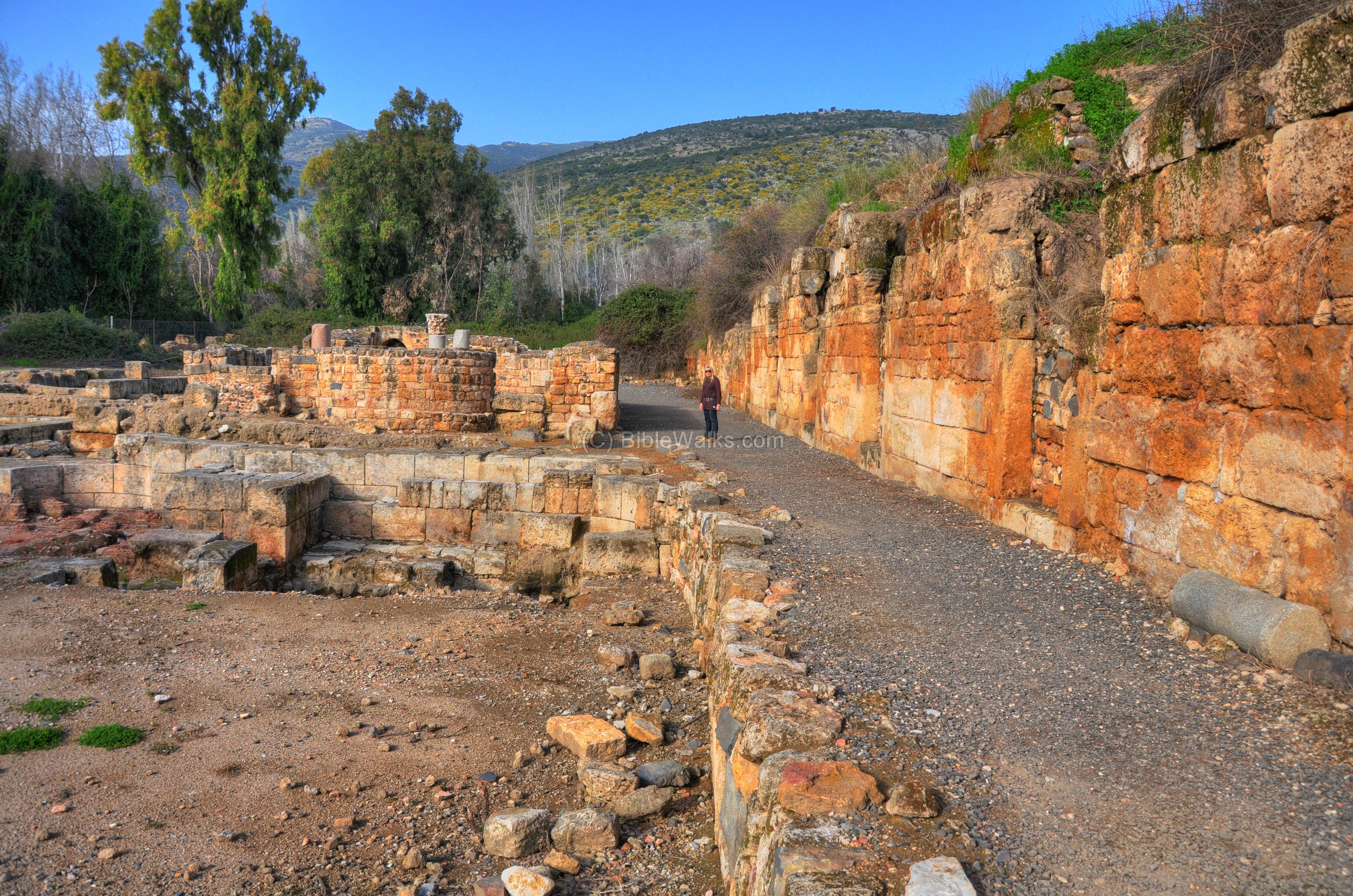
The eight arched vaults along this wall served as warehouses for the palace.

A closer view of one of the vaults. They were preserved in a remarkable condition.
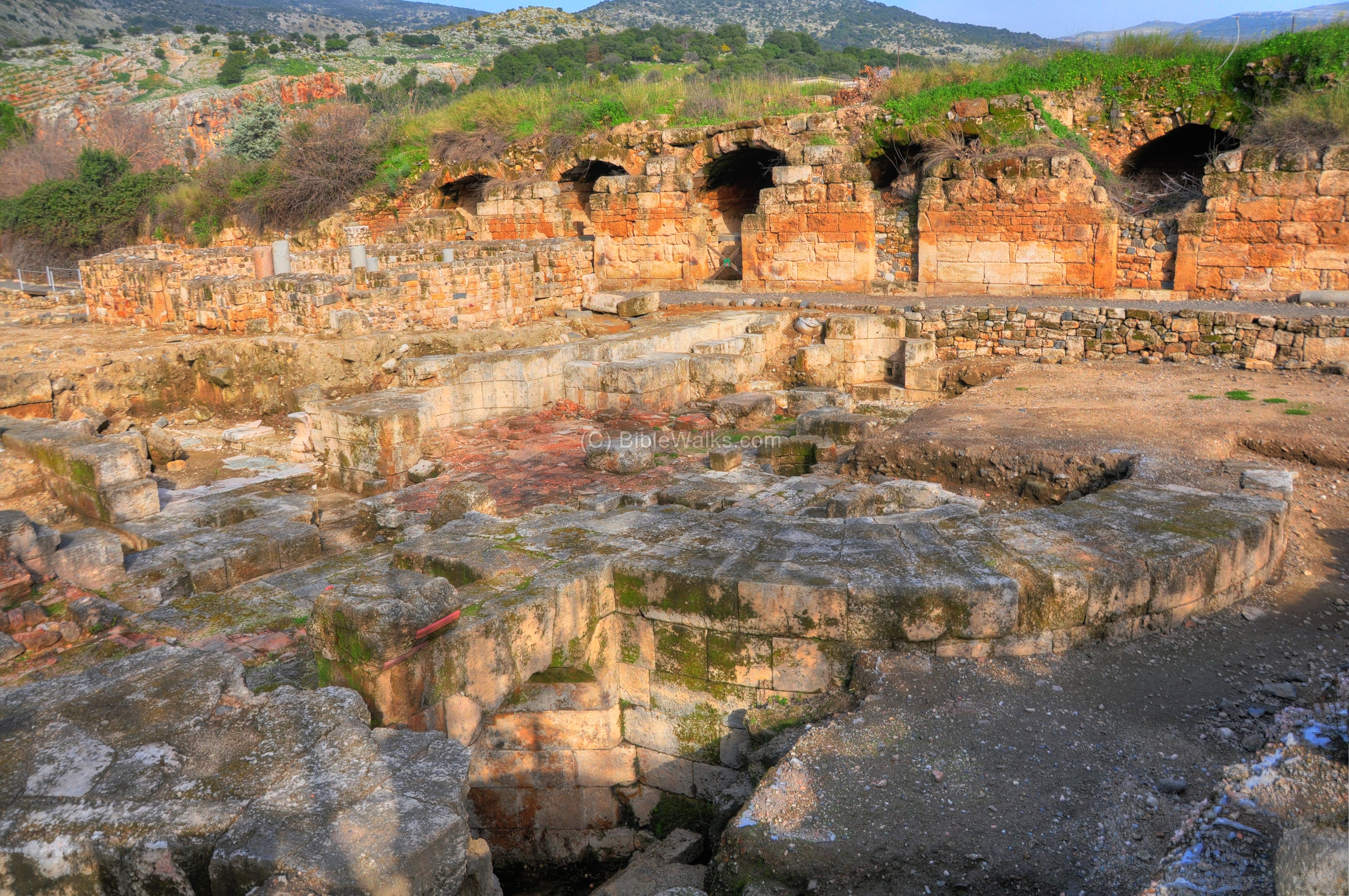
(d) Byzantine bathhouse
Part of the Roman palace was converted to a bathhouse during the Byzantine period. The remains of this bathhouse is seen on the floor below. The bathhouse used an under-floor heating system (hypocausts), based on hot air which was pumped under the tiles which heated its waters.

Another section of the bathhouse:
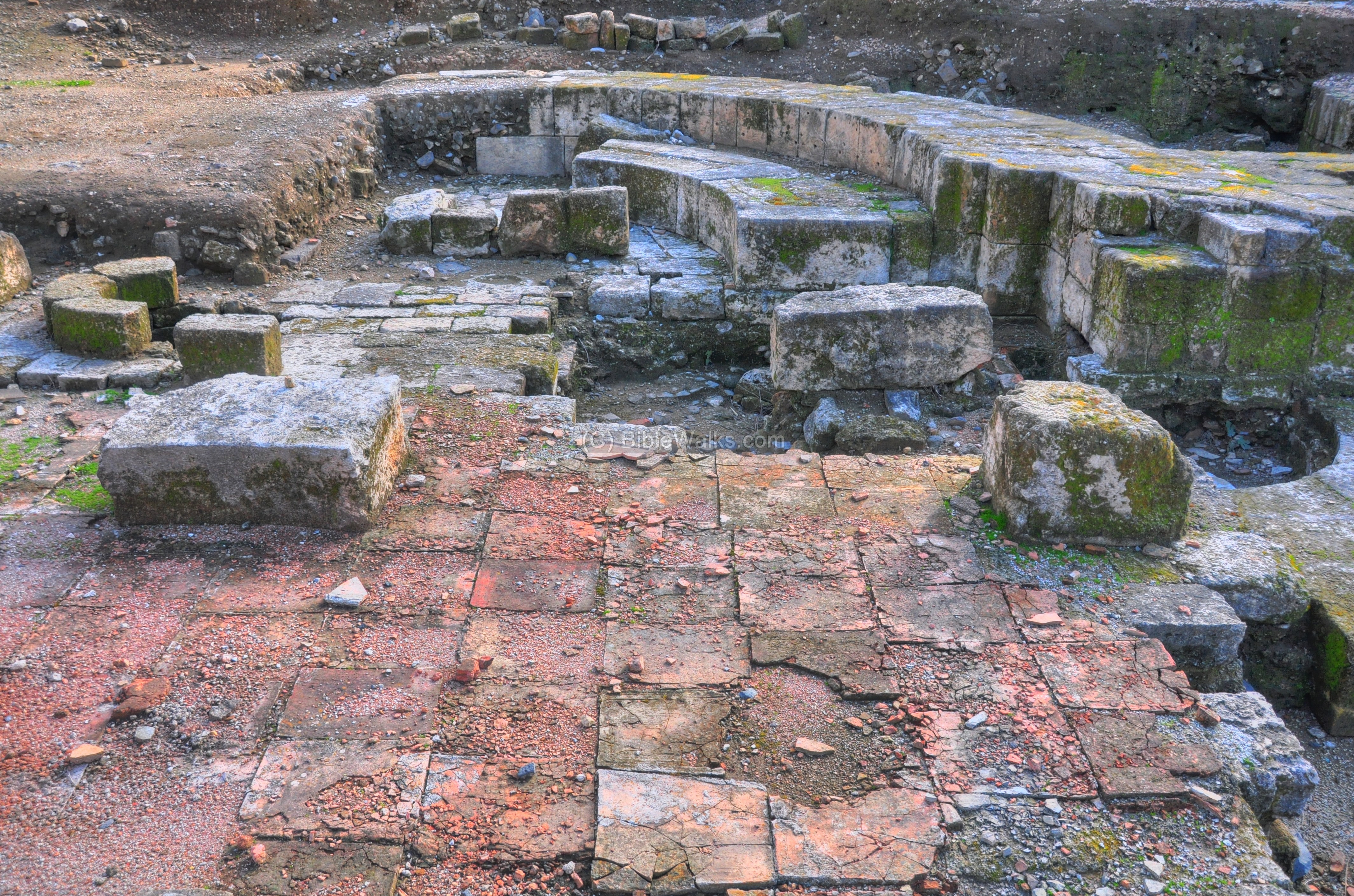
Under the bathhouse are a number of passageways and water carriers.
(e) Synagogue
Near the remains of the Byzantine period bathhouse is a structure believed to be a Synagogue. Its location is indicated by a red square.

The synagogue served the Jewish population until the 11th century.
The entrance to the synagogue from the north side is seen in the picture below.

The inner courtyard, with standing columns, shown below.
Another view from the south-east corner:
The western wall:
(f) Roman/Byzantine ruins
An excavated area north-east of the palace contains a number of Roman and Byzantine houses.
The photo below shows this area from a north view, with the synagogue seen in the left background.

A closer view:
A section along the north-east wall of the palace:
he following photo shows another section of the area. In the background is a Ottoman-Syrian period house, which was built over the north-east tower of the Roman city.

A closer view of the excavated rooms:

A detail in one of the rooms:
(g) Cardo Maximus
Cardo Maximus was the main Roman street in large cities. In the city of Paneas/Banias this street crosses the city from north to south, connecting the Banias springs to the Sa’ar stream.
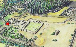
Sections of this colonnaded street are visible on the north side of the excavated city, as indicated by a red square on the illustration.
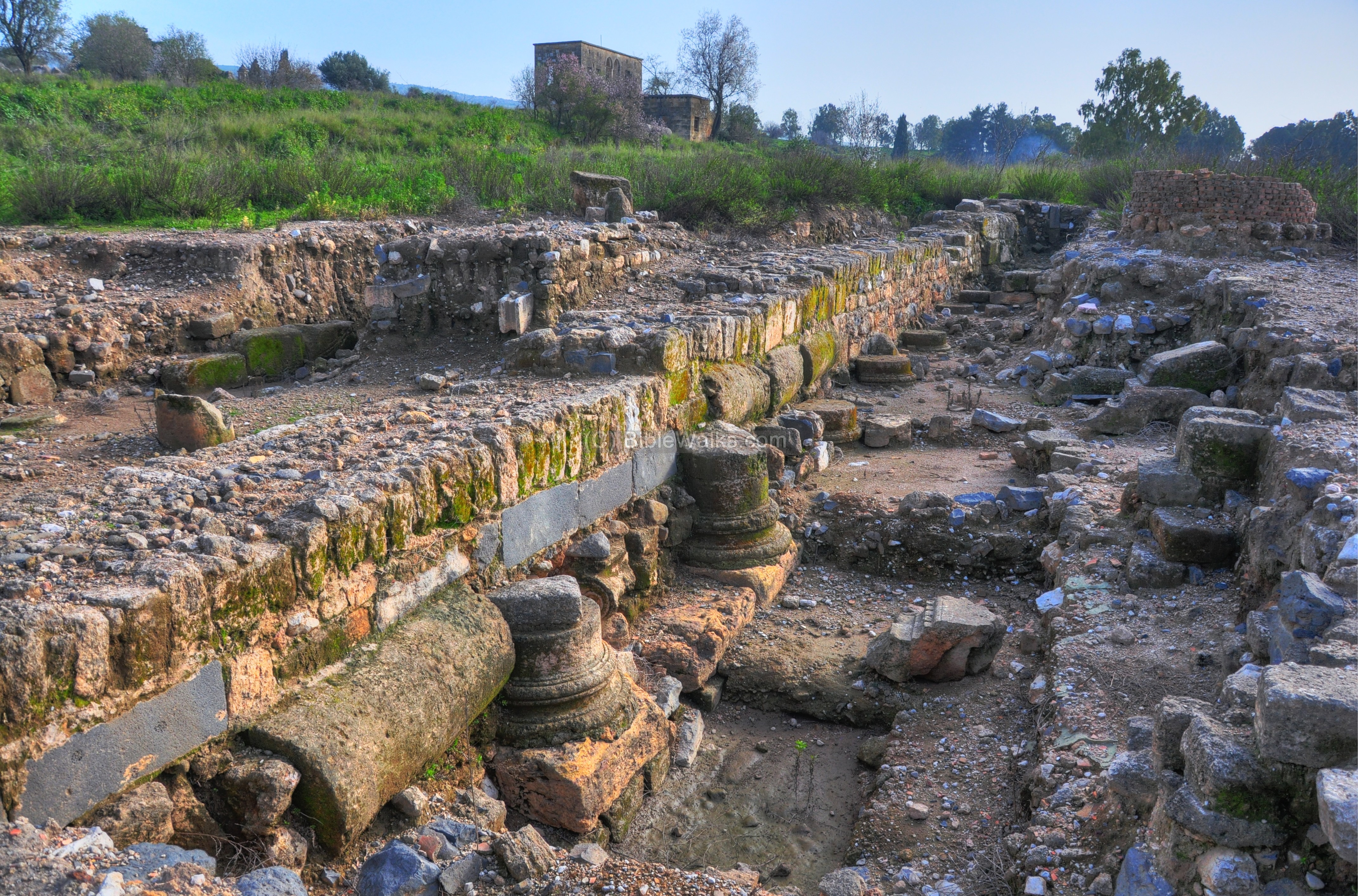
A view of the Cardo from the north-east side:
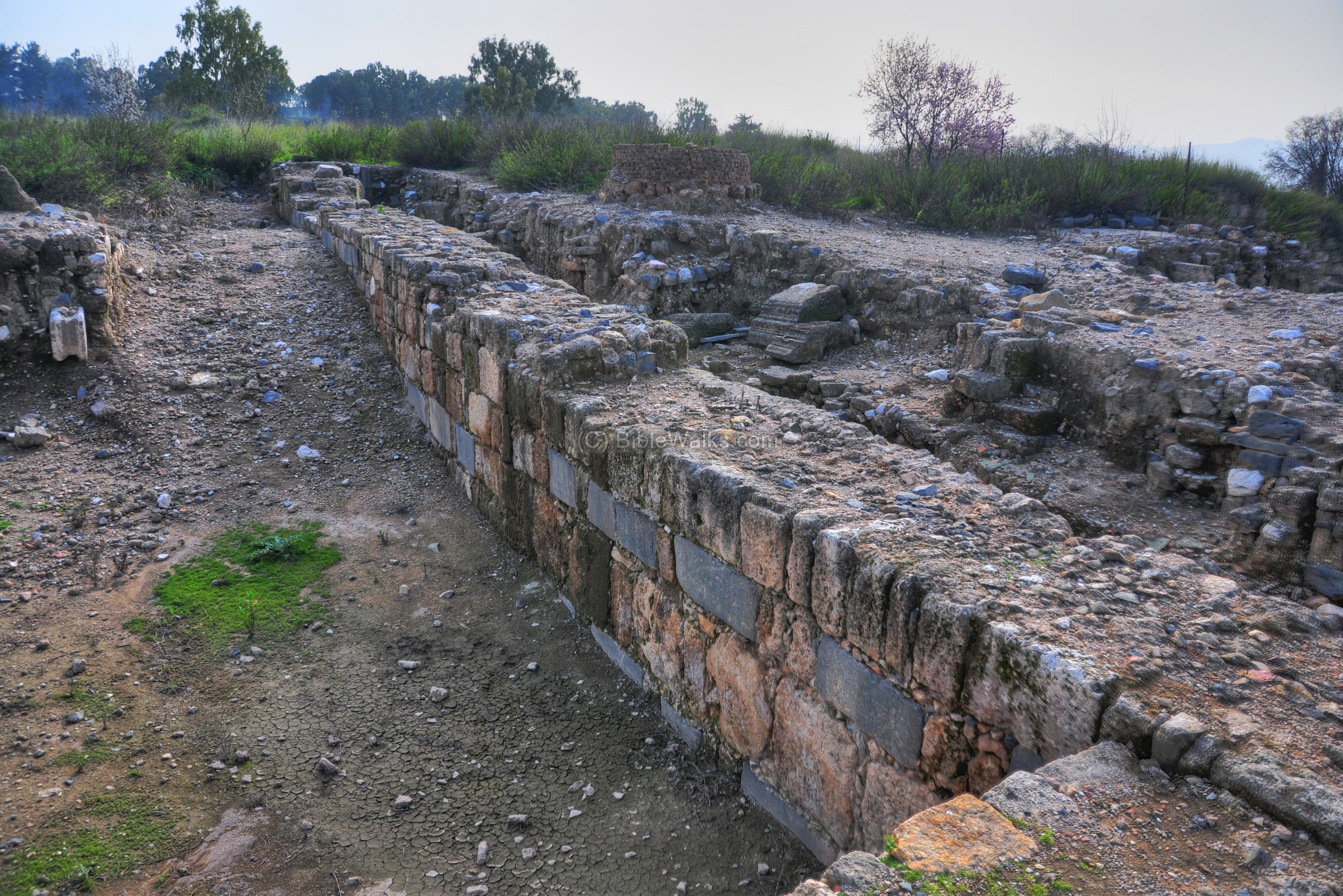
A detail of the column bases along the Cardo is in the photo below. The street was constructed during the period of Herod Philip and Agrippa II.

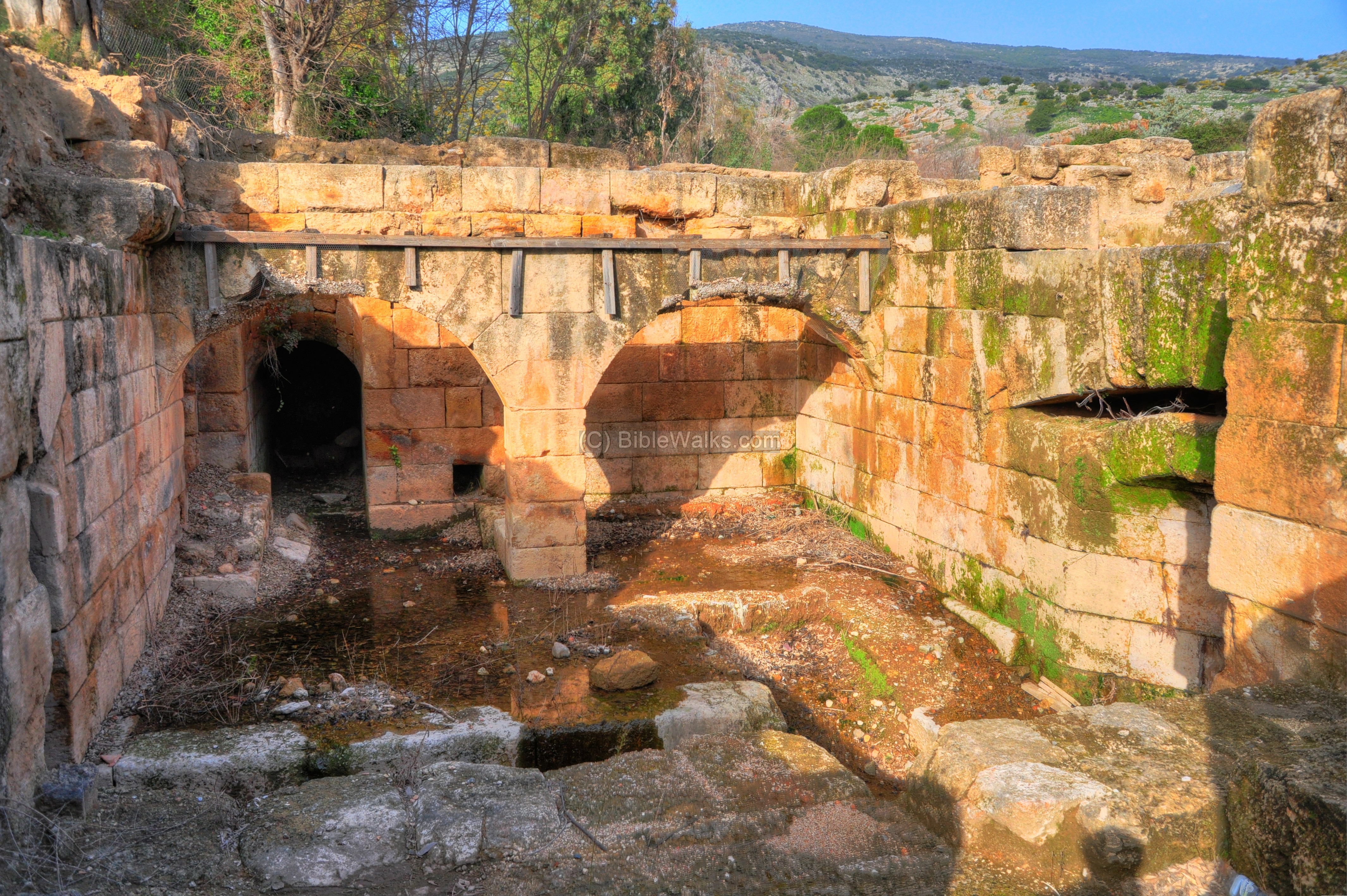
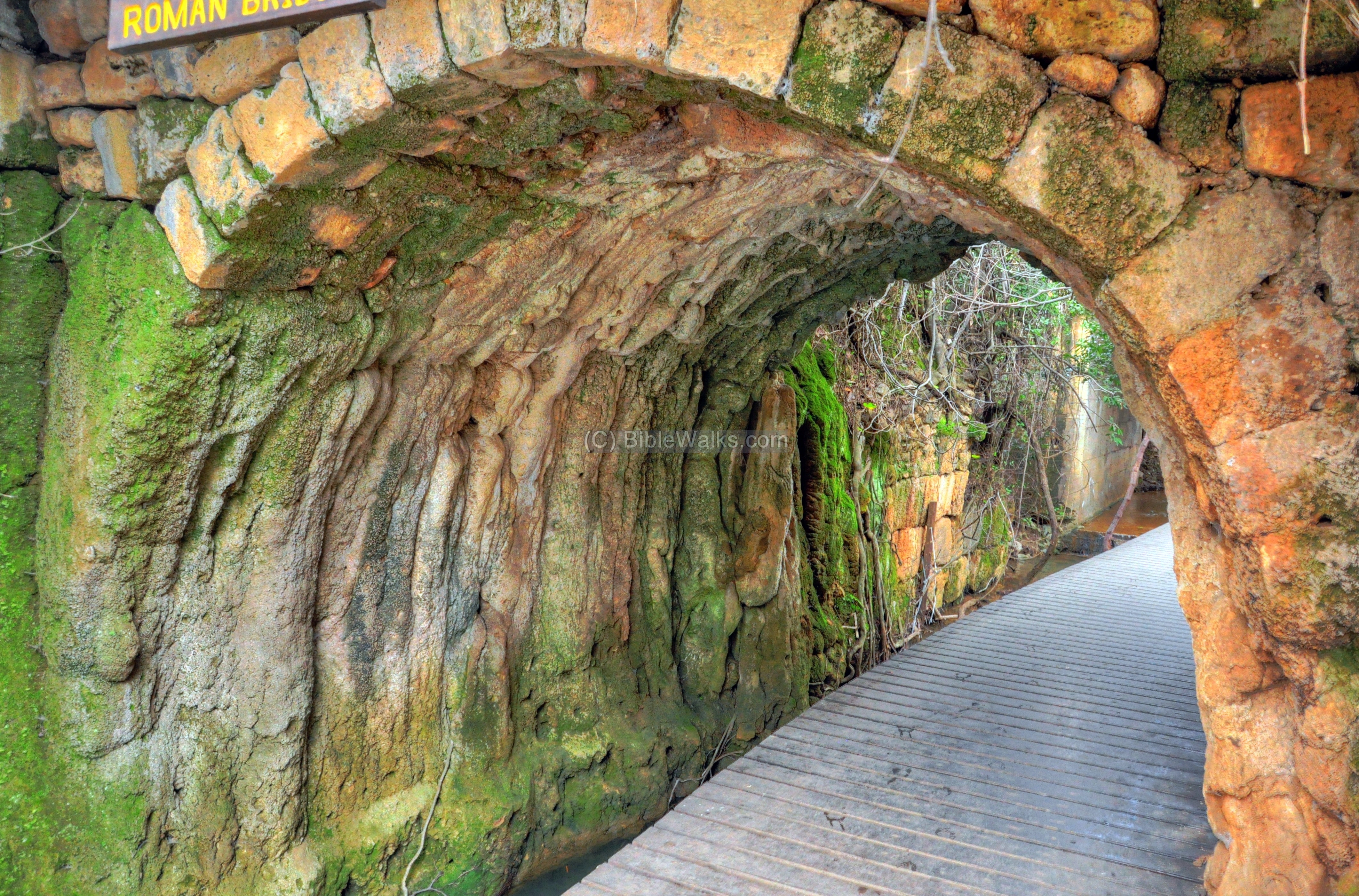
(h) Roman Bridge:
The junction of two streams – Banias and Guveta – is located on the north-west side of the Roman city. This location is indicated by a red square on the top-left corner of the illustration.
At this point, under the old road connecting to the Golan, is the base of a Roman bridge.
The photo below shows the bridge from the south side. This was once a section of the ancient Roman road that led to Damascus. It dates to the 1st century AD, during the early Roman period. It was likely built under the rule of Herod Philip (4 BC – 34 AD) or slightly later under Roman administration.
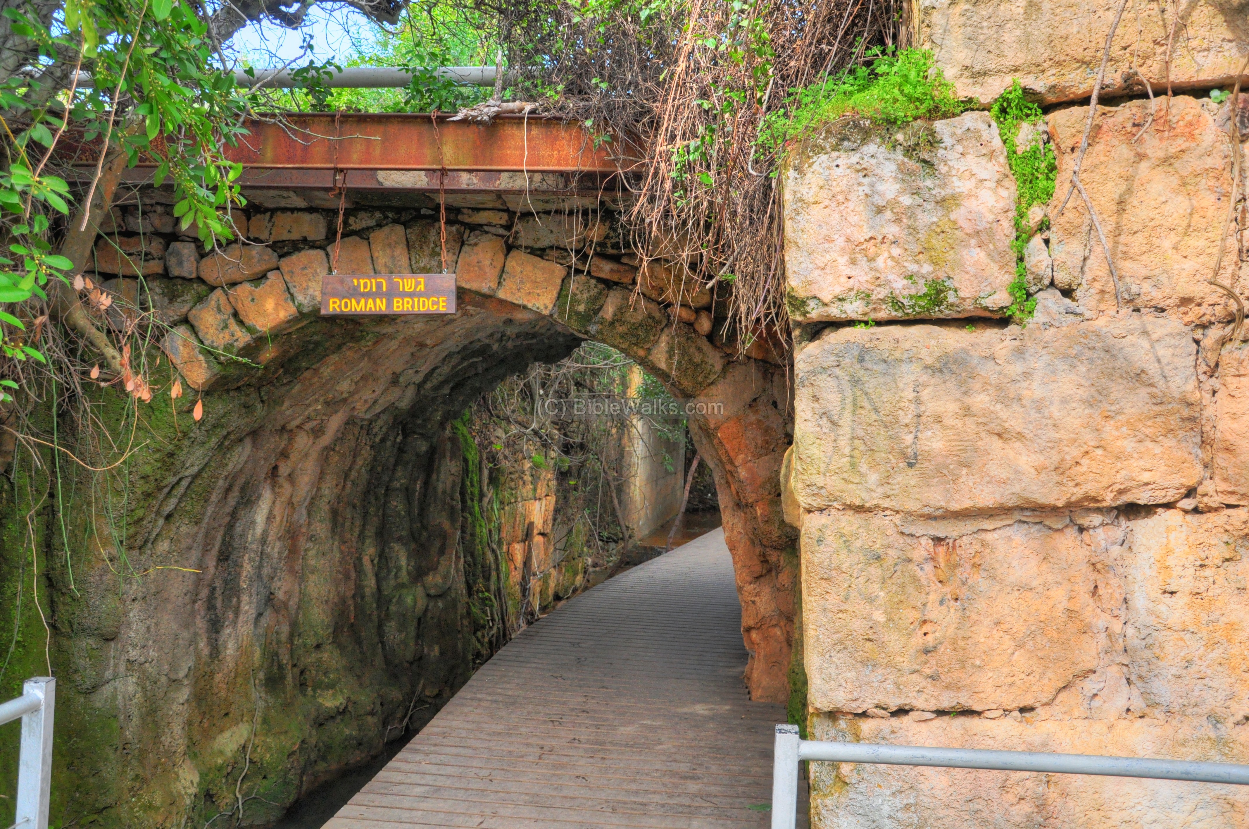
The Roman road passed Banias on its way up the Golan heights in the direction of Damascus. It appears on a section of the Peutinger map (Peutingeriana tabula), which was based on a 4th century map of Imperial Roman roads.
The map, rotated with the west on the top, illustrates the major military roads between Tiberias (shown as “Tyberias”) and Damascus (on the right, marked as “Damaspo”).
The road passed through Banias (marked in the center by twin towers as “Caferapaneas” – Kafar-Panias – Caesarea Philippi). It connected Tyre (XXXII Roman miles away) to Damascus (“XXXVII” and “XXIIII”, meaning 37 and 24 Roman miles between the stations on the road to Damascus).
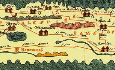
This road is als0 mentioned in Jesus’ travels (Mark 8 27): “Now Jesus and His disciples went out to the towns of Caesarea Philippi; and on the road He asked His disciples, saying to them, “Who do men say that I am?”, and Peter confessed Jesus as the Messiah. They have probably walked over this bridge.
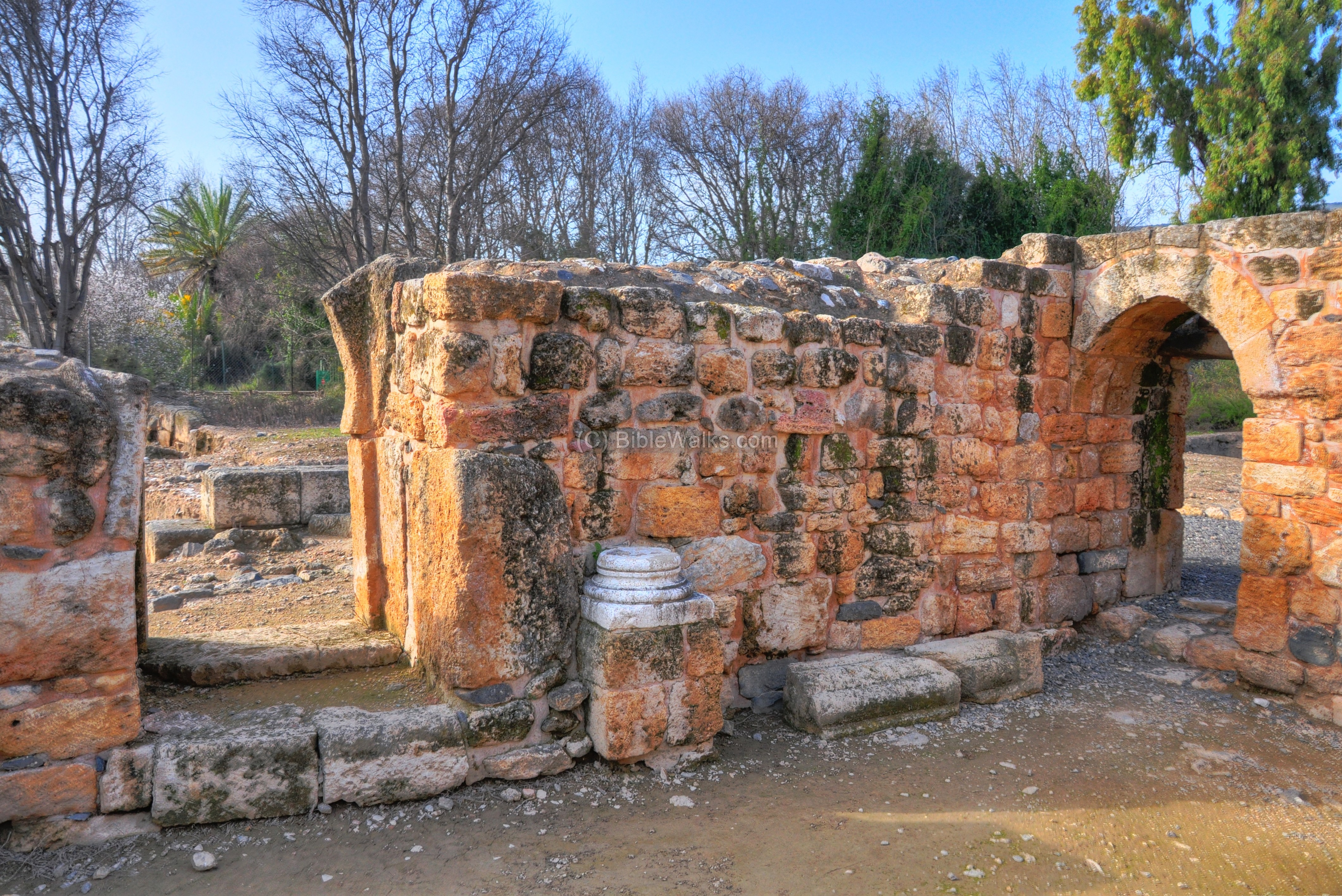
(i) Area B – Roman ruins, Byzantine Church:
Area B is located near the nature reserve’s entrance, on the side of the parking lot. Its location is illustrated on the map of the nature reserve.
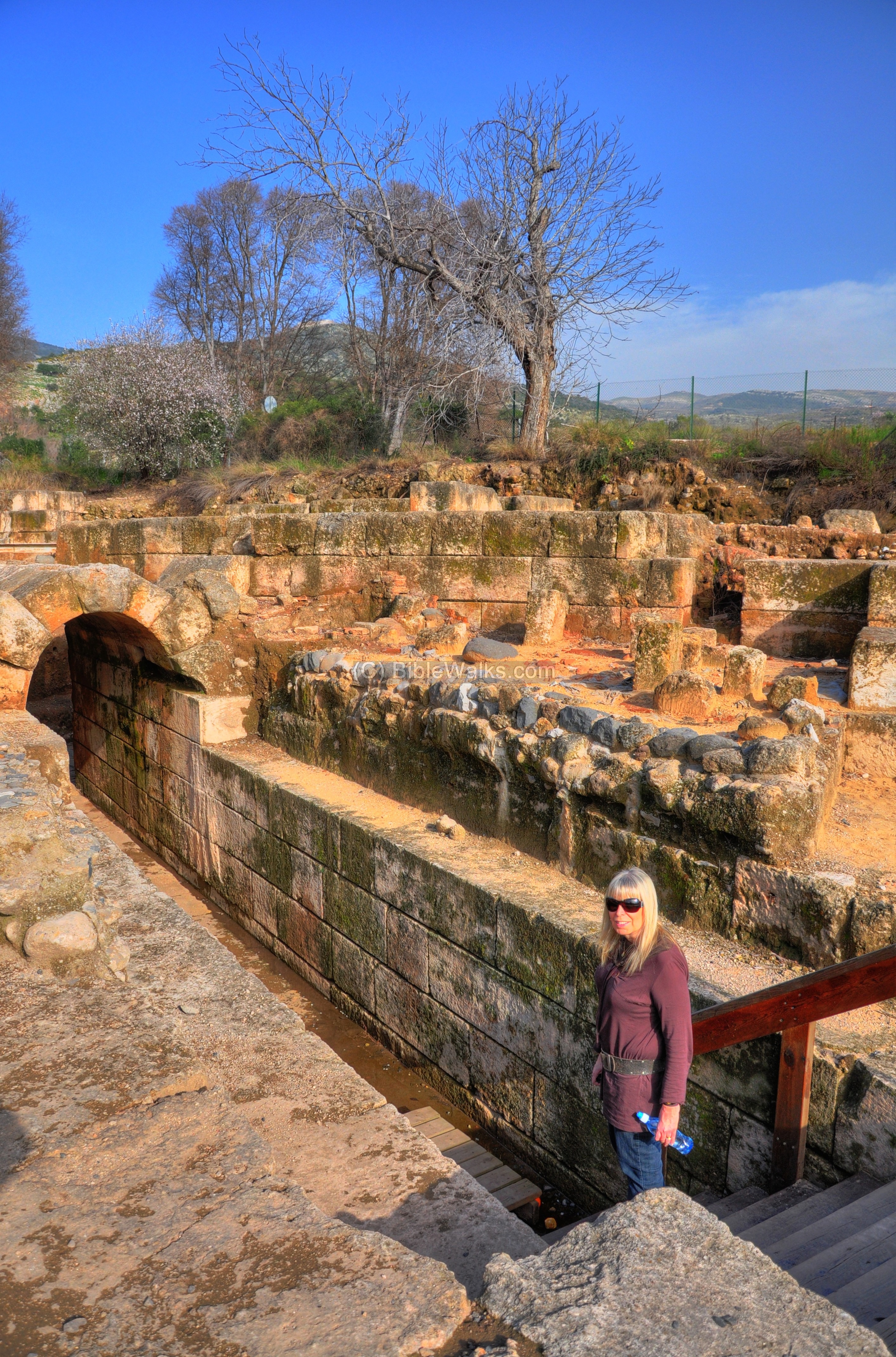
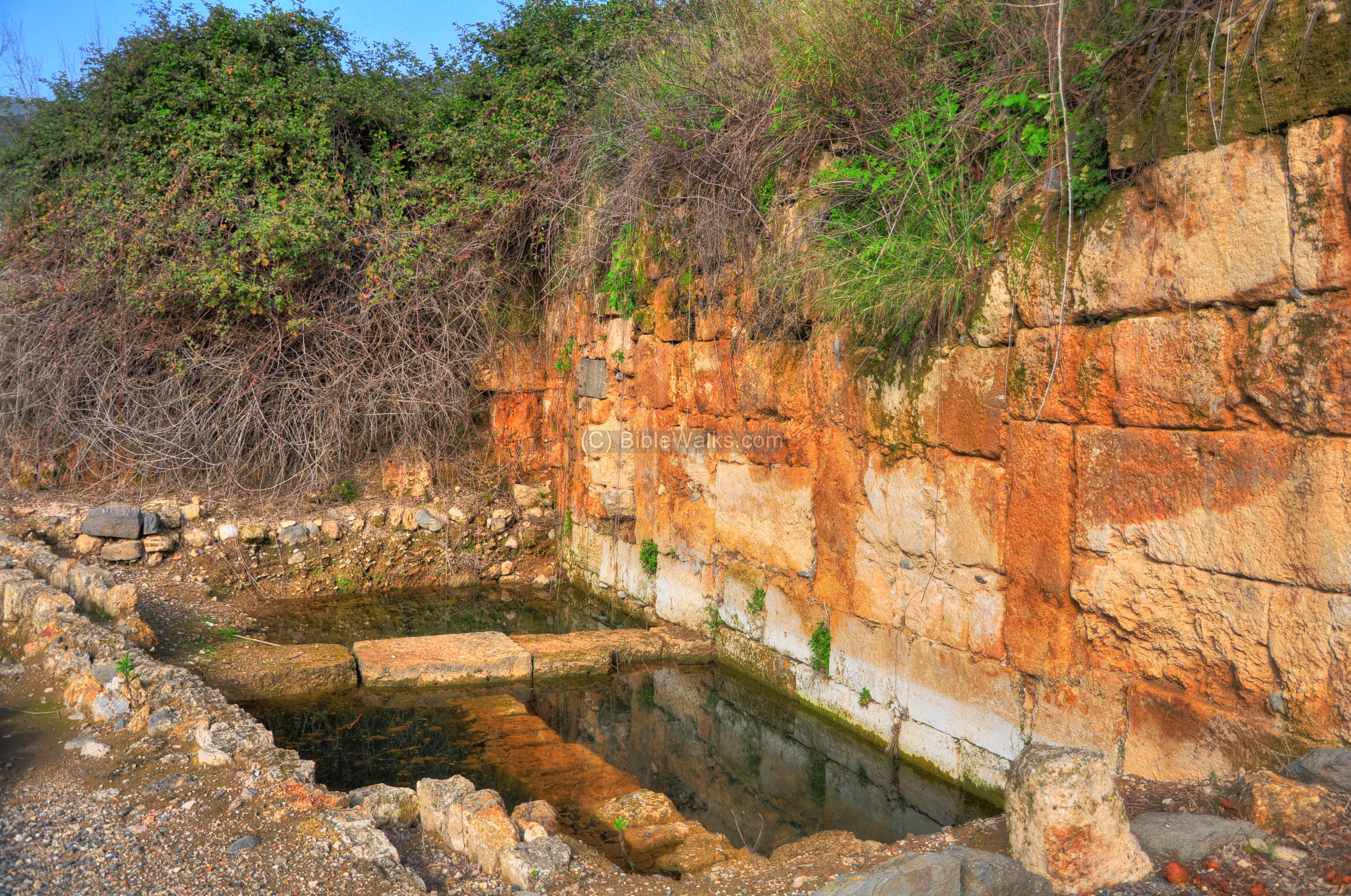
A large Byzantine Church was excavated here, as well as other archaeological periods. The aqueduct to the Roman city also passed at this location and was found under the church. The city’s north-eastern wall passed on the eastern side of the church. 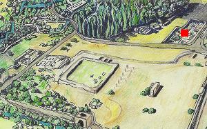
A view towards the south is observed below, with remains from various periods. The Byzantine church is located behind the wall on the right side. Under the arch passes a Roman Aqueduct that channeled water from the springs to the city.
-
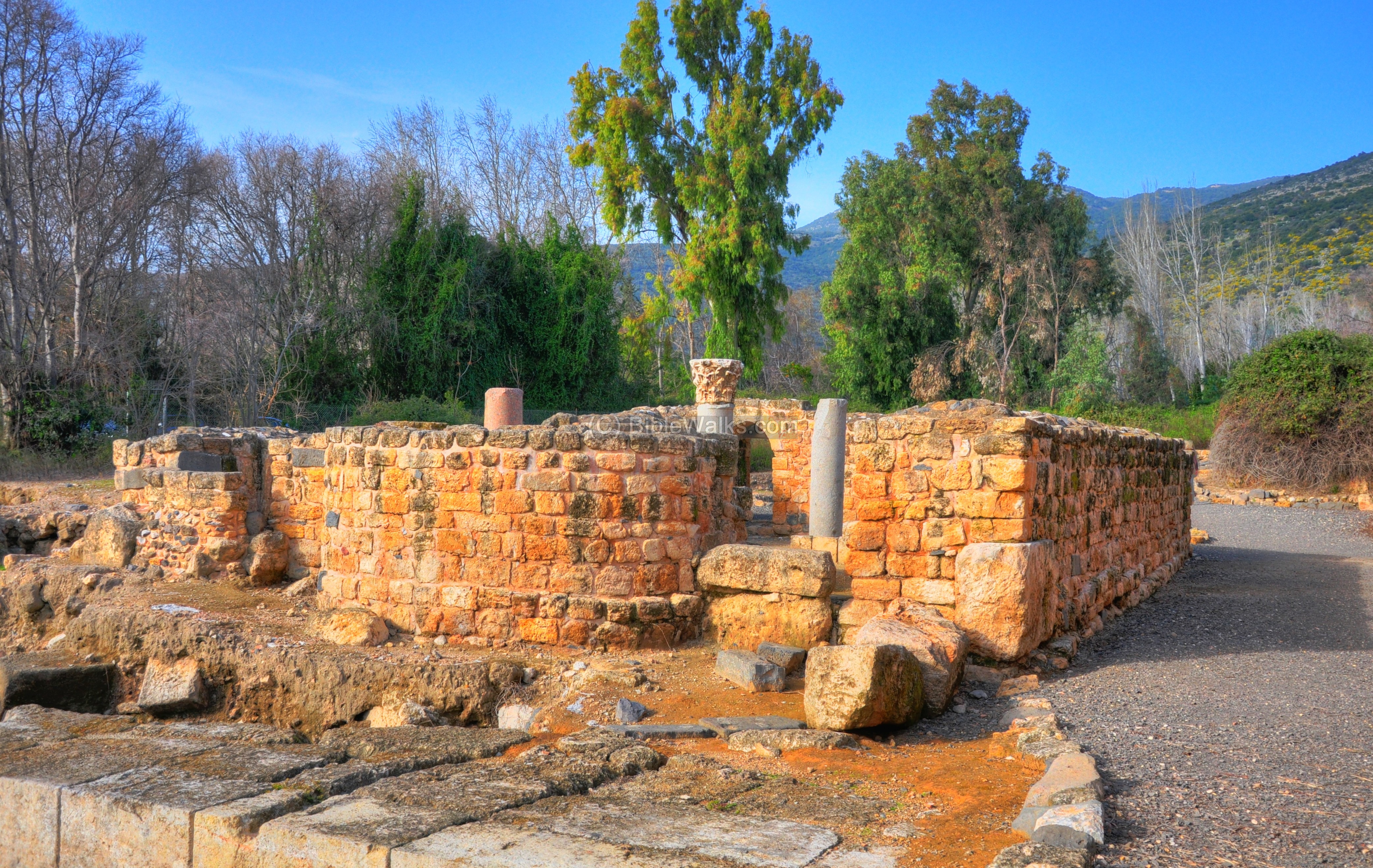
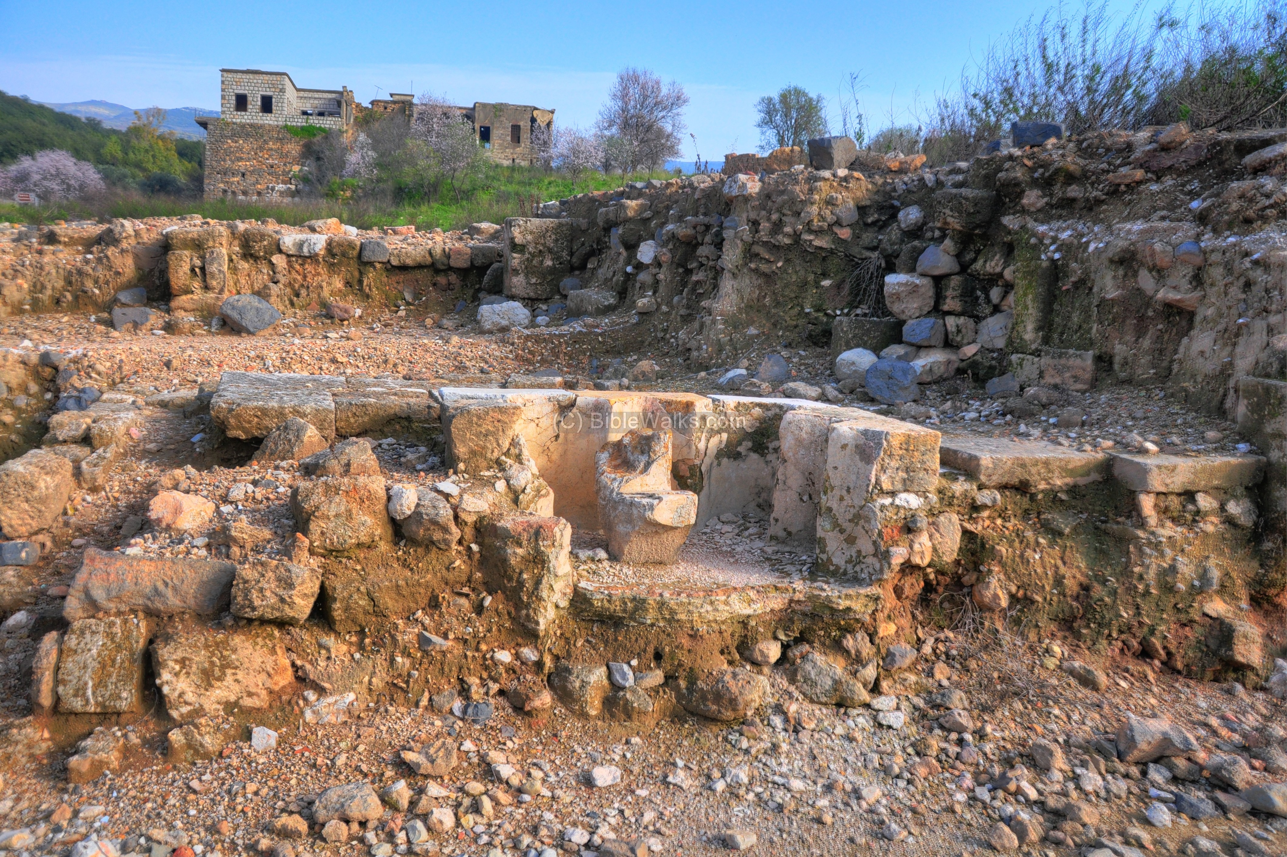
Monumental building and Gateway
The remains of an Early Roman period monumental building is located on the north side of the excavated area. It is dated to reign of Herod Philip. Notice the heart-shaped column in the center, which is commonl in Roman period structures (such as found in ancient synagogues).
A view from the north-east side is in the picture below.
This structure may have been part of a monumental gateway from the Roman city to the temple area, known as a propylaea (or propylaia), a Greek word meaning “front gate”, which is based on a prefix pro (front) and suffix pylaion (gate). Similar monumental gateways were constructed in other structures in the ancient world, including the Acropolis in Athens.
A detail of the early Roman monumental building is seen below:
Another section of the building:
-
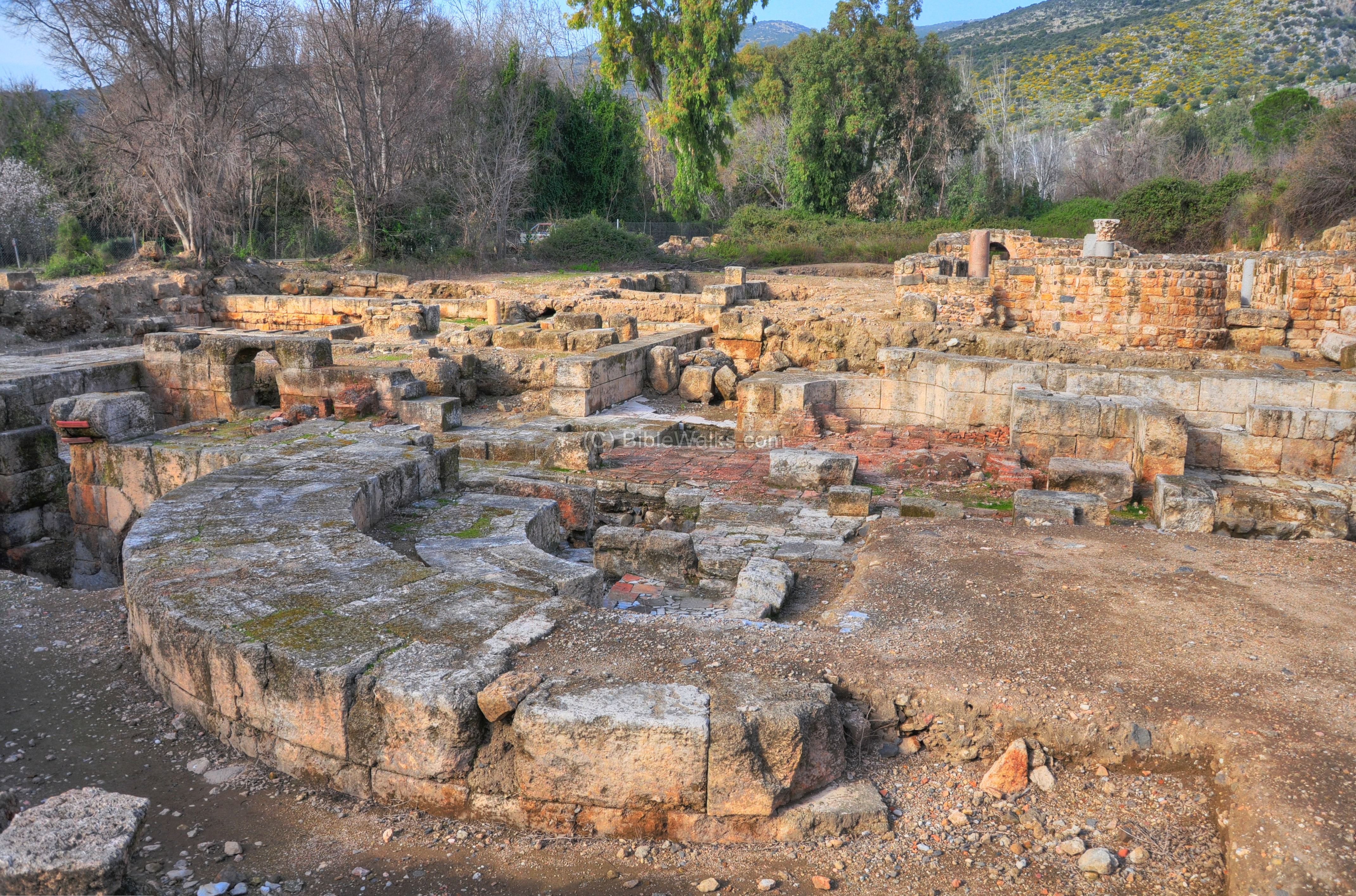
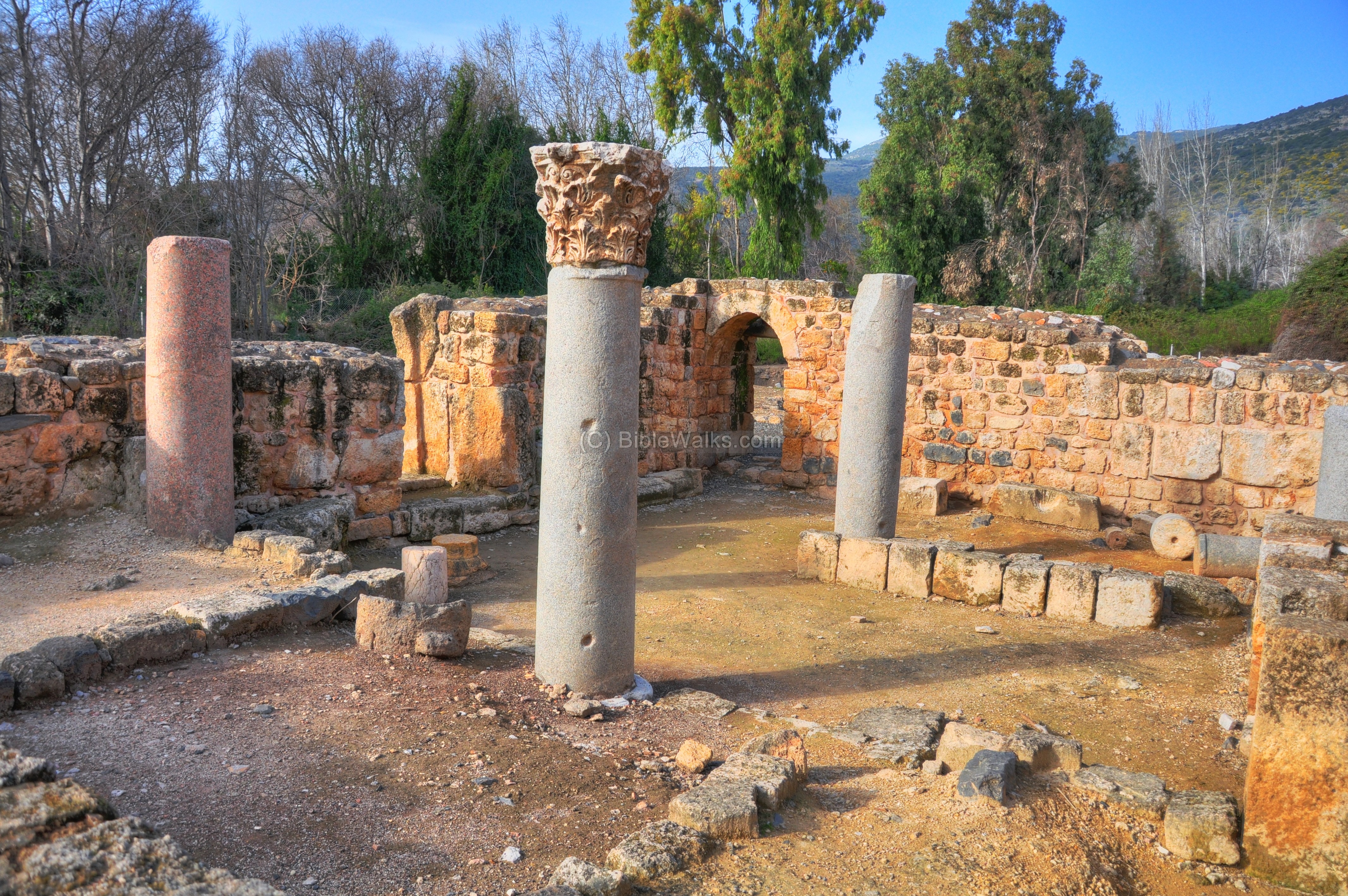
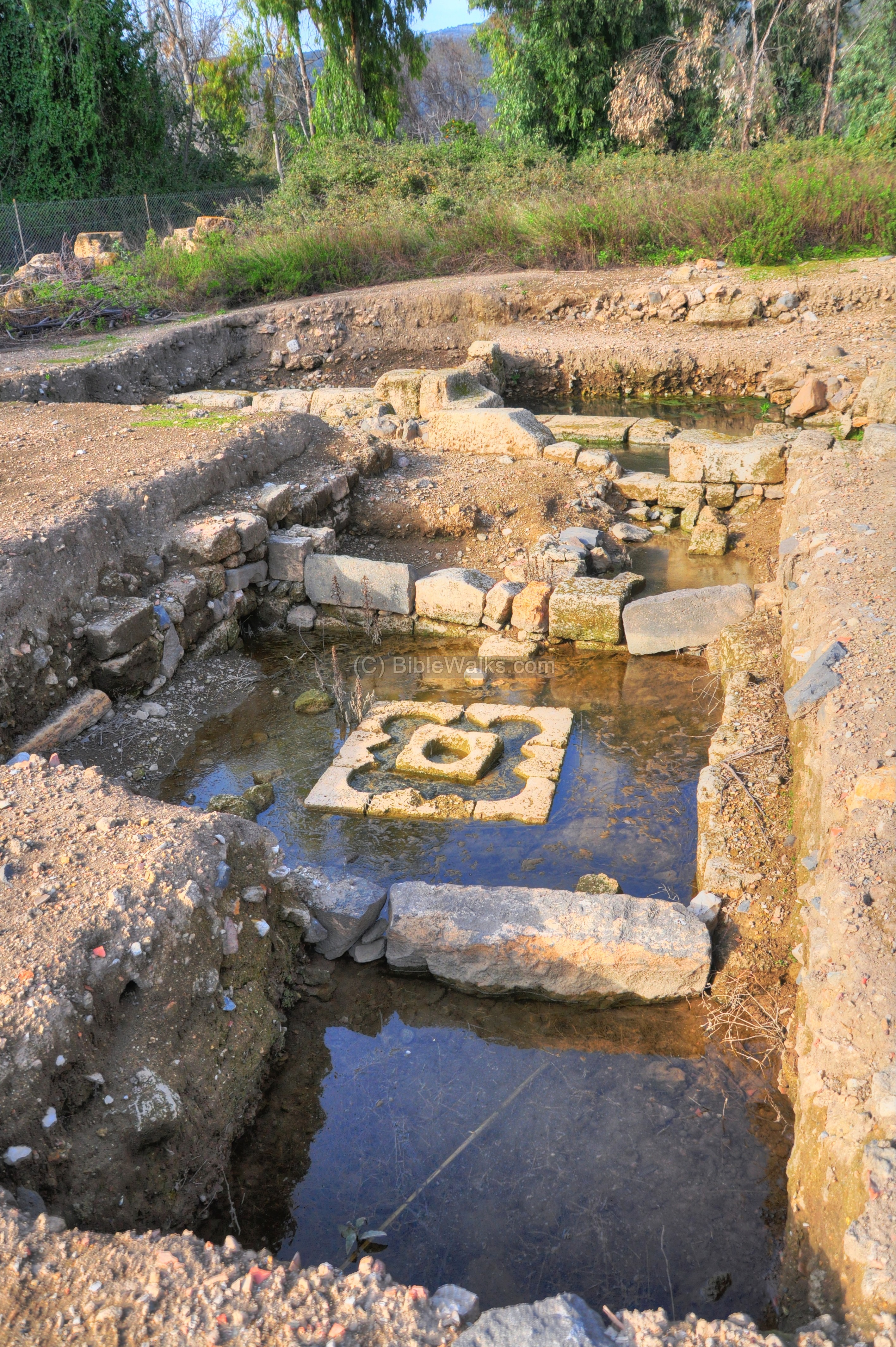
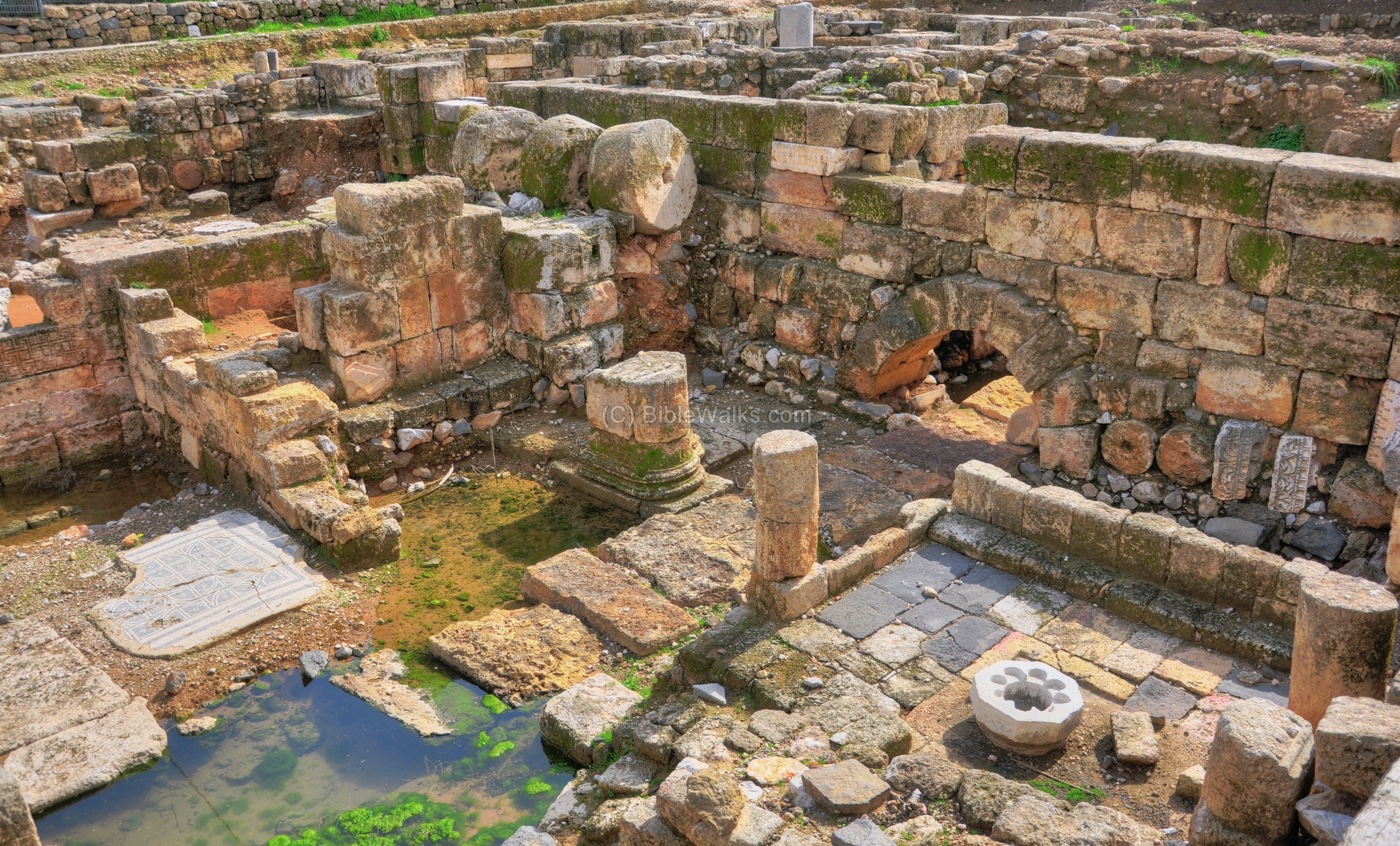
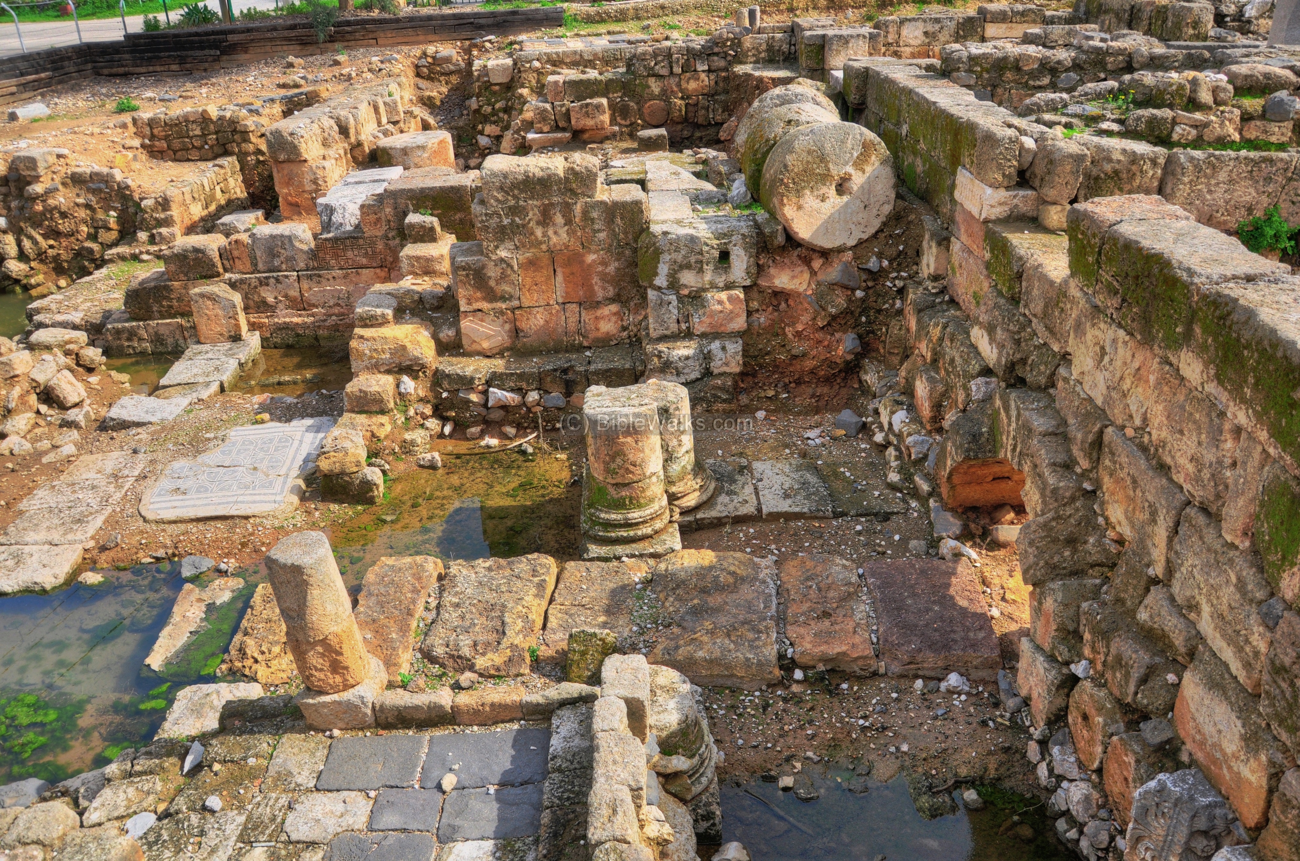
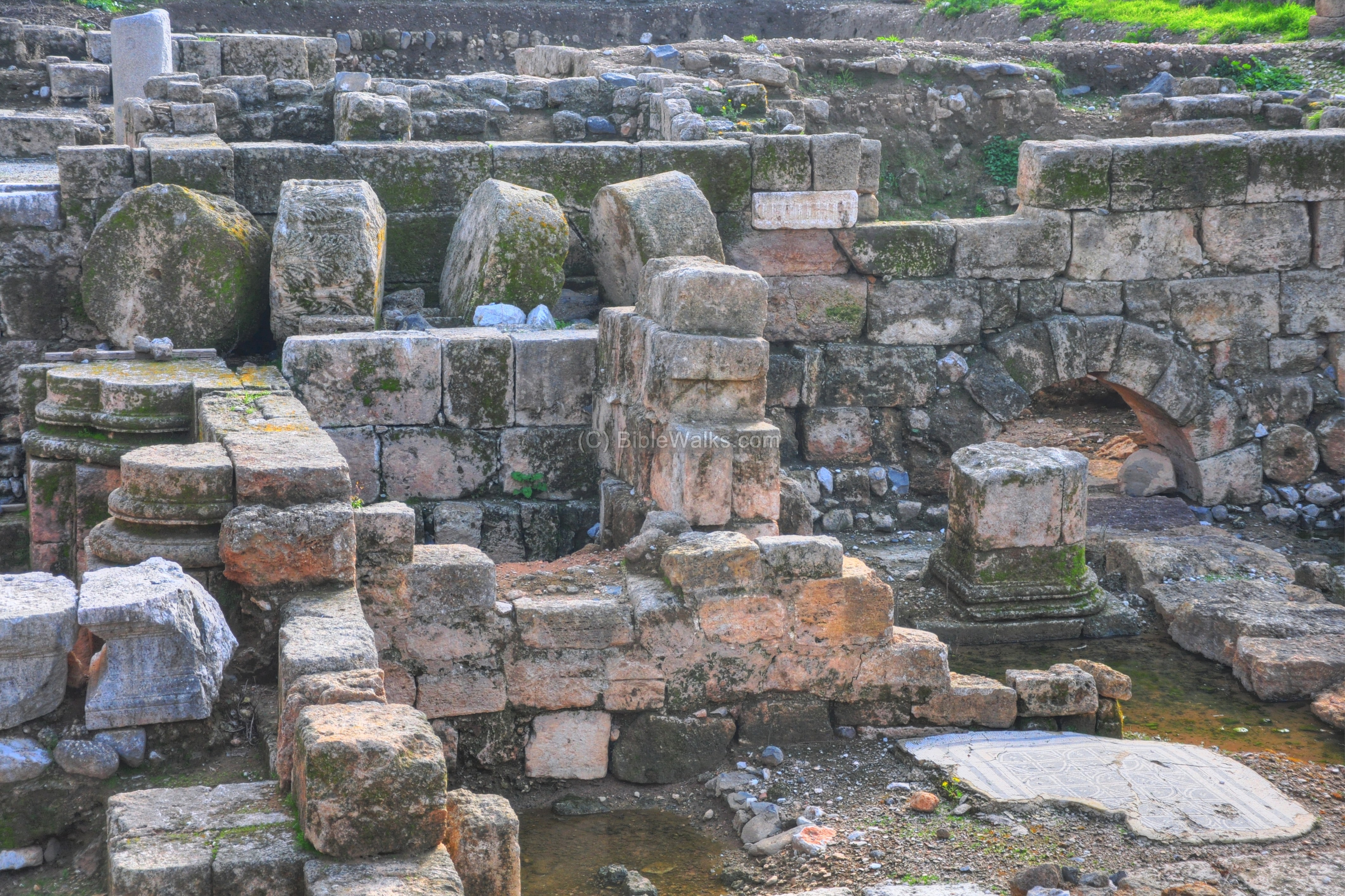
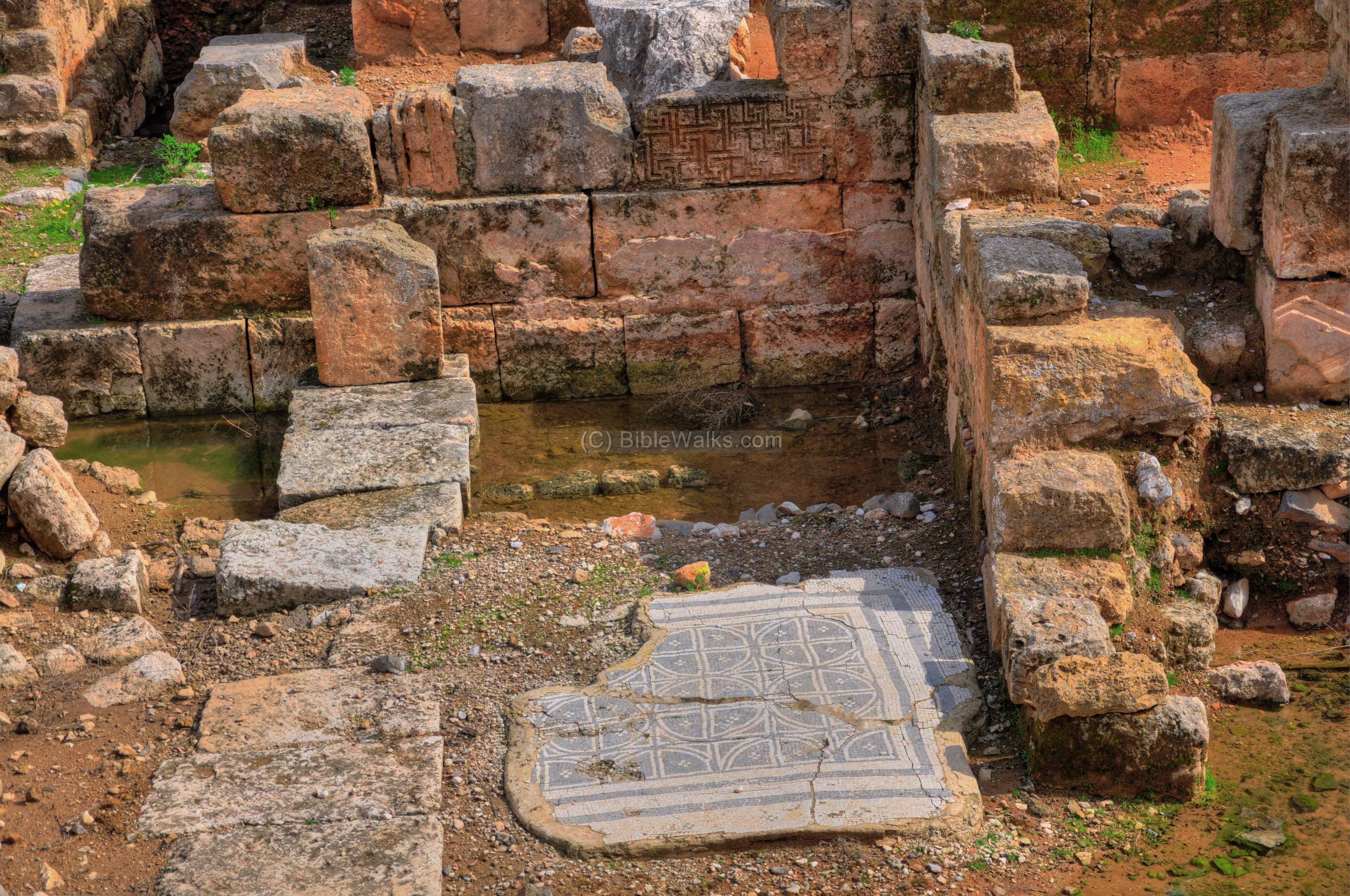
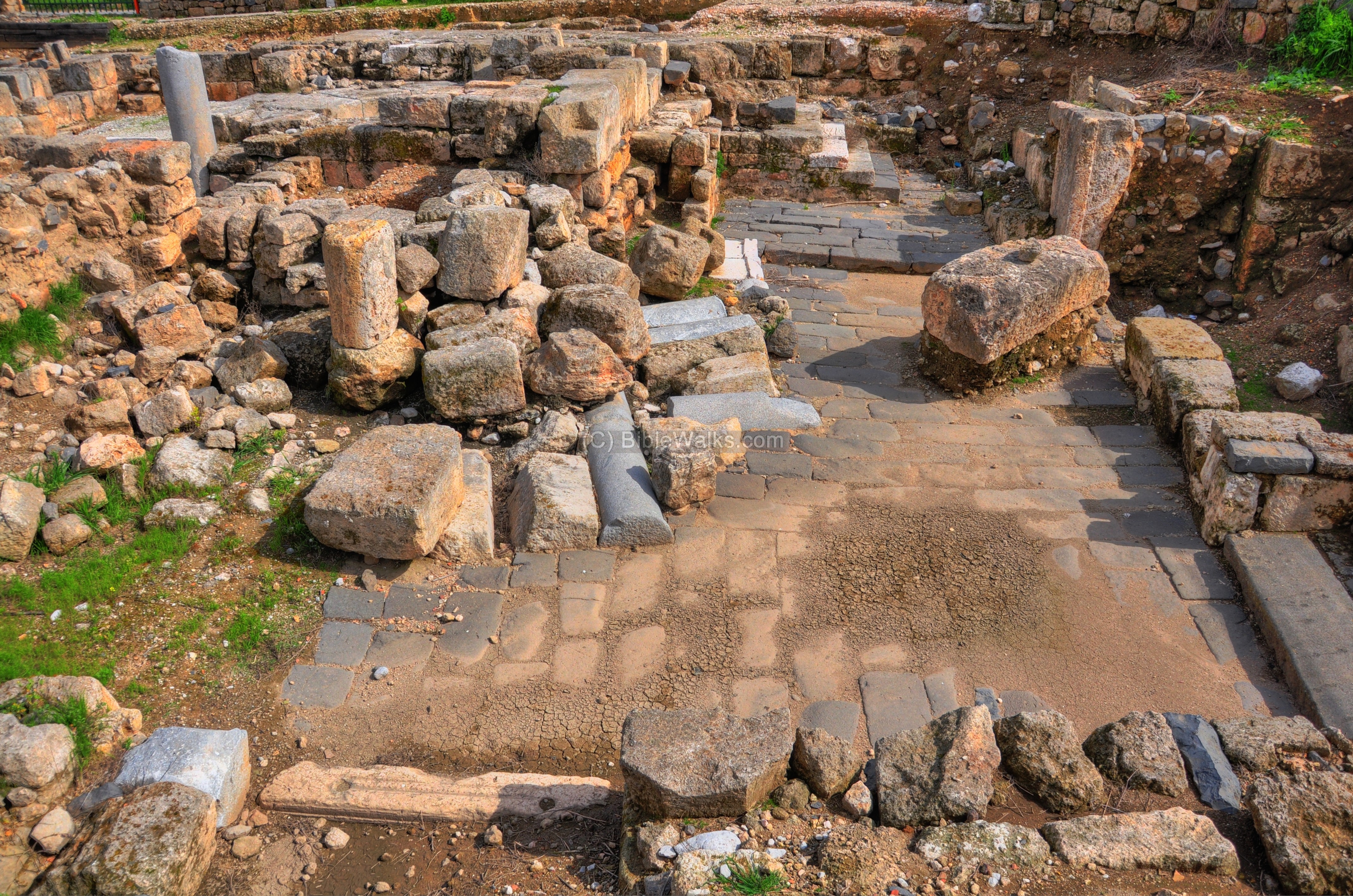
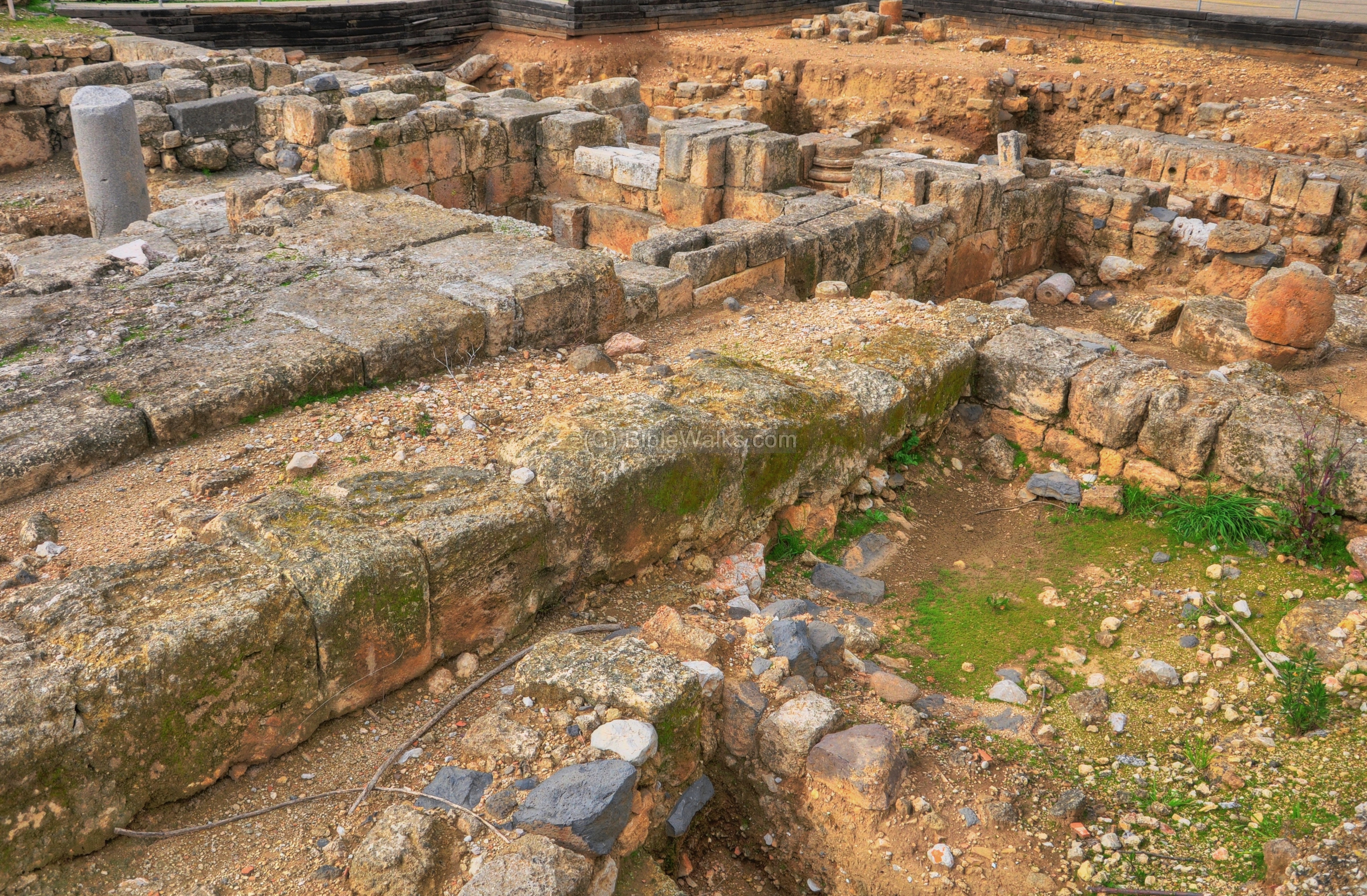
Basilica – Church of the healing of the bleeding woman
The large Byzantine Church was erected here in the 4th century, and was destroyed in the 9th century following the Arab conquest. This Basilica-shaped Church was the Cathedral of the Byzantine city of Paneas. A reconstructed plan of the west side of the church is illustrated here, although most of its stones were removed during Medieval times to build the new walls on the south.
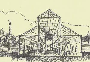
The church was dedicated to the miracle of the healing of the bleeding woman by Jesus. According to Mark 5 25-34 and Luke 8 43-50, this is a description of her healing: “And a woman having an issue of blood… Came behind him, and touched the border of his garment: and immediately her issue of blood stanched”.
Tradition holds that the healed woman herself erected the first statue of Jesus at her house as a gratitude to Jesus. According to the accords (“Church history”) of 4th C Bishop/Historian Eusebius of Caesarea, a statue of the miracle of the bleeding woman was located in one of the rooms. In 361, however, the anti-Christian Caesar Flavius Julian (“The Apostate”) replaced it with his own statue. But soon the bust “went bust” and the Caesar’s statue was damaged.
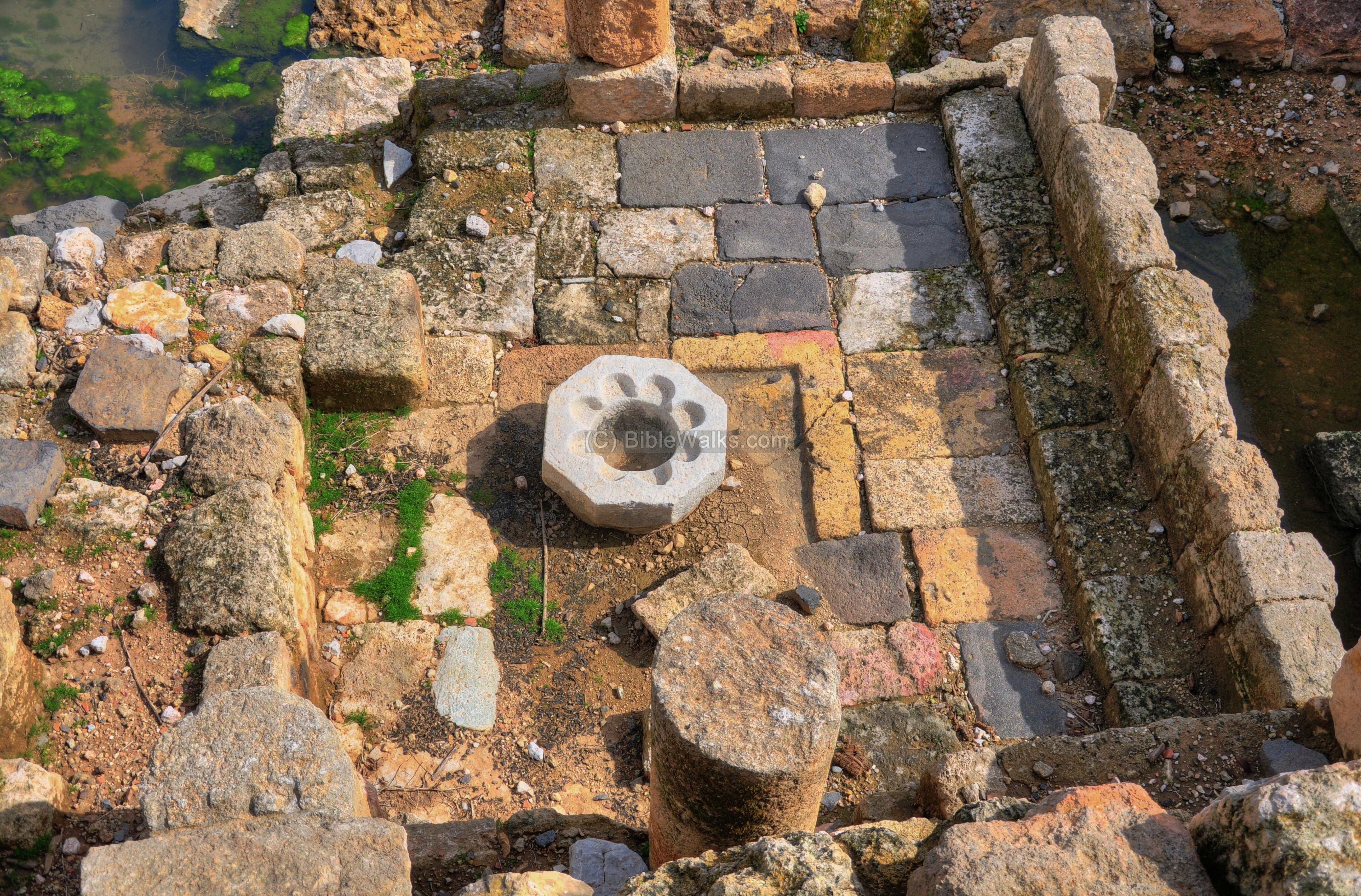
The following photo shows the more preserved eastern section of the basilica.
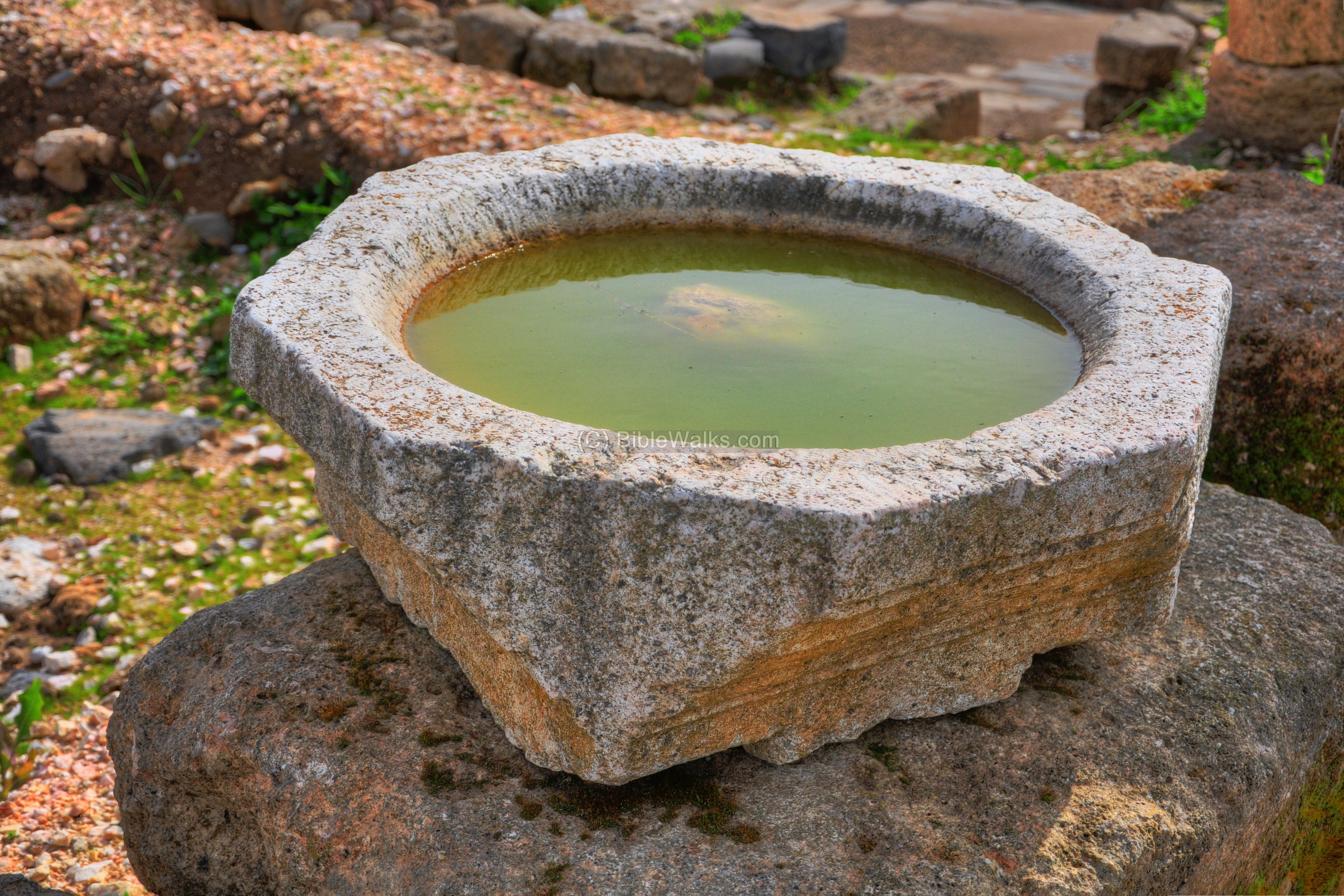
One of the excavated stone elements, a water vessel, is seen below:
Biblical References:
(a) Miracle of the Healing of the Bleeding woman:
Jesus heals the bleeding woman:
Mark 5 25-24:
“And a certain woman, which had an issue of blood twelve years, And had suffered many things of many physicians, and had spent all that she had, and was nothing bettered, but rather grew worse, When she had heard of Jesus, came in the press behind, and touched his garment. For she said, If I may touch but his clothes, I shall be whole. And straightway the fountain of her blood was dried up; and she felt in her body that she was healed of that plague. And Jesus, immediately knowing in himself that virtue had gone out of him, turned him about in the press, and said, Who touched my clothes? And his disciples said unto him, Thou seest the multitude thronging thee, and sayest thou, Who touched me? And he looked round about to see her that had done this thing. But the woman fearing and trembling, knowing what was done in her, came and fell down before him, and told him all the truth. And he said unto her, Daughter, thy faith hath made thee whole; go in peace, and be whole of thy plague”.
Luke 8 43-50:
“And a woman having an issue of blood twelve years, which had spent all her living upon physicians, neither could be healed of any, Came behind him, and touched the border of his garment: and immediately her issue of blood stanched. And Jesus said, Who touched me? When all denied, Peter and they that were with him said, Master, the multitude throng thee and press thee, and sayest thou, Who touched me? And Jesus said, Somebody hath touched me: for I perceive that virtue is gone out of me. And when the woman saw that she was not hid, she came trembling, and falling down before him, she declared unto him before all the people for what cause she had touched him, and how she was healed immediately. And he said unto her, Daughter, be of good comfort: thy faith hath made thee whole; go in peace. While he yet spake, there cometh one from the ruler of the synagogue’s house, saying to him, Thy daughter is dead; trouble not the Master. But when Jesus heard it, he answered him, saying, Fear not: believe only, and she shall be made whole”.
(b) Jesus visits Paneas; Peter confesses He is the Messiah
Jesus and His disciples visited the site, and Peter confessed Jesus as the Messiah:
Mark 8 27-30:
“Now Jesus and His disciples went out to the towns of Caesarea Philippi; and on the road He asked His disciples, saying to them, “Who do men say that I am?” So they answered, “John the Baptist; but some say, Elijah; and others, one of the prophets.” He said to them, “But who do you say that I am?” Peter answered and said to Him, “You are the Christ.” Then He charged them that they should tell no one about Him.”
(d) Matthew 16 13-20:
“When Jesus came into the coasts of Caesarea Philippi, he asked his disciples, saying, Whom do men say that I the Son of man am? And they said, Some say that thou art John the Baptist: some, Elias; and others, Jeremias, or one of the prophets.He saith unto them, But whom say ye that I am? And Simon Peter answered and said, Thou art the Christ, the Son of the living God. And Jesus answered and said unto him, Blessed art thou, Simon Barjona: for flesh and blood hath not revealed it unto thee, but my Father which is in heaven. And I say also unto thee, That thou art Peter, and upon this rock I will build my church; and the gates of hell shall not prevail against it. And I will give unto thee the keys of the kingdom of heaven: and whatsoever thou shalt bind on earth shall be bound in heaven: and whatsoever thou shalt loose on earth shall be loosed in heaven. Then charged he his disciples that they should tell no man that he was Jesus the Christ”.
Etymology (behind the name):
* Names of the city-
- Paneas – The city of Pan – Greco-Roman God of shepherds and flocks, mountainside, hunting and rustic music
- Panias, Panium, Panaeon – other forms of “city of Pan”
- Caesarea-Philippi – Caesarea is the city of Caesar; Philippi – named after Herod’s son who made the city his capital
Links:
* External links:
- Nature reserve
* Internal links:
- Banias Overview page
- Banias temples
- Banias stream
- Nimrod fortress – Crusaders/Arab/Mameluke fortress above the city
BibleWalks.com – have Bible will travel
Banias Stream <<<–previous site—<<<All Sites>>>—Next Golan site —->>> Banias Crusaders city
This page was last updated on Feb 8, 2025 (note on bridge dating)
Sponsored links: