Ruins of a Crusader fortress, located on the side of the road from Jaffa and Ramla to Jerusalem.
Contents:
Overview
Aerial Map
History
Photos
* Aerial views
* South West
* Top of hill
* Eastern side
* Basement
* Monument
* Video
Etymology
Links
Overview:
Ruins of a Crusader fortress, located on the side of the road from Jaffa and Ramla to Jerusalem, in the Judean foothills region. The fortress, named La Tour des Chevalliers (“the Castle of the Knights”), was built in 1137 and held by the knights of the Templar order. It was captured by Saladin in 1187 and demolished 4 years later.
The French name “La Toron” (the castle) was the source of the Arabic name of the place – Latron/Latrun.
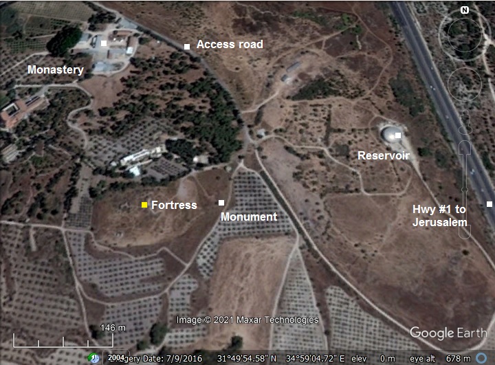
Map / Aerial View:
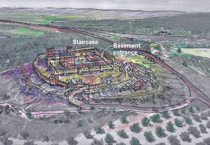
An aerial map is shown here, indicating the major points of interest around the site.
The access road, marked on the map as passing along the eastern foothills of the fortress, was the path of the old road to Jerusalem.
History:
- Crusaders
The roads and highways of the Crusader Kingdom were never safe. Therefore, the Crusaders built fortresses along the roads to protect against attacks from organized groups and nomads. This fortress was constructed in 1137 because of attacks from organized groups coming from Ashkelon (as per Hiestand, R. 1994). The fortress, named La Tour des Chevalliers (“the Castle of the Knights”), was held by the cavalry knights of the Templar order. A village was built adjacent to the fortress, and its Jewish residents were described in the memoirs of the 12th century traveler Benjamin of Tudela.
An illustration of the fortress at the times of the Crusaders is shown here from the south side. The fortress was first constructed as a central tower (keep) on the top of the hill, then in further years an inner and an outer wall were added around it.
The road from Ramla and Jaffa to Jerusalem passed on the north side of the hill. The valley of Ayalon is seen in the far background.
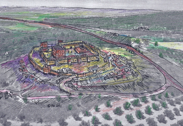
The plan of the fortress was based on the following elements:
- A central tower (keep): 14m square with 3-4m thick walls.
- An inner fortress : area enclosed by a quadrangular enclosing inner wall, 3m thick (72m E-W by 55 N-S).
- On the east side – a possible location of a Church (“al-Kanisah” – “The Church”)
- A vast basement under the inner fortress, with a ceiling supported by cross vaults
- Steps that lead from the basement to the ground level
- Parallel to the northern side is a 8m wide continuous barrel-vault
- A polygon shaped outer wall followed the shape of the hill
- Twin towers along the outer wall, on the south and north west
- Vaulted buildings, including stables, 100m to the north
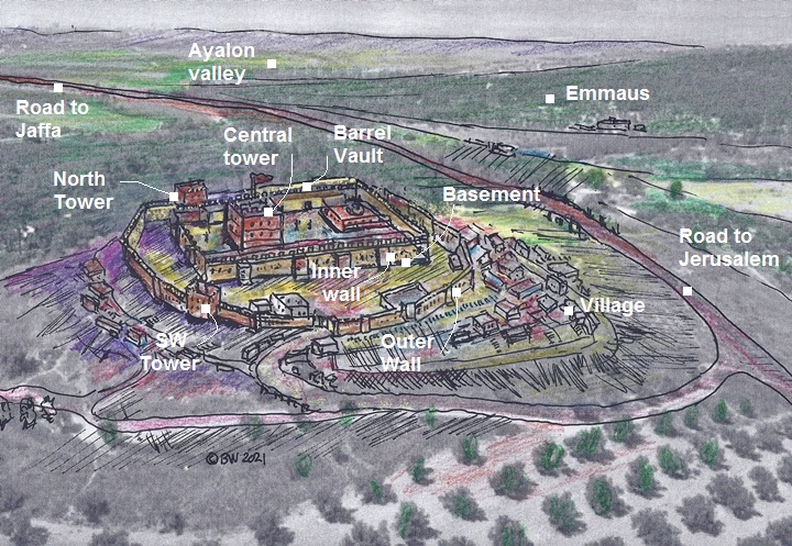
Most of these elements are now gone, so don’t expect top see all these on the hill. The main intact structure is a section of the basement – a floor under the quadrangular fortress enclosed within the inner wall.
- Ayyubids
In the second half of the 12th century, the great opponents of the Crusaders were the Ayyubid Muslims. This dynasty was founded by Saladin (Salah ad-Dīn Yusuf ibn Ayyub). The Ayyubid Muslims ruled Syria and Egypt in the years 1171-1341. Saladin, a Muslim of Kurdish origin, was the first Ayyubid Sultan in 1174 and reigned until 1193. His mission was to drive the Crusaders out of the Holy Land and the Levant, a mission that was mostly accomplished. This fortress was captured by Saladin in 1187, as part of the conquest of Jerusalem.
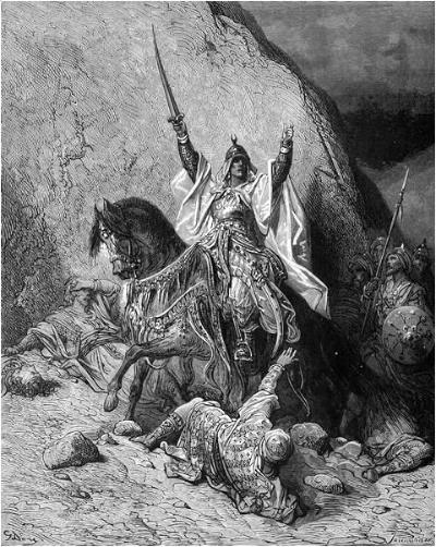
Saladin – by Gustave Dore (French artist, 1832-1883)
Jerusalem was the key target of the Crusaders. In attempt to block their attempts, Saladin fortified Jerusalem in 1191 and secured the roads to the city. As part of these attempts, Saladin demolished the fortress (1191) in order to block the Crusaders from recapturing Jerusalem.
In the same year, Richard the Lionheart, the leader of the 3rd Crusade (1189-1192), captured the fortress. He then repaired the castle and added fortifications. The fortress continued to be in Crusaders hands until 1263 when it was captured by the Mameluke forces headed by Baybars. Under Mameluke control the fortress was abandoned.
In the 14th century an inn was constructed near the ruins of the fortress.
- Ottoman Period – (1516-1918 A.D.)
The site was examined in the PEF survey (1866-1877) by Wilson, Conder and Kitchener. It appears in the center of the section of this map of 1878. The castle is marked as “Latrôn”.
An ancient road, marked by a double dashed line, appears to the north of Latrun. This is also the modern route of highway #1 to Jerusalem.
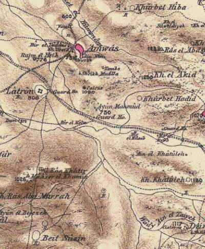
Part of Map Sheet 17 of Survey of Western Palestine,
by Conder and Kitchener, 1872-1877.
(Published 1880, reprinted by LifeintheHolyLand.com)
Their description of the site is on page 135:
“Latron -The ruined walls of a mediaeval fortress on a knoll overlooking the plain. Walls and vaults of good-sized masonry, but of indistinguishable plan, remain. The arches are pointed. On the west are remains of a sloping revetment of undrafted stones ; large drafted stones lie among the ruins. The modern hovels are built in the ancient vaults. The natives consider part of the ruin to be a chapel. West of this site, near Howard’s new hotel, is a rock-cut Jewish tomb, now shown to visitors as the Tomb of the Maccabees (see Section A) ; it has nine kokim. A second tomb exists in the ruins.
Gue’rin speaks of a second wall, below the fortress and on the side of the hill, which formerly surrounded the city properly so-called. Nothing remains of this city, however, except vaulted magazines, cisterns, and wells. Ganneau (‘Quarterly Statement,’ 1874, p. 170) mentions a tradition among the fellahin that the place was formerly surrounded by a high wall. He also mentions a tradition that there exists a subterranean passage between Latron and Soba”.
An illustration was made by one of the PEF surveyors – Charles Wilson – in his book “Picturesque Palestine” (Volume III p. 152), titled “The ruined fortress of Latrôn from ‘Amwas”, illustrated in the early 1880s. At that time the ruins were more visible. Most of the stones were since then robbed.
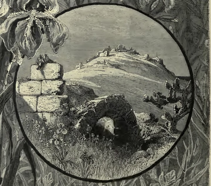
C. Wilson – “The ruined fortress of Latrôn from ‘Amwas”. (Engraving on Wood. 1880s). ‘Amwas is Emmaus – a multi period city located east of the castle
In 1890 a monastery was built on the north west side of the ruined castle. It is also known as the Monastery of Silence, which was founded in 1890 by a group of monks from Trappes (France). The Monks here used to avoid talking except for prayers, hence the name. It is famous also for its good wine and olive oil, sold at reasonable prices in the local store. A charming church is located at the place.
- Modern period
On the hill are old Jordanian military trenches, as the hill was also a strategic military post in modern times. Fierce battles were conducted during the Independence war, and a monument was erected at the foot of the hill.
Photos:
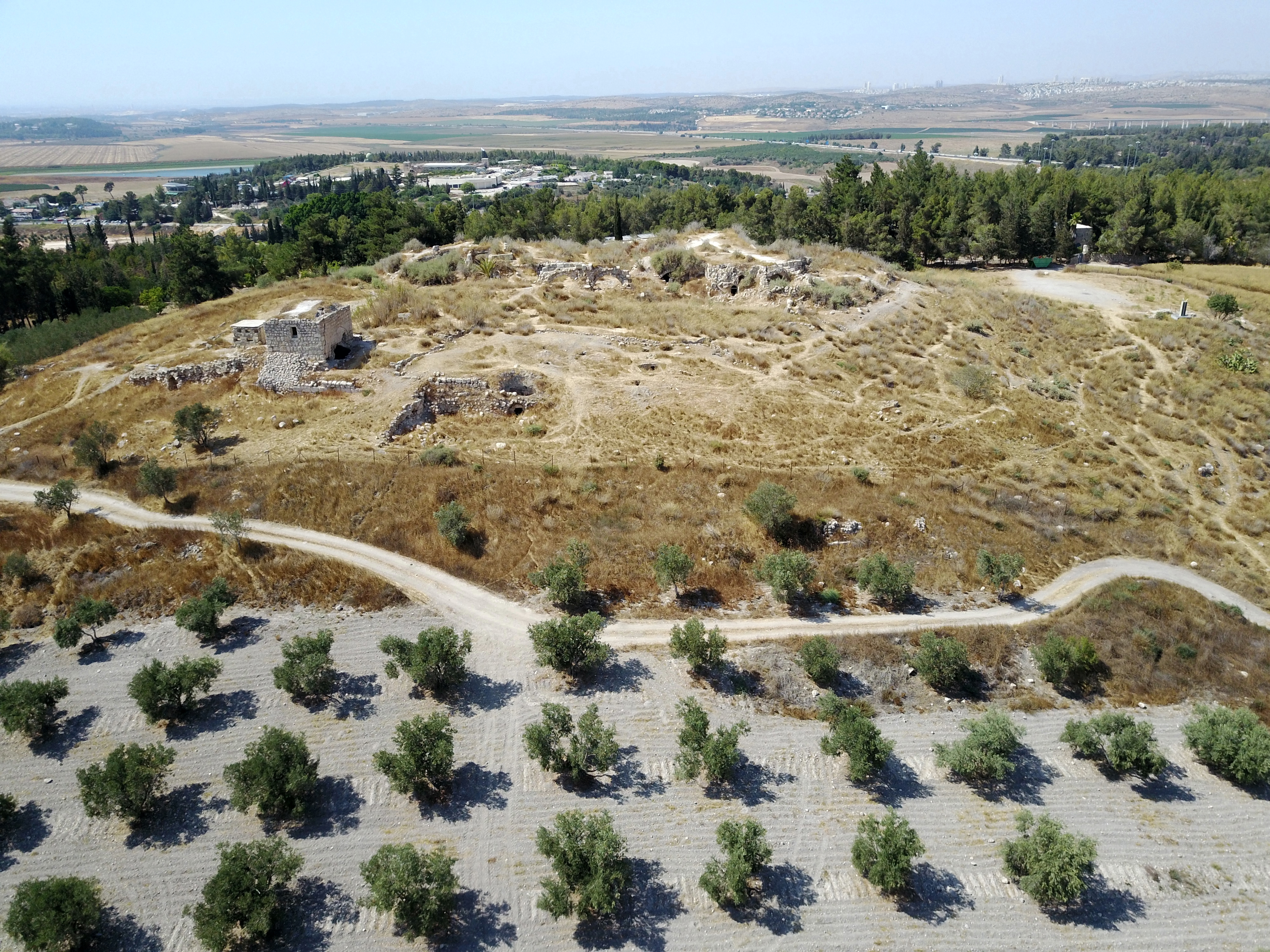
(a) Aerial Views
The following photos were captured by our drone flying over and around the site.
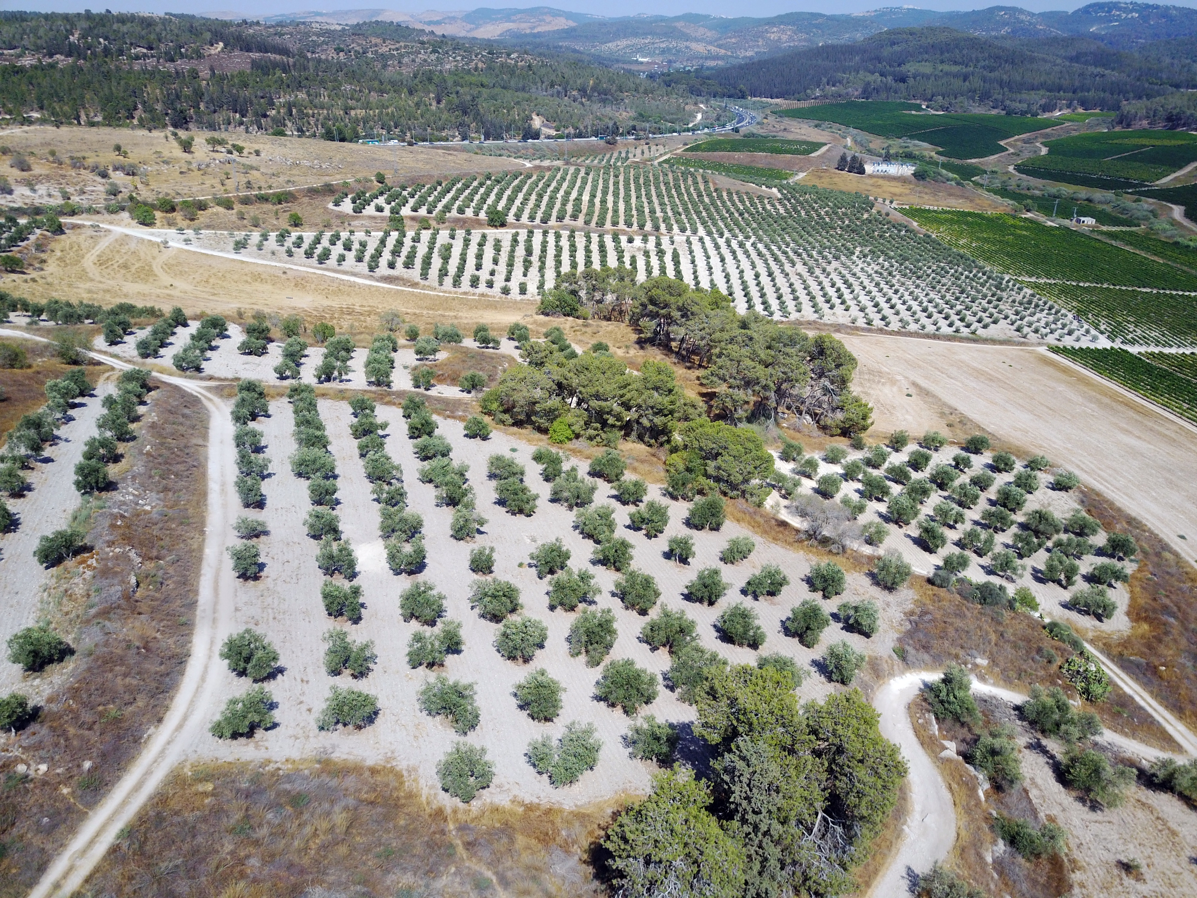
The ruined fortress is located on a hill overlooking the road to Jerusalem.
Click on the photos to view in higher resolution…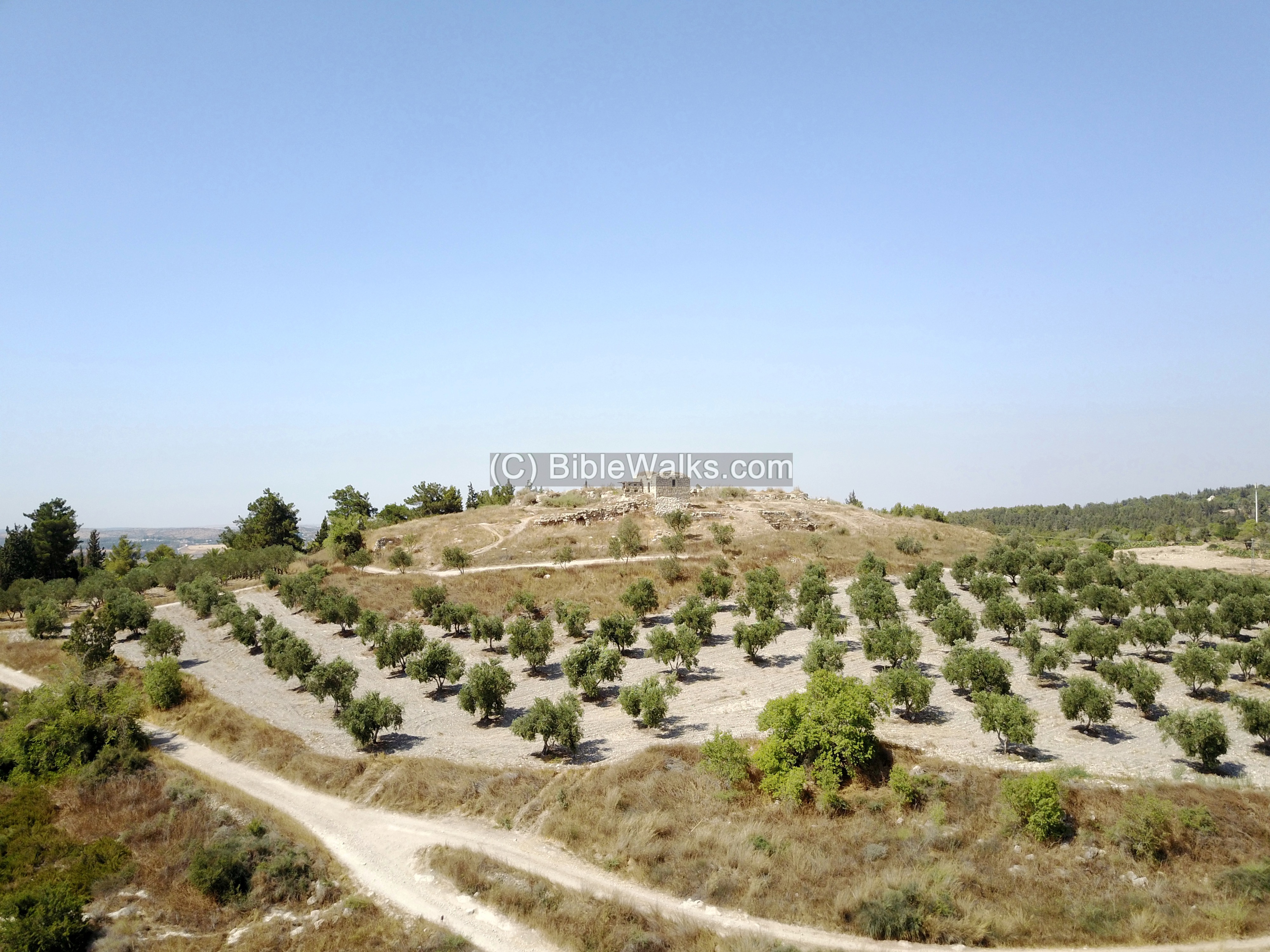
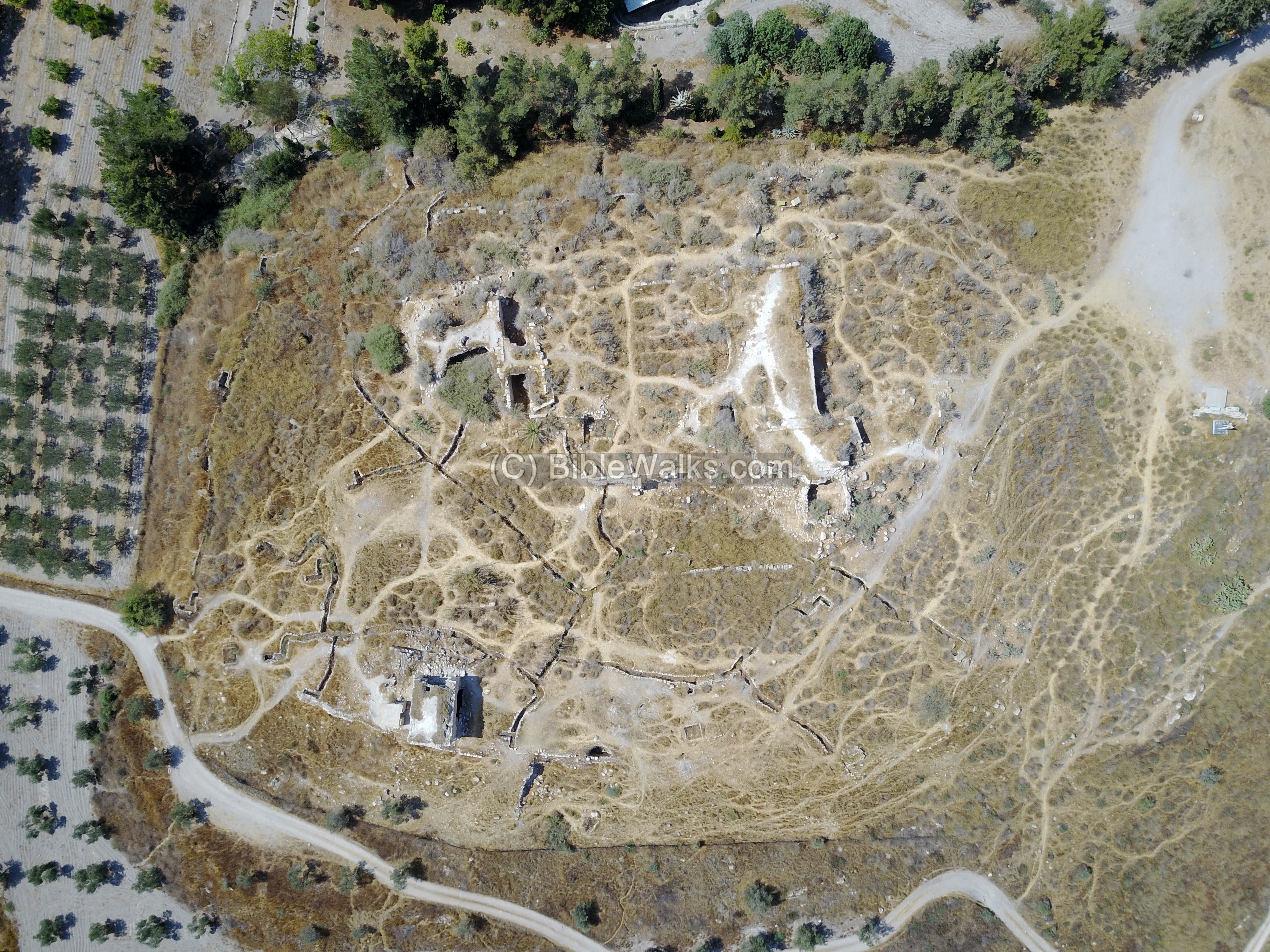
The plan of the fortress was an inner fortress (Donjon), surrounded by a number of defense lines and towers.
The plan of the inner fortress – the Donjon -was rectangular, covering an area of covering an area of 55 x 70m.
The Donjon (French) is also called “the keep” (English) and “Bashura” (Arabic), which is a strong central tower which is used either as a tower, inner fortress or dungeon (hence the name Donjon). In medieval castles the Donjon was usually an inner tower which protected the defenders in case the main walls were penetrated, and in daily life it served as the residence of the commander of the fortress.
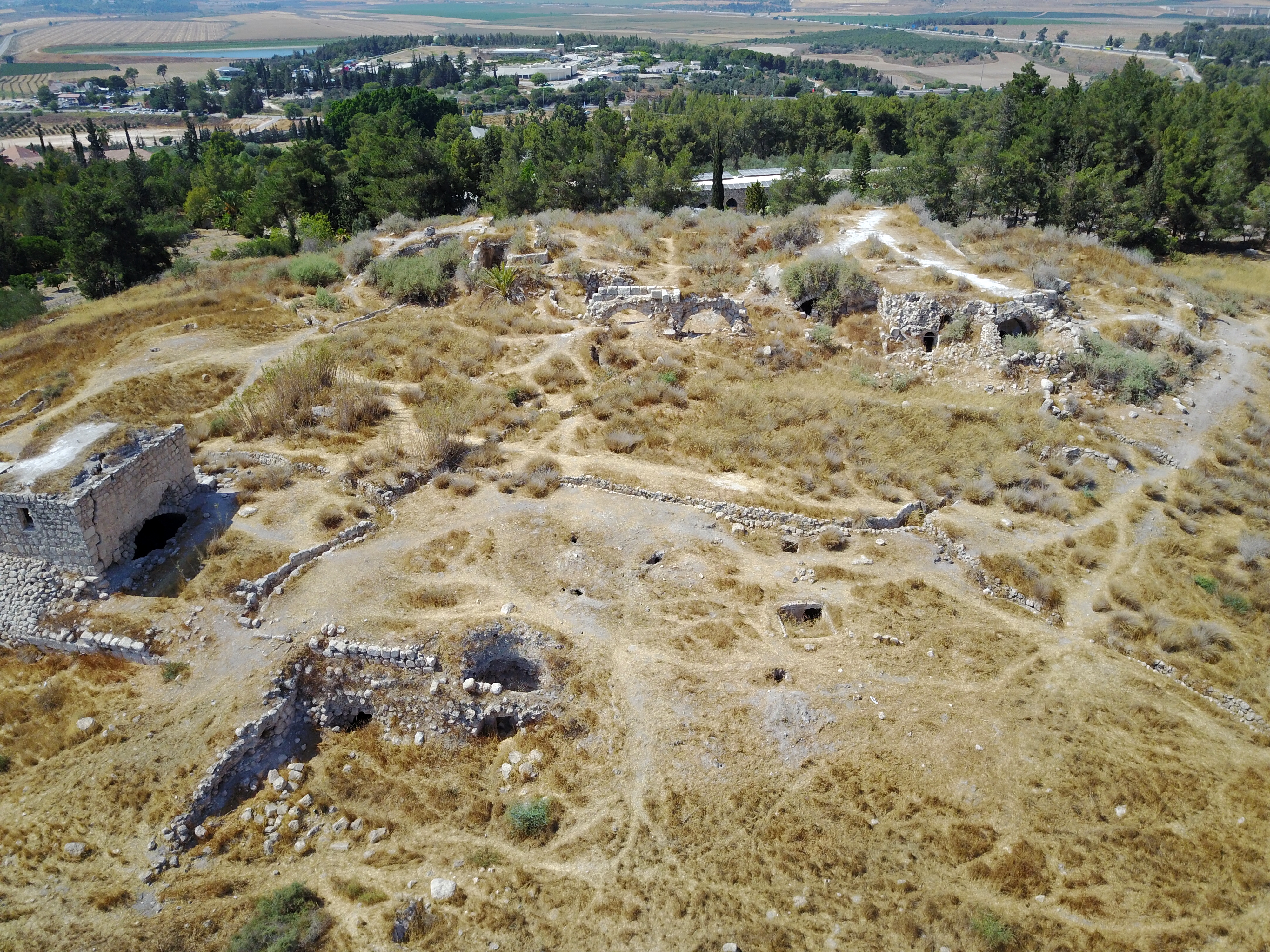
The structure on the south east corner of the fortress is what remains from the outer fortifications.
A top view of the ruins are in the next photo, with an orientation towards the north.
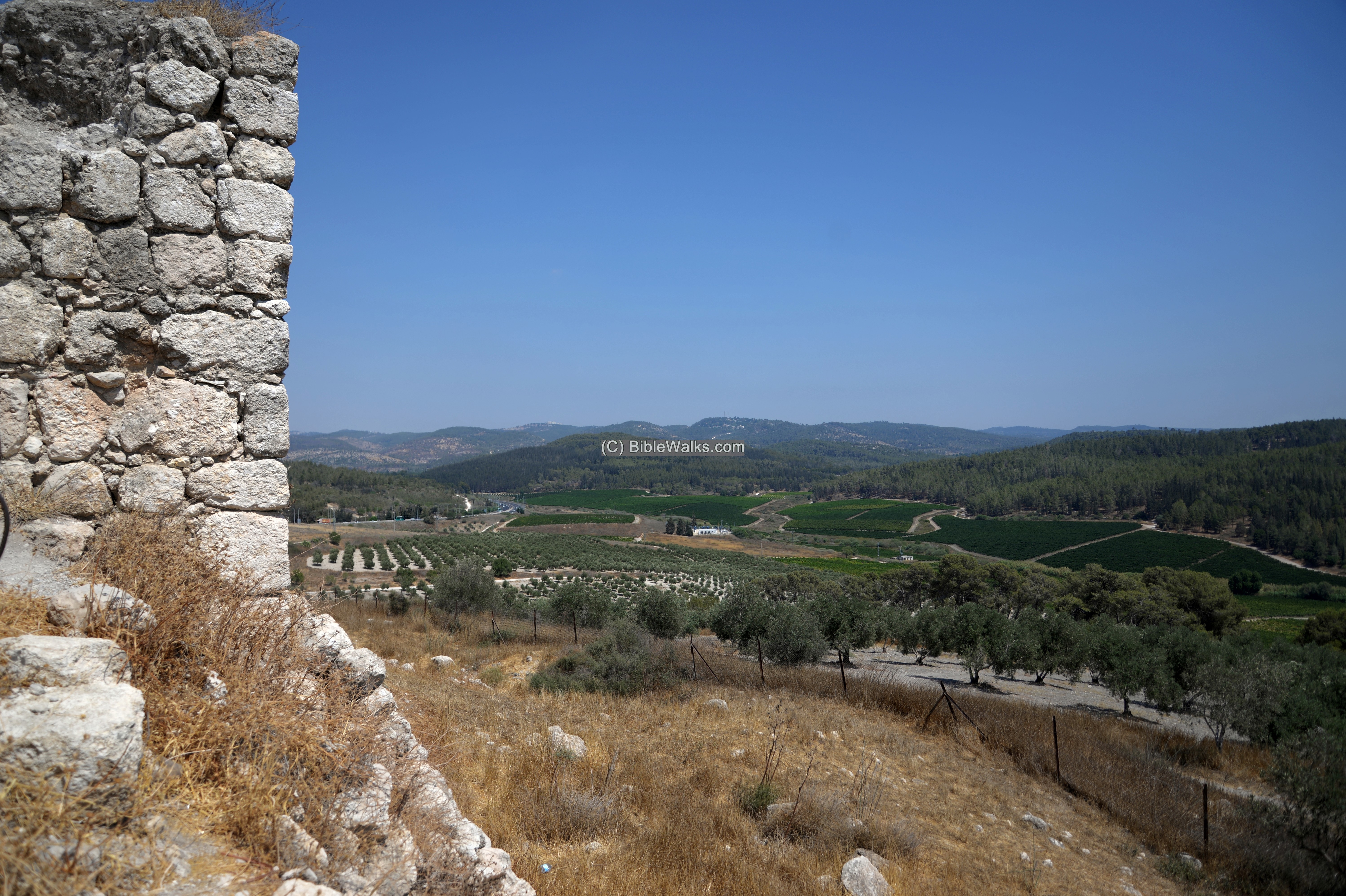
In the next view, towards the north east, is the road to Jerusalem (situated on the mountains in the far background). Latrun fortress protected this major road.
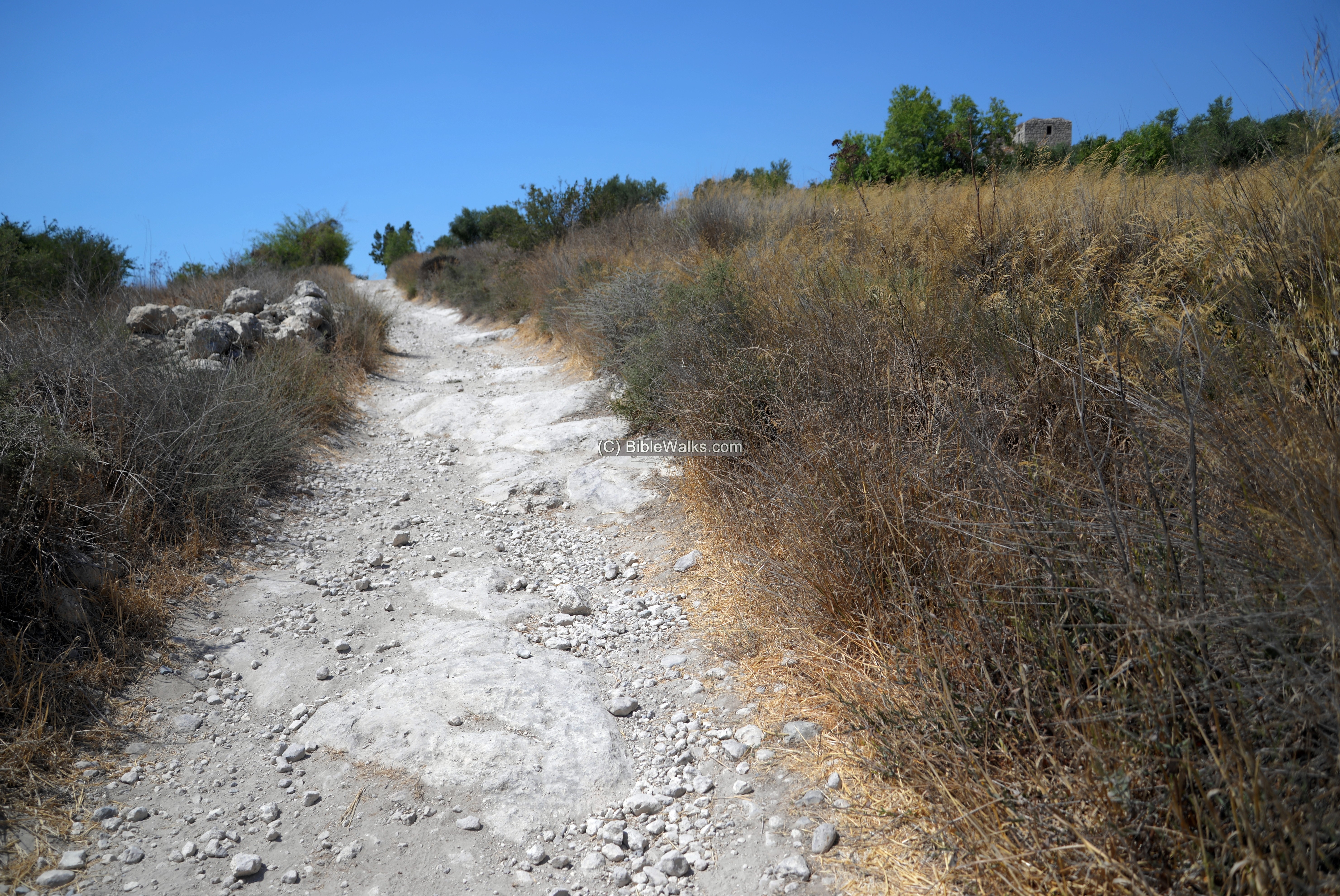
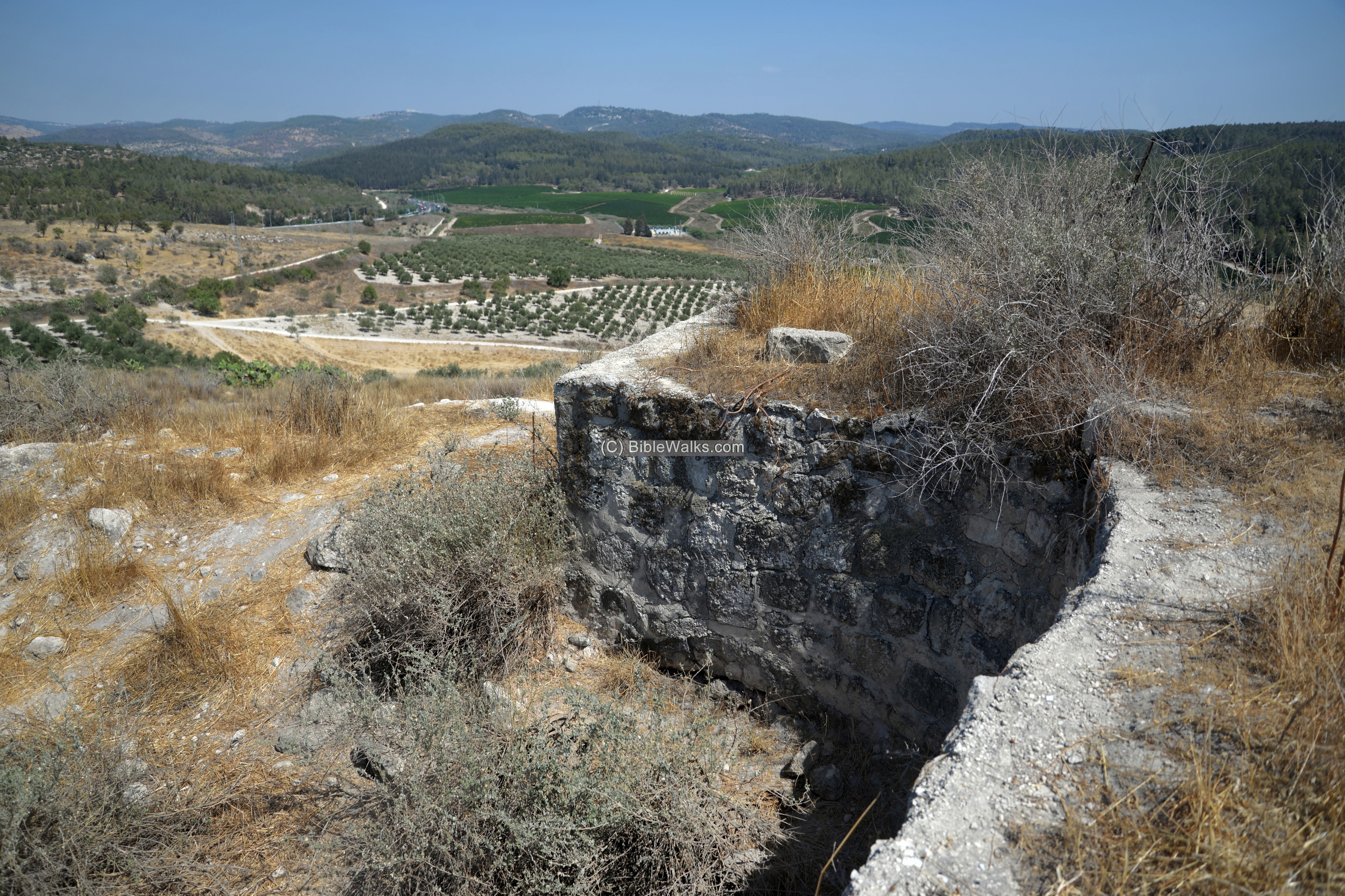
A steep road leads up to the south west side of the hill.
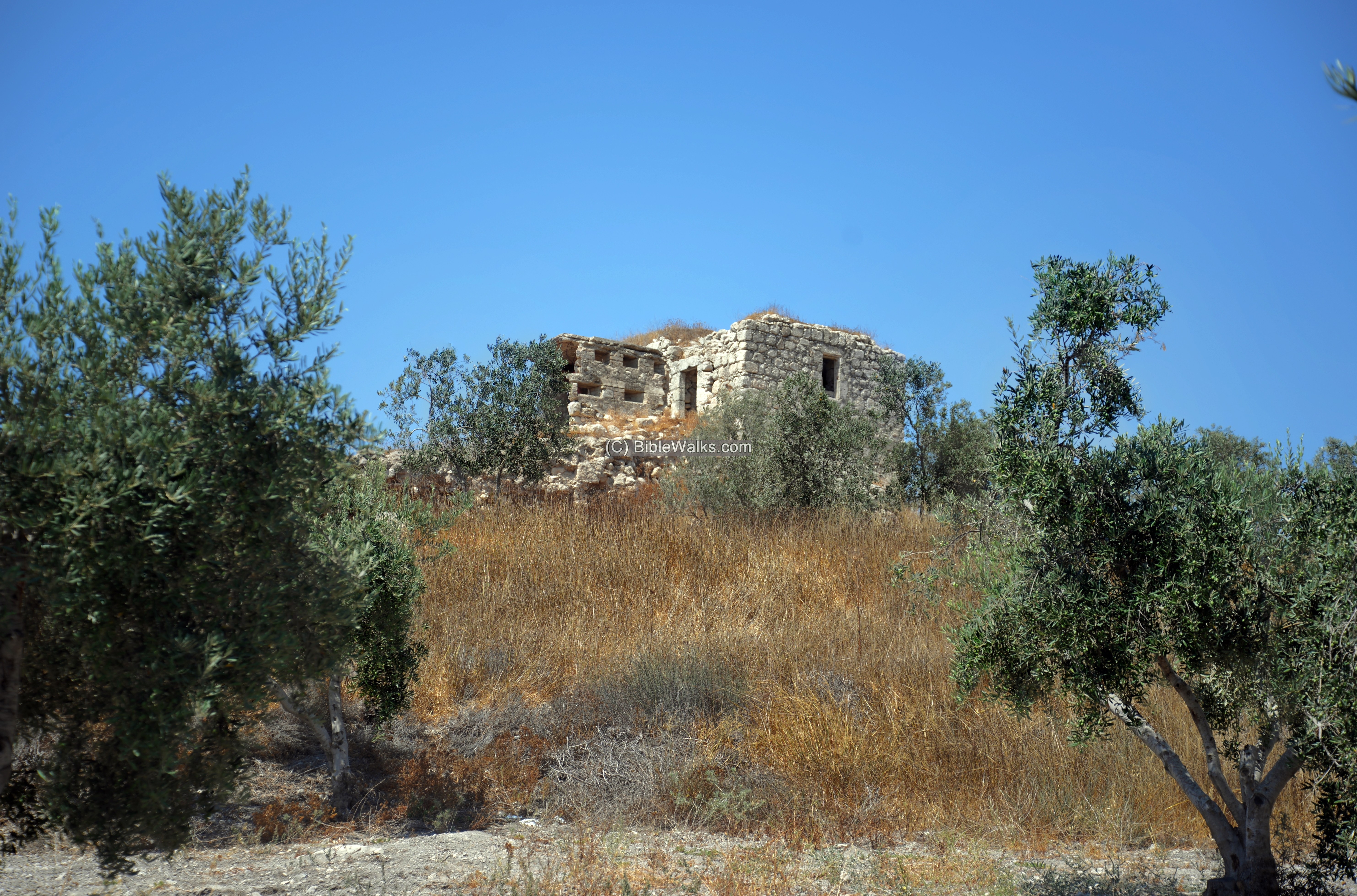
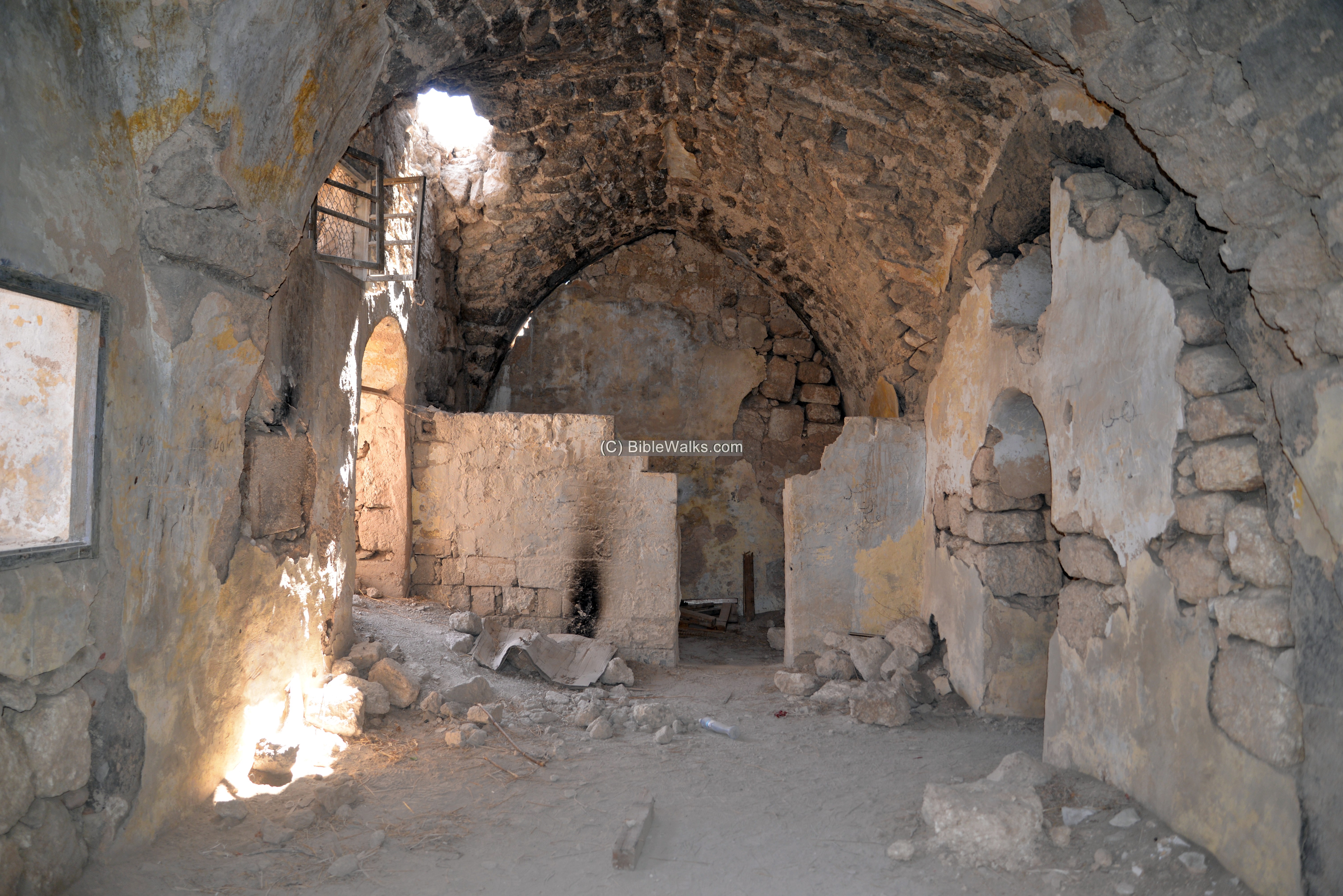
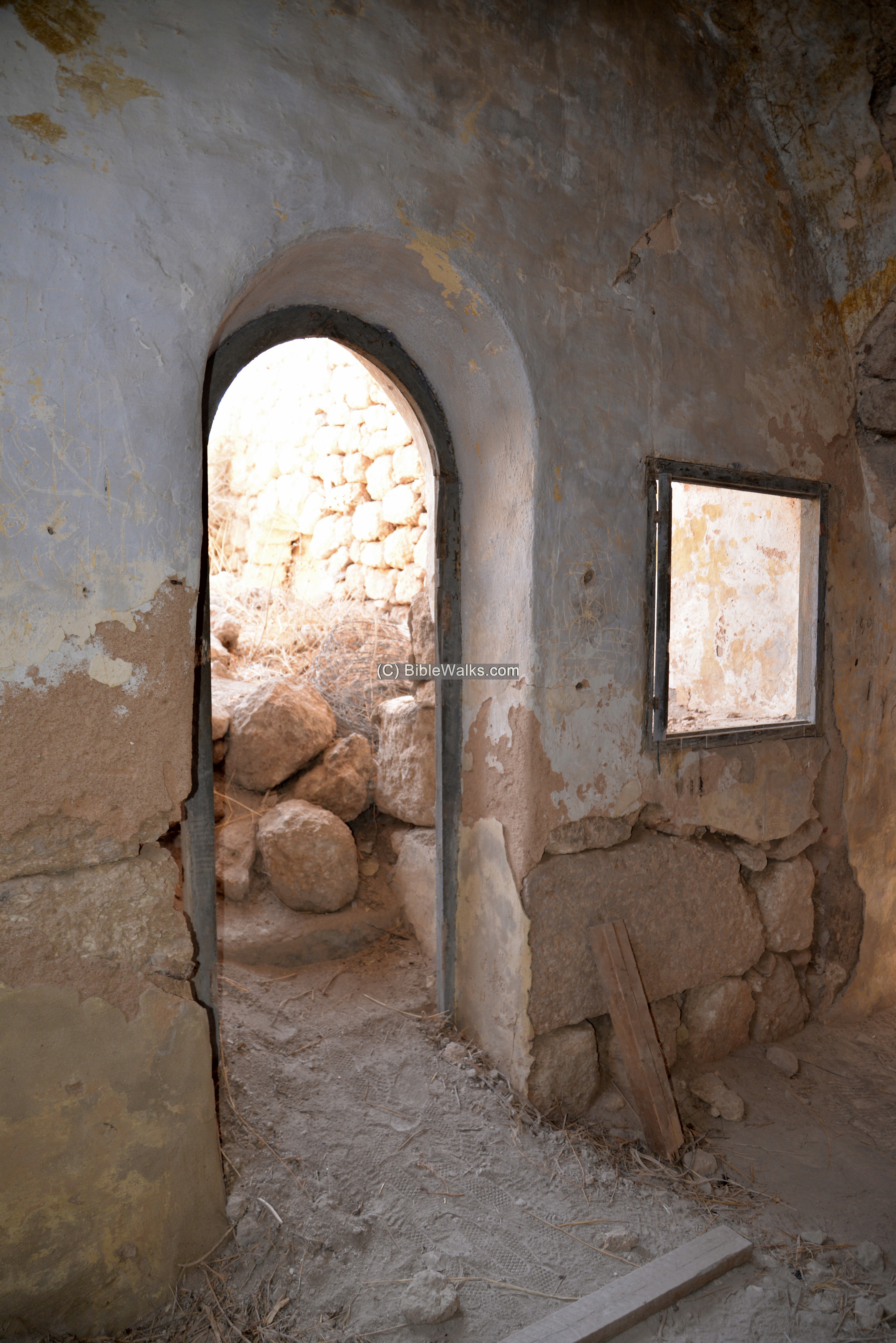
On the south west edge of the hill are remains of a structure.
The structure was part of the fortifications, and later used by the Jordanian army as an outpost before the 1967 war. Notice the horizontal holes on the southern wall – arranged for positioning machine guns.
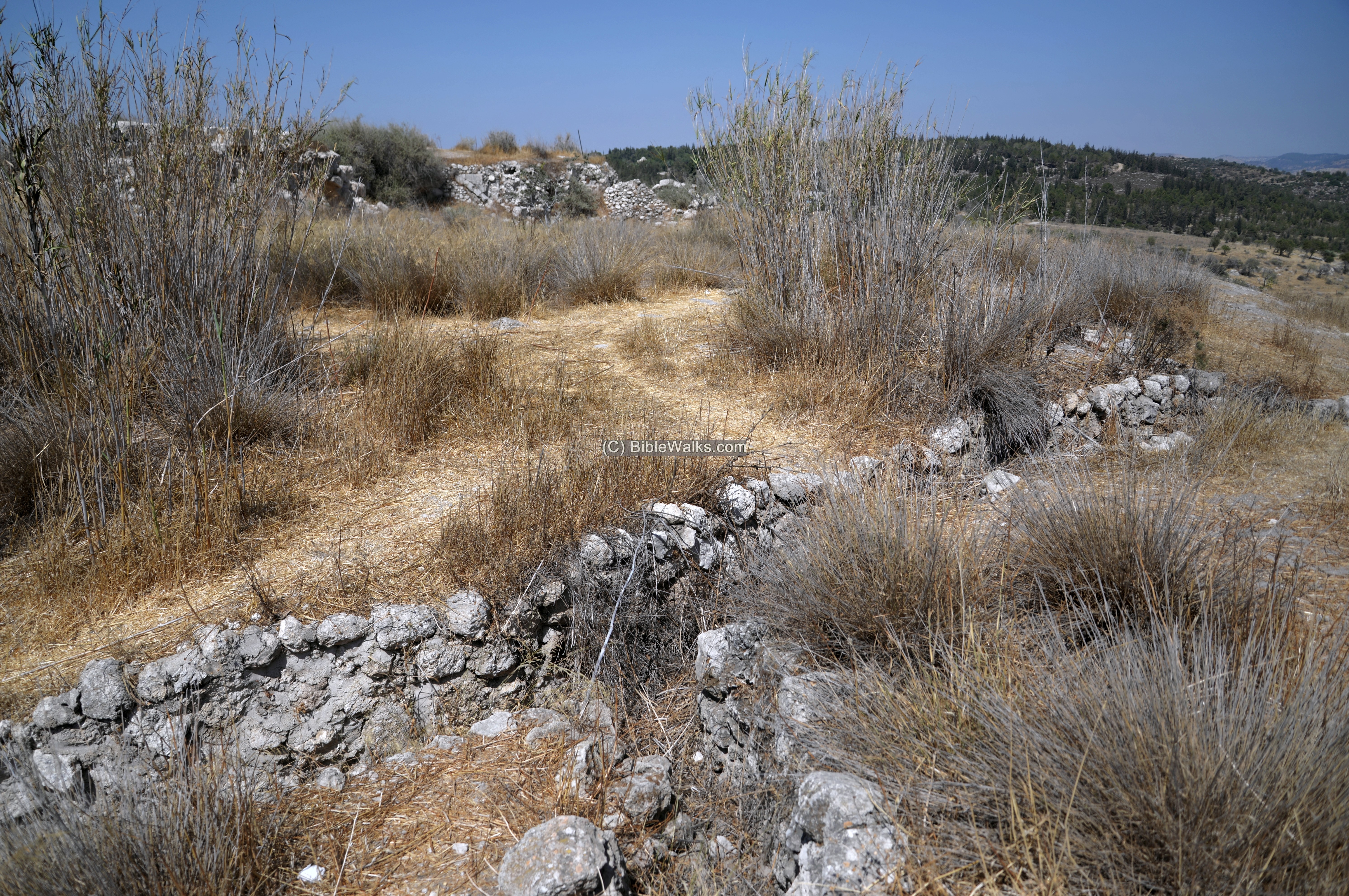
The Jordanian army also cut military trenches on the surface of the hill.
From the house is an eastern view of the road to Jerusalem.
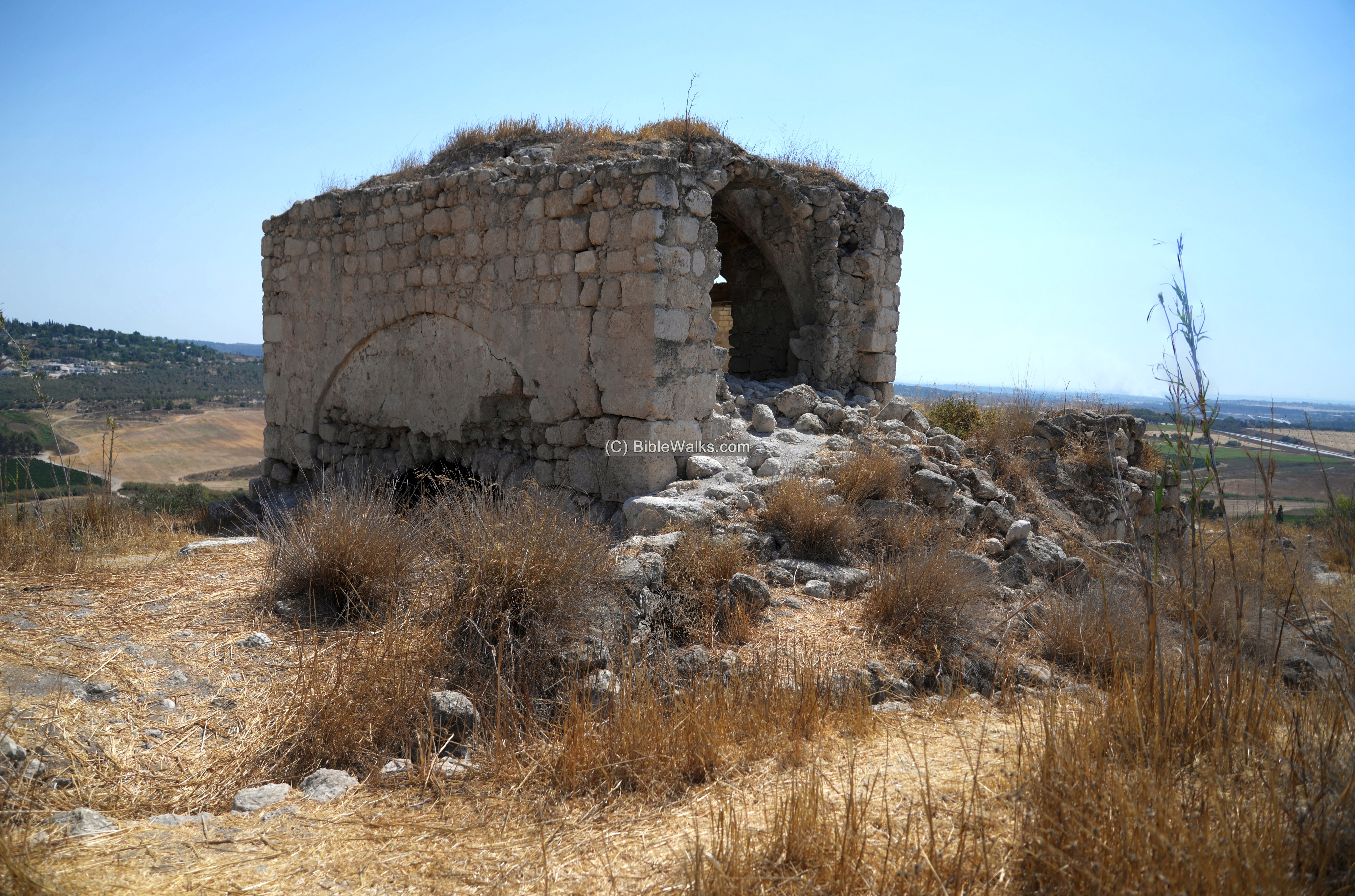
The structure is built on top of vaults with pointed arches – a common architectural design of the Crusaders.
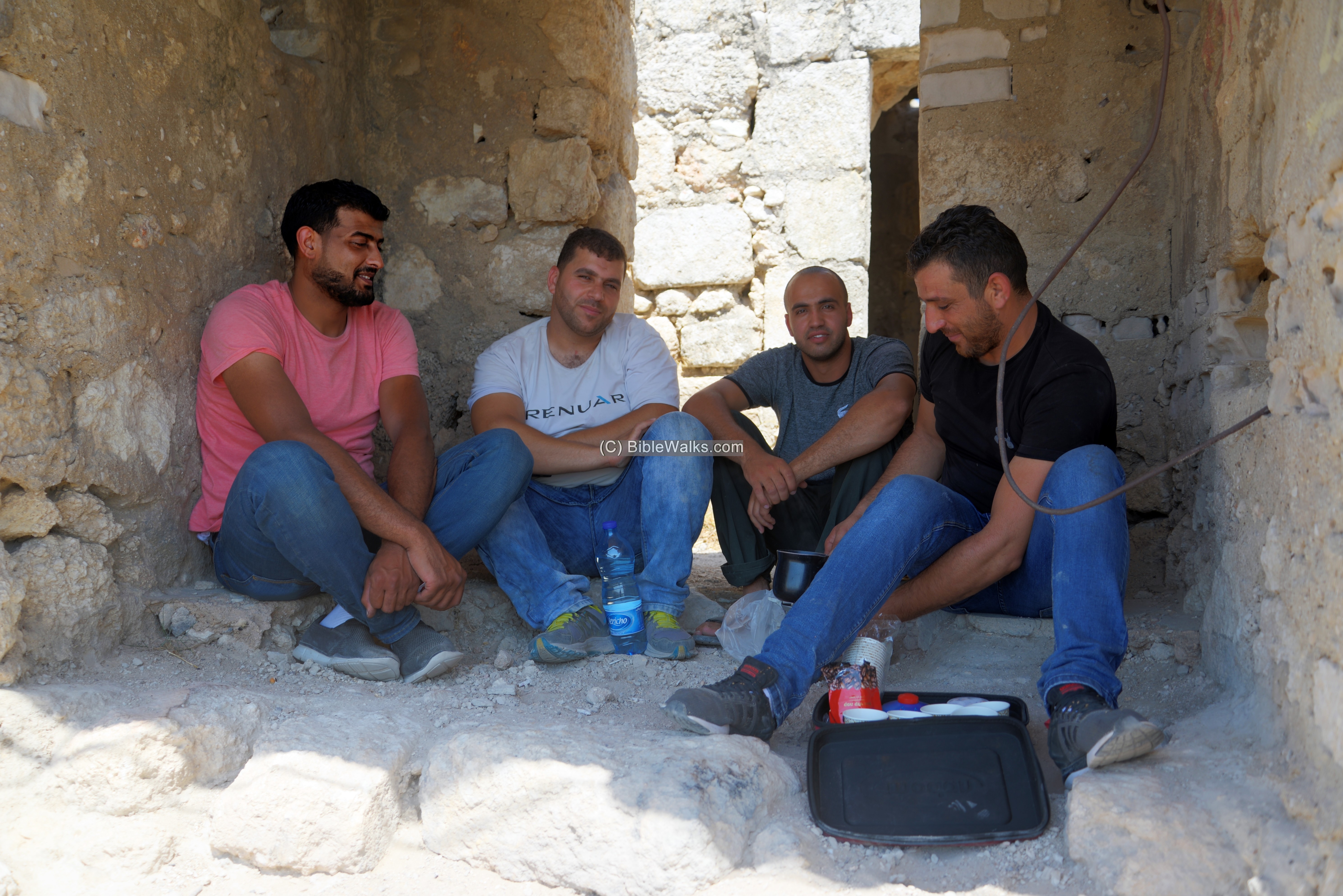
A group of young Palestinians from East Jerusalem enjoyed an afternoon coffee.
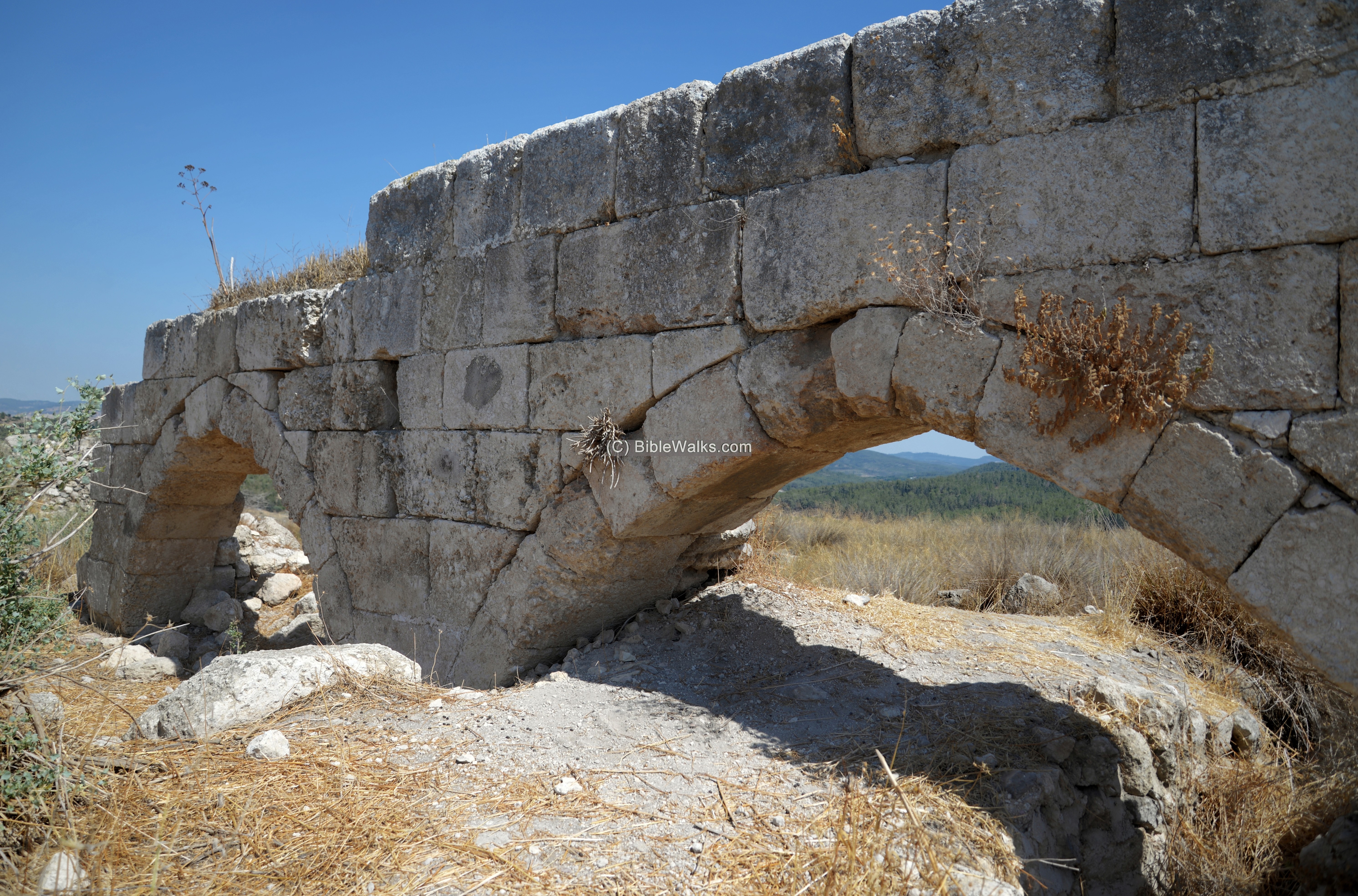
Few remains were left of the formidable fortress. This pair of arches on the south side are one of the few standing walls.
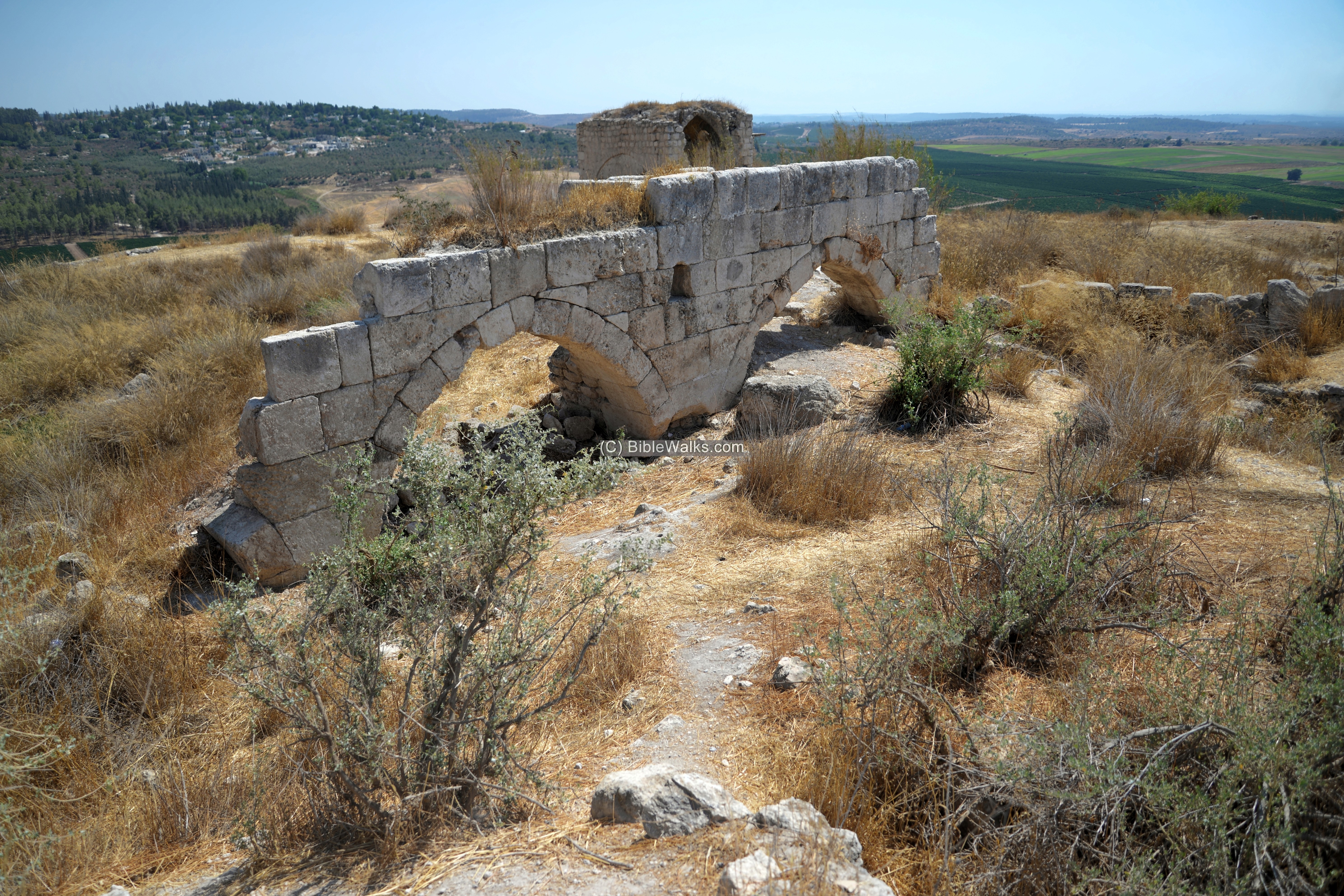
A view from the other side of the arches:
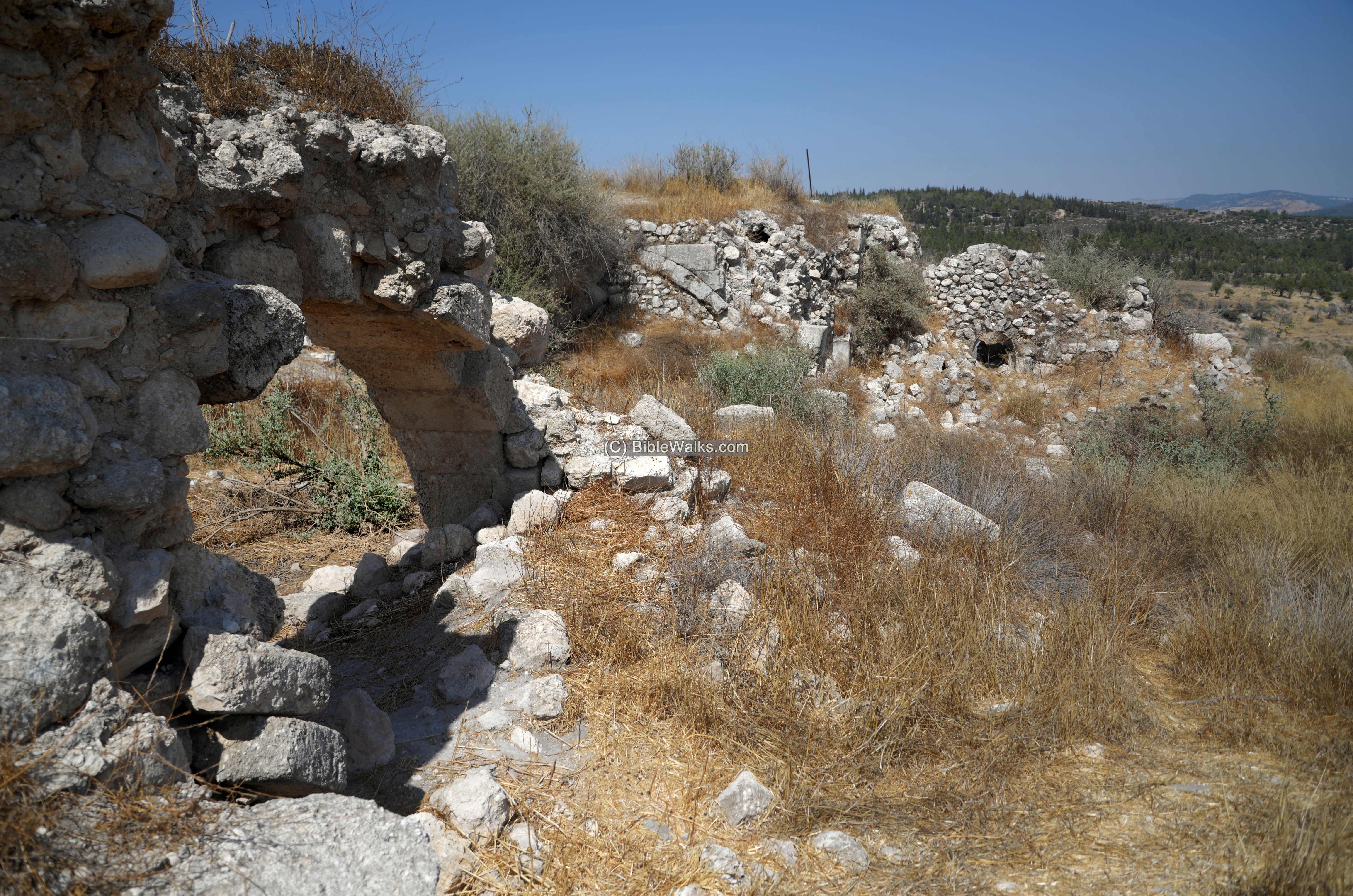
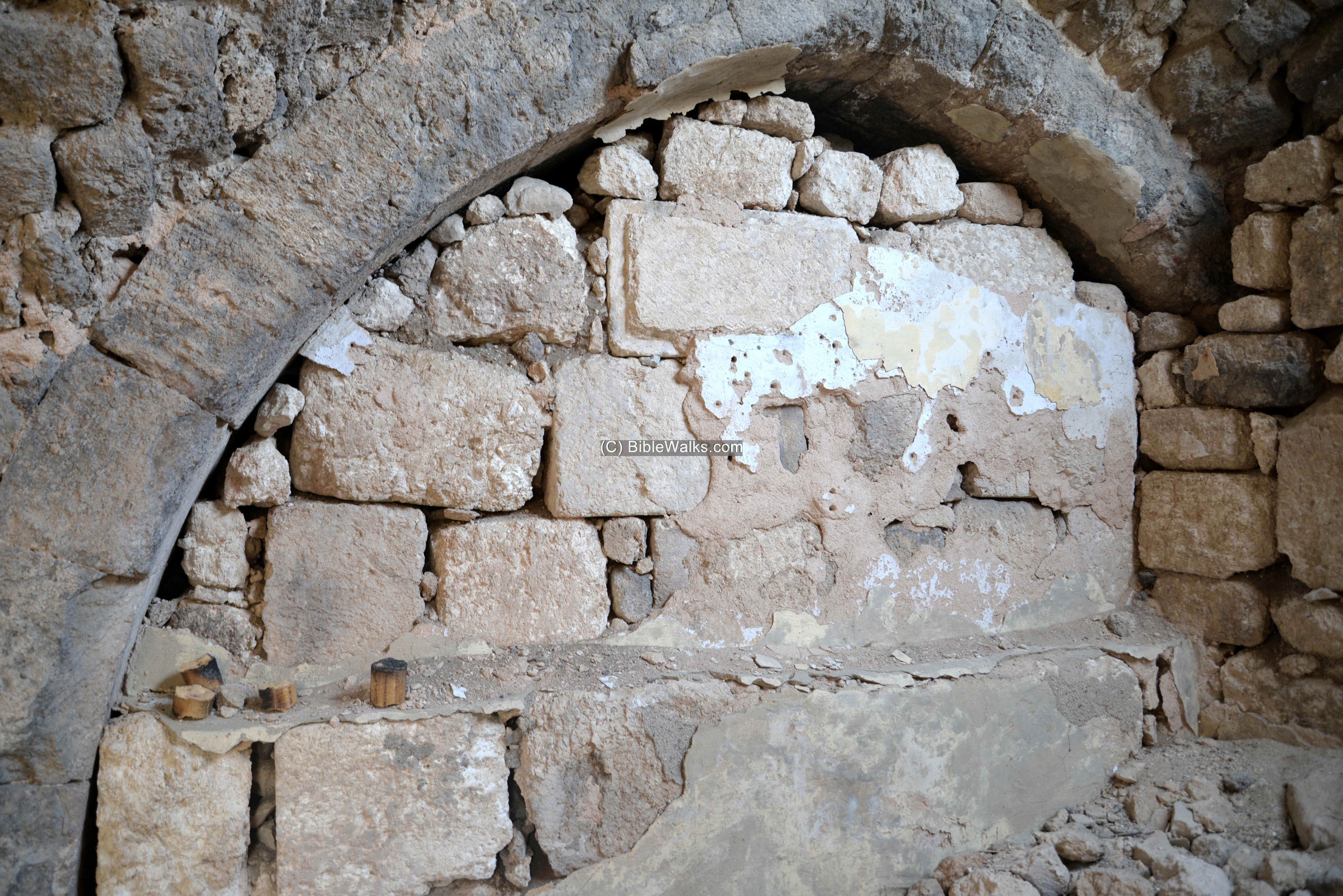
A wall on the eastern side is still intact.
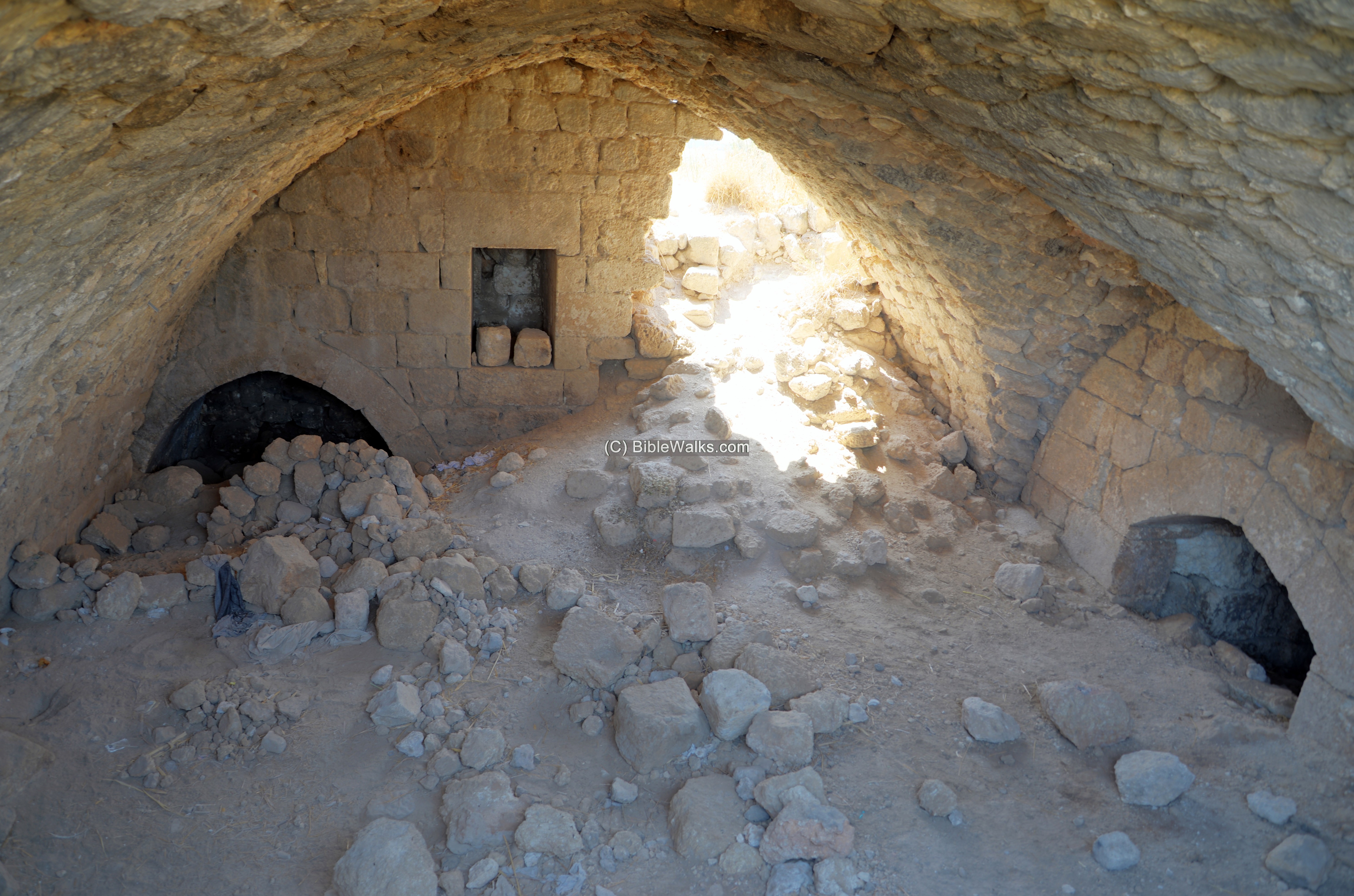
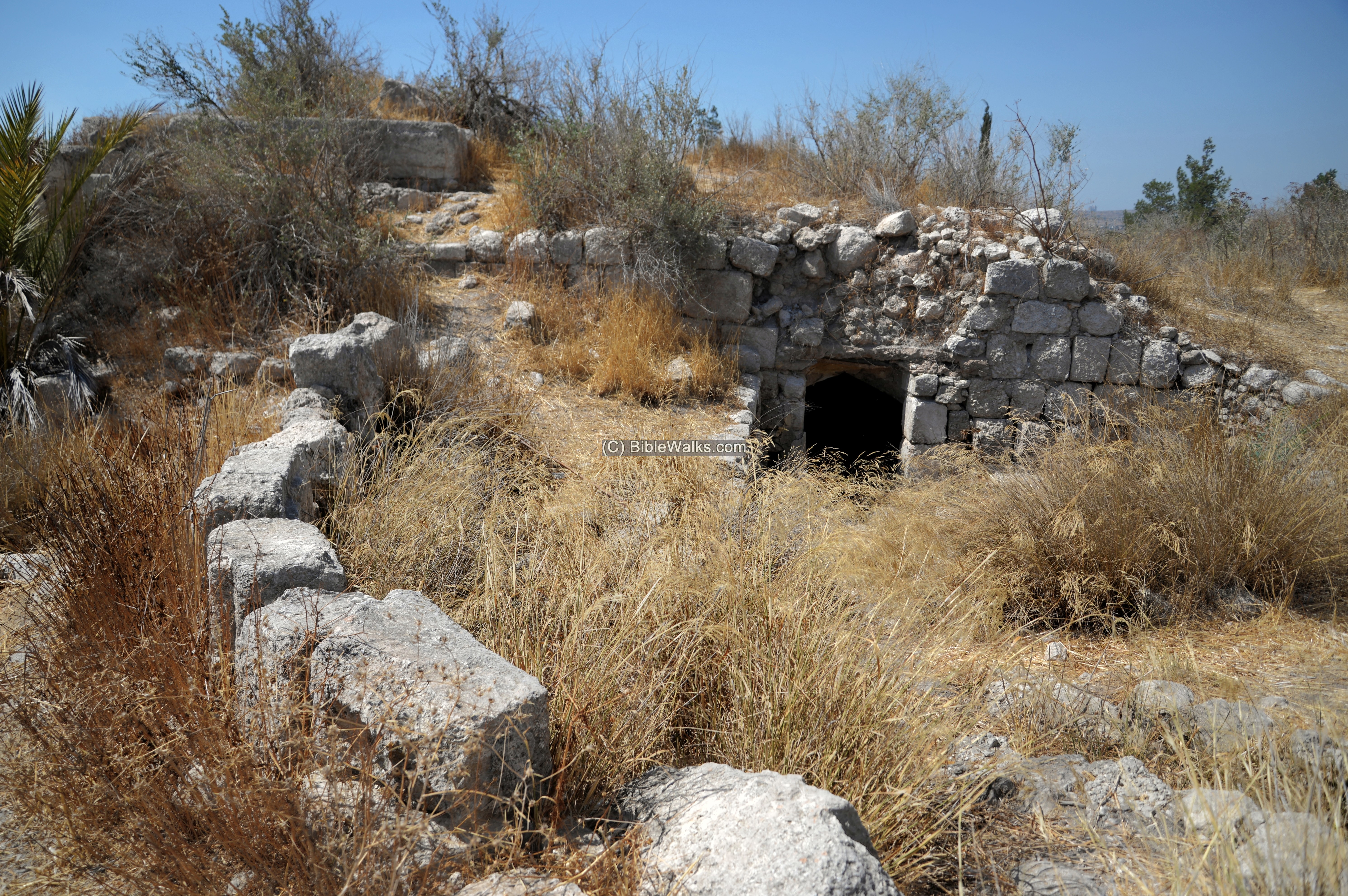
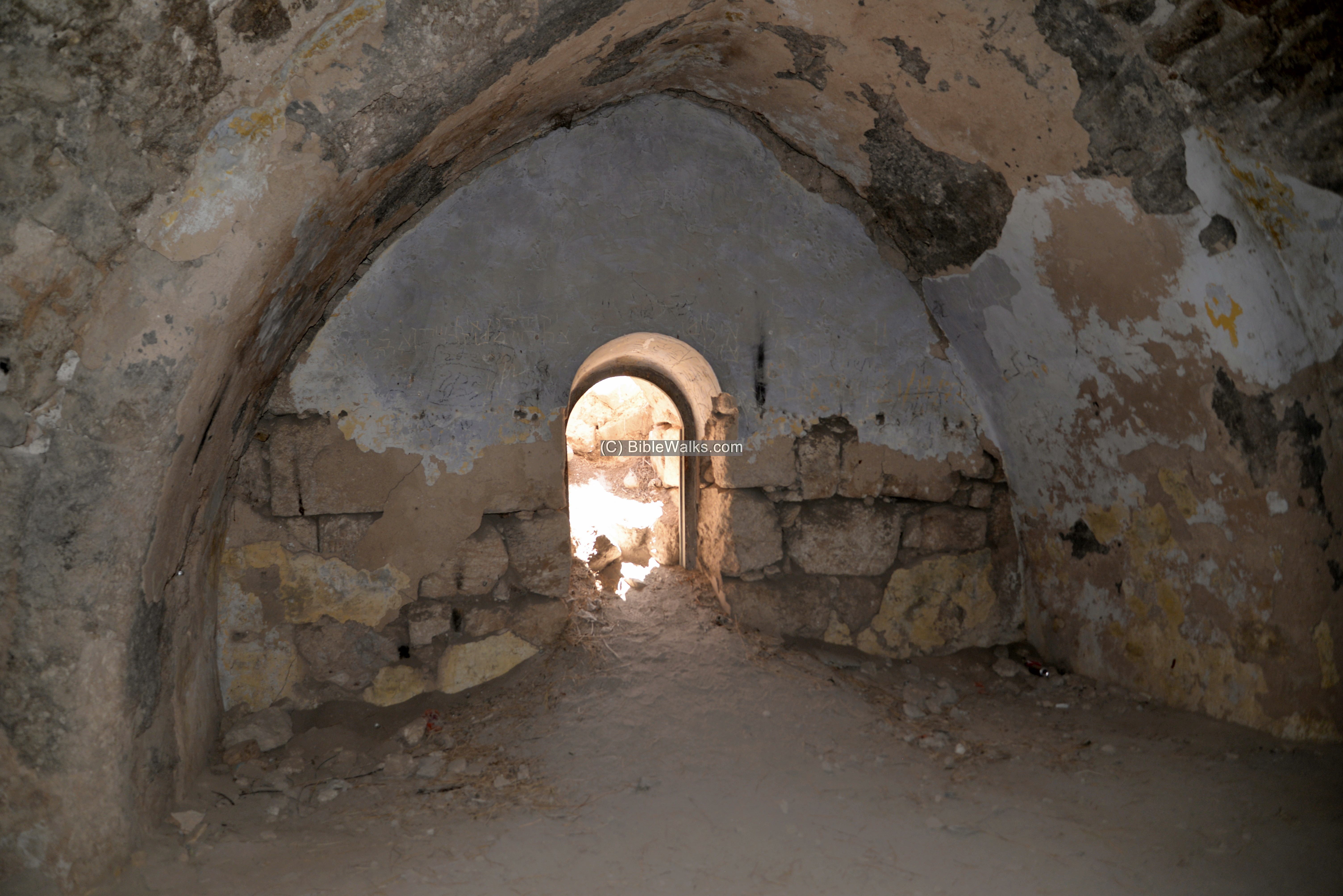
There was one entrance to the basement level of the inner fortress. This entrance is on the north east side. It was protected by a metal shield.
The location of the entrance to the basement, on the east side of the inner fortress, is indicated on the illustration.
In the center of the basement was a staircase the led up to the ground level, alongside to the walls of the central tower.
A section of the basement is the only standing structure, seen here.
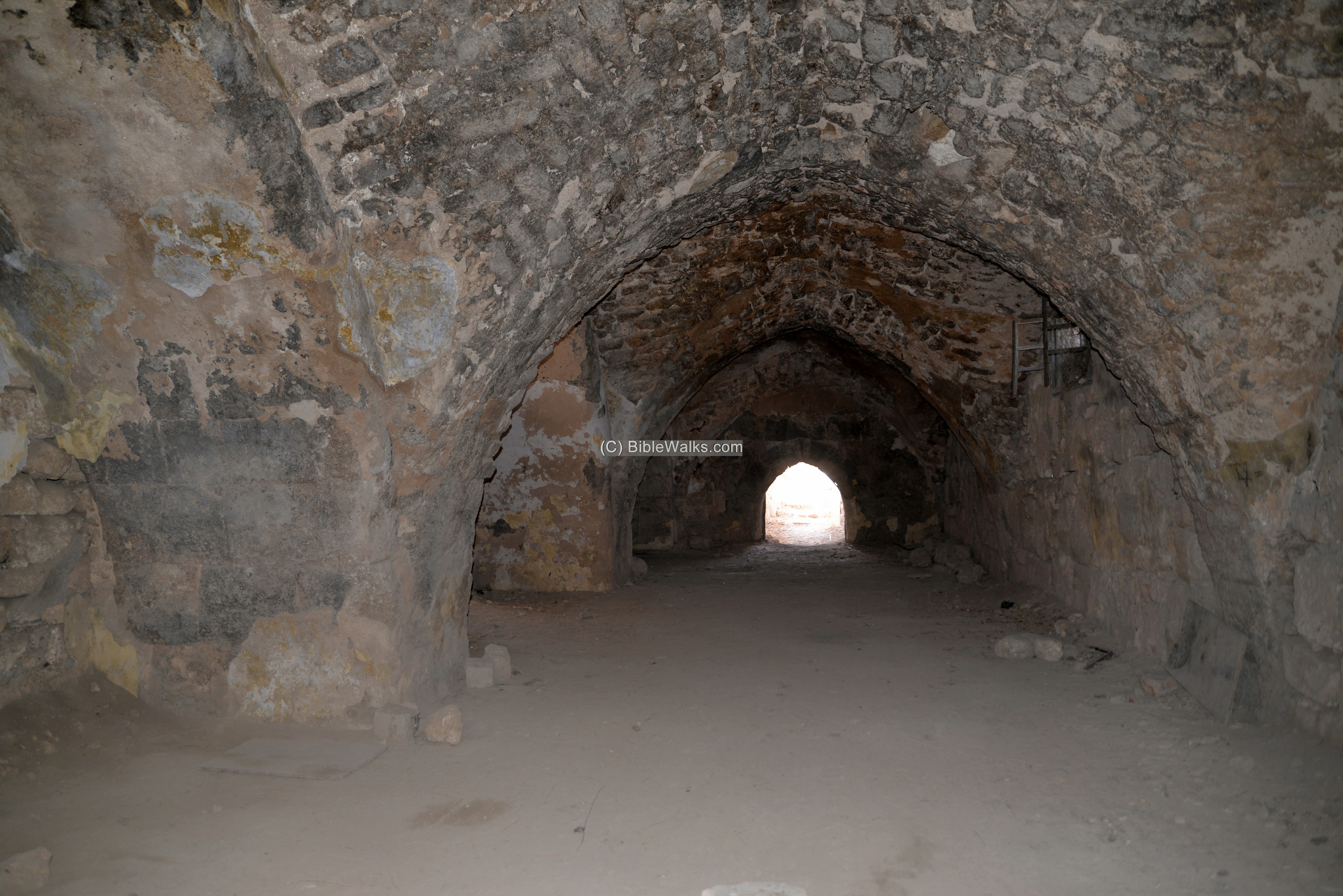
Another section of the vaults is in the next photo. The vaults are cross shaped (groin vaults) as in typical Crusade structures. The cross shaped vaults are arranged in 2 clusters of 11×2 on the southern side, 5+5+3 on the northern cluster. Between the clusters is a 6m barrel-vaulted corridor. Two other barrel-vaulted corridors are arranged along the west and north sides.
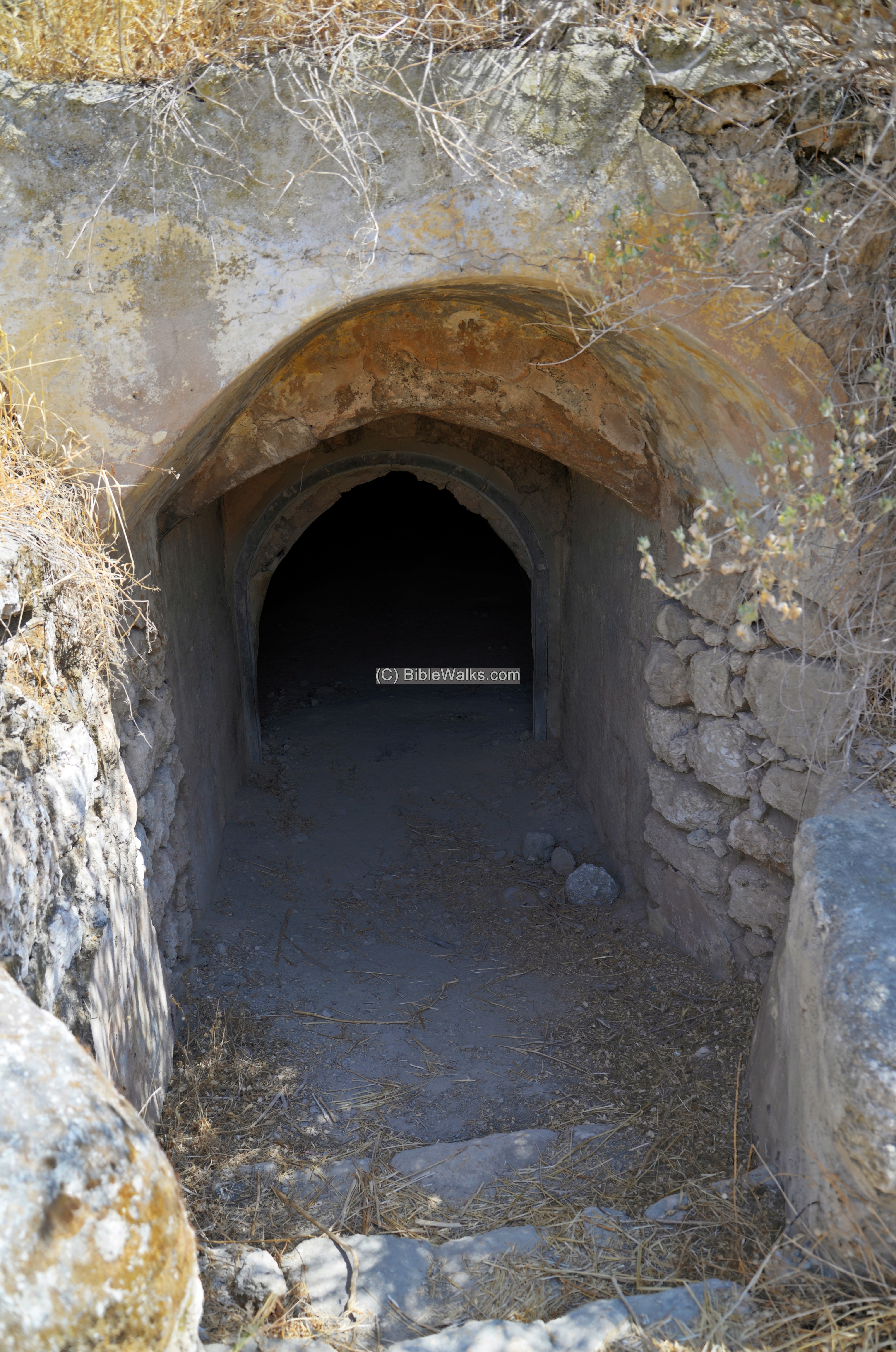
A staircase led from the basement to the first level.
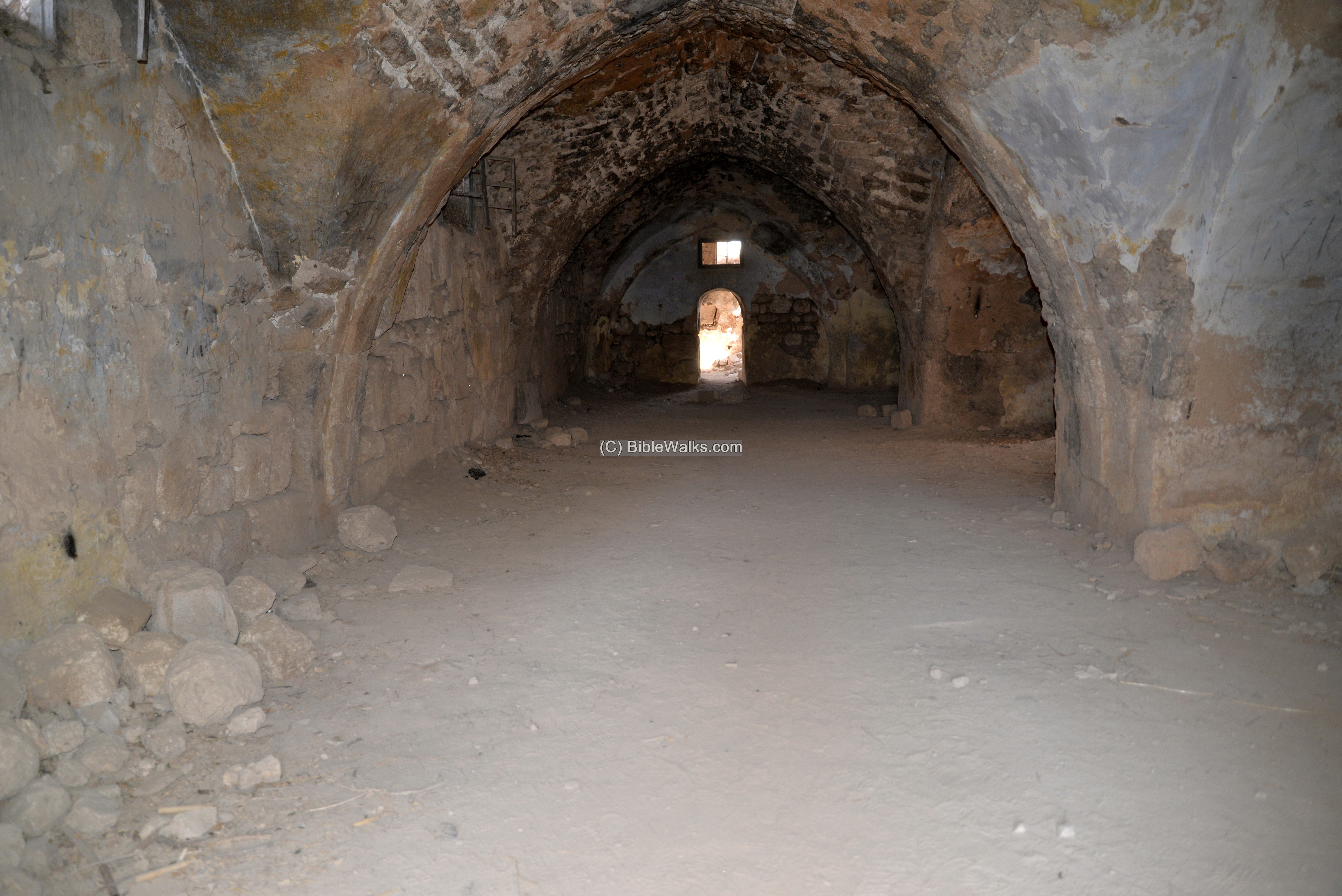
A closer view of the door at the end of the vault:
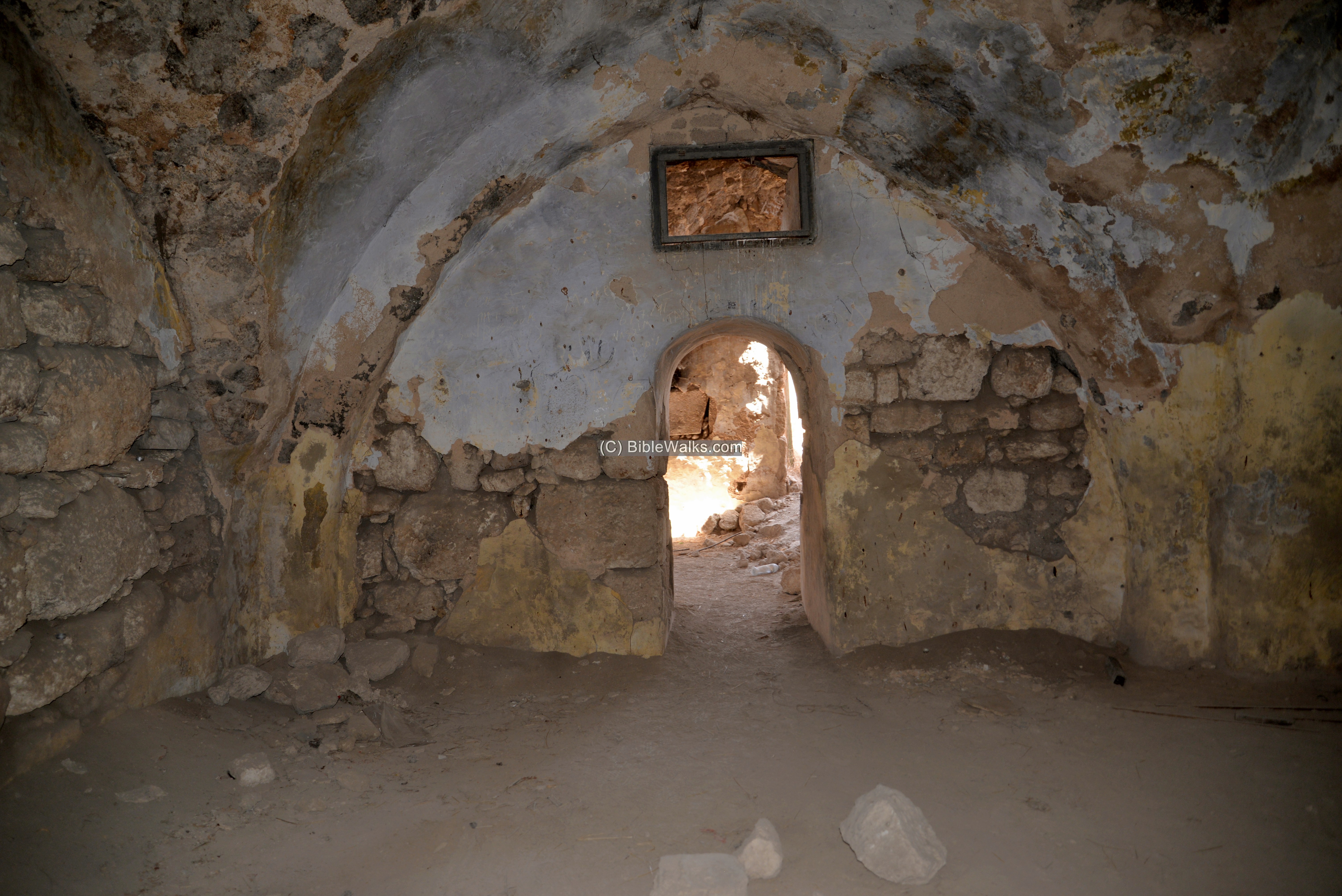
Other views of the basement level of the inner fortress is in the following photos:
(f) Monument
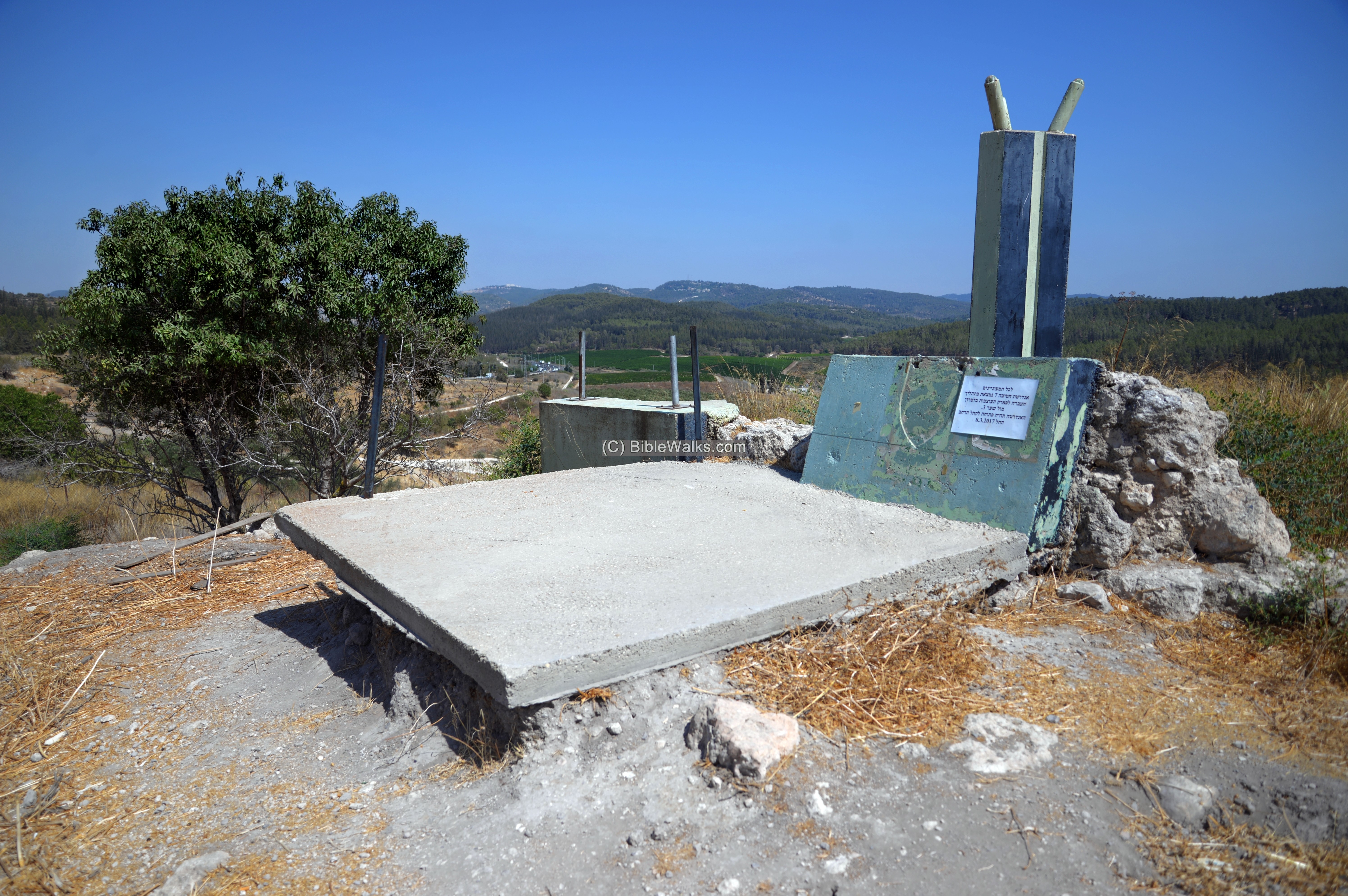
An old monument, commemorating the fallen soldiers of the 7th Armored Brigade (“חטיבה 7”), is located on the eastern foothills. It was built in 1973, but was later relocated to the new memorial center inside the compound of the British police Tegart fortress, 1 KM north. This old monument was sabotaged – its inscribed marble stone was smashed and the head stone was removed.
(g) Video
![]() Fly over the site with this Youtube video:
Fly over the site with this Youtube video:
Etymology – behind the name:
* Names of the site:
- The French name “La Toron” (the castle) was the source of the Arabic name of the place – Latron/Latrun.
- La Tour des Chevalliers (“the Castle of the Knights”)
- Castle of the Good thief (“castrum Boni Latronis”) – a 17th century tradition was that Latrun was the castle one of the thieves who was crucified with Jesus
Links:
* External links:
- ‘The fortress at Latrun’, Qadmoniot, 7.3, 117–20 (1974; Hebrew).
- Secular buildings in the Crusaders Kingdom of Jerusalem – D. Pringle, 1997, pp. 64-65
- The Churches of the Crusader Kingdom of Jerusalem Vol II- D. Pringle, 1998, p. 5-9
* Internal Links:
- Drone Aerial views – collection of Biblical sites from the air
- Our facebook page on Crusaders sites
BibleWalks.com – walks along the Bible land
Emmaus winepresses <<<—previous Judea site—<<<All Sites>>>— next Judea site—>>>Kathisma
This page was last updated on Feb 5, 2021 (Add illustration)
Sponsored Links: