Tell Me’amer (Al Amar) is the ruins of a Biblical city on the eastern side of Mount Carmel. Identified with “Geva Shemen” and “Harosheth of the Gentiles”.
Judges 4, 13: “And Sisera gathered together all his chariots, even nine hundred chariots of iron, and all the people that were with him, from Harosheth of the Gentiles unto the river of Kishon”.
Home > Sites > Lower Galilee > Geva Shemen (Tell Me’amer, el-Amar)
Contents:
Background
Location
History
Photos
* Aerial view
* General views
* Wild flowers
* Kishon park
* Glass Factory
Biblical Refs
Etymology
Background:
Tell (Mound) Me’amar was a biblical city on the main ancient road (Via-Maris), on the eastern side of Mt. Carmel. It is identified as the Biblical Geva-Shemen, or “hill of oil”, and “Harosheth of the Gentiles” where Barak defeated Sisra.
In the Hellenistic period it was abandoned and continued in a hill west to the Tell (Khirbet Harithiya) , on the other side of the Kishon. The new site was identified by some scholars as “Geva”, “Geva Parashim” or “Gaba” .
In the Roman and Byzantine period a village was located on the hill west of the ancient mound, with a glass factory that exported glassware to the Roman world.
Location:
The site is located on the junction (“valleys”) of the road to Haifa, to Tivon and to Yokneam. This junction is called the “valleys” junction, since the two valleys (Acre/Zabulun and Yizrael/Jezreel) meet. At this place the Kishon river flows around the eastern side of the Tell, providing it with water. A nature park and picnic place is located by the river.
The following illustration shows the points of interest. In this view you can see that the Kishon river/brook turns around the old city of Tell Me’ammer. You can also see the new city (Geva, or Kh. Harithiya) on the east of the old city. On the right side is the modern highway from Haifa to Yokneam and TelAviv, which is in the same route as Via-Maris.

History:
-
Pre-history
According to the Archaeological survey, there were pottery findings from the Chalcolithic period (4,500-3150 BC) in the area. The city continued to be populated in the Early Bronze (3150-2200 BC), and especially in the middle Bronze (Caananite) period (2200-1550 BC).
-
Late Bronze (Canaanite)
In the late Bronze period (1550 BC- 1200 BC) the city was an important city. It was mentioned in list of cities (“Geva-Shemen”) that were conquered in 1468 BC by Egyptian Pharaoh Thutmose III.
Later, Pharaoh Amenhotep II returned to Israel in 1429 BC in order to crush a second rebellion from cities in Jezreel Valley. One of the cities that are referred in his tablets is Geva-Shemen, where he replaced the governor.
-
Israelites
The City was not listed in Biblical texts, but it was in the Asher tribe region.
During the period of the Judges, the armies of Judge Deborah and military leader Barak meet the army of Canaanite Sisera in a place called “Harosheth of the Gentiles“, which is identified as this site. The 10,000 Israelites defeated the Canaanites in spite of their 900 Iron Chariots.
-
Hellenistic and Hasmonean
Later, the city gradually became a minor site and finally abandoned, since it was too small for the larger population. The new city was established during the Hellenistic period on the hills east of the Tell, in Khirbet Harithiya. It first started as a farm in the Persian period, grew, then finally replaced the old city.
According to an archaeological survey the city “phased out” during the Roman/Byzantine period.
-
Roman and Byzantine period
A small village was established on the hill 200m west of the ancient Tel. Unfortunately, the ruins of the site were damaged by the modern structures built on the hill – a jail, bus station and municipal garage. Few remains can be seen today, such as a burial cave on the western side of the hill – just above the garden shop.
The archaeologists, in an expedition headed by G.D. Weinberg and the Corning Glass Museum (1964-1968, 1971) unearthed a glassware workshop (named “Jalame Glass”). In 2016 a raw glass production kiln was unearthed on the foothills near the new railway. These two findings suggest that Roman village handled the two stages of glassware manufacturing – creating the raw chunk of glass in the furnaces, then turning the raw material into glass objects.
-
Ottoman period – PEF survey
The area around the valley was examined in the Palestine Exploration Foundation (PEF) survey (1866-1877) by Wilson, Conder and Kitchener. This area appears in the center of the section of the map of 1878 (below).
The ancient city was located on crossroads of major highways, marked by double dashed lines, so the Biblical city was like a gateway.
The sites marked on this map include the following points of interest (text quoted from the PEF report, Volume 1 sheet V) –
- “Tell ‘Amr (or Leiyet Zahluk) – A large artificial mound with stones on it”.
- “Kh. el ‘Asafneh – Heaps of stones”. [Arabic meaning: “Ruin of the people of ‘Asafneh” – Druze people from Isfiya who resided in the ruins for some time]
- “Kh. Jelameh “Heap of stones and cisterns”. [Arabic meaning: “ruin of the hill”].
- “el Harithiyeh – A miserable hamlet of mud, on high ground, with an open plateau to the east and a spring below on the west (‘Ain el Ghafr). The population in 1859 is stated by Consul Rogers at 120 souls, and the village at twelve feddans. This place has been supposed to be the ancient Harosheth of the Gentiles from the identity of name (Judges iv. 2). The position is not an impossible one. Guerin proposes this place as the site of Josephus’s Besara (Life iv 24), which was twenty miles from Gaba He places Gaba at Sheikh Abreik”.
 Part of Map Sheet 5 of Survey of Western Palestine,
by Conder and Kitchener, 1872-1877.
(Published 1880, reprinted by LifeintheHolyLand.com)
-
Modern times
Today both the old city (Geva-Shemen) and new city (Geva, Kh. Harithiya) are in ruins. On top of the old city and to the south of it is the new Kibbutz of Sha’ar Ha’Amakim. South to the Tell is Kiryat Haroshet, which is named after the Biblical “Harosheth of the Gentiles”.
Note that Kibbutz Geva is not related to this site. It is located north of the Gilboa mountain.
-
Road 6
The new Road 6 (Trans-Israel highway) is planned to pass near the site. Phase 2 of the northern section of the road is under construction. Just like the ancient coastal road that passed here, the modern highway follows the same topography, and will affect the area around the site.
Part of the civil works for this project include a west going highway that cuts the southern edge of the site. Excavations were conducted in June 2015 on that section.
Photos:
(a) Aerial views
A view from the east side of the site was captured by a drone. The Kishon river loops around the mound, on its way to the sea in the far background. Mt Carmel foothills are seen on the left side.
Click on the photo to view it in higher resolution…
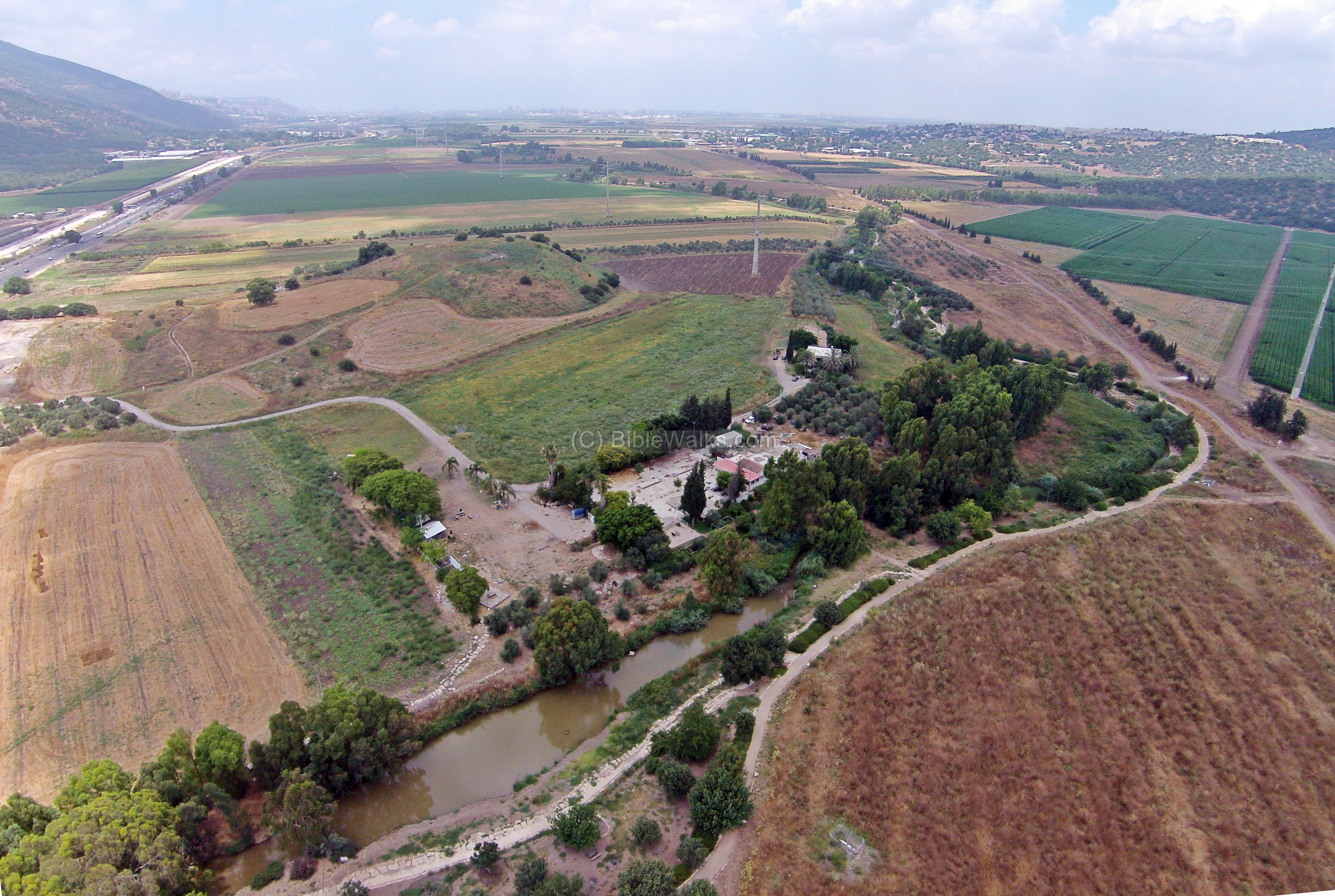
An aerial view from the south-east side is seen below. The size of the mound is about 40 Dunams (4 Hectares), and is 39m above sea level, or 27m above the Kishon river at its side.
The front part of this view is the lower city, while the upper city is located on the far (north) side. The northern foothills of Mount Carmel are seen on the left edge of the photo.

A flight around the site can be seen in this drone video:
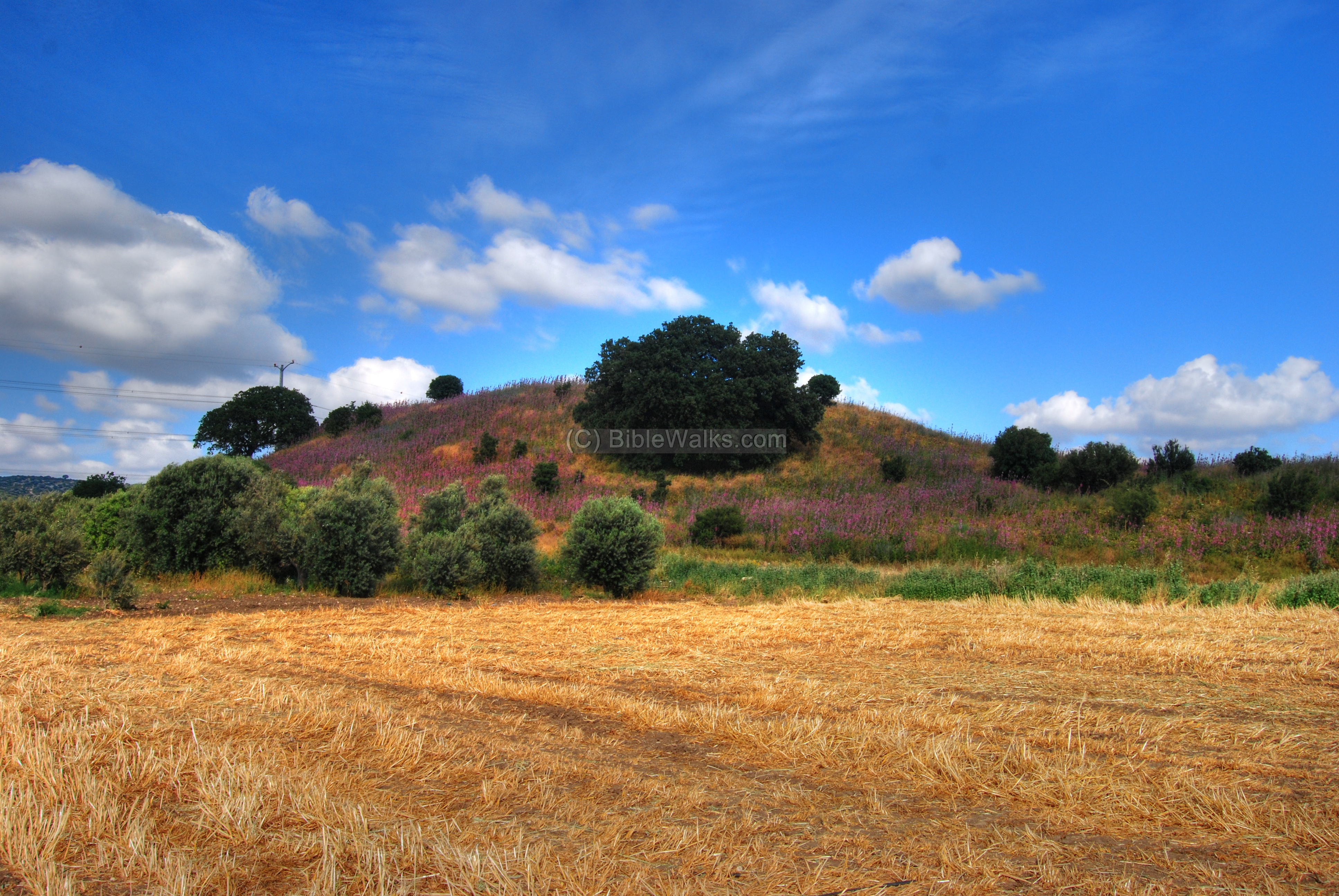
(b) General views:
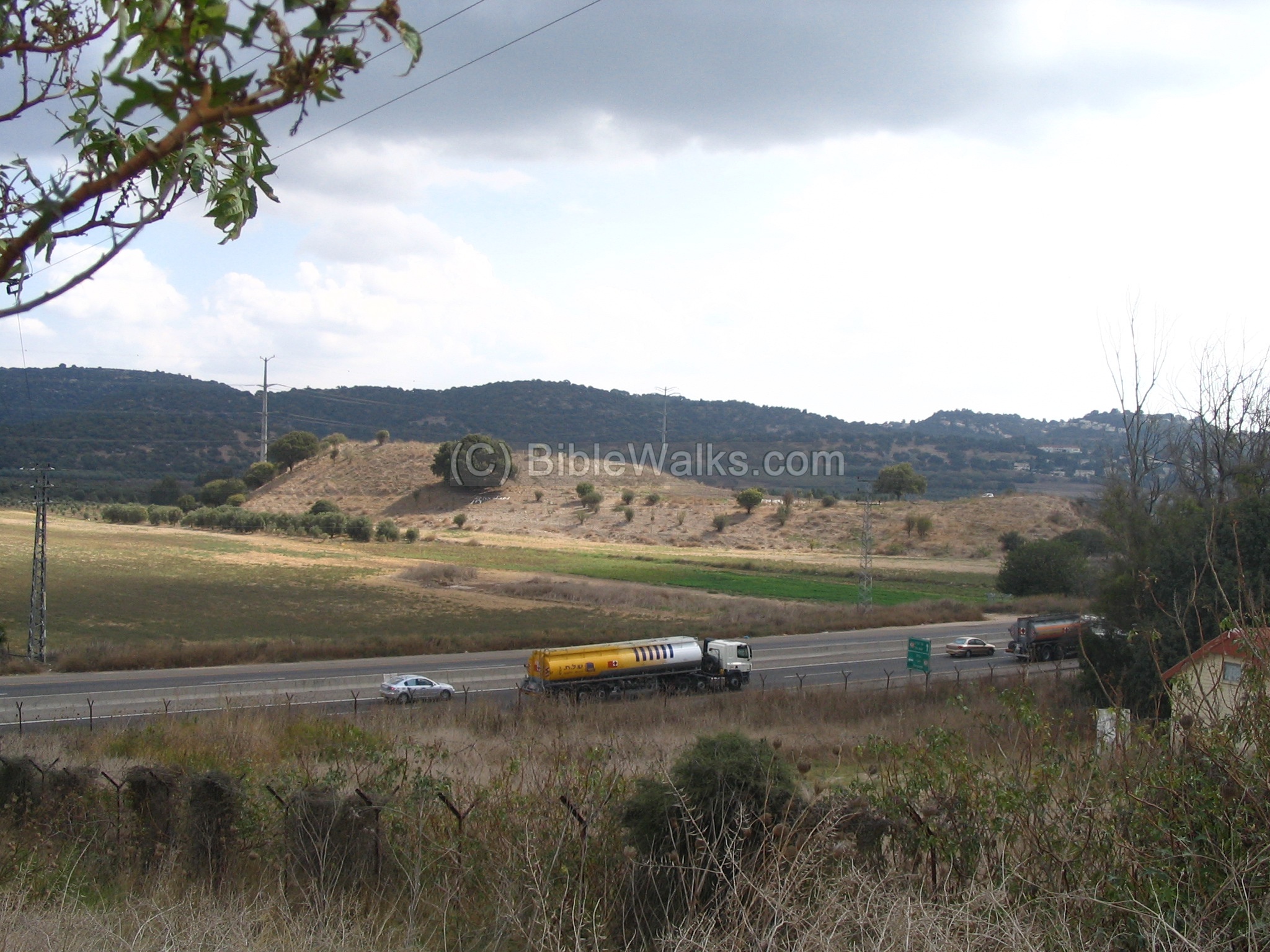
The following photo shows a view of the Tell Al-Amar (Geva), as seen from the south-west hill – across the highway. The Tell has two parts: an upper city to the north (left side) and a lower city to the south (right side).
The Kishon river winds around and behind the Tell, flowing from right to left towards the bay of Haifa. As can be seen, the ancient road of Via Maris, passing at this point, had a very narrow corridor that was completely under the control of this ancient city, hence its strategic importance.
Kh. Harithiya is seen on the center-left hill behind the Tell, just above the tree in the center of the Tell. On its right side is Kibbutz Sha’ar-Haamakim. Behind the Kibbutz, on the far background, is the city of Tivon.
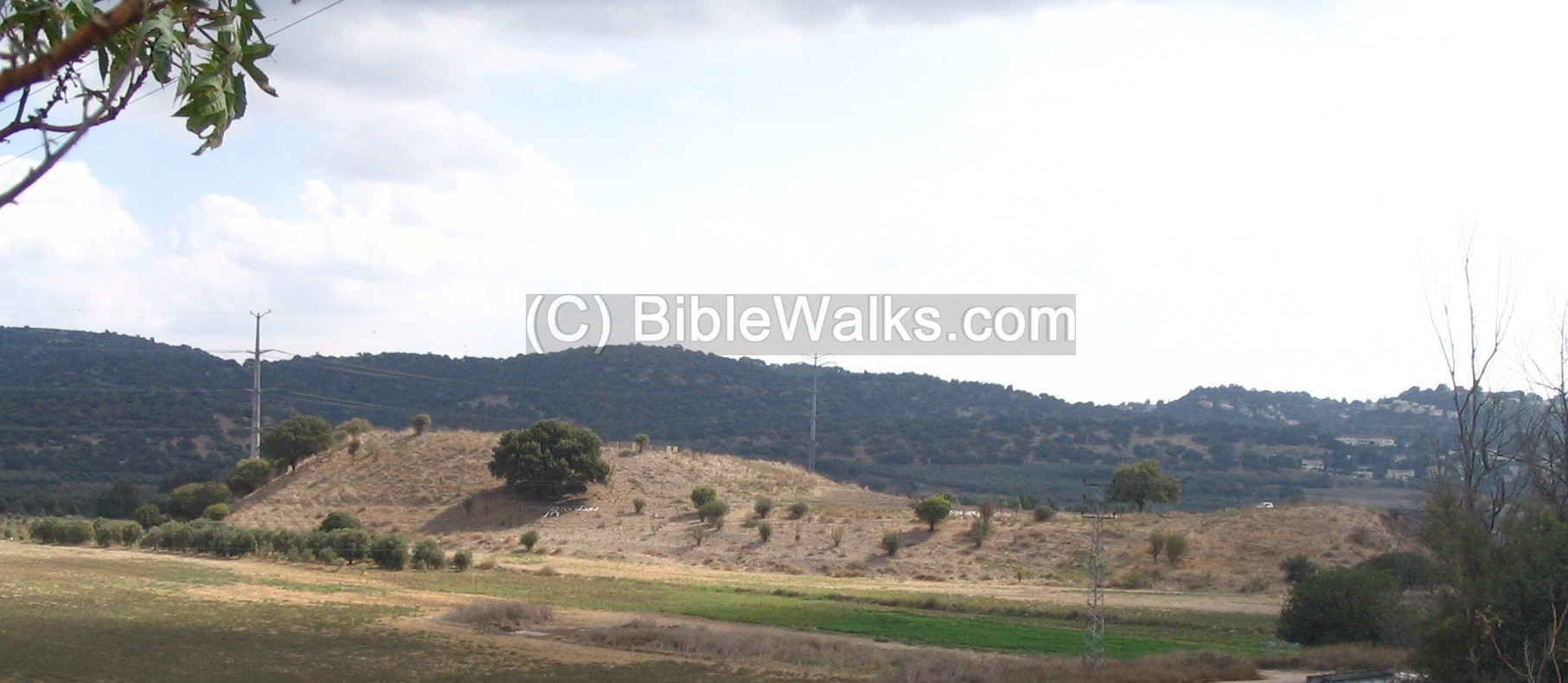
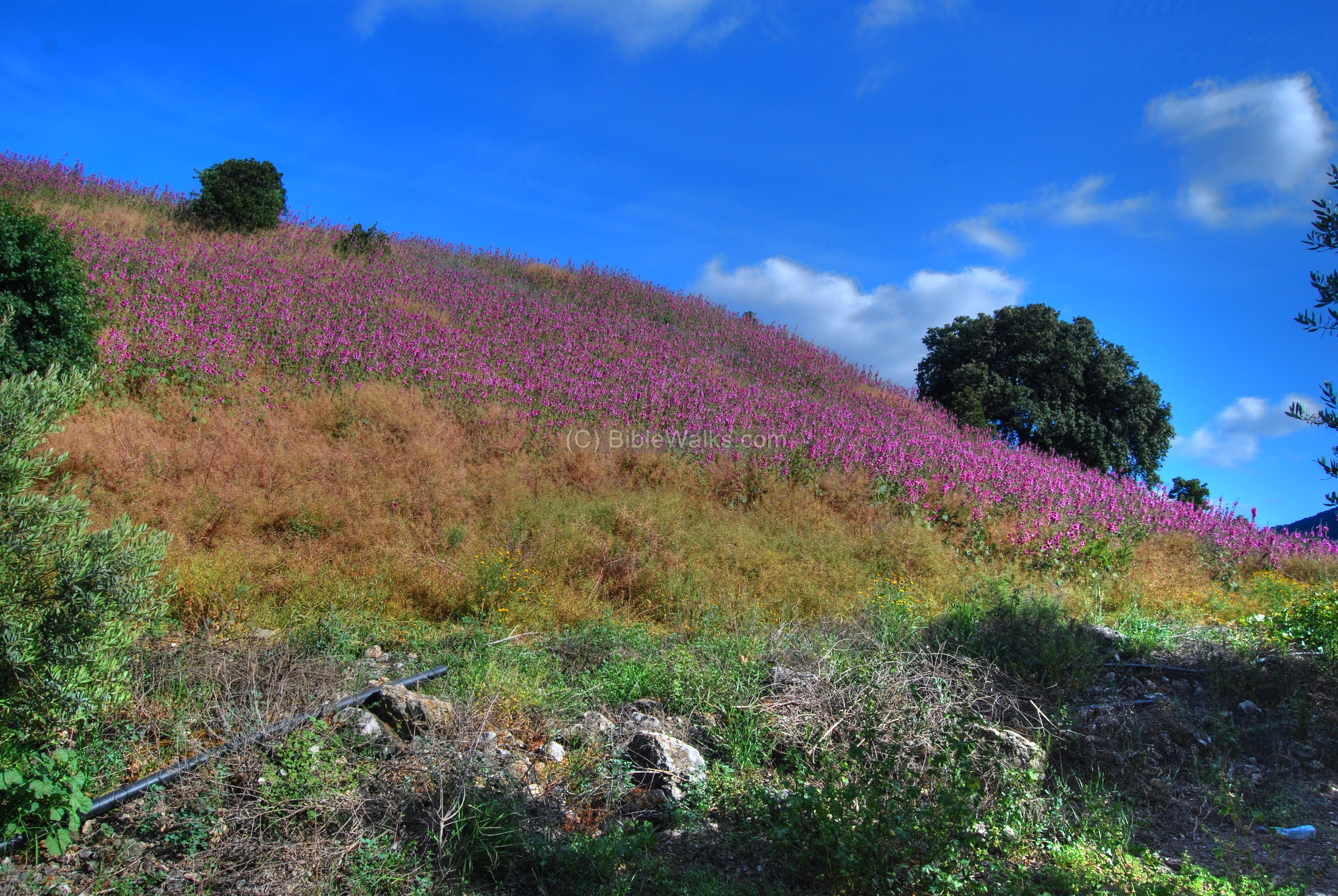
The Tell changes its view and colors throughout the seasons. The photos below were taken during the spring time, when the Tell is dressed with purple wild flowers.
A closer view of the north-west side of the Tell.
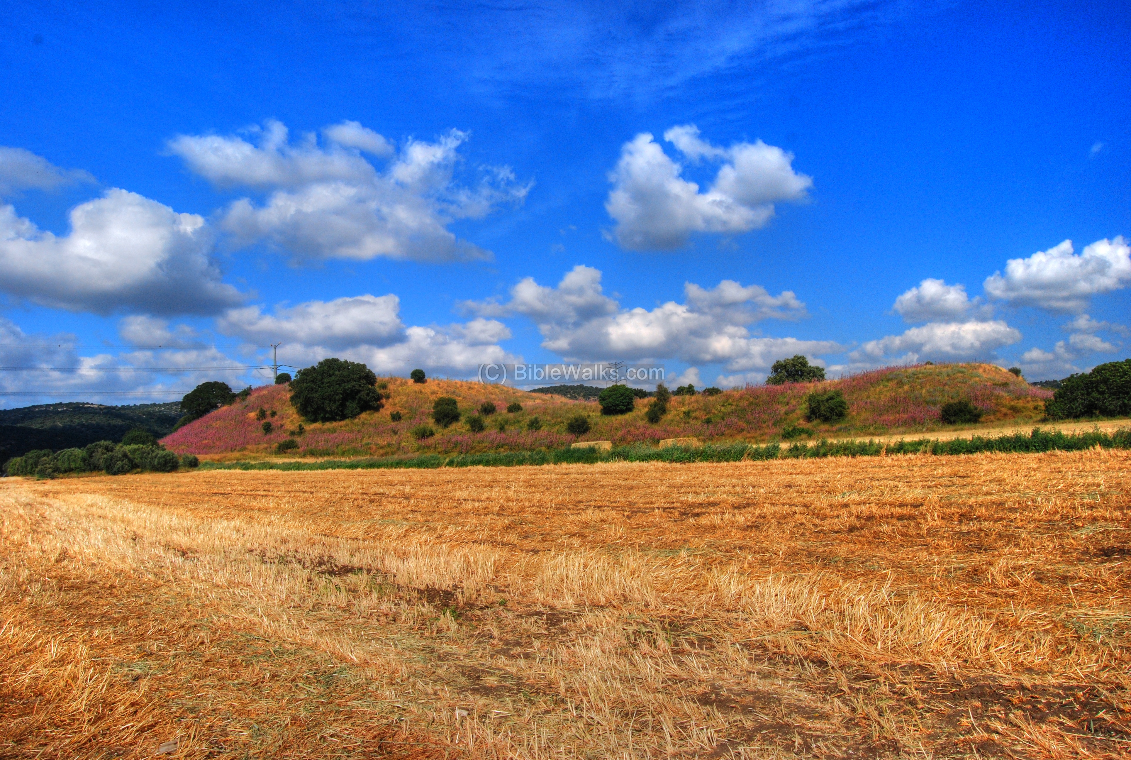
(c) Wild Flowers:
During the short spring time the western slopes are covered with wild flowers.
A closer view of the wild flowers. The flower’s name is “Althaea setosa Boiss”, and in Hebrew “Khatamit Zifanit”. They flower from April thru June, and reach up to 2M height (More info in link below; thanks to uncle Ronnie).
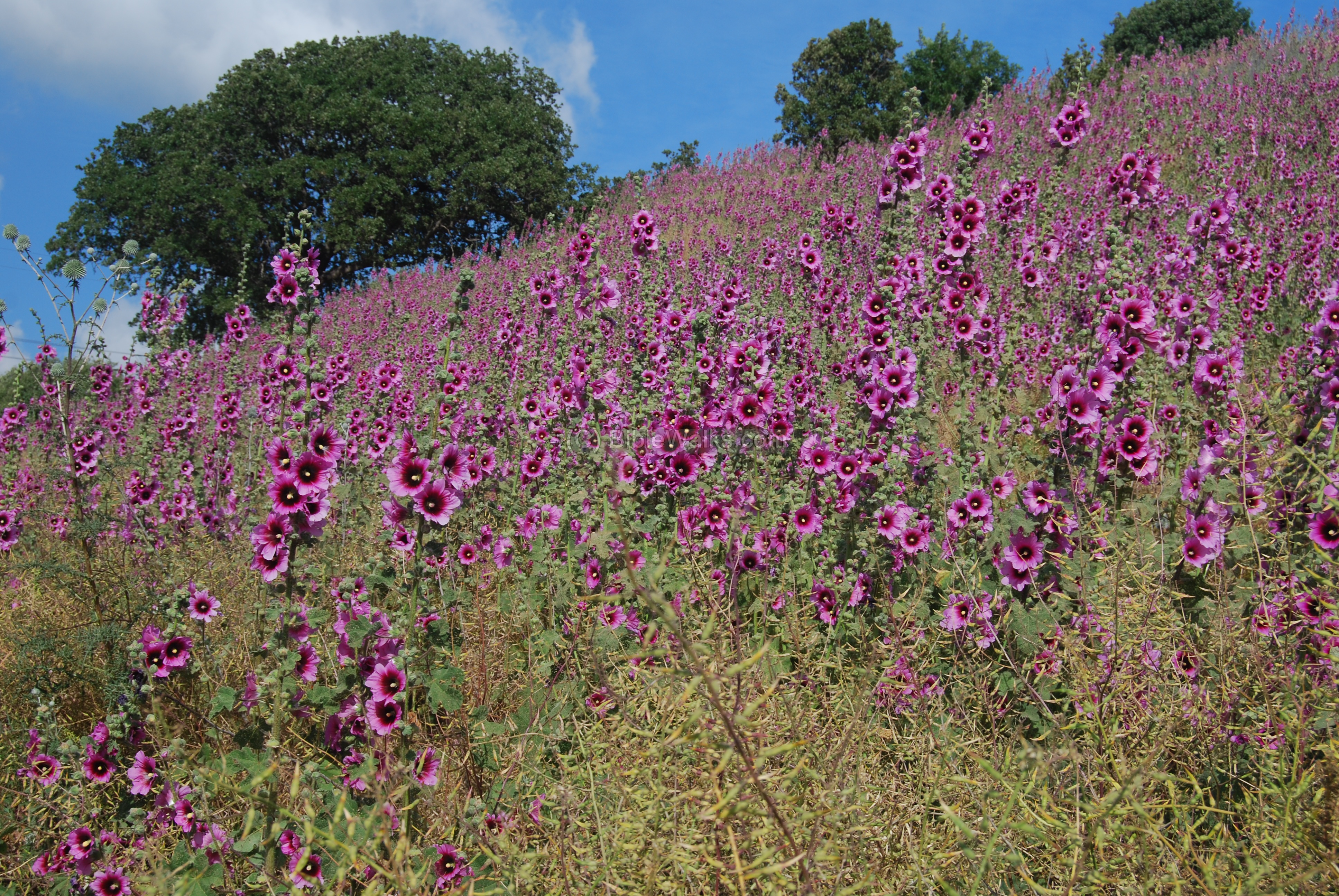
A detailed view of the “Khatamit Zifanit” flowers.

(d) Kishon Park:
The Kishon creek is located 100M to the east and north of the Tell, and in ancient times may have completely surrounded it for defense purposes. A photo of the eastern section is seen below, taken in late November before the flooding of the winter season (which normally happens during December through March). The Tell is seen in the center background.

A view towards the south: the Turkish bridge is seen in the background, and behind it is Mount Carmel. The Turkish railway, from Haifa to Hejaz, used the south bridge to cross the Kishon.

A small park was constructed here, in memory of Shoshi Perry, and is a nice place for a picnic (tables are located beneath the central Eucalyptus tree), and a stroll along the path that follows the Kishon creek. The entrance to the park is north of the main road, 50M east of the bridge.
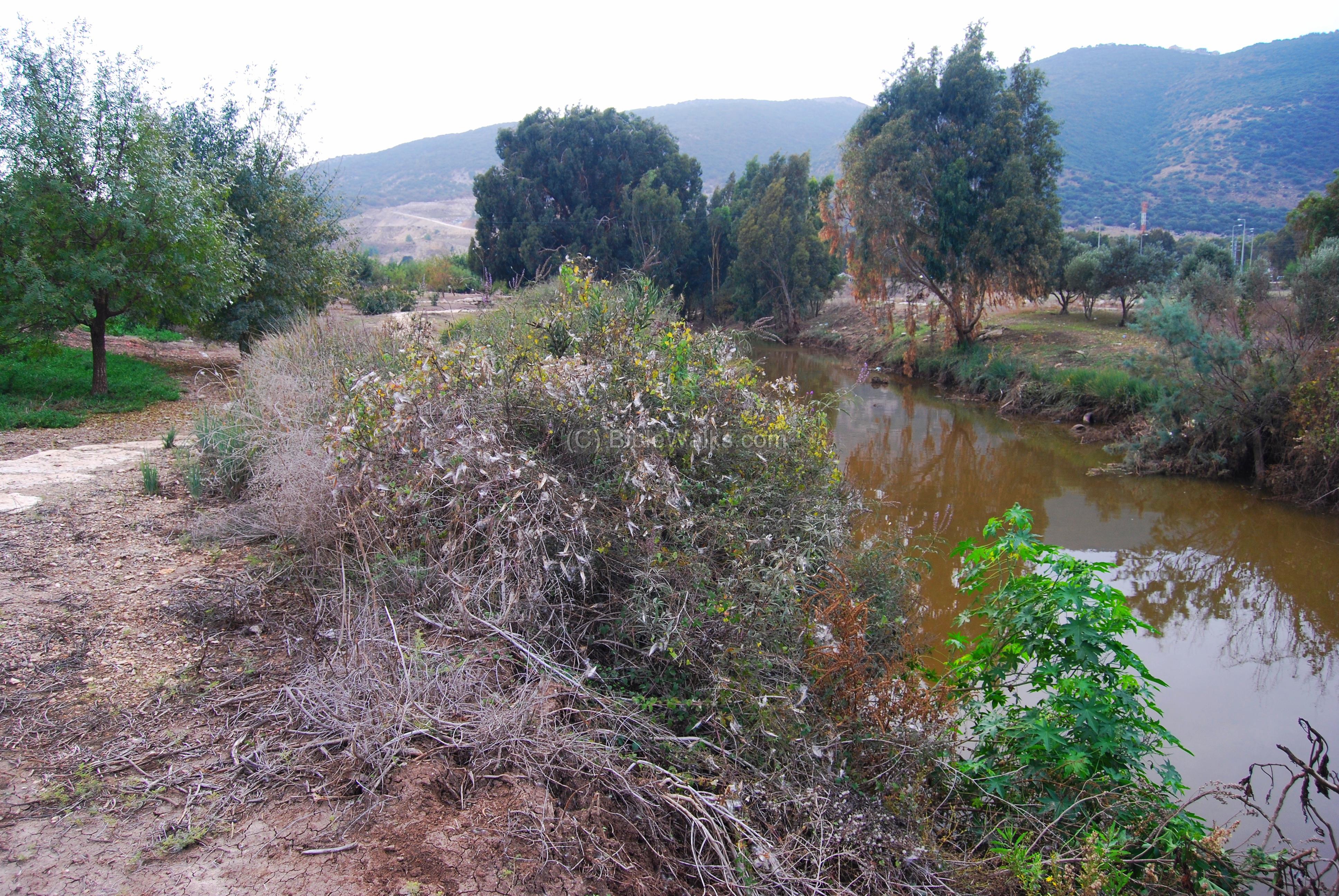
Although it looks like a small creek, this is the actual place of the Kishon river, where Barak defeated Sisera. Judges 5 1+21: “Then sang Deborah and Barak the son of Abinoam on that day, saying… The river of Kishon swept them away, that ancient river, the river Kishon. O my soul, thou hast trodden down strength”.
(e) Roman glass factory:
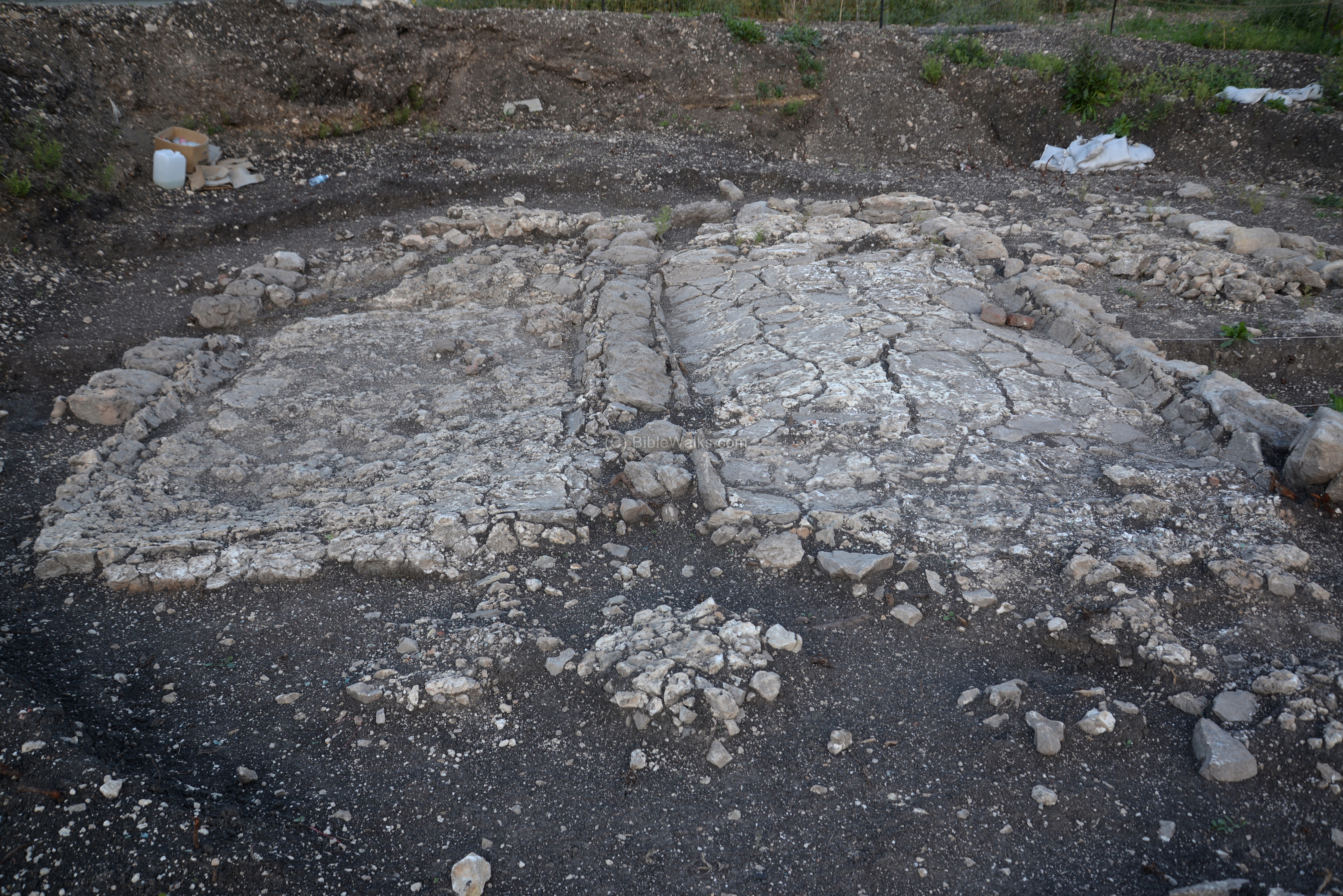
Remains of a Late Roman period glass factory was found in 2016 in Jalame, at the side of the new railroad, 200m west of Tel Me’amar. According to the IAA report this was “the oldest glassworks ever found in Israel”, and “a world center for glass making in Antiquity”. The base of the four furnaces that produced the raw material of melted glass in seen in the following photo.
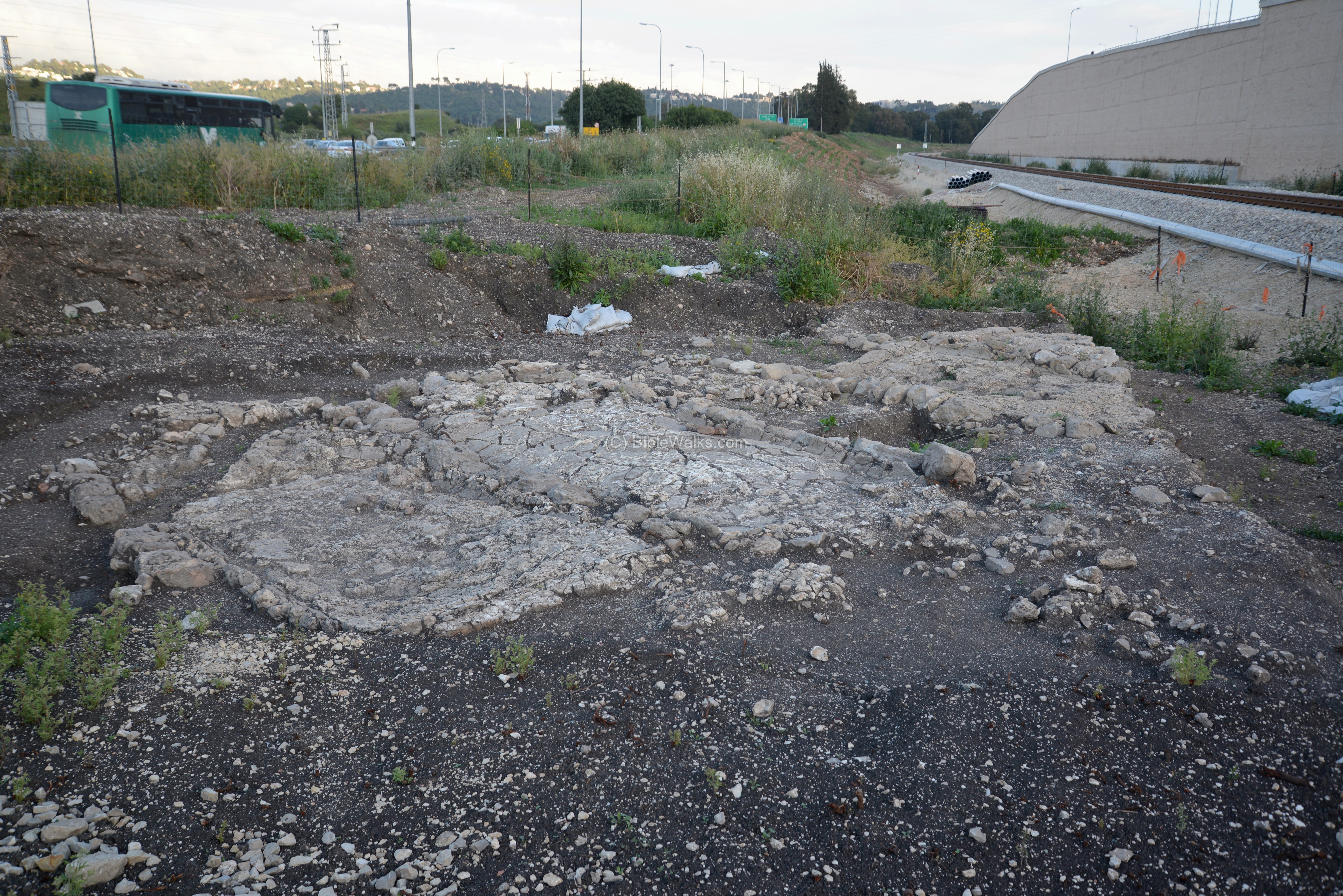
In the kilns, dated to 1,600 years ago, commercial quantities of raw glass were produced. The archaeologists unearthed the base of the kilns and numerous fragments of the glass that was produced here.
During the Greek and Roman periods (5th Century BC thru 9th century AD) the glass was of soda-lime-silica composition, with low magnesium and potassium levels. Suitable glassmaking sands (the first ingredient) would have come from areas with high silica content and low impurities, which can be found mainly on the eastern Mediterranean area. This source of quality sand was found along the the Na’aman river, located to the north of the site in the bay of Acre. It was mixed with the second ingredient – mineral soda (“Natron”) – which was imported from Egypt. The third ingredient was lime, which was used as a stabilizer to prevent the glass to dissolve in water. It came from calcium carbonate prepared from grinded limestone and chalk that was found in the nearby hills. The fuel for the fire in the furnaces was the wood from the Carmel, which is located above the site.
The mixture was placed inside the kiln; the heat from the fire melted it at 1700c degrees to become liquid sand, and was cooled down to transform to solid glass. Each furnace produced raw glass, with the size of 4m x 2m x 45cm, weighing 8-10 tons. When the process was completed, the furnace was dismanteled, and the glass bloc was removed and shipped to glass workshops.

Reconstruction of the glass furnace
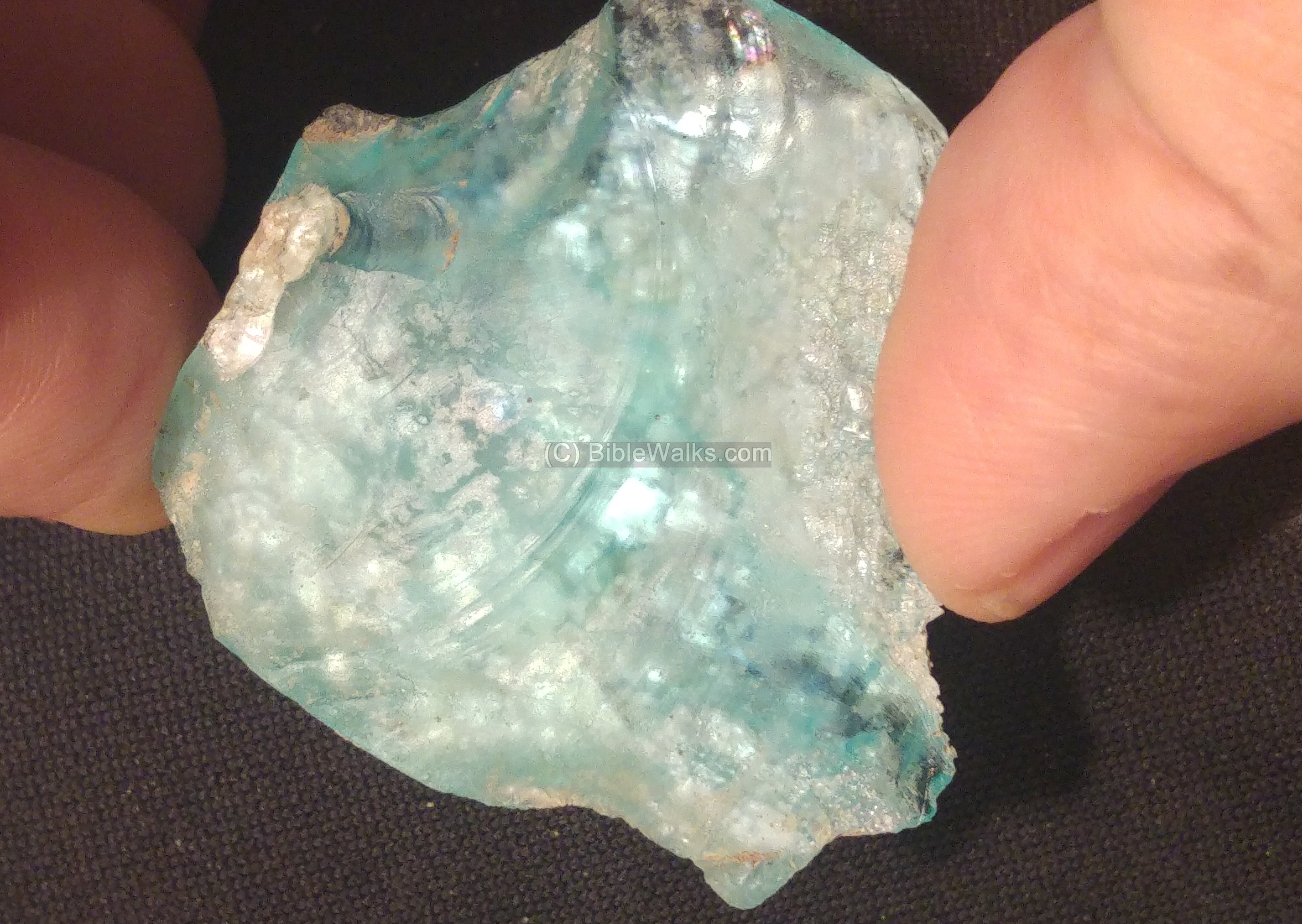
The raw glass was then broken up to pieces and melted again in glass workshops in order to create fine glass vessels. During the Early Roman period chunks of the raw glass were used to create glass products by glass blowing – a new techniuque that perfected the qaulity of the products. Local workshops were discovered on the nearby hill in the late 1960s, where craftsmen worked the raw glass into wonderful glassware objects.
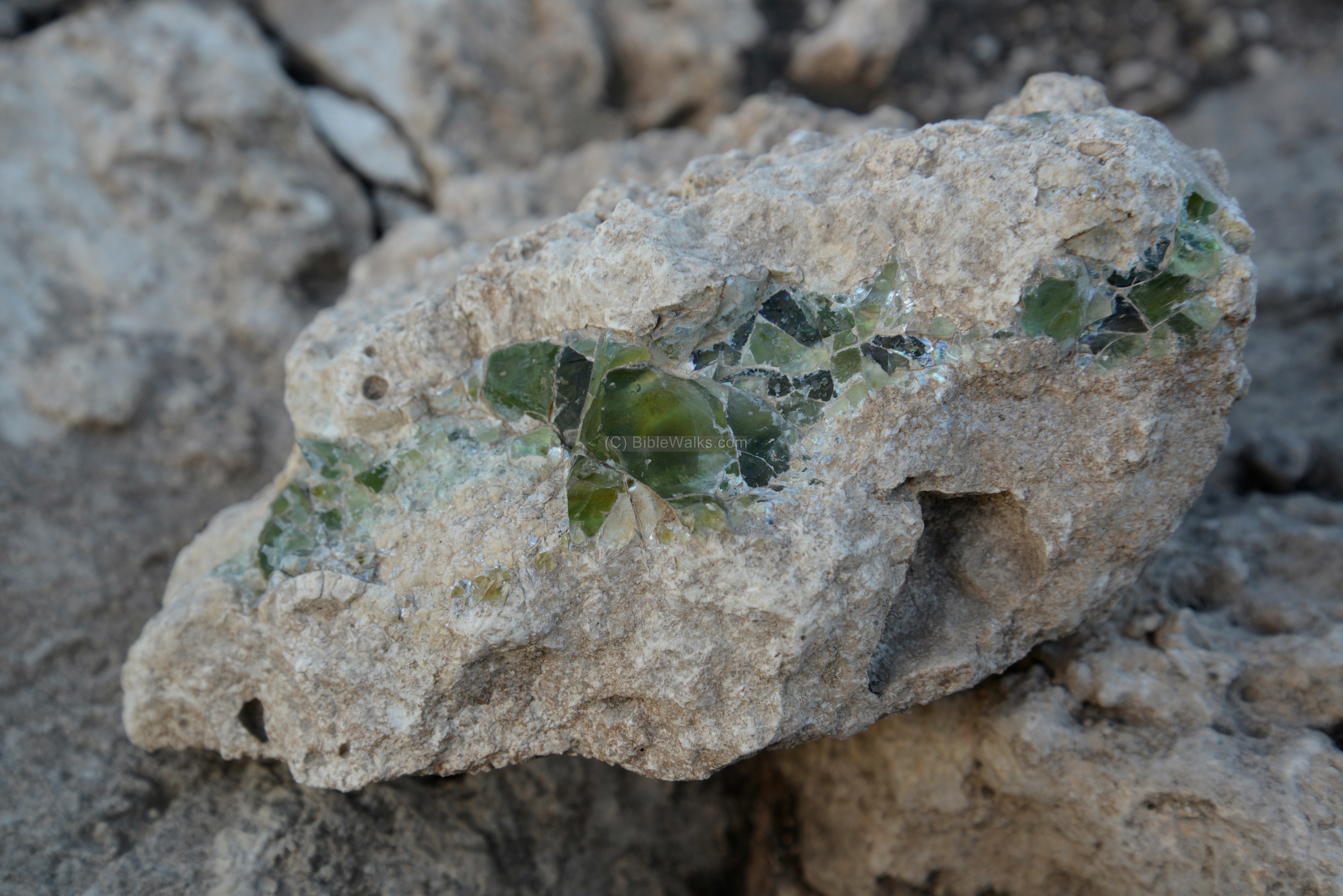
The final goods were shipped to the Roman markets. According to chemical analysis of glass vessels in the Roman world, the source of glass was from this production center. Below – remains of rocks with melted glass that found here.
Glass can be traced back to Mesopotamia in 3500 BC. It was first made there, in Egypt or in the coasts of the Levant. Extensive glassmaking started in the 16th Century BC, while glass blowing was invented in the 1st century BC on the coasts of northern Israel and Lebanon. Glass was expensive during antquities. In the Bible it is equaled to gold, although named “crystal” in KJV version (Job 28, 17): “The gold and the crystal [Glass] cannot equal it: and the exchange of it shall not be for jewels of fine gold”.
The discovery of the raw glass production and the glass vessels workshops, together with another glass production factory in nearby Beit Shearim, supports the theory that Israel was a major exporter of glassware in antiquity.
Biblical:
Judges 4, 7-13- 16-24:
The site is identified as “Harosheth of the Gentiles” where the Judge Deborah had Barak ben Avinoam trap the army and Chariots of Sisera, the General of the Canaanite King Jabin, and defeat him.
“And I will draw unto thee to the river Kishon Sisera, the captain of Jabin’s army, with his chariots and his multitude; and I will deliver him into thine hand….”
“And Sisera gathered together all his chariots, even nine hundred chariots of iron, and all the people that were with him, from Harosheth of the Gentiles unto the river of Kishon”.
“But Barak pursued after the chariots, and after the host, unto Harosheth of the Gentiles: and all the host of Sisera fell upon the edge of the sword; and there was not a man left”.
“And the hand of the children of Israel prospered, and prevailed against Jabin the king of Canaan, until they had destroyed Jabin king of Canaan”.
Judges 5, 1+21:
The Judge Deborah sang the famous song after this victory:
“Then sang Deborah and Barak the son of Abinoam on that day, saying,”
…
“The river of Kishon swept them away, that ancient river, the river Kishon. O my soul, thou hast trodden down strength”.
Etymology (behind the name):
- Geva – In Hebrew its a short form of the word “hill”. There were other places with this name. This is why there is a prefix : Geva-Shemen and Geva-Parashim.
- Shemen – Hebrew for “oil”. Geva-Shemen – in Hebrew “the hill of oil” or “oil hill”
- Parashim – Hebrew for “horsemen”
- Tell Me’ammer (Tell el-Amar, Tell Amr): the Arabic name of the site, meaning “Mound of ‘Amr”. ‘Amr is a private name.
- Leiyet Zahluk – the slippery dry ground.
- Nahr el Mukutta – Arabic for the river of the “cut-up one”, refers to the Kishon south of the site.
- Kibbutz Shaar Haamakim – the name means in Hebrew “the gate to the valleys” – the valleys are Jezreel and valley of west Galilee.
- Kiryat Harosheth – “Kiryah” is in Hebrew: city or suburb. “Harosheth” is in Hebrew: industry. It is called after the area “Harosheth of the Gentiles” described in the Biblical battle of Barak and Sisera (Judges 4,5).
- El Haritiyeh or Haritheh – Arabic: the ploughed land.
- Jelameh – Arabic: “hill”
Links and references:
* Archaeology:
-
Carta’s Atlas of the Bible – Y. Aharoni [Carta Jerusalem 1974] – Shop for this must-have book.
Site: Tell Meamer Maps: 34, 36
-
Three conquests of Canaan – Eero Junkkaala [2006] – a large article, some reference on Tell el-Amar
-
Gai-Yiftachel – The border between Asher and Zebulun – (Hebrew; pdf) – the article by Zvi Gal suggests that this site was actually the Biblical city of Khelkat, which bordered between the two tribes. It identifies Geva at Tell Kassis near Yokneam or Tell Abu-Shusha near Mishmar-Haemek .
-
An Important Archaeological Discovery at the Foot of Mount Carmel [IAA report, Apr 2016]
-
Archaeological survey of Israel (map 27, Yagur) site 103 – Khirbet ‘Asafna
-
Hadashot Arkheologiyot Volume 123 2011 – Khirbet ‘Asafna
-
Corning Museum of Glass – Excavations of a glass factory at Jalame
*Internal Links:
-
Wild flowers of Israel
- Story of a Tel – Biblical mounds
-
Drone Aerial views – collection of Biblical sites from the air
-
Beit She’arim Catacombs – 5km to the west was another glass production factory dated to the Roman period
* Nearby sites:
- Khirbet Harithiya – located 1.5KM east.
- Tel Yokneam – located 7Km to the south.
- Tel Kassis – located 5KM to the south. Identified as Biblical Khelkat.
- Beit Sharim – located 3-4KM to the south-east, and was a large ancient city, including a famous necropolis (with
- tombs buried inside caves).
BibleWalks.com – walk with us through the sites of the Holy Land
K. Hannania <<<—previous lower Galilee site—<<<All Sites>>>—next site—>>>Harithiya
This page was last updated on Dec 23, 2025 (add details on glass)
Sponsored links: