The Biar spring and shaft tunnel – one of the sources of Solomon’s pools; fed the “Upper aqueduct” that supplied water to Jerusalem.
Home > Sites > Judea > Biar Tunnel
Contents:
Overview
History
Aqueduct plan
Photos
* Shaft Tunnel
* Open Aqueduct
* Upper Aqueduct
Guided tours
Etymology
Links
Overview:
The Biar spring was one of the sources of Solomon’s pools, that fed the “Upper aqueduct”. A shaft tunnel was built from the spring to the pools. According to the archaeologists who researched the tunnel, and based on C-14 dating, it was built during the 1st century AD and later renovated during the 2nd century. They suggested it was built during the period of the Judean prefect Pontius Pilate.
Location:
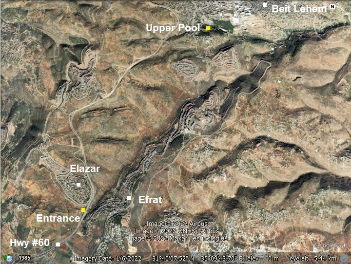
The map shows the points of interest along the Biar aqueduct – starting from the first shaft (near Efrat) and ending in the Upper “Solomon’s” pool (in south west side of Bethlehem). The overall length of the aqueduct is 5km, where its first 3km are underground.
History:
- Early Roman Period
During the end of the 1st century BC, Herod the Great planned to increase the water supply to Jerusalem which was growing in size. Pontius Pilatus, Judea’s prefect (26/27 thru 36/37 AD), increased the water supply to the reservoirs (“Solomon’s’ Pools”) by diverting the Arroub spring waters. As Josephus wrote (Antiquities 18 3:2)
“But Pilate undertook to bring a current of water to Jerusalem, and did it with the sacred money, and derived the origin of the stream from the distance of two hundred furlongs [BW: 40 KM]”.
Later, the 10th Legion constructed a second aqueduct – named the “Upper Aqueduct” – in addition to the Hasmonean period “Lower aqueduct” that crosses the hill east of Mar Elias. The Biar spring, another source of the pools near Efrat, was collected into a higher pool via a 5km long aqueduct (“Biar aqueduct”). It enabled to raise the water level in the reservoirs, thus increasing the height of the Upper aqueduct. It made the plan straighter, cutting the total length by half (!). This 13 km long aqueduct started from the ‘Solomon’s pools’, where it received waters from the Arroub and Biar springs. It conveyed the water to the old city near Herod’s palace. Its engineering was more sophisticated, using a different shorter and straighter route.
-
Ottoman period
Conder and Kitchener of the Palestine Exploration Fund (PEF) surveyed the area during the Survey of Western Palestine (SWP) in 1874-75. This is a section of their map, focusing on the area from the spring (marked as “shaft”, south of Kh. el Katt) to Solomon’s Pools (marked as “el Burak”). The valley is named here Wady el Biar (Arabic for the valley of the springs), which gave the name to the Biar aqueduct.
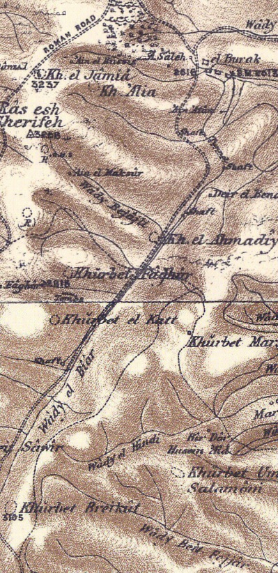
Part of map sheets 17/20 of Survey of Western Palestine,
by Conder and Kitchener, 1872-1877.
(Published 1880, reprinted by LifeintheHolyLand.com)
They wrote about Solomon’s Pools, the Upper aqueduct and the Biar aqueduct (Volume 3, Sheet XVII, pp. 89-92):
“El Burak —Commonly called Solomon’s Pools. Three reservoirs formed in a valley, with strong retaining walls. They measure 582 by 177 feet, 423 by 232 feet, and 350 by 233 feet respectively, but are none of them rectangular, the east walls being broader than the west.
(The breadths given are the mean measures.) The pool-floors are formed by the valley-bed, and they are thus each deepest on the east, where they measure 50 feet, 30 feet, and 25 feet, the smallest and shallowest pool being to the west. The masonry resembles that of the aqueducts which lead from them”.
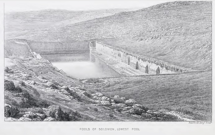
Pools of Solomon, lowest Pool (PEF Volume 3, p. 89)
“Four springs were connected with the pools:
- ‘Ain Saleh, an underground spring, in a rock chamber now closed by a wooden door—the water runs in through a vault into the west pool;
- ‘Ain Farujeh, a spring said to be beneath the pools ;
- ‘Ain ‘Atan, on the hillside southeast of the pools ;
- And a fourth spring inside the old castle, north of the upper pool.
They were further supplied from the high-level aqueduct which comes down Wady el Biar. This aqueduct starts from a well in the valley, where it is probably supplied by a spring, though now dry. It also would have brought down the surface drainage of the valley to the pools.
The longer aqueduct, which commences at ‘Ain Kueiziba, runs below the pools, receiving the supply from ‘Ain ‘Atan and from the lower pool. It flows beneath the hill of Bethlehem and east of Mar Elias, carrying water to el Kas, in the Haram at Jerusalem, when in repair. This aqueduct is called ‘ The Pagan’s Canal,’ and is presumably that constructed by Pontius Pilate (Ant. xviii. 3, 2).
The part of this aqueduct south of the pools is sometimes cut in rocks, and in one place tunneled through the hill, but generally carried on a wall of rubble masonry, sometimes 6 to 8 feet high, and faced with ashlar. The channel is 1 1/2 to 2 feet wide, and 1 foot to 21/2 feet deep, lined with good cement, and covered with loose .slabs of stone. From the pools, pipes set in masonry form the channel, but these are perhaps part of a later restoration. The channel has here sloping sides, and is 2 feet 3 inches deep, 1 foot wide at the bottom, 1 foot 10 inches at the top : in this the pipes are laid.
The high-level aqueduct to Jerusalem is a continuation of that from Wady el Biar, but its exact course in the immediate neighborhood of the upper pool is lost. The water was conducted through stone pipes 15 inches diameter, jointed together by rebates ; the exterior diameter is 2 feet. This channel is traceable from the pools to the neighborhood of Rachel’s Tomb, where it crosses a low saddle running up-hill on the north side. The channel with stone tubes is again visible at the bottom of the garden of the Austrian Consul’s country house. The shafts which lead down to the tunnel of this aqueduct in Wady el Biar may be compared with those of the Caesarea Aqueduct. The general character of masonry of the aqueducts and pools resembles that of the Caesarea aqueducts, and would seem, therefore, to be Roman work. It was formerly supposed that the high level aqueduct was traceable west of the Bethlehem road in the plain north of Mar Elias, as is shown on the map. Further search, however, shows that the channel ran east of the main road. It is not traceable further than the plain. The old castle by the pools (Kulat el Burak) appears to be Saracenic or Arab work. It is said to have been built to protect the water supply from the Bedawin, and is square, with corner towers, and a gate to the west.Visited November, 1873″.
-
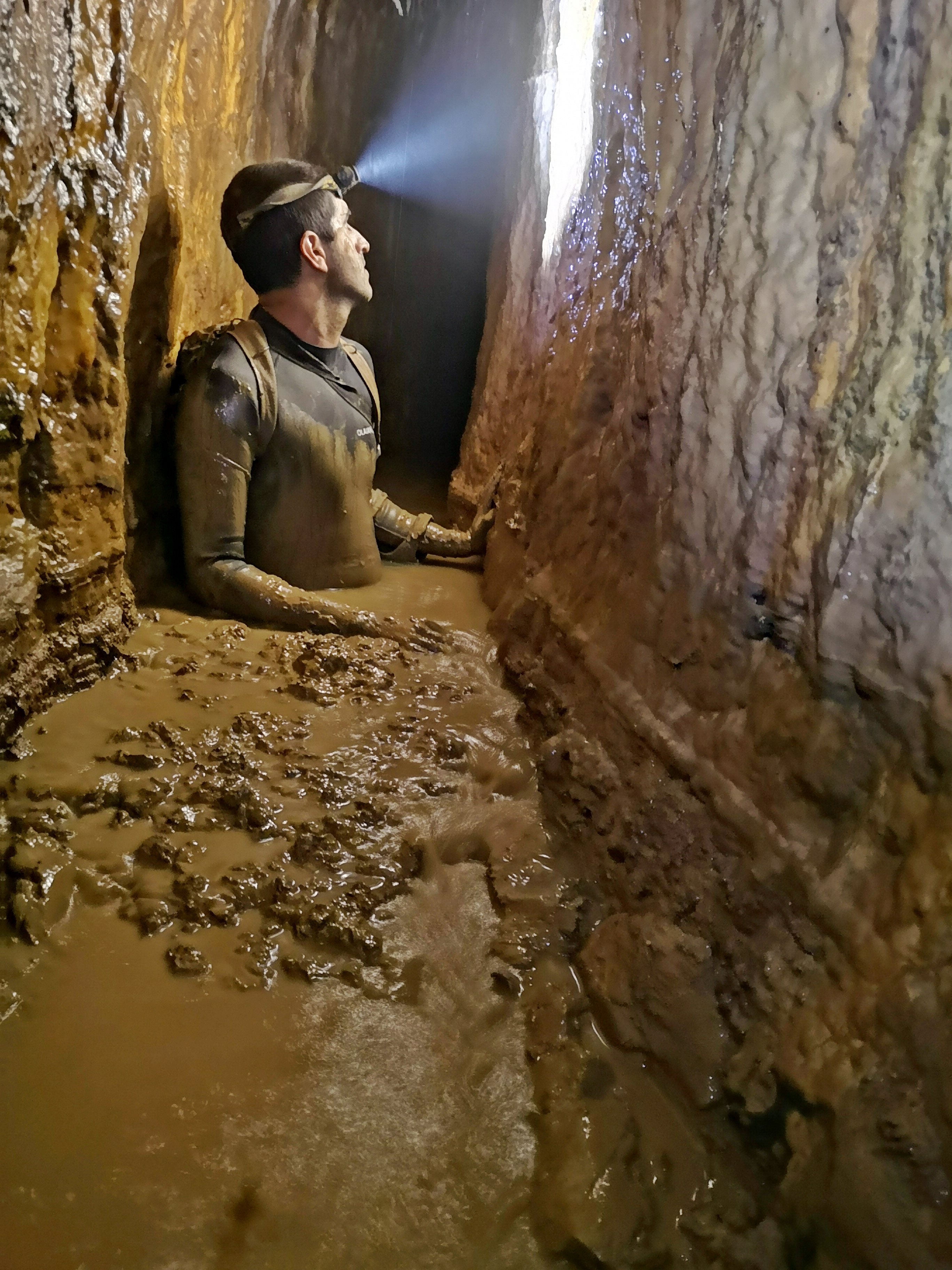
Modern period
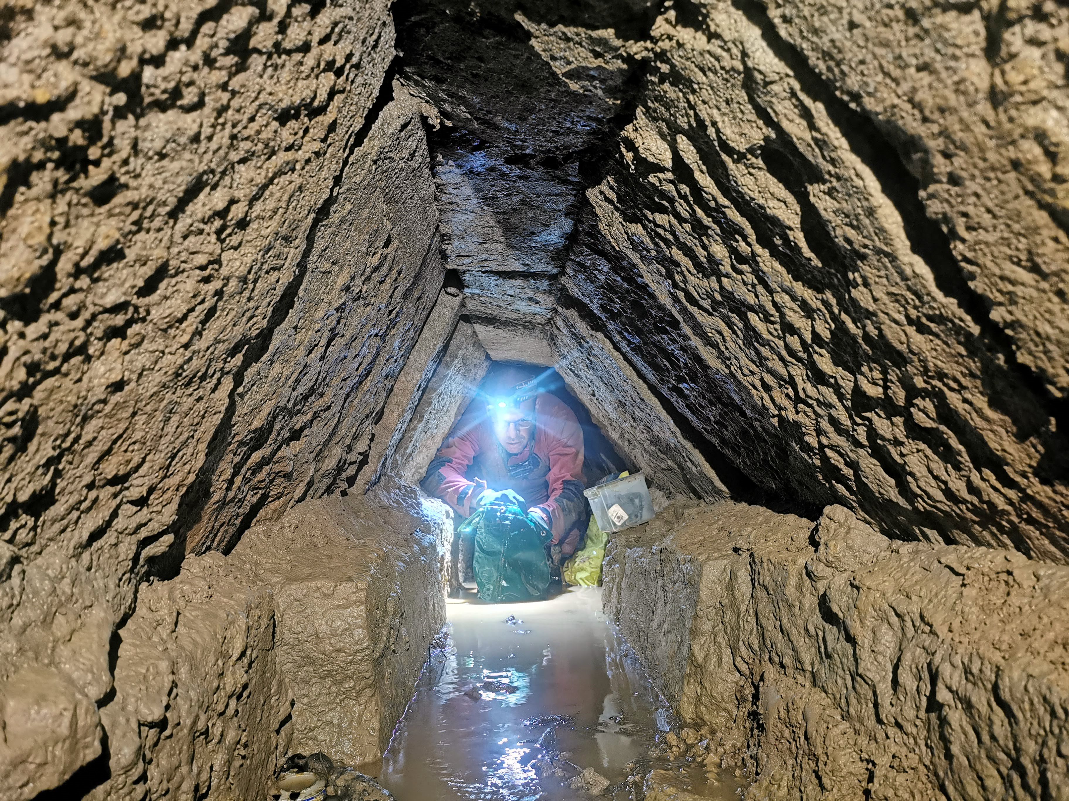
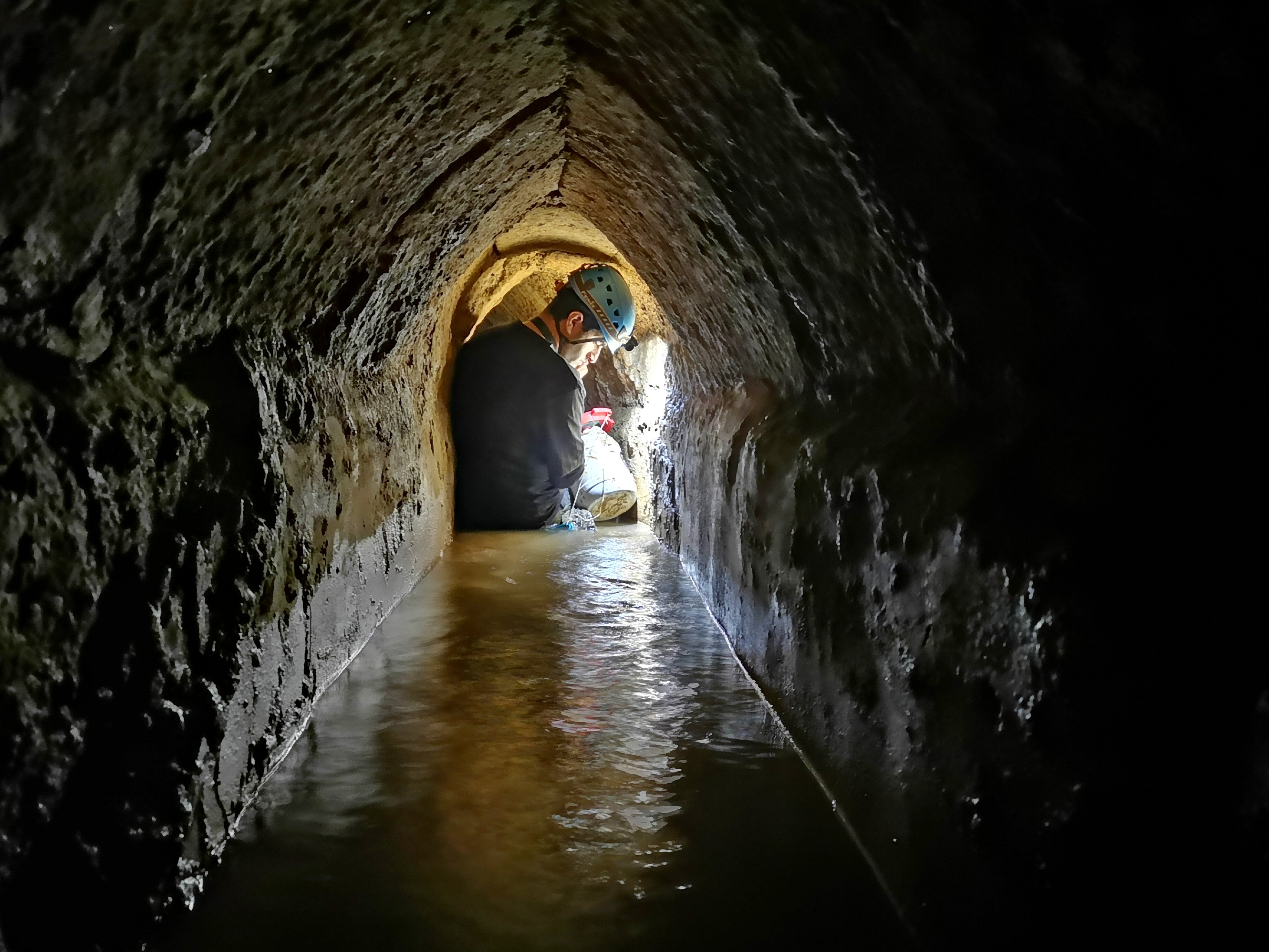
A short section of the Biyar tunnel is accessible to the public. An entrance is in the valley between Elazar and Efrat (formerly Efrata) in the Gush Etzion area. This section is between the first shaft and the second shaft. Although the hike along the underground tunnel is wet, it is an enjoyable cool experience.
Plan:
The water supply system to the Temple has several sections:
- Biyar aqueduct, 5 km long, consisting of:
a. The Biyar spring
b. Underground shaft tunnel for conveying the water (3km long)
c. A surface channel
d. A ridge crossing tunnel
e. A surface channel that feeds into the “Solomon’s pools”
2. “Solomon’s Pools, consisting of 3 pools – Upper, Middle and Lower.
3. “From “Solomon’s Pools” are 2 aqueducts leading to Jerusalem:
- Lower level aqueduct – The length to Jerusalem was estimated to be around 21.5 kilometers (approximately 13 miles). It was first constructed in the Hasmonean period, with an average gradient of 0.14% (30m drop in height).
- Upper level aqueduct – The length to Jerusalem was estimated to be around 14 kilometers (approximately 8 miles), with an average gradient of 0.28%. It was constructed in the Early Roman period. This shorter aqueduct was made possible by the construction of the Upper pool that was fed from the Biar tunnel.
Photos:
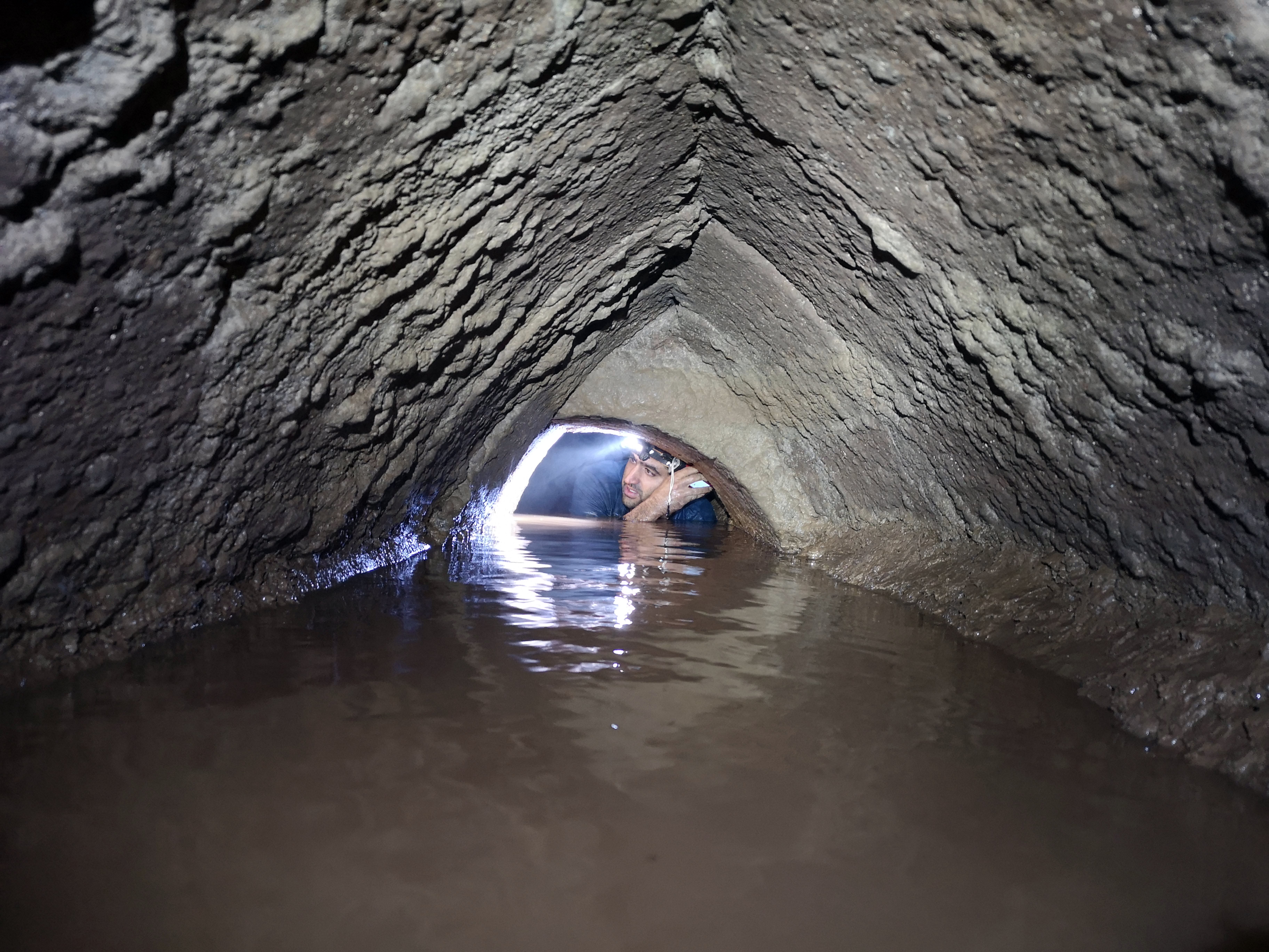
All photos in the tunnel section – courtesy of Dr. Azriel Yechezkel and Yoav Negev
a) The Biyar Shaft Tunnel
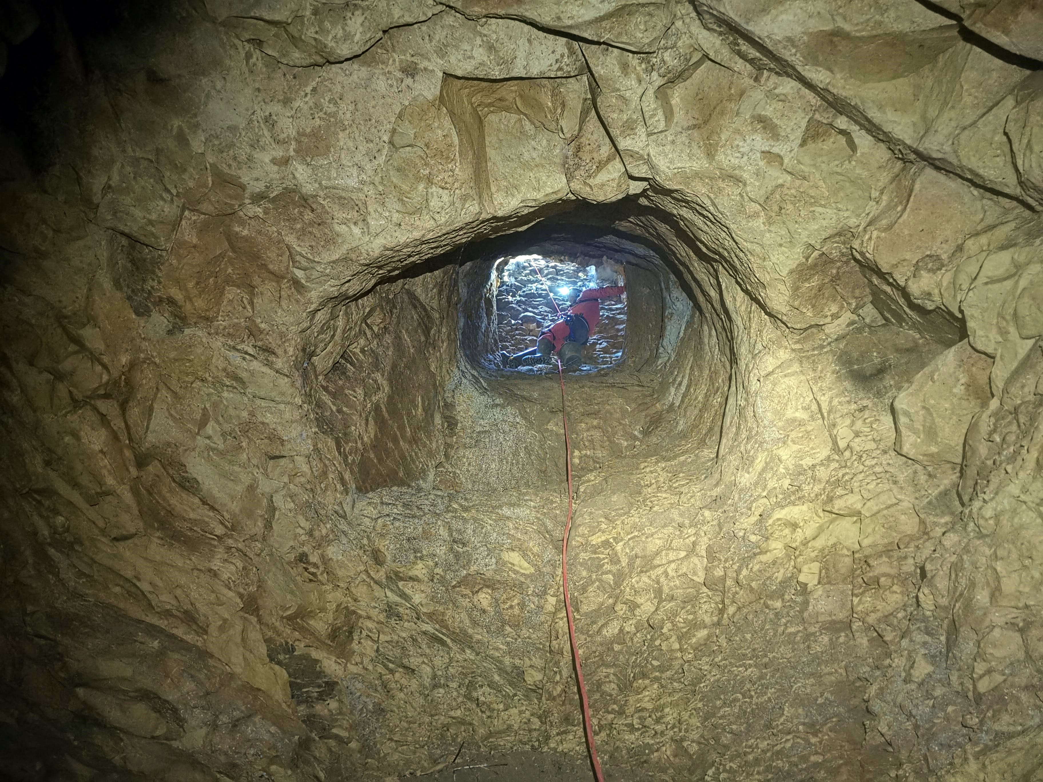
1. Shafts
The tunnel was built by digging shafts into the ground, positioned along the line at distances ranging from 31m to 65m. Opposite teams dug horizontally between each pair of vertical shafts and met in the middle between the shafts. The shafts are numbered 1 thru 25, covering the total length of the underground tunnel. The total length of the tunnel is 2952m according to Azriel Yechezkel and Yoav Negev survey.
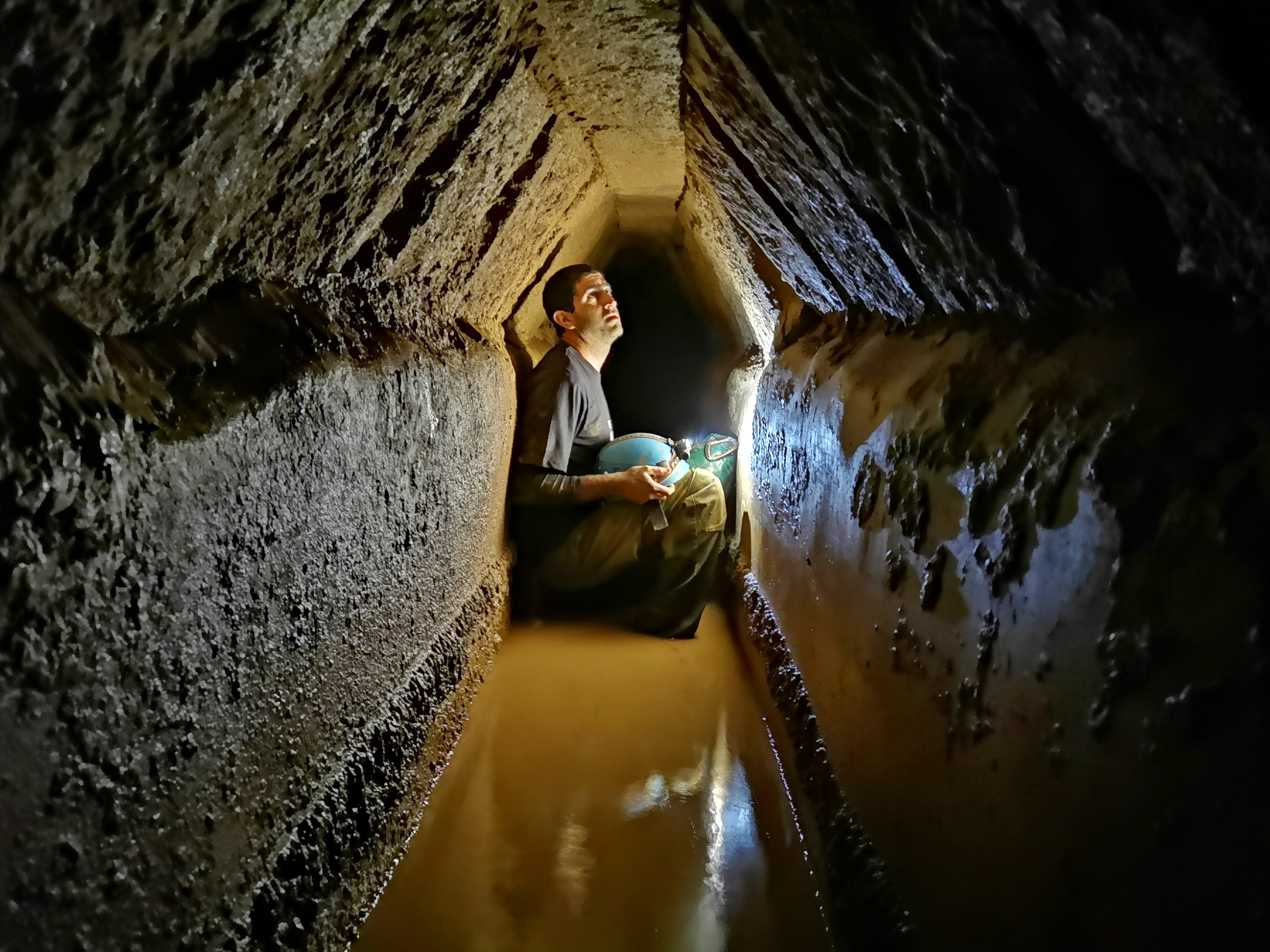
The following photo shows one of the shafts, looking up towards the entrance:
2. Rock cut section
The tunnel is built in various methods. One major section was by cutting into the rock. The total length of the rock-cut tunnel is 2416m – 82% of the total length of the tunnel. The shafts were cut from the surface directly above the tunnel, with a slope towards the upstream side.
Stalactites and Helictites were found in a section near between shafts 8(-3) and 8(-2).
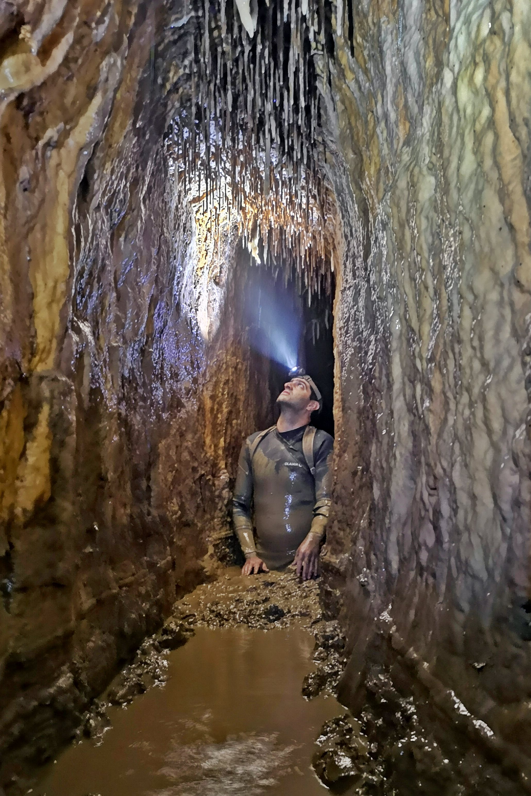
The stalactites (mineral formations growing vertically from the ceiling) and Helictites (growing horizontally or diagonally) are about 25cm long.
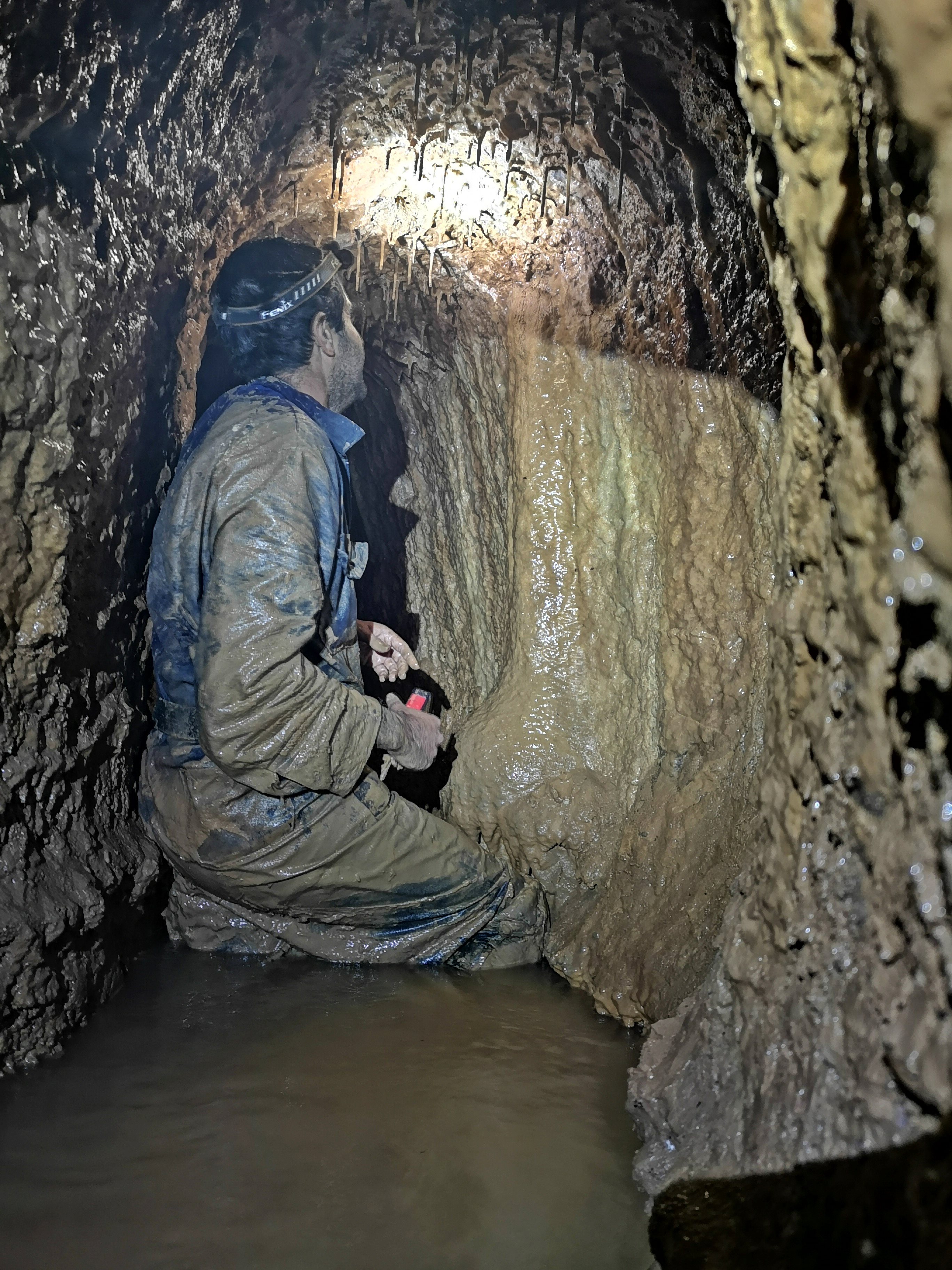
3. Ashlars built section
Other sections, between shaft 19(+1) to the outlet (25), were built with ashlar blocks. The total length of this section is 536m.
In the photo below is a section of the tunnel with the form of a complex gable, as built between shafts 22 and 25. Note that a complex gable is a roof built of two stone slabs leaning toward each other, and a keystone between them.
Another section, between shafts 22-25, is also with a roof of the form of a 3-course complex gable:
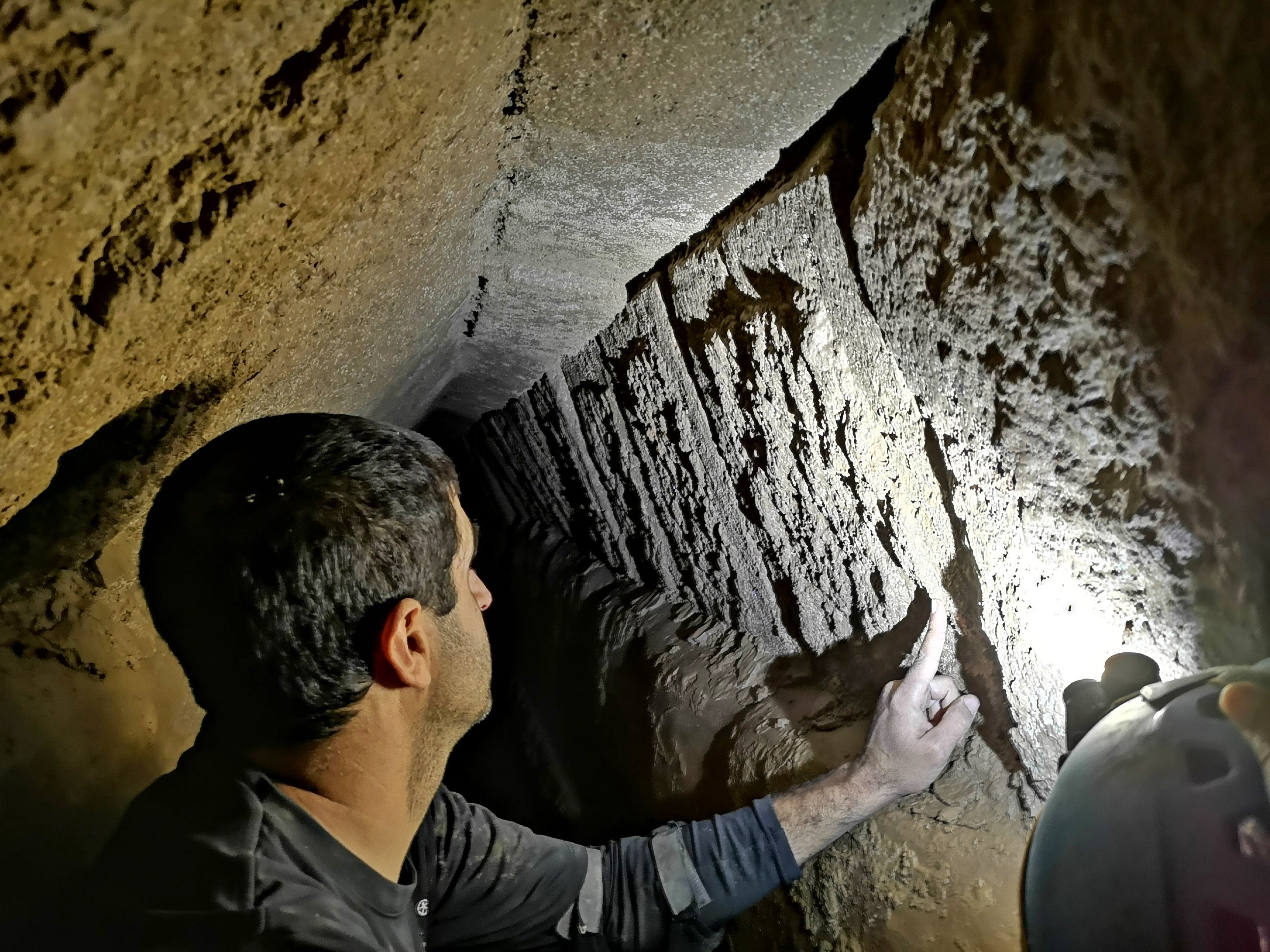
The tunnel between shafts 22-23 has ashlars built in the form of complex gables, built of stones with finely chiseled margins.
In this photo the archaeologist points to the drafted margins on the stone.
A section with two roof forms – transition from an arched gable to a complex gable:
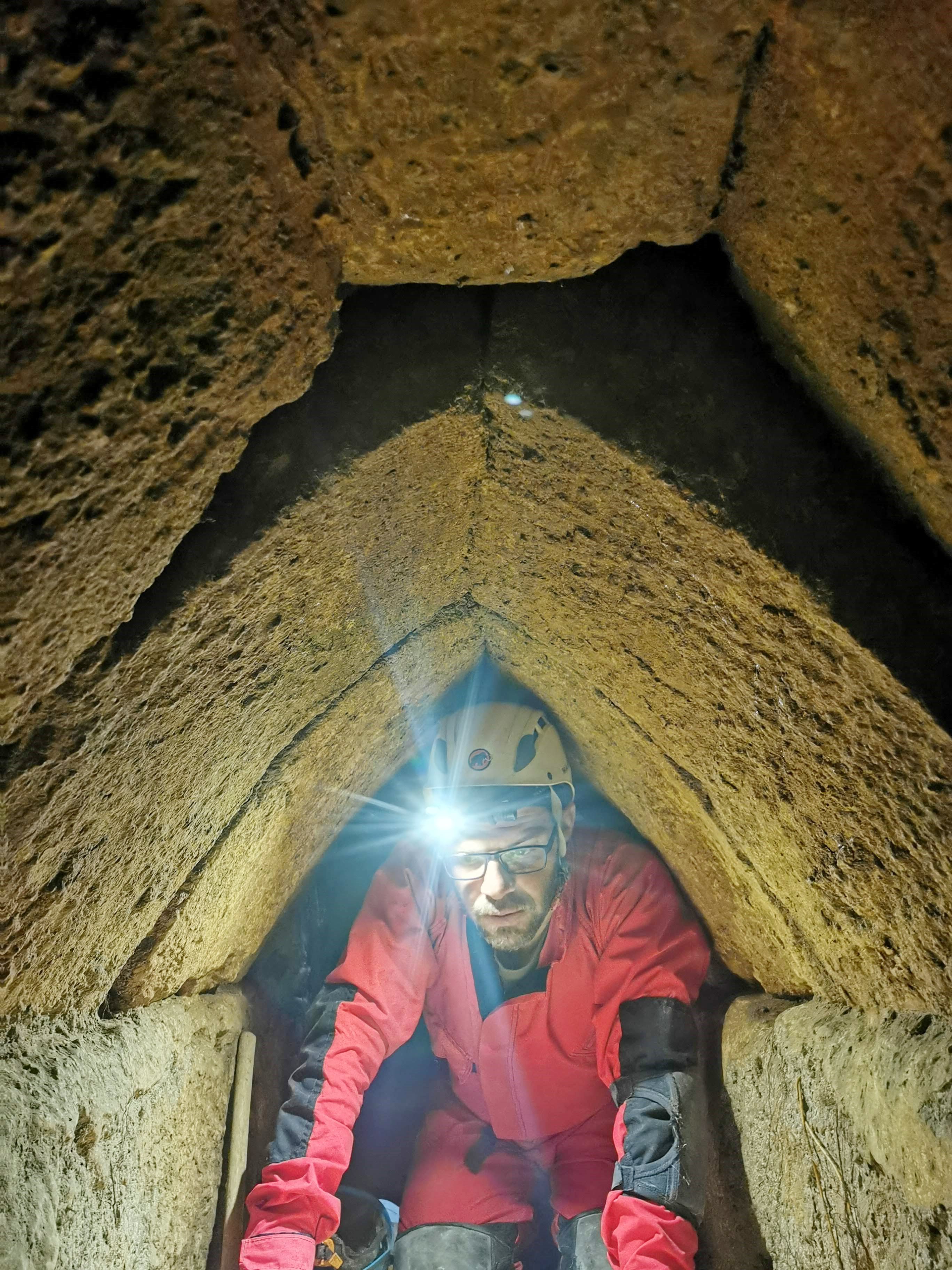
Another section with an arched gable roof, and behind it is a barrel shaped roof, also built with 3 courses:
In the next photo – a section between shaft 20 and 22. The roof changes between an arched gable and a barrel vault roof.
A detailed description of the tunnel is provided in the article by Azriel Yechezkel, Yoav Negev, Amos Frunkin and Uzi Leibner.
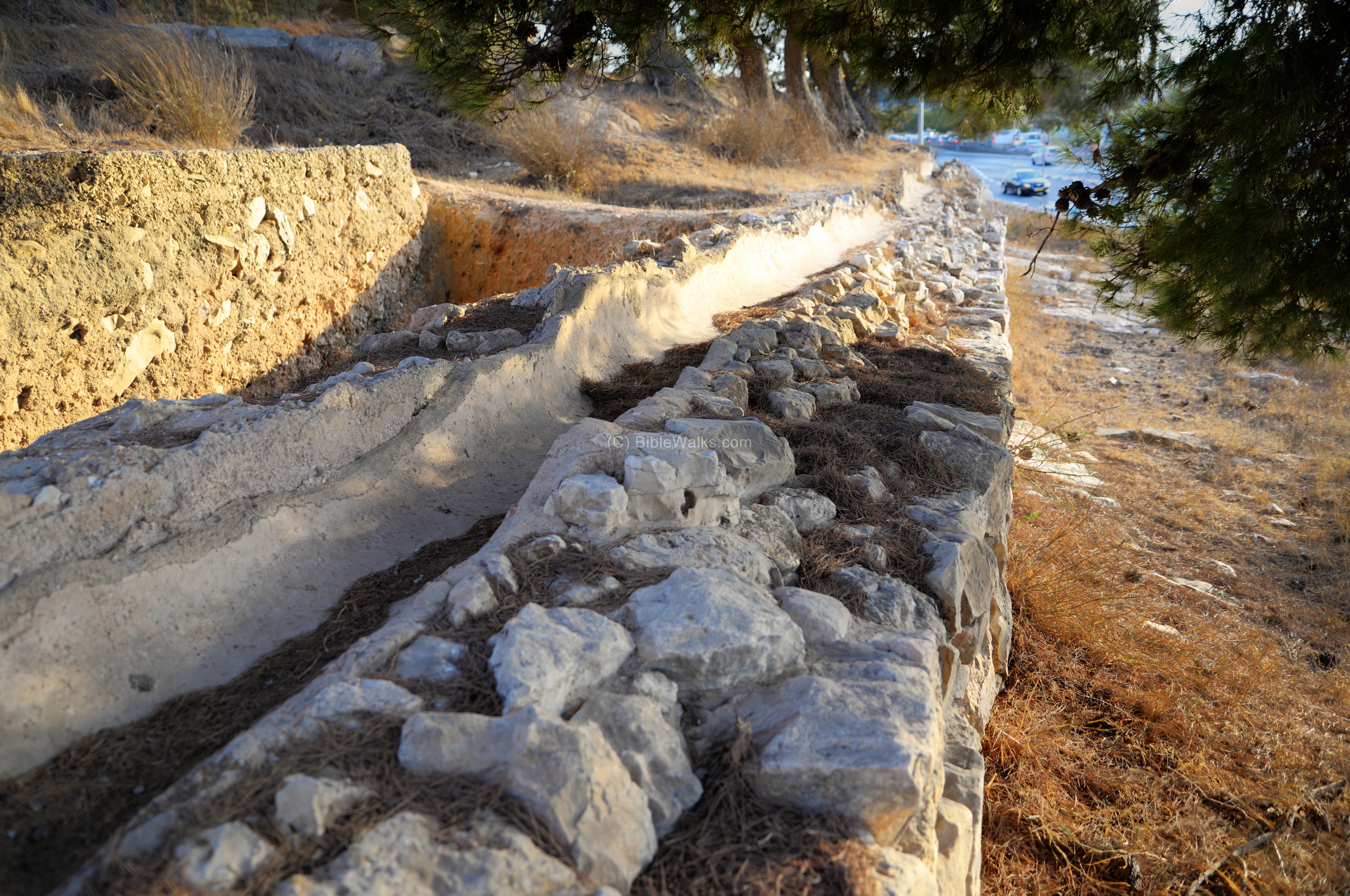
b) Wadi el Biar open Aqueduct:
After the underground section is an open aqueduct.
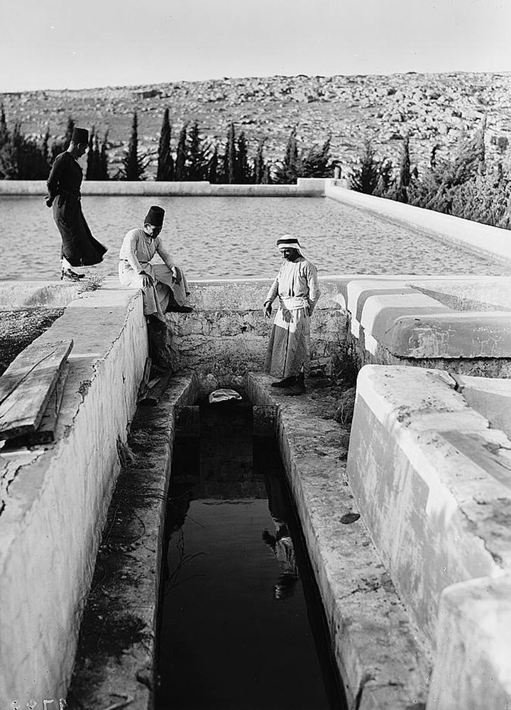
The American Colony captured in the 1930s a series of photos along the open section of the Wadi el Biar aqueduct. Here are some of the photos, starting from the open aqueduct and leading to the Upper pool.
a) Open section of the Wadi el Biar aqueduct
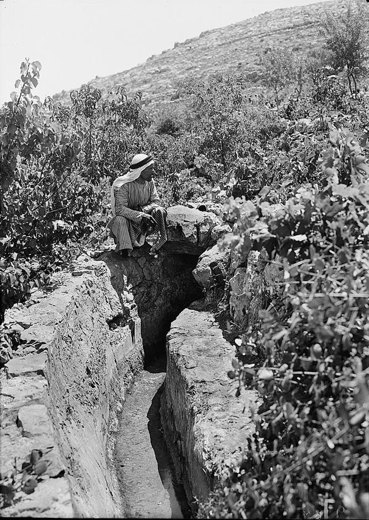
Photos of the Library of Congress – American colony – 1934-1939
b) A fork near the pools
One canal to the right leading to the lower pool seen in the distance, while the left canal leading to the middle and upper pools.
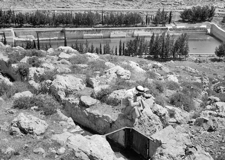
Photos of the Library of Congress – American colony – 1934-1939
c) Open section of the Wadi el Biar aqueduct, leading to the Upper pool. Notice the lower pool on the left background.
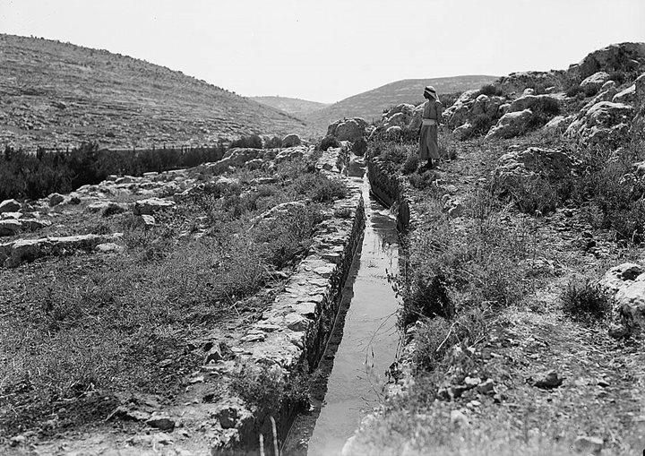
Photos of the Library of Congress – American colony – 1934-1939
d) Inflow of the aqueduct to the Upper pool.
Photos of the Library of Congress – American colony – 1934-1939
c) Upper Aqueduct
From the Upper pool of “Solomon’s pools” is an aqueduct that connects to the Temple mount in Jerusalem. Sections of this aqueduct are seen in various places, such as in the Airplane hill and under Ramat Rachel (the photo below).
The final destination of the Upper Aqueduct in the old city of Jerusalem was the Temple Mount. Here, the water was collected in large cisterns and distributed to various parts of the city for domestic use, agricultural purposes, and for supplying fountains and baths.
Lectures and Guided tours
Interested in lectures or guided tours to Jerusalem’s ancient water systems and aqueducts? Pls contact DR. Azriel Yechezke at azriel.ye@gmail.com.
Etymology:
- Burak – Arabic: pools
- El Burak—commonly called Solomon’s Pool
- Wadi el Burak – valley of pools
- Biyar, Biyarete – Arabic: wells
- Biyar/Biar spring – also known as Bir ed Duragee
- Wadi Biyar – the name of the valley
Links:
* External:
- The Shaft Tunnel of the Biar aqueduct of Jerusalem: Architecture, hydrology, and dating
– Azriel Yechezkel, Yoav Negev, Amos Frumkin, Uzi Leibner
Architecture, hydrology, and dating - The Biyar Aqueduct – K-Etzion
- Upper Aqueduct – Atiqot 69-90 (Hebrew)
* Internal:
BibleWalks.com – walk with us through the sites of the Holy Land
Hill of the four<<<—previous Judea site–<<< All Sites >>>—next Judea site—>>> Beth Zechariah
This page was last updated on July 27, 2023 (add email)