A large archaeological mound on the bank of Nahal Gerar, identified as David’s Ziklag.
* Site of the month June 2019 *
Home > Sites > Negev> Tel Ser’a (Tell esh Shariah) – Biblical Ziklag?
Contents:
Background
Location
History
Photos
* Aerial
* General Views
* North side
* Eastern foothills
* South
* Rail road
* Tel Ma’aravim
Etymology
Overview:
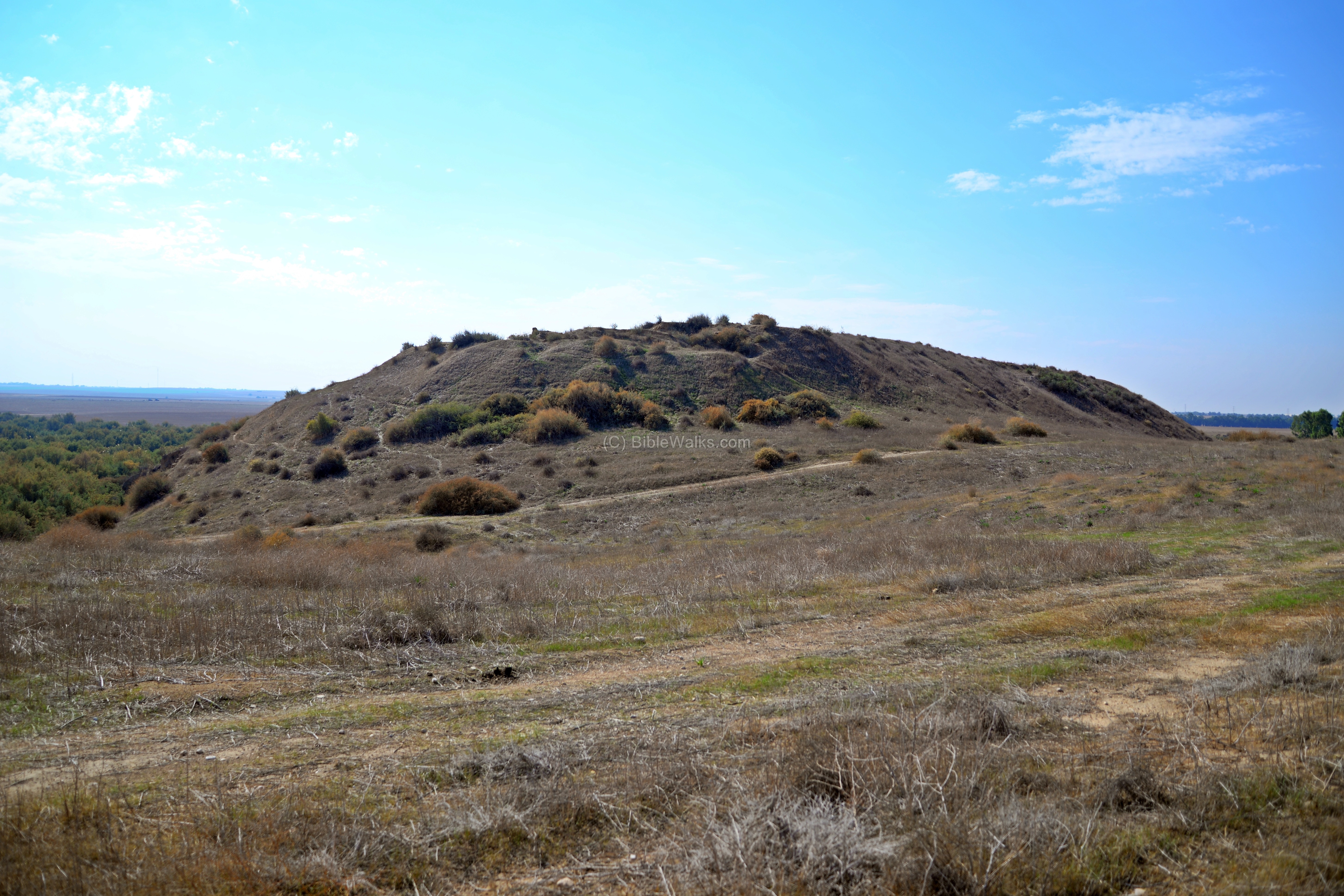
Tel Ser’a (Tell esh-Shariah) is a large archaeological mound on the bank of Nahal Gerar (Wady esh Shariah) in the Western Negev region, 20KM NW of Beer-Sheba. The Arabic name – Tell esh-Shariah – means “the mound of the Drinking place”, as the lake on its eastern side was a source of water for the herds.
The elongated horseshoe shaped hill covers an area of 16-20 dunam, with a height of 14m above the area. A total of 13 ancient layers, from the Chalcolithic period up to the Byzantine period, accumulated a height of 8-10m above the natural hill.
The site is identified by many scholars as the ruins of Biblical Ziklag, where David took refuge while escaping from King Saul. 1 Samuel 30:1-3: “David and his men were come to Ziklag”.
Location and Map:
This aerial map shows the area around the site. The mound, at an altitude of 168m above sea level, is located on the north side of Nahal Gerar stream. The abundant springs supplied the water to the city, and gave the ancient city a natural defense on its east and south sides.
To reach this remote site, drive along dirt roads from Rahat, Mishmar HaNegev or Moshav Taashur.

The areas A-B-C-D-R indicate excavation areas, as detailed in the following sections.
History:
-
Bronze Age
The first phase of settlement was during the Chalcolithic and Early Bronze period (Layer XIII in area ‘A’). The Canaanite city was fortified during the middle and late Bronze Age (1800-1230 BC). The archaeologists identified 4 layers on top of the mound (Layers XII thru IX) in area ‘A’ and ‘B’ on the south side of the mound.
-
Biblical Periods
Ziklag was a city within the tribe of Judah (Joshua 15: 20, 31): “This is the inheritance of the tribe of the children of Judah according to their families….And Ziklag, and Madmannah, and Sansannah”. In Chronicles it was part of Simeon’s tribe inheritance until Ziklag was relocated to Judah (1 Chronicles 4: 24, 30, 31): “The sons of Simeon were… And at Bethuel, and at Hormah, and at Ziklag…These were their cities unto the reign of David.”.
The Biblical map below shows the location of the site and the major roads and cities during the ancient times. The city, marked with a red circle in the center of the map, is located on the banks of the Gerar brook.
An ancient road passed near the city (although not marked here): the road along the Gerar basin, via Gerar (Tel Haror) and Tel Ser’a (Ziklag) to Judea and Hebron, along the Gerar brook. According to D. Alon, this road is mentioned in the Bible as the way of the Anakim (Joshua 11, 21-22): “And at that time came Joshua, and cut off the Anakims from the mountains, from Hebron, from Debir, from Anab, and from all the mountains of Judah, and from all the mountains of Israel: Joshua destroyed them utterly with their cities. There was none of the Anakims left in the land of the children of Israel: only in Gaza, in Gath, and in Ashdod, there remained”.

Ziklag and the south west of Israel – during the Biblical periods (based on Bible Mapper 3.0)
The Philistines: The “Sea Peoples” from the Aegean sea landed in Canaan and Egypt in waves of invasions during the 12th century BC (Iron Age I). They eventually settled along the eastern shores of the Levant, in a region called “Pleshet”, named after the Philistines (Hebrew: Plishtim). They became the arch enemies during the period of the Judges (12th-10th century) and the Israelite Kingdom (10th – 6th century BC).
The identity of the invaders is not certain, and several hypotheses attempt to resolve the origins of these people:
-
The Bible: wrote about the Philistine invasion (Amos 9 7): “Have not I brought up Israel out of the land of Egypt? and the Philistines from Caphtor…”. Caphtor is the island of Cypress. Another Biblical source points out to the source of the Philistines (Jeremiah 47 4): “Because of the day that cometh to spoil all the Philistines, and to cut off from Tyrus and Zidon every helper that remaineth: for the LORD will spoil the Philistines, the remnant of the country of Caphtor”.
-
Egyptian sources: Ramses III confronted the Sea People invaders in 1168BC, in the sea and on land. A relief describing the naval battle, located in Medinet Habu (Tebes, Upper Egypt), tells about the invasion: “The foreigners made a conspiracy in their island…their confederation ware Plst, Skl, … no land could stand before them…they were coming towards Egypt, and fire walked before them.” The “Skl” may have been, according to some scholars, Sikels from Sicily.
Following the battles, the Egyptians managed to repulse them into a small enclave in the southern coastal cities of Canaan (from Gaza to Ashkelon), as per (Joshua 13, 3): “…five lords of the Philistines; the Gazathites, and the Ashdothites, the Eshkalonites, the Gittites, and the Ekronites”.
Ziklag became a Philistine city, as confirmed by the excavations on the mound (layer VIII – dated to 12th-11th century BC, Iron Age I period). Some scholars (such as B. Mazar) suggested that the name “Ziklag” is related to the Sikels (Skl in Ramses III relief).
-
King David
After the battle of David and Goliath and David’s victories over the Philistines, he becomes the great hero of Israel. However, this caused his relationship with King Saul to deteriorate. The jealous Saul tried to kill David, as illustrated here.

King Saul tries to kill David –
Drawing by Gustav Dore (French artist, 1832-1883)
David escapes, and eventually arrives with his small army to Gath where he requests refuge in the Philistine territories. (1 Samuel 27:1-2):
“And David said in his heart, I shall now perish one day by the hand of Saul: there is nothing better for me than that I should speedily escape into the land of the Philistines… And David arose, and he passed over with the six hundred men that were with him unto Achish, the son of Maoch, king of Gath”.
King Achish of Gath gave David the city of Ziklag (1 Samuel 27:6-7):
“Then Achish gave him Ziklag that day: wherefore Ziklag pertaineth unto the kings of Judah unto this day. And the time that David dwelt in the country of the Philistines was a full year and four months”.
At some point David leaves the city. During his absense the Amalekites raided the city, capturing his wives (1 Samuel 30:1-3):
“And it came to pass, when David and his men were come to Ziklag on the third day, that the Amalekites had invaded the south, and Ziklag, and smitten Ziklag, and burned it with fire; And had taken the women captives, that were therein: they slew not any, either great or small, but carried them away, and went on their way. So David and his men came to the city, and, behold, it was burned with fire; and their wives, and their sons, and their daughters, were taken captives.”
David later recaptured their booty.
The excavators did not find a destruction level between the Philistine layer VIII (Iron Age I, 12th-11th century) and the Israelite layer VII (Iron Age II, 10th-9th century). This implies that the Philistine population co-existed with the Israelite population, as described in the Biblical story of David’s residence in Ziklag.
-
Israelite Kingdom
The city became part of the Judean Kingdom (1 Samuel 27:6): “Then Achish gave him Ziklag that day: wherefore Ziklag pertaineth unto the kings of Judah unto this day”. Ziklag reached its peak during the Iron Age II, 10th-9th century BC, as observed in layer VII.
The excavators identified royal structures in layer VI (8th century BC, Iron Age III). The suggested that these structures were one of King Uziah’s construction projects which the Bible reports (2 Chronicles 26 10): “Moreover Uzziah built towers in Jerusalem at the corner gate, and at the valley gate, and at the turning of the wall, and fortified them. Also he built towers in the desert, and digged many wells”. This was the last layer of the Israelite Kingdom.
-
Assyrian conquest
The city was probably destroyed in 734 BC, during the first wave of Assyrian intrusions of Tiglath-Pileser III (734-732BC). Kings II 15: 29:
“In the days of Pekah king of Israel came Tiglath-pileser king of Assyria, and took Ijon, and Abel-beth-maacah, and Janoah, and Kedesh, and Hazor, and Gilead, and Galilee, all the land of Naphtali; and he carried them captive to Assyria.”.
The Assyrians reached Gaza and made the Philistine cities – from Jaffa to Raphia – a kingdom subdued and raising taxes to the Assyrians. The main city of the Philistine-Assyrian kingdom was Ashdod.
A large Assyrian fortress was unearthed on the south side of the city, in Area ‘A’ Layer V (7th century, Iron Age III).
Another Assyrian fortress was unearthed in the northern part of the city (area ‘D’). On one of the ceramics was an inscription L-Y-R-M (“To Yoram” or “to Jeremiah”).

Fragmentary relief slab from Tiglath-Pilesar III palace in Nimrud (744-727BC)
[Istanbul Archaeological museum]
The Assyrian city was destroyed by fire in the 2nd part of the 7th century. This may have been caused by the conquests of Judean King Josiah (628 to 609BC). Josiah seized the moment of the fall of the Assyrian empire, and expanded the Kingdom until Ashdod (2 Kings 23:8): “And he brought all the priests out of the cities of Judah, and defiled the high places where the priests had burned incense, from Geba to Beersheba”.
-
Persian period
During the Persian period (5th-4th century BC), the major Tels along the Gerar and Besor valleys continued to serve as a military defense line and administrative centers. After the Persians leveled the destruction layer, they constructed a number of grain silos and grain storage facilities on the mound. This was a common feature in other sites of the Negev and the southern plains. According to scholars, the grain supplies in sites at the edge of the desert area were intended to feed the Persian troops en route to Egypt, and also to sell grain to passing caravans.
The Bible lists Ziklag as one of the cities resettled by the people of Judah who returned from the Babylonian exile (Nehemiah 11:25, 28): “some of the children of Judah dwelt at … And at Ziklag, and at Mekonah, and in the villages thereof…”. This was the last Biblical reference of Ziklag.
-
Roman/Byzantine Period
During this period the settlement moved to the other side of the valley. On the southern bank of Nahal Gerar is a large area (2 dunam) with remains of structures dated to the Roman/Byzantine period, including a remarkable bathing complex, plastered pools and other public structures.
During the Byzantine period a monastery was built on the northern end of the Tel.
-
Ottoman period
PEF Survey:
Conder and Kitchener of the Palestine Exploration Fund (PEF) surveyed the area during the Survey of Western Palestine (SWP) in 1874-75.
The site, Tell esh Sheriah (Arabic: “The mound of the drinking place”) is shown in the center of the section of the PEF map here.

Part of map Sheet 24 of Survey of Western Palestine, by Conder and Kitchener, 1872-1877.
(Published 1880, reprinted by LifeintheHolyLand.com)
The surveyors mearly wrote (Volume III, p. 399): “Tell esh Sheriaha – a large mound on the north bank of the valley. Broken pottery and a few small unhewn stones are found on the top. In the valley is a well-cut trough of basalt”.
Nearby is a well of Bir Suleiman Abu Sharib (meaning: the well of Solomon, the man with a moustache. He was Sheikh of the Teiahah Arabs). Their report (p. 391) describes the well as “a masonry cistern dry in summer”.
- World War 1
During WW1 the Turkish/German army was stationed on the mound, in order to protect the railway from Istanbul to Auja al-Hafir in the Sinai desert. This photo was captured in 1917 during the war in Gaza and surroundings.
The forces included infantry units (seen in this photo), anti aircraft guns, field hospital, and kitchen.

Machine gun corp on Tell el Sheria, 1917; Library of Congress collection
The Turkish III Corps was headquartered here after pulling back from Beersheba. After heavy combat, Tell el Sheria was captured by British and ANZA forces on Nov 7, 1917, just a few days after the capture of Beersheba.
Another WW1 photo shows bake ovens that supplied bread to the Turkish army positioned on and around Tell el-Sheria. On the background is the north side of the mound.

Bake ovens at Tell el Sheria, 1917; Library of Congress collection
The military railway, built in 1915, passed on the south side, on its way to Beer Sheba. It provided the supplies to the Turkish army. A train station was built on the south bank of Nahal Gerar, south of the railway.
The bridge over Nahal Gerar is seen in this 1917 photo with Tel Ser’a (Tell el Sheria) in the background. Its raised ramp, seen on the left, is visible near the southern foothills. The ramp was built with soil removed from a section of the mound, as seen on the upper left foothills just above the ramp. During the retreat of the Turkish forces, the Turks blew up sections of the bridge, and the British demolished it after the war.

Tell el Sheria bridge, 1917; Library of Congress collection
-
Modern period:
The site was excavated during 6 seasons (1972-1979). The teams, headed by E.D. Oren of the Ben Gurion Univerisity, worked in 5 areas on the mound (‘A’ south-east, ‘B’ south-west, ‘C’ west, ‘D’ north-east) and ‘R’ across the valley. They dated the findings to 13 levels – starting from the Chalcolithic period (Layer XIII – 4th Millennium BC), through the Iron Age period (layers IV-VIII – 11th-6th century BC), up to the Byzantine period (Layer I – 5th/6th century AD), accumulating a height of 8-10m above the natural hill. The earlier periods are on the southern side, while the Iron Age period covers the entire hill. In later periods the top of the hill was covered with hundreds of Muslim graves and the site was damaged during WW1.
Photos:
(a) Aerial Views:
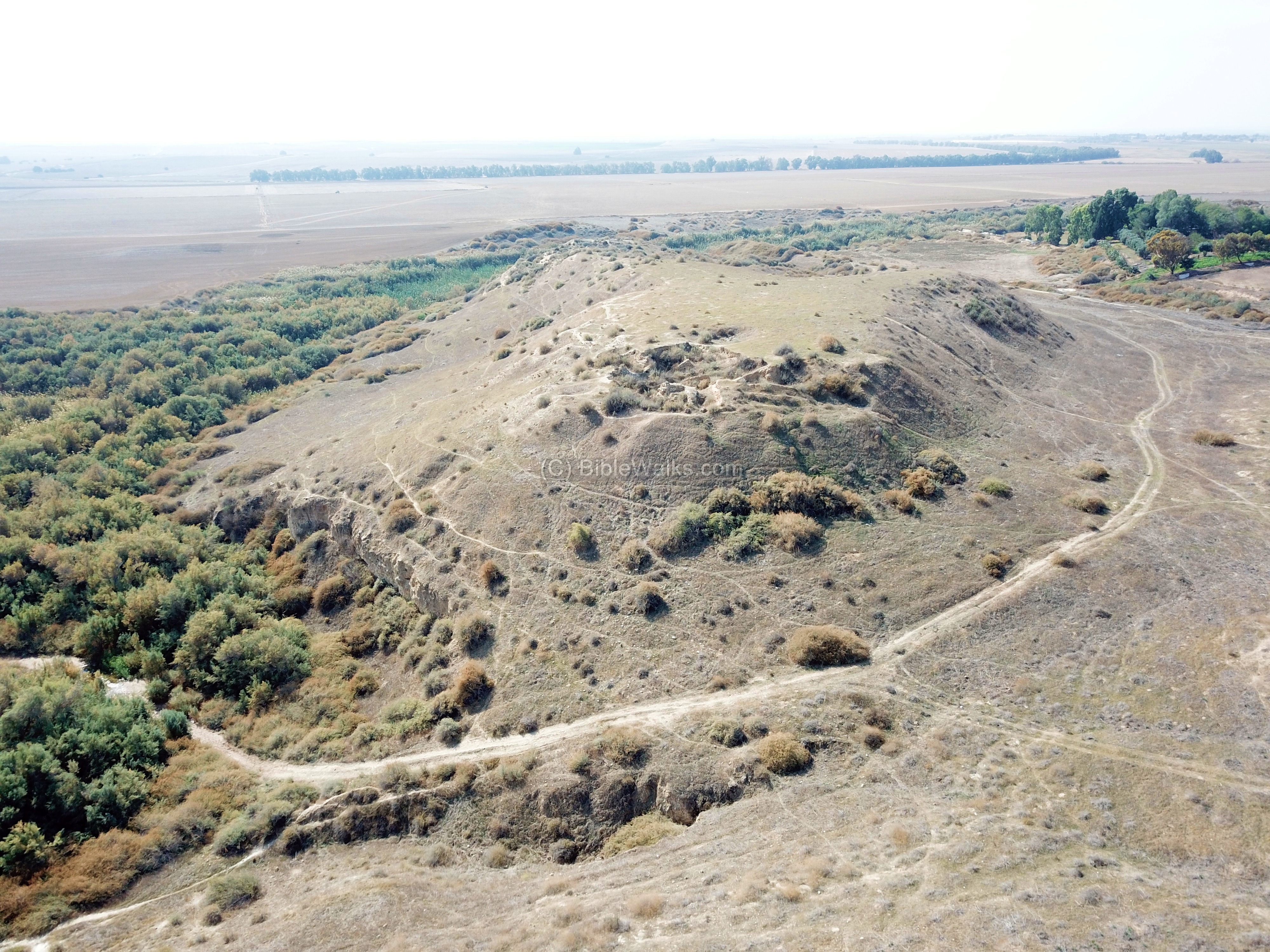
Tel Ser’a is located Tel Ser’aon the bank of Nahal Gerar (Wady esh Shariah). This drone view shows the mound on the west side of the springs of Nahal Gerar.
Click on the photos to view in higher resolution…
On top of the mound are few structural remains, as the archaeological excavations dug into the historical layers, peeling off layer after layer, but then covered most of them.
A closer view of the mound is next. The remains of the excavation area (area ‘D’) on the north eastern top edge of the mound is clearly seen.
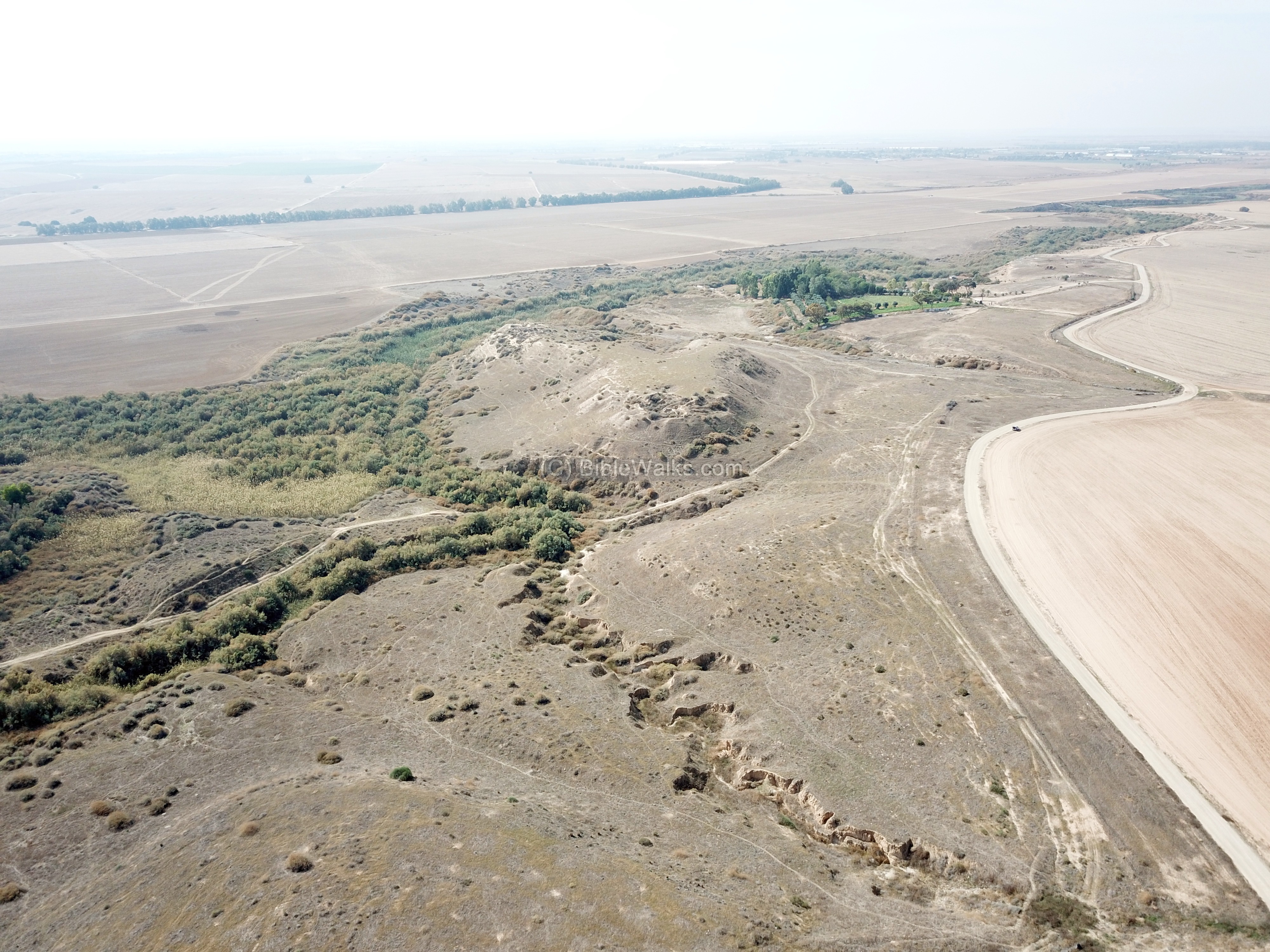
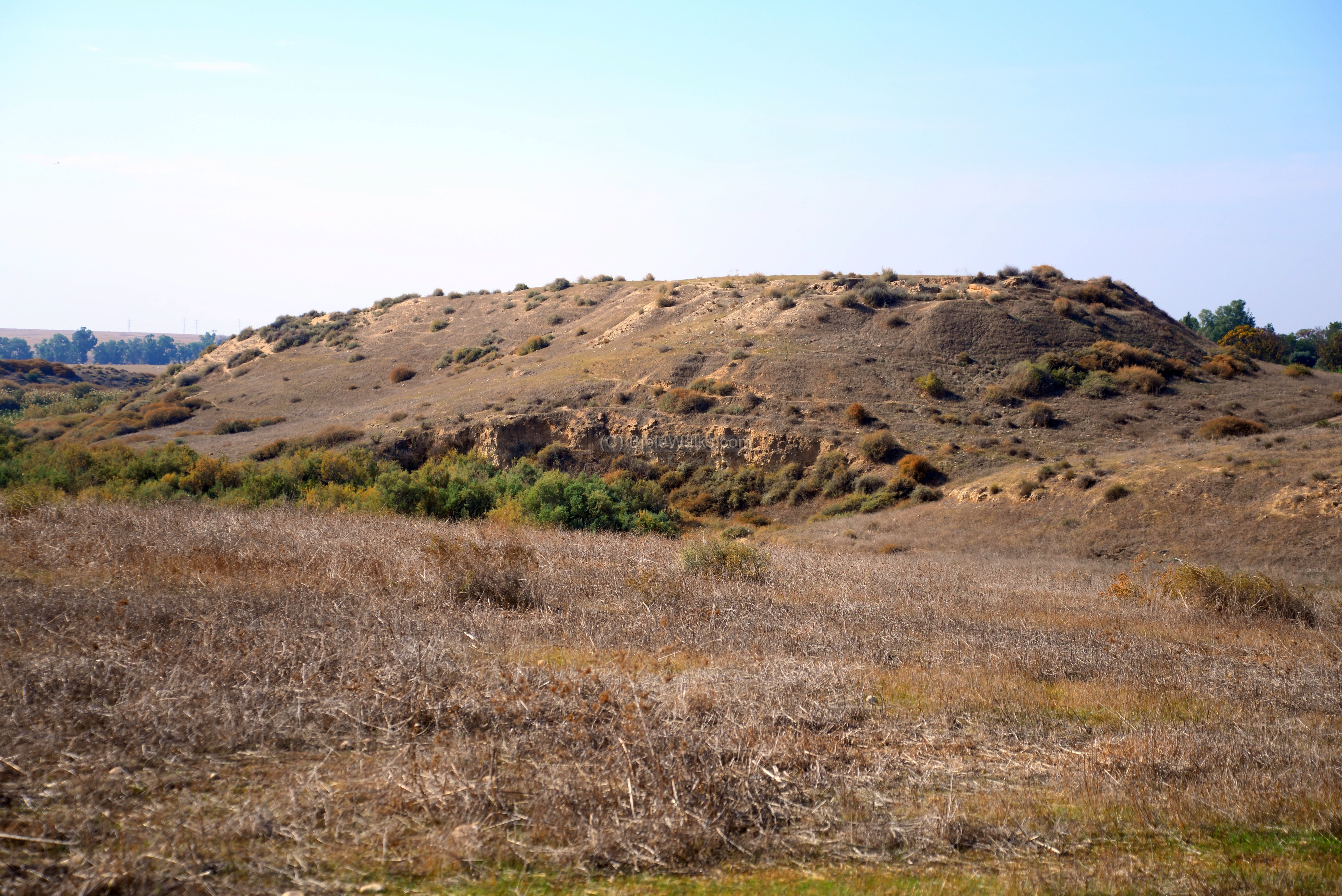
Another view of the western foothills of the mound is below. The course of the old Turkish railroad is seen on the south (right) side.

The south eastern section of the mound is in the next aerial view.
Notice the ramp of the Turkish railroad on the upper right side, heading toward the green patch of Nahal Gerar where it crossed over a bridge. The railroad ramp required large amounts of soil to raise it up above the water level. That soil was extracted from the western side of the mound, resulting in a ‘crater’ that is visible in this photo.
The excavation areas on this side of the mound were: area ‘A’ on the left (south east) side, area ‘B’ on the south side of the ‘crater’, and area ‘C’ in the center of the ‘crater’.
![]() The following YouTube video shows a flight of a drone around the site.
The following YouTube video shows a flight of a drone around the site.
(b) Ground Views:
A north-east view of Tel Ser’a is seen here from the ground level.
Next is another view from the north.
A closer view of the western foothills:

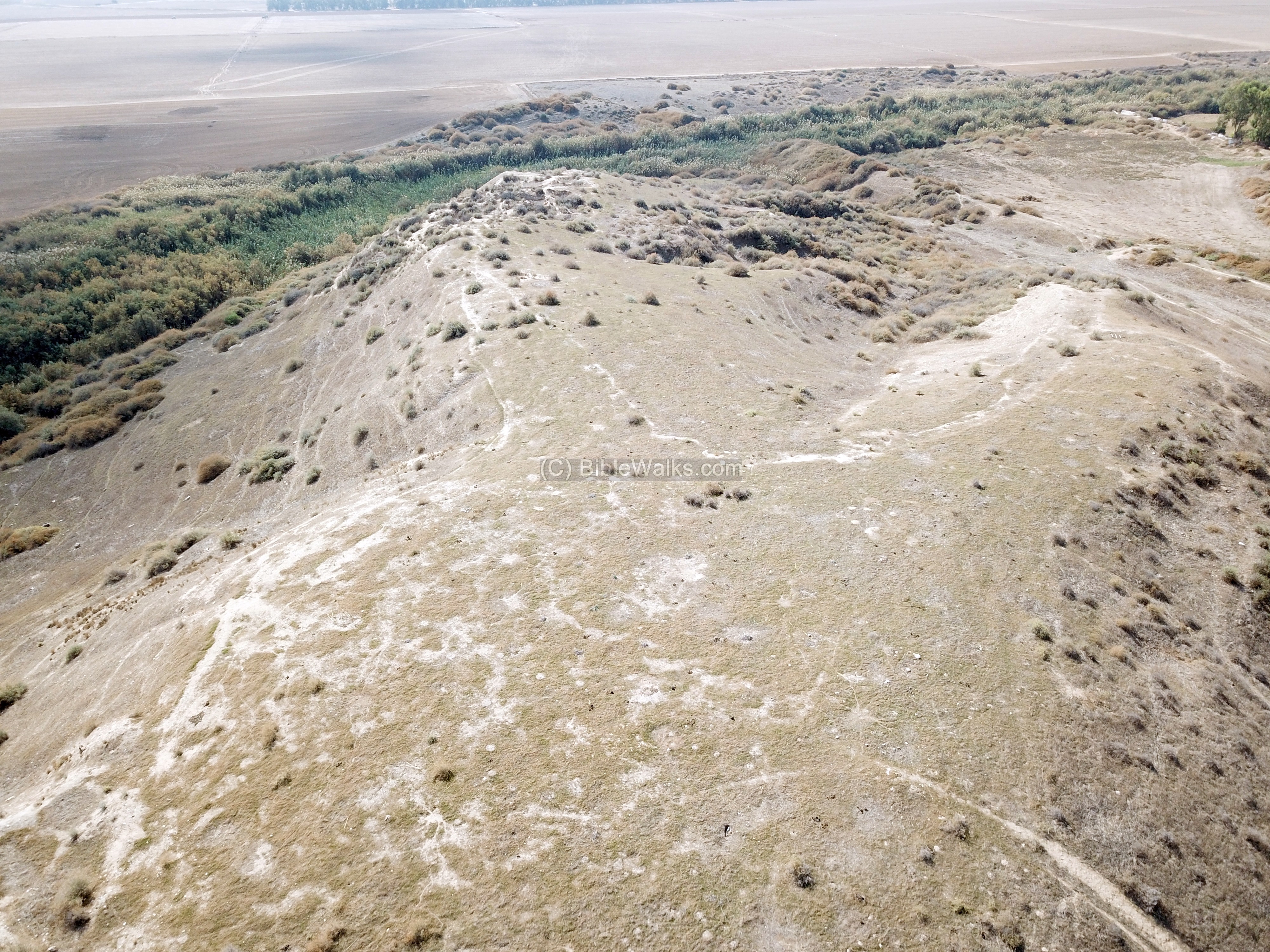
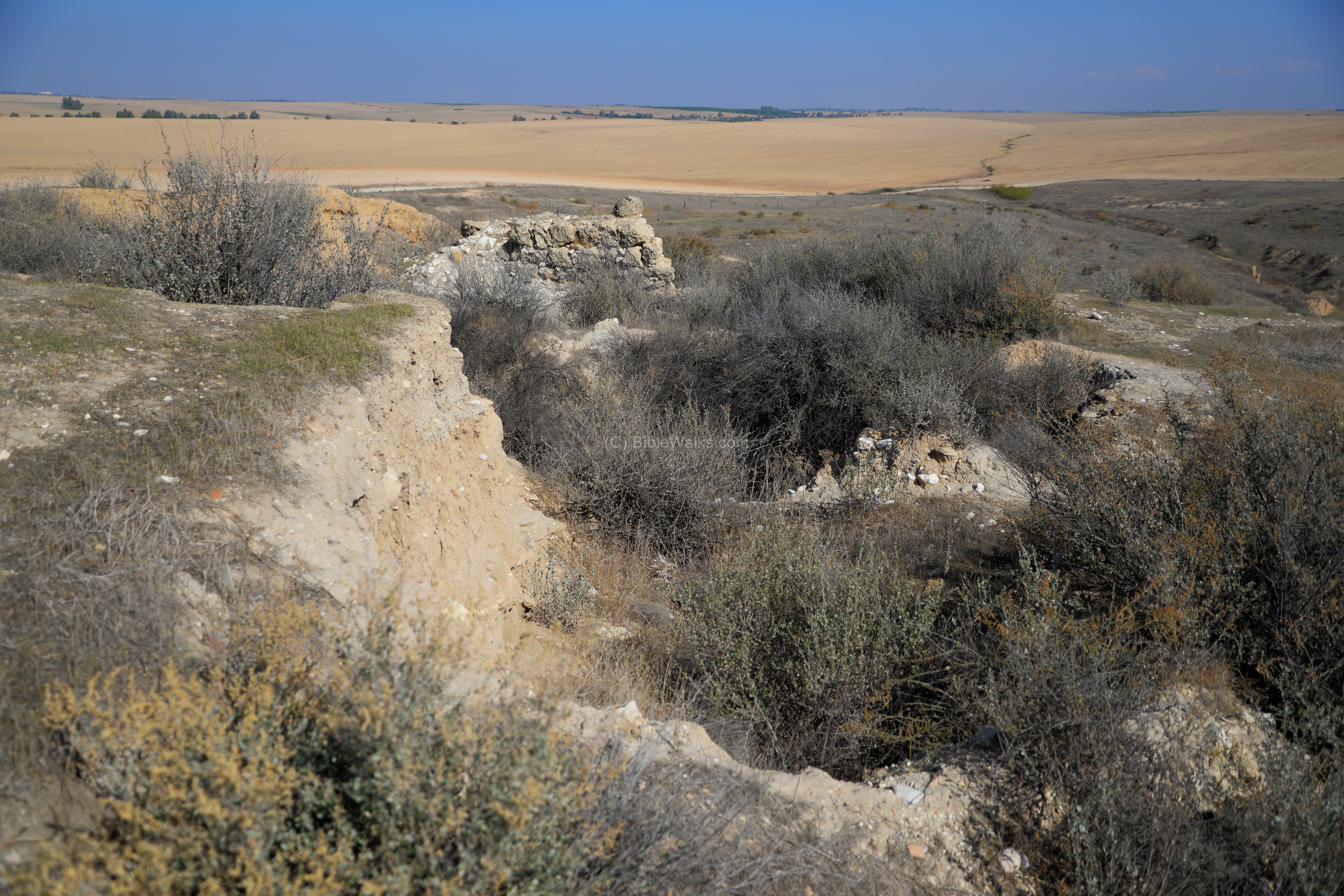
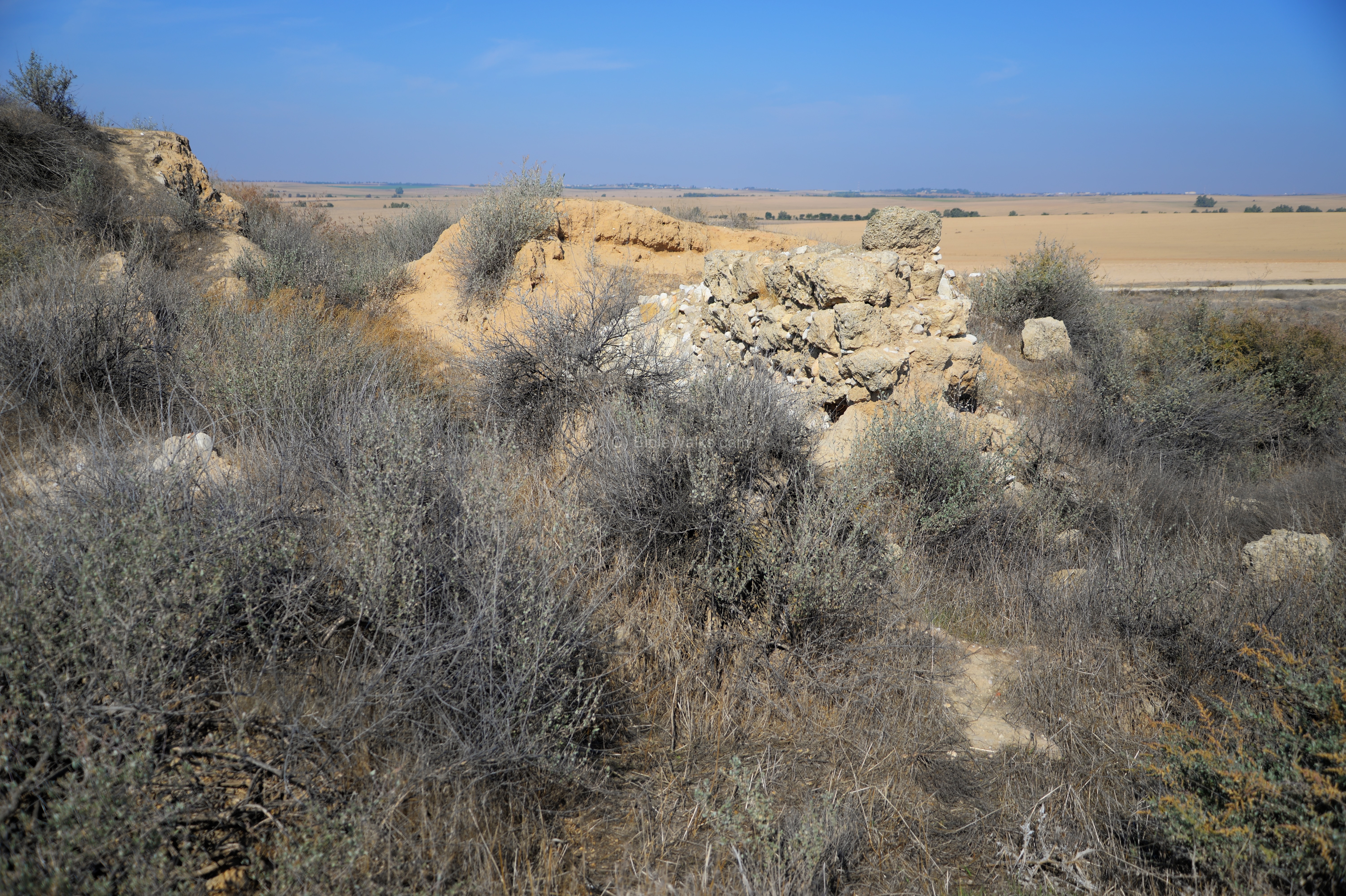
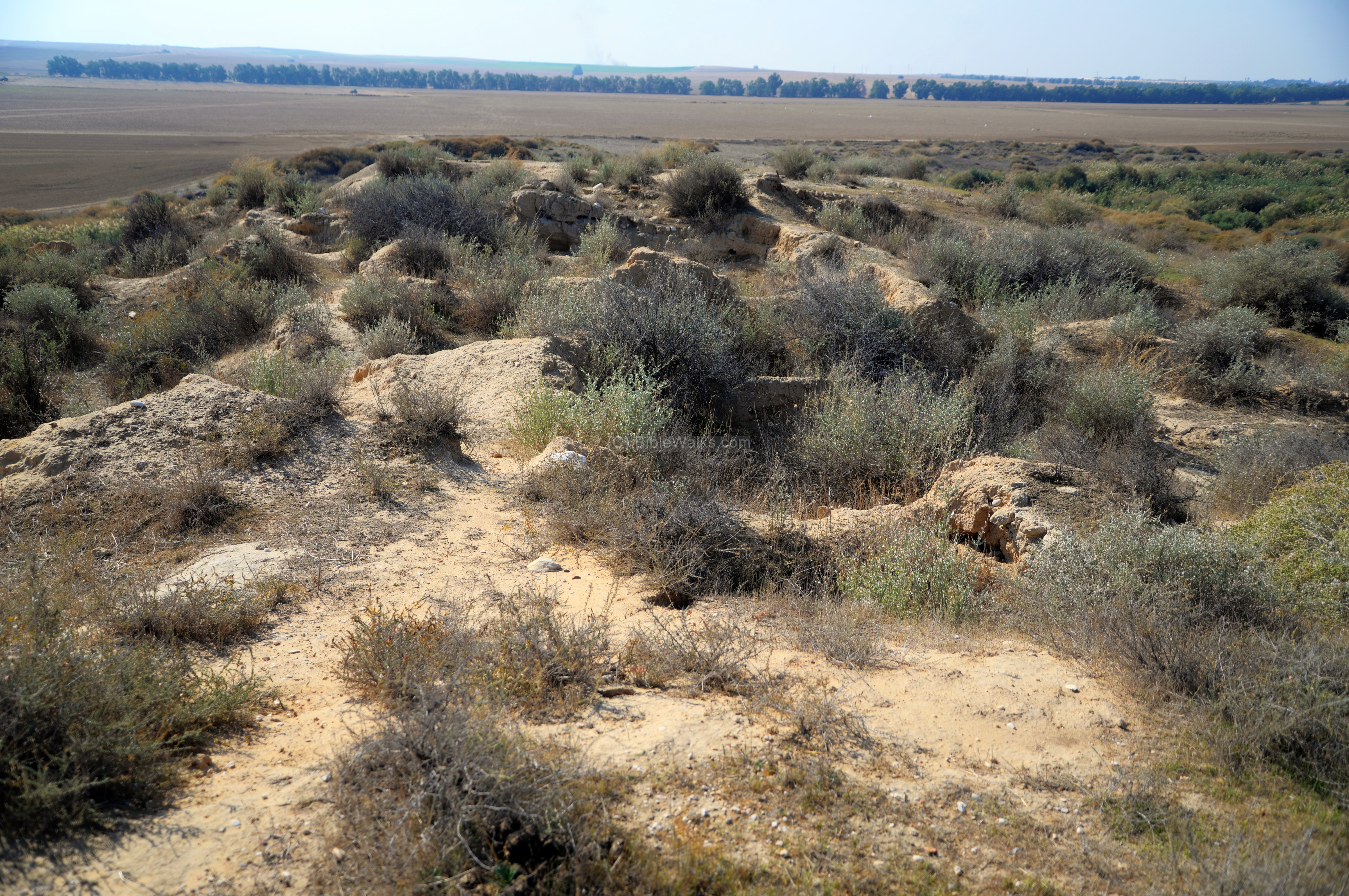
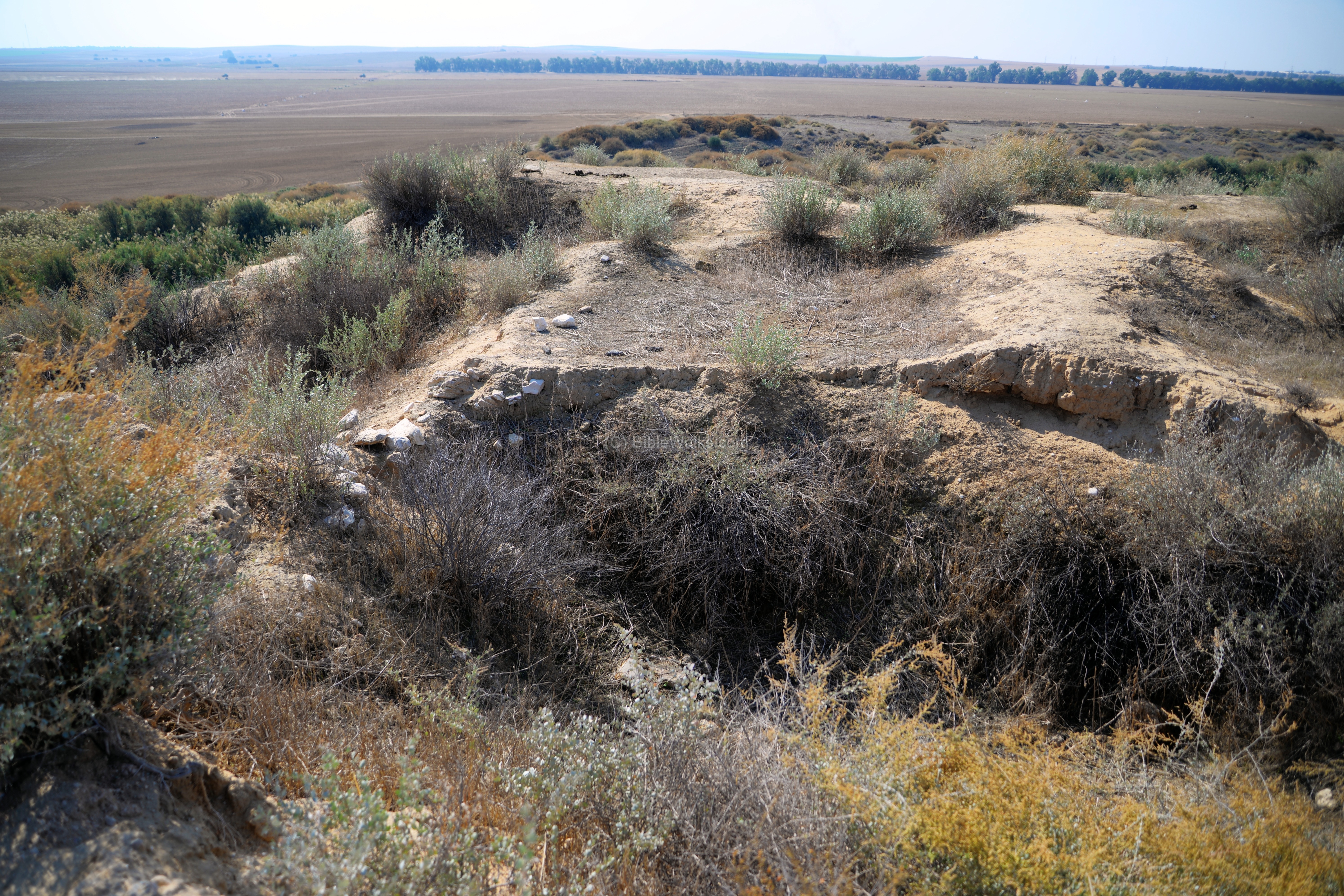
(c) North (Area ‘D’):
The excavators opened trenches on the north end of the mound, designating it as area ‘D’. The foundings in this area were dated starting from the Iron Age II (Layer VII, 10th-9th century BC) to the Byzantine period (5th-6th century AD).

During the 10th-9th century BC (Layer VII) the city reached a peak, with new structures added or built over the previous level. Layer VI (Iron Age III, 8th century BC) included a number of impressive structures that were built on two sides of a street that led to the north edge. The archaeologists attributed these structures to King Uziah’s construction projects.
The layer above it (Layer V, Iron Age III, 7th century BC) was the last fortified settlement of the Iron Age, built by the Assyrians. On this area were remains of a tower that protected the northern side. The fortress was surrounded by a 4m wide wall, and included17m long cellar halls and a courtyard. On the floor of the courtyard the excavators found a ritual crescent-shaped bronze plaque – the symbol of Sin or Suen who was the god of the moon in the Mesopotamian religions. Nearby they found a long Iron chain, ended by a siege hook, and a 60cm Assyrian bronze socketed spear-head.
The Assyrian city was destroyed by fire in the 2nd part of the 7th century, probably by Judean King Josiah (628 to 609BC). It was later rebuilt, with remains found in layer IV (Iron Age III, 7th-6th century BC).
On top of the ruins of the Assyrian fortress was a Persian fortress (Layer III, 5th-4th century BC).
The last layers on this northern edge included remains of Hellenistic period (layer II, 2nd-1st century BC).
In a later period a Roman villa (layer II, 1st century AD) was built above the Hellenistic structures and the earlier Assyrian remains. The villa included a large hall and several rooms enclosed inside a wall. Above it was a massive watch tower, constructed of large stones and pebbles.
The villa was damaged by the later Byzantine structure (Layer I, 5th-6th century AD).
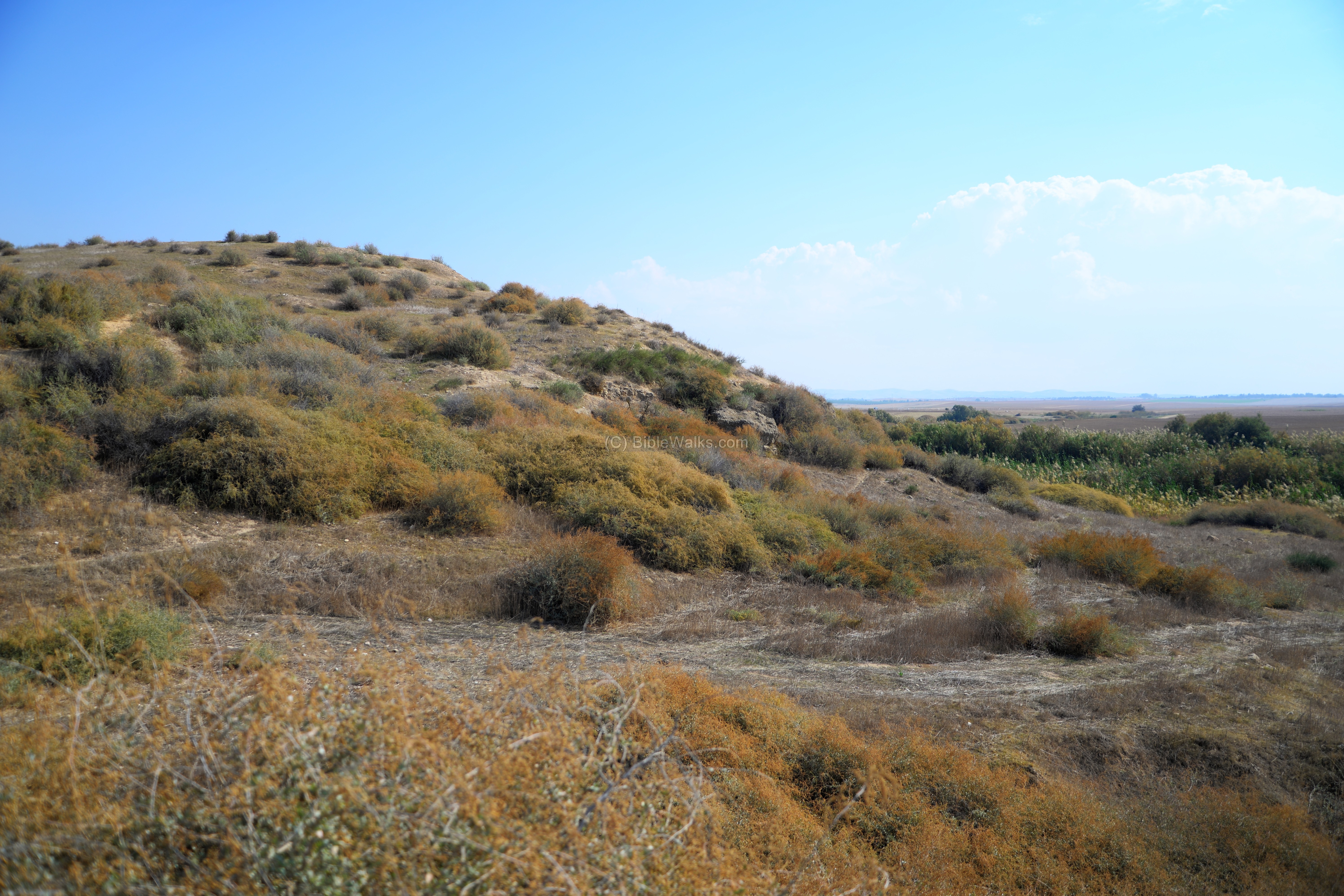
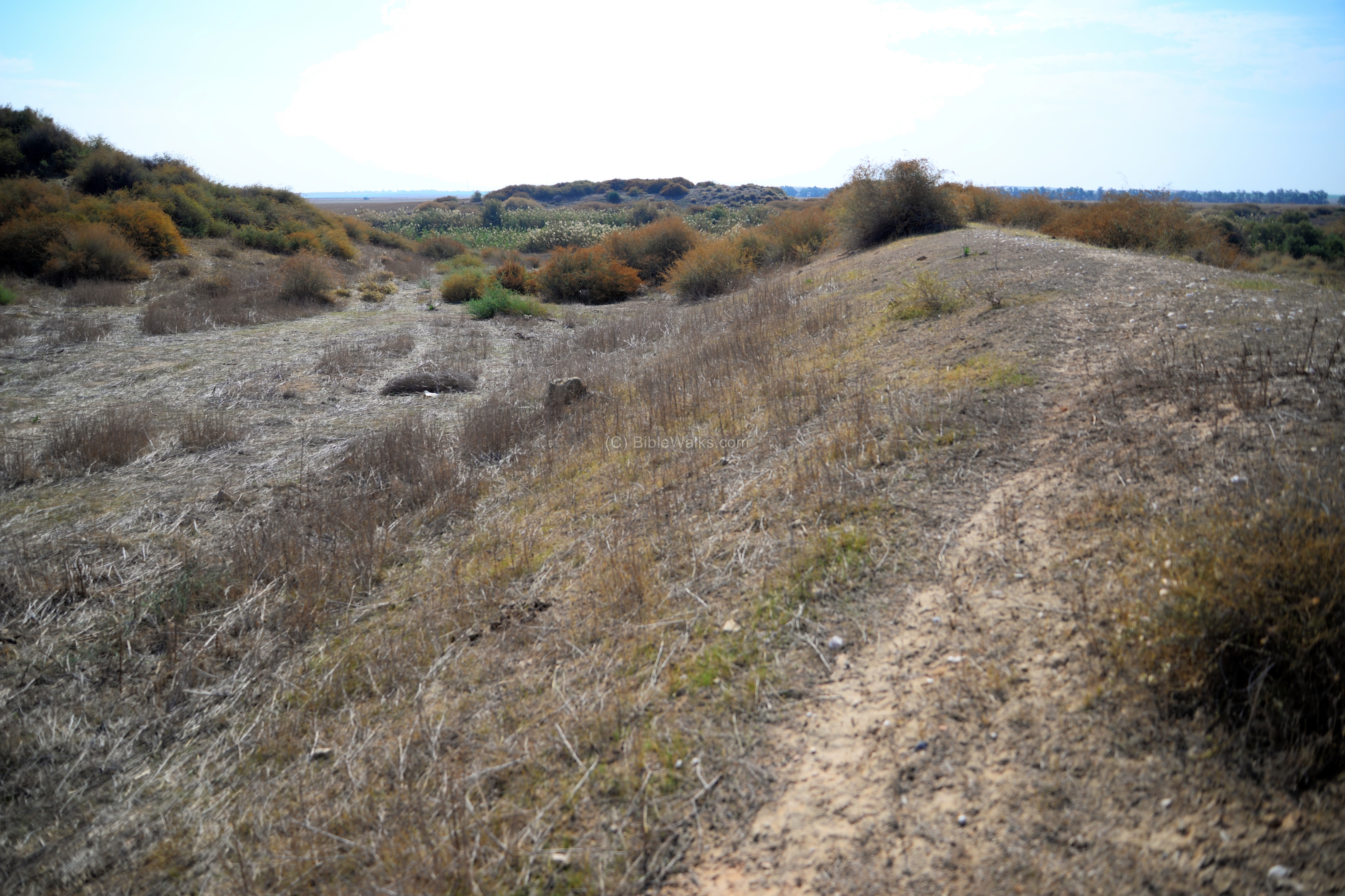
(d) East:
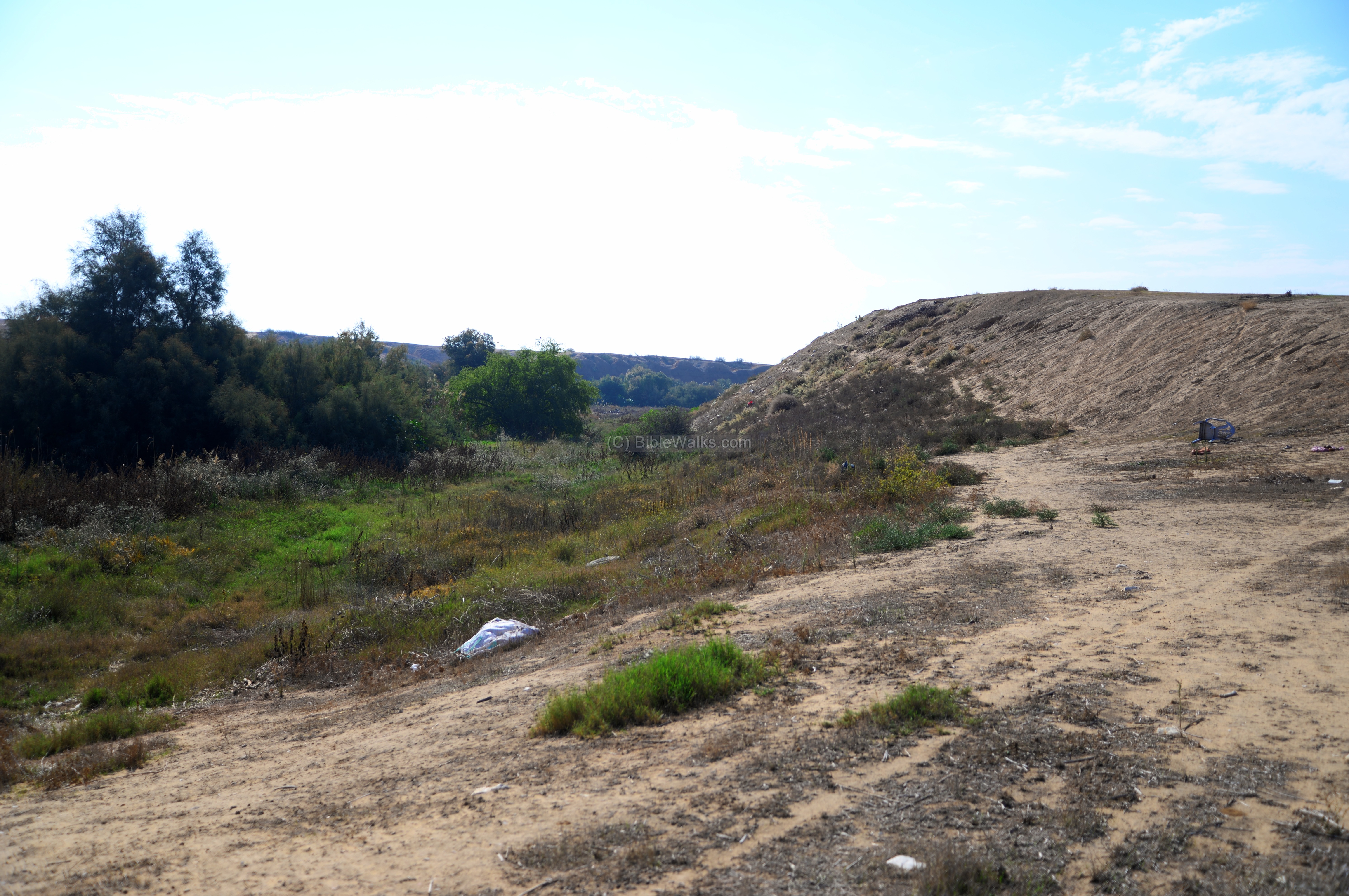
A view of the eastern foothills is here. It overlooks the valley of Nahal Gerar, where several springs filled up the lake along the edge of the city.
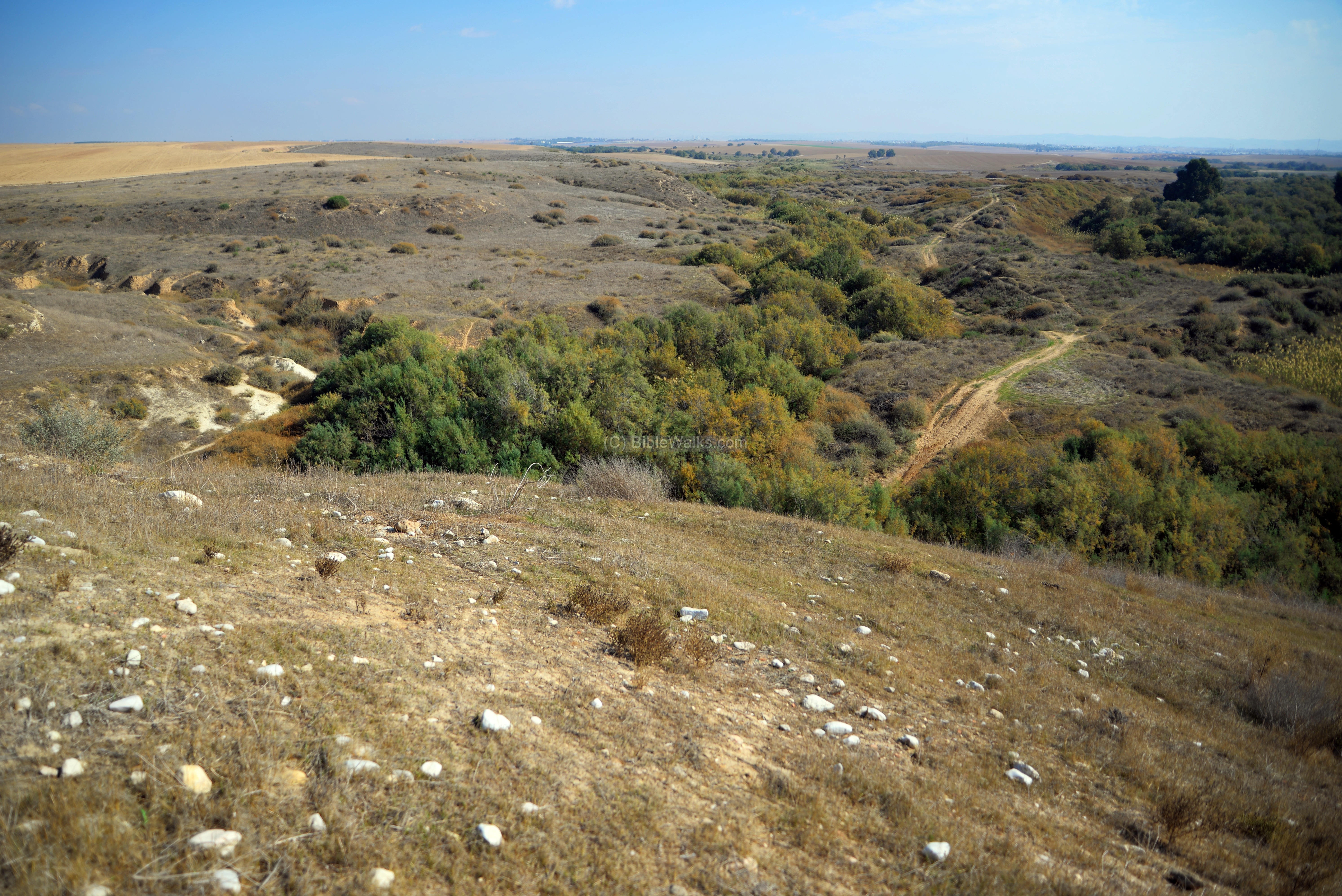
Another view of the eastern foothills, with a view towards the south, is in the next photo. These steep slopes and the muddy area at the foothills provided a great protection to the city.

(e) South:
On the southern side of the mound is area ‘A’. In this excavation area the archaeologists dated 12 layers, with the earlier one (Layer XIII, Chalcolithic and Early Bronze Age) of a small settlement built on a natural hill above the valley.
The archaeologists concluded that the foundation of the Canaanite city to the end of the Middle Bronze period (Layer XII, 17th-15th century BC). Remains of a massive structure, probably a palace, with 2m wide walls. It had a rectangular hall and smaller rooms. At this time the Canaanite city covered large areas of the mound.
The next layer (XI, Late Bronze period, 14th century BC) had remains of a large structure with a wide courtyard to its east side. Burial pits in the courtyard with animal bones and ceramics imply it served as a ritual structure. It was destroyed by fire in the middle of the 12th century BC.
Layer X (Late Bronze III, 13th century BC) had a large building and round silo, and a ritual place.
In the next layer (Layer IX, Late Bronze to Iron Age I, first half of the 12th century BC), on the south eastern slopes of the mound, the excavators unearthed a massive structure – the Egyptian governor’s house. The square structure (25m x 25m) was built with a roof supported by cedar tree logs. The Canaanite city was destroyed by a massive fire, probably by the invading Philistines.
In area ‘A’ are later periods of the Iron Age. Layer VIII (Iron Age I, 12th-11th century BC) has remains of a Philistine city, which was built above the remains of the Canaanite cities.
In the next layer (VII, Iron Age II, 10th-9th century) are several Israelite type houses (‘4-room’). Layer VI (Iron Age III, 8th century BC) included royal structures, probably one of King Uziah’s construction projects.
In area ‘A’, on Layer V (Iron Age III, 7th century BC), the excavators unearthed a large citadel. It had long narrow storage halls, small rooms, and a wide 5m surrounding wall.
(f) Railroad:
To the south of the mound is a raised ramp. This is what remained from the Turkish military railway, which was constructed in 1915 on the eve of World War I. The railroad crossed the stream on top of a bridge, on its way to BeerSheba. The remains of the bridge are seen on the south east side.
The railroad metal rails were dismantled long ago, but some of the metal parts could be found along the ramp.

(g) Tel Ma’aravim:
On the northern bank of Nahal Gerar, 2.5km east of Tel Ser’a, are remains of a smaller mound – named Tel Ma’aravim (Arabic: Kh. Umm el Bakr). Its area is 3 dunam and is raised 4m above the area around it. The surveyor (D. Alon) and the archaeologists (E.D. Oren and A. Mazar of BGU) dated 4 archaeological layers:
- Layer 4 (Late Bronze II), 1m deep on a small area, probably when the Canaanite city was founded,
- Layer 3 (Late Bronze III, 13th century BC), 1m deep; building with white walls, 2 rooms and courtyard, parallel to layer X of Tel Ser’a
- Layer 2 (Iron Age I, 11th century BC); Philistine ceramics; parallel to layer VIII of Tel Ser’a
- Layer 1 – modern Muslim tombs on the surface.
The archaeologists suggested that Tel Ma’aravim is one of the “villages” of the Canaanite and Philistine city of Ziklag.
Etymology (behind the name):
* Names of the site:
- Tell esh-Shariah – means “the mound of the drinking place”
- Tel Sera – the Hebrew name, based on the Arabic name.
- Ziklag – Biblical name of the city. Perhaps based on one of the Philistine people – the Sikels.
- Kh. Umm el Bakr – Arabic: “the ruin with the cows”.
Links and References:
* References:
- The new encyclopedia of Archaeological Excavations in the Holy Land (1992) – V4, pp 1563-1570; E.D. Oren
- Hadashot Arkhiologiot 53 (1975) – Tel Ma’aravim – E.D. Oren and A. Mazar
* External links:
- Scene from movie “King David” (1985) – David is granted refuge in Ziklag
- Battle of Sheria Wikipedia
- Tels along Nahal Gerar – (David Alon, Hebrew)
* Internal links:
- Tel Haror – nearby site on Nahal Gerar; identified as Biblical Gerar.
- Drone Aerial views – collection of Biblical sites from the air
- BibleWalks YouTube channel (join!)
BibleWalks.com – Exploring the Bible sites
Mo’a <—previous Negev site—<<<All Sites>>>— Next Negev site—>>> Aravah Copper
This page was last updated on Dec 13, 2018
Sponsored links: