This page focuses on the Crusaders period in Nebi Samuel, from their arrival (1099) to their departure (1187).
Home > Sites > Judea > West > Nebi Samuel > Crusaders
Contents:
Overview
Map
History
Photos
* Western gates
* South
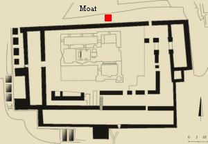
* East moat
* North moat
* North stables
* NE Stables
* Water
* Structures
* Findings
Etymology
Links
Overview:
Nebi Samuel was a military fortress during the Crusaders period, a religious site and a hostel for Christian pilgrims on their way to Jerusalem.
This web page focuses on this period, from their arrival in 1090, the construction of the fortified church in 1140, and their final departure in 1187.
For a general description and history of Nebi Samuel – refer to the overview page.
Map:
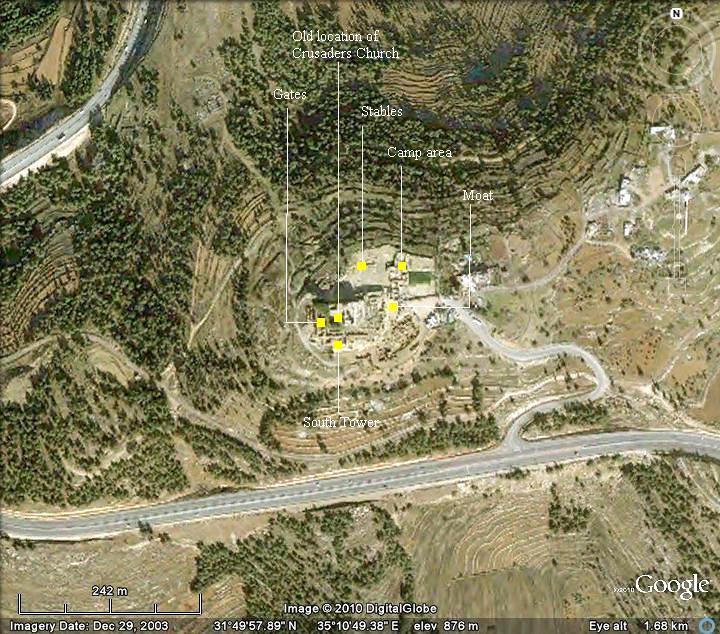
The location of the major ruins in Nebi Samuel, which are dated to the Crusaders period, are shown on the aerial map.
History:
This section on the history of the place focuses on the Crusaders period (1099-1187). For a full history of Nebi-Samuel – check the overview page.
-
Crusaders period – Mountain of Joy
The crusade to liberate the Holy Land and free Jerusalem was initiated in the great council meeting of Piacenza (March 1095), following an appeal from the Byzantine emperor Alexios I Komnenos to repel the Muslim (Seljuk) Turks conquests in the south Turkey. Pope Urban II (1042-1099) pushed for a military action to the Holy Lands at the council of Clermont (27 November 1095), with the primary goal to assist the Byzantine capitol of Constantinople. His speech at the council had a great influence, resulting in a call for arms throughout Europe to regain the Holy Lands. A large force of volunteers was assembled in France, Germany and Italy, estimated at 30,000-40,000, which included peasants, trained soldiers and knights. They fought their way to Constantinople, and finally reached the city a year later. The campaign against the Seljuks in Anatolia took another year to complete (June 1098), ending with the conquest of Antioch after 8 months of siege (June 1098). In the beginning of 1099 the Crusaders continued from Antioch towards Jerusalem, encountering little resistance along the coastal way.
On June 7, 1099, three years after the military expedition started in Europe, the Crusaders finally approached the gates of Jerusalem. They first arrived to the site of Nebi Samuel, which is west of the city.
The Crusaders were so joyful on viewing the Holy city for the first time, that they later named this site as the “Mountain of Joy” (Mons Gaudii). An illustration of this event is shown here.

First view of Jerusalem – by Gustav Dore (French artist, 1832-1883)
The Crusaders waited here until they secured a supply of wood which was required for building siege weapons, in order to breach the strong walls of Jerusalem. The armies finally took Jerusalem a month later, on July 15, and established the Kingdom of Jerusalem.
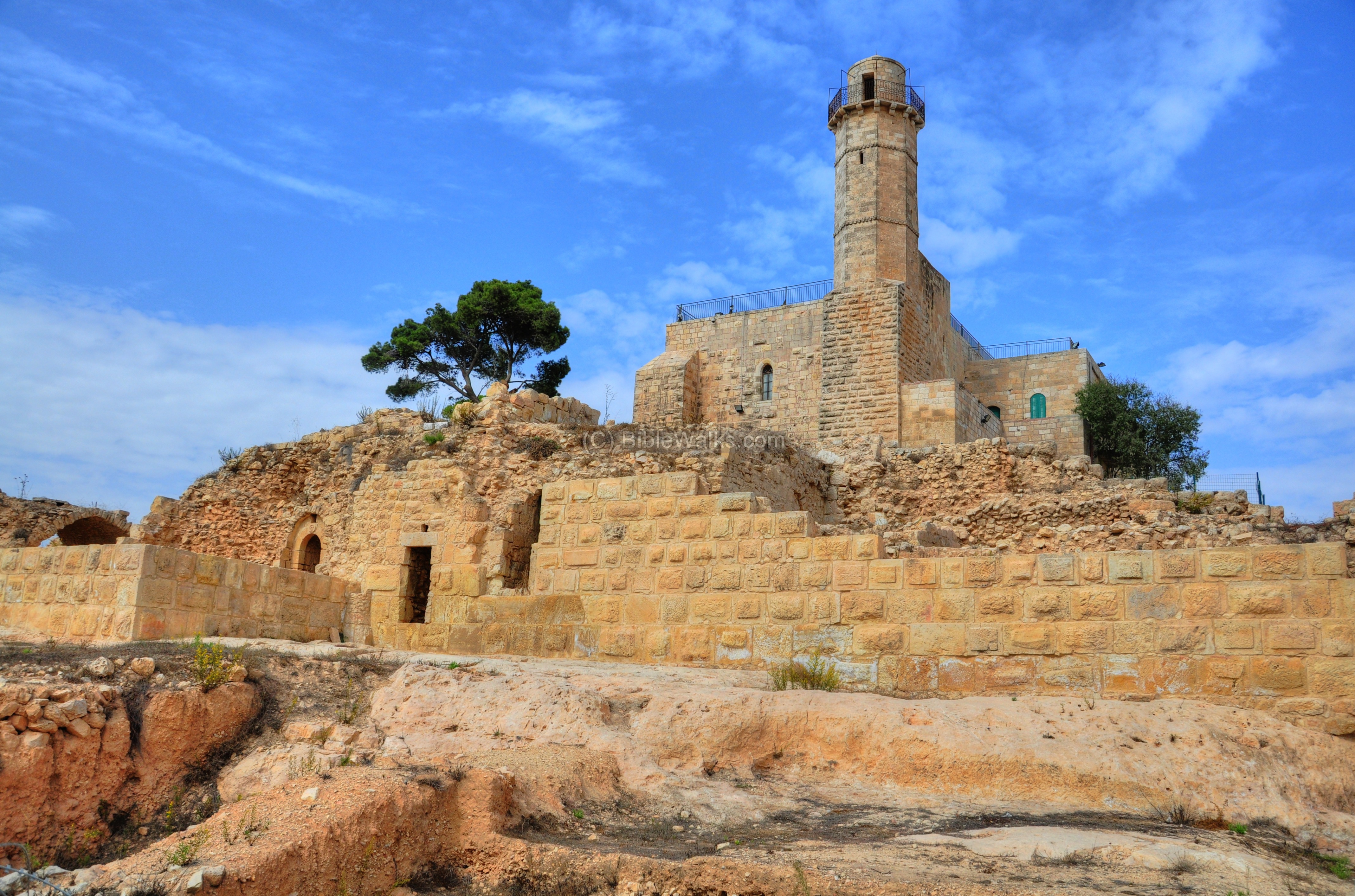
In 1140 the Crusaders upgraded the site as a military fortress as well as a holy shrine. They cut into the bedrock on the west, north and east sides – thus creating a defensive moat. The hewn rocks were used for the building material of the fortress on the top of the hill. The quarry also served as stables for the horses, water reservoirs and other structures.
The abbey church of St. Samuel was built by the Premonstratensian order and inhabited from 1141 to 1244. Melisanda, the Queen of Jerusalem from 1131 until 1153, donated money to the order in Nebi Samuel.
-
Departure
The Crusaders were driven out of Jerusalem in 1187 by the Arab forces headed by Saladin, and their military forces retreated from the site. The fortified church was destroyed in 1244 by the Arabs in order to prevent its recapture.
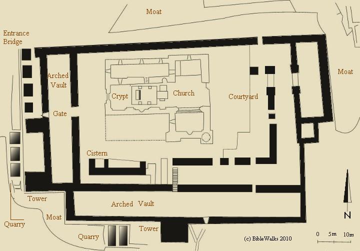
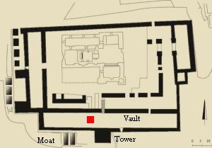
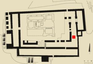
Plan:
The plan of the Crusaders fortress was reconstructed by the archaeologists, and shown in the following illustration. The black lines are sections of the walls of the fortress that existed during the Crusaders period, but only parts of them survived. As seen on the plan, the existing modern structure of the mosque occupies only the central part of the original area of the fortified church.
The fortress was a rectangular structure (67m by 100m), with the church at its center and over the traditional tomb of the prophet.
Photos:
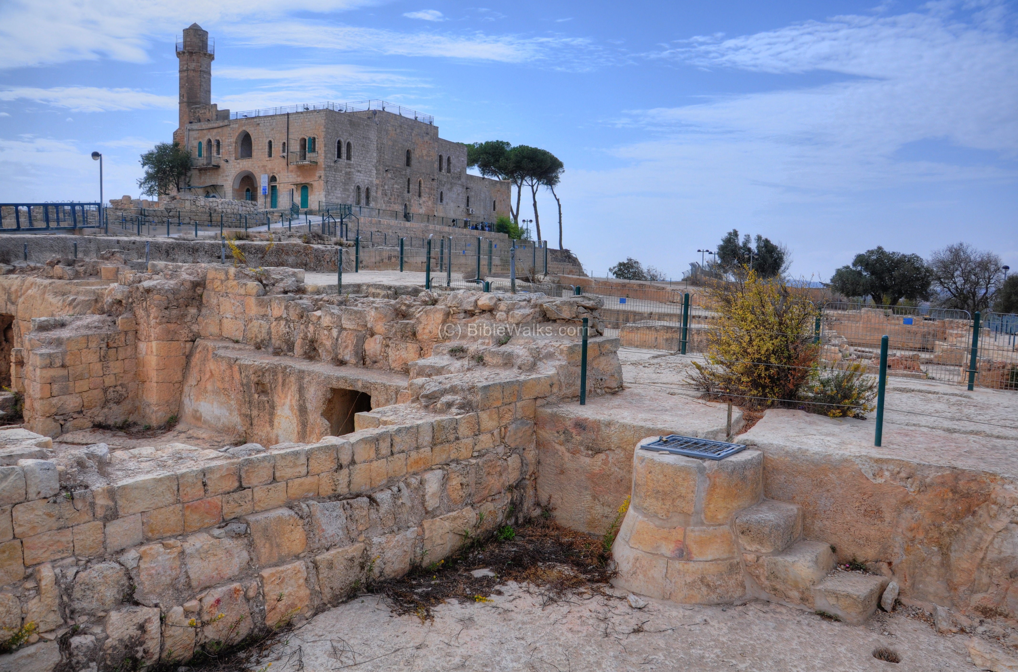
The pictures are ordered as a “counter-clockwise” tour around the fortress, starting from the west gate.
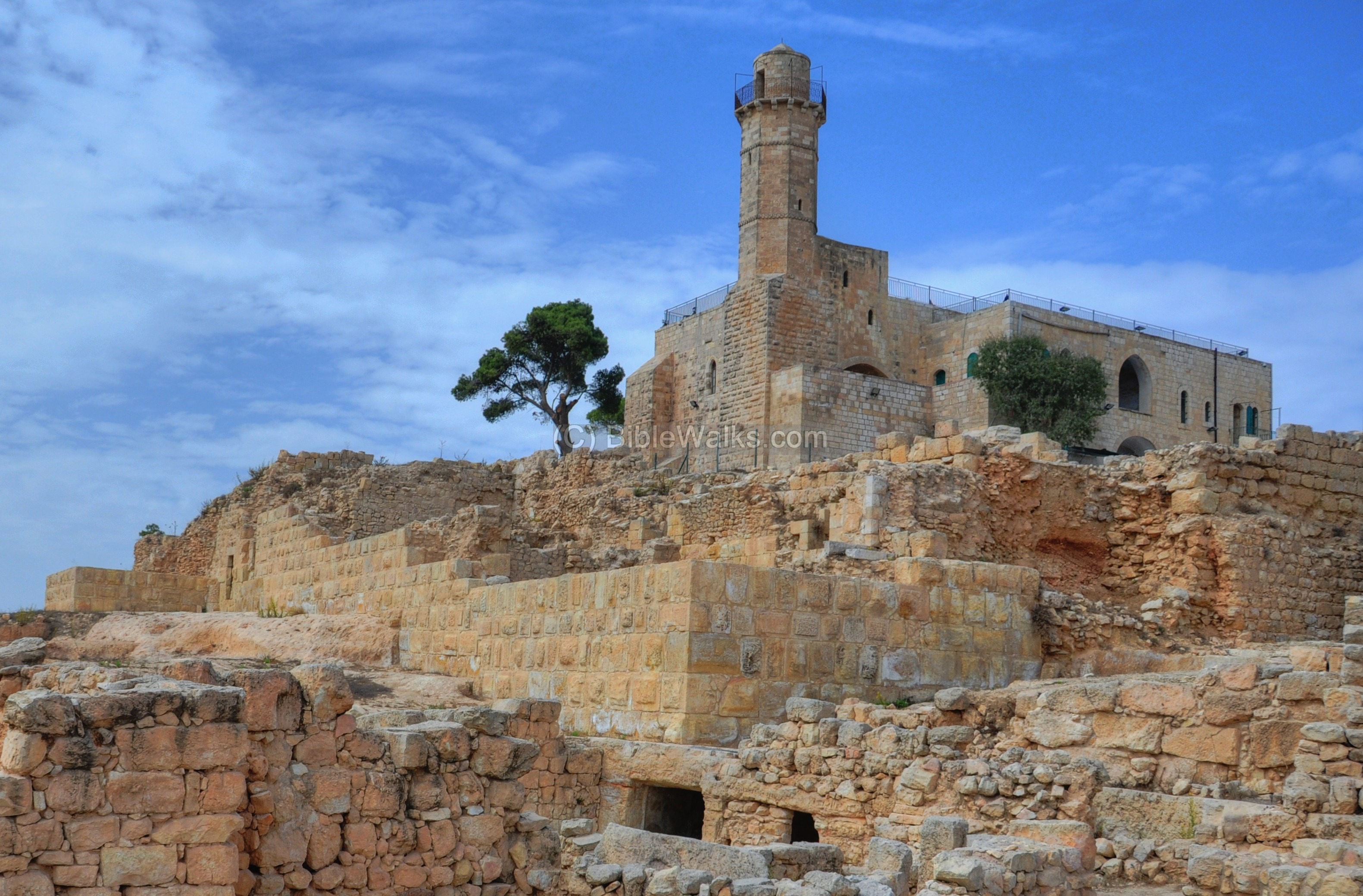
(a) Western Wall and Entrance Gates:
The western side of the Crusader fortress, which is 46m wide, is indicated as a red square on the illustration. A narrow (6.4m) underground arched vault was built along the inner side of the western wall, supporting the raised platform of the courtyard around the fortified Church.
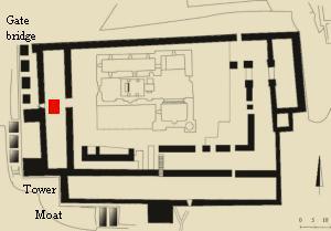
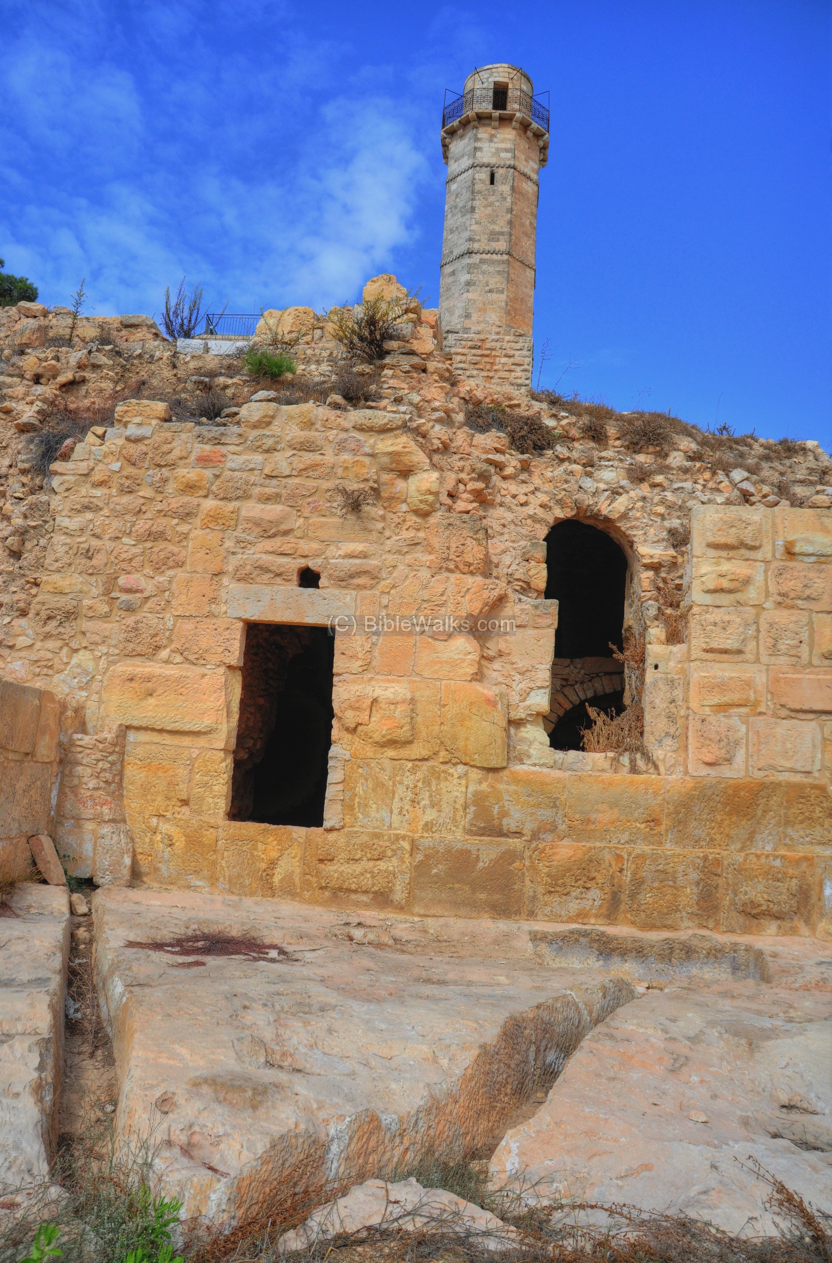
On this side were two gates – a lower inner gate which was used for daily purposes, and a higher gate which was accessed by a bridge. Strong walls, 2m wide, were built on along the western side – built of large ashlars. A large tower protected the south-western corner. A moat was in the process of being cut into the rock, but not completed in time.
The ruins of the western side of the Crusader fortress are seen in the picture below. In the front is a quarry, where a new moat was in the process of being cut into the rock. Behind it is an arched base of the entrance bridge, which ascended from left to right. Behind the ruins of this bridge are traces of the western walls of the fortress, and in the background is the modern structure of the tomb of Samuel.
Click on the photos to view in higher resolution…

A closer view of the south-western section is shown in the following picture.
Here were two gates:
-
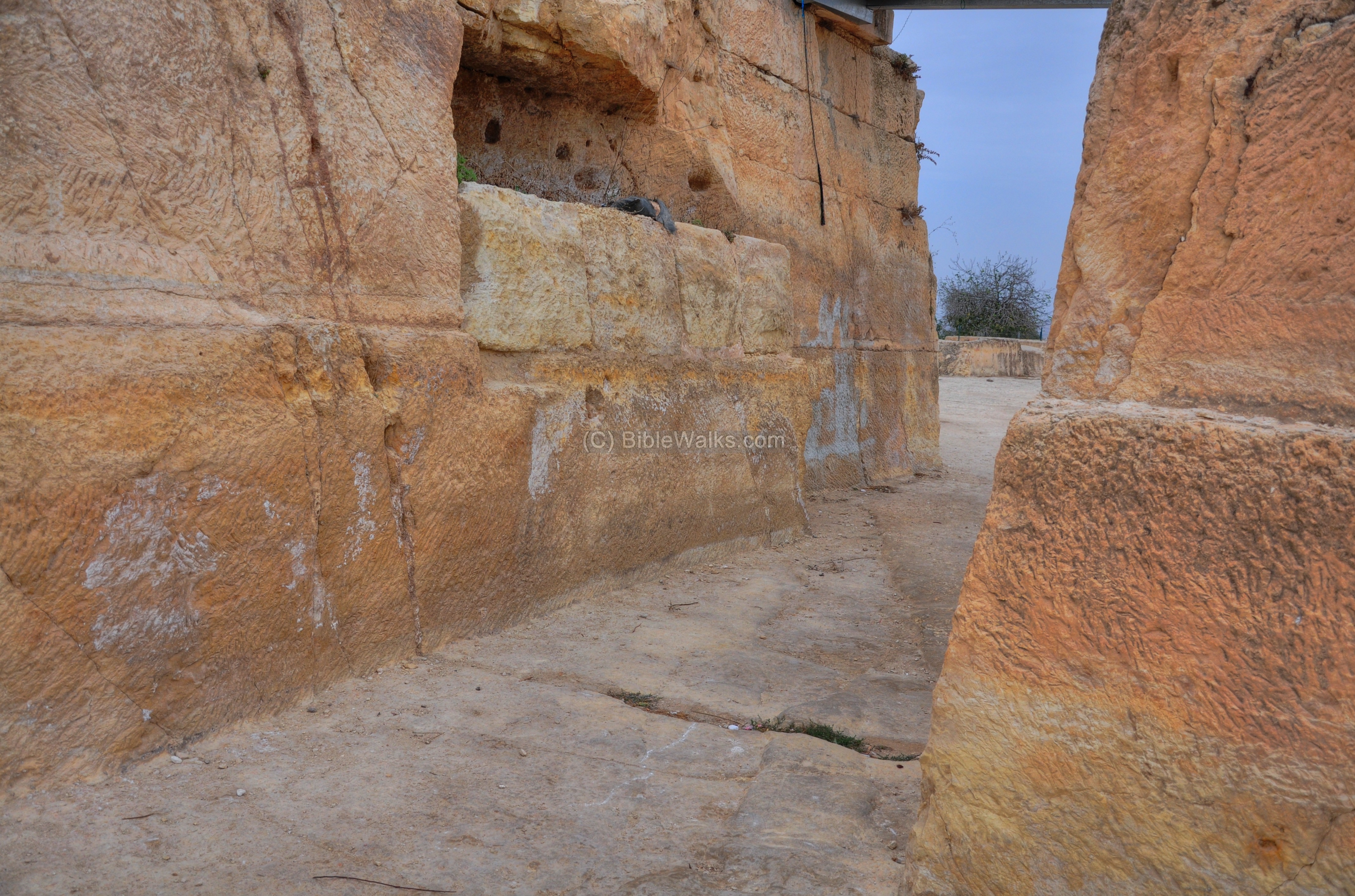
A lower entrance to the fortress, entering through the opening seen in the higher wall in the back. This entrance led into the lower level of the arched vault.
-
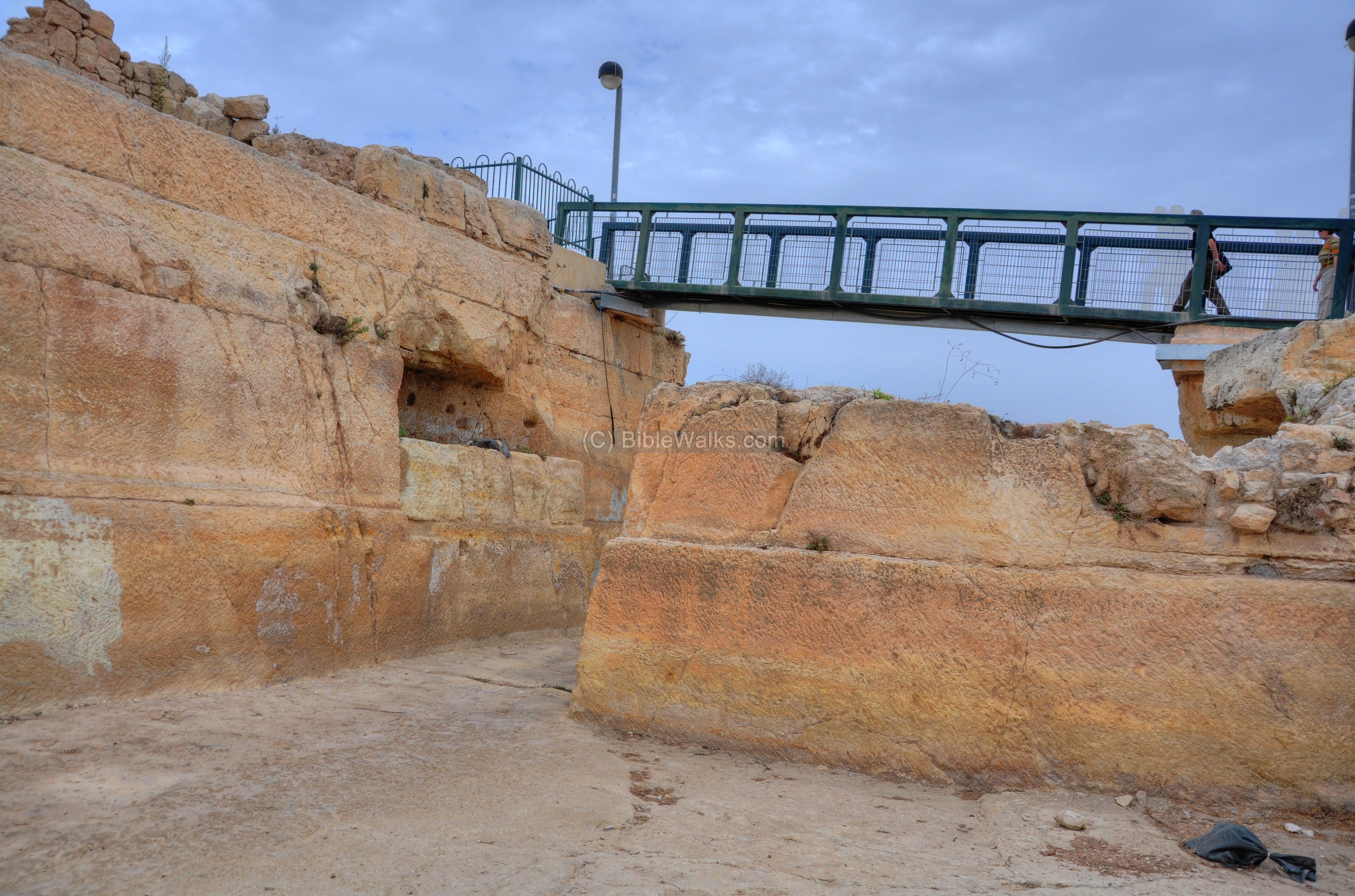
An upper entrance, accessed by a bridge, leading to the raised podium. One of its arched bases is seen in the center of the picture. The bridge, 28m long and 2.5m wide, ascended from left (north) to right (south), and was supported by a series of arches. It entered through the opening in the wall on a higher wall, which is now missing.
While standing on the upper side of the podium, near the western wall of the modern structure of the tomb of Samuel, this is the view of the top of the arched vault and the south wall.
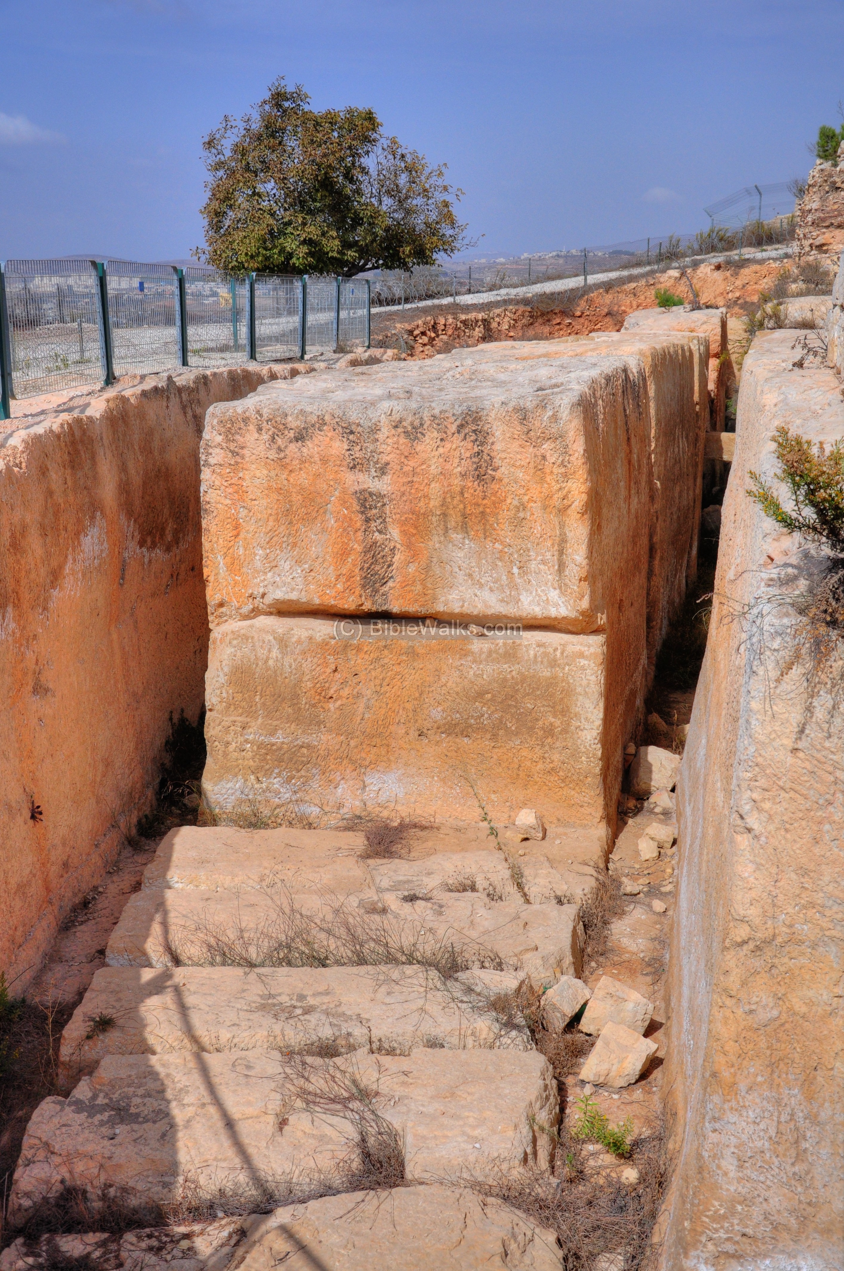
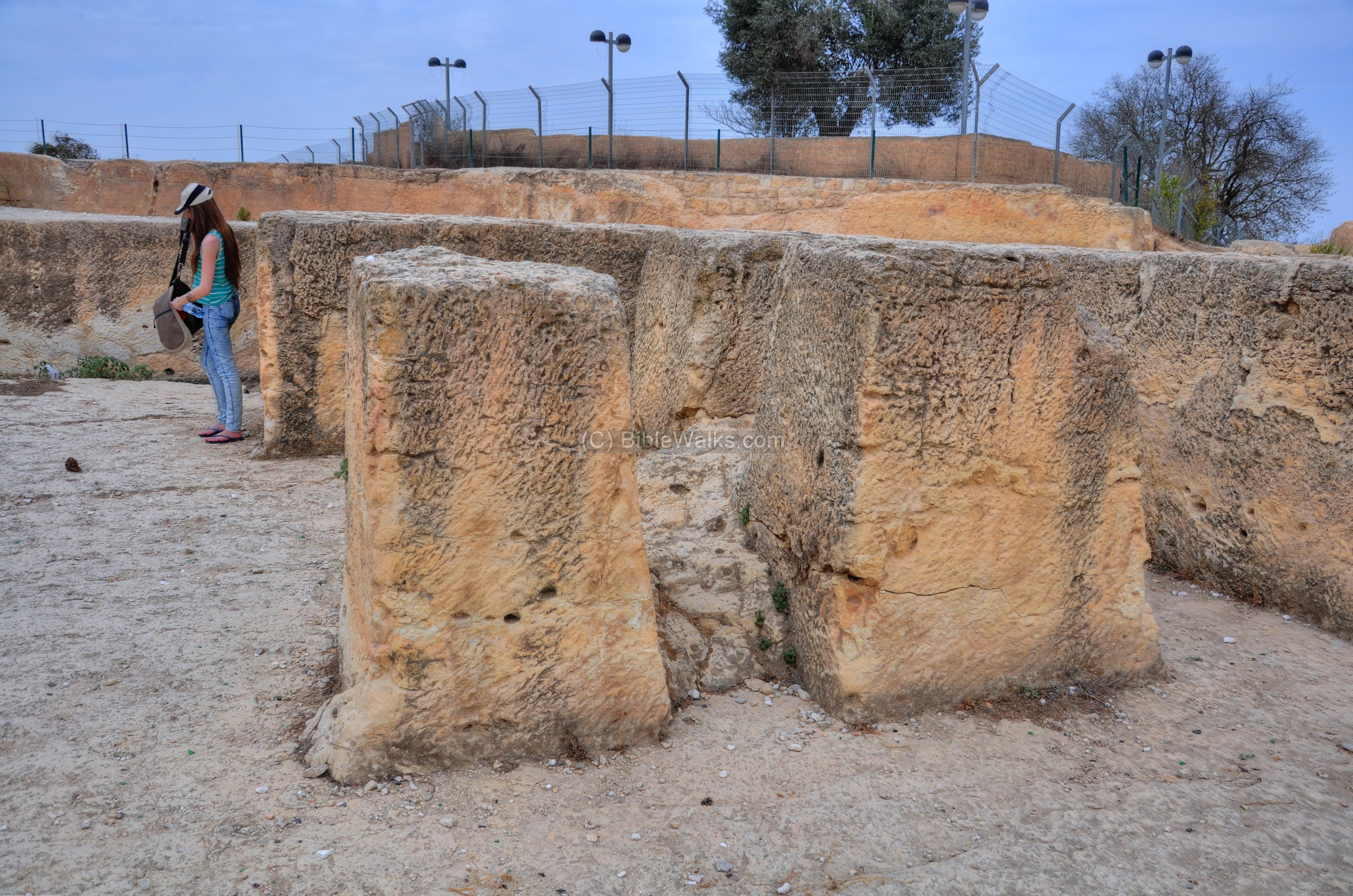
Back to the bottom of the western wall: A stone quarry is located on the west and south side of the fortress. The large stones were used to build the fortress. After the planned removal of the blocks, the cavity left over would have created a wide moat similar to the north and east sides.
The stones were in the process of being cut by the stonemasons when the work was suddenly disrupted. Perhaps, this was at the end of the Crusaders period.
The next photo shows a gigantic block which was left in the quarry. Behind this block is the base of the south-west tower.
A closer view of the rock cutting from the other side:
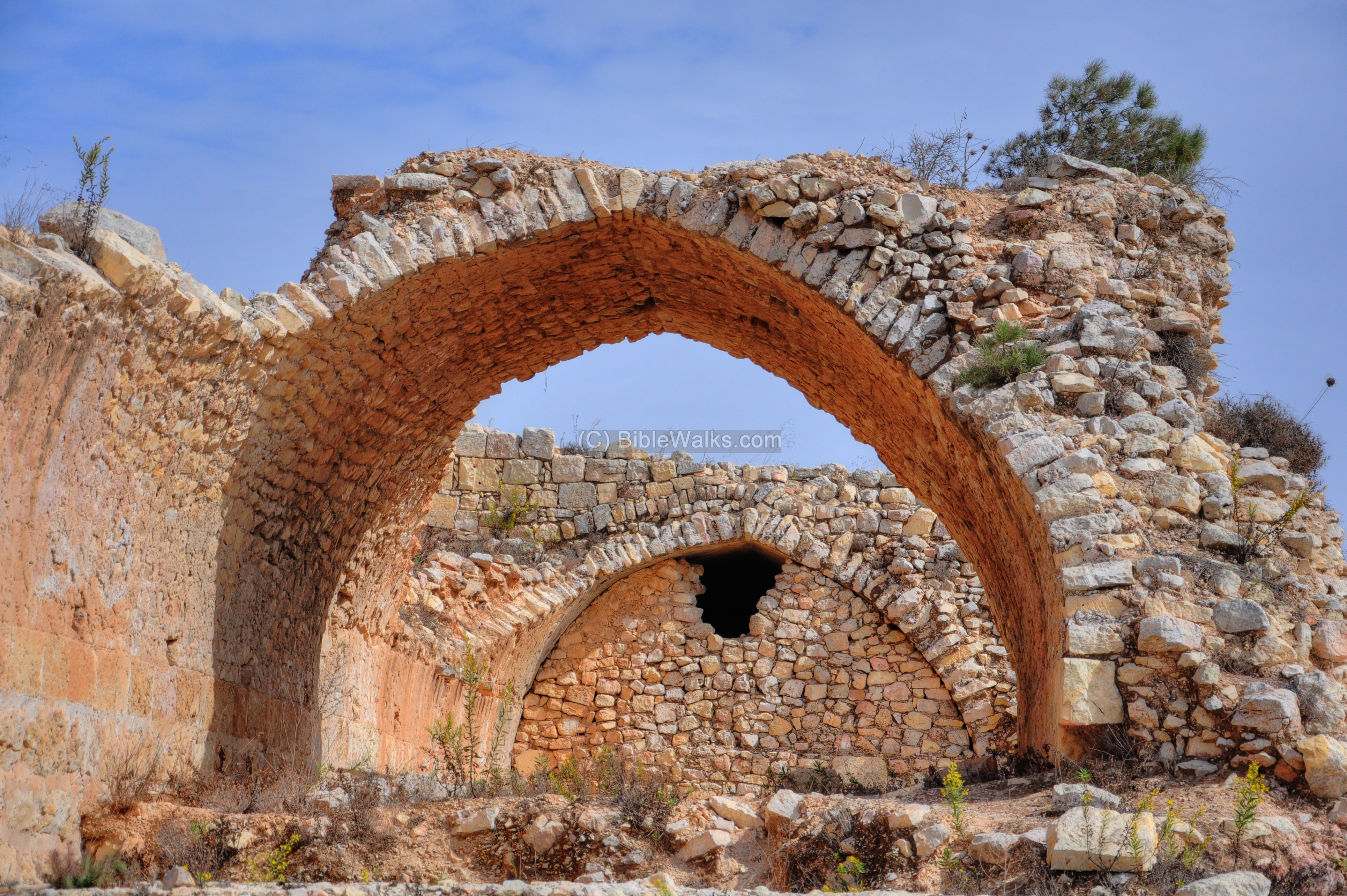
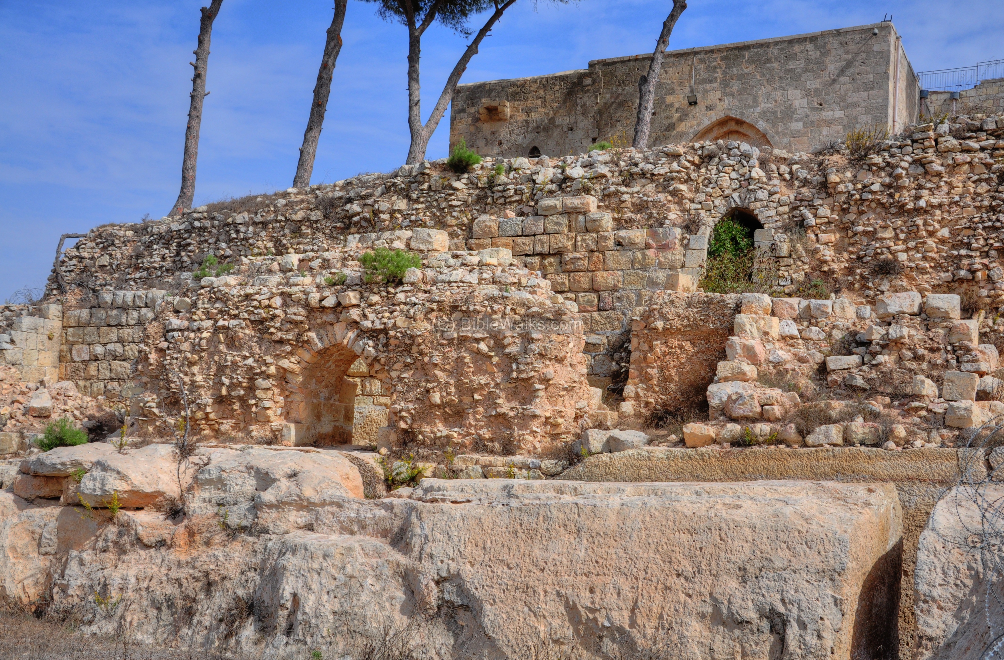
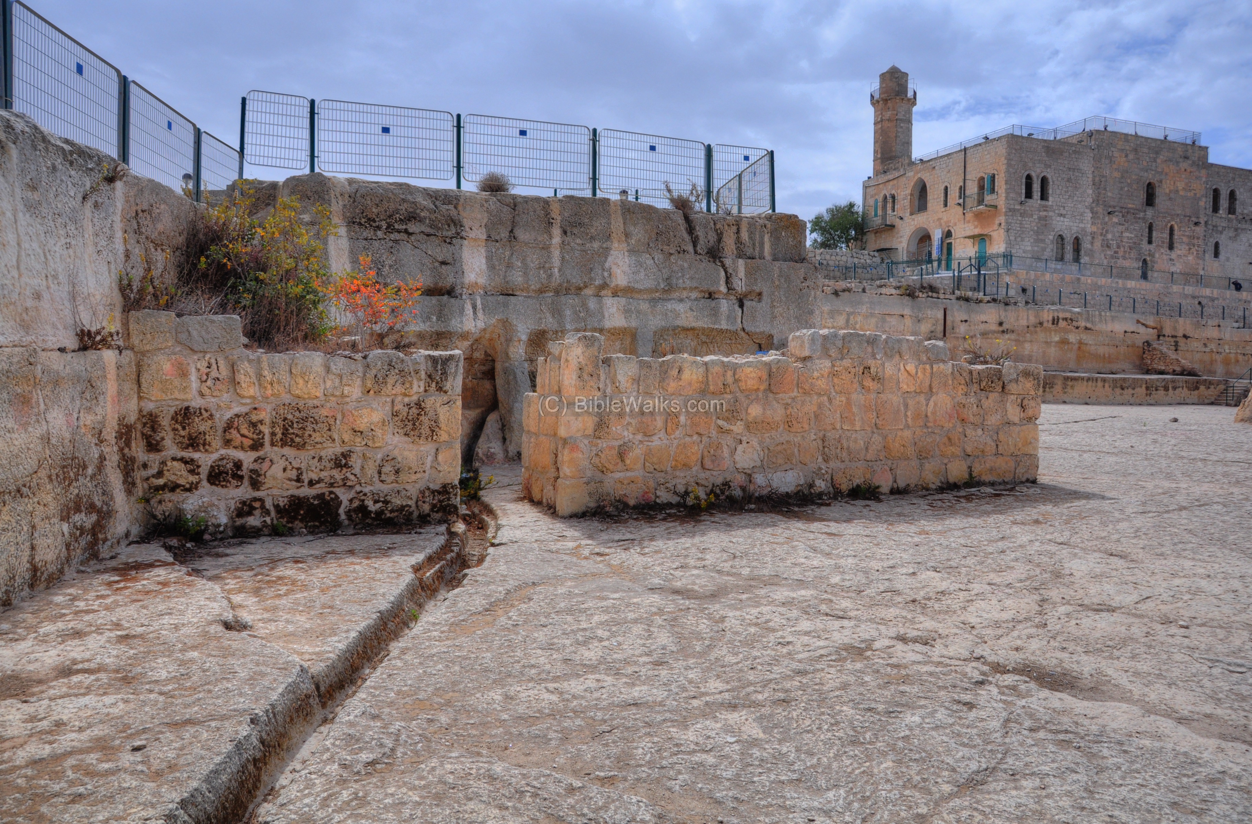
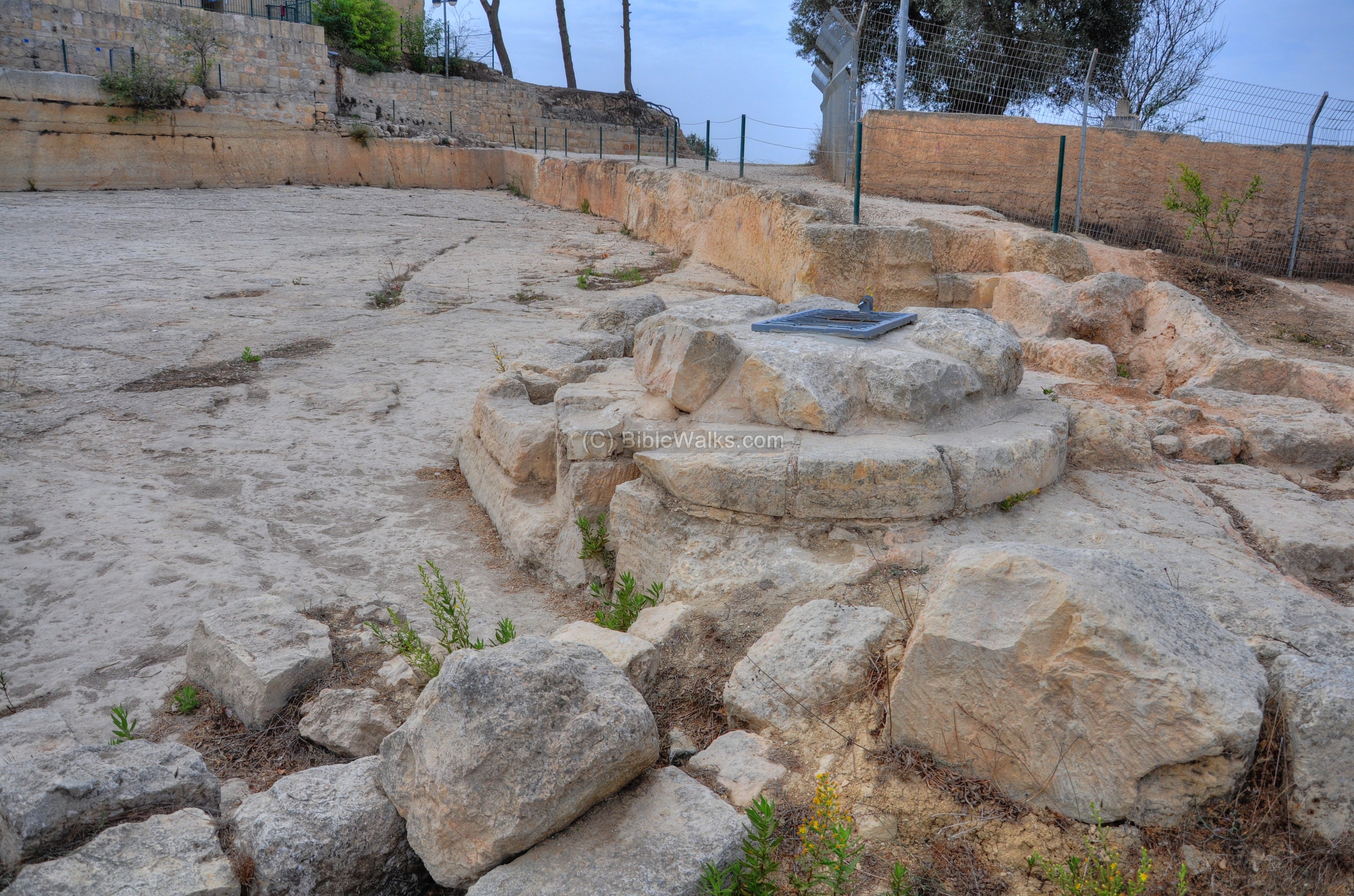
(b) South:
The southern side of the Crusader fortress is indicated as a red square on the illustration. A long (72m) terraced wall was built on top of a 8m wide arched vault. It supported the podium on which the courtyard stood.
On this side was a large tower (6m x 6m), illustrated as a black square standing out of the southern walls.
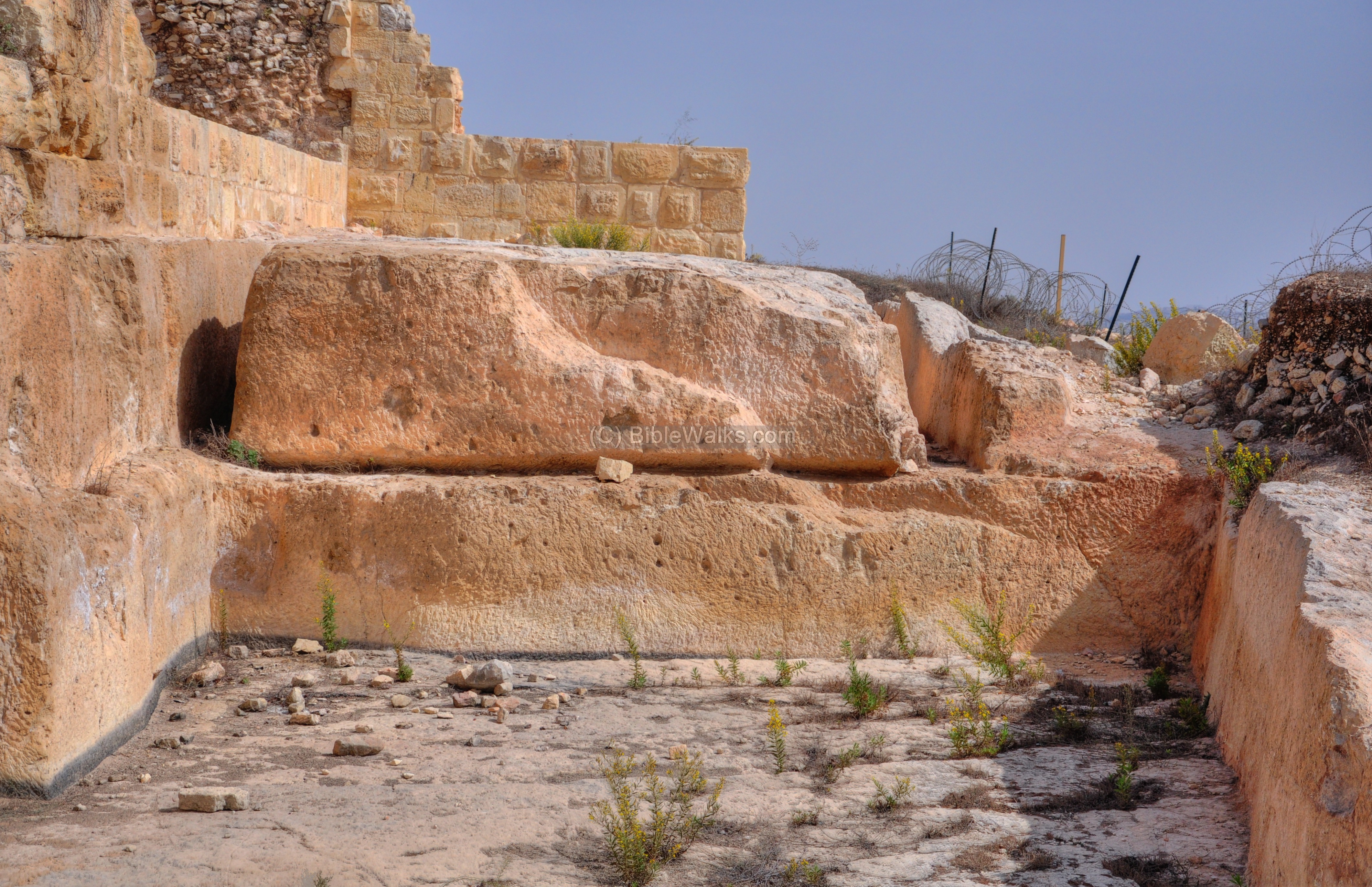
The ruins of the southern wall are seen below. The base of the south-west corner is seen in the foreground of the picture. Behind it are the remains of the arched vault which supported the raised platform.

The south-western section on the external side of the wall is also part of the stone quarry, with another block in the middle of the cutting process. Above the edge of the moat is the base of the wall of the fortress.
The following picture shows a closer view of the arched vault. Above its roof is the raised platform which was the courtyard of the fortress.
Another section of the arched vaults which supported the podium. The secondary use of the underground vault was for storage.
A staircase led from the upper courtyard of the fortress down to the underground vaults. The stairs and the opening is seen on the bottom right side in the southern view below.
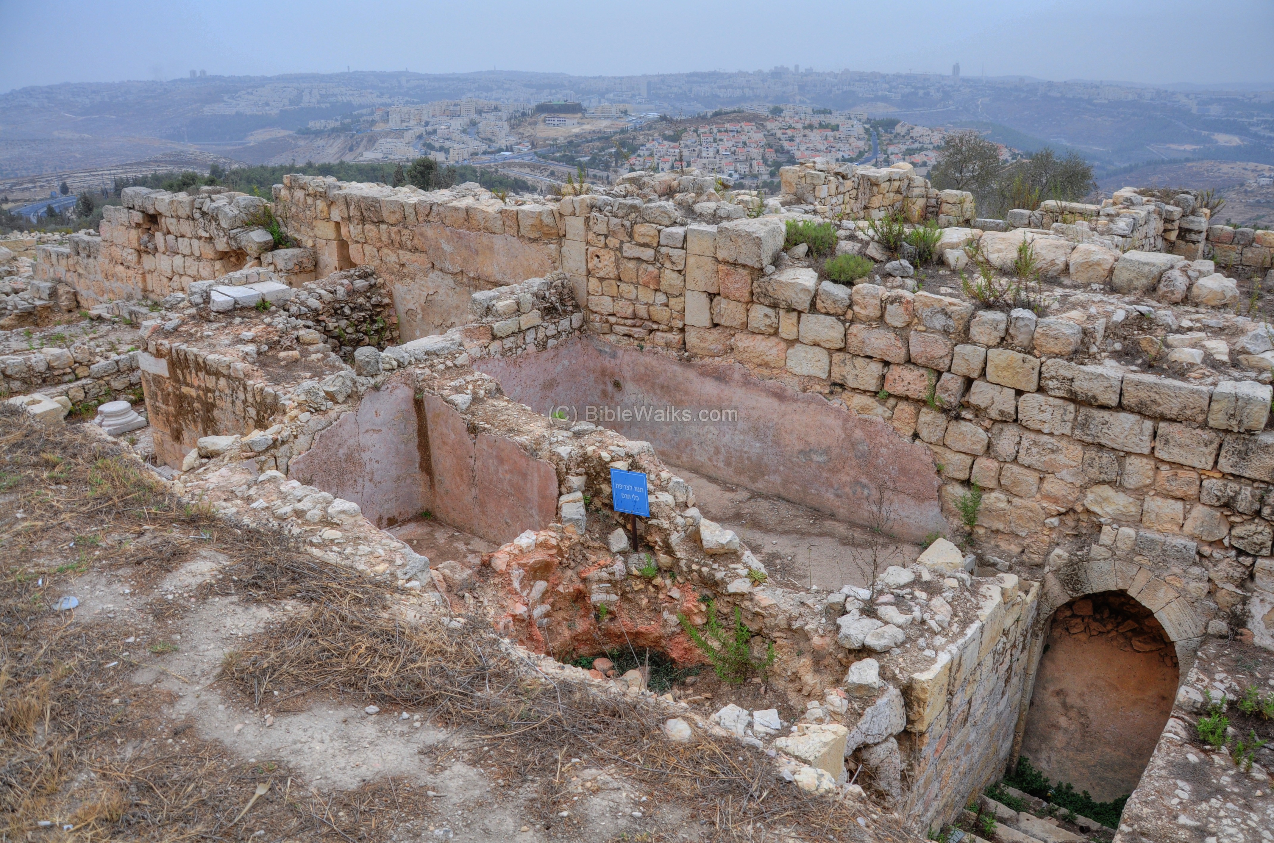
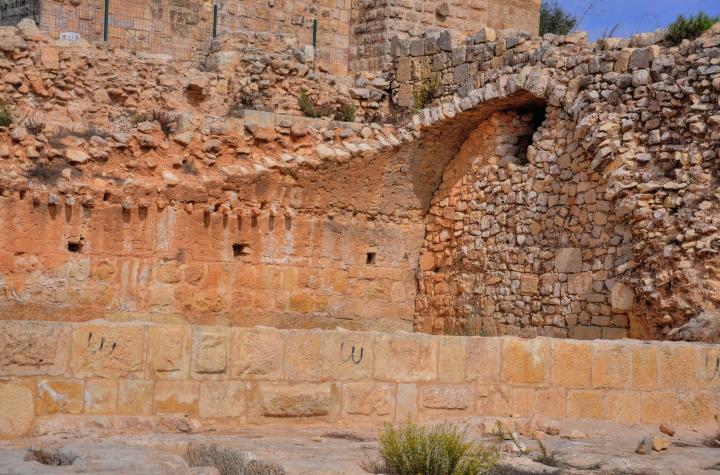
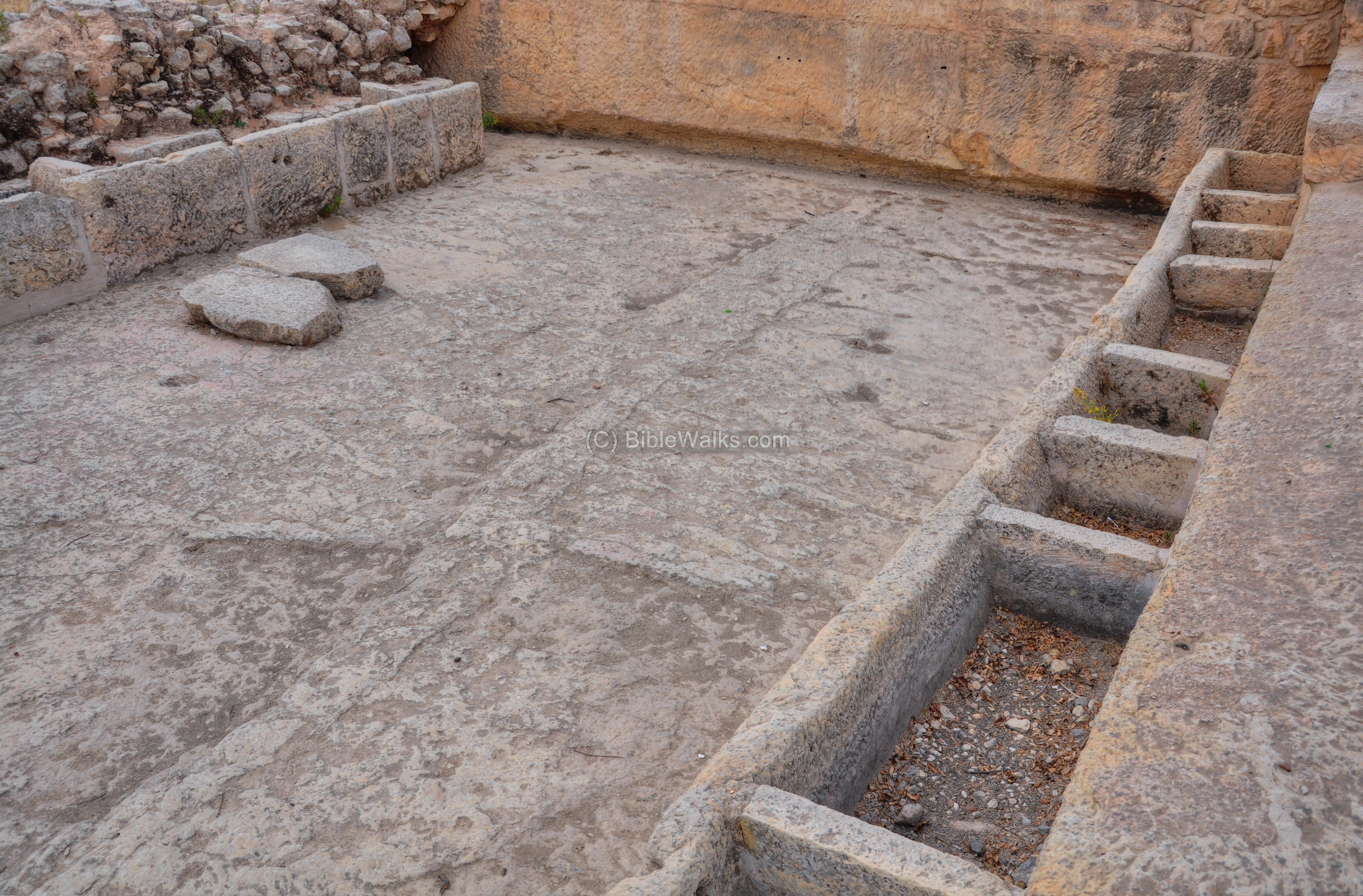
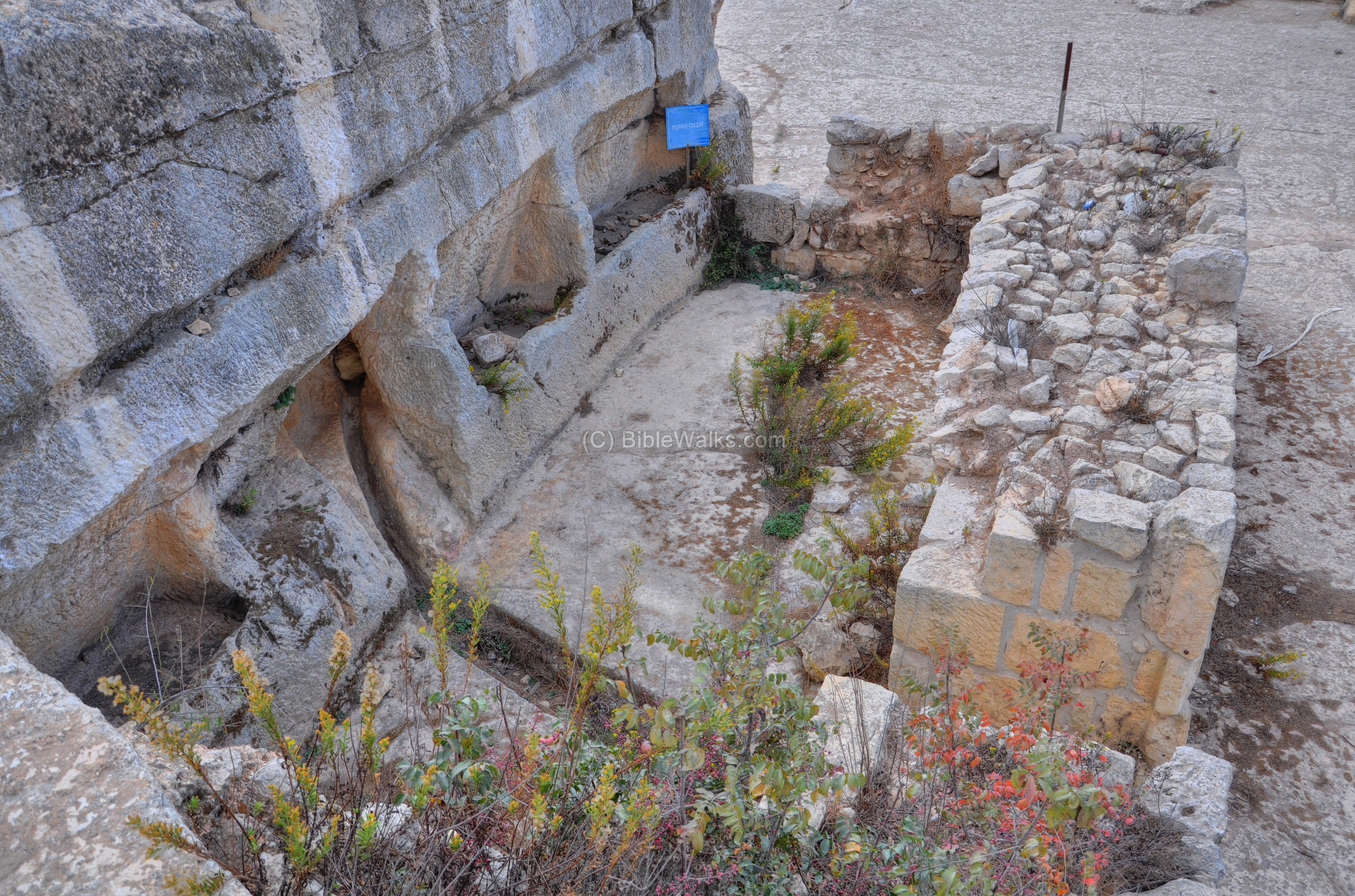
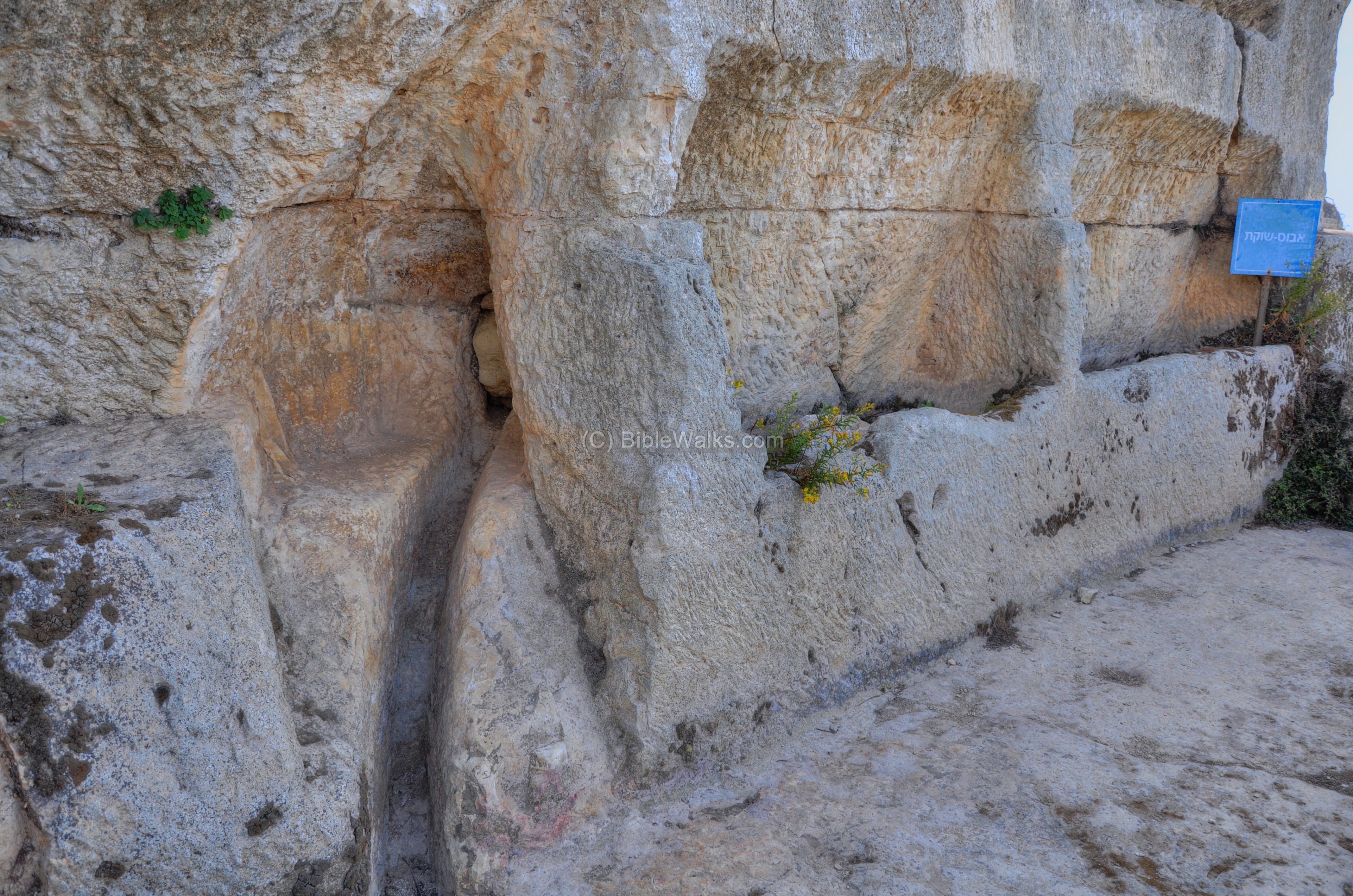
Further to the east are traces of the large southern tower (6m x 6m), and the section of the wall.
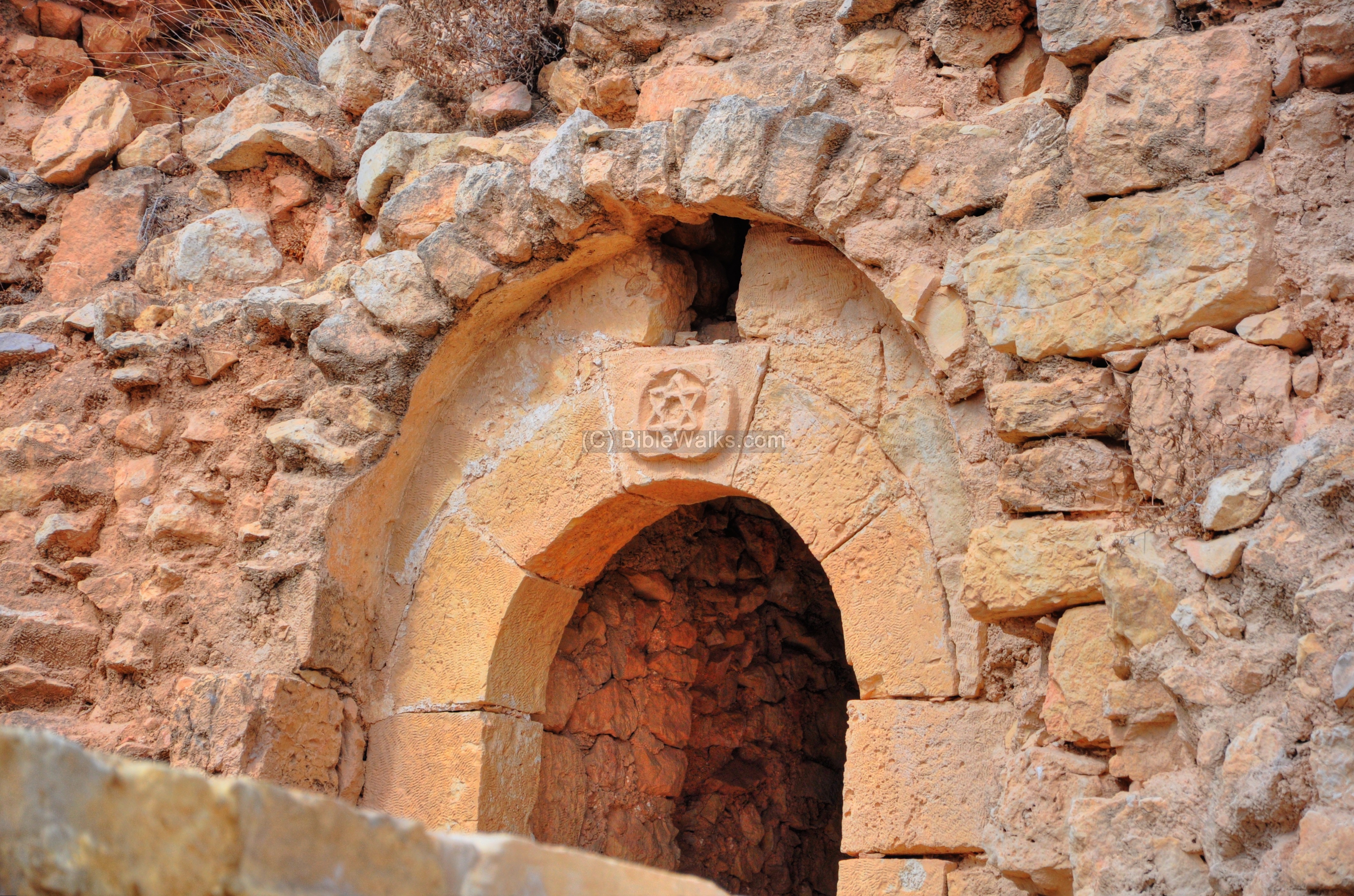
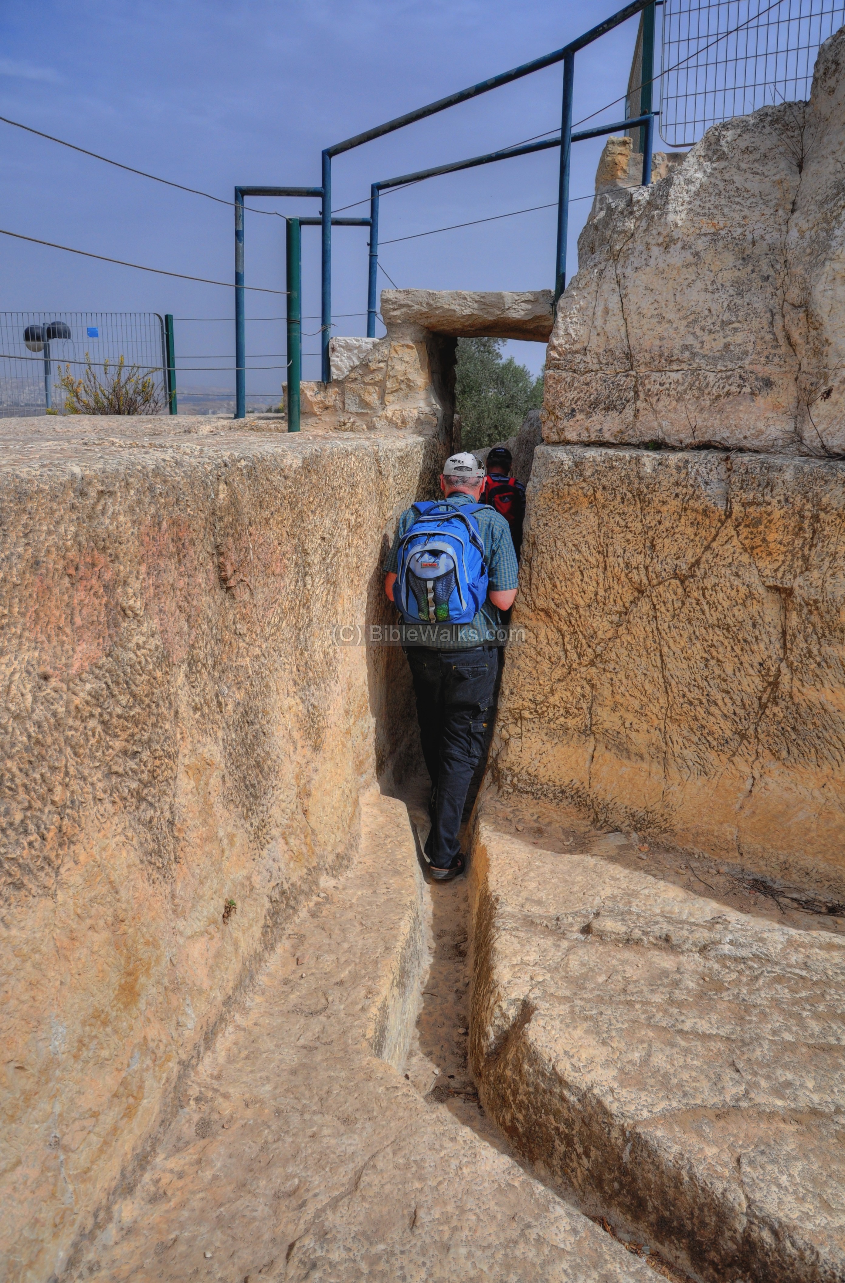
Taking a closer view on the corner of the tower and the wall, you can see openings in the wall and in the underground vault. A pair of sewage channels can be seen cut into the floor.
An interesting symbol = star of David – is marked above the entrance to the tower. This element was probably added in the Mameluke period.
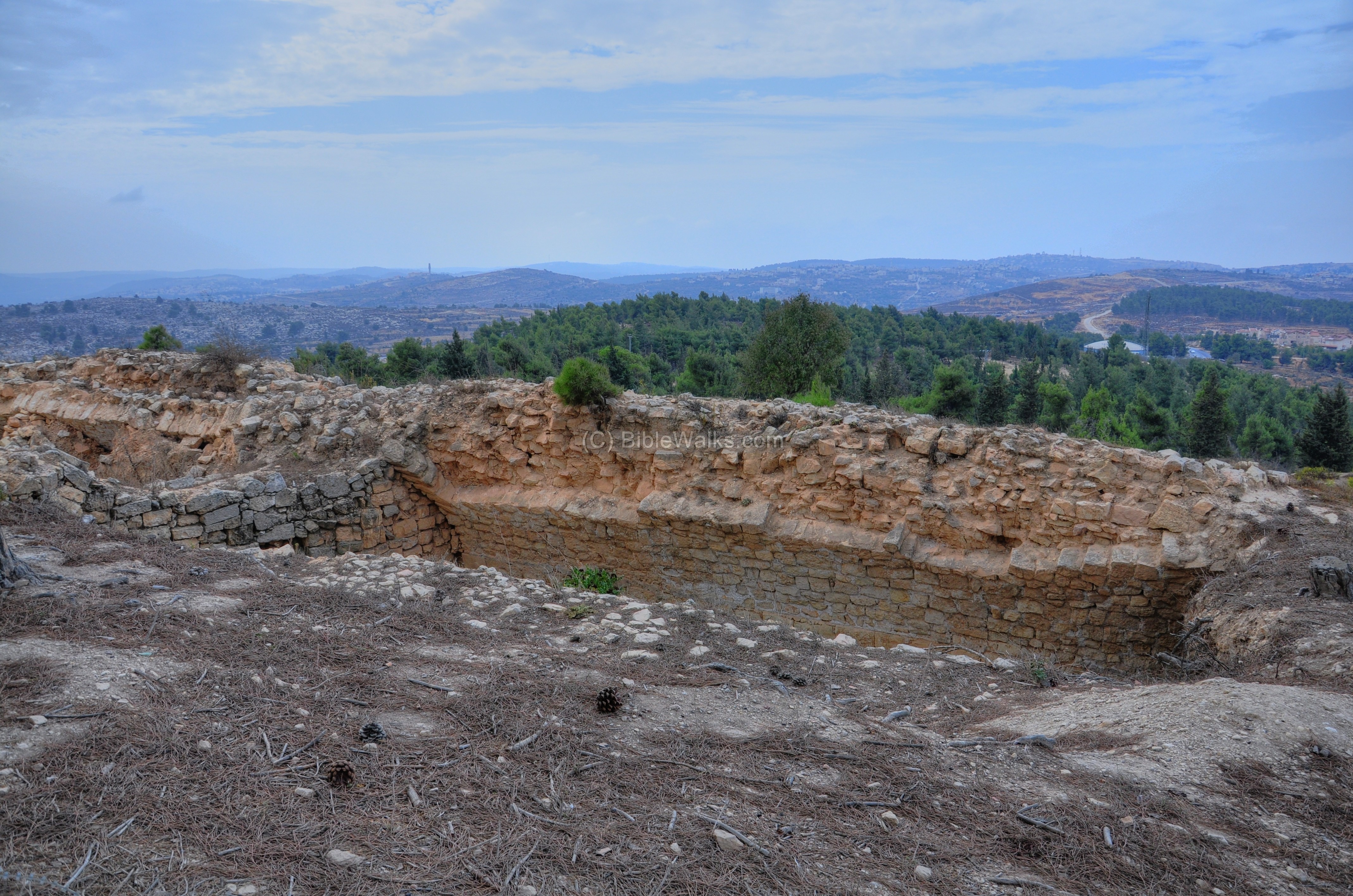
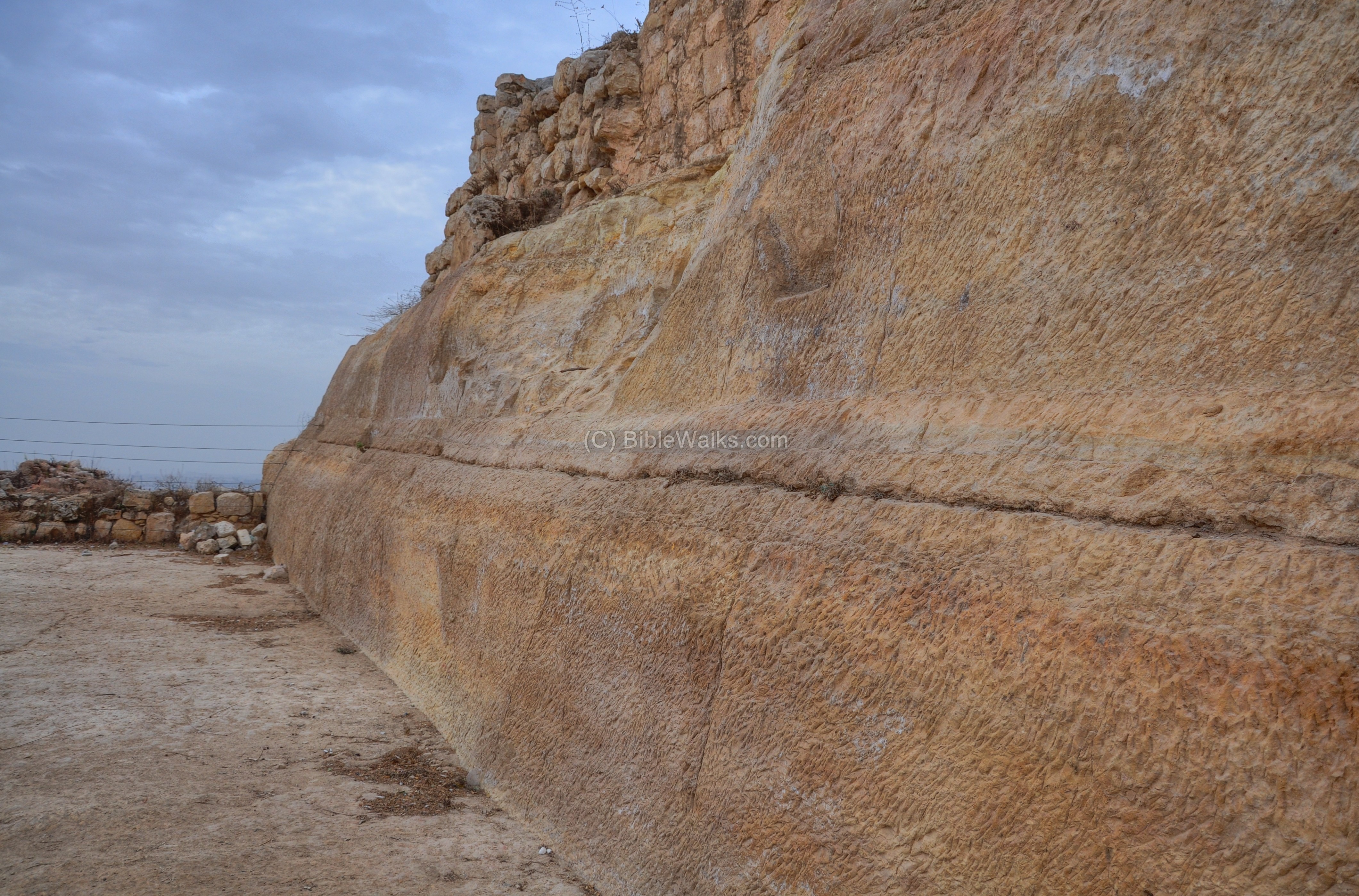
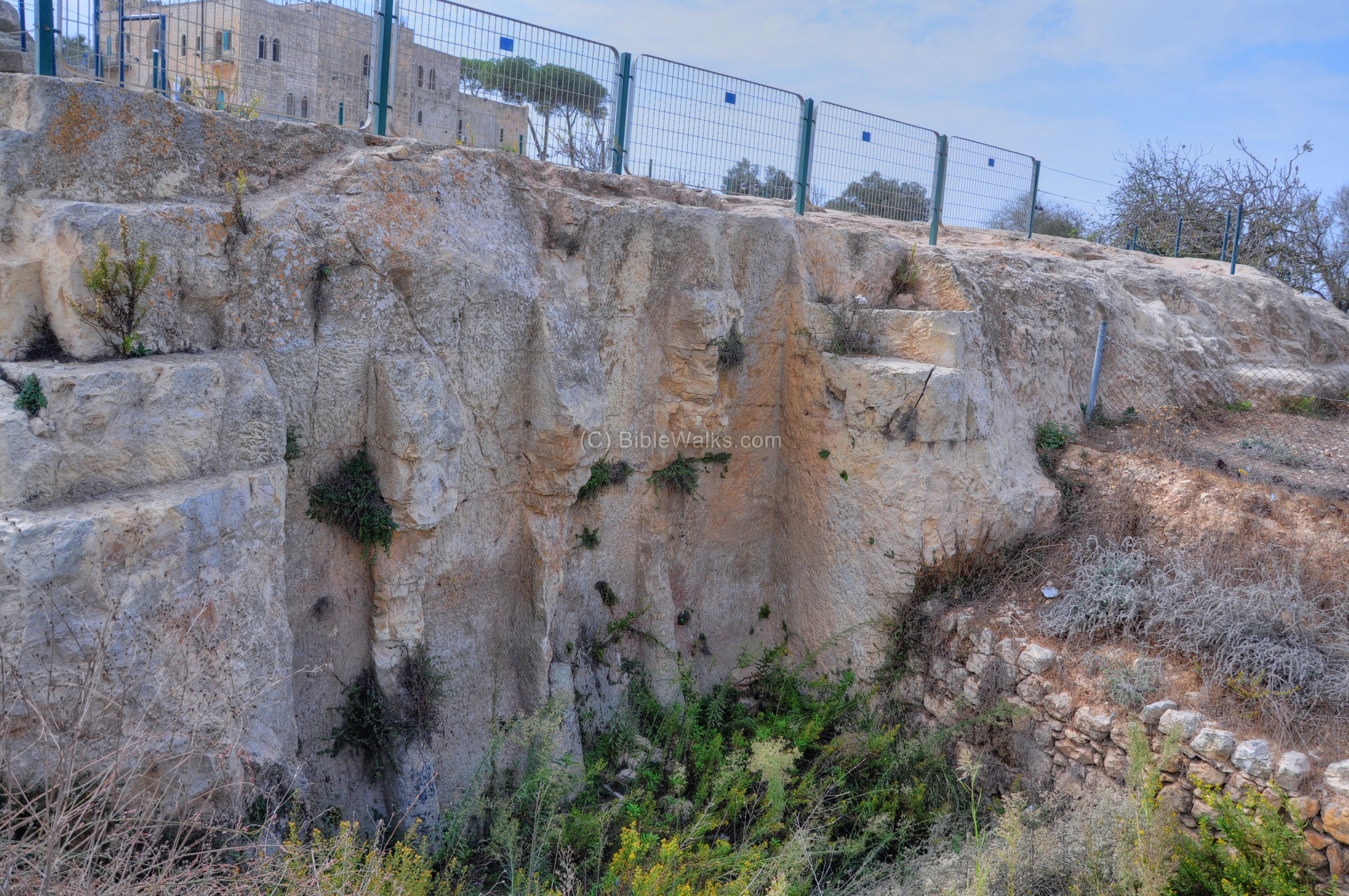
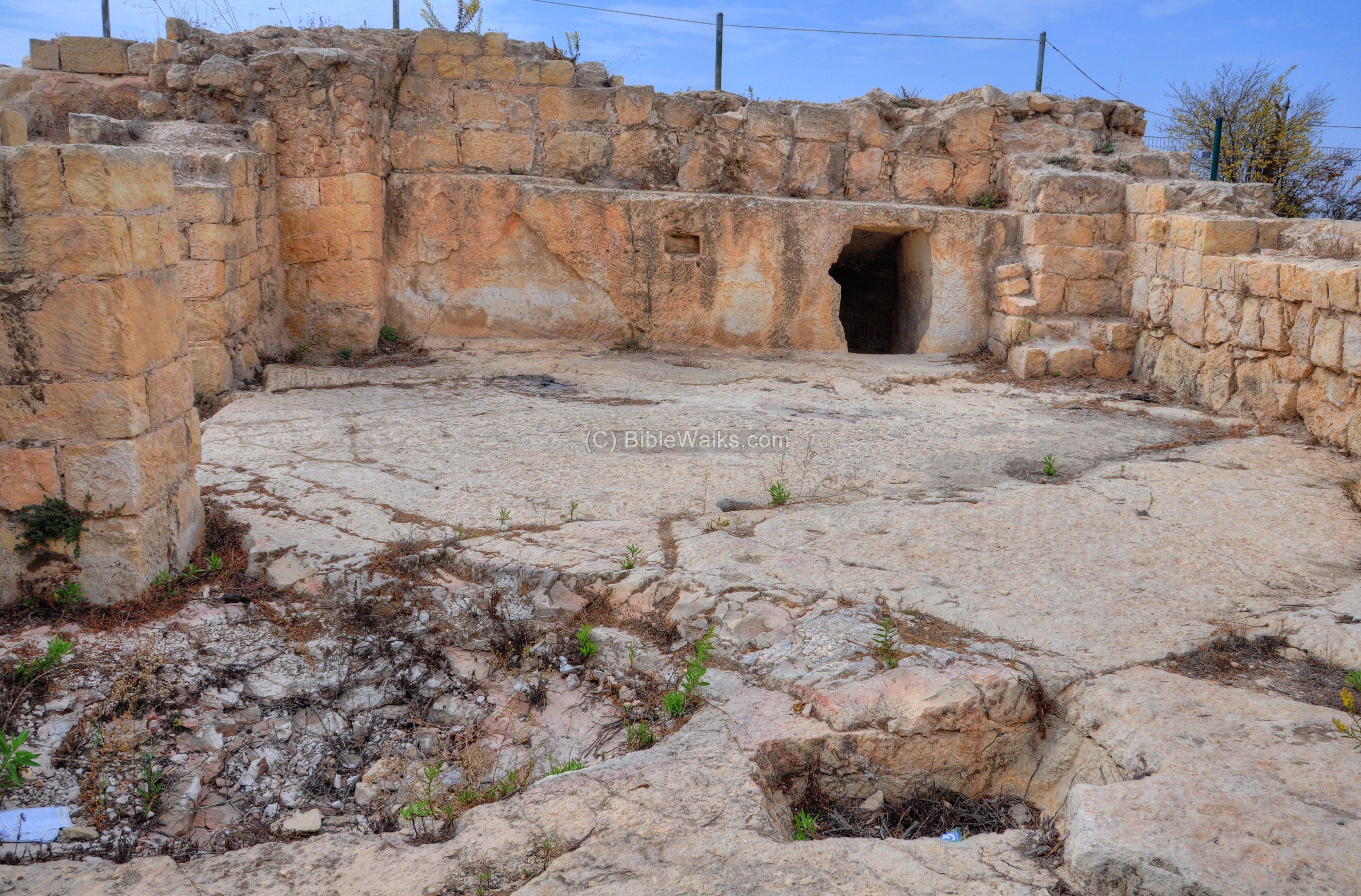
(c) East Walls and Moat:
The eastern side of the Crusader fortress was protected by walls and a deep dry moat. This side, which is 67m wide, is indicated as a red square on the illustration.
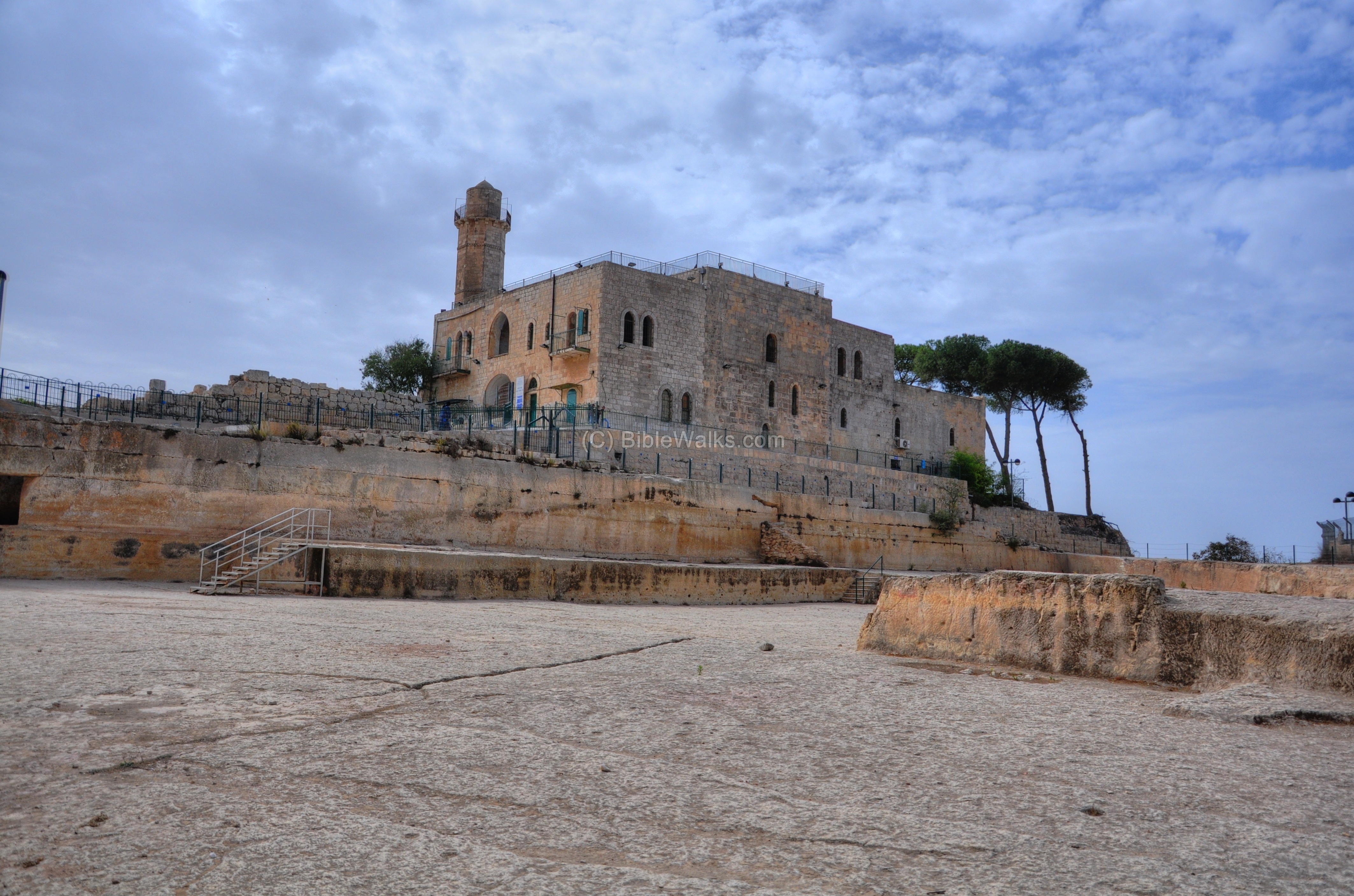
The south-east corner of the fortress is seen in the photo below. It shows the south wall and tower on the left side, and the eastern wall on the right side. Under the Crusader fortress is a lower level dated to the Hasmonean/Hellenistic period, while under that level is the oldest period of the site (Persian period).
Ruins of the inner eastern side of the Crusader fortress, right in front of the entrance to the mosque, are seen in the picture below.

The rock-cut moat along the eastern and north sides is 5m deep, creating a high cliff below the walls of the fortress.
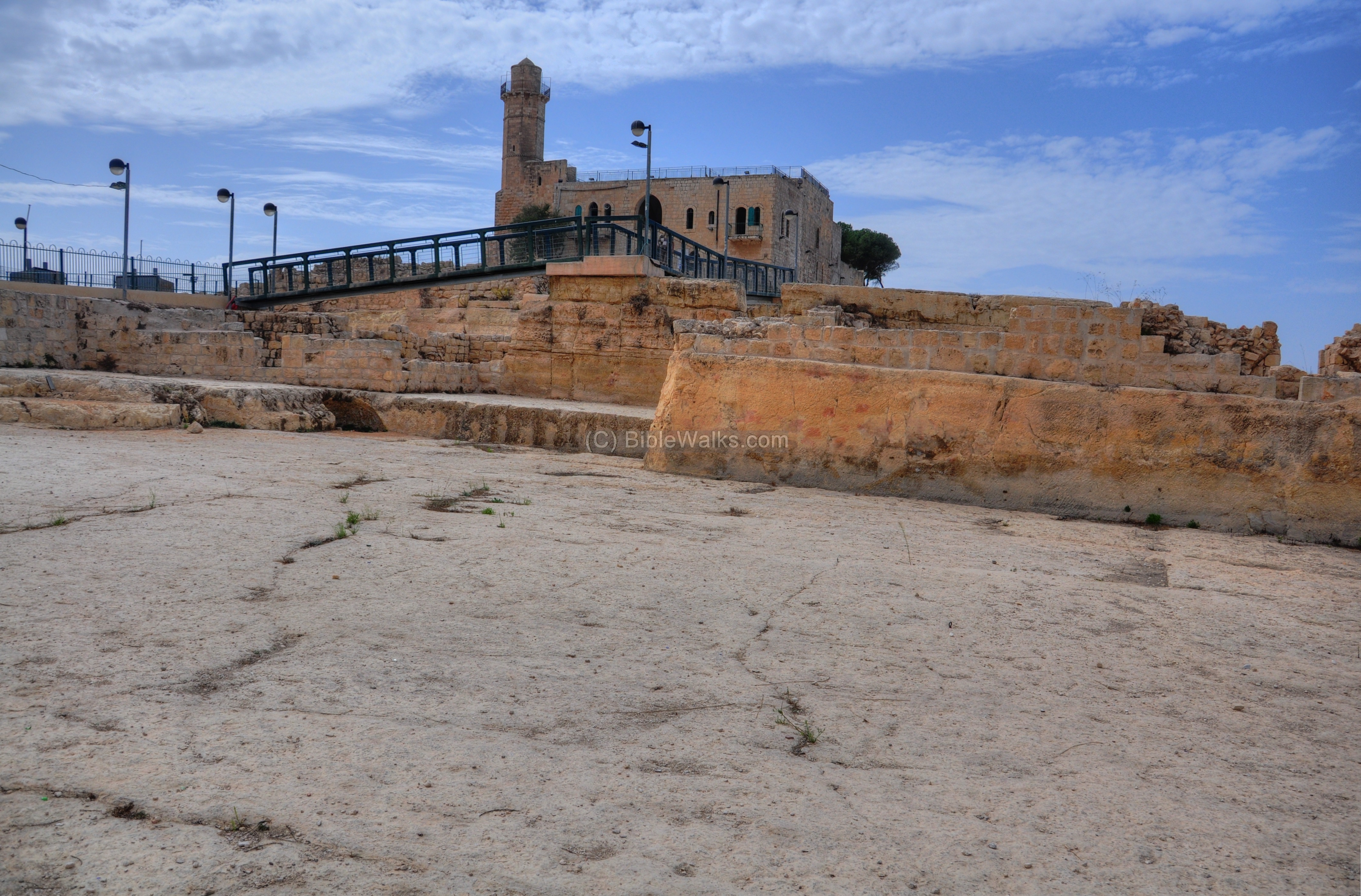
A modern pedestrian bridge was built on this north-east corner, enabling an easy access from the parking lot on the east side into the modern structure. During the Crusader period the entrance was from the other side.
The lower side of the dry moat is seen below. Notice how smooth are these rock cut surfaces.
A south view of the rock-cut moat is shown in the next picture, with traces of the wall above:
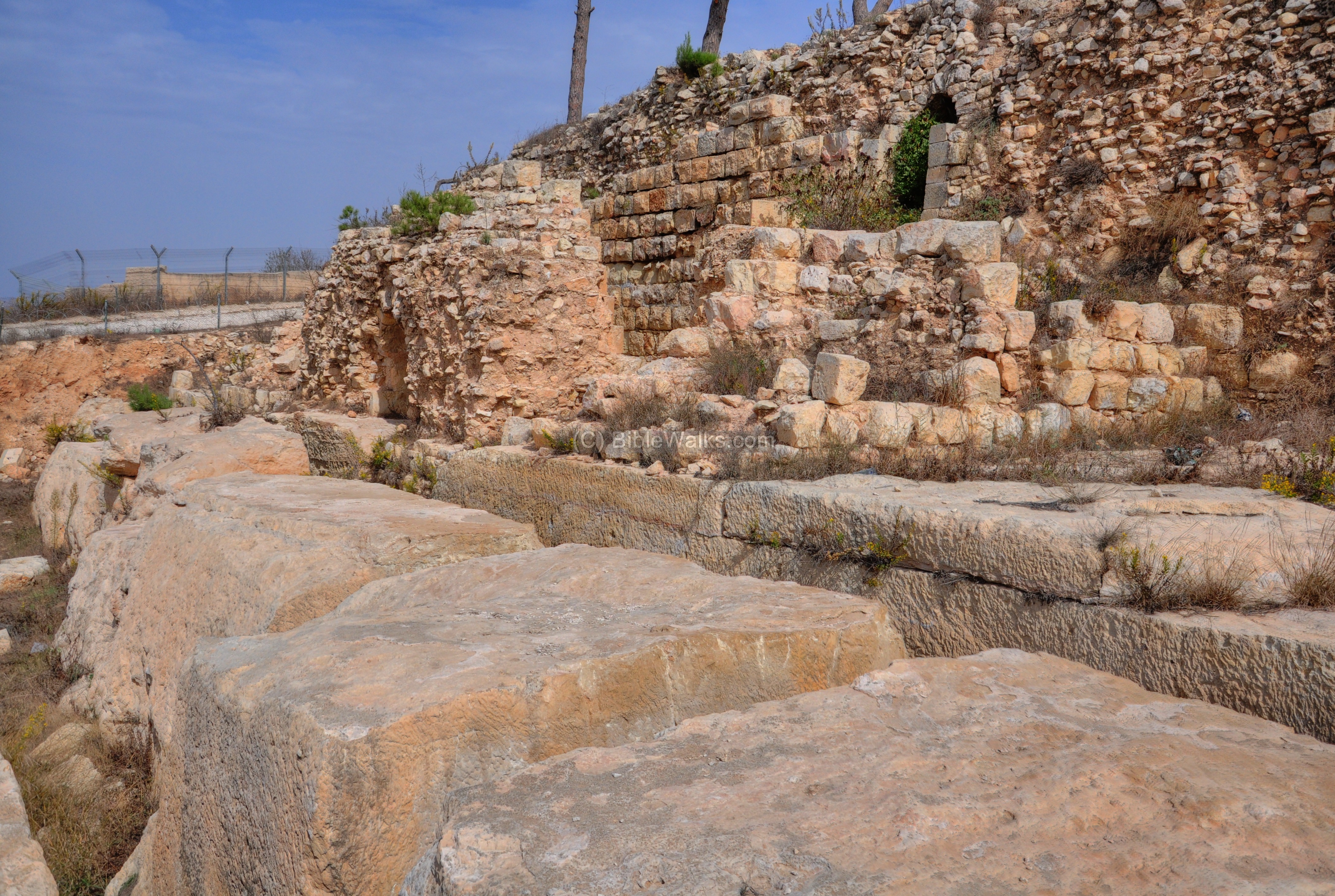
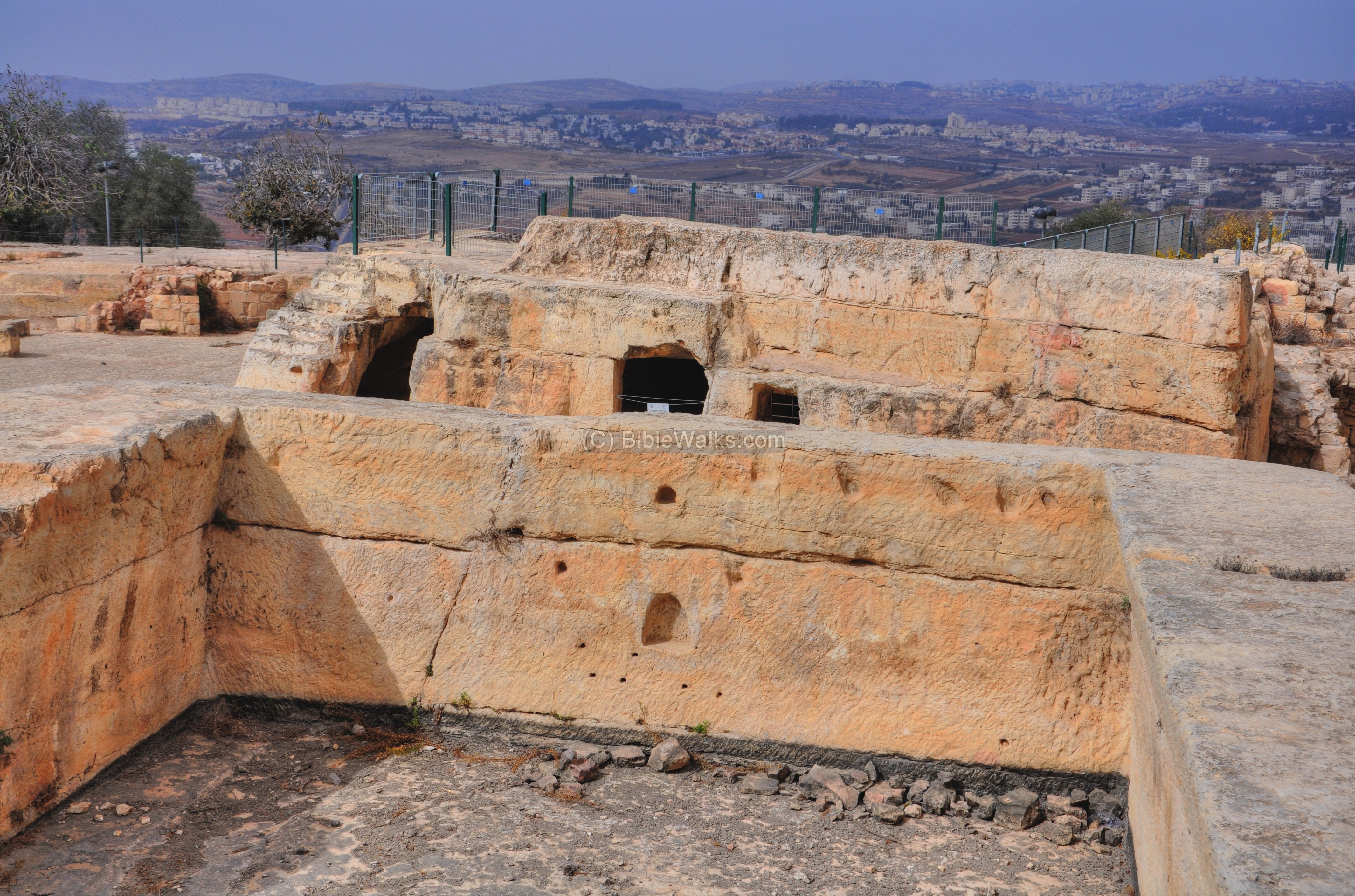
(d) North Moat and Open Area:
The northern side of the Crusader fortress was protected by walls and a deep dry moat. This side, which is 100m long, is indicated as a red square on the illustration.
The north side of the mosque is seen in the picture below. Only the remains of the moat remained from this side of the Crusaders fortress.
A view from the level of the mosque towards the north-east side is shown in the next picture. The moat in this area was enlarged to create the grounds of a large camping area (37m x 47m), which hosted the army, pilgrims and visitors to the fortress.

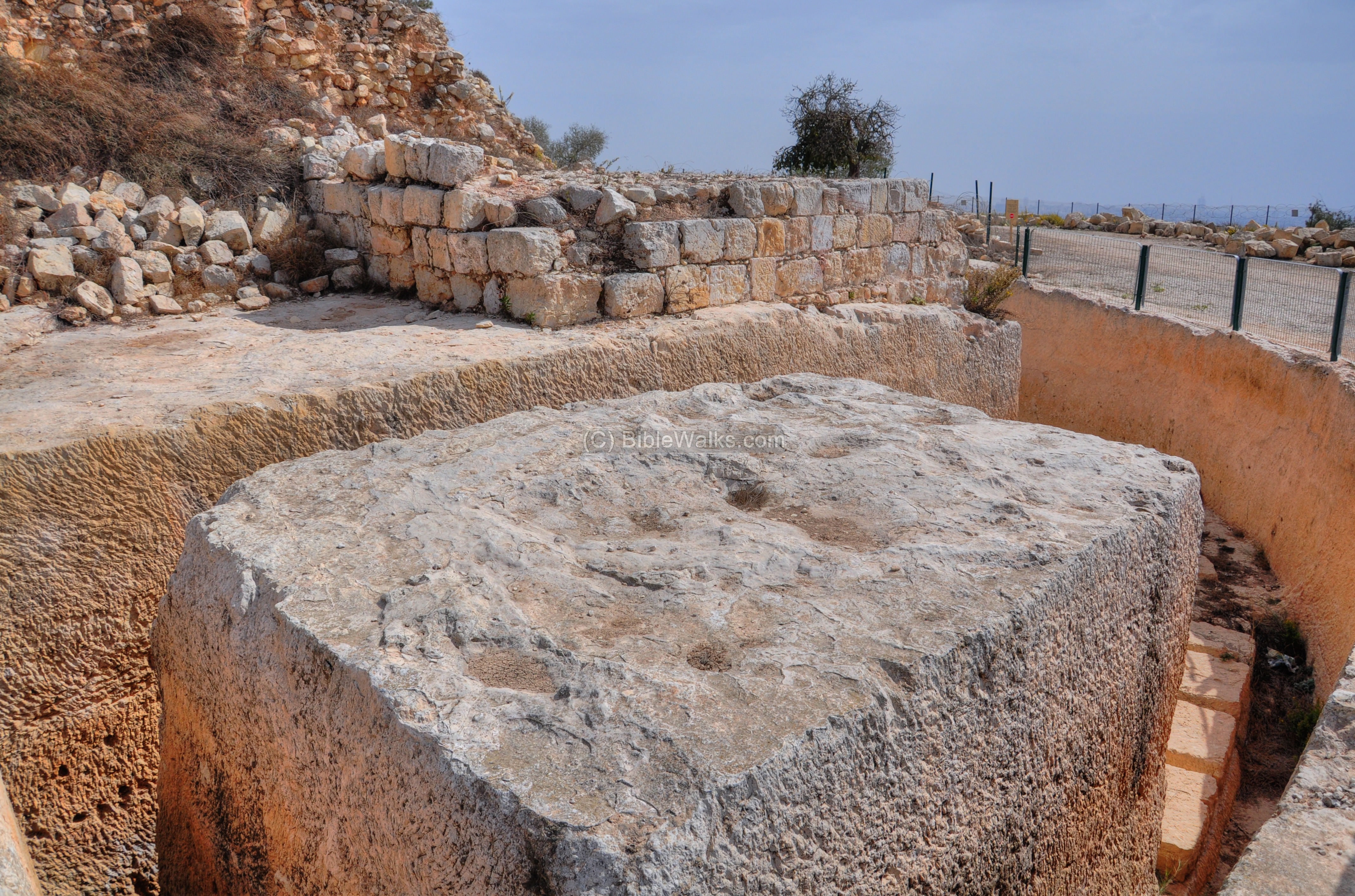
Another view of the camping area, with a view towards the west:
Several rock-cut blocks were left on the west side of the area. The tradition held that this was the altar of King Solomon – the “high place of Gibeon” where King Solomon made an offering and had a dream, asking God for wisdom rather than long life and riches (1 Kings 3 4-5): “And the king went to Gibeon to sacrifice there; for that was the great high place: a thousand burnt offerings did Solomon offer upon that altar. In Gibeon the LORD appeared to Solomon in a dream by night: and God said, Ask what I shall give thee”.
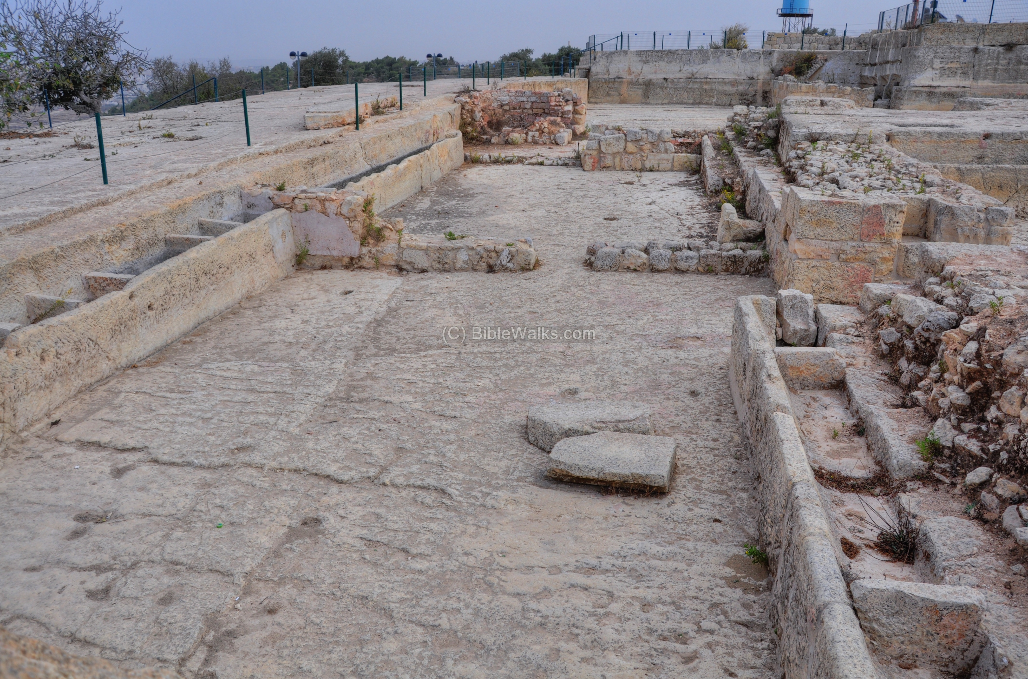
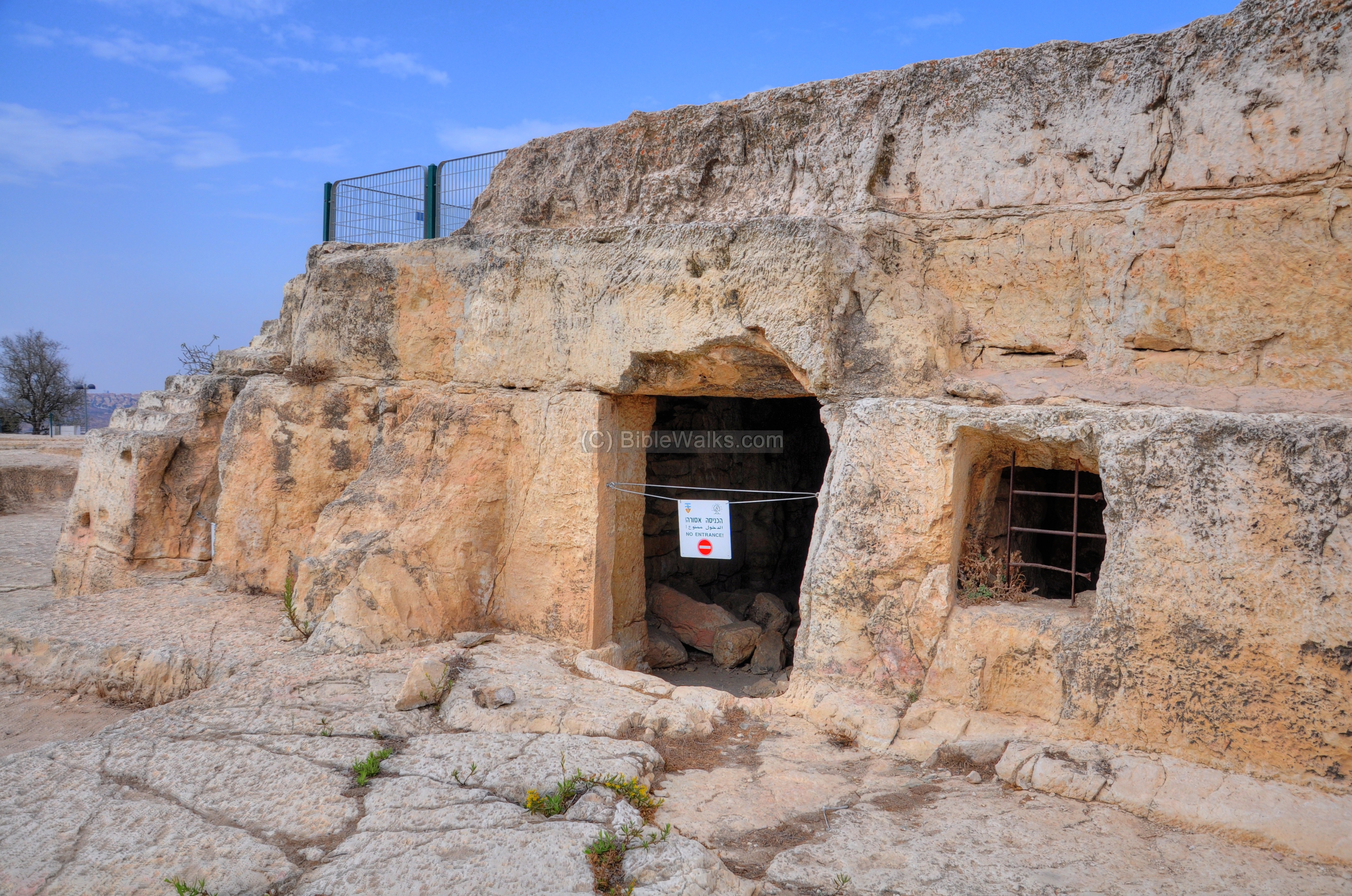
(e) North Stables:
On the north side of the open area is a large rock-cut stable, where the horses of the Knights and visitors to the fortress were kept.
Along the edge of the wall of the stable were rock cut troughs. Some of the basins were covered with plaster to hold the water supply.
On the far end of the floor is a rock cut sewage pipe which was used to clean the stable.

A view towards the east shows the extensive area of the stables.
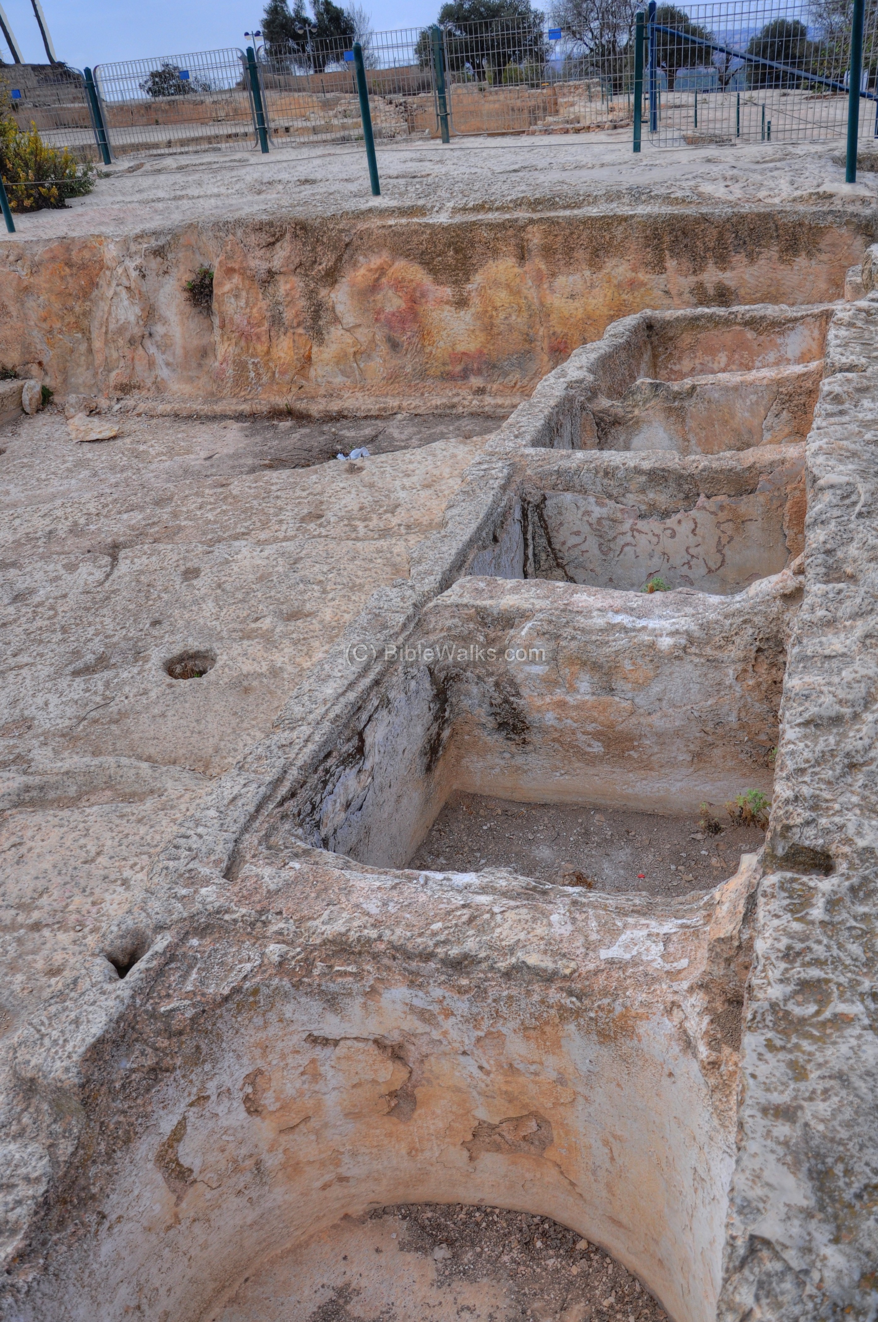
(f) North-East Stables:
A smaller stable is located on the north-east side.
A view from the podium above the stable:
A sewage channel was used to clean the stable with water.
The sewage channel passed through a hole in the wall and out to the north hillside.
(g) Water Installations:
In the camp area were a number of water cisterns and pools, which were needed to supply water for the army, pilgrims and horses. Rain water filled the cistern, which supplied water during the dry season. One of these cisterns is seen on the right side below.
Another cistern is located on the north-west side:
A large reservoir is located outside the camp area, on the northern foothills.
The Nebi Samuel spring, located on the northern foothills, has a year round water flow. Visitors come hear to pray and bath in the Holy waters of the tomb of Samuel.

(h) Structures:
A square rock-cut tower protected the camp area on the east.

A view from the top of the tower:
A closer view to the rock-cut structure:
The internal side of the structures:

Another side of the structures on the raised rock:
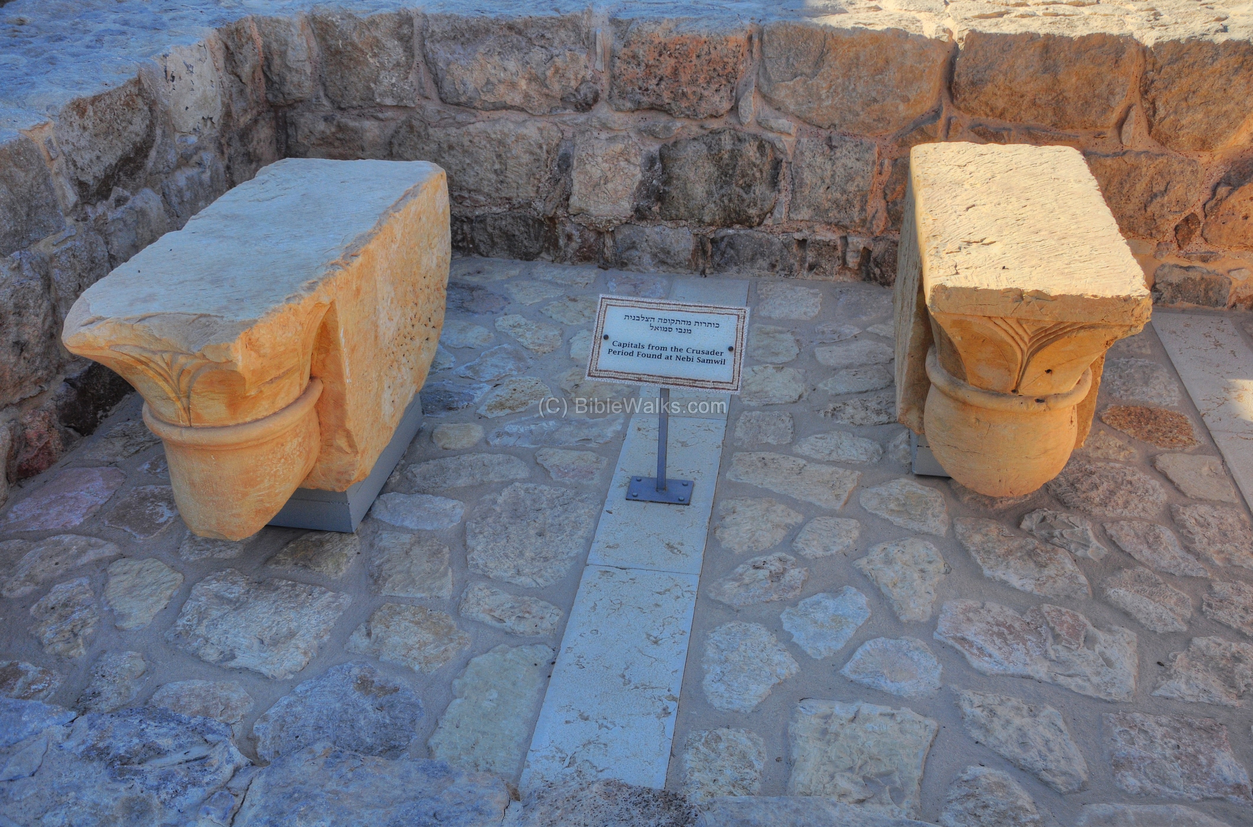
(i) Findings:
Capitals from the Crusader Period found in the excavations of Nebi Samuel are on display at the archaeological museum at the Inn of the Good Samaritan (Ma’ale Adummim).

Another view of the capitals:
Etymology:
- Mons Gaudii -Latin – “Mountain of Joy”, the Crusaders name of the site (named after their happy first sighting of Jerusalem)
Links:
* Archaeology:
* Other links:
- Gustav Dore – illustrations of the Crusaders (Wikimedia)
* Internal links:
BibleWalks.com – walk with us through the sites of the Holy Land
Nebi Samuel – Hasmonean <<<—previous site–<<< All Sites >>>—next site >>> Nebi Samuel – Ottoman/British
This page was last updated on May 31, 2014
Sponsored links: