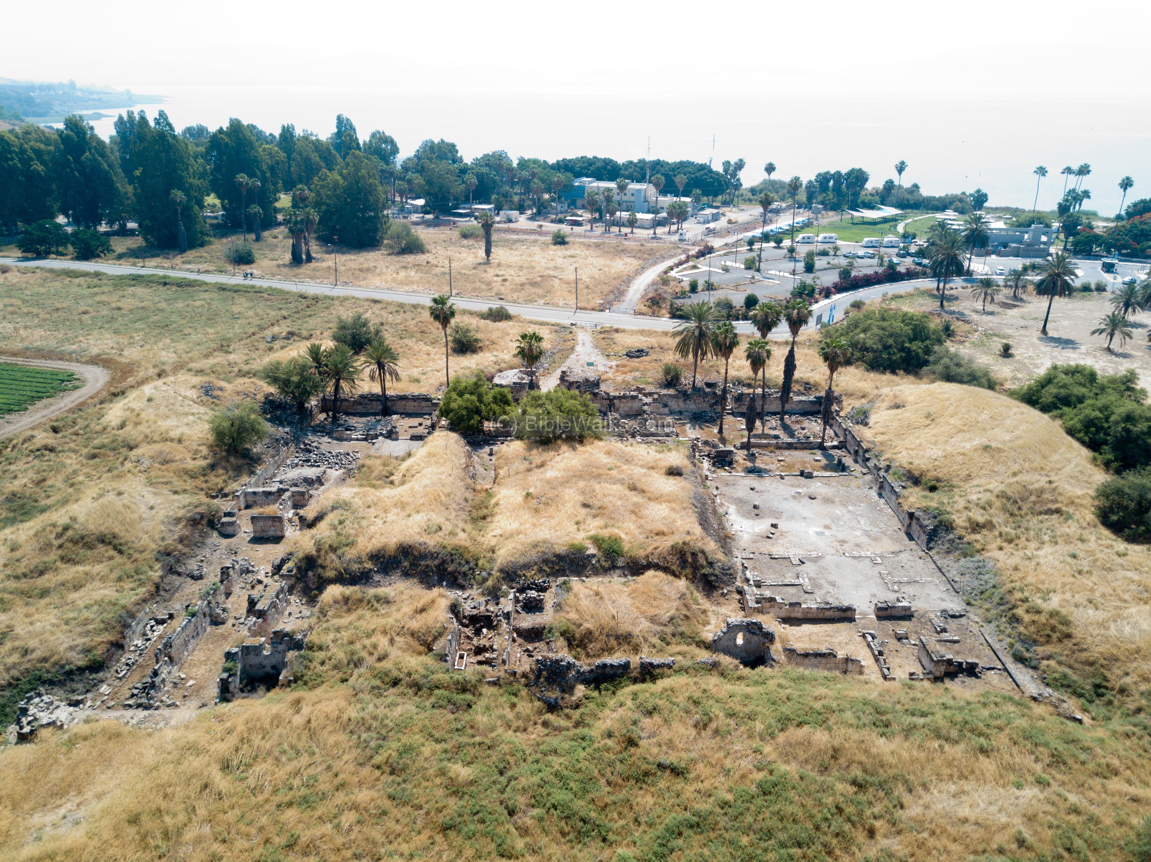
Ruins of a grand Omayyad palace , built in the 8th century AD south of Tel Kinneret.
Home > Sites > Sea of Galilee > Khirbet Minya (Horvat Minnim)
Contents:
Background
Location
Map
History
Photos
Videos
References
Etymology
Links
Background:
Ruins of an Early Muslim period palace on the route of the ancient road from Tiberias to the north of the Sea of Galilee. It served as a winter palace for the Omayyad rulers of Damascus.
A Khan (road hostel) was located nearby, closer to the hill of Tel Kinneret, but there are no traces of it today. It served the caravans from Damascus to Egypt.
Location:
The site is located at the north corner of the Sea of Galilee. While driving from Tiberias to Capernaum, after about 10KM and just before Tel Kinneret, there is a right turn to Karei Deshe youth hostel and Khurvat Minya. This road gets you to the entrance of Khirbet Minya.
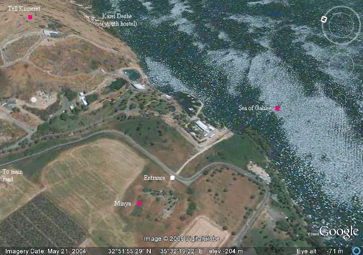
Aerial Map:
This is the aerial view of the area from the south. The ruins of the palace are are located in the field south of Tel Kinneret.
History:
In earlier times the site was located on the major road that connected Egypt to Syria. It is very close to Capernaum, which is located 3 Km to the east. Jesus must have passed this very spot several times on his travels from Capernaum to the Galilee, Nazareth, Judea and Jerusalem.
A Roman/Byzantine Jewish village called Ein-Te’ena (Hebrew for “Spring of the Fig”) is referred in the Talmud (4th century AD). It was probably located around the spring which is located closer to the hill. The Arabic name of the spring, Ein e-Tina (spring of the fig tree), preserved the name of the village.
In the 5th century AD a Byzantine structure was located in the area of Minya.
- Early Muslim
Minya is an early Muslim palace, built by the Omayyad Khalif caliph al-Walid I (705-715) from Damascus to serve as a winter palace. An inscription of this ruler was found on a stone in the palace. It was built over the a ruined Byzantine building. The size of the rectangular structure is 67m x 73m.
The palace was destroyed shortly after its construction in the severe earthquake of 749 AD that caused a havoc throughout the Galilee.
- Middle ages
During the Crusader or Mameluke periods a large scale sugar factory was constructed inside the ruins, one of many large scale production centers for cane sugar. Ruins of an oven were found on the south east side of the central courtyard. An aqueduct reached the structure as part of the cane crushing process. Ceramic vessels, used in the sugar manufacturing process, were found on the site. The factory continued to function for a long period, enriching the Crusader landowners.
In 1440 a Mameluke khan was built north of the ruined palace. It serviced the caravans and a tax collection station until the 18th century. The ruined structure is located inside the secured area of the water pumps.
- Ottoman period
Conder and Kitchener surveyed this area during the Survey of Western Palestine (SWP), commissioned by the Palestine Exploration Fund (PEF) in 1873. A section of their map is seen here. Kh. Minia is marked in the center of the map. The spring of ‘Ain et Tineh is located near it, as well as Khan Minia. Tell Kinneret (Kh. el ‘Oreimeh) is to the north of the site. Tabghah is farther along the shore.
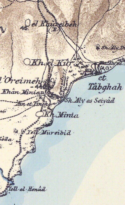
Part of Map Sheet 6 of Survey of Western Palestine, by Conder and Kitchener, 1872-1877.
(Published 1880, reprinted by LifeintheHolyLand.com)
In 1881 the surveyors wrote about the site (SWP, Vol 1, Sheet VI, pp. 403-404):
“Kh. Minia —A slight mound and traces of ruins, a few walls visible. The ruins extend over an area of about 100 by 200 yards. It is said that good stone for building can be procured by a little excavation here. There is no data for judging of what age these remains may be.
‘A short distance north of the spring is Khan Mini, almost a ruin, though inhabited by a few Arabs. The Khan was doubtless built for the convenience of travelers to Damascus, and is at least as old as the twelfth century, being mentioned by Bohaeddin in his ” Life of Saladin.’West of the spring are the ruins (Kh. Minyeh) which Dr. Robinson, the learned American traveler, identifies with Capernaum. They form a series of mounds, covering an extent of ground small in comparison with either those of Tell Hum or Kerazeh. We made some small excavations in these, but did not succeed in finding the remains of any building of great size. The walls were rudely built, and the fragments of pottery dug up appeared to be modern. There were traces of a thick wall surrounding the site. No fragments of columns, capitals, or carved stones were found in the ruins, nor could any be seen in the walls of the Khan, or round the tombs close by—a fact which seems to indicate that the ruins are of modern date, or at any rate never contained any building such as the synagogues or churches found elsewhere, as in all other places old material is invariably found built into the walls of later buildings where they are near old sites.’-Wilson, ‘Recovery of Jerusalem,’ pp 350. 351′
The site of Minia, or Minyeh, has been identified by Robinson, Macgregor, and Conder with Capernaum, which is placed by Dr. Wilson, Tristram, Colonel Wilson, and others at Tell Hum. Guerin identifies it with Bethsaida”.
They also described a khan to the north of Kh. Minia, that is now lost (SWP, Vol 1, Sheet VI, p. 394):
“Khan Minia —This is a ruined khan on the great Damascus road, similar to Khan Jubb Yusef and Khan et Tujjar. It is now in ruins, and is not used. There are still a few chambers round the courtyard, showing it to have been very similar in plan to Khan Jubb Yusef. It faces due north and south, and is 192 feet long, by 165 feet east and west. The entrance was by a handsome gate in the centre of the southern side.
Basaltic stone was principally used in the construction, and white limestone was employed as ornament”.
- British Mandate
A section of the 1940s British map shows the area around the site (Kh. Khan Minya). The spring ‘Ein et Tina is on the south side of Tel Kinrot (Kh. ‘Ureima). A khan (Kh. el Khan) is located north of Minya, on the side of the road from Tiberias to the North.
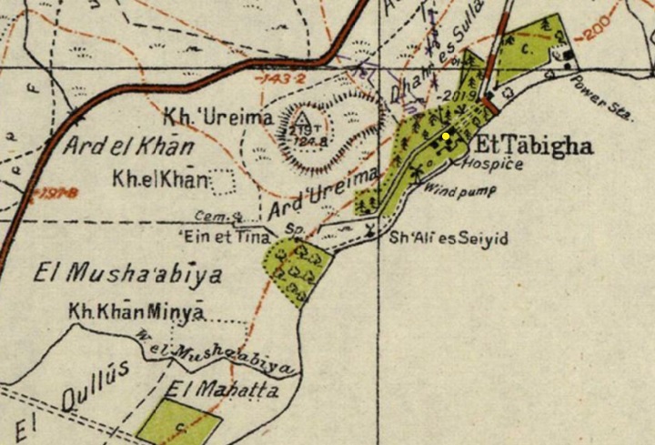
British survey map 1942-1948 – https://palopenmaps.org topo maps
License: public domain under the UK Copyright, Designs and Patent Act 1998
- Modern period
The ruins of Kh. Minia were first excavated in 1932–1939 by E.A. Mader and O. Puttrich-Reignard, on behalf of the German Görres Society and the Museum of Islamic Art of Berlin. Some of its excavated items are on display in the museum in Berlin.
The excavated ruins are open to the public.
Photos:
An aerial view of Khirbet Minya was captured in 2017 by a drone from the west side. The Sea of Galilee is seen in the background.
Click on the photo to view it in higher resolution…
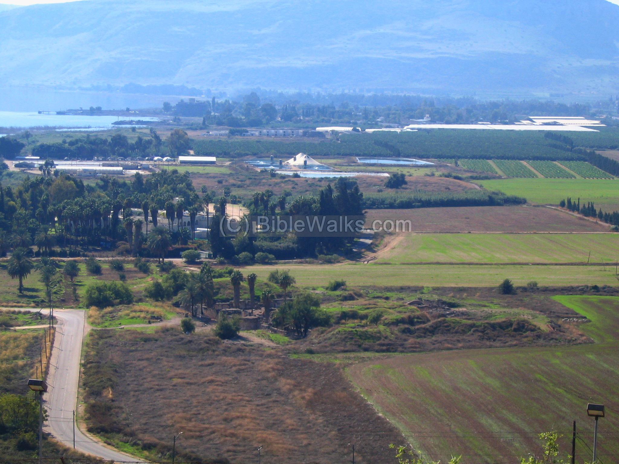
A view of the site from Tel Kinneret, seen in the center of the next image. In the background is Ginnosar, and behind it – the Arbel Cliffs on the right and the sea of Galilee on the left.
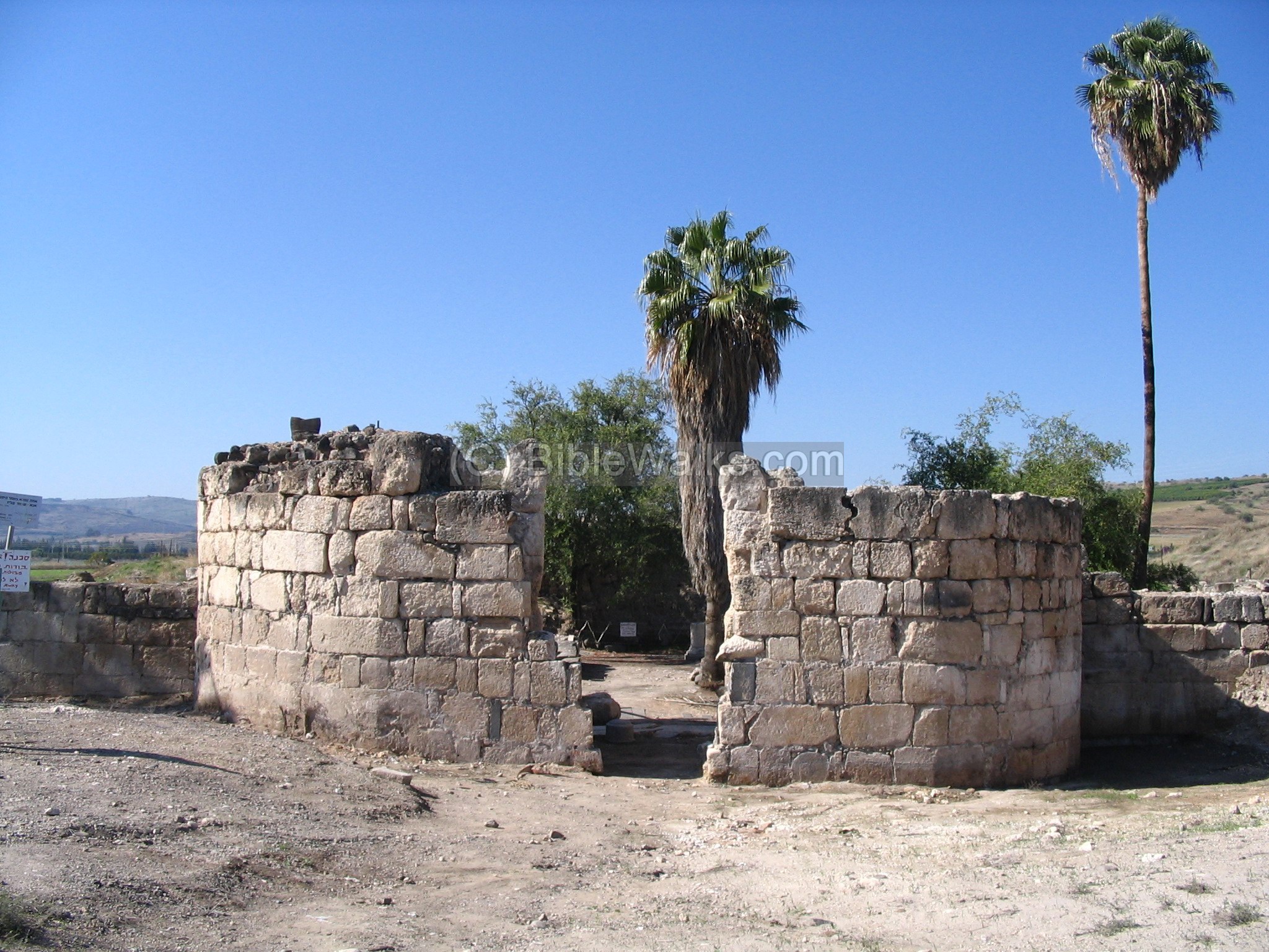
This is the entrance to the palace from the sea (east) side:
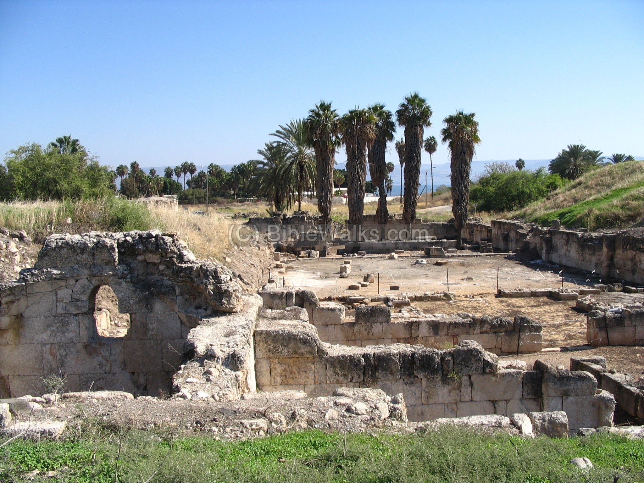
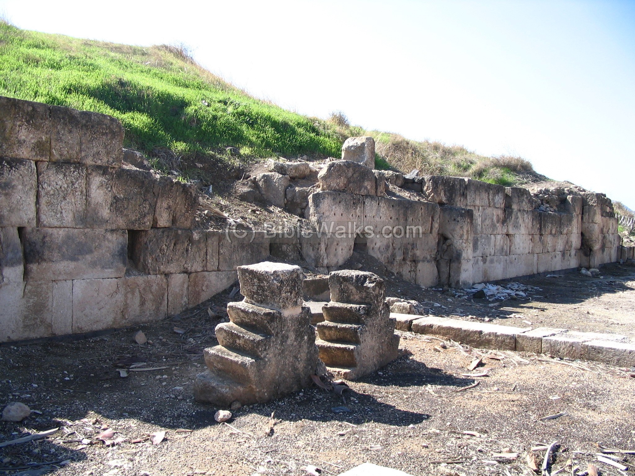
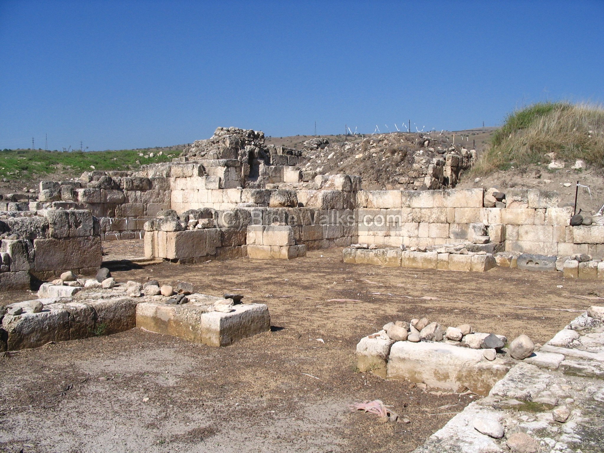
On the south side – the ruins of the palace:
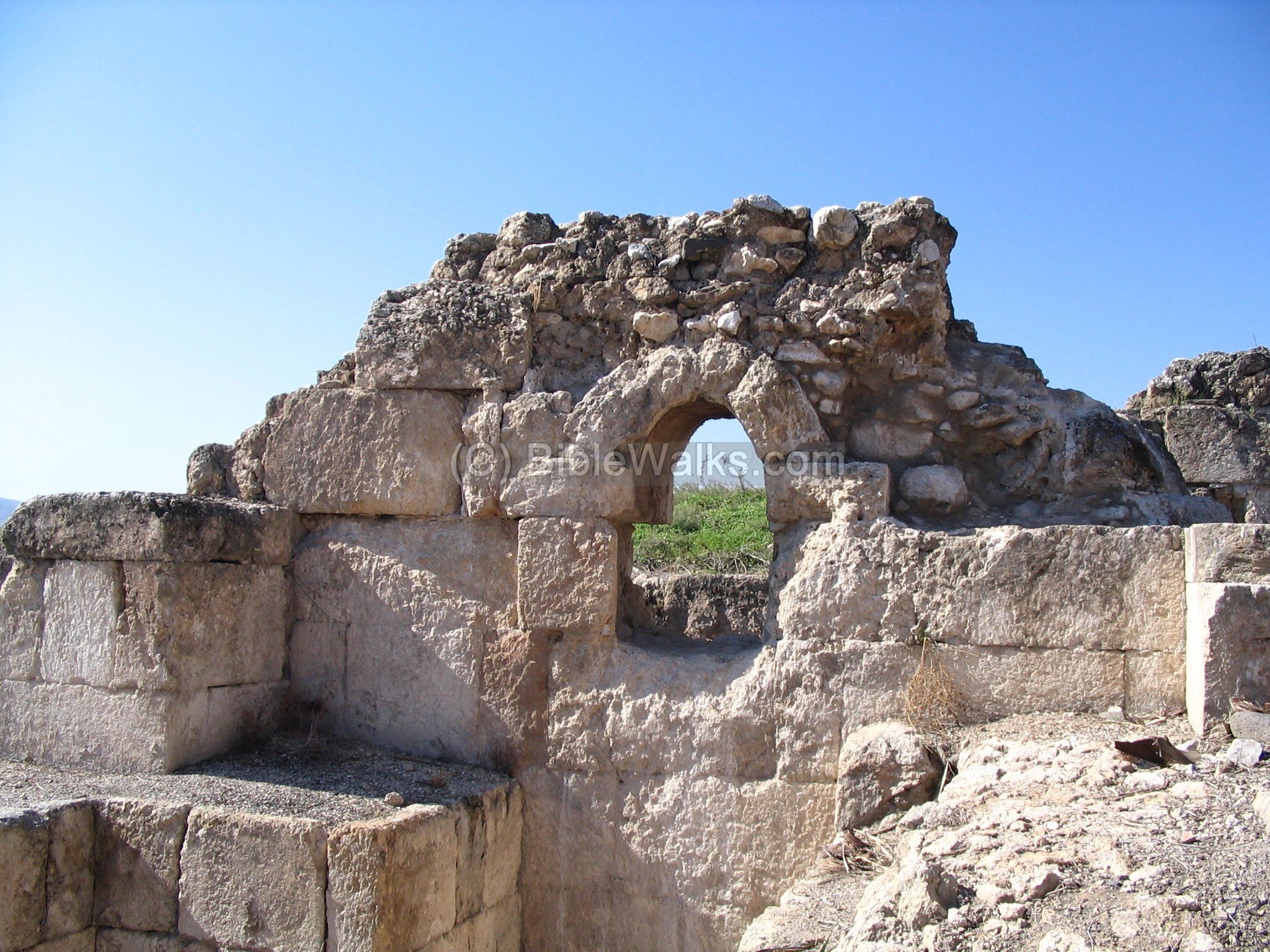
The view of the palace on the west side:
West side window:
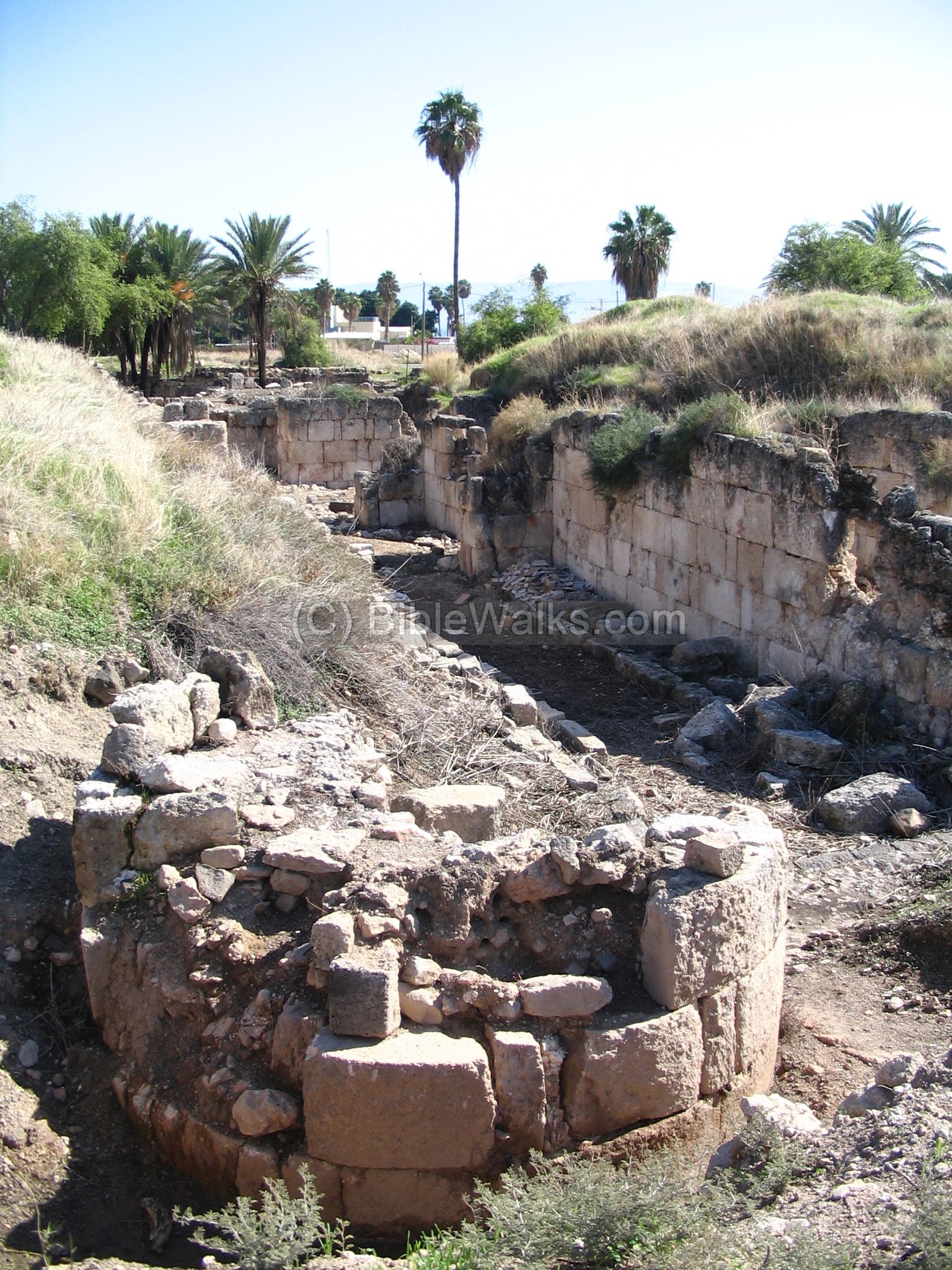
View of the palace from the west side is in the next photo. The sea of Galilee is seen behind the palm trees.
A view of the north side of the palace:
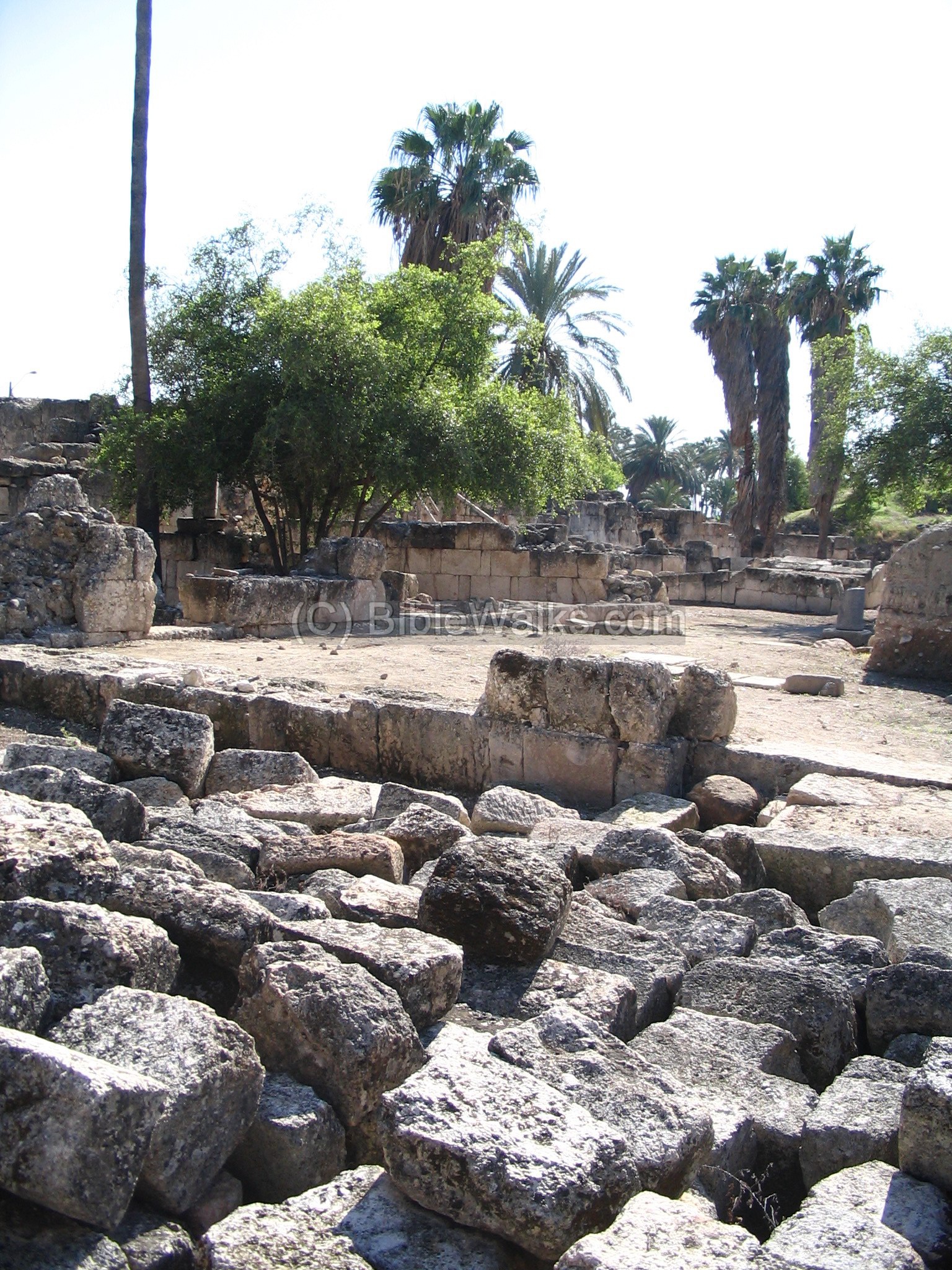
View of the east side of the palace:
Videos:
![]() The following YouTube video shows a flight over the site (captured June 2017):
The following YouTube video shows a flight over the site (captured June 2017):
The following video captured a tour of the ruin (captured Feb 2025):
Other References:
(a) “Haifa” Dec 26 24, 1884
- Laurence Oliphant “Haifa, or Life in Modern Palestine”
His article was published on Dec 26, 1884, with the title “Sea of the Galilee”, where he tells his readers about his visit to the site of Minya. At his times the scholars still debated whether Minya was Capernaum, the city of Jesus, or was it located in the ruins north-east to Minya, called Tell-Khum. His opinion that Minya was not the city of Jesus, and he later visited the ruins of Tell-Khum.
It is a recommended book for the period of rediscovering the Holy Land.
(b) “The Land and the book” W. M. Thomson
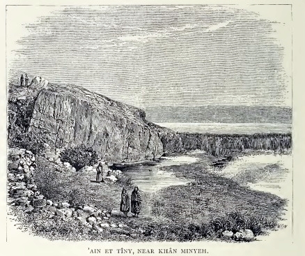
In this traveler’s book of 1861 (“The Land and the Book” Volume 2) he wrote about the spring near the site, on the south side of Tel Kinneret, named ‘Ain et Tineh (Tiny). Thomson wrote about it (p. 408):
“’Ain et Tiny is the most northern fountain of the plain, but so low and so near to the lake—on the shore, in fact—that it could not have been extensively used. That portion of the plain is not so well watered as the southern, and the stream from ’Ain et Tabi-ghah appears to have been brought into that region to supply the deficiency. In the summer-time all the streams which enter the plain disappear before they reach the lake….”.
Thomson’s illustration of the spring and Tel Kinneret behind it (p. 412):
“’Ain et Tiny is the most northern fountain of the plain, but so low and so near to the lake—on the shore, in fact—that it could not have been extensively used. That portion of the plain is not so well watered as the southern, and the stream from ’Ain et Tabi-ghah appears to have been brought into that region to supply the deficiency. In the summer-time all the streams which enter the plain disappear before they reach the lake….”.
He continued describing the aqueduct found above the spring (p. 415):
Lieutenant Kitchner adds: “Round the southern brow of this hill [above ’Ain et Tiny], where’the rock runs steeply down to the lake, is the rock-cut aqueduct now used as a road, and described by Major Wilson. It is fifty-two feet four inches above the sea, which is almost perpendicularly beneath it at one part, and has a fall of seven feet in the mile: the water would not have been carried far on the plain, but would have watered the gardens round Khurbet Minyeh.”
Etymology (behind the name):
- Minya, Minyeh – this name may have originated from the Greek word “moni” – a dwelling.
- Horvat Minnim – the Hebrew name of the ruins.
Links:
* External:
- Excavations (2005) – press release (in Hebrew)
- Horvat Minnim – Hans-Peter Kuhnen, Miriam Pines and Oren Tal [Hadashot Arkheologiyot V130 2018]
- Discover Islamic art – Berlin
- Archaeological destruction layers – Erez Hassul (pdf 125 pages; 2015) – see pages 17-25 on earthquake damage to Horvat Minnim
* Internal:
- Drone Aerial views – collection of Biblical sites from the air
- Earthquakes
* Nearby sites:
- Tel Kinneret – site above Horvat Minya
- Lower Tsalmon stream – mills, probably where the sugar canes were processed
- Skull cave, Amud stream – prehistoric cave
BibleWalks.com – walk with us through the sites of the Holy Land
Tell Kinneret <<<–previous site—<<<All Sites>>>–-next Sea of Galilee site –>>> Hammat Gader
This page was last updated on Nov 22, 2025 (add link)
Sponsored links: