Ruins of a Roman and Byzantine fishermen village located along the shore, south of Rosh Hanikra. May have been the Biblical area of Misrephot-Maim.

Home > Sites > Upper Galilee > Khirbet Masref (Musheirifa)
Contents:
Background
Location
Aerial map
History
Photos
Biblical
Etymology
Links
Background:
Khirbet Masref is the ruins of a Roman period village on the shore of the Mediterranean Sea, 1 KM south of Rosh Hanikra – the Israeli-Lebanese border.
This site may have been the area called ” Misrephothmaim” in the Bible, as described in the book of Joshua. (Joshua 11: 8): “And the LORD delivered them into the hand of Israel, who smote them, and chased them unto great Zidon, and unto Misrephothmaim”
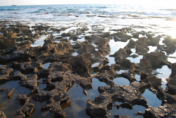
The site is also perfect for walking, fishing, and sightseeing – enjoying the interaction between the sea and the sandstone rocks.
Location:
The ruins are located on the shore, along the boardwalk that leads to the coastal entrance to Rosh Hanikra. You can reach the parking lot near the site from either the road from Kefar Rosh Hanikra , or from the coastal road from Achziv.
Most of the ancient village is buried under the sand and is located east to the road.
The site is worth a visit since the scenes of the rocks along the sea are breathtaking.
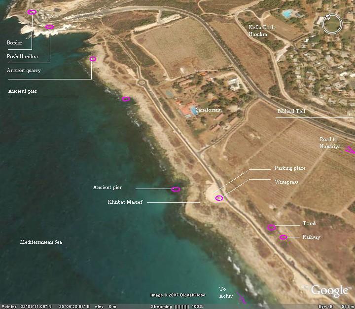
Aerial Map:
An aerial photo of Khirbet Masref and the area around it is shown below, indicating the major points of interest.
History:
- Biblical
The area was (probably) mentioned in the description of Joshua’s conquest (12-13th century BC), where the Bible described the northern area where he chased the Canaanites. Joshua 11:8: “And the LORD delivered them into the hand of Israel, who smote them, and chased them unto great Zidon, and unto Misrephothmaim, and unto the valley of Mizpeh eastward; and they smote them, until they left them none remaining”. The term “Misrephot-Maim“, is identified by some scholars as the salt industry at this site, south of Rosh Hanikra.
Note that a large Tell is located on the south-west side of Kibbutz Rosh Hanikra, and dated to the Bronze age. Today it is totally destroyed. This may have been the main city at the Biblical times.
- Roman/Byzantine
The village was established at the Roman period. The villagers were fishermen, rock cutters, farmers and exported wine. They also provided services to the Roman coastal road that connected Acre and Antiochia, which passed nearby.
- Modern times
Kibbutz Rosh-Hanikra was established in 1949, 1KM east to the site.
The site is totally ruined with few traces of its structures still visible. Most of Khirbet Masref is covered by the sand, and other parts were damaged. A boardwalk and road were constructed and pass at the site, making it easier to enjoy the view of the dominating white cliffs of Rosh-Hanikra, the rocky beach, the sun and the sea.
Photos
(a) General view:
A view from the north, on top of the Rosh Hanikra cliff, shows the shore of the Mediterranean sea. Khirbet Masref is located on the upper center. On the left side is a path of the railway, which then enters below the cliff.
Click on the photos to view in higher resolution…
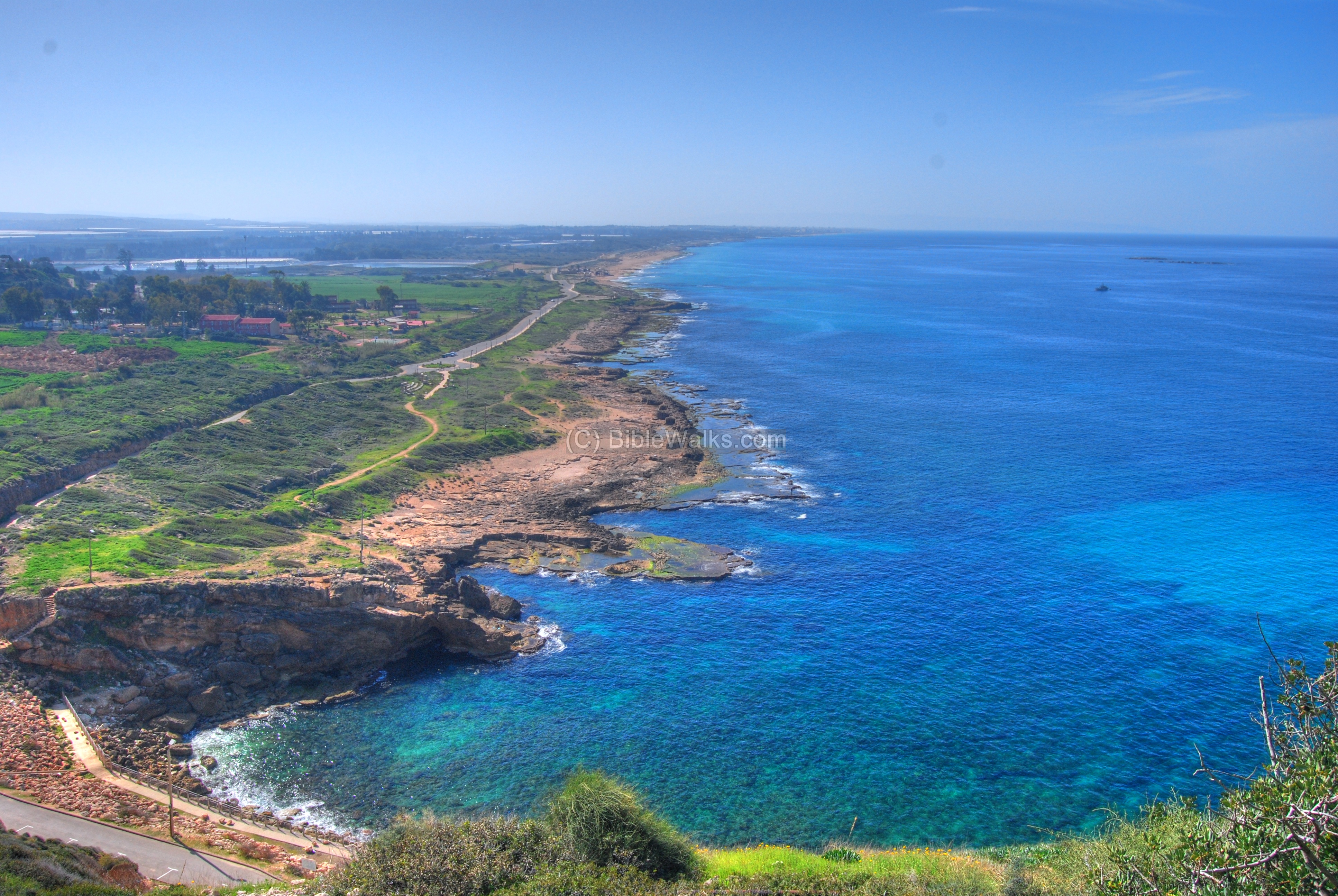
A detailed view of Khirbet Masref (west) is seen below. Along the rocky beach are quarries, ancient piers, and traces of ruins.
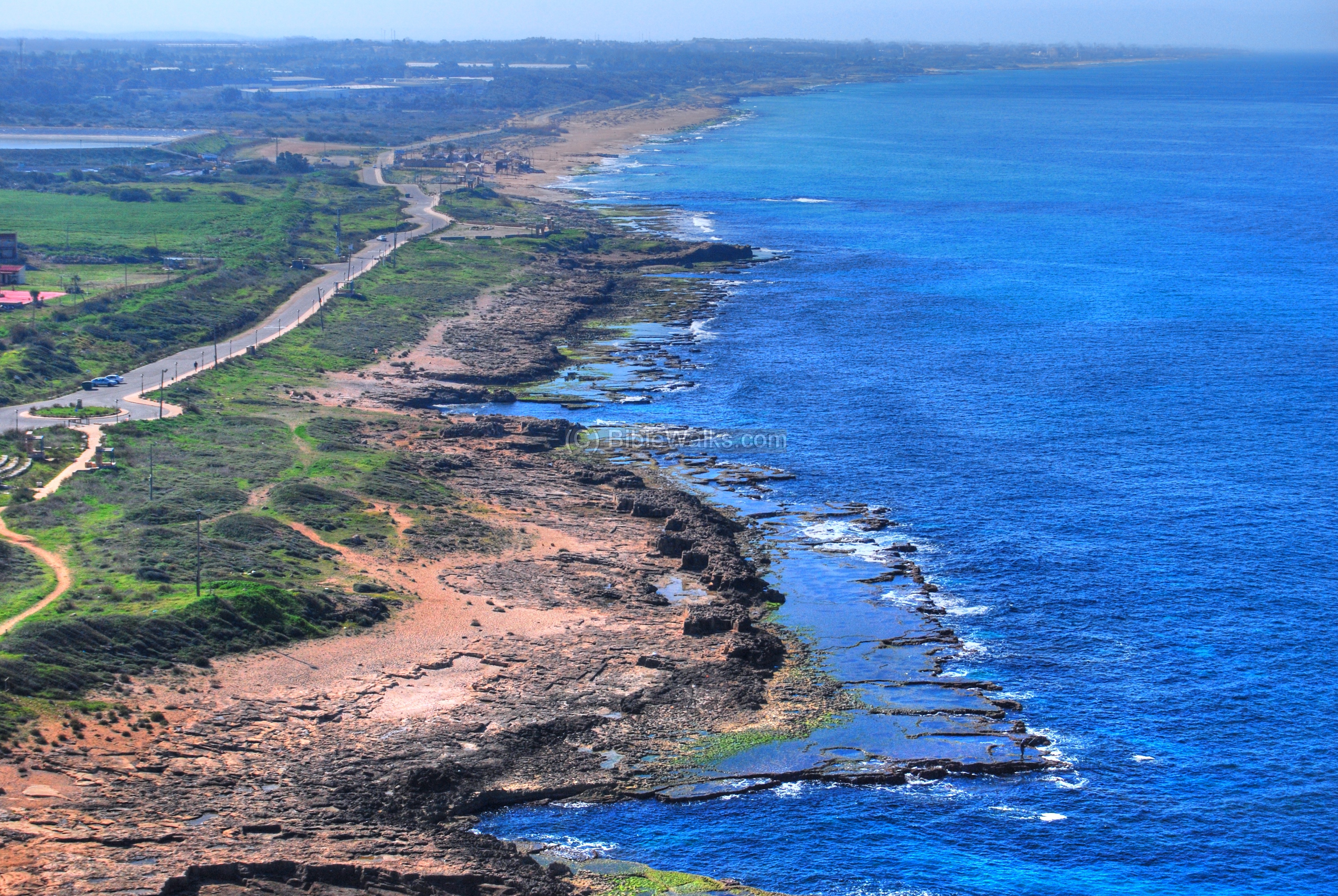
(b) The shore:
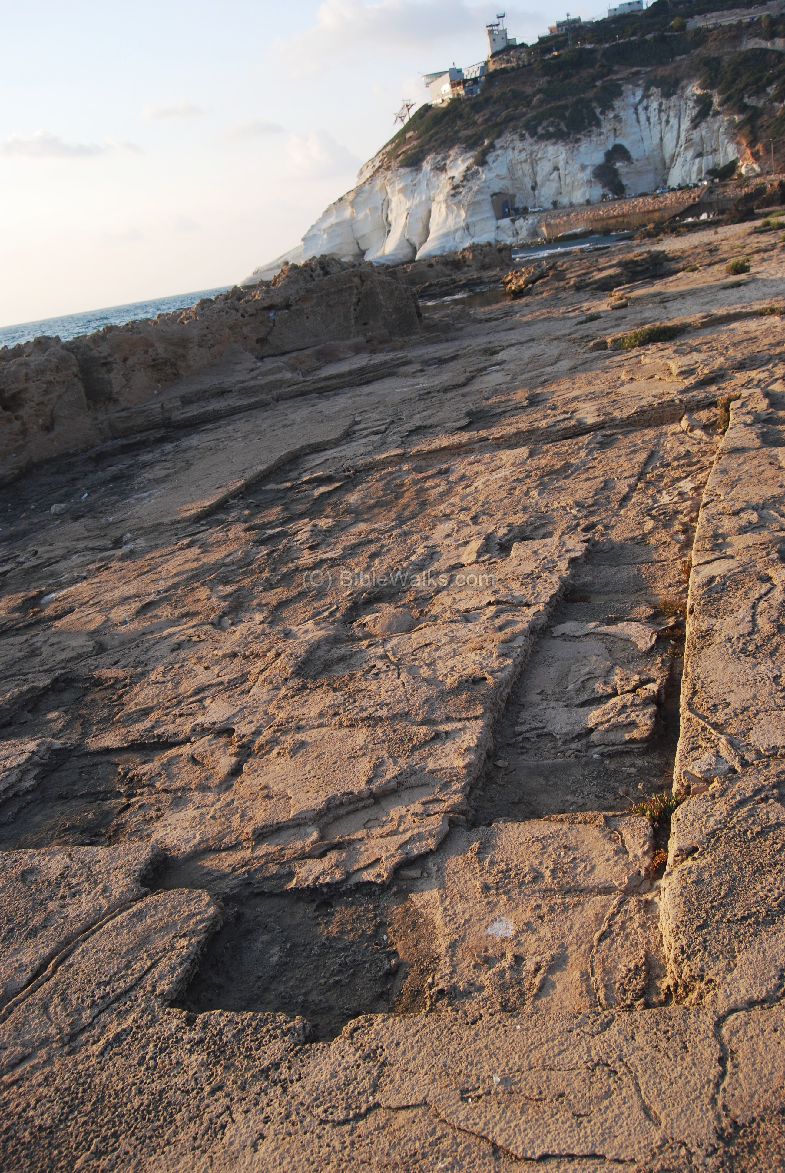
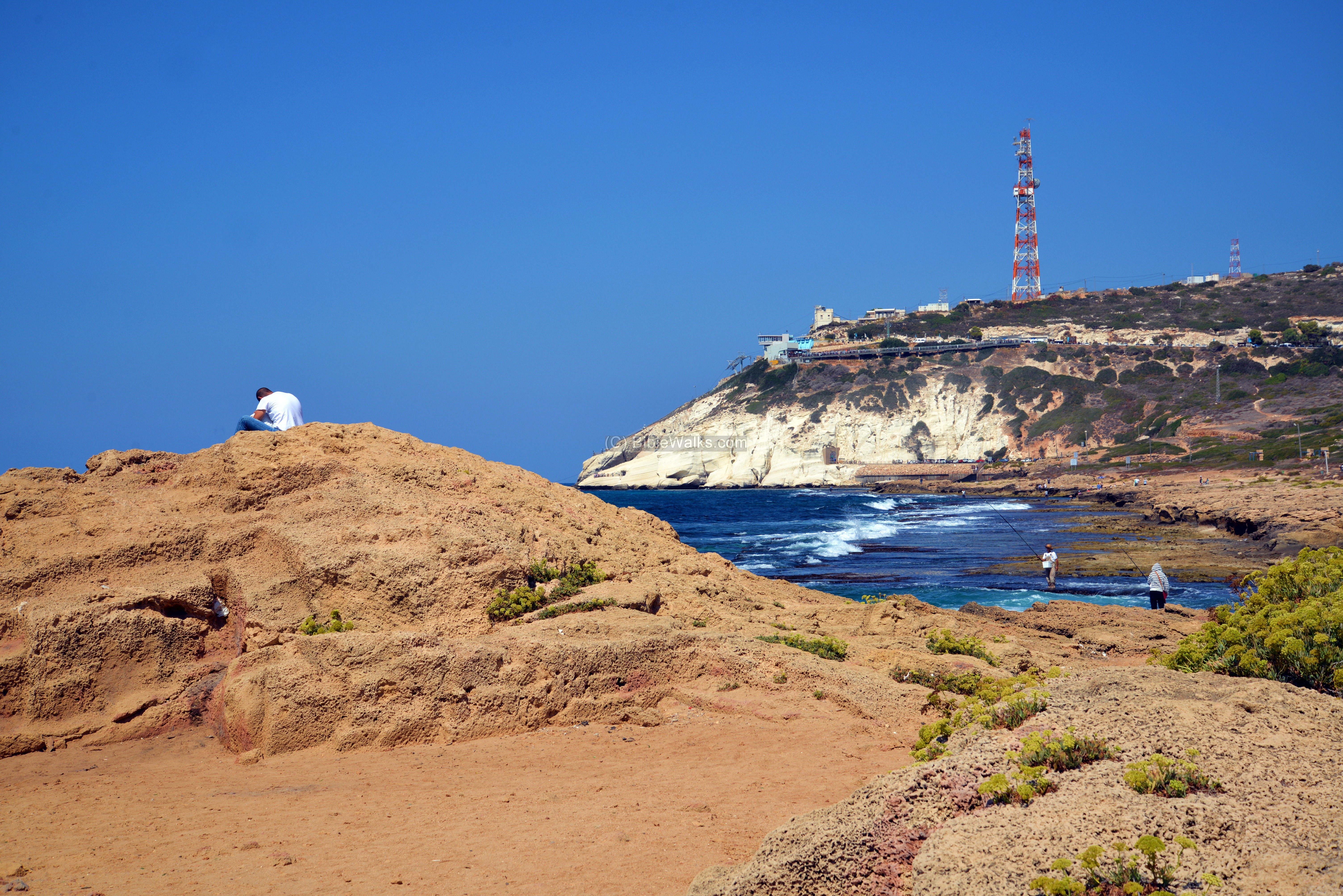
The photo below, taken towards north, shows the shoreline near the site. In the center background is Rosh Hanikra, or the “head of the grotto” – the white chalk cliffs on the left edge of the hill. The hill, called Sulam-Tsor (“the ladder of Tyre”), extends from this point to the east along the northern border of Israel.
The ancient road that once passed here used to climb up the hill towards Tyre and Sidon. The railroad, from the period of the British Mandate, passed this white chalk hill in a tunnel.
Click on the photos to view in higher resolution…
Another view of the area near the site.
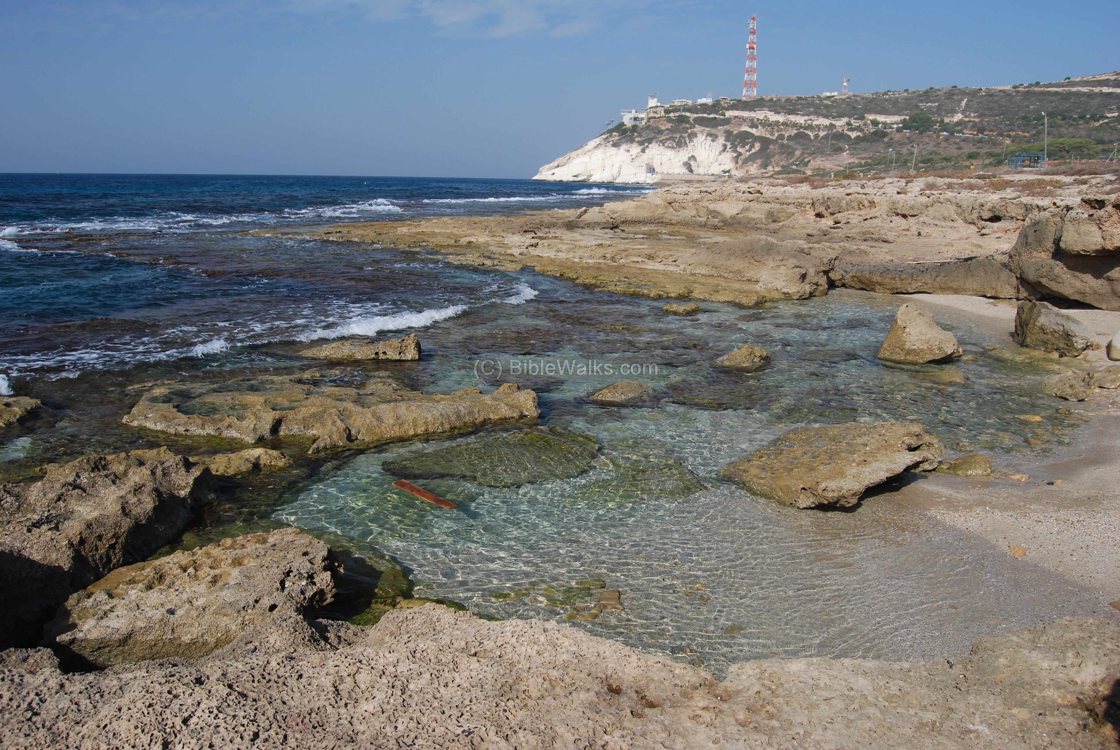
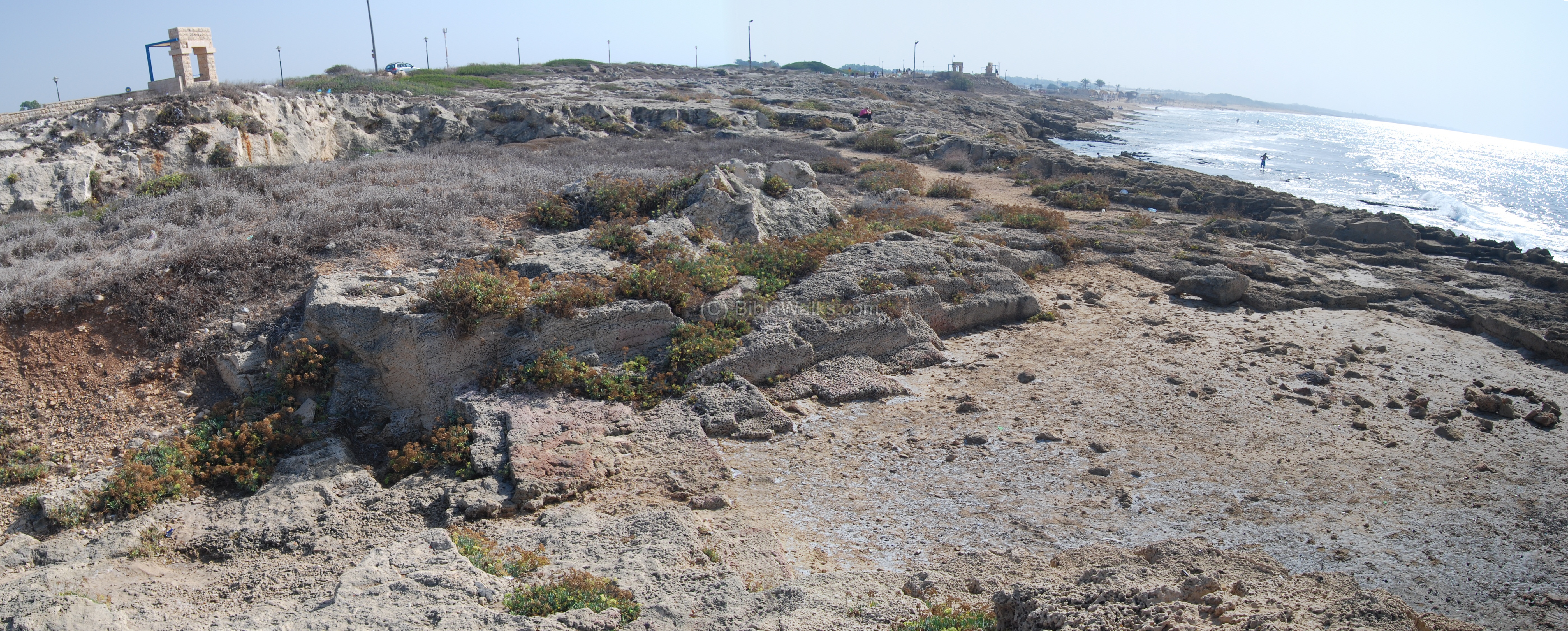
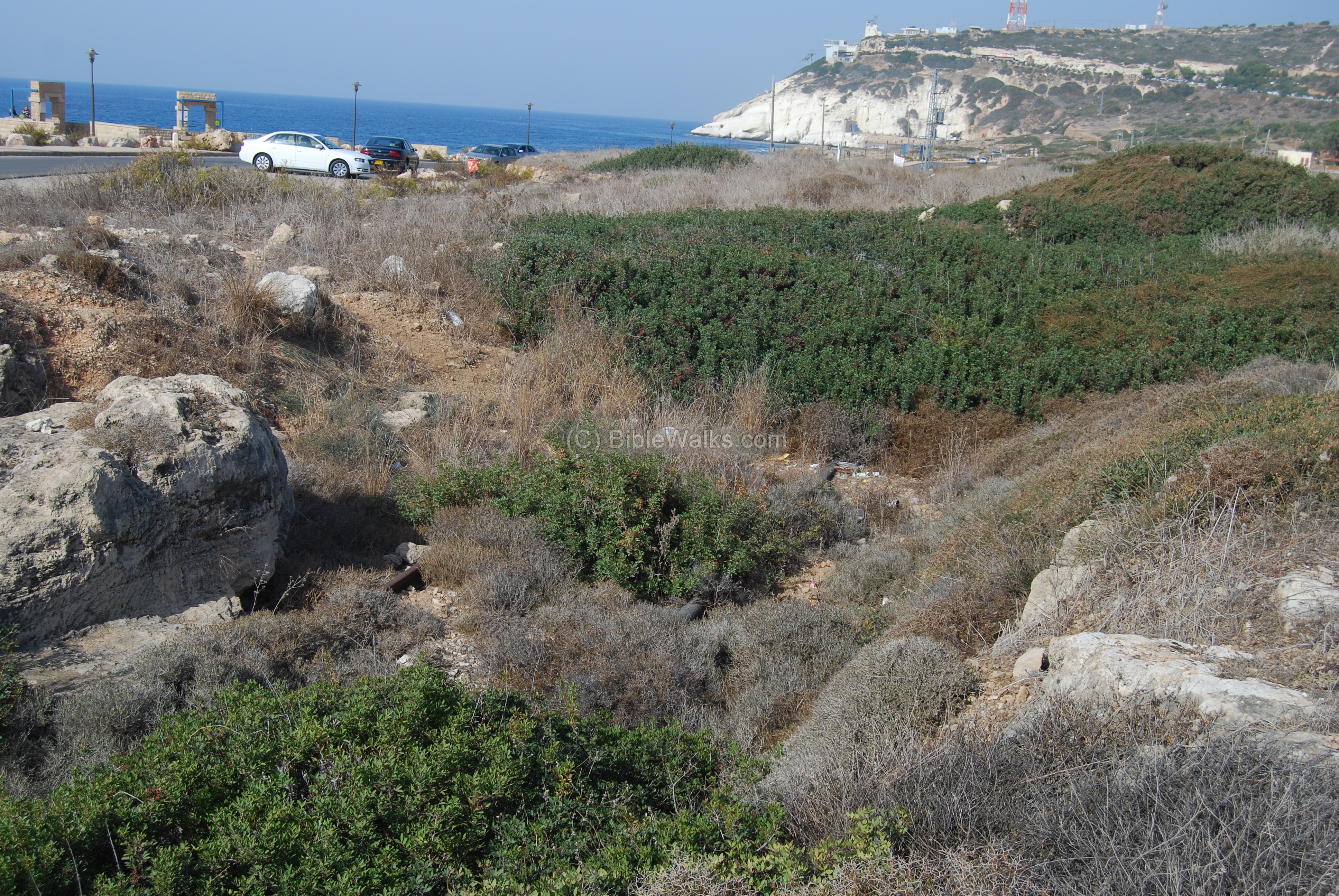
(c) Khirbet Masref (west):
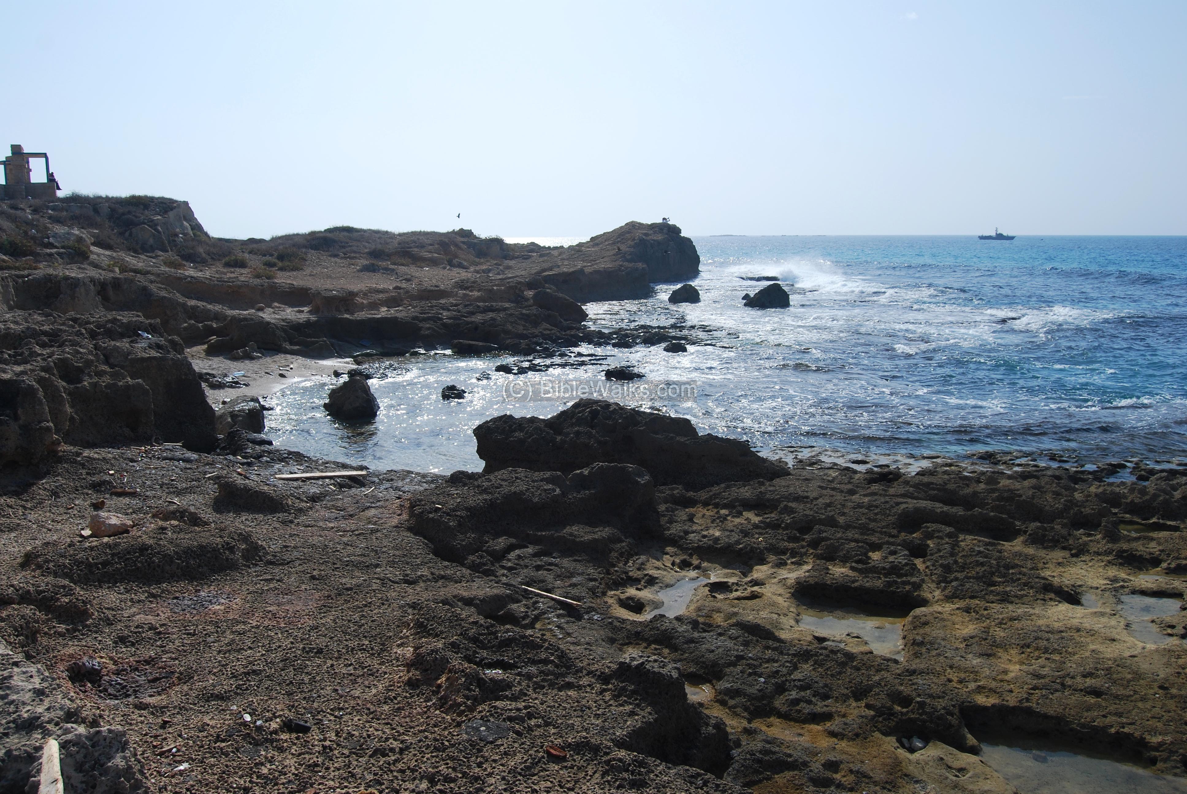
A view of the south side of the site is seen in the panoramic photo below. The whole area is a large sand-stone quarry, and the houses of the village we located around and east to the area. On the right side the rock extends into the sea, creating a sort of “peninsula”.
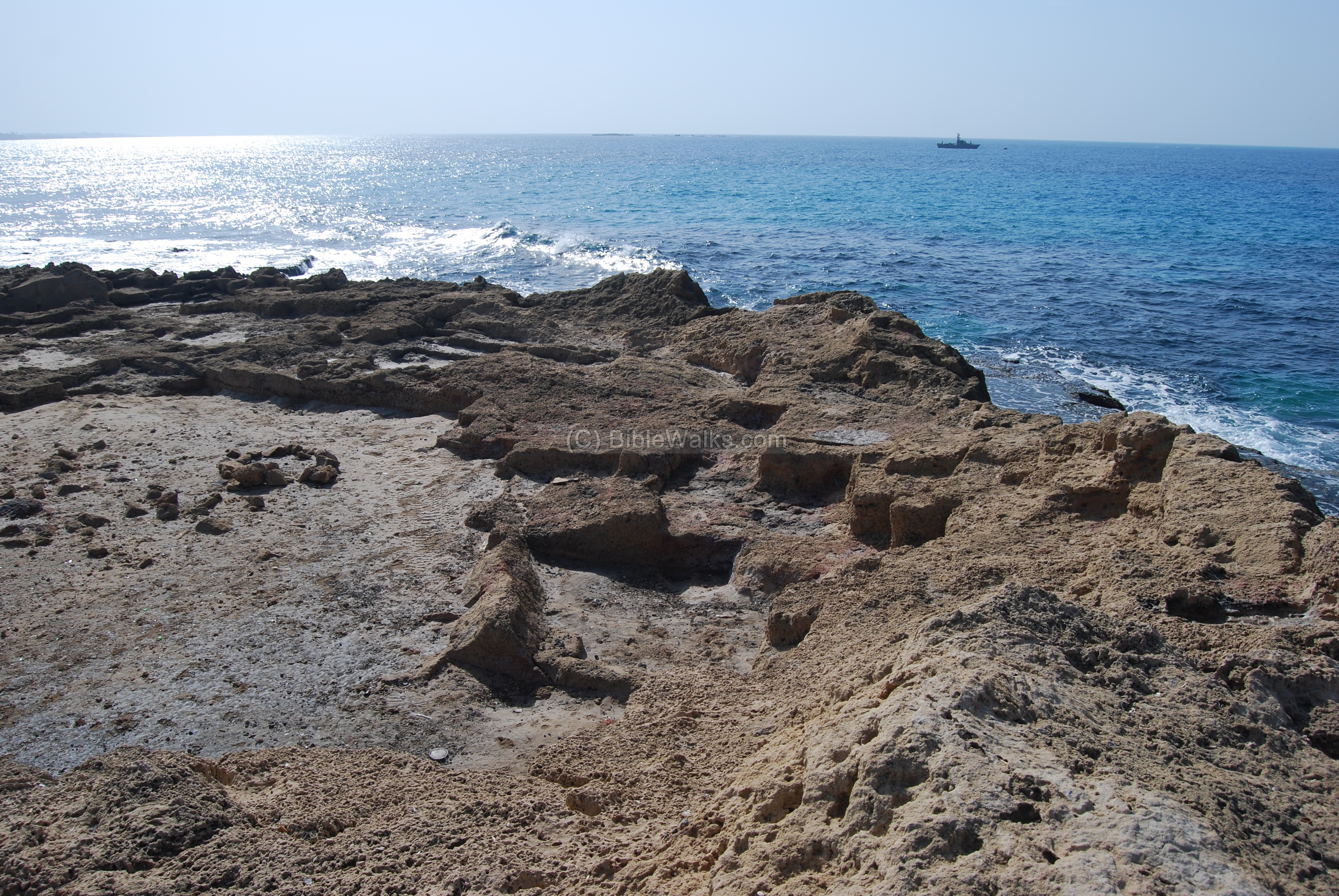
A closer view of the stone quarry, in the “peninsula”. On the far right is the Israeli Navy boat which is patrolling the area in order to prevent Terrorists to attack Israel from the North.
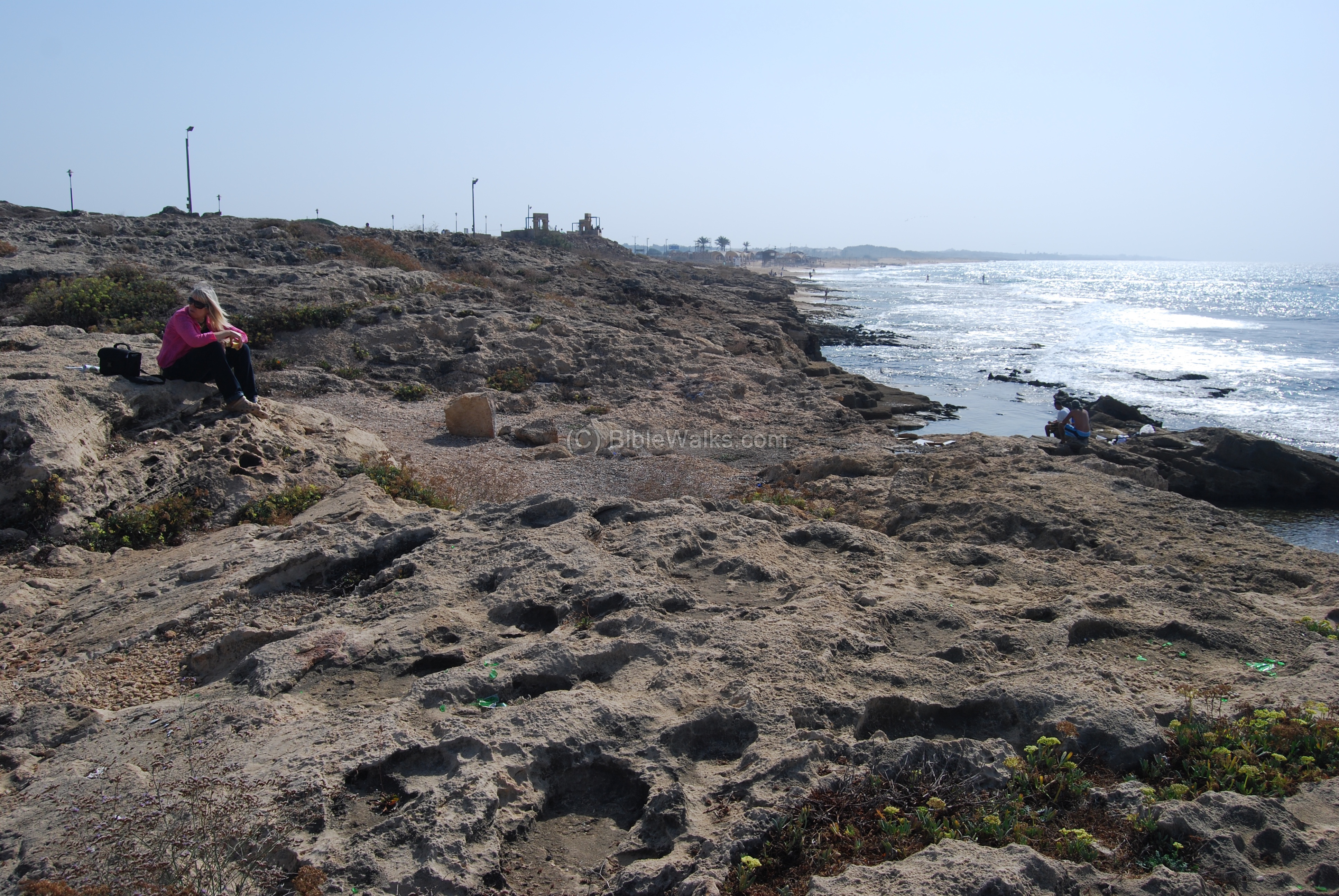
Another view of the shoreline. The hill on the background is Tell Achziv.
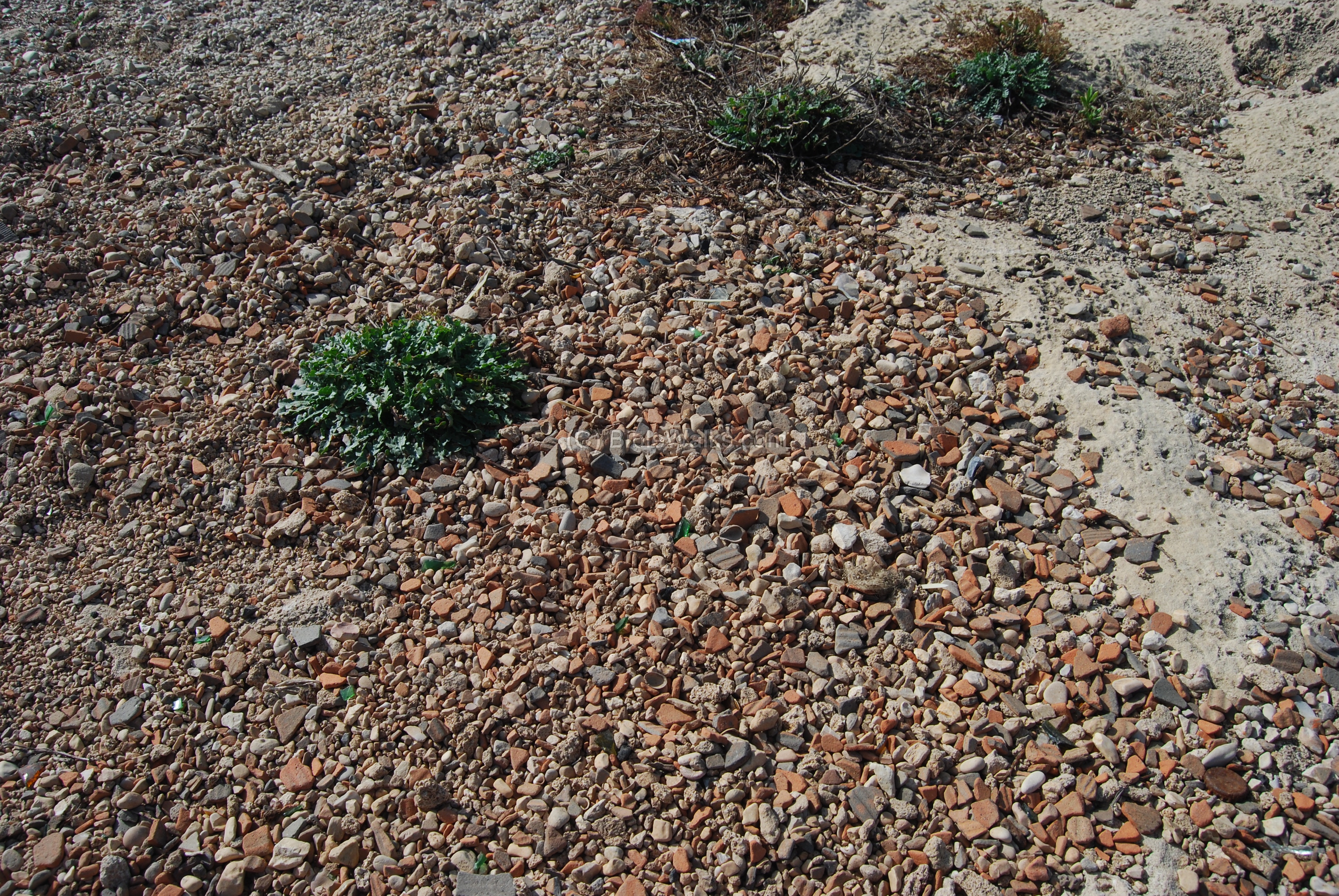
A closer view on the ground shows thousands of pottery fragments.
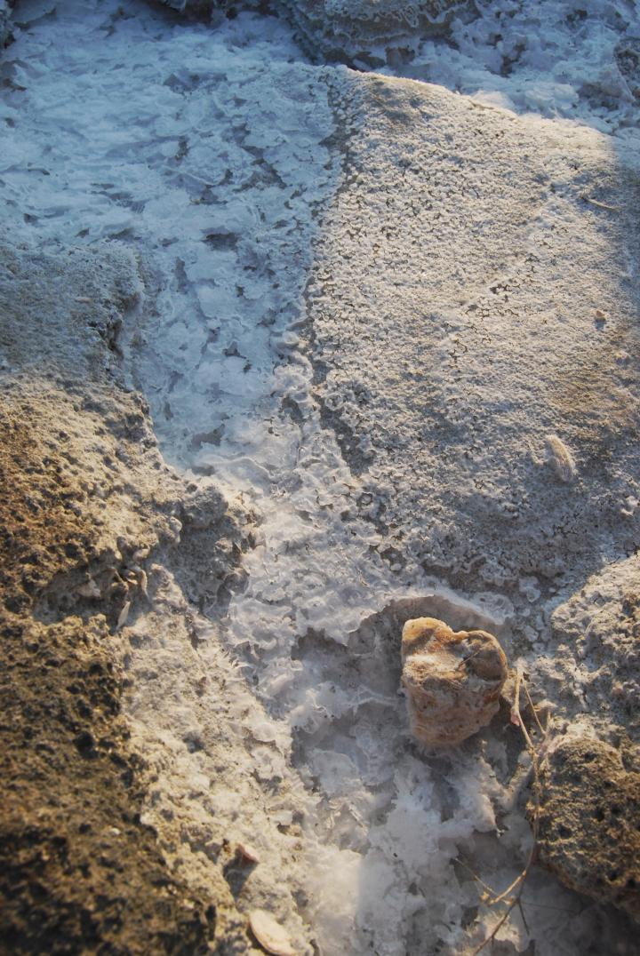
The site’s name, Khirbet Masref (perhaps the Biblical “Misrephothmaim”), may have been derived from the salt industry. The photo below shows one of the cracks in the rock with a deposit of the white salt. The sea water evaporates in the sun, and the salt remains to be picked up.
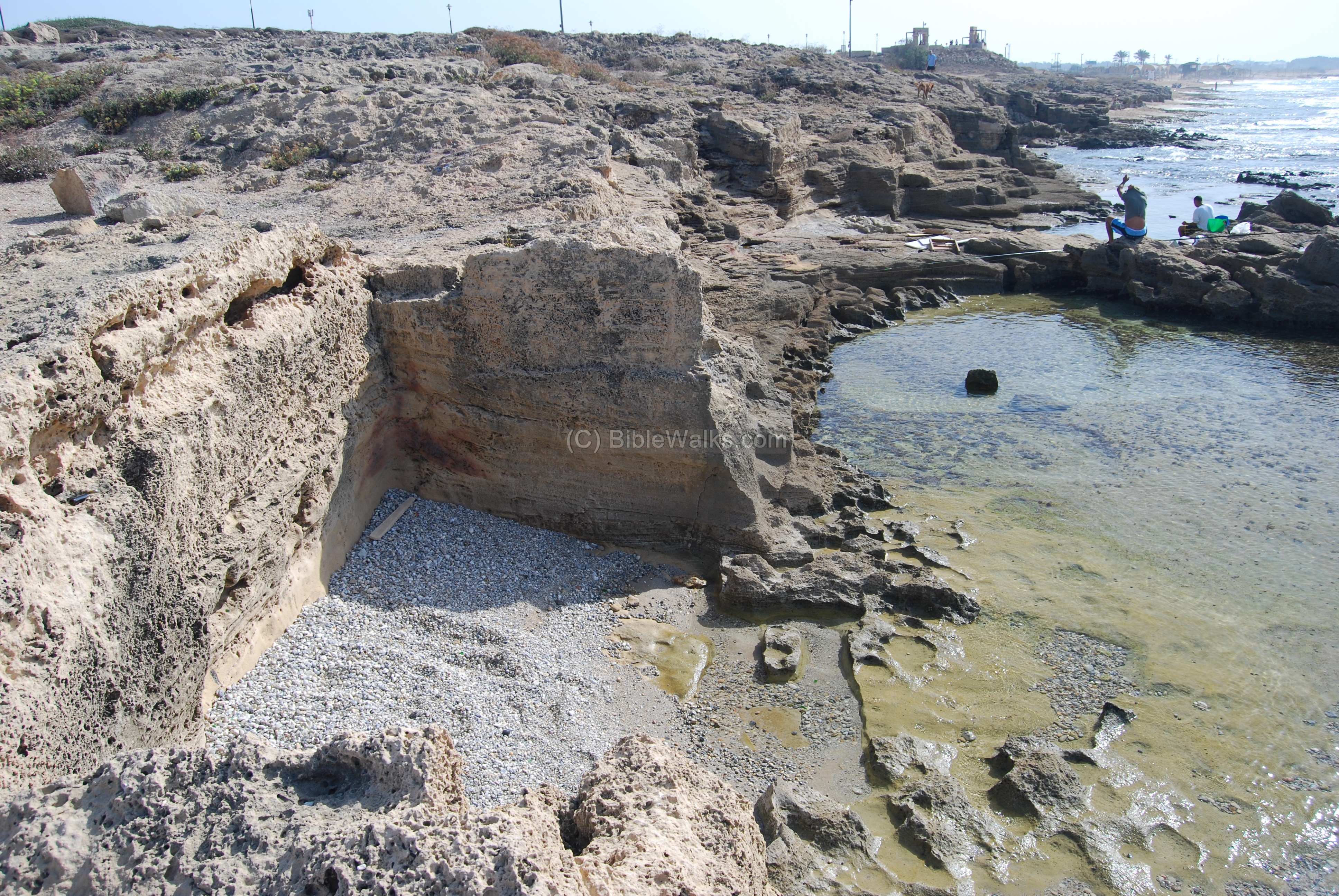
(d) Ancient piers:
The villagers cut into the rock and built a small pier. This was used to market their products to the main ports around – Achziv and Acre.
Another pier near the site is seen below.
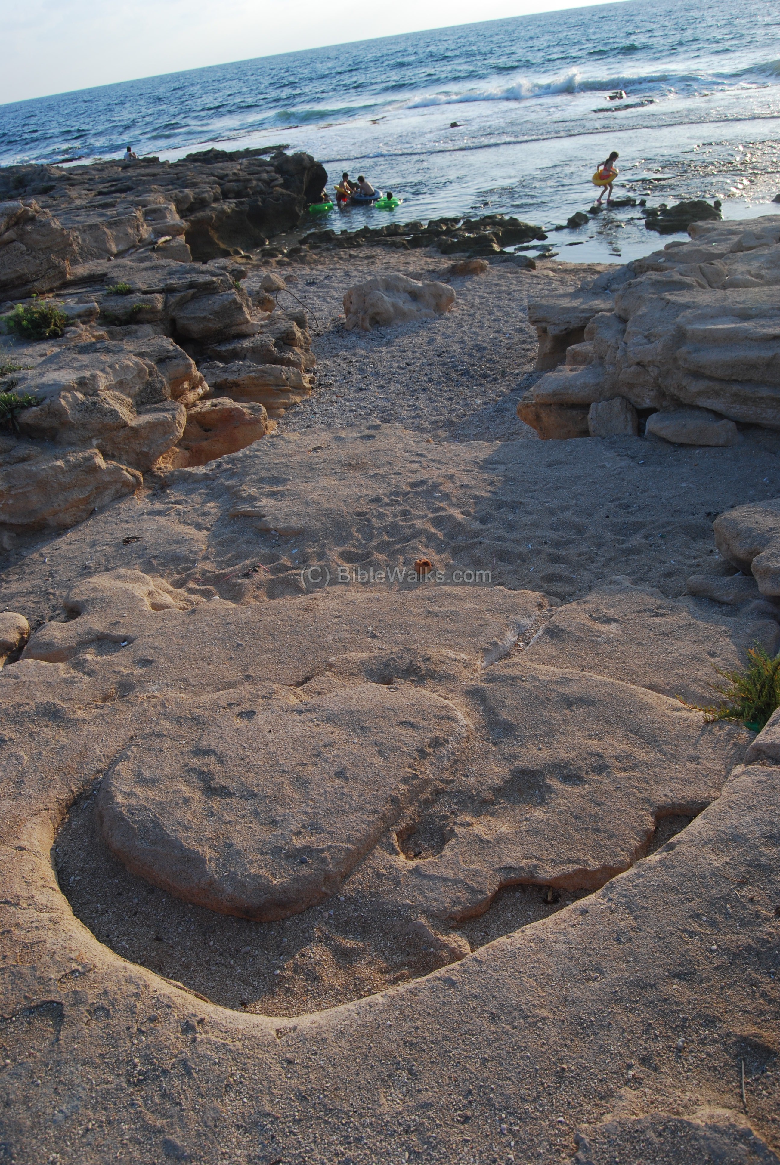
A round rock cutting below seems like an ancient anchorage hook, which allowed to tie the boat to the shore.
(e) North quarry:
North to the site is a large stone quarry, as seen below.

A closer view of the sandstone rock cutting is seen below. Rosh Hanikra, its cable tower and the tunnel of the old railroad is seen in the background.
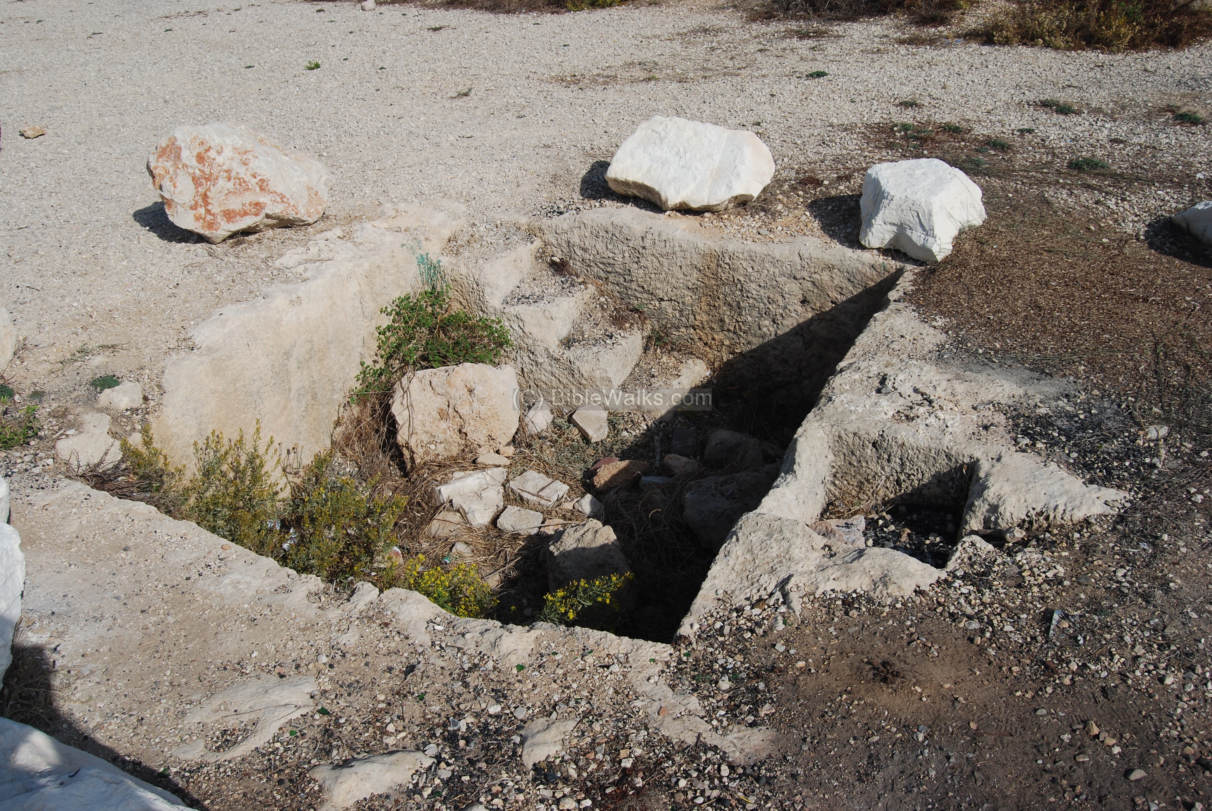
(f) Wine press:
A wine press is located in the center of the public parking lot on the south-west side of the ancient village.
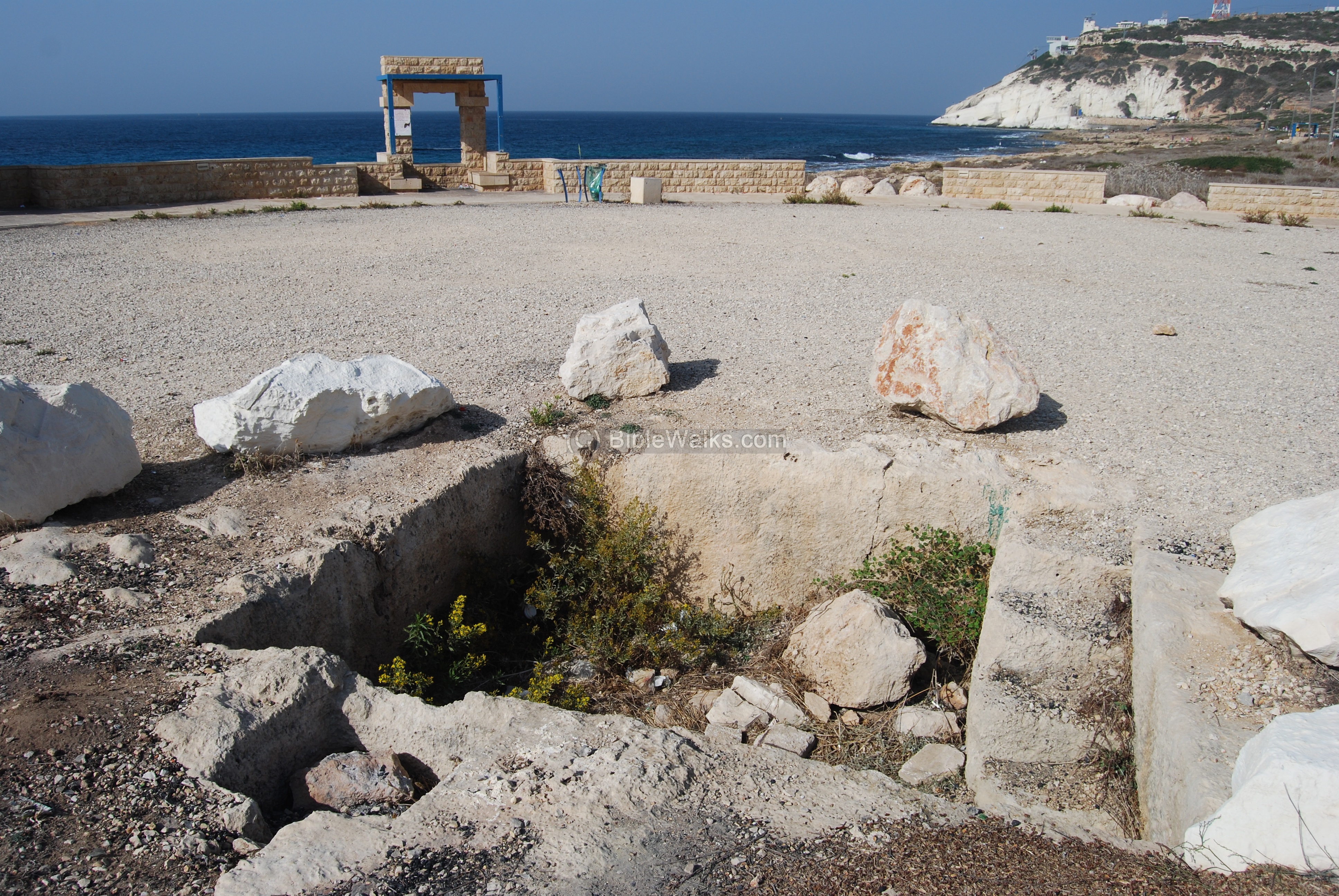
Another view of the wine press. The grapes were pressed on a large flat surface which is hidden under the sand on the right. The extracted grape juice, together with the squashed grapes, was left in the treading floor by blocking the outlet. After the fermentation process, the wine juice flowed into a small pit on the right through a filter.
The small filtration pit (0.65 x 0.55M) – has a mosaic floor. The larger pit (3.2 x 2.6m x 1.3m deep) has 6 steps in order to allow the workers to step down and collect the juice into jars, then store them for subsequent fermentation.
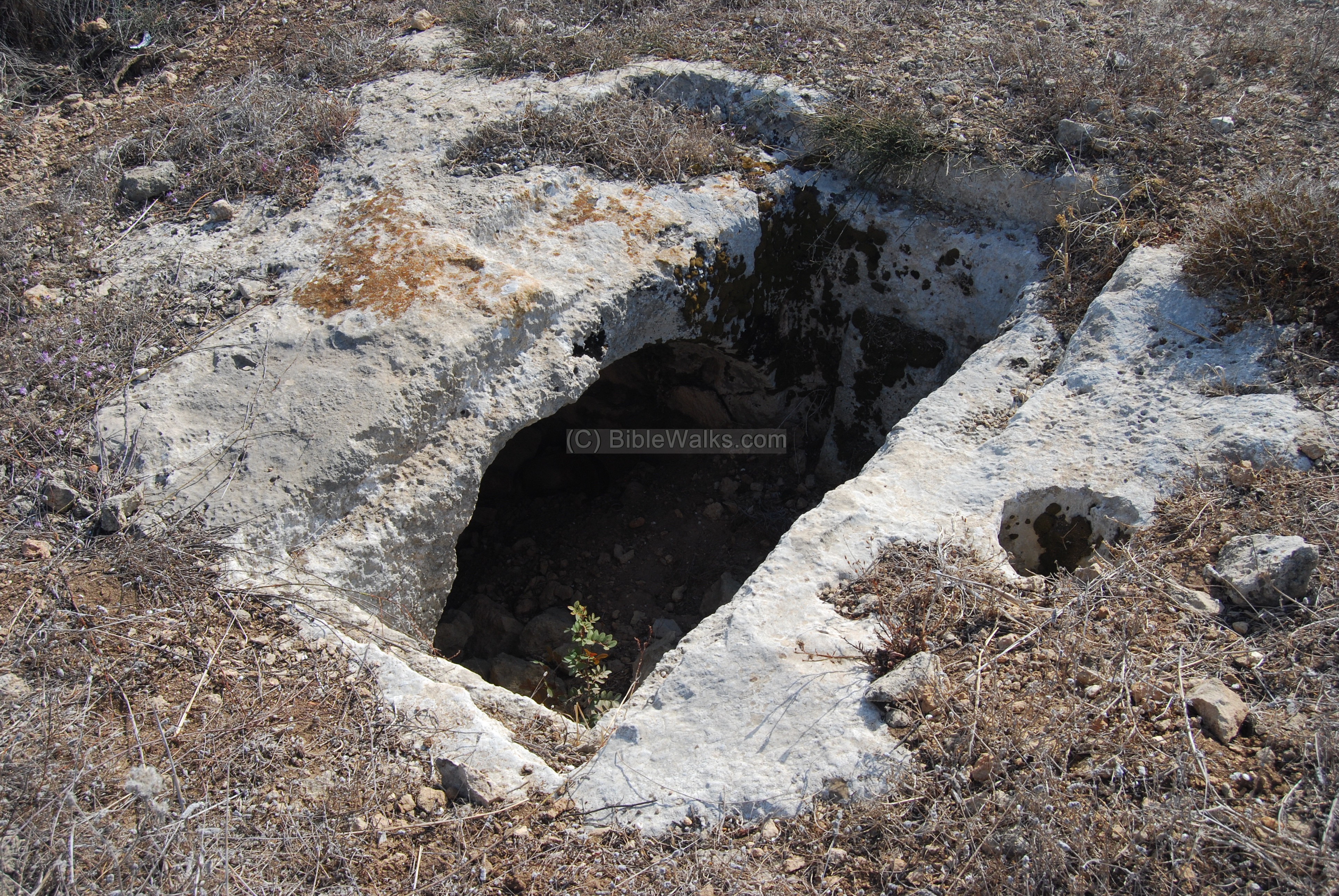
(g) Tombs:
A rock cut tomb is located east to the road, near the railroad path. A burial chamber is seen in the photo below, below the rock. A small hole (on the right) was used to hold the vessel, which was used for the ritual pouring (libation) of a drink (water or wine) as an offering to a god.
(h) Railway:
The old railroad passed at this site, and some of the rails are still visible in the path that was cut through the site.
Today, a tourist “train” passes the site, carrying kids and their parents from Achziv to Rosh Hanikra.

(i) Other photos:
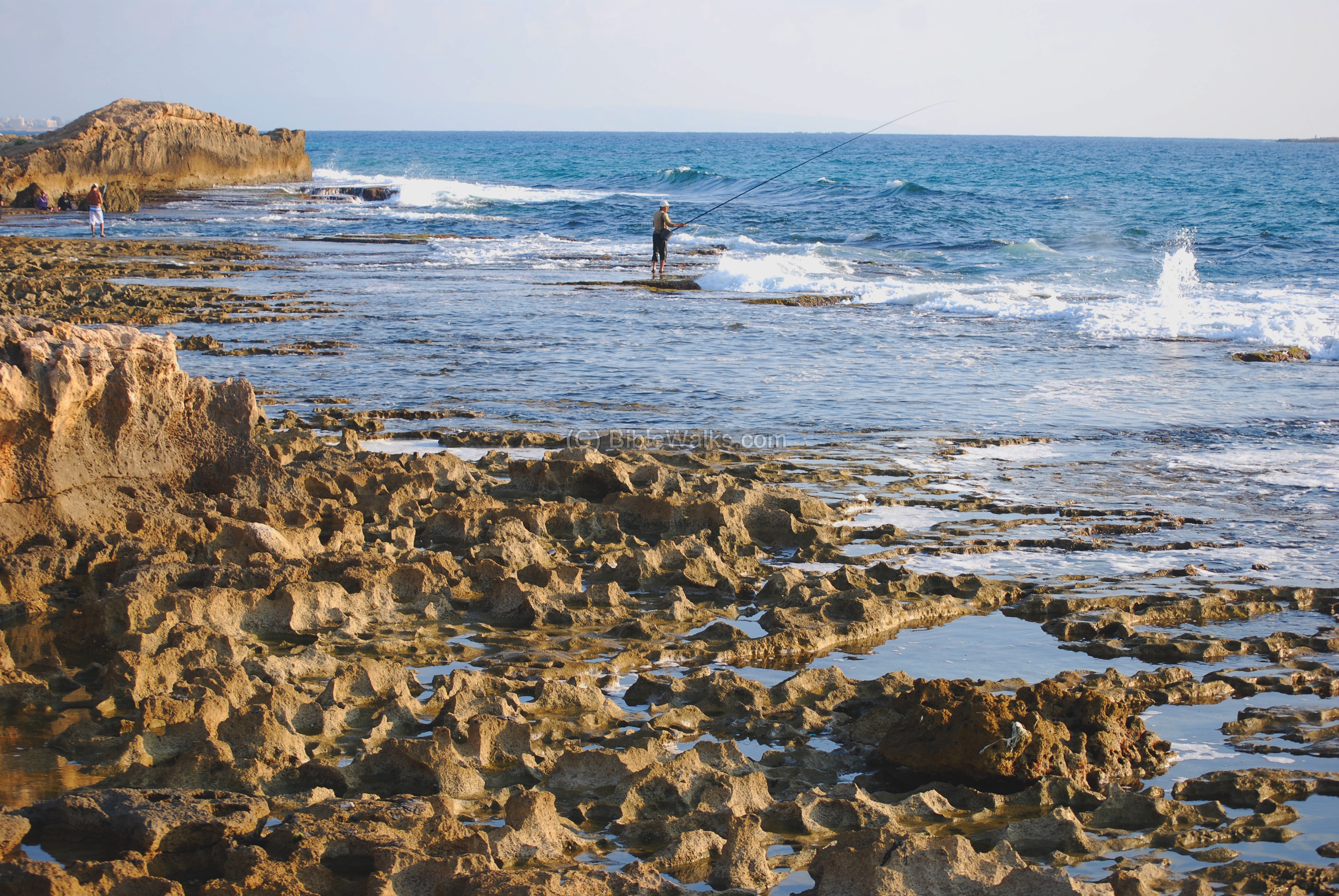
Along the shore are beautiful nature views.
Many come here to enjoy the sights. Others try their luck with the fish.
Some come here only for solitude… nature can heal your soul.
(j) Nature photos:
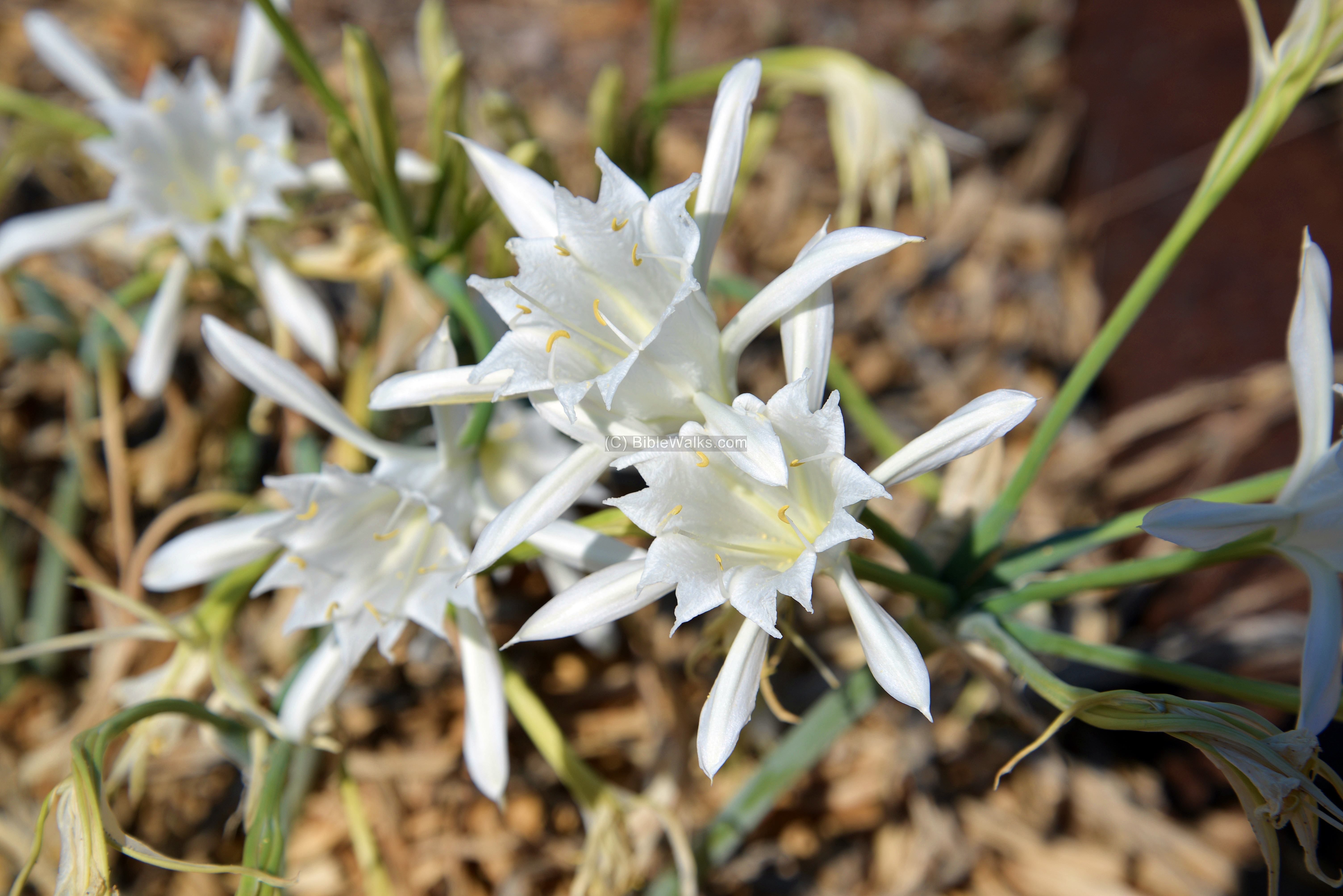
Along the beach are various types of wild flowers. One of these we noticed in late September – the Sea daffodil (Pancratium Maritimum, Hebrew: Havazelet Hahof). The flower is mentioned in the Bible (Song of Solomon, 2 : 1-2): ” I am the rose of Sharon, and the lily of the valleys. As the lily among thorns, so is my love among the daughters”.
Biblical:
Joshua 11: 7-8:
Joshua wins the battle of waters of Merom, and chases the Canaanites until ” Misrephthmaim”. According to some scholars (Vilnais), the place was Masref which preserved the ancient name. “Maim” is waters in Hebrew, and this indicates a coastal location.
“So Joshua came, and all the people of war with him, against them by the waters of Merom suddenly; and they fell upon them. And the LORD delivered them into the hand of Israel, who smote them, and chased them unto great Zidon, and unto Misrephothmaim, and unto the valley of Mizpeh eastward; and they smote them, until they left them none remaining.
Joshua 13: 7:
This text describes the borders of Israel after death of Joshua, and Misrephothmaim may indeed refer to the site which is even today located on a natural border, and at the ancient times was a topographic barrier between the Holy Land and its neighbors (Tyre and Sidon).
“All the inhabitants of the hill country from Lebanon unto Misrephothmaim, and all the Sidonians, them will I drive out from before the children of Israel: only divide thou it by lot unto the Israelites for an inheritance, as I have commanded thee”.
Etymology (behind the name):
- Rosh Hanikra – Hebrew: Nikra: grotto. Rosh: Head.
- Sulam Tsor – Hebrew: the “ladder of Tyre” – the name of the mountain ridge that separates Israel and Lebanon.
- Misrafot – Hebrew: places of fire, or also area where salt was prepared (since it baked in the sun).
- Maim – waters. May also be derived from “Mi-Yam” which means “from the west”.
- Misrafot-Maim – the Biblical name of the area.
Links:
-
Arch. Survey of Israel – Hanita Map (2) – R. Frankel & N. Getzov [1997] ,
-
site # 12.2: H. Masref
-
site: #14.2 : H. Masref (south)
-
-
Libation – ritual pouring practices in the Levant (an article by Macalester collage, 2007 )
-
Wine & Oil Production in Antiquity in Israel & other Med. Countries [ISBN 1850755191 1998] Frankel, Rafael.
-
Winepresses – BibleWalks info page
BibleWalks.com – walk with us through the sites of the Holy Land
Tell Avdon <<<–previous site—<<<All Sites>>>–next Upper Galilee site —->>> Rosh Hanikra
This page was last updated on April 29, 2016 (wine fermentation)
Sponsored links: