This Arab village is identified with the Biblical Gilgal of the Sharon, one of the Kings that were defeated by the Israelites: “the king of the nations of Gilgal” (Joshua 12:23).

Home > Sites > Sharon > Gilgal (Jaljulia)
Contents:
Background
History
Photos
Biblical
References
Etymology
Background:
The village is located on the east side of via Maris, the main ancient road from north (Damascus, Syria) and the south (Cairo, Egypt). For thousands of years caravans have passed this village. Even today the Israel’s main Toll road (#6) passes close to this site.
The site has been identified with Biblical “Gilgal” of the Sharon (not to be misplaced with the city on the Jordan river). The only remains that are seen today are located at the west side of the congested Arab village: the ruins of a large Khan (inn, motel), and a Crusaders sugar factory.
History of the place:
- Prehistoric periods
A recent emergency excavation conducted in 2018 revealed a Lower Paleolithic period village on the eastern fringes of Jaljulia, buried 5m below the surface. The archaeologists uncovered a rich lithic industrial site, and collected hundreds of flint stone tools, used by the hunter-gatherers as early as 500 million years ago.
- Bronze/Iron age periods
According to the ceramics survey in the village, the site has been inhabited from the late Bronze period (1550-1200 BC), through the early and late Israelite/Iron period (1200-1000 BC, 1000-586 BC), and on to the Persian period (586-332 BC). Therefore, the scholars identify the place with “Gilgal” in the Sharon, as referred in Joshua (see references). The name of the Arabic village (Jaljulia) preserved the ancient site’s name.
According to David Dorsey (“The roads and highways of Ancient Israel”, map p. 165, route p. 167), a crossroad of major Bronze/Iron age roads passed at the site:
- “S5” – Road from Shechem via Azzun to Jaffa
- “I1” – the major north-south highway
- Middle ages
The ceramics and other findings show that the site was inhabited in the early Arabic and Crusaders period (640AD-1099AD, 1099 AD-1250 AD). In the east side of the village are ruins of buildings from the Crusaders period and the Mamelukes period (1250-1517 AD).
- Medieval times – Mamelukes (1260-1517)
The Mamelukes were Turkish prisoners of the Mongols who were sold to the Sultan of Egypt, trained by him and served as his palace guards. In 1250 they seized the control of Egypt, and defeated the Mongols (1260) and captured the Holy Land.
A Khan (inn, caravansary) was constructed in Jaljulia during the 13th Century. This inn, part of a line of similar structures, served the caravan and express mail service route between Cairo, via Tiberias, to Damascus.
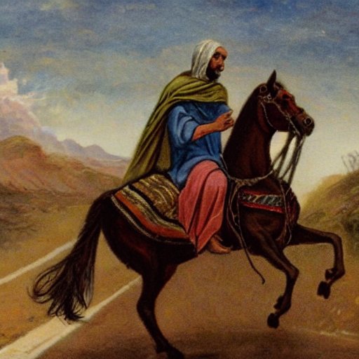
Rider on the Mameluke postal route – AI generated by Stable Diffusion
-
Ottoman Period – (1516-1918 AD)
The area of was examined in the Palestine Exploration Foundation (PEF) survey (1866-1877) by Wilson, Conder and Kitchener.
A section of their map is here below. Notice the double dashed lines, indicating major ancient roads, that cross the modern village, with the ruins of “el Khan” (Ottoman period caravanserai, inn, or: motel) on its west side. The west-east road is from Jaffa to Jerusalem, while the north-south road is from Damascus to Egypt.
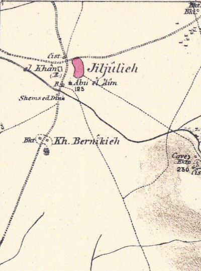
Part of map sheet 14 of Survey of Western Palestine,
by Conder and Kitchener, 1872-1877.
(Published 1880, reprinted by LifeintheHolyLand.com)
The PEF surveyors suggested to identify Jiljilia as Gilgal (Volume 2, p. 290):
“Jiljilia – A large village on the top of a high hill, with a well to the south, and a few olives. The ridge is arable land”.
The name suggests its identity with Gilgal, a town in the mountains near Bethel. This Gilgal (2 Kings 2:10) is mentioned as though above Bethel (verse 2), which does not agree exactly with the position of Jiljilia (2,441 feet above the sea), and of Beitin (2,890), but the descent into the great valley, Wady el Jib, may account for the expression, ‘went down to Bethel’.”
Also, on pp. 288-289, they identified it again with “Gilgal of Nations”:
“Jiljulieh – A large mud village in the plain, with a fine ruined mosque, and a ruined Khan. It is supplied by a well on the west. This place is perhaps ‘Gilgal of Nations’ (Joshua xii. 23), a place apparently in the maritime plain”.
Photos:
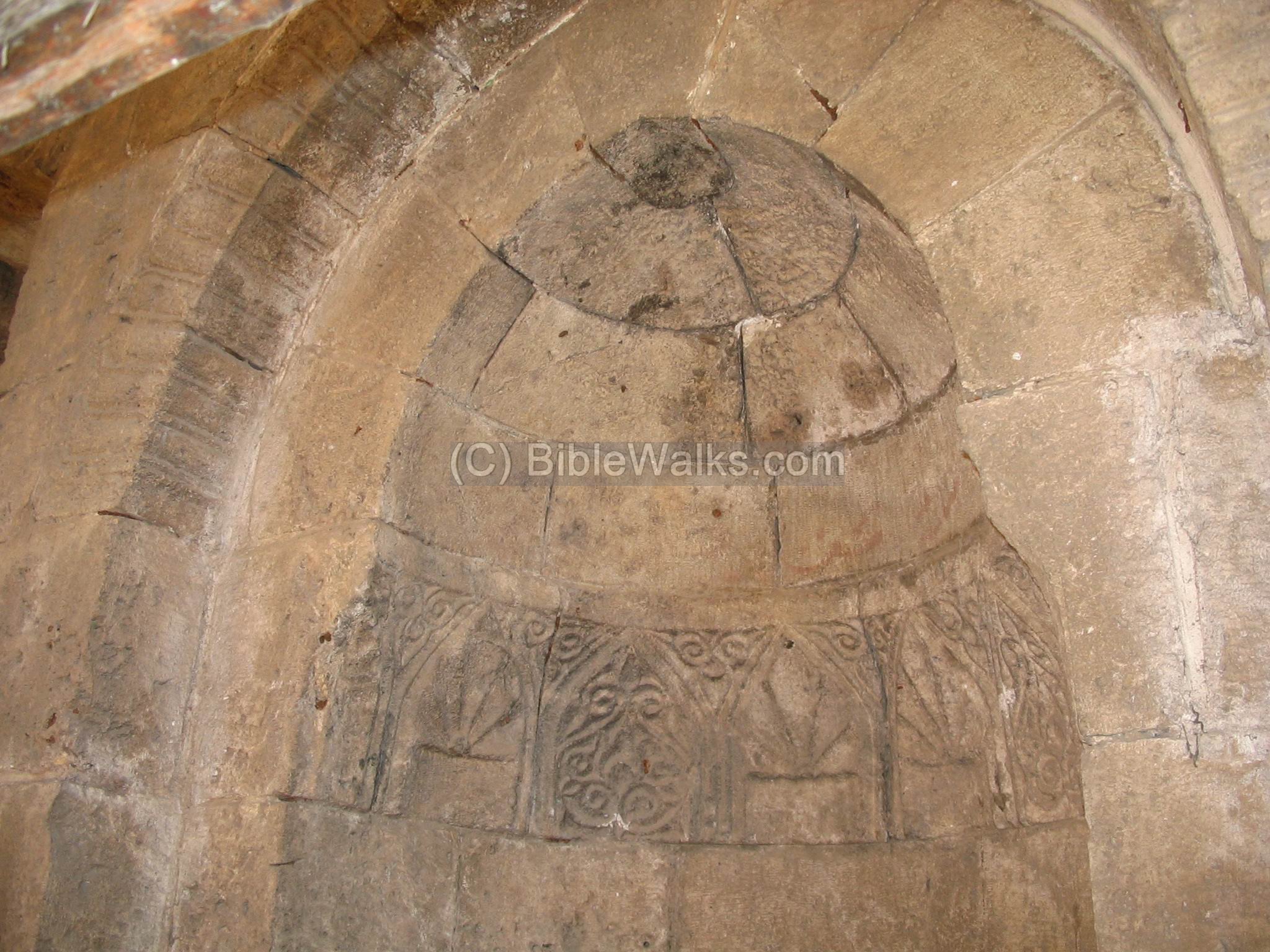
(a) Tomb and Crusader Sugar factory:
A large sacred Arabic tomb is in the north side of the modern cemetery east to the main old road. According to Arabic tradition, it is the holy tomb of Shams E-Din, Saladin’s general.
Click on the photos to view in higher resolution…
In the Crusaders period this building, now in restoration, may have been used as a sugar factory (“Miskara”). The sugar canes were grown in the area and brought to the factory. Then they were chopped, smashed, boiled, then poured into pots. During the cooling the juice would crystallize into sugar, and sold. The water that was used in the process was fetched from the well nearby and the factory was operated by oxen.
In Cypress, near Kolossi, Limassol, there is a similar sugar-refining factory which was also built by the Crusaders. Another sugar processing factory is located in the west upper Galilee – in Manueth (Manot). The sugar industry was mainly managed by the Knights order of Hospitallers, while the Knights order of Templars managed the wheat business in the Holy land.
A detail inside the building. Its entrance is towards the west and it is built in Gothic style.
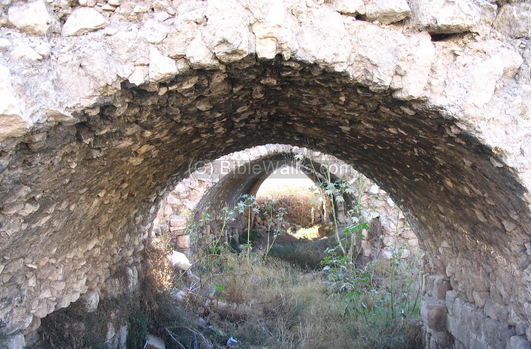
(b) Mameluke Khan (motel):
North to the sugar factory is the ruins of a large Khan, an important and impressive middle-ages Motel that used to host the caravans from Damascus (Syria) to Cairo (Egypt). This Khan was built in the 13th century AD.
The Khan was constructed during the Mameluke period, and was an important station on the crossroads of major trade routes and the postal road from Cairo to Damascus. This road was initiated by the first Mameluke emperor, Bybars, in 1268. It served the Mameluke empire until the 16th century.

A detail of one of the rooms of this large roadside motel. A lot of the stones have been stolen for reuse in the houses around. The site is also filled with rubbish, hopefully one day the municipality will clean it up and restore parts of it, bringing back a touch of its glory.
Biblical References:
(a) Joshua 12:7,23
Gilgal of the Sharon is mentioned in the list of Kings that were defeated by Joshua and the Israelites:
“And these are the kings of the country which Joshua and the children of Israel smote on this side Jordan on the west…
The king of Dor in the coast of Dor, one; the king of the nations of Gilgal, one;”.
Other References:
- Israel Guide [Keter & I-DOD, 1979] – “Sharon” – Jaljulia site
- Crusaders sugar industry – IAA article
- Manueth (Manot) – Crusaders period sugar factory
Etymology (behind the name):
-
Gilgal – from the root word Galgal (Hebrew for circle or wheel). In Biblical times the Gilgal referred to a ancient ritual place, based on a stone circle , like Stonehenge in England. There were several similar sites in Israel, like in the Golan heights. In the course of the years the name evolved to to Gilgal (Hebrew) or Jaljulia or Rujem El-Hiri (Arabic). Therefore, there might have been a ritual circle of stones in the area of the site.
-
Sharon – this region in Israel lays along the shore, between the Yarkon river (Tel Aviv) in its south side, and the Carmel on the North side. According to Ariel Encyclopedia (Z. Vilnai), the name originates from the Horites, cave dwellers from area of Petra, where the name “Sharna” means forest.
BibleWalks.com – walk with us through the sites of the Holy Land
Caesarea Aqueduct <<<-previous Sharon site—<<<All Sites>>>—next Sharon site —>>> Benjamin’s Tomb
This page was last updated on Mar 16, 2024 (add prehistory, Dorsey’s roads)
Sponsored links: