A Hasmonean period fortress located inside the Ayalon park. It was fortified by Bacchides during the Maccabee revolt.
Home > Sites > Judea > Emmaus (Nikopolis) > Hasmonean Fortress
Contents:
Overview
Map
History
Photos
* Aerial views
* Path
* Summit
* Cisterns
* South gate
* Agriculture
Etymology
Links
Overview:
A fortress dated to the Hasmonean period (2nd century BC), located on a steep hill above the valley of springs. The fortress was constructed by the Seleucid general Bacchides, who fought against the Hasmonean kingdom during its early period. The site is now in ruins, and are called Khirbet El ‘Akedor Akid (in Hebrew: Hurbat Eked).
The fortress was strategically located on a major road that connected Jerusalem to the coastal plain, making it an important military installation in the region. The fortress was also used to control the surrounding agricultural land, which was a vital source of food and resources for the local population.
The construction of the fortress (Hebrew: Matzad) was the beginning of the establishment of the city of Emmaus/Nicopolis, which later relocated several KM to the west.
Map / Aerial view:
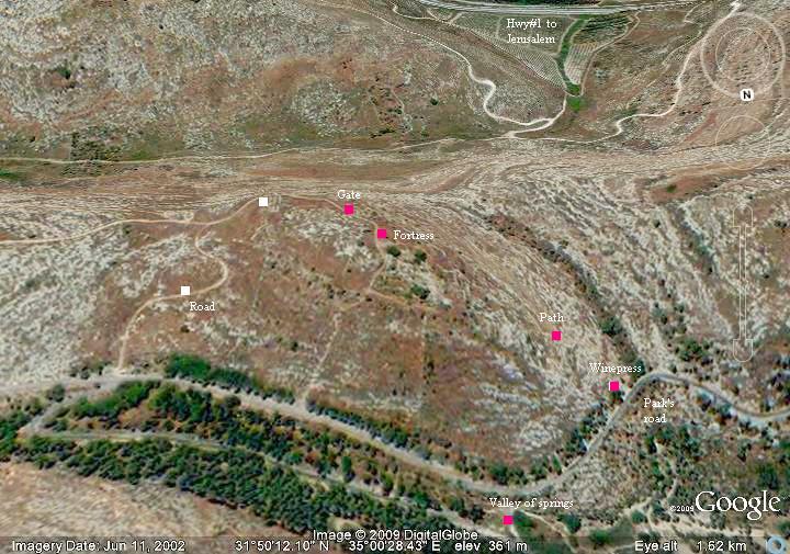
An aerial photo of the area is seen below, indicating the major points of interest. The fortress is seen in the center of the aerial map below. The height of the hill is 350M and the size of the ruins is 20 Dunam. The valley of springs lies on the bottom (north) side.
History:
- Rise of the Maccabees
The Maccabees, a national liberation movement during the Hellenistic period, liberated Israel from the Seleucid ruler Antiochus IV after two years of fighting (167-165 BC). One of the battles of Judas Maccabee was fought here in Emmaus in 167 BC, when Judas defeated an army led by Gorgias with 5,000 soldiers (Ant. of Jews, XII, Chapter 7, 3-4). In 164 BC Jerusalem was captured by the Maccabees, a victory which is celebrated every year since then (“Hannukah”, named after the inauguration of the temple).
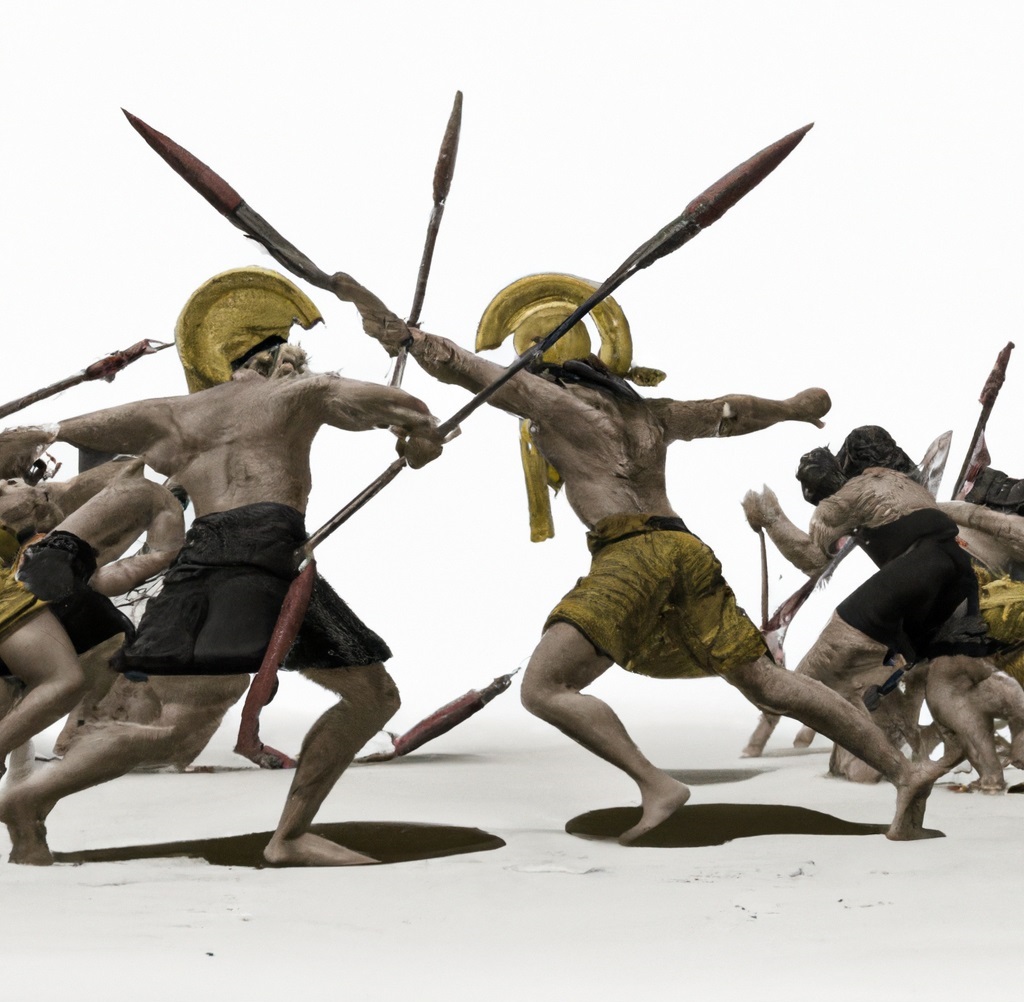
Dall-E 2 illustration of Greek and Maccabees fighting
- Arrival of Bacchides
In 162 BC the new Seleucid ruler, Demetrius I Soter (162-150 BC), sent his General Bacchides to crush the revolt. He managed to recapture Jerusalem in 162BC, and returned to Syria after appointing a local governor. However, this control was short lived – his local commander Nicanor was defeated in the battle of Beit Horon in 161 BC. Bacchides therefore had to return to Jerusalem in 161BC with a large army. After chasing the Maccabee army the Seleucid general indeed managed to kill Judas, and the Maccabee army fled to the Judea desert.
- Fortifications of Bacchides
This time General Bacchides was determined to keep Judea under a tight control. During the years 160 BC through 155 BC Bacchides constructed seven new fortresses around Jerusalem, including this one in Emmaus, and strengthened two existing posts (Ant of Jews, XIII, Chapter 1 3). The fortress in Emmaus controlled the western road – from Gezer to Jerusalem. The other fortresses included Jericho, Beth-horon, Bethel, Timnath, Pharathon, and Tephon. These fortifications established a strong defense line around Jerusalem. Other Greek troops were stationed at the Acra citadel in Jerusalem, in Beth-zur, and in Gazara.
- Hasmonean Kingdom
The Maccabees continued the revolt and managed to retake control of the land in 150 BC. In 142 BC the autonomous state was recognized by the Seleucids. Thus started the Hasmonean Dynasty, which ruled the autonomous Israel until 37BC when it was replaced by Herod the great.
- Destruction
The fortress was destroyed during the early Roman period – either on 4 BC, after an uprising quelled by Verus following Herod’s death, or by Vespesian during the great revolt (68 AD). The fortress was reused as a hiding place during the Bar Kochba revolt (131-135 AD).
Photos:
(a) Aerial views
![]() A flight over the site was captured by a drone on July 2017:
A flight over the site was captured by a drone on July 2017:
(b) Climb to the fortress
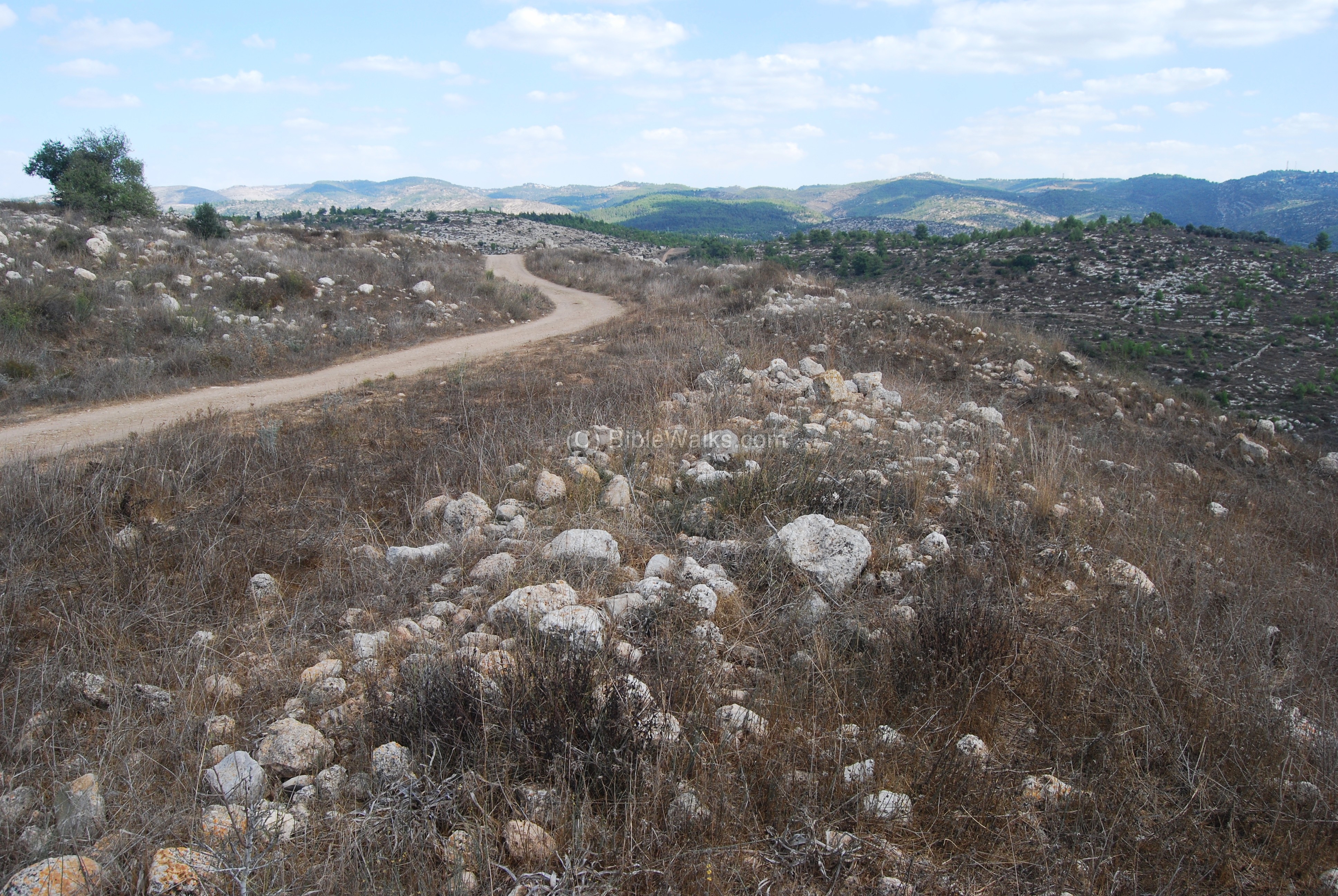
The fortress is located on the south-east side of the valley of springs. You can walk up the north-west side, seen in the photo below. This is a steep, breathless, climb. An alternative route is along a dirt road that climbs up on the east side.

The path starts from the ancient wine press on the side of the circular road, as seen below. Park the car and start climbing the steep hill.
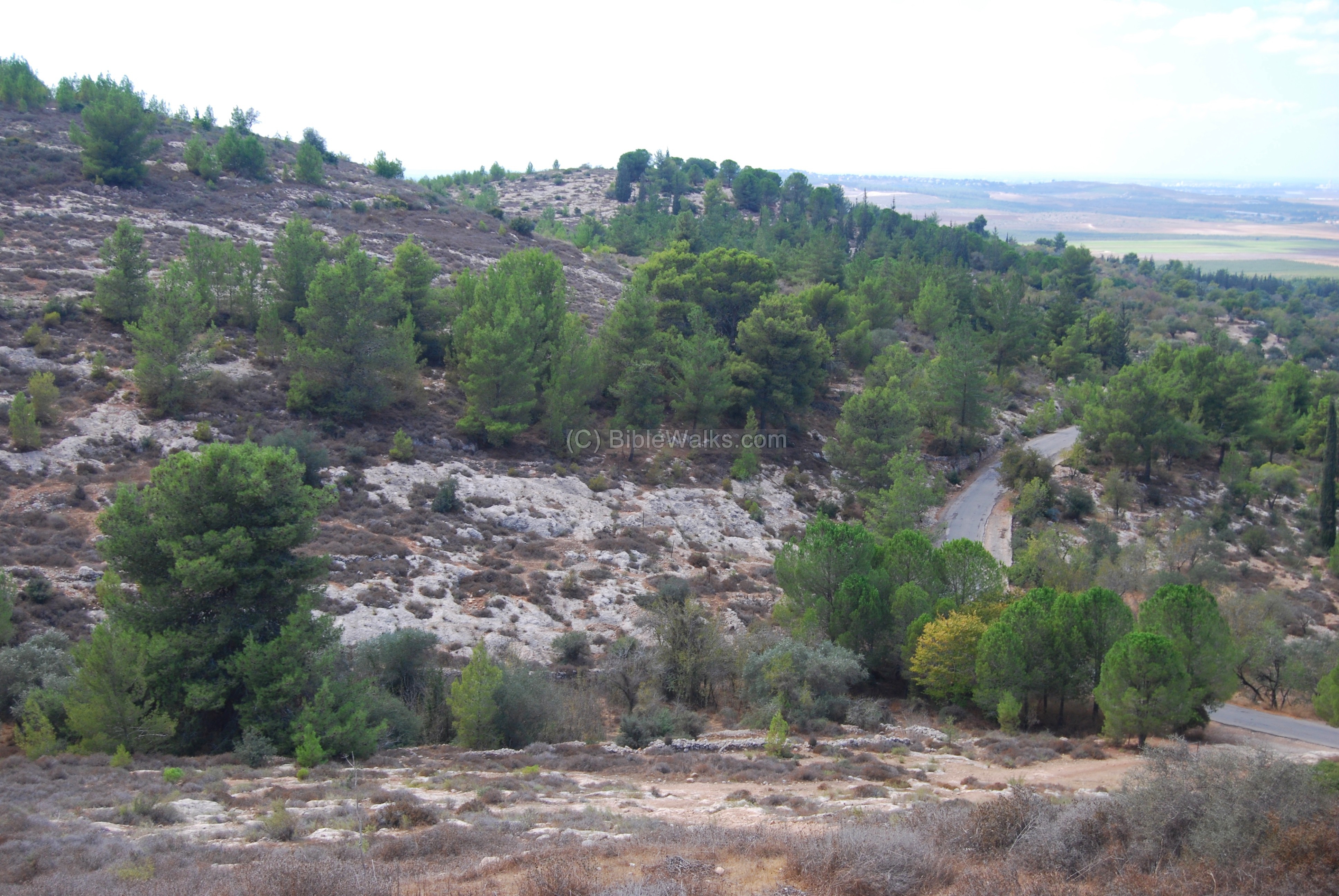
Along the path, in the valley between the two hills, are terraces with ancient olive trees. Ceramic fragments found here indicate that the site was inhabited during the Israelite Iron II period, the Persian period, Hellenistic period (the time of the fortifications), and late Roman period.

(c) Top of the hill
When you finally reach the summit (Alt 350M), the view is rewarding. The entire Ayalon valley and the area of Tel-Aviv is seen in this westward view.
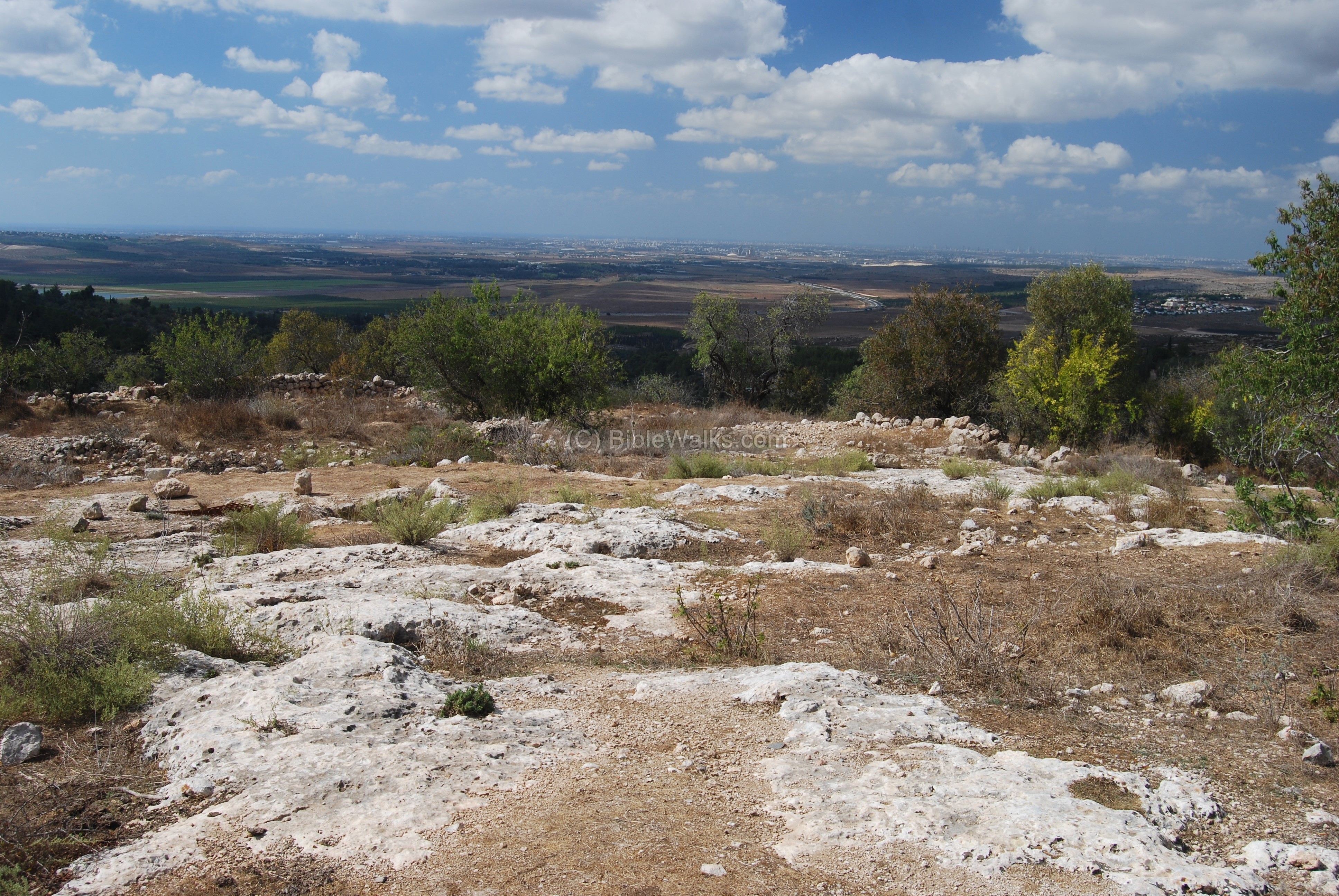
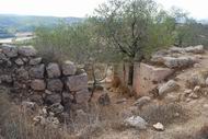
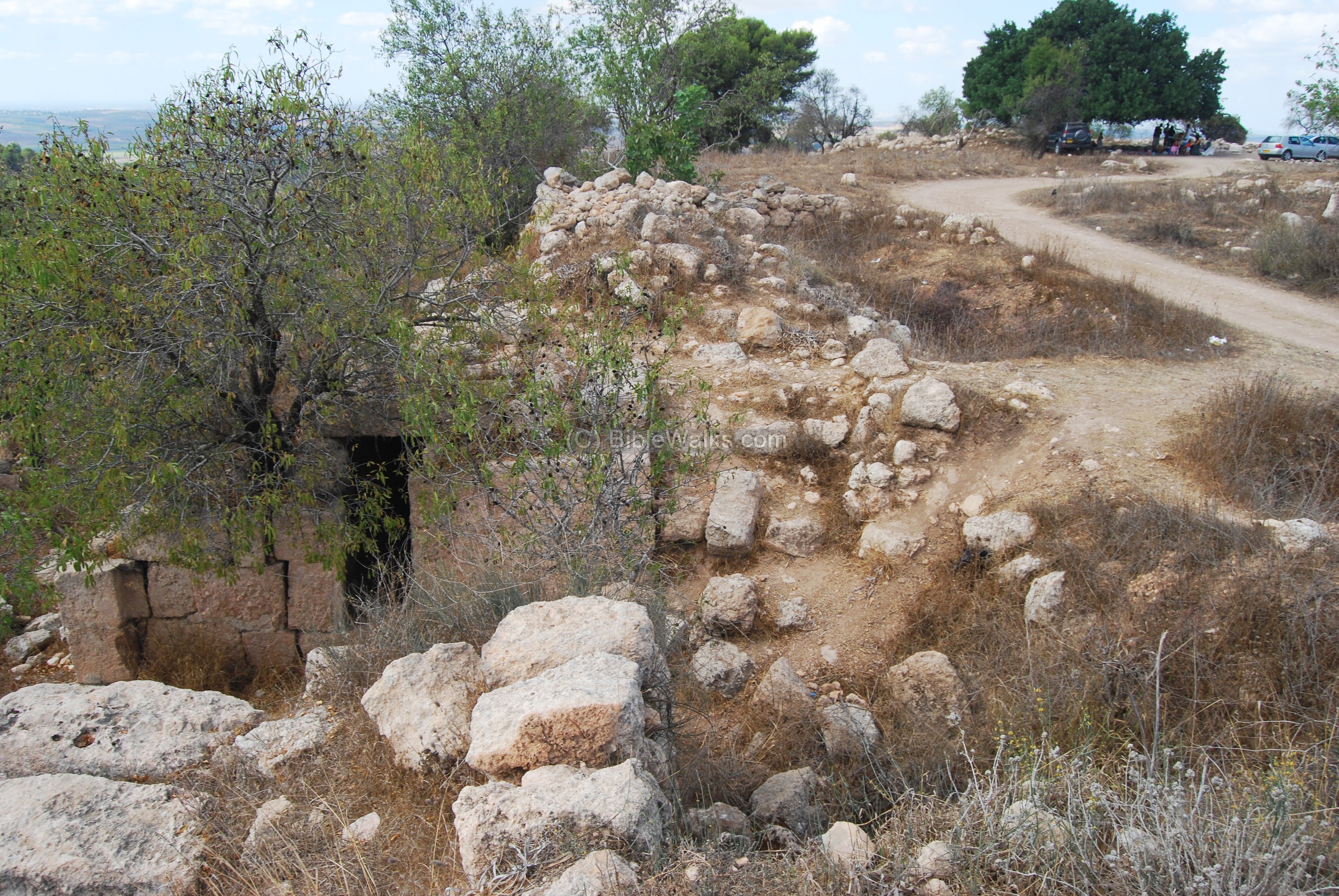
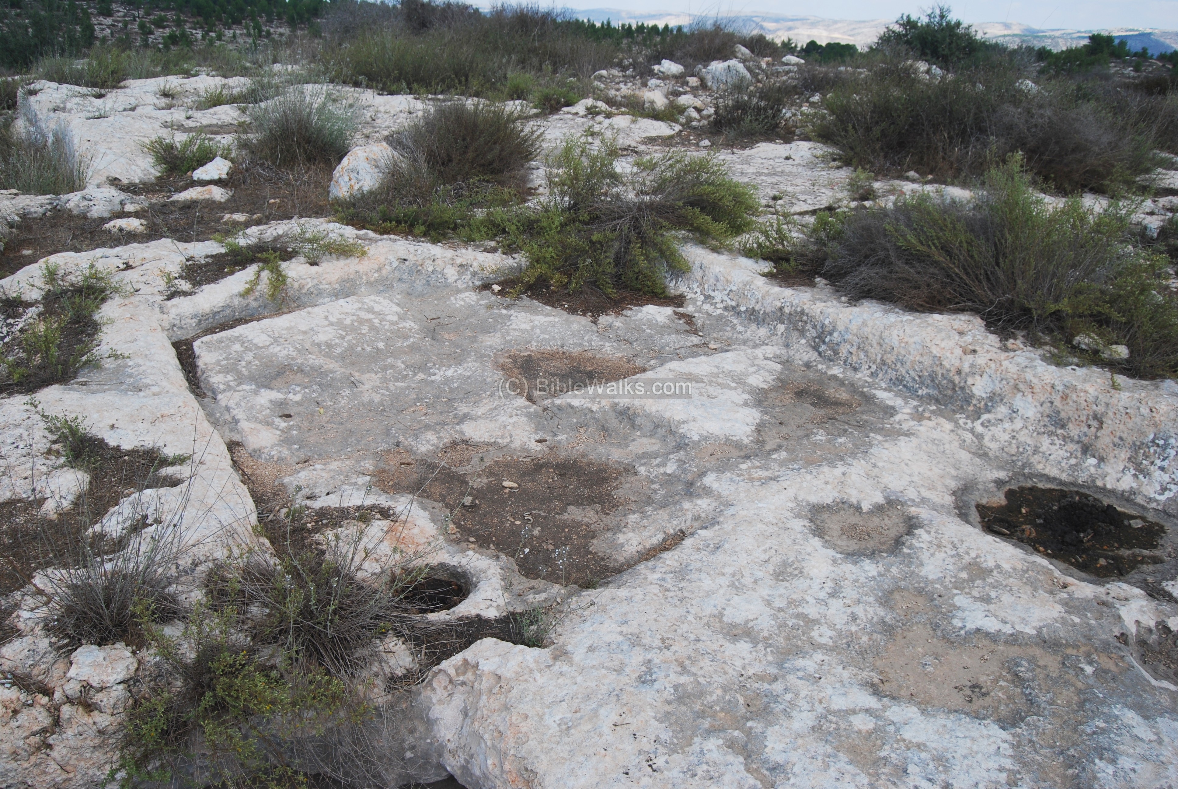
On the summit are the ruins of the Hellenistic period fortress, with dozens of walls, cisterns, and rock cuttings covering an area of 20 Dunam. The entire site is protected with a wide wall.
The ceramics date to the Hellenistic and early Roman periods. The coins found in the survey date to the Seleucid period – Antiochus IV (164-175 BC) and Antiochus VII (138-129 BC).
The rock cuttings are visible on the entire summit. This stone quarry produced massive stone blocks which were used to build the fortress.
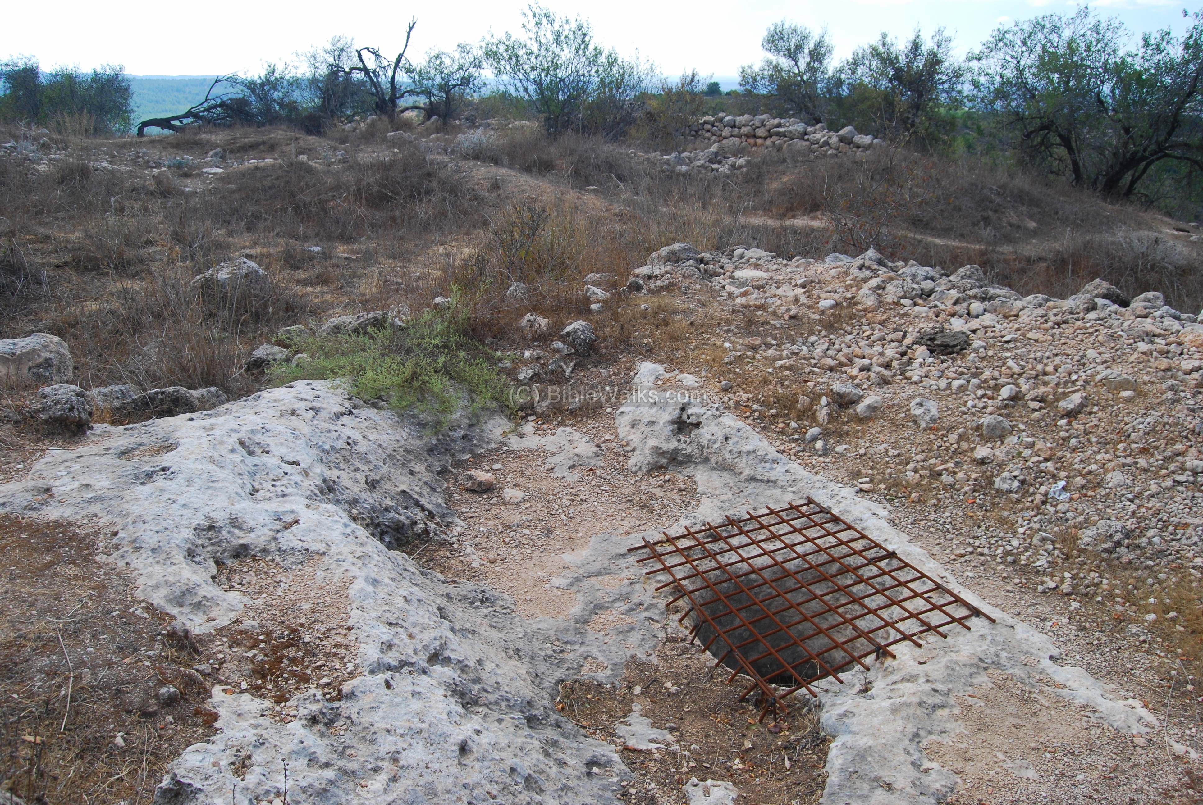
(d) Cisterns
There are also dozens of cisterns between the houses. These were used to collect the rain water off the roofs during the winter time and used as the source of the drinking water.
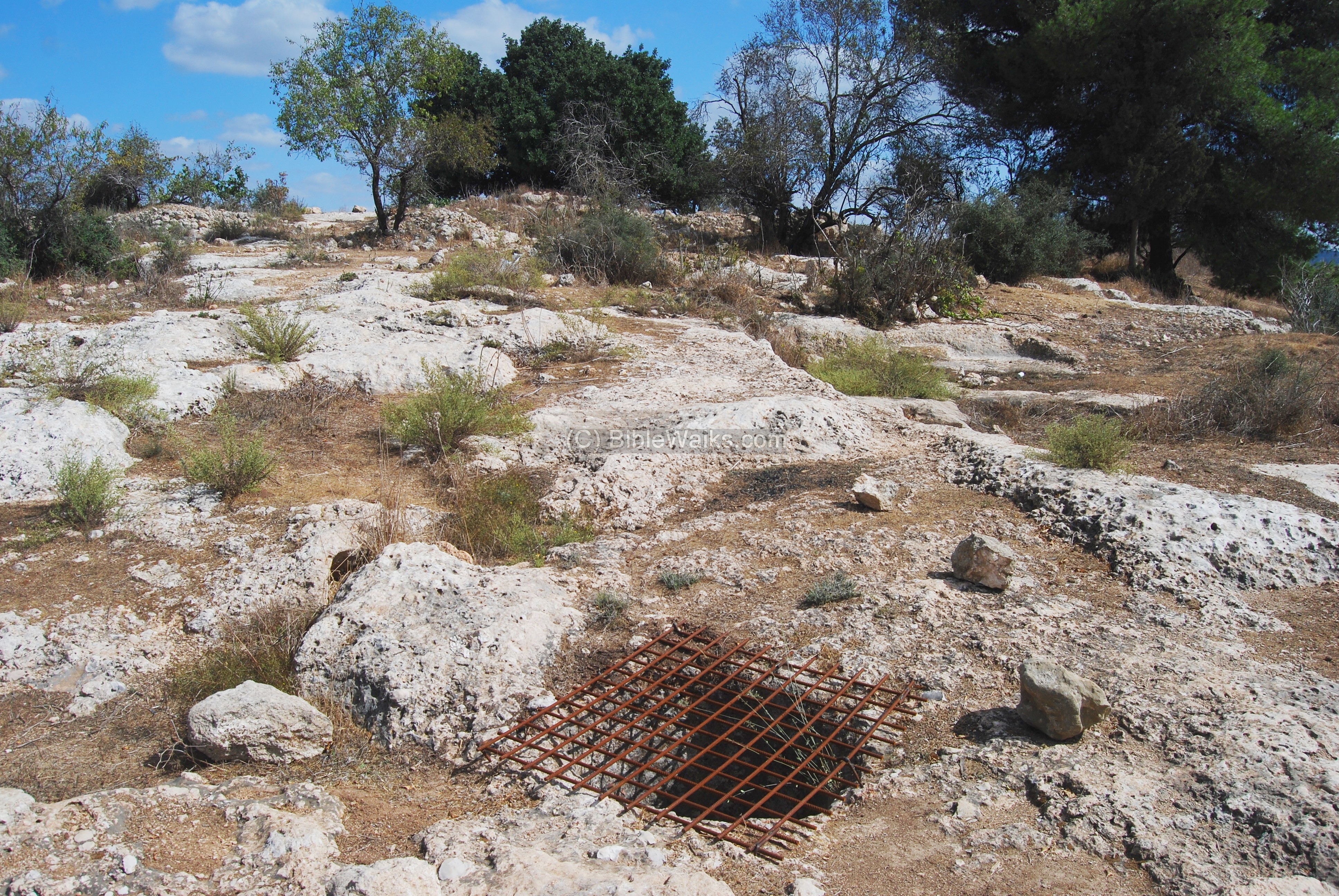
The cisterns had a secondary use at a later date: A network of narrow tunnels connect some of these holes, and were part of the hiding places that were prepared during the Bar Kochba revolt (131-135 AD). In one of these tunnels a number of coins were found dated to the Bar Kochba revolt.
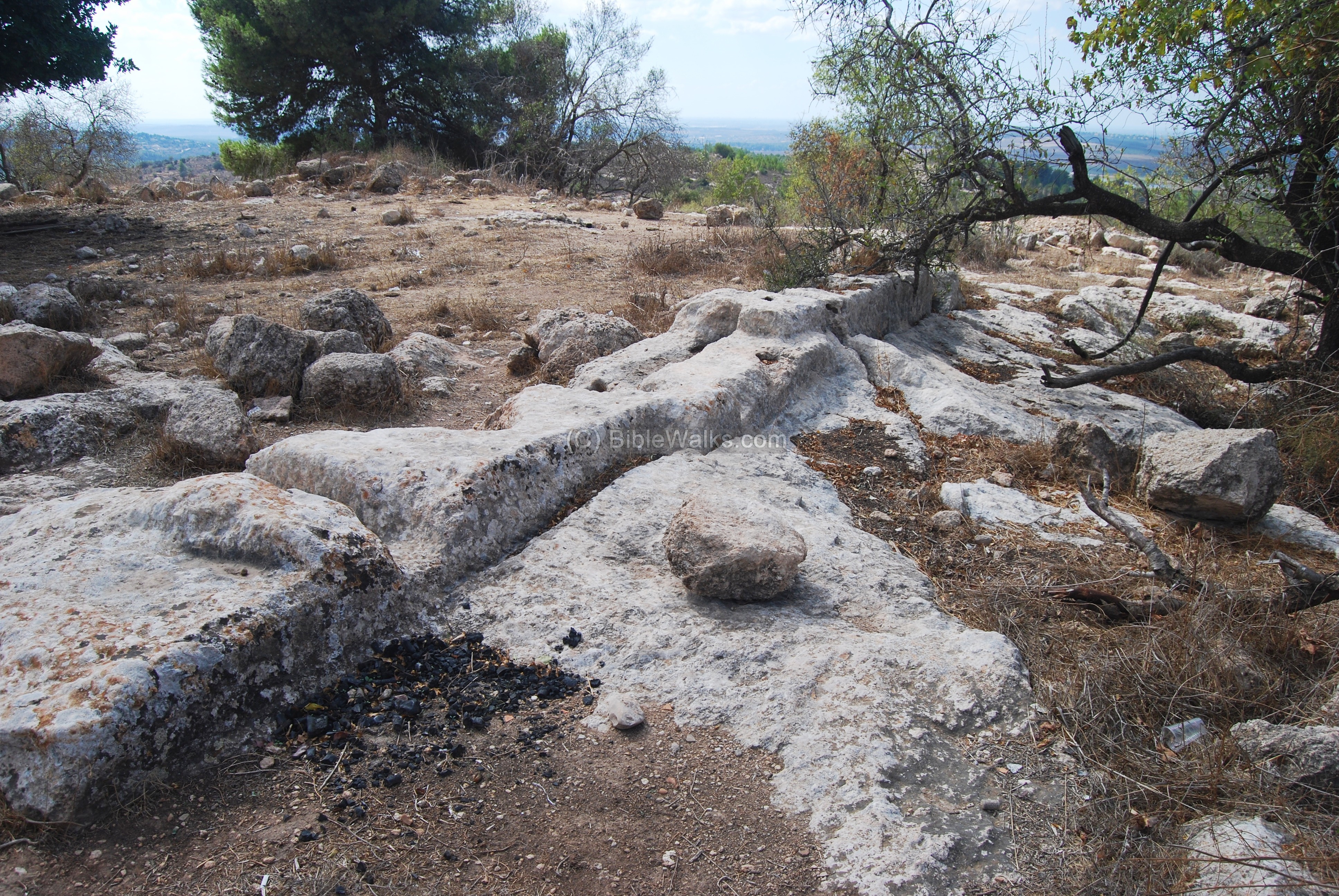
Another rock cutting on the summit has holes on the face of the rock, used to hold wooden beams that supported the roof.
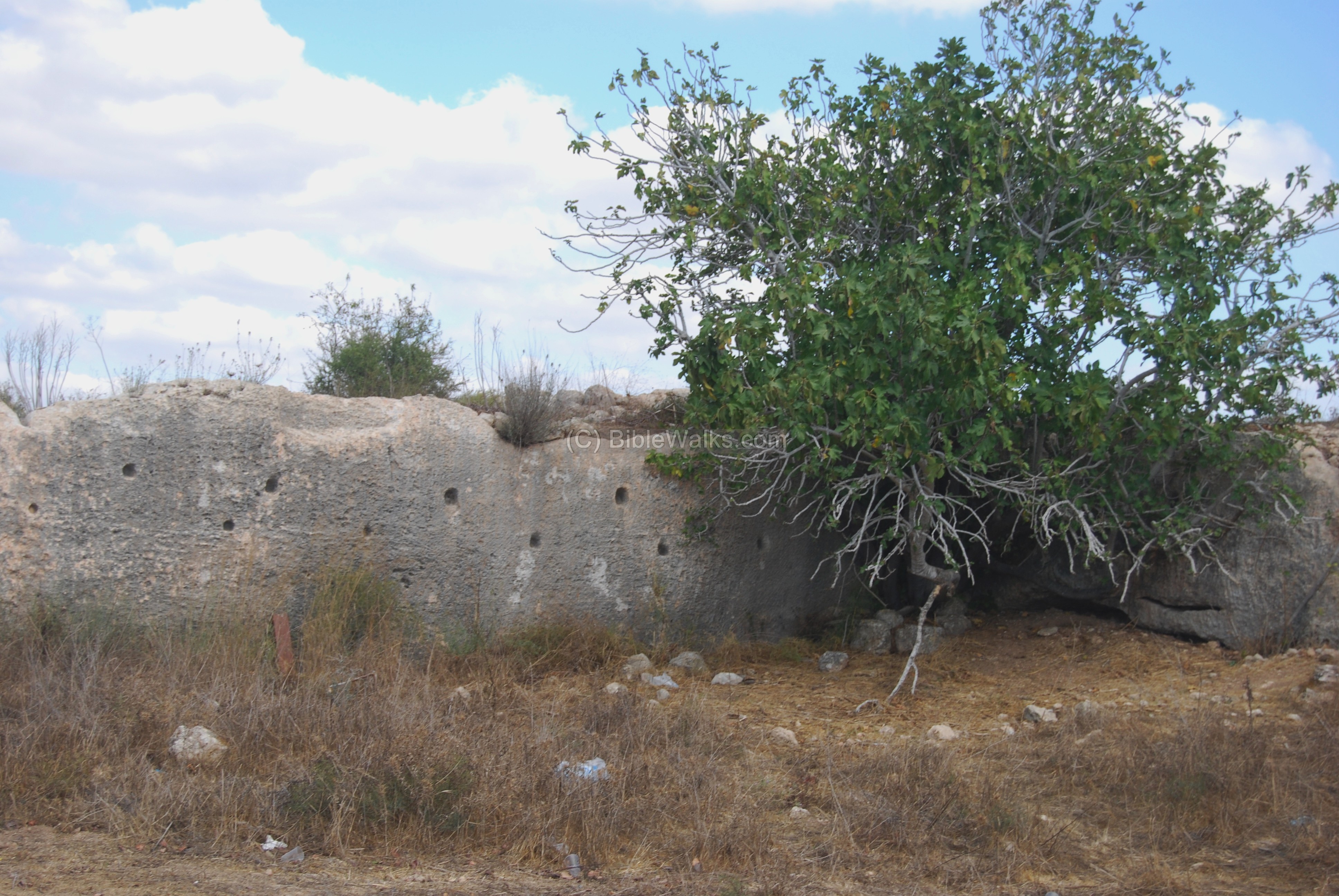
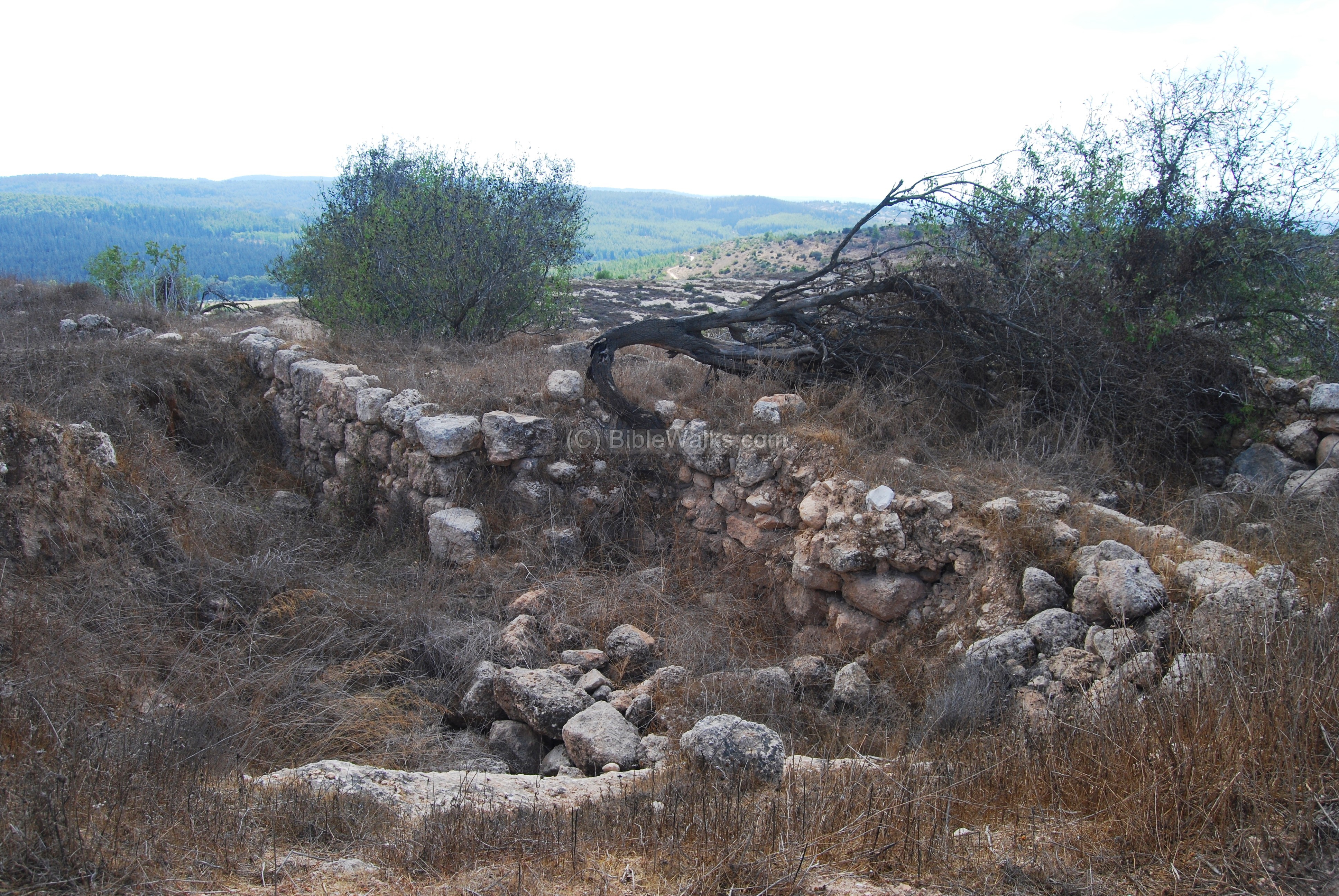
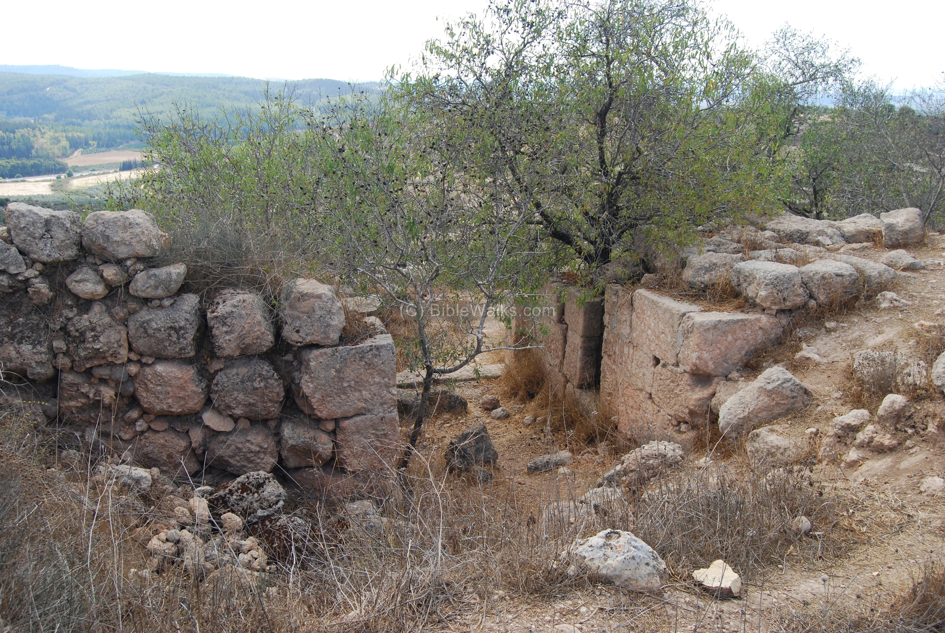
(e) South walls and towers
A defense wall stretches along the south side of the fortress. In the background is highway #1 from Latrun to Jerusalem, which closely follows the ancient route. The road, from the coast to Jerusalem, was one of the most important routes, and this fortress protected and controlled the travel along the road.

Traces of the fortress building blocks are scattered around the area of the gate, located on the south-eastern side.

An access road reaches the fortress from the south-eastern side. This is the easier way to get to the fortress, allowing vehicles to climb up the hill from Park Ayalon-Canada.
Along the south wall are bases of towers and a gate, as seen below. These fortifications were constructed by Bacchides during the years 160-155BC.
Another view of the fortifications. This side overlooks the main road to Jerusalem, seen on the far left background.
(f) Ancient agriculture
Along the foothills on the north-east side are ancient terraces and rock-hewn tombs.

A winepress is also seen on the summit.
Historical References:
Jozefus Flavius (Ant. of Jews, XII, Chapter 7, 3-4)
Story of the great battle of Judas Maccabee (167 BC) as part of the revolt against the Seleucid rulers and the campaign to liberate the Country :
3.” Upon this Lysias chose Ptolemy, the son of Dorymenes, and Nicanor, and Gorgias, very potent men among the king’s friends, and delivered to them forty thousand foot soldiers, and seven thousand horsemen, and sent them against Judea, who came as far as the city Emmaus, and pitched their camp in the plain country….”.
4. “And this was the speech which Judas made to encourage them. But when the enemy sent Gorgias, with five thousand foot and one thousand horse, that he might fall upon Judas by night, and had for that purpose certain of the runagate Jews as guides, the son of Mattathias perceived it, and resolved to fall upon those enemies that were in their camp, now their forces were divided. When they had therefore supped in good time, and had left many fires in their camp, he marched all night to those enemies that were at Emmaus. So that when Gorgias found no enemy in their camp, but suspected that they were retired, and had hidden themselves among the mountains, he resolved to go and seek them wheresoever they were. But about break of day Judas appeared to those enemies that were at Emmaus, with only three thousand men, and those ill armed, by reason of their poverty; and when he saw the enemy very well and skillfully fortified in their camp, he encouraged the Jews, and told them that they ought to fight, though it were with their naked bodies, for that God had sometimes of old given such men strength, and that against such as were more in number, and were armed also, out of regard to their great courage. So he commanded the trumpeters to sound for the battle; and by thus falling upon the enemies when they did not expect it, and thereby astonishing and disturbing their minds, he slew many of those that resisted him, and went on pursuing the rest as far as Gadara….for this victory greatly contributed to the recovery of their liberty”.
Jozefus Flavius (Ant. of Jews, XIII, Chapter 1, 3)
Bacchides fortifies Emmaus in order to protect Jerusalem against the Maccabees:
“…Bacchides returned presently to the citadel at Jerusalem, having lost about two thousand of his army. He also fortified many cities of Judea, whose walls had been demolished; Jericho, and Emmaus, and Betboron, and Bethel, and Tinma, and Pharatho, and Tecoa, and Gazara, and built towers in every one of these cities, and encompassed them with strong walls, that were very large also, and put garrisons into them, that they might issue out of them, and do mischief to the Jews”.
Etymology (behind the name):
- Ham – warm in Hebrew.
- Hammat/Hammath – the Hebrew name of the city, based on its hot springs.
- Emmaus – the name of the city in Greek, based on the Hebrew name, and means hot springs. Another spa city, called “Emmaus of Galilee” , is located near Tiberias.
- Khirbet El ‘Akedor Akid – Arabic name of the ruins
- Hurbat Eked – Hebrew name of the ruins
Links:
* External links:
- Park Canada (Ayalon) (in Hebrew)
* Other BibleWalks web pages of Emmaus:
* Other fortresses along the Emmaus-Jerusalem road:
* Other internal links:
- Quadcopter Aerial views – collection of Biblical sites from the air
BibleWalks.com – exploring the sites of the Holy Land
Emmaus Valley of Springs<<<—previous site—<<< All Sites >>>— next Judea site—>>> Emmaus Winepresses
This page was last updated on July 14, 2017 (Added aerial views)
Sponsored links: